Quiet weather continues into next week. Curtains for the Atlantic Tropics?

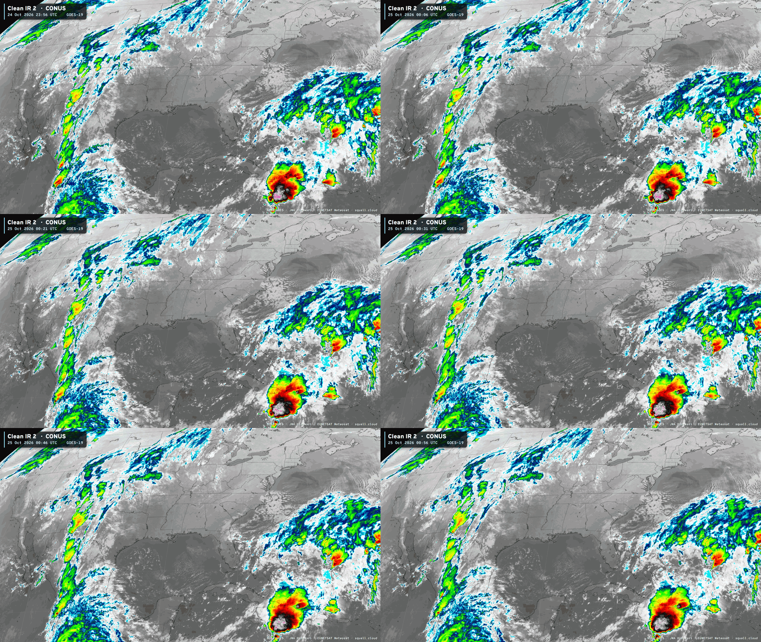
Beautiful day across California on Saturday with some mountain snow showing up in Sierra. Lake Tahoe opening in 2-weeks … we’ll see if the cooler weather and troughs from Alaska and Canada will mean consistent snowfall through November, or if the Pineapple Express (atmospheric rivers) turbocharged by El Niño will dominate.
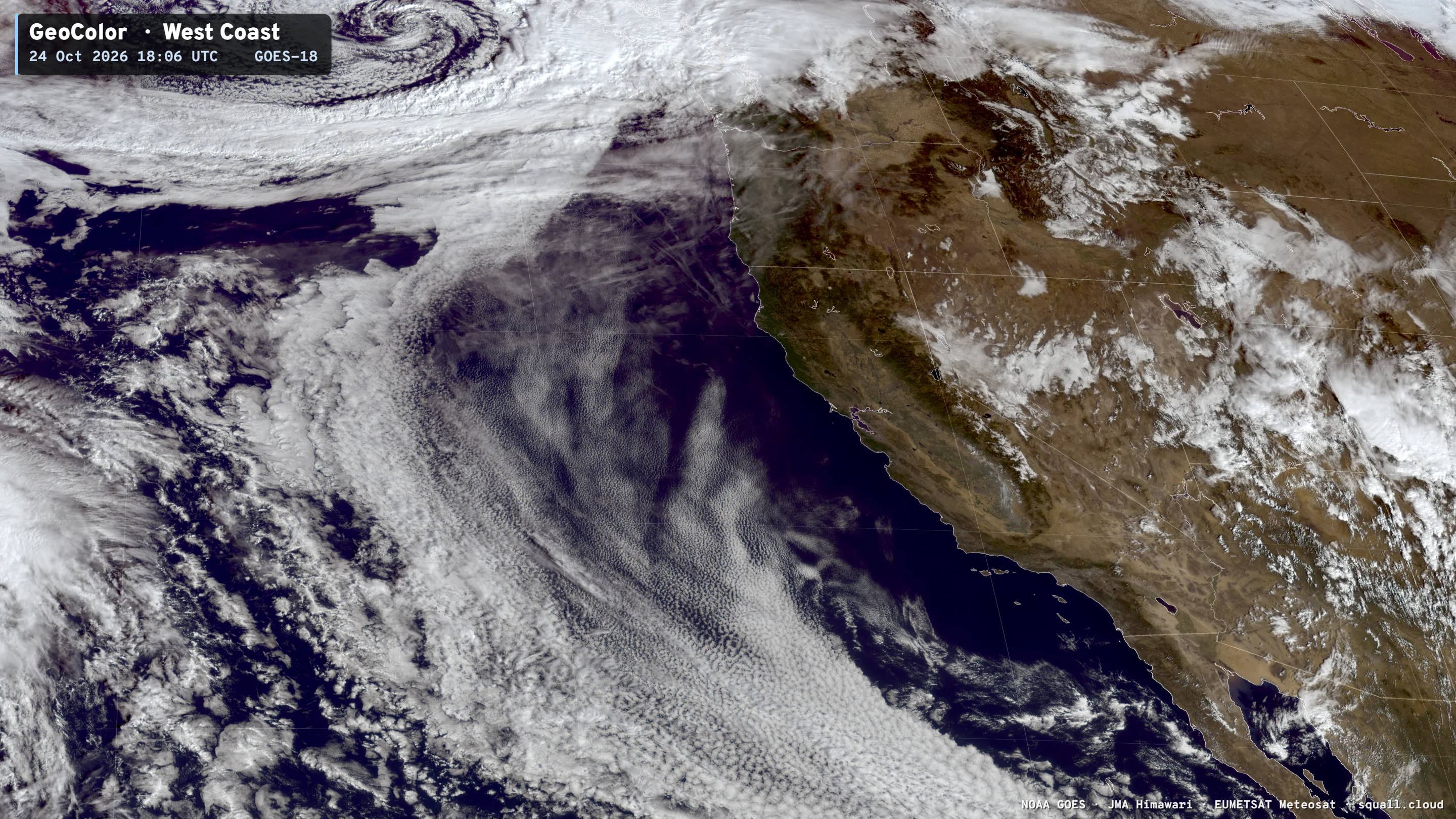
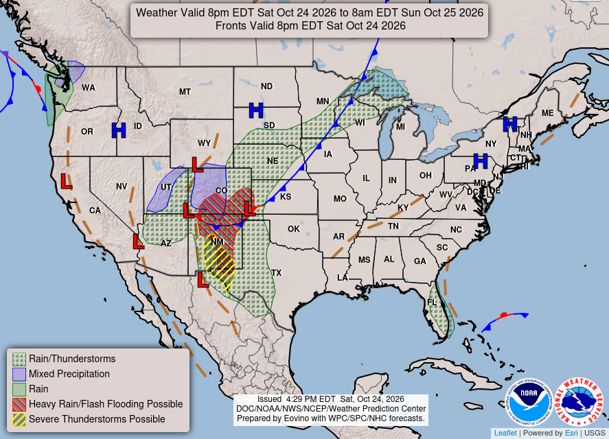
Area of low pressure with Pacific subtropical moisture firing severe storms across New Mexico and West Texas this evening. A frontal boundary with much cooler, seasonable air behind it from Canada is heading into the Great Lakes for Sunday.
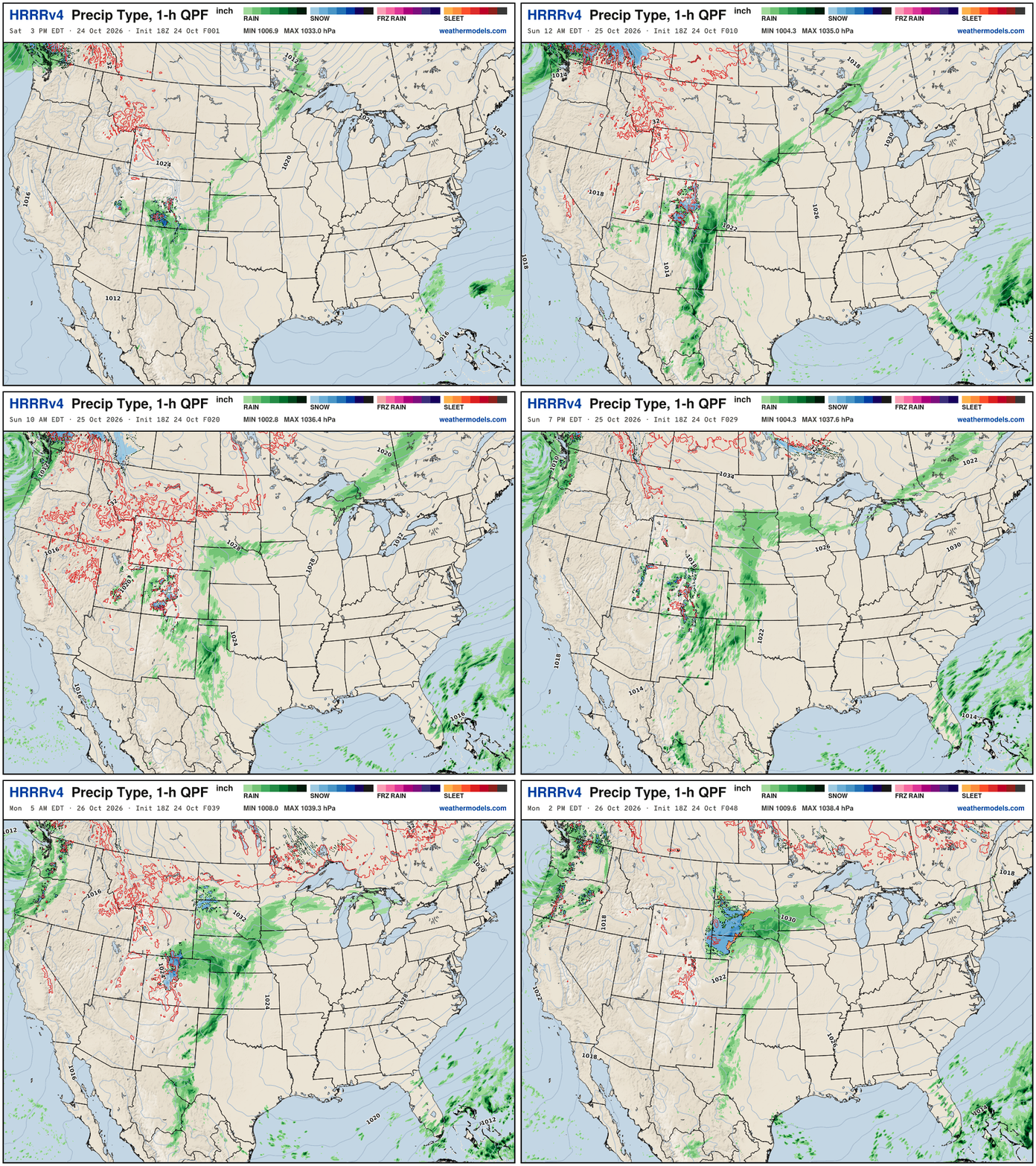
A small storm system is swirling off the Washington State coastline with welcome rainfall, and some gusty winds, but not particularly extreme.
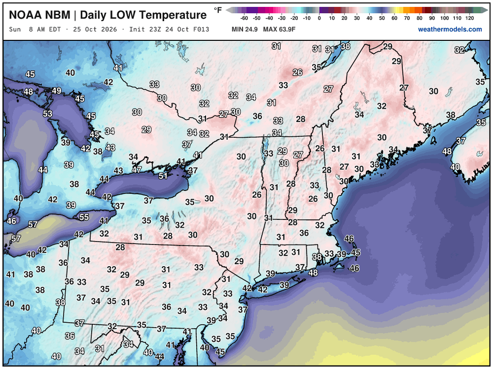
Low Temperatures Sunday Morning
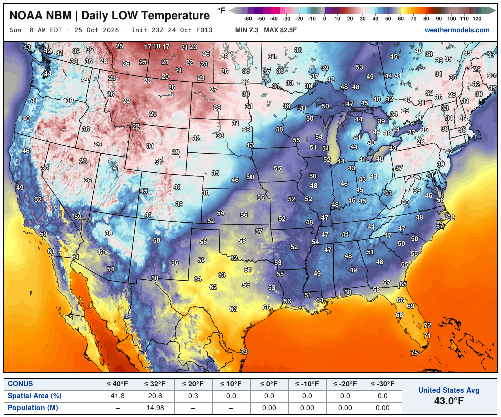
Seeing 20s in the Midwest — and even teens up in Prairies of Canada. Also 20s and lower 30s in the Northeast. About 15 million below freezing.
High Temperatures on Sunday
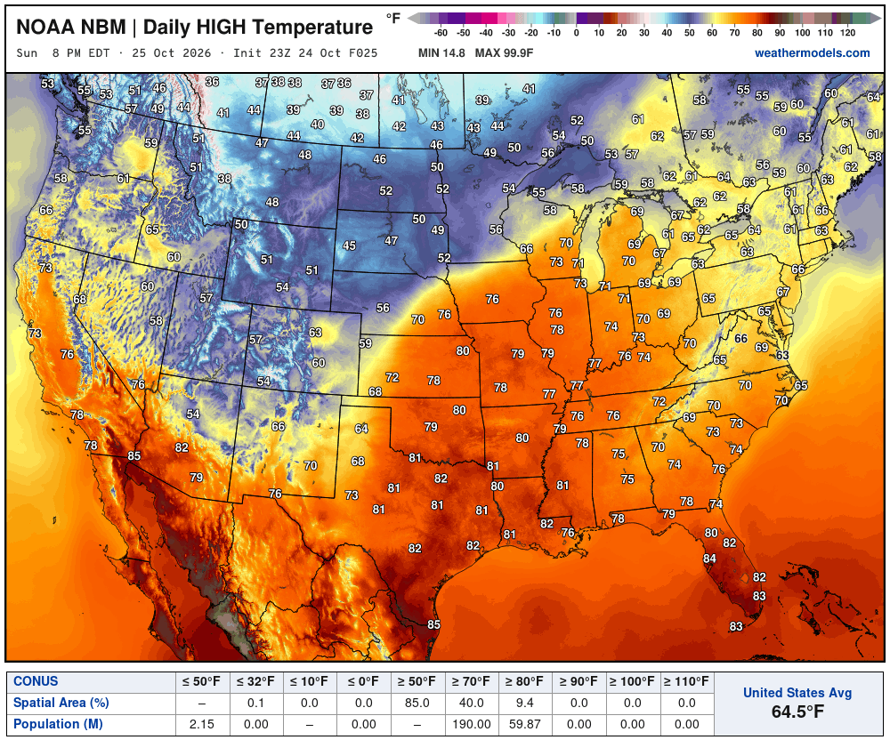
Very warm 70s in the Great Lakes — 60s in Northeast. Very comfortable, beautiful late October day. It could be a lot cooler!
Integrated Vapor Transport Next 10-days | ECMWF AIFS 12z
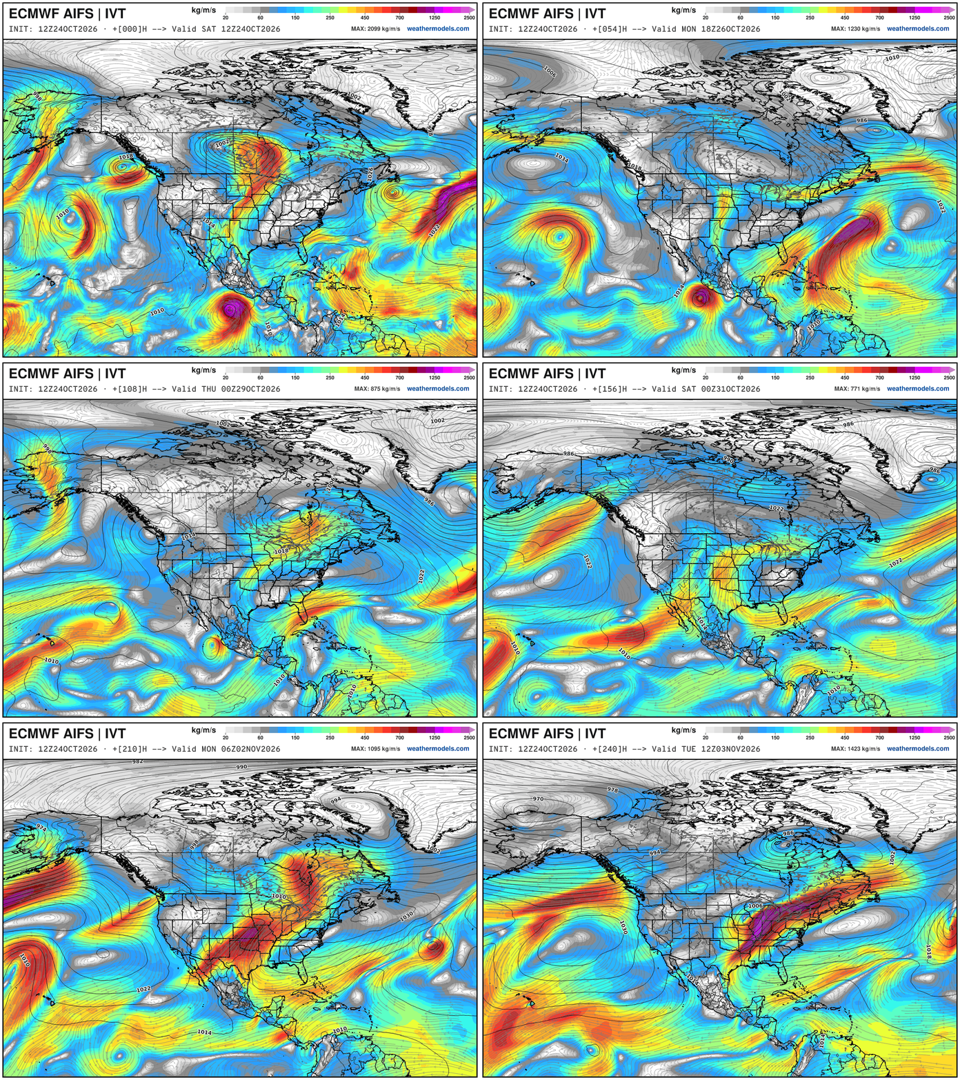
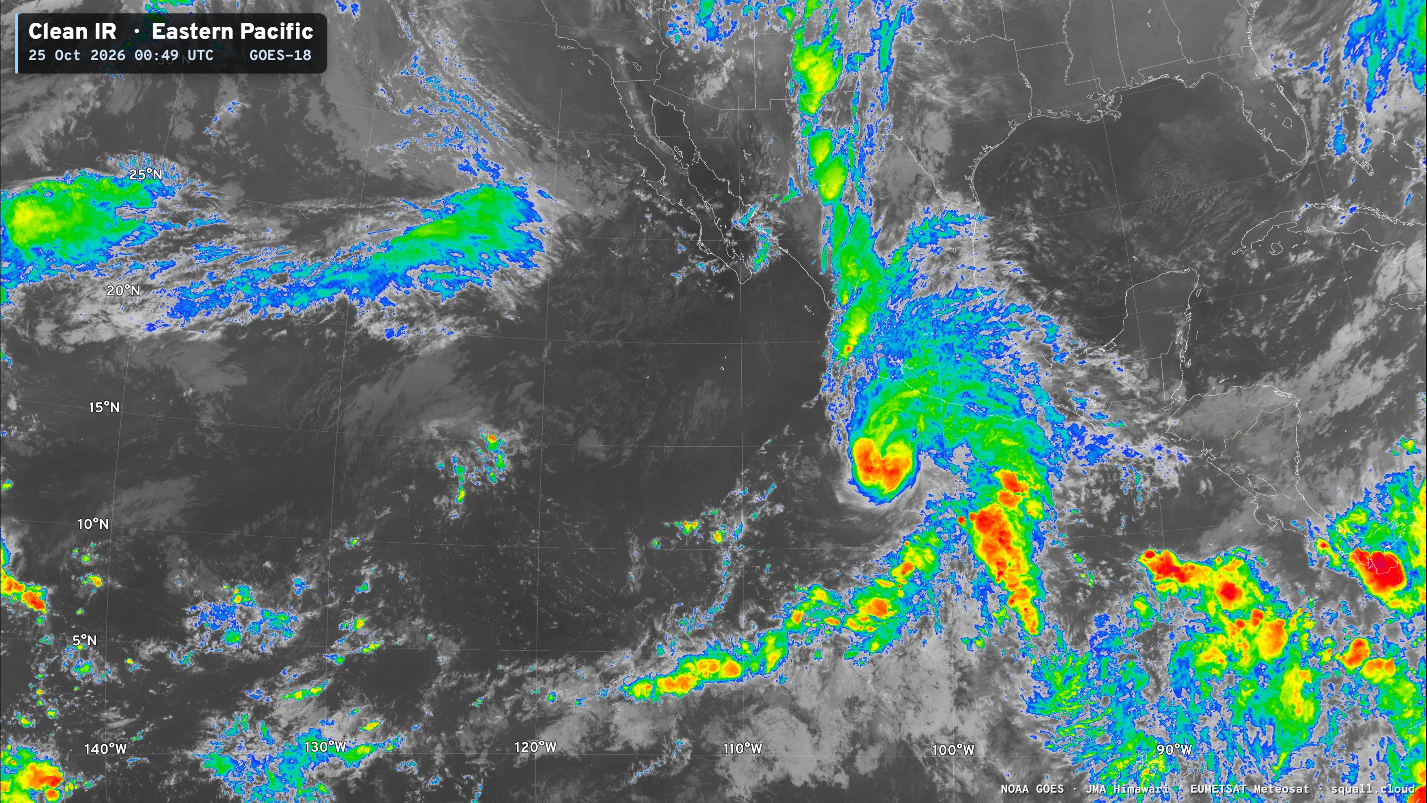
Hurricane Vance dissipates in the mouth of the Gulf of California and its moisture is pulled into the subtropical jet stream out of the Pacific —> that becomes the dominant weather pattern and flow in into weekend —> which is WARM across the Eastern half of the U.S.
Otherwise, not seeing any atmospheric rivers for the West Coast.
Height Anomaly Pattern | Next 10-days
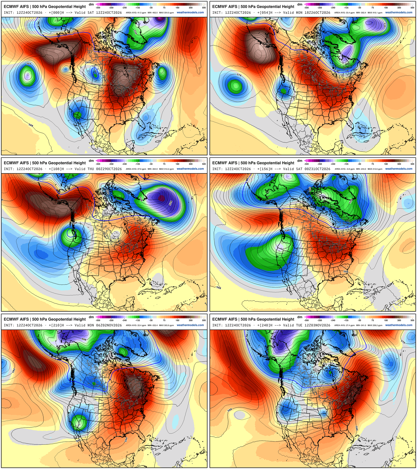
Parade of troughs dipping across the West Coast — and ridging east of the Rockies.
Bomb Cyclones — Second of three to affect United Kingdom and Western Europe
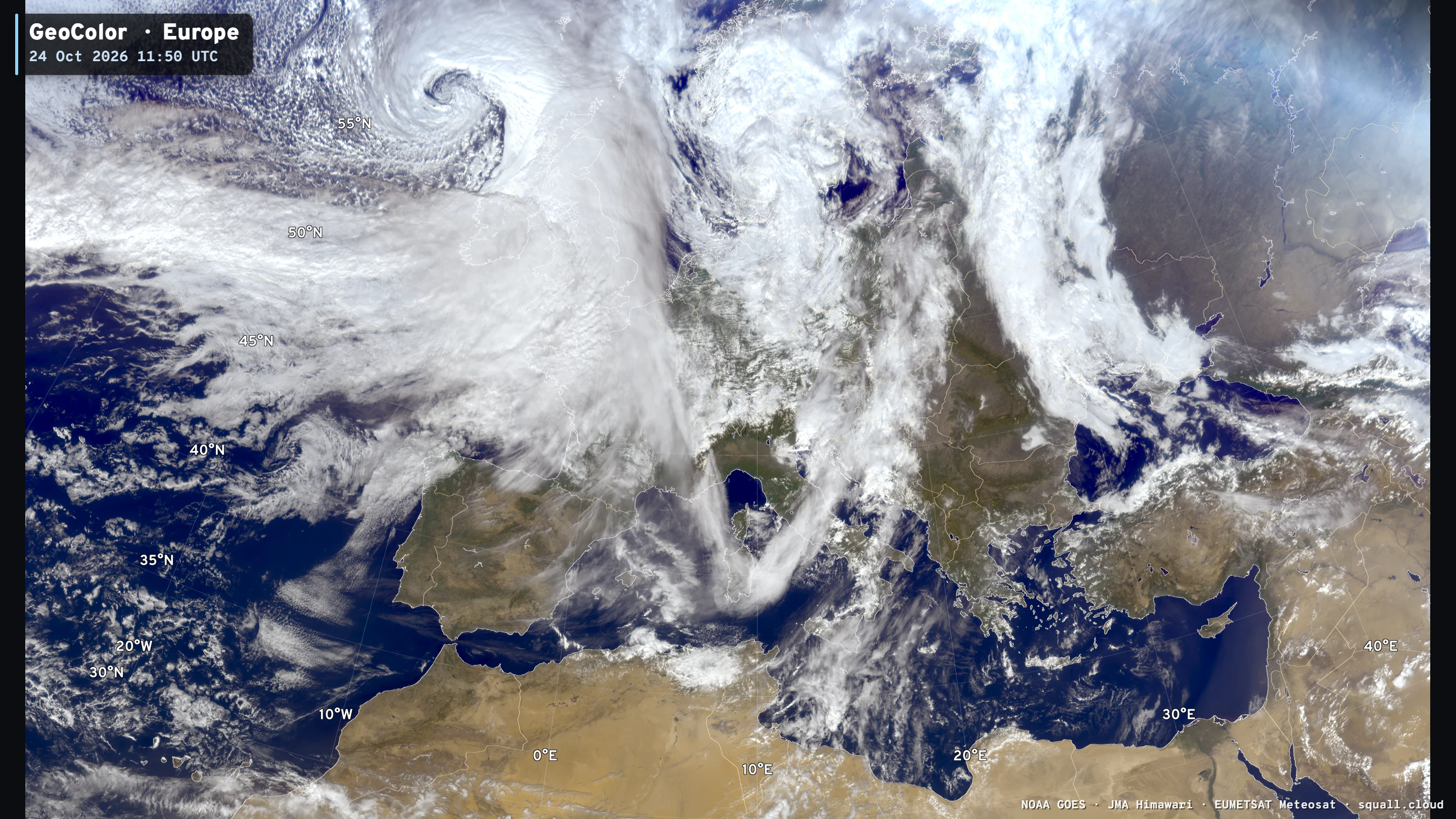
One more powerful bomb for early next week. Barometers across Scotland were getting a workout today.
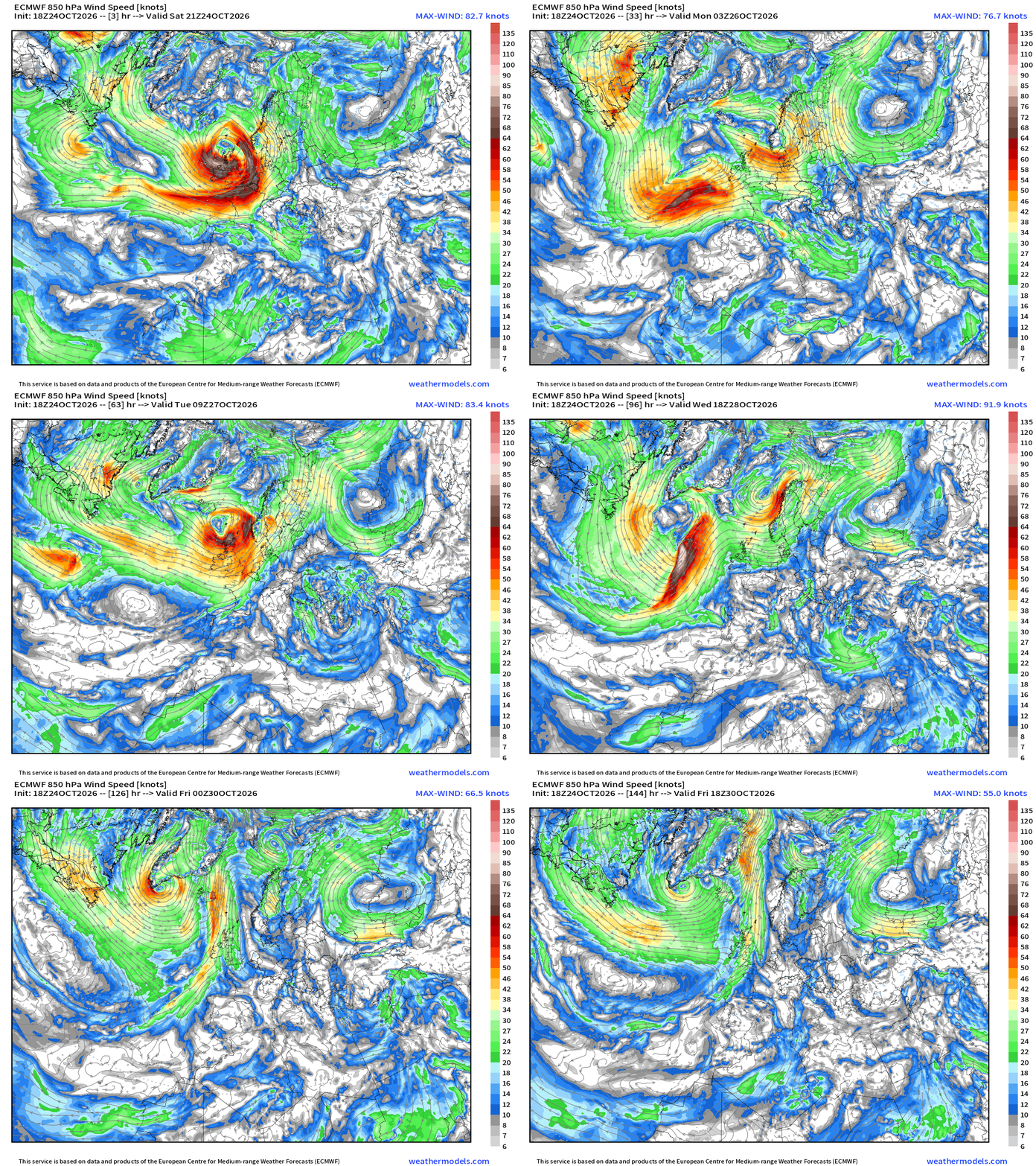
850 mb winds (1.5 km up) to show the strong “chevron shaped” band of often hurricane force winds on the back side of the powerful bomb cyclones. This was a major chunk of my dissertation back at Florida State more than 2-decades ago.
Blend of Models Precipitation Next 7-days | Lower 48
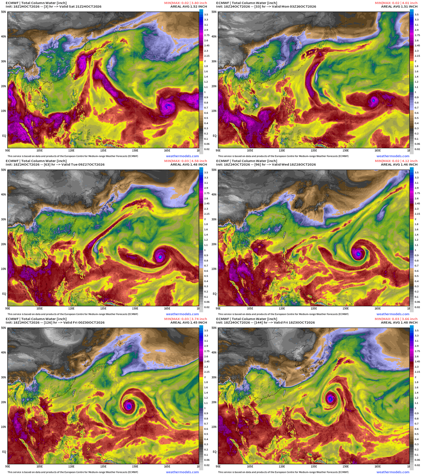
My favorite parameter — precipitable water | ECMWF 18Z next 6-days
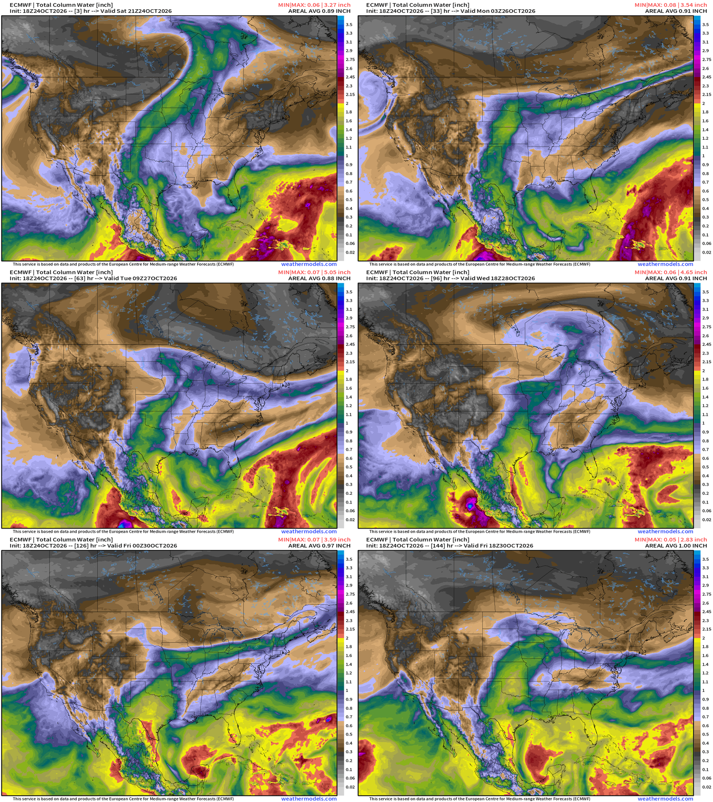
Bit of a subtropical / cut-off low east of Florida but no tropical development likely. That moisture gets dragged westward across the Gulf
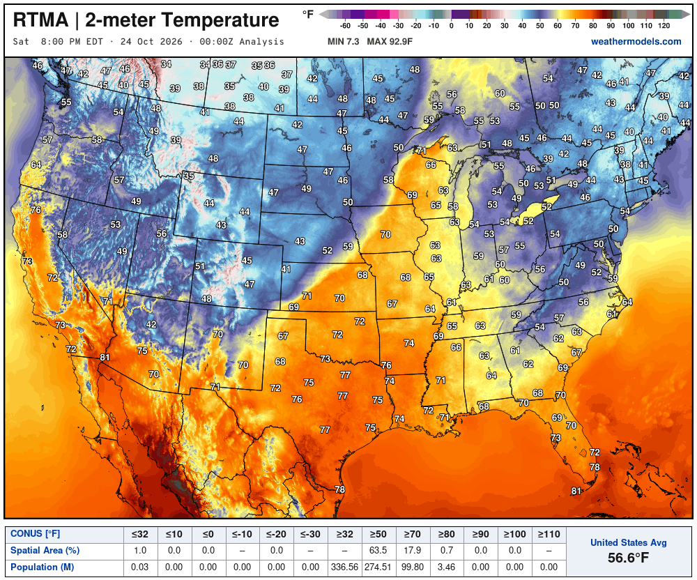
Temperature Analysis at 8:00 PM ET
Temperature Analysis | Anomaly from Normal
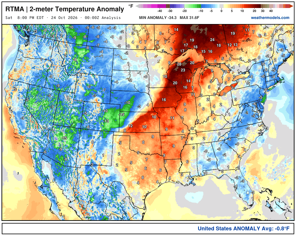
Lower 48 was -0.8ºF below normal
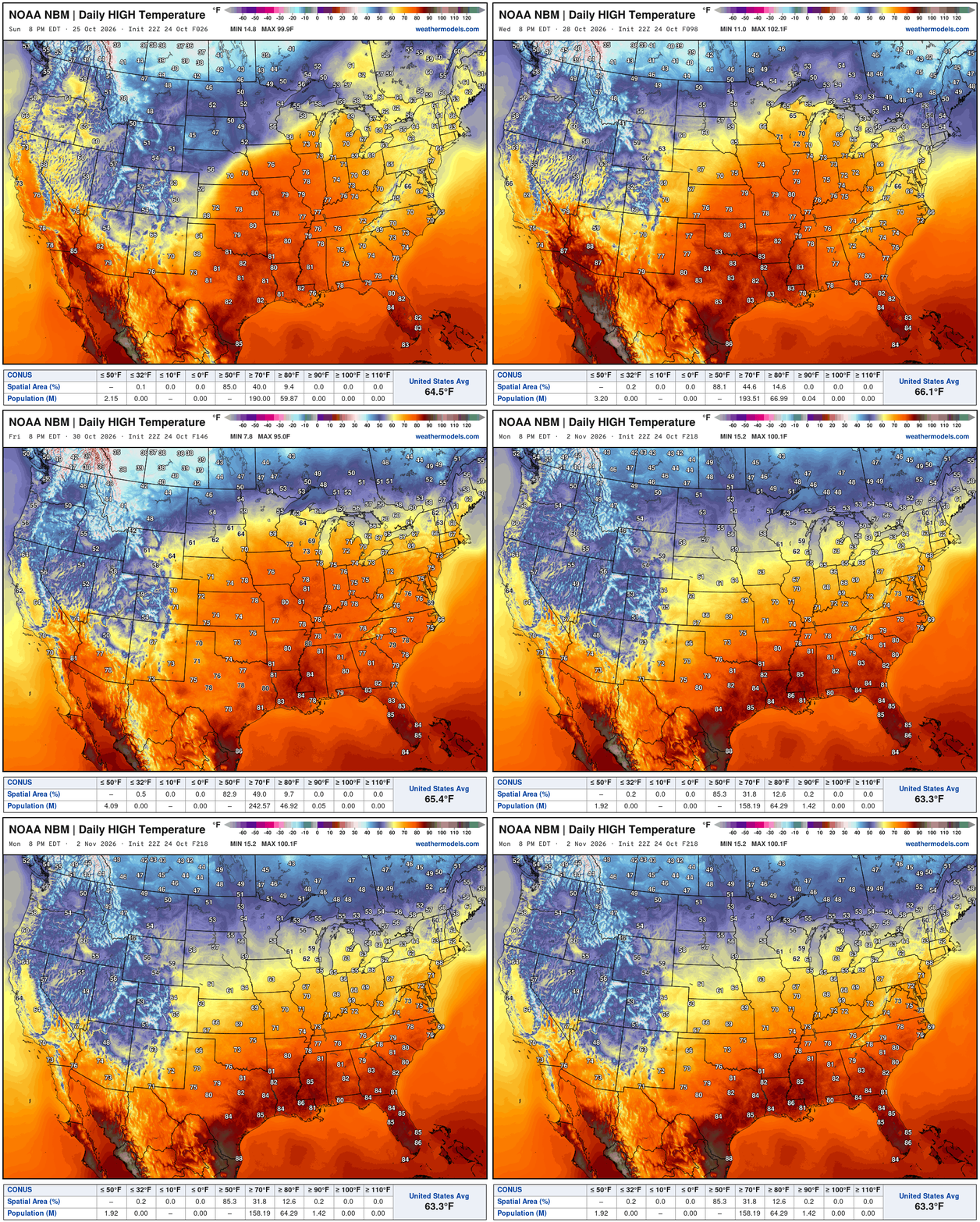
High Temperatures next 9-Days | Mild Late October (way above normal)
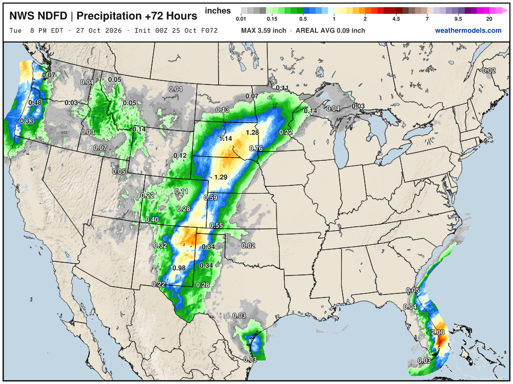
NWS NDFD Next 3-days precipitation
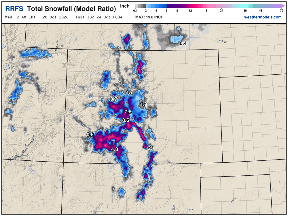
New RRFS Model Snowfall Next 84-hours — Model becomes operational on November 3rd — alongside HRRR.
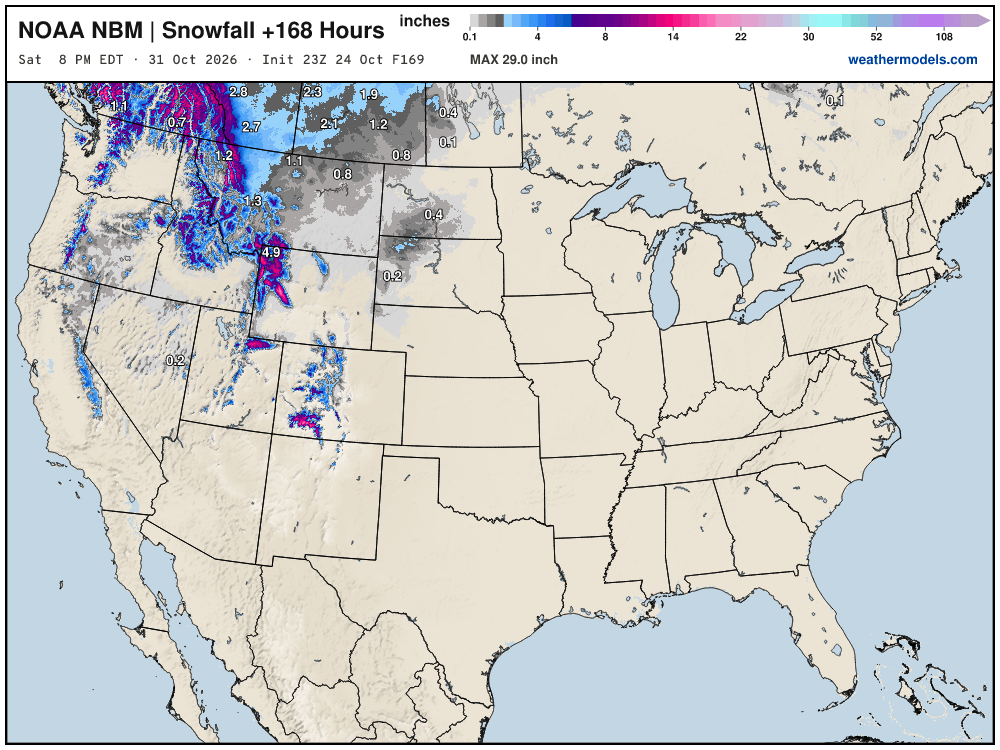
Blend of Models Snowfall Next 7-days
Still waiting on our first Eastern U.S. snowfall through first week of November.
Snowfall Next 15-days | ECMWF Ensemble 12z Median
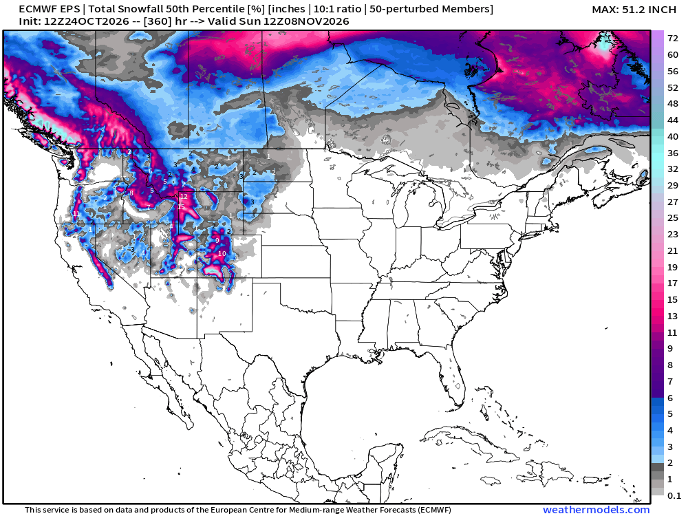
Slowly but surely as these maps head into early November — we’ll see our first chances of a snow storm for the Midwest, Great Lakes, and Northeast — not yet.
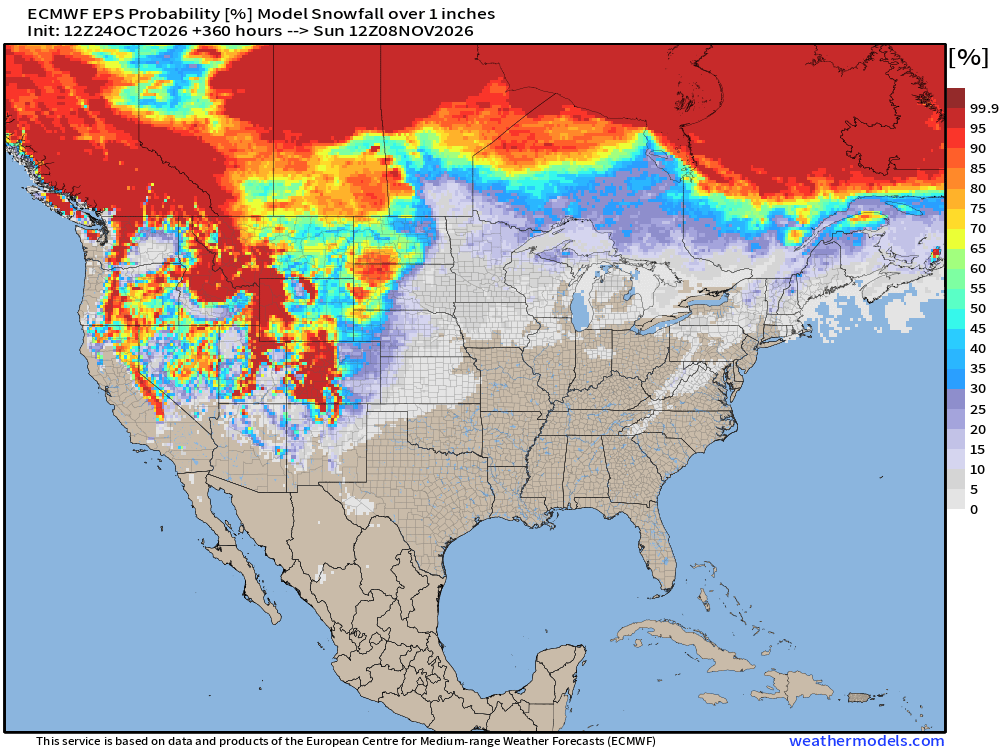
Probability of 1-inch or more of snowfall through November 8th
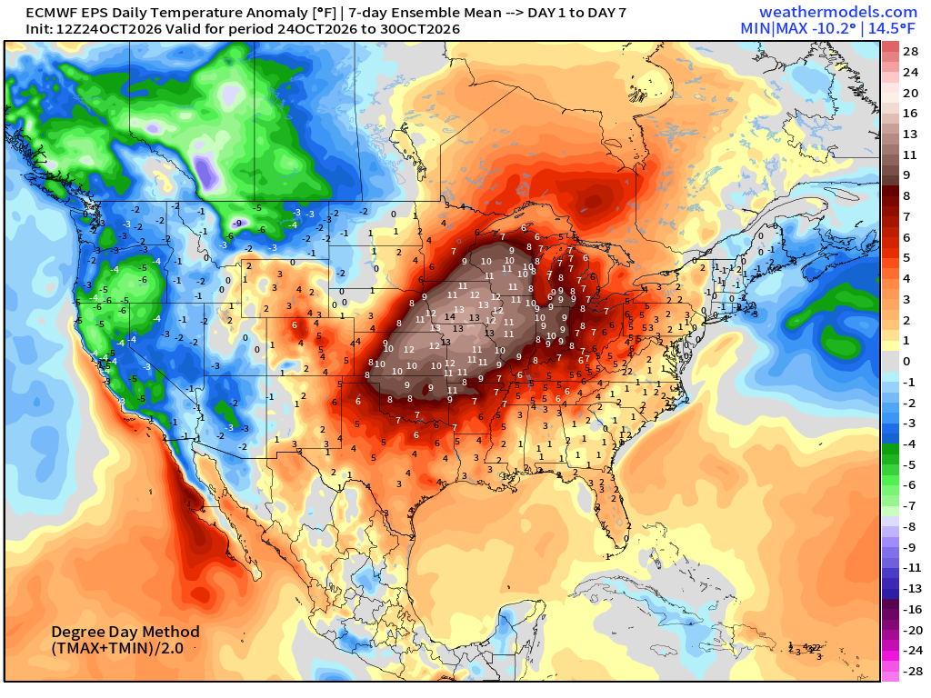
Week 1 Temperature Anomaly | Oct 24 - Oct 30
Week 2 Temperature Anomaly | Oct 31 - Nov 6
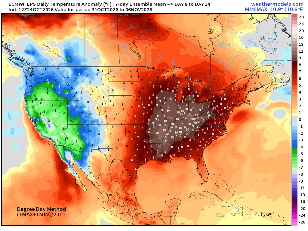
Blow torch first week of November across Eastern U.S.
North Atlantic Hurricane Season
No areas of interest from NHC … I think this is curtains as November is typically quiet.
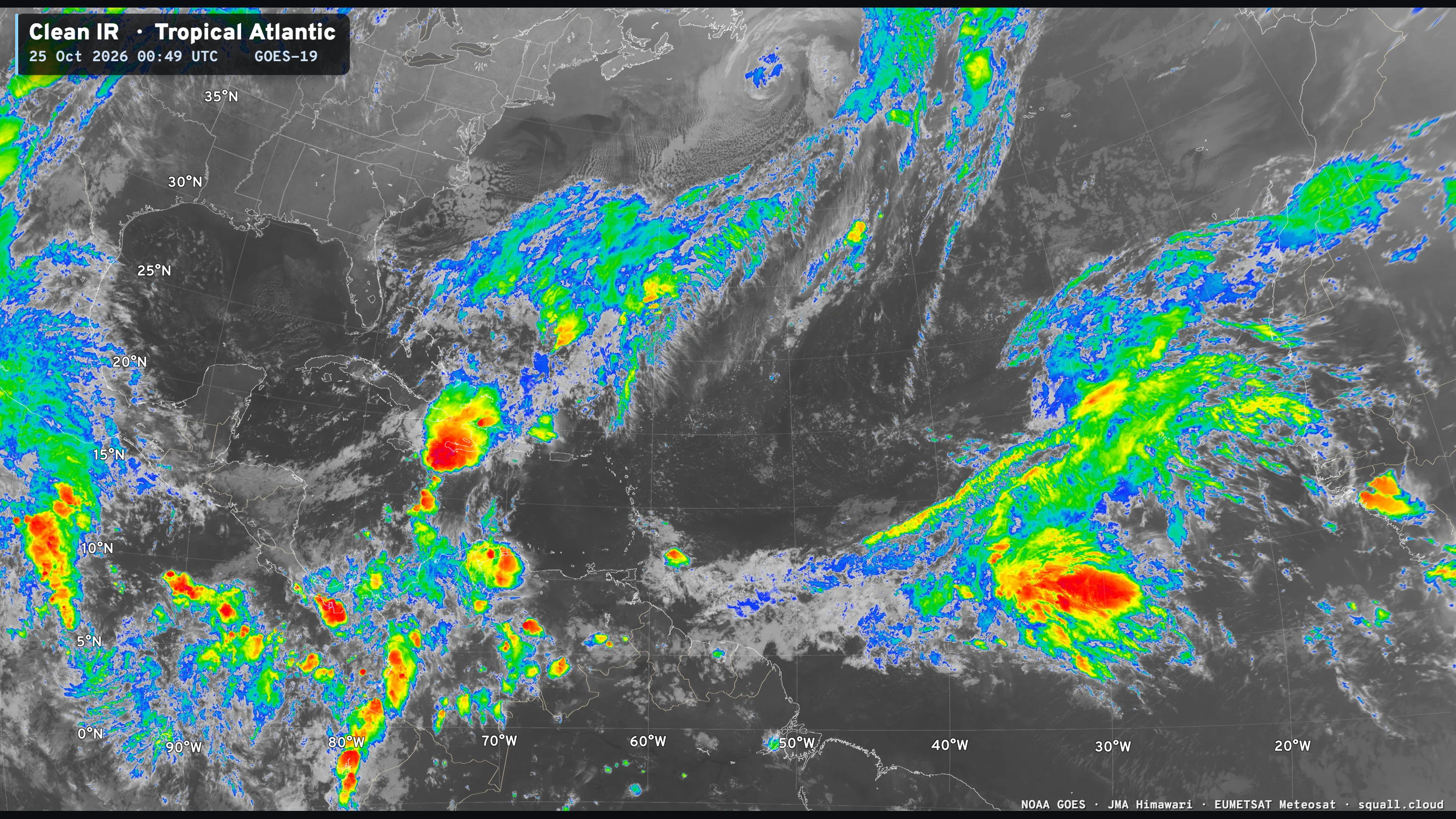
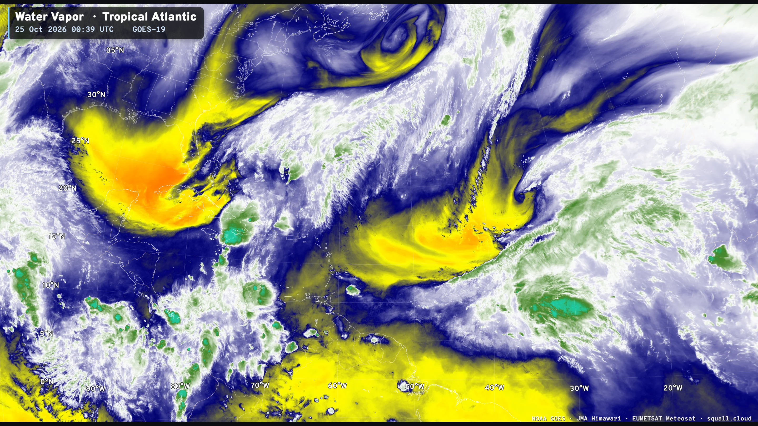
EPS 12z had nothing tropical in the next 10-days.
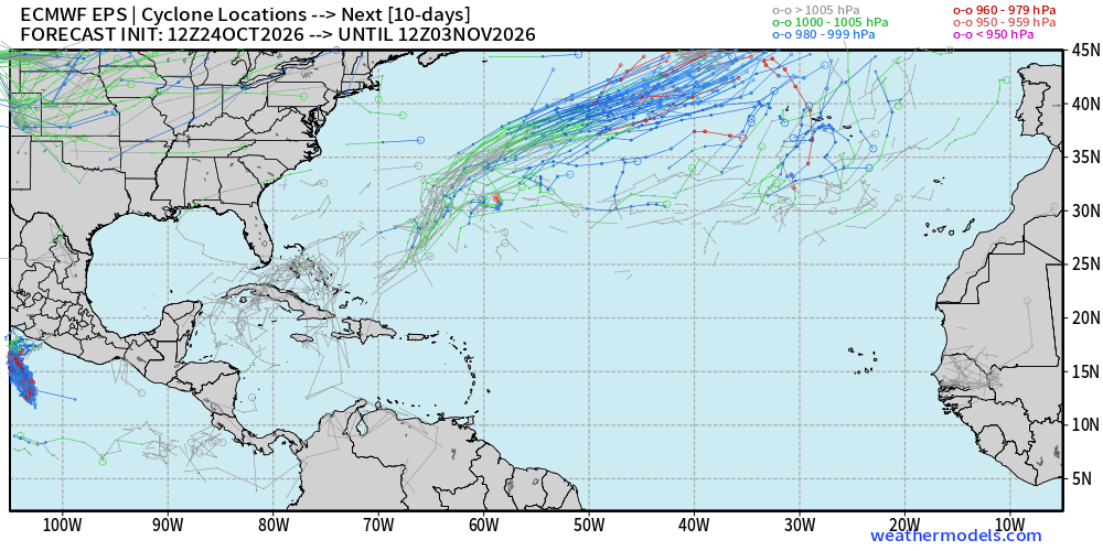
I think we can conclude the Atlantic hurricane season updates unless something pops up.
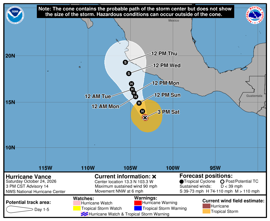
Eastern Pacific Hurricane Vance — but will weaken
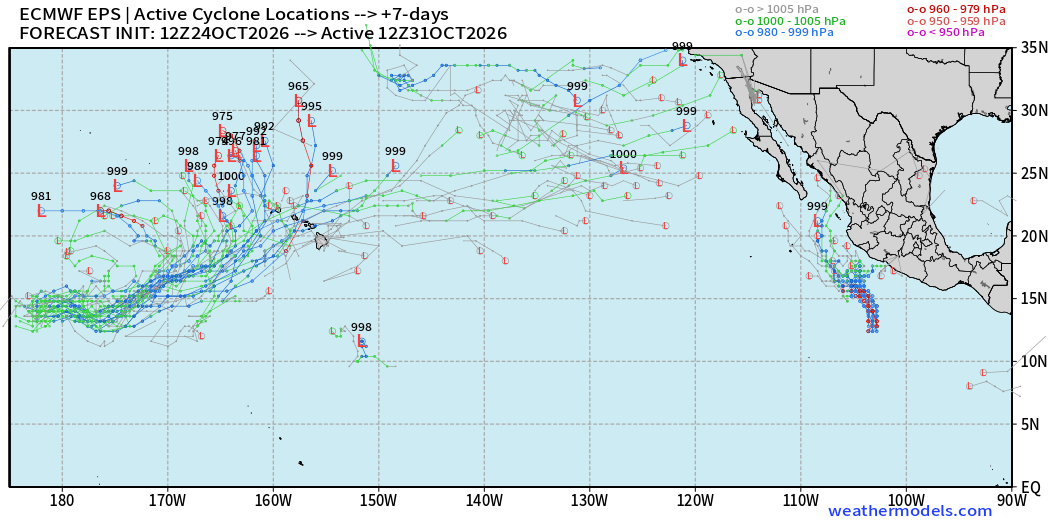
No other areas of interest in the Eastern Pacific, but perhaps something west of Hawaii in the Central Pacific (30%) chance.
Along the International Dateline — area of disturbed weather could drift eastward toward waters west of Hawaii in the next week.
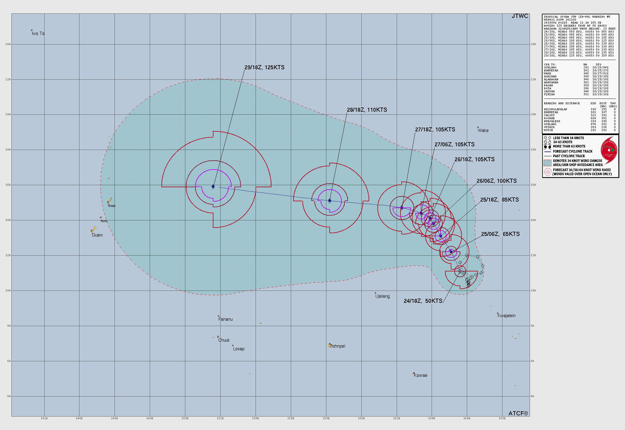
Western Pacific Typhoon Basin | In-fa (30W)
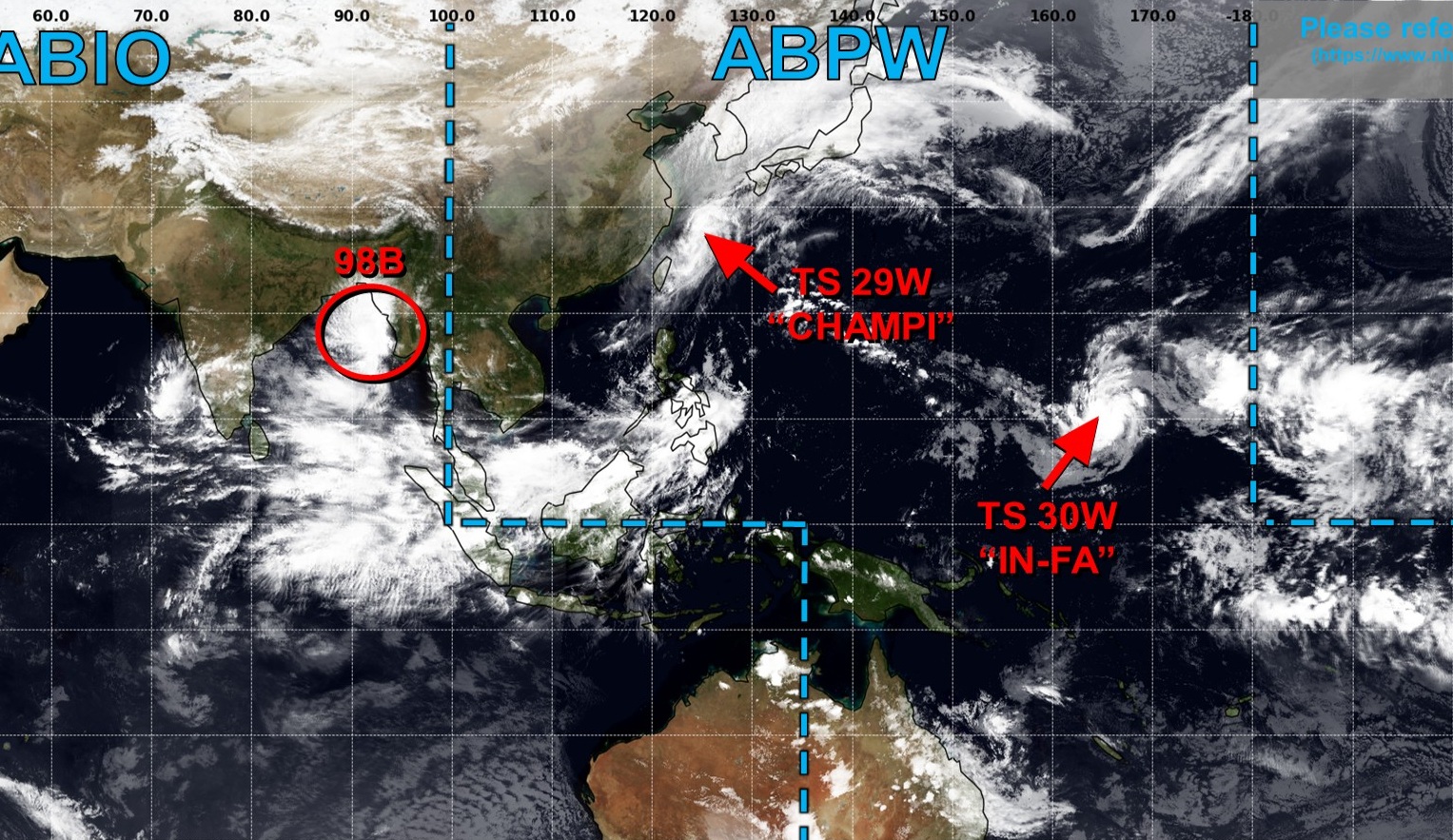
JTWC up to Category 4 — potential for yet another Super Typhoon
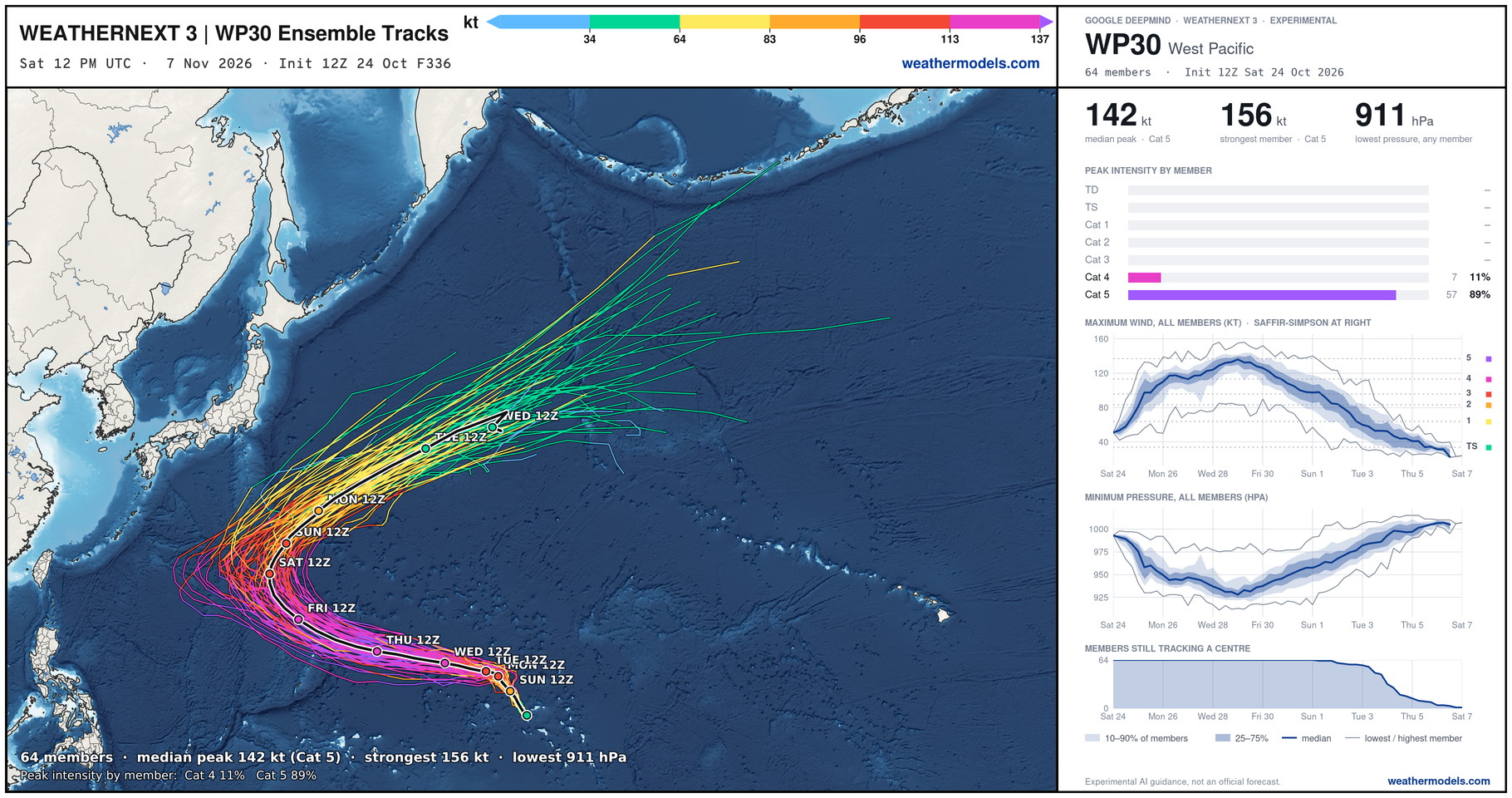
Weather Next 3 median intensity was 142 knots (Category 5)
A cool track animation — forgot I made these, so I need to show them off.
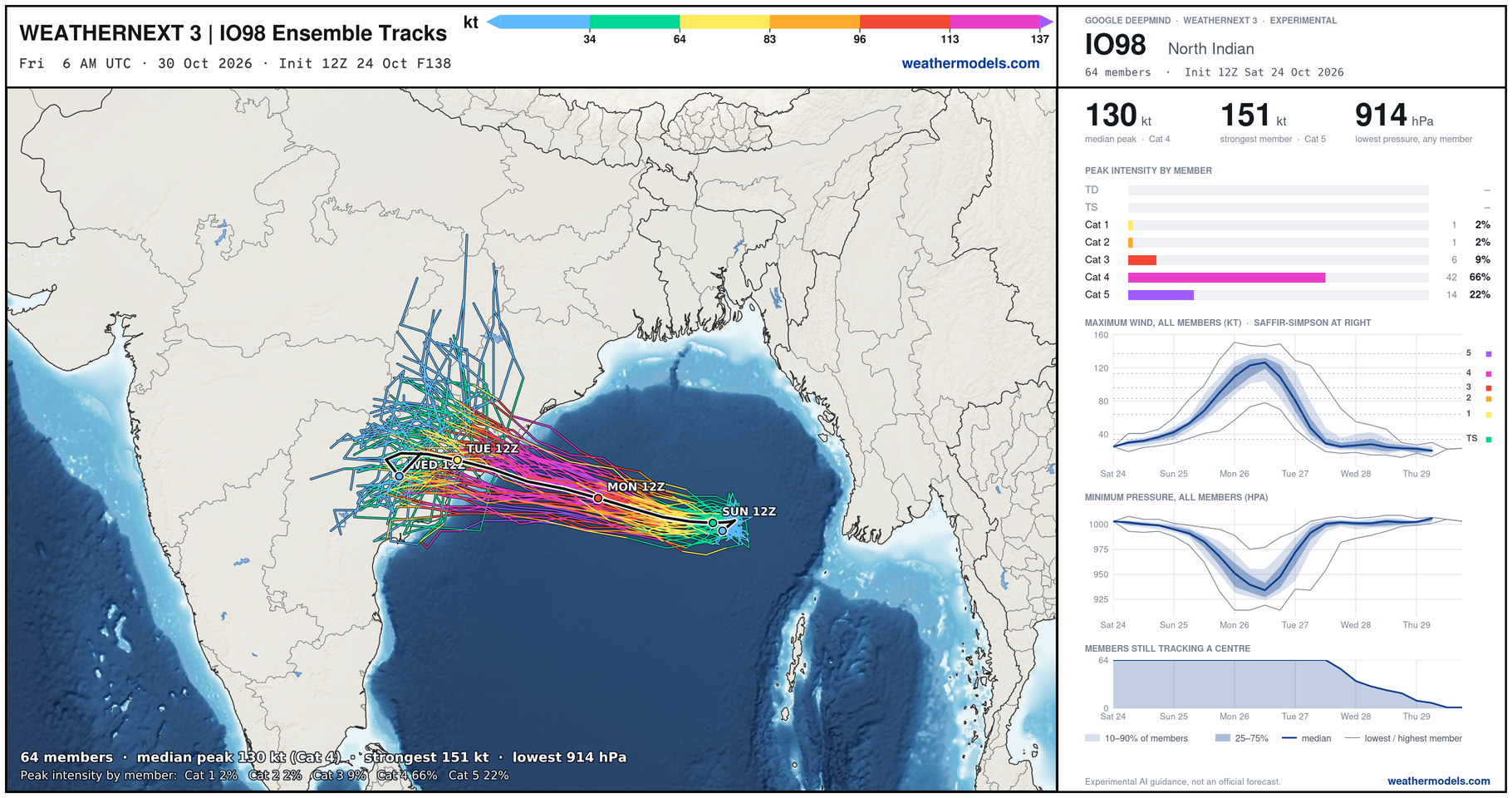
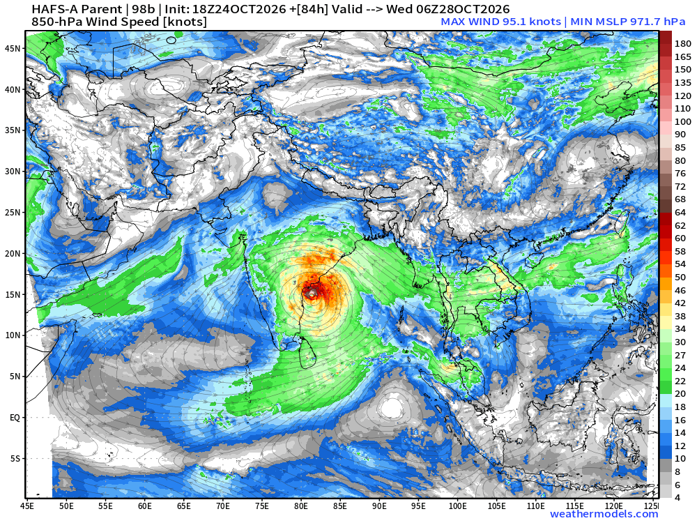
Northern Indian Ocean | Invest 98B —> powerful Cyclone w/median intensity of 130-knots = strong Category 4+
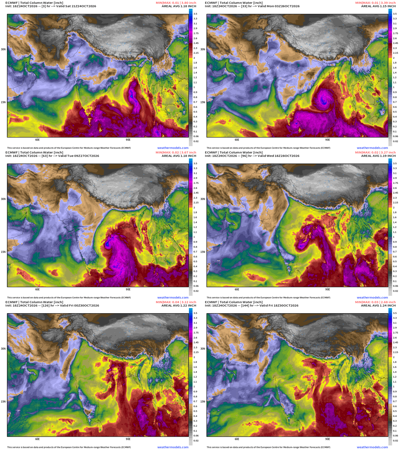
HAFS-A down to around 969 mb —> Major Hurricane Intensity landfall late Tuesday / Early Wednesday along Indian coastline.
Thank you for visiting / reading — always more to come!
Visit Global Tropical Cyclones w/Dr. Pielke Jr. for more ACE information, as well as my original climatlas.com/tropical site with much new research including a calibrated “Best Track” and historical tropical cyclone browser with plenty of interesting features like rankings of storms by their IKE (size). ACE up to 890.

Satellite imagery from Squall Cloud. Maps sourced from weathermodels.com designed and innovated by yours truly! Please subscribe there for real-time access to the newest maps, charts from all of the weather models including ECMWF and AIFS, and NOAA GFS/GEFS, HRRR/RRFS and Blend of Models (NBM). NOAA WPC and SPC for fronts/convective outlooks. Our own content is now sourced from hottestsince.com and weather.city and celsius.earth, and global-tropical-cyclones.com and precip.earth and forecastcanada.com and forecastgermany.com
Day 146 Atlantic Hurricane Season | YTD: 10 Named Storms, ACE = 19.5
NE Pacific Hurricane Season: YTD: 23 Named Storms, ACE = 350
My Atlantic Hurricane Season Forecast (2026)
From April 7, 2026: Atlantic Seasonal Hurricane Forecast: (11/5/2)
9-13 Named Storms (11 most likely)
4-7 Hurricanes (5 or 6 most likely)
1-3 Major Hurricanes (2 most likely)
Accumulated Cyclone Energy: 75-85 (well below normal)
NOAA 2026 Atlantic Hurricane Season Forecast
Previous in this storyline: No signs of life in the Atlantic while the Pacific goes gangbusters (SEP 9)
- Milepost
- 1630 · laid 2026-10-25T01:28:48Z
- Source
- https://weather.substack.com/p/october-24-2026-saturday-weather · October 24, 2026 Saturday Weather Update
- Tagged
- I-26 Tropics · Atlantic Season 2026 · Atlantic (25.0, -55.0) · by rule, at build
- Digest
- cec3b437a2cedf2049b45d67dbba08b11d4e1280efe0a594b0d83af961ce82f0