September 9, 2026 Wednesday Tropical Update
No signs of life in the Atlantic while the Pacific goes gangbusters

Satellite imagery of the Dust Cloud blanketing the Atlantic
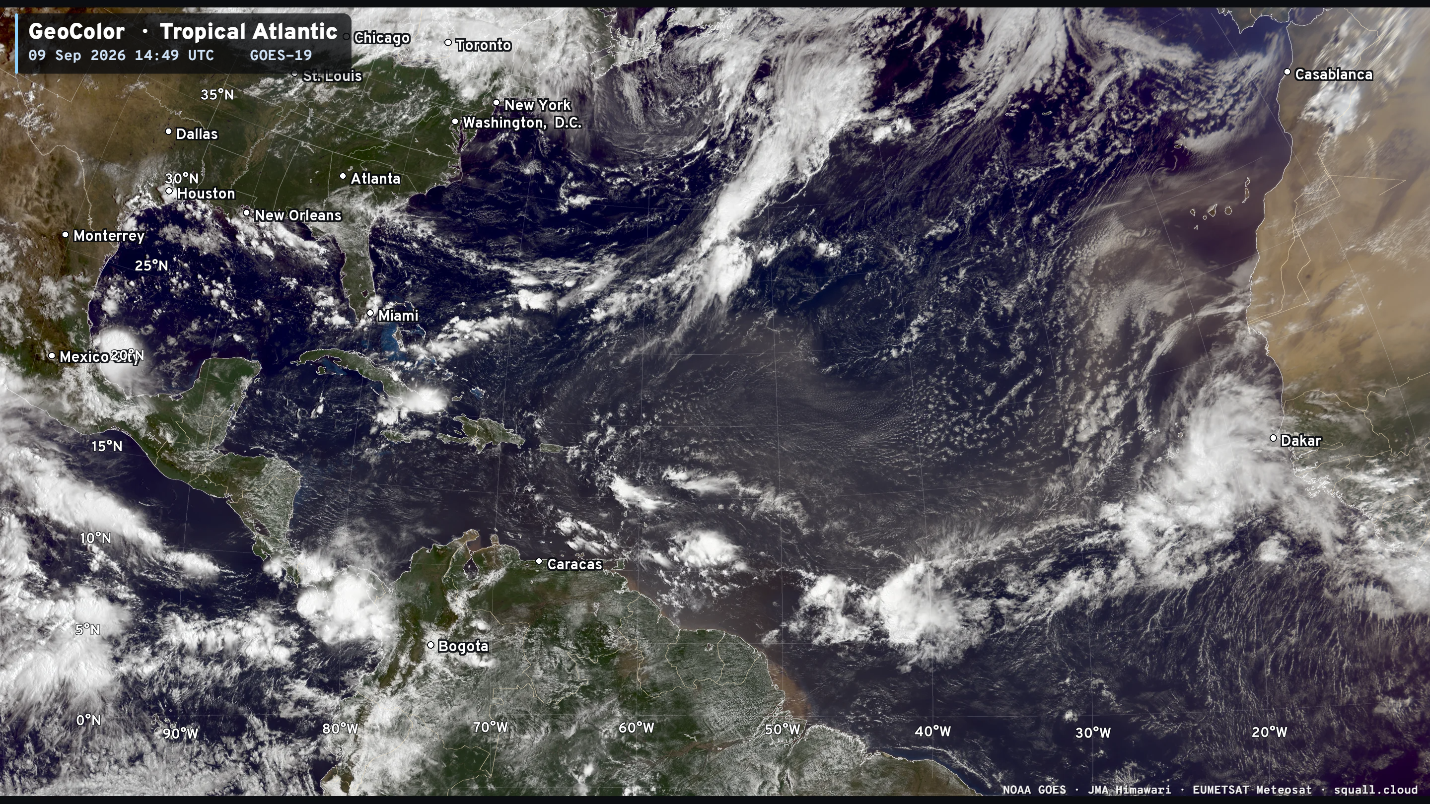
The Saharan Air Layers and dust plume is on the top half / north side of the ITCZ and monsoon trough. Tropical waves can still look healthy coming off Africa, but they find the dry, more stable environment over the water — seems counterintuitive to be dry over the ocean — but that’s what is suppressing the convection (storms).
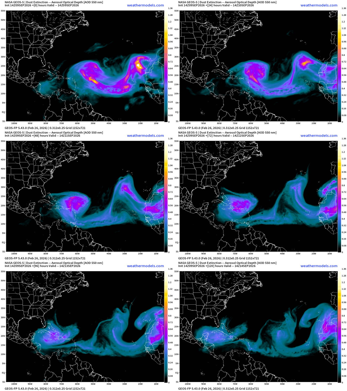
NASA GEOS-5 Dust — Next 5-days —> Massive plume entering Caribbean and then crosses Florida/Cuba into the Gulf of Mexico. Another swirl of dust actually is clockwise (anti-cyclonic) in the next few days.
Headlines Wednesday Evening in the Tropics
Atlantic tropics is entirely dead … no other way to put it.
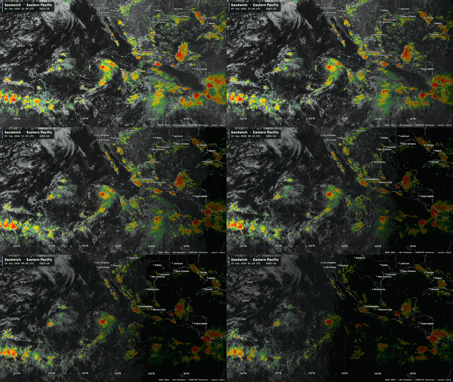
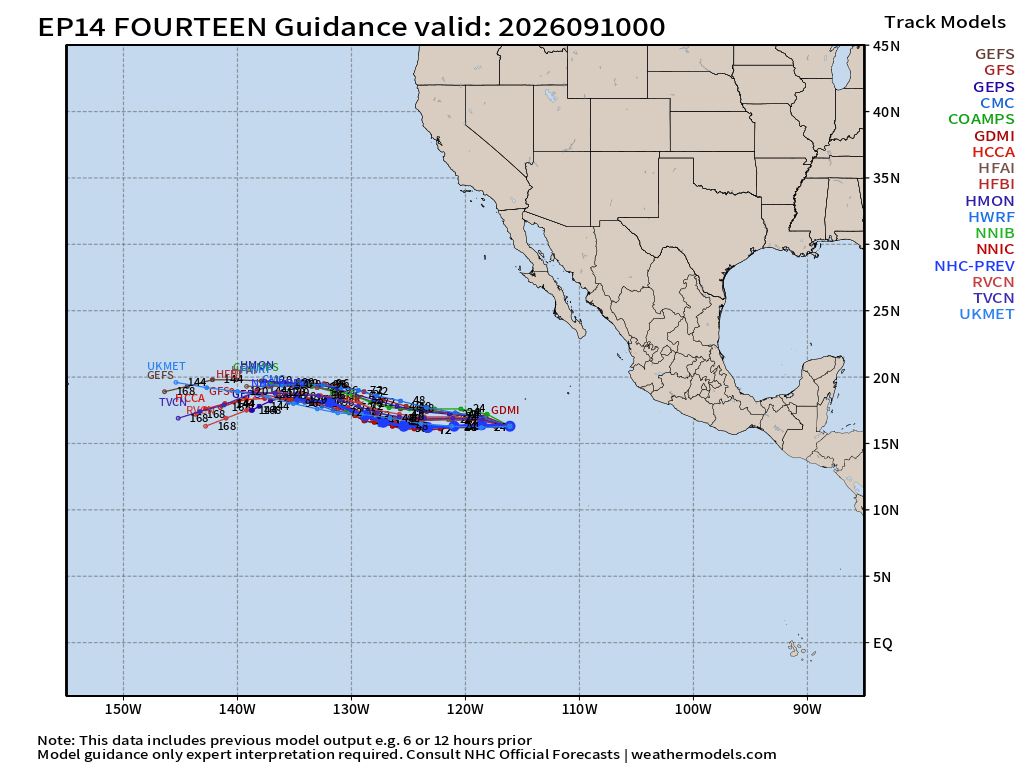
Tropical Depression 14E —> Norbert in the coming days. This storm will be around for a while … maybe 10+ days and could become a major hurricane on a westward course over very warm water, and end up near Hawaii.
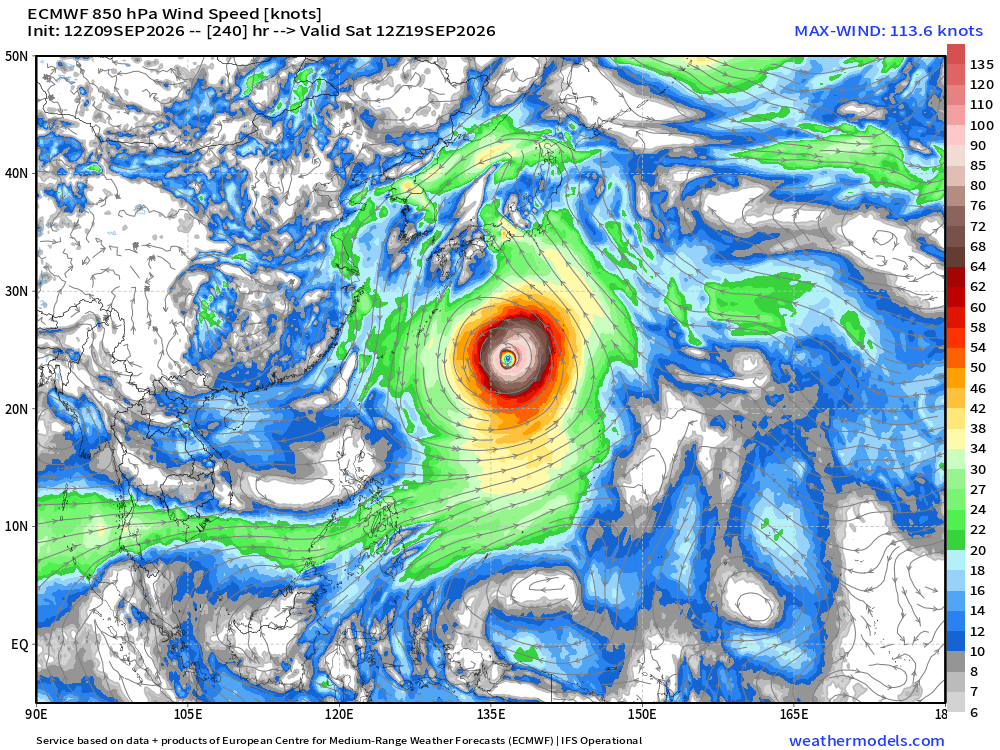
Massive Typhoon coming online in next 5-days across Western Pacific named Dujuan. The models have a monster.
Atlantic Tropical Outlook
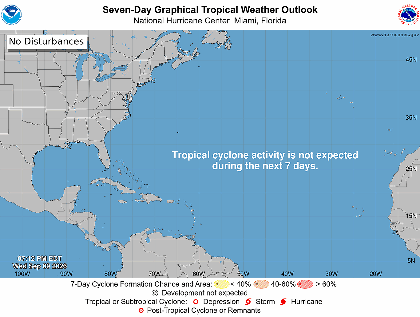
Ghost town —> no organized tropical systems through 7-days
While the tropics are still functioning in the Atlantic, tropical waves do not development and instead continue westward through the Caribbean and find “greener pastures” in the Eastern Pacific hurricane factory. ECMWF HRES 18z next 6-days PWAT (my favorite parameter)
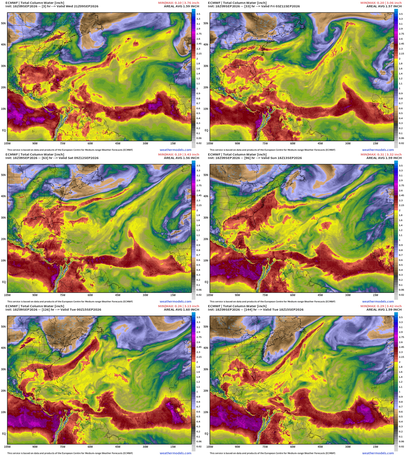
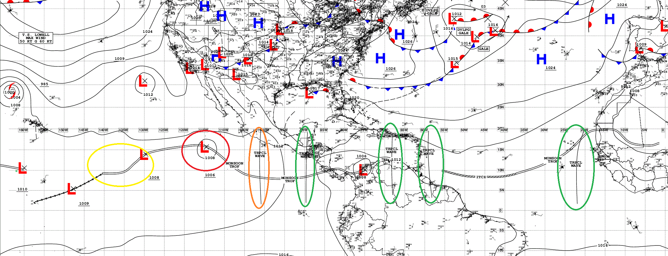
Atlantic Ghost Town | Tropical Waves Analysis (18z)
Atlantic Satellite
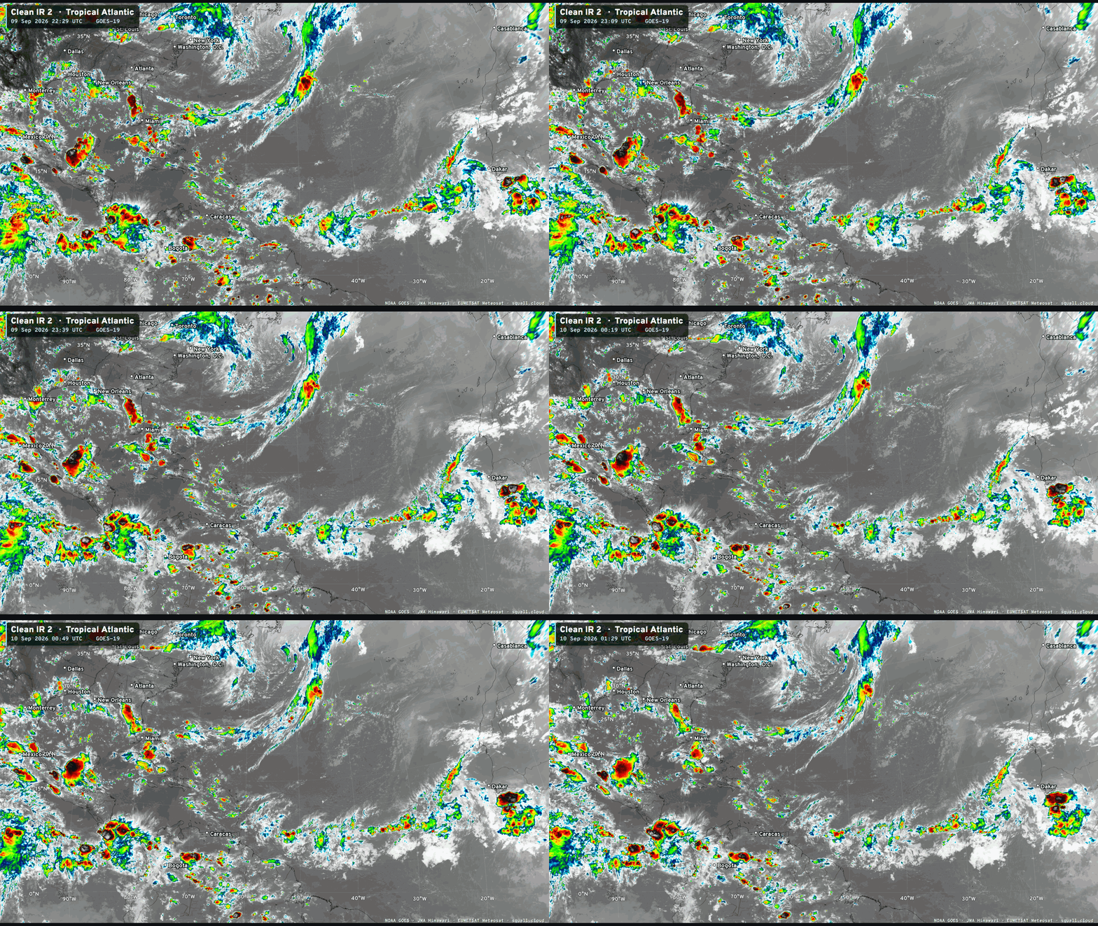
Minor convection along ITCZ but huge void where the Saharan Air / Dust Layers have scoured the basin.

You can see more Satellite Imagery at Squall Cloud —> LINK
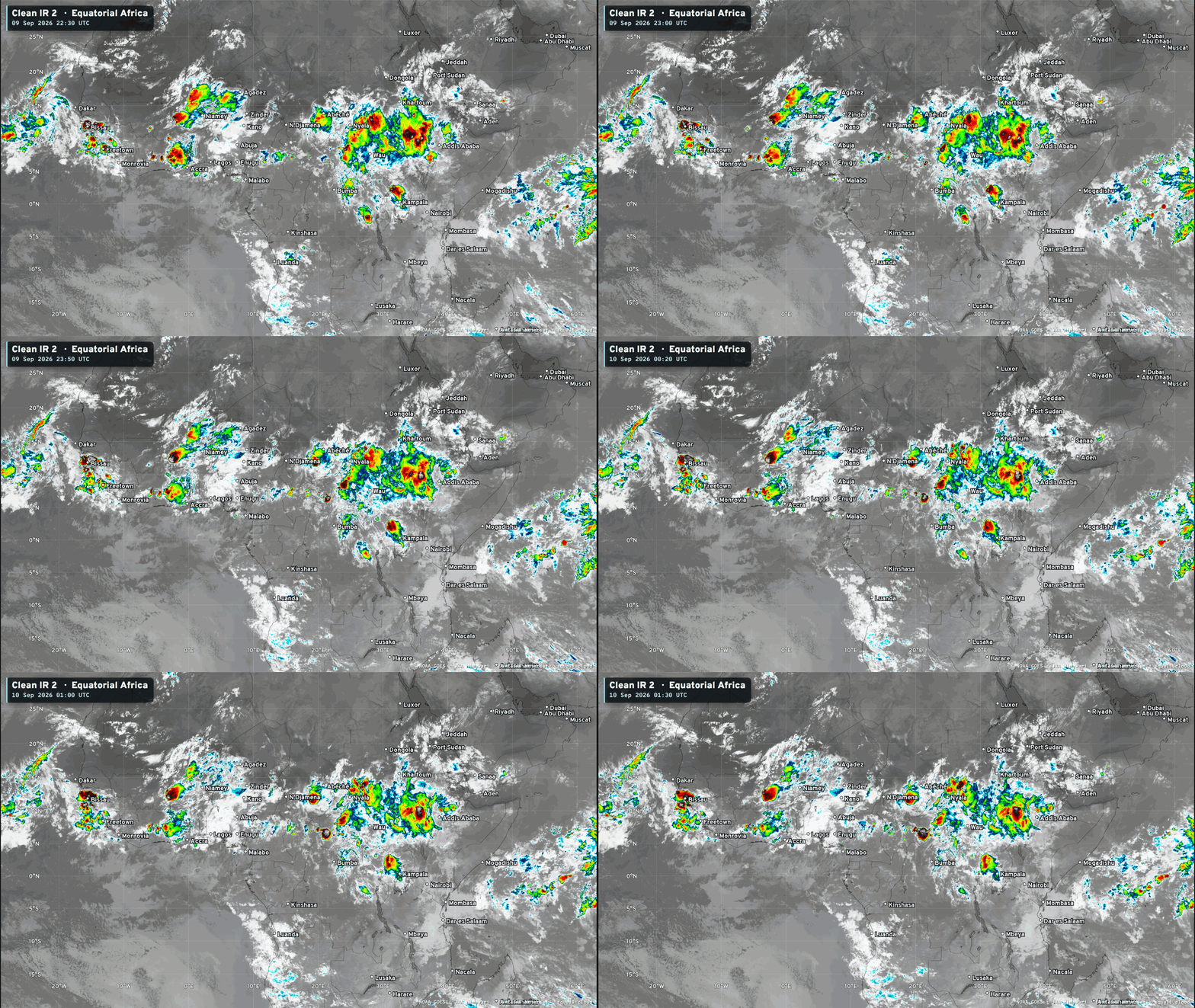
Equatorial Africa tropical waves — 3 areas … keep watching!
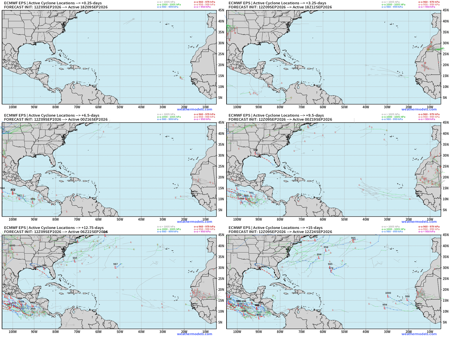
ECMWF Ensemble 12z full-physics tracks next 15-days
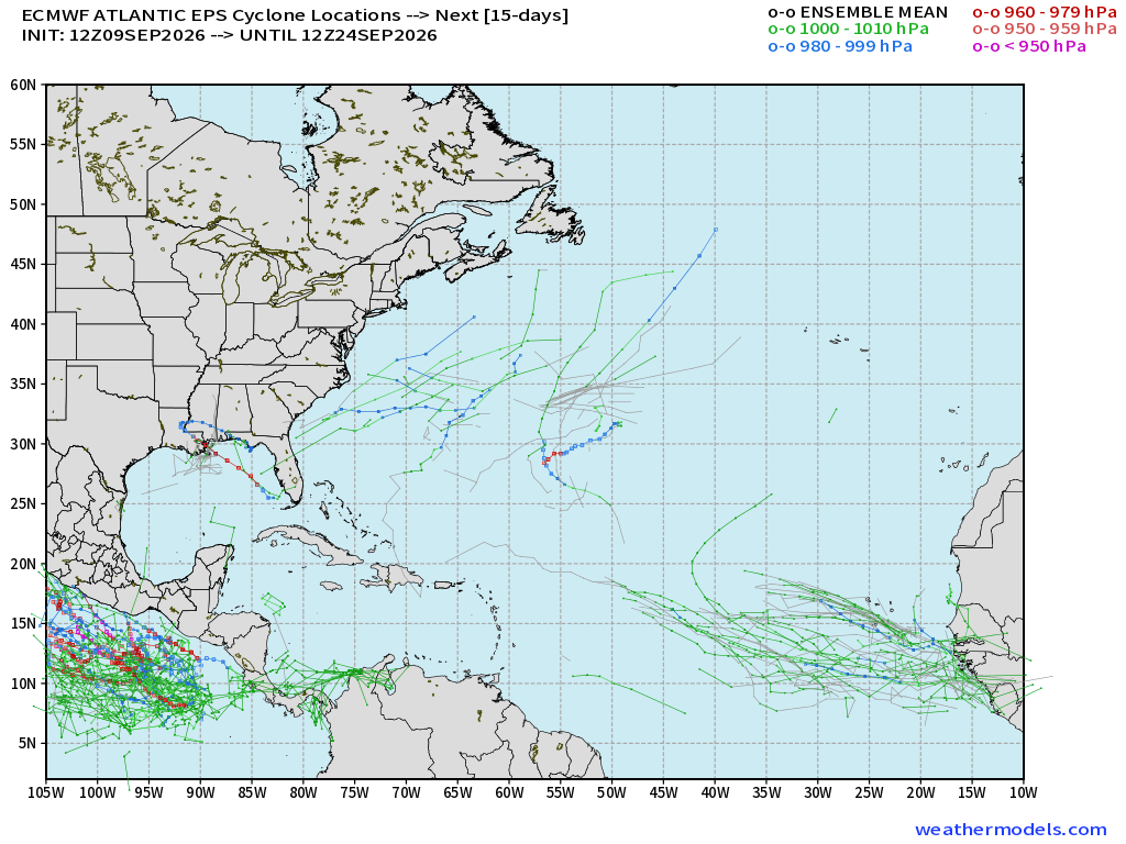
Almost a completely blank map except for a few TS/hurricane tracks outside of the MDR in the Eastern Atlantic. Minimal chance of development under 10%
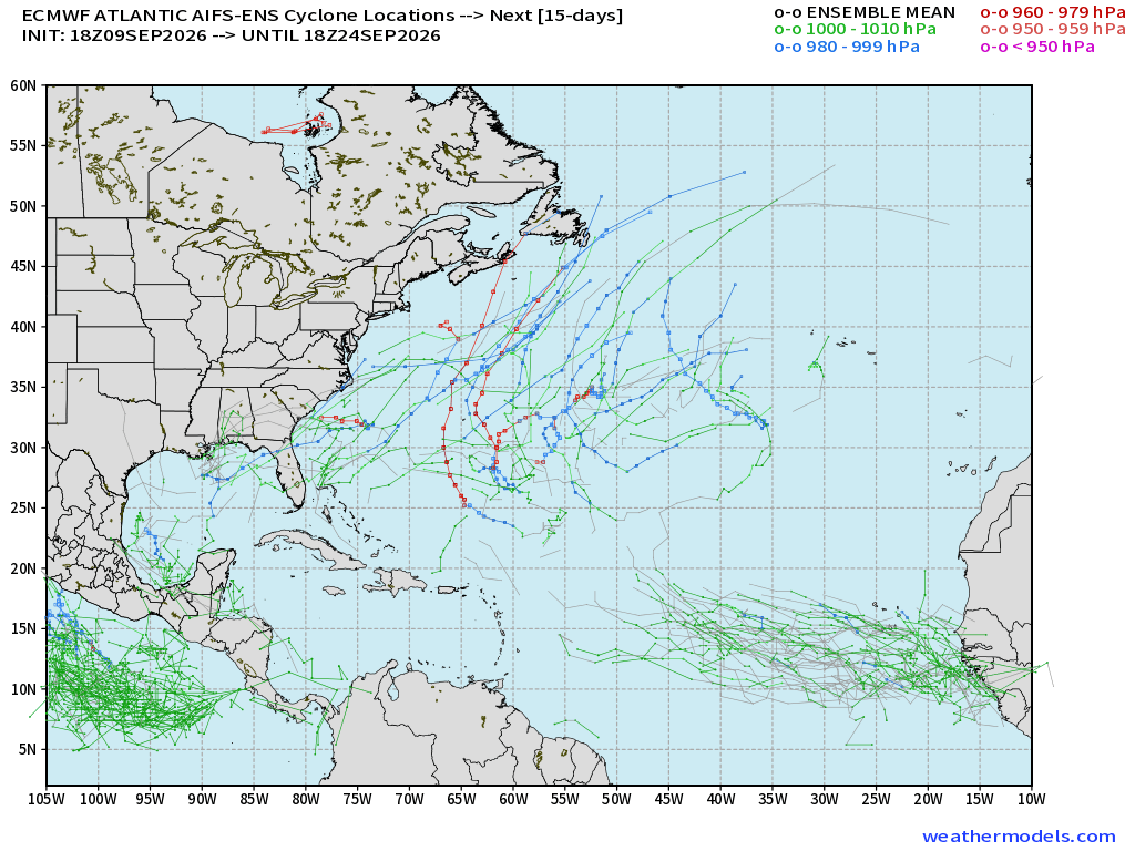
More activity in the central Atlantic from AIFS-ENS 18z and I’d call that 30% chance of something
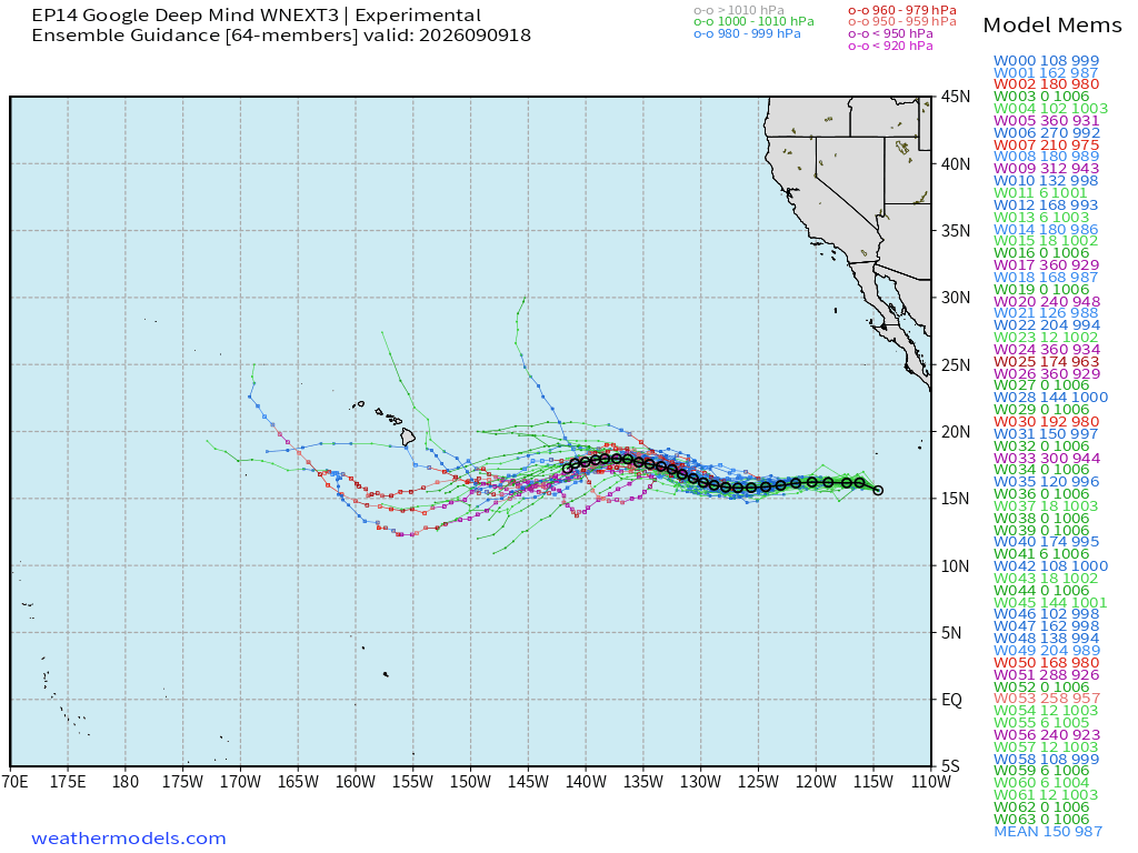
Google Deep Mind | Weather Next 3 | 18z Tracks (64-members)
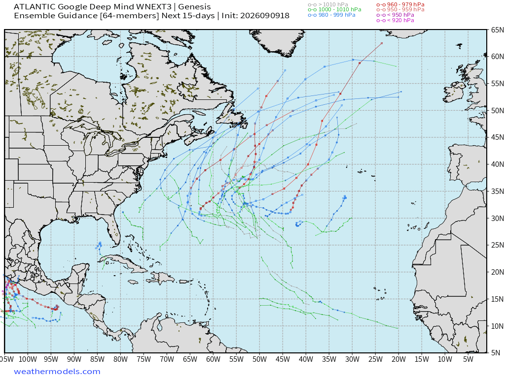
Also the tracks in the central Atlantic but more members to choose from (64) so maybe 20% to 30% chance of “something”
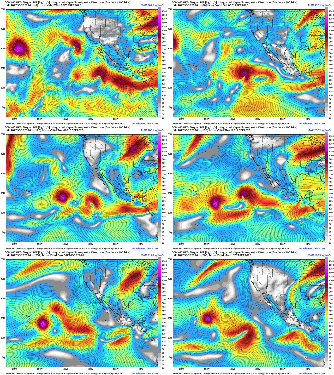
Flagship model: ECMWF AIFS 18z —> Integrated Vapor Transport next 12-days
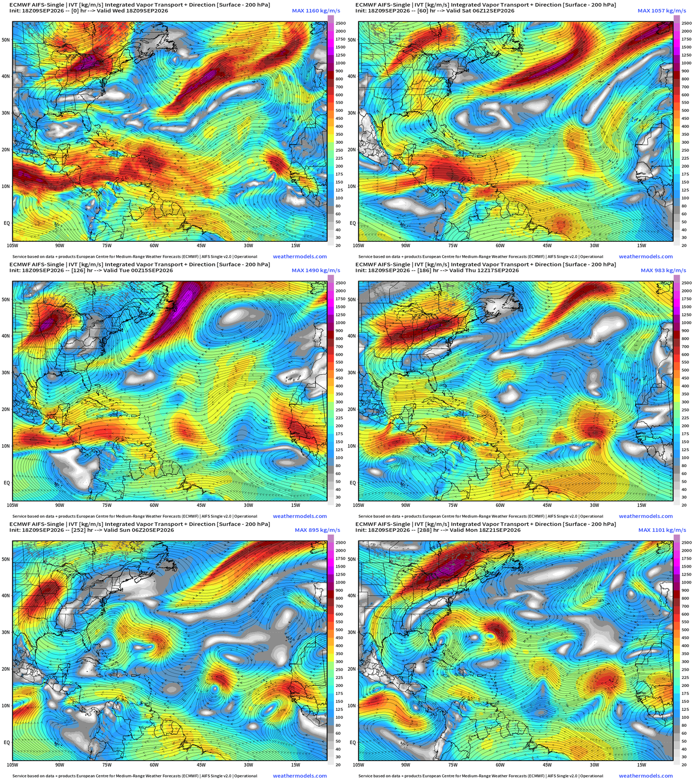
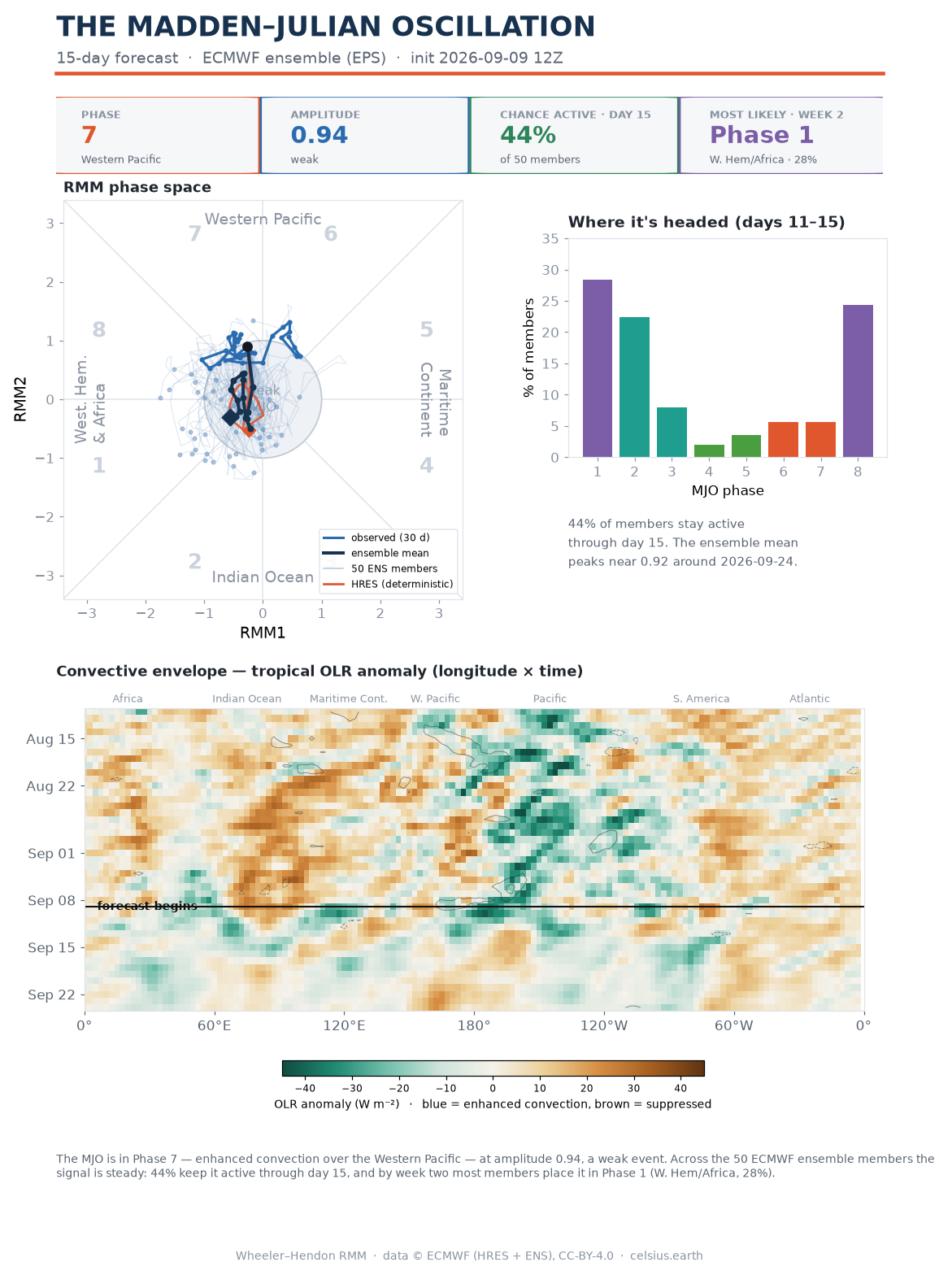
Interesting to see 4 areas line up by Day 12 … perhaps some background favorability from MJO but the overall signal is weak
Madden-Julian Oscillation update from EPS at celsius.earth
Eastern Pacific Tropics
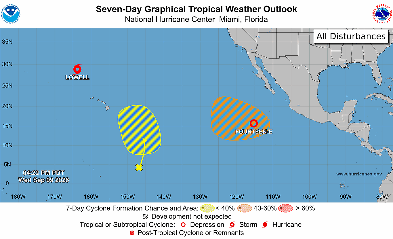
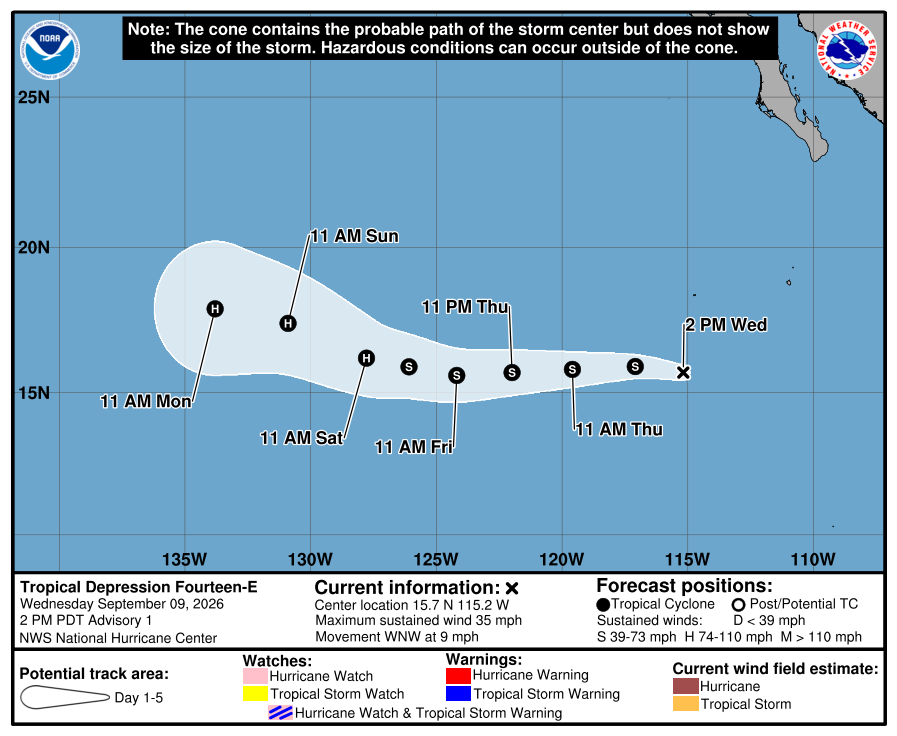
Tropical Depression 14E —> Norbert underway!
Due westward track over warm water!
And, some Weather Next 3 ensembles even show a Category 5 like Lowell.
NHC takes up to Category 1 Hurricane by Saturday morning — slow and steady intensification
ECMWF AIFS 18z shows Odalys forming the wake of Norbert
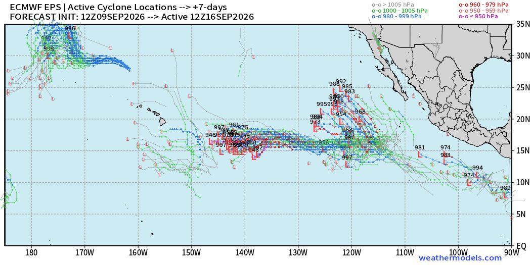
Tracks at Day 7 across the Eastern Pacific: 2 hurricanes
Western Pacific Tropics
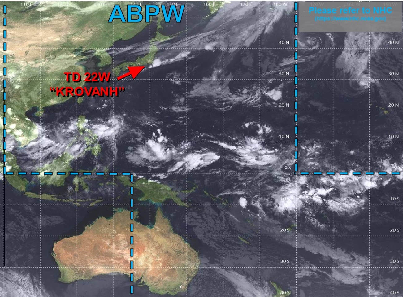
Quiet across the entire Western Pacific basin
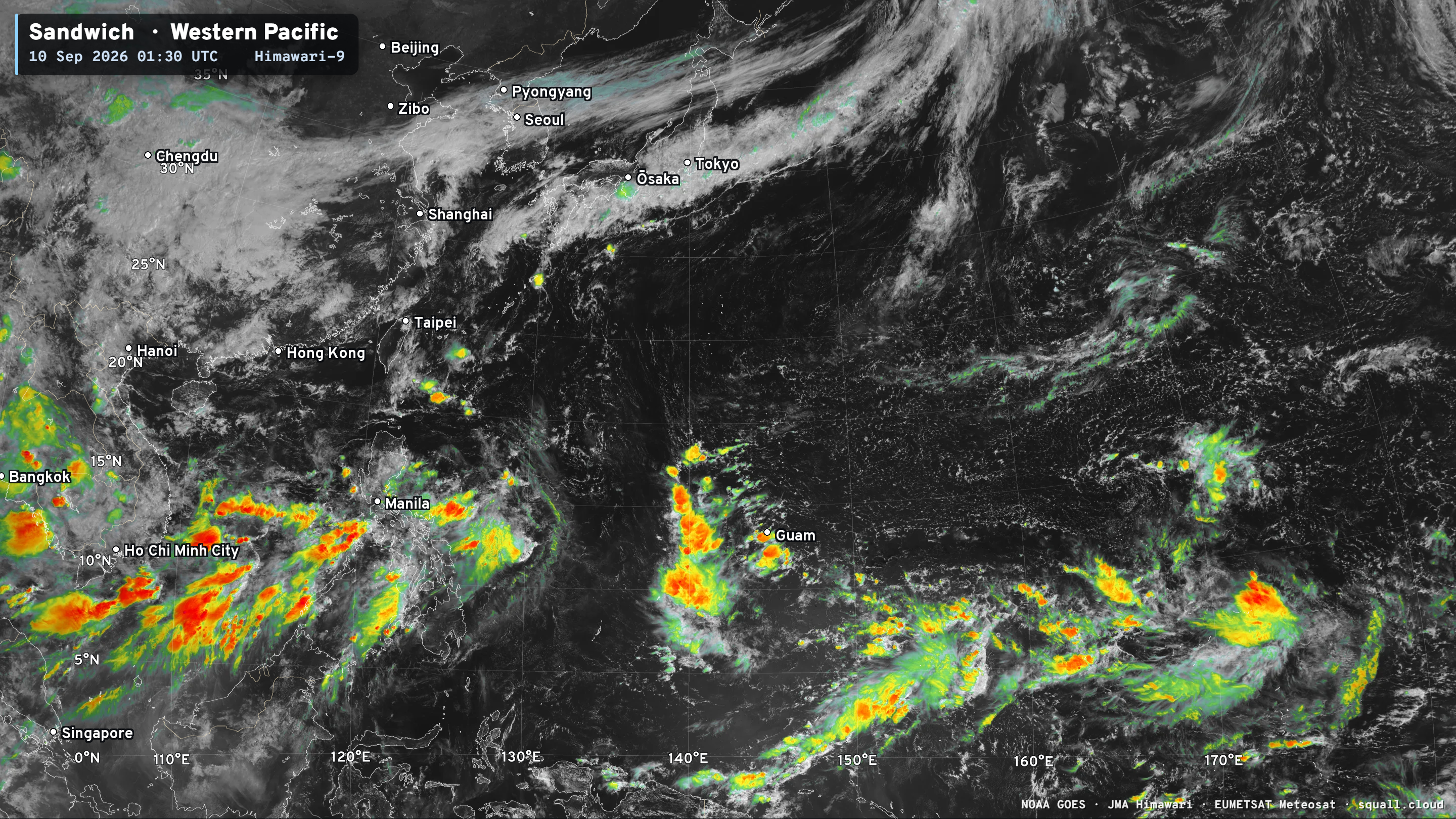
But then this monster forms —> next name is Dujuan.
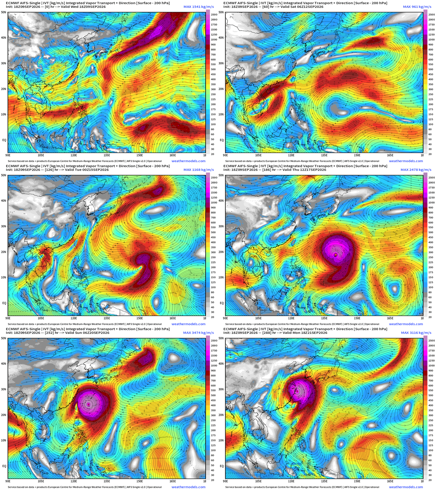
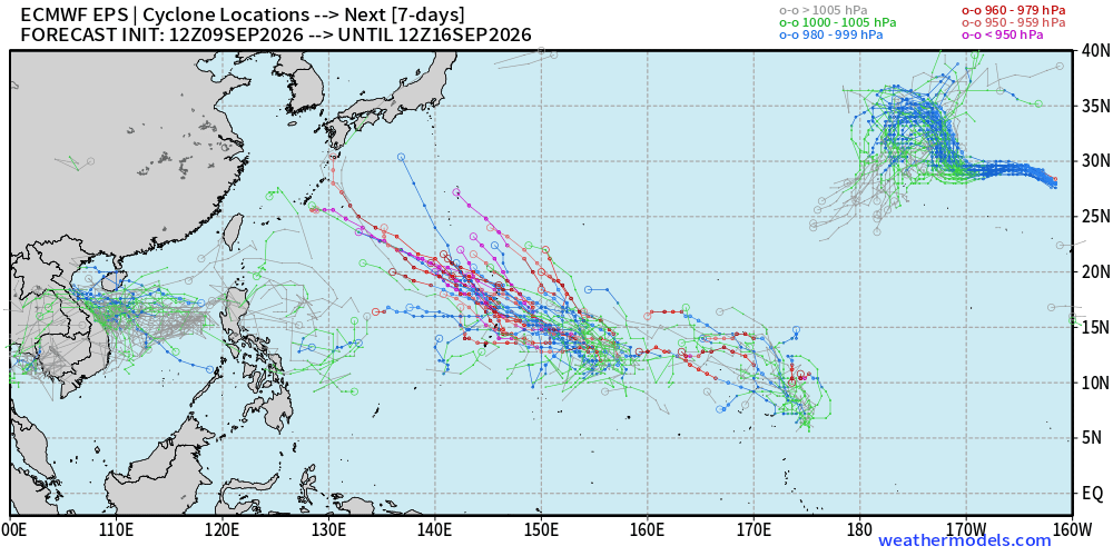
ECMWF 12z HRES also had the “monster” Super Typhoon look in 10-days, so long way down the road.
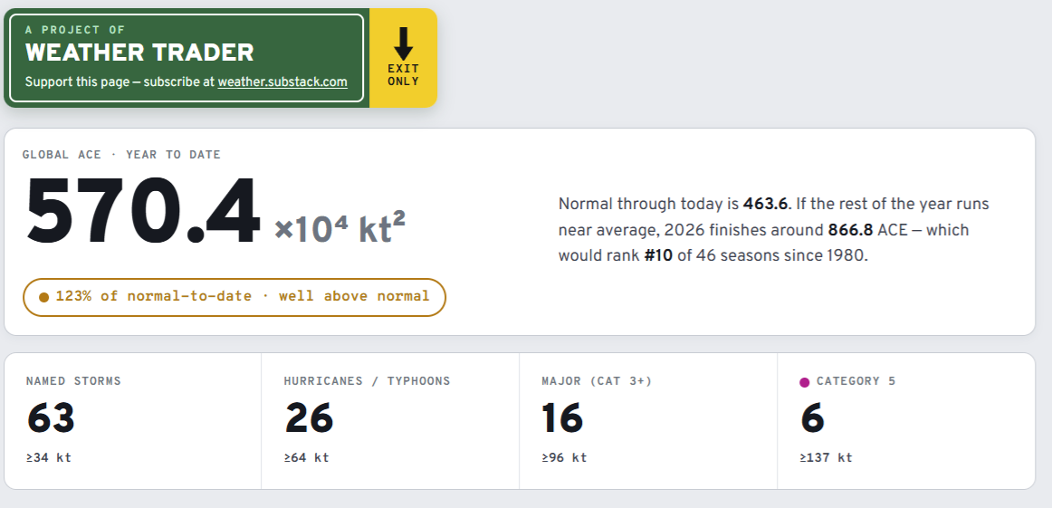
Visit Global Tropical Cyclones for more ACE information, as well as my original climatlas.com/tropical site now with the beautiful Interstate Highway theme and full of interesting content! ACE now 570
Forecast Eagle maps explorer

Satellite imagery from Squall Cloud. Maps sourced from weathermodels.com designed and innovated by yours truly! Please subscribe there for real-time access to the newest maps, charts from all of the weather models including ECMWF and AIFS, and NOAA GFS/GEFS, HRRR/RRFS and Blend of Models (NBM). NOAA WPC and SPC for fronts/convective outlooks. Our own content is now sourced from hottestsince.com and weather.city and celsius.earth, and squall.cloud and weather.football and global-tropical-cyclones.com and precip.earth
My Atlantic Hurricane Season Forecast (2026)
From April 7, 2026: Atlantic Seasonal Hurricane Forecast: (11/5/2)
9-13 Named Storms (11 most likely)
4-7 Hurricanes (5 or 6 most likely)
1-3 Major Hurricanes (2 most likely)
Accumulated Cyclone Energy: 75-85 (well below normal)
NOAA 2026 Atlantic Hurricane Season Forecast
- Milepost
- 1028 · laid 2026-09-10T02:37:44.053000Z
- Source
- https://weather.substack.com/p/september-9-2026-wednesday-tropical
- Digest
- c7d7403a5c6d78faadf5e11cb9c82fc1c9bc8c4fa462a69ef86d53809be90d99
- Machine
- JSON