June 21, 2026 Sunday Summer Weather
Atlantic tropics in a long slumber until July. A powerful Typhoon well east of Taiwan will turn north in the coming days away from land.
June 2026 was the 18th-warmest June in the 132-year national record (1895–2026), at 70.6°F against a 1991–2020 normal of 69.5°F (+1.2°F).
June 2026 was the 32nd-wettest June in the 132-year national record (1895–2026), at 3.3in against a 1991–2020 normal of 3.1in (+0.2in).
NOAA/NCEI Climate at a Glance, contiguous United States. This is the observed record for the month, not a score of anything said in this piece — the forecast ledger begins 2026-08-17 and cannot reach earlier posts.

Help support this newsletter (nearing post 1,000!) —> June 2026 Coupon
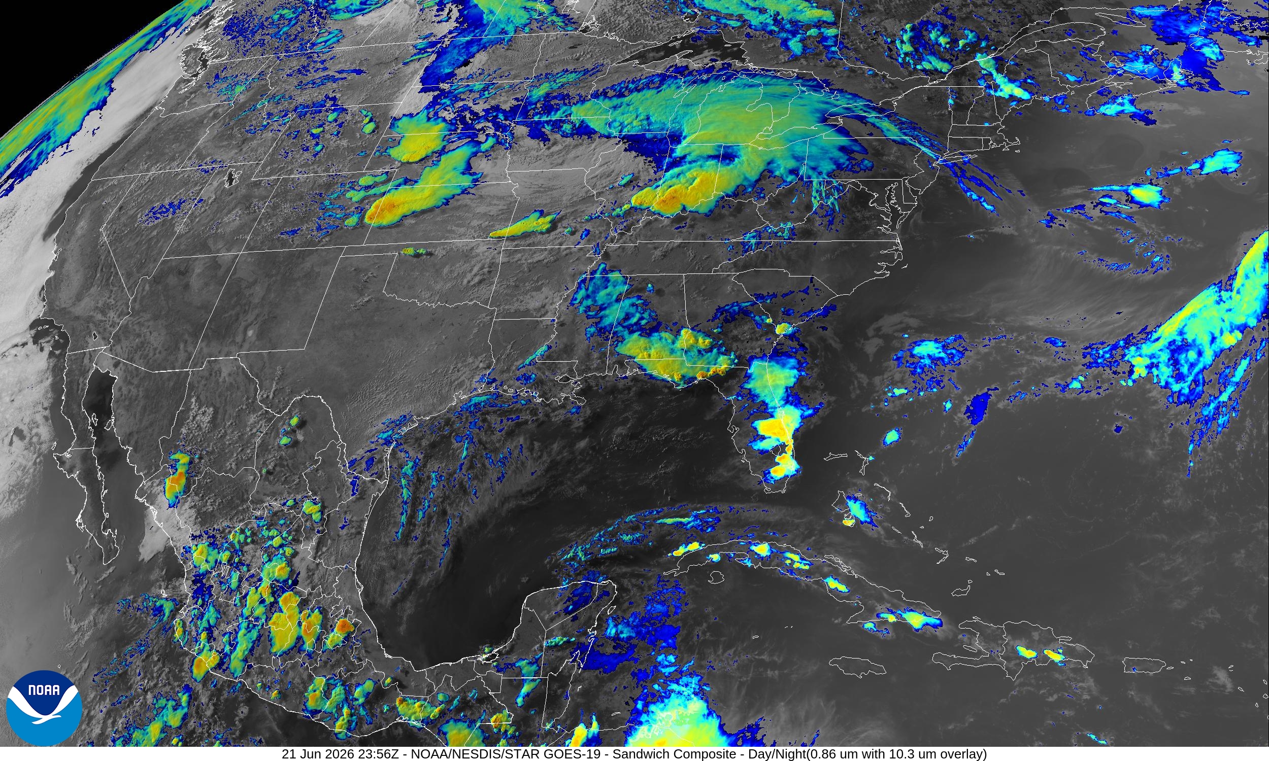
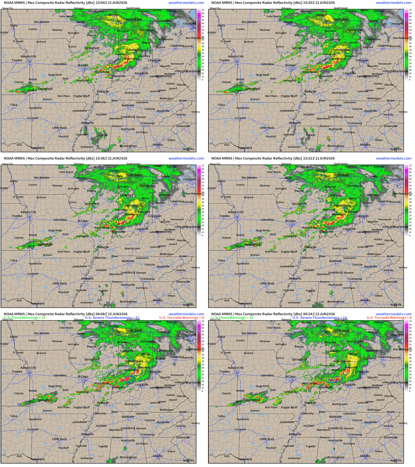
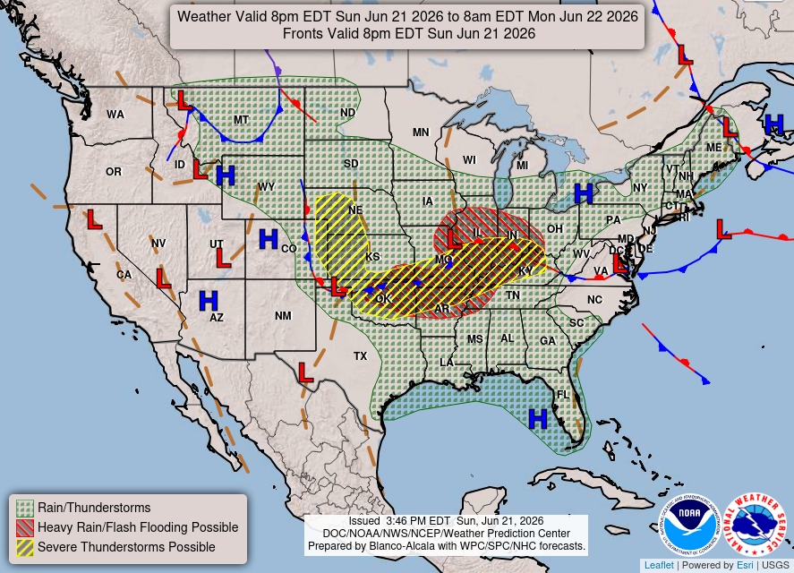
Severe thunderstorms about to reach the Ohio River in a convective complex. Embedded tornadoes and risk for damaging winds along with heavy rain, of course.
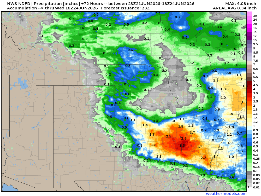
NWS Precipitation Next 72-hours —> Wednesday Afternoon
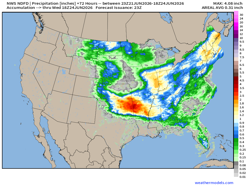
More rainfall for the lower Great Lakes and Northeast w/widespread 1-inch+
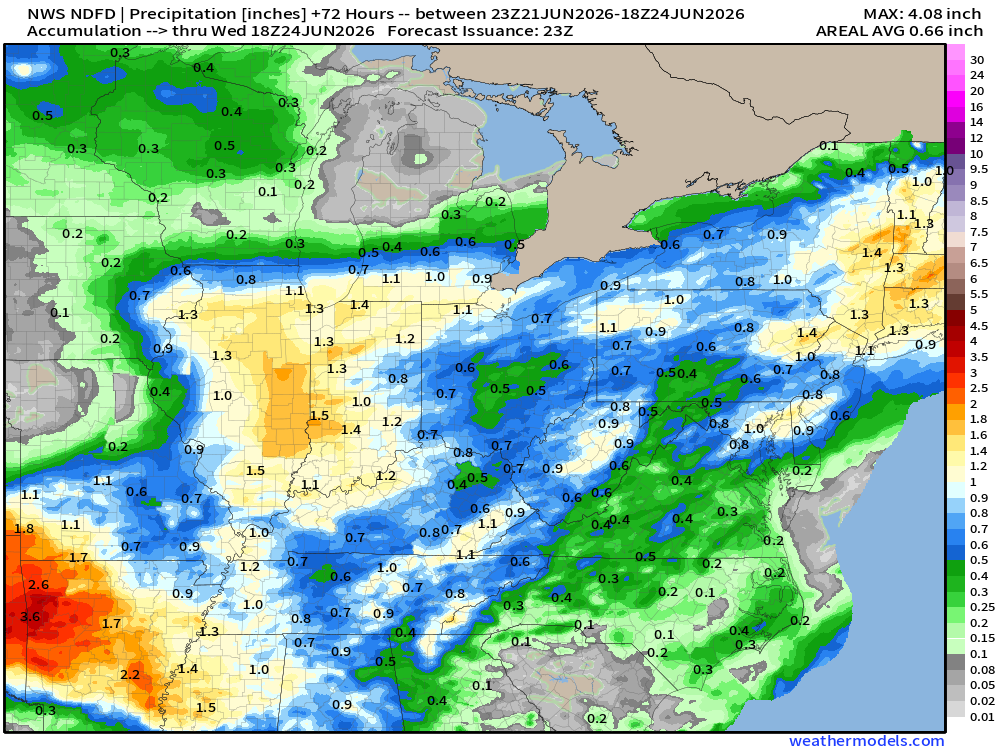
Much more in Oklahoma with a convective storm complex expected to move southward tomorrow.
My favorite parameter — next 48-hours of HRRR Precipitable Water
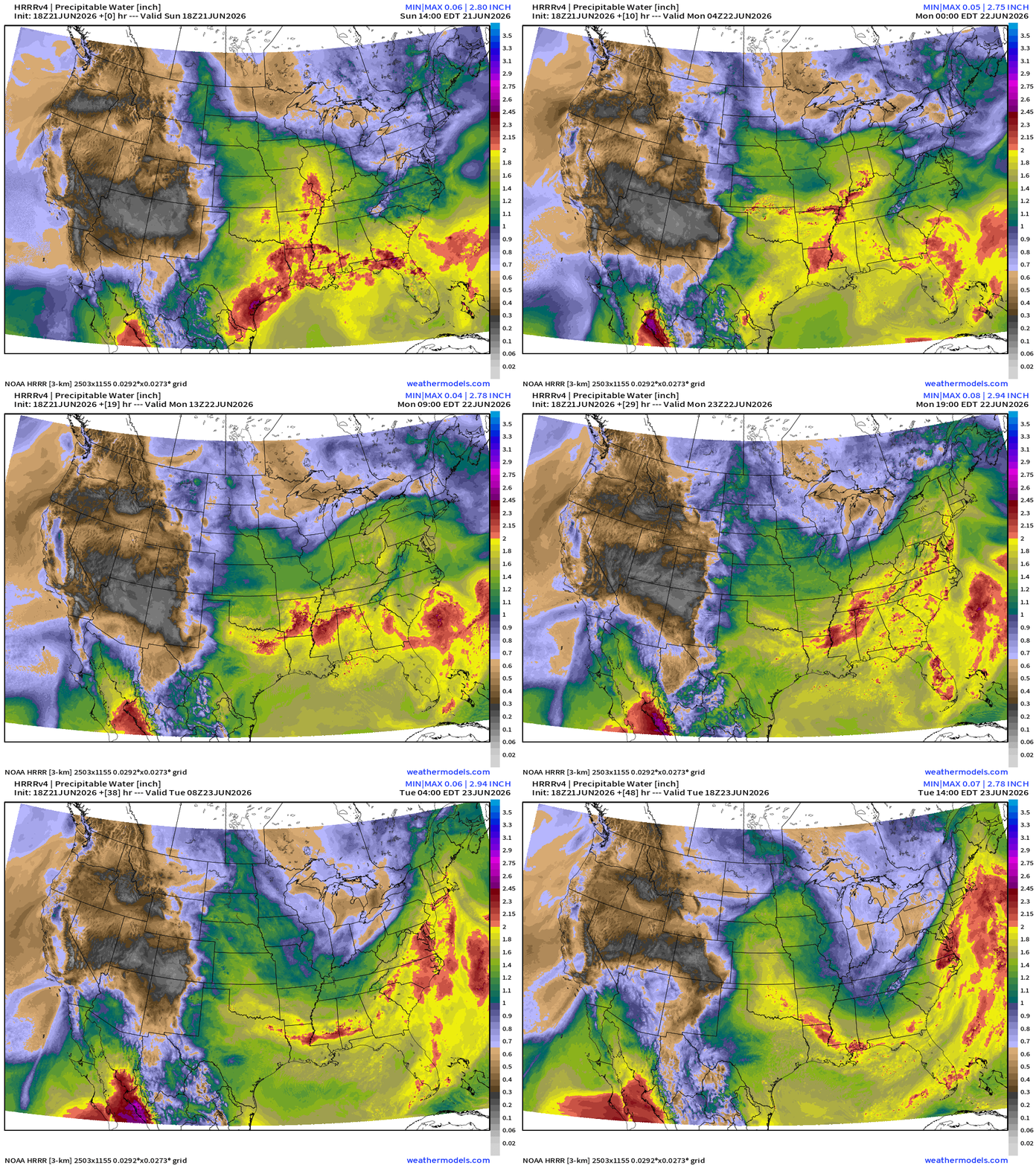
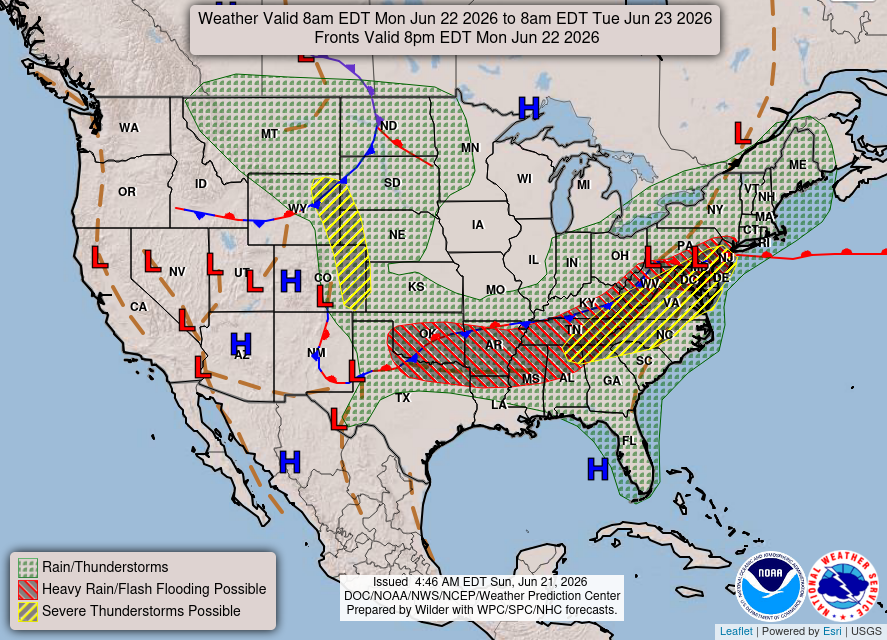
Into later Monday, the frontal boundary digs southward and pushes the tropical moisture into Southeast. On the backside of the trough, the MCS forms in southern Kansas and crashes southward through Oklahoma.
Weather Into Monday Morning
HRRR Forecast Radar into Monday Noon ET
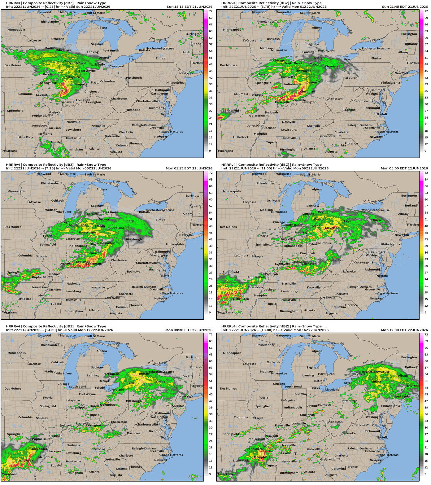
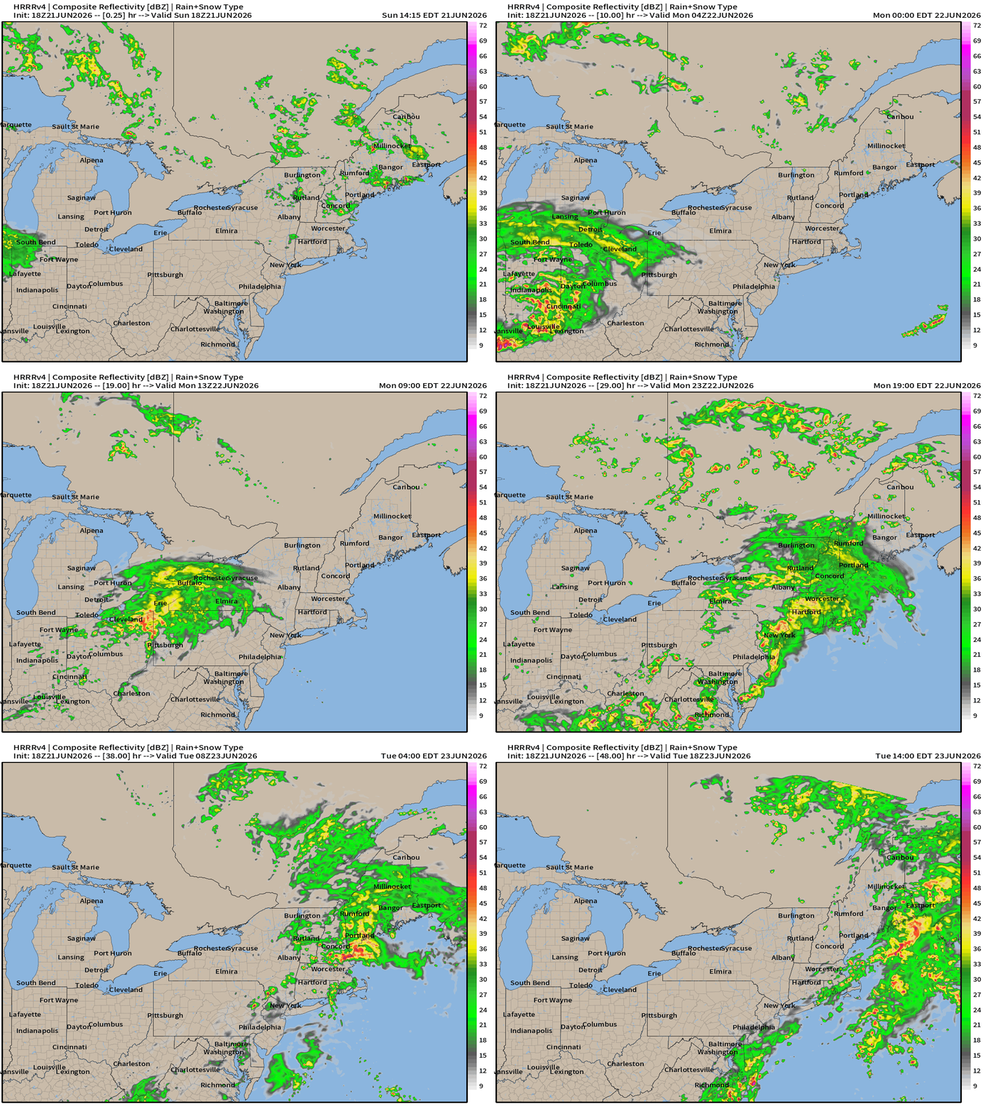
Rain and embedded storms head into the Northeast with the storm system.
We’ll need to wait until later in the day for new storms to fire up for the Mid-Atlantic.
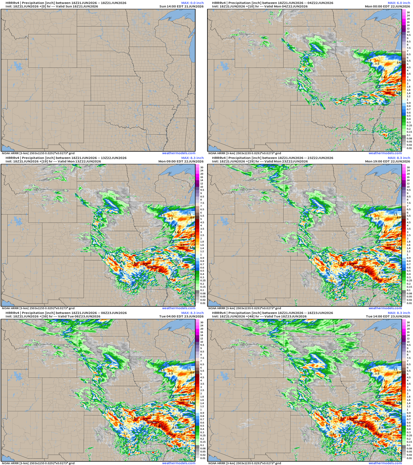
HRRR Rainfall over the next 48-hours painted by the storms
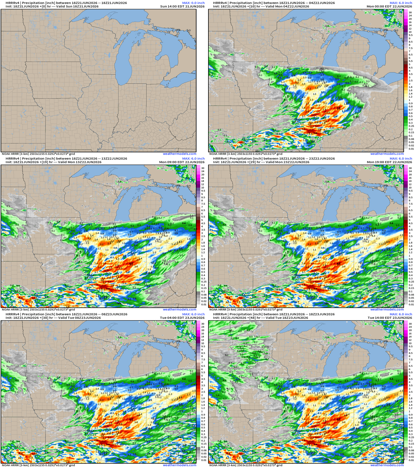
Oklahoma and Arkansas with heaviest downpours with this 18z HRRR cycle
HRRR Next 48-hours simulated Radar through Tuesday 2 PM ET
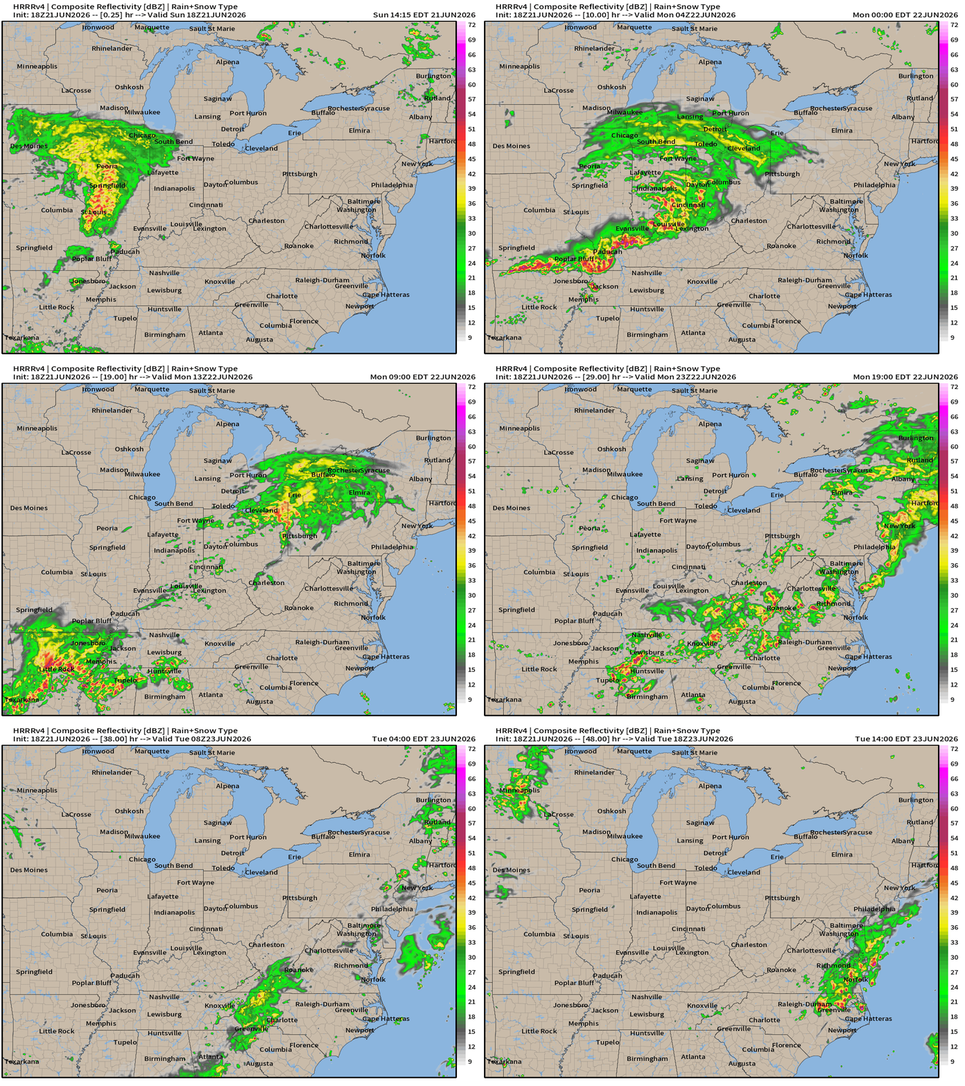
Weather on Monday — Frontal Boundary focus for continued storms and heavy rain as tropical moisture encounters digging trough
ECMWF 18z | Precipitation + MSLP | Next 6-days
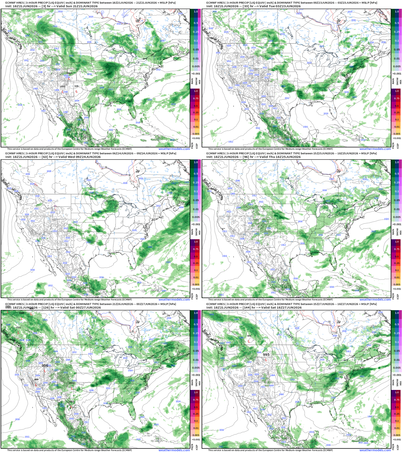
Mainly scattered convective complex — rather than organized storms systems
In Summer we watch for frontal boundaries that are more humidity gradients rather than cold/warm air separation.
Week ahead looks unsettled
Blend of Models —> Precipitation Next 9-days
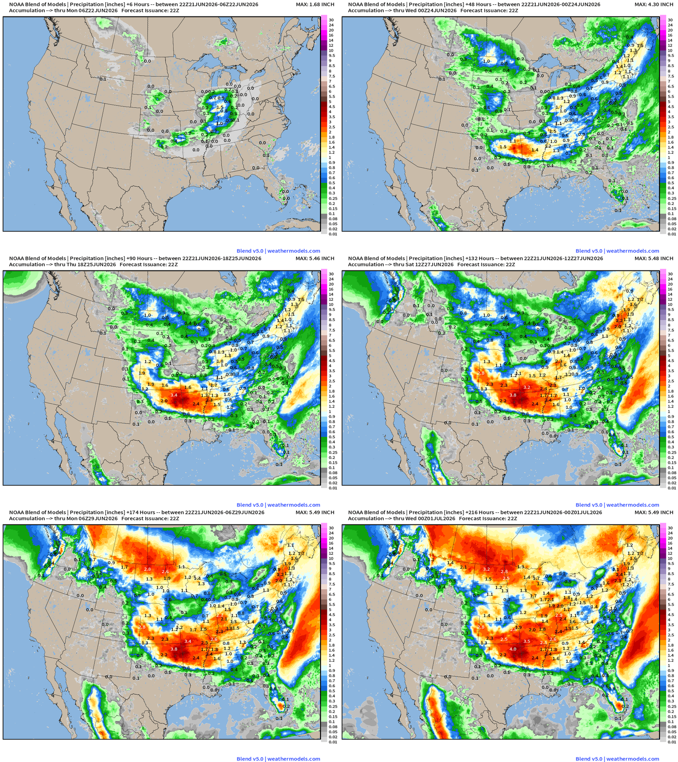
Continued wet pattern for the Central U.S. from OK/AR up into the Midwest while Texas dries out nicely. Sometimes a break from heavy rain is a good thing in early summer!
Help support this newsletter (nearing post 1,000!) —> June 2026 Coupon
Flagship model: ECMWF AIFS 18z —> Integrated Vapor Transport next 10-days
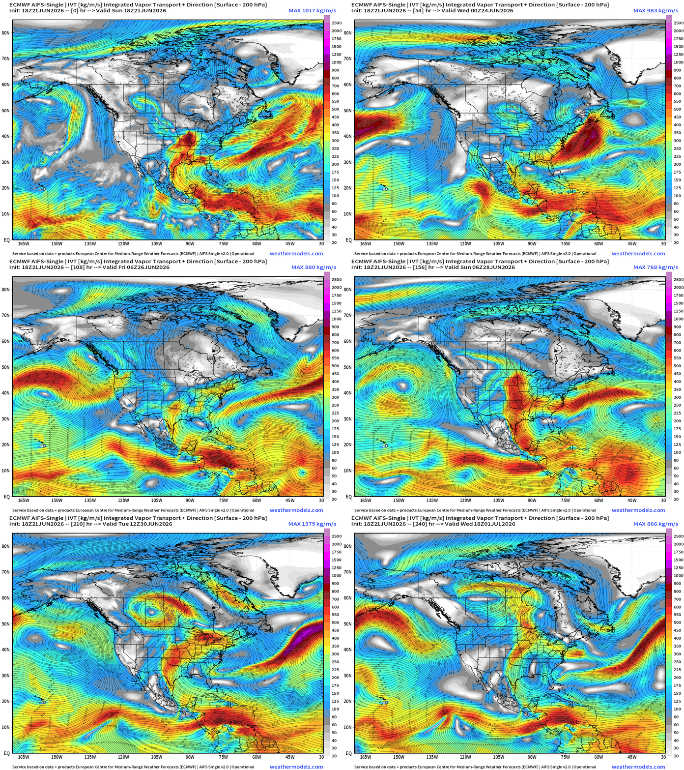
The magnitude of the tropical moisture feed into the USA from the Caribbean and Gulf is dialed down/back significantly as ridging strengthens over the Southeast U.S. —> heat dome?
ECMWF 18z | Precipitable Water | My Favorite Parameter
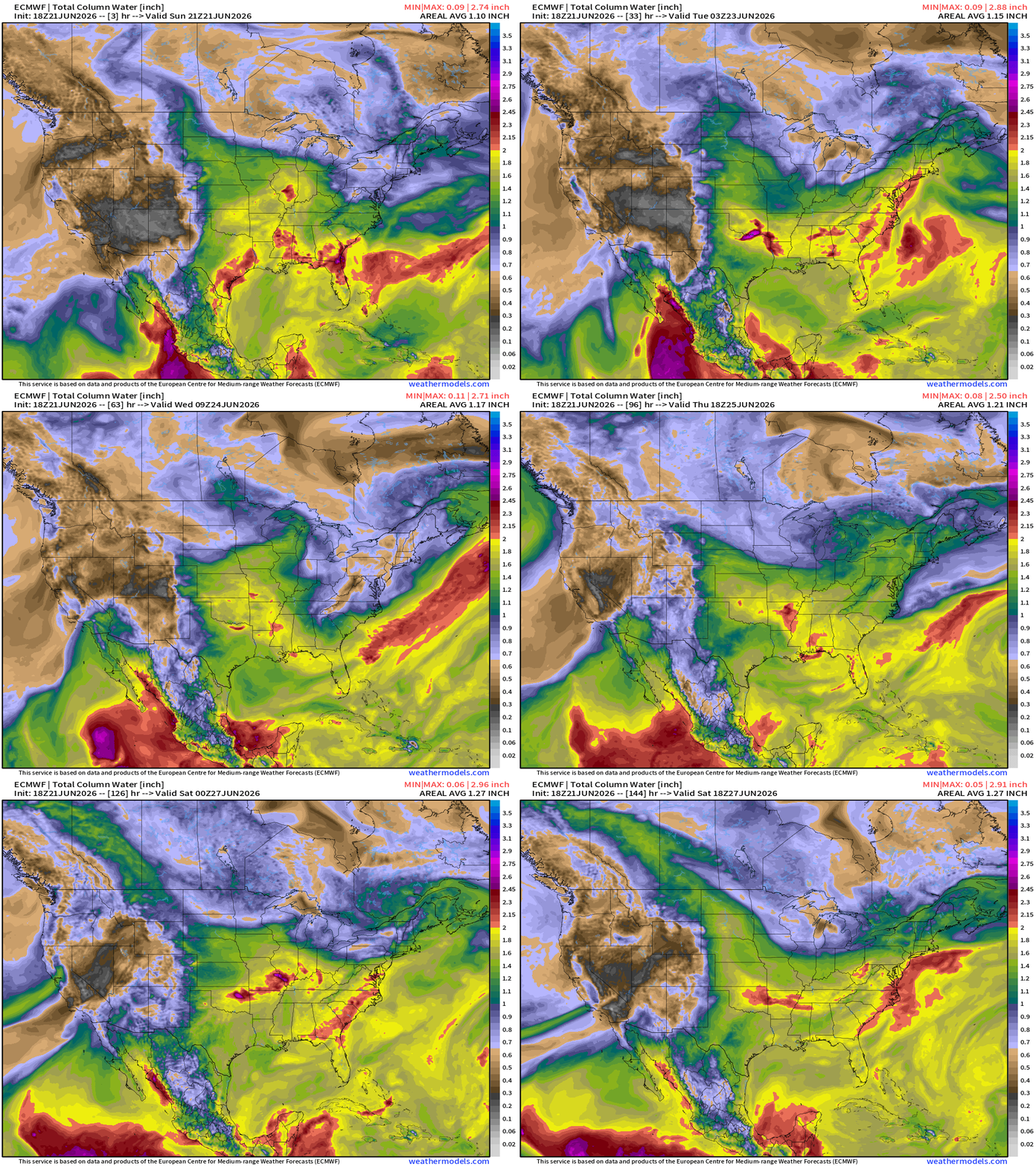
Generally 1.8” (yellow) PWAT with embedded > 2” convective cells = heavy downpours across Central U.S. into the Southeast.
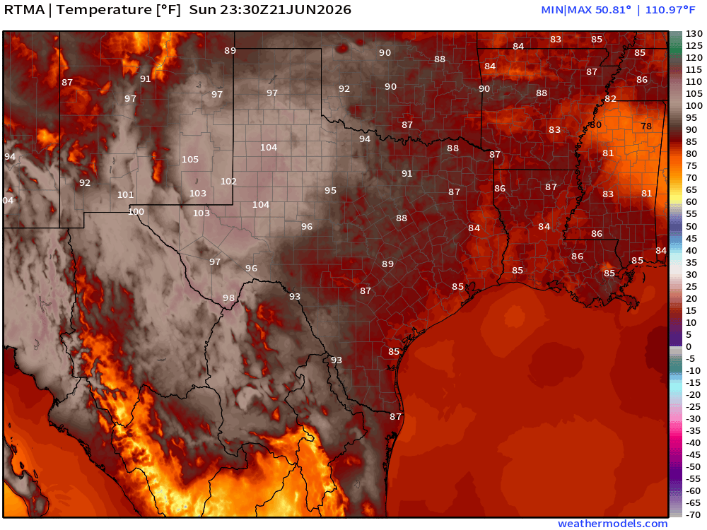
Temperature Analysis | RTMA | 7:30 PM ET
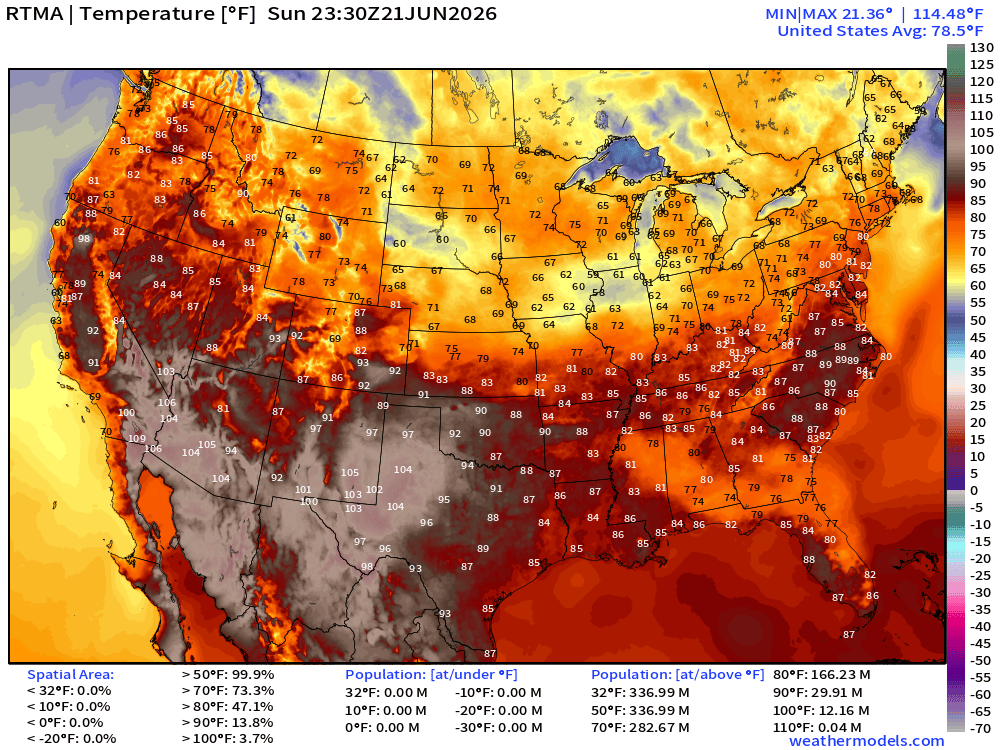
Very hot in west Texas > 105°F … only 30 million population at least 90°F at 7:30 PM
Temperature Anomaly | RTMA | 7:30 PM ET
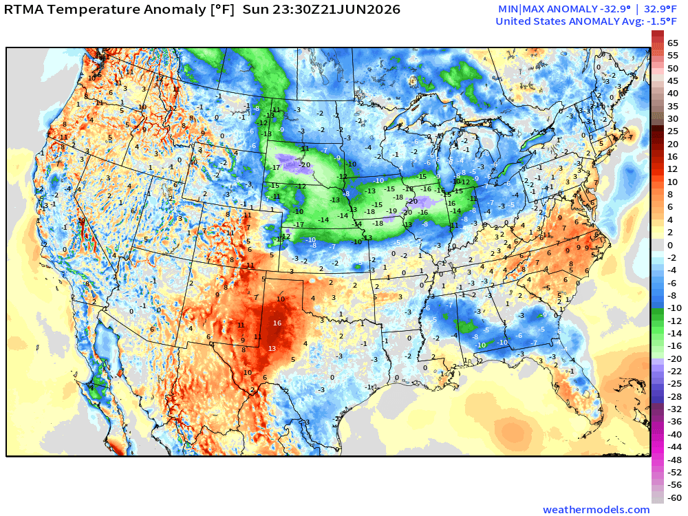
Lower 48 was -1.5°F below normal with clouds and rainfall cooling down the Dakotas, Midwest into the Great Lakes
High Temperatures Next 8-Days —> Tuesday June 30th
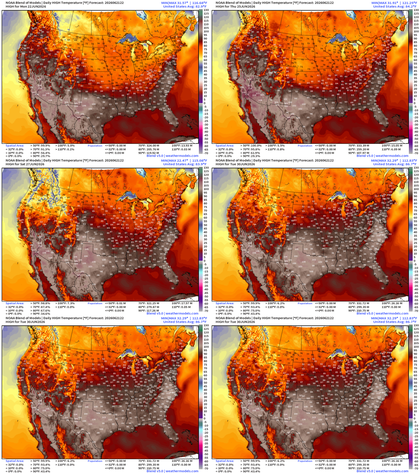
Trend to hotter temperatures across the board into final days of June with 100s building across all of Texas with the much dryer conditions. Southeast including Atlanta and Carolinas push well into the 90s.
With less tropical moisture plume activity from the Gulf of Mexico, we’ll see much warmer temperatures and lower rain chances —> warming trend into 4th of July.
210 million+ at least 90°F by June 30th with Lower 48 average high of 86.7°F
Low Temperatures on Monday
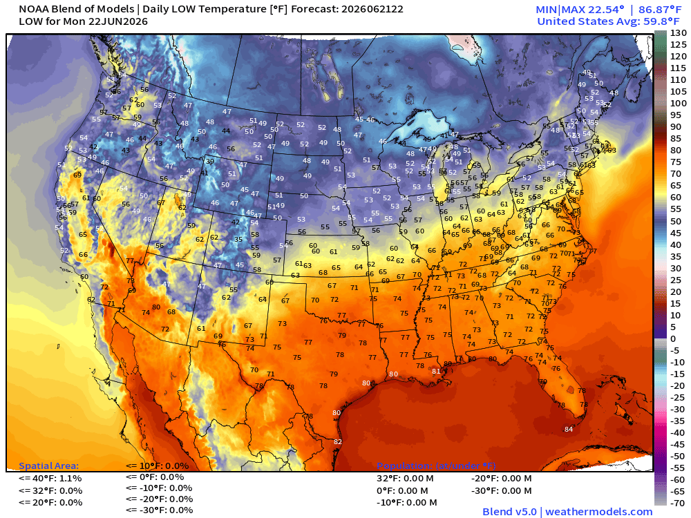
40s and 50s from northern Rockies into the Midwest, Great Lakes, and Northeast.
No sign of muggy, heat wave conditions — windows open!
High Temperatures on Monday
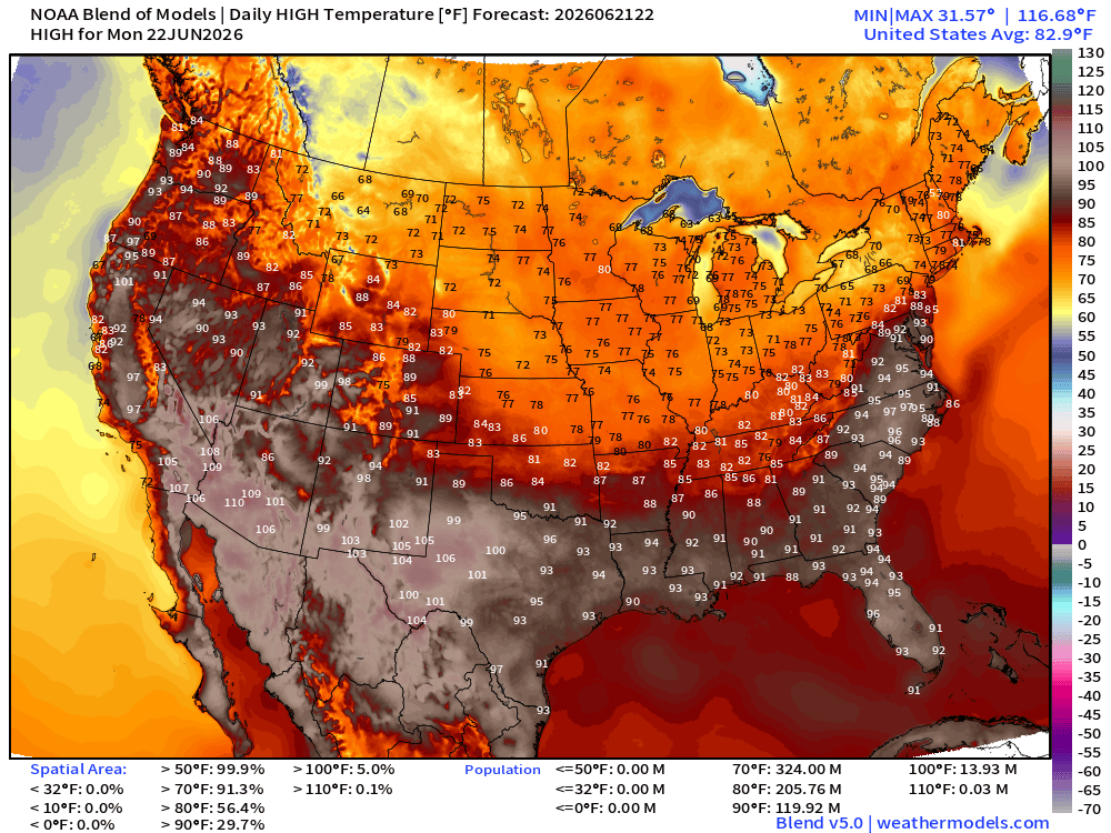
Up to 120 million at least 90°F and 14 million at least 100°F
Upper-Level Height Anomaly | AIFS-Single Next 10-days
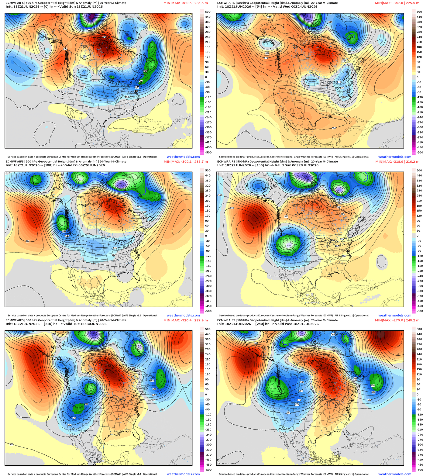
Strong troughing digs into the Pacific Northwest in the medium range = much cooler across the Western U.S. with potential for mountain snow into early July.
Ridging builds across the Eastern U.S. —> dry and heating up especially across the Southeast
Into Summer —> Height Anomalies don’t tell entire story … actual height helps!
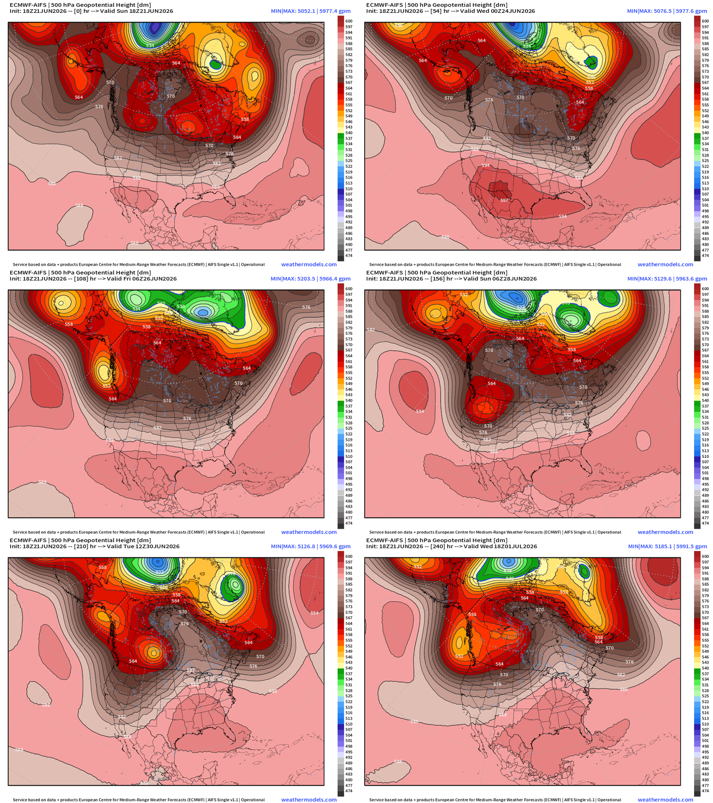
594 dm —> 597 dm (or higher) contours pop up across the U.S. border in AZ/NM and then in the Southeast … trending warmer —> maybe a more typical “heat dome” centered over the Southeast into early July.
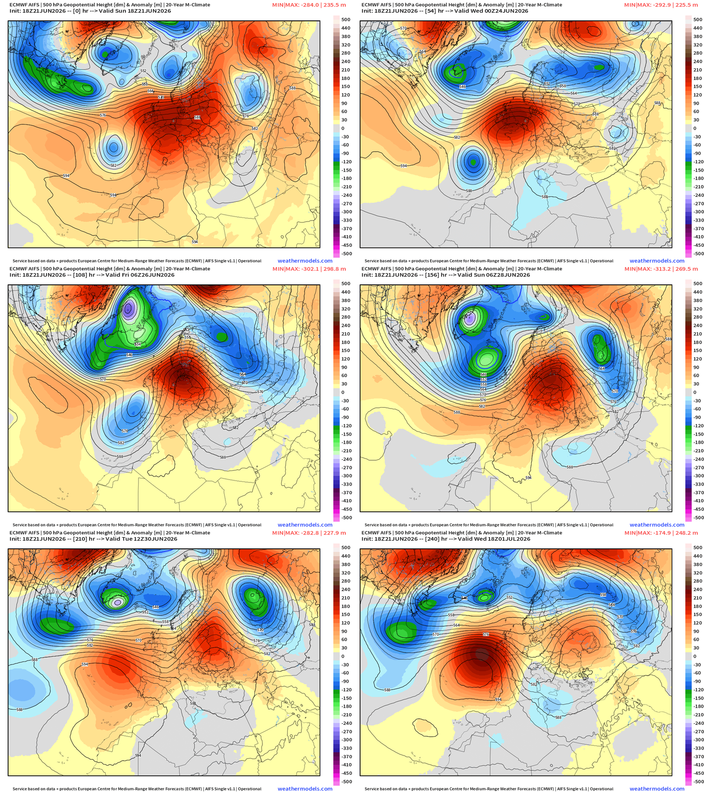
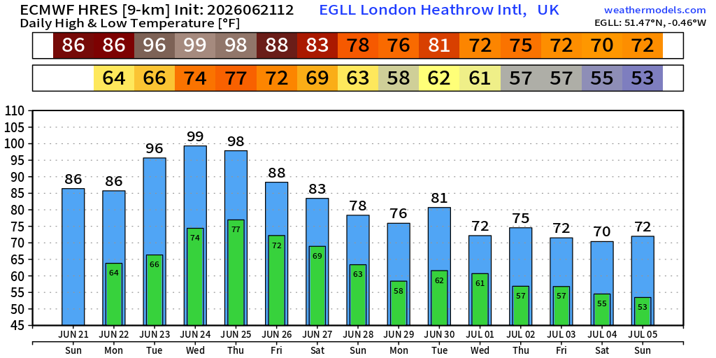
European Heat Dome Next 10-days centered Western Europe — moves eastward into Germany and Poland … and potential for another event in 10-days west of the U.K. which could push over Isles.
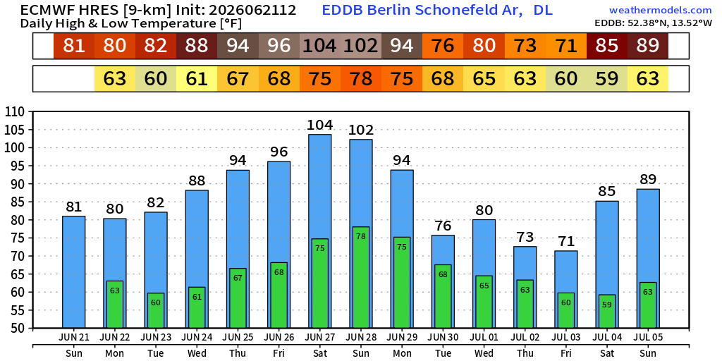
104°F in Berlin maximum next weekend!
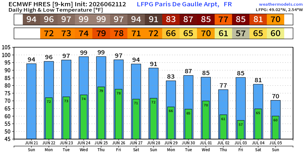
HOT with 99°F in Paris maximum Wed/Thursday
96°F in London on Tuesday and 98°F to 99°F on Wed/Thurs
Temperature Anomaly next 12-days
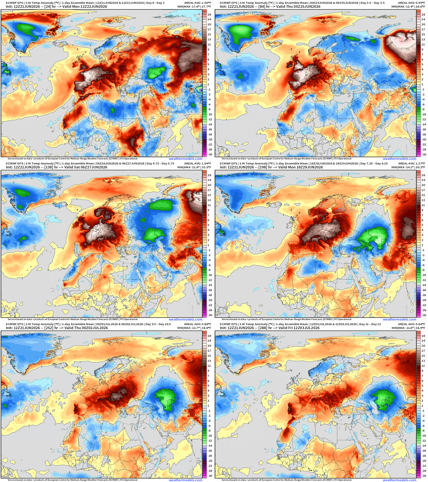
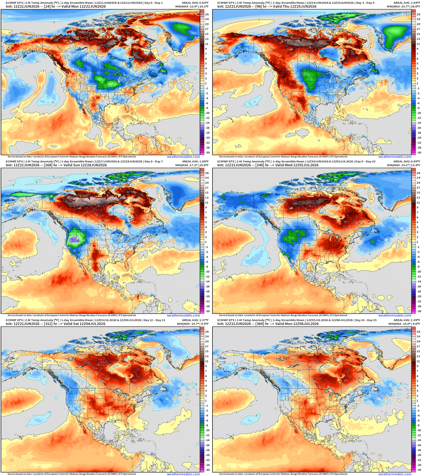
ECMWF Flagship Ensemble Mean Temperature Anomaly next 15-days
Week 1 —> June 21 to June 27
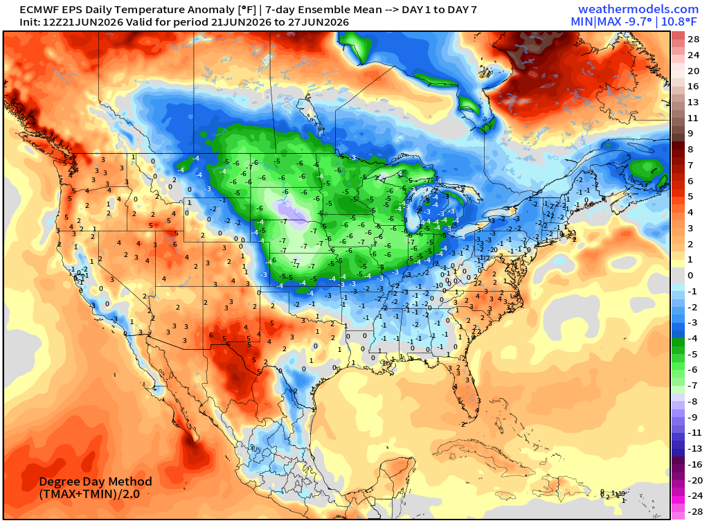
Cool 7-days ahead for Midwest and Great Lakes — no complaints
Week 2 —> June 28 to July 4
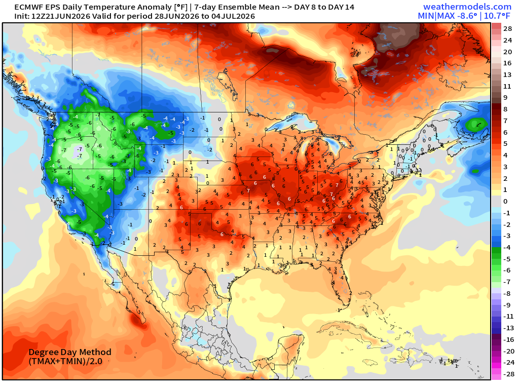
Pattern flip with trough in the NW and Western U.S. —> cooler than normal with much warmer than normal into 4th of July east of the Rockies
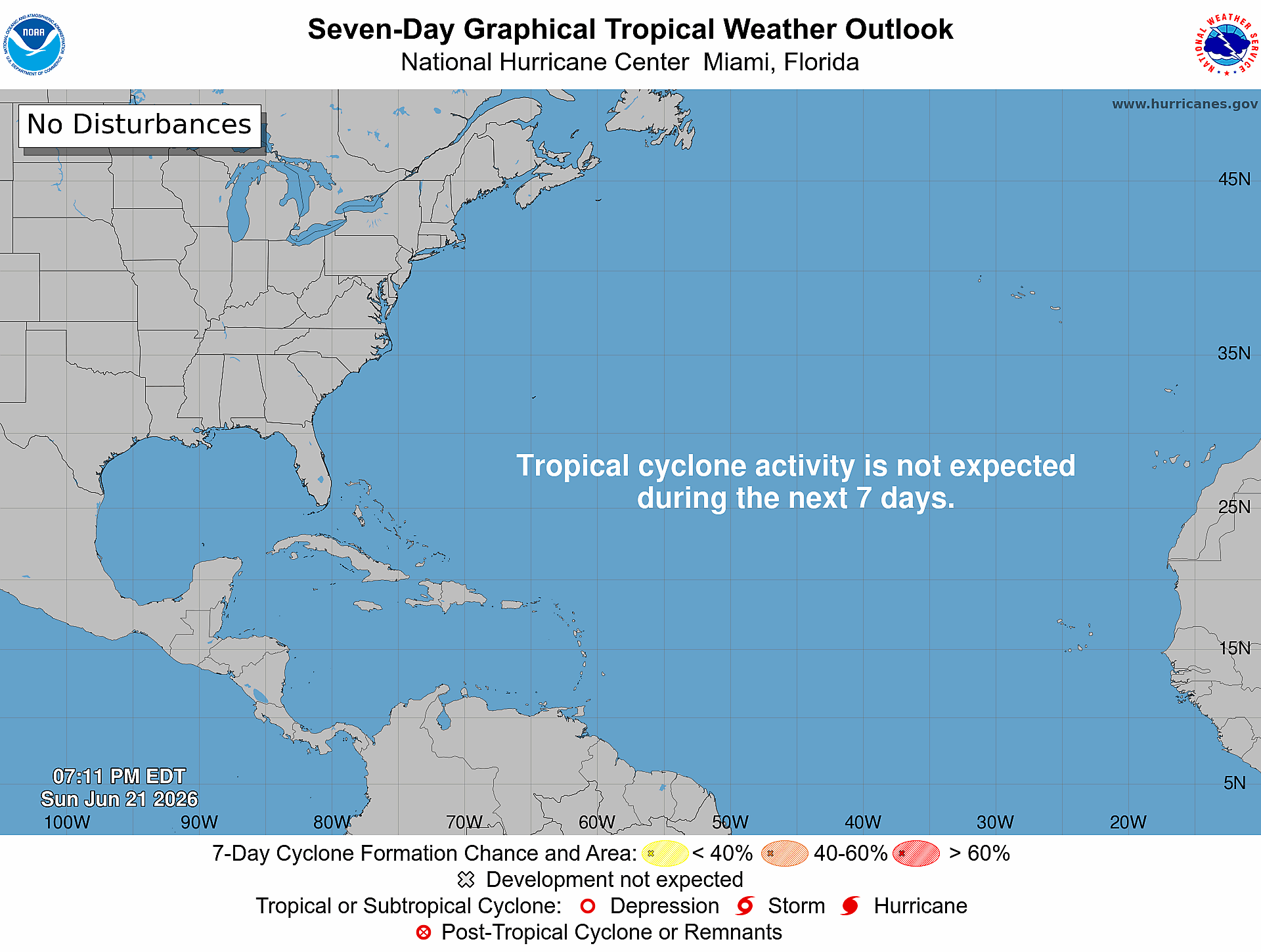
Atlantic Basin — Very Quiet through end of June 2026
Dust Forecast | NASA GEOS-5 Model Next 10-days
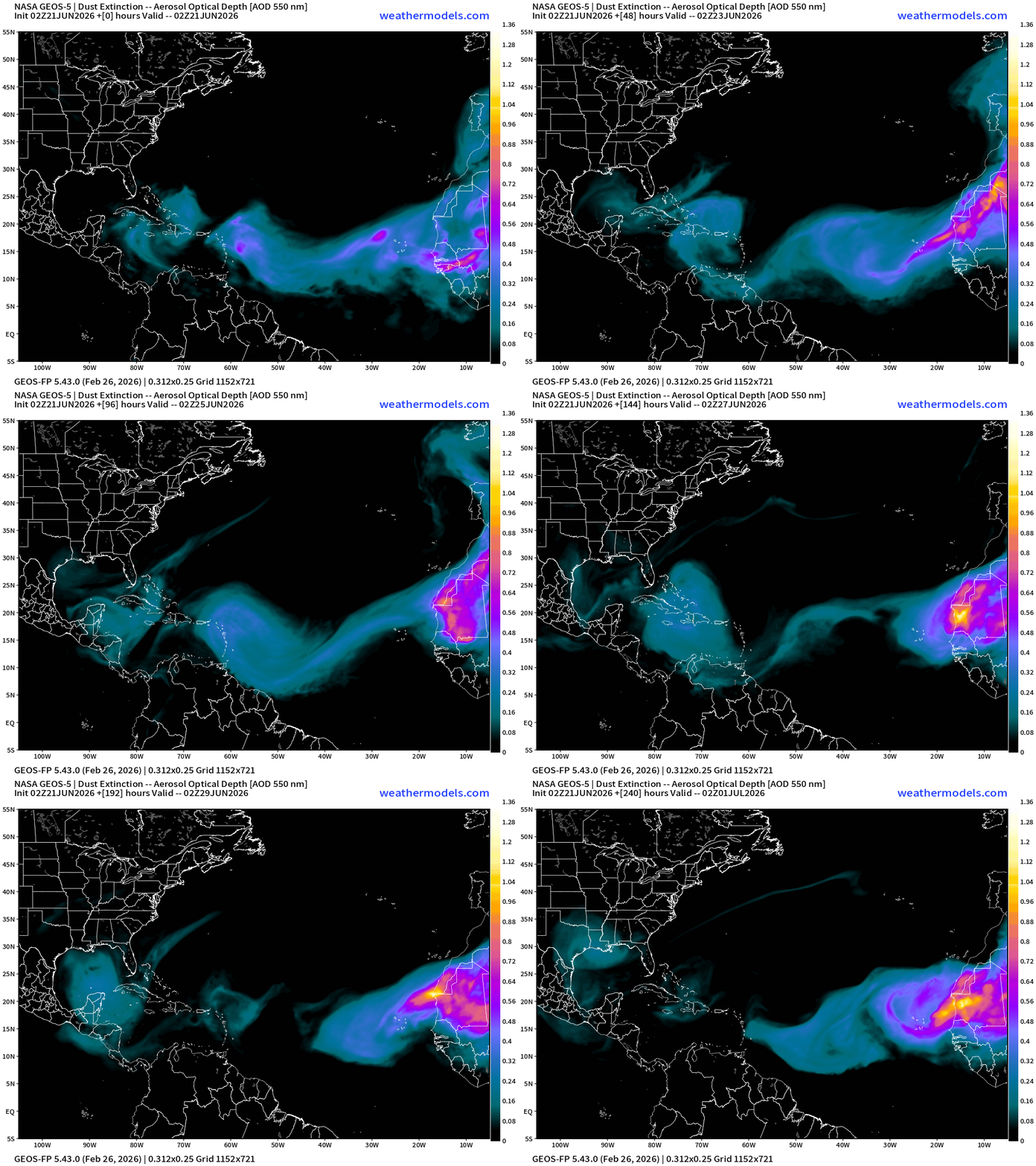
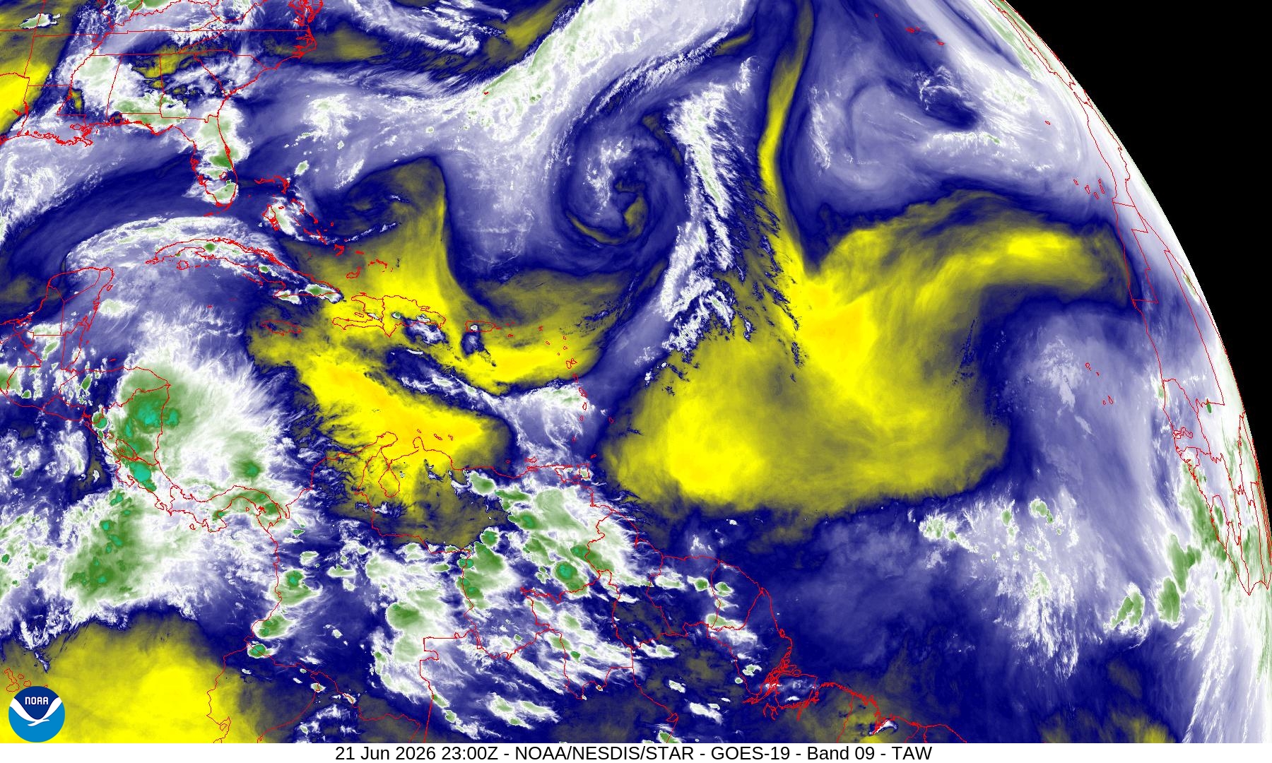
Dust plumes are not particularly intense, but they are noticeable. However, the Saharan Air Layers are more important which blast off the African continent —> warm, stable air at low-levels = suppression of convective (storms) and any tropical waves struggle to even generate a shower.
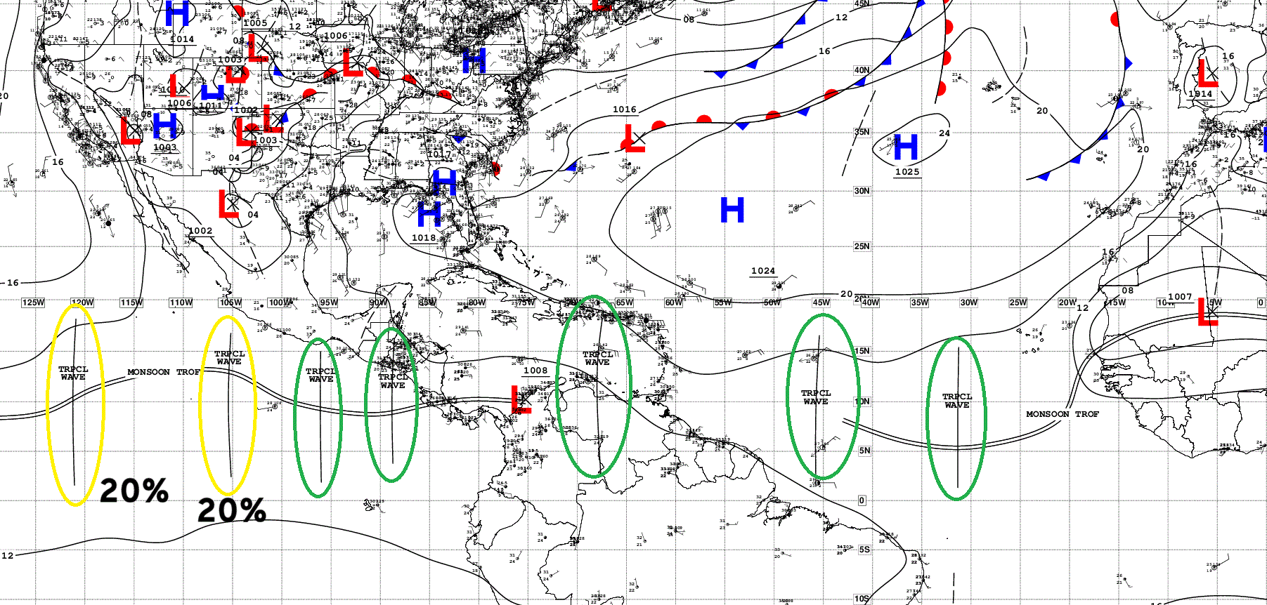
Tropical Waves … multiple across the 2 basins but nothing active
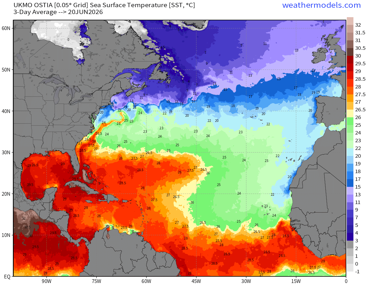
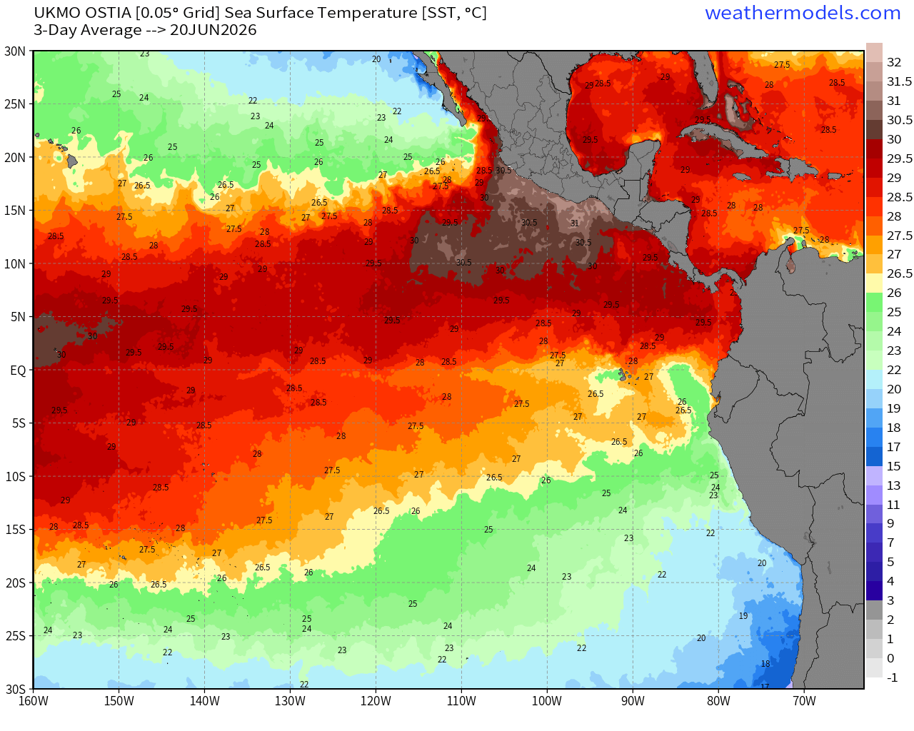
SST Temperature Analysis — still sub-26°C over half of the MDR east of 50°W
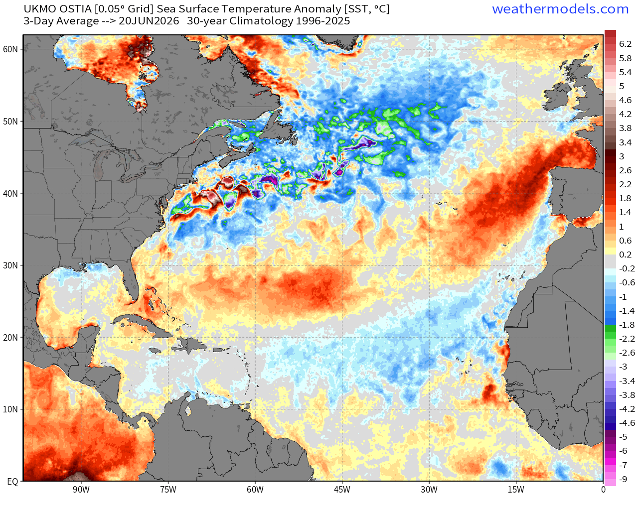
And, that area is much cooler than the last 30-years climatology. Northwest Atlantic is also very chilly
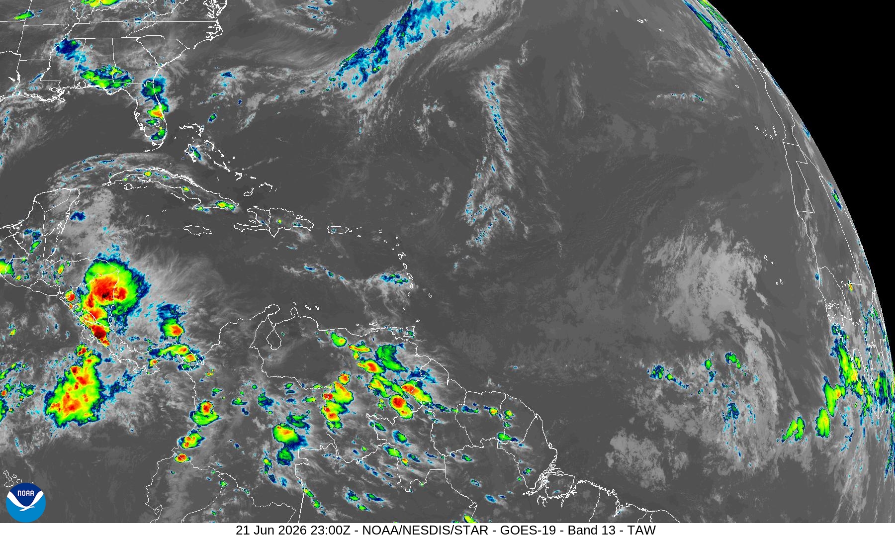
Satellite Imagery — not much active convection across the entire Atlantic tropics
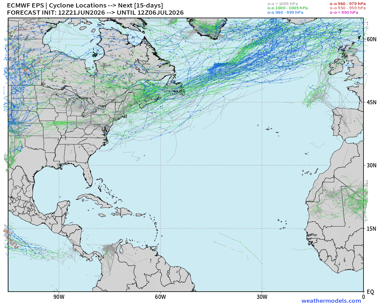
Ensemble Storm Tracks Next 15-days —> Complete Ghost Town in Atlantic
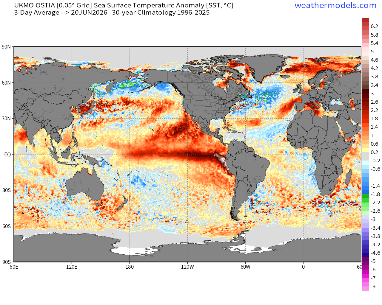
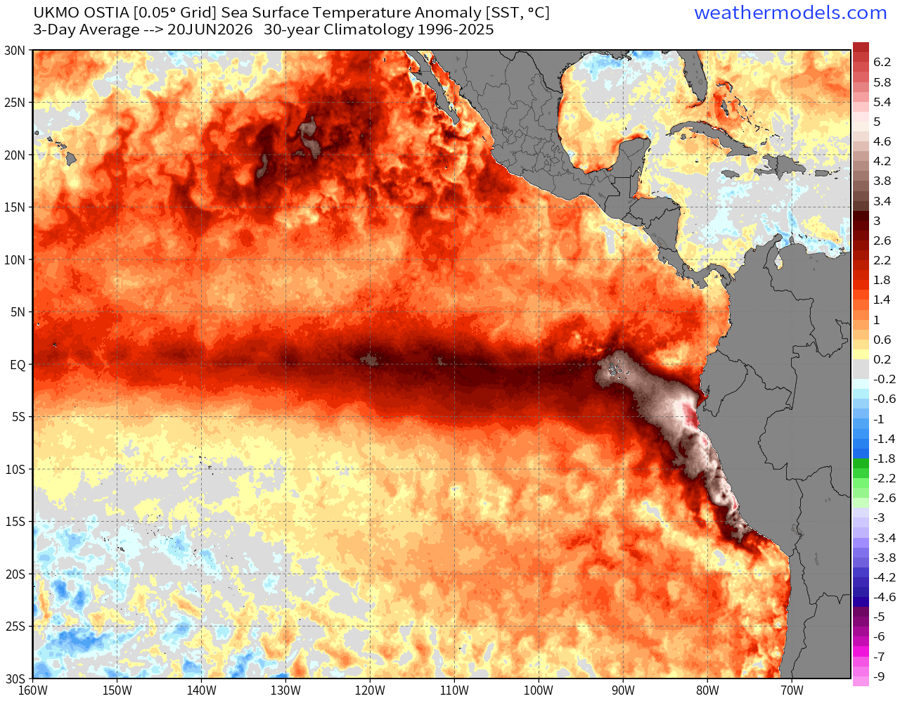
Global SST Anomaly show the ongoing / intensifying El Niño
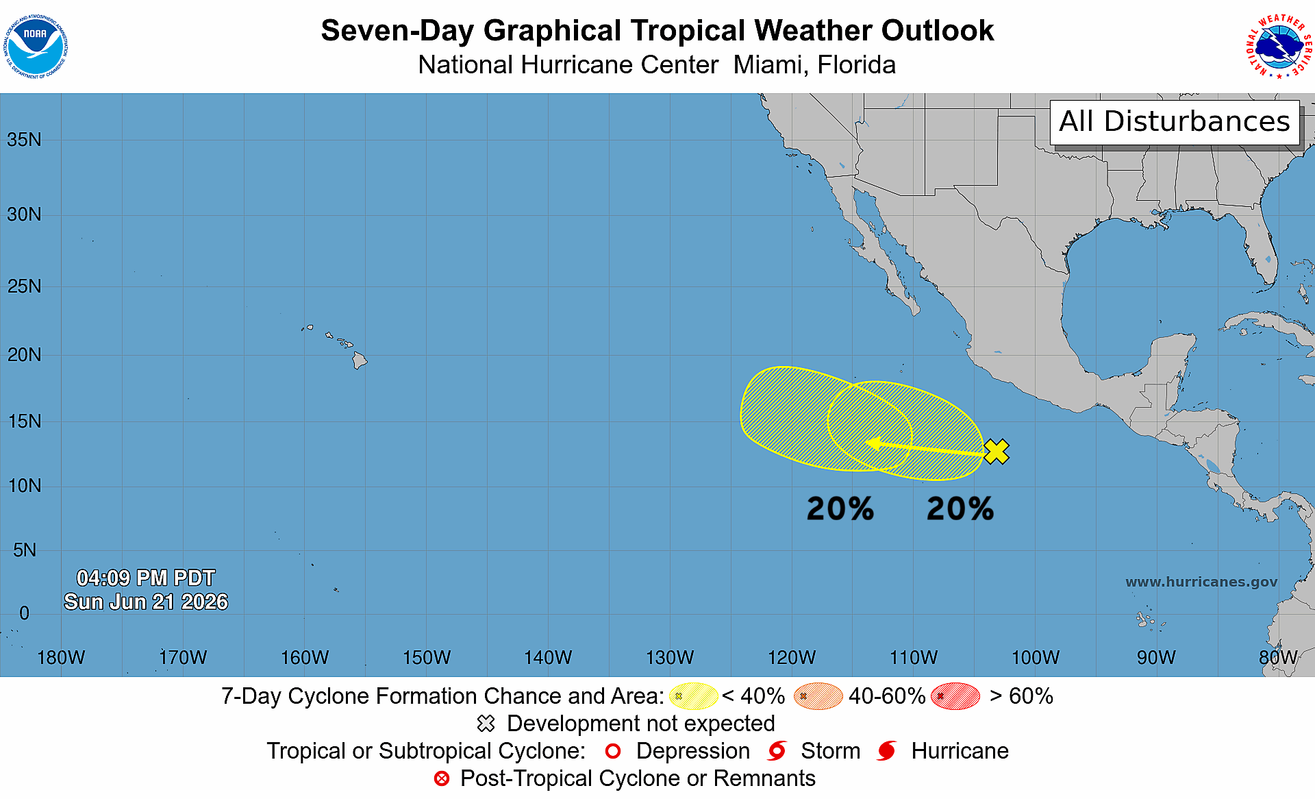
Couple Tropical Waves in Eastern Pacific with Low Chance (20%) in coming week
Western Pacific Typhoon Season
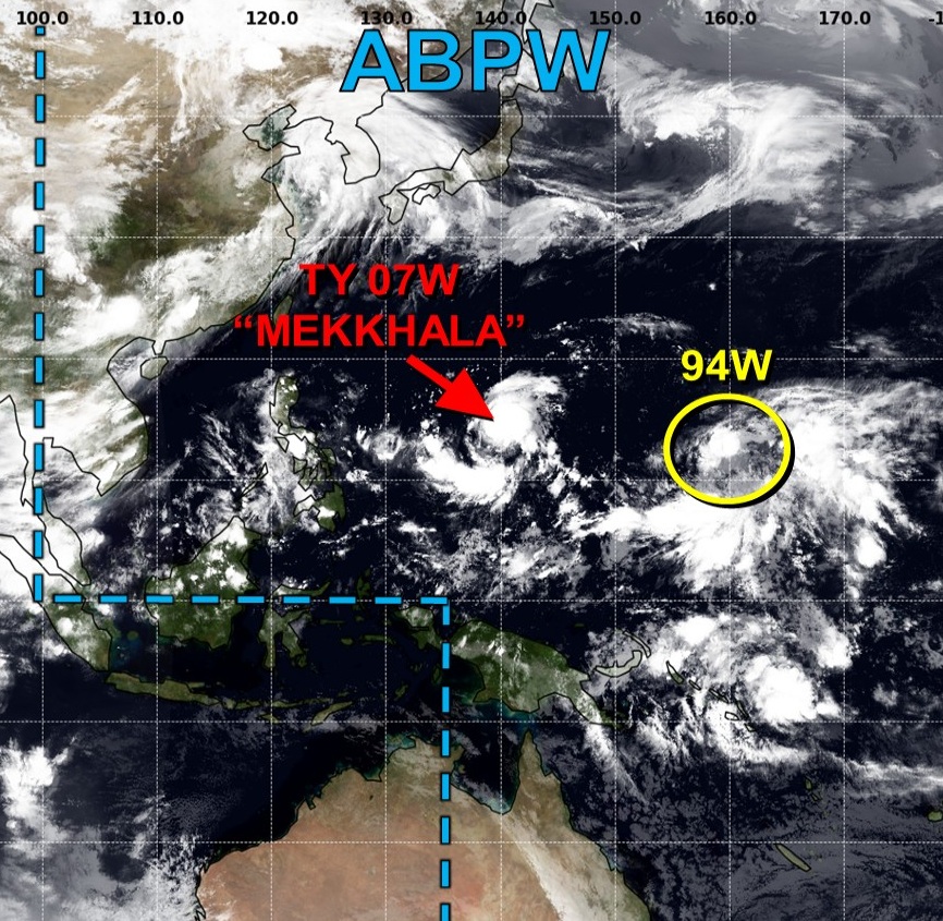
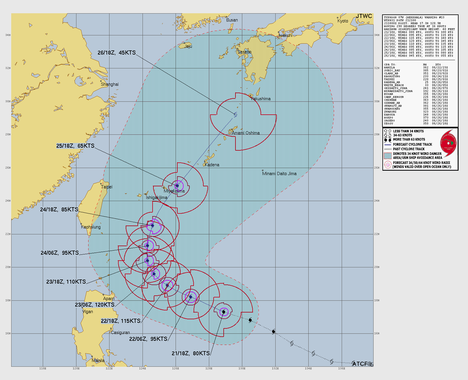
Typhoon MEKKHALA has nicely cleared out a large eye
The NW quadrant of the eyewall is not quite complete, but we’re likely looking at a Category 4 Typhoon (115-knots) — morning out there.
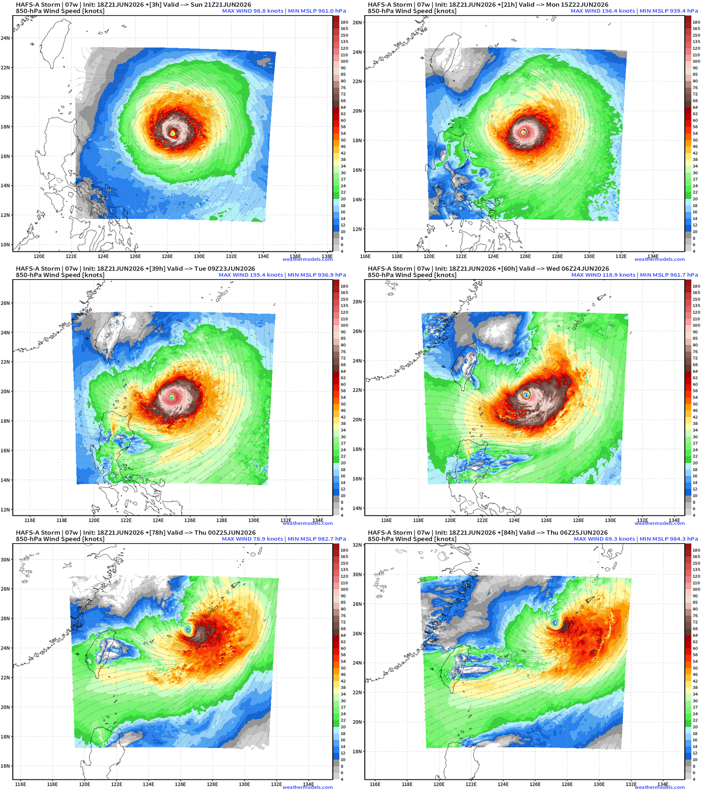
HAFS-A 18z suggests minimum pressure into the 935 mb range —> Super Typhoon at Category 4 — 130-knots.
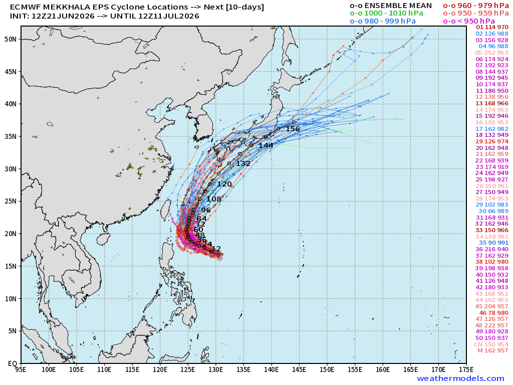
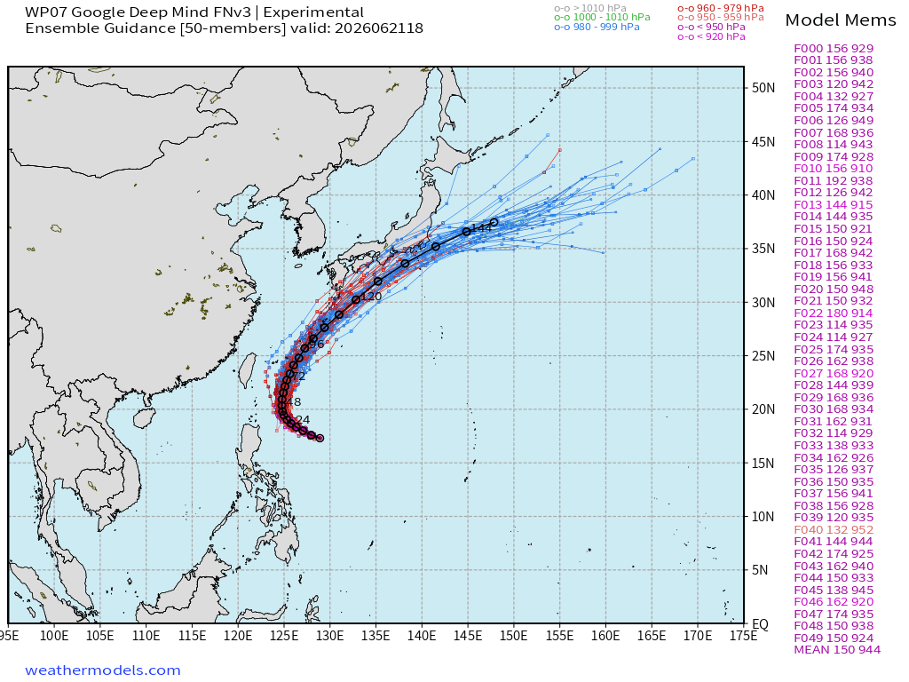
Tracks from Full Physics EPS Ensembles + Deep Mind both show a WNW track for next 2-days before recurving to the NORTH and then NNE along/near coast of Japan by weekend.
JTWC forecast track through 5-days — max 120-knots winds (Cat 4)
Full Physics ECMWF Ensembles | Next 15-days
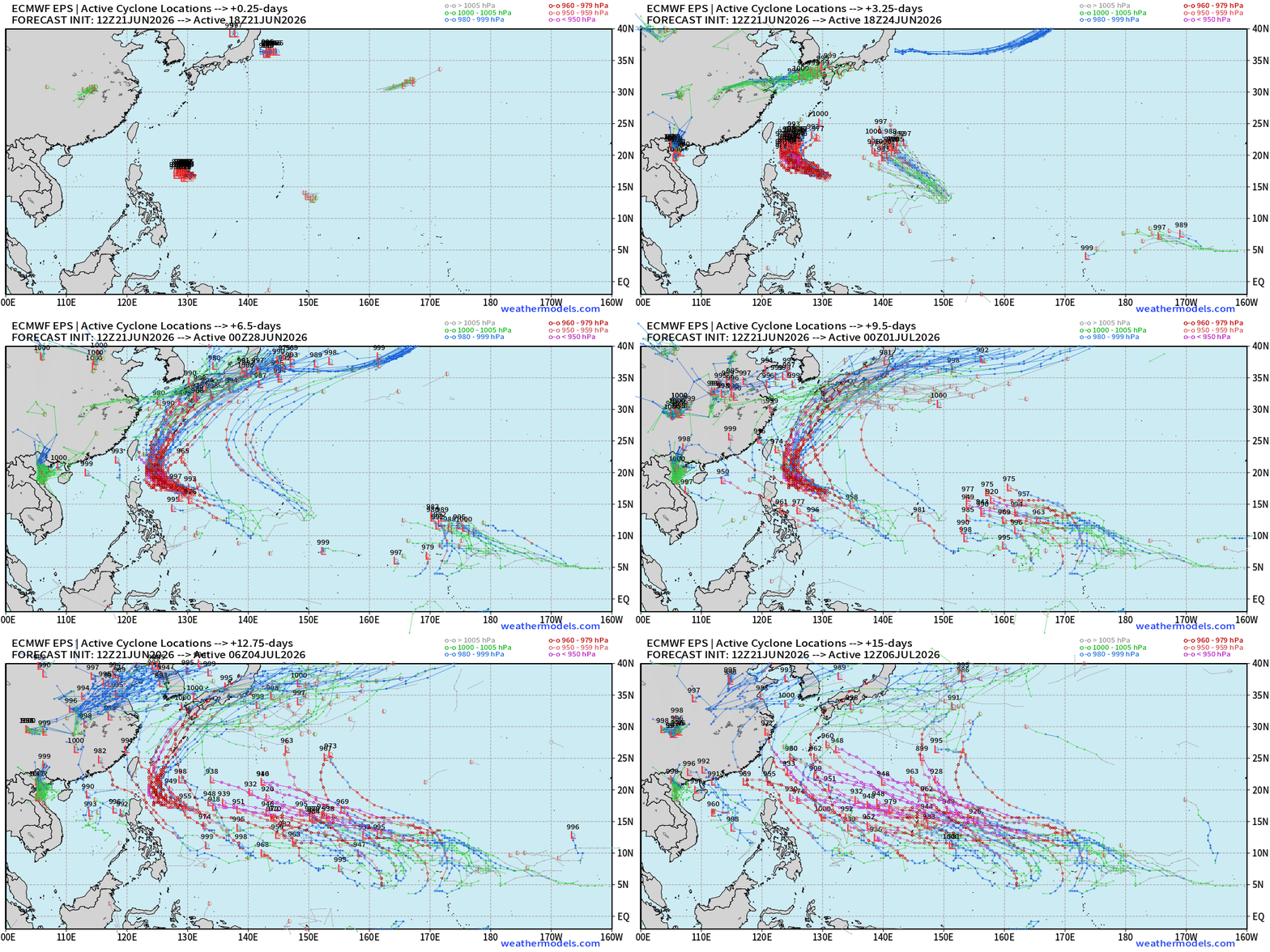
94W may briefly become a tropical storm … but watching potential for a long-duration, major typhoon coming across the Dateline into July = a lot of ACE
Thank you for reaching the end of this post! Hopefully you enjoyed the beautiful weather maps. Please help increase the visibility of Weather Trader on Substack: Share or Like!
Help support this newsletter (nearing post 1,000!) —> June 2026 Coupon
Maps sourced from weathermodels.com designed and innovated by yours truly! Please subscribe there for real-time access to the newest maps, charts from all of the weather models including ECMWF and AIFS, and NOAA GFS/GEFS, HRRR/RRFS and Blend of Models (NBM). NOAA WPC and SPC for fronts/convective outlooks.
My Atlantic Hurricane Season Forecast (2026)
From April 7, 2026: Atlantic Seasonal Hurricane Forecast: (11/5/2)
9-13 Named Storms (11 most likely)
4-7 Hurricanes (5 or 6 most likely)
1-3 Major Hurricanes (2 most likely)
Accumulated Cyclone Energy: 75-85 (well below normal)
NOAA 2026 Atlantic Hurricane Season Forecast
- Milepost
- 964 · laid 2026-06-22T01:39:24.086000Z
- Source
- https://weather.substack.com/p/june-21-2026-sunday-summer-weather
- Digest
- fa1abd23d0b22d97f20863405dd9e08ad374fcc0198a2fef62c2fbd9f75f142c
- Machine
- JSON