July 13, 2026 Monday Tropical Update
Eastern Pacific lights up with activity, and watching close-to-home Gulf trough into next week for storm action
July 2026 was the warmest July in the 132-year national record (1895–2026), at 76.9°F against a 1991–2020 normal of 74.4°F (+2.5°F).
July 2026 was the 26th-driest July in the 132-year national record (1895–2026), at 2.5in against a 1991–2020 normal of 2.9in (-0.3in).
NOAA/NCEI Climate at a Glance, contiguous United States. This is the observed record for the month, not a score of anything said in this piece — the forecast ledger begins 2026-08-17 and cannot reach earlier posts.

Help support this newsletter (nearing post 1,000!) and the growing constellation of companion website — Become a paying subscriber. Weather Trader is entirely reader-supported publication (no ads). To receive all new posts and support our work, consider becoming a free or paid subscriber. I’m very excited for what’s coming. This is what I’ve been waiting for 15-years now: Finally charting my own course.
Full tilt El Niño underway — eastern Tropical Pacific focused with Niño 3.4 region now nearing Super status (> 2.0°C anomaly)
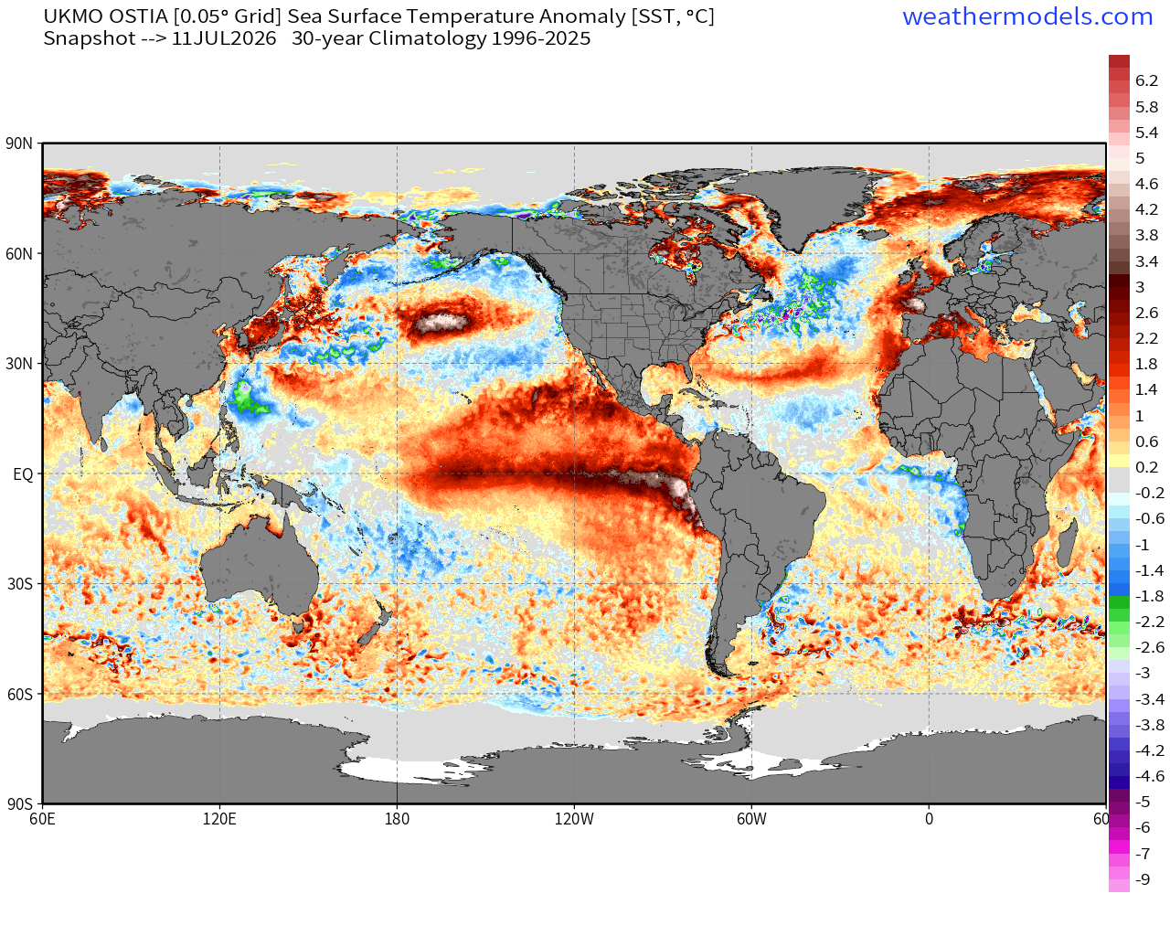
Dramatic warmth relative to the last 30-year average, but I don’t think we should call that normal considering the “mean state” of the tropical Pacific is an average of two extremes (La Niña + El Niño) and neutral —> that’s why they call it the Southern Oscillation
North Pacific blob is back and intense — created by -PDO + persistent high pressure and light winds —> lack of upwelling
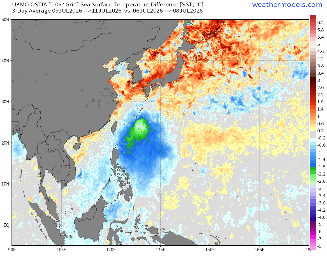
Super Typhoon Bavi “cold wake” footprint near Philippines, but it will wash out as the water column mixing reverts back to normal “warm pool”
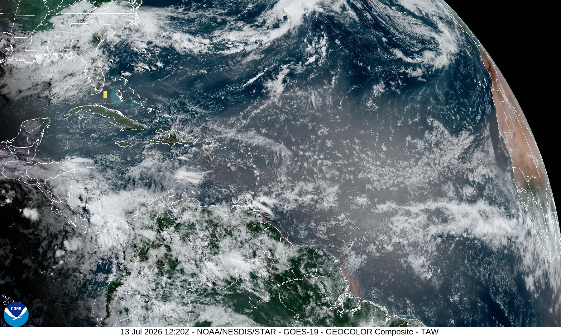
Atlantic Niña (weak) in the equatorial waters with a cool Main Development Region (MDR) and very chilly North Atlantic off the coast of North America.
North Atlantic Basin — Tropical Weather Outlook still blank
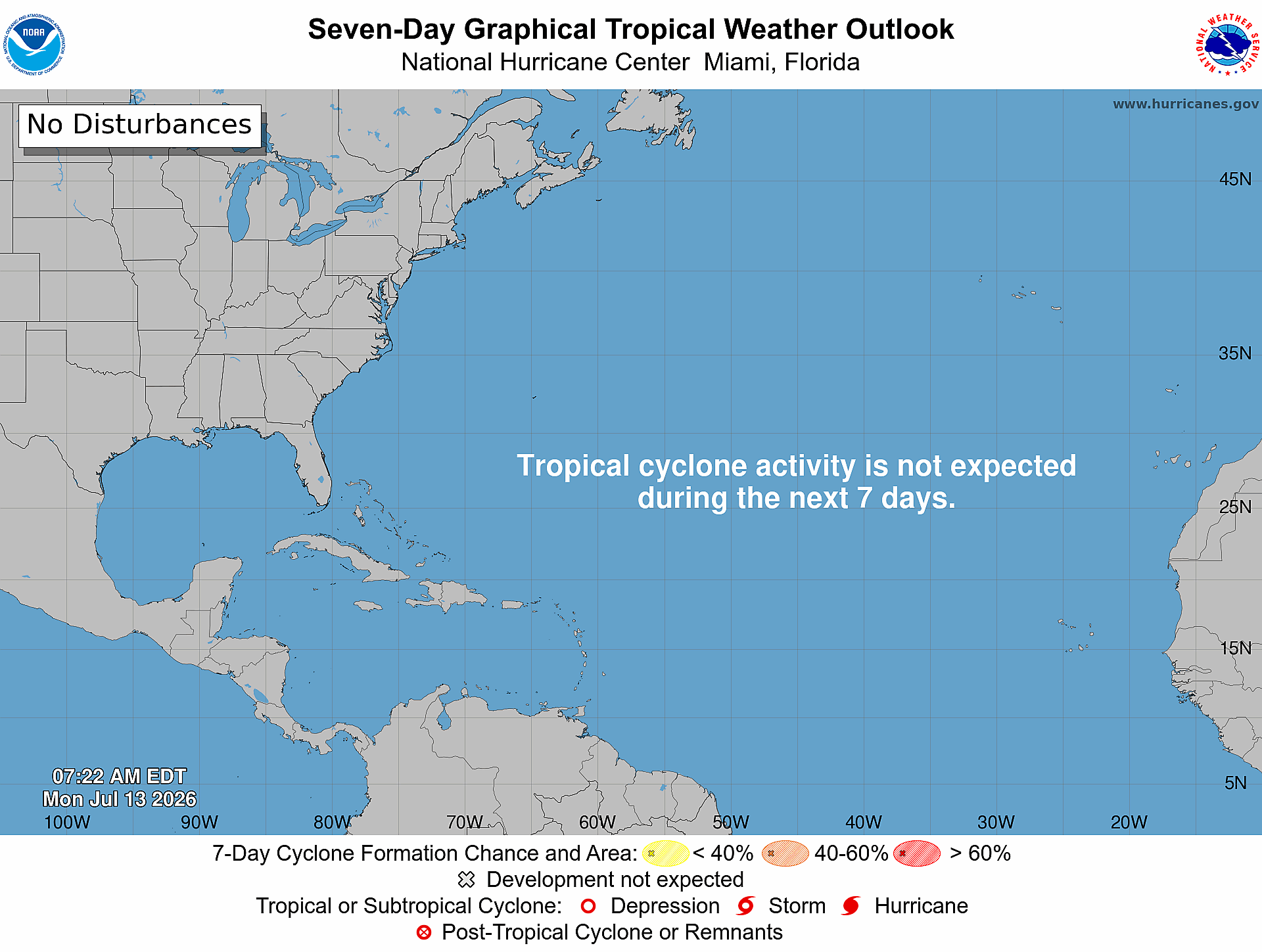
But, we’re keeping an eye on the models for potential non-tropical origin development of Bertha in the northern Gulf of Mexico. However, this is too far down the road to do much better than probabilities. I’d say “coin flip” of “something” developing, but the range of outcomes is nothing to hurricane. More on that after housekeeping announcement — see more in yesterday’s Sunday Evening Weather Update
weather.city
For 20-years, I’ve dreamed of my own weather website the way that I wanted it. I’ve been sitting on this domain for 10+ years waiting for an opportunity to develop weather.city [weather dot city] and now it’s entirely feasible, and a lot of fun creating exactly the look and feel of a weather forecasting website.
Please click around. I’m adding more features including satellite, radar, models, and other useful tools, but I’m very picky with the details and design. Again, without your support over the past 2+ years, this could not have happened. Substack + Weather Trader subscribers have sustained my development and kept me motivated to finally launch everything. This makes n=6 websites that will work together with Weather Trader providing the data store and forecasting engine to run everything.
Major startup costs involved that could balloon quickly [servers] so I do need your continued support to make this happen. Current subscribers can add gift subscriptions at 50% off, or upgrade to the Founder’s Level —> This is a small but growing group that has trusted me to provide them the best possible and profitable information, and they will be granted nameplate status within weather.city. You’d have open-door access to my consulting services.
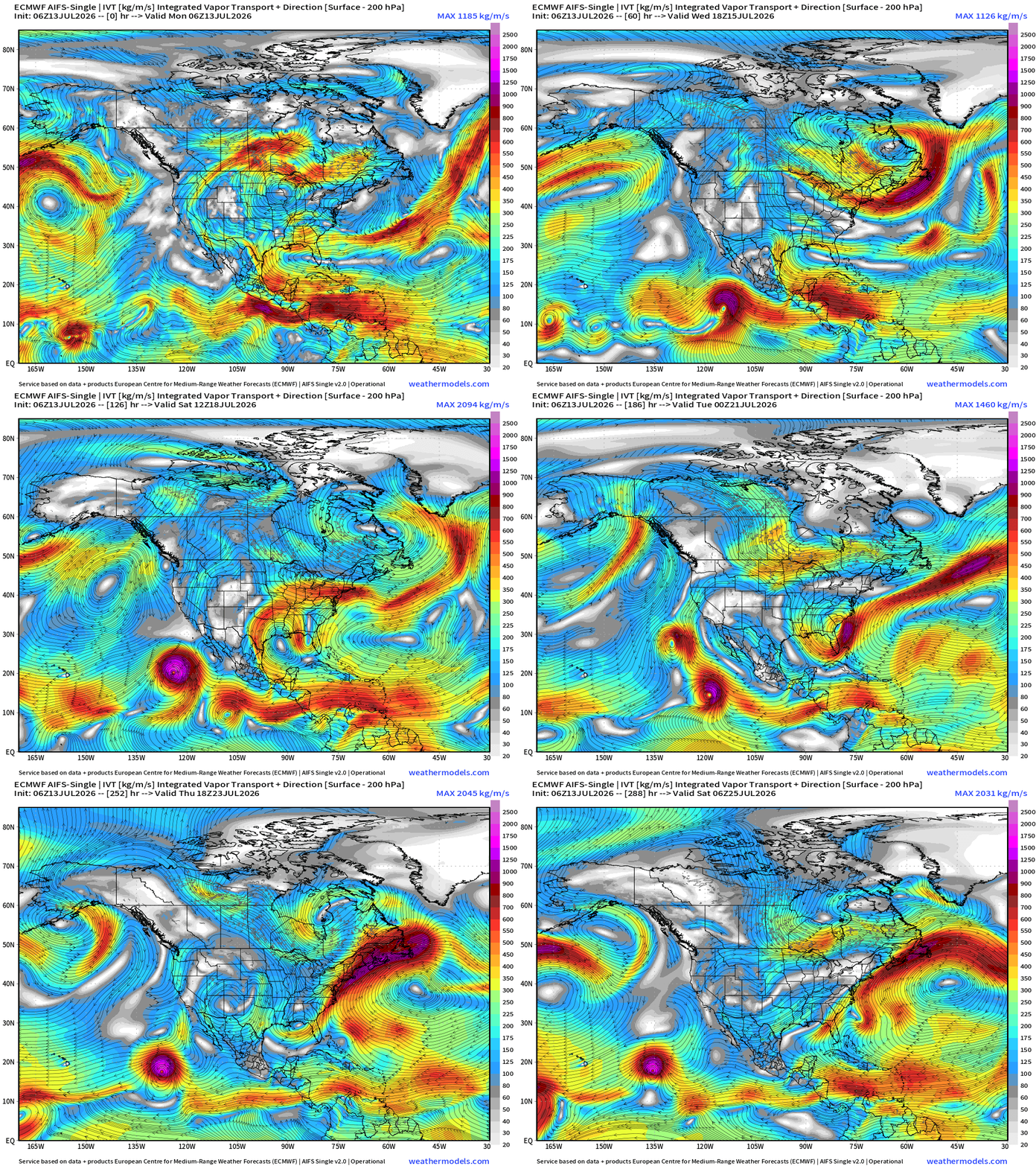
Flagship model: ECMWF AIFS 06z —> Integrated Vapor Transport next 12-days
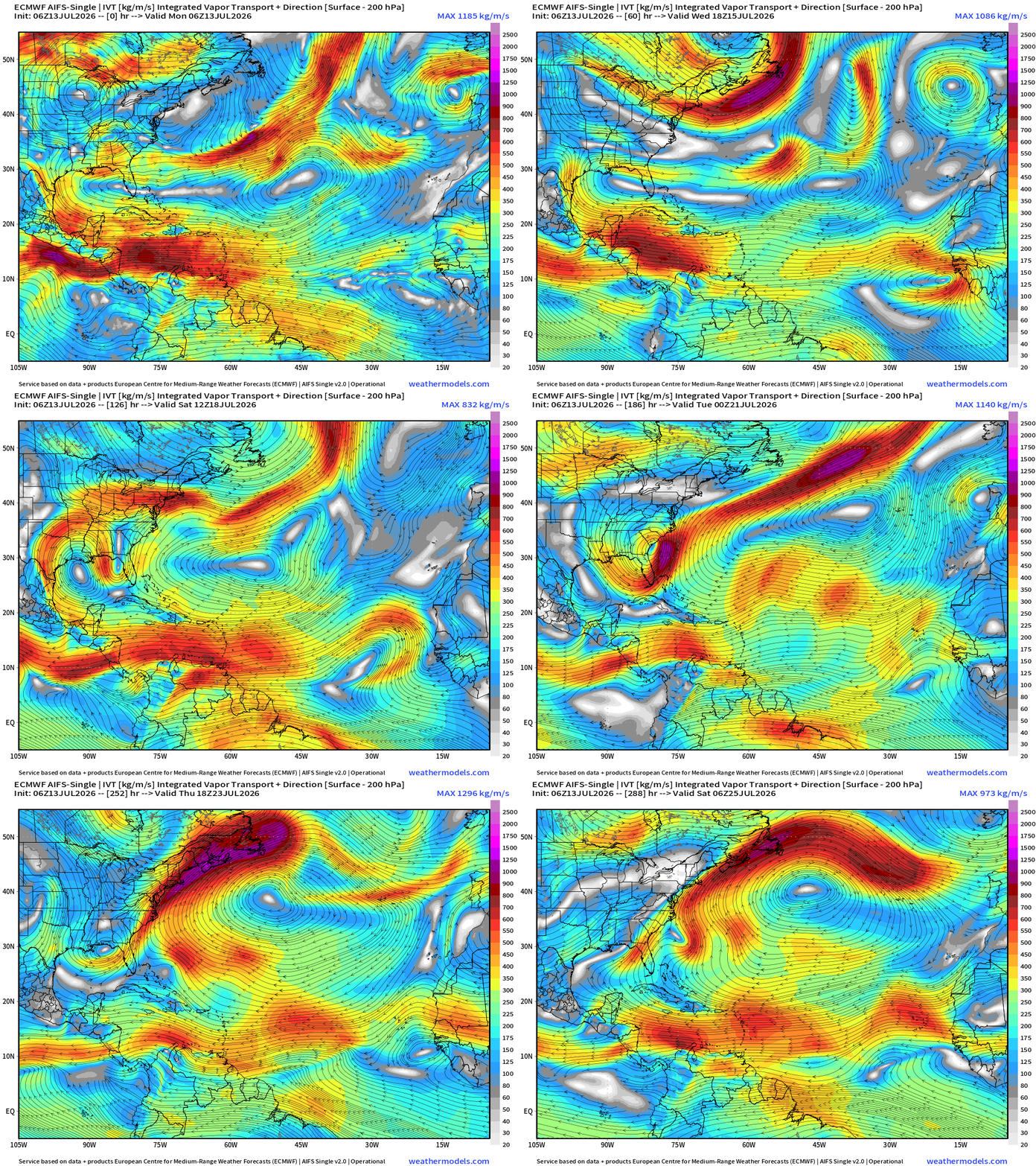
The heat dome across the Great Lakes shows up as a clockwise closed circulation within the moisture parameter (IVT)
Formation of a trough bent across North Florida and the Southeast Atlantic underneath the strong ridge —> potentially spins up into Bertha!
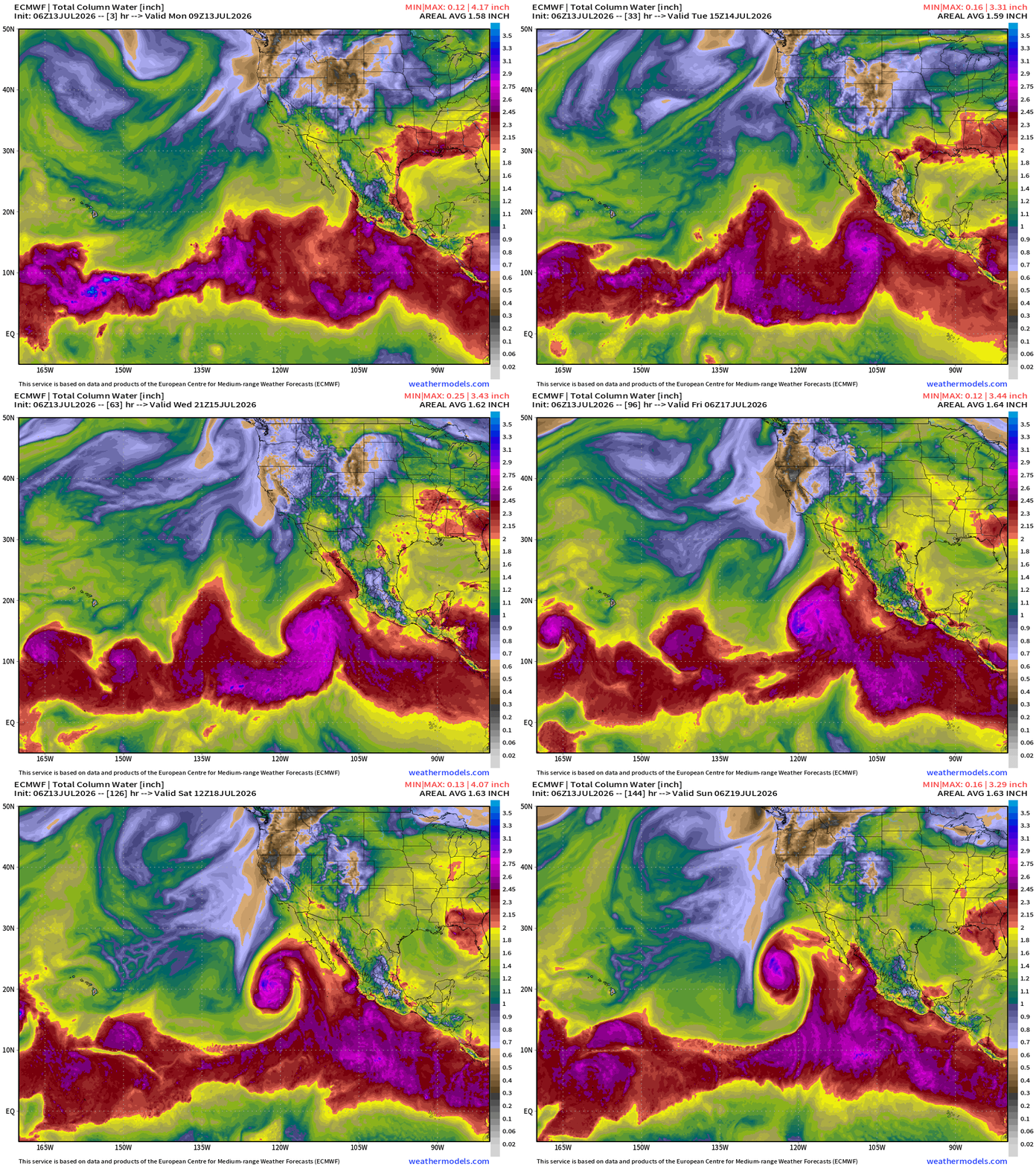
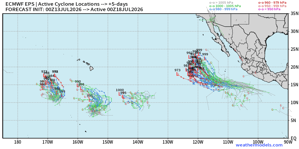
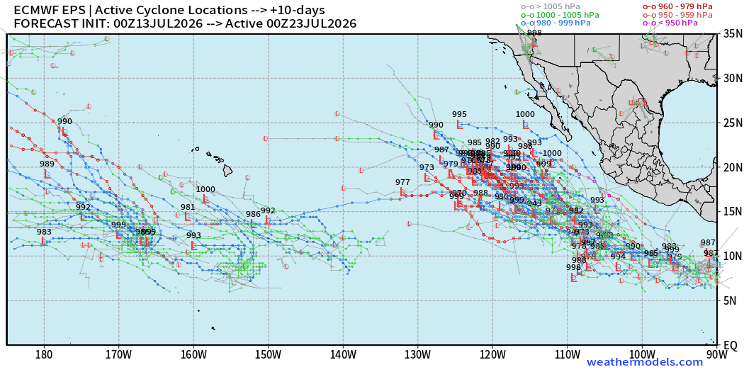
1 or 2 Eastern Pacific tropical storms or hurricanes likely in next 3-7 days with moisture from the remnants swooped up into the Western US to power the monsoon
Aside from the “close to home” even during an intensifying El Niño, the tropical waves coming off Africa are looking more robust, but they quickly sputter out as they move over the “cooler water” of the top half of the MDR.
Central Pacific also seeing potential
ECMWF HRES 06z | Precipitable Water | My Favorite Parameter
Atlantic Tropics
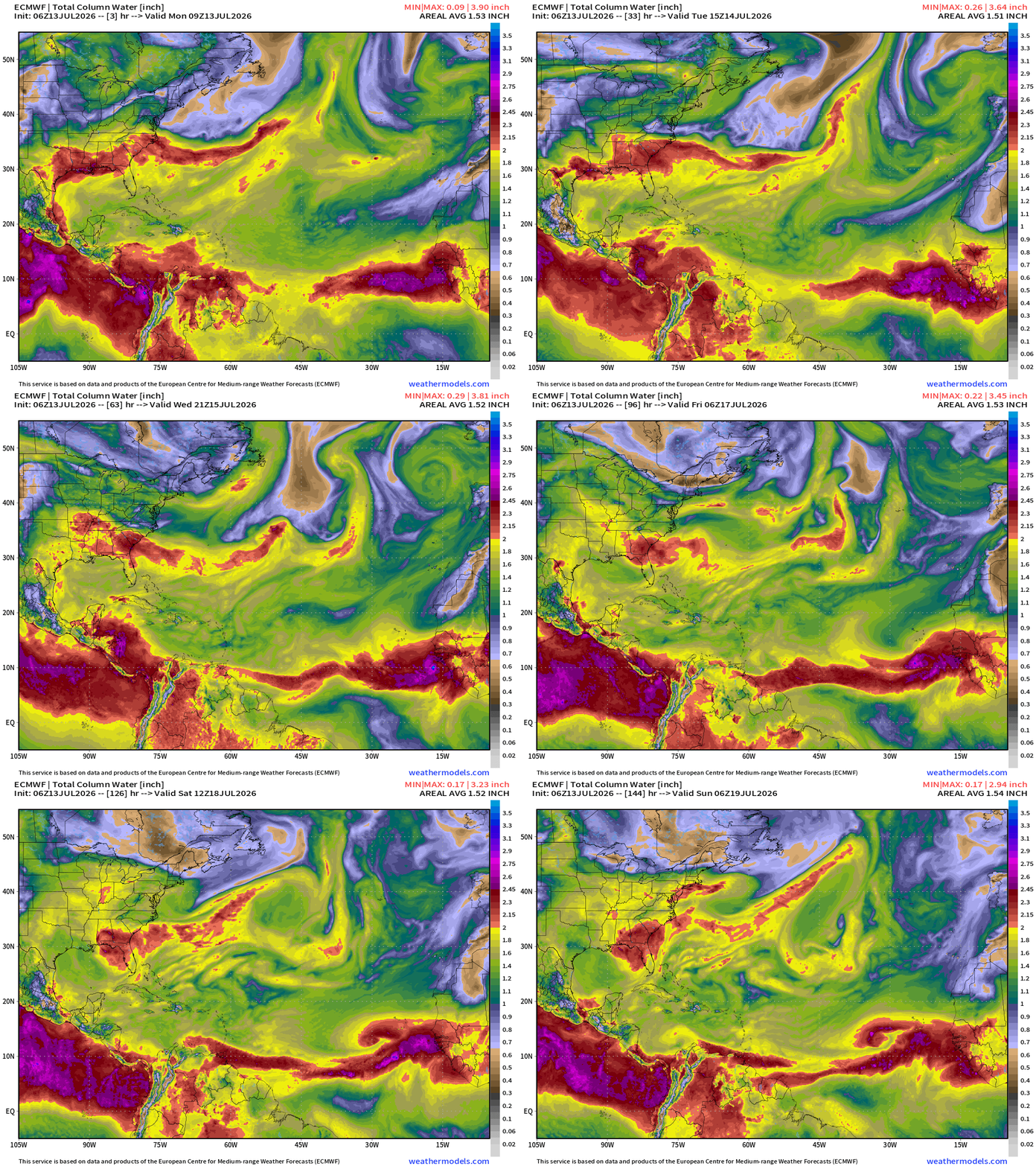
Check out the robust tropical wave off Africa through 5-6 days that shows some circulation potential. The storm trackers are showing a surface low pressure, so maybe this will qualify as a TD or very briefly a TS. Perhaps the upper-level environment of the far eastern Atlantic may be more favorable away from the strong wind-shear blasting out of the Pacific.
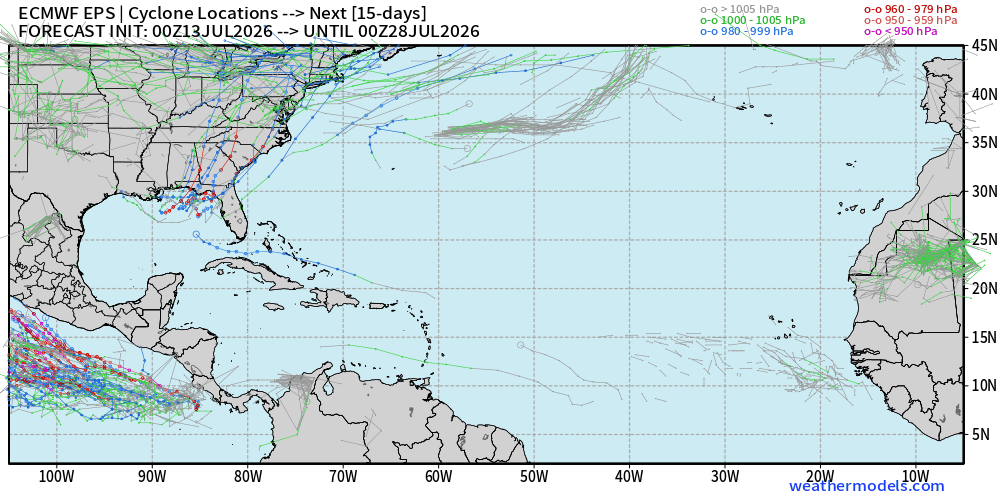
15-day Ensemble Tracks
Full physics ensembles (00z) show a small signal (20%) in the northern Gulf of Mexico, and it has come alive with the AIFS catching onto the signal yesterday. This seems to be a trend that the AIFS “sniffs” out the potential 12-24 hours ahead of the full-physics systems.
More — a lot more members with the AIFS-ENS at 06z with “Bertha”
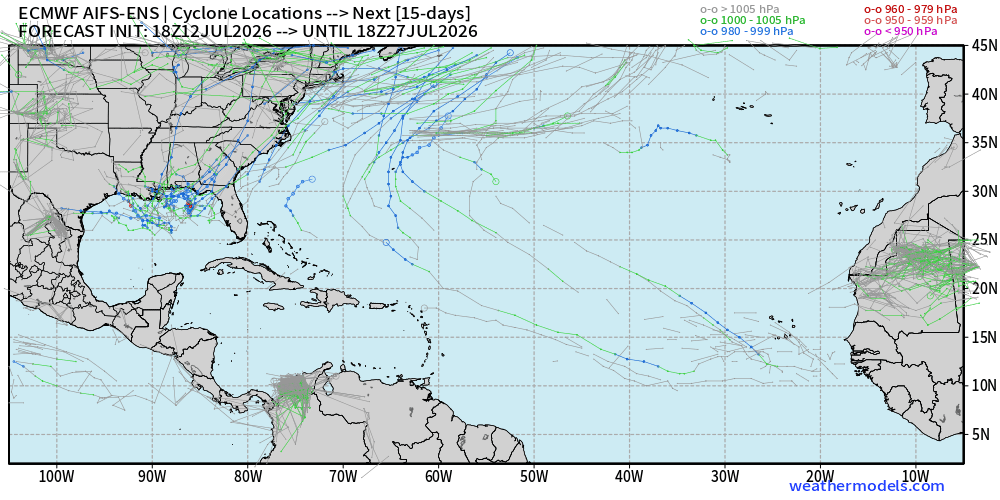
Still a few days before we can be sure about the formation of Bertha near the U.S. coastline — so we’ll keep watching, not much other choice!
NASA GEOS-5 Dust Forecast Next 10-days
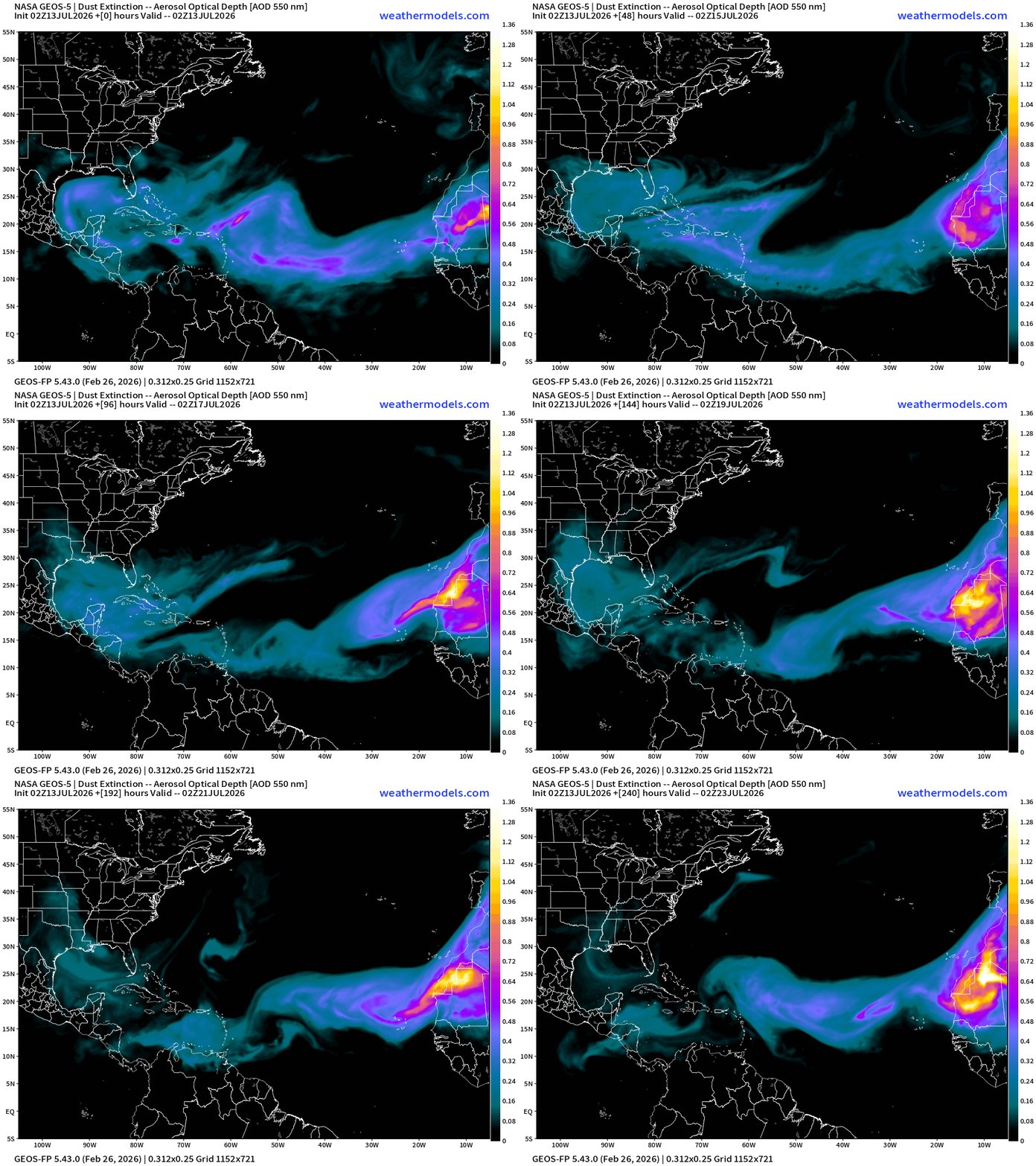
Like a dragon breathing fire off the African continent across the Atlantic — the entire basin along 15°N to 25°N will be very dusty and under control of Saharan Air Layer origin air mass.
Tropical Waves — only the far southern Caribbean has analyzed wave
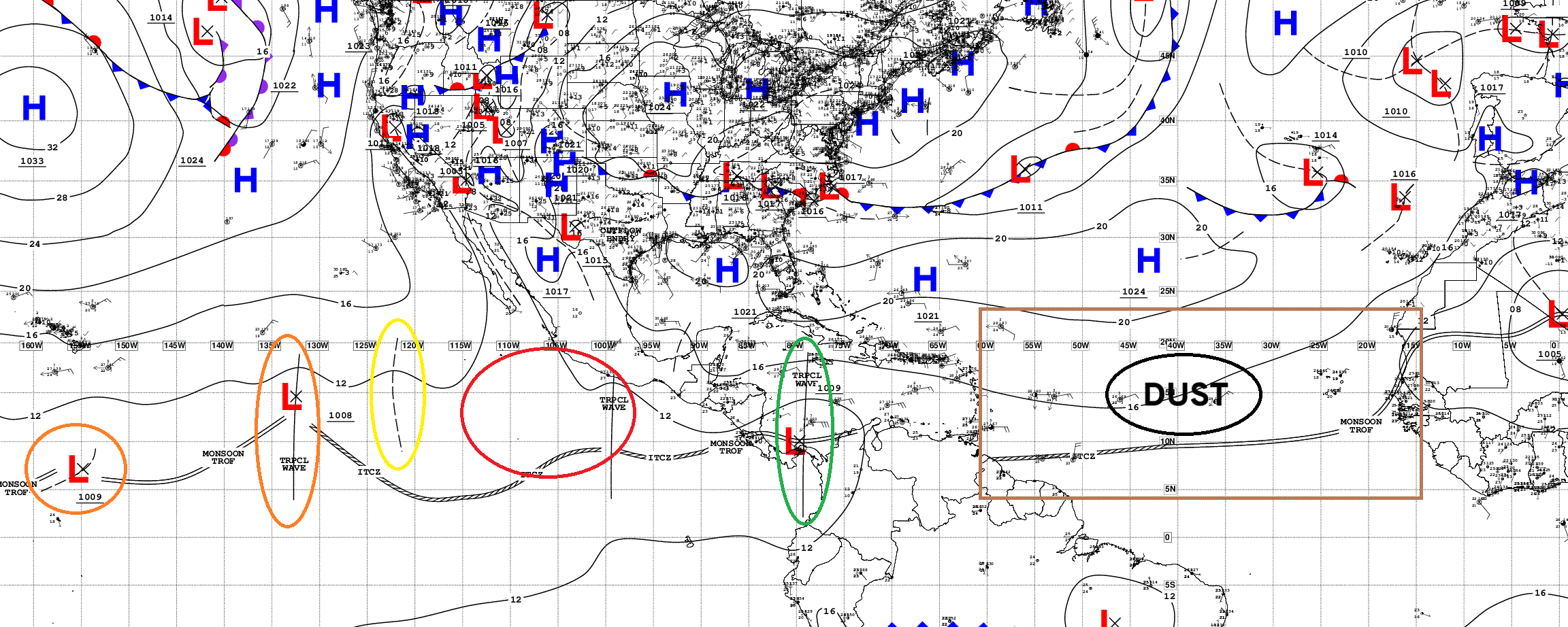
The tropical systems expected to form in the Eastern Pacific are often tropical waves that fail to develop in the Atlantic!
Eastern Pacific Tropics
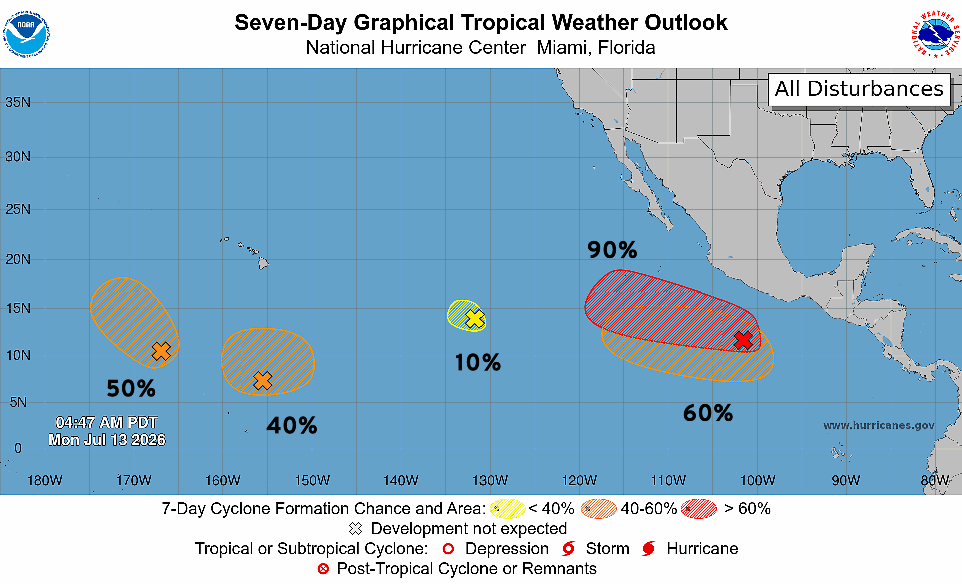
3 Moderate + 1 High Chance of development … another weak lemon drop, and all could spin up at any time … busy ITCZ/monsoon trough out in the EPAC!
Next names Elida, Fausto, Genevieve, Hernan
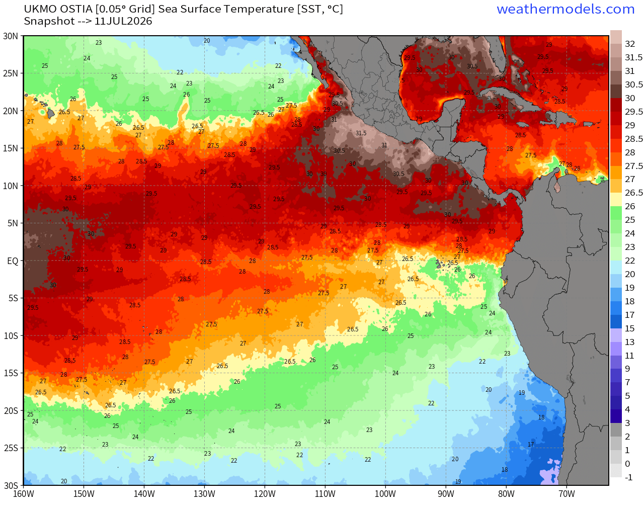
No surprise as the SSTs are VERY warm
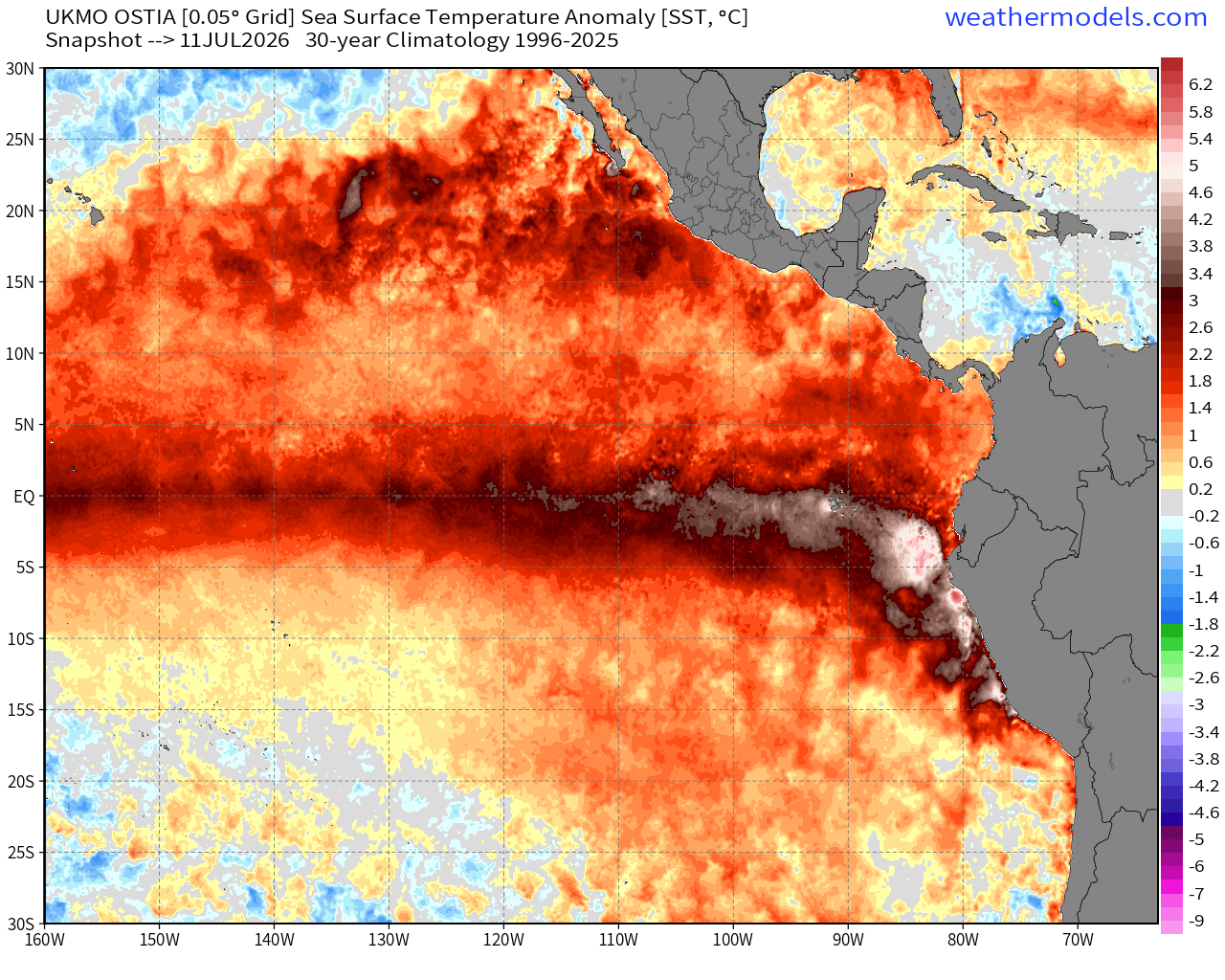
Actual SSTs up to 27°C near Hawaii and pushing 30°C along the coast of Mexico
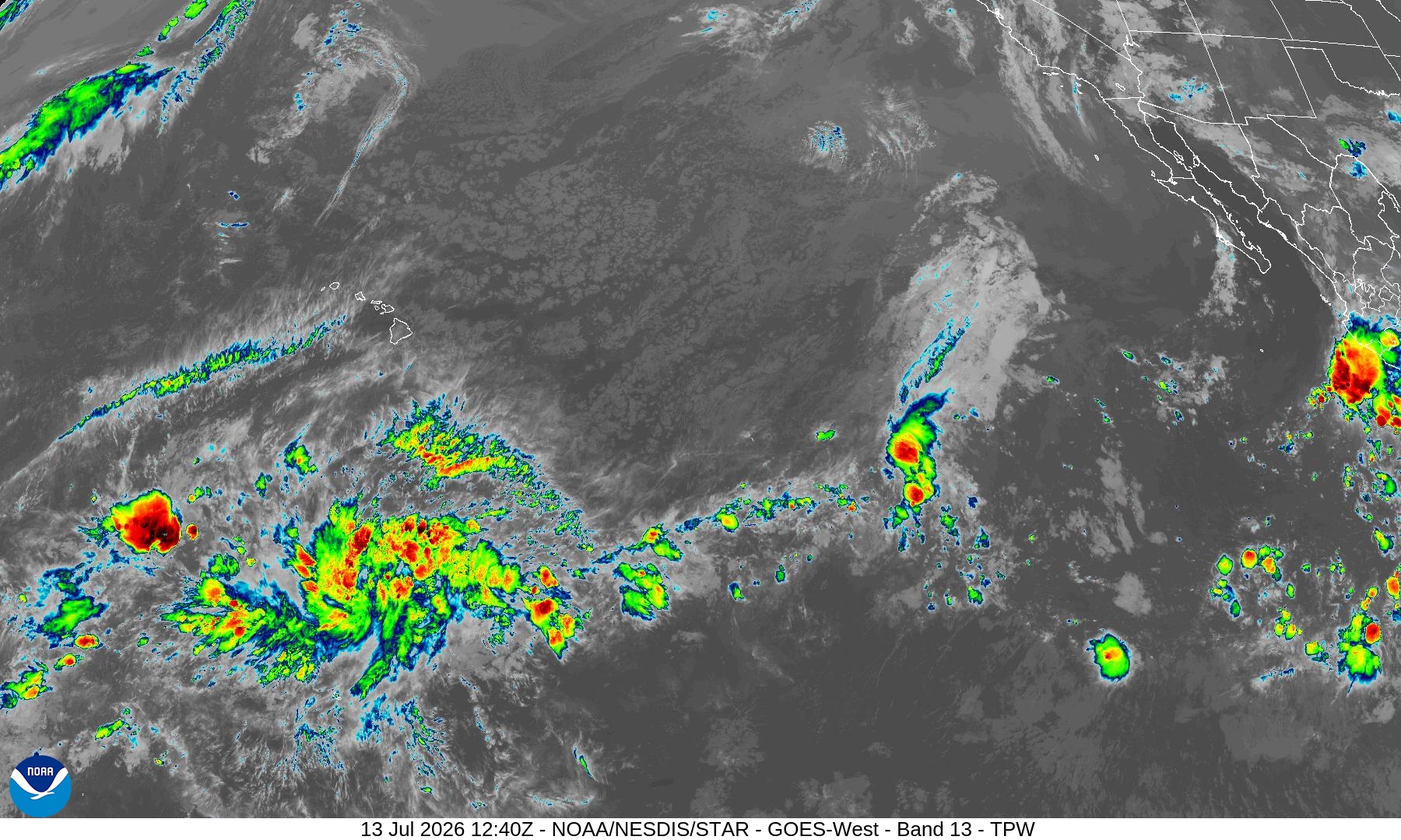
Quite a blob of convection with a swirl south of Hawaii — during El Niño the Central Pacific can get very busy
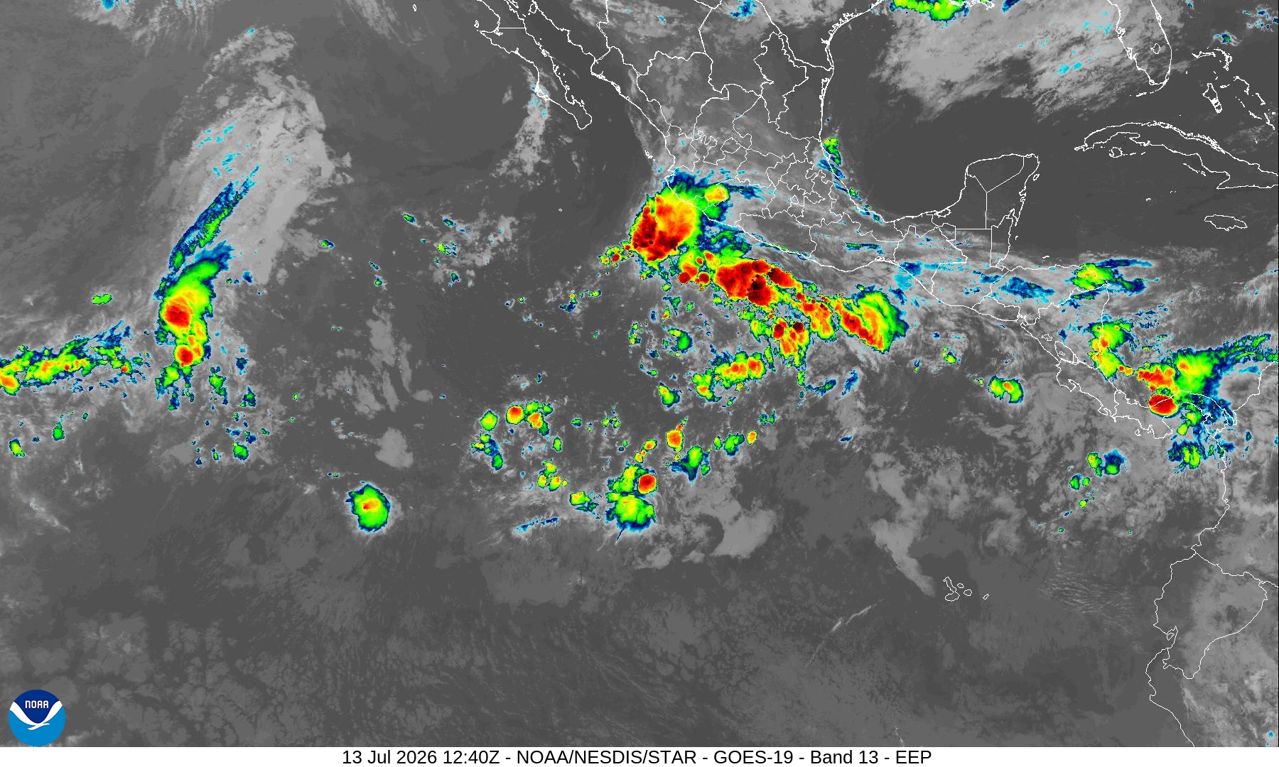
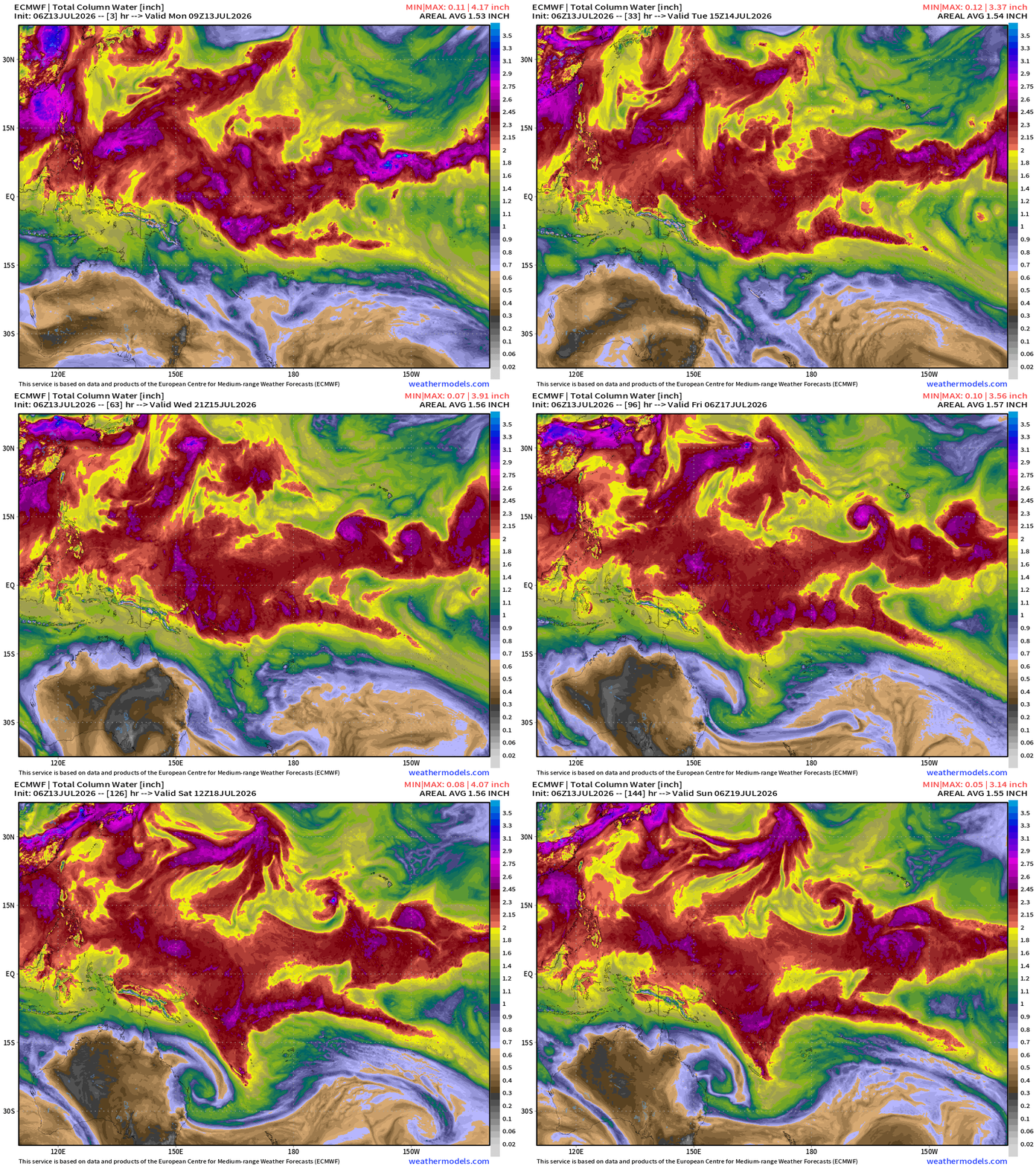
Precipitable Water — my favorite variable shows 4 concurrent areas of circulation in next 2-days.
Day 5 Ensemble Tracks
Day 10 — more hurricane(s) along coast of Mexico!
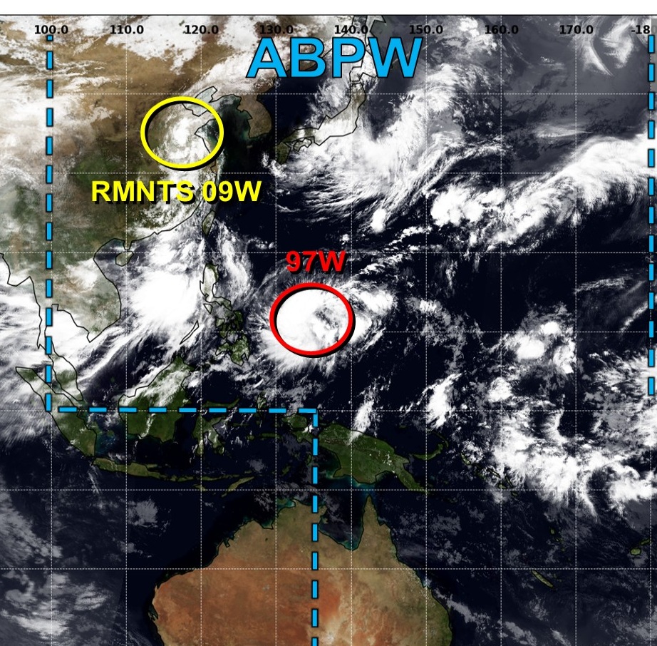
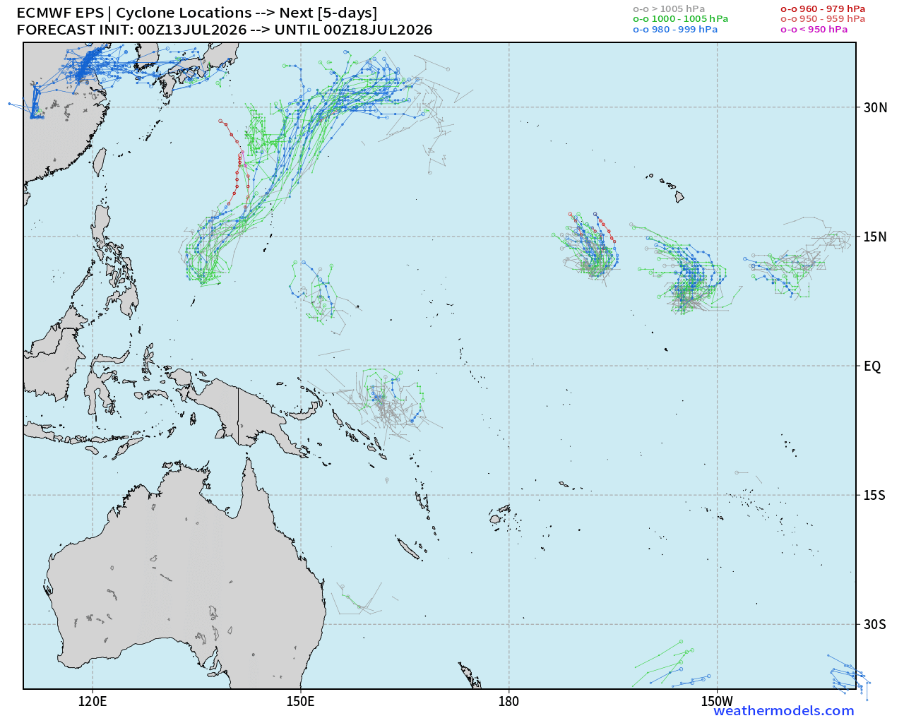
Western Pacific Basin — one Invest 97W expected to become a storm
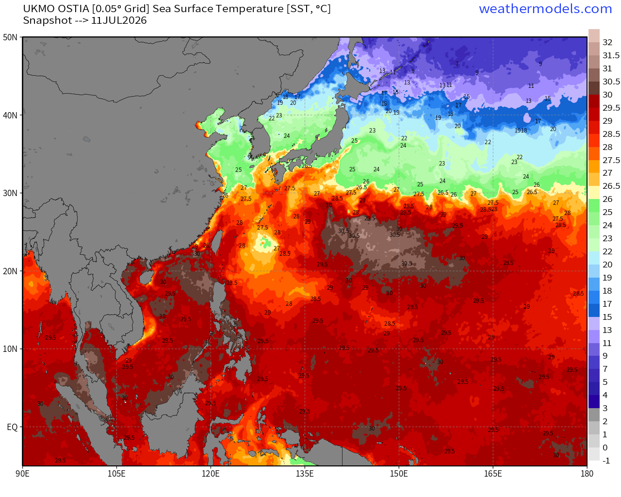
SST cool wave footprint from Bavi — upwelling and mixing! Wow.
Change in SST over past 3-days compare to prior 3-days
SST Anomaly Snapshot
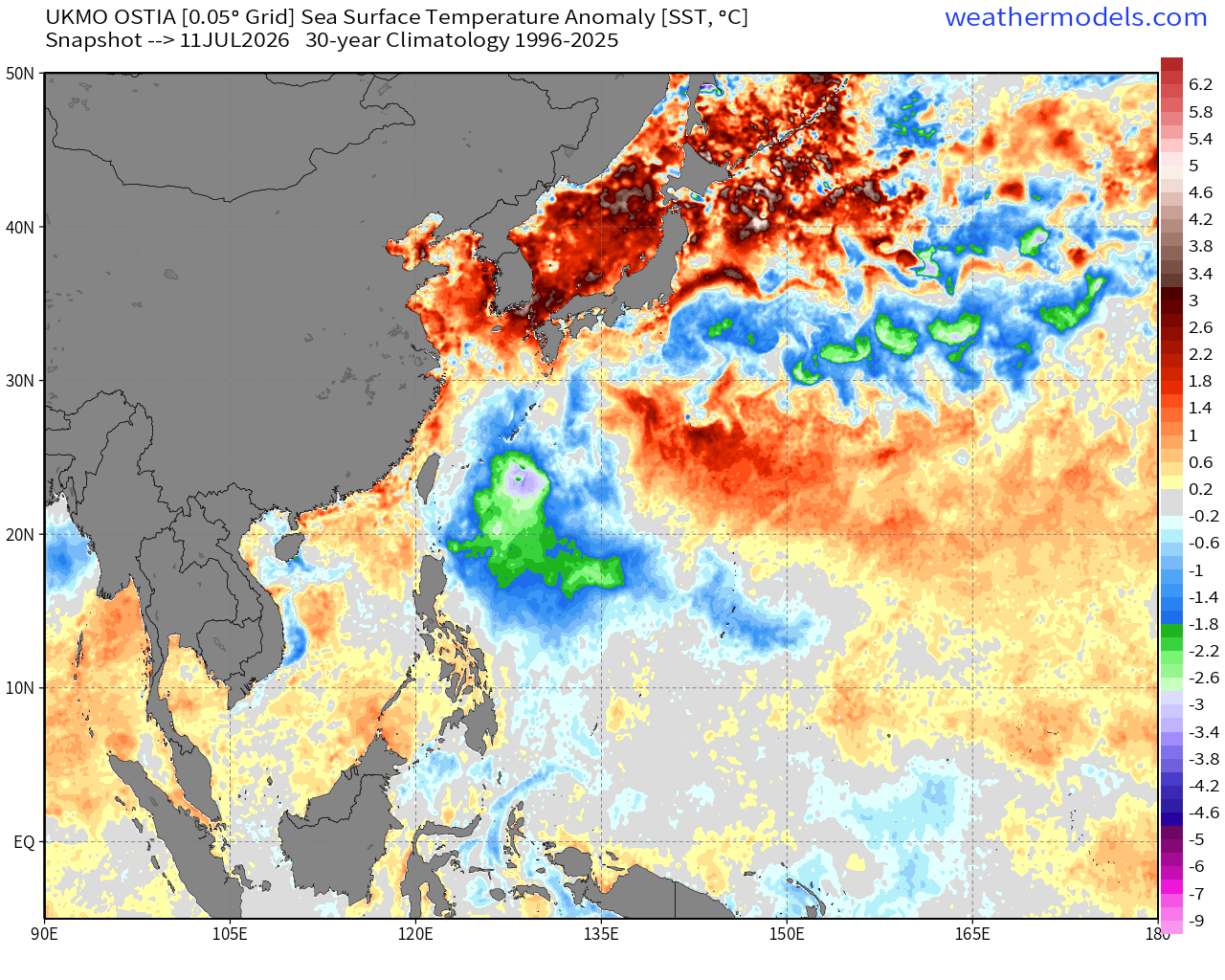
Actual SSTs actually dip below 26°F in the wake of Bavi — but still very warm elsewhere so the WPAC won’t shut down or care about that
Warm Pool — Precipitable Water
Next 5-days Ensemble Tracks
Thank you for reaching the end of this post! Hopefully you enjoyed the beautiful weather maps. Please help increase the visibility of Weather Trader on Substack: Share or Like!
Please also use our constellation of other sites … growing.
Maps sourced from weathermodels.com designed and innovated by yours truly! Please subscribe there for real-time access to the newest maps, charts from all of the weather models including ECMWF and AIFS, and NOAA GFS/GEFS, HRRR/RRFS and Blend of Models (NBM). NOAA WPC and SPC for fronts/convective outlooks.
Our own content is now sourced from hottestsince.com + weather.city
My Atlantic Hurricane Season Forecast (2026)
From April 7, 2026: Atlantic Seasonal Hurricane Forecast: (11/5/2)
9-13 Named Storms (11 most likely)
4-7 Hurricanes (5 or 6 most likely)
1-3 Major Hurricanes (2 most likely)
Accumulated Cyclone Energy: 75-85 (well below normal)
NOAA 2026 Atlantic Hurricane Season Forecast
- Milepost
- 979 · laid 2026-07-13T14:09:59.259000Z
- Source
- https://weather.substack.com/p/july-13-2026-monday-tropical-update
- Digest
- 1bbef1de7ec64a4afd748093537e2a3001443bc51447af56b93f7da1d868ed09
- Machine
- JSON