July 15, 2026 Wednesday Tropical Update
Thick smoke from Canadian wildfires will ride the ridge (heat dome) with temperatures in the 100s around Washington D.C. and one lonely 20% chance of development in Gulf
July 2026 was the warmest July in the 132-year national record (1895–2026), at 76.9°F against a 1991–2020 normal of 74.4°F (+2.5°F).
July 2026 was the 26th-driest July in the 132-year national record (1895–2026), at 2.5in against a 1991–2020 normal of 2.9in (-0.3in).
NOAA/NCEI Climate at a Glance, contiguous United States. This is the observed record for the month, not a score of anything said in this piece — the forecast ledger begins 2026-08-17 and cannot reach earlier posts.

Major Canadian Fires will blanket thick smoke across the Northeast U.S. downstream of a massive heat dome
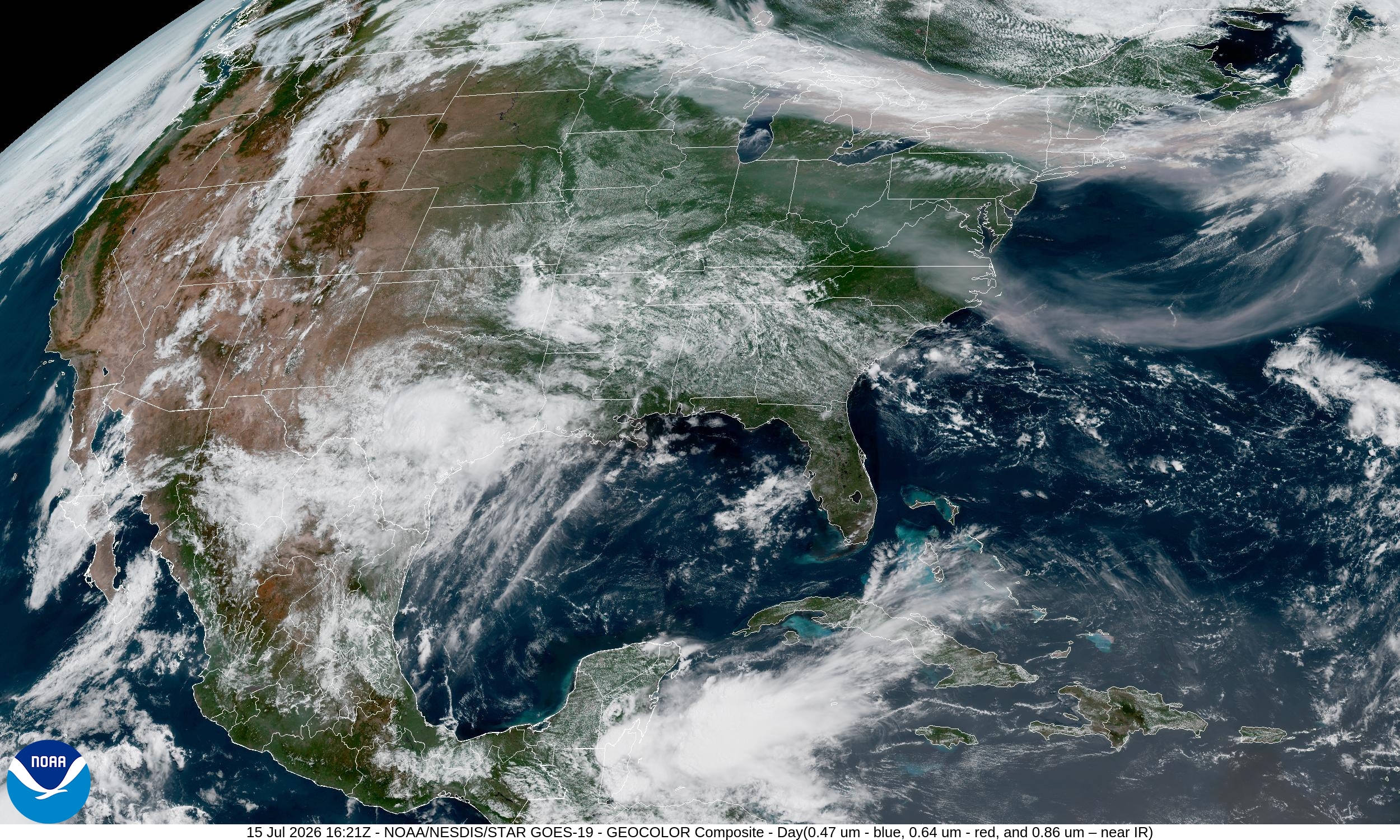
Visible satellite shows the very dense smoke aloft.
Please give weather.city a try … more features added daily, including Areal Impacts, Population Impacts, and Costco Store location weather.
Where is this “Weather Trader” newsletter headed? No where, and this Substack hosted blog will continue onward. I will have more time/opportunity to expand into other topics, too, once I can pre-wire all of the maps/content that is currently download, and cut-and-paste. There will be companion sites, and services that will allow (paid) subscribers to interrogate the models, get their own customized point forecasts and/or regional views, including maps and charts. The development is extremely rapid with Claude Code (not joking), and your continued support is appreciated but also necessary. What has been shipped in the past week? Freely available services: hottestsince.com / coldestsince.com / wettestsince.com / driestsince.com / weather.city, and precipitation.earth is being built with celsius.earth after that. I currently have a list of 20 high-priority additional sites/services.
How am I able to build these so quickly? Well, I have all of the data already, and I knew how to stage it for turn-key wiring into the web interfaces. I already did the hard part of ingesting and processing the weather data, so passing off the web design to Claude eliminates much of the ridiculously time intensive work. I’ve literally done at least 20,000 man hours (10-years) of full time web design required in 2025. No longer.
So, what’s the play here? I am going to produce everything as if I am a power-user, from my professional level of experience and expertise. I want all of you to be able to see under the hood with how the weather enterprise works today, and give as much away for free (non-commercial) but maintain a “value-added” structure for subscribers. I am making shareable cards, interactive tools, and broadcast quality maps. And, I already have the ability to ship individualized PDFs through weathertrader.com And, that’s the crown jewel — the weather trading market interface (but not for money, and humans aren’t involved. In the coming weeks/months, you’re going to see some incredible things! Upgrade from free —> paid / or upgrade to annual: Coupon

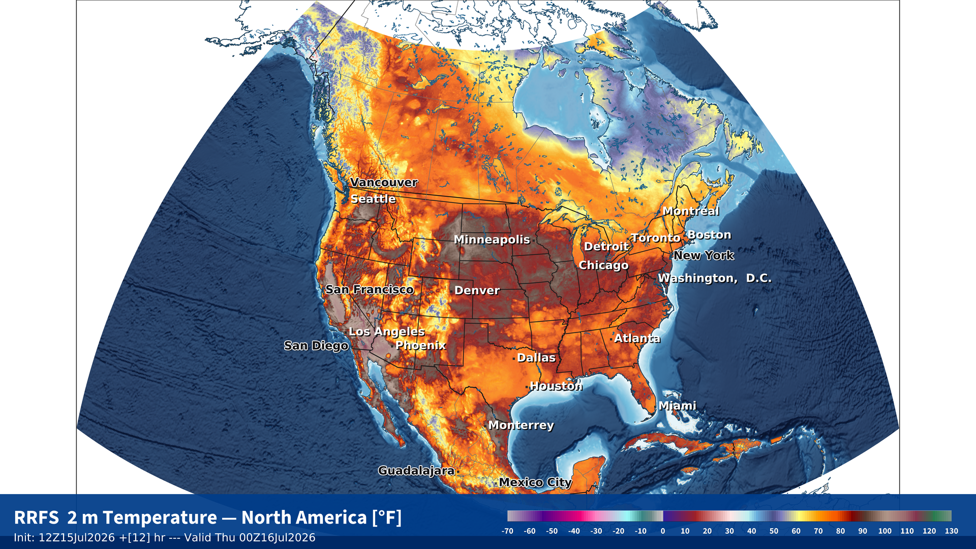
New maps! My favorite parameter with RRFS-A
HRRR Smoke Forecast (entire column, not surface) over the next 24-hours
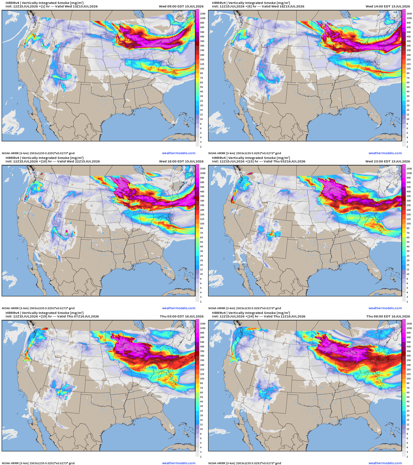
Much of this thick smoke will remain aloft, but eventually the visibility will degrade as the heat dome suppression / descent of air starts making more unhealthy conditions near the surface.
Blend of Models —> Precipitation Next 7-days
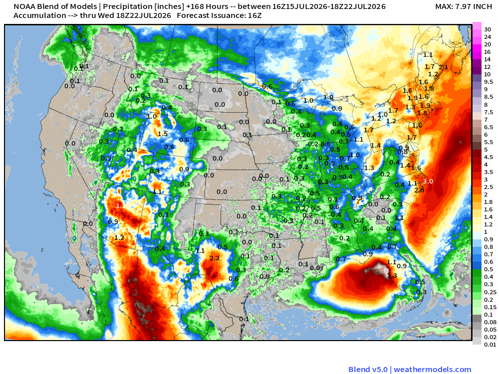
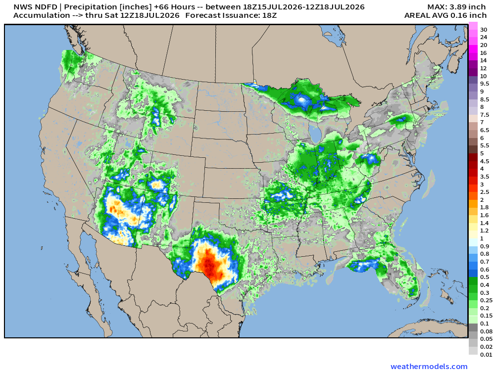
Check out the Southwest Monsoon! Huge rainfall across Arizona and into the Great Basin — very welcome, but we want to avoid lightning
Area in NE Gulf may be a prolific rainmaker for the Florida panhandle and western Gulf coastline
High Temperatures on Wednesday (Today)
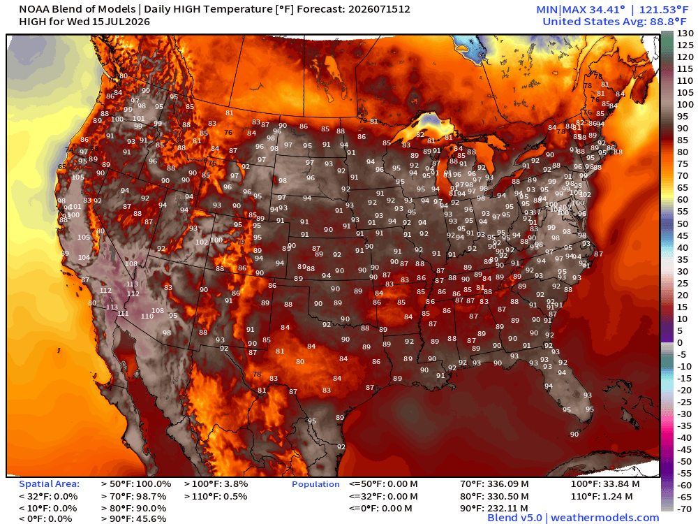
Lower 48 average high is 88.8°F and 232 million at least 90°F —> HOT
and 34 million at least 100°F
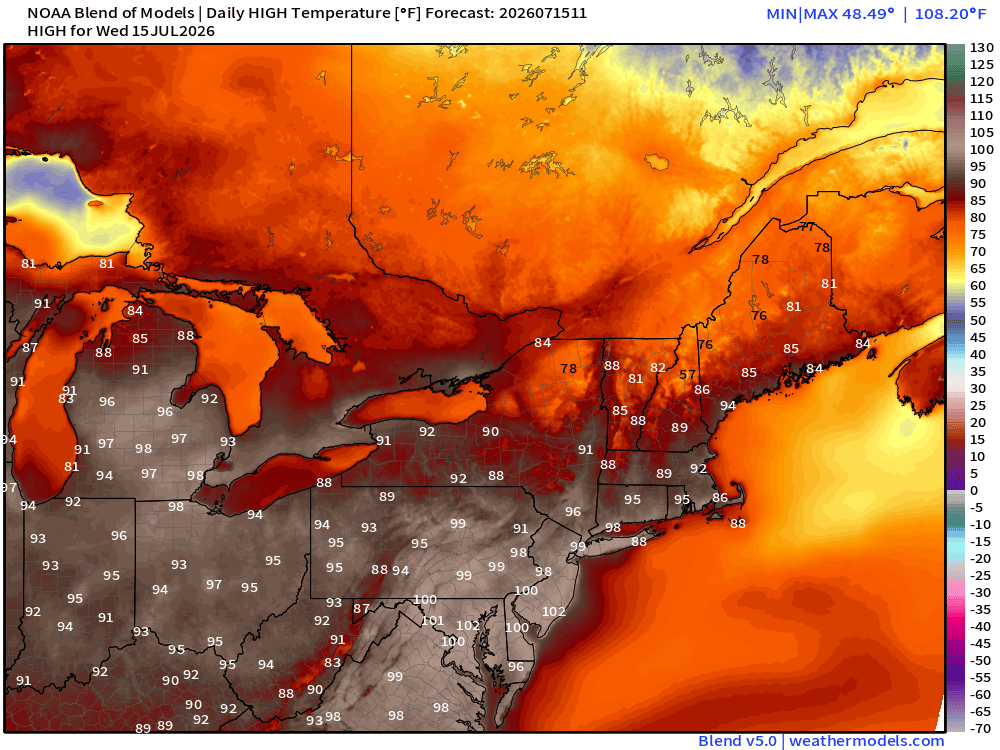
Washington D.C. —> 102°F would break the record high for Today
More at Hottestsince.com and keep track at weather.city
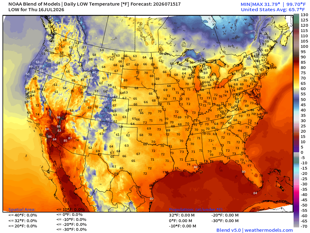
Thursday Low Temperatures
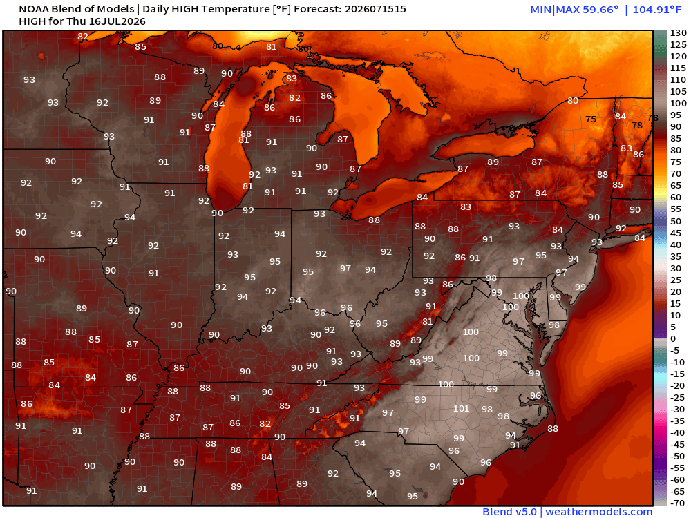
Thursday High Temperatures
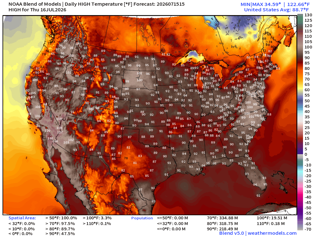
Similar Story for Thursday with almost 20 million at least 100°F including the mid-Atlantic
Upper-Level Height Anomaly | AIFS-Single Next 10-days
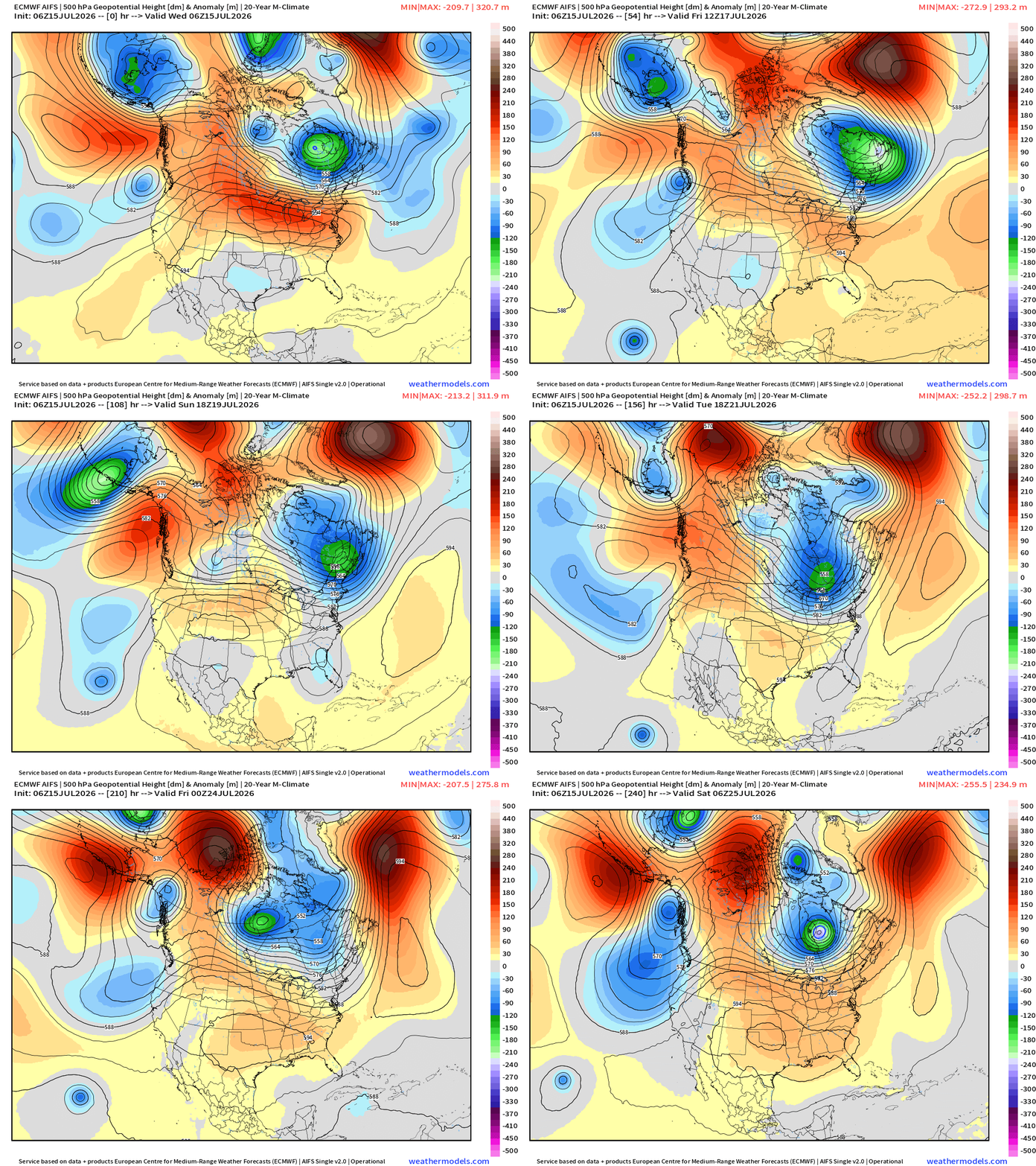
The impressive central U.S. ridge + a series of digging troughs out of the Gulf of Alaska and Pacific Northwest.
Also, note the troughs digging into the Northeast into Days 5-8 —> back to the cooler/unsettled pattern for mid-July.
NWS Precipitation Next 66-hours —> Saturday Morning
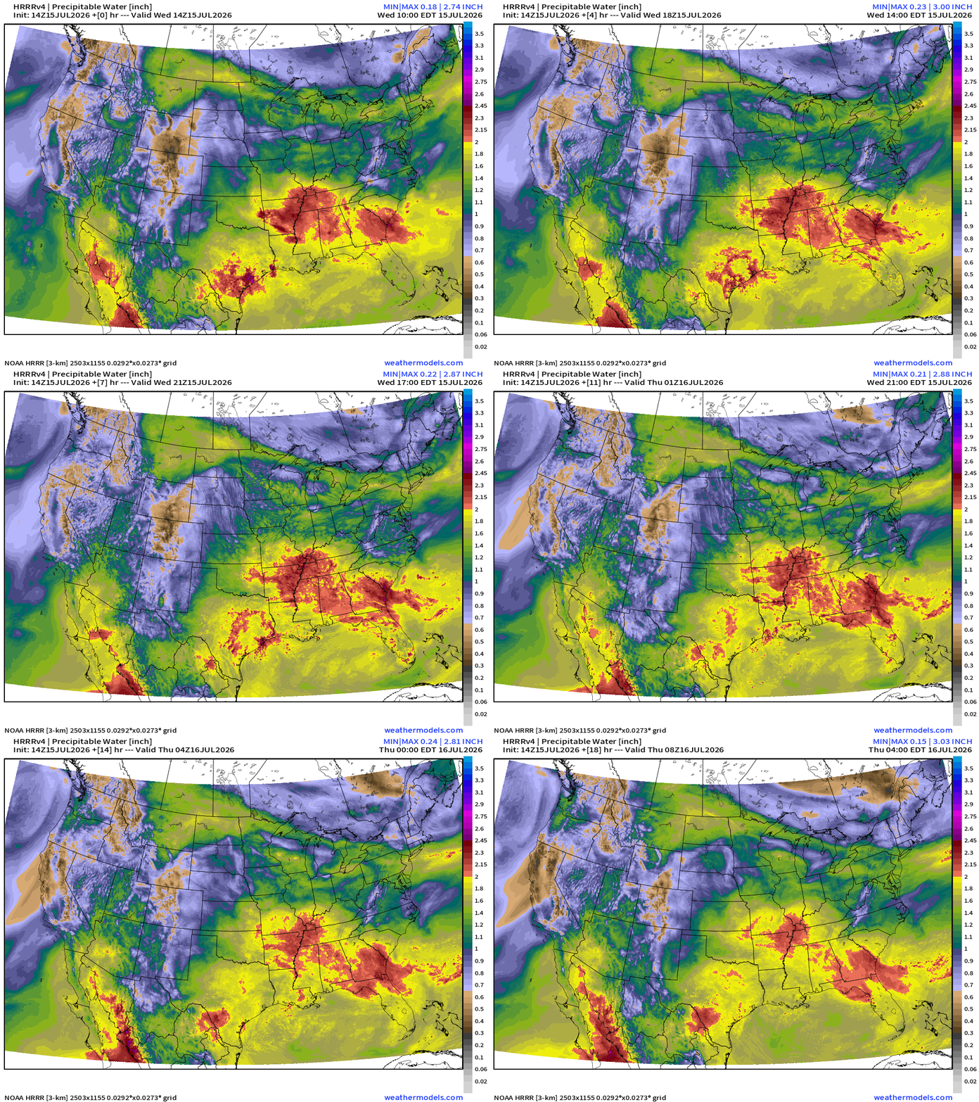
My favorite parameter — next 18-hours of HRRR Precipitable Water
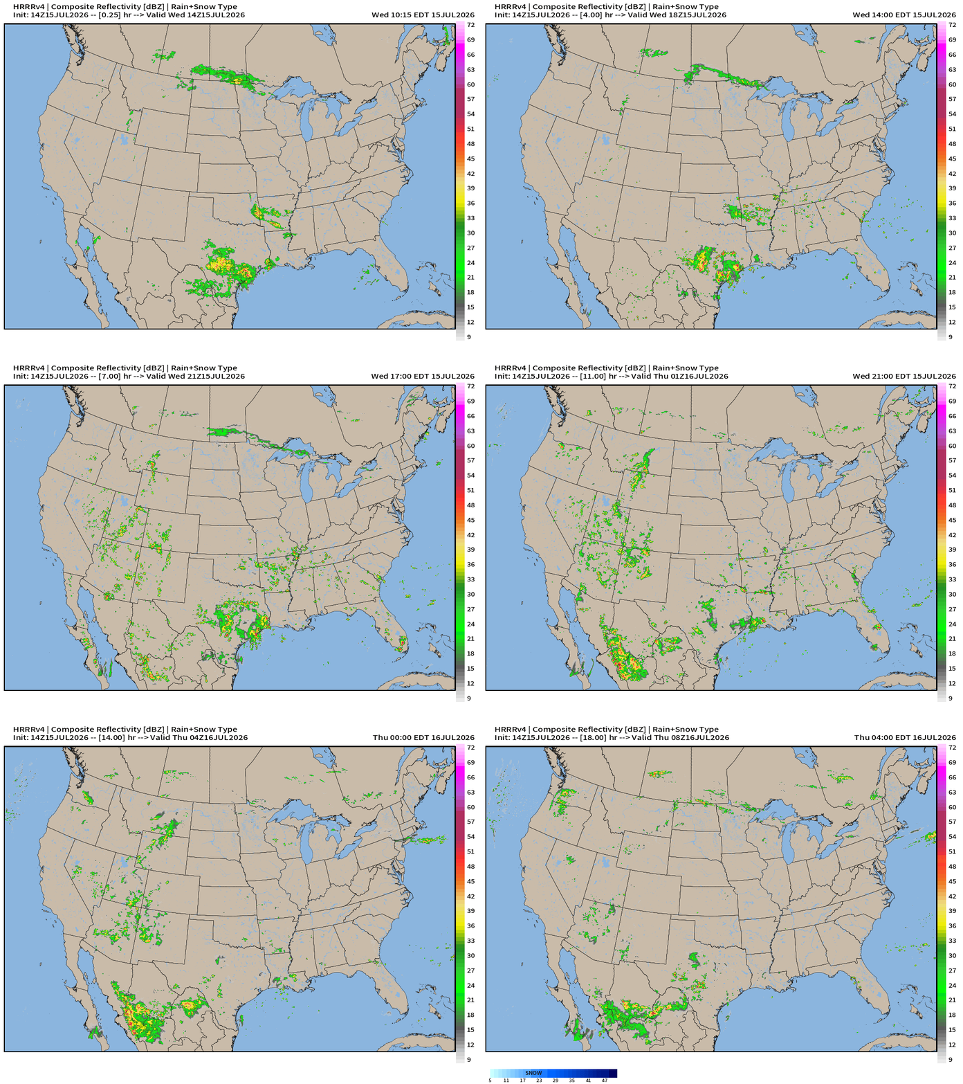
HRRR Next 18-hours simulated Radar through Thursday 4 AM ET
Flagship model: ECMWF AIFS 06z —> Integrated Vapor Transport next 10-days
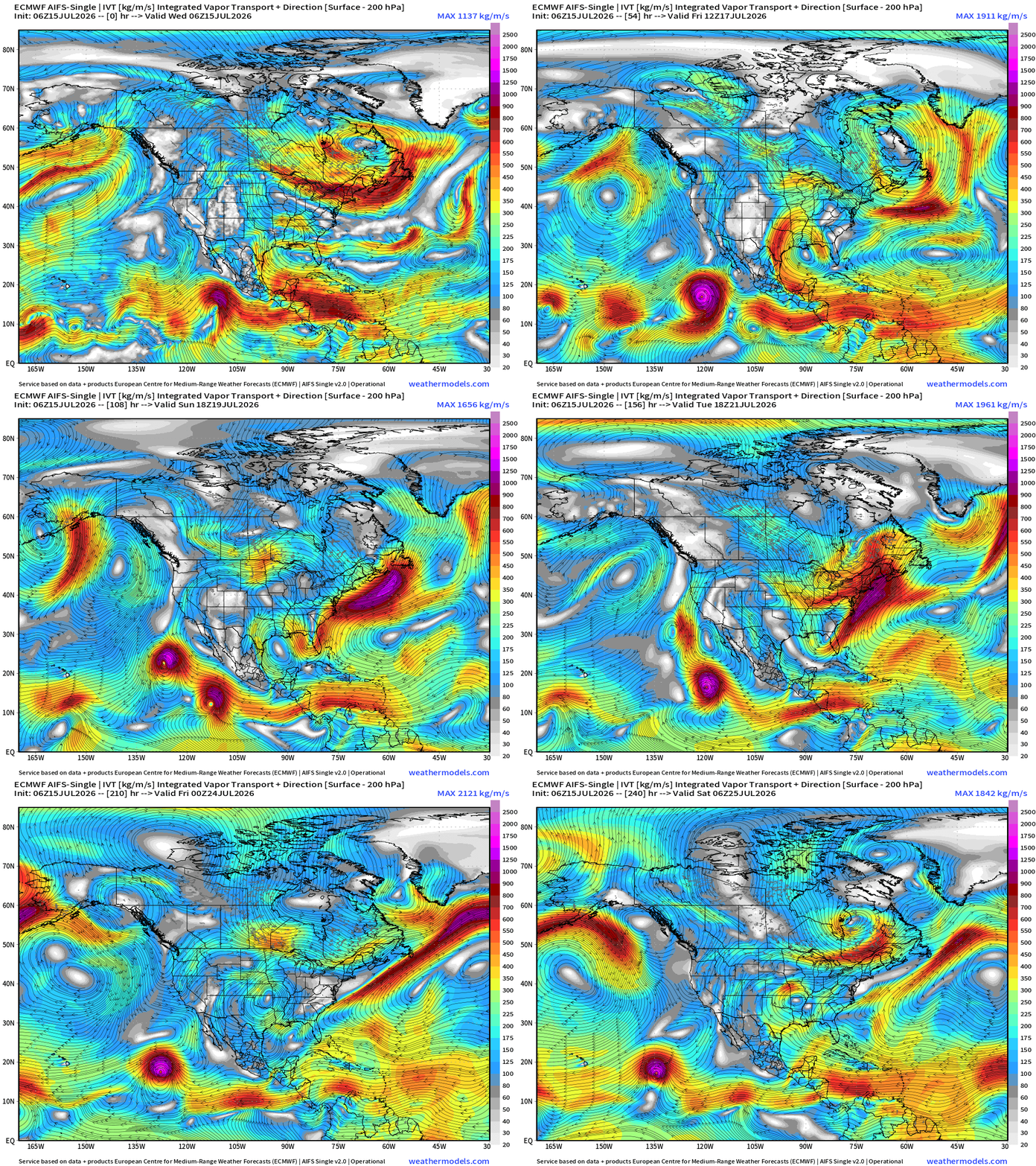
The heat dome across the Great Lakes shows up as a clockwise closed circulation within the moisture parameter (IVT) and a new one forms in the central U.S. possibly in 8-10 days.
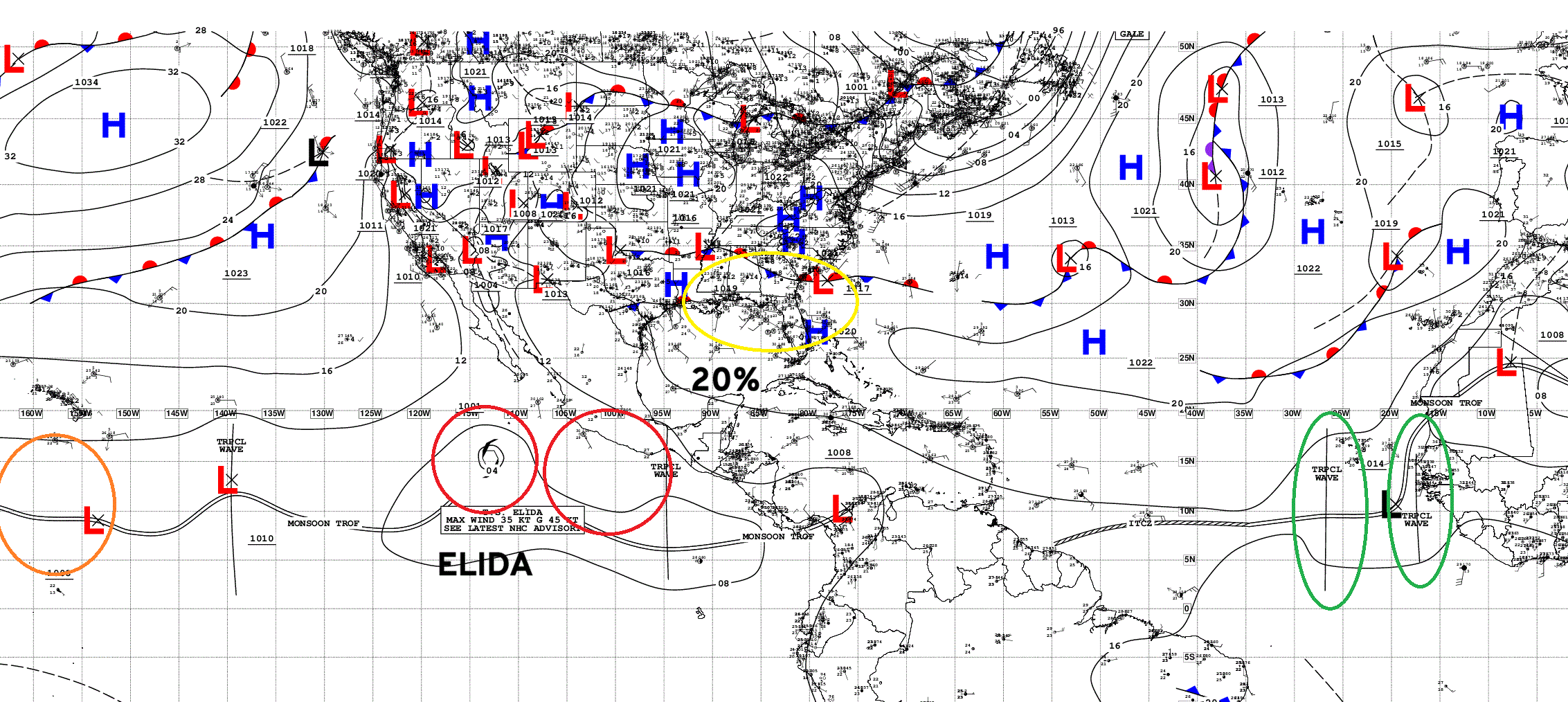
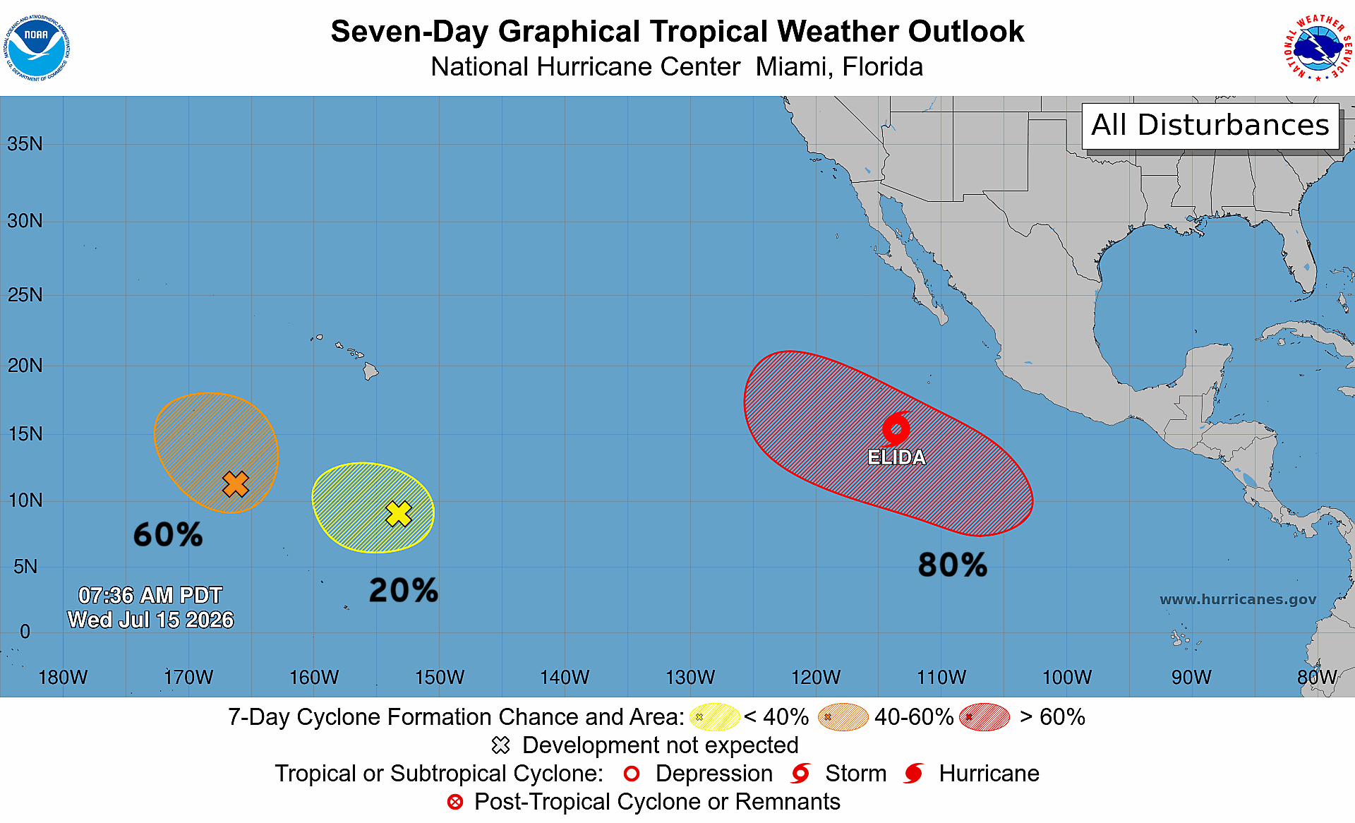
2 Eastern Pacific hurricanes likely in next 3-7 days (Elida + Fausto)
Otherwise, the Atlantic tropical basin is mostly quiet — tropical waves are still being produced, but nothing catching fire.
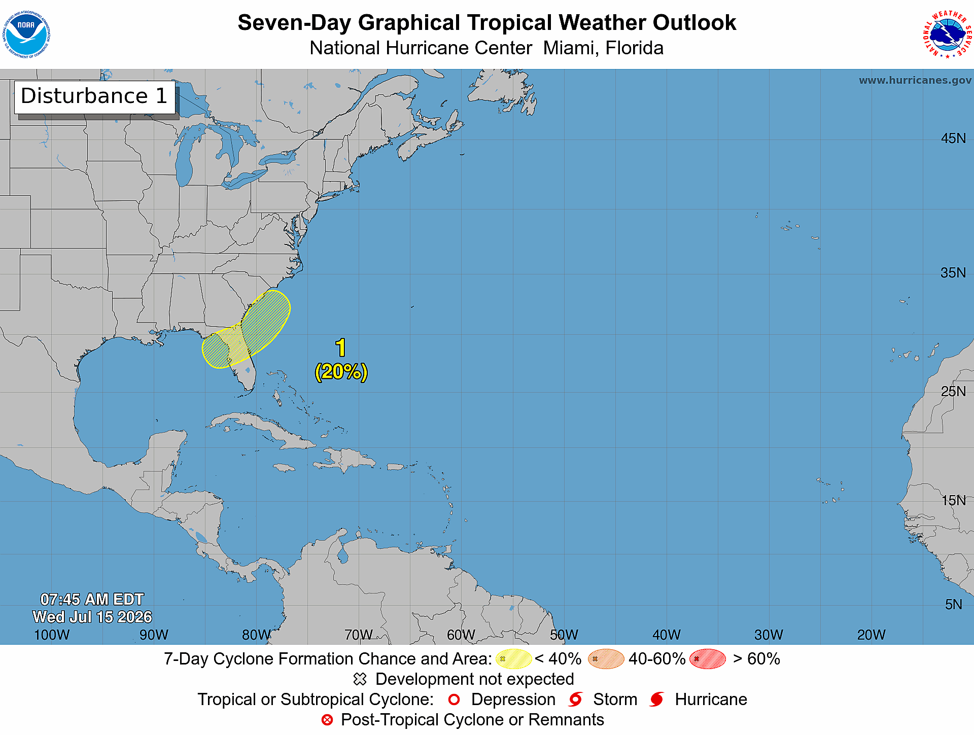
A trough over the Southeast could trigger a surface circulation over water, but the likelihood remains small (20% NHC)
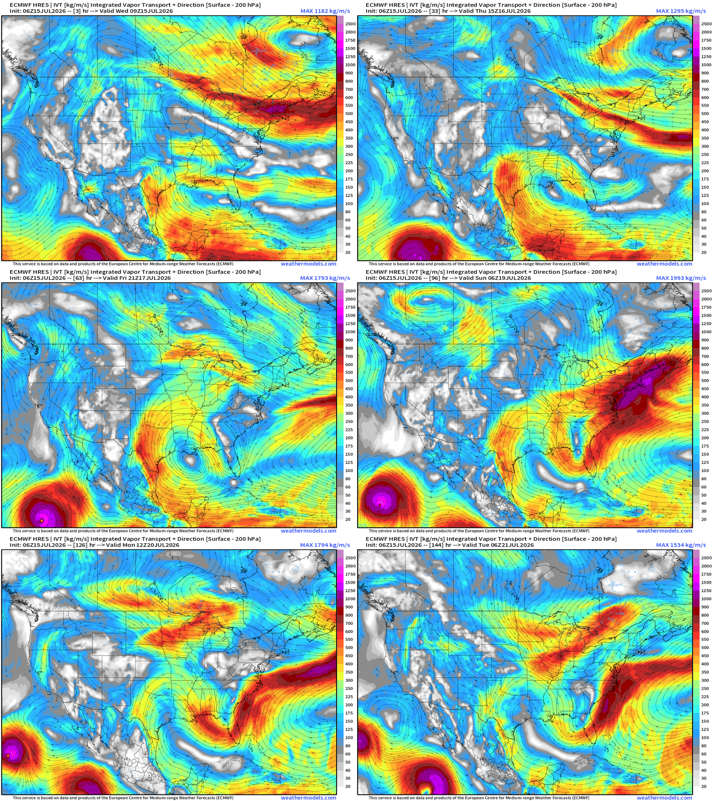
ECMWF 06z zoom — through 6-days shows the trough formation but any surface circulation remains over land
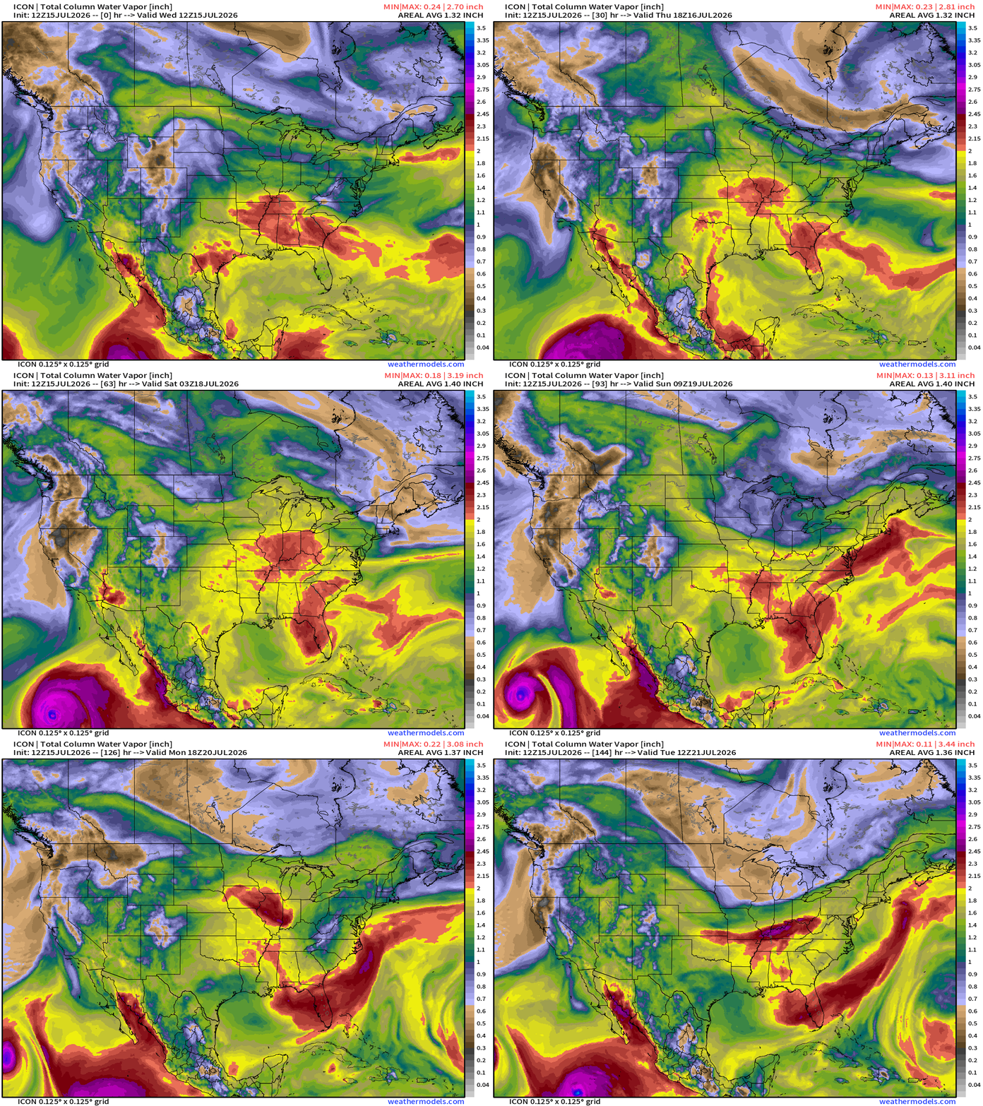
ICON 12z | Precipitable Water | My Favorite Parameter
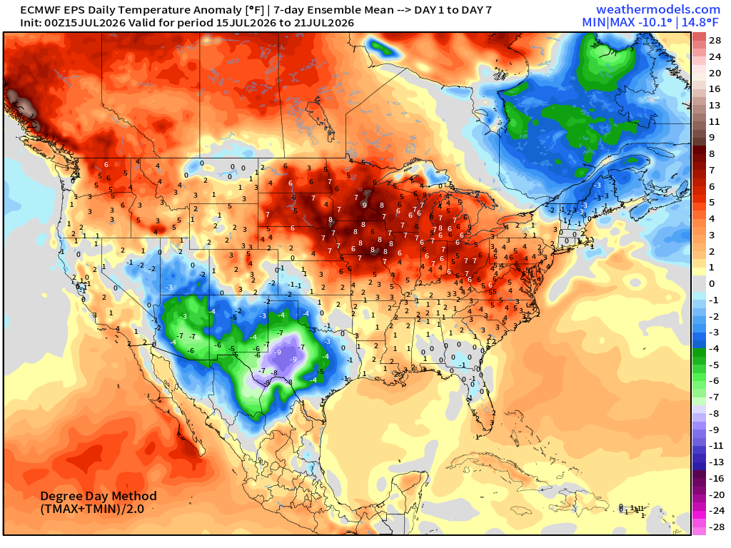
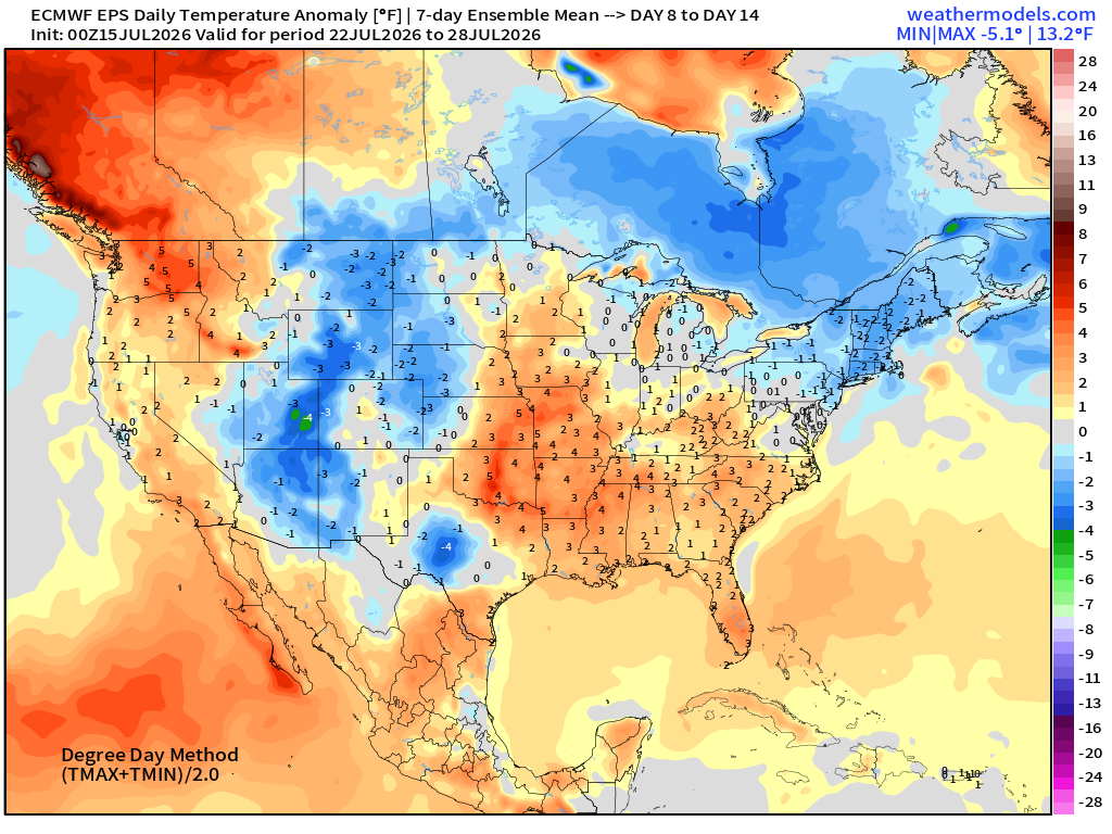
ECMWF Flagship Ensemble Mean Temperature Anomaly next 2-Weeks
Week 1 —> July 15 to July 21
Week 2 —> July 22 to July 28
Atlantic Tropics — One area of interest at 20% in 7-days from non-tropical trough —> tropical transition potential (low)
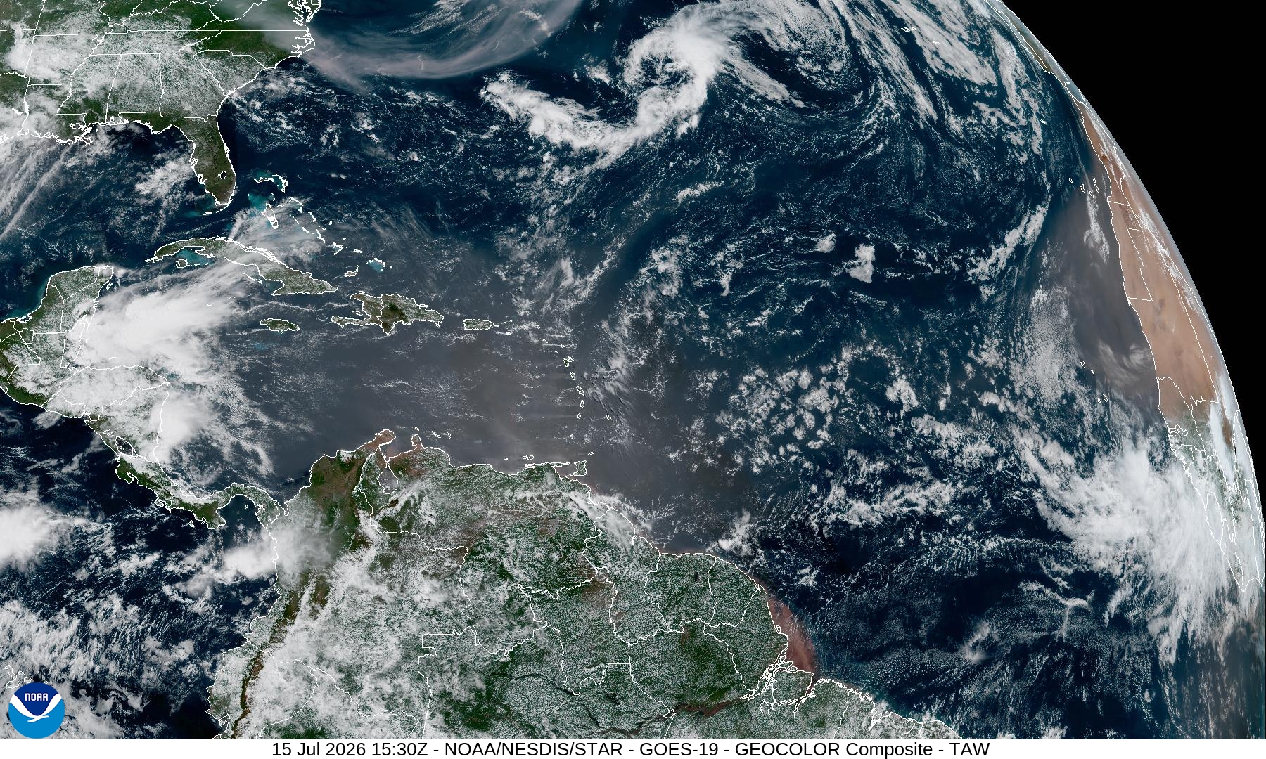
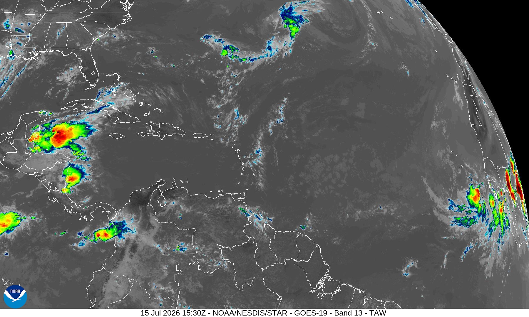
Tropical Waves off the coast of Africa are quite robust! But the environment just to the west is hostile (shear + dry air) and cooler water
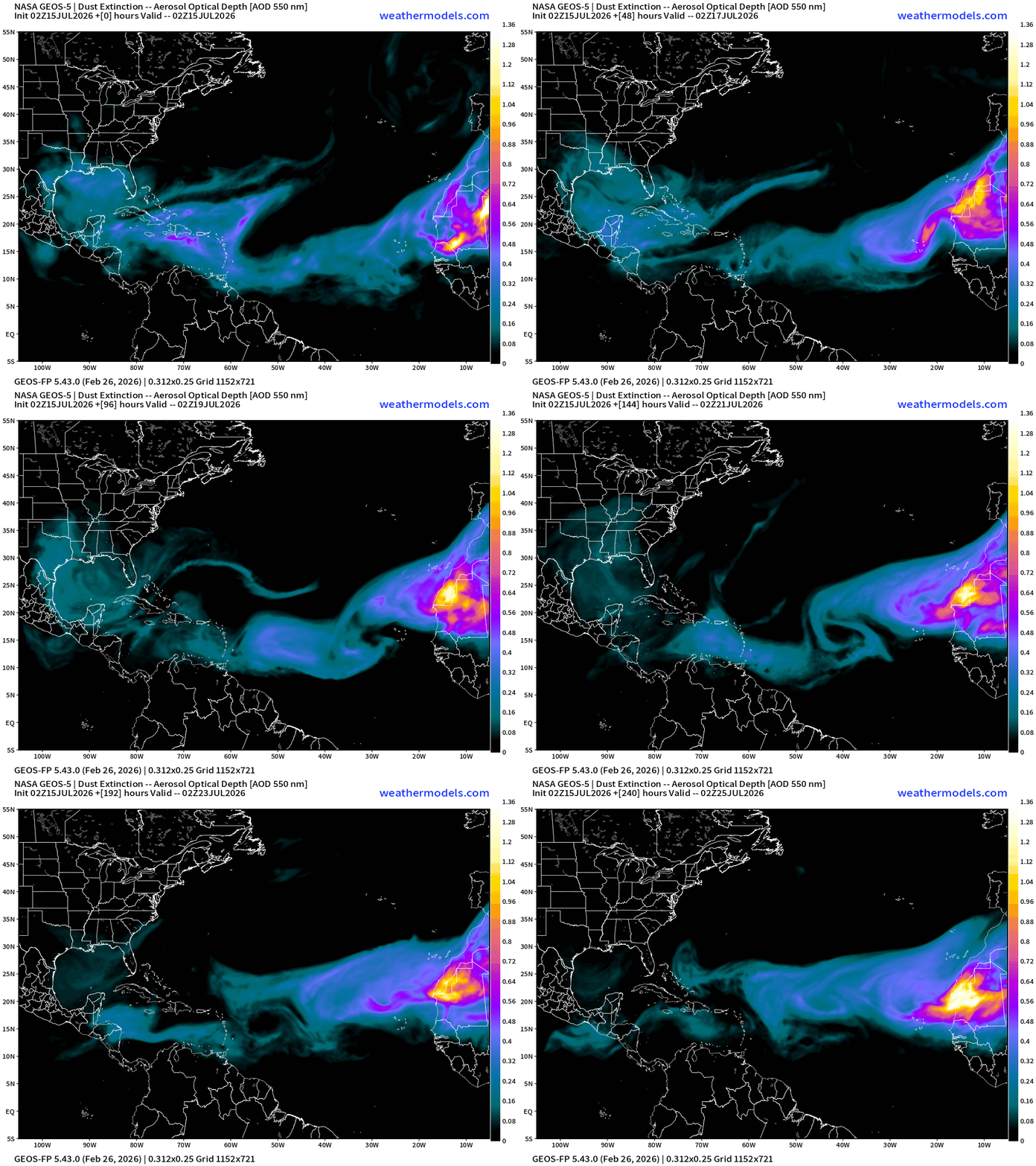
NASA Dust — notice the tropical waves turning the dust cloud cyclonically!
Saharan Air Layer is a hugely negative influence on storm development aside from the dust. The air near the boundary layer is hot, dry, and sinking.
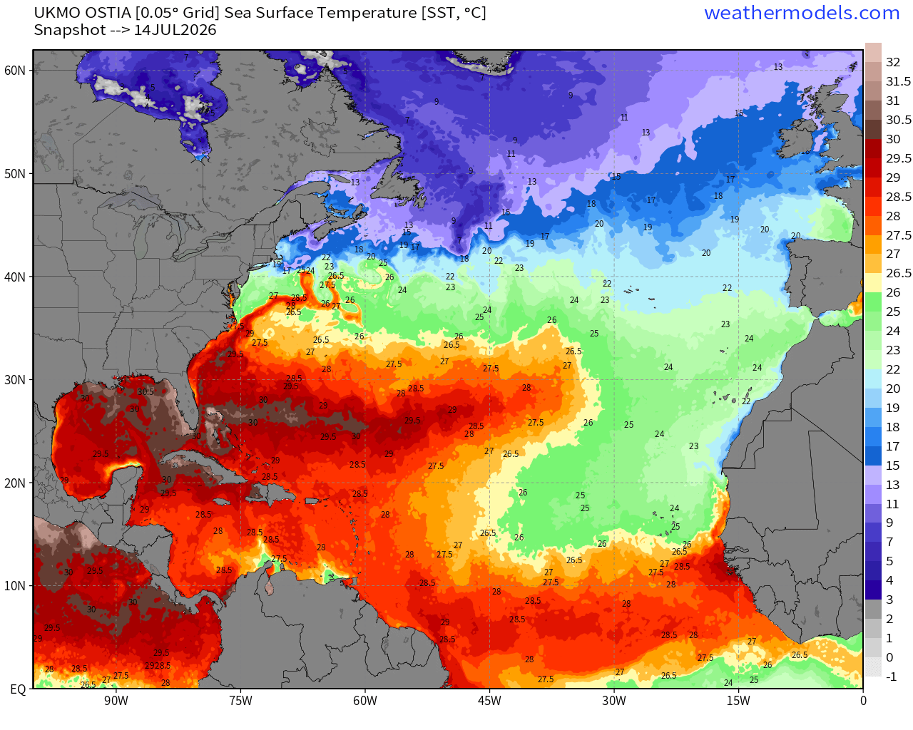
I seee the SSTs are now > 27°F up to about 15°N latitude, but still too cool above that across the NE Atlantic including part of the MDR
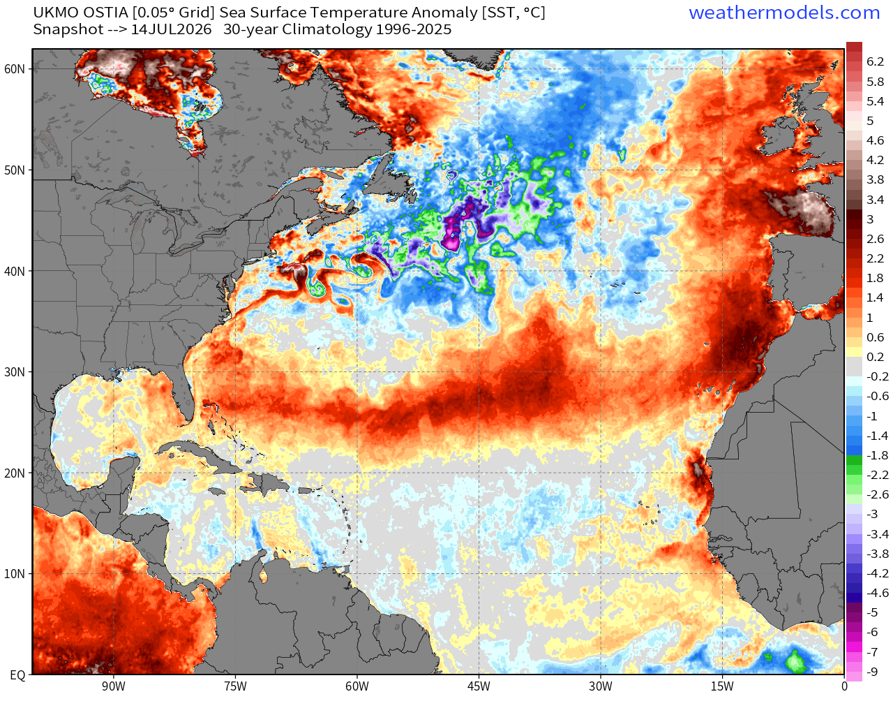
The subtropics are well above normal — weaker trade winds and clear skies —> warming
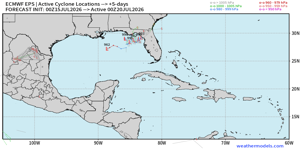
Day 5 ECMWF 00z Ensembles — show the 20% development in the corner of the NE Gulf of Mexico … kind of amusing that we are watching such a tiny area for Atlantic tropical storm development, but “close-to-home” is usually the typical situation in strong El Niño years.
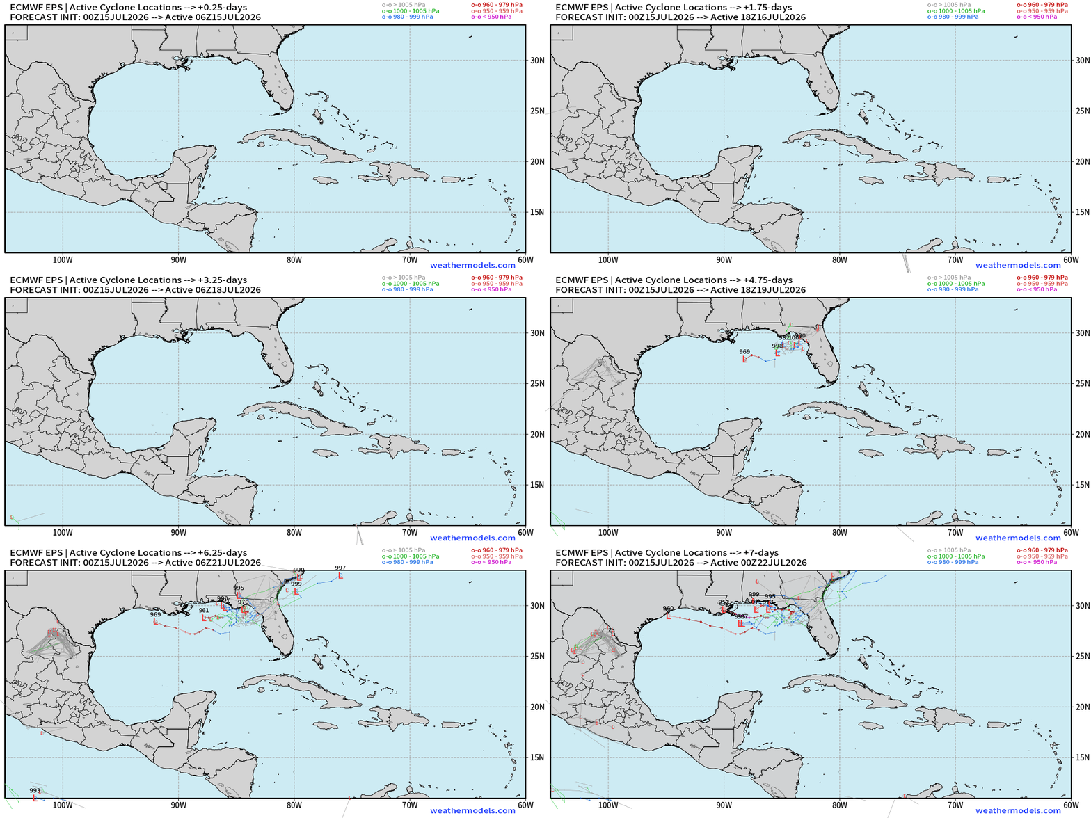
Next 7-days animation — anything that develops could move westward and intensify even into a major hurricane. But the chances are very low right now.
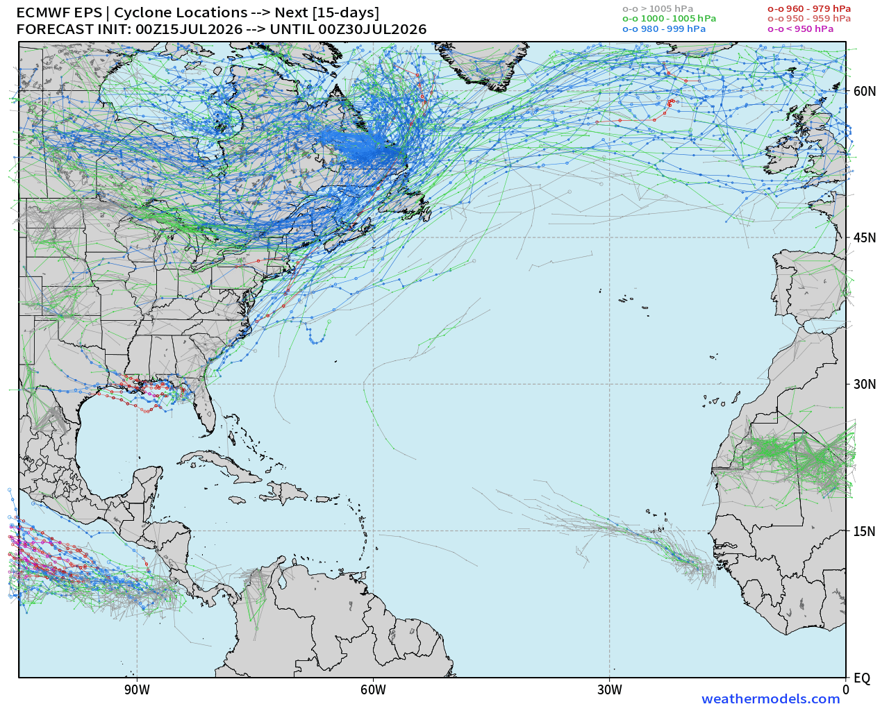
Next 15-days — maybe some hints of Eastern MDR tropical wave
Eastern Pacific Tropics —> Tropical Storm Elida 05E
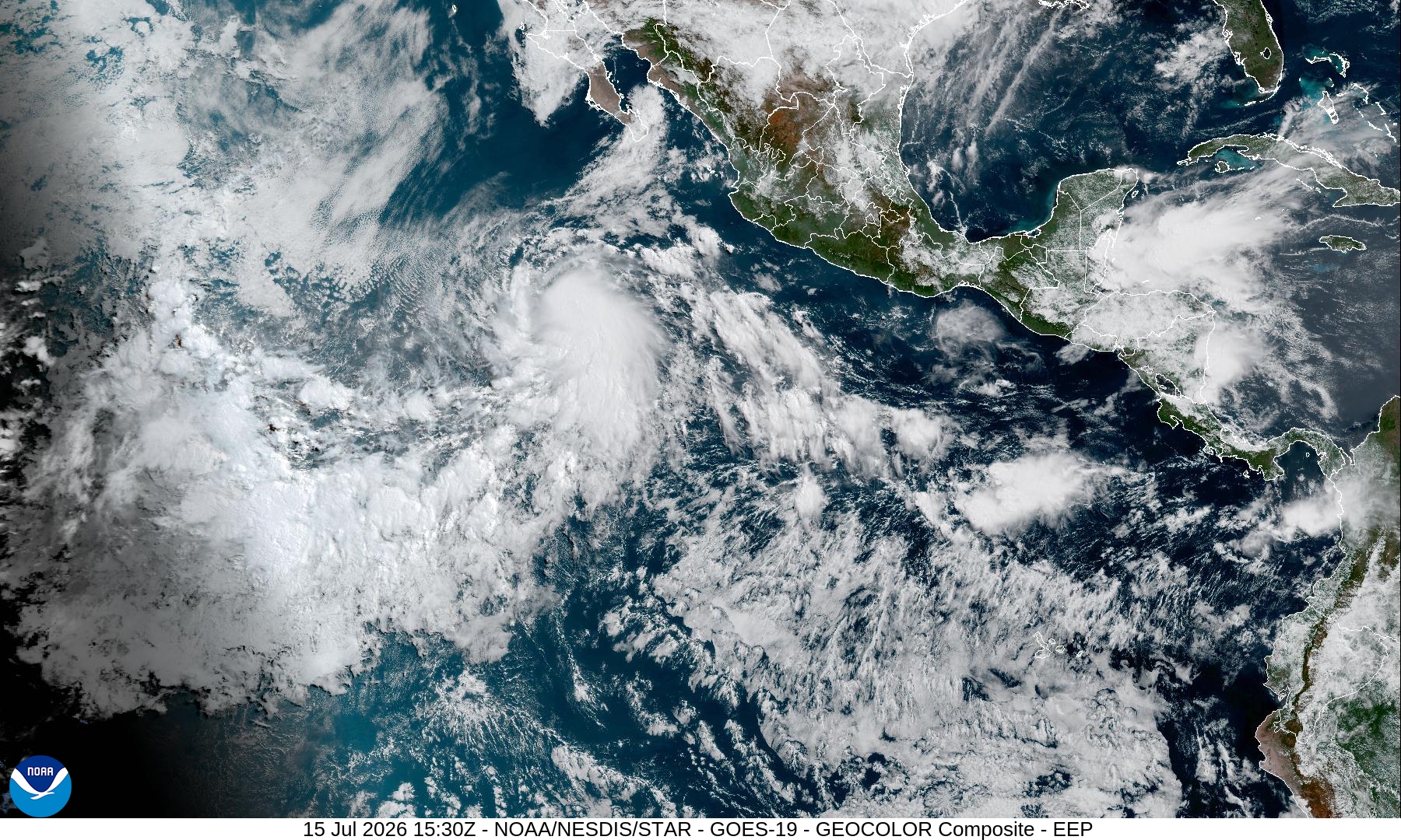
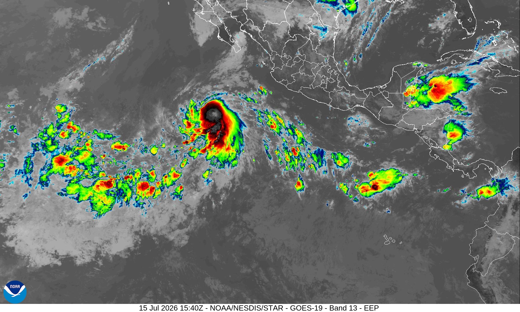
Should become a hurricane in next 12-24 hours
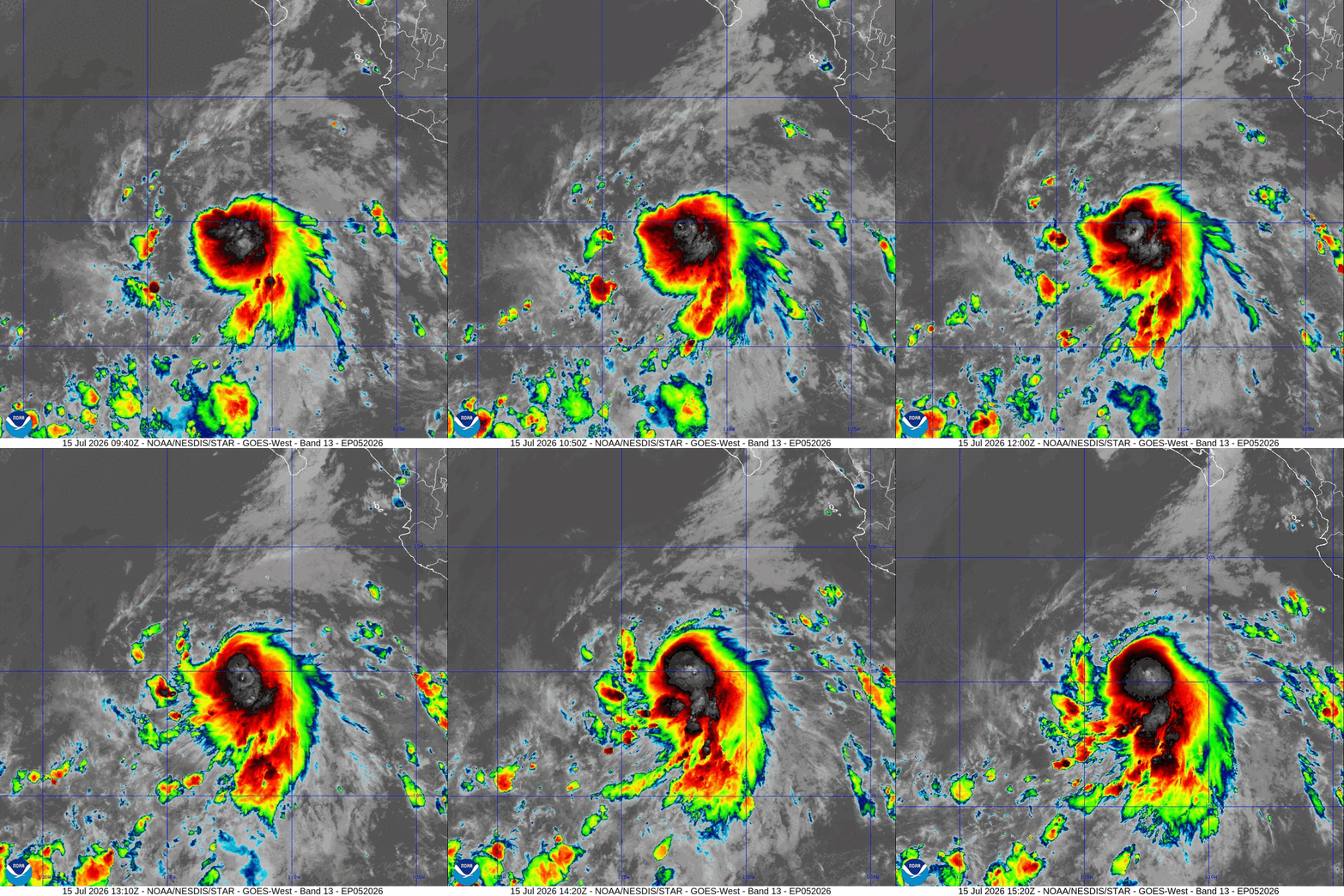
Maximum intensity 80-85 knots —> Category 2
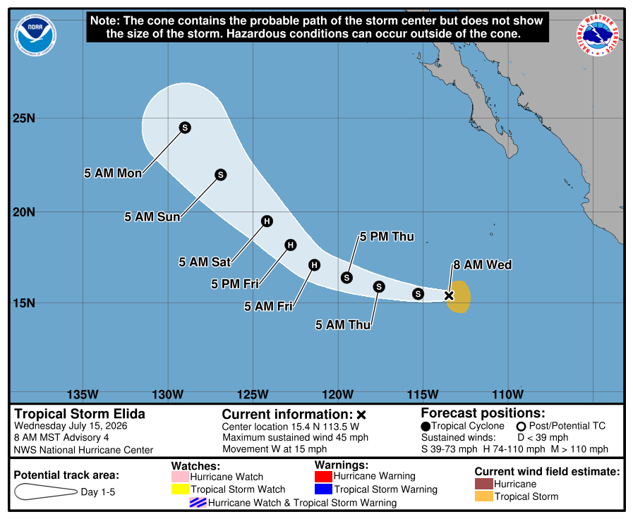
Tropical Storm Elida is expected to become a mid-range Category 2 Hurricane Elida — then comes Fausto behind it along the coast of Mexico.
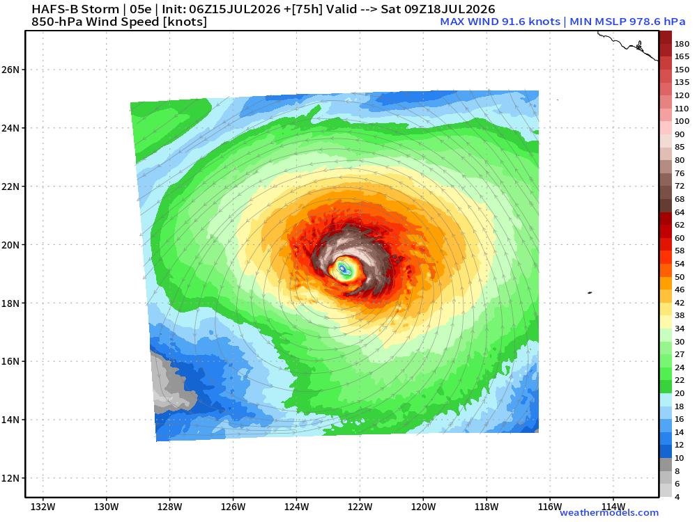
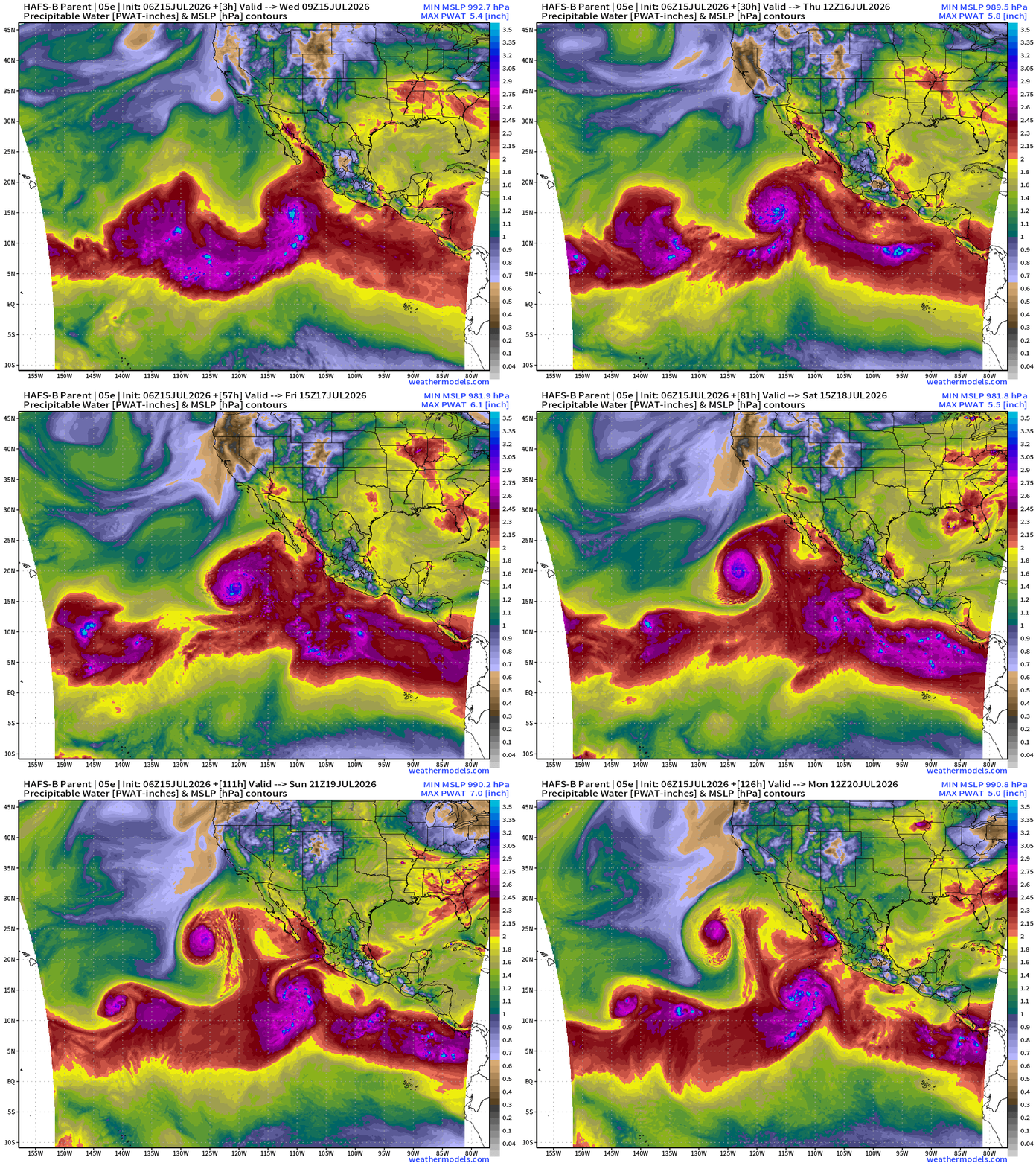
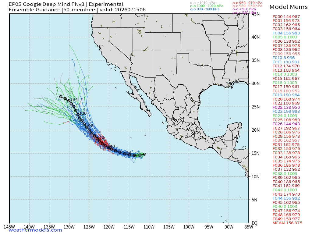
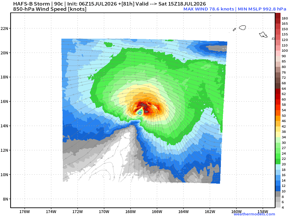
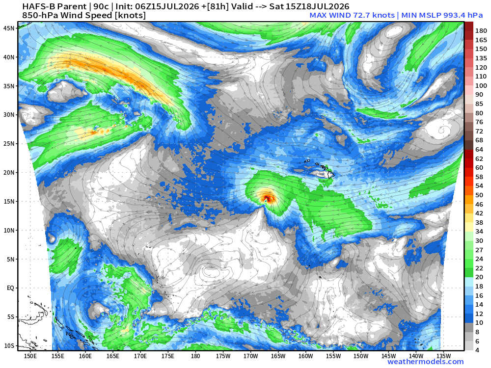
Invest 90C —> Perhaps a strong tropical storm or hurricane well south of Hawaii in the Central Pacific basin. First name for 2026 out here is Lala
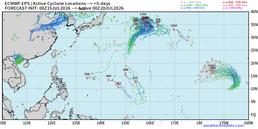
Western Pacific has gone quiet, but with the Super El Niño, any area of convection could spin-up relatively quickly.
Maps sourced from weathermodels.com designed and innovated by yours truly! Please subscribe there for real-time access to the newest maps, charts from all of the weather models including ECMWF and AIFS, and NOAA GFS/GEFS, HRRR/RRFS and Blend of Models (NBM). NOAA WPC and SPC for fronts/convective outlooks.
Our own content is now sourced from hottestsince.com and weather.city
Still working on “broadcast quality” maps, but getting the look and feel perfect is a laborious process!
My Atlantic Hurricane Season Forecast (2026)
From April 7, 2026: Atlantic Seasonal Hurricane Forecast: (11/5/2)
9-13 Named Storms (11 most likely)
4-7 Hurricanes (5 or 6 most likely)
1-3 Major Hurricanes (2 most likely)
Accumulated Cyclone Energy: 75-85 (well below normal)
NOAA 2026 Atlantic Hurricane Season Forecast
- Milepost
- 981 · laid 2026-07-15T18:38:12.182000Z
- Source
- https://weather.substack.com/p/july-15-2026-wednesday-tropical-update
- Digest
- e91fc04f77c08ad0b4cc9eb74e3354cea6c13717894399ccc23323e4e5847953
- Machine
- JSON