August 18, 2026 Tuesday Tropical Update
Atlantic may come alive next week with a strong African tropical wave. A huge Typhoon is forming in the Western Pacific out by Guam.
August 2026 was the warmest August in the 132-year national record (1895–2026), at 75.6°F against a 1991–2020 normal of 73.1°F (+2.5°F).
August 2026 was the 22nd-driest August in the 132-year national record (1895–2026), at 2.3in against a 1991–2020 normal of 2.7in (-0.4in).
NOAA/NCEI Climate at a Glance, contiguous United States. This is the observed record for the month, not a score of anything said in this piece — the forecast ledger begins 2026-08-17 and cannot reach earlier posts.

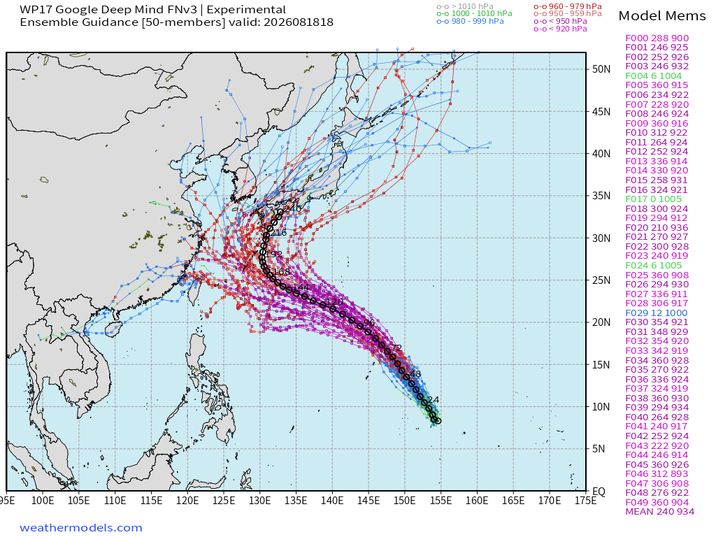
Newly minted Tropical Depression 17W —> will become Super Typhoon Saudel going to the north of Guam this time. Huge expanse of untapped “warm pool” for a system coming out of low latitude (9°N) … quite the typical El Niño fueled typhoon!
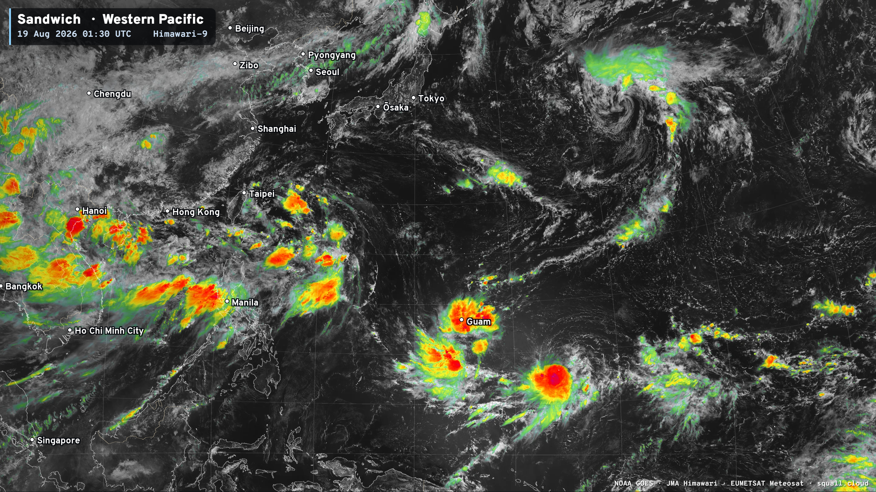
The system is just forming but looks poised to rapid intensify without much wind shear so deep in the tropics.
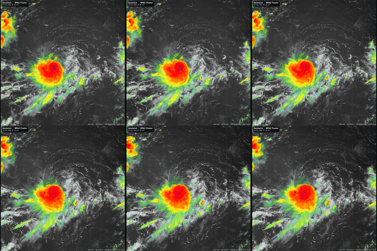
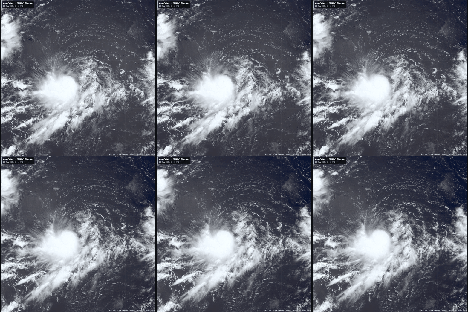
Likely a tropical storm already — and won’t take much to become a Typhoon probably by Thursday.
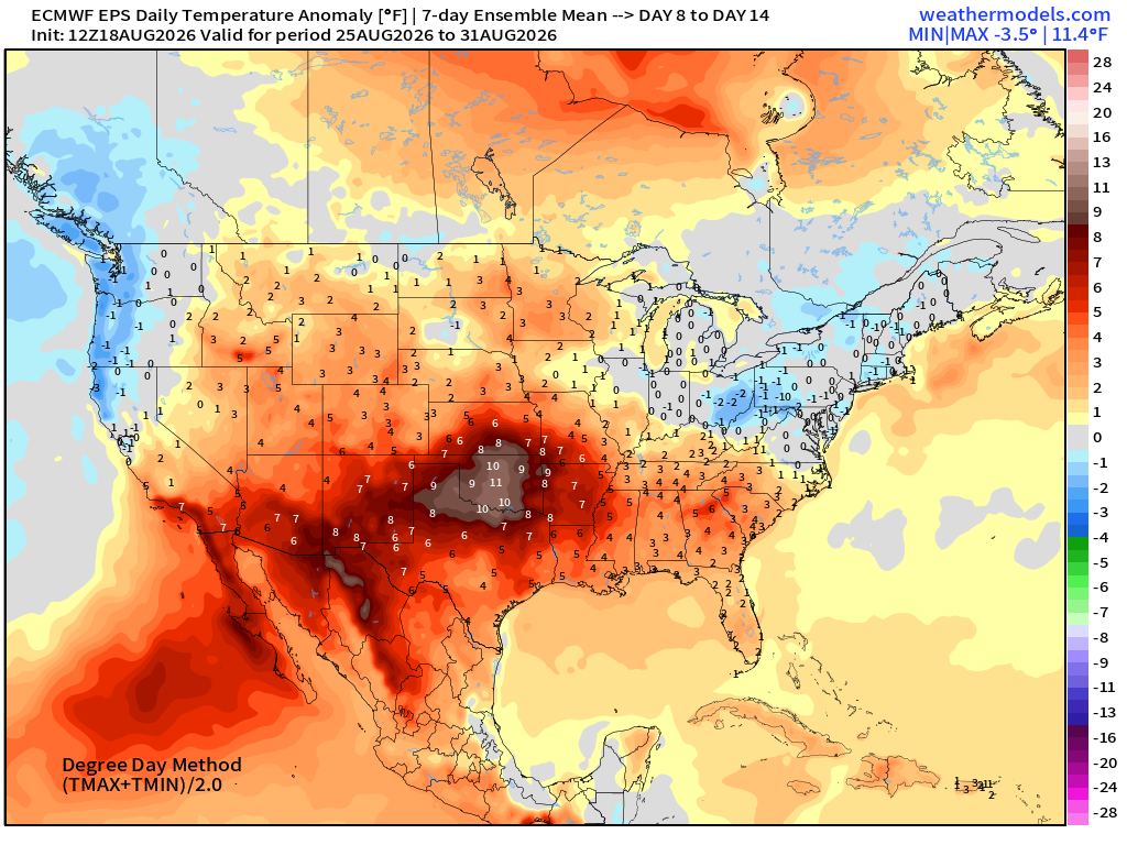
Heat Dome Continues Across the Southern U.S. with baking temperatures for the next 2-weeks across Texas and Oklahoma.
Temperature anomaly > 10°F for next 7-days on average.
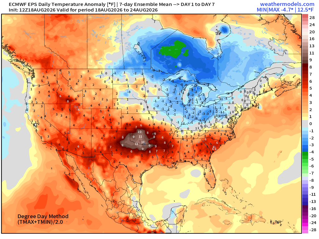
And, no movement for Week 2 to end August!
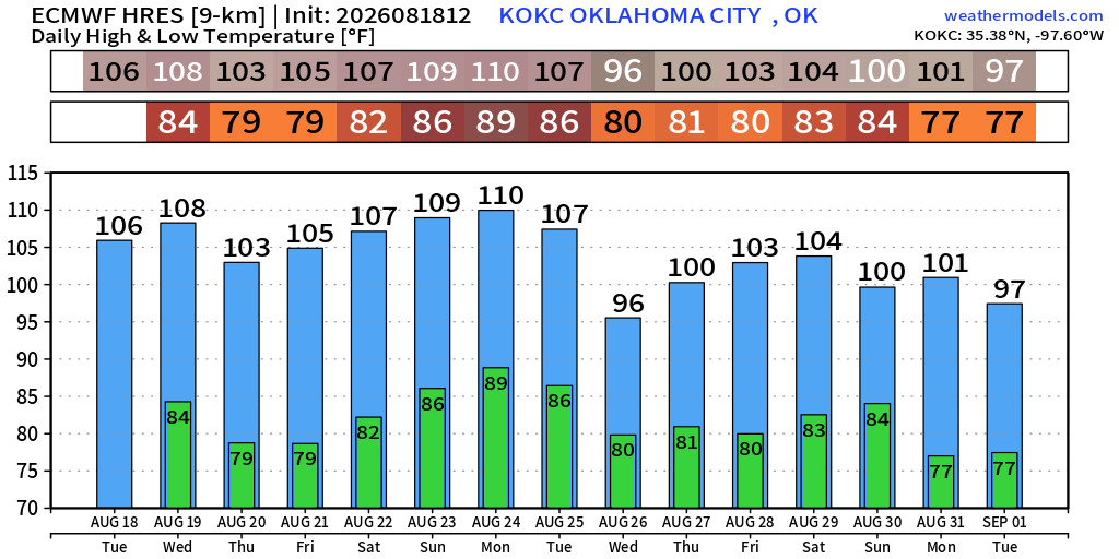
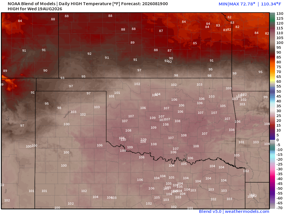
Exceptional heat continues in Oklahoma City — 100s through end of August.
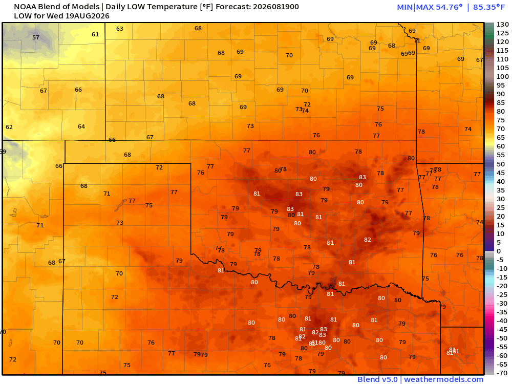
Wednesday’s Low Temperatures
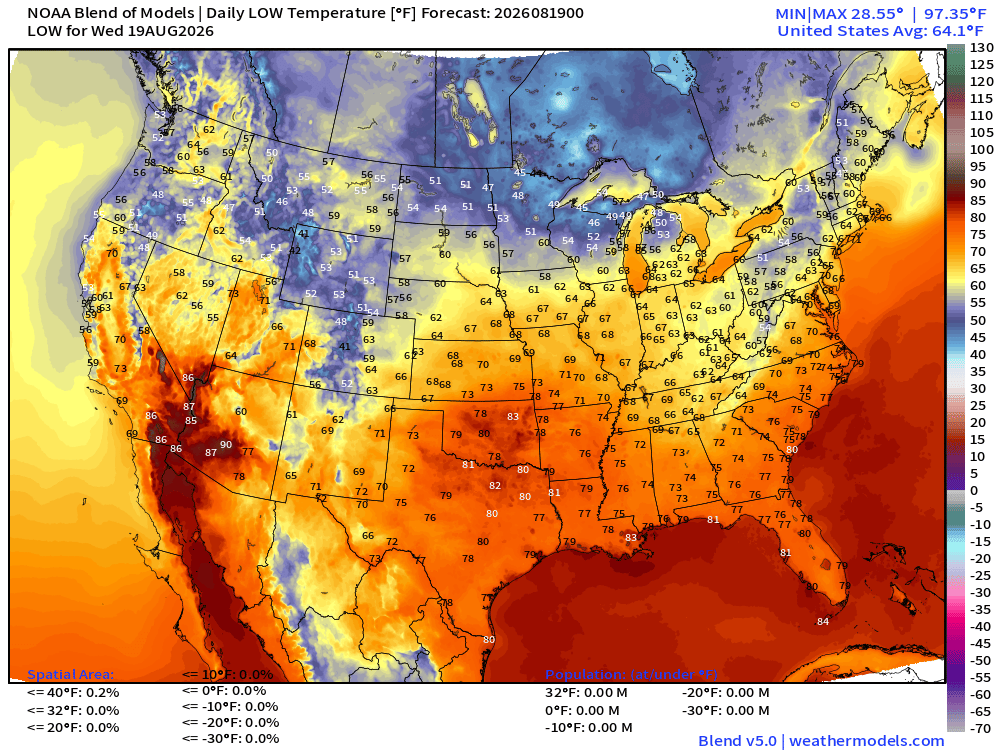
80s for lows in Oklahoma and North Texas including DFW
Wednesday’s High Temperatures
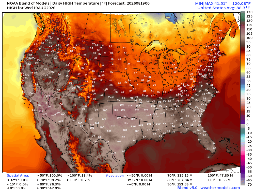
Widespread 90s and 100s from Texas into the Carolinas with 48 million population at least 100°F. 107°F+ in OKC and 105°F+ in Dallas - Fort Worth.
Thursday High Temperatures
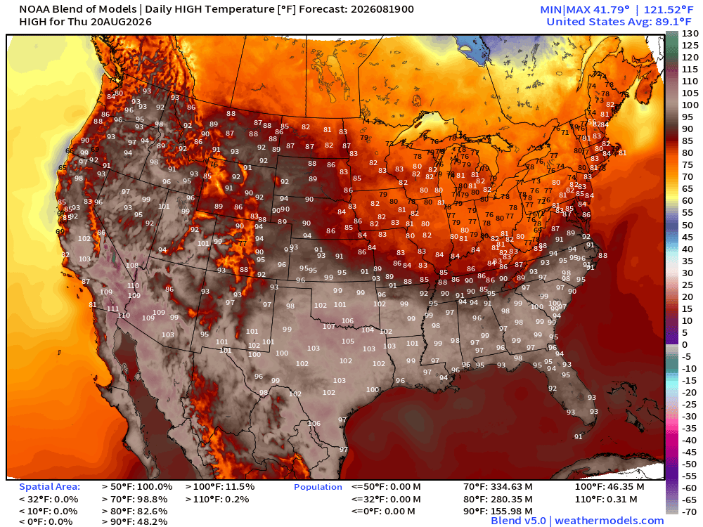
Similar heat dome coverage. Brutal along the Red River Valley in the mid-100s.
Blend of Models Precipitation Next 7-days
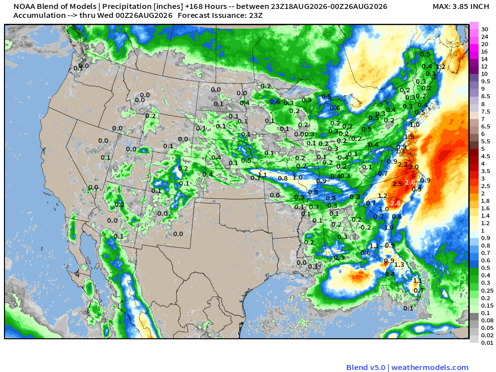
Texas looks still dry as a bone + Oklahoma. Not much western mountain monsoon moisture either. California is dry.
Tropical Spaghetti Next 15-days
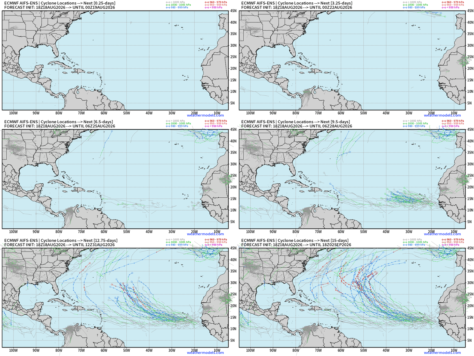
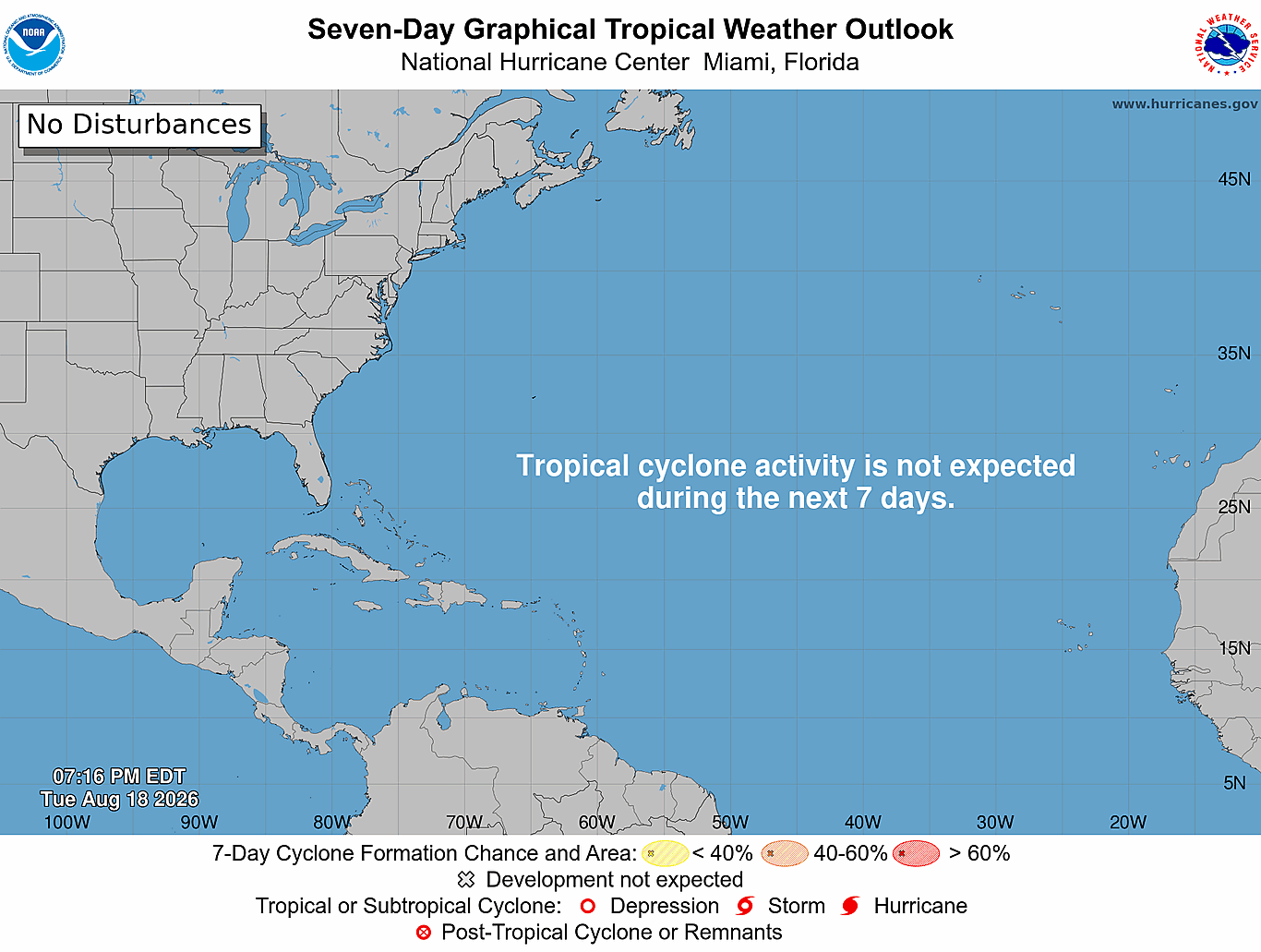
Nothing cooking for the next 7-days until a tropical wave exits Africa — then we might have a much better chance at a TS/Hurricane into end of August.
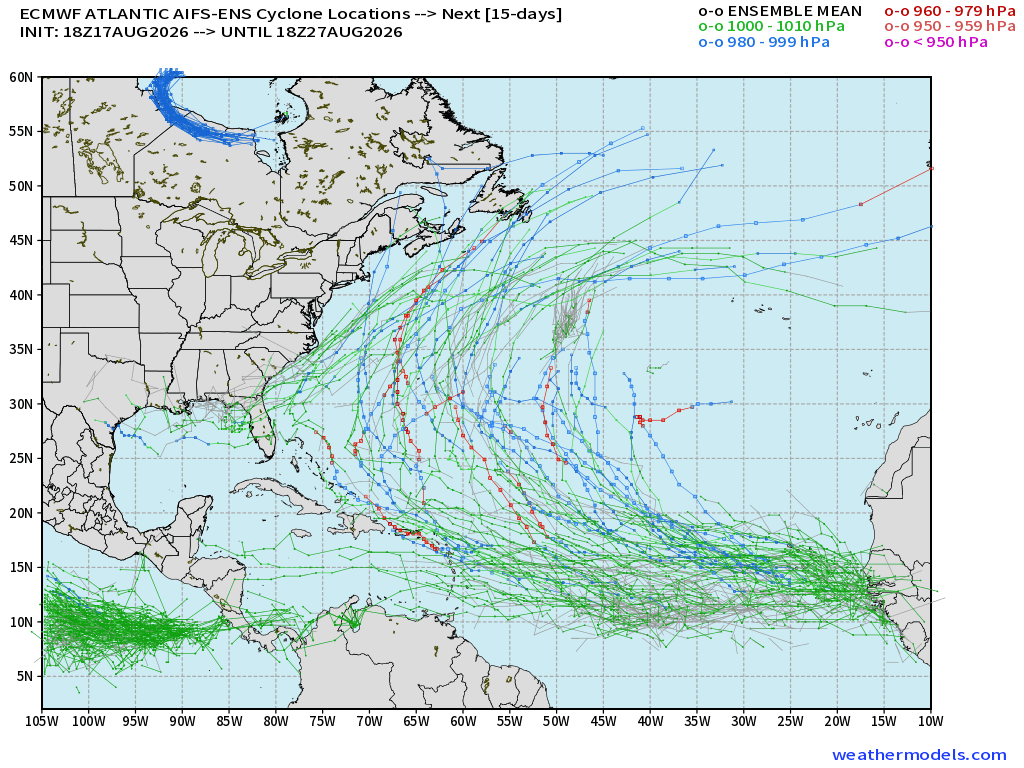
AIFS-ENS 18z does picks up a tropical wave in the MDR at Day 7 with the strongest signal for development into a TS/Hurricane
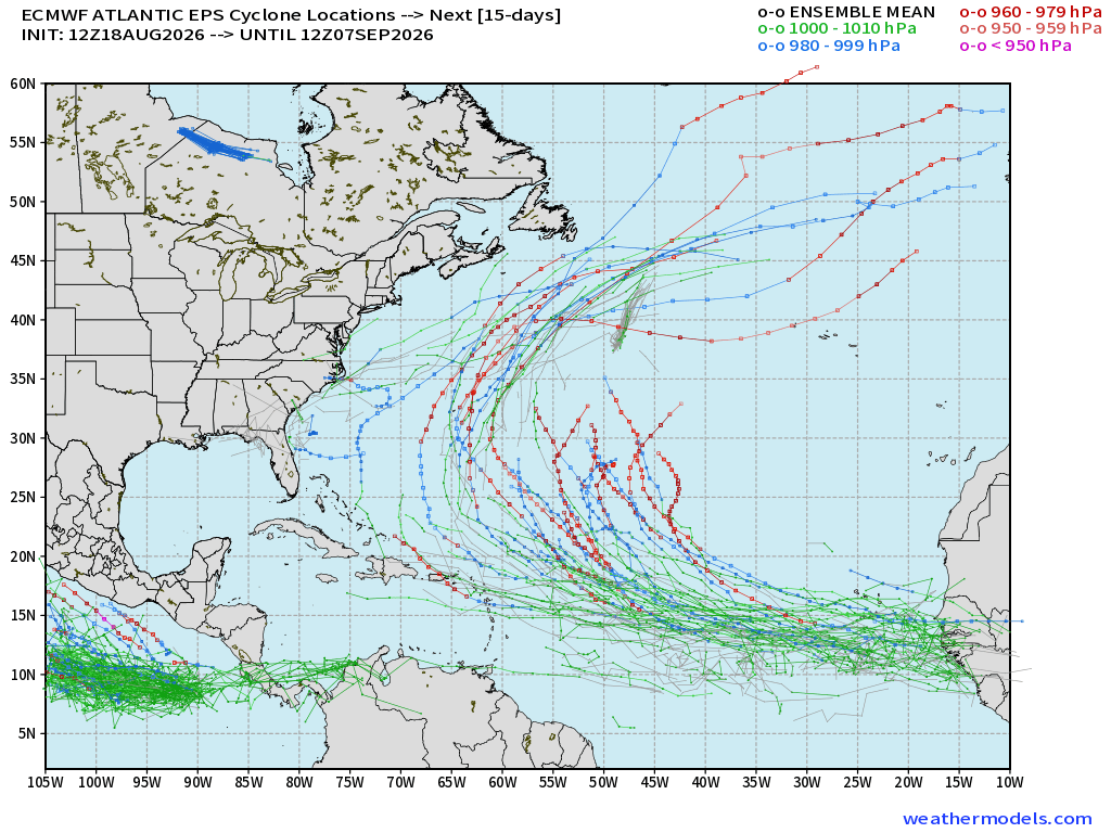
ECMWF Ensemble 12z full-physics active tracks next 15-days
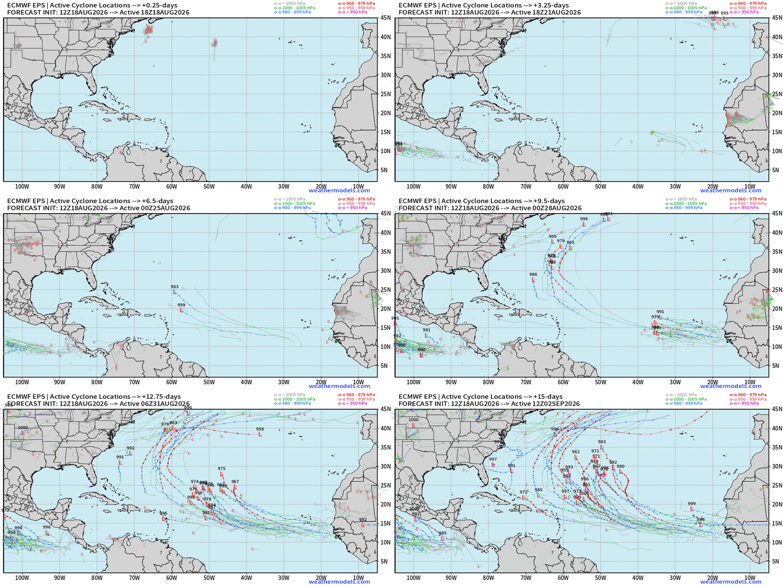
Looking at the full-physics gives another outlook —> and we see some many ensemble members with hurricanes out of the tropical wave in 7-10 days with more favorable environment in the Western Subtropical Atlantic — out to sea. EPS 12z also has the tropical wave off Africa in 8-9-days.
Tough Sledding for Tropical Waves — not enough firepower (convection) to overcome the wind shear and Saharan Air Layers + Dust
Ghost Town for the next 7-days
ECMWF HRES | Precipitable Water | Atlantic Tropics Next 6-days
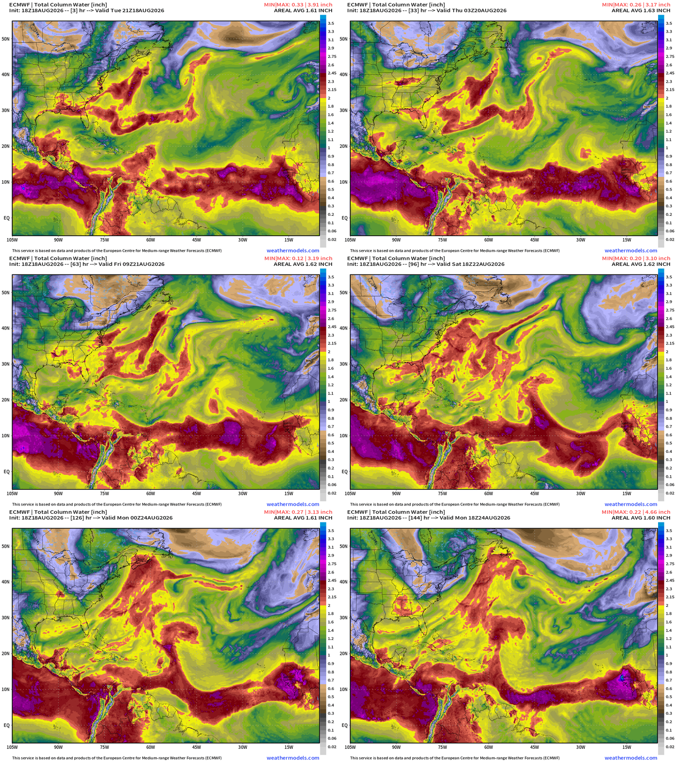
The Tropical Waves are going to be wiped out by a Saharan Air Layer — you can see the front of the warm/dusty air wipe out the MDR into early next week.
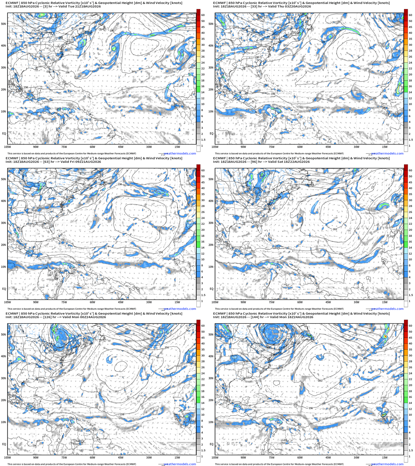
Cyclonic vorticity doesn’t show much of anything … except for a tropical wave coming off Africa in 6-days.
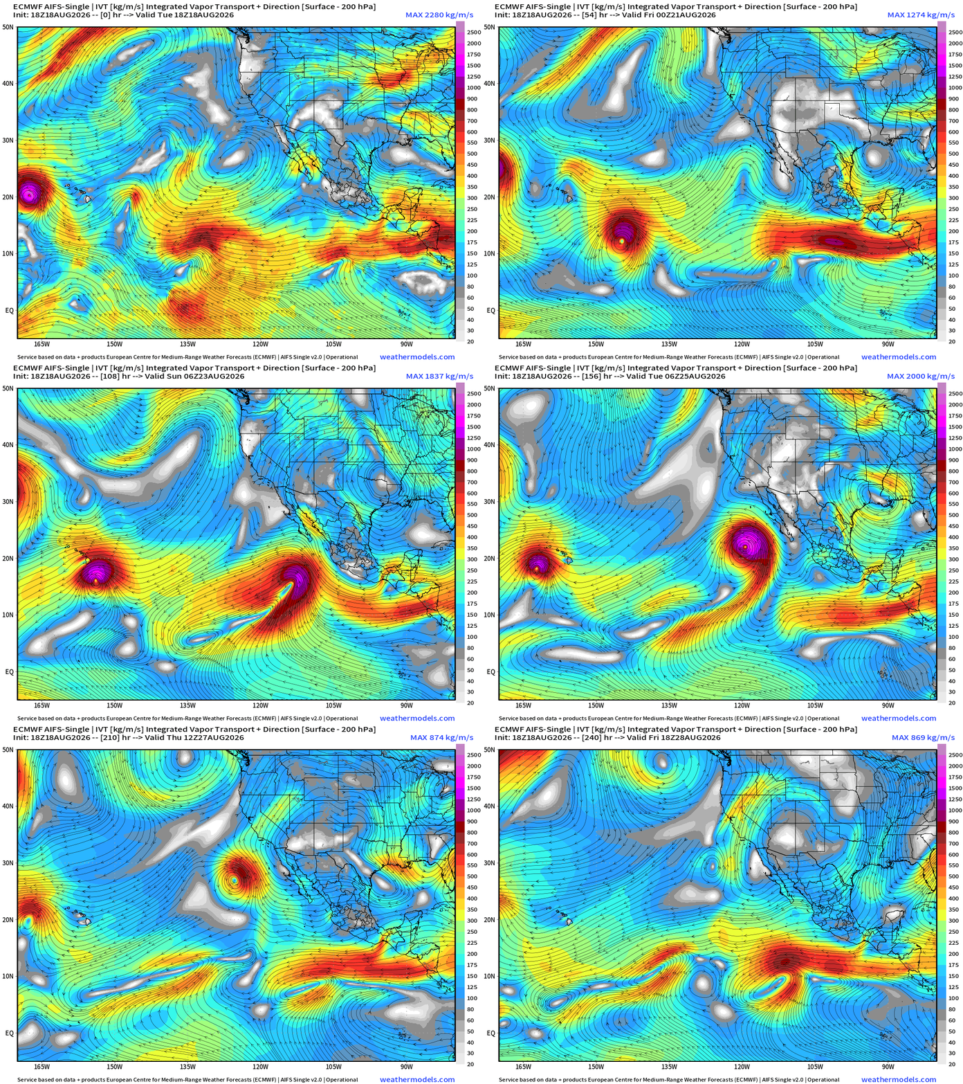
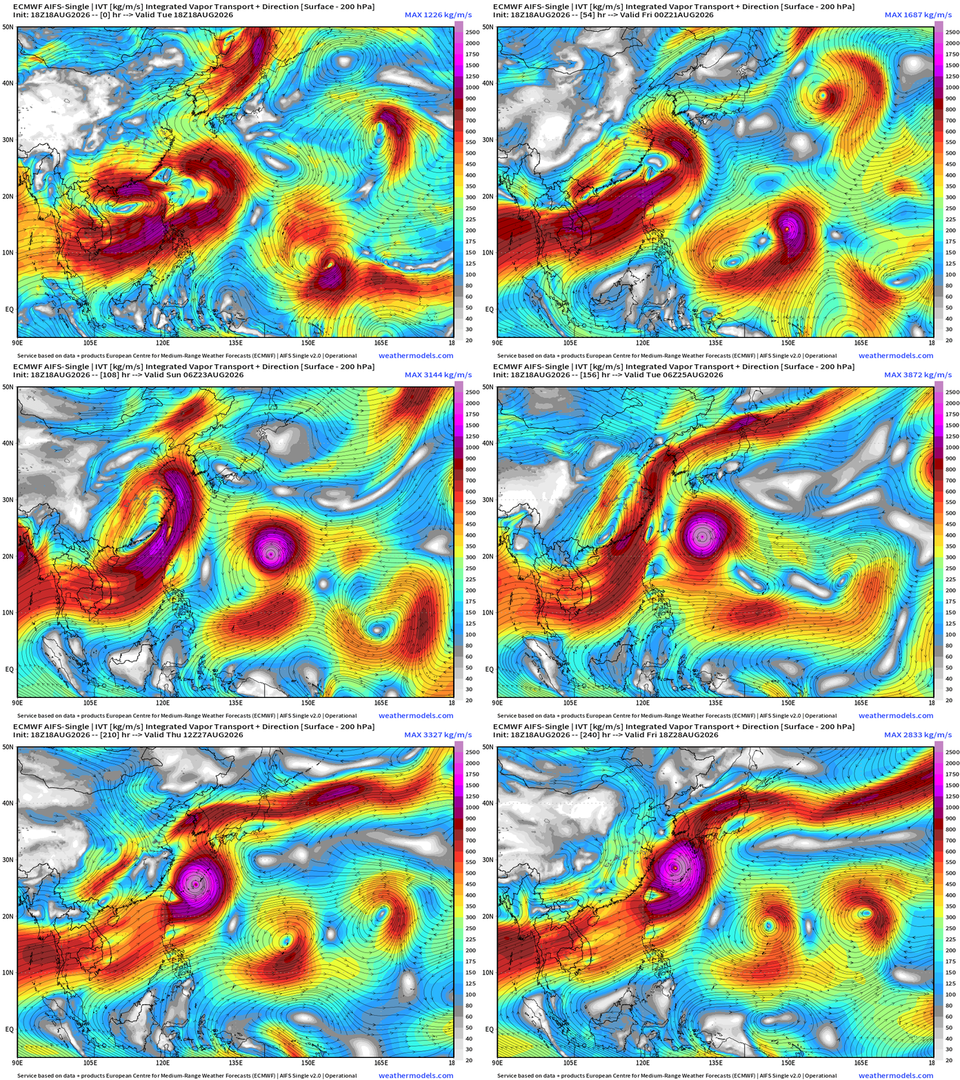
Flagship model: ECMWF AIFS 18z —> Integrated Vapor Transport next 10-days
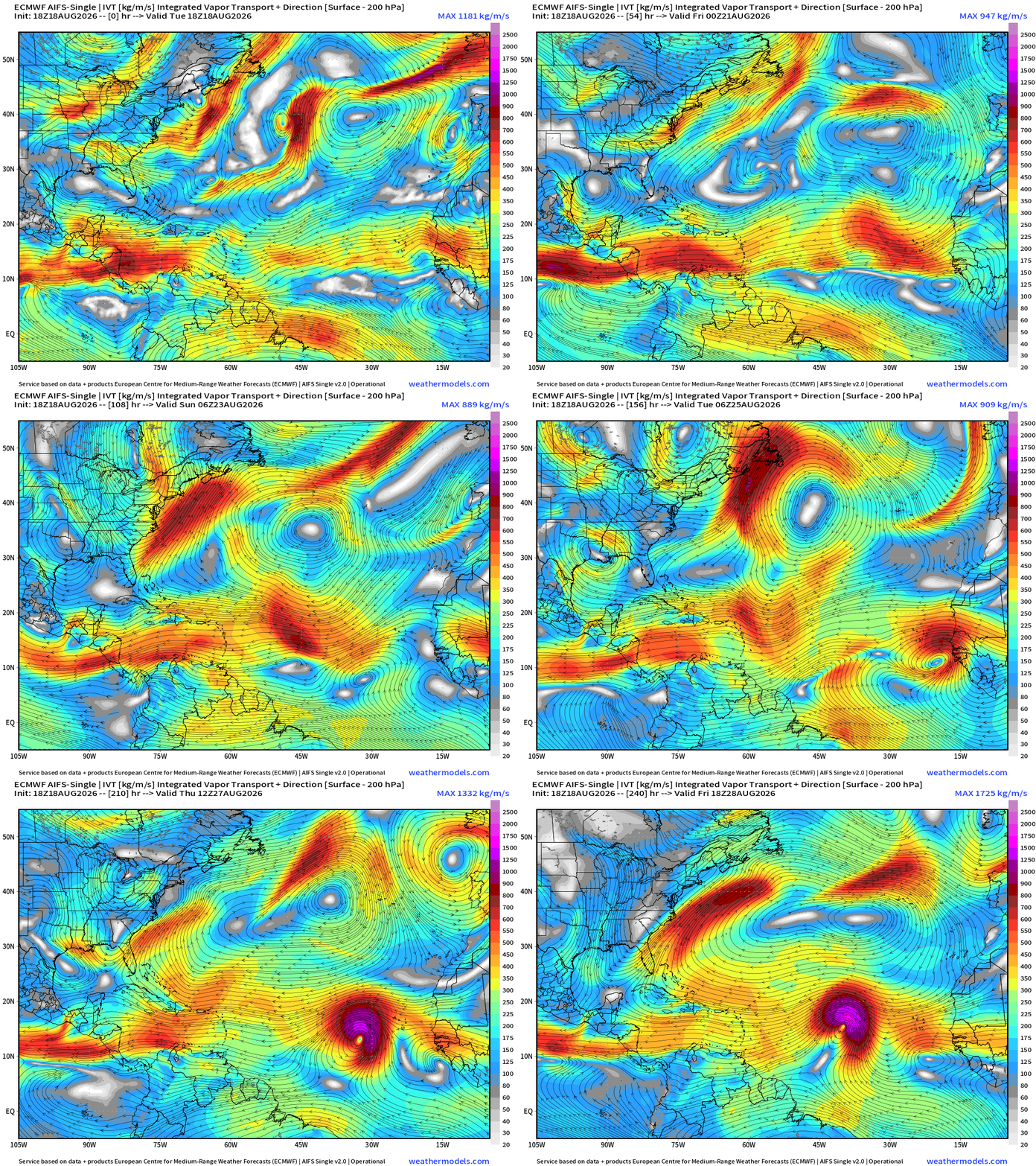
AIFS-Single 18z quite interested in a tropical wave into Days 7-8 (Aug 25-26) coming off Africa. That is definitely a hurricane.
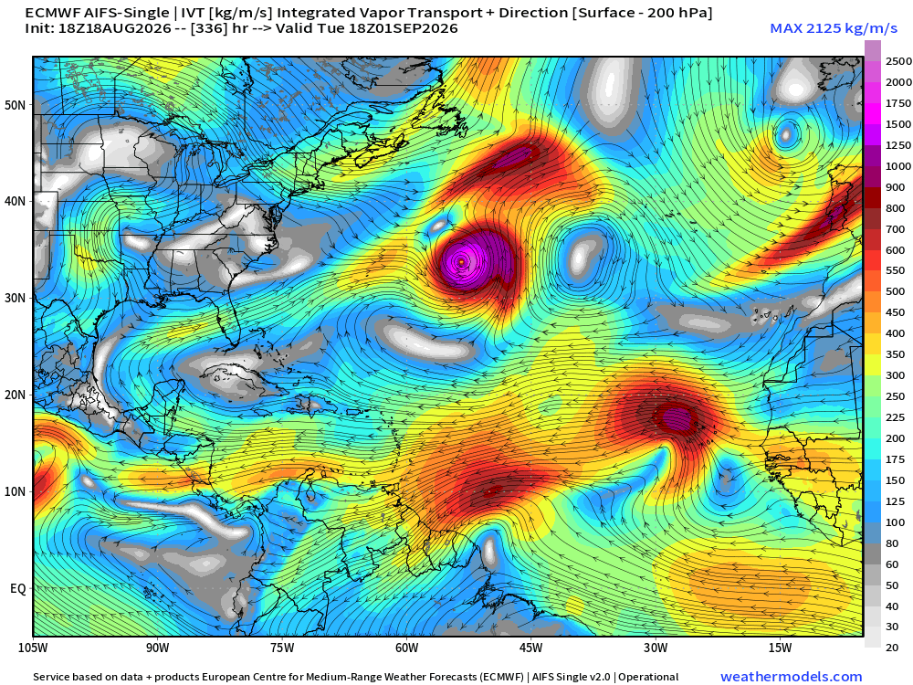
Where does it go in 14-days? Out to sea — perhaps a major hurricane, with another robust tropical wave following.
Atlantic Tropics | Ghost Town for next 7-days
Atlantic tropics very dry without rain/convection —> Dead
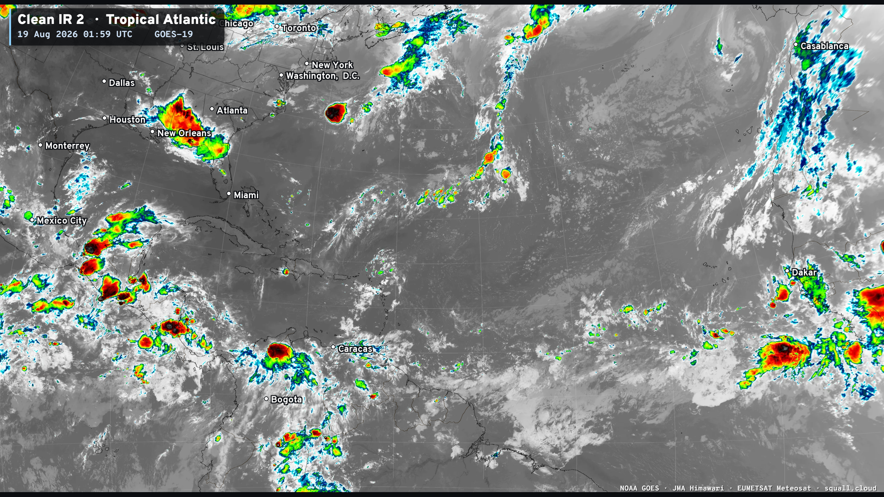
You can see more Satellite Imagery like this at Squall Cloud —> LINK
Tropical Waves
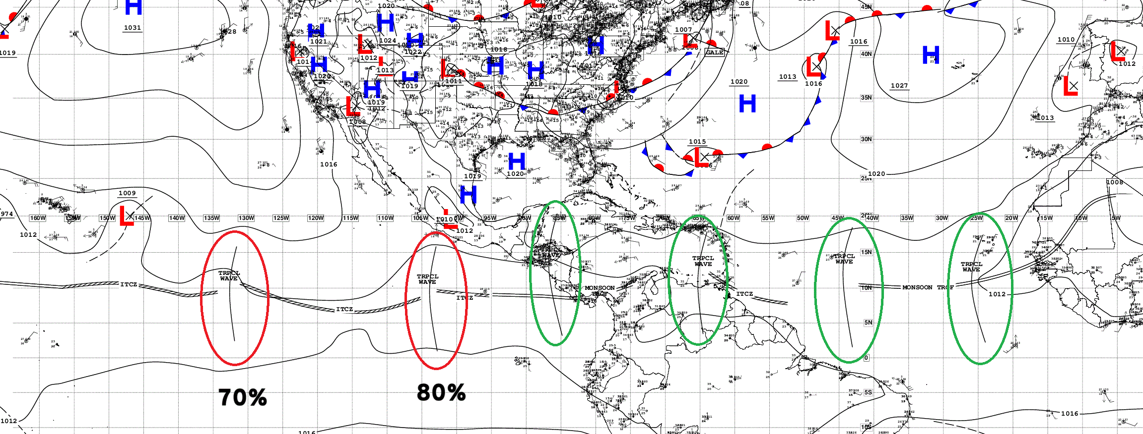
Multiple Atlantic tropical waves but all are barely functioning with limited or no convection.
Sea Surface Temperatures plenty warm now > 28°C (red)
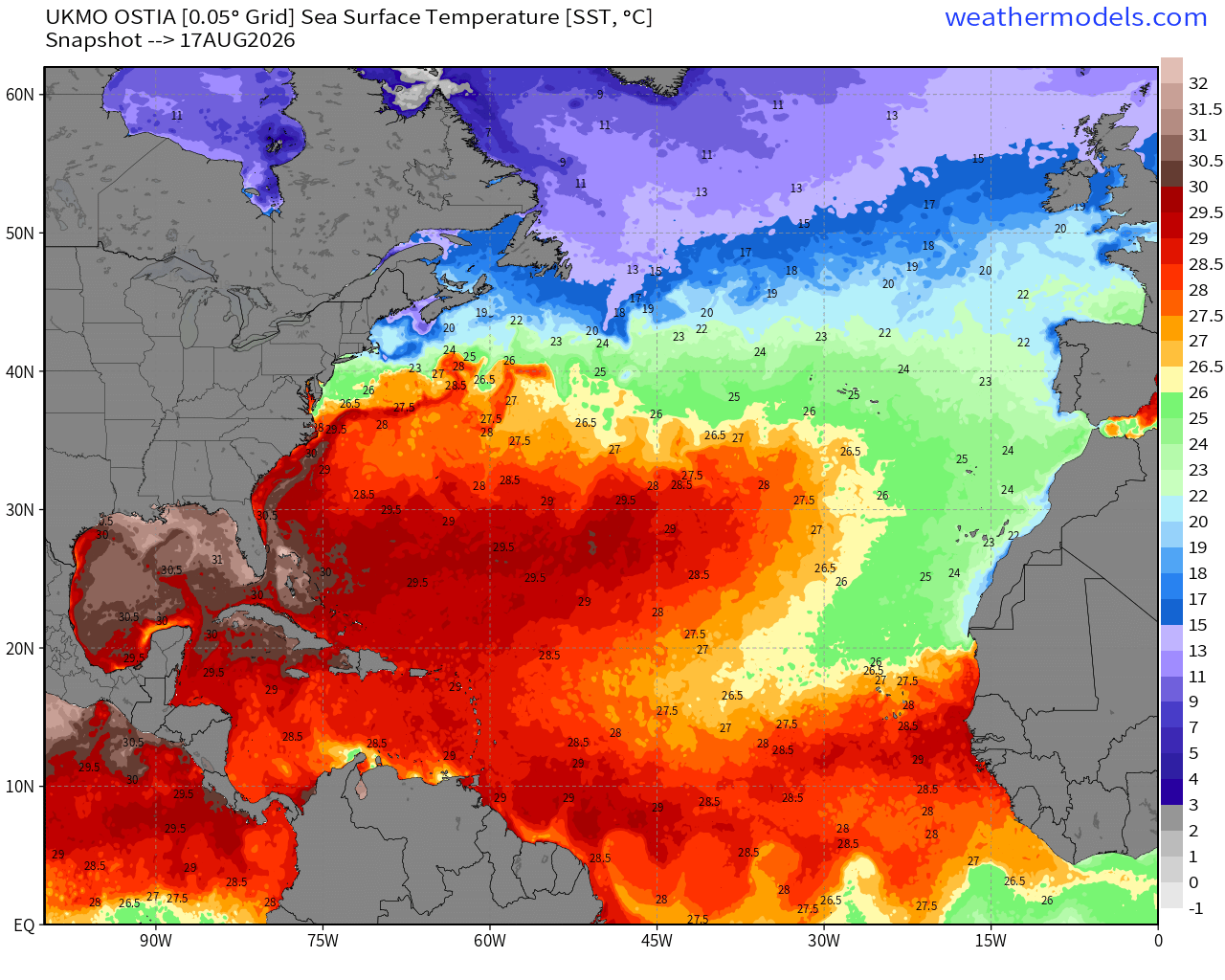
The warmth in the MDR is quickly expanding to carve into the cool <26°C water from the cold Canary Current, so I think any tropical waves that stay below 20°N latitude will have sufficient warm water to develop.
NASA Dust (GEOS-5) — Saharan Air Layers continue to cruise across the Atlantic doing damage to tropical waves and stabilizing the tropical environment with warmth at lower levels.
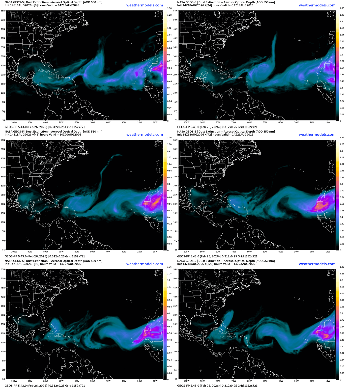
Still another large sandstorm over NW Africa that might or might not cut loose into the Atlantic. The intensity of the SAL + dust should markedly decrease heading into late August, but who knows with the El Niño.
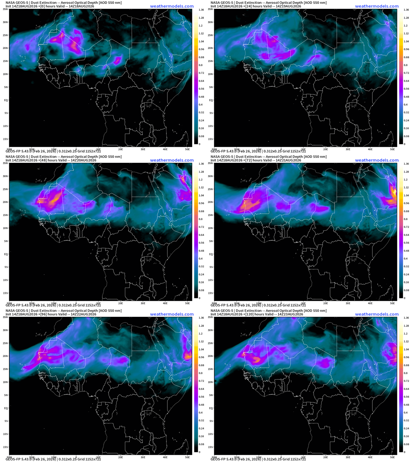
Tropical Equatorial Africa — still several more waves to come! Huge ones!
Cool to see them lined up in sequence and firing huge convective blowups.
Eastern and Central Pacific Hurricane Basin
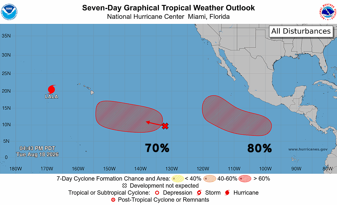
Two areas of interest + Huricane Lala.
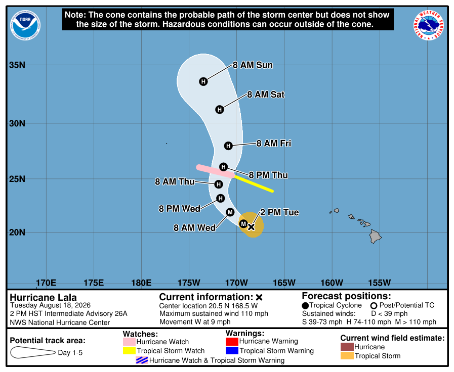
Next name in the Central Pacific is Moke — and that’s the 70% area
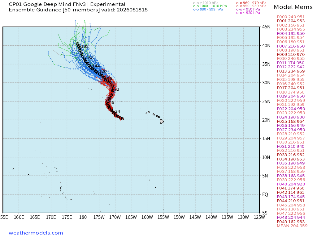
Moke may take a similar course as Lala previously.
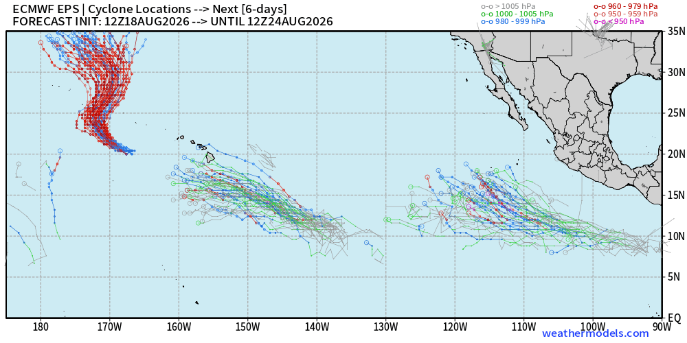
The other system will become TS/Hurricane Iselle.
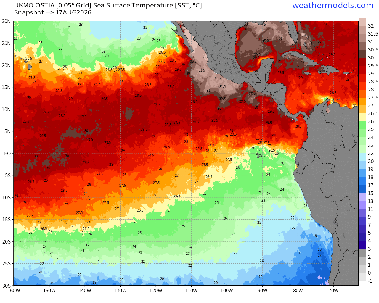
Very warm SST near the coast of Mexico > 31°C
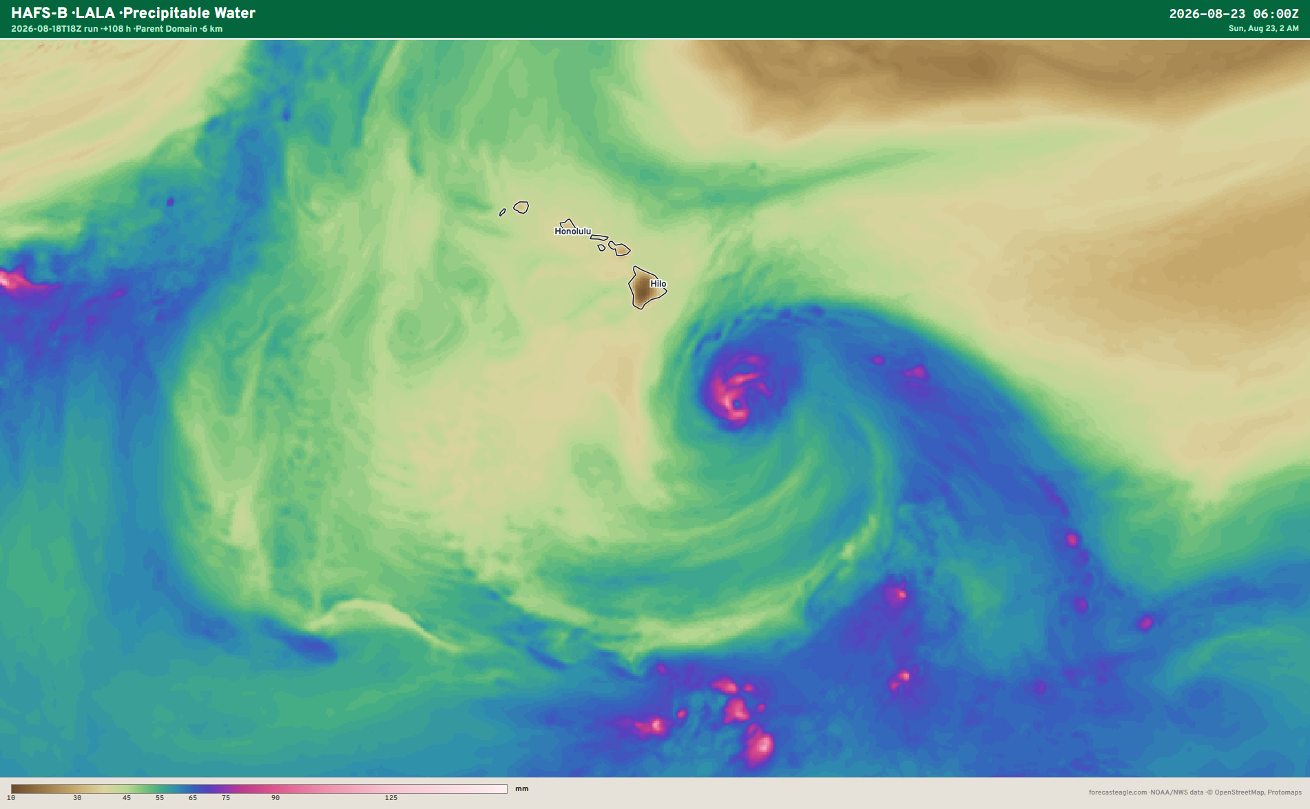
Hurricane Lala is putting on a show in the Central Pacific — Category 4 on satellite! T 6.3 —> 125-knots
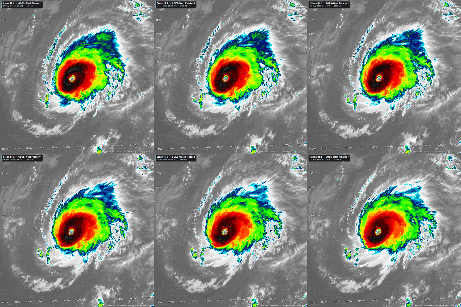
Track is NW and then a turn to the north, plenty of time to keep intensifying to 130-knots, or so.
Western Pacific Typhoon Basin
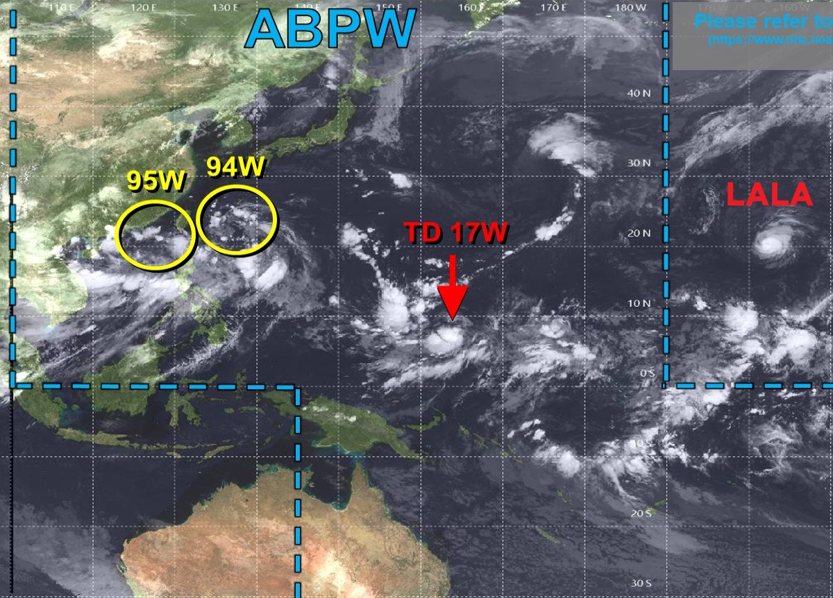
Soon to be named Tropical Storm Saudel (17W)
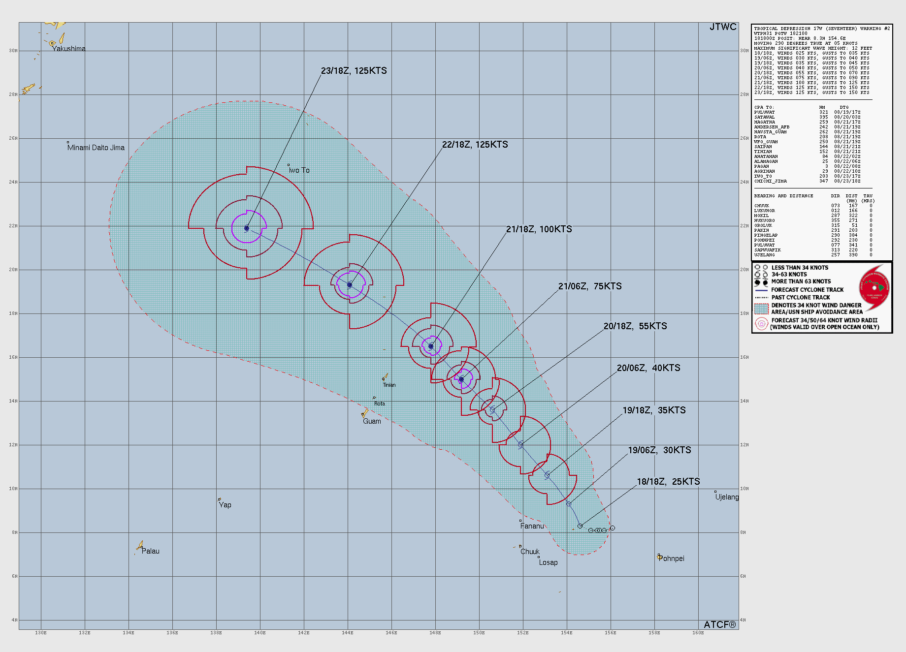
Will track to area south of Japan in the next 7-8 days, and could become very intense e.g. Category 5.
Integrated Vapor Transport from ECMWF AIFS 18z
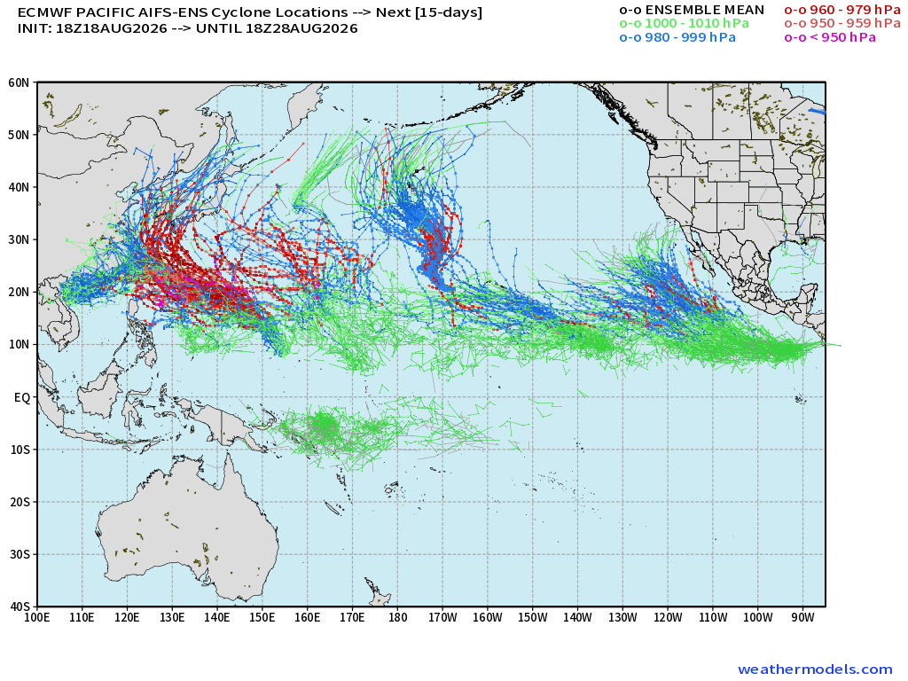
Our next typhoon is developing and we may have the entire Pacific basin really lit up with multiple long-track, intense Typhoons or Hurricanes over next 15-days: AIFS-ENS18z tracks
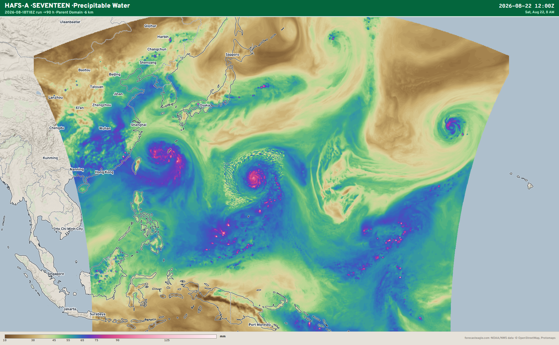
Thank you for reading my newsletter. Here’s a little HAFS hurricane model viewer that’s under construction, my favorite parameter PWAT for 17W.
Global Tropical Cyclones for more ACE information, as well as my original climatlas.com/tropical site now with the beautiful Interstate Highway theme and full of interesting content!
Forecast Eagle maps explorer under construction.

Also, Forecast Canada with some beautiful Arctic views.

Satellite imagery from Squall Cloud.
Maps sourced from weathermodels.com designed and innovated by yours truly! Please subscribe there for real-time access to the newest maps, charts from all of the weather models including ECMWF and AIFS, and NOAA GFS/GEFS, HRRR/RRFS and Blend of Models (NBM). NOAA WPC and SPC for fronts/convective outlooks. Our own content is now sourced from hottestsince.com and weather.city and celsius.earth, and squall.cloud and weather.football and global-tropical-cyclones.com and precipitation.earth
My Atlantic Hurricane Season Forecast (2026)
From April 7, 2026: Atlantic Seasonal Hurricane Forecast: (11/5/2)
9-13 Named Storms (11 most likely)
4-7 Hurricanes (5 or 6 most likely)
1-3 Major Hurricanes (2 most likely)
Accumulated Cyclone Energy: 75-85 (well below normal)
NOAA 2026 Atlantic Hurricane Season Forecast
- Milepost
- 1010 · laid 2026-08-19T02:38:43.989000Z
- Source
- https://weather.substack.com/p/august-18-2026-tuesday-tropical-update
- Digest
- 5aaeaac30958440b9775824a623f914b7a78dc4d7dcd594570576b859e0105b6
- Machine
- JSON