June 4, 2026 Thursday Tropical Update
Watching Caribbean and Gulf for tropical storm development later next week
June 2026 was the 18th-warmest June in the 132-year national record (1895–2026), at 70.6°F against a 1991–2020 normal of 69.5°F (+1.2°F).
June 2026 was the 32nd-wettest June in the 132-year national record (1895–2026), at 3.3in against a 1991–2020 normal of 3.1in (+0.2in).
NOAA/NCEI Climate at a Glance, contiguous United States. This is the observed record for the month, not a score of anything said in this piece — the forecast ledger begins 2026-08-17 and cannot reach earlier posts.

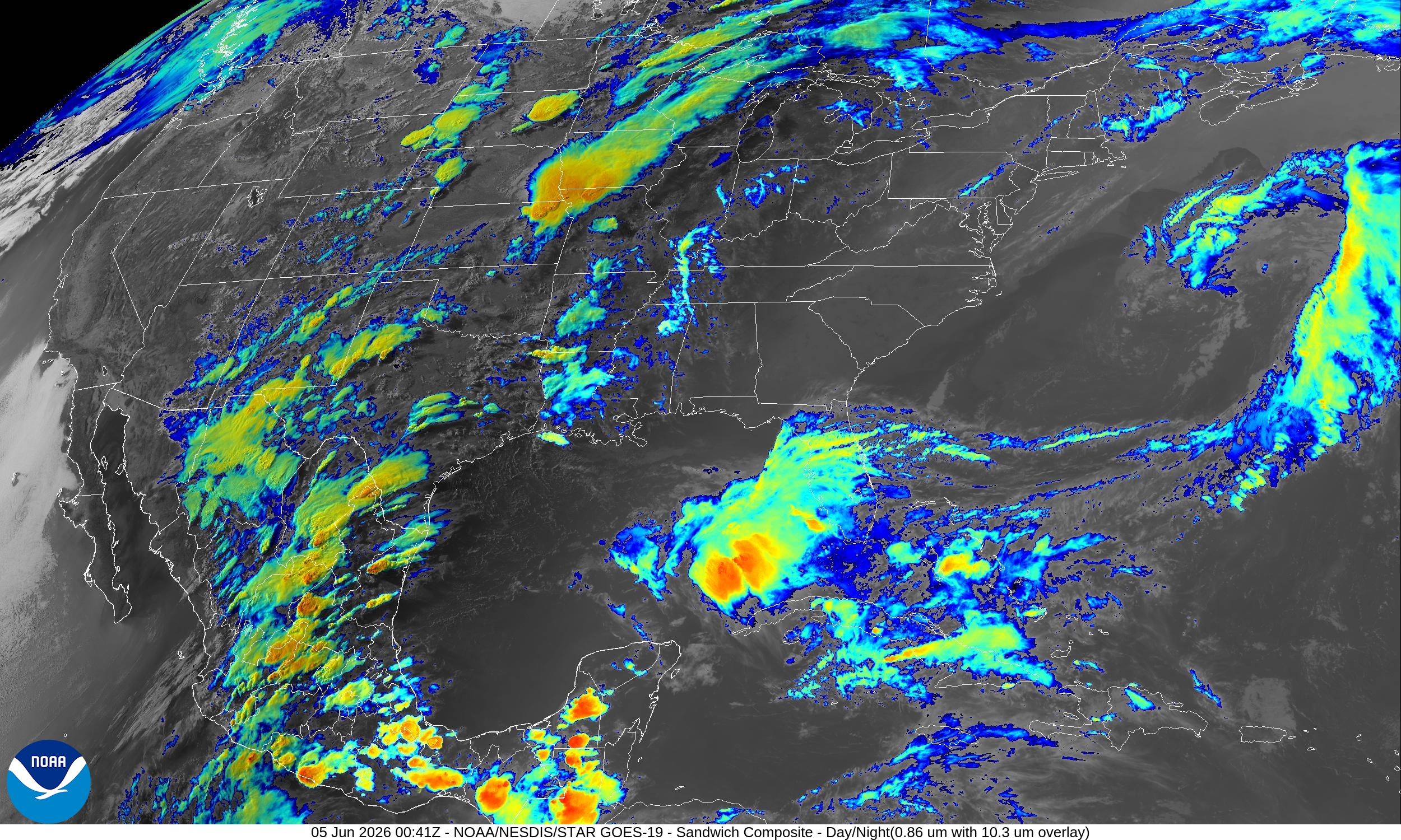
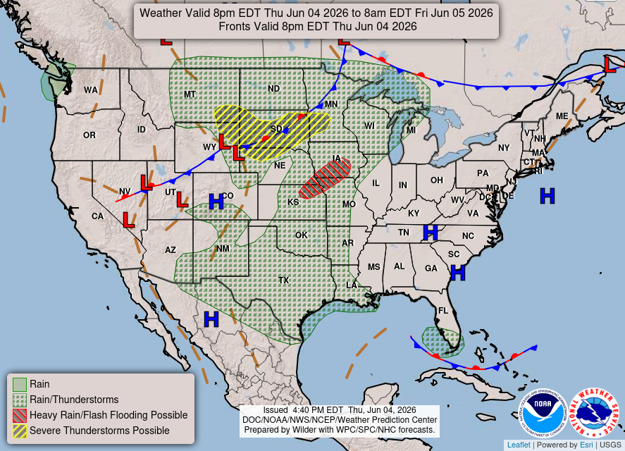
Not expecting any tropical system out of the convection in the Gulf, just a rainmaker for TX/LA. Monsoon showers firing up in Mexico with moisture surging northward between two troughs — a strong one digging into Baja California, and …
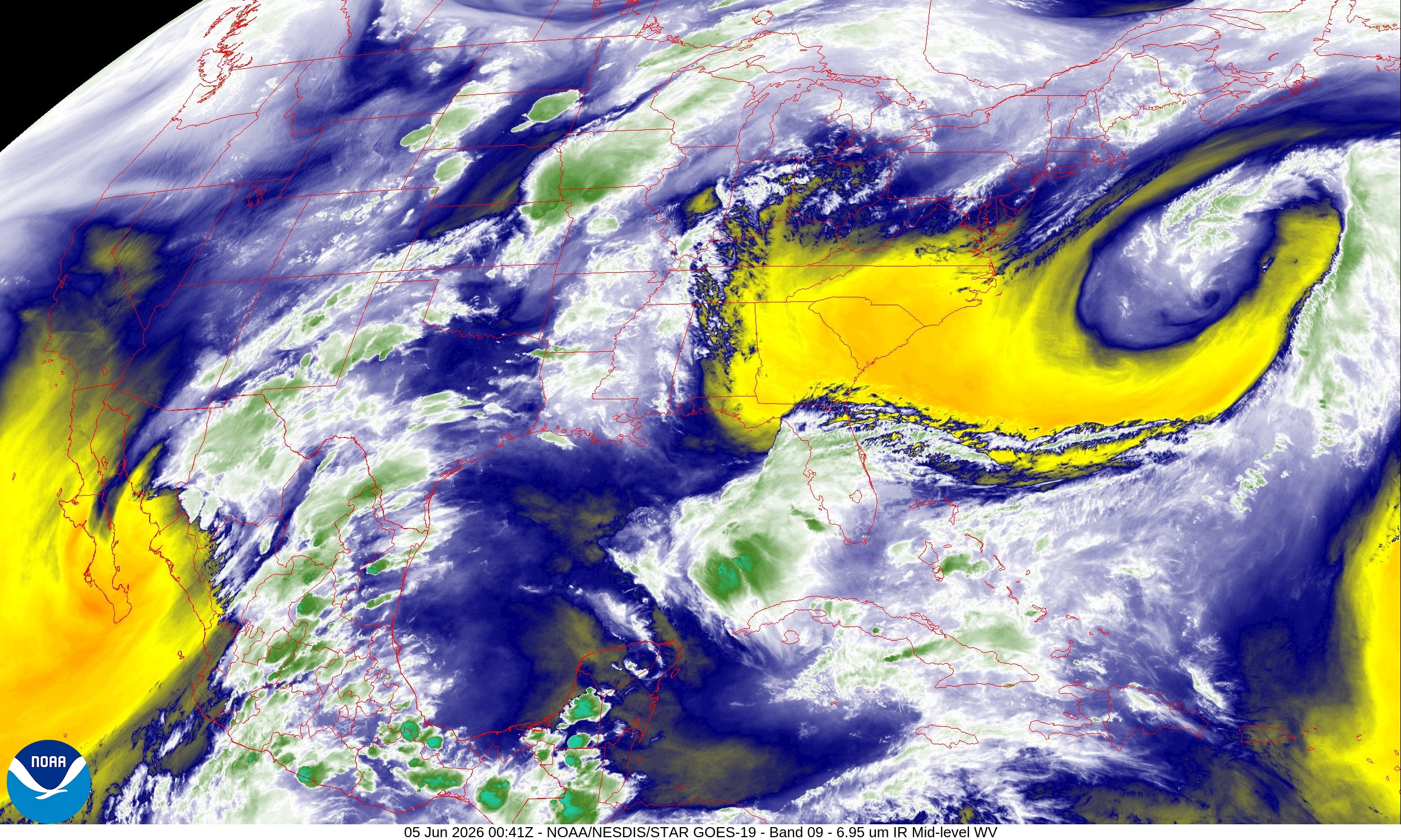
… another massive trough off the East Coast of the United States with bone dry air dipping through Georgia into North Florida.
Weather Headlines for Thursday
Eastern Pacific Amanda is a minimal tropical storm, and not expected to intensify further while meandering well away from land. 2 more storms on the way near Mexico and Central America coast (80% and 70% chance from NHC)
Atlantic: Weak, disorganized system in the Gulf into weekend mainly a rainmaker. Long-range (8-10 days, at least) eyeballs on whatever happens in the Eastern Pacific to move over Central America, and enter the Gulf of Mexico. —> Central American Gyre Circulation. Probability of a TS/Hurricane is STILL better than 50% through 15-days.
Western Pacific: no activity expected in next 5-7 days
ECMWF Flagship Ensemble Cyclone Tracks (12z)
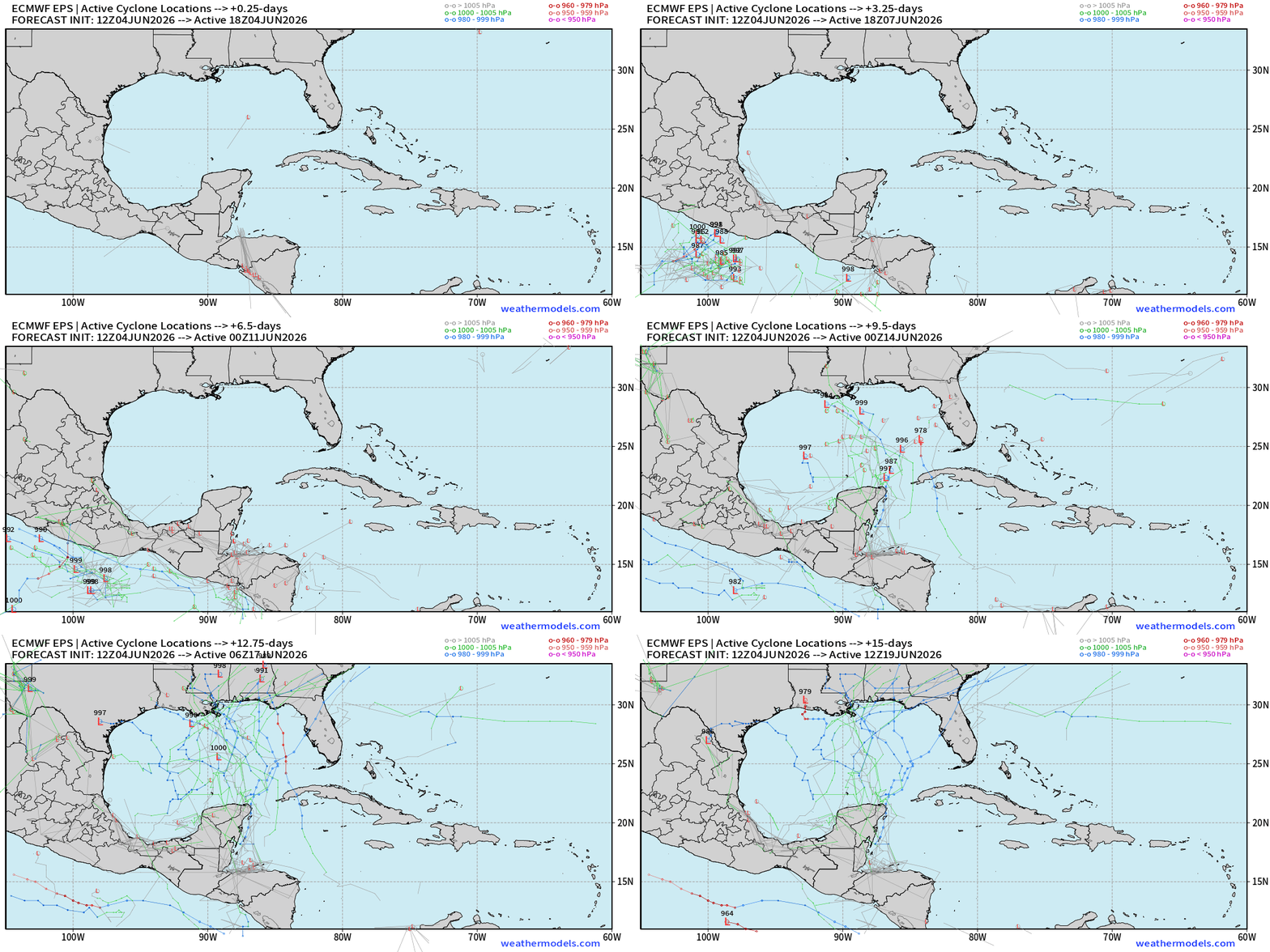
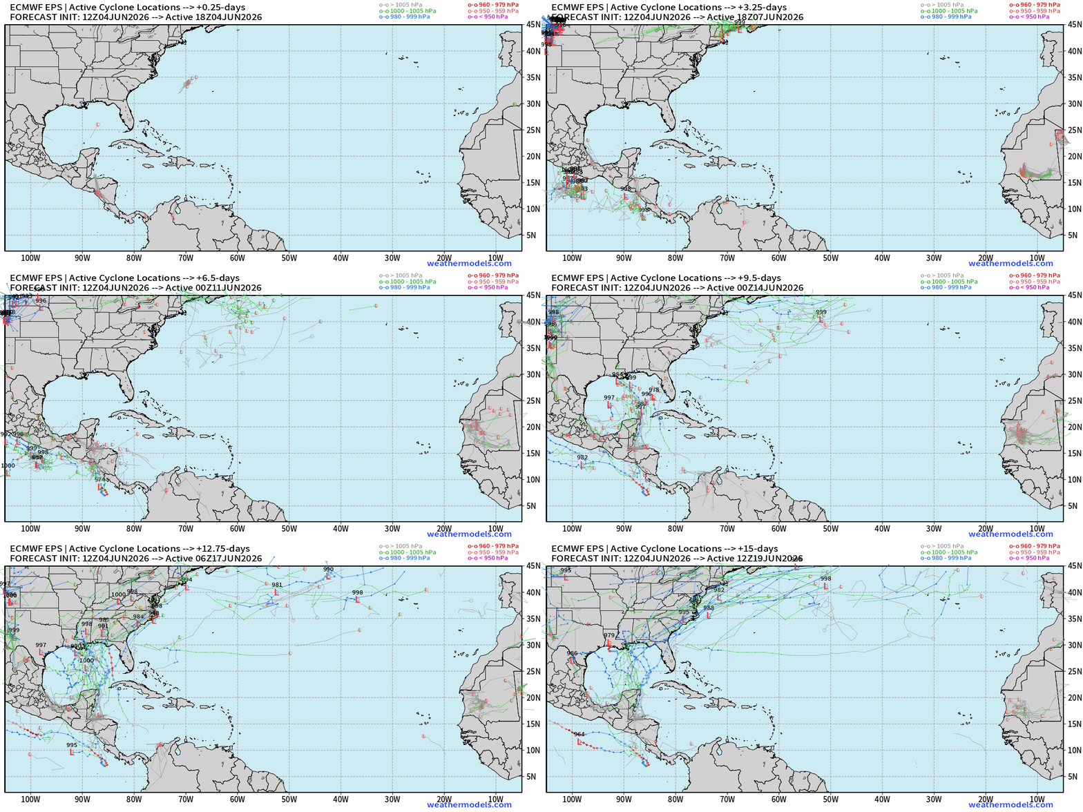
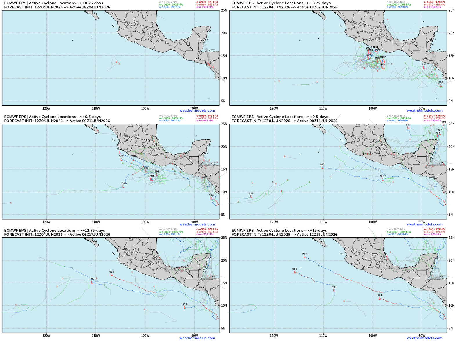
50-ensembles or realizations of the next 15-day forecast of sea level pressure (L’s) tracked … and then plotted on top of each other.
Later next week, we’re watching the Gulf of Mexico for medium chance of TS/Hurricane activity out of a large circulation/ gyre centered over Mexico + Central America that will spawn 2 Eastern Pacific tropical cyclones.
The remnants of an EPAC storm could cross into the Gulf. Still pegging June 15th (+12 days) signal for a TS/Hurricane in the Gulf > 50%. The overall environment will be hostile with strong wind shear (typical for mid-June) so we may looking at a fast-moving, asymmetric system.
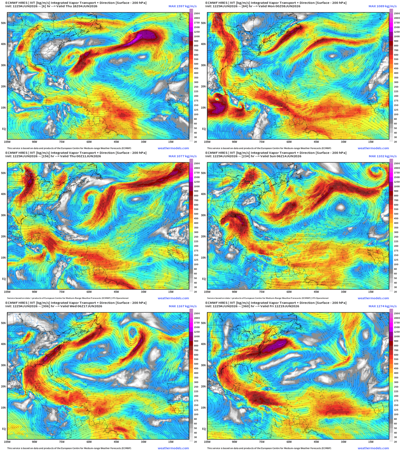
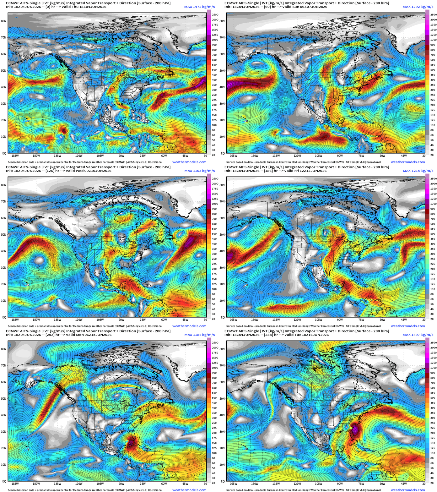
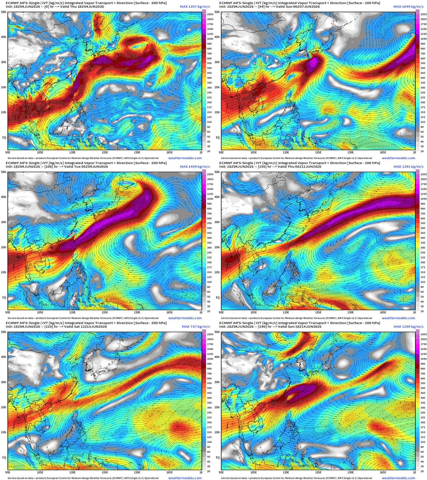
One scenario: ECMWF HRES 12z —> Integrated Vapor Transport
Watch the large scale flow with the Central American Gyre pick up the remnants of an Eastern Pacific tropical storm into the Gulf … and then the very strong Caribbean —> Gulf of Mexico moisture plume resumes around the westward extension of the Bermuda High. We’ll be watching this pattern for the next 2-weeks, of course.
Weather Patterns | Thursday Evening
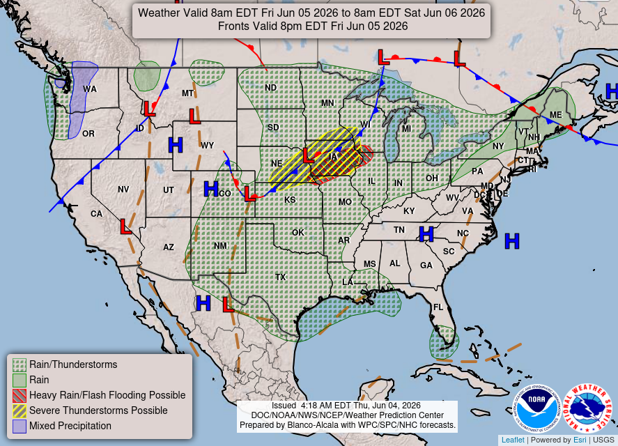
Weather Patterns | Friday
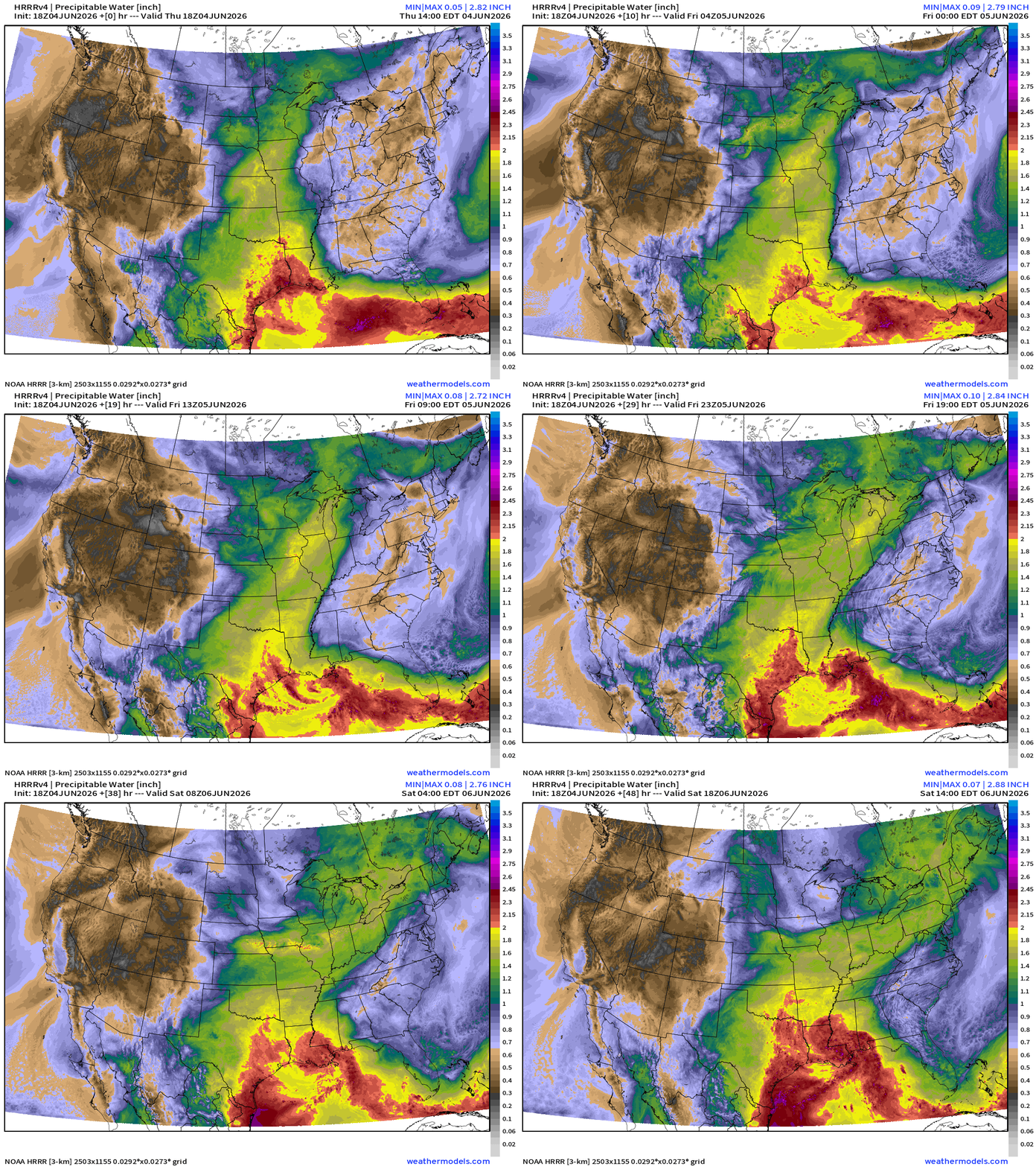
ECMWF 18z | Precipitable Water | My Favorite Parameter
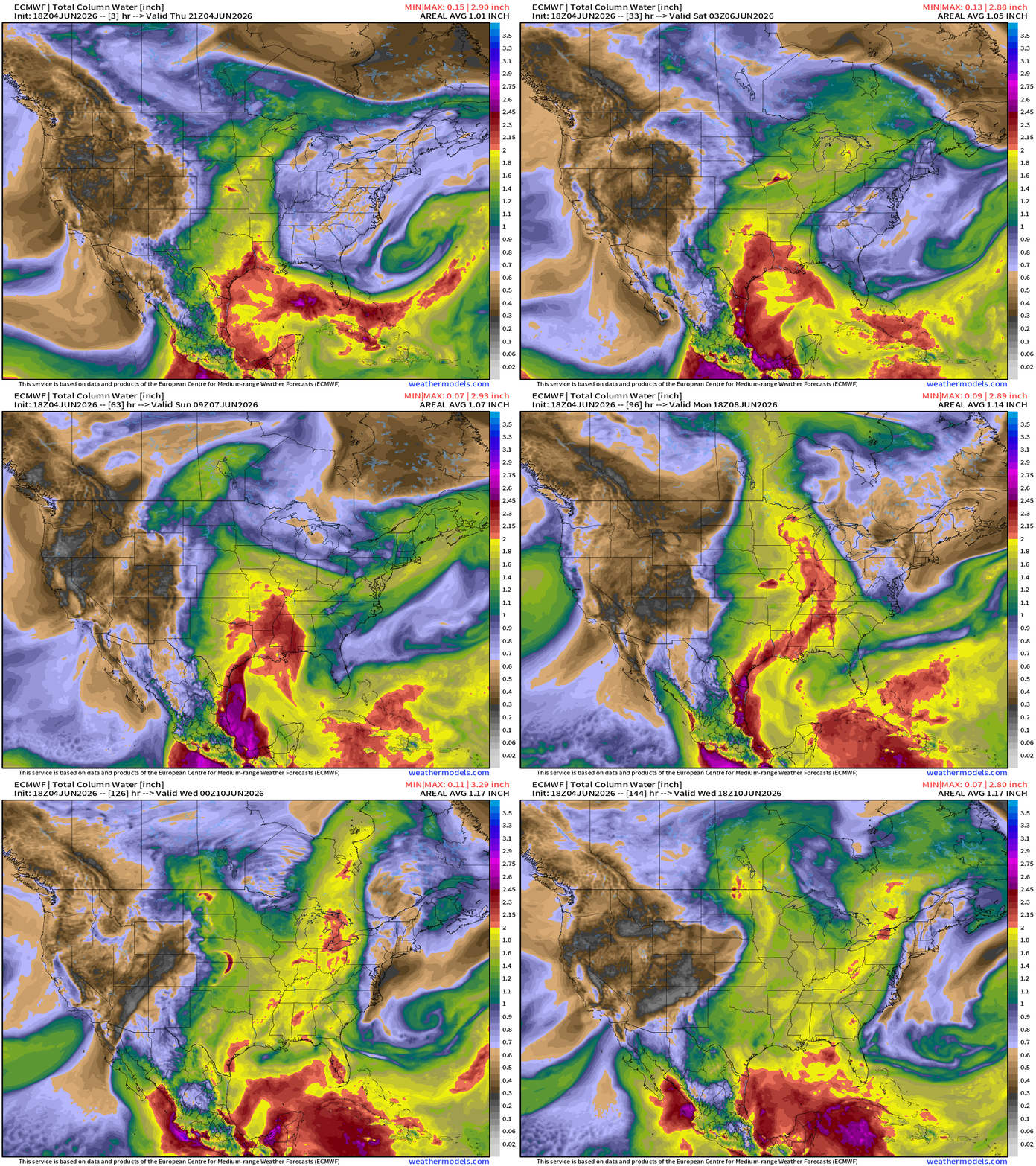
Quite the moisture surge northward with the assistance of the two mid-level troughs!
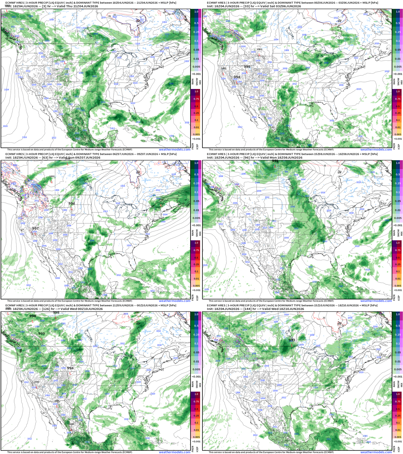
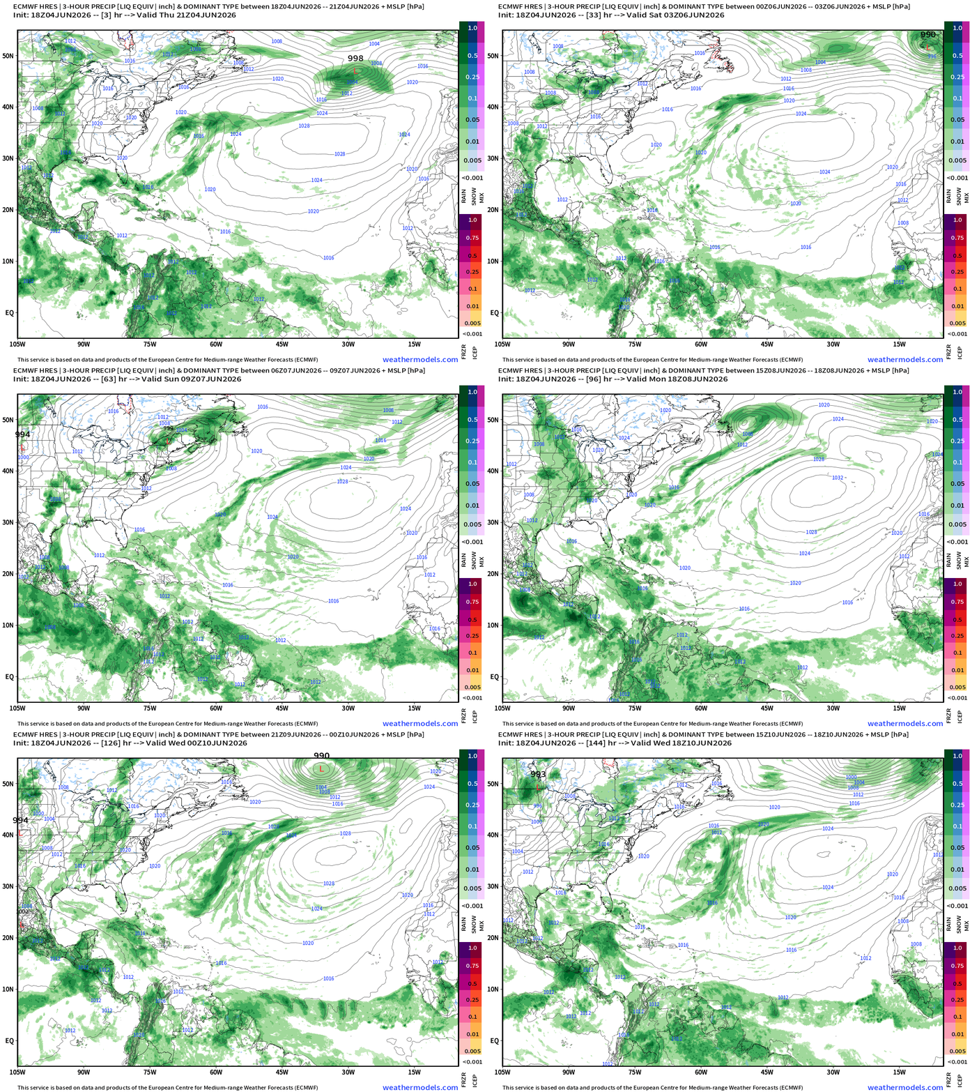
ECMWF 18z | Precipitation Type + MSLP | Next 6-days
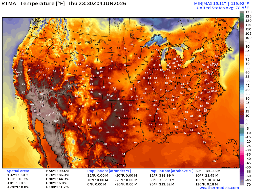
Current Temperatures | RTMA | 7:30 PM ET
Current Temperature Anomaly | RTMA | 7:30 PM ET
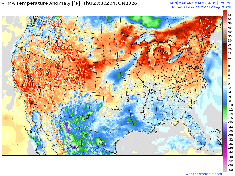
Lower 48 was 2.7°F above normal
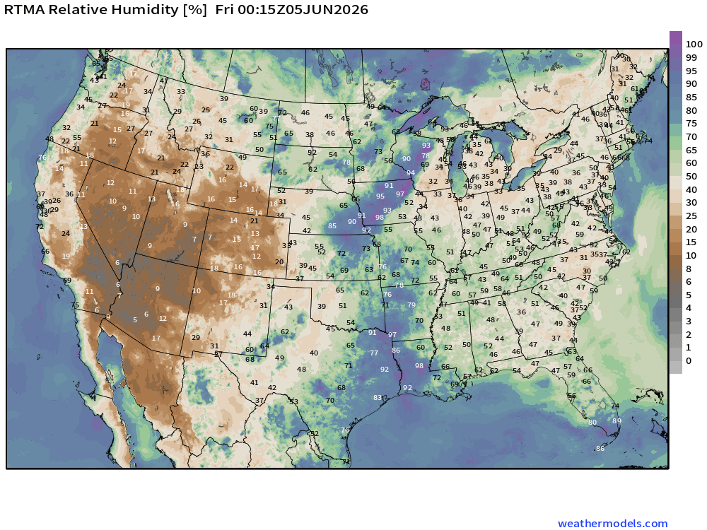
Relative Humidity —> Bone Dry out West, and also rather dry across the entire Eastern U.S.
High Temperatures Next 8-Days —> Saturday June 13th.
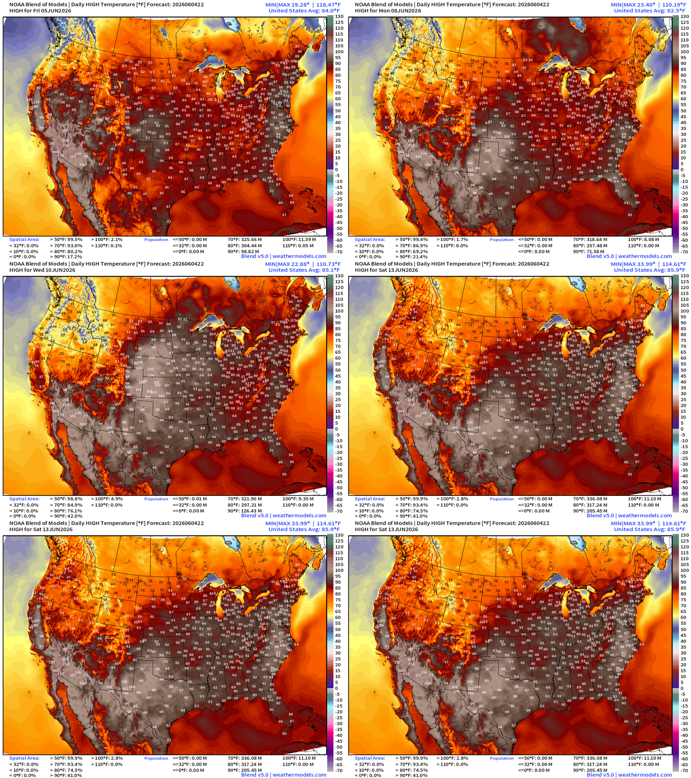
A lot more 90s building with 225 million population by next Friday
100s in the Plains mid-week
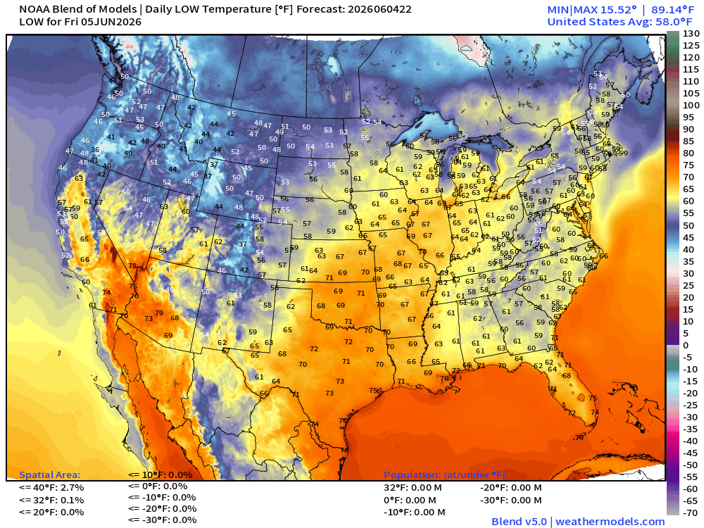
Low Temperatures Friday Morning
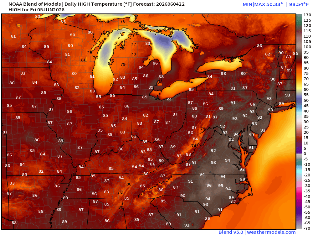
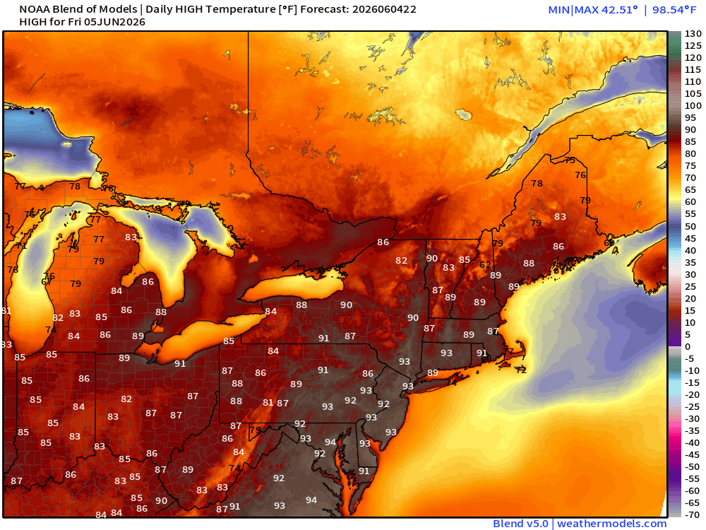
High Temperatures on Friday
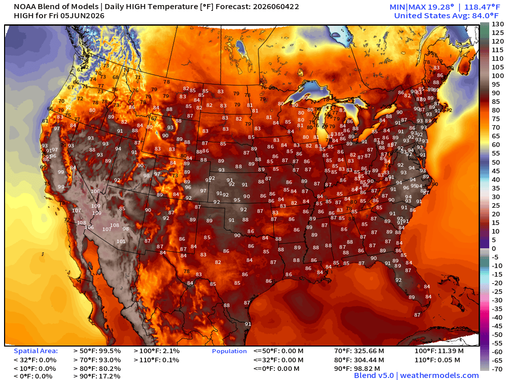
Almost 100 million at least 90°F … and 304 million at least 80°F, so that’s 90% of folks in the Lower 48
Upper-Level Height Anomaly | AIFS-Single Next 10-days
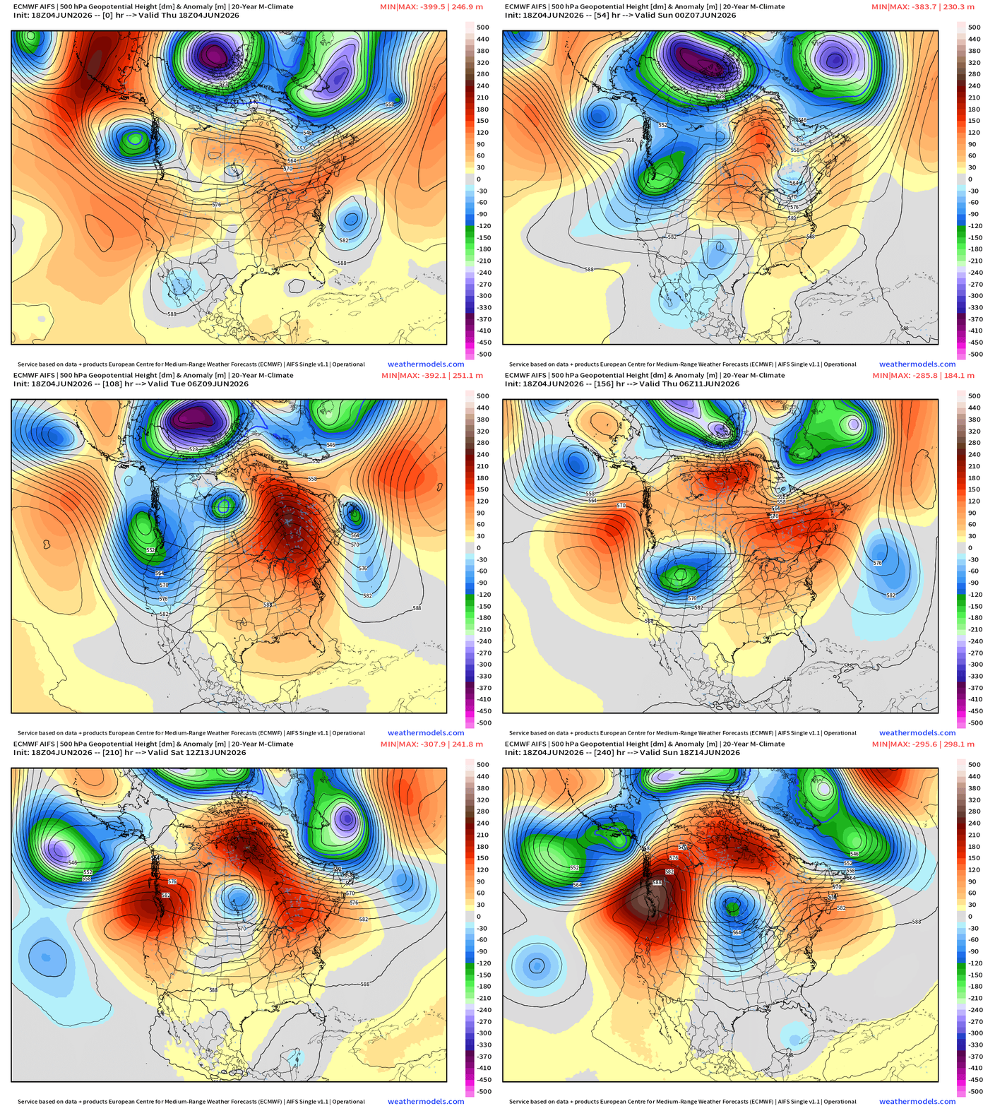
ALERT: Next week, a heat dome will form over the Great Lakes into the Mid-Atlantic and Northeast with potential for extreme heat.
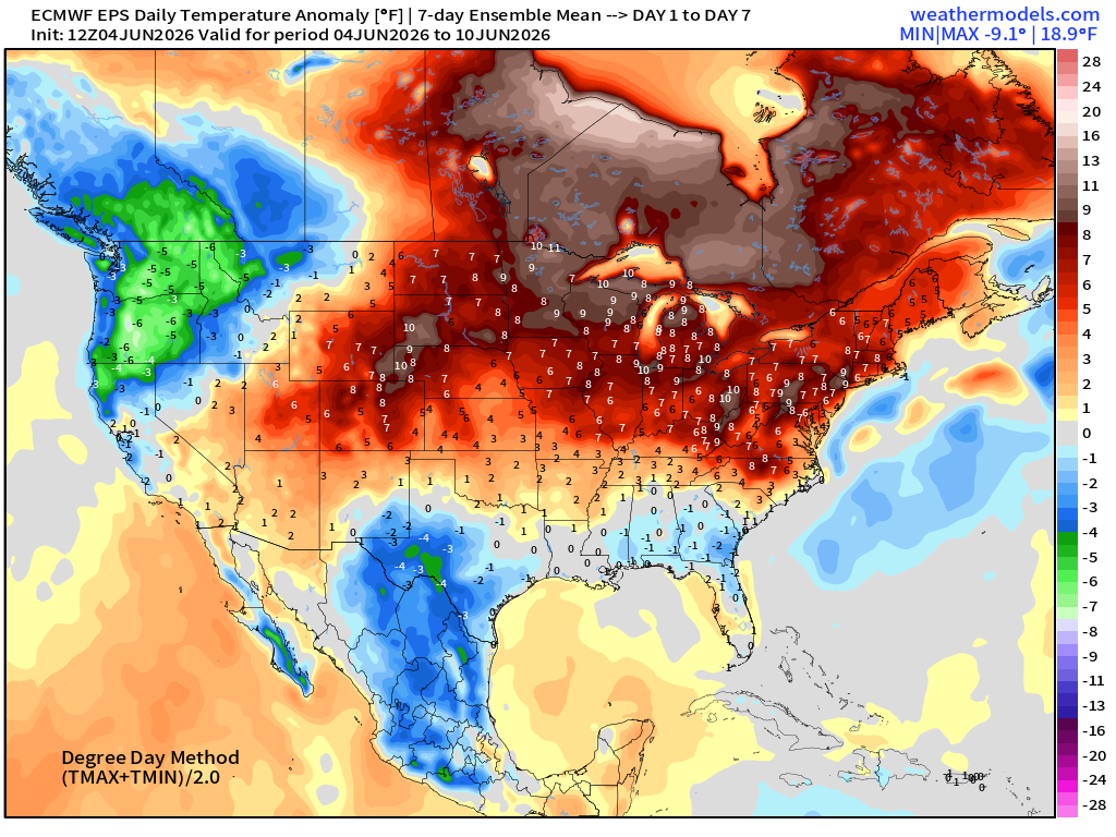
ECMWF Flagship Ensemble Mean Temperature Anomaly next 15-days
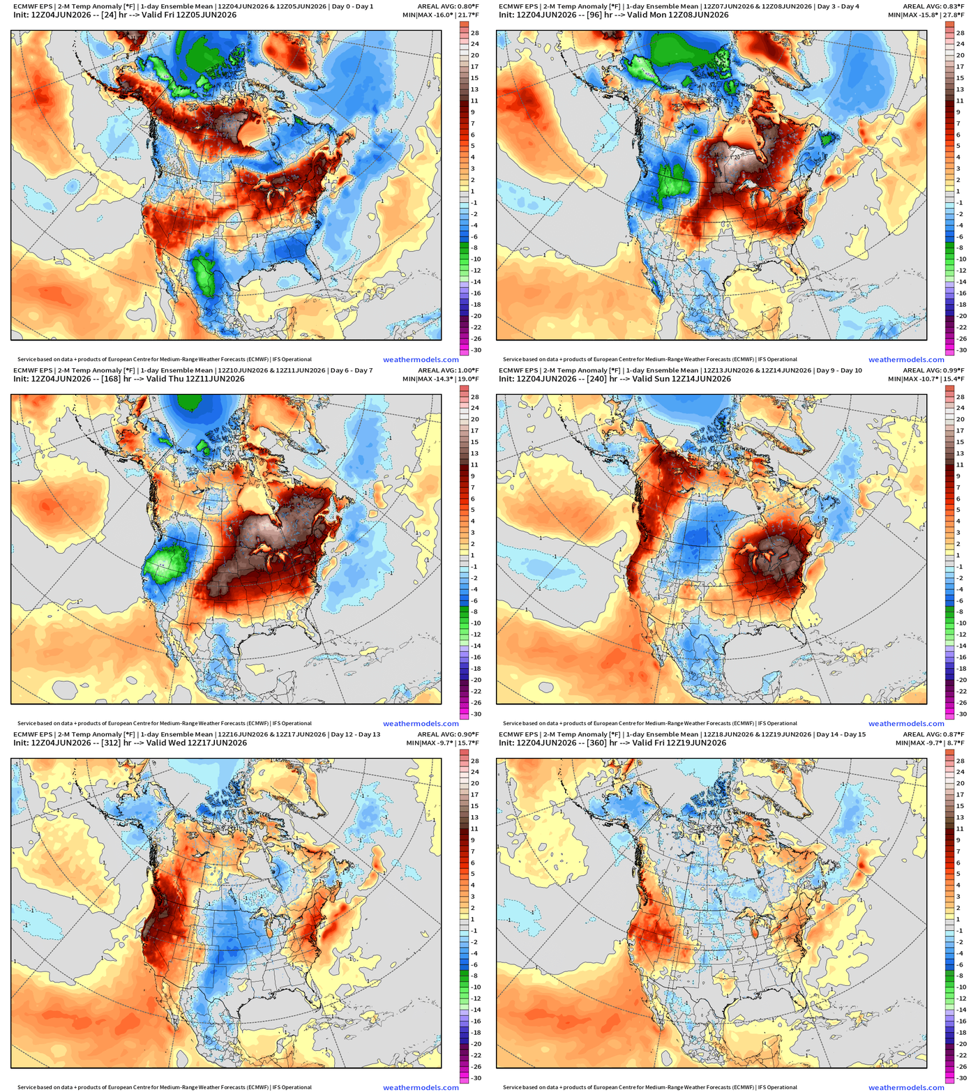
Week 1 —> June 4-10th
Week 2 —> June 11-17th
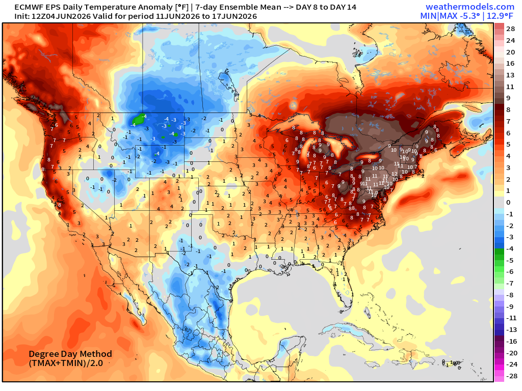
Whoa, that’s a strong heat signal for Week 2 > 12°F anomaly for mid-Atlantic and Northeast
HRRR Radar Simulation Next 48-Hours —> Saturday 2 PM ET
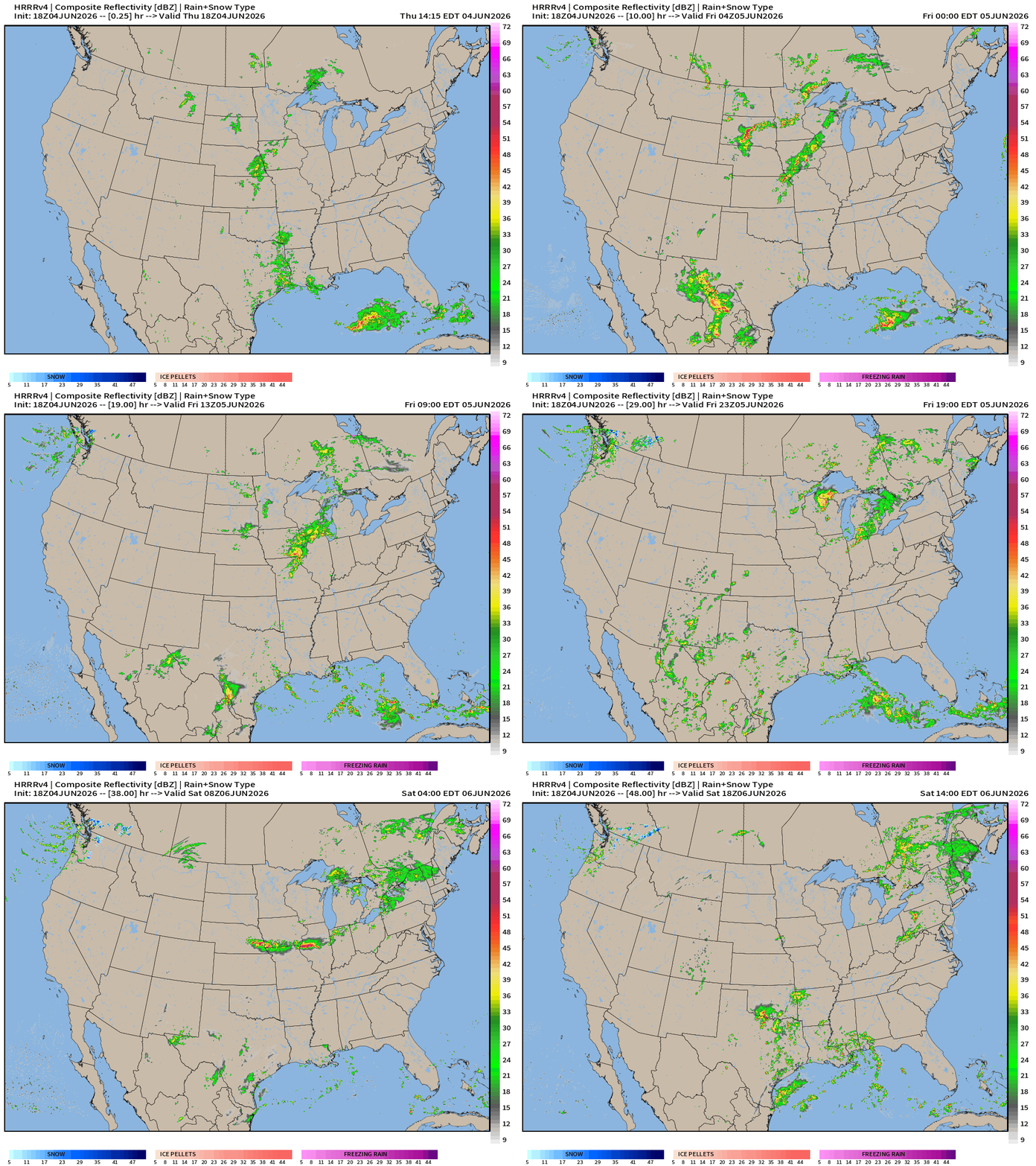
Plenty of scattered storms in this very moist air mass surging northward out of the Gulf and tropical Pacific.
HRRR Precipitable Water Next 48-Hours
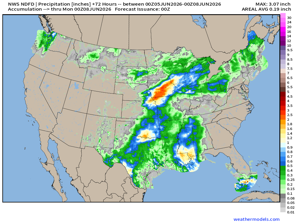
NWS Precipitation Next 72-hours —> Sunday Evening
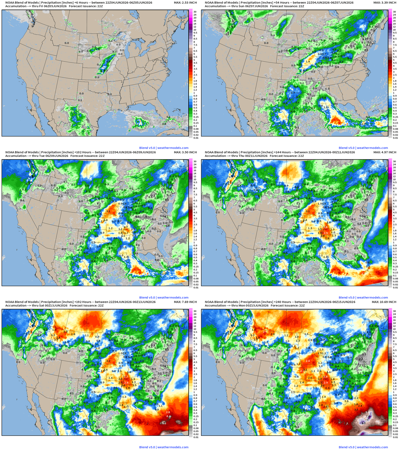
Blend of Models —> Precipitation Next 10-days
Atlantic Basin Satellite Channels
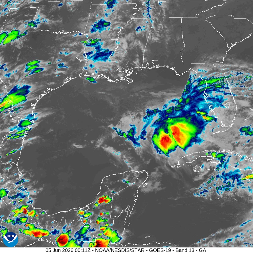
Gulf of Mexico convection is associated with tail end of front connected to strong trough/storm off the East Coast
Infrared (Channel 13) colorized —> showers and thunderstorms
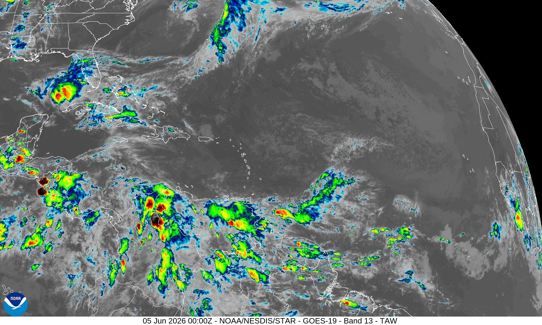
Still completely clear Caribbean
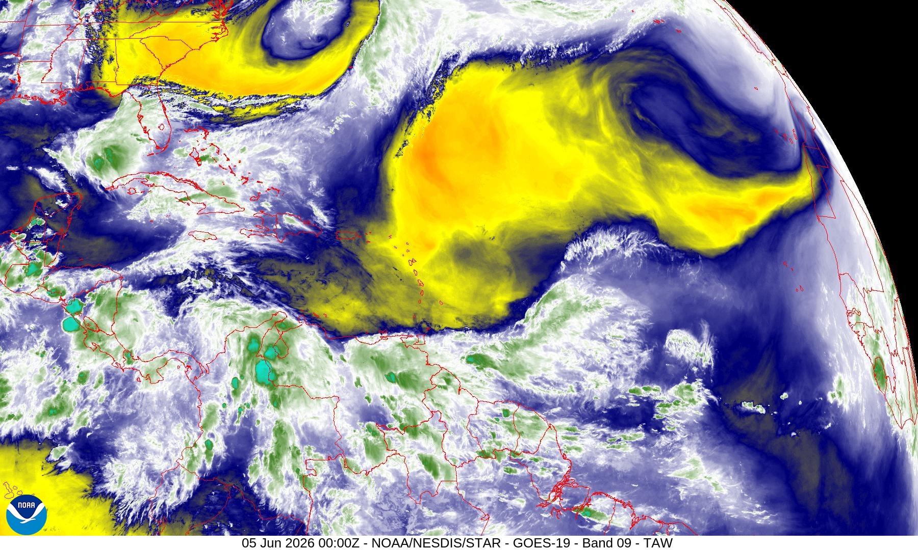
Water Vapor (Mid-Level Ch. 9) - troughs + areas of dry air
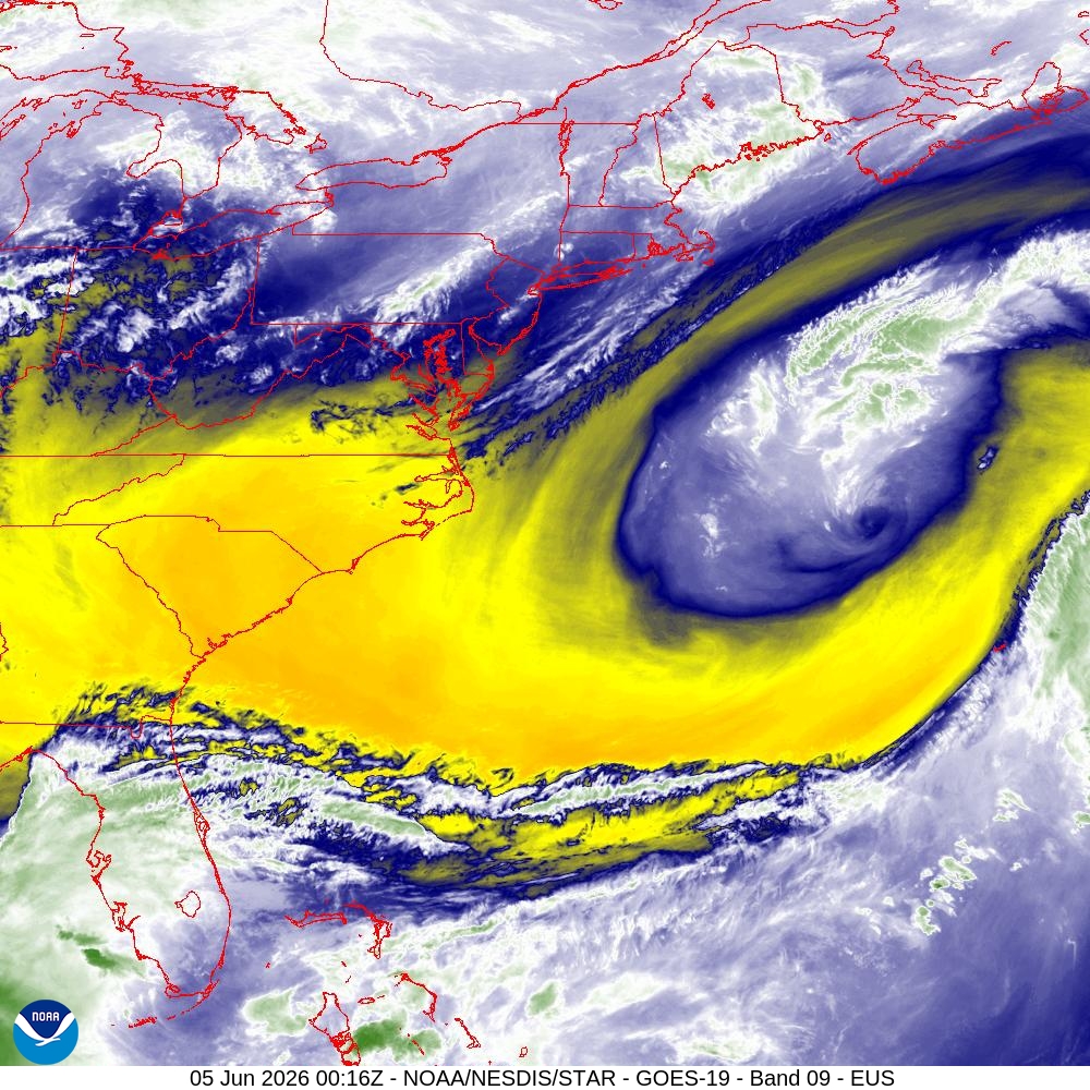
Major dry slot behind the mid-level trough
NASA GEOS5 (00z) —> African dust plume forecast next 10-days
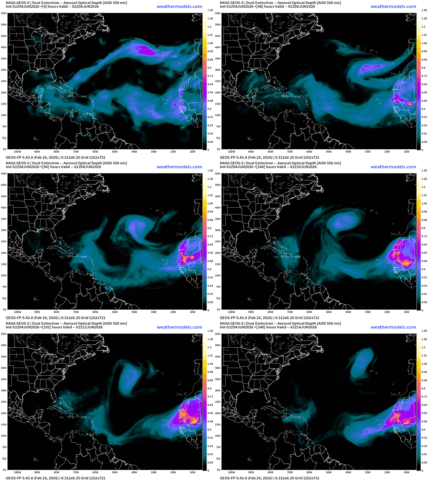
African dust activity has really died down … decreased, but the Saharan Air Layers will still come across the basin even without dust.
North Atlantic Tropics | Quiet Next 7-days
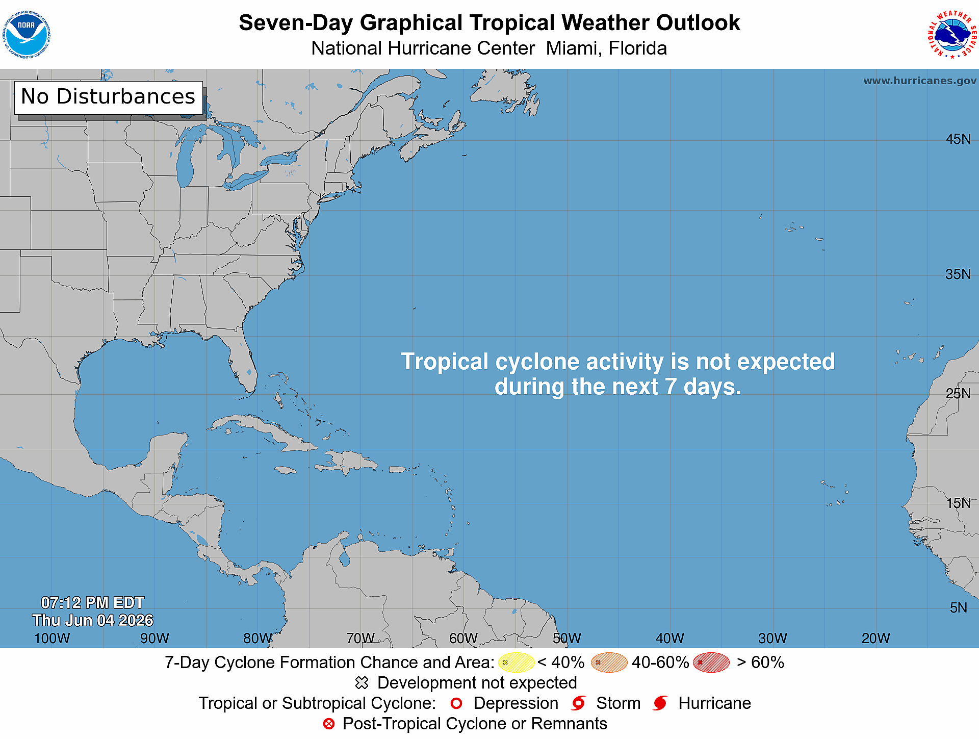
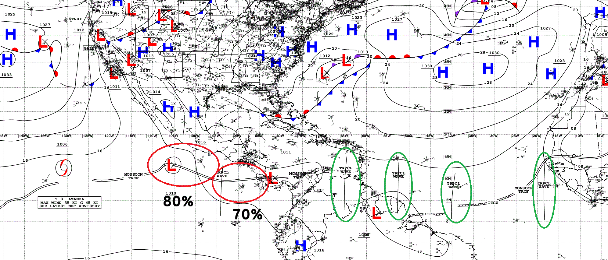
4 Tropical Waves — none developing in the Atlantic, but as they eventually reach the Eastern Pacific, could trigger formation.
My favorite parameter —> Precipitable Water (PWAT) next 6-days
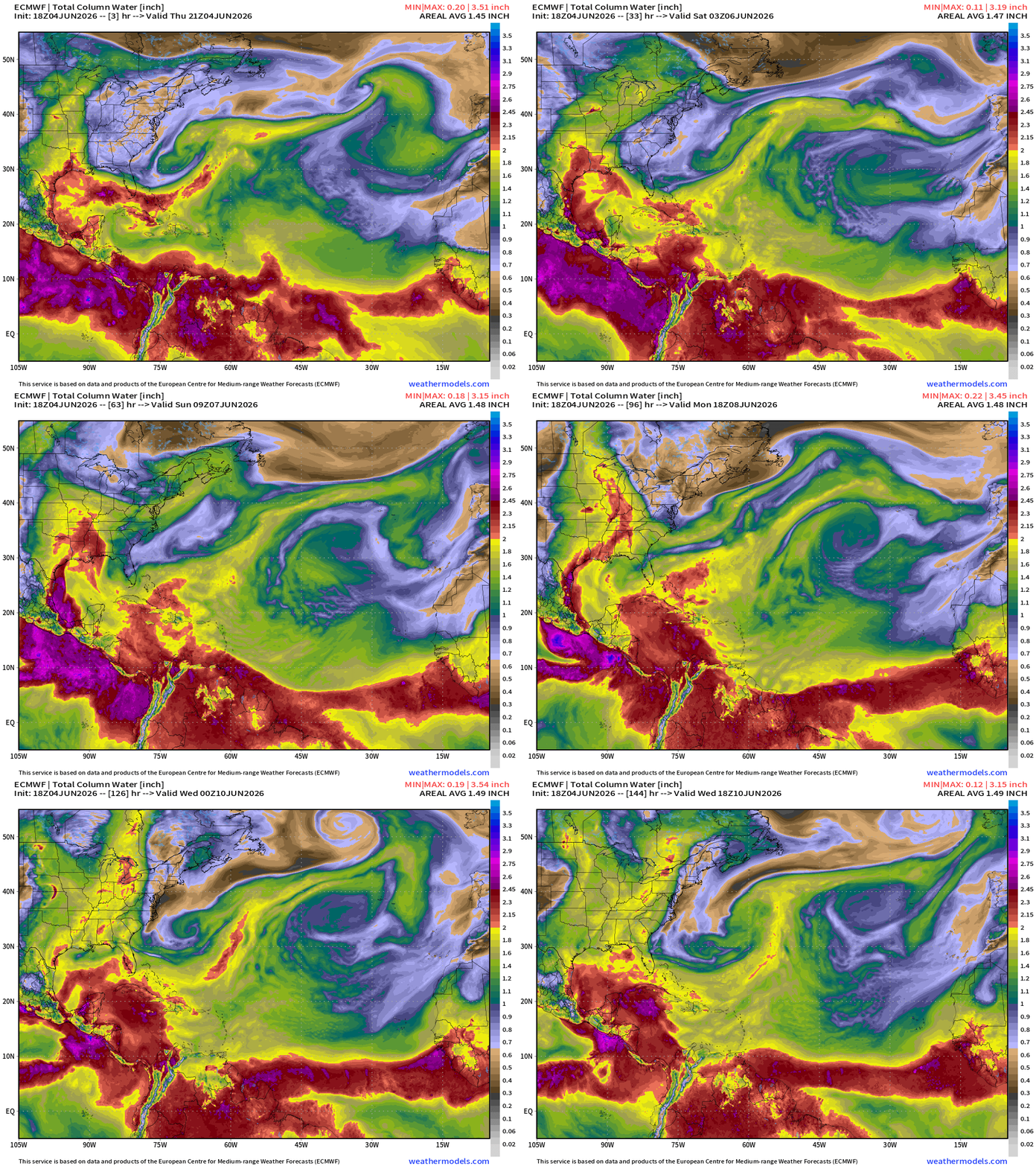
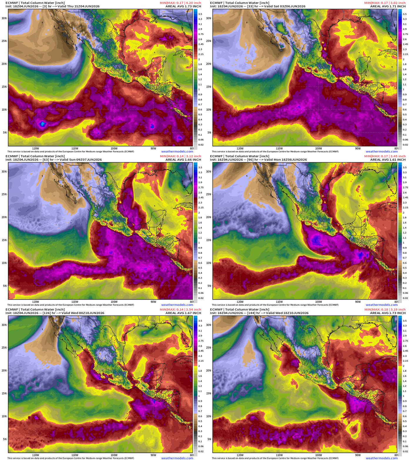
Tropical storms and hurricanes are bundles of high moisture air > 2” in the column (or more) so we look for areas of concentrated high PWAT air in the tropics —> and we also can view frontal boundaries or dry air input from the middle-latitudes into the subtropics or tropics + Saharan Air Layers (dry)
Precipitation + MSLP Next 6-Days
Integrated Vapor Transport —> IVT next 12-days from ECMWF AIFS
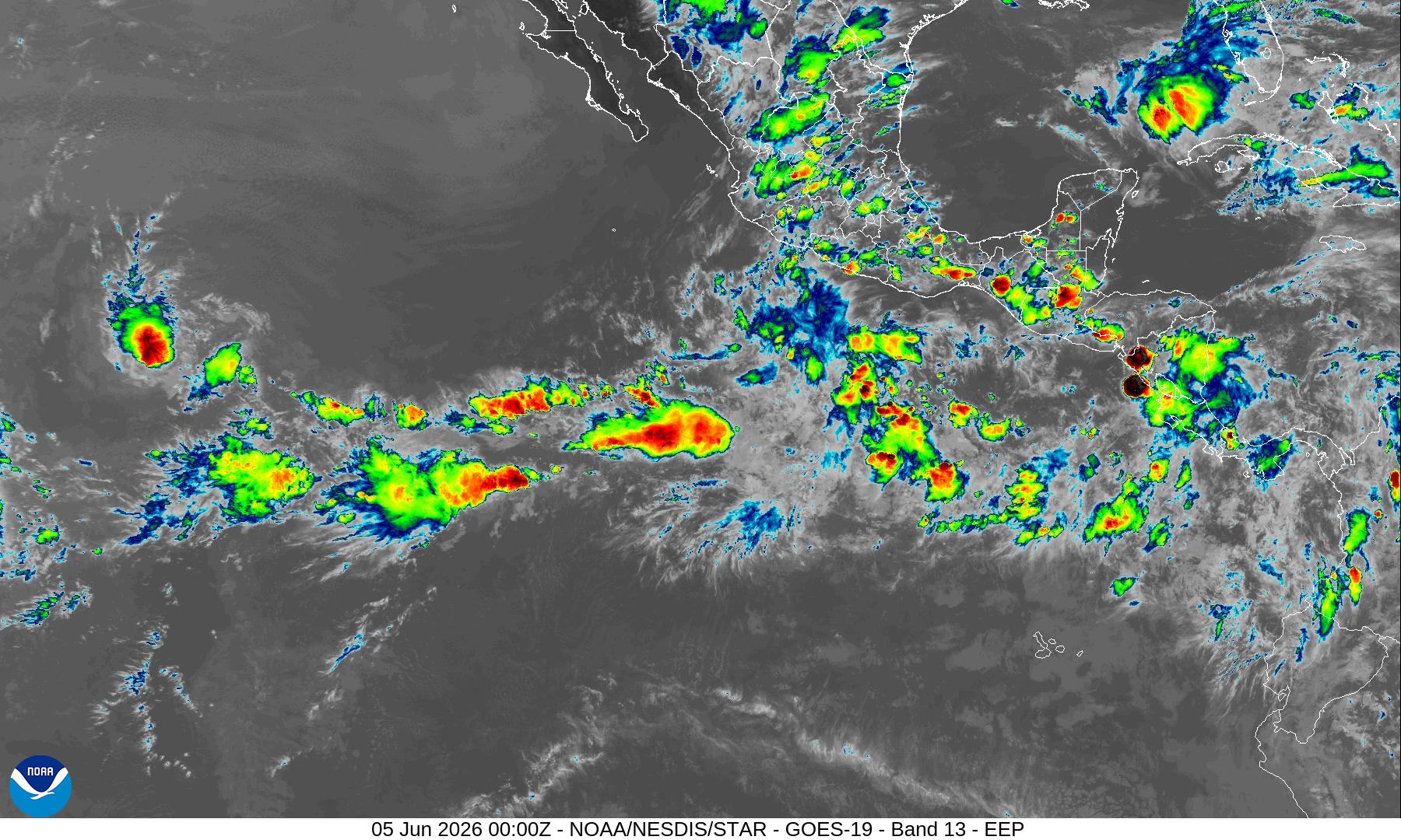
Eastern Pacific is busy with Amanda for a little while longer, and 2-more systems forming along Mexico/Central America within the gyre.
The moisture plume surges through the Caribbean into the Gulf and then northward through eastern U.S. — and we will watch for any tropical cyclone development in the Gulf in the 8-10 day time frame.
Eastern Pacific Tropics | 2026 Season | Tropical Storm Amanda 01E
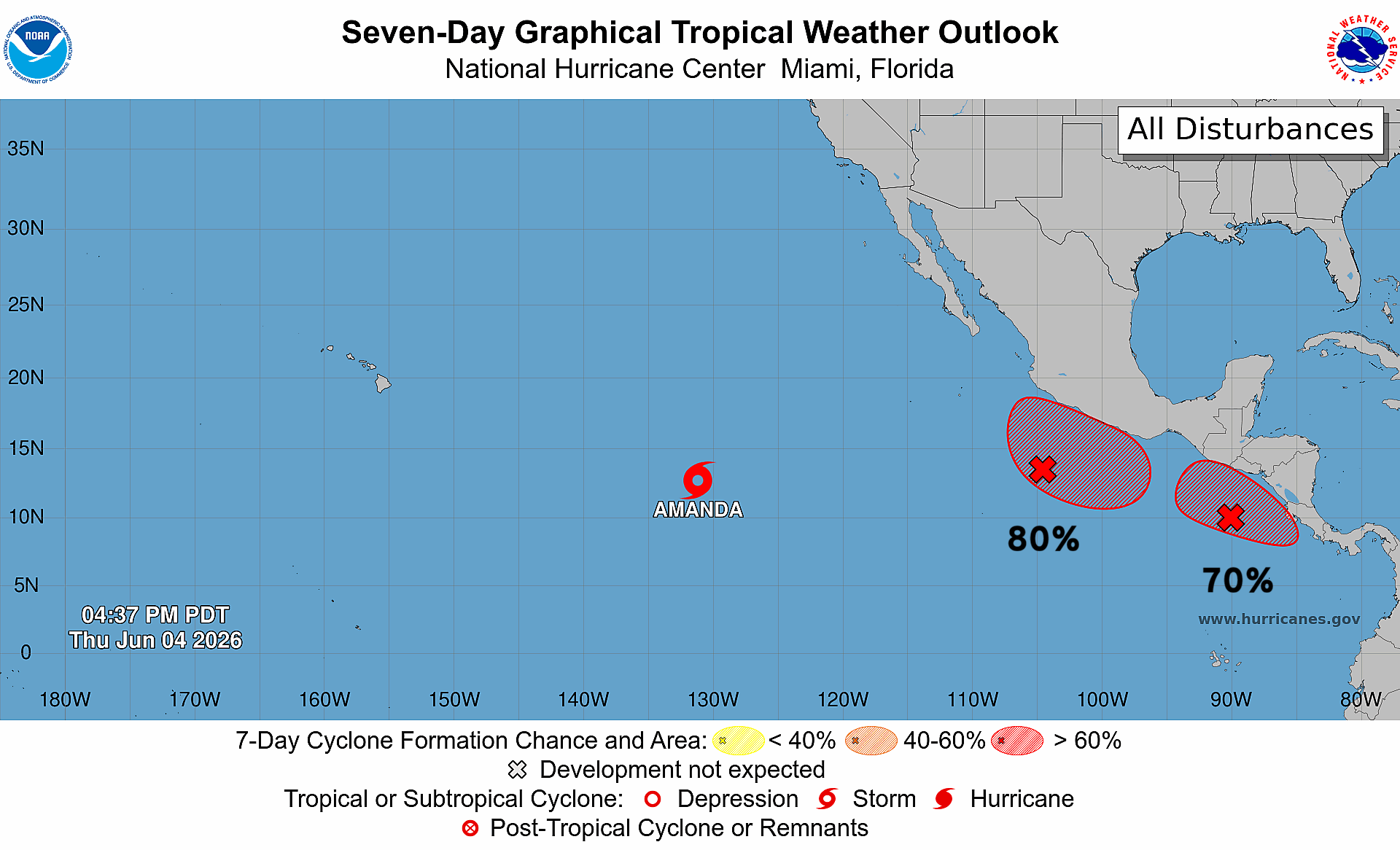
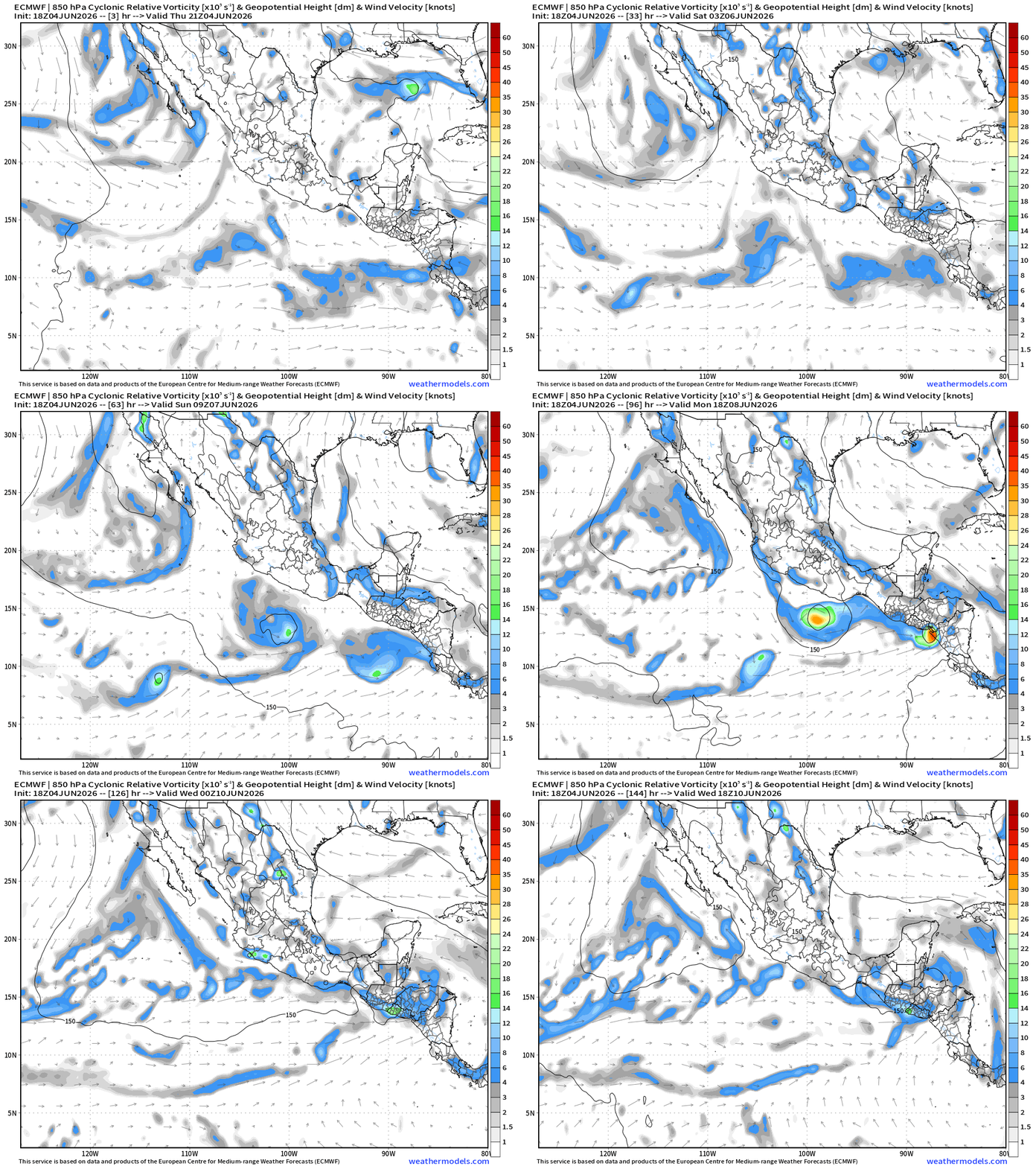
2 more systems on the way!
Amanda is hanging on, and may be bursting convection into the evening out there.
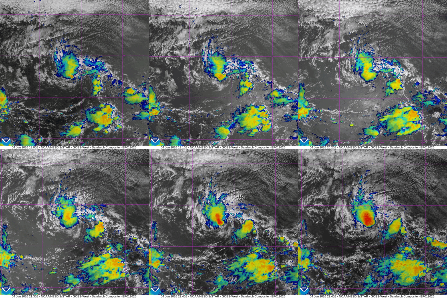
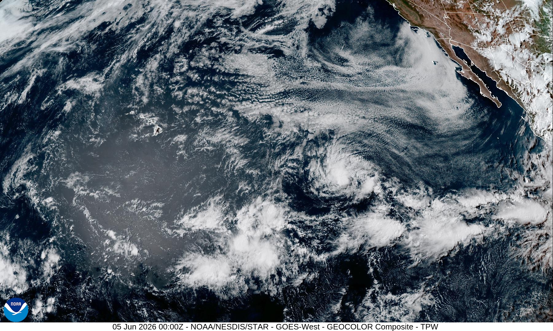
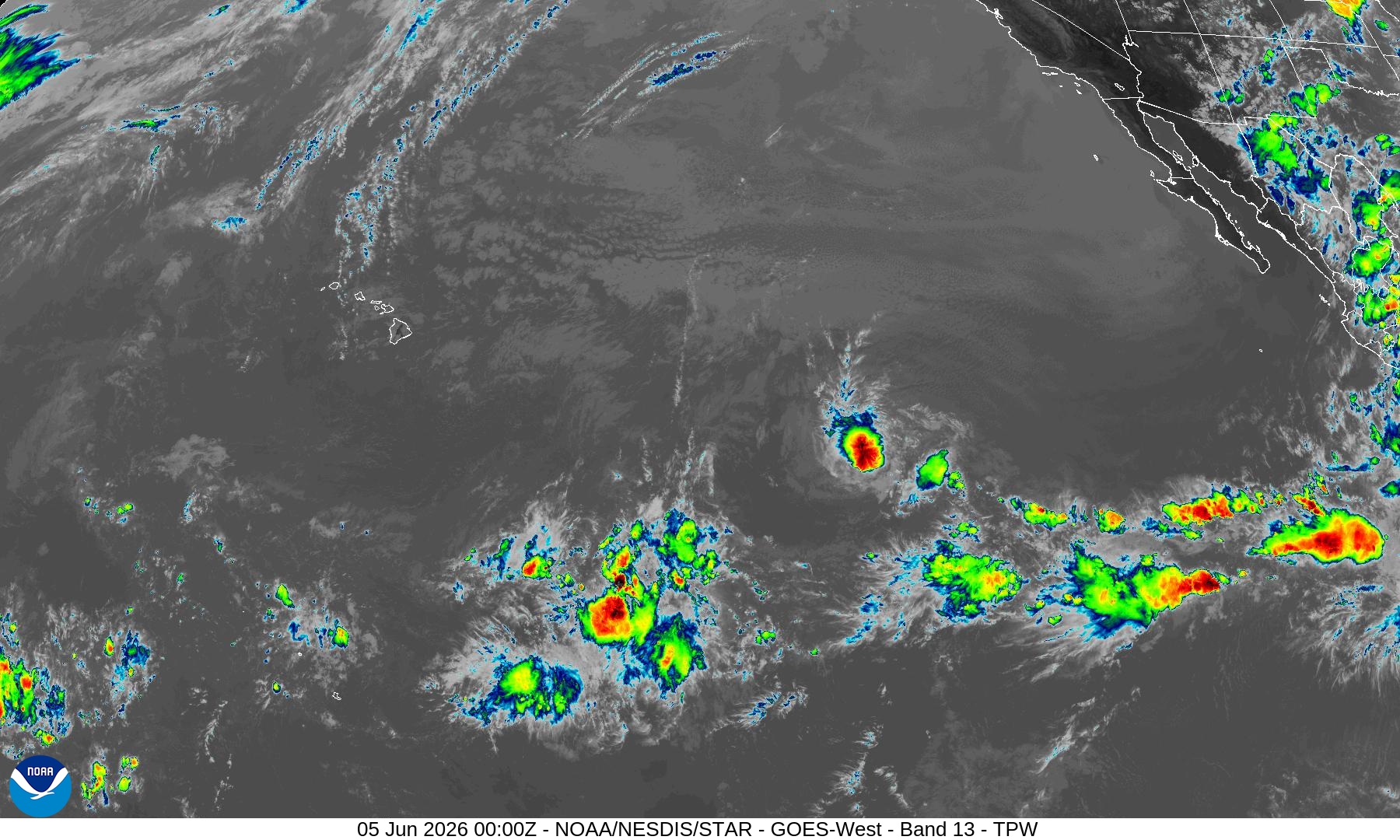
Tropical Storm Amanda is way out in the Pacific … mixing some fish with 45 mph winds.
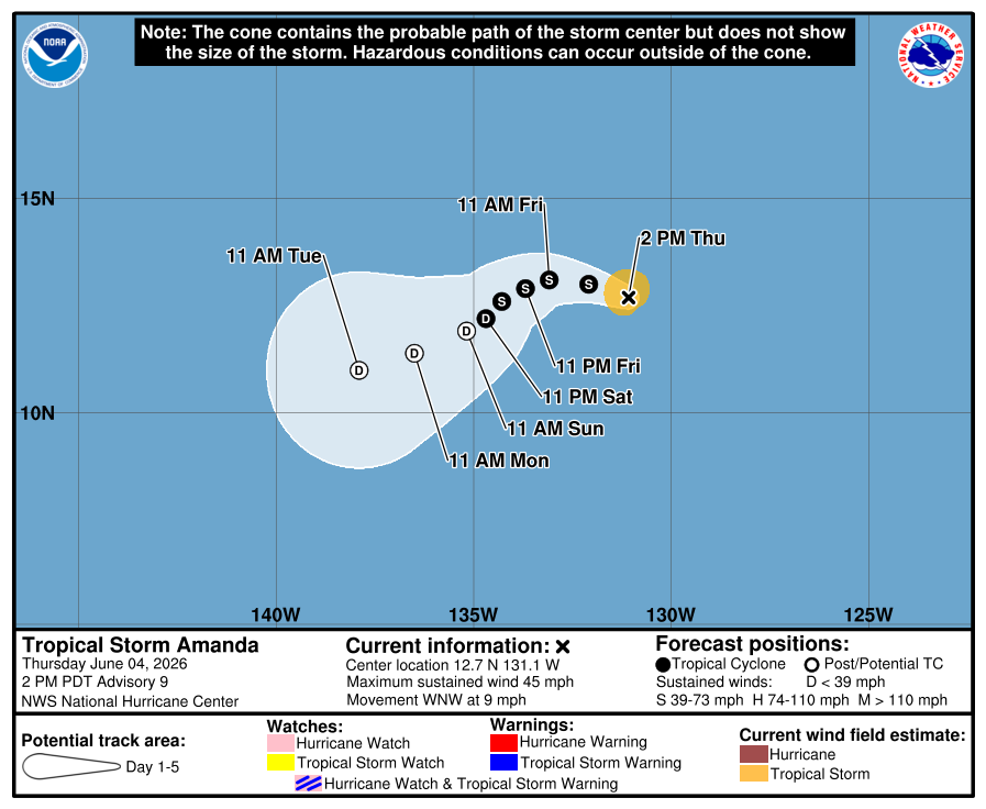
2026 Names —> Amanda, Boris, Cristina, Douglas, Elida
ECMWF Precipitable Water Next 6-days
Relative Vorticity (Cyclonic) — interesting twin / elongated vorticity along Mexico + Central America —> 2 named storms for the price of one, but both look weak without much time prior to landfall.
ECMWF EPS | Next 15-days for Eastern Pacific
Western Pacific Basin — Typhoon Season — Quiet next 7-days
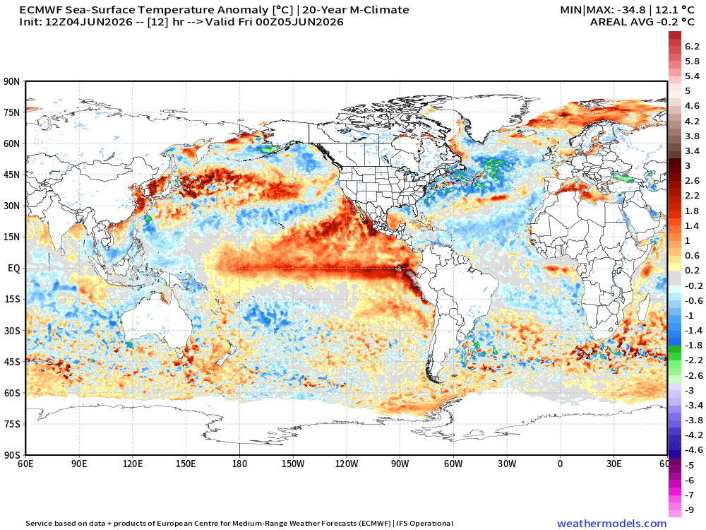
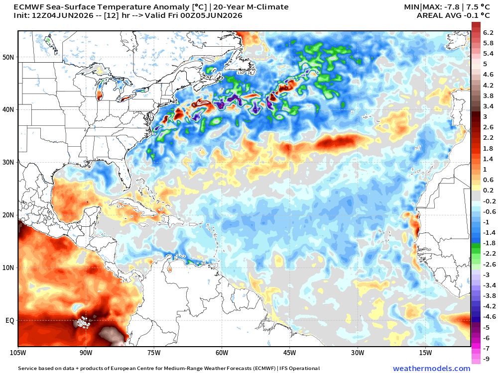
Global Ocean Temperatures —> Sea Surface Temperature (SST)
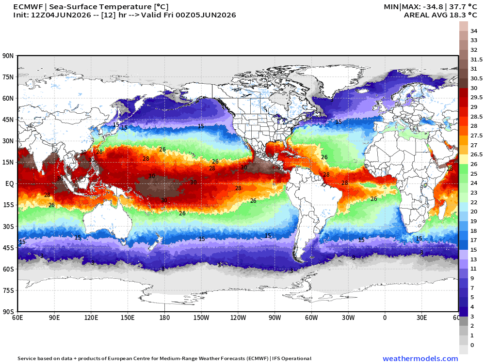
Tropical storms need at least 26°C SST to form and intensify … and hurricanes most often become major with 28°C SST (at least).
There are still rather cool (relative) areas in the Western Pacific and North Atlantic compared to the growing warmth along the Equator and off the western coast of Mexico with the oncoming El Niño. The recent 20-year climatology highlights much better than an older 1991-2020 baseline.
Atlantic Ocean Temperatures | SST Analysis (June 5 00z)
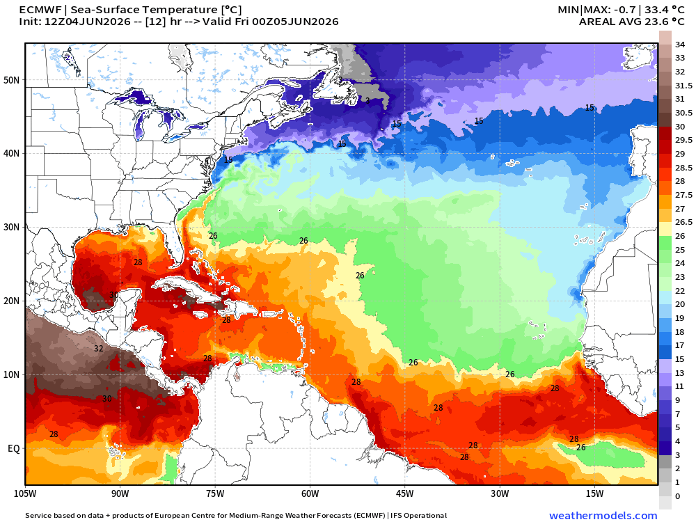
The Atlantic remains cooler than past 2-decades across the Main Development Region [MDR] from the Lesser Antilles (Caribbean) to the Canary Islands and coast of Africa. The North Atlantic off the East Coast and into the mid-latitudes is also quite cool.
Thank you for reaching the end of this post! Hopefully you enjoyed the tour of the global tropics and what’s coming in the weeks/months ahead in the tropics here on Weather Trader on Substack.
Maps sourced from weathermodels.com designed and innovated by yours truly! Please subscribe there for real-time access to the newest maps, charts from all of the weather models including ECMWF and AIFS, and NOAA GFS/GEFS, HRRR/RRFS and Blend of Models (NBM). NOAA WPC and SPC for fronts/convective outlooks.
For 2026 Hurricane Season: Every 6 or 12 hours, we get an update including these model output
ECMWF EPS full-physics ensembles … 50 perturbed members + control/HRES
ECMWF AIFS-Ensemble (data driven) … another 50 members + control
ECMWF AIFS-Single … a special deterministic system that has exceptional skill
NOAA GEFSv12 Ensembles … 30 perturbed members + control
NOAA GFSv16 … 13-km high resolution global deterministic
UK Met Office MOGREPS lagged ensembles … global 14-km 72-members per day
Environment Canada ensembles + Germany ICON + Australia BOM Unified Model
New Google WeatherNext 1000-member ensemble system (!) more on that in future post
My Atlantic Hurricane Season Forecast (2026)
From April 7, 2026: Atlantic Seasonal Hurricane Forecast: (11/5/2)
9-13 Named Storms (11 most likely)
4-7 Hurricanes (5 or 6 most likely)
1-3 Major Hurricanes (2 most likely)
Accumulated Cyclone Energy: 75-85 (well below normal)
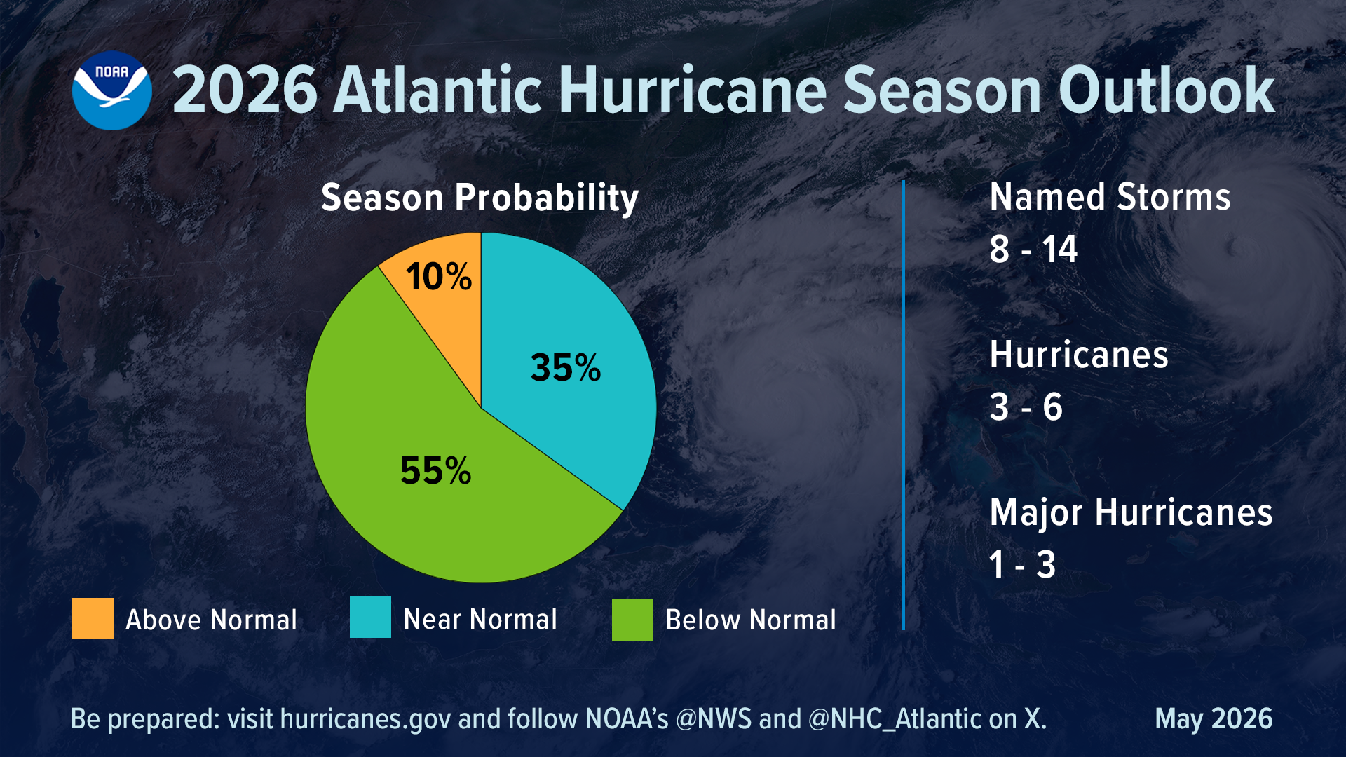
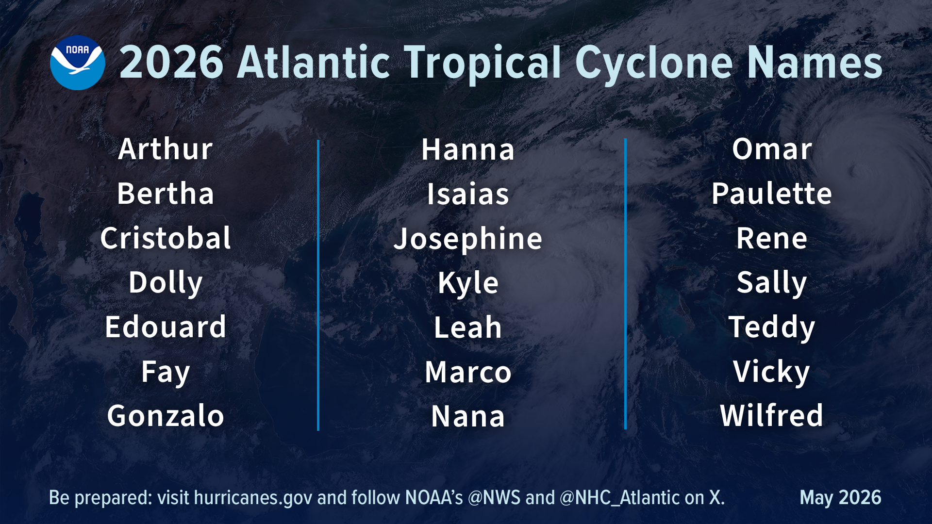
NOAA 2026 Atlantic Hurricane Season Forecast
More details in Thursday, May 21, 2026 Tropical Update
The Intertropical Convergence Zone (ITCZ) in the tropics along 5°N to 10°N is where moist air can ascend and form thunderstorms or like a convective pot boiling over = convection. In the coming weeks, especially into late June, we’ll look for areas of disturbed weather — which means persistent convection — and potential formation of low pressure swirls along the ITCZ with tropical waves, in the Caribbean and Gulf of Mexico (America) with decaying frontal boundaries, and other pathways like tropical transition or subtropical cut-off lows. Lots of options/ways to form a tropical storm in the Atlantic in any given season.
The Bermuda High —> Azores High in the subtropics usually keeps things quiet in the latitude around 30°N and suppresses the ITCZ to the south in late May into June. On the periphery of the Bermuda High, moisture plumes out of the Caribbean into the Gulf and then Texas + Southeast.
- Milepost
- 951 · laid 2026-06-05T01:32:08.436000Z
- Source
- https://weather.substack.com/p/june-4-2026-thursday-tropical-update
- Digest
- d3df79ec4f6499d393dc7fab3481305a0831ae0f5961694210fa103130f4ed84
- Machine
- JSON