Storyline · concluded · Season thread
Atlantic Season 2026
Every dispatch on this road this season, in order: the thread a daily newsletter leaves behind when you read it end to end.
41Dispatches
159Days · MAY 19–OCT 24
I-26Tropics
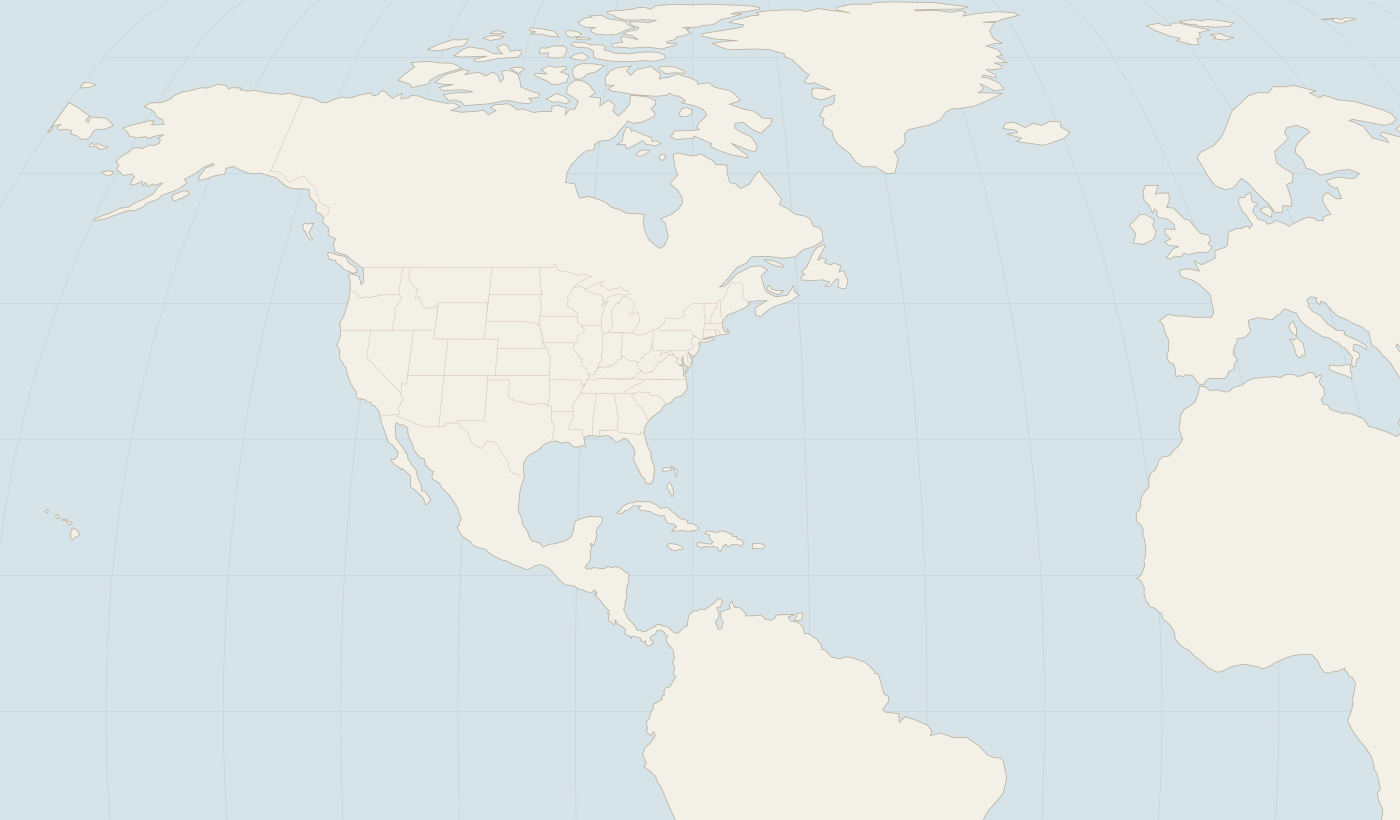
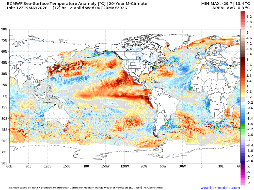 FIGURE 1
MAY 19 · I-26 TROPICS Atlantic hurricane season starts June 1st and we have many new forecasting tools
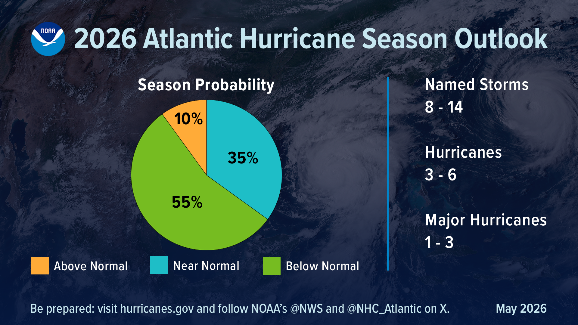 FIGURE 1
MAY 21 · I-26 TROPICS Atlantic hurricane season starts June 1st and may be front loaded
 LOOP
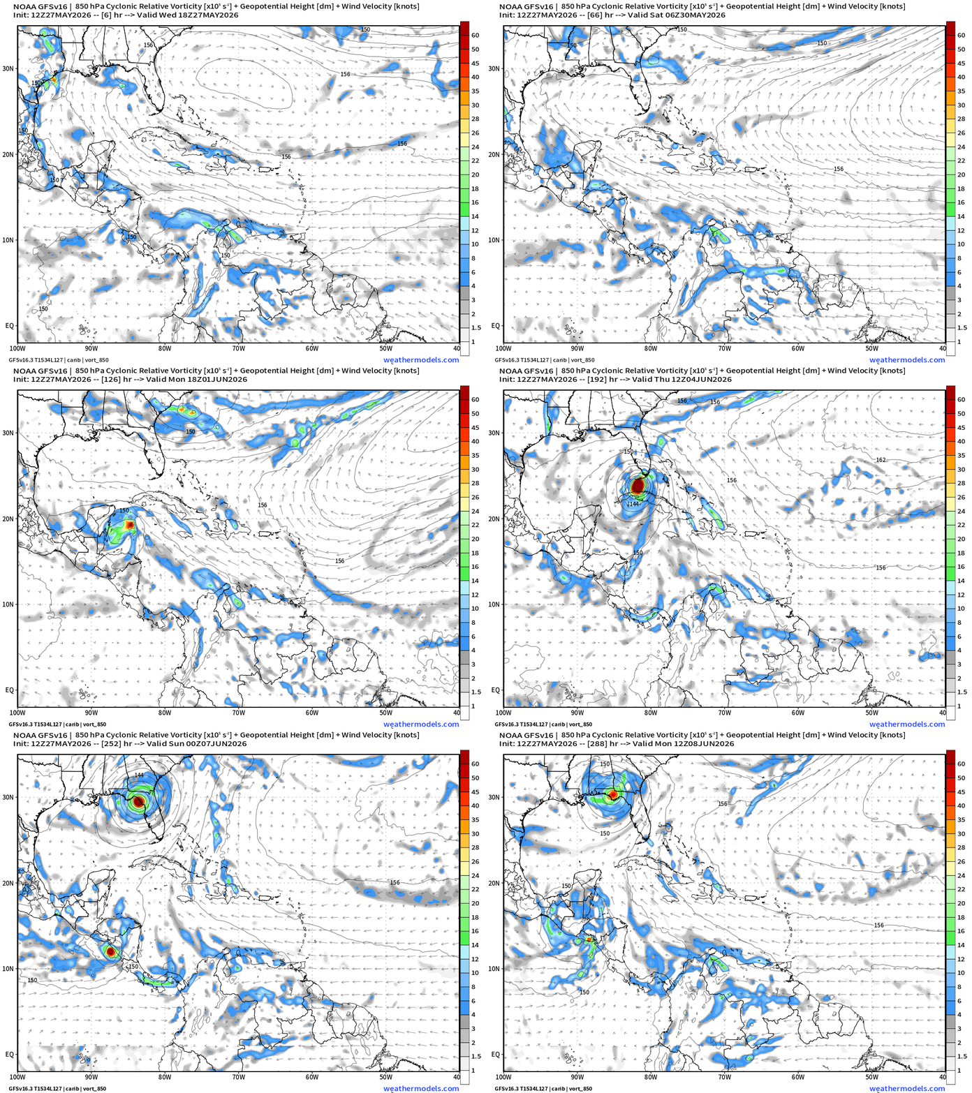
MAY 27 · I-26 TROPICS GFS model with a known model bias spinning up bogus-canes
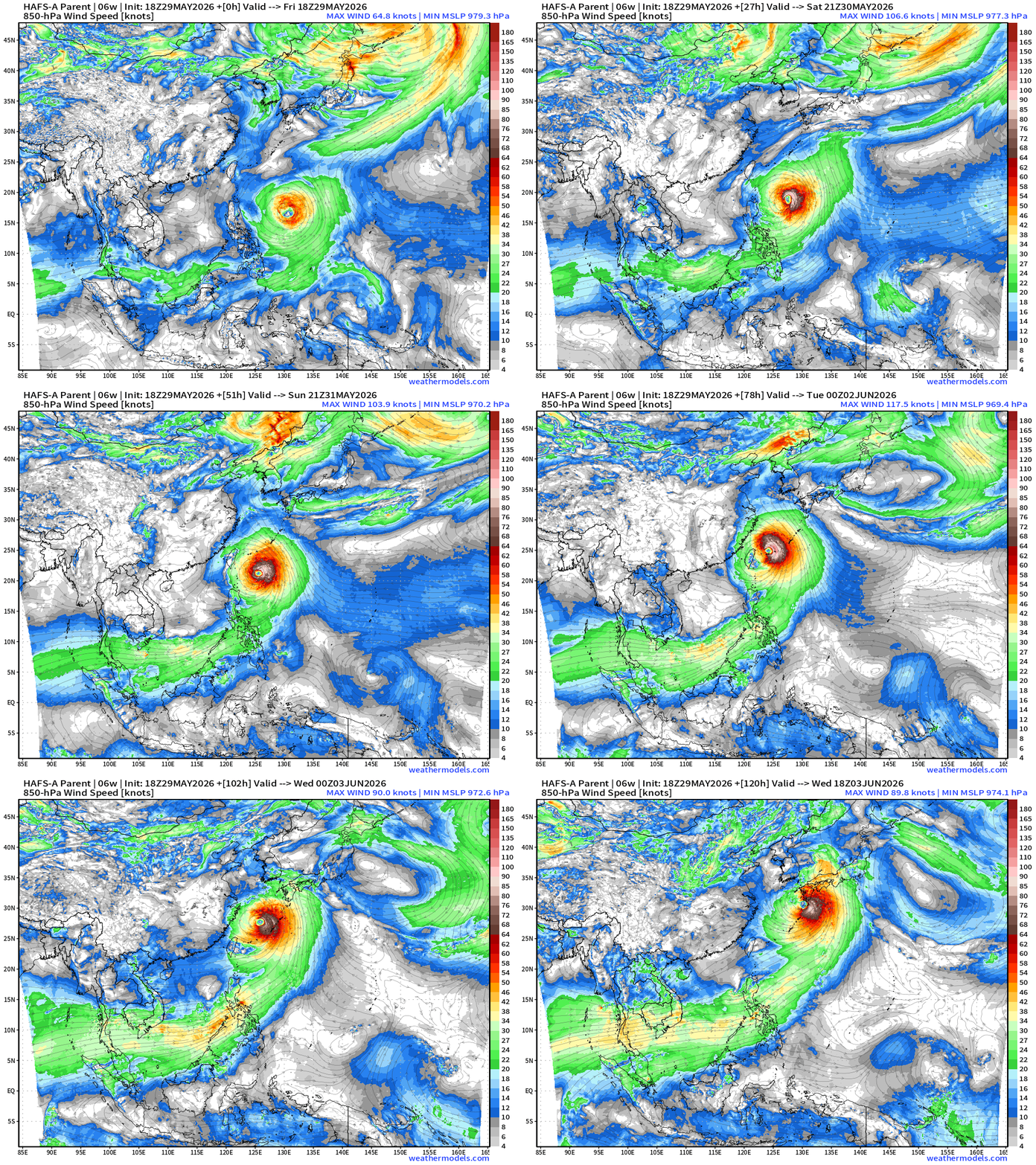 LOOP
MAY 29 · I-26 TROPICS HAFS-A next 5-days for Jangmi (06W)
The route · every exit
- Exit 1 · MAY 19 Atlantic hurricane season starts June 1st and we have many new forecasting tools
- Exit 2 · MAY 21 Atlantic hurricane season starts June 1st and may be front loaded
- Exit 3 · MAY 27 GFS model with a known model bias spinning up bogus-canes
- Exit 4 · MAY 29 Gulf of Mexico next week could spin up a weak tropical system
- Exit 5 · JUN 1 Atlantic Hurricane Season gets underway + Eastern Pacific tropical activity
- Exit 6 · JUN 2 Eastern Pacific basin finally sees first tropical depression
- Exit 7 · JUN 4 Watching Caribbean and Gulf for tropical storm development later next week
- Exit 8 · JUN 5 · Subscribers Watching models for tropical storm development late next week in Gulf
- Exit 9 · JUN 7 New tropical depression off coast of Mexico and remnants could cross into southern Gulf
- Exit 10 · JUN 8 Boris and Cristina in Eastern Pacific bringing heavy rain to the Mexico and Central America coasts
- Exit 11 · JUN 10 First lemon drop of season (10% chance) for low pressure in Bay of Campeche
- Exit 12 · JUN 11 Busy weather pattern with severe storms across Midwest and Great Lakes. Heavy rain over next week across South with tropical moisture plume
- Exit 13 · JUN 12 Prepare for enormous rainfall next week with tropical moisture plume delivering boatloads
- Exit 14 · JUN 15 Boatloads of rainfall with deep layer tropical moisture plume + Texas coast disturbance (30% chance)
- Exit 15 · JUN 21 Atlantic tropics in a long slumber until July. A powerful Typhoon well east of Taiwan will turn north in the coming days away from land
- Exit 16 · JUN 28 Atlantic not completely a ghost town but very quiet start to July likely
- Exit 17 · JUN 30 Atlantic remains quiet into first week of July while a massive Super Typhoon develops in Western Pacific
- Exit 18 · JUL 10 · Subscribers Eastern Pacific basin lighting up over next 1-2 weeks. Some hints at Gulf activity forming from a trough. Otherwise the Atlantic in a dust cloud
- Exit 19 · JUL 13 Eastern Pacific lights up with activity, and watching close-to-home Gulf trough into next week for storm action
- Exit 20 · JUL 15 Thick smoke from Canadian wildfires will ride the ridge (heat dome) with temperatures in the 100s around Washington D.C. and one lonely 20% chance of development in Gulf
- Exit 21 · JUL 17 · Subscribers Two areas of interest in the Atlantic including a tropical wave off Africa that looks interesting but window for development is short
- Exit 22 · JUL 22 New one-stop-shop for climatology information about Earth's powerful tempests
- Exit 23 · AUG 3 Hints of Atlantic basin activity picking up in the Main Development Region next week as tropical waves finally escape the Saharan Dust over warm ocean waters
- Exit 24 · AUG 4 Atlantic remains closed for business until next week when a break in the Saharan Air Layer infused dust may allow tropical waves to catch fire
- Exit 25 · AUG 5 · Subscribers Signs of life in the Atlantic basin later next week as robust African tropical waves encounter a more favorable environment in the MDR
- Exit 26 · AUG 6 Ensembles perking up into next week across the Atlantic with two candidate tropical waves going up against Saharan Air Layer gauntlet
- Exit 27 · AUG 7 Robust tropical waves coming off Africa will follow a major Saharan dust layer event
- Exit 28 · AUG 9 · Subscribers Atlantic hurricane season has come alive with multiple areas being watched. A hurricane may threaten Hawaii later in the week
- Exit 29 · AUG 18 Atlantic may come alive next week with a strong African tropical wave. A huge Typhoon is forming in the Western Pacific out by Guam
- Exit 30 · AUG 19 · Subscribers A powerful Super Typhoon, another Central Pacific Hurricane on the way. Model agreement on Atlantic tropical wave on Sunday developing into a hurricane
- Exit 31 · AUG 20 Still waiting until next week for a tropical wave in the Eastern Atlantic but some non-tropical low pressure off Portugal may get the next name
- Exit 32 · AUG 21 · Subscribers Eyes on a tropical wave in the Eastern Atlantic early next week. A non-tropical low pressure off Portugal may get the next name
- Exit 33 · AUG 21 Pacific full tilt with plethora of active systems and more to come. Atlantic has 3 areas watched including Eastern MDR tropical wave
- Exit 34 · AUG 23 Pacific continues to churn out tropical systems. The Atlantic has several areas to watch including a tropical wave with moderate chance of development in MDR this week
- Exit 35 · AUG 23 Pacific continues to churn out tropical systems. The Atlantic has several areas to watch including a tropical wave with moderate chance of development in MDR this week
- Exit 36 · AUG 24 · Subscribers Strong tropical wave emerged off African coast and looks healthy. However, tough sledding ahead into marginally favorable Atlantic tropical basin
- Exit 37 · AUG 25 Time running out for Invest 96L to become a tropical depression before conditions degrade. Then another window may open in 7-10 days near Bahamas
- Exit 38 · AUG 26 · Subscribers Invest 96L looks healthy this evening but not quite a tropical depression in the central Atlantic. Eastern Pacific lighting up with a flurry of activity
- Exit 39 · SEP 8 Atlantic tropics ghost town through next week but perhaps more favorable in 10-12 days in far eastern MDR. Norbert is next in the Eastern Pacific
- Exit 40 · SEP 9 No signs of life in the Atlantic while the Pacific goes gangbusters
- Exit 41 · OCT 24 Quiet weather continues into next week. Curtains for the Atlantic Tropics?
END
Why I-26?
Tropical stories ride Interstate 26, after the 26 °C sea-surface temperature often used as a rough threshold for tropical development.
26 °C
The sea-surface temperature often used as a rough threshold for tropical development; the shield number of this road.
Invest
An area the Hurricane Center is investigating, numbered 90–99 with a basin letter, before it has a name.
ACE
Accumulated Cyclone Energy: a season's wind, squared and summed every six hours. Climatology sets the scale.