September 8, 2026 Tuesday Evening Weather
Atlantic tropics ghost town through next week but perhaps more favorable in 10-12 days in far eastern MDR. Norbert is next in the Eastern Pacific

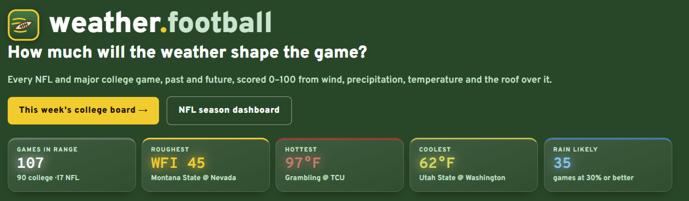
Weather and Football is operational for 2026 CFB + NFL
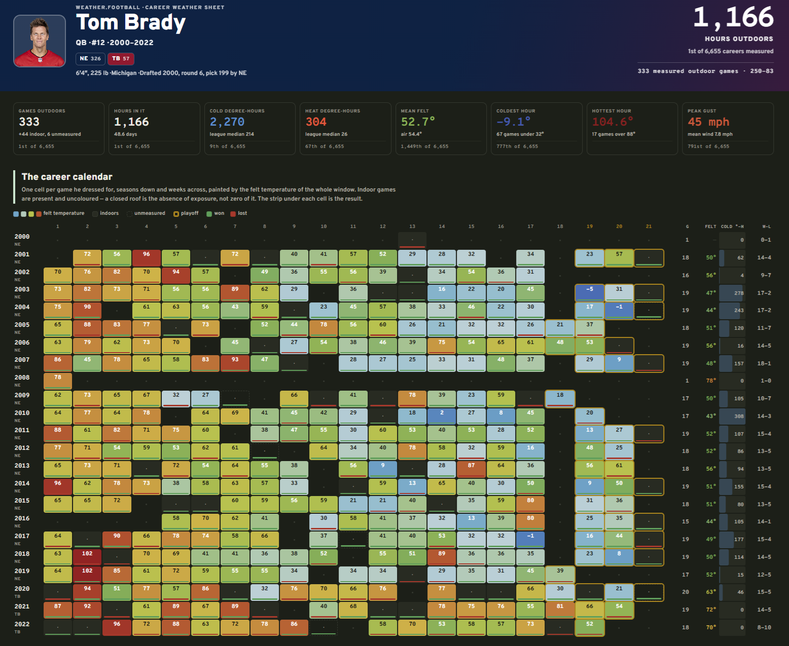
And, you can dig into the careers of each player over the past 20+ years and nerd out on the weather that occurred during every game. Plenty of interesting statistics and climatology of weather and football together e.g. Michigan Man Tom Brady:
Headlines Tuesday Evening in the Tropics
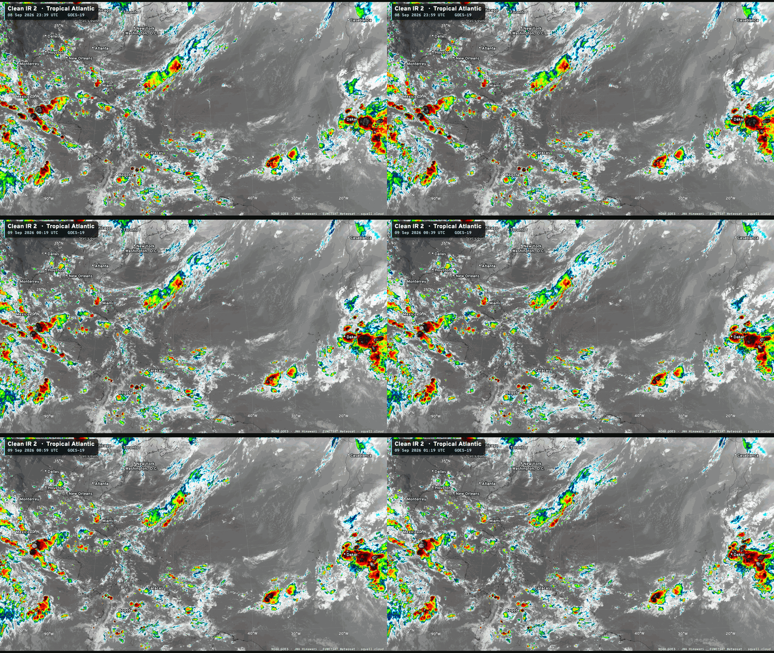
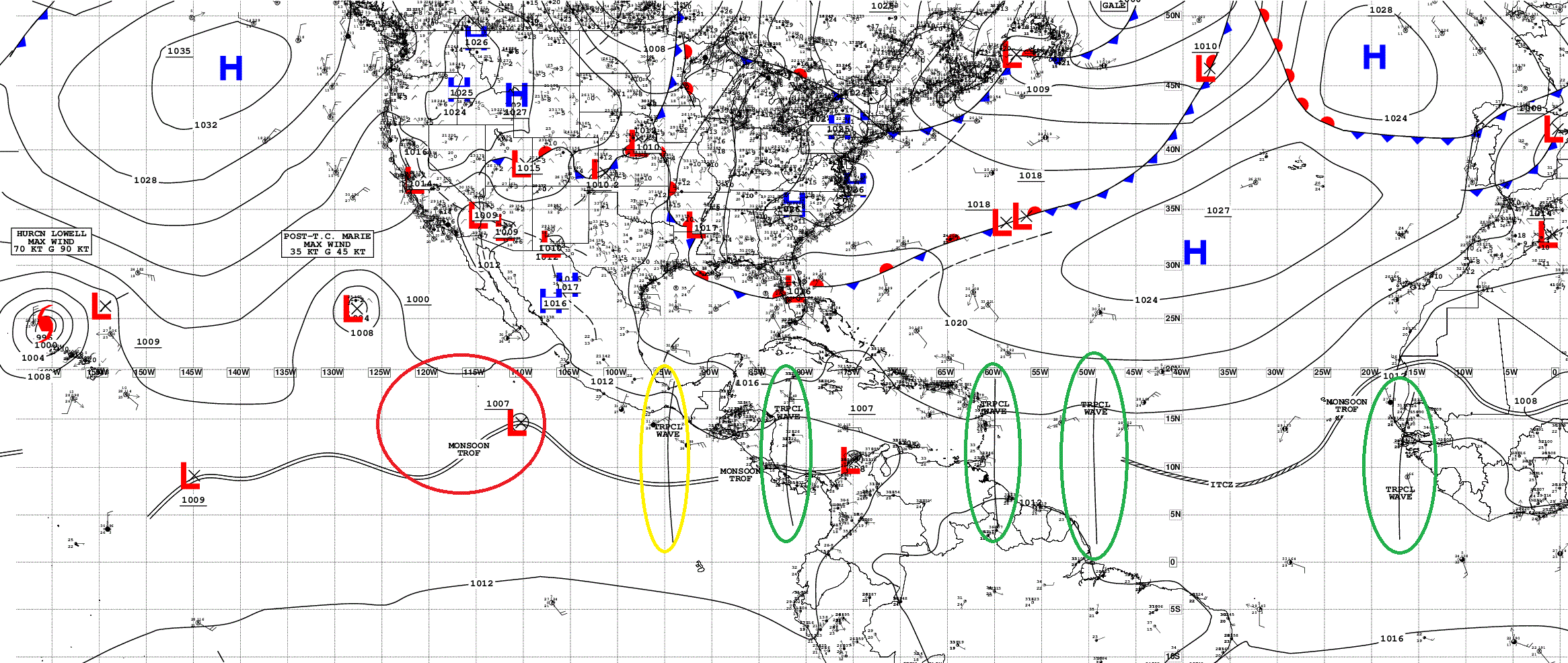
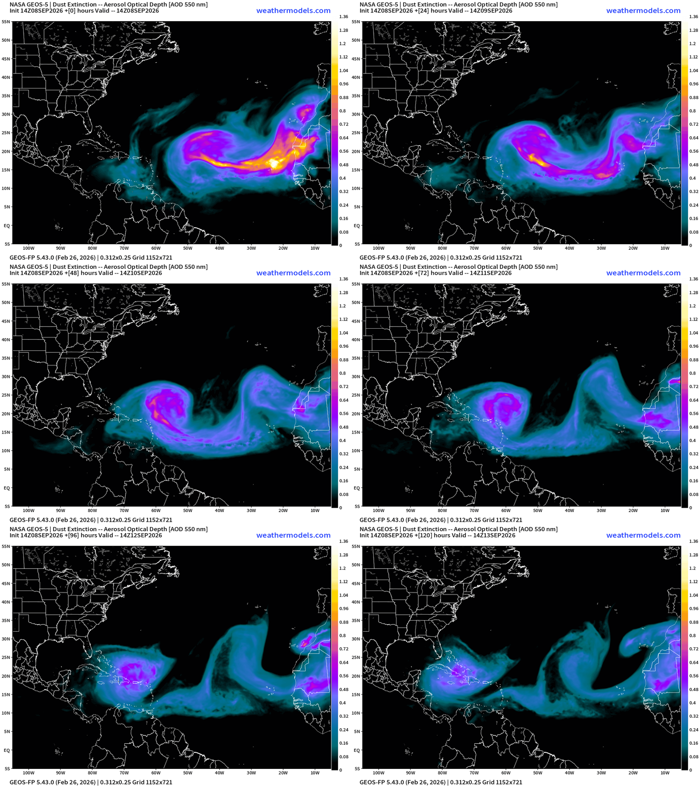
Atlantic tropics is not entirely dead with a couple tropical waves firing convection against the backdrop of an impressive late-season Saharan Dust Layer.
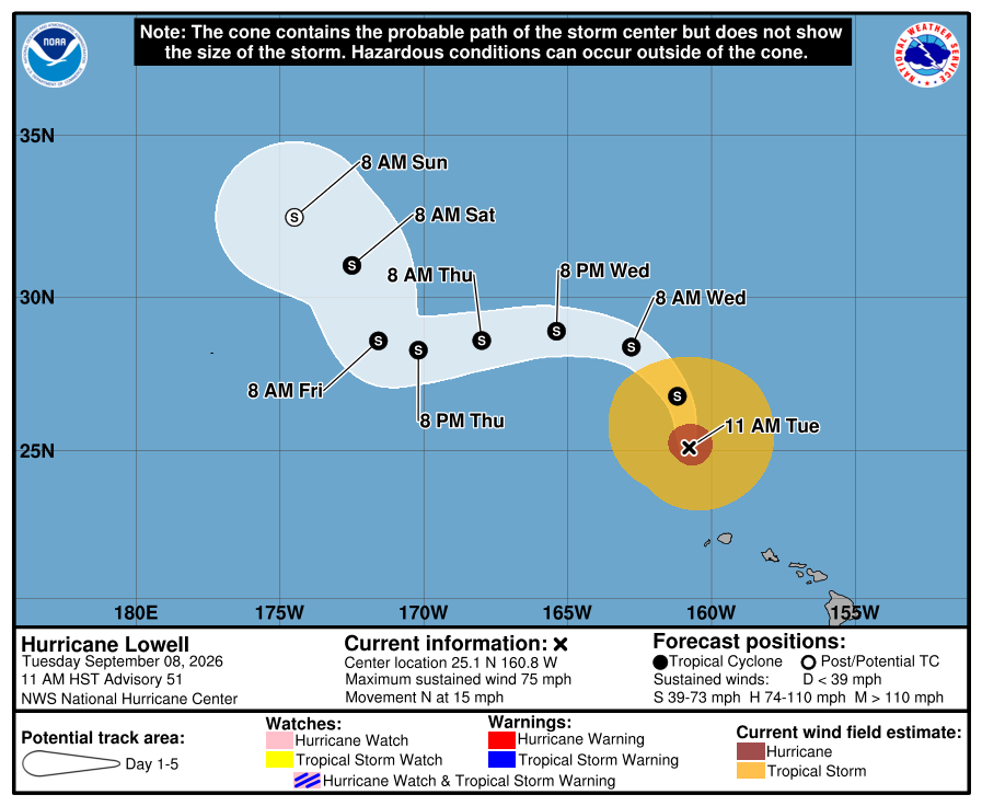
Hurricane Lowell has moved away from the Hawaiian Islands, and will take another 4-5 days to completely spin down as a tropical storm over cooler water.
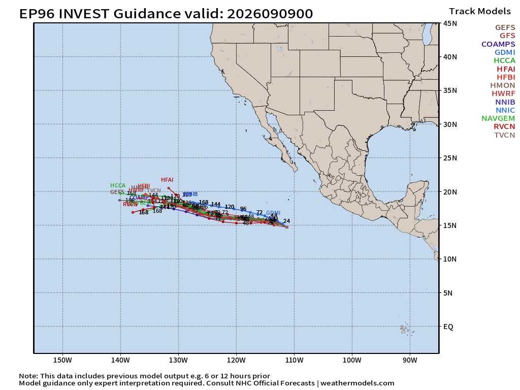
Another system is forming in the coming days (Invest 96E) with next name —> Nestor. It could end up near Hawaii in 10-days, too! The hurricane factory keeps pumping out more — ODALYS and POLO — next up!
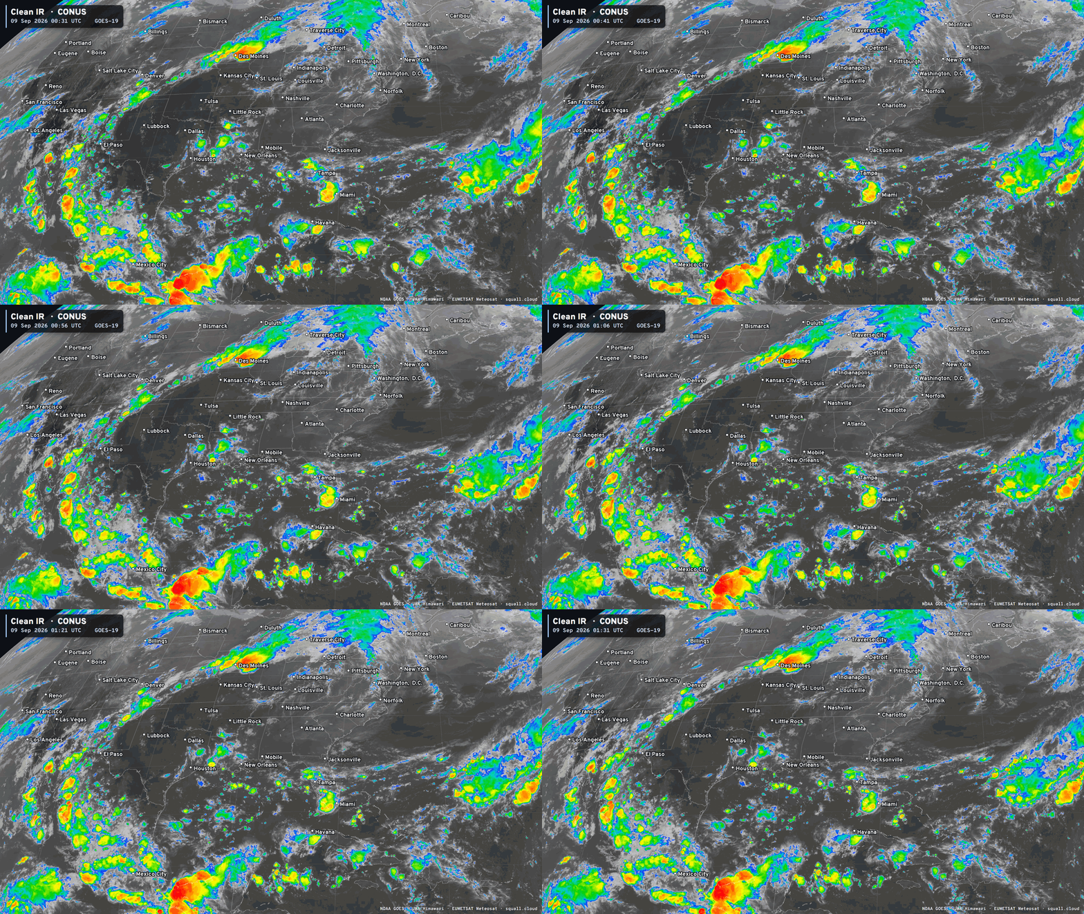
The ridge of high pressure —> HEAT DOME —> remains anchored over TX/Oklahoma with extreme heat continuing for another week at least. Around the ridge, we get a “ring of fire” setup with storm systems tapping into subtropical Pacific moisture.
Temperature Analysis this evening 9:00 PM ET
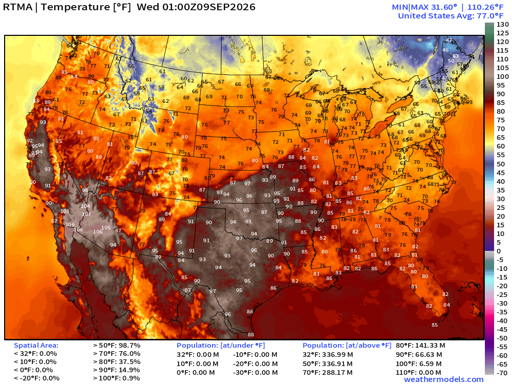
Quite hot in California this evening, continuing tomorrow with additional humidity.
Temperature Anomaly this evening 9:00 PM ET
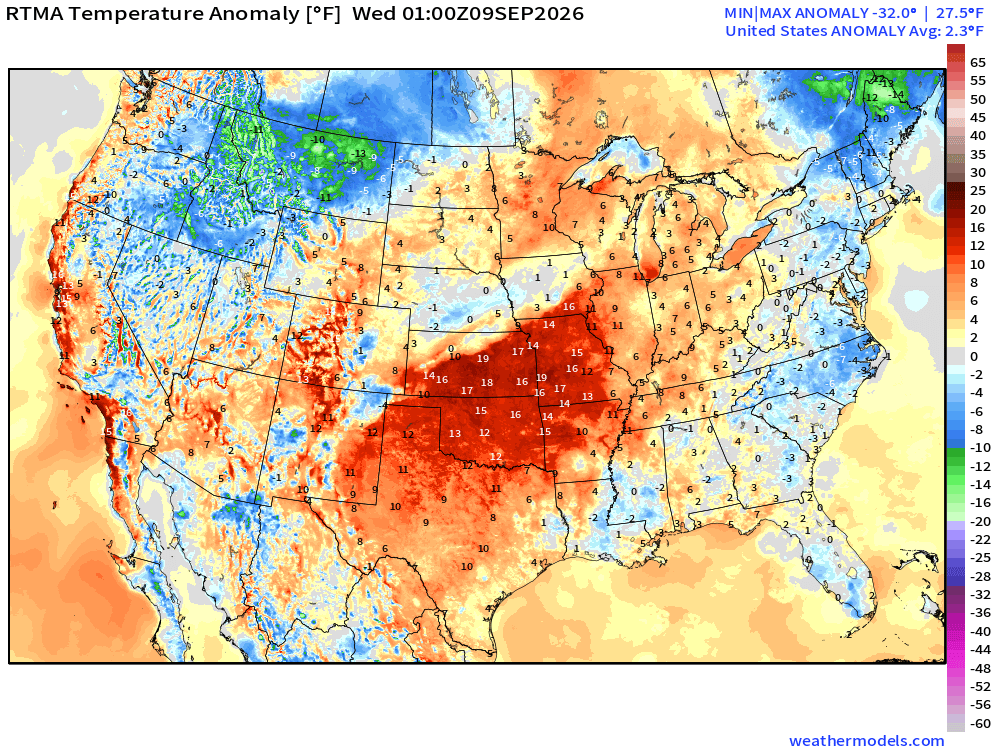
Lower 48 was 2.3ºF ABOVE normal with a huge area of much above normal heat in central Plains
HRRR Precipitable Water Next 48-hours
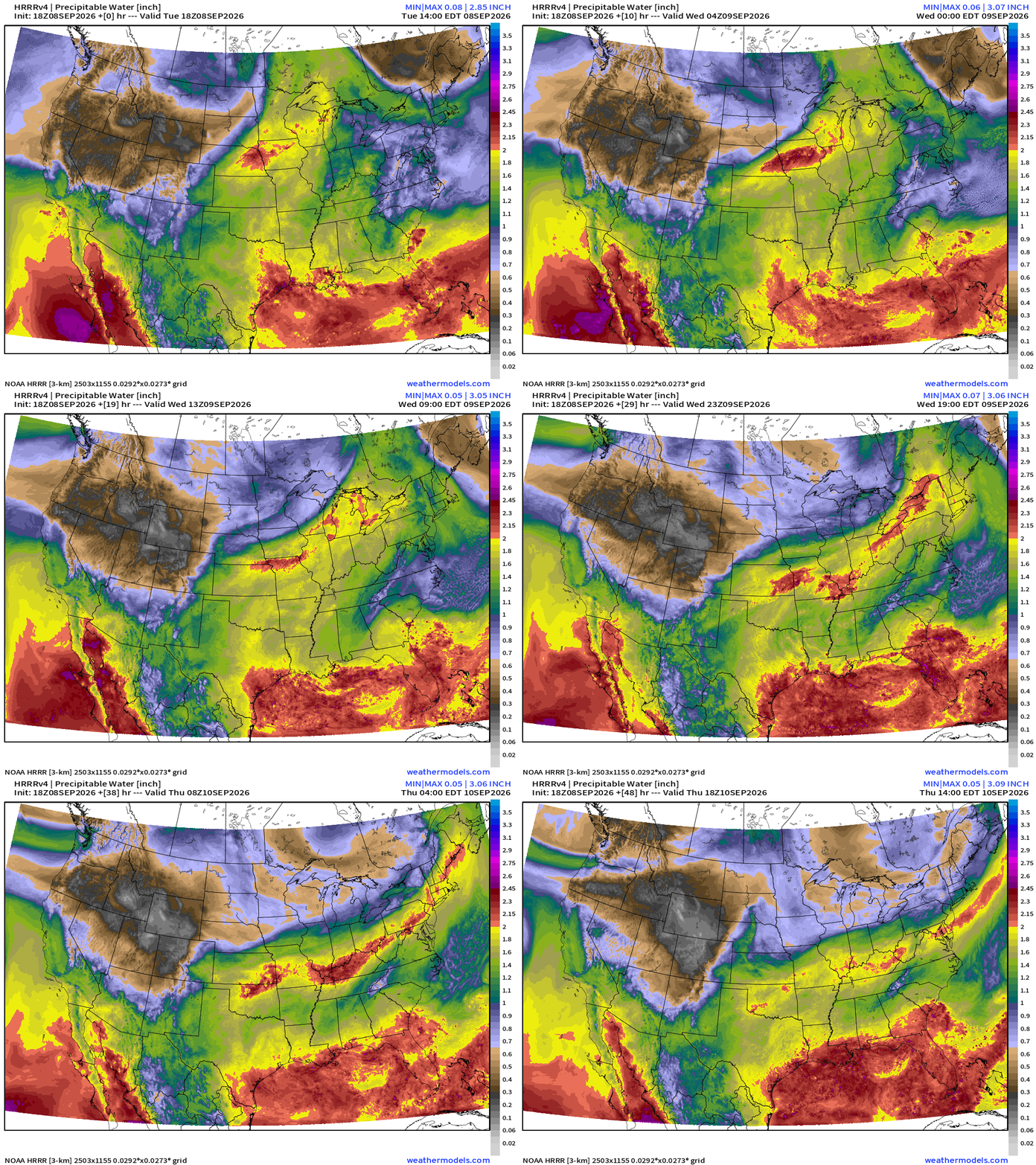
Tropical Moisture into Southern California and even up the coast into Wed/Thurs as a more tropical airmass surges northward with help from Marie’s leftover large circulation. The added moisture = humidity increase —> heat index in the 100s across to SoCal including LA. Quite unusual!
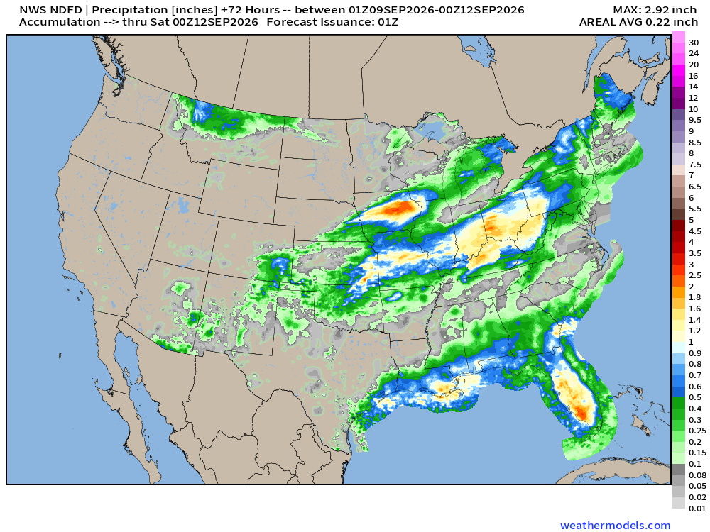
NDFD NWS Precipitation Next 72-hours
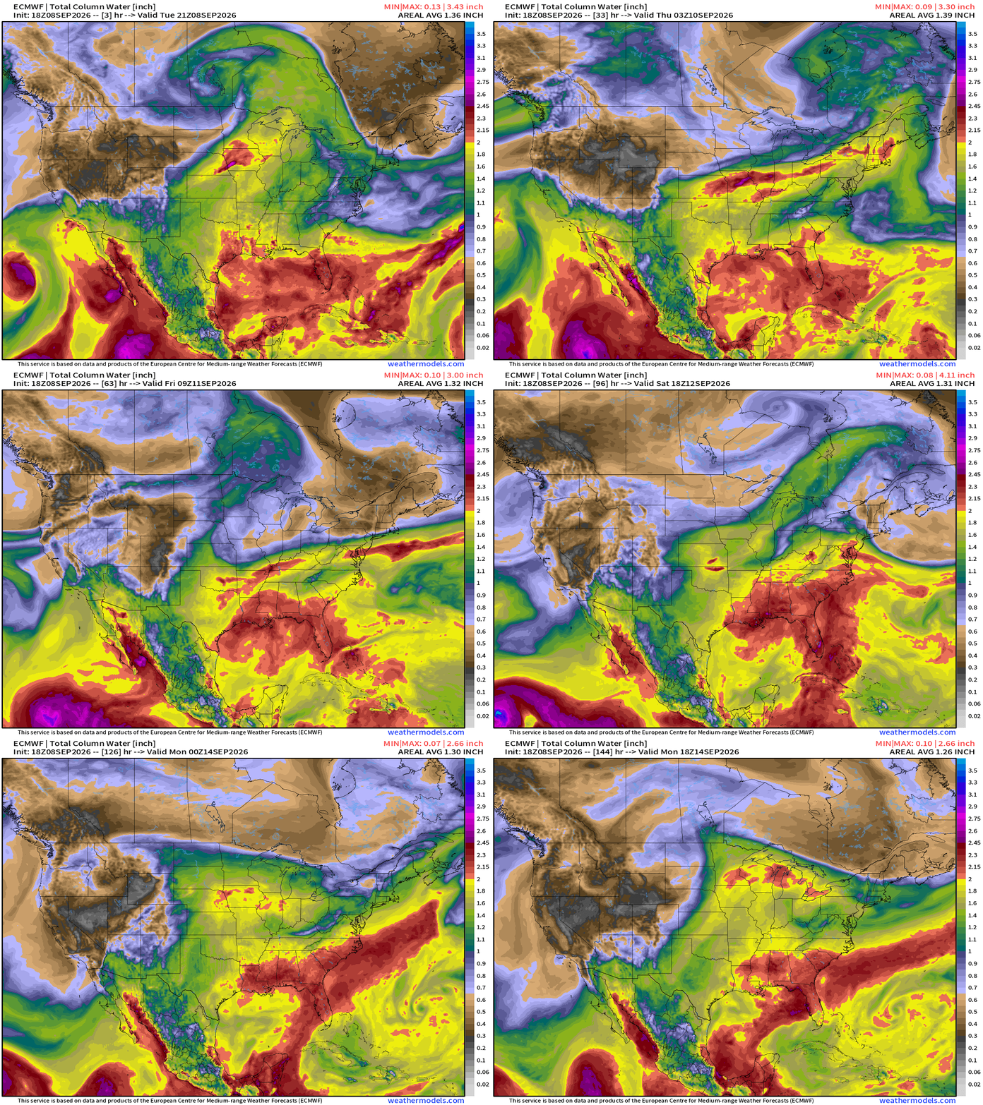
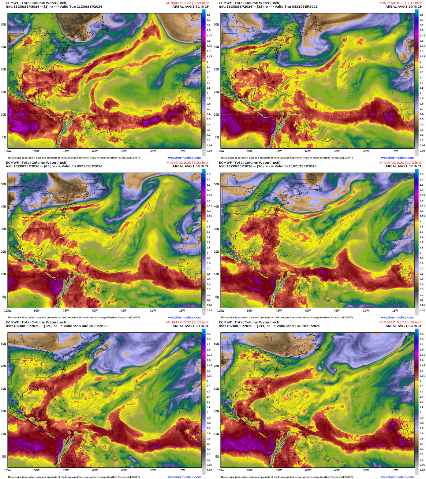
Precipitable Water | My Favorite Parameter (6-days ECMWF HRES 18z)
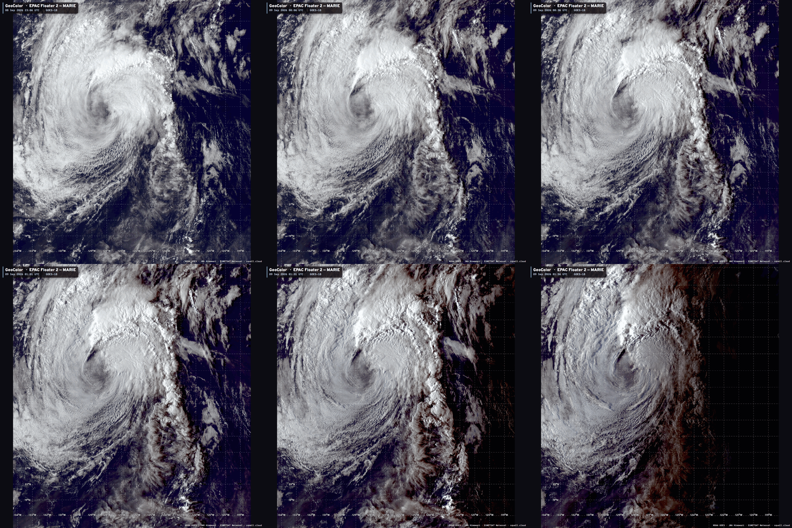
Hurricane Norbert spins westward just out of the frame with the remnants of Marie finally getting wiped away by a trough along the West Coast. The leftovers of Marie are quite beautiful — still generating convection over the chilly waters off the coast of California. The very humid / tropical conditions in SoCal are due to Marie’s circulation.
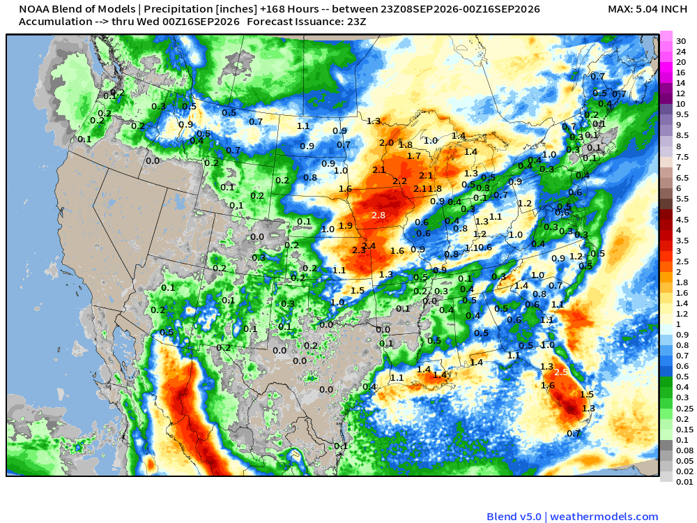
Blend of Models — Precipitation Next 7-days
Height Anomaly 10-days | AIFS 18z —> upper-level circulation pattern
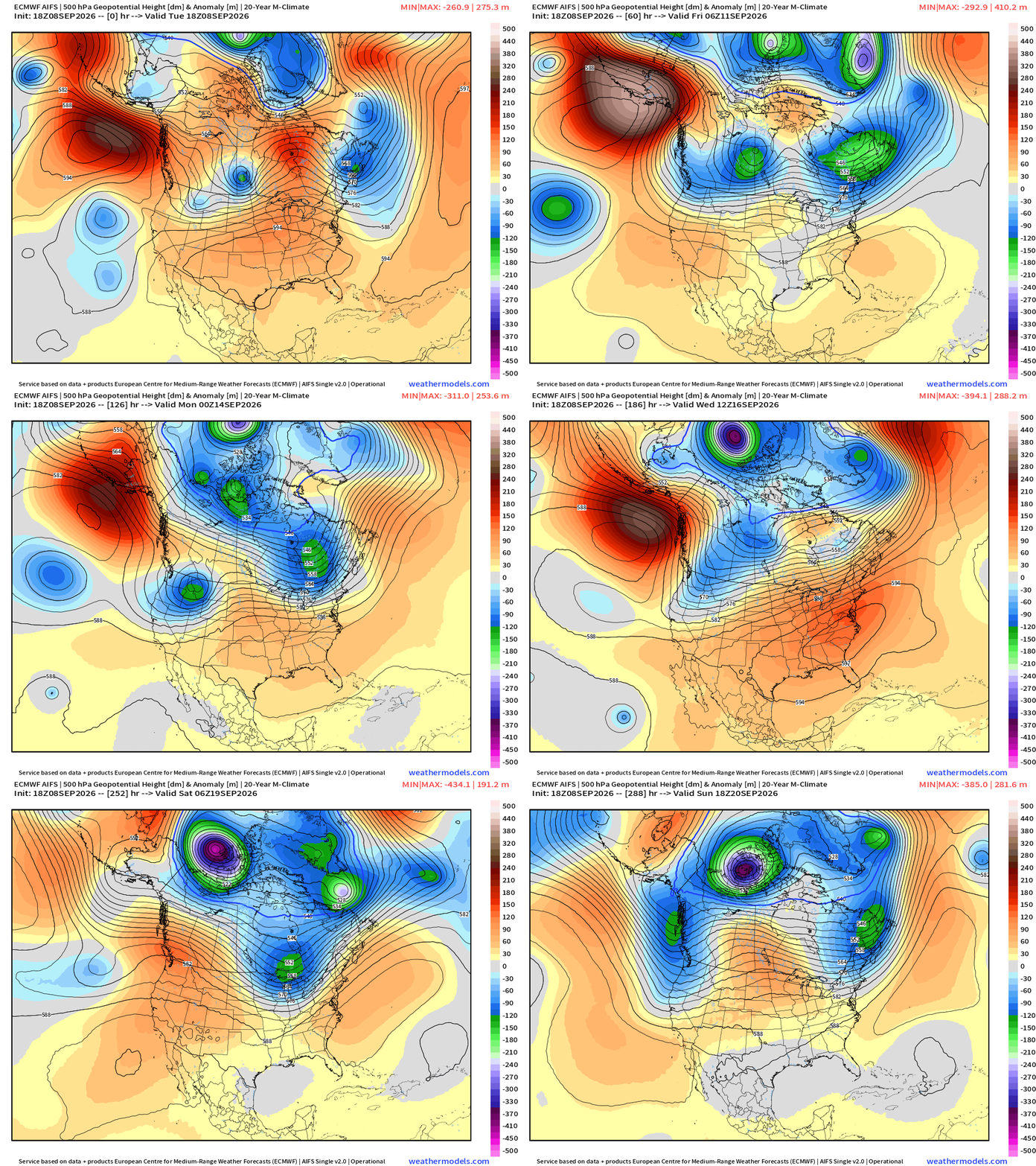
Finally a sequence of strong troughs bringing much cooler Canadian Arctic into the Lower 48 by Days 8-10 — and then the “polar vortex” trough in far northern Arctic looks more intense.
High Temperatures Next 8-days
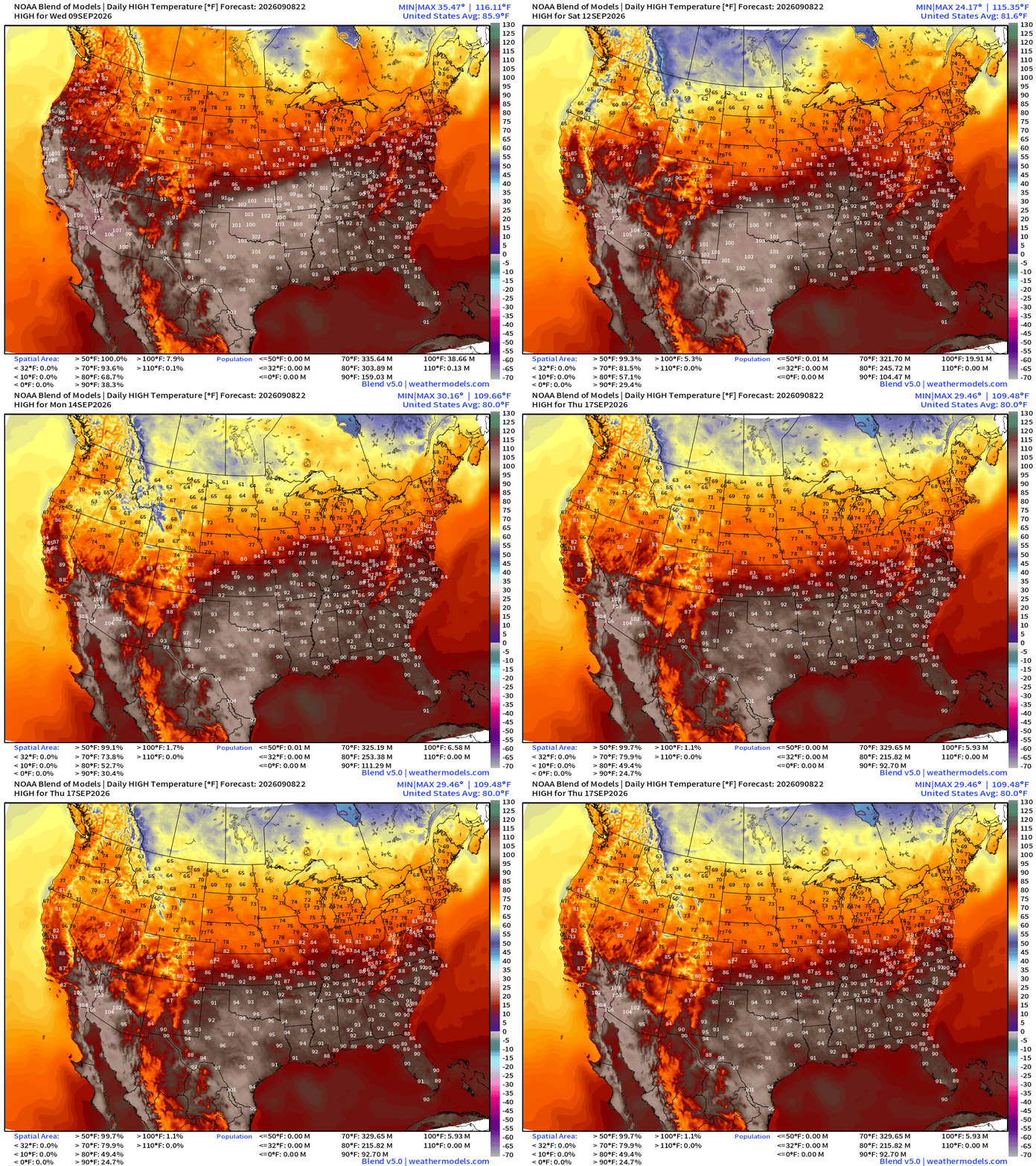
Cooler 50s and 60s across southern Canada are on their way! But the 90s and even 100s are holding strong across the southern 1/3 of the Lower 48 into Thursday, September 17.
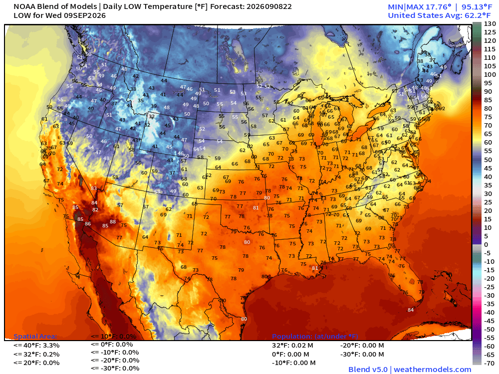
Low Temperatures Wednesday Morning
High Temperatures on Wednesday
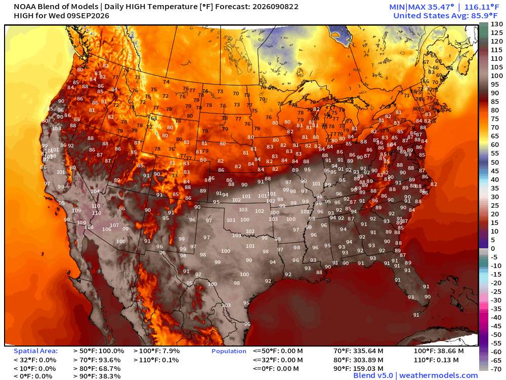
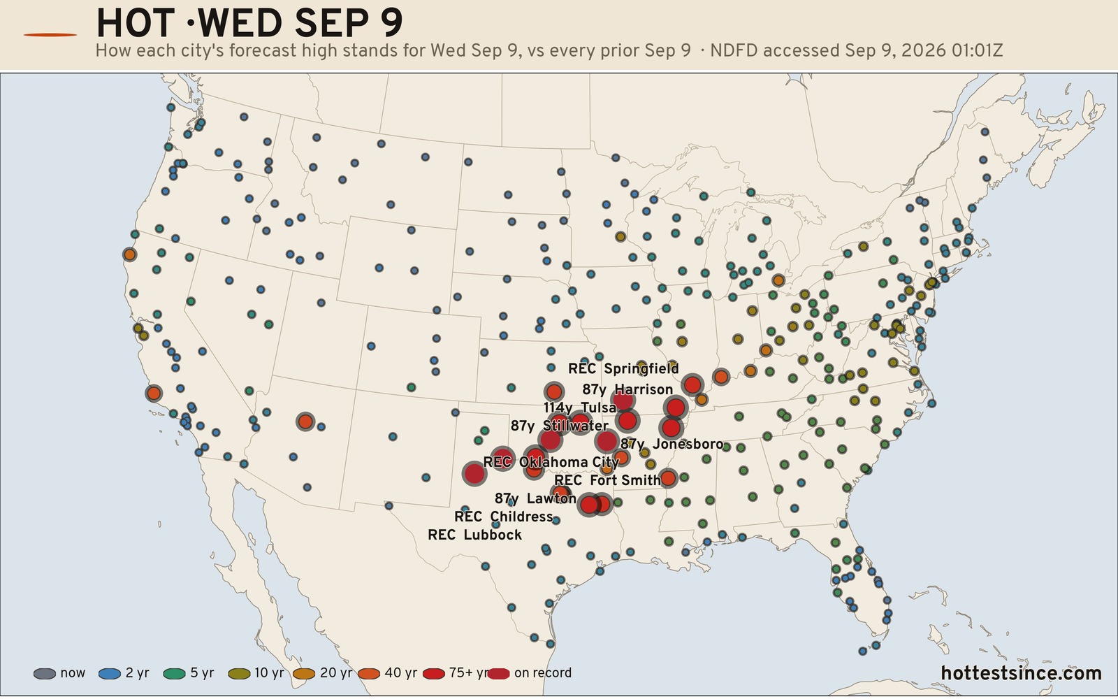
Extremely warm for September 9th — 100s into southern Illinois. And then 100s in California, too!
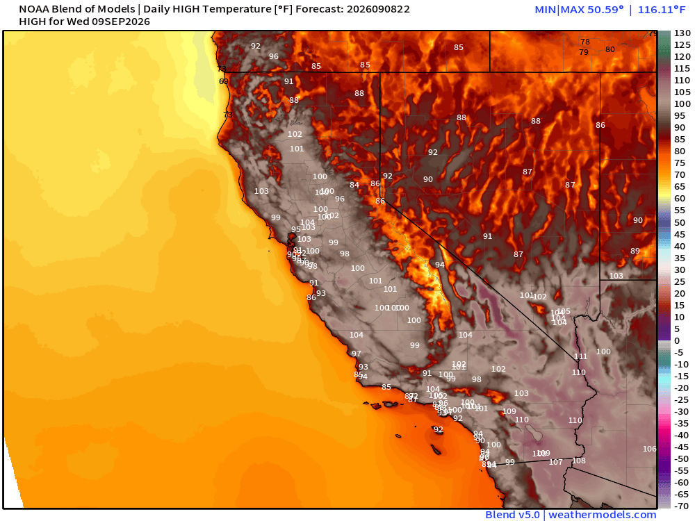
Plenty of Record Highs from HottestSince.com
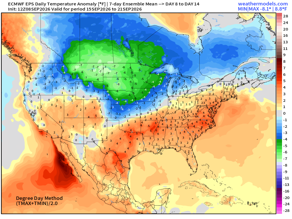
Weekly Temperature Anomaly Next 2-Weeks | EPS 12z '
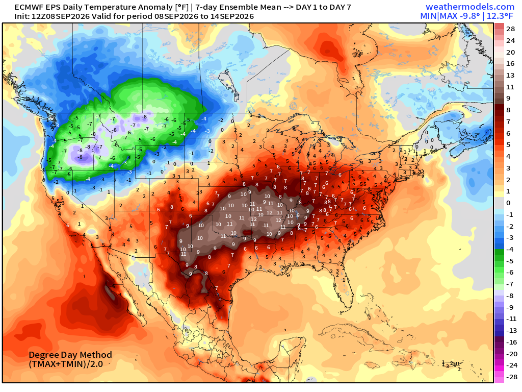
Chilly air across the Pacific NW … transitions to northern Rockies and Midwest into first days of autumn
Atlantic Tropical Outlook
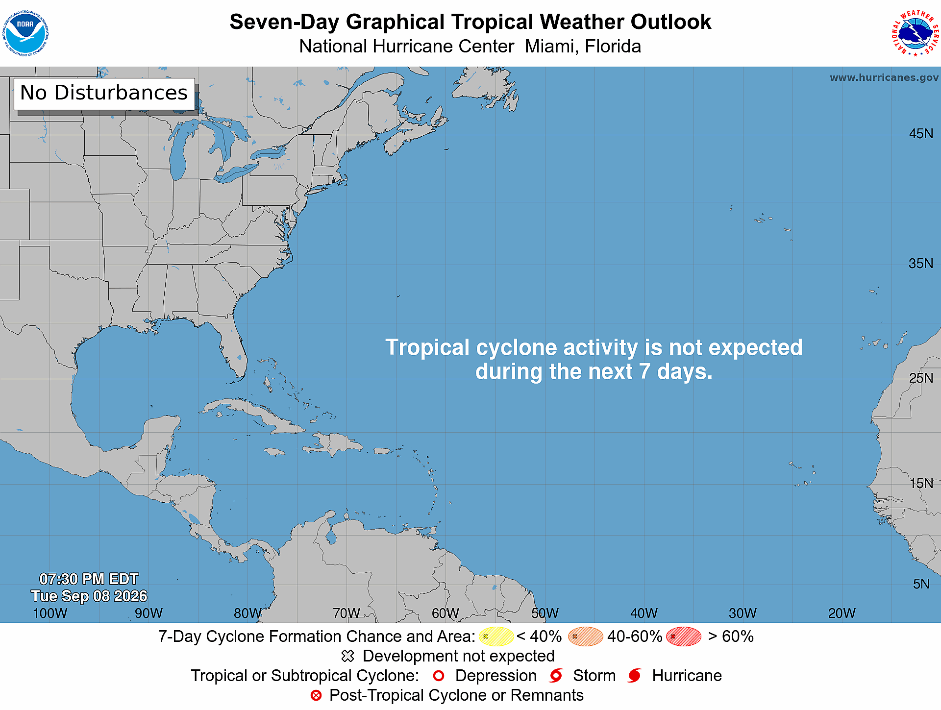
Ghost town —> no organized tropical systems through 7-days
The Atlantic Tropics are still functioning — plenty of convergence along the ITCZ with tropical moisture but the tropical waves can’t catch fire due to Saharan Air Layers, dust, and wind shear. ECMWF HRES 18z next 6-days PWAT (my favorite parameter)
Ghost Town | Tropical Waves Analysis
NASA GEOS-5 Dust — Next 5-days —> huge plumes still coming off Africa and completely wiping out the tropics!
Atlantic Satellite | Air Mass
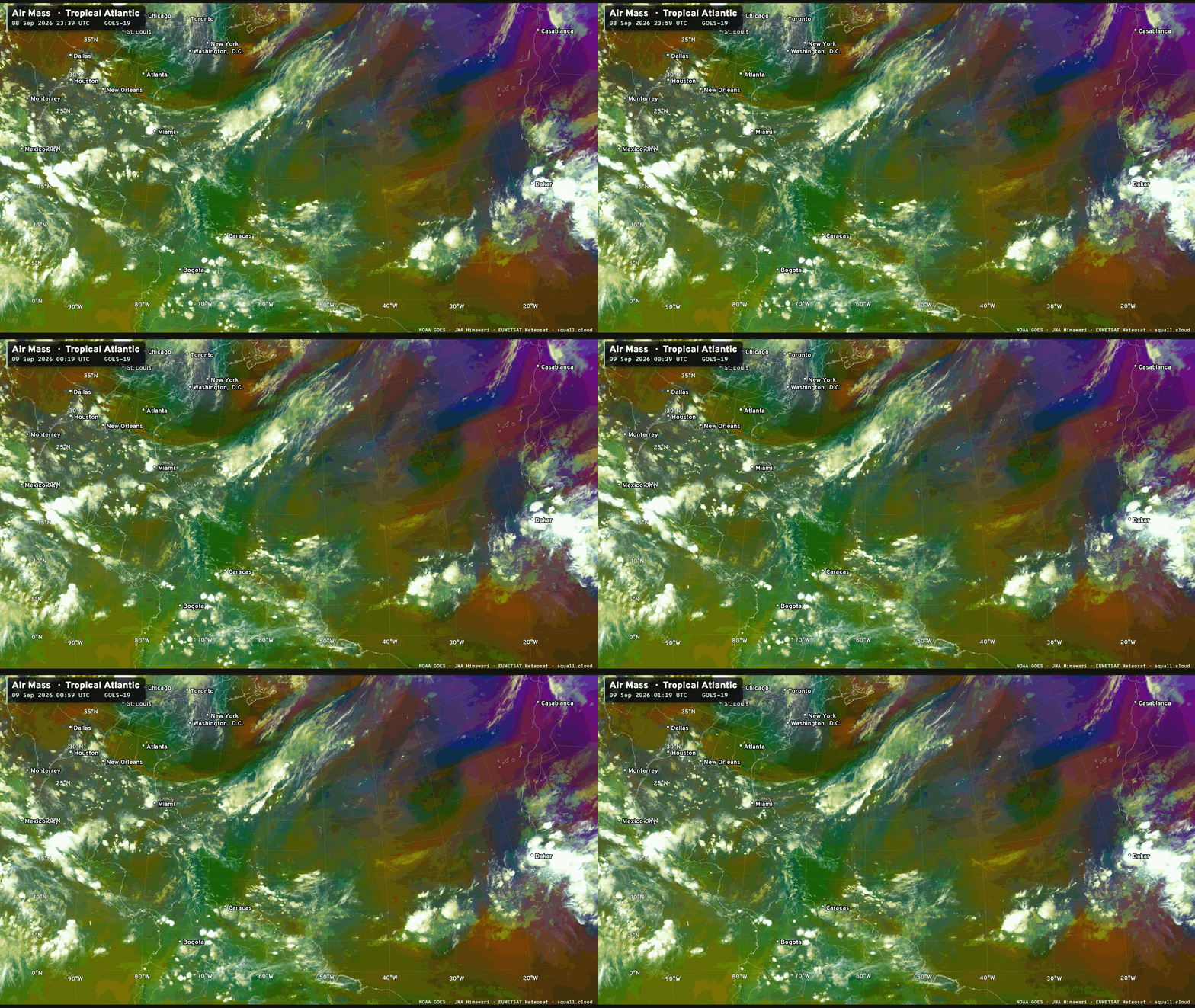

You can see more Satellite Imagery at Squall Cloud —> LINK
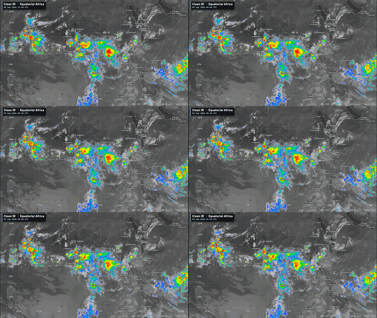
Equatorial Africa tropical waves look better than a few days ago. One is about to come off the coast on Wednesday and another later this weekend over central Africa.
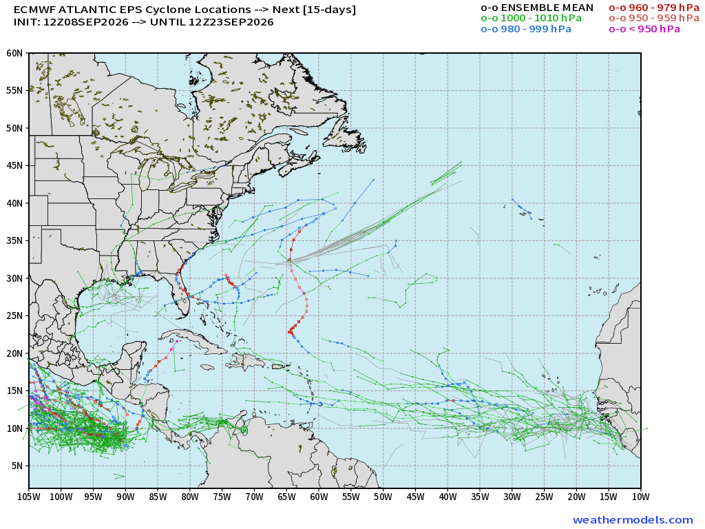
ECMWF Ensemble 12z full-physics tracks next 15-days
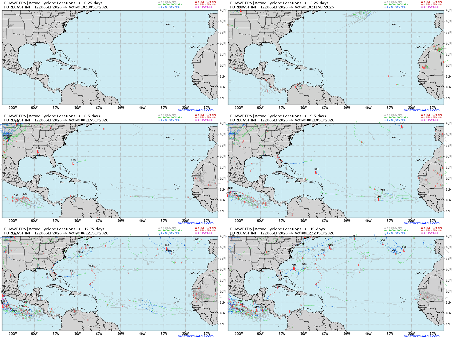
Not a completely blank map — just unorganized or random development from a handful of members e.g. 10/50 so 20% chance of “something” in next 2-weeks during the climatological peak of Atlantic hurricane season = snooze!
Google Deep Mind | Weather Next 2 | 18z Ensemble Tracks (50-mems)
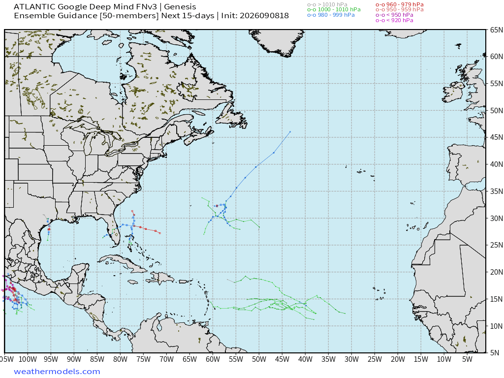
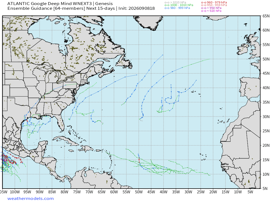
Same story from Weather Next models (versions 2 and 3) with some scattered tracks … but until we see a strong signal, these are just random developments, and low chance % of storm formation. Not zero!
Google Deep Mind | Weather Next 3 | 12z Tracks (64-members)
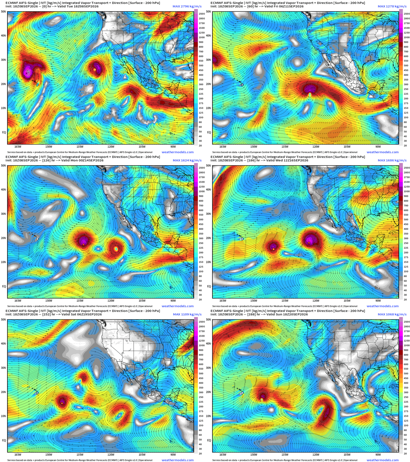
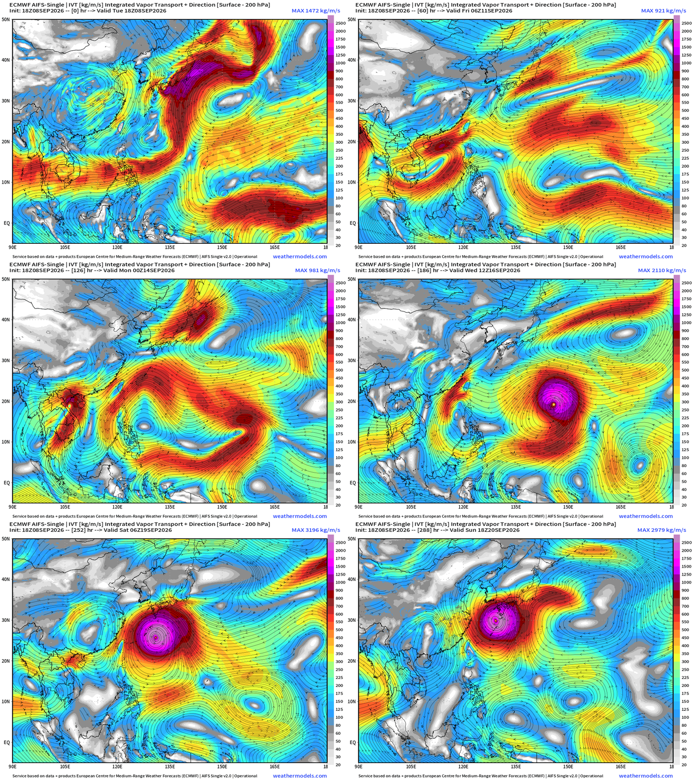
Flagship model: ECMWF AIFS 18z —> Integrated Vapor Transport next 10-days
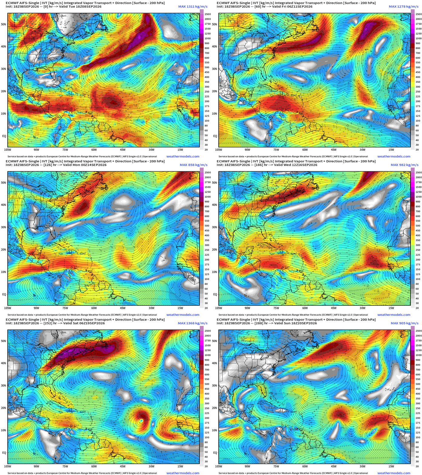
Interesting couple of waves in the Eastern Atlantic at Days 9-12 = something?
Eastern Pacific Tropics
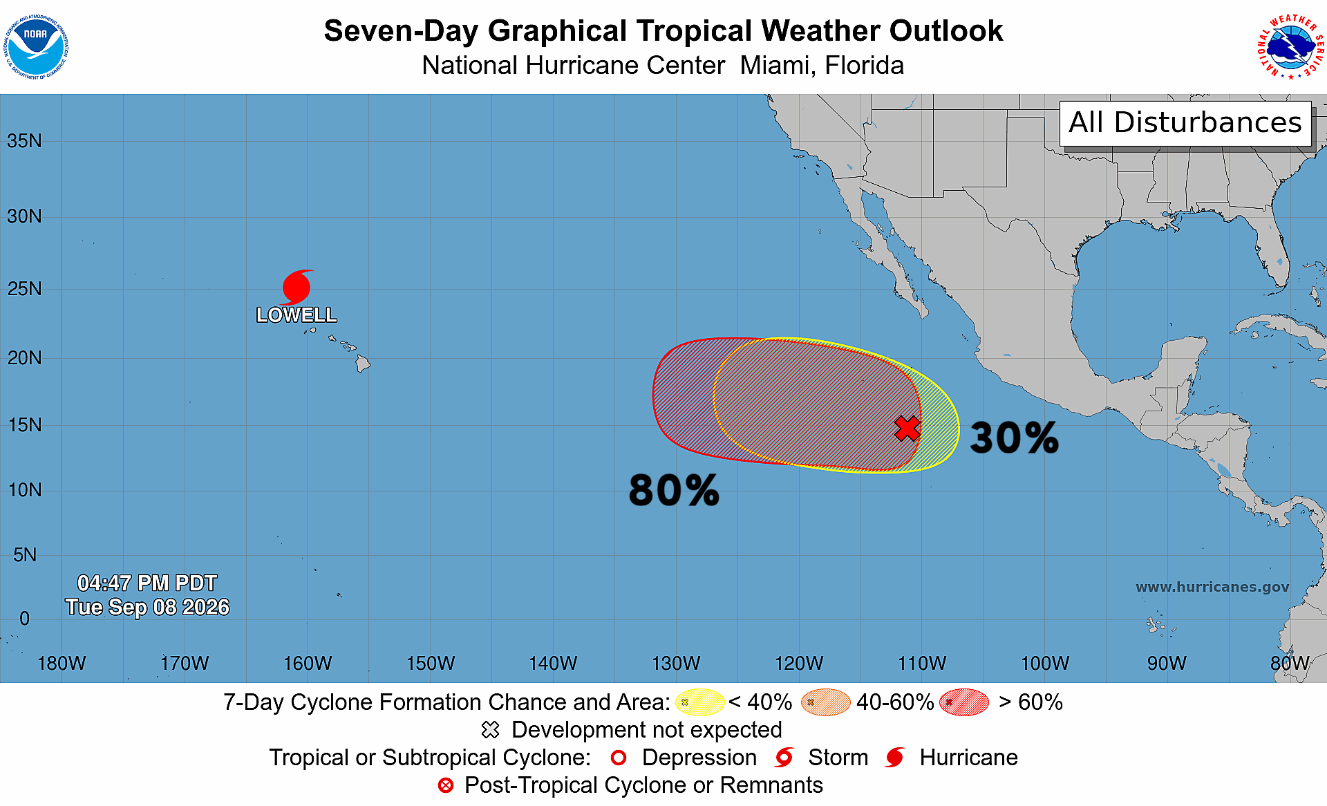
Next up is Invest 96E —> Norbert as Lowell heads away from Hawaii.
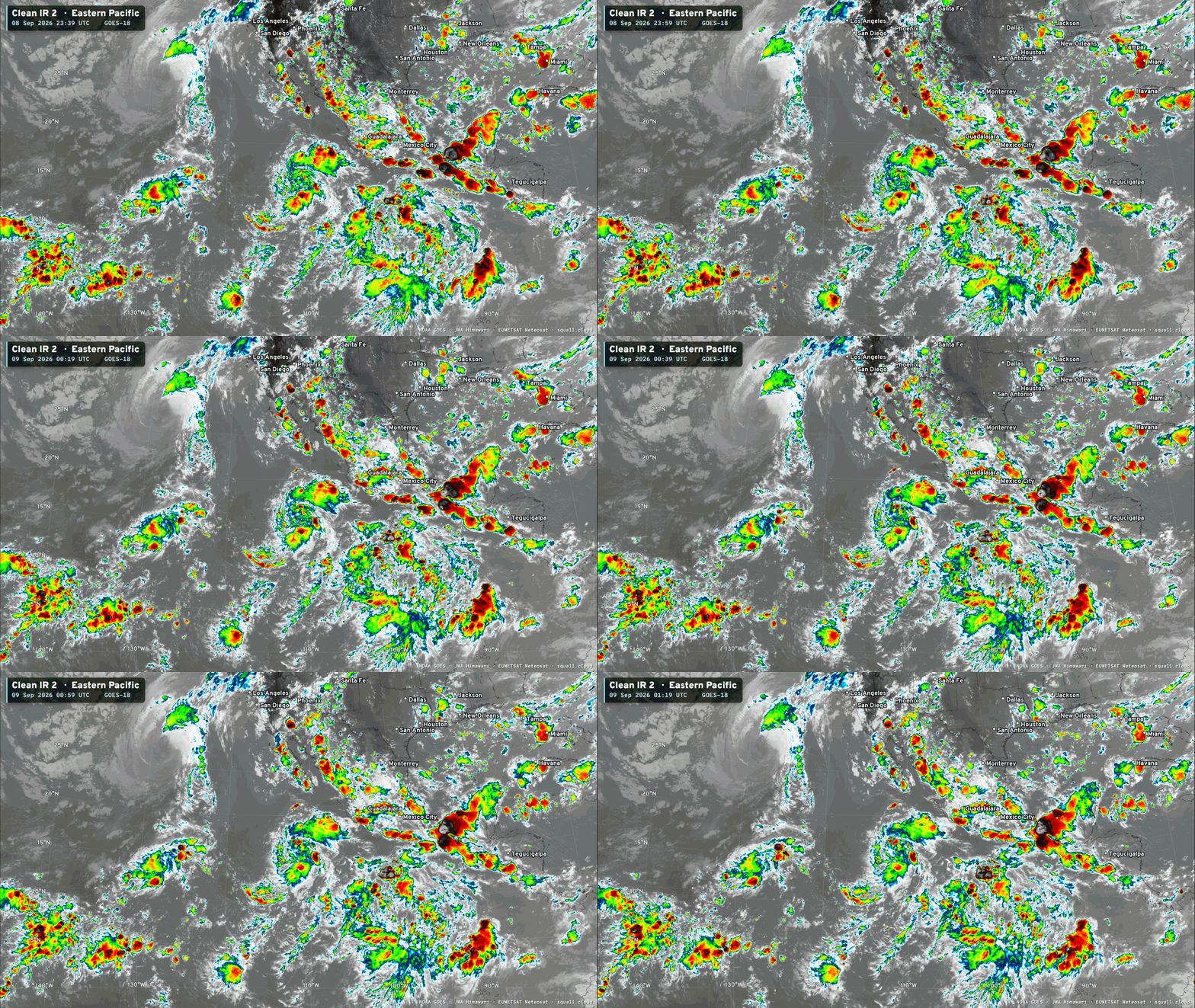
Lowell likely to be downgraded to a tropical storm and then meander until this weekend over the far central Pacific
Invest 96E —> WNW track stays over warm water through 7-days
And, we need to watch 96E —> Norbert and interactions with Odalys that could cause more problems to Hawaii down the road.
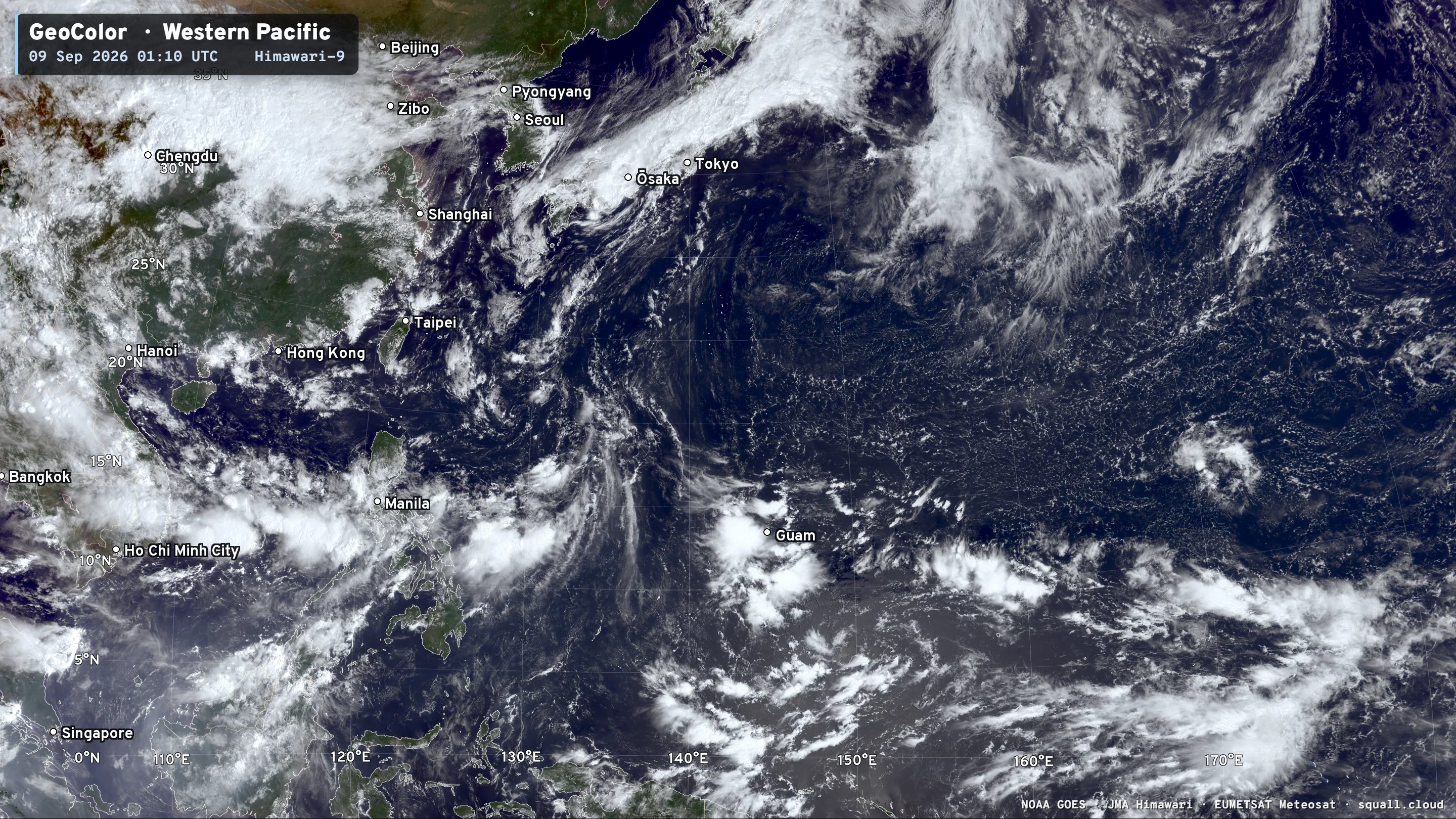
Western Pacific Tropics
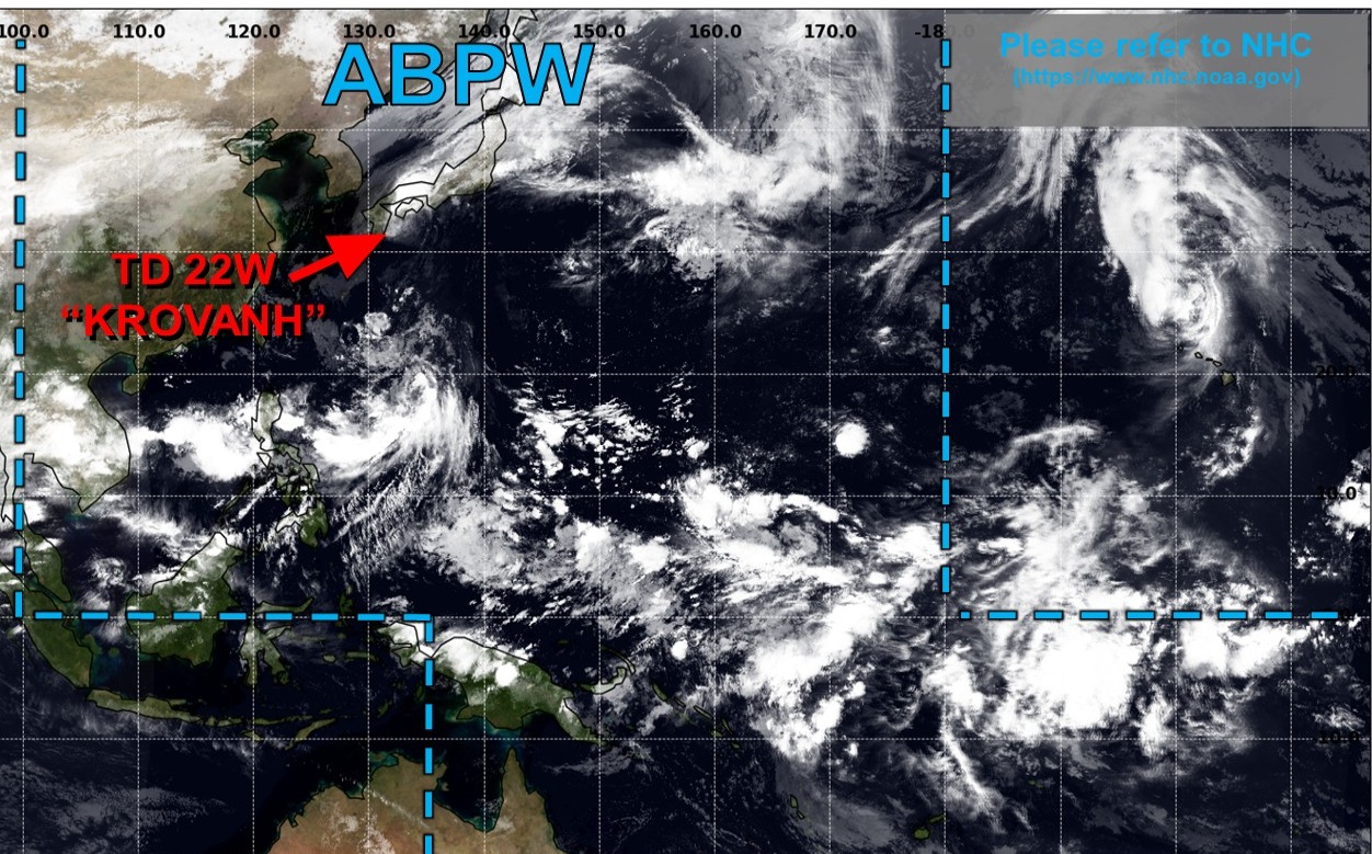
Quiet this week.
But then a monster Typhoon is scheduled by middle of next week
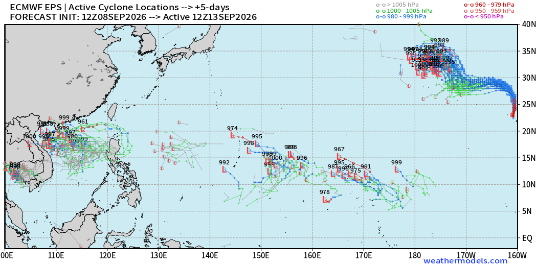
Day 5 ECMWF EPS 12z full physics active tracks — also TS/TY in the South China Sea … and maybe Lowell gets a second wind over the subtropical central Pacific.
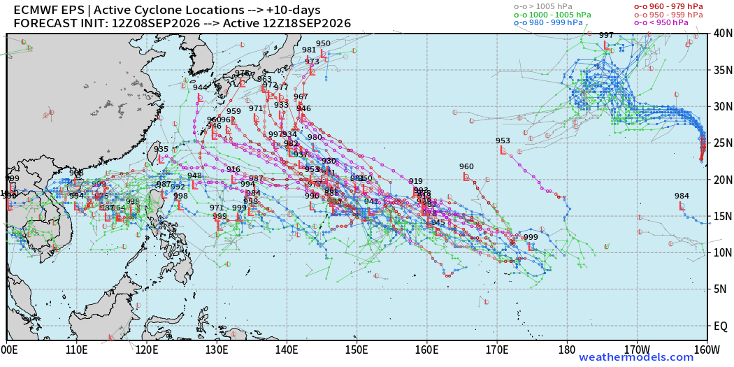
Genesis of the next mid-basin (MDR) typhoon somewhere between Guam and the Dateline
Day 10 Active Tracks (EPS 12z) show ongoing powerful Typhoon(s)
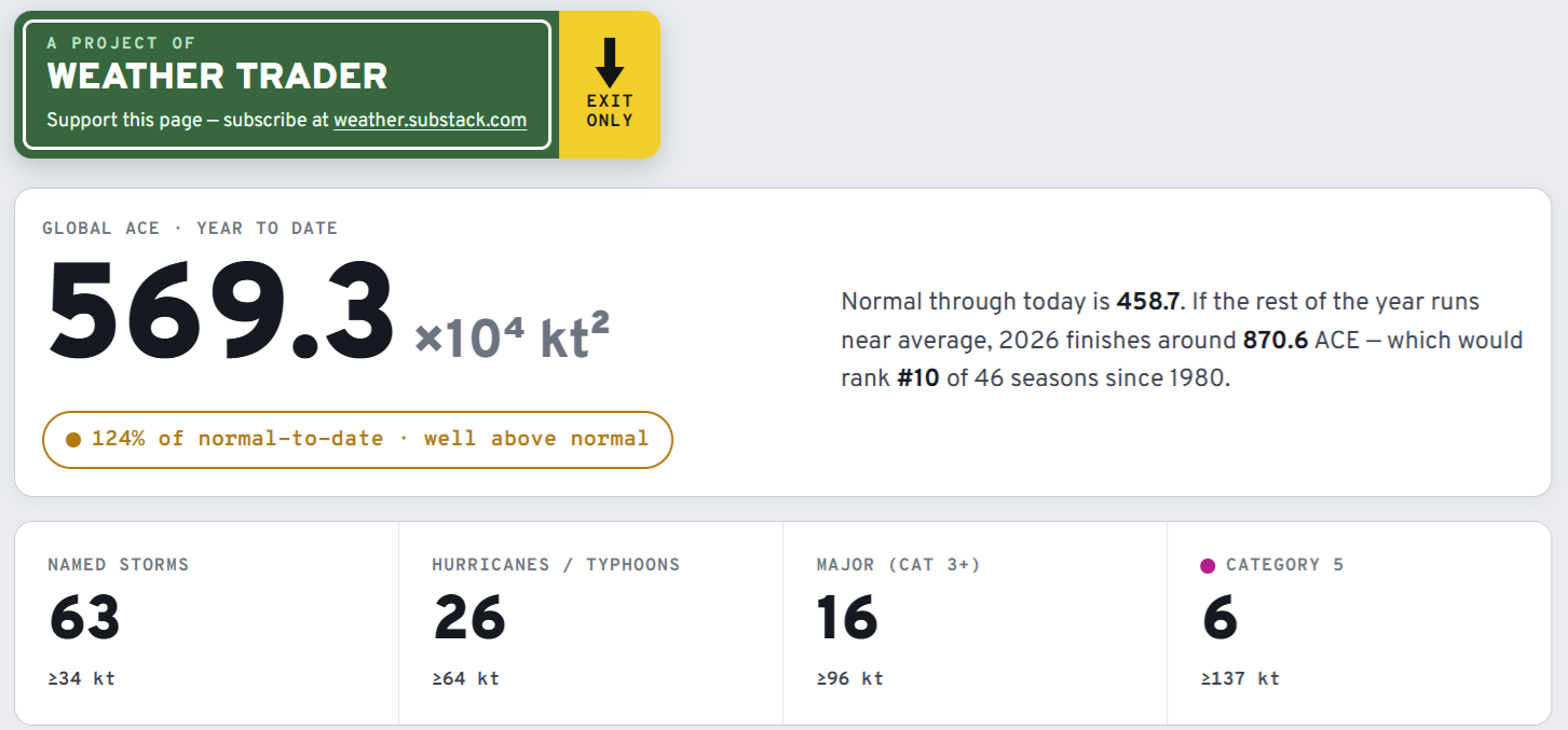
Visit Global Tropical Cyclones for more ACE information, as well as my original climatlas.com/tropical site now with the beautiful Interstate Highway theme and full of interesting content! ACE now 569
Forecast Eagle maps explorer in beta for another week. Trying to make into a functional mobile app, too.

Satellite imagery from Squall Cloud. Maps sourced from weathermodels.com designed and innovated by yours truly! Please subscribe there for real-time access to the newest maps, charts from all of the weather models including ECMWF and AIFS, and NOAA GFS/GEFS, HRRR/RRFS and Blend of Models (NBM). NOAA WPC and SPC for fronts/convective outlooks. Our own content is now sourced from hottestsince.com and weather.city and celsius.earth, and squall.cloud and weather.football and global-tropical-cyclones.com and precip.earth
My Atlantic Hurricane Season Forecast (2026)
From April 7, 2026: Atlantic Seasonal Hurricane Forecast: (11/5/2)
9-13 Named Storms (11 most likely)
4-7 Hurricanes (5 or 6 most likely)
1-3 Major Hurricanes (2 most likely)
Accumulated Cyclone Energy: 75-85 (well below normal)
NOAA 2026 Atlantic Hurricane Season Forecast
- Milepost
- 1027 · laid 2026-09-09T02:26:54.617000Z
- Source
- https://weather.substack.com/p/september-8-2026-tuesday-evening
- Digest
- 81de575f35f04ca74ea0c3be887cf17e390b99d1368f7d461e9bf574fe6894ab
- Machine
- JSON