June 11, 2026 Thursday Spring Weather
Busy weather pattern with severe storms across Midwest and Great Lakes. Heavy rain over next week across South with tropical moisture plume.
June 2026 was the 18th-warmest June in the 132-year national record (1895–2026), at 70.6°F against a 1991–2020 normal of 69.5°F (+1.2°F).
June 2026 was the 32nd-wettest June in the 132-year national record (1895–2026), at 3.3in against a 1991–2020 normal of 3.1in (+0.2in).
NOAA/NCEI Climate at a Glance, contiguous United States. This is the observed record for the month, not a score of anything said in this piece — the forecast ledger begins 2026-08-17 and cannot reach earlier posts.

Help support this newsletter (nearing 1,000!) —> June 2026 Coupon
In case you missed yesterday evening’s tropical update with highlight that Colorado State’s seasonal forecast now matches ours from April 7th —> Wednesday Evening
Headlines for Thursday
Heat across the Eastern U.S. with sunny skies + humidity
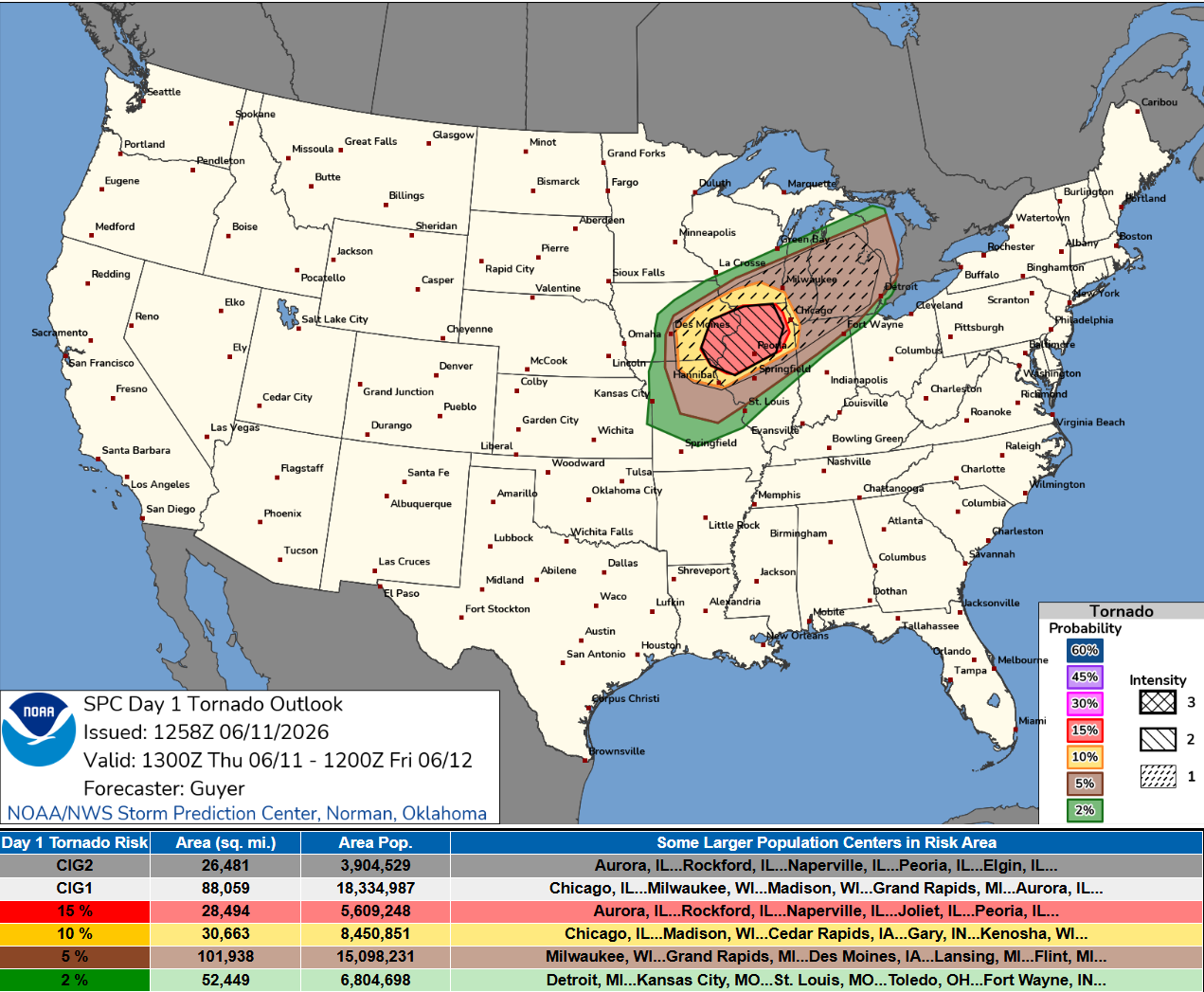
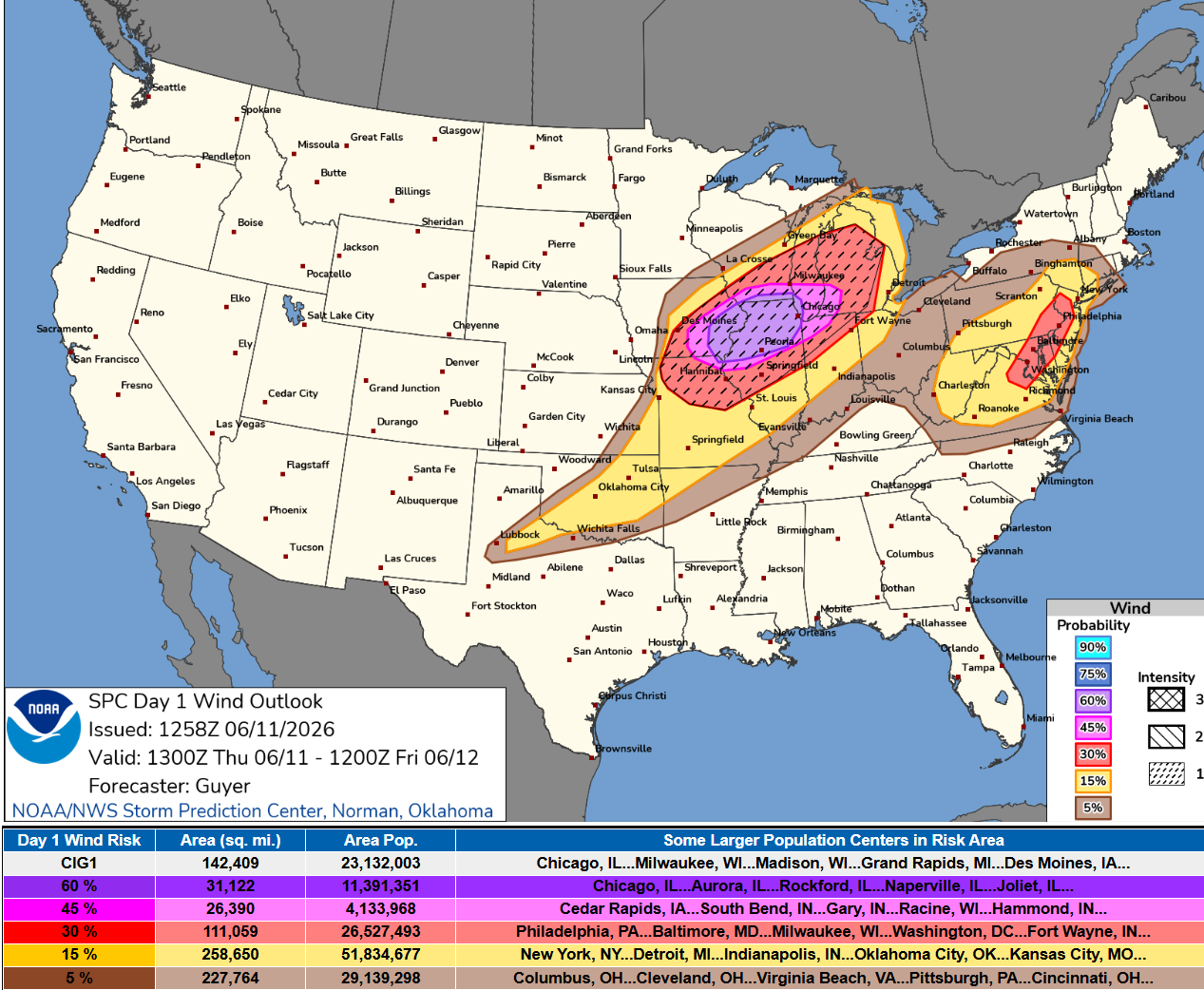
Severe weather — wind + tornado —> Moderate Risk across Great Lakes
Tropical moisture plume will collide with Canadian trough —> boatloads of rainfall across the South
Headline Maps — severe weather event underway across the Midwest and Great Lakes
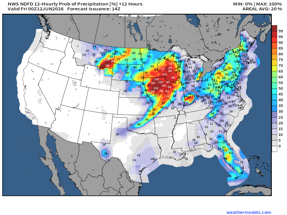
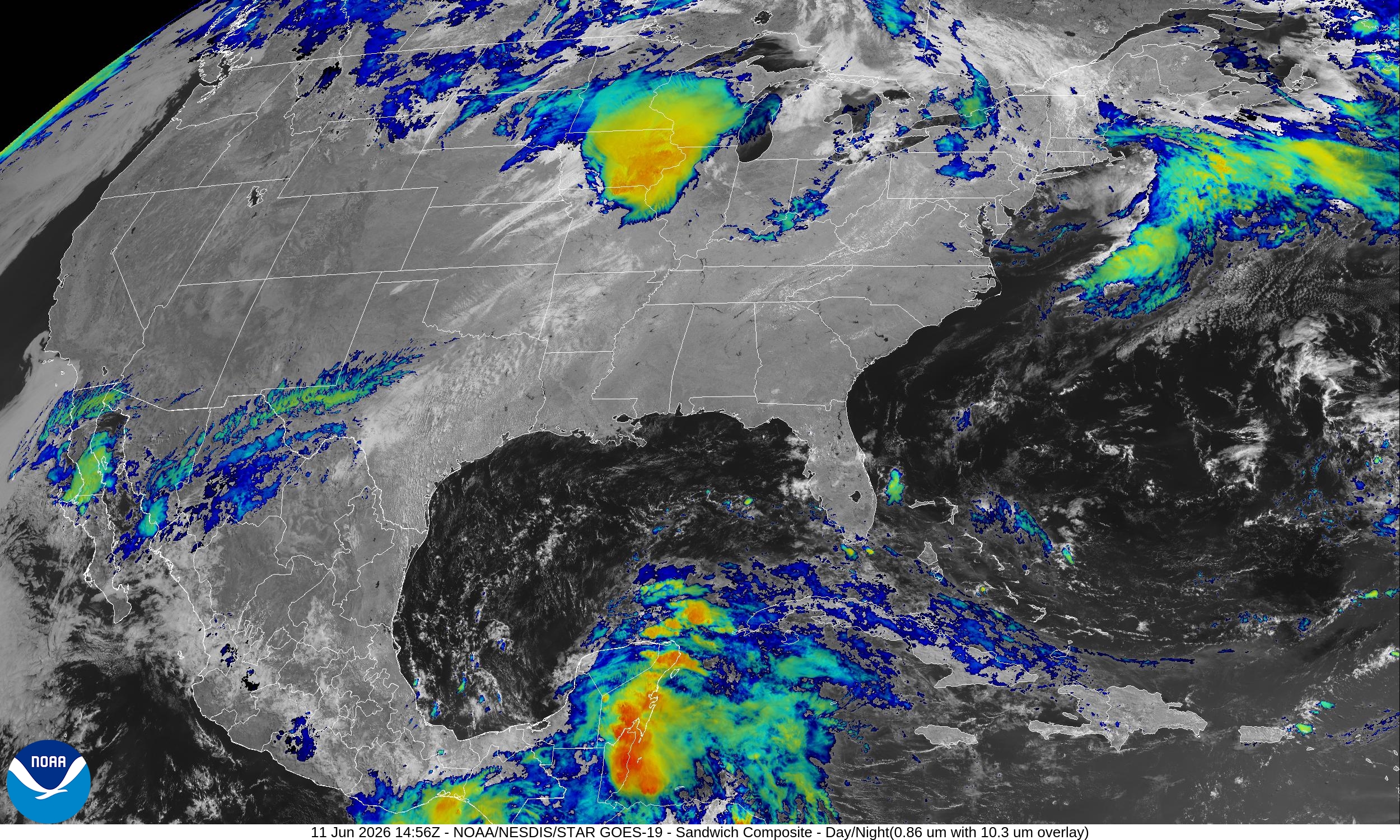
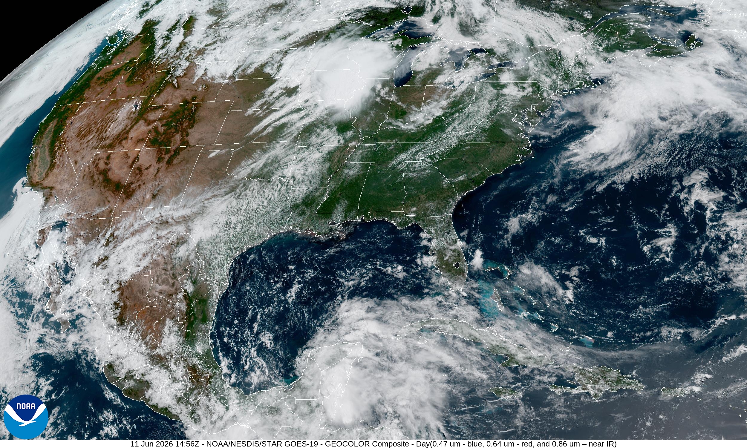
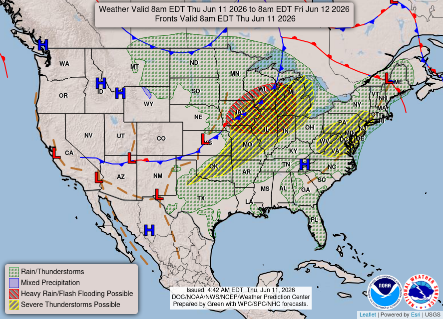
Convective Outlook — Severe Thunderstorms on Thursday (SPC Day 1)
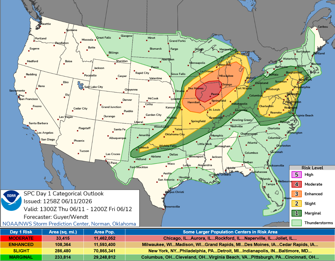
SPC Summary: Widespread severe thunderstorms are expected across parts of the Midwest and Great Lakes region, including Iowa, northern Missouri, northern Illinois and southern Wisconsin to Lower Michigan and northern Indiana. This includes the potential for widespread/intense damaging winds, large hail, and tornadoes, some of which may be strong.
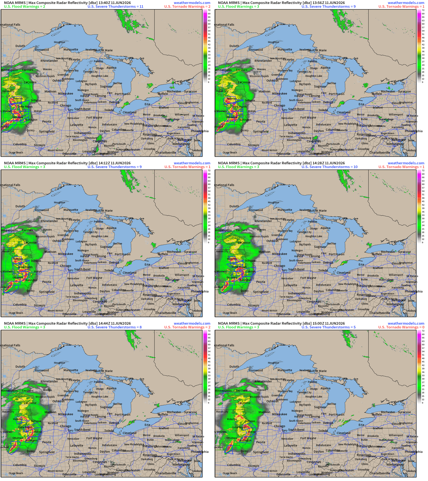
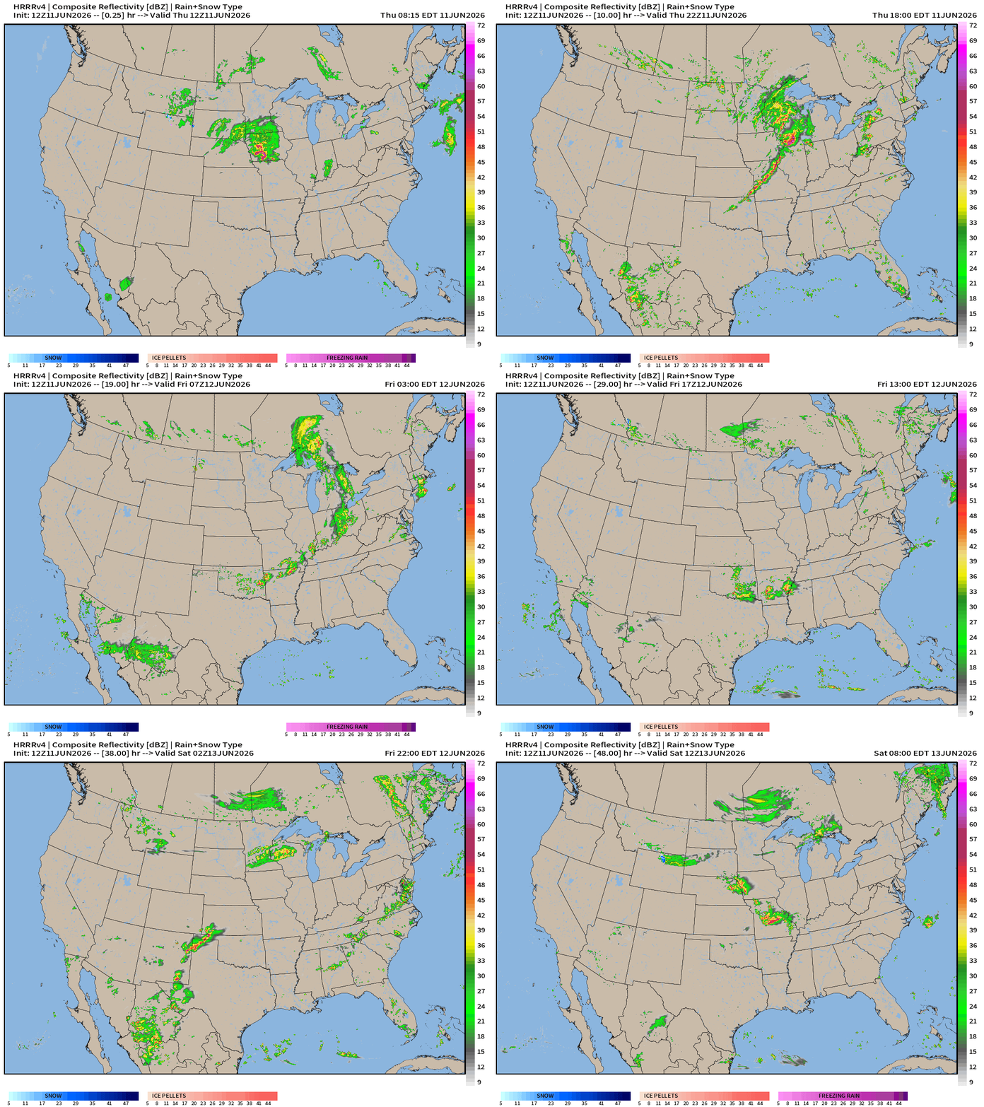
Radar Through 10 AM ET showing mesoscale convective complex
HRRR simulated Radar through Friday 2 AM CT
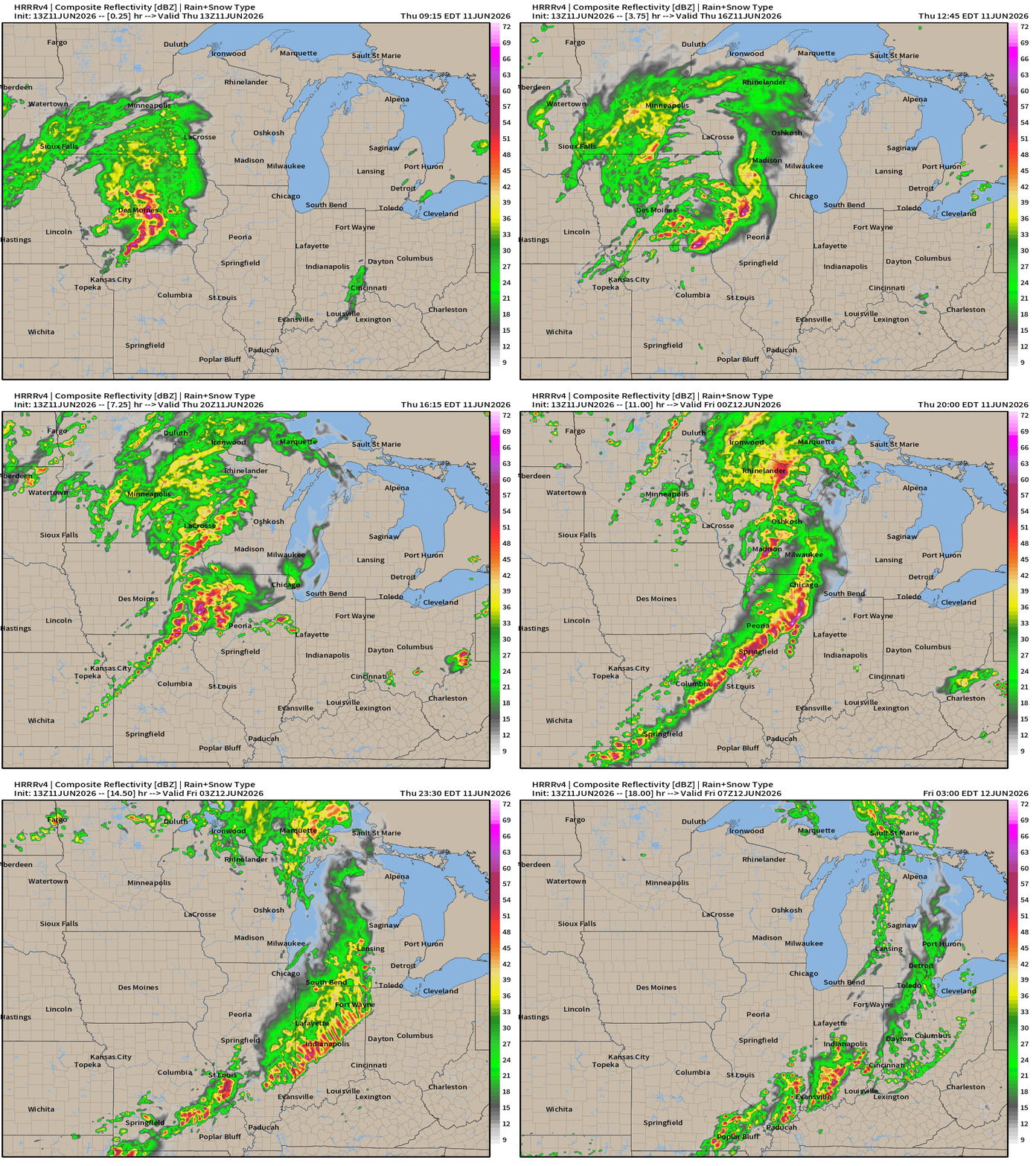
Squall line develops later this afternoon/evening and sweeps through the region
Please monitor your local National Weather Service alerts and watch online streaming coverage + local television broadcasts
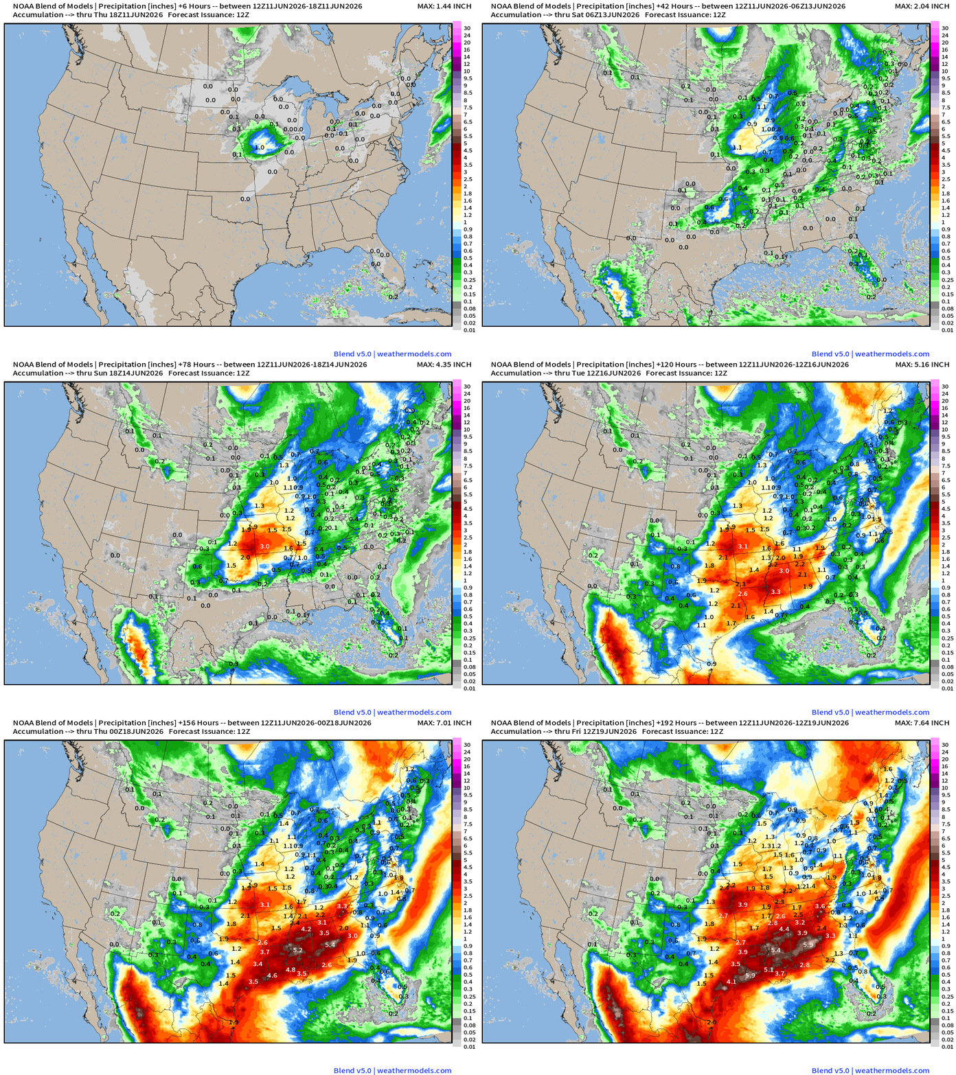
Boatloads of Rainfall on the Way
Blend of Models —> Precipitation Next 10-days
Weather Trader is entirely reader-supported publication (no ads). To receive all new posts and support our work, consider becoming a free or paid subscriber. ALL CONTENT is original (human — Ryan) and not A.I.
Help Support these posts (now nearing 1,000!) —> June 2026 Coupon
My favorite parameter — next 48-hours of HRRR Precipitable Water
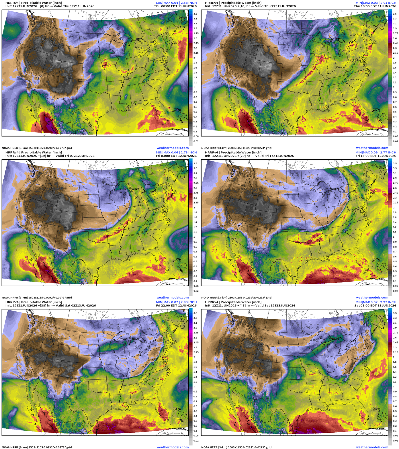
Also, note the monsoon moisture in the U.S. Southwest and in the Gulf of California + Baja California — surging northward.
Flagship model: ECMWF AIFS 06z —> Integrated Vapor Transport next 10-days
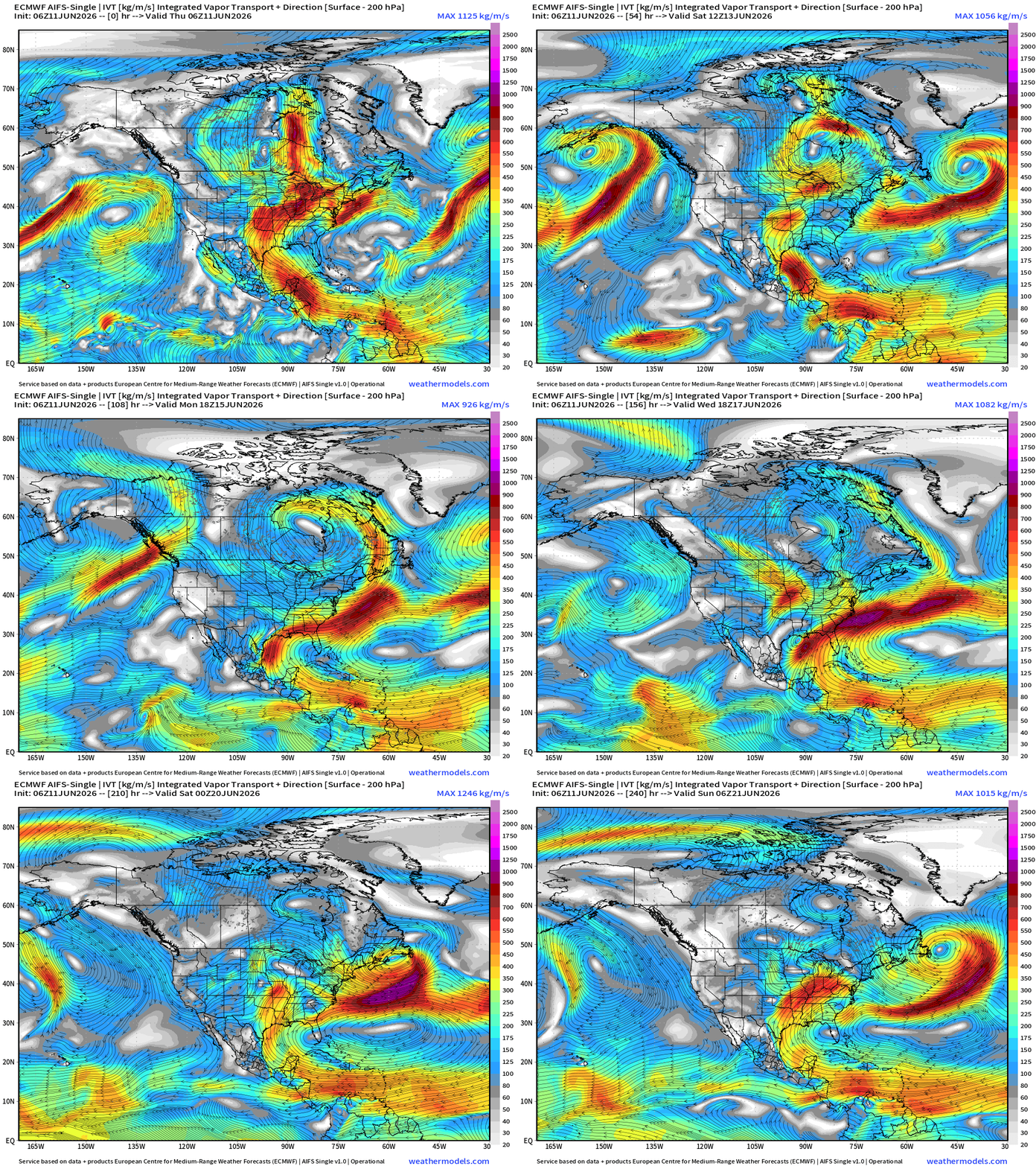
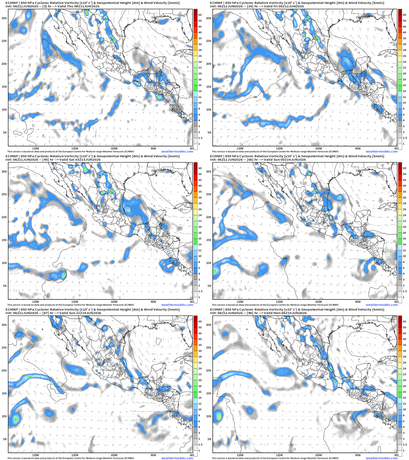
The large scale flow with the Central American Gyre picks up the remnants of Cristina into the southern Gulf of Mexico with a northerly turn along the Texas coastline. 10% chance of a tropical depression in the Bay of Campeche (Low chanc)
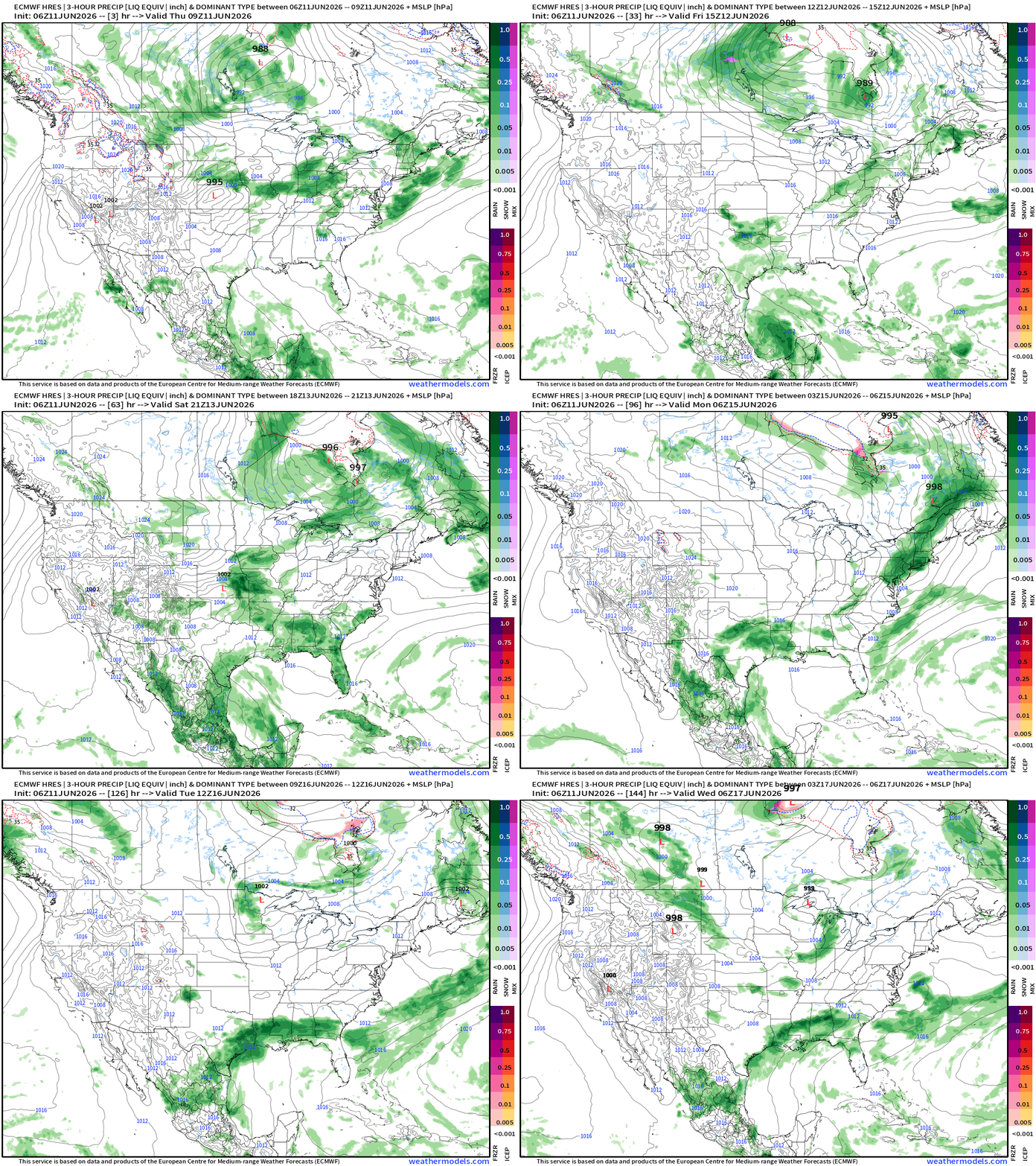
The very strong Caribbean —> Gulf of Mexico moisture plume takes a right turn to the east with the Canadian trough in control for a week. Then, the storm track resumes across the northern tier of the Lower 48 with low pressure systems lining up from the Midwest into the Great Lakes.
ECMWF 06z | Precipitable Water | My Favorite Parameter
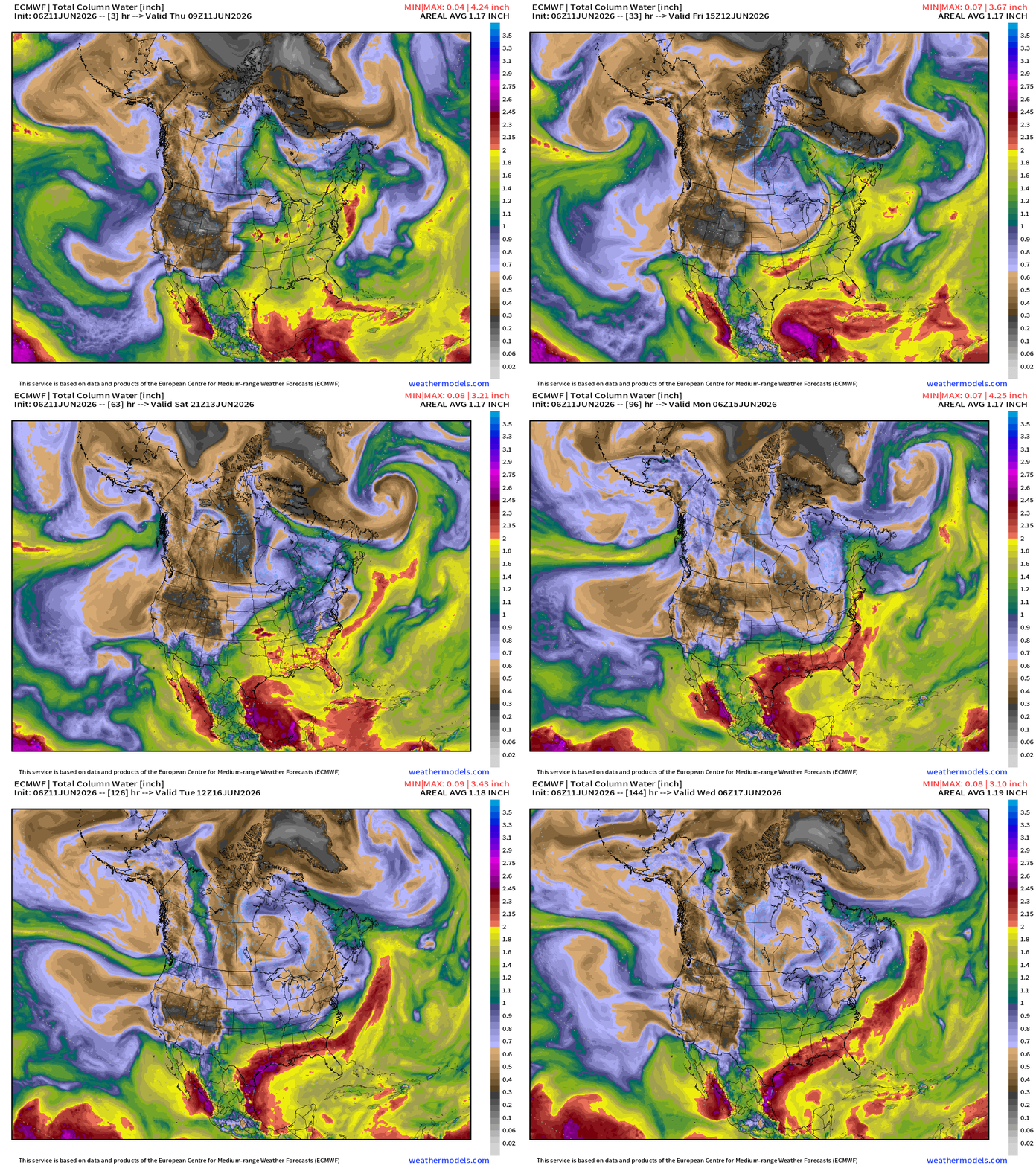
Sharp Canadian trough briefly erases the tropical moisture across the Central and Eastern U.S. into later next week
Tropical > 2” —> boatloads of heavy precipitable water along the Gulf coast (!)
ECMWF 06z | Precipitation + MSLP | Next 6-days
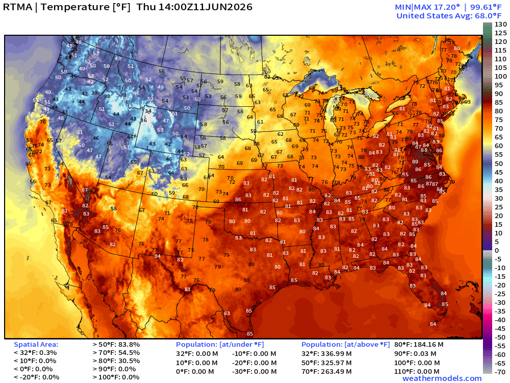
Temperature Analysis | RTMA | 10:00 AM ET
Current Temperature Anomaly | RTMA | 10:00 AM ET
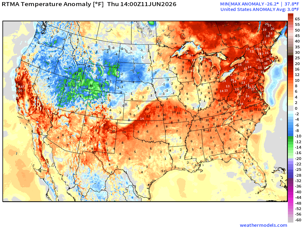
Lower 48 was +3.0°F above normal
High Temperatures Next 8-Days —> Friday June 19th
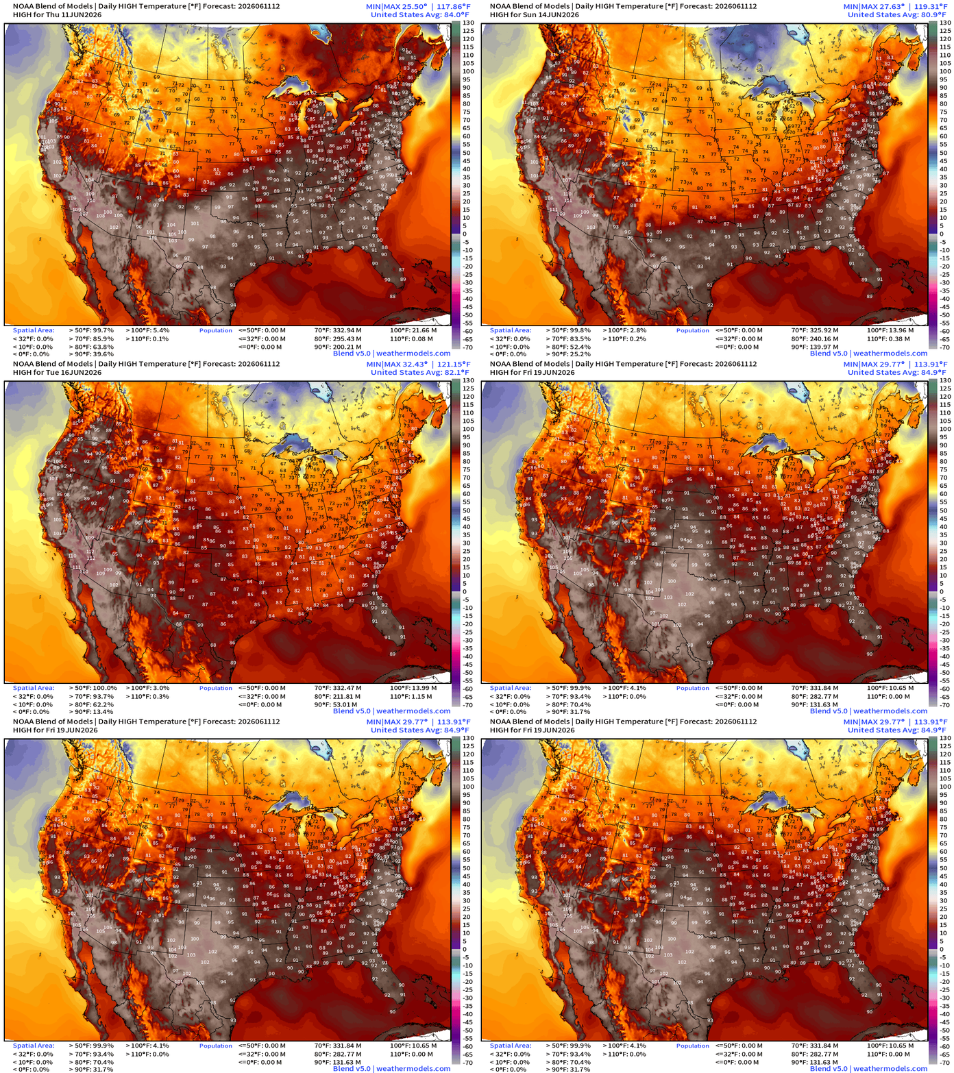
Mini heat wave underway for mid-Atlantic and Northeast with 90s and even some 100s in North Carolina and Virginia into tomorrow. Then Canadian cool front sweeps through the Lower 48 … 60s and 70s for highs in the Midwest and Great Lakes for mid-June —> also no one is complaining.
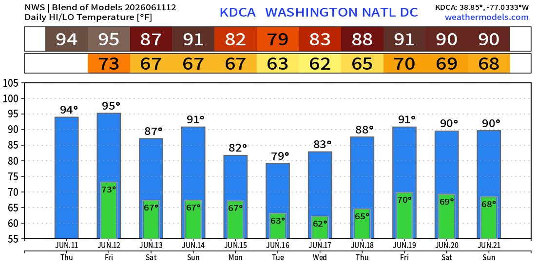
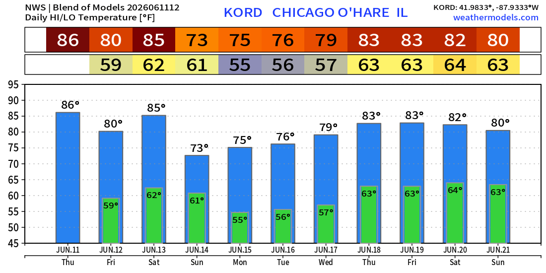
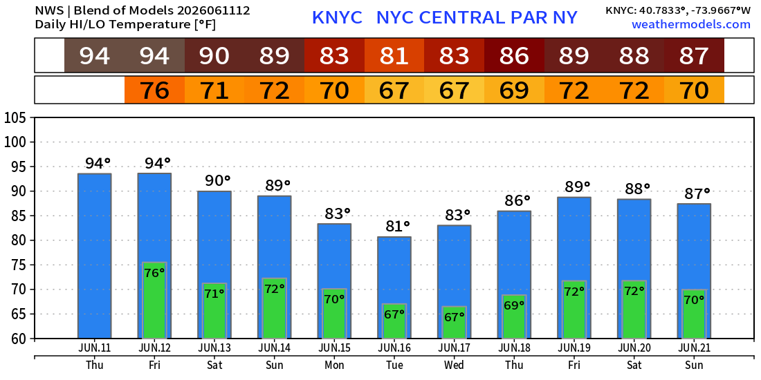
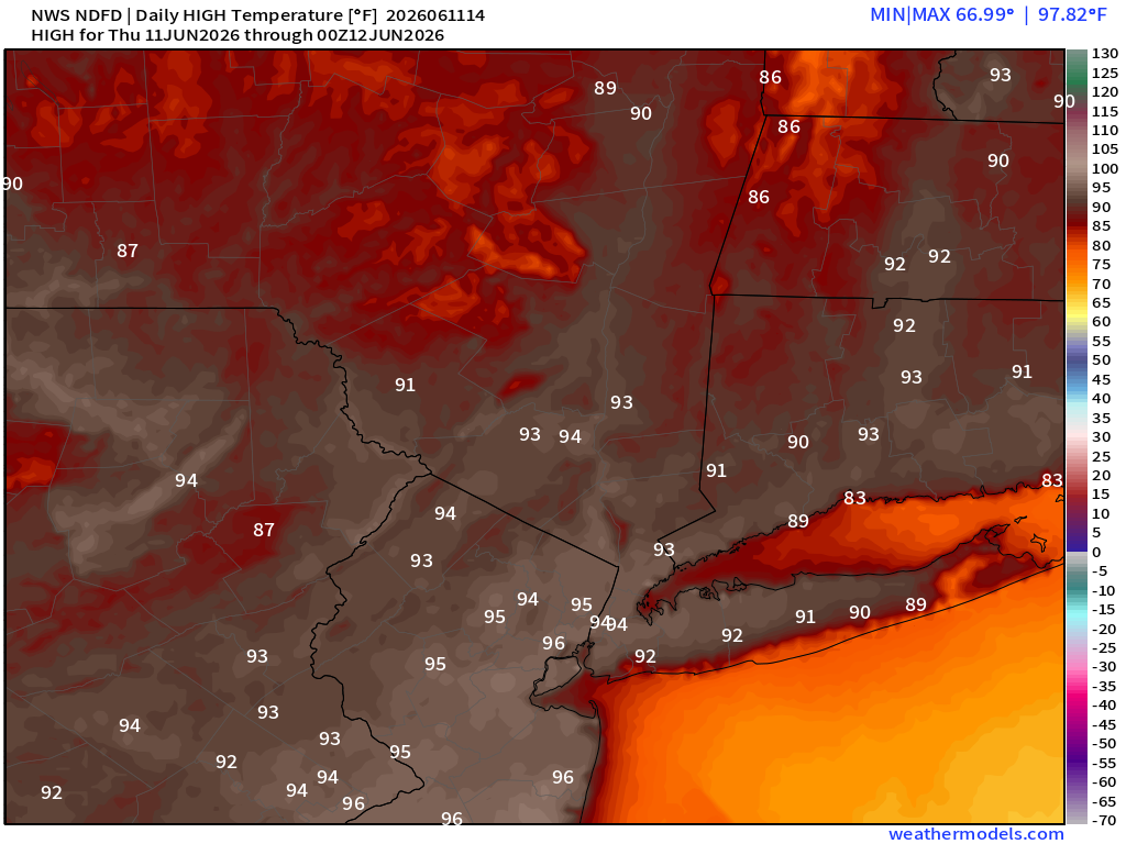
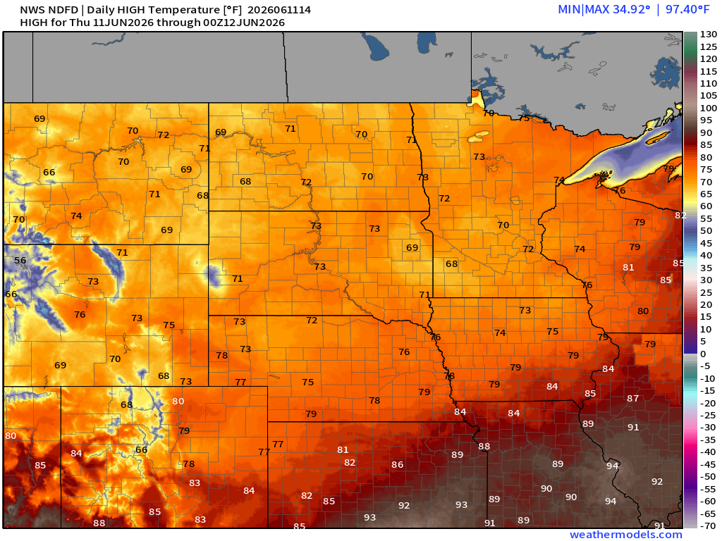
High Temperatures on Thursday | Quick Comparison NWS vs. Blend
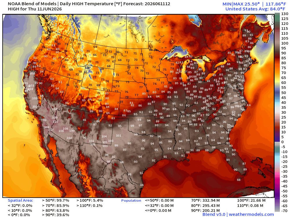
200 million Americans at least 90°F
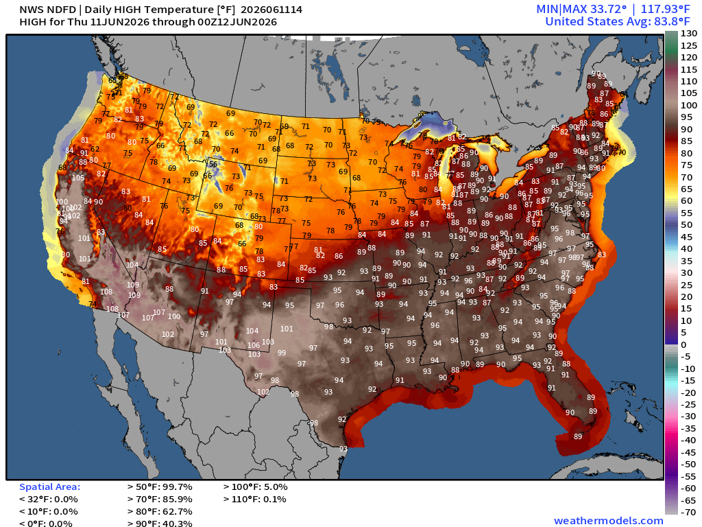
Pretty close match between NWS NDFD and Blend of Models for Day 1 high temperatures — which is great news as forecasters can focus on impactful weather.
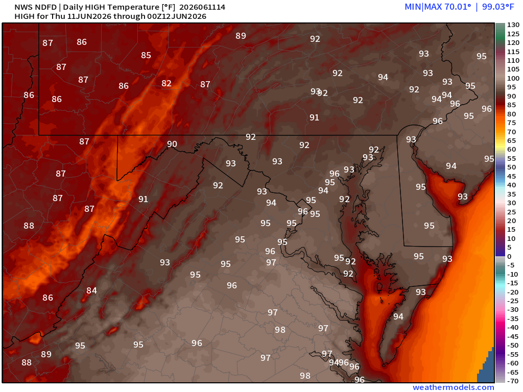
95°+ in Washington D.C.
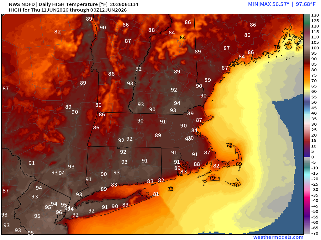
94°F to 96°F around New York City with heat advisories in place!
Cooler in the Midwest — 60s and 70s —> PERFECT
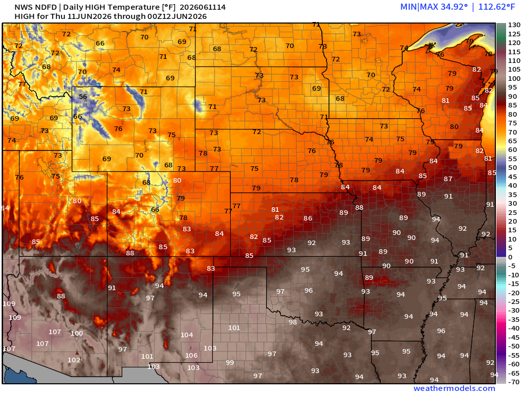
60s and 70s in the Dakotas when it could easily be 100°F
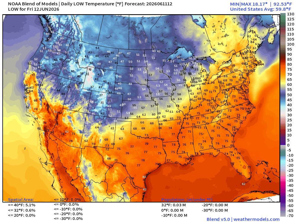
Low Temperatures on Friday
High Temperatures on Friday
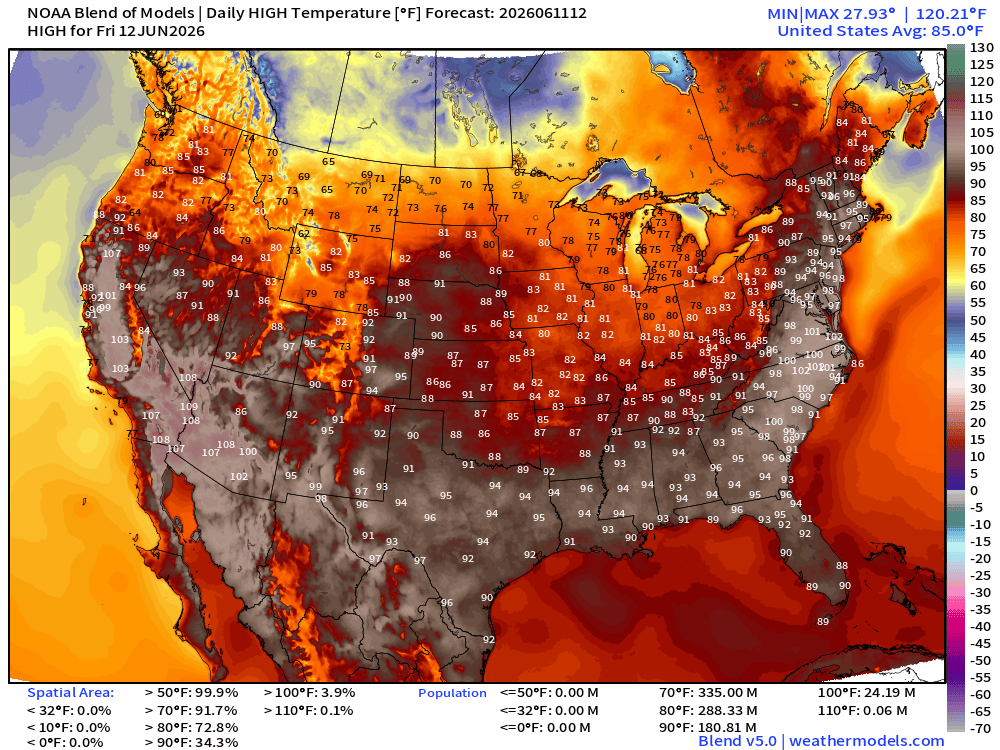
Still very hot —> 181 million at least 90°F and over 24 million at least 100°F
100s in the Carolinas and Virginia (!)
Weather Pattern
Upper-Level Height Anomaly | AIFS-Single Next 10-days
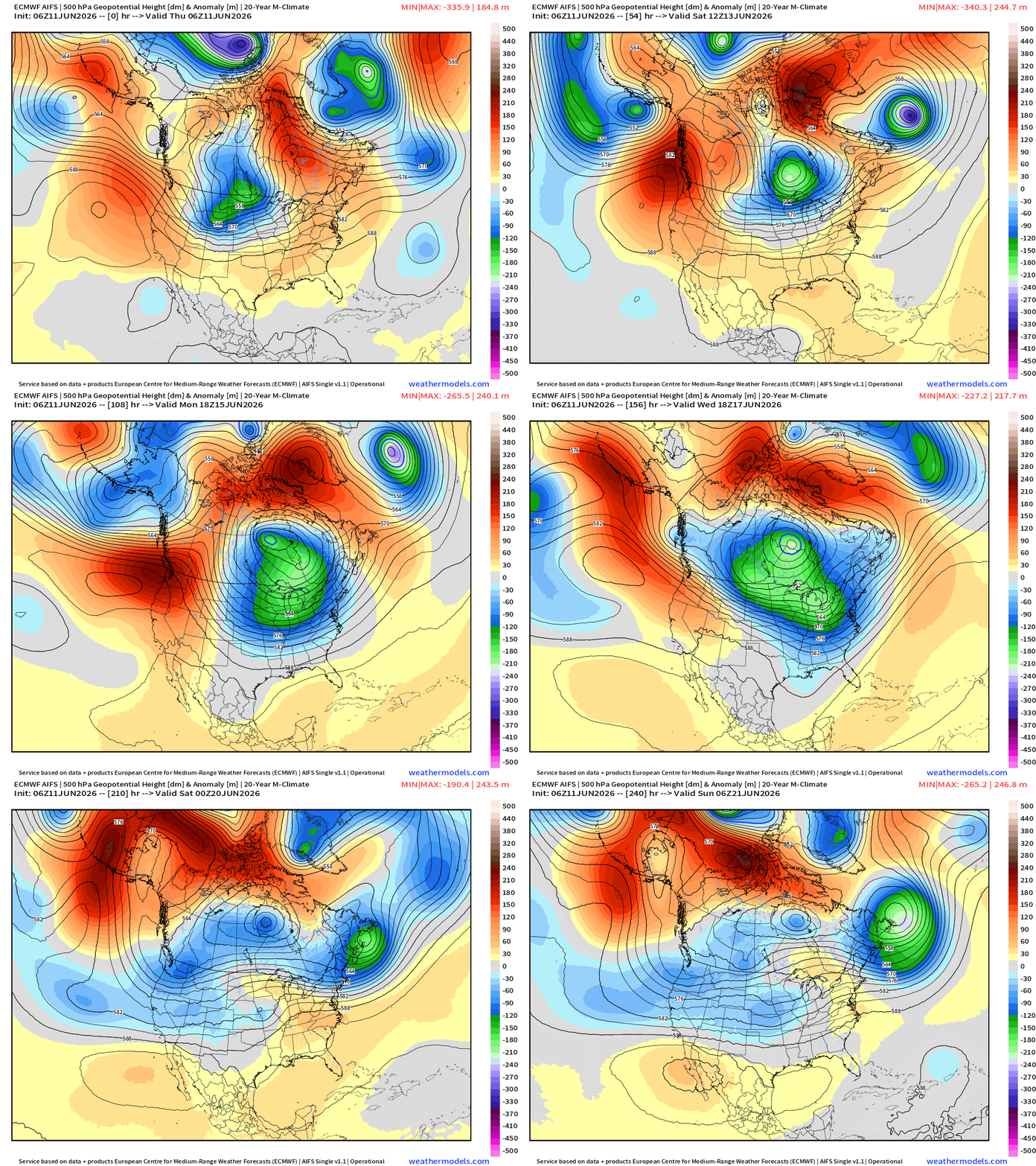
Very strong mid-level trough maintains its grip on the Midwest and Great Lakes for the next 10-days. The flow out of the Northwest is straight from the Arctic = cool and dry … very intense trough for mid-June.
ECMWF Flagship Ensemble Mean Temperature Anomaly next 15-days
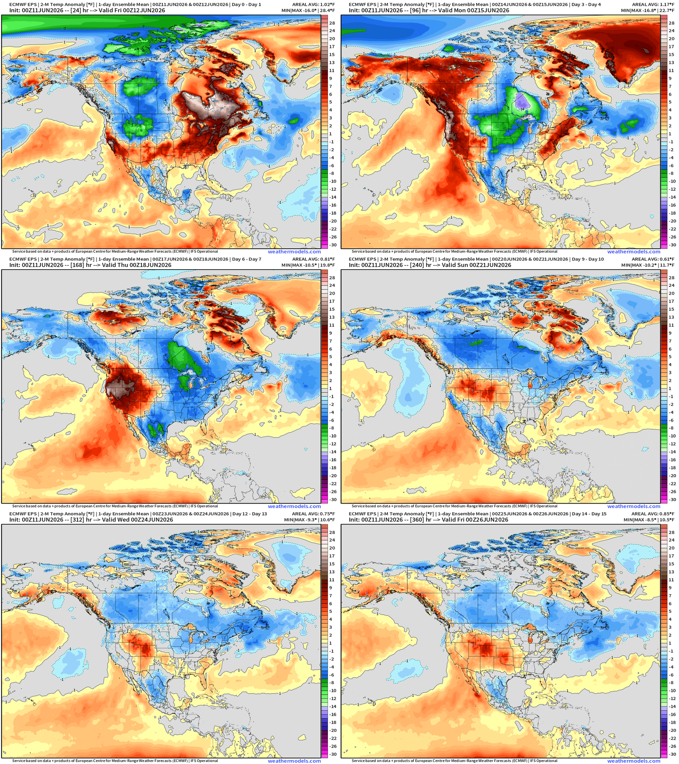
Much cooler than normal air blankets central Canada and dumps into the Lower 48 with recovery from west to east into late June.
Week 1 —> June 11 to June 17
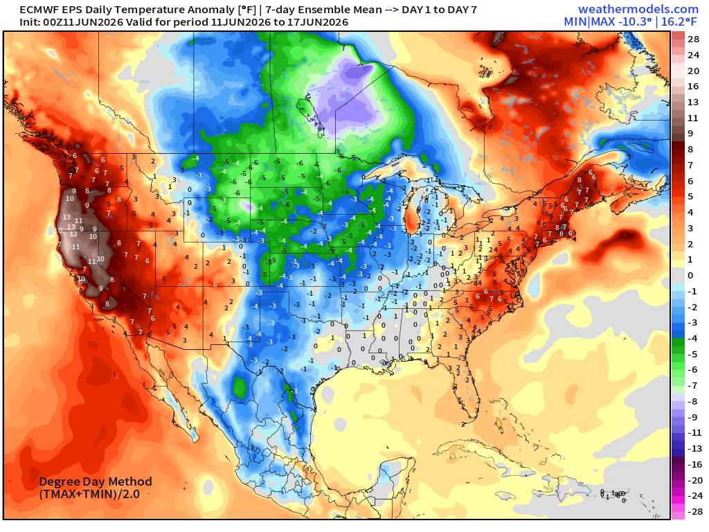
Week 2 —> June 18 to June 24
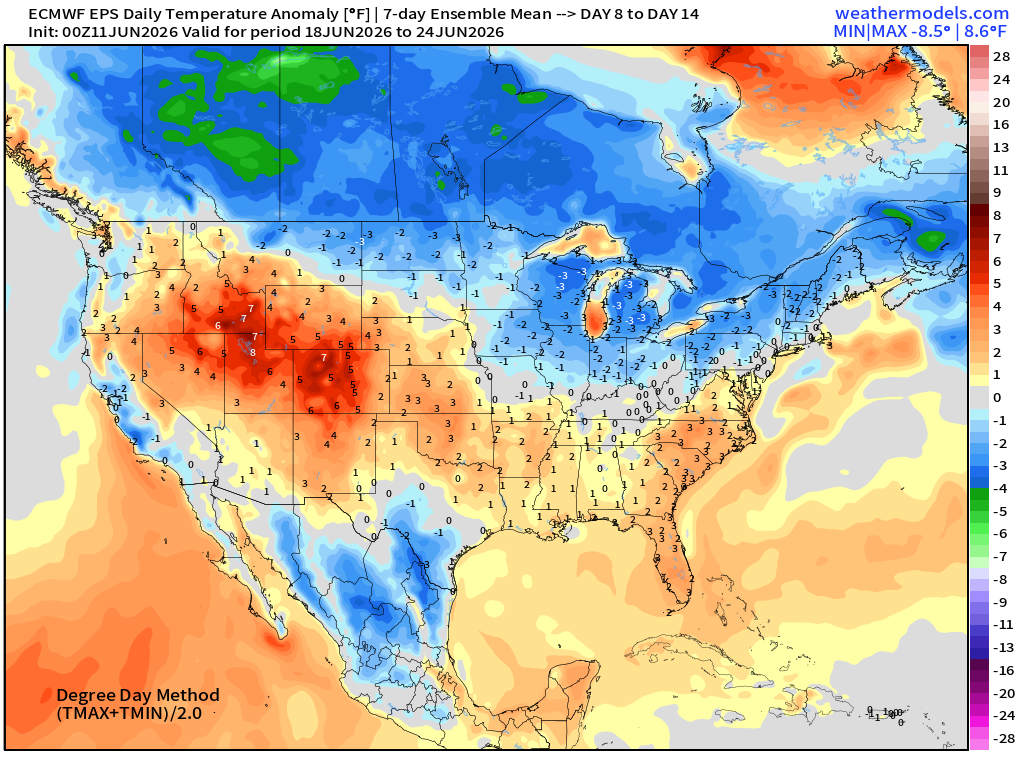
Below normal — blue —> blankets Canadian border into the northern Lower 48
HRRR Radar Simulation Next 48-Hours —> Saturday 8 AM ET
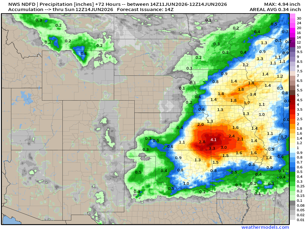
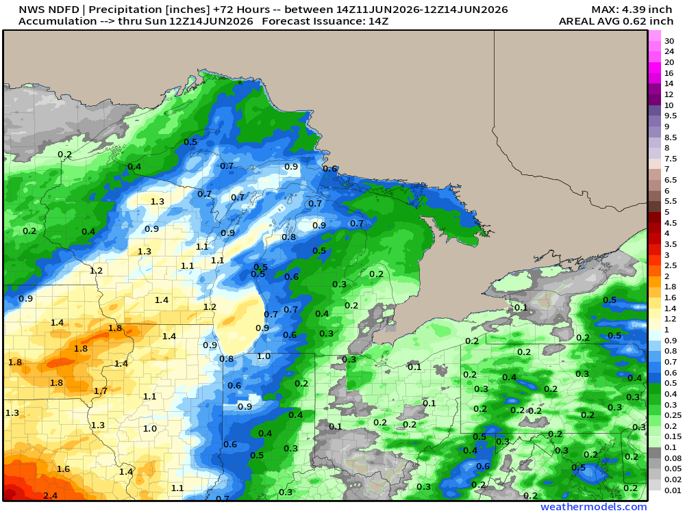
NWS Precipitation Next 72-hours —> Sunday morning
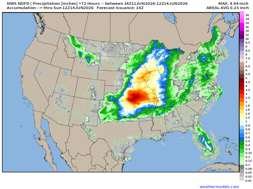
Huge precipitation totals centered on Kansas City … 2” to 4”+ with widespread 1”-2” across the Corn Belt (good news minus any severe weather)
Quick Tropical Update in the Atlantic
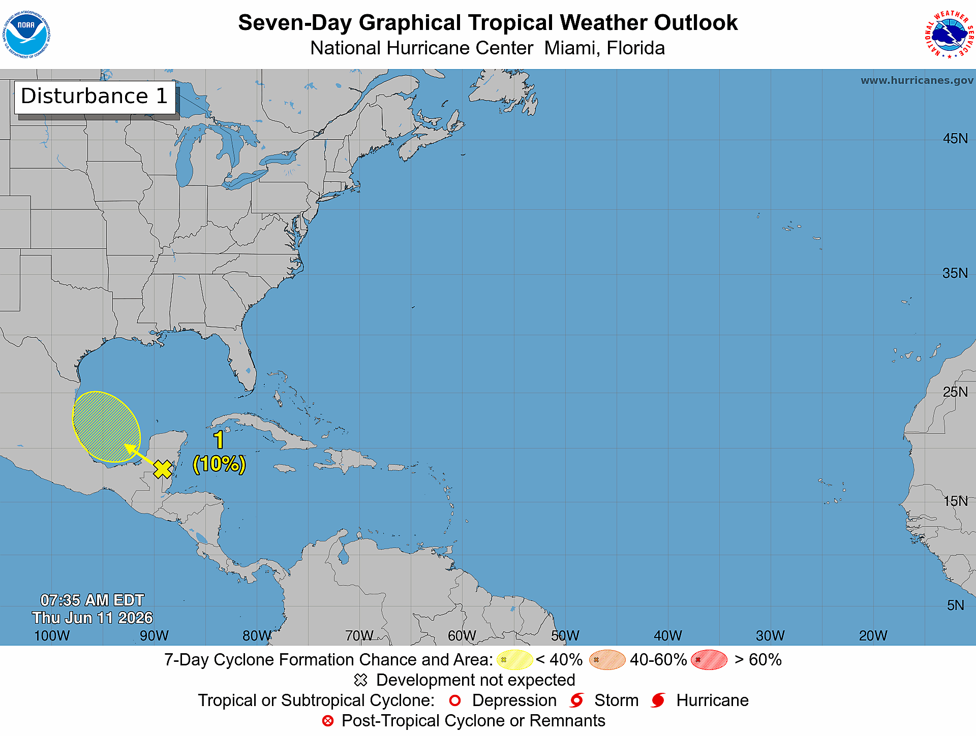
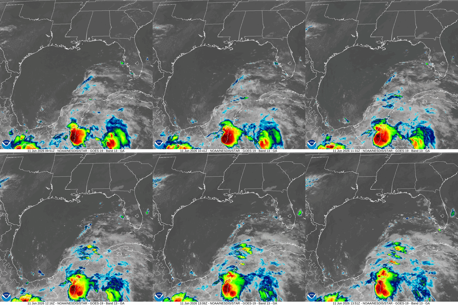
10% chance of a weak tropical wave forming a coherent low pressure in the Bay of Campeche (Southern Gulf of Mexico) on Friday. Convection will move over Yucatan today with remnants of Tropical Storm Cristina.
Eastern Pacific + Central American Gyre | Cyclonic Vorticity Next 4-days
Thank you for reaching the end of this post! Hopefully you enjoyed the beautiful weather maps. Please help increase the visibility of Weather Trader on Substack: Share or Like!
Help support this newsletter (nearing 1,000!) —> June 2026 Coupon
Maps sourced from weathermodels.com designed and innovated by yours truly! Please subscribe there for real-time access to the newest maps, charts from all of the weather models including ECMWF and AIFS, and NOAA GFS/GEFS, HRRR/RRFS and Blend of Models (NBM). NOAA WPC and SPC for fronts/convective outlooks.
My Atlantic Hurricane Season Forecast (2026)
From April 7, 2026: Atlantic Seasonal Hurricane Forecast: (11/5/2)
9-13 Named Storms (11 most likely)
4-7 Hurricanes (5 or 6 most likely)
1-3 Major Hurricanes (2 most likely)
Accumulated Cyclone Energy: 75-85 (well below normal)
NOAA 2026 Atlantic Hurricane Season Forecast
- Milepost
- 957 · laid 2026-06-11T15:39:16.282000Z
- Source
- https://weather.substack.com/p/june-11-2026-thursday-spring-weather
- Digest
- 563194ca3e92d36a73498e41eefc8d7914fe62848aba0c7fec367840d142fe81
- Machine
- JSON