June 28, 2026 Tropical Update Sunday
Atlantic not completely a ghost town but very quiet start to July likely
June 2026 was the 18th-warmest June in the 132-year national record (1895–2026), at 70.6°F against a 1991–2020 normal of 69.5°F (+1.2°F).
June 2026 was the 32nd-wettest June in the 132-year national record (1895–2026), at 3.3in against a 1991–2020 normal of 3.1in (+0.2in).
NOAA/NCEI Climate at a Glance, contiguous United States. This is the observed record for the month, not a score of anything said in this piece — the forecast ledger begins 2026-08-17 and cannot reach earlier posts.

Tropical Waves across Africa are not particularly robust
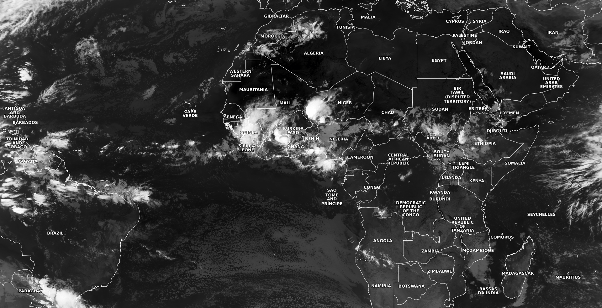
The Atlantic tropical basin is very quiet for late June, and that’s not surprising in any given year. However, with (Super) El Niño intensifying across the Tropical Pacific, there’s little expectation that tropical storm activity will pick up anytime soon. However, the basin’s overall “health” or favorability will improve through July into August as the ocean temperatures warm significantly and the impacts of Saharan Air Layers (SAL) and dust subside. Tropical waves will have a better opportunity to maintain low-level circulation as they emerge from the African coast into the "Main Development Region” (MDR) of Atlantic basin.
Early today GeoColor satellite imagery
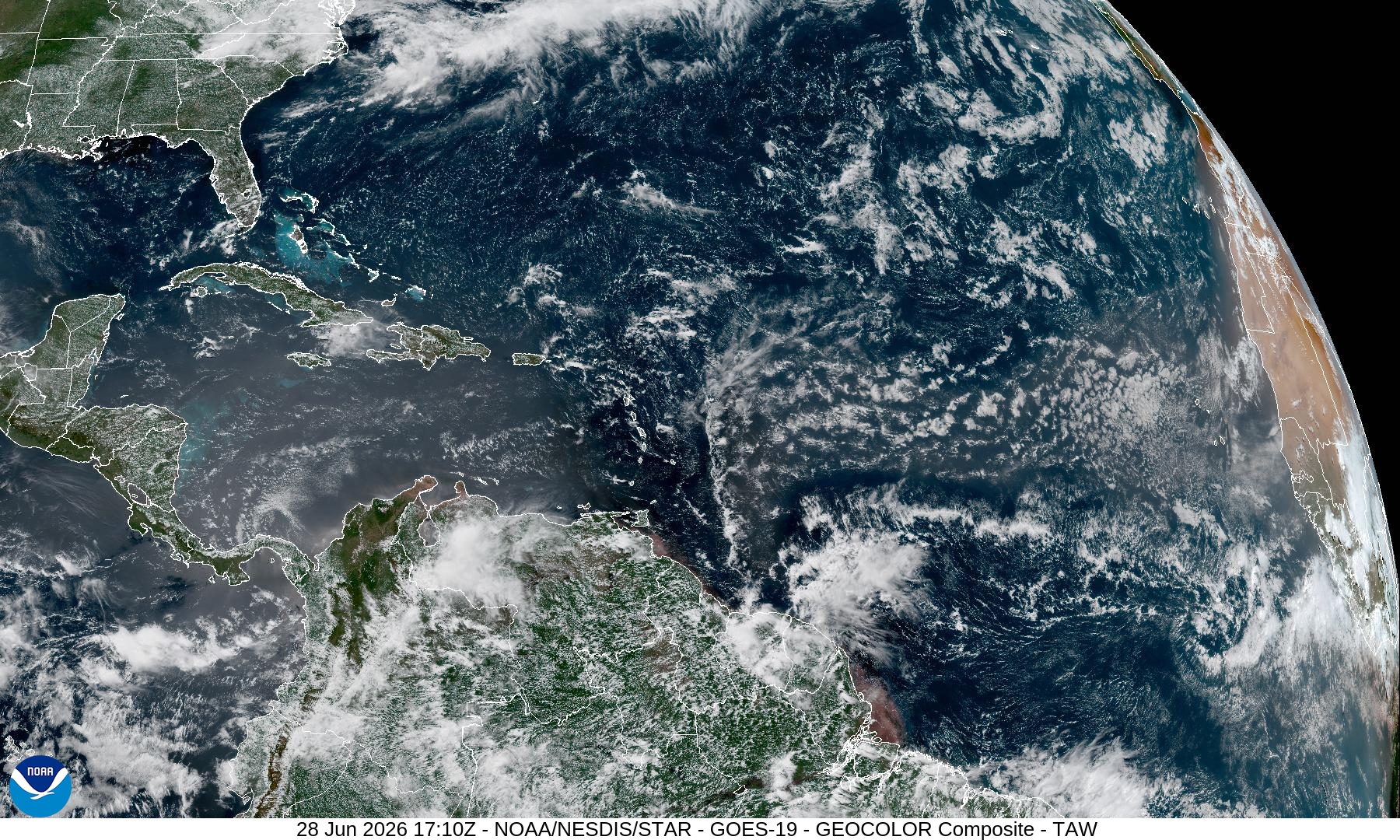
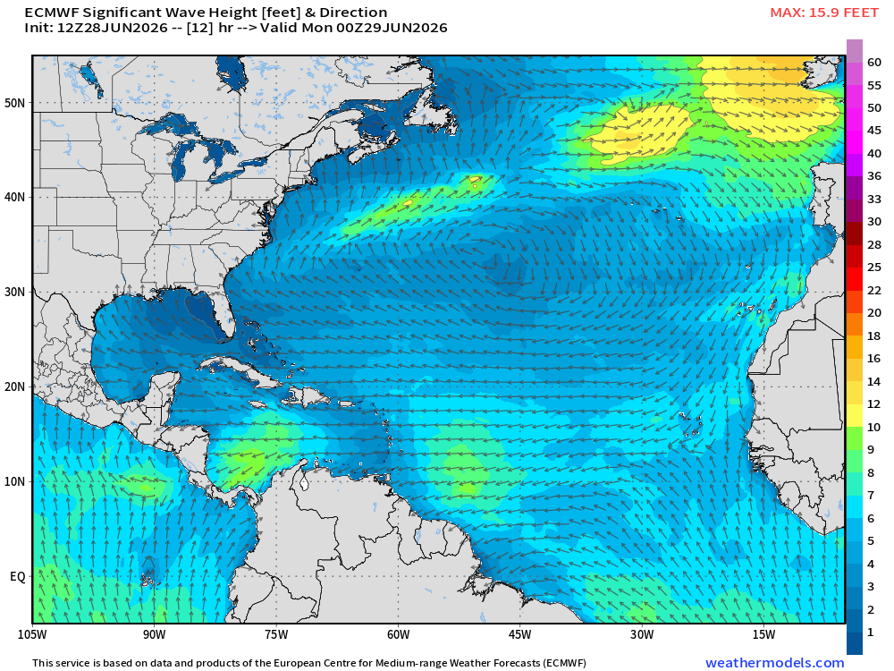
A large plume of Saharan dust pushing through the Caribbean with the characteristic milky hue. The clouds within the SAL are typically puffy cumulus but it is difficult to even produce a shower. The Atlantic is calm with minimal wave heights 3-6 feet at most. Wave height 8 PM ET
Help support this newsletter (nearing post 1,000!) —> June 2026 Coupon
The Sea-Surface Temperature Anomaly across the tropical central and eastern Pacific is full tilt El Niño.
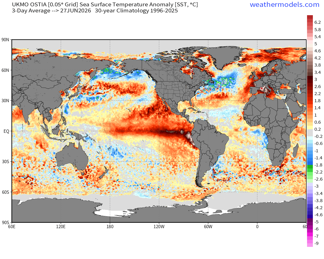
2026 compared to 2025 for the last 7-days:
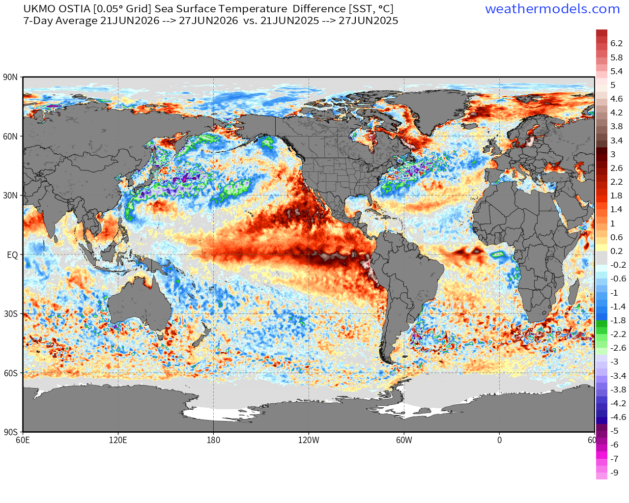
Huge warming in the Pacific … but cooling in the mid-latitude Northern Hemisphere, significantly!
Headline Tropical Cyclone Tracks — for the next 15-days from ECMWF EPS 12z
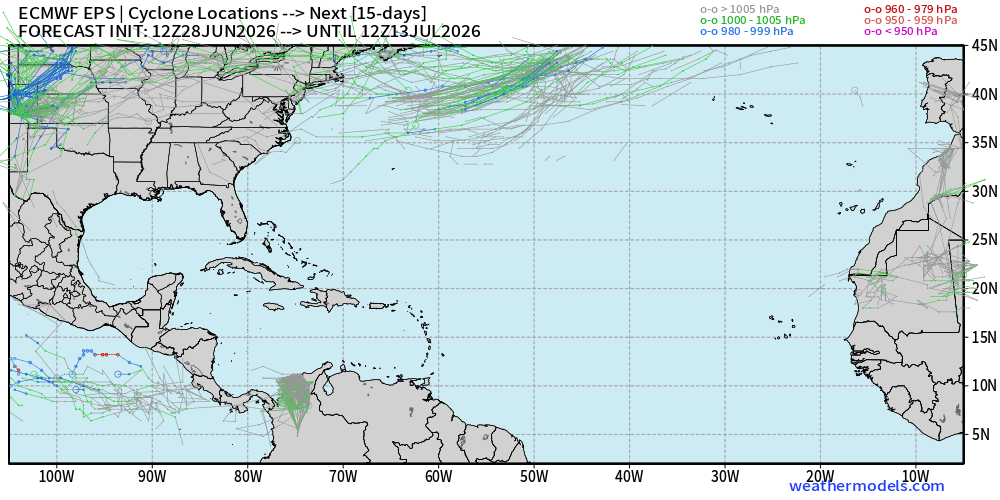
Ghost town in the Atlantic — whatever develops off the U.S. Southeast coast would be quite weak, and difficult to track in the MSLP field because of the background high pressure (Bermuda High)
Help support this newsletter (nearing post 1,000!) —> June 2026 Coupon
Flagship model: Canada GEM 12z —> Integrated Vapor Transport next 10-days
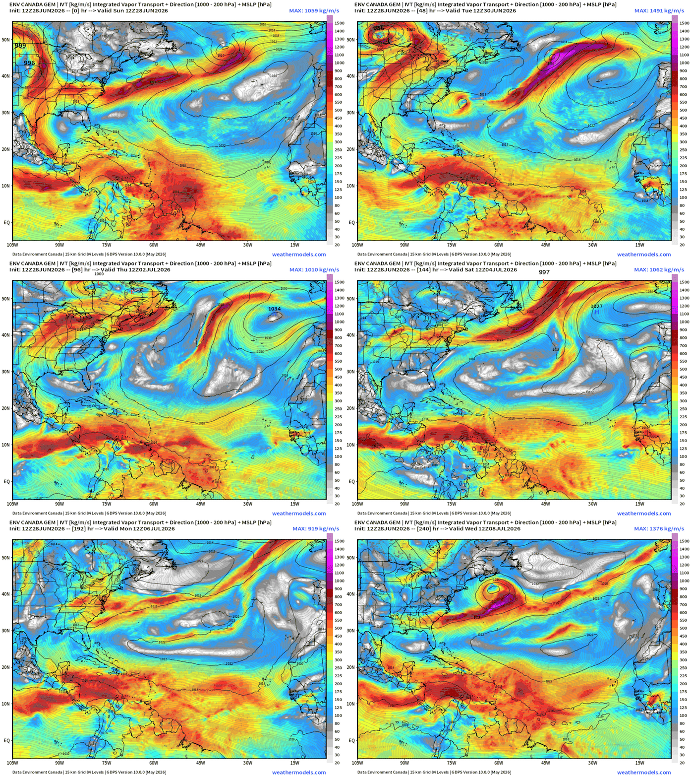
HUGE heat dome forms over the Eastern U.S. with a clockwise anti-cyclone in the IVT field — very strong deep layer ridge.
An area of low pressure should form as part of a cut-off low later in the week off the U.S. East Coast, but wind shear would be unfavorable.
Atlantic Basin Simulated Water Vapor Satellite — Next 10-days
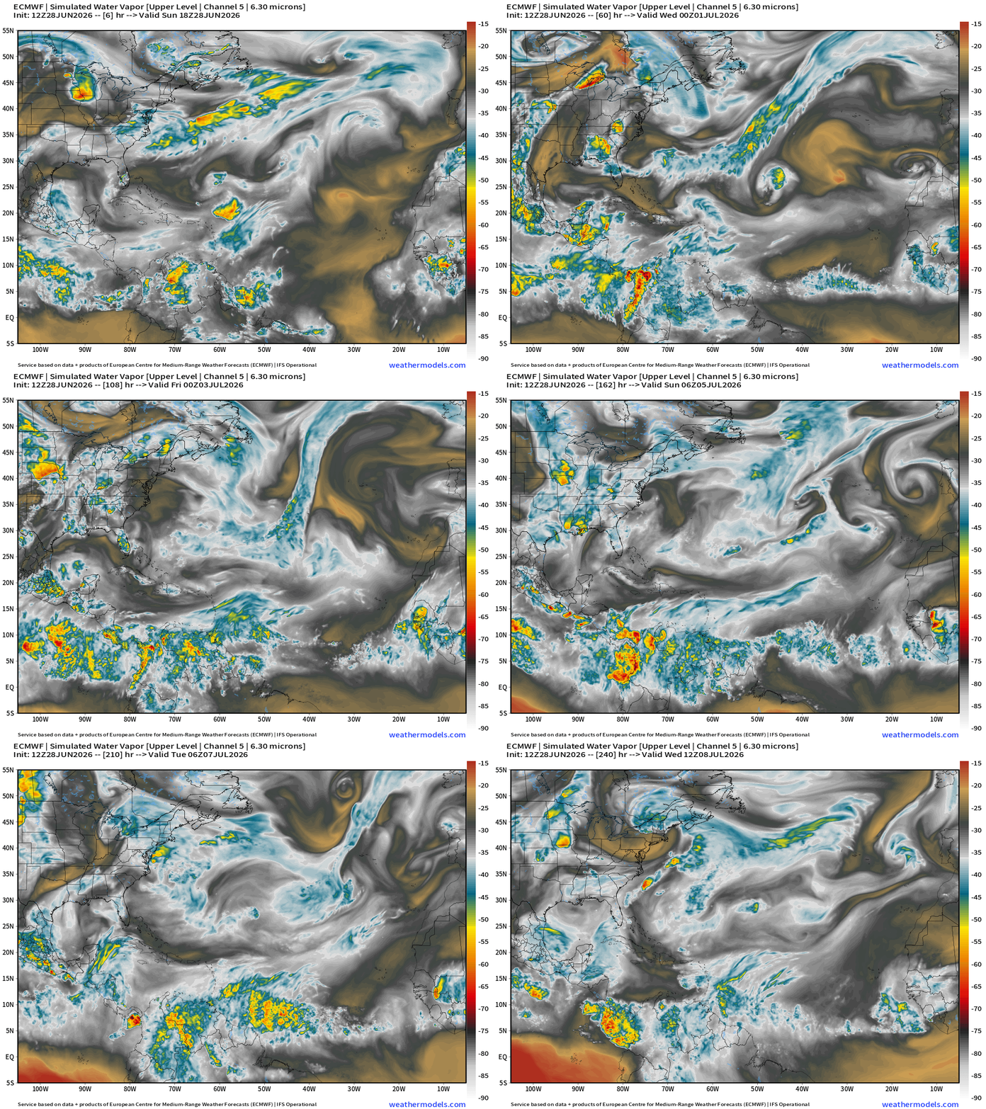
Heading into July, the Atlantic basin remains chaotic with many small scale features that do spin cyclonically but are cold-core or result of upper-level troughs.
Tropical waves in the Main Development Region generate convection but none are catching fire.
ECMWF 18z | Precipitable Water | My Favorite Parameter
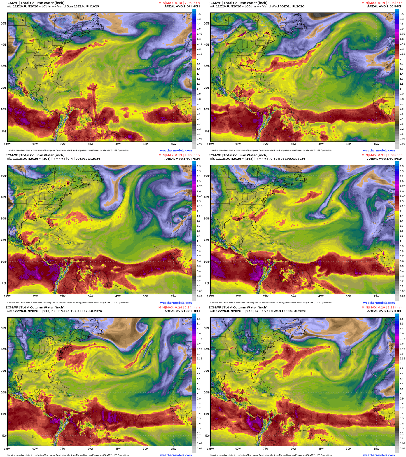
Fairly decent tropical PWATs in the central Main Development Region (MDR) of the Atlantic, but nothing developing in late-June. Into next week, another Saharan Air Layer scours the MDR clear again.
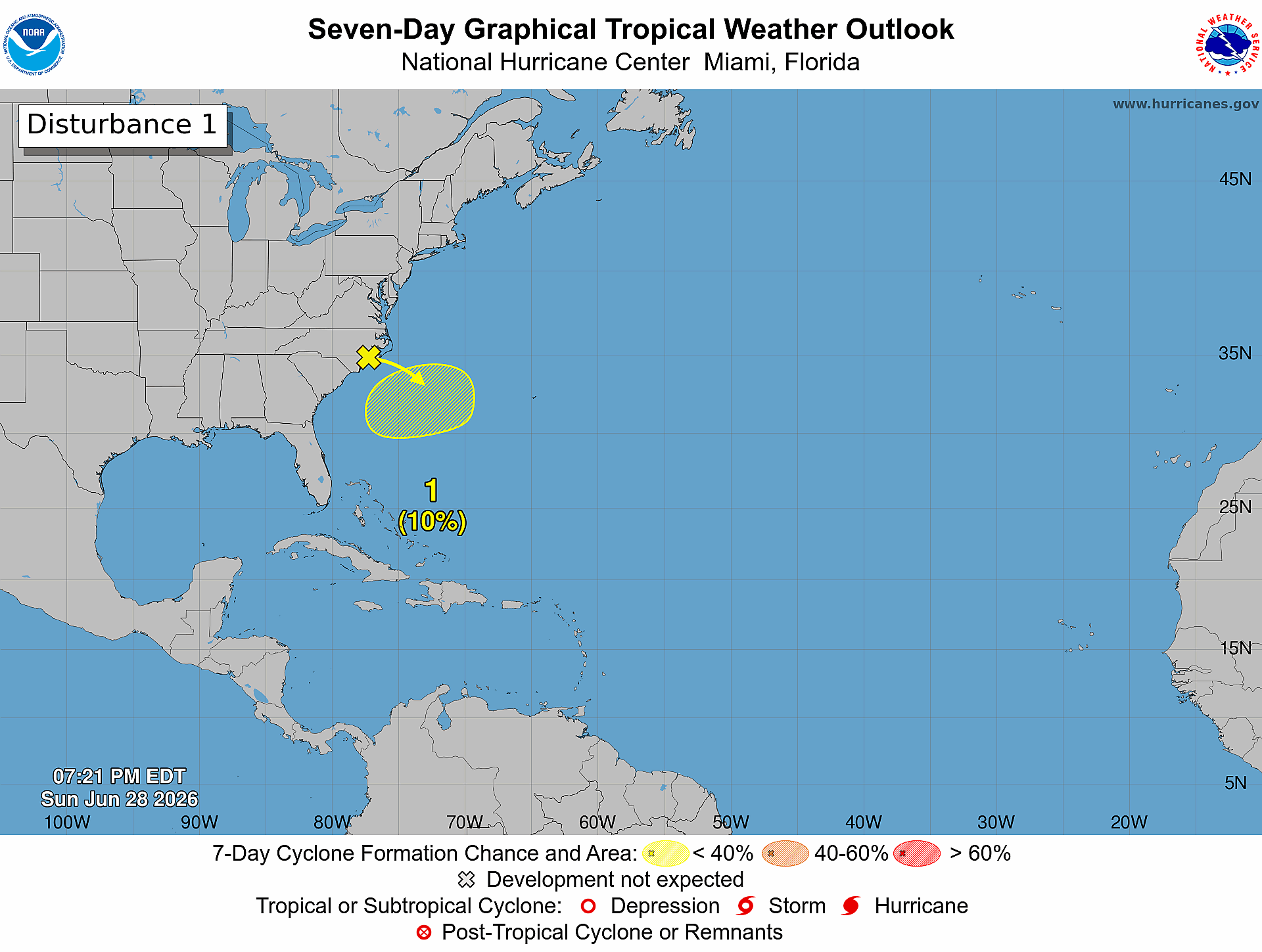
Atlantic Basin — Quiet —> almost July 2026 but one feature 10% chance
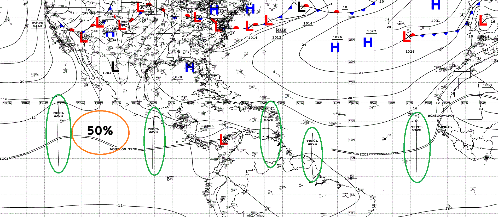
Tropical Waves … multiple across the 2 basins but nothing active in the Atlantic. 50% chance of something in the Eastern Pacific this week. The previous areas of interest did not develop last week.
Sea Surface Temperatures still below 26°F reaching well into the MDR (green coloring)
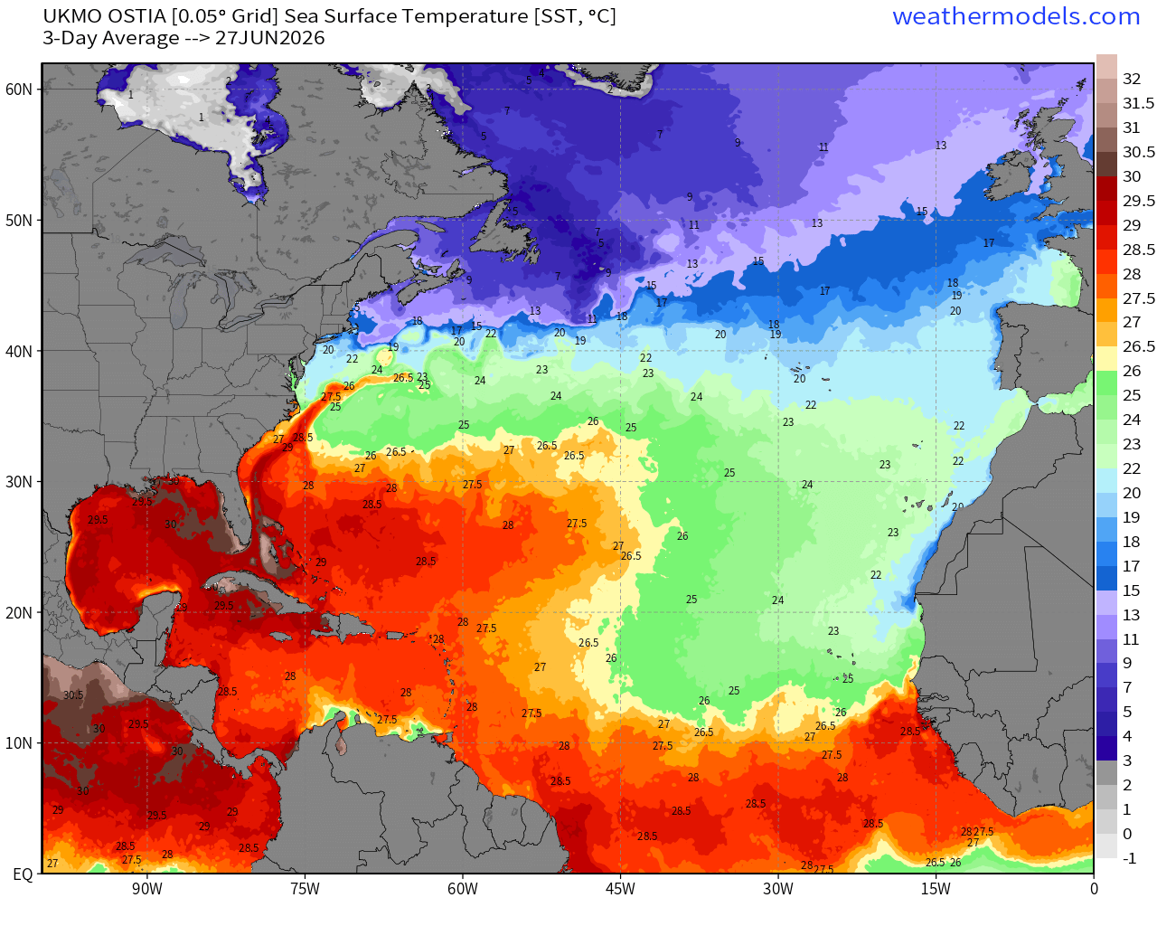
Warmer than normal in the subtropics due to persistent weak winds and a strong subtropical high pressure (Bermuda high —> Azores high)
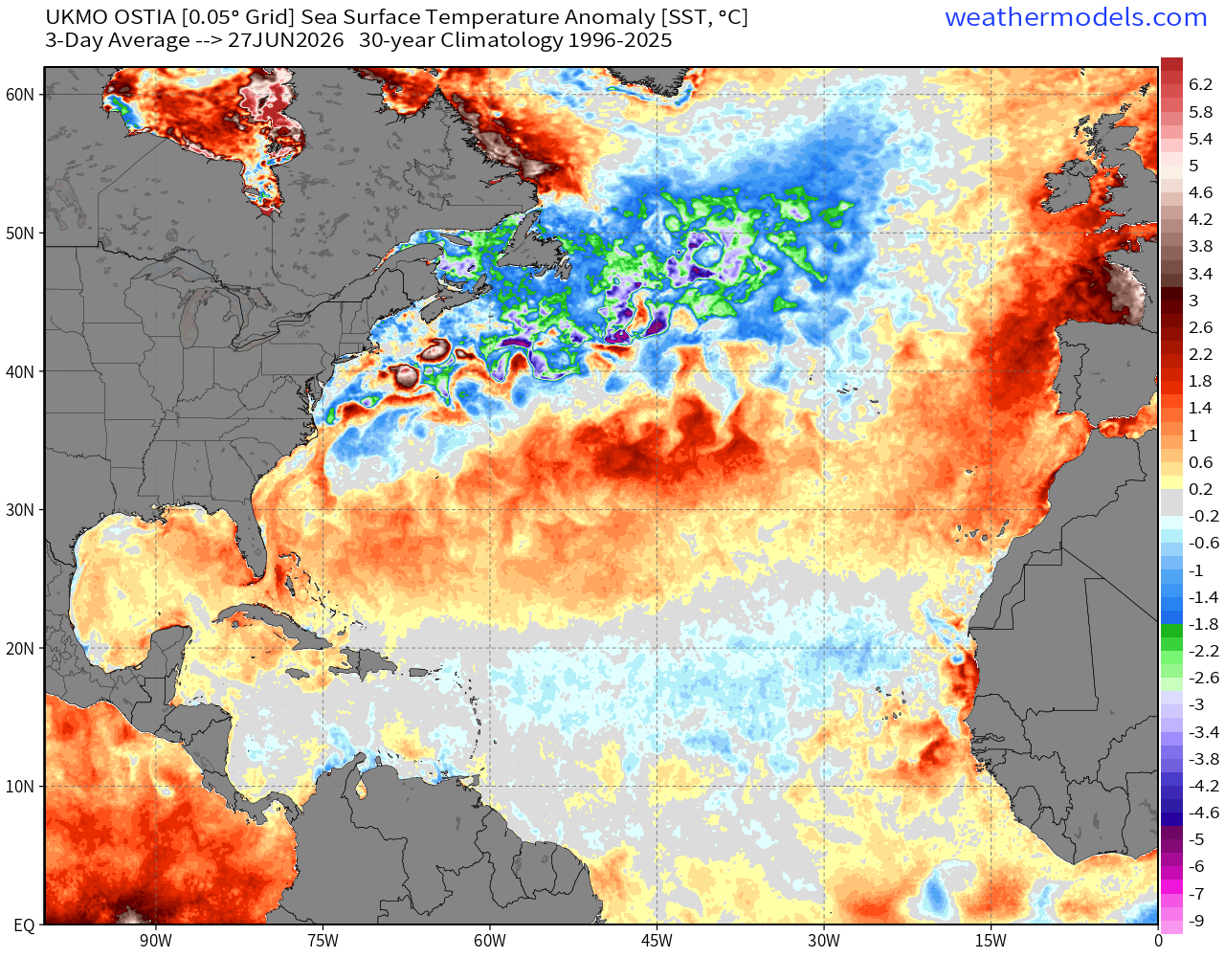
But still cooler than typical for end of June in the MDR
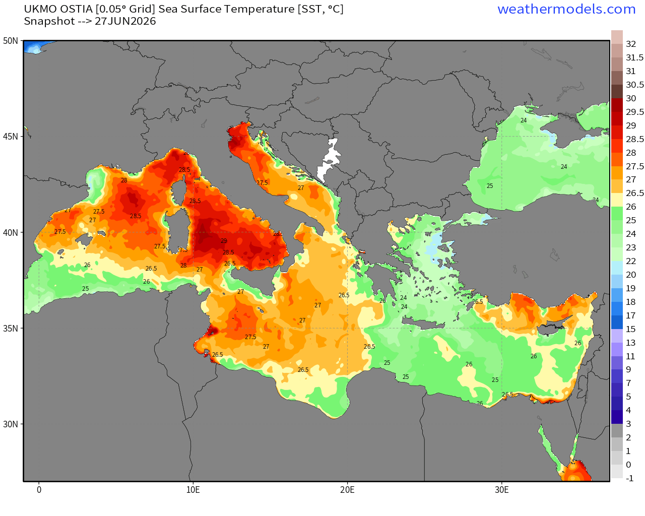
Change in the Mediterranean over the past 10-days due to “Heat Dome”
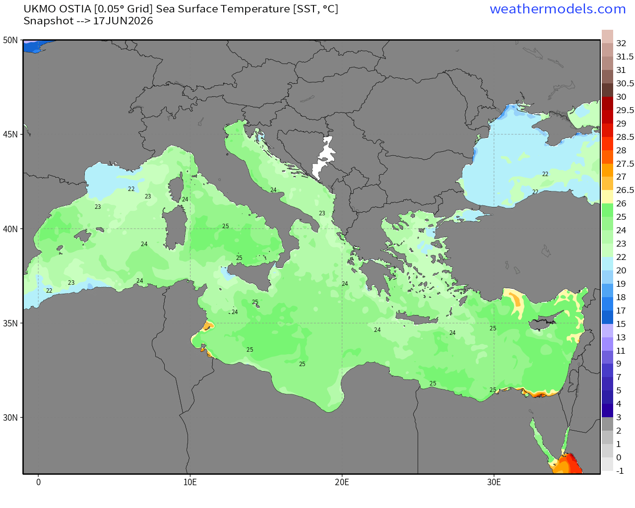
23°C to 24°C —> 28°C — very warm indeed!
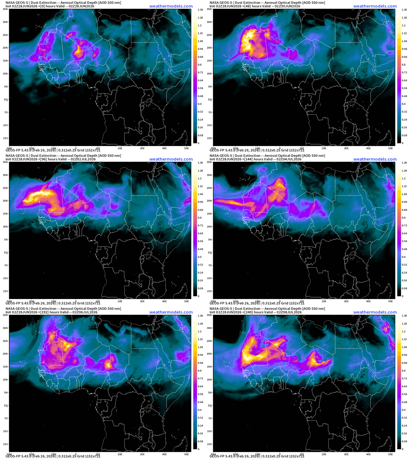
Saharan Air Layer with African Dust — next 10 days
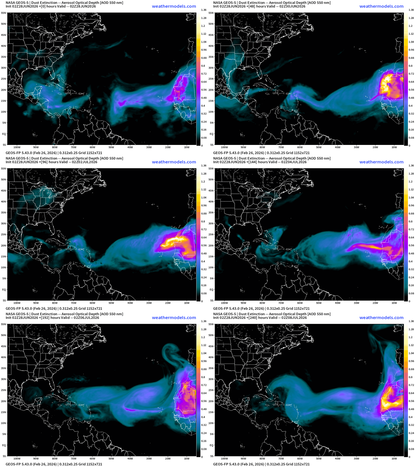
During the months of June and July, winds over the African continent pick up sand and dust from the deserts and loft it into the boundary layer around 850-700 mb creating a stable and warm layer. The prevailing trade winds (east to west) in the tropics capture the dust layers and move them along into the Atlantic and eventually the Caribbean and even the Gulf of Mexico to provide beautiful & colorful sunsets for folks in Florida and Texas.
NASA GEOS-5 shows a whopper in the Central Atlantic during next week
Zooming out to North Africa — origin of the Saharan Air Layers + Sand/Dust
Satellite Imagery — little active convection across the entire Atlantic tropics
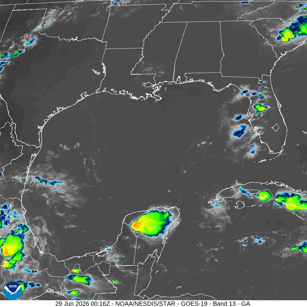
Gulf of Mexico is devoid of showers and storms
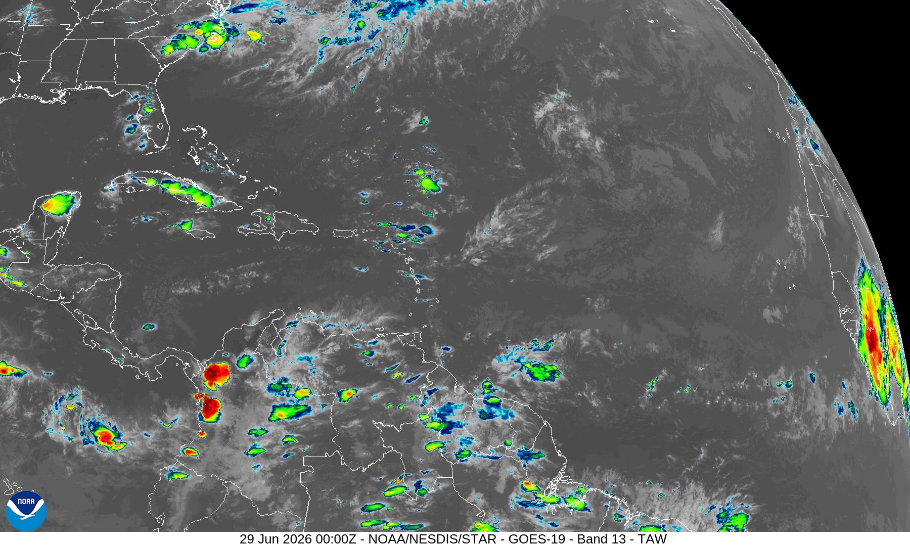
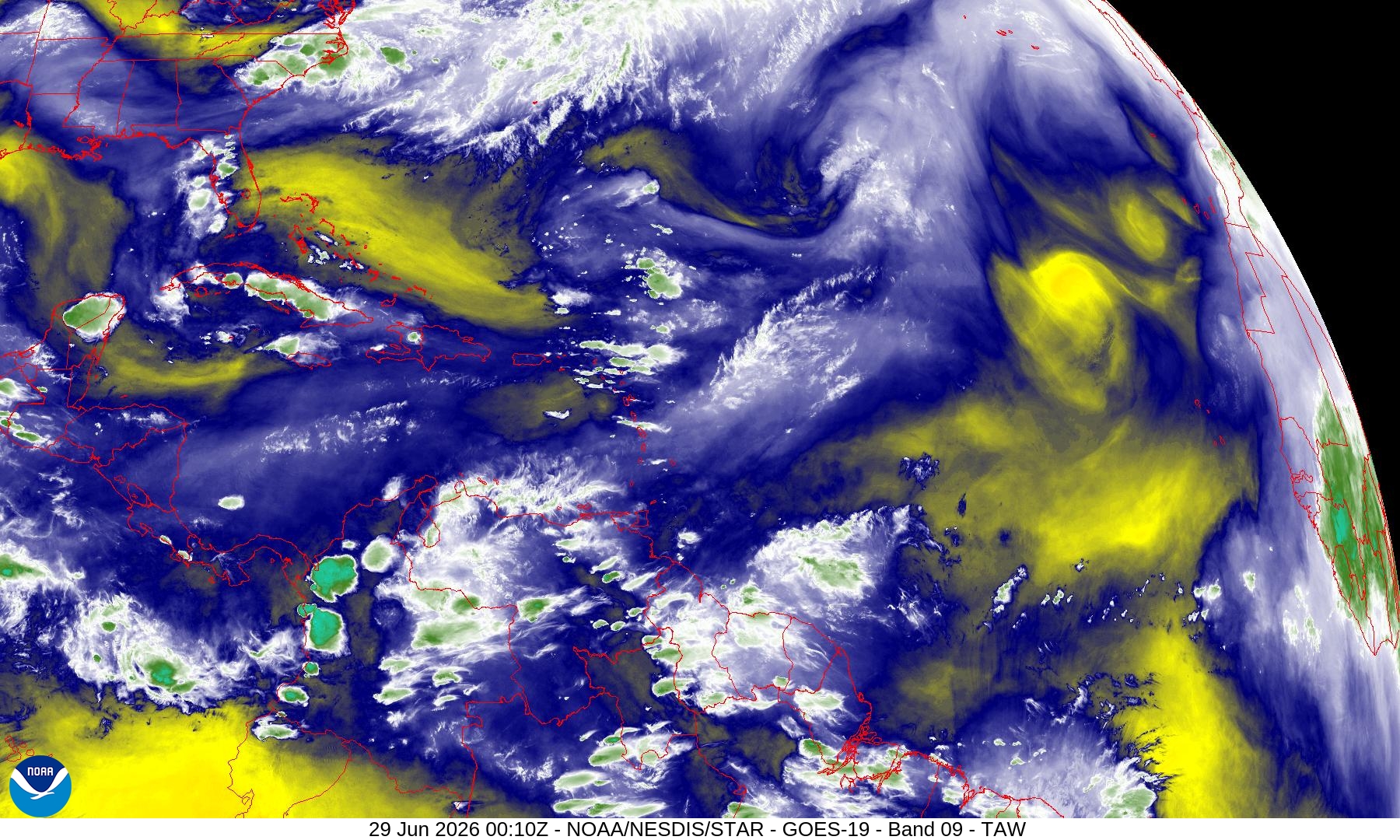
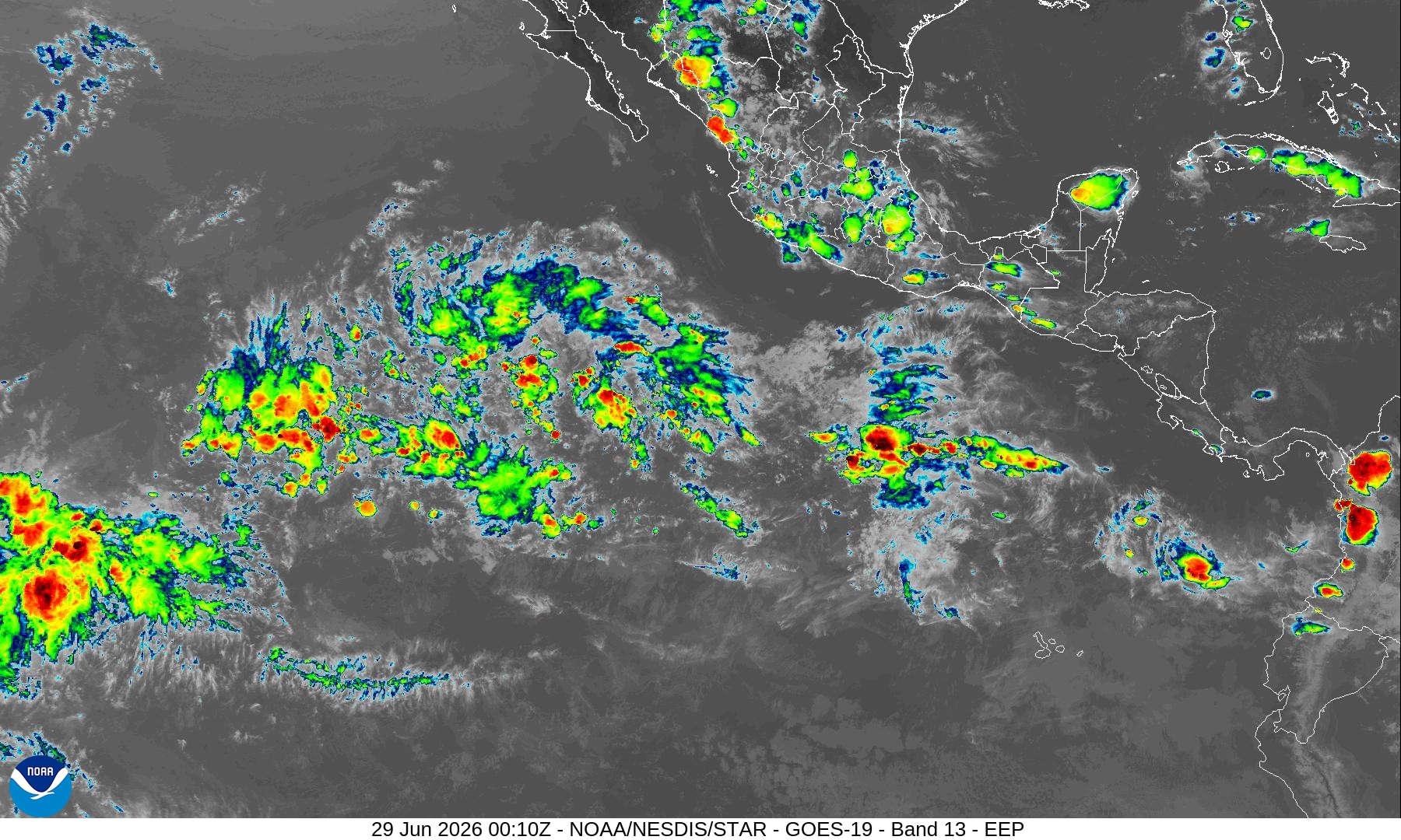
Eastern Pacific Hurricane Basin — area at 50% this week
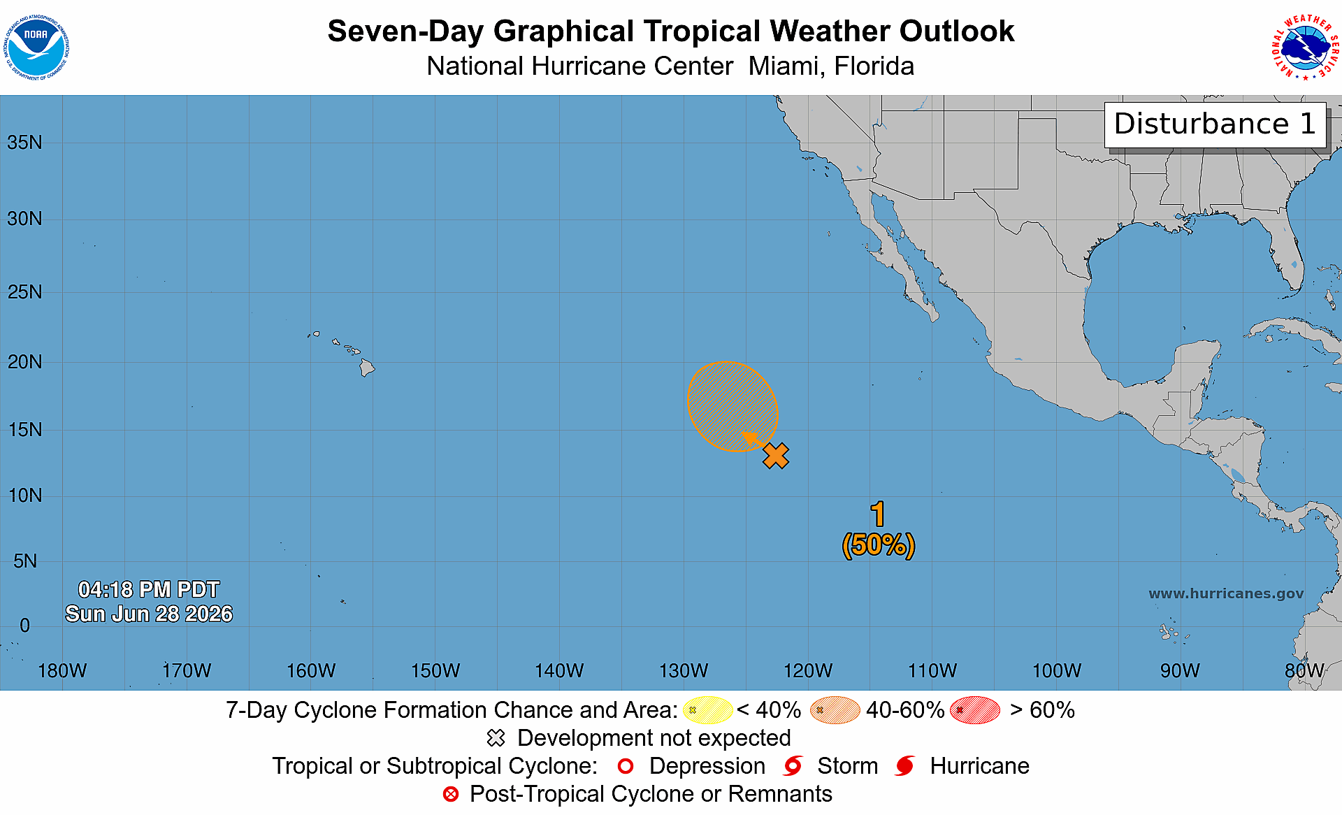
Nothing imminent, but area of convection over the warm waters could become our next tropical storm
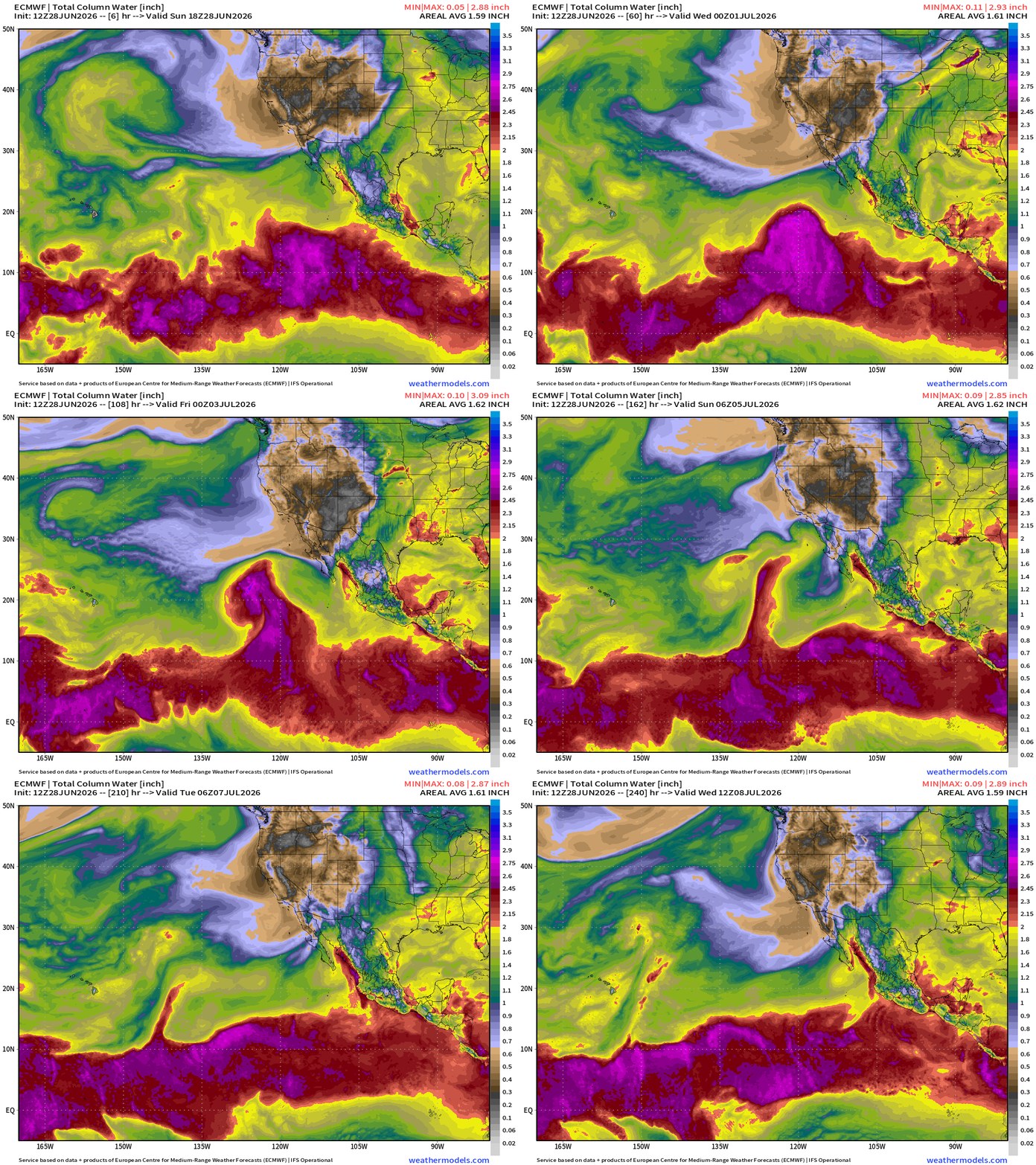
Precipitable Water Next 10-days does show a weak TD/TS formation
Western Pacific Typhoon Season
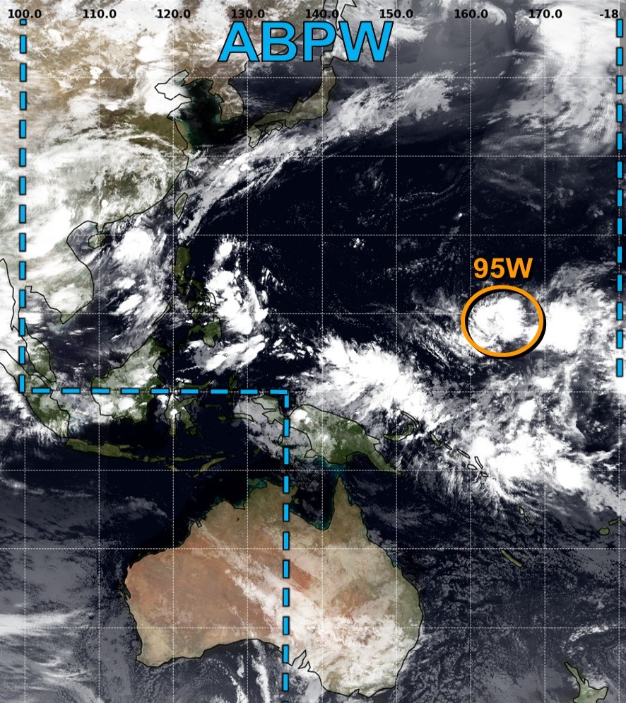
95W is our next area to watch well out in the eastern part of the basin, and models continue to show a powerful typhoon.
Another area (unmarked) of disturbed weather will move through the Philippines and could become a TS/TY in South China Sea into end of week.
ECMWF 12z developed 95W into a Super Typhoon
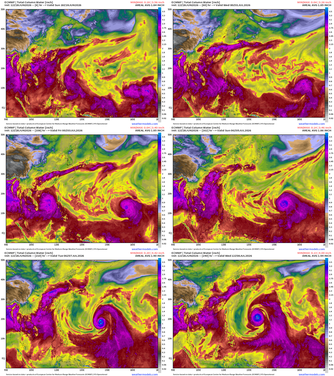
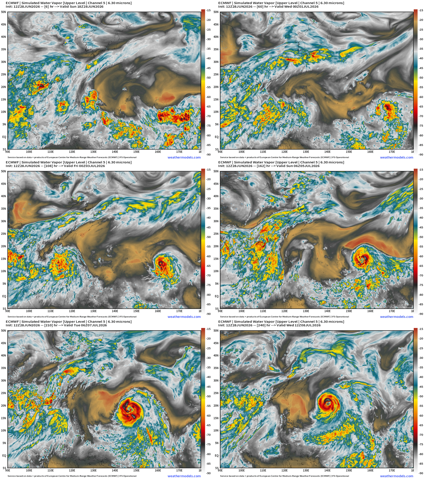
926 mb —> Super Typhoon … close to Category 5. Very large typhoon as its origin is in the deep tropics in the monsoon trough along the equator … however, ECMWF was been biased way too intense (and large) with Mekkhala, so we’ll tap the brakes on this one for now.
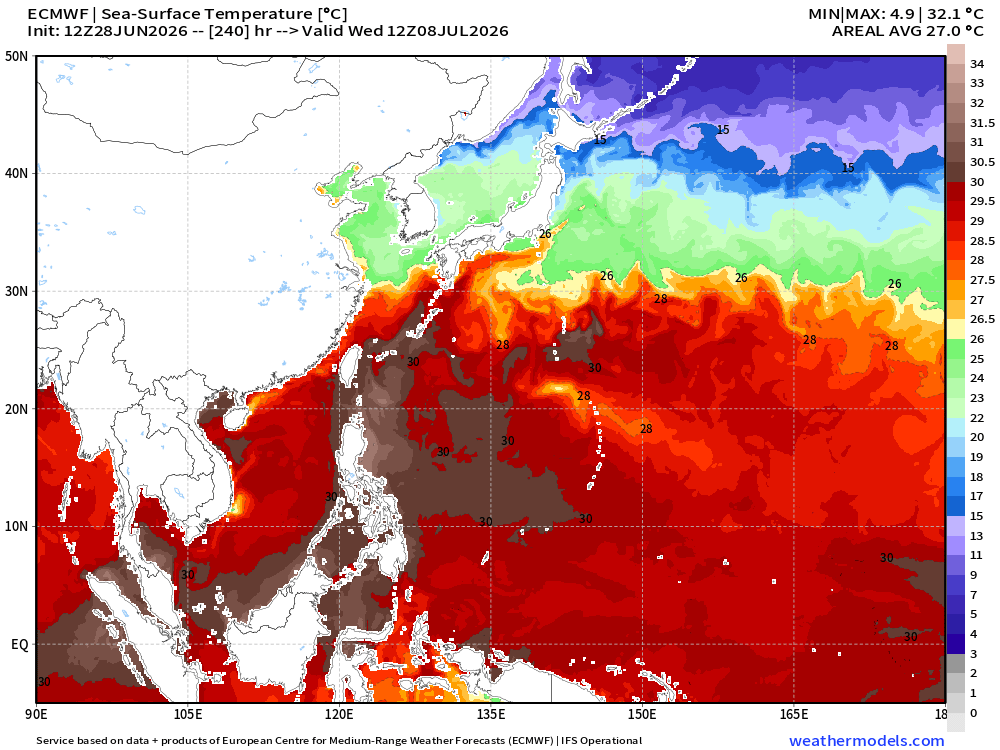
SSTs now in the 28°C to 30°C range across the entire Western Pacific up to about 30°N latitude
Full Physics ECMWF Ensembles | Next 15-days | Active Storm Tracks
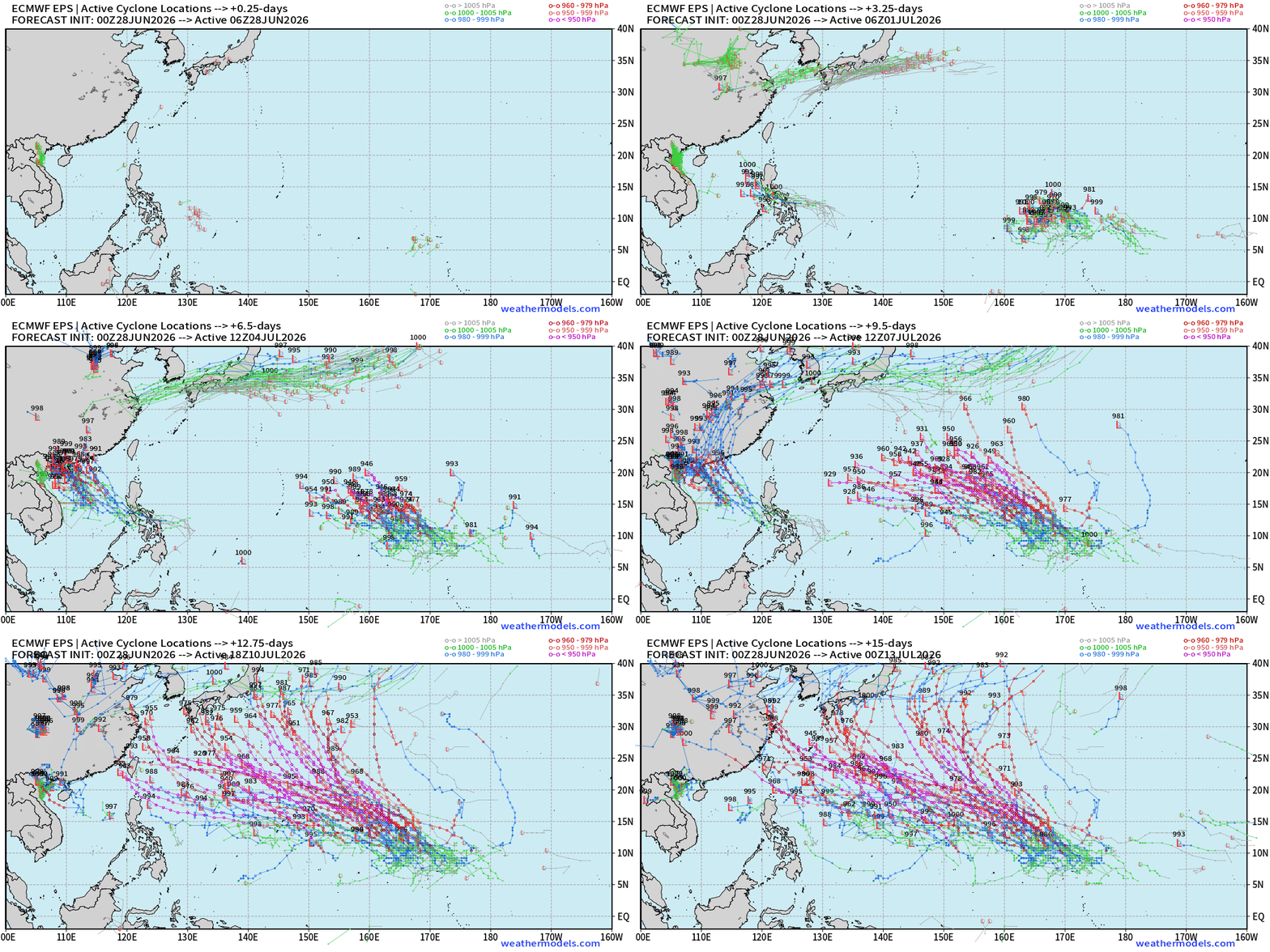
Long track, powerful Typhoon from Invest 95W — comes out of the far eastern part of the basin near the Dateline (typical of El Niño summers) —> Lots of ACE
Thank you for reaching the end of this post! Hopefully you enjoyed the beautiful weather maps. Please help increase the visibility of Weather Trader on Substack: Share or Like!
Help support this newsletter (nearing post 1,000!) —> June 2026 Coupon
Maps sourced from weathermodels.com designed and innovated by yours truly! Please subscribe there for real-time access to the newest maps, charts from all of the weather models including ECMWF and AIFS, and NOAA GFS/GEFS, HRRR/RRFS and Blend of Models (NBM). NOAA WPC and SPC for fronts/convective outlooks.
My Atlantic Hurricane Season Forecast (2026)
From April 7, 2026: Atlantic Seasonal Hurricane Forecast: (11/5/2)
9-13 Named Storms (11 most likely)
4-7 Hurricanes (5 or 6 most likely)
1-3 Major Hurricanes (2 most likely)
Accumulated Cyclone Energy: 75-85 (well below normal)
NOAA 2026 Atlantic Hurricane Season Forecast
- Milepost
- 969 · laid 2026-06-29T01:54:44.374000Z
- Source
- https://weather.substack.com/p/june-28-2026-tropical-update-sunday
- Digest
- 5201d5114ffcb3a3e8d26ffbb8ecc0ab160ca1143e31fe7c14dd347aba8084fe
- Machine
- JSON