Storyline · concluded · Season thread
Atlantic Season 2023
Every dispatch on this road this season, in order: the thread a daily newsletter leaves behind when you read it end to end.
34Dispatches
74Days · AUG 1–OCT 13
I-26Tropics

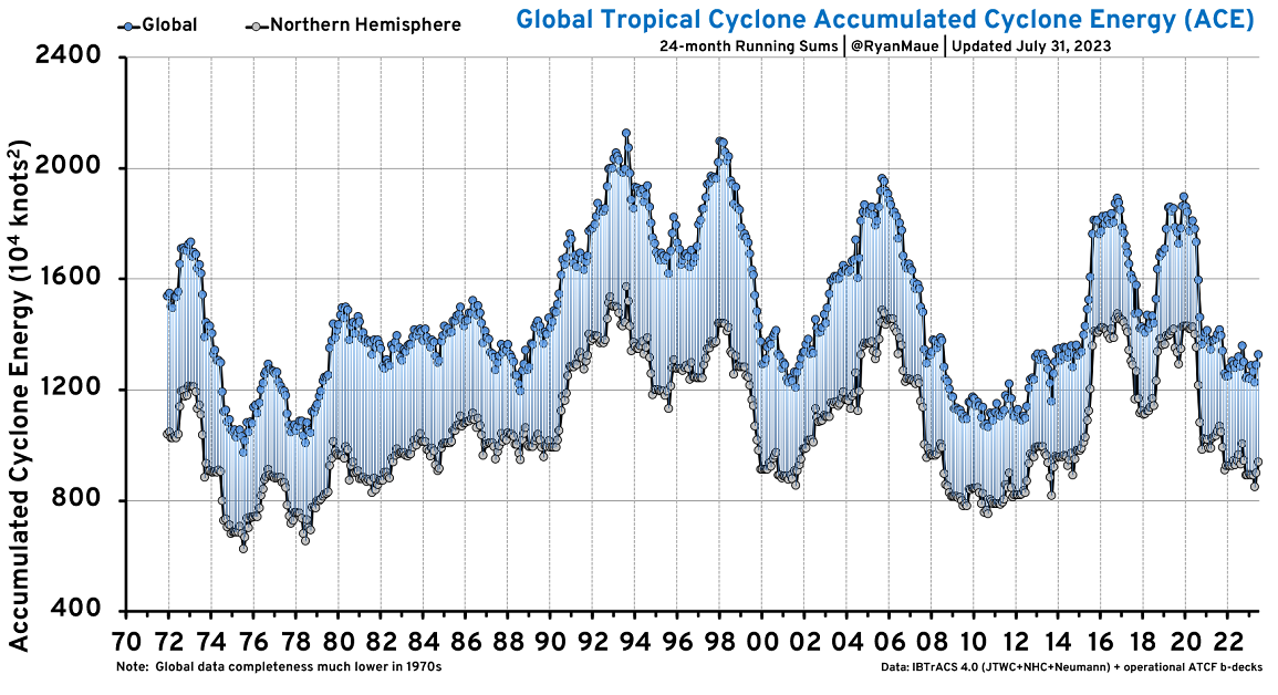 FIGURE 1
AUG 1 · I-26 TROPICS Global hurricanes and Accumulated Cyclone Energy
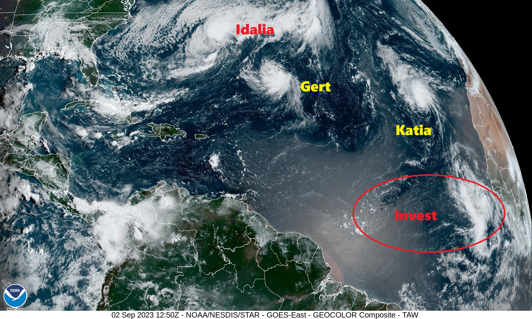 FIGURE 1
SEP 2 · I-26 TROPICS Tropical wave in Main Development Region ready to roll
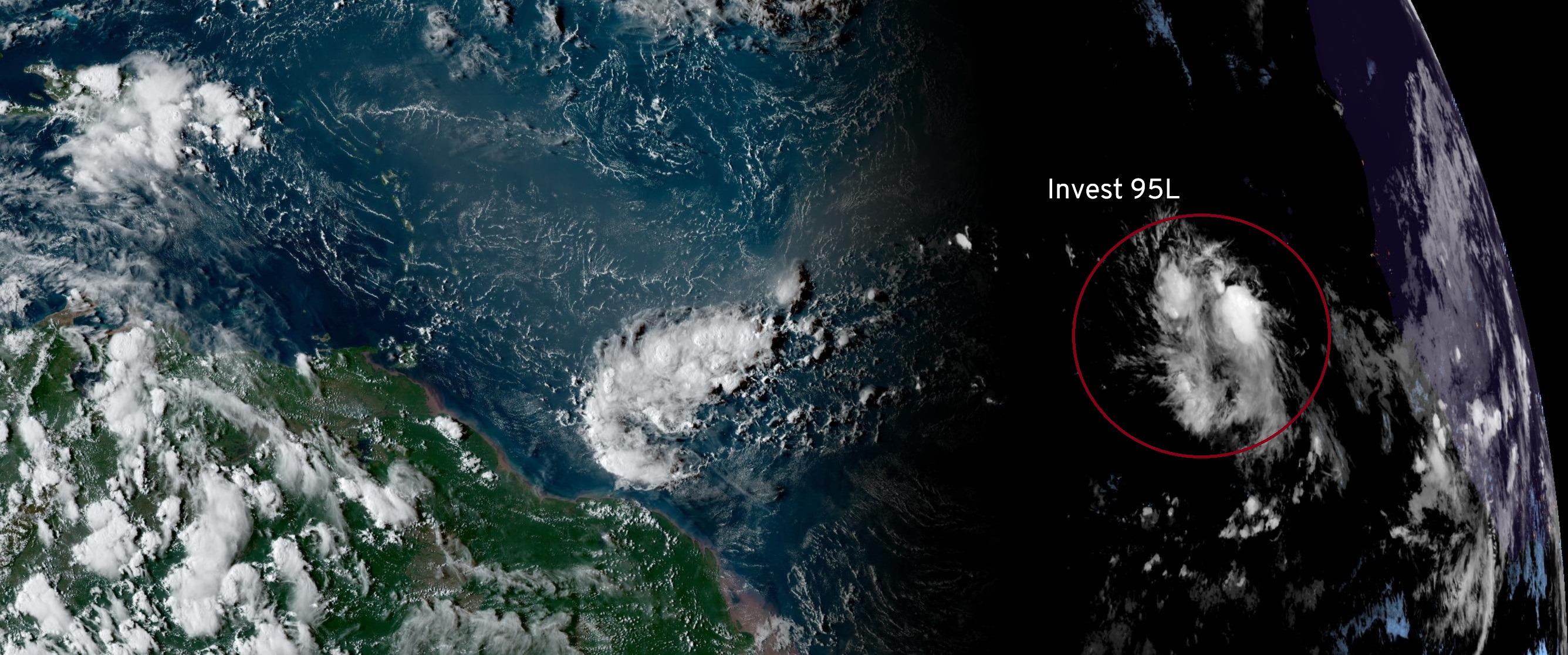 FIGURE 1
SEP 3 · I-26 TROPICS Invest 95L high chance of development into likely major hurricane
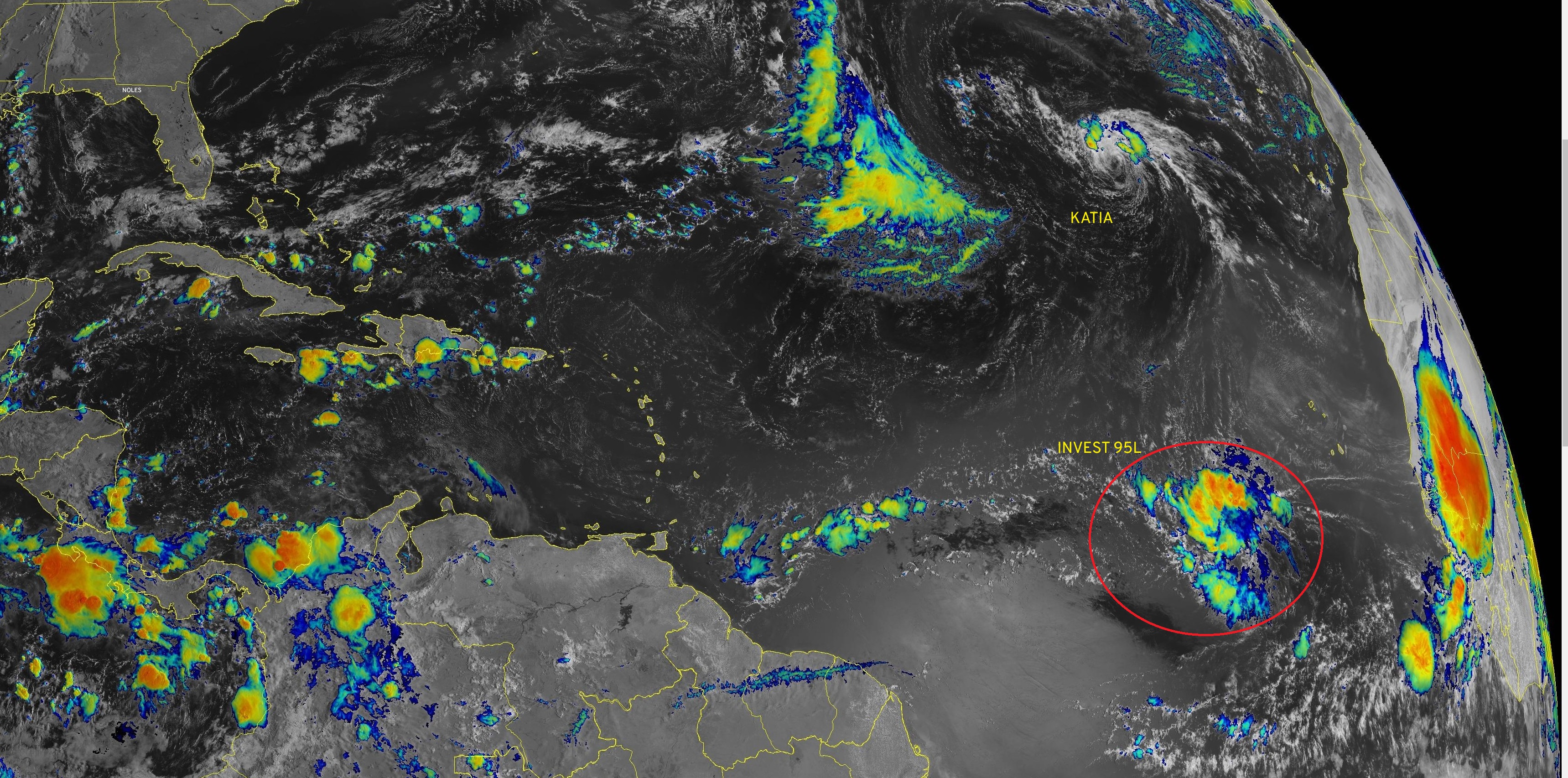 FIGURE 1
SEP 4 · I-26 TROPICS Watching Invest 95L for Tropical Depression by Wednesday
The route · every exit
- Exit 1 · AUG 1 Global hurricanes and Accumulated Cyclone Energy
- Exit 2 · AUG 3 · Subscribers Looking toward week 2 in the Atlantic
- Exit 3 · AUG 4 · Subscribers Looking toward week 2 in the Atlantic
- Exit 4 · AUG 7 · Subscribers Atlantic remains a ghost town
- Exit 5 · AUG 8 · Subscribers Hunga Tonga volcano influence on global climate
- Exit 6 · AUG 10 · Subscribers Two waves to watch in Atlantic next week
- Exit 7 · AUG 11 · Subscribers Hostile conditions continue in Atlantic
- Exit 8 · AUG 14 · Subscribers Atlantic seeing signs of activity
- Exit 9 · AUG 15 · Subscribers Atlantic seeing signs of activity
- Exit 10 · AUG 15 · Subscribers Hurricane develops from tropical wave and transits the Atlantic
- Exit 11 · AUG 21 · Subscribers Flurry of storm activity in Atlantic
- Exit 12 · AUG 22 · Subscribers Potential Gulf system next week
- Exit 13 · AUG 23 · Subscribers Franklin only show in town
- Exit 14 · AUG 24 · Subscribers Gulf of Mexico threat increasing
- Exit 15 · AUG 25 · Subscribers Gulf of Mexico tropical system likely
- Exit 16 · AUG 25 · Subscribers Tropical Storm or Hurricane landfall potential
- Exit 17 · AUG 26 · Subscribers Invest 93L organizing over warm waters of southern Gulf of Mexico
- Exit 18 · AUG 27 · Subscribers Slow intensification likely over next 2 days to hurricane
- Exit 19 · AUG 27 · Subscribers NHC maximum intensity is 80 knots
- Exit 20 · AUG 31 · Subscribers Traffic jam around Bermuda
- Exit 21 · SEP 2 Tropical wave in Main Development Region ready to roll
- Exit 22 · SEP 3 Invest 95L high chance of development into likely major hurricane
- Exit 23 · SEP 4 Watching Invest 95L for Tropical Depression by Wednesday
- Exit 24 · SEP 18 Area off Southeast US coast could become tropical this weekend
- Exit 25 · SEP 19 · Subscribers Area of low pressure off Carolinas will drench coast
- Exit 26 · SEP 20 · Subscribers Models confused about African easterly wave development
- Exit 27 · SEP 21 · Subscribers Ophelia on the way to North Carolina
- Exit 28 · SEP 22 · Subscribers Ophelia intensifying up until landfall in North Carolina
- Exit 29 · SEP 25 · Subscribers Philippe struggling with Rina on the way
- Exit 30 · SEP 26 · Subscribers Philippe nearing demise and waiting for Rina
- Exit 31 · SEP 27 · Subscribers Nor'easter may drench New England
- Exit 32 · OCT 11 · Subscribers Southeast tropical disturbance drenching Gulf Coast
- Exit 33 · OCT 12 · Subscribers Invest 94L looks more threatening
- Exit 34 · OCT 13 · Subscribers Invest 94L with high chance of development
END
Why I-26?
Tropical stories ride Interstate 26, after the 26 °C sea-surface temperature often used as a rough threshold for tropical development.
26 °C
The sea-surface temperature often used as a rough threshold for tropical development; the shield number of this road.
Invest
An area the Hurricane Center is investigating, numbered 90–99 with a basin letter, before it has a name.
ACE
Accumulated Cyclone Energy: a season's wind, squared and summed every six hours. Climatology sets the scale.