September 3, 2023 Hurricane Season
Invest 95L high chance of development into likely major hurricane
September 2023 was the 9th-warmest September in the 131-year national record (1895–2025), at 67.7°F against a 1991–2020 normal of 66.0°F (+1.8°F).
September 2023 was the 27th-driest September in the 131-year national record (1895–2025), at 2.1in against a 1991–2020 normal of 2.6in (-0.4in).
NOAA/NCEI Climate at a Glance, contiguous United States. This is the observed record for the month, not a score of anything said in this piece — the forecast ledger begins 2026-08-17 and cannot reach earlier posts.
Thank you to all supporters and subscribers! I received a nice banner for paid subscribers in the 100s. Of course, that means one more than 100, but for the first month, that support is fantastic. There are > 2,000 free subscribers and about 55% email open-rate. I do not get much traction from X/Twitter due to Elon’s link squashing, so growth is organic. Based upon number of posts, the cost is about 15 cents per update.

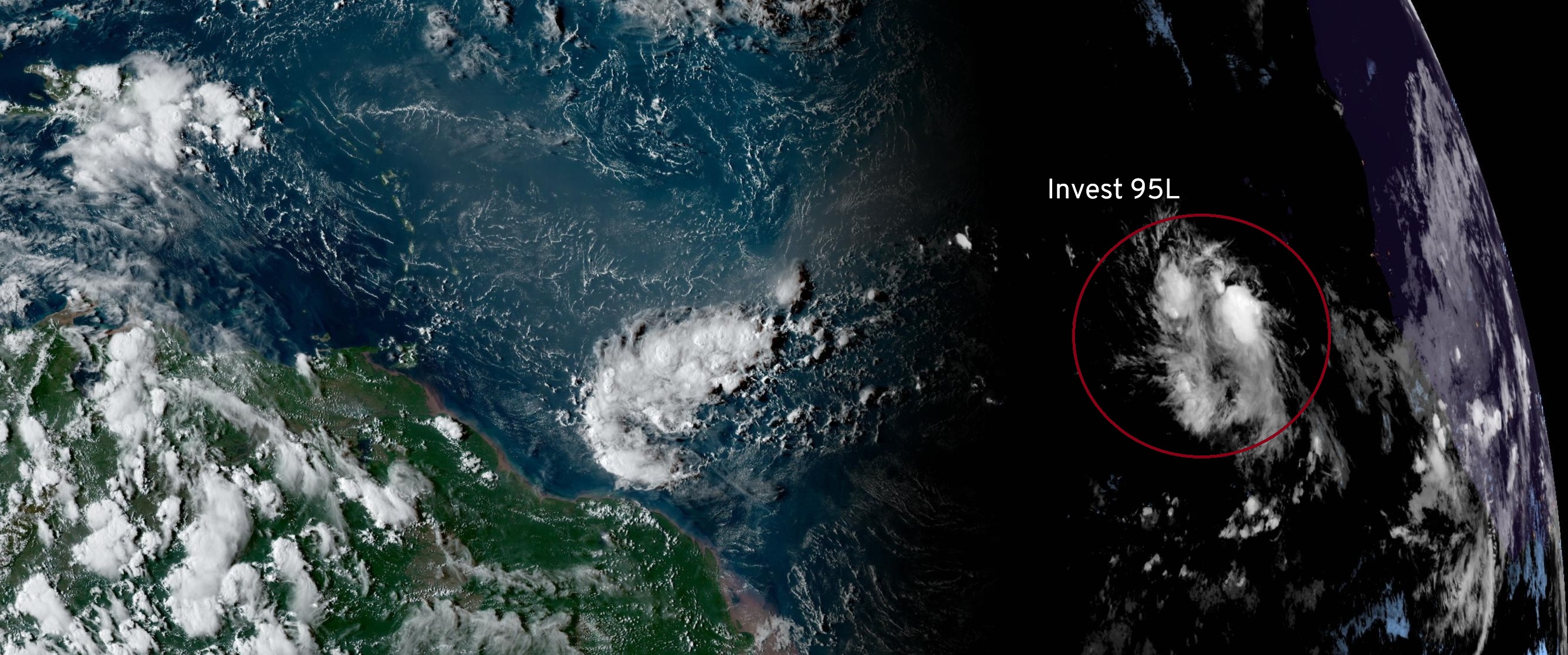
Invest 95L is expected to develop [90% next 7-days] into a tropical depression and then intensify into a major hurricane by end of coming week. Gert and Katia are ending their lifecycles and will dissipate on Monday.
2023 Medium Range Atlantic Tropics
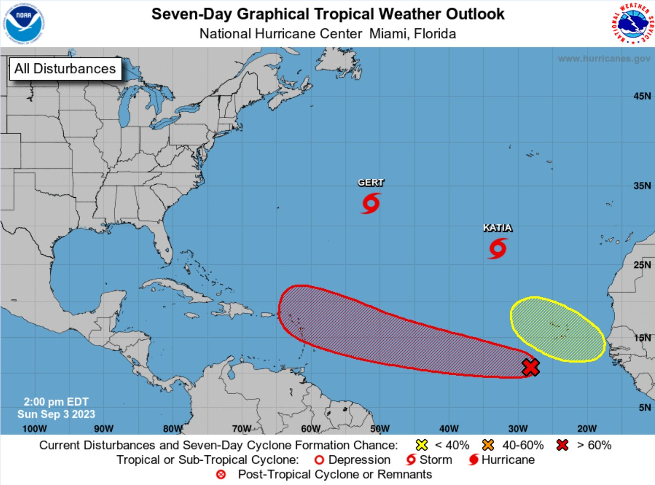
Invest 95L is lit up with the red hatching for high chance (90%) of development in the next 2-7 days. Models area all on board with significant intensification.
HAFS-A and HAFS-B in the 940s and 950s with central pressure = major hurricane on a track to miss the Leeward Islands.
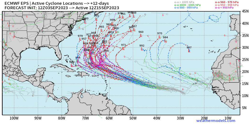
The global models ECMWF and GFS are both major hurricane intensity and on a track expected to recruve out to sea. We’ll look at the ECMWF ensembles from 12z next.
All tracks are abruptly turned out to sea. Of course, this is at least 5-7 days away before we can probably confidently determine the final outcome of Major Hurricane Lee.
Atlantic 2023 Year to Date | ACE: 55 (153% normal | 36)
Unnamed Subtropical Storm [January 2023]
Arlene 02L: 35 knots, Bret 03L: 60 knots, Cindy 04L: 50 knots
Don 05L: 65 knots, Emily 07L: 45 knots, Franklin 08L: 130 knots
Gert 06L: 40+ knots, Harold 09L: 45-knots, Idalia: 115-knots
Jose: 50-knots, Katia: tropical storm, Lee and Margot are next
2023 Eastern Pacific Hurricane Season
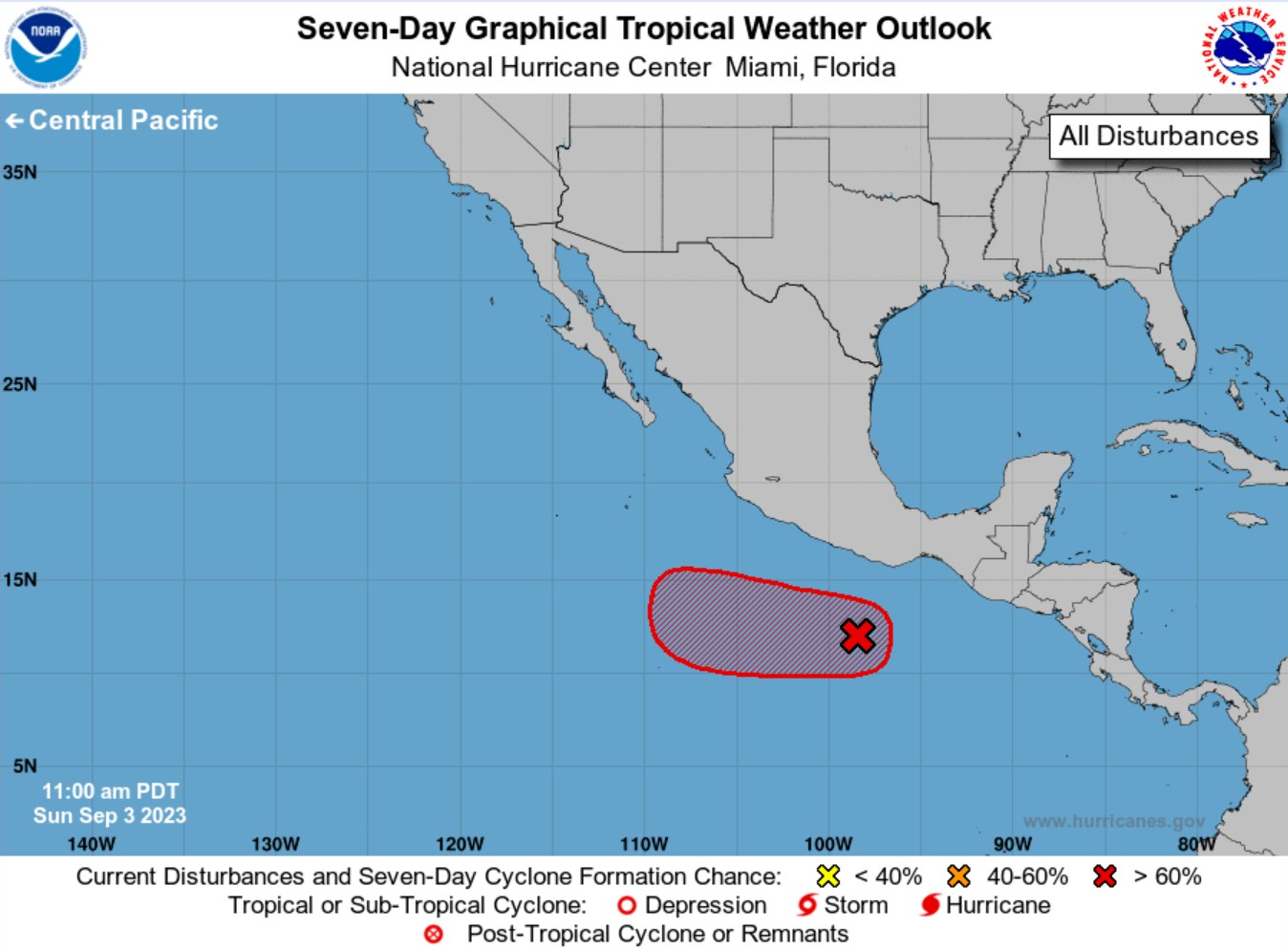
Formation chance through 7 days...high...90 percent.
Area of low pressure likely to develop later next week, but no impacts to land are expected.
Eastern Pacific 2023 | Year to Date ACE 106 (130% of normal | 81)
Adrian 01E: 90 knots, Beatriz 02E: 75 knots, Calvin 03E: 110 knots
Four 04E: 30 knots, Dora 05E: 125 knots, Eugene 06E: 60 knots
Fernanda 07E: 115 knots, Greg 08E: 45 knots
Hilary 09E: 125 knots, Irwin 10E: 40 knots
2023 Western Pacific Typhoon Season
Typhoon Haikui (10W) made landfall on Taiwan as a major Category 3 storm and the inner-core was obliterated by the mountainous terrain. Haikui may retain Typhoon status prior to landfall in China in about 36-hours.
Western Pacific Typhoon 2023 YTD ACE: 210 (152% normal | 138)
Sanvu 01W: 30 knots, Mawar 02W: 160 knots, Guchol 03W: 90 knots
Talim 04W: 85 knots, Doksuri 05W: 130 knots, Khanun 06W: 120 knots
Lan 07W: 115 knots, Damrey 08W: 65 knots, Saola 09W: 135 knots
Haikui 10W: typhoon, Kirogi 11W: tropical storm
Thank you for subscribing! Your support pays for my servers and product development. Feel free to say hello and follow on Twitter (@RyanMaue)
- Milepost
- 88 · laid 2023-09-03T21:14:38.079000Z
- Source
- https://weather.substack.com/p/september-3-2023-hurricane-season
- Digest
- b99c8583fca07fae8d73b8b0c7feed8a821179db9ed6abdcd9aa24791947c846
- Machine
- JSON