Heavy rain across the Southwest and Texas linked to El Niño fueled Pacific moisture

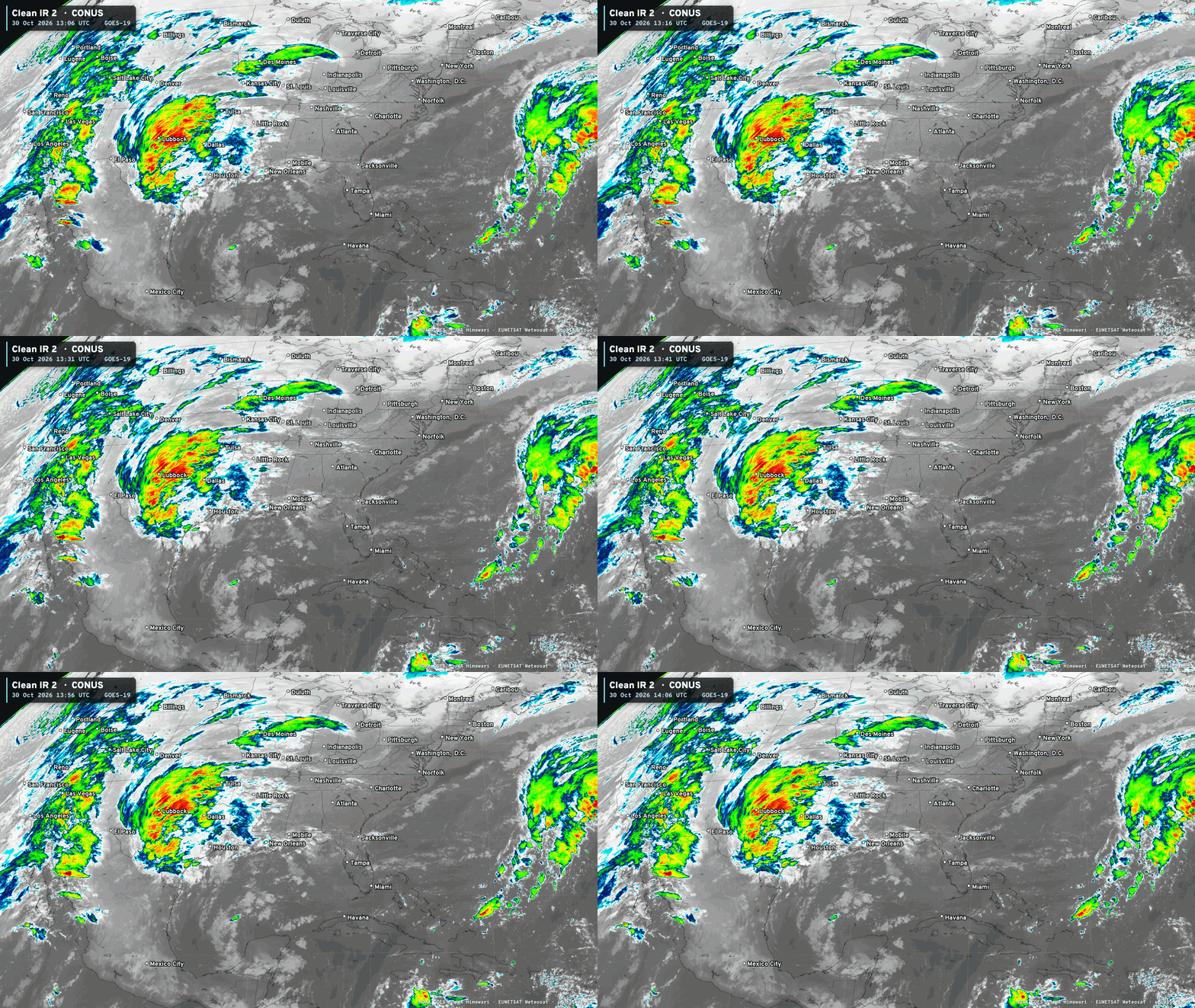
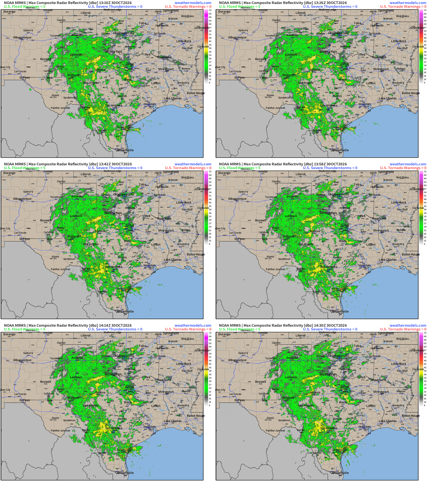
Boatloads of rainfall blanketing Texas today! I’d assume all of it is welcome.
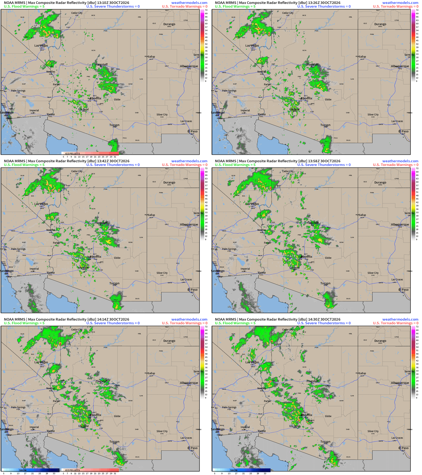
Also, convective showers and storms over southern Nevada and crossing through Phoenix, Arizona. Quite the rainy/wet pattern on the way with continued heavy precipitation —> flooding / runoff.
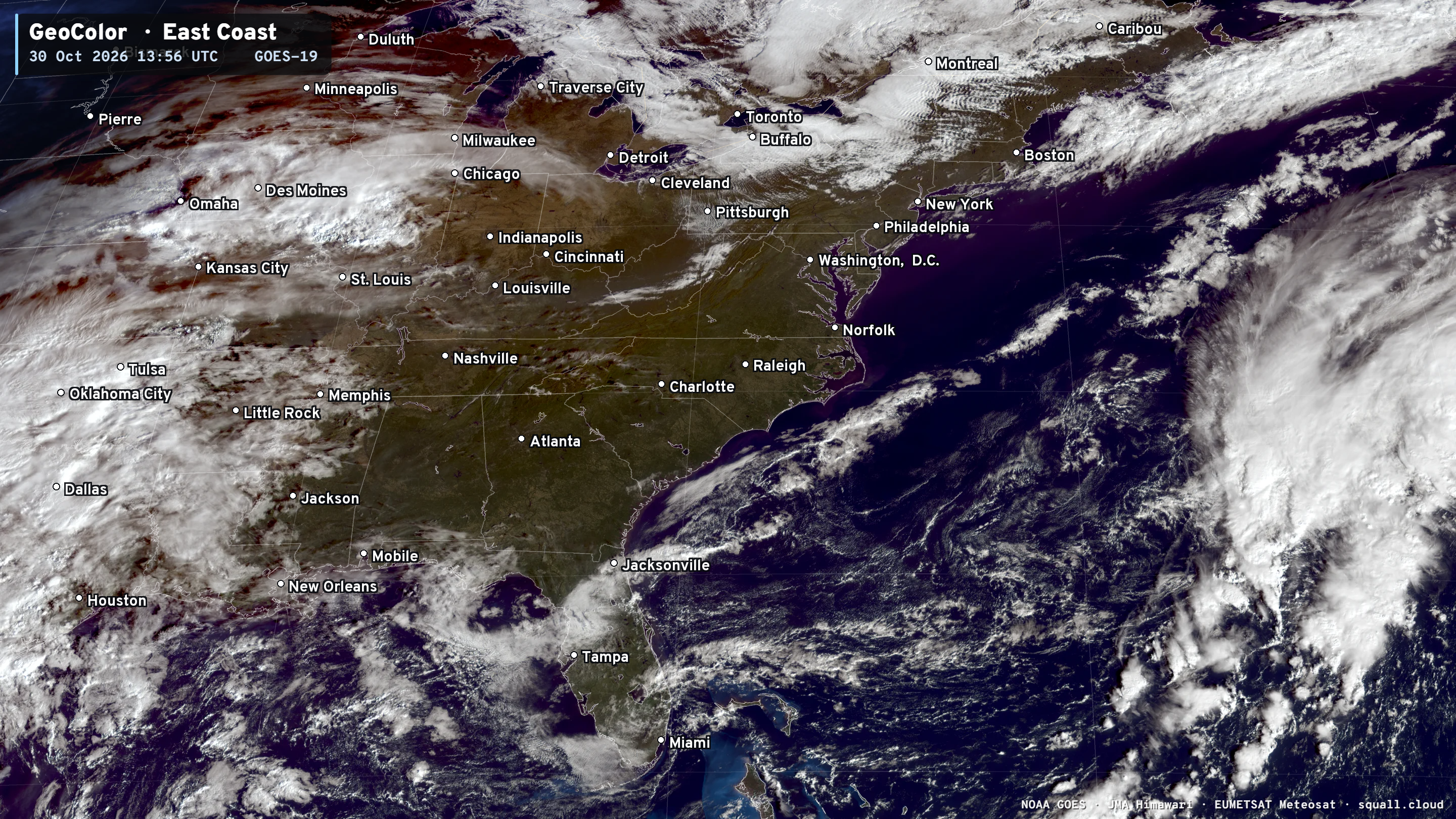
A couple frontal boundaries are clearing out the Northeast and Great Lakes.
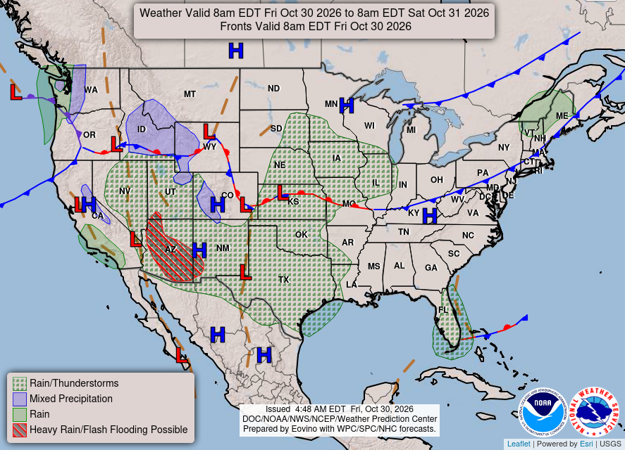
Heavy rain / Flash flooding across Arizona! A weak frontal boundary across South Florida. Weak / swirling low pressure off the Pacific Northwest — some mountain snow.
Weather Headlines for Friday
Typhoon In-fa motoring westward through Micronesia and will recurve east of Japan
Heavy rain and some mountain snow for California and the Southwest this weekend with a strong surge of Pacific moisture from Pineapple Express (Subtropical Pacific atmospheric river)
Well above normal temperatures for next 2-weeks East of the Rockies
Europe continues chilly into mid-November.
Unprecedented Polar Vortex breakdown with Stratospheric Warming Event (SSW) and Wind Reversal. Down the road (2-4 weeks) impacts are uncertain against the raging El Niño background.
HRRR Simulated Radar through Sunday 8 AM ET
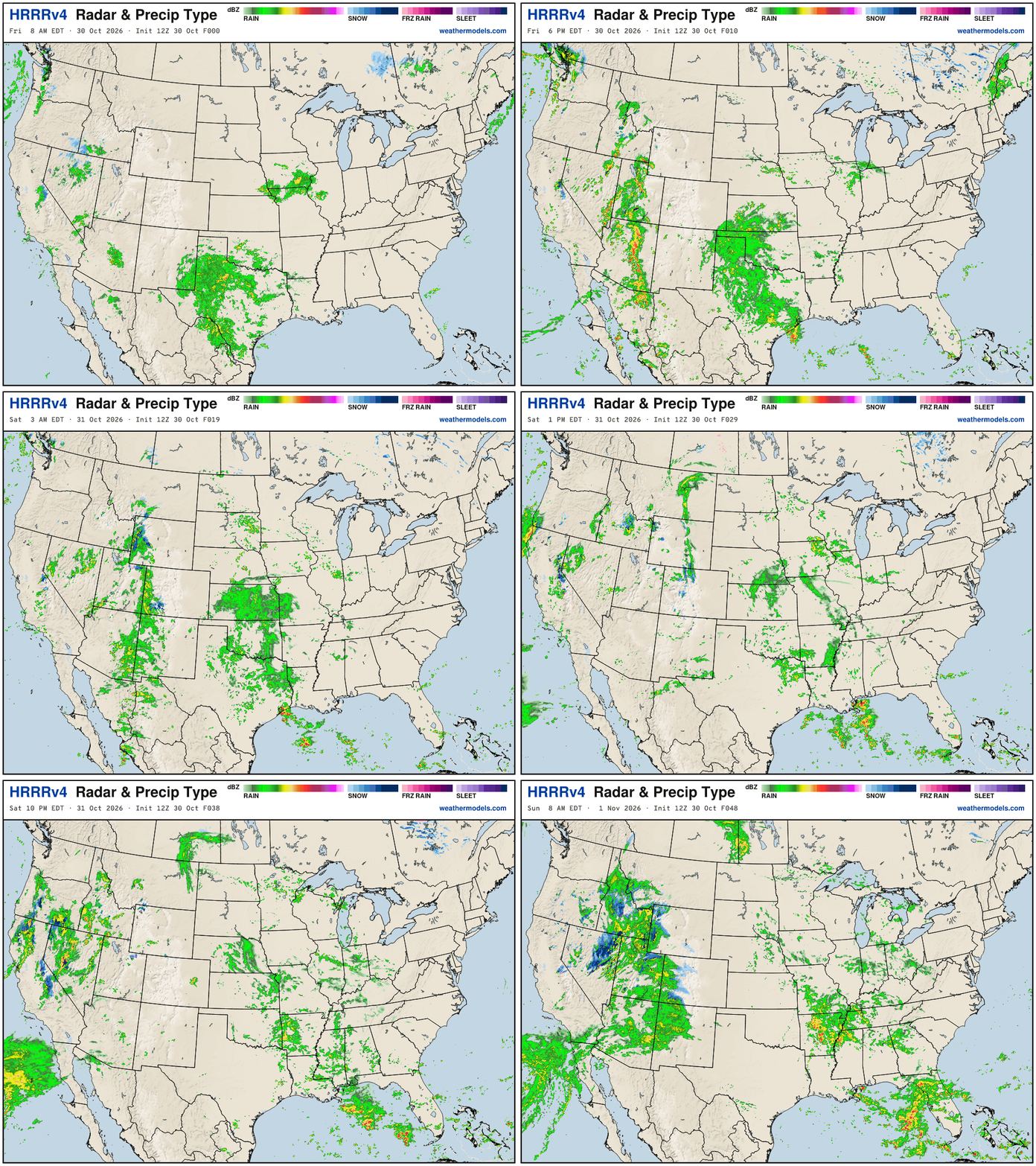
Heading into November — and supposedly transitioning to winter and cooler weather — we have an impressive subtropical Pacific moisture feed spreading from the West Coast into the Southwest, and then adding to Texas blob of rain = a very busy Lower 48. Thankfully not a major risk of severe weather.
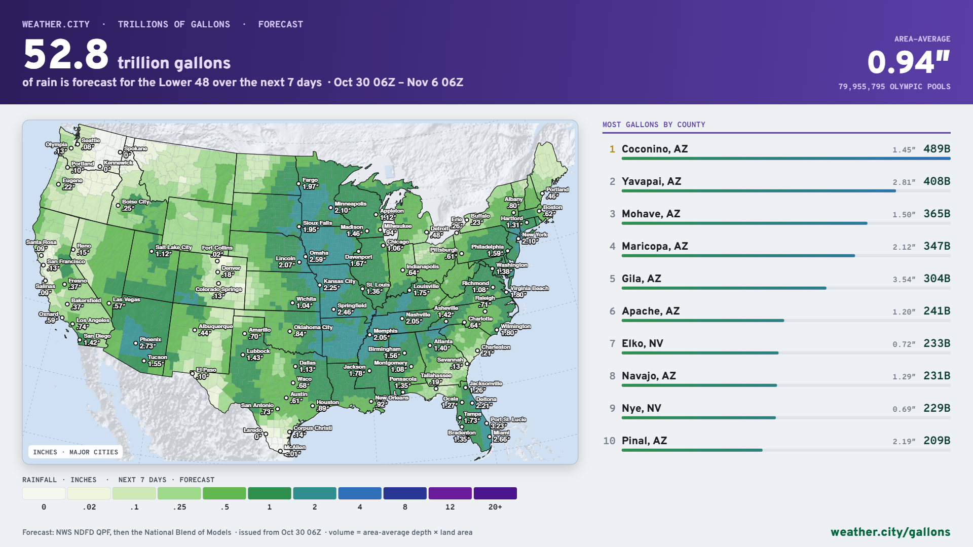
Overall — 53 trillion gallons of precipitation over next 7-days for Lower 48
Arizona counties are the biggest winners!
Temperature Analysis this Morning at 9:15 AM ET
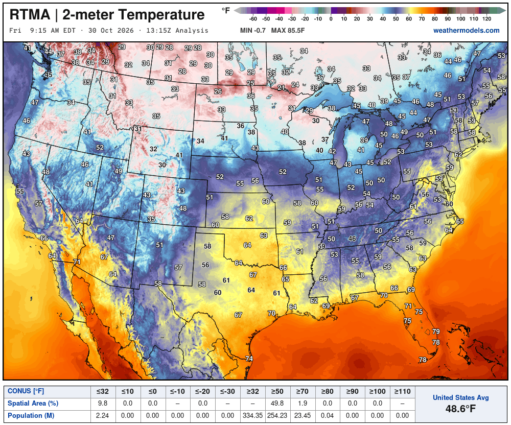
Mild in the Northeast but chilly in the Midwest (20s)
Temperature Analysis | Anomaly from Normal
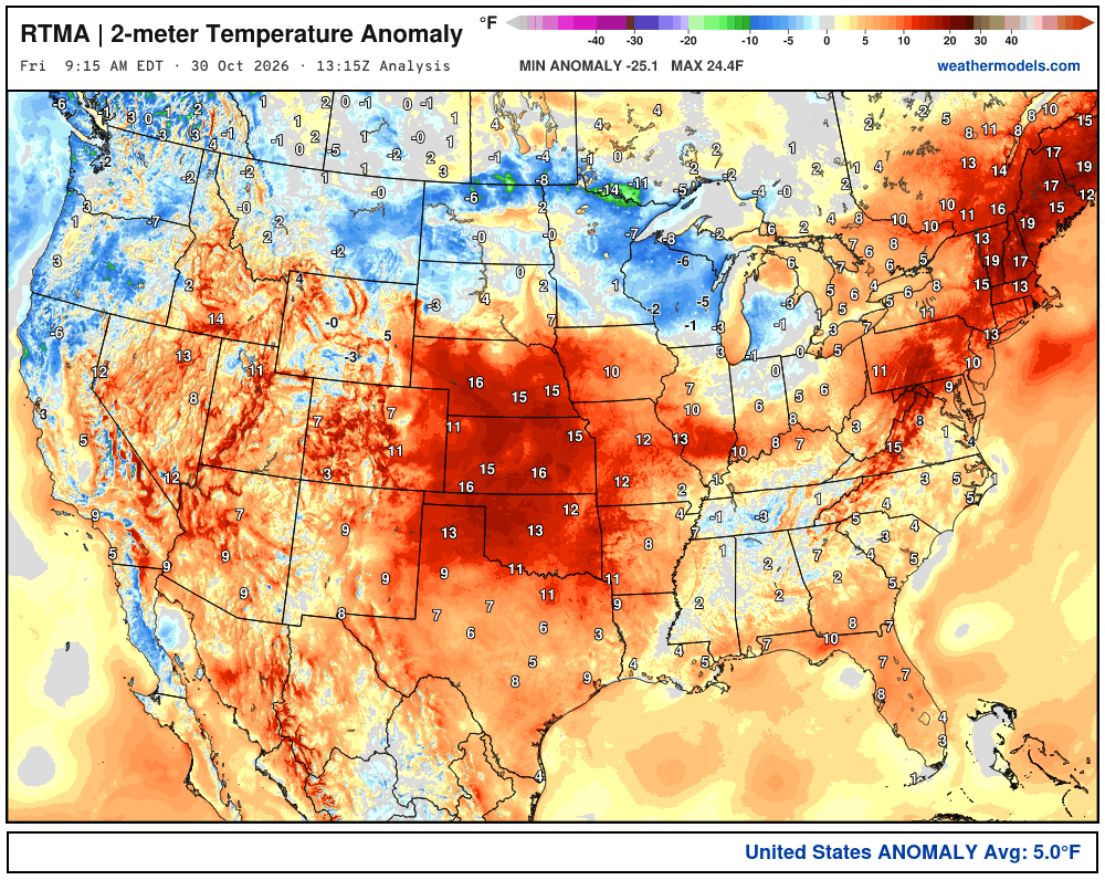
Lower 48 was a whopping 5.0ºF above normal
Another mention of Chilly Weather in Europe
2-weeks of blue over much of Europe —> below average temperatures. Also, normal is getting progressively colder, too! So this is a bullish signal for energy usage for heating. It’s not freezing cold, but chilly — still early November not mid-January or this would be brutal. Paris and Berlin with lows in the 30s and 40s. Also, this pattern is not great for solar or wind —> altogether a perfect storm of “weather dependent” energy unreliability.
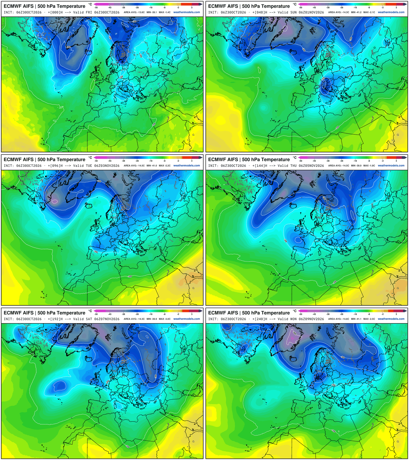
What weather pattern yields such persistent cold in Europe?
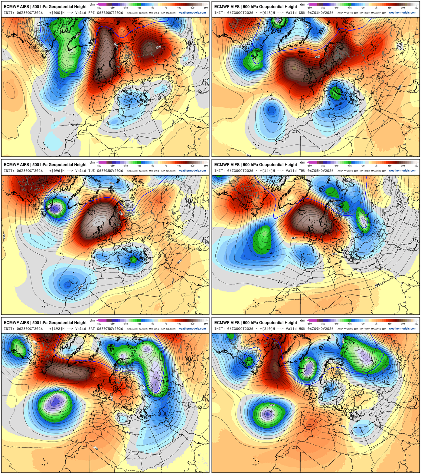
A blocking ridge stuck over Scandinavia which repeats over and over! Beneath it continue cut-off lows with cooler air from polar vortex “teardrops” drip off and retrograde through western Europe. -30°C at 500 hPa is Arctic/polar airmass — so we certainly have a strong polar vortex intensifying into early November — and plenty of -40°C area forming, too. Something I’m working on is the areal coverage of the -40°C isotherm at 500 hPa (a topic that Dr. Pielke Sr. has spent much research effort understanding in the Arctic). With the raging El Niño, I’d like to see its impact of the “cold pool” formation in mid-levels (500 hPa).
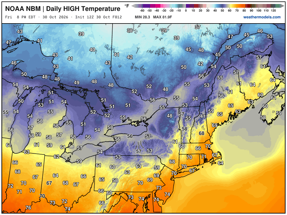
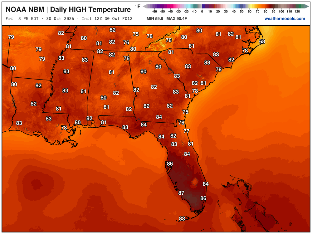
High Temperatures on Friday
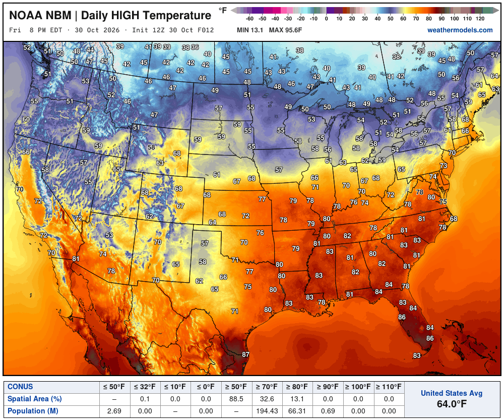
Very mild — toasty across the Ohio Valley and southward — but also around 70 in NYC and Boston. Perfect weather.
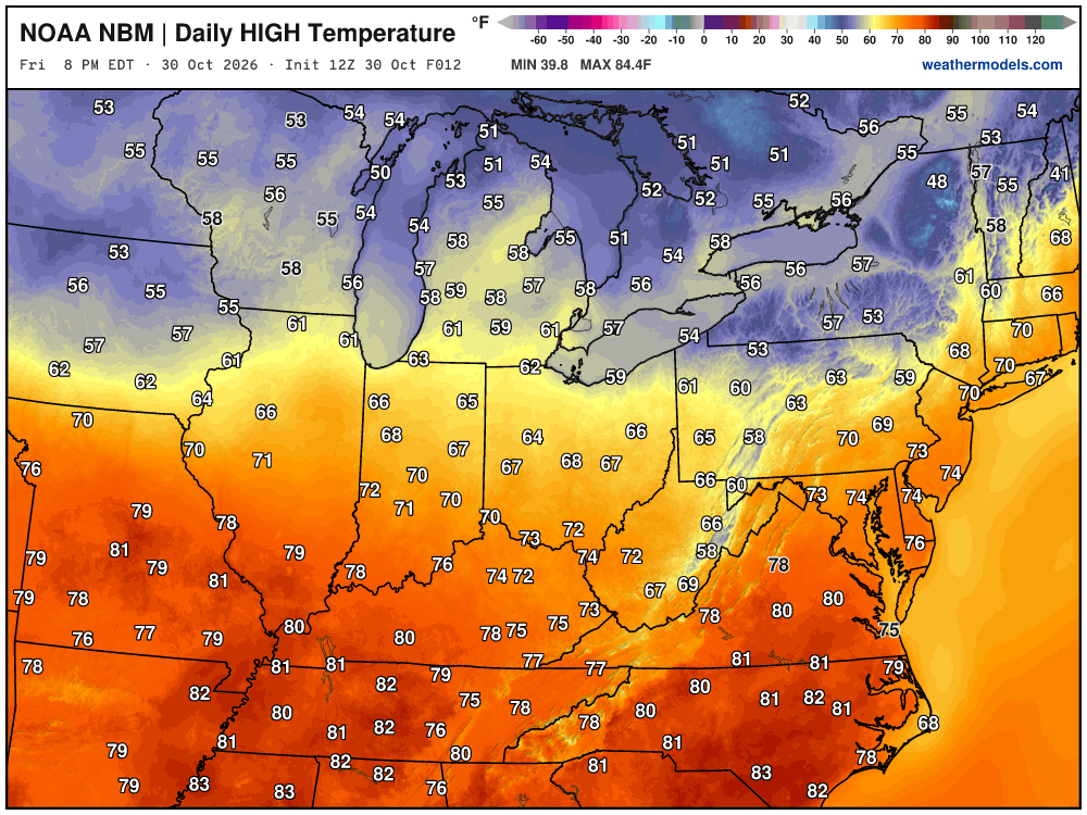
80s in the Southeast — including Nashville, Atlanta, and Tallahassee. Maybe some 90s in Southwest Florida.
Integrated Vapor Transport Next 10-days | ECMWF AIFS 06z
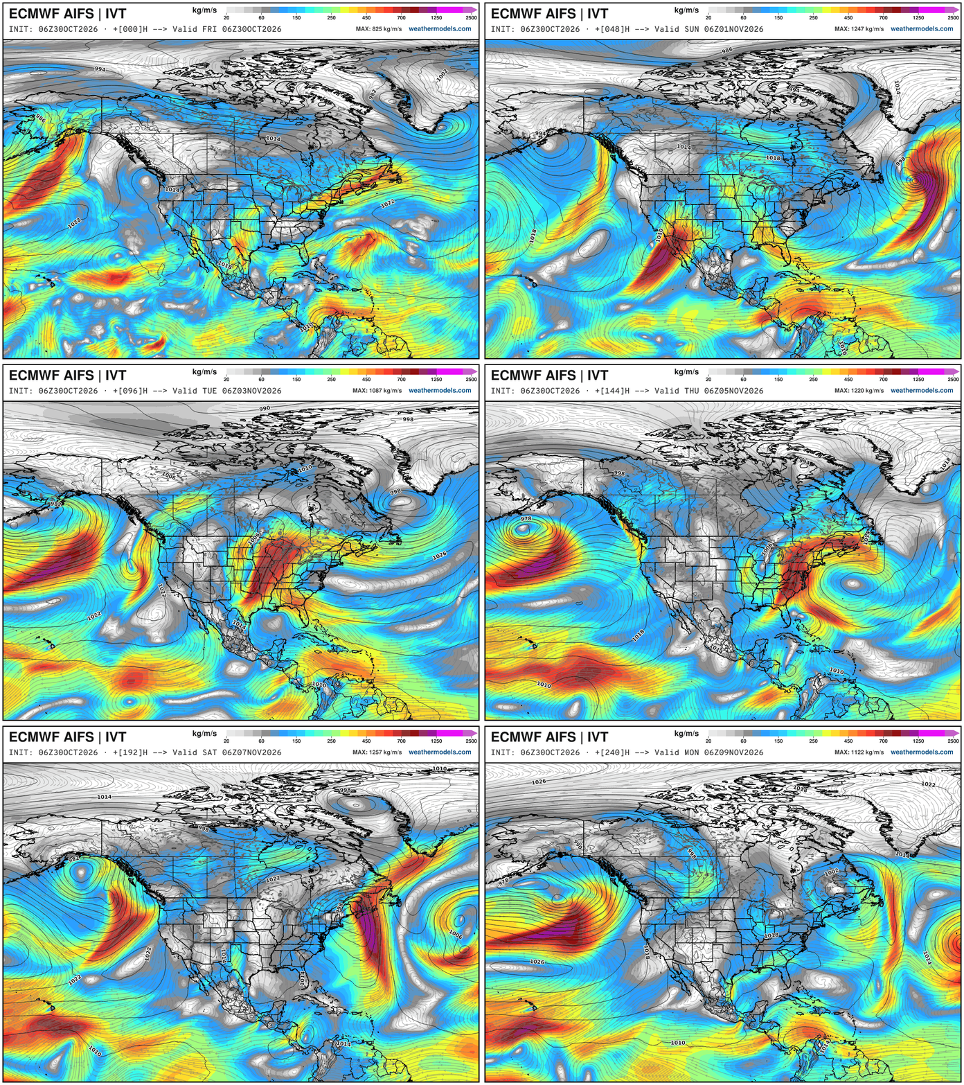
Impressive atmospheric river (stubby) arriving into Southwest U.S. with a weak low pressure through the weekend. Boatloads of rain for California and Arizona. That all moves into the central U.S. into a stronger storm system … slowly heads eastward over next 7-days, or so, finally dying over the Northeast next weekend. The overall upper-level weather pattern is blocked, and not progressive, so weather systems are clogged.
Height Anomaly Pattern | Next 10-days | AIFS 06z | Flagship model
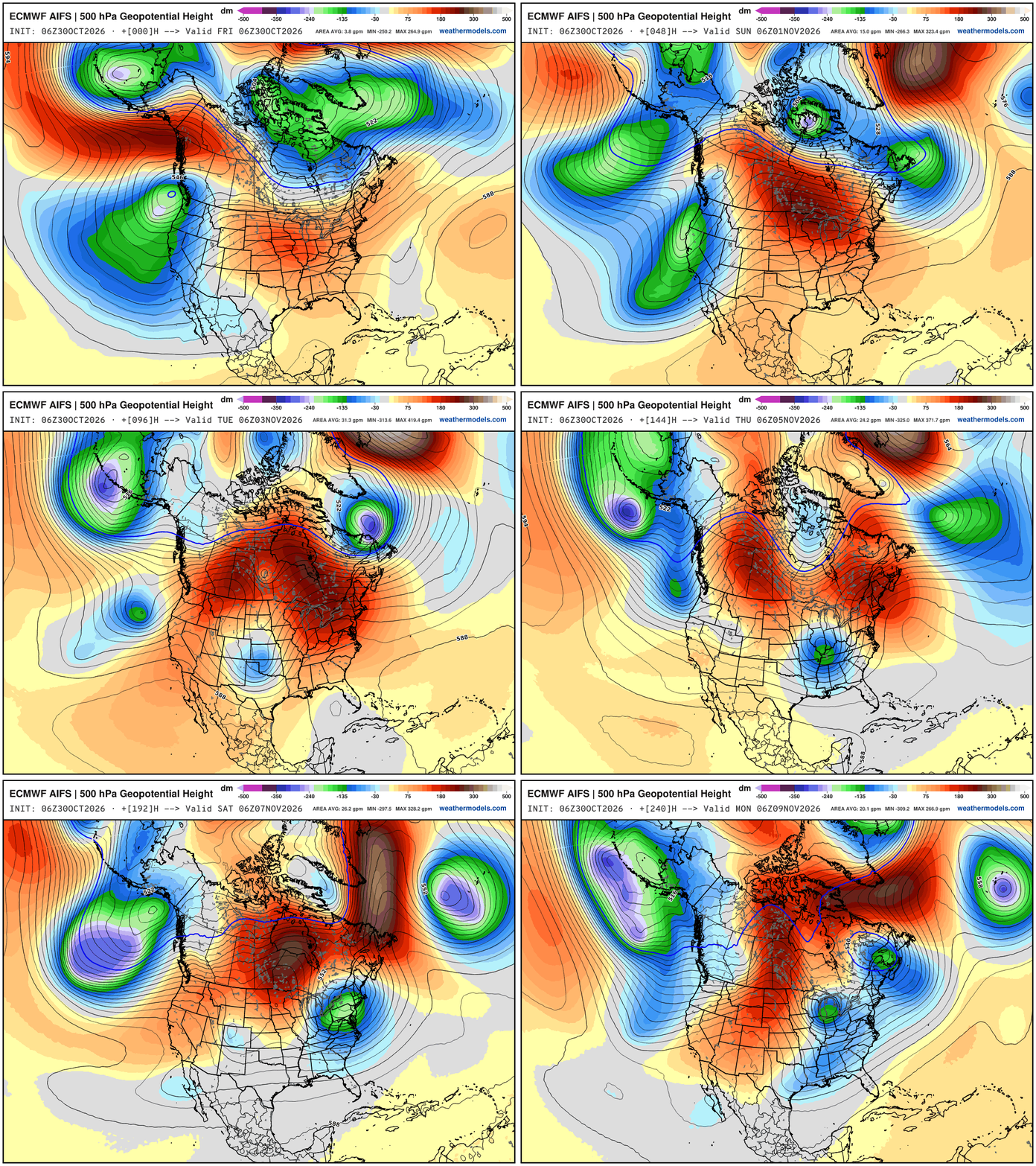
Large scale pattern —> Parade of troughs dipping across the West Coast — and ridging east of the Rockies. But, the new feature for late next week is one of these Pacific cut-offs travels through the southern U.S. under the block, and then finds access to the polar front again, accessing some colder Arctic air … 500 hPa Temperature is the best way to show the “polar vortex” intrusions. We should watch for some interior New England snowfall potential into next weekend.
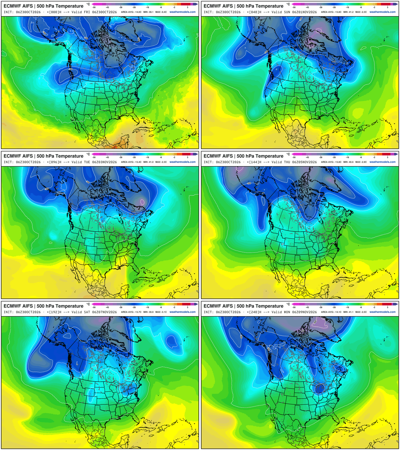
Otherwise — mostly a blow-torch across Canada (very warm) … AIFS next 2-weeks temperature anomaly (weekly averaged)
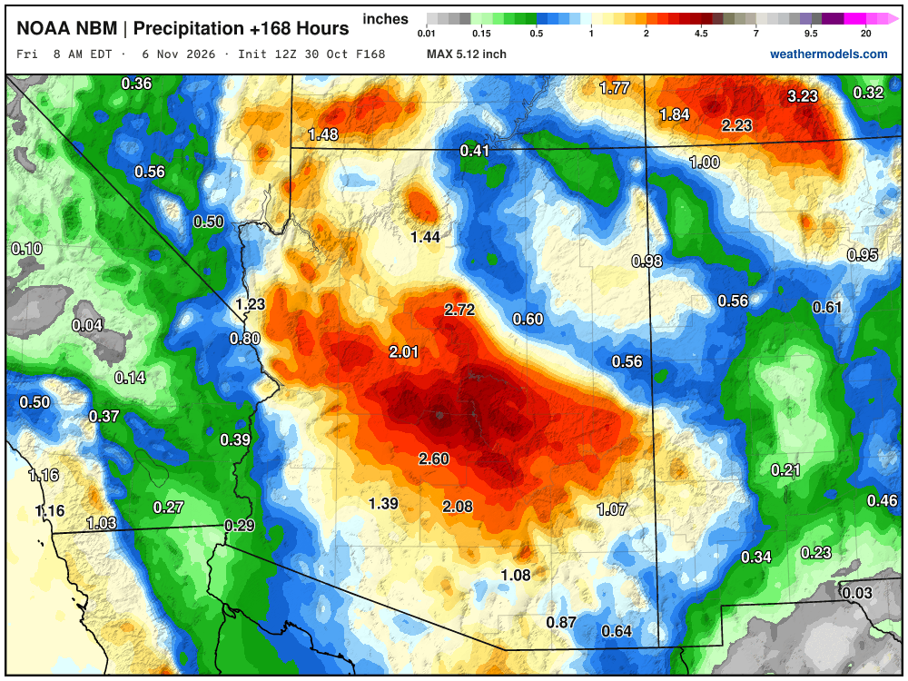
NWS NDFD Next 3-days precipitation | Boatloads in Arizona.
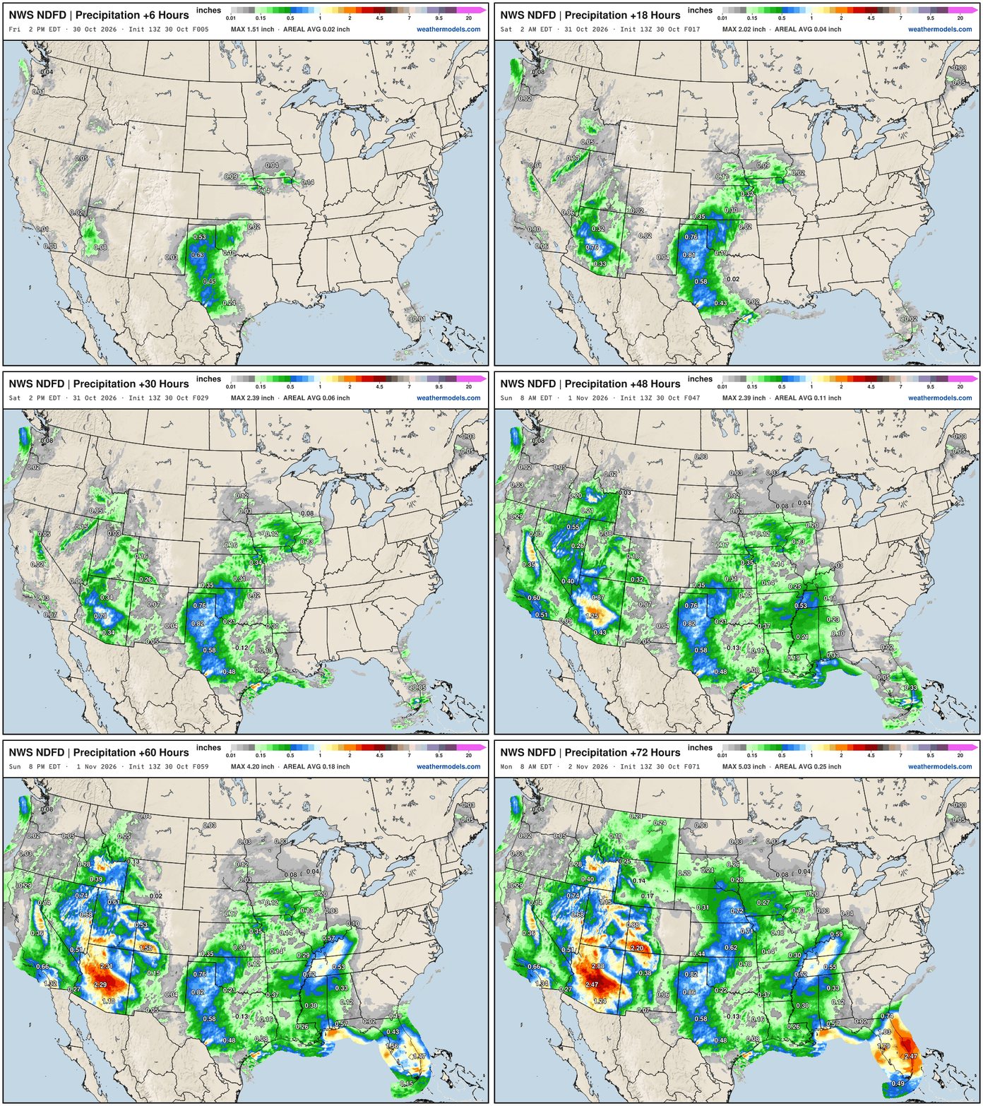
And some mountain snowfall!
Blend of Models Precipitation Next 7-days | Lower 48
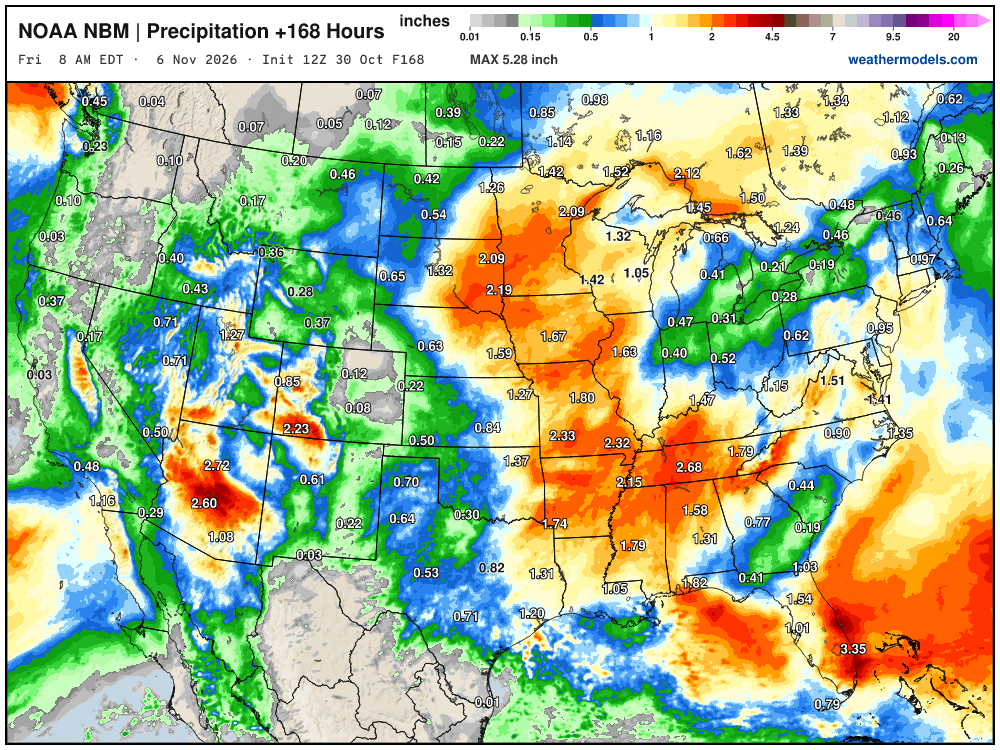
Southwest subtropical jet stream + storm system with a mini-atmospheric river means heavy rainfall for Southern California and Phoenix later this week. Also, thankfully some rain for the Southeast.
My favorite parameter — precipitable water | ECMWF 06Z next 6-days
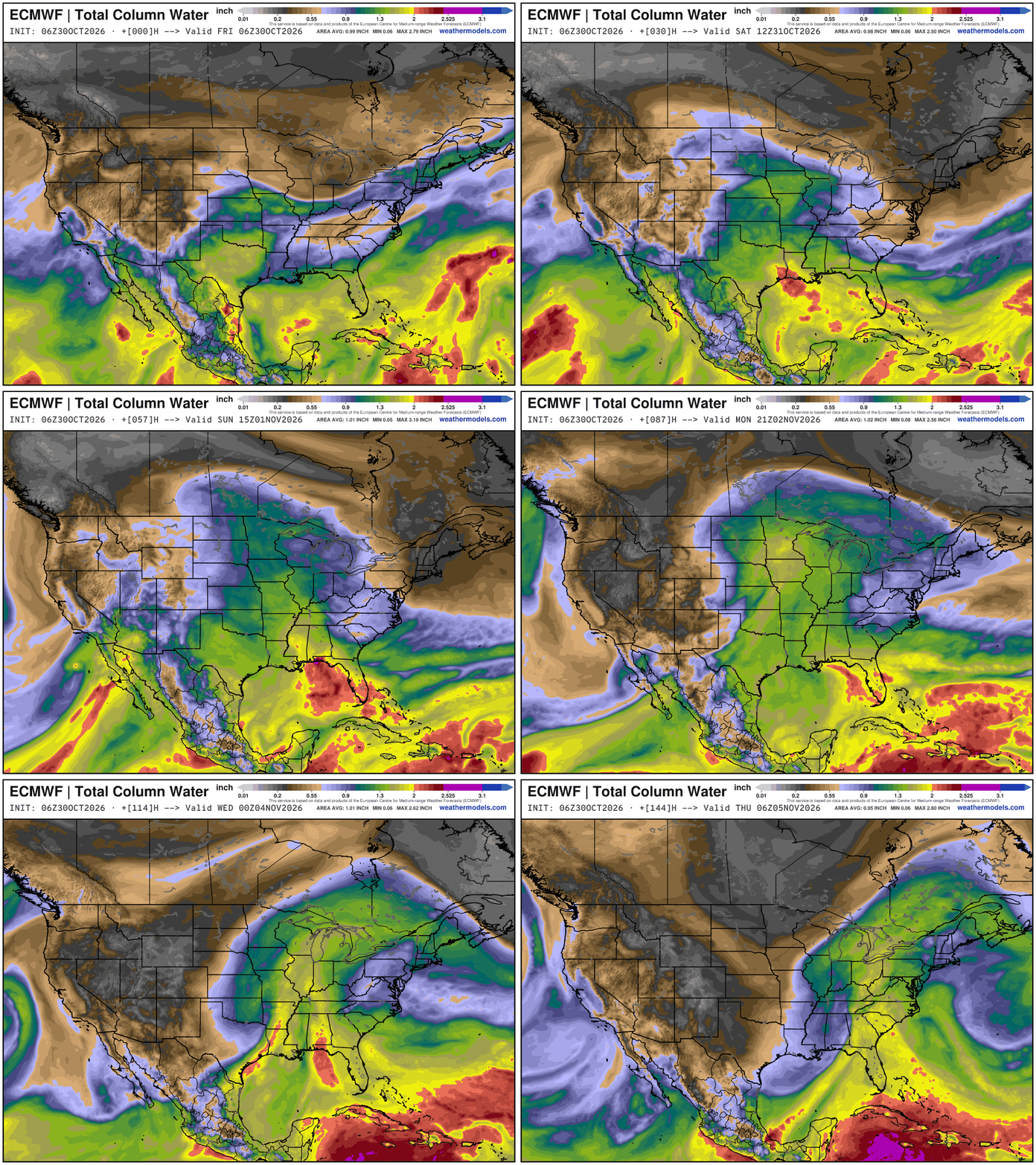
Huge subtropical Pacific moisture feed — with input from former Vance, and another storm system (Pineapple Express) all combines into well-above normal PWAT over the central U.S. until the developing storm system can finally move east.
High Temperatures next 9-Days through first week of November
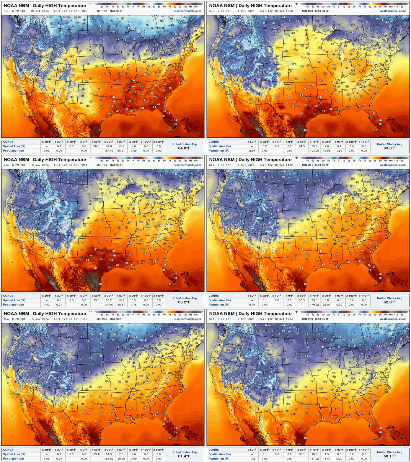
The cooler Canadian air (40s and 50s for highs) remains mostly bottled up as warmth and moisture from the Gulf and Subtropical Pacific combine with the mid-level ridging.
Blend of Models Snowfall Next 10-days
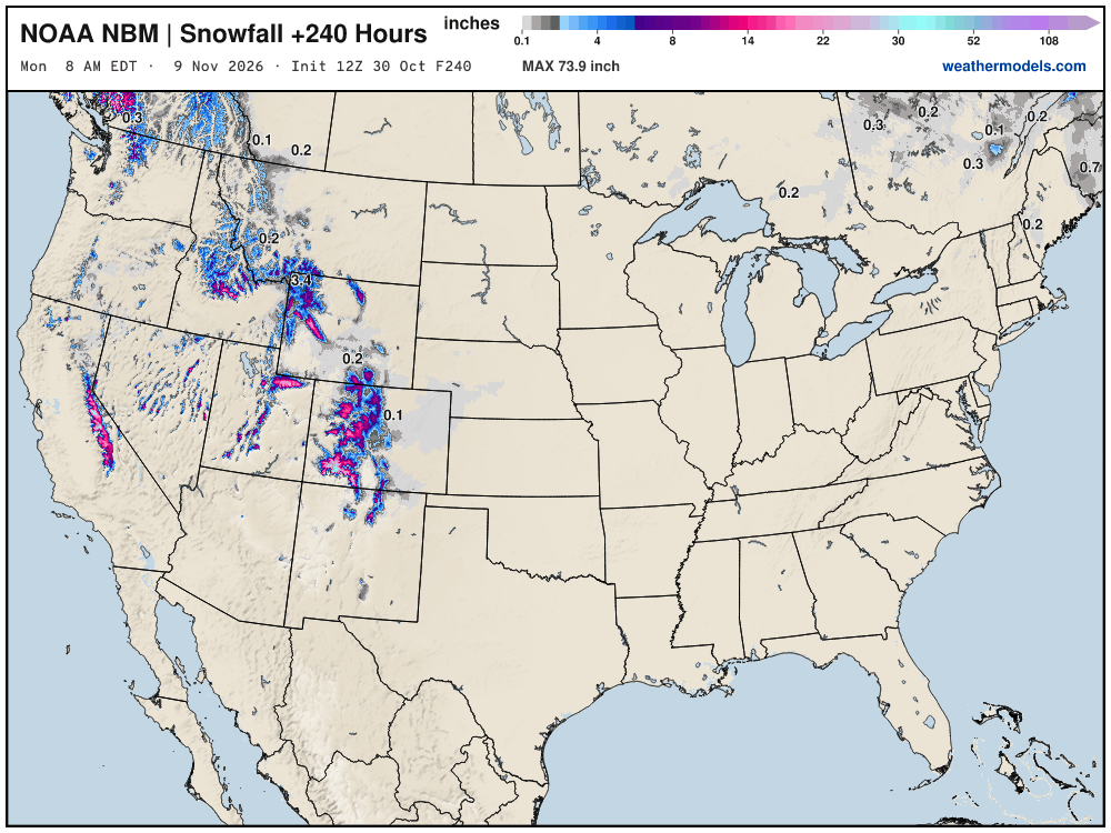
Still waiting on our first Eastern U.S. snowfall through first 10 days of November.
Snowfall Next 15-days | ECMWF Ensemble 00z Median
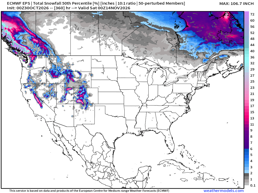
Slowly but surely as these maps head into early November — we’ll see our first legitimate chances of a snow storm for the Midwest, Great Lakes, and Northeast — not yet.
Probability of 1-inch or more of snowfall through November 12th
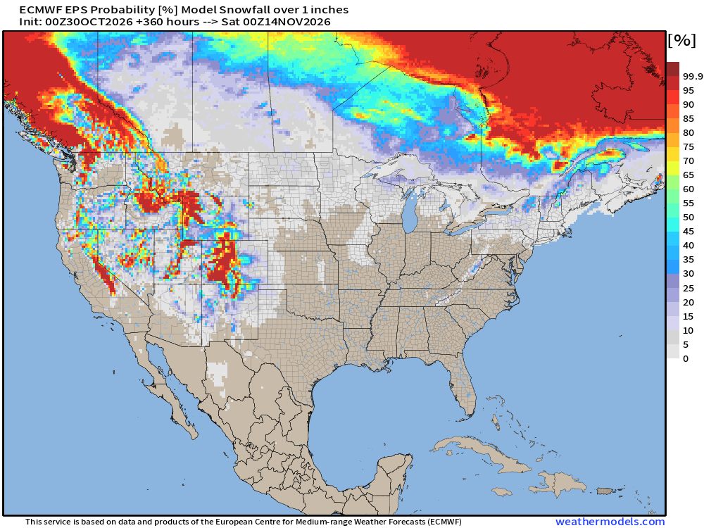
Low chances of snowfall < 10% across Eastern U.S. through 2-weeks — not zero, but best chances across elevation of interior New England.
Week 1 Temperature Anomaly | Oct 30 - Nov 5
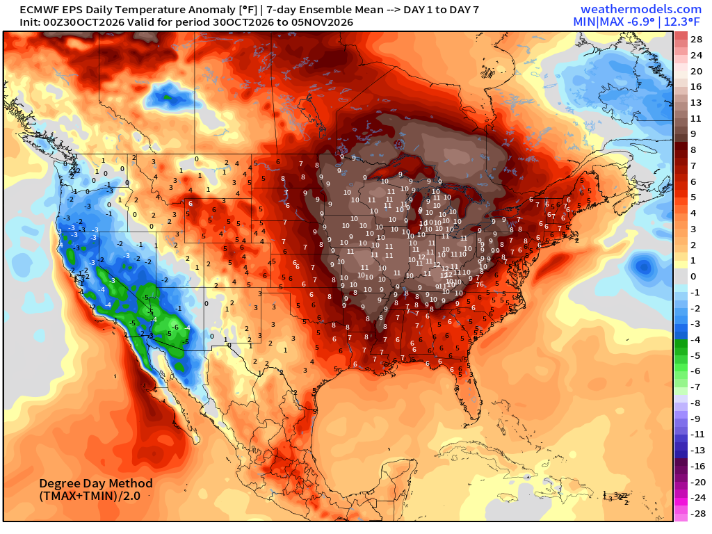
>10°F warmth for the Midwest — continues into early November. Warm!
Week 2 Temperature Anomaly | Nov 6 - Nov 11
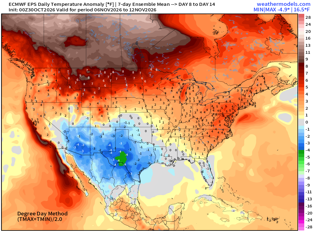
Blow torch continues into second week of November across Canada
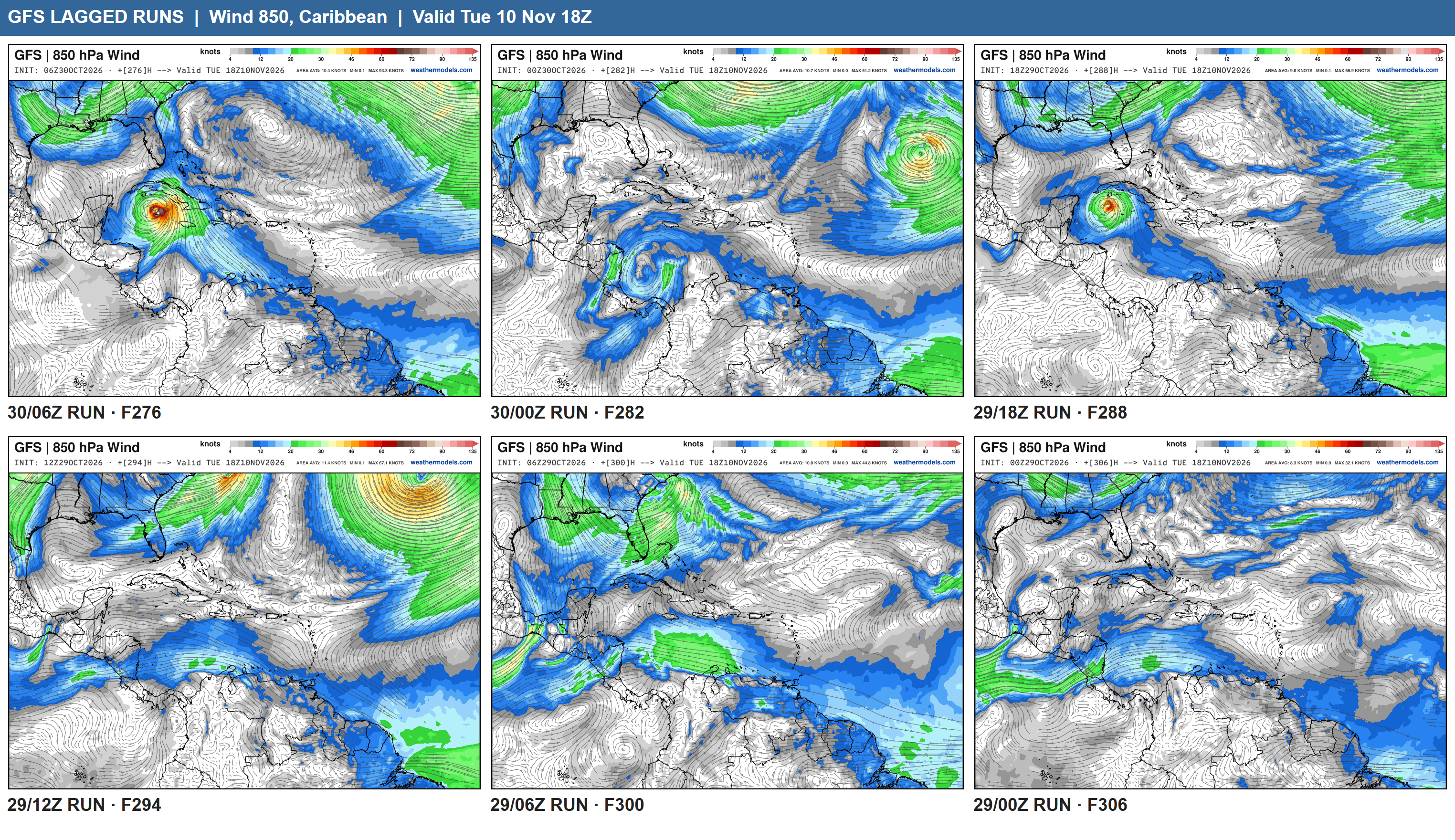
North Atlantic Hurricane Season | Curtains or not yet?
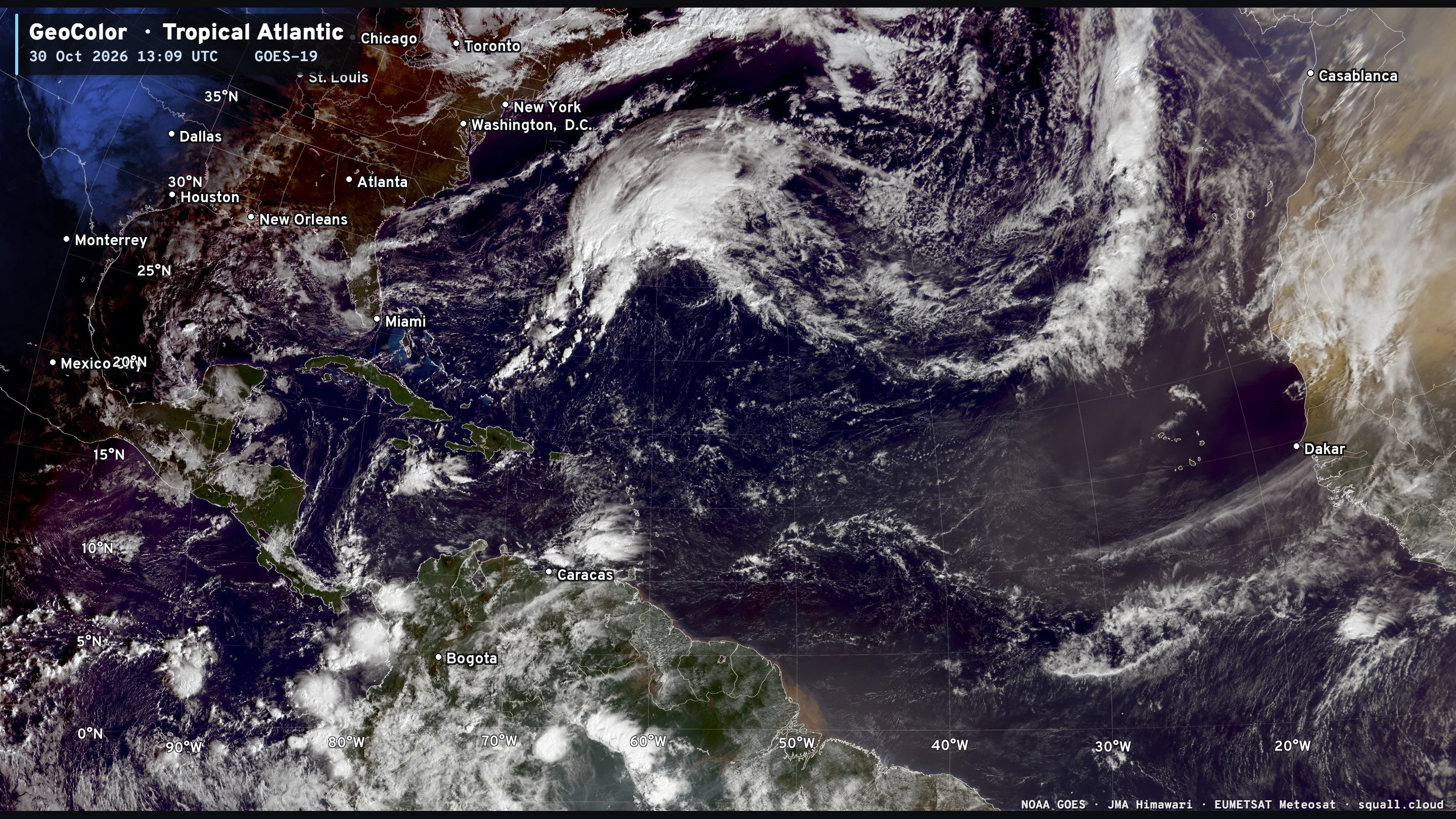
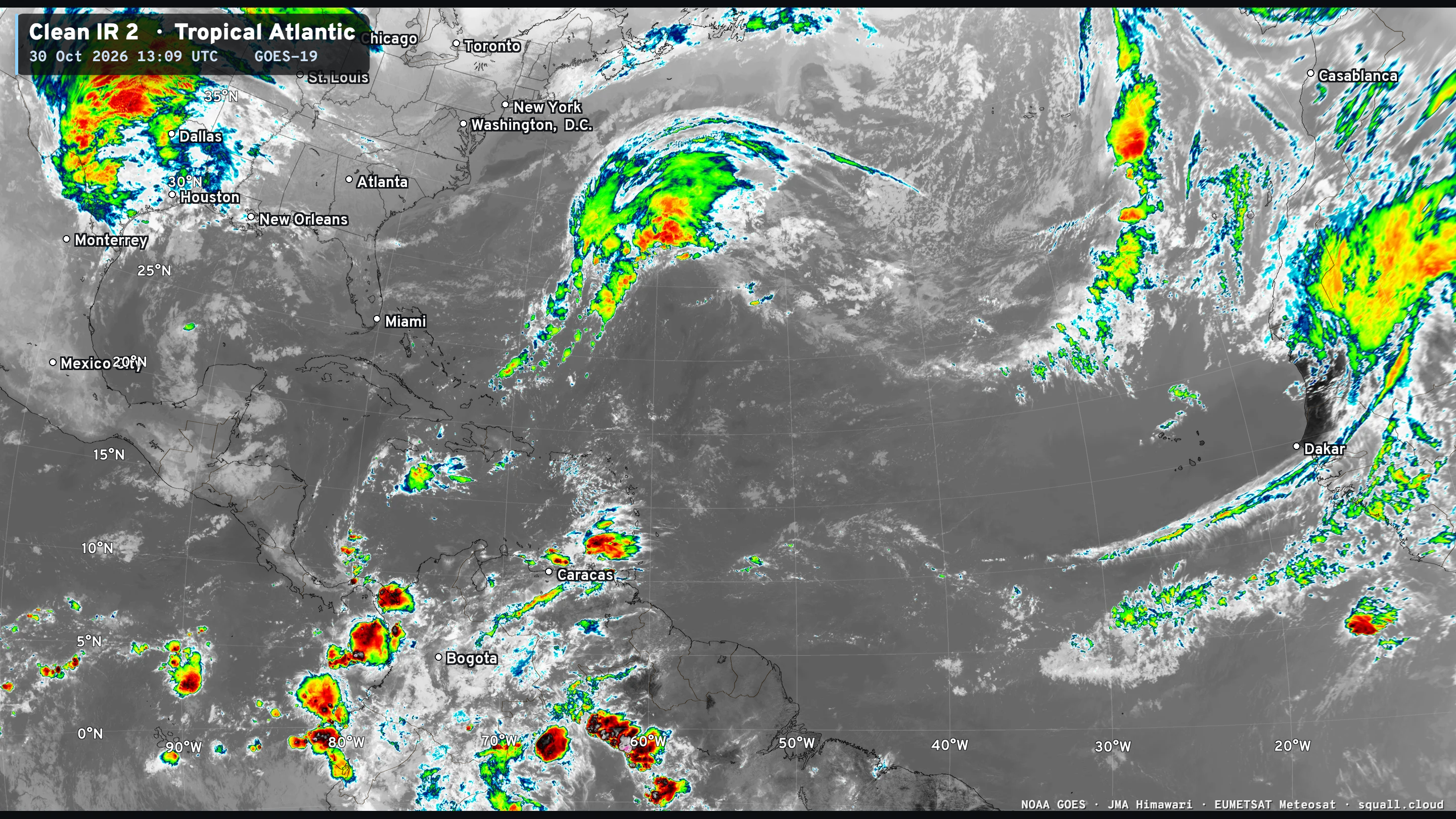
Again, what’s going on in the far Southern Caribbean near Central America?
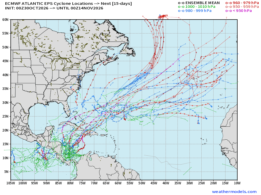
This is a low to moderate signal of TS/hurricane formation over the warm waters near Central America.
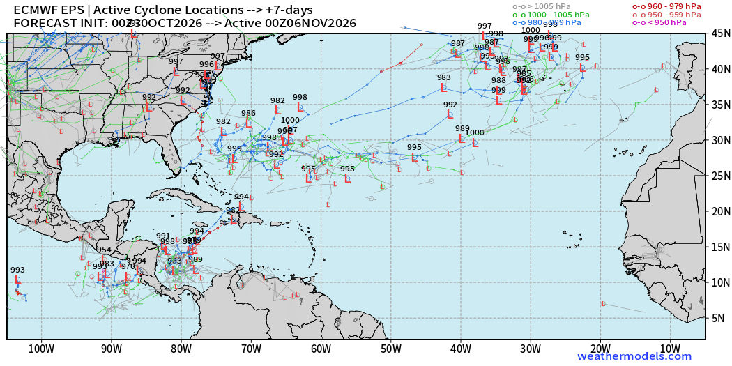
GFS is notorious for spinning up Caribbean hurricanes, and has recently picked up on the signal as well. However, this mechanism is perhaps not “fake” related to easterly flow over South America mountains. Need to watch into 2nd week of November.
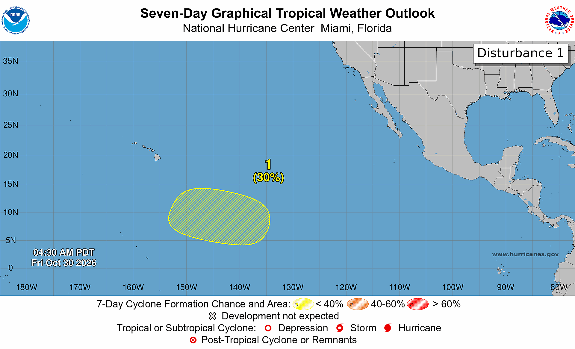
Eastern Pacific | 30% area at low latitude
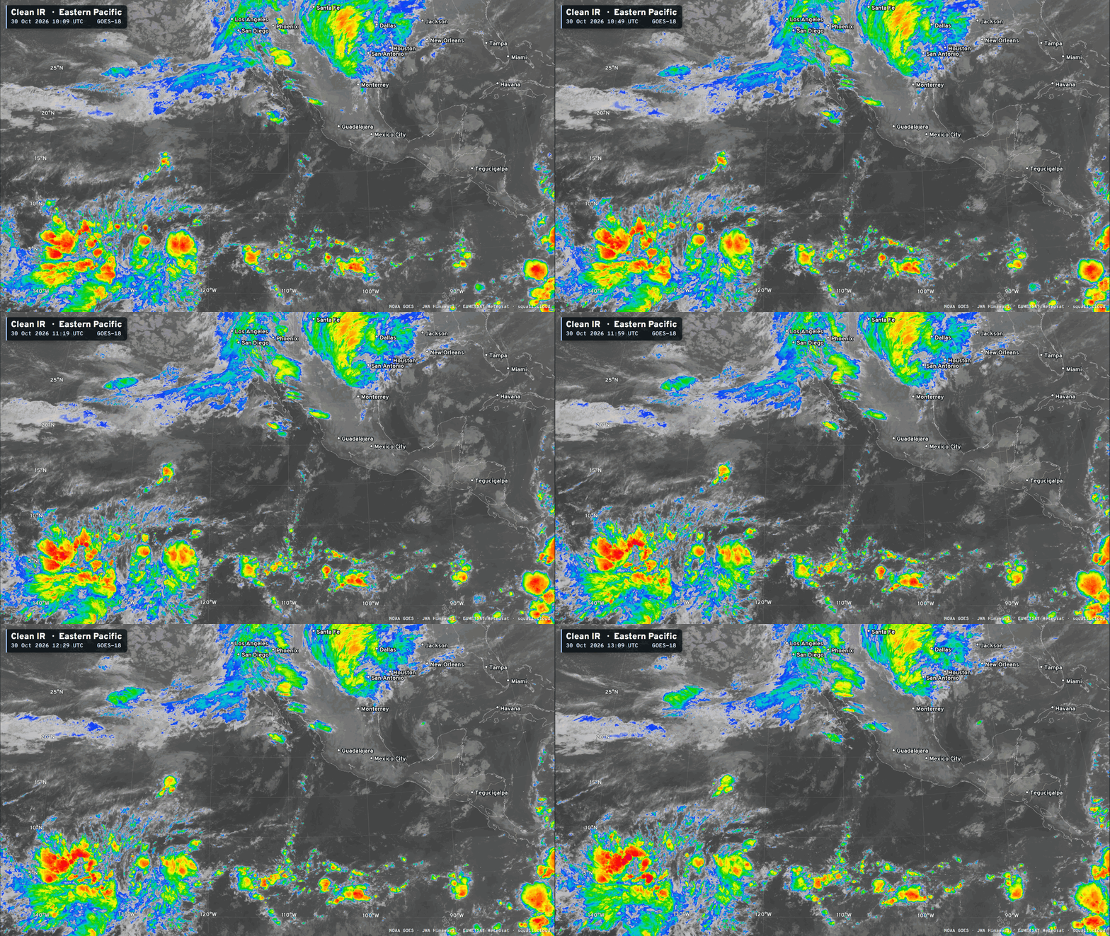
Deep convection — fueled by El Niño
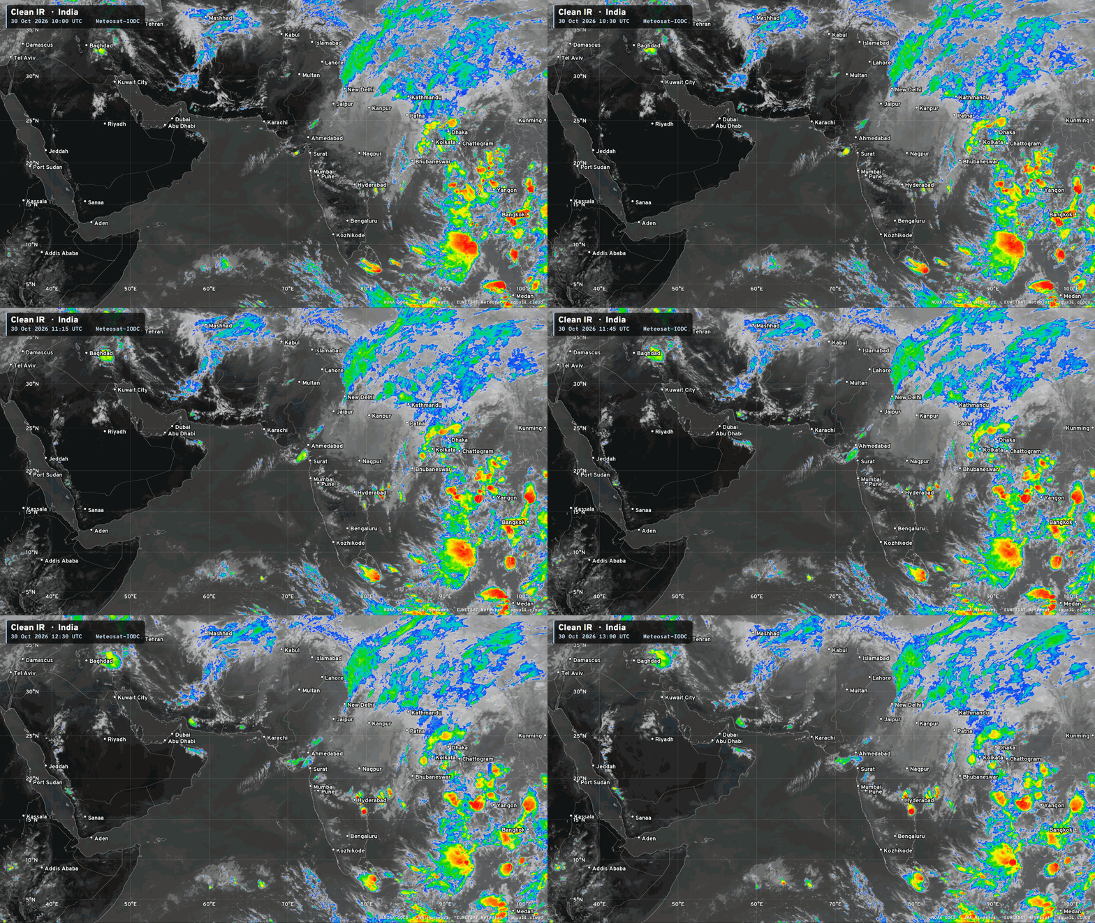
Western Pacific Typhoon Basin | Typhoon In-fa (30W)
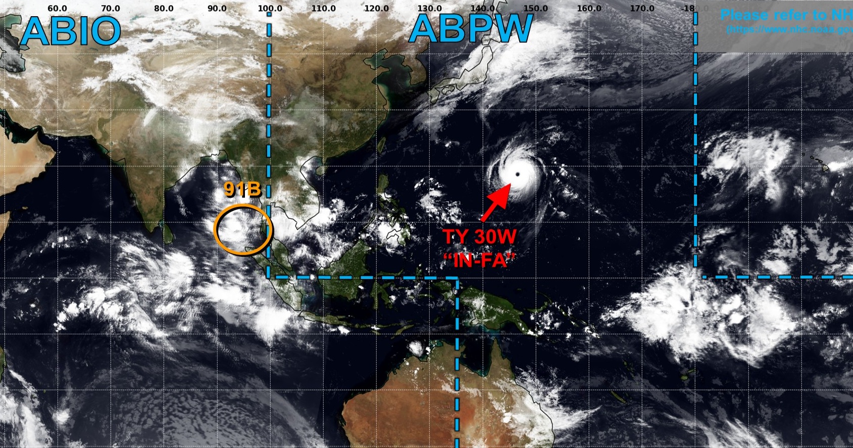
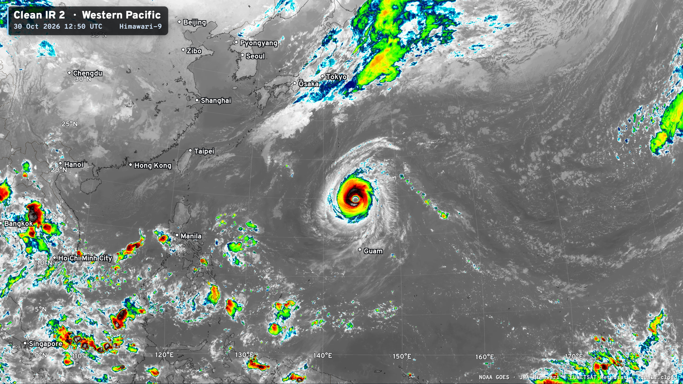
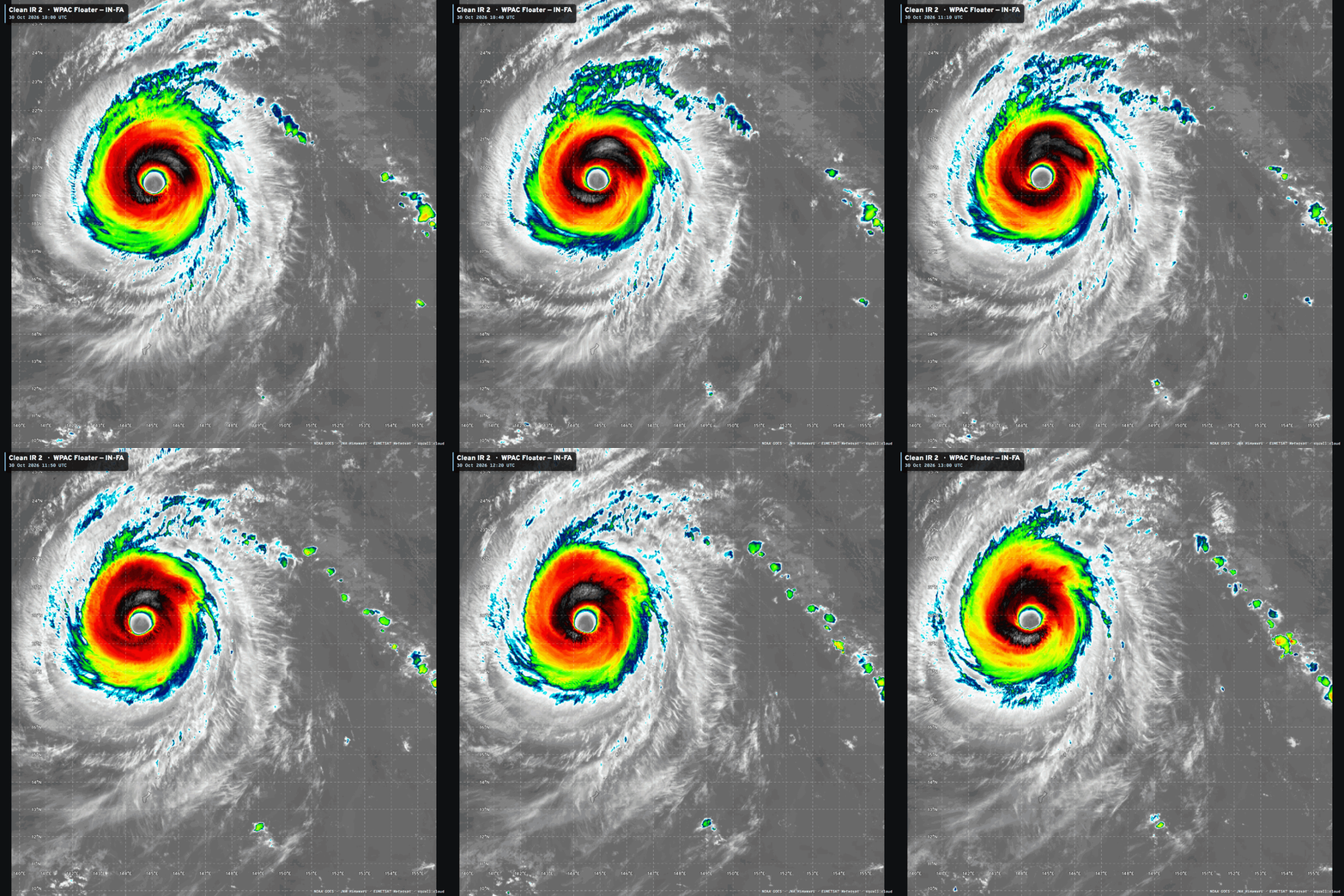
Massive Truck Tire Typhoon — 120-130 knots over the past few days. No threat to land.
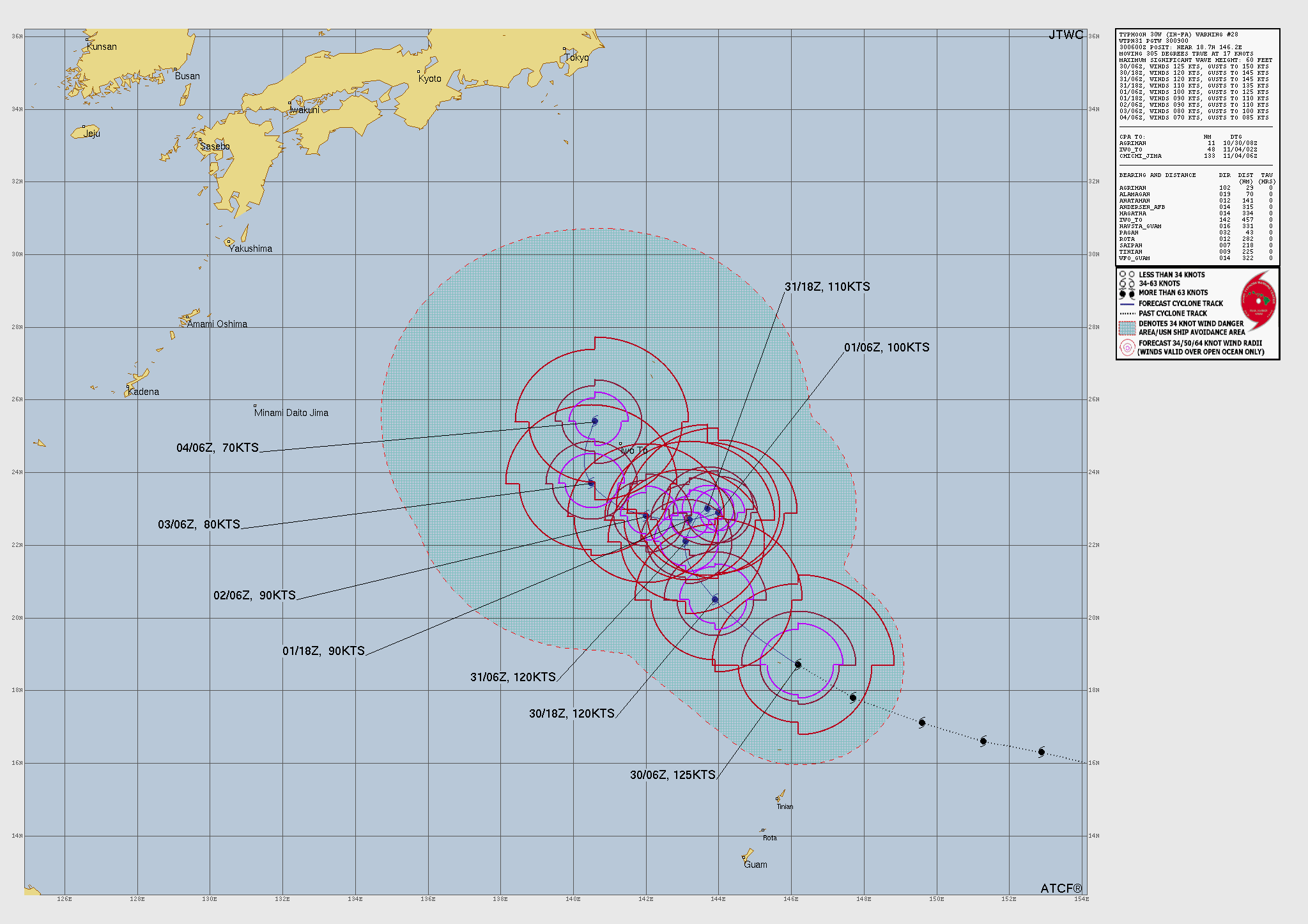
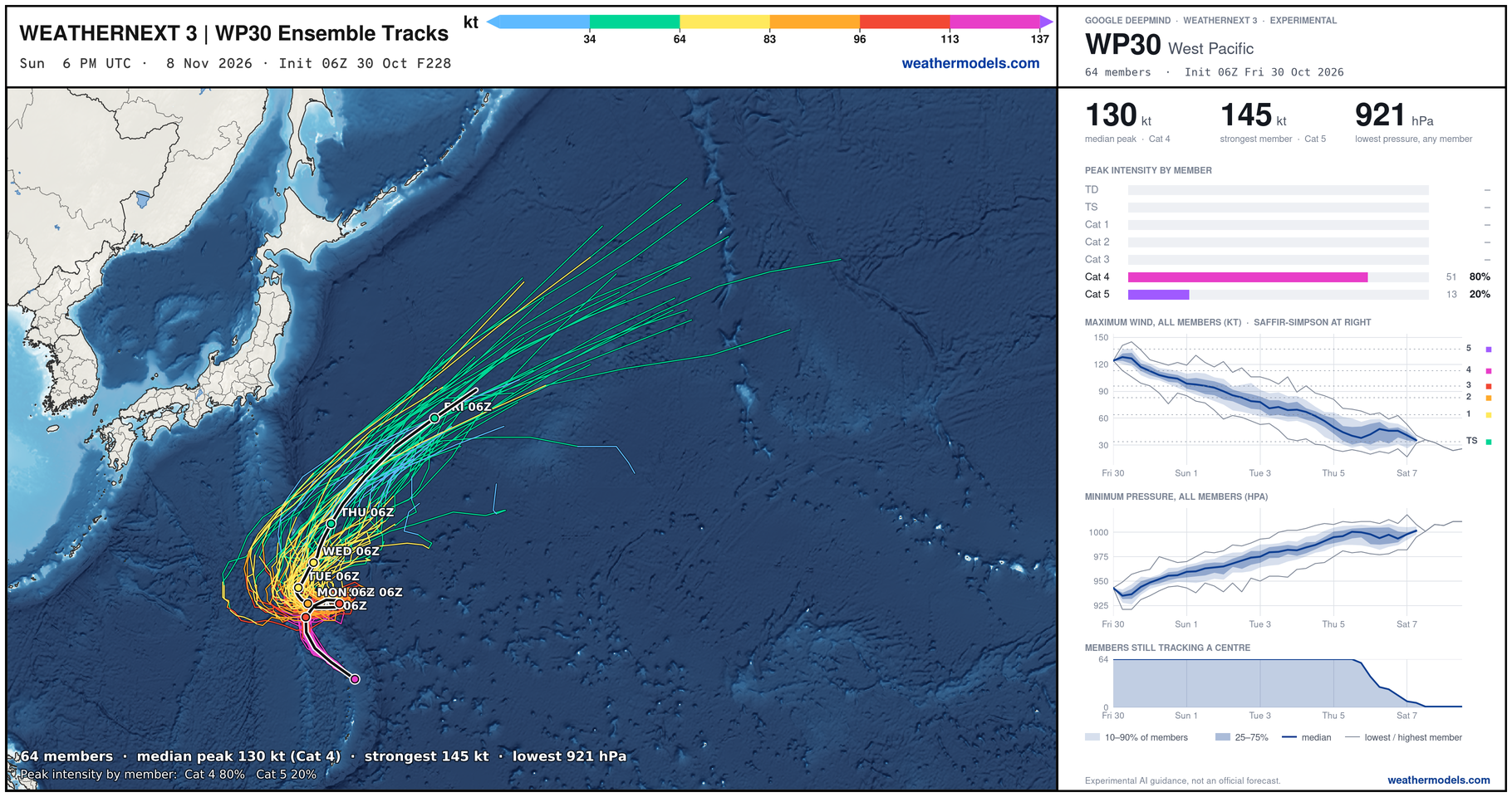
Typhoo In-fa will do a little loop and then continue its re-curvature out to sea East of Japan. JTWC is watching the eastern Bay of Bengal for 91B.
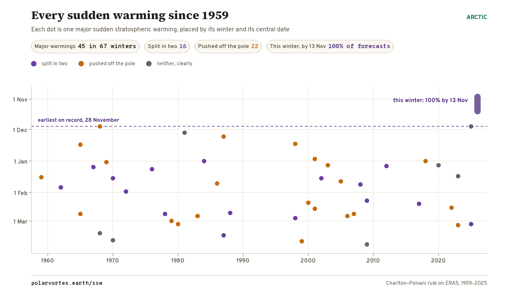
Polar Vortex Earth | 100% chance of a SSW and wind reversal!
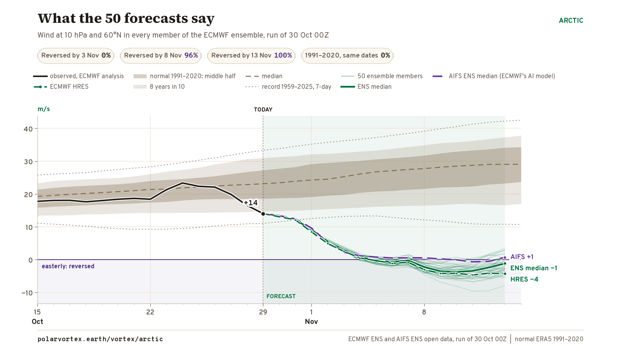
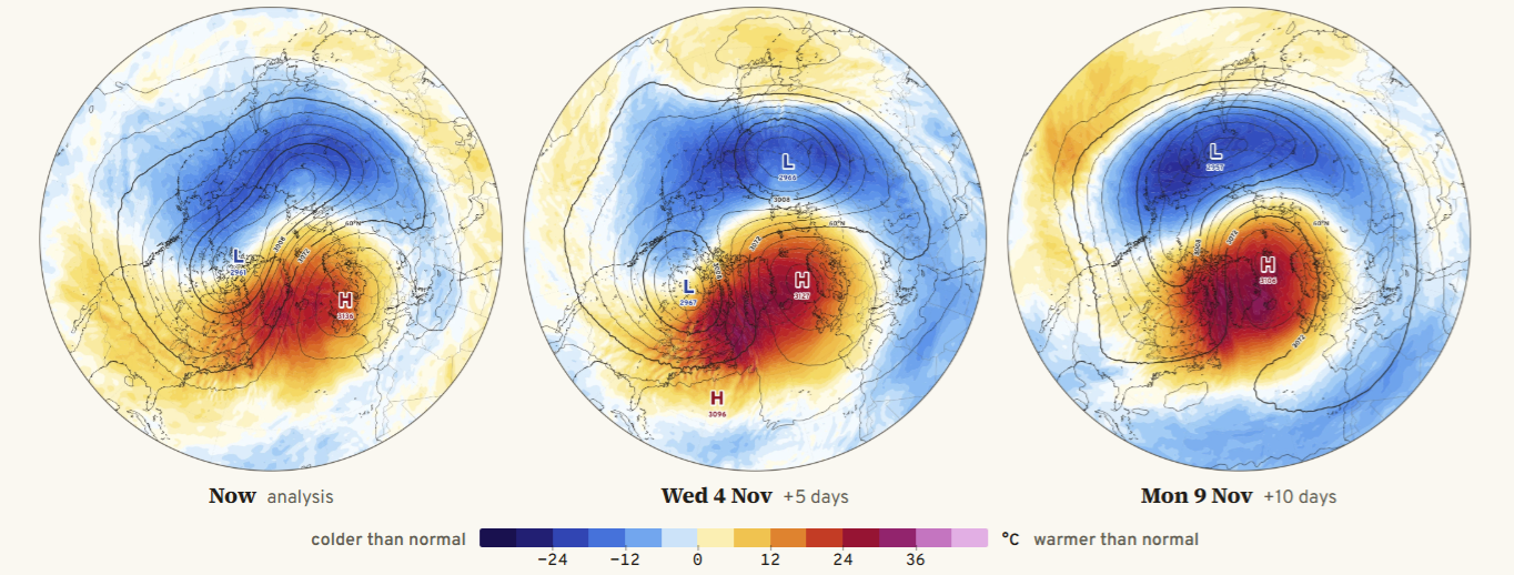
The maps show a “warming” event = strong center of 10 millibar warmth — which extends down to about 50 mb in the stratosphere. The process will peak in about 10-15 days, and then wither away as the polar vortex westerlies crank back up slowly. The winds go from westerly at 20 m/s zonallly averaged around the 60°N latitude … and goes to about -4 m/s (easterly)
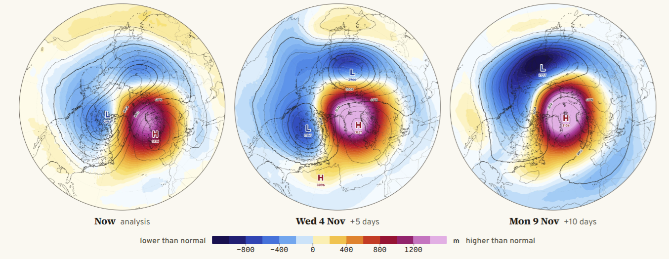
Also, this shows up as a strongly positive height anomaly (of the polar cap) centered well over Greenland.
This is an unprecedented early SSW event since at least 1959 by 3 weeks.
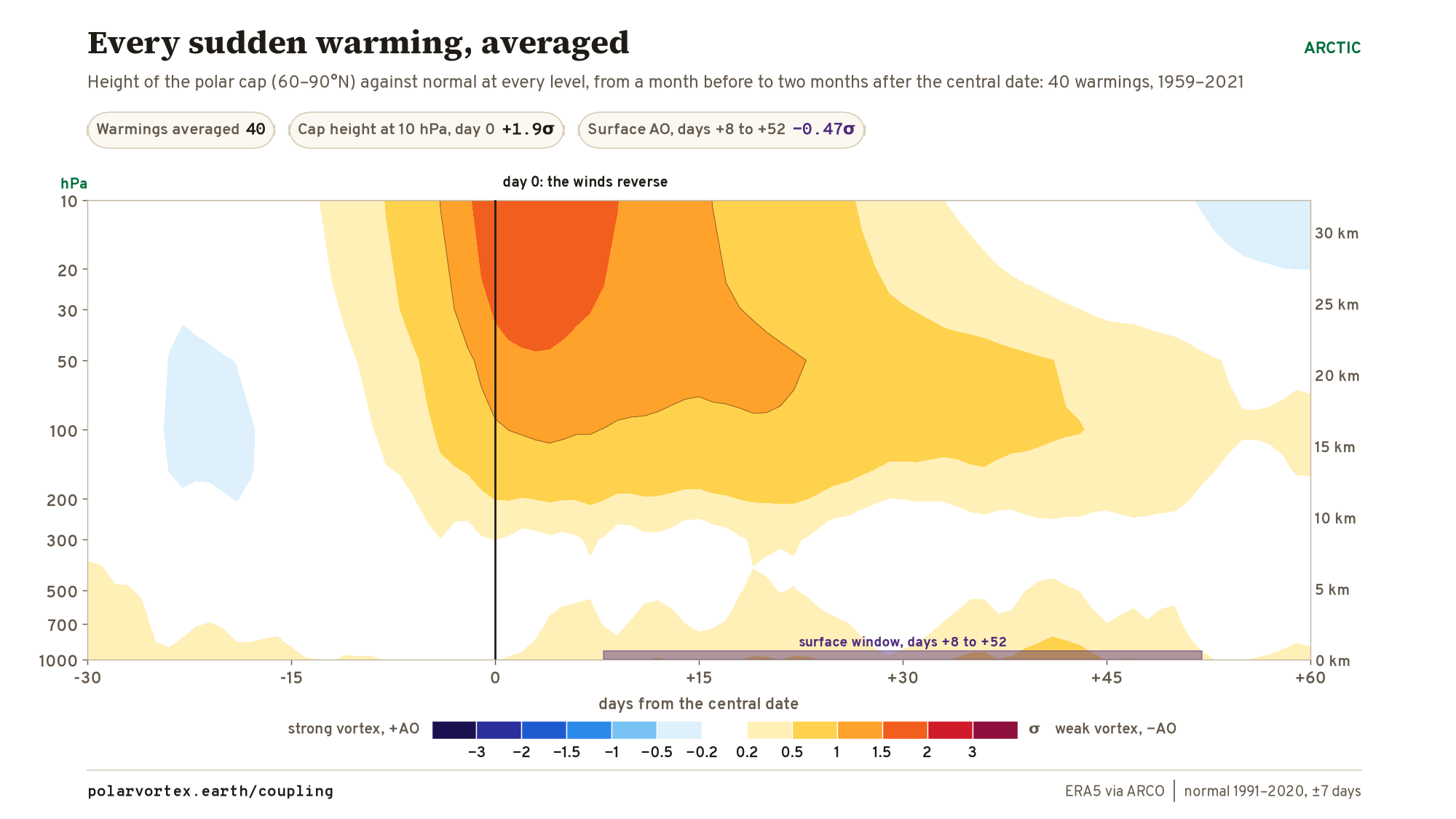
However, the impact is not expected to be felt near the surface for 15-45 days … and that puts us in Mid-November to early-December. The composite of the warming events — shows the polar cap anomalous height spreading downward out of the stratosphere into the polar troposphere at 200 hPa — eventually / briefly phasing with the mid-latitude jet. This can trigger massive cold air outbreaks … as the entire store of Arctic air simply evacuates southward.
However, with the ongoing El Niño, it remains to be seen just how much cold air is available upstream from the Lower 48 … in western Canada and across Greenland. Indeed, the focus of the major SSW downstream impacts could be over Europe or Asia with Siberia the major source of cold pool fun and games!
Thank you for visiting / reading — always more to come!
Visit Global Tropical Cyclones w/Dr. Pielke Jr. for more ACE information, as well as my original climatlas.com/tropical site with much new research including a calibrated “Best Track” and historical tropical cyclone browser with plenty of interesting features like rankings of storms by their IKE (size). ACE up to 930

Satellite imagery from Squall Cloud. Maps sourced from weathermodels.com designed and innovated by yours truly! Please subscribe there for real-time access to the newest maps, charts from all of the weather models including ECMWF and AIFS, and NOAA GFS/GEFS, HRRR/RRFS and Blend of Models (NBM). NOAA WPC and SPC for fronts/convective outlooks. Our own content is now sourced from hottestsince.com and weather.city and celsius.earth, and global-tropical-cyclones.com and precip.earth and forecastcanada.com and forecastgermany.com
Atlantic Hurricane Season | YTD: 10 Named Storms, ACE = 19.5
NE Pacific Hurricane Season: YTD: 24 Named Storms, ACE = 355
My Atlantic Hurricane Season Forecast (2026)
From April 7, 2026: Atlantic Seasonal Hurricane Forecast: (11/5/2)
9-13 Named Storms (11 most likely)
4-7 Hurricanes (5 or 6 most likely)
1-3 Major Hurricanes (2 most likely)
Accumulated Cyclone Energy: 75-85 (well below normal)
NOAA 2026 Atlantic Hurricane Season Forecast
Previous in this storyline: Historical Context of Atlantic Inactivity as Pacific goes bonkers with El Niño (OCT 13)
- Milepost
- 1633 · laid 2026-10-30T15:17:59Z
- Source
- https://weather.substack.com/p/october-30-2026-friday-weather-update · October 30, 2026 Friday Weather Update
- Tagged
- I-34 El Niño · El Niño / La Niña 2026 · Texas (31.2, -99.3) · by rule, at build
- Digest
- 032f4854365896d4f0c302dd09a65dae9b8654ee6239e5293b0f2e18e382940c