March 5, 2026 Thursday Weather Update
Strong El Niño forecast to form this summer suppressing hurricane activity
March 2026 was the warmest March in the 132-year national record (1895–2026), at 50.8°F against a 1991–2020 normal of 43.6°F (+7.3°F).
March 2026 was the 8th-driest March in the 132-year national record (1895–2026), at 1.8in against a 1991–2020 normal of 2.5in (-0.7in).
NOAA/NCEI Climate at a Glance, contiguous United States. This is the observed record for the month, not a score of anything said in this piece — the forecast ledger begins 2026-08-17 and cannot reach earlier posts.

ECMWF 18z Precipitation Type + Intensity | Next 6-days
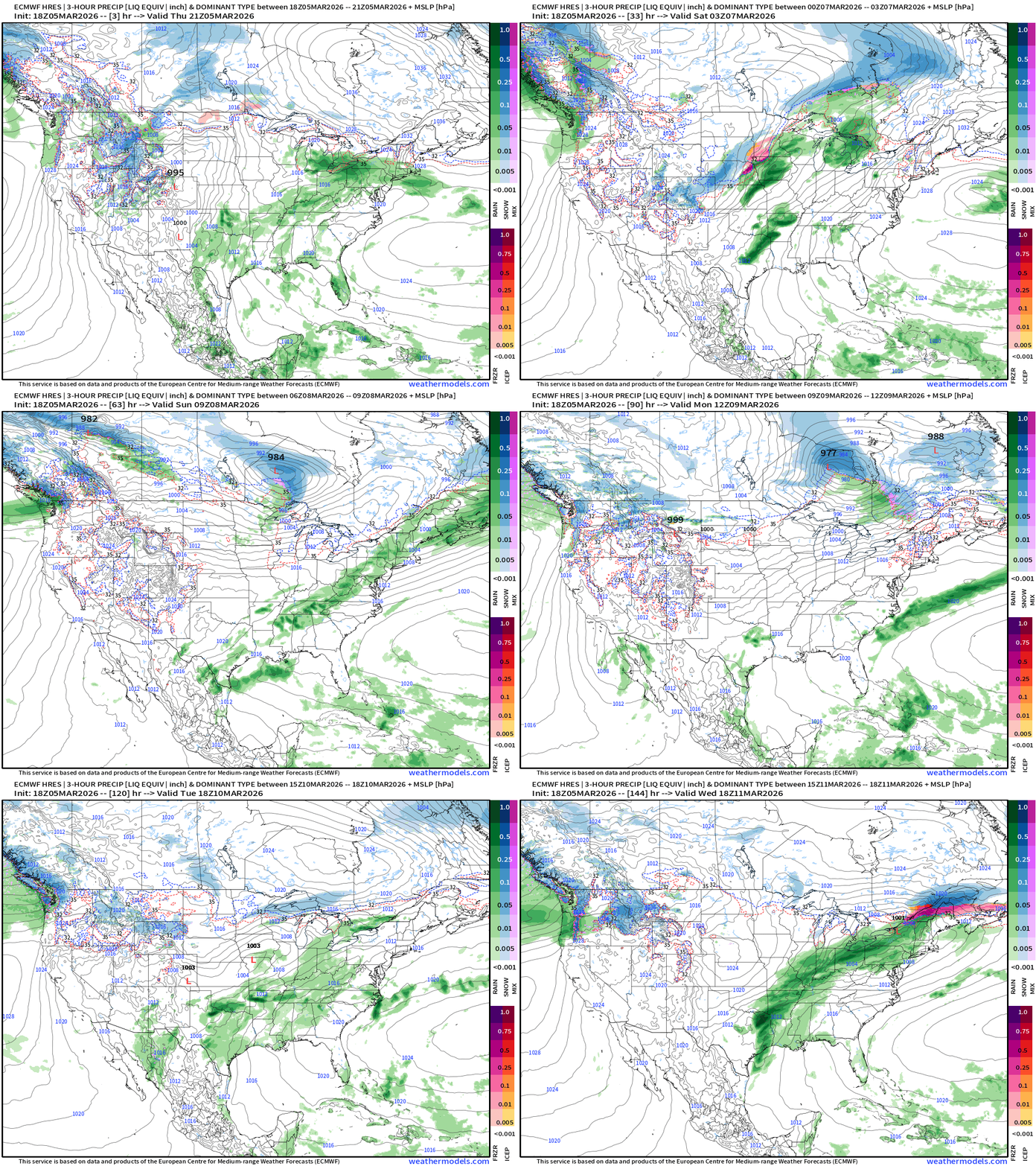
Busy weather pattern … helps to have moisture and warmth coming out of the subtropics rather than dealing with the frigid and dry polar vortex. Even with the warming trend across the Eastern U.S. there is still plenty of cold air to the north in Canada that gets dragged behind storm systems to generate wintry weather. The western U.S. will return to late winter conditions with moisture and cold air to help with the end of the water year.
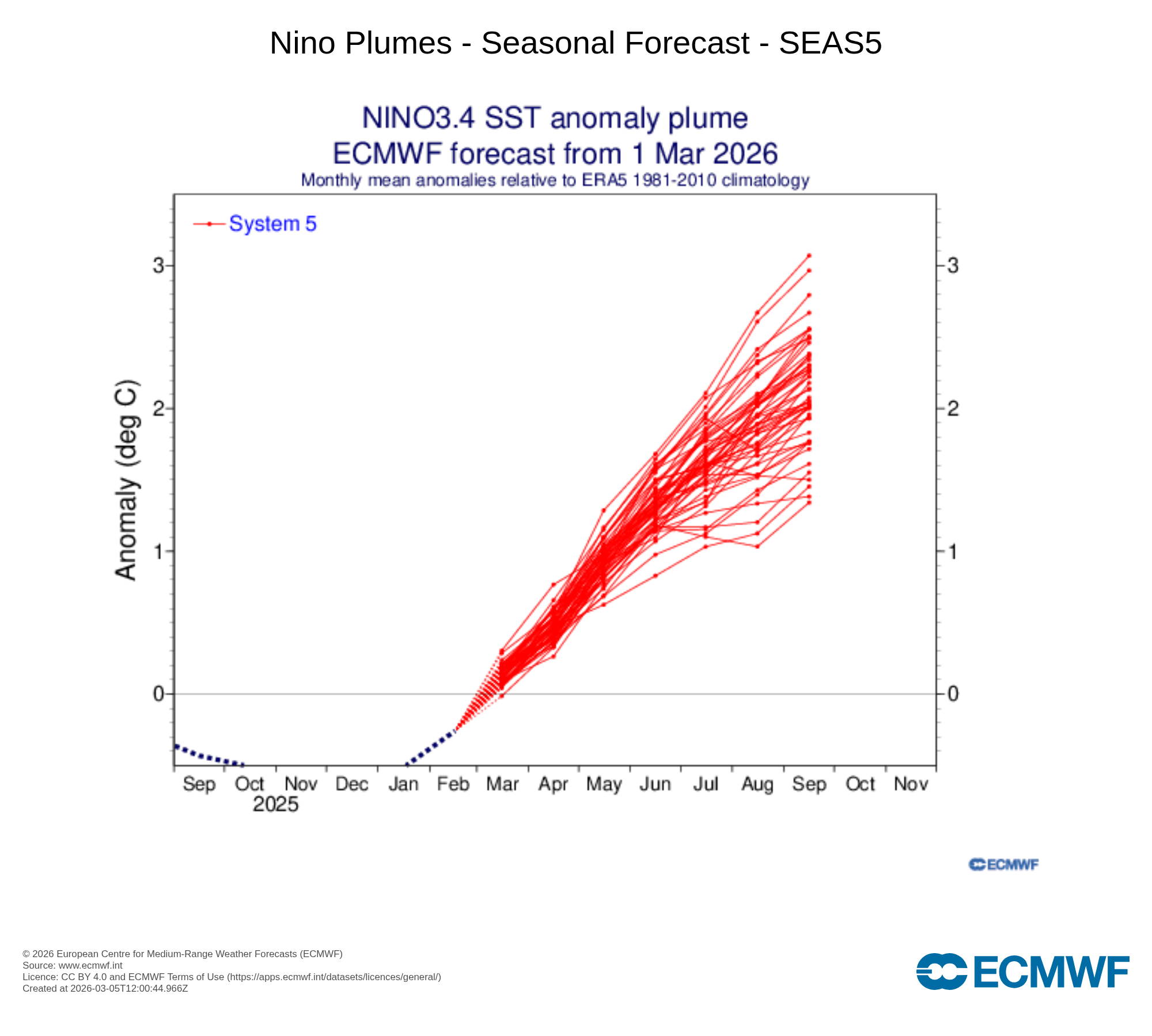
ECMWF Seasonal Forecast Day for March to September 2026: very strong El Niño!
However, this is March and there is some measure of uncertainty crossing the “spring predictability barrier” but members between 1.5°C to 3.0°C suggest a “strong event”
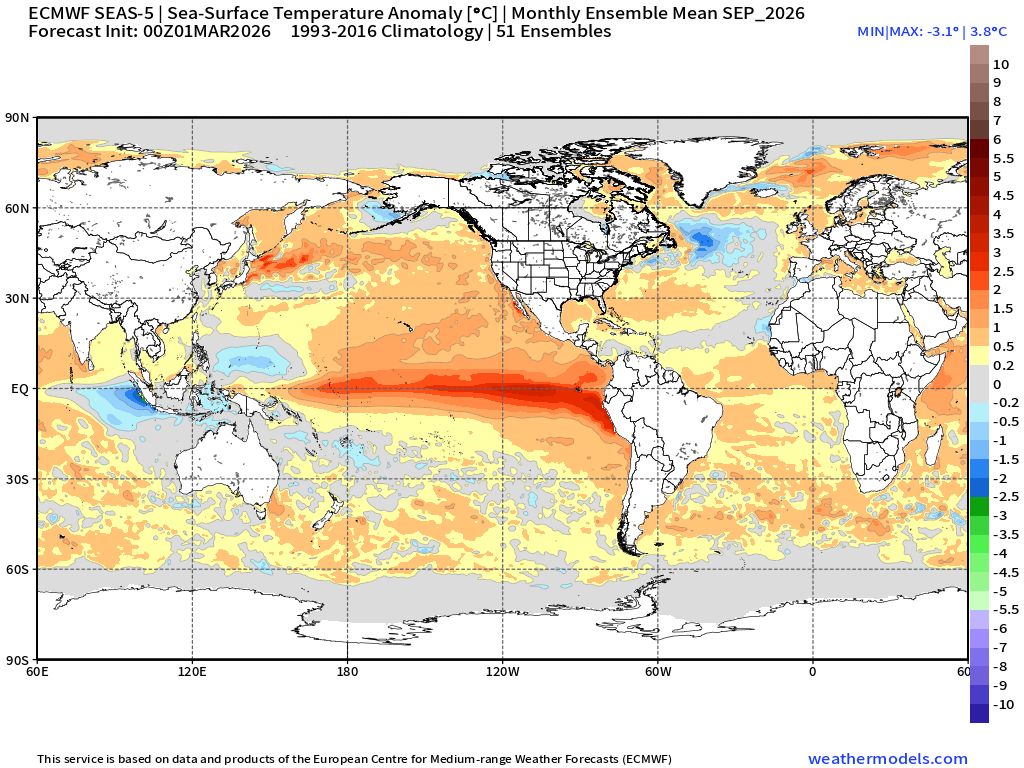
SST Anomaly for month of September shows the canonical El Niño warmth along the equator. The North Atlantic has a cool blob while the rest of the Atlantic tropics are near to slightly above normal.
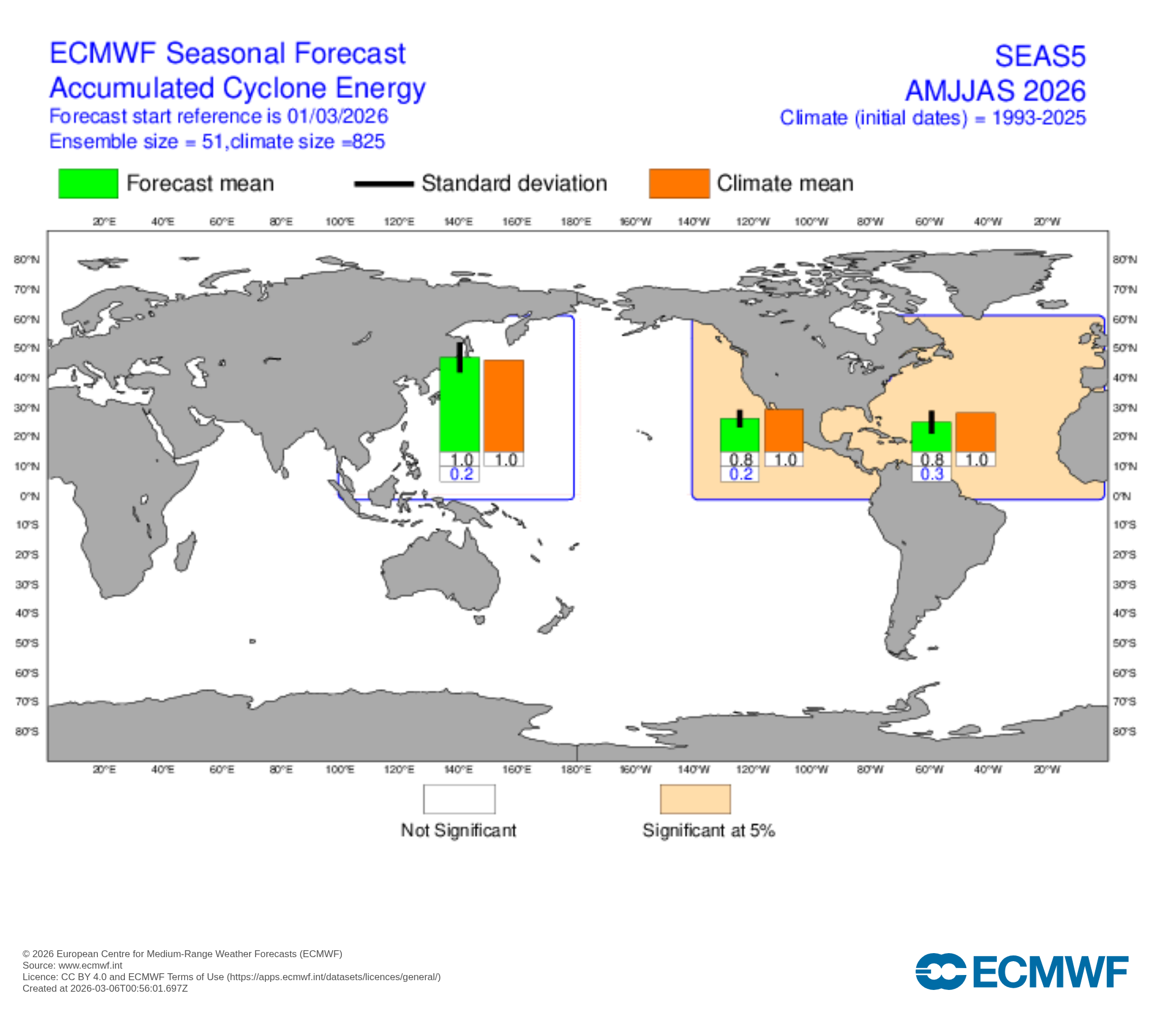
For the months of hurricane season through end of September, the model shows 20% below the climate mean for Accumulated Cyclone Energy. We’ll watch the next couple months’ (April / May) forecasts when they land, but history usually (almost always) means a tepid/quiet Atlantic hurricane season with strong El Niño. However, it’s a bit suspicious that the Pacific is near normal when it should be going gangbusters.
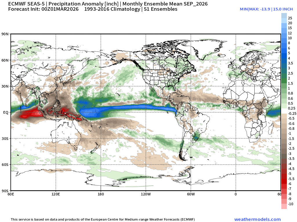
The ITCZ is shifted northward into the summer hemisphere with El Niño enhanced convection for September but very dry around the Philippines and the western Pacific warm pool, which is weird! The Atlantic tropics are much drier than normal consistent with quiet season — at least thru end of September.
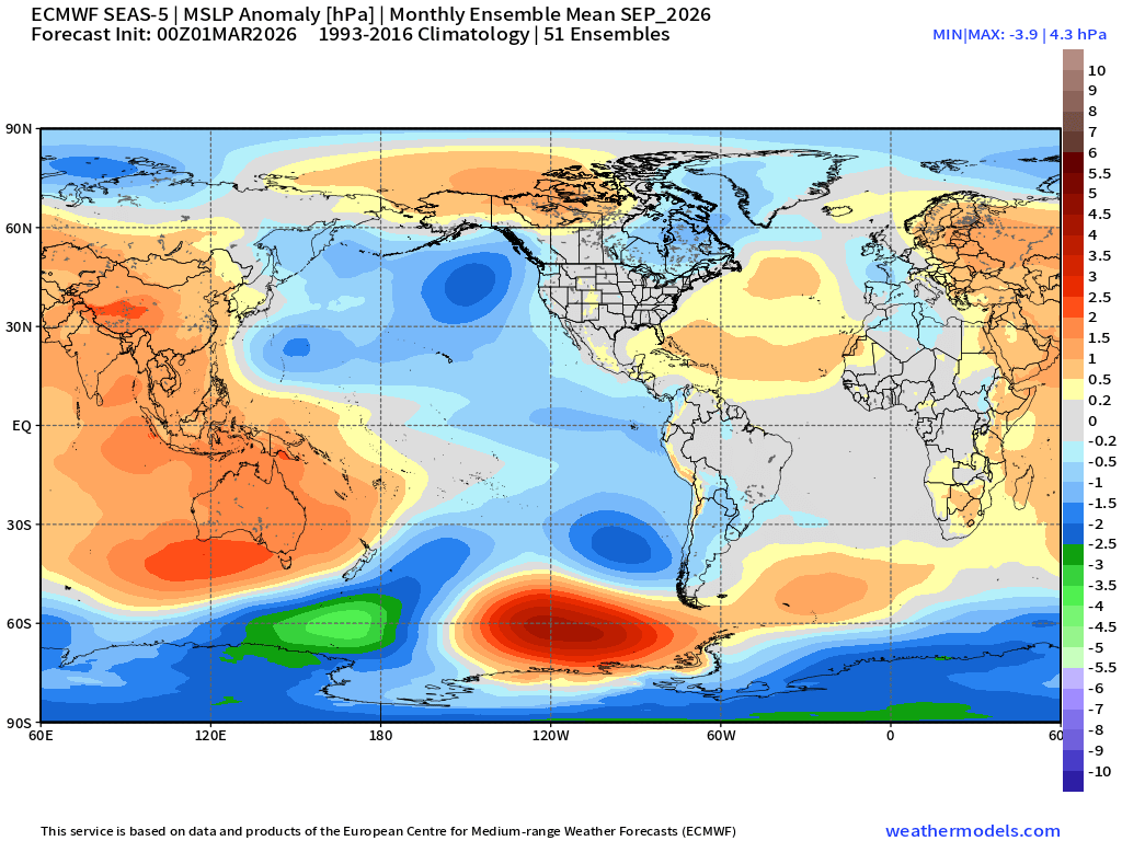
And, higher that normal surface pressure in the Atlantic = more ridging/less storms
Daily High Temperatures to Saturday March 14th
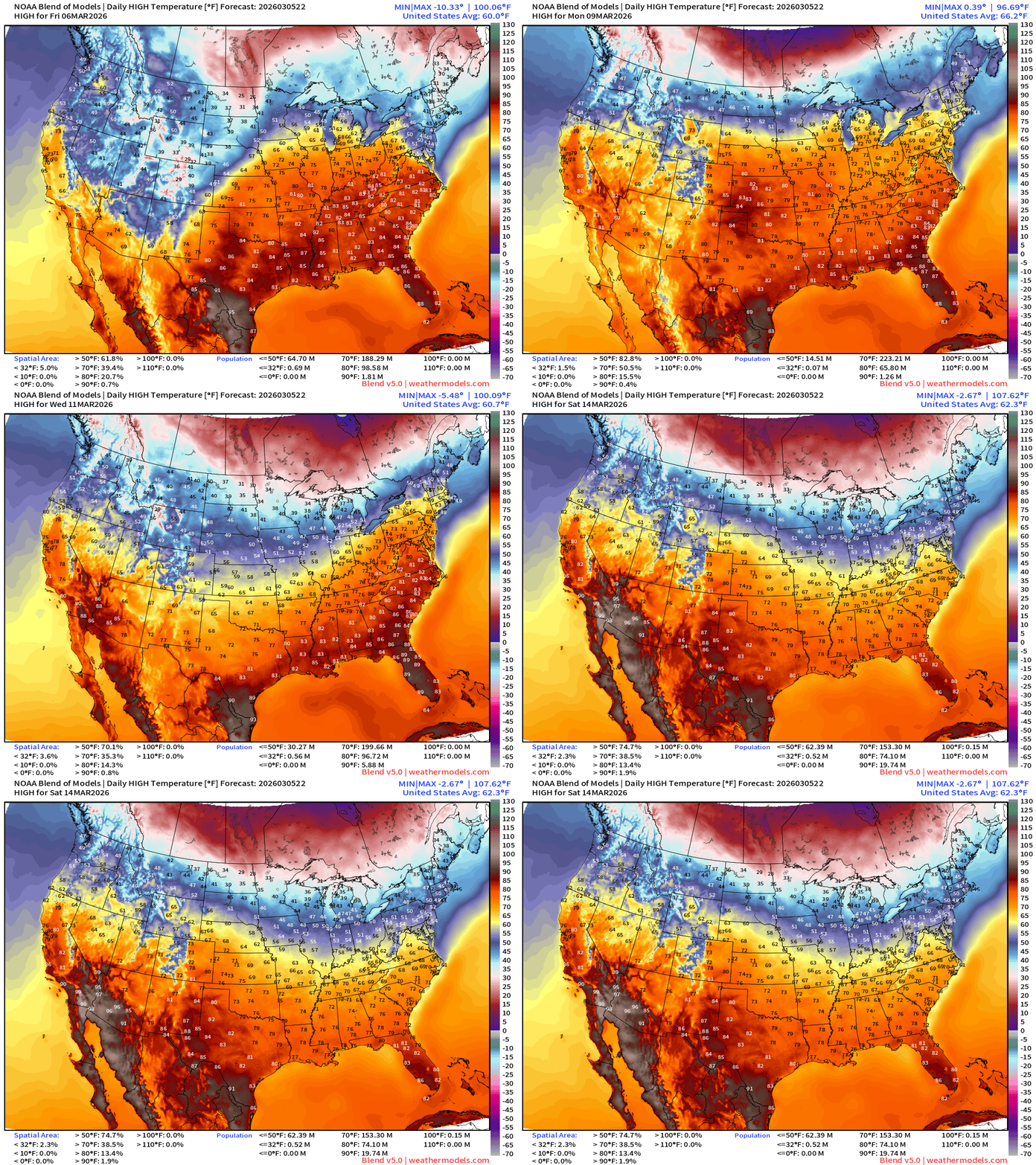
Spring like warmth continues into next week with only minor/brief interludes from passing cold fronts and storm systems through next weekend … with the Arctic blast just beyond this horizon.
Lows for the next 8-days — through Saturday morning the 14th.
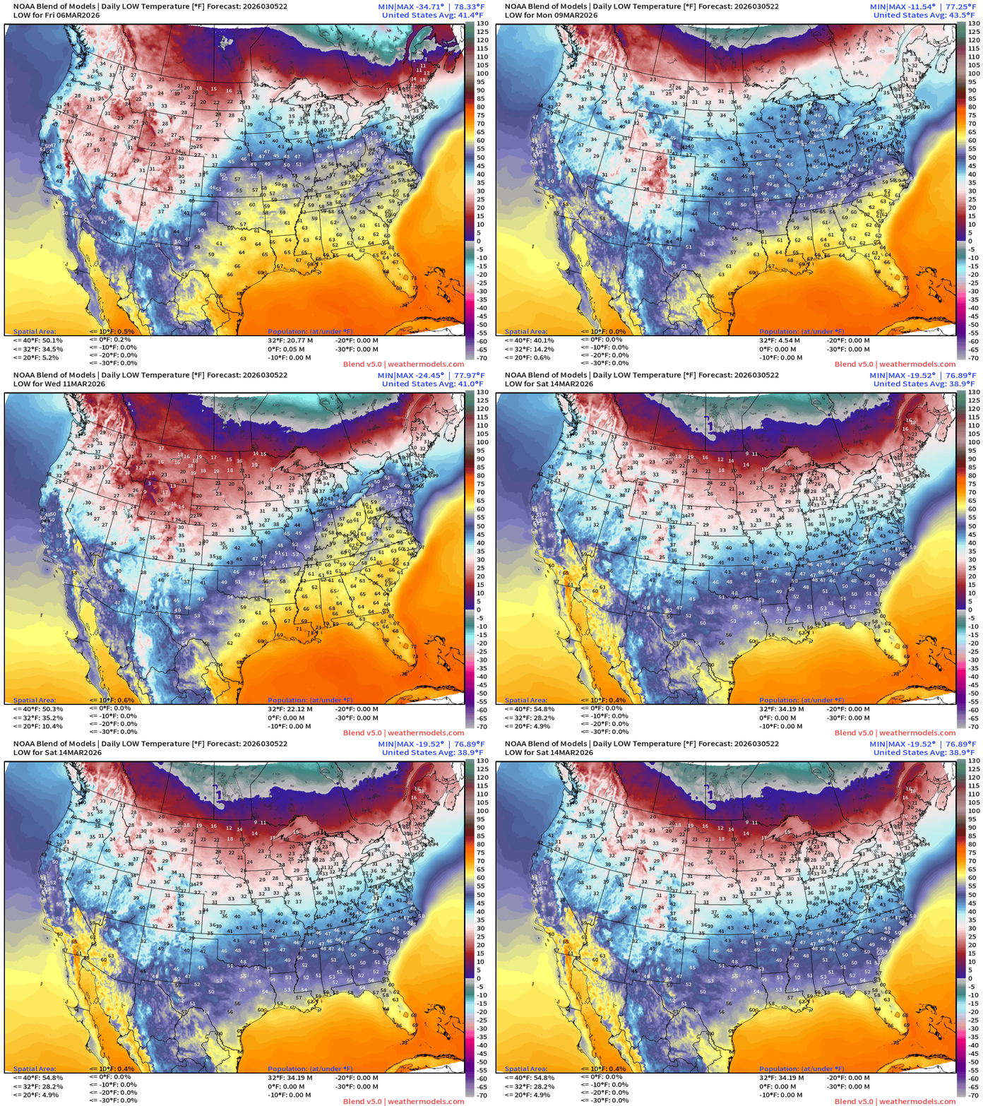
Friday’s Record Highs — 70° Chicago and 82°F Nashville!
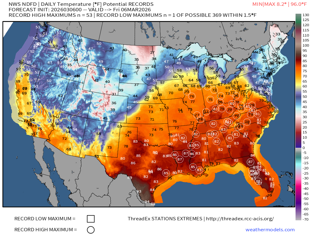
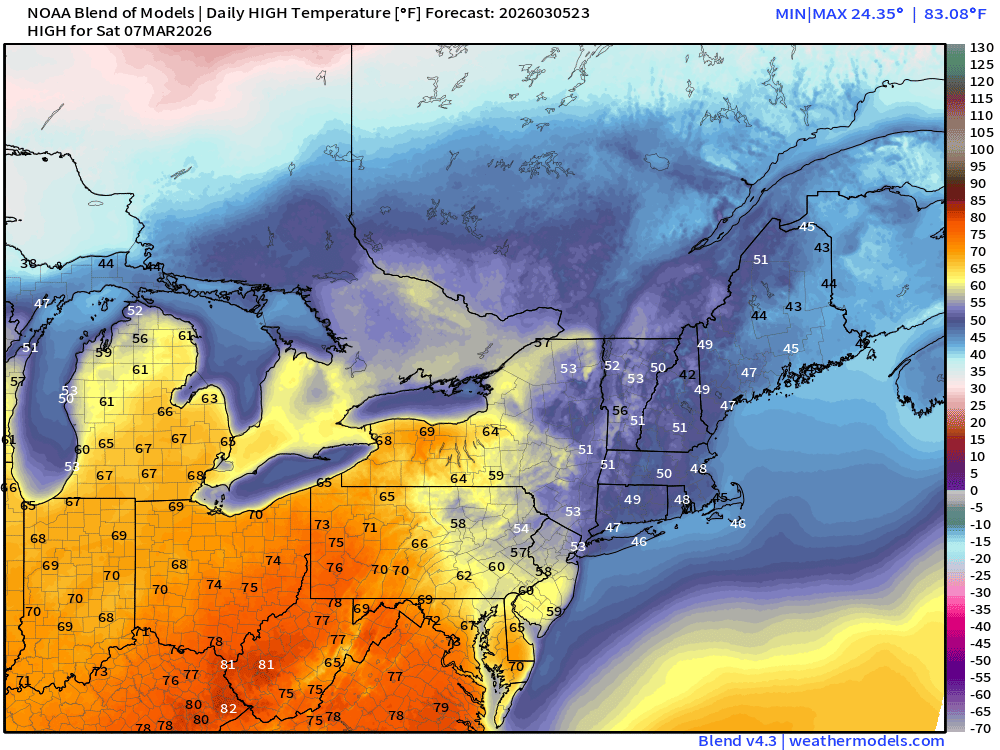
Northeast not participating in the warmth right now.
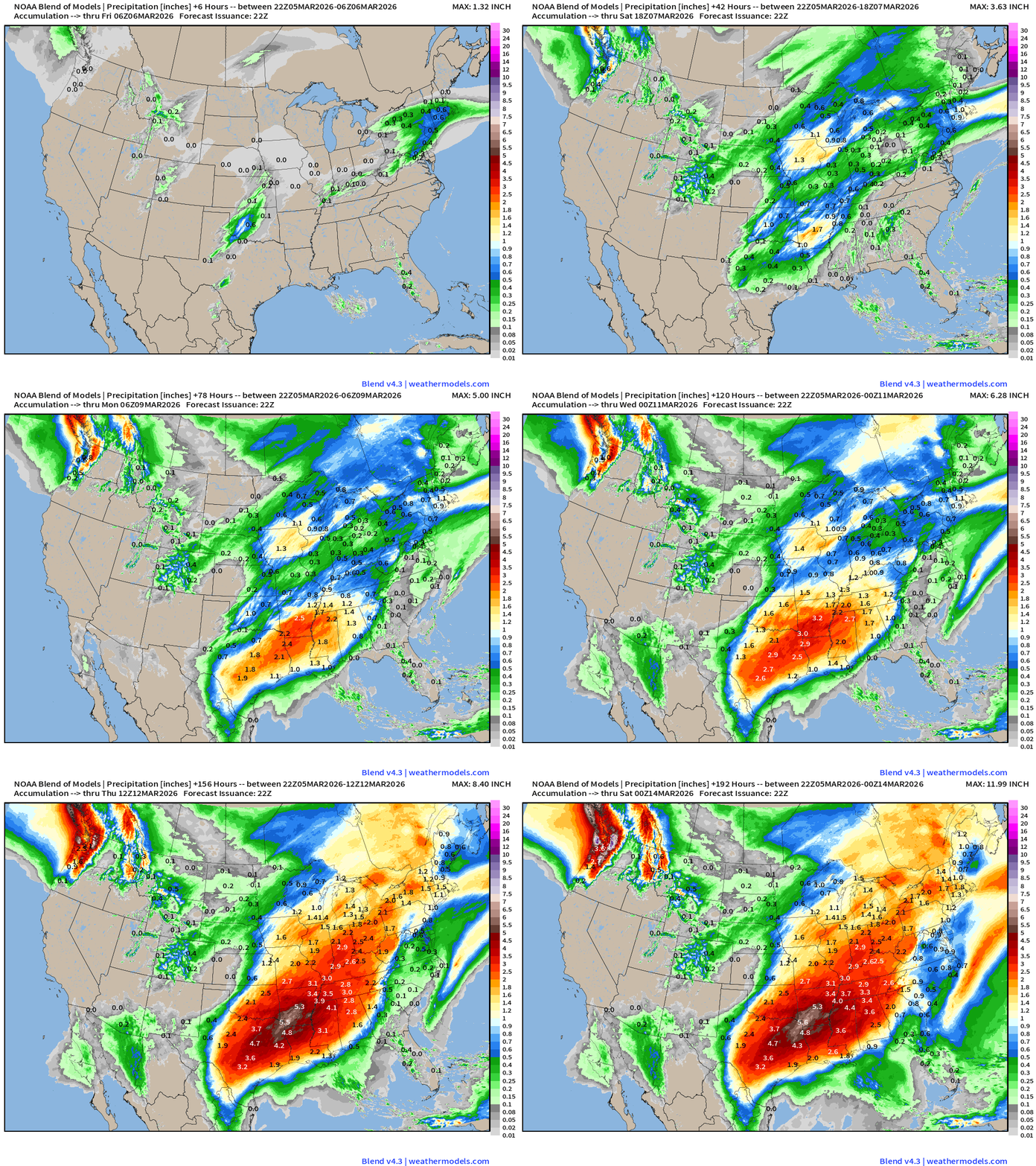
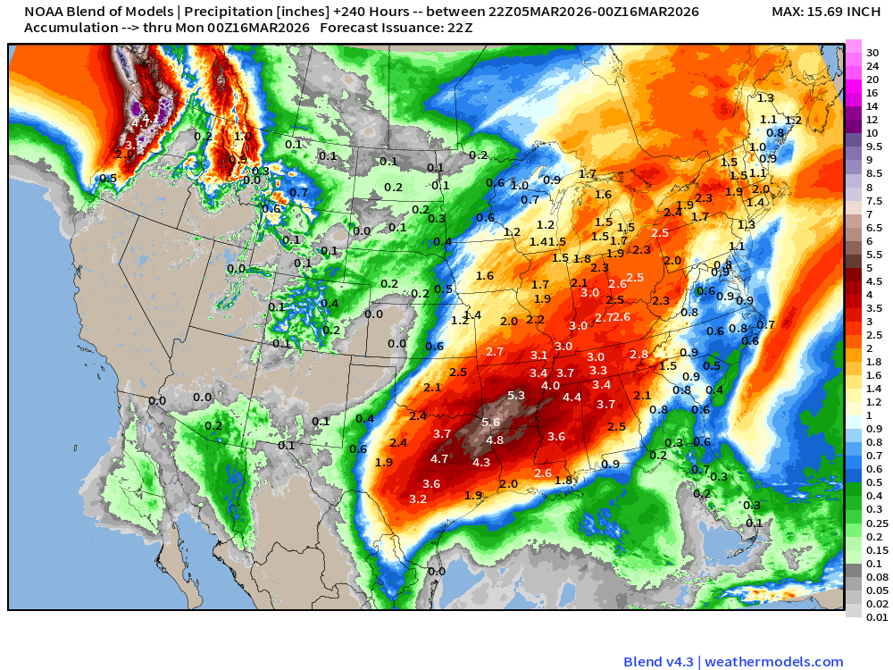
Boatloads of precipitation / heavy rainfall for next 8-days+
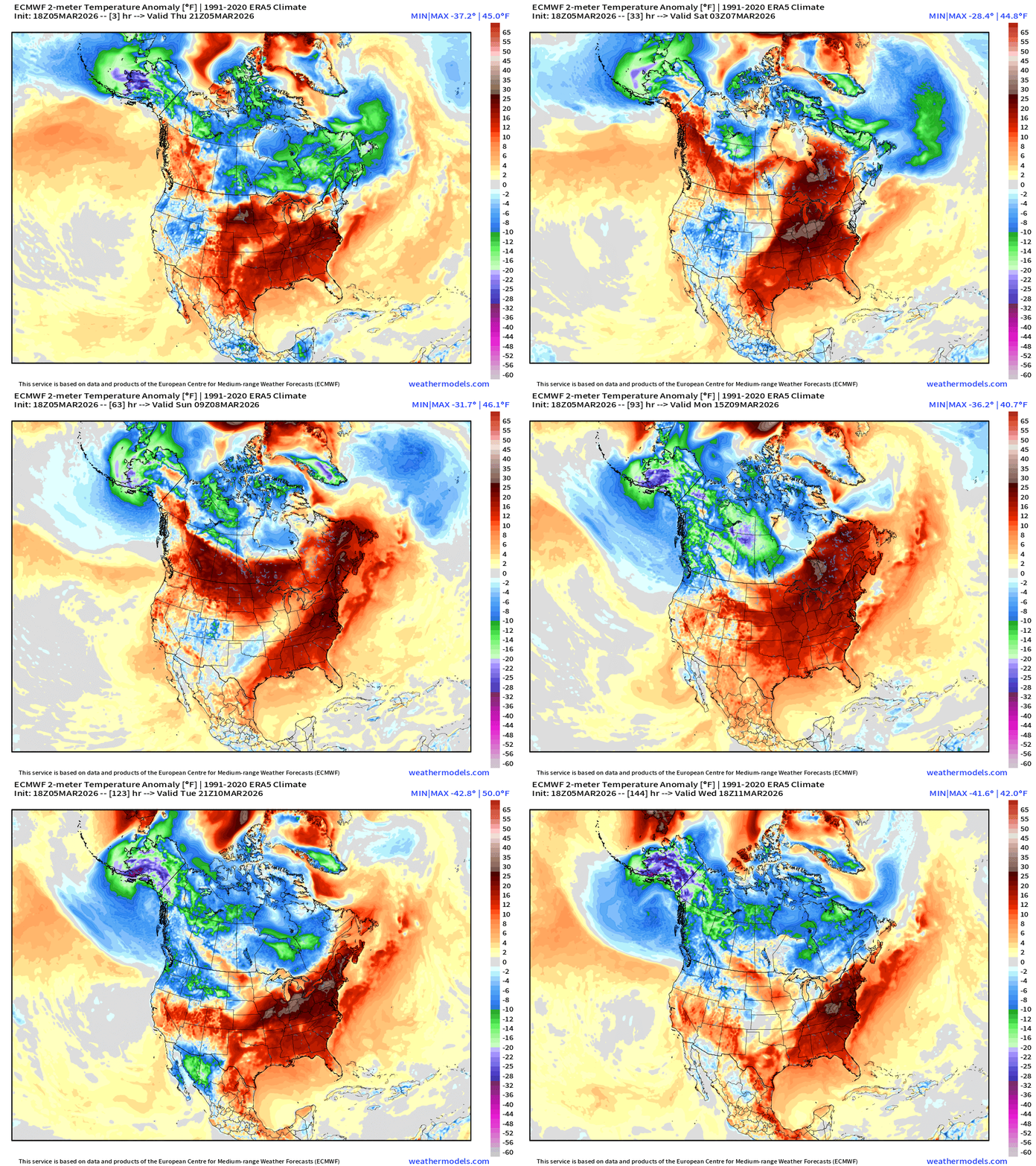
Temperature Anomaly Next 6-days —> Much above normal temperatures across much of the Lower 48 with warm, southerly flow. The coldest Arctic air across Canada is eroded with help from the Pacific leaving Alaska as the main source of cold pool formation. That cool air dips into the Pacific Northwest into middle of next week.
Next 6-days of Precipitable Water (my favorite parameter)
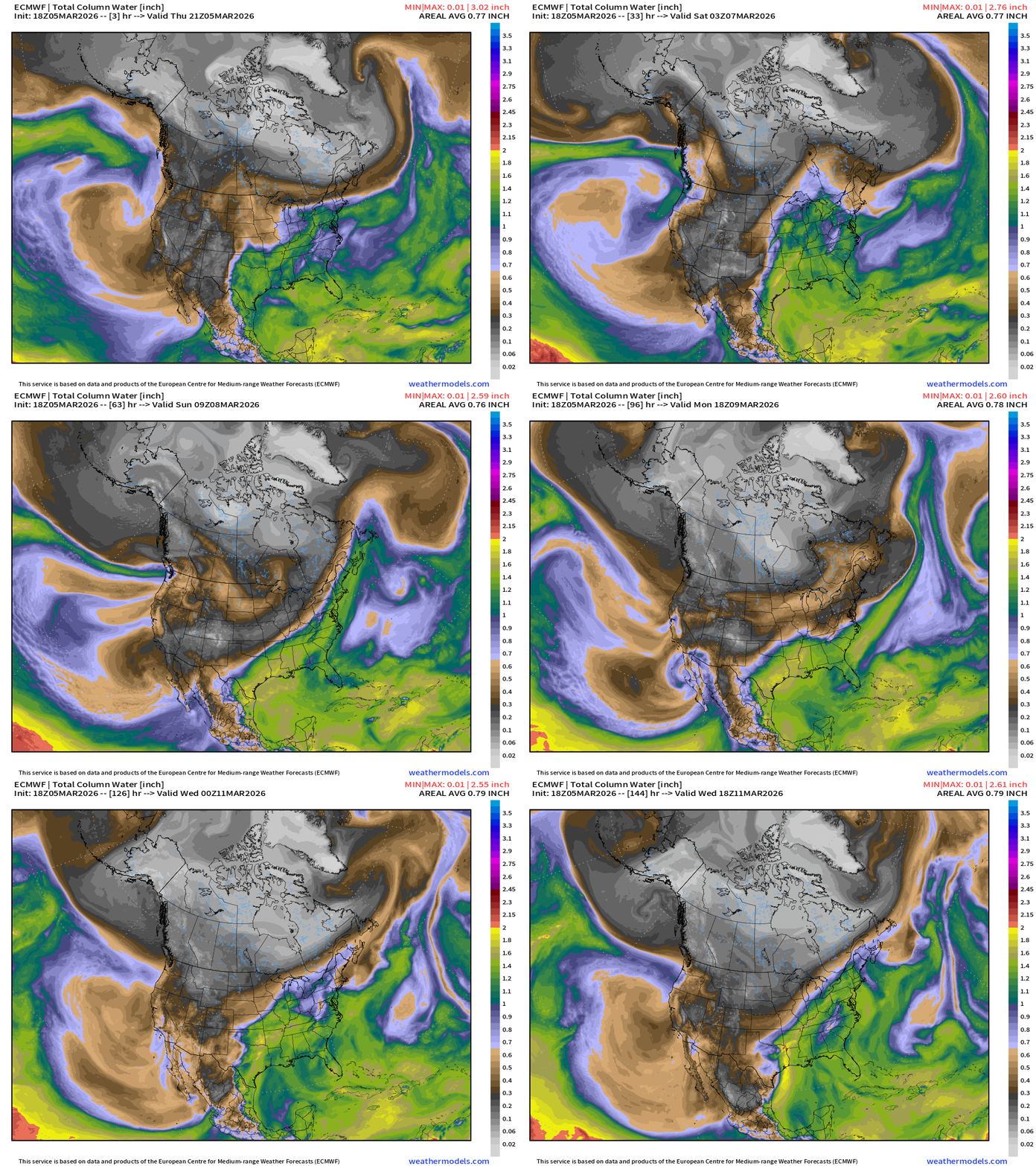
Interesting cut-off low spins off the coast of Baja California next week — and now it crosses northern Mexico into Texas to form a surface low pressure system. That’s got my attention.
Next 12-days of Integrated Vapor Transport (ECMWF 12z)
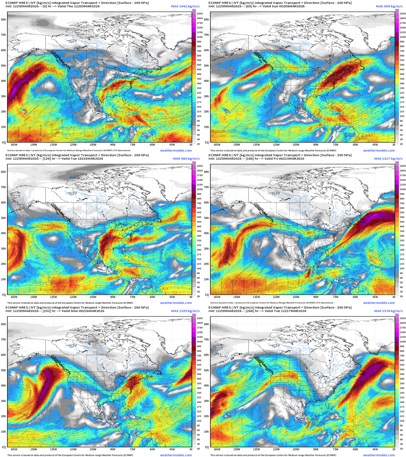
Next week or so, multiple surges of moisture from the Gulf of Mexico enhanced by storm systems = heavy rain and thunderstorms (severe weather) across the central Plains and eastward — “ring of fire” around subtropical ridge / Bermuda High.
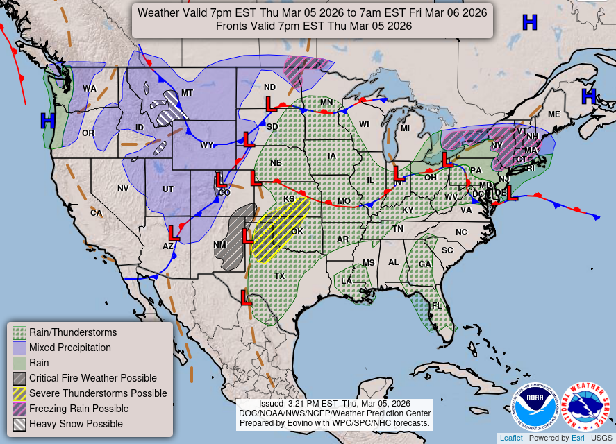
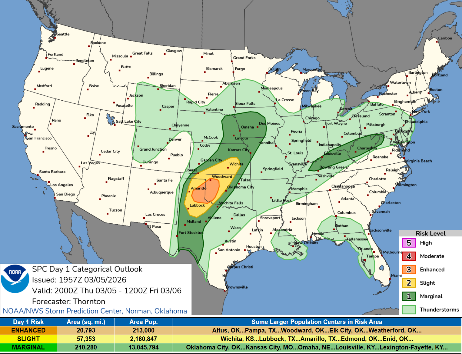
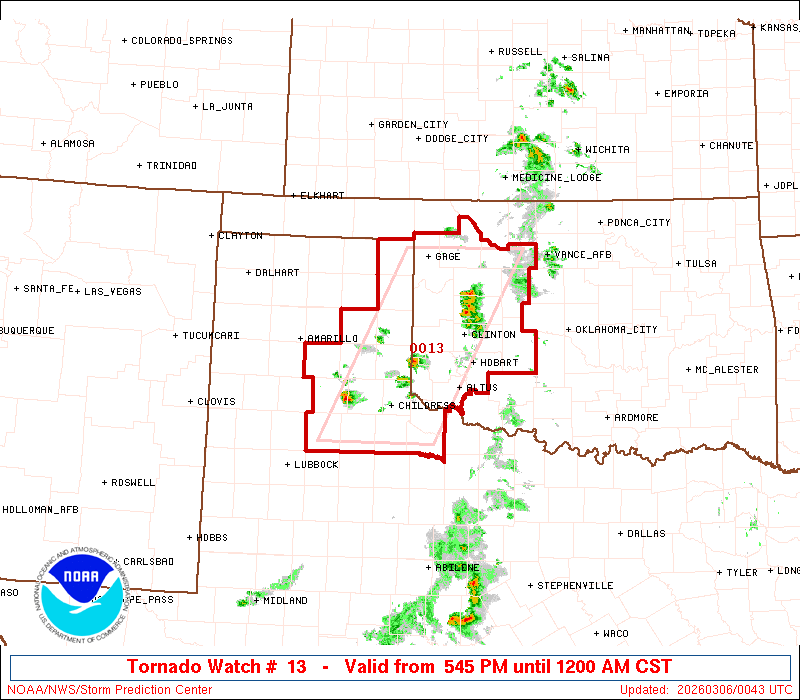
Weather into Friday morning — Slight to Enhanced chance of severe weather in the Texas panhandle into OK/KS with ongoing convection
Day 1 Convective Outlook through 7 AM Friday
Tornado Watch 13
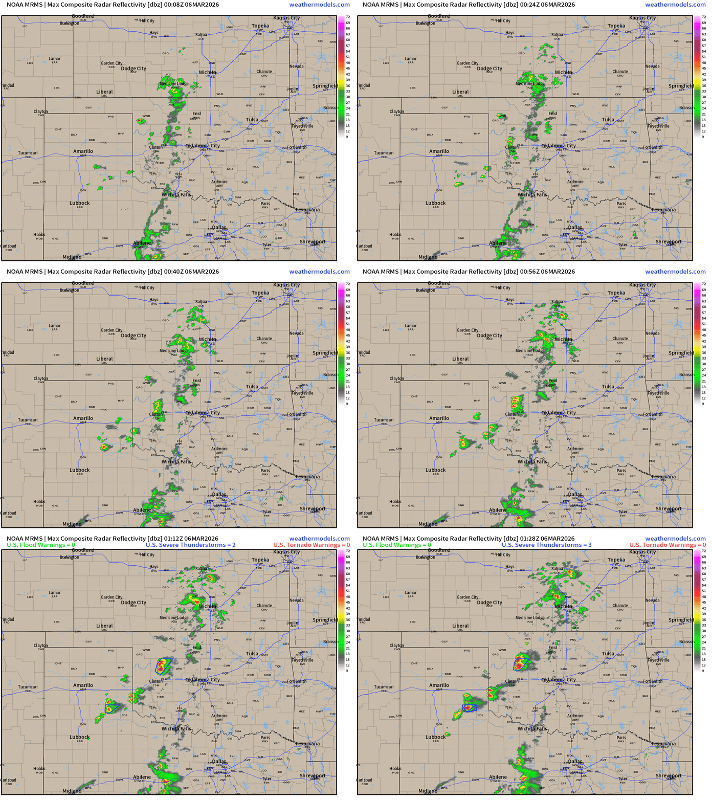
Radar at 7:30 PM CT
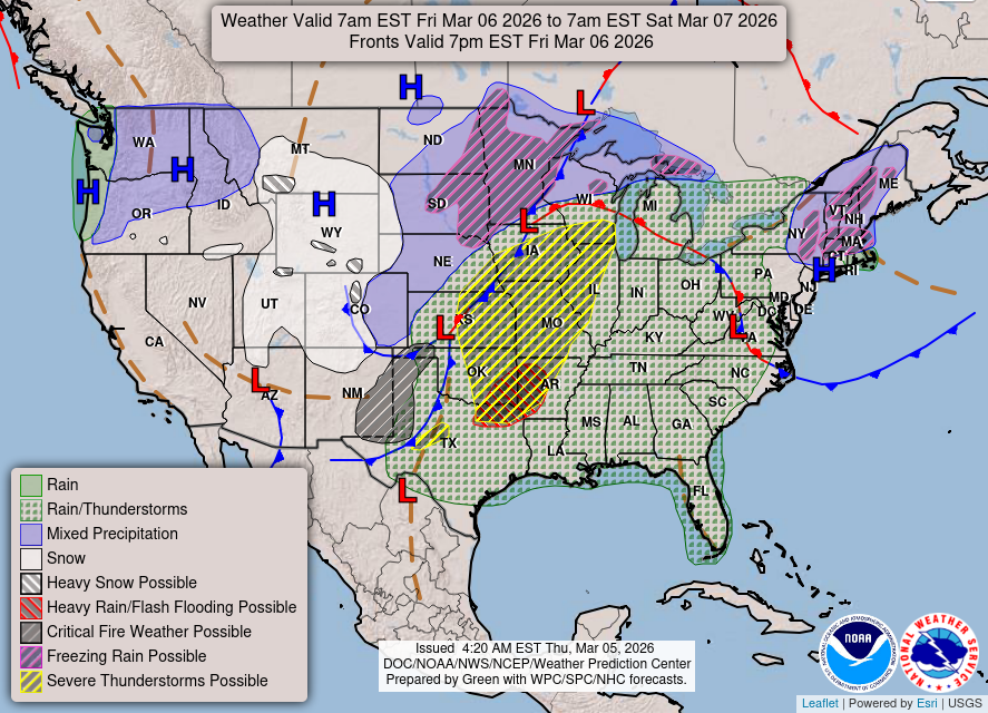
Weather On Friday: Larger area of thunderstorms with low pressure system with mixed precip on the backside in Minnesota.
Day 2 Convective Outlook:
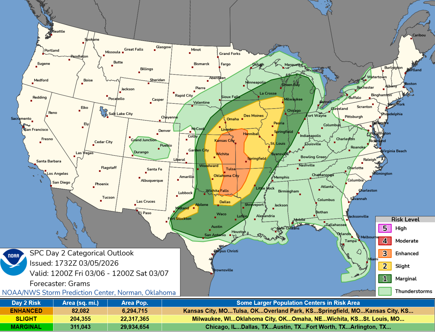
Enhanced risk for KC, Tulsa, and Springfield, Missouri
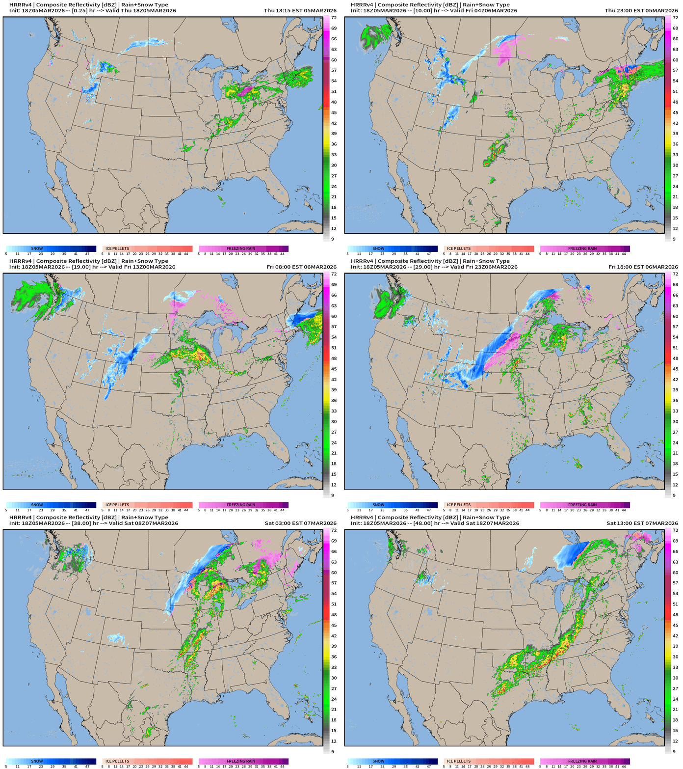
HRRR 18z — Radar Simulation Next 48-hours to Saturday 1 PM ET
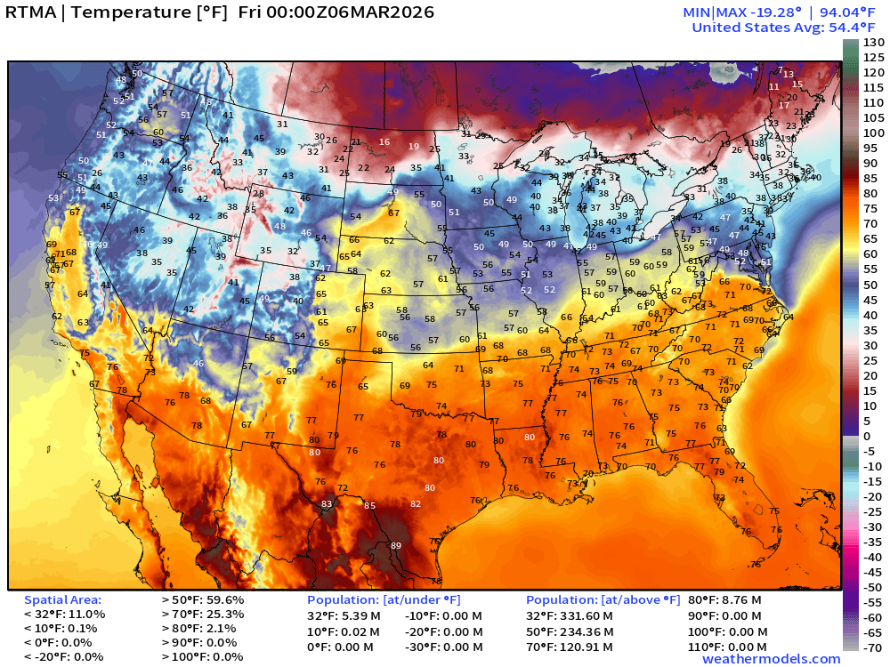
RTMA Current Temperature Analysis | 7:00 PM ET
RTMA Current Temperature Anomaly Analysis | 7:00 PM ET
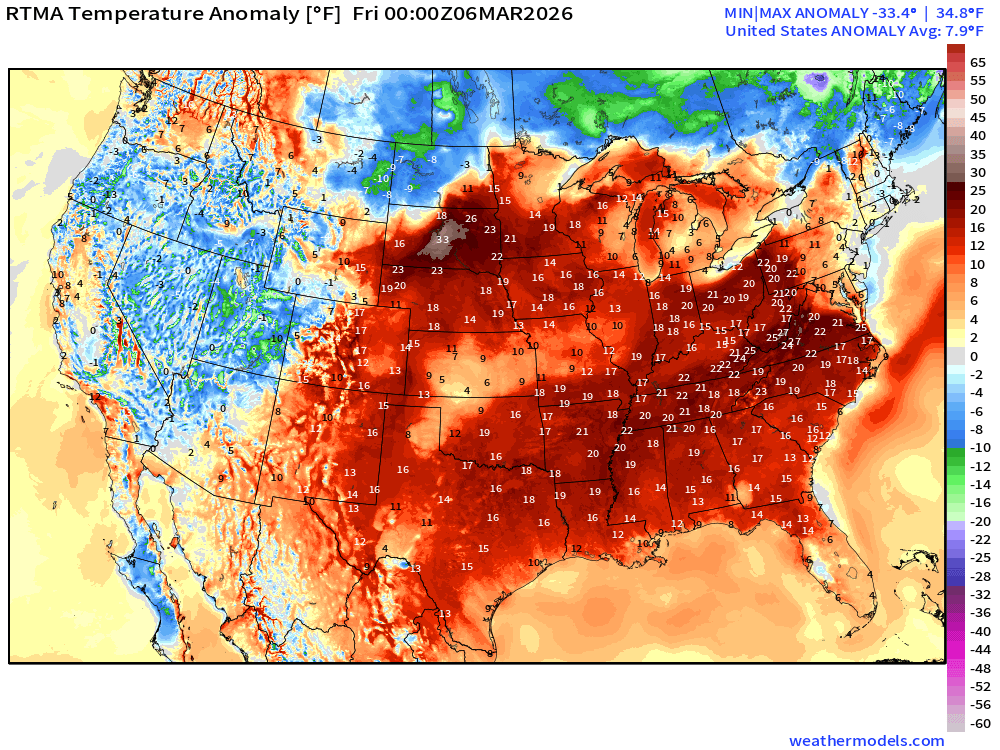
Lower 48 is a whopping 7.9°F above normal
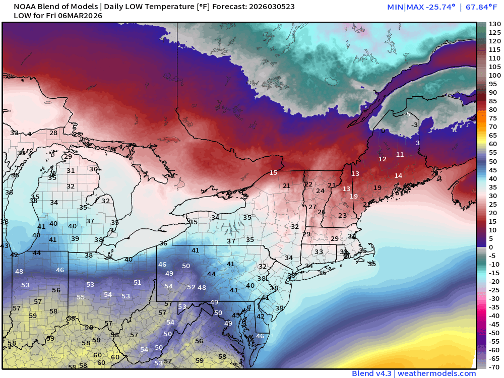
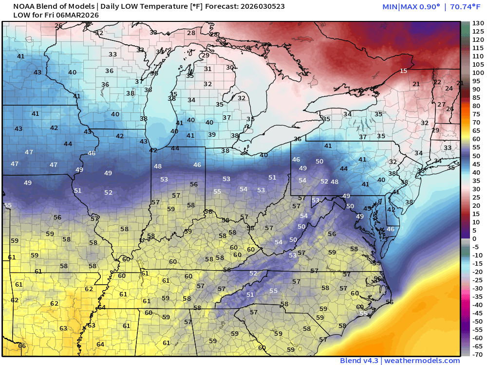
Low Temperatures on Friday
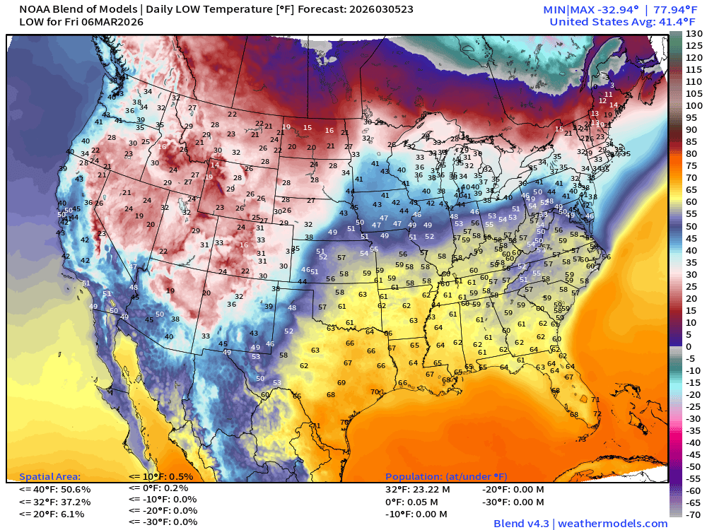
Only 23 million below freezing mainly New England
High Temperatures on Friday
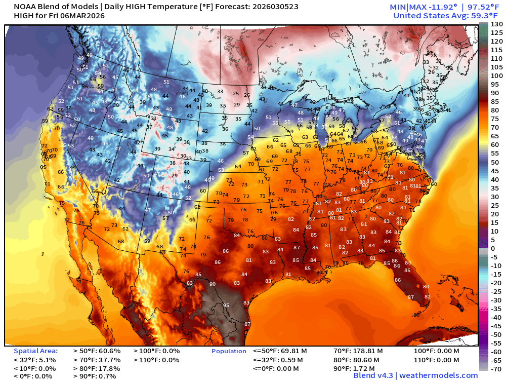
179 Million at least 70°F and 81 million at least 80°F
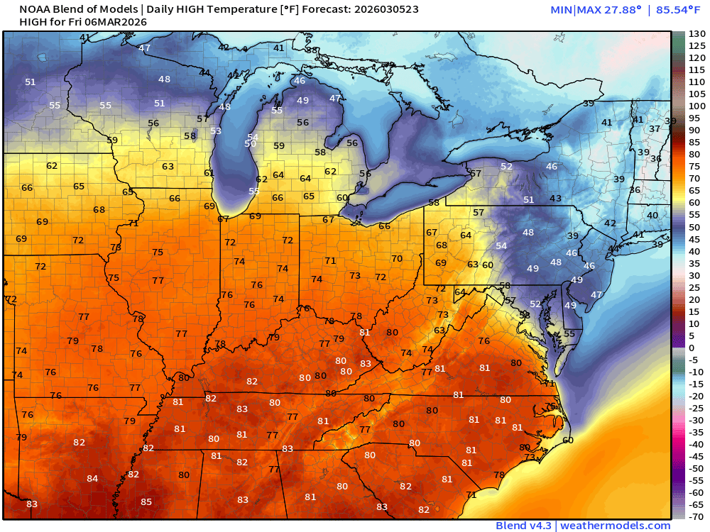
Except the Northeast is stuck in much colder/wedge like conditions with only 30s in Boston and 20s in Caribou!
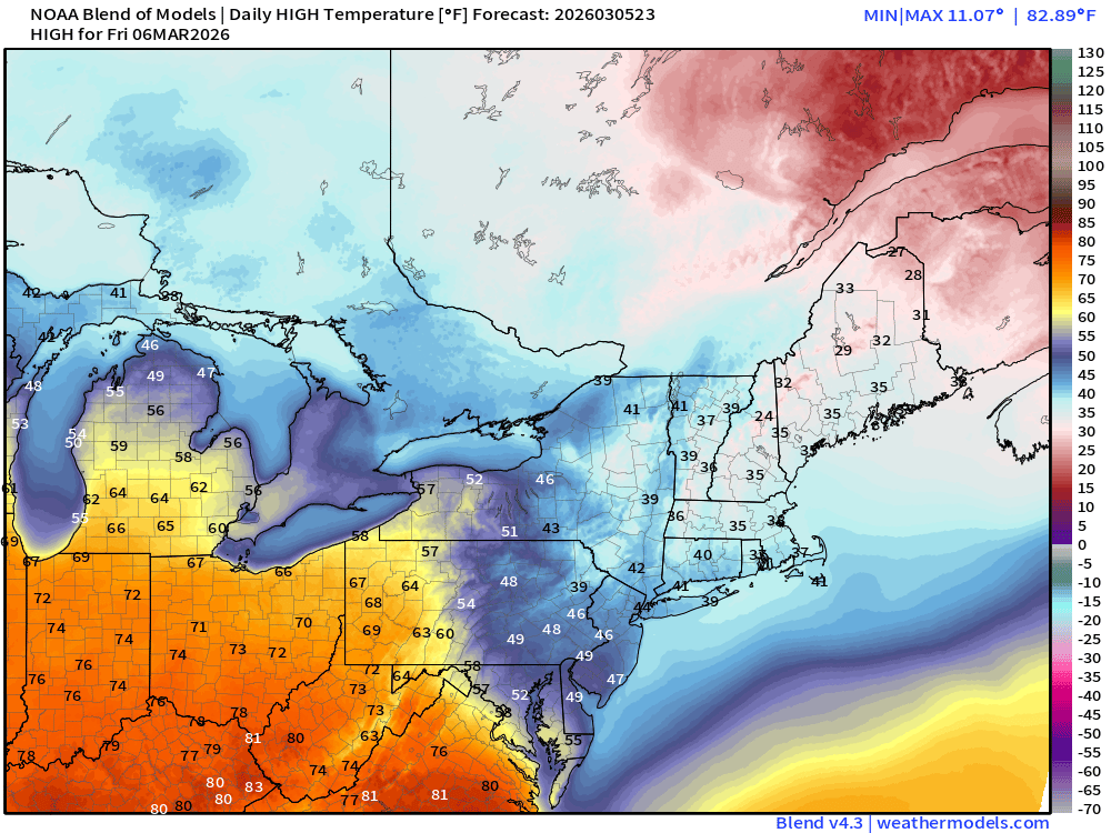
Highs on Saturday
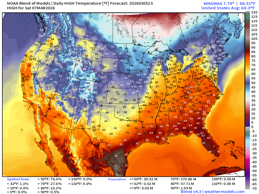
171 million at least 70°F and 57 million > 80°F
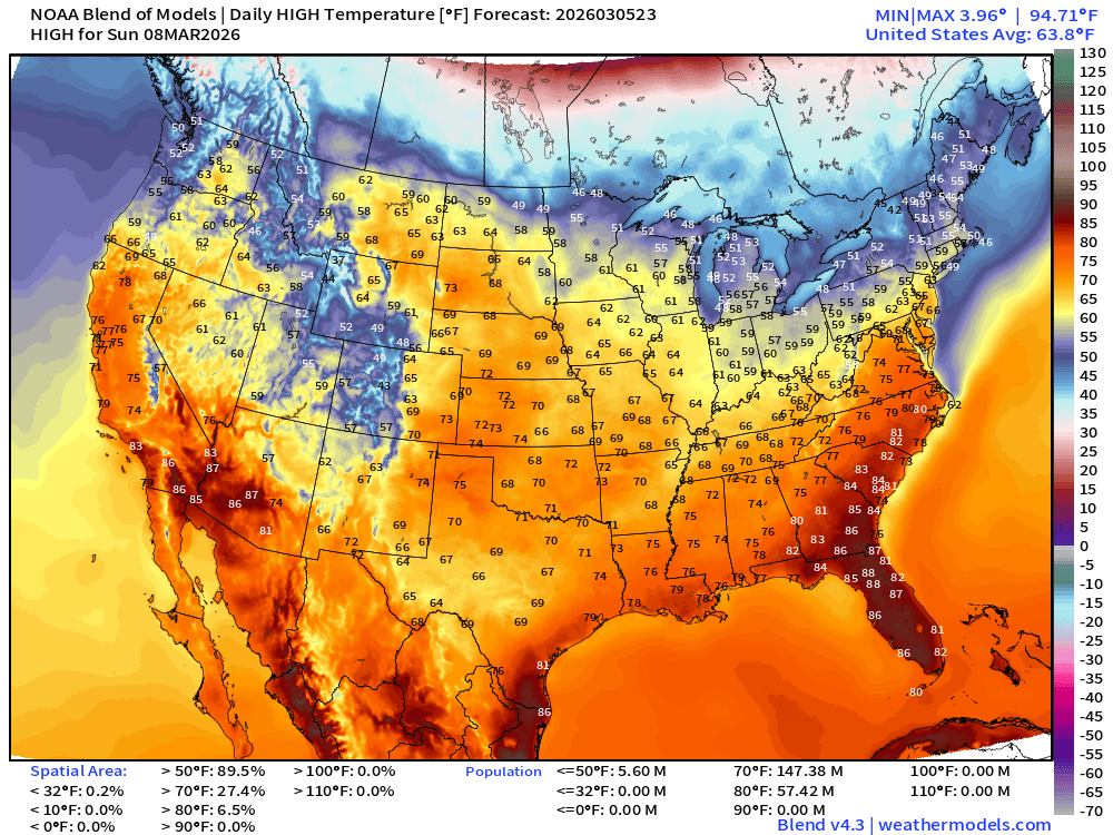
High Temperatures on Sunday
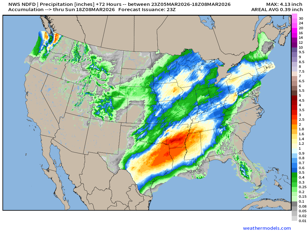
NDFD NWS Total Precipitation Next 72-hours through Sunday Afternoon
NWS Snowfall Next 72-hours — through Sunday afternoon
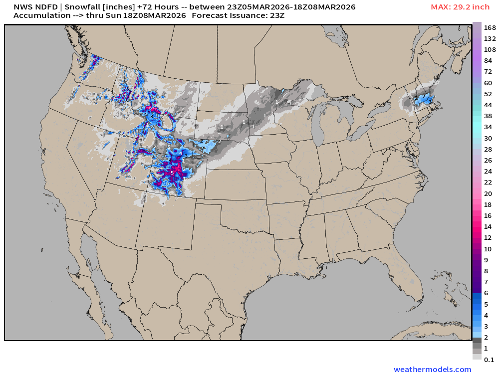
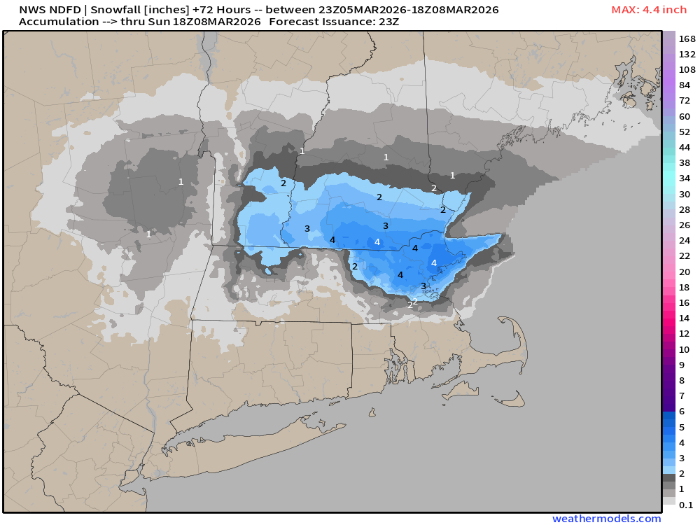
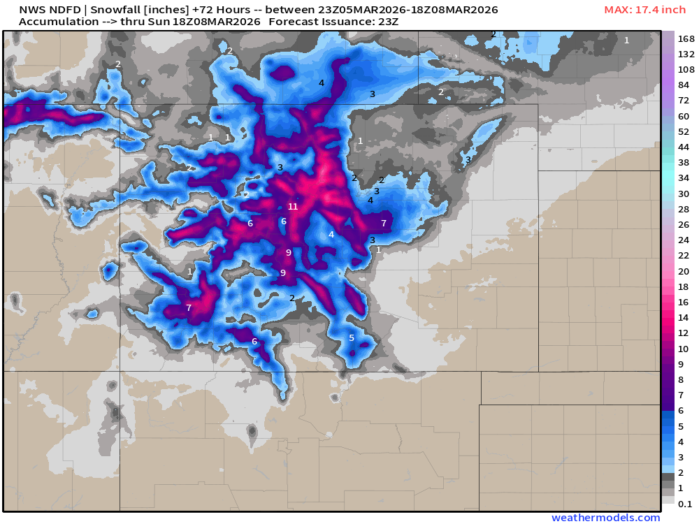
Blend of Models | 10 Days Precipitation Total
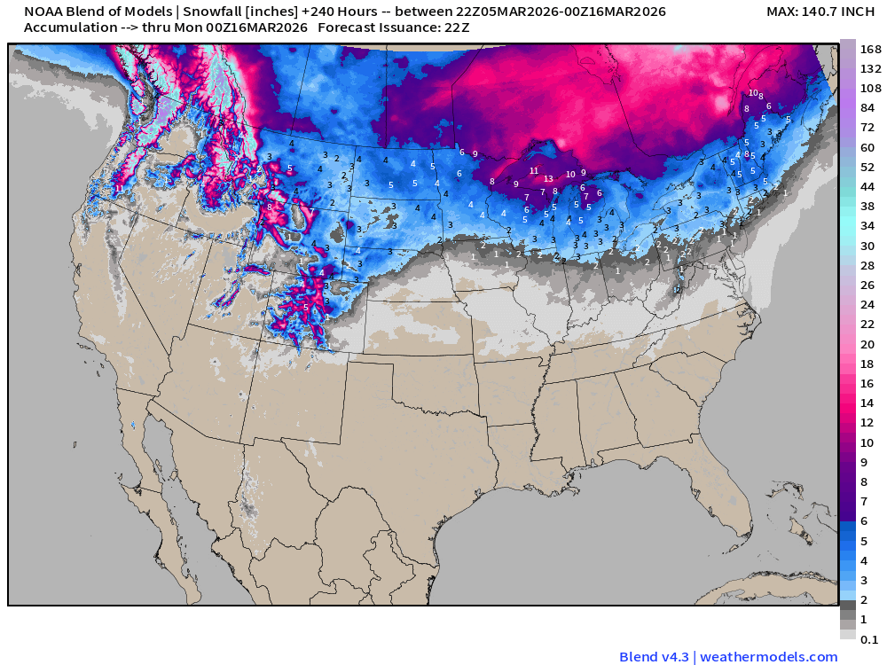
Blend of Models | Total Snowfall Next 10-Days
ECMWF AIFS 18z | Temperature at 500 mb | Next 10-days
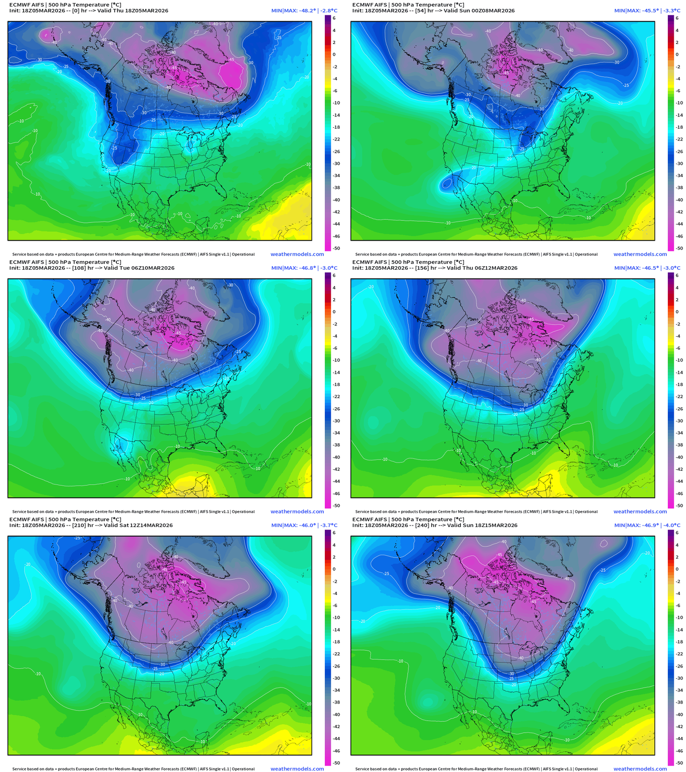
Still watching the middle of next week for the entire Polar Vortex shifts/stretches southward closer to the Canadian border with potential for “lobes” of cold Arctic air — even for mid-March — to sweep through the Lower 48.
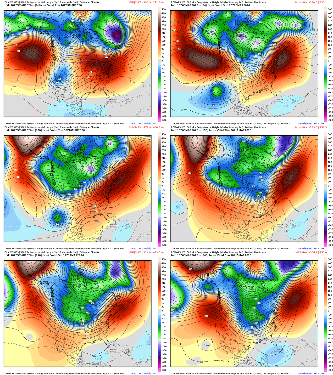
ECMWF AIFS 18z | Height Anomaly at 500 mb | Next 10-days
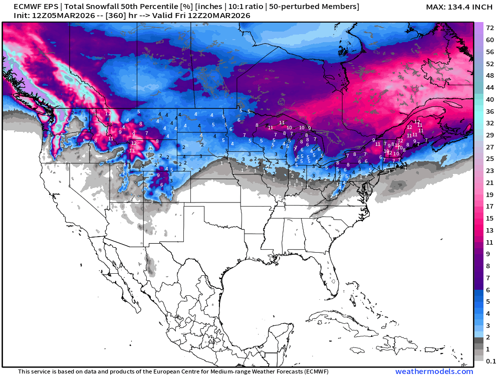
Snowfall | Median of ECMWF Ensembles at 12z | Next 15-days
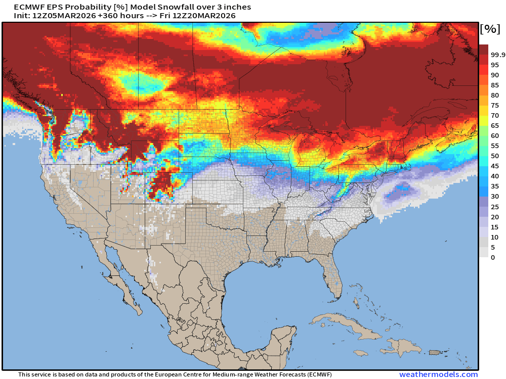
Probability of at least 3” of Snowfall Next 15-days
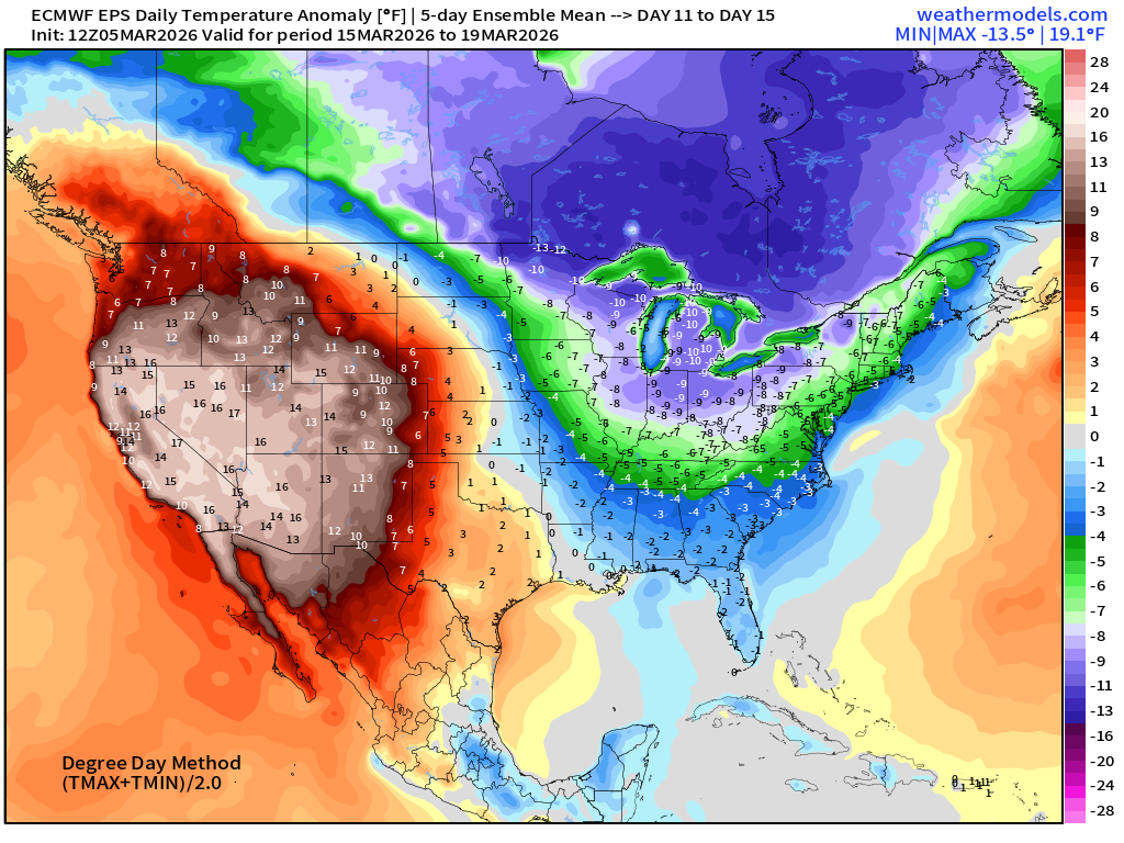
Temperature Anomaly | Next 15-days | ECMWF EPS 12z Ensemble Mean Flagship
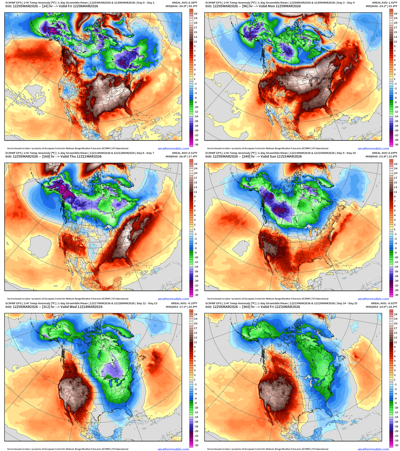
Coldest Days are 11 to 15 east of the Rockies
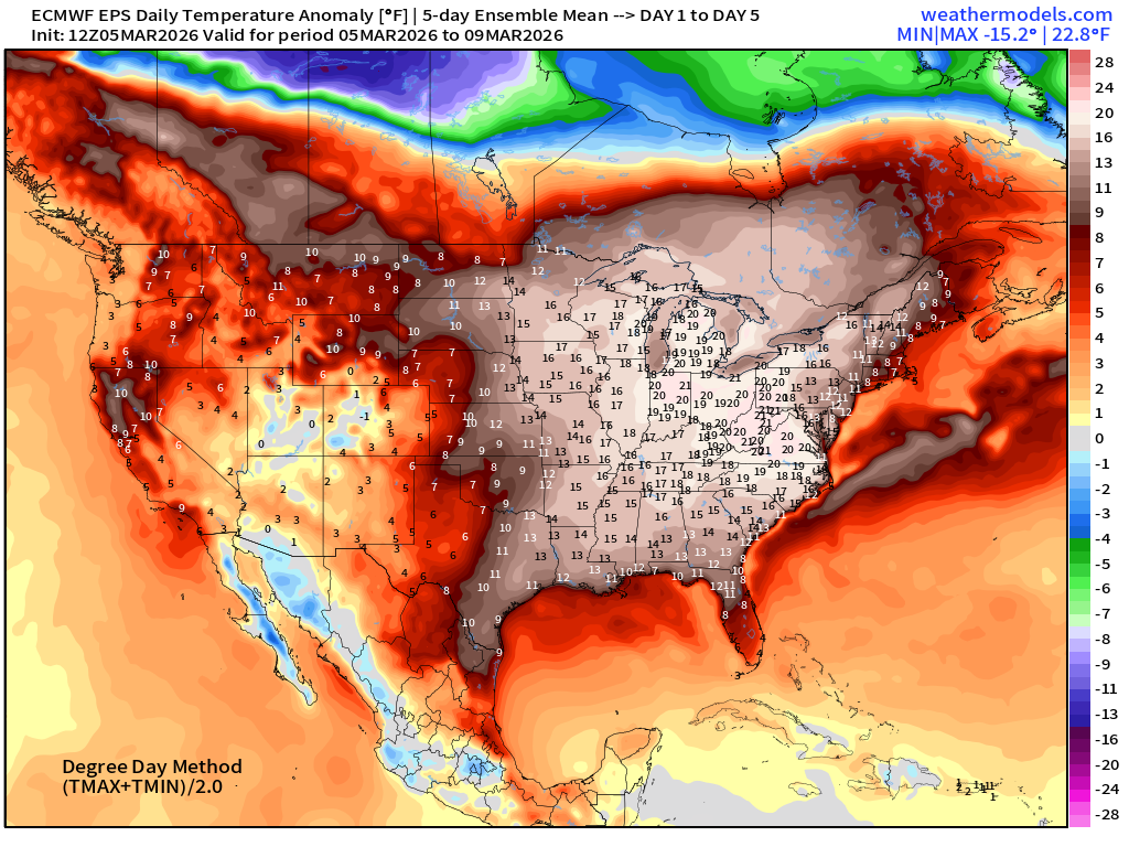
5-Day Chunk #1 | Temperature Anomaly | March 5 - March 9
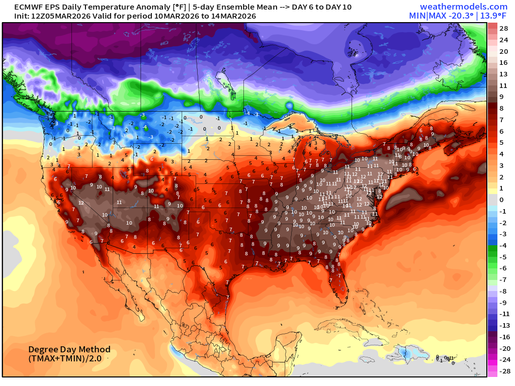
5-Day Chunk #2 | Temperature Anomaly | March 10 - March 14
5-Day Chunk #3 | Temperature Anomaly | March 15 - March 19
Maps sourced from weathermodels.com designed and innovated by yours truly! Please subscribe there for real-time access to the newest maps, charts from all of the weather models including ECMWF and AIFS, and NOAA GFS/GEFS. NOAA WPC and SPC for fronts/convective outlooks.
- Milepost
- 889 · laid 2026-03-06T01:37:30.916000Z
- Source
- https://weather.substack.com/p/march-5-2026-thursday-weather-update
- Digest
- b26b0f3ee05d60b9f3eba64383f00e55919543e7875c4aaa03f1e399bfa233f1
- Machine
- JSON