Brief cold snap for Eastern U.S. including Florida but otherwise dry and quiet for long period

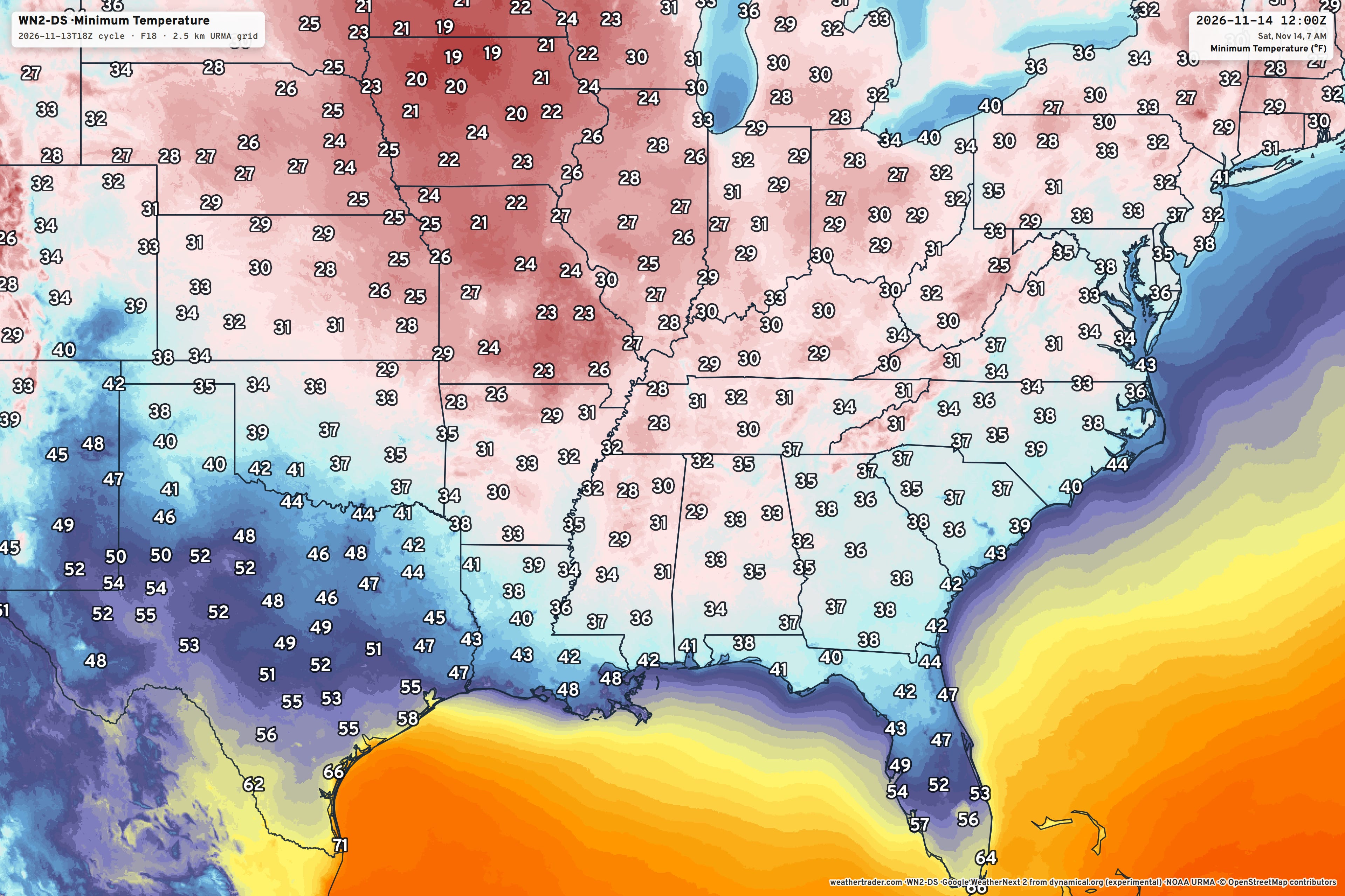
Google Weather Next 2 is an ensemble with 50-members, and is highly skillful A.I. trained global model. I’ll work on its recently released upgraded Weather Next 3 system on Saturday. This is one of the last remaining gaps in our global forecast engine.
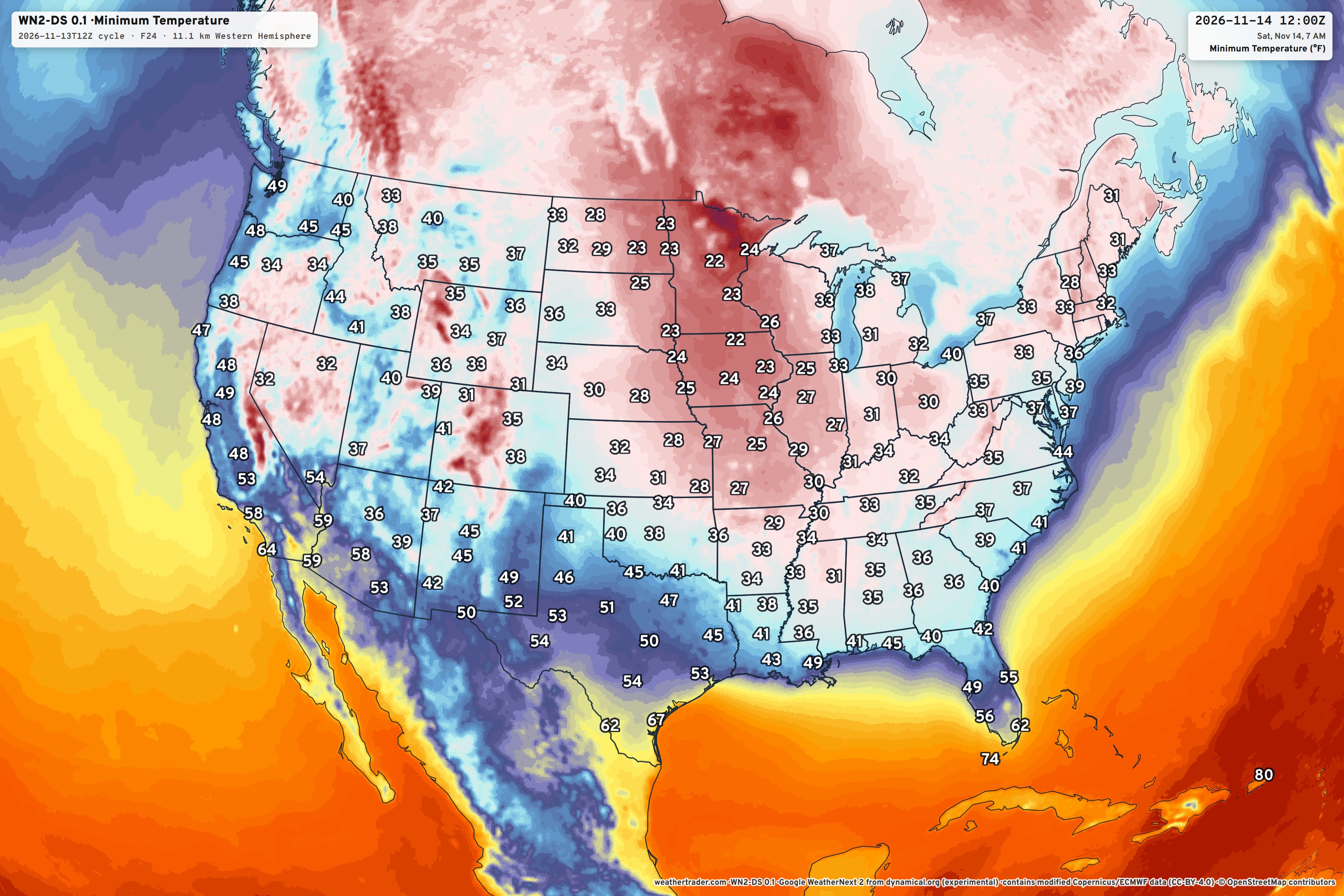
Rendering shows/maps across many markets is a great way to show off my model maps, too. Plenty of fun examples on the way to populate my various weather websites.
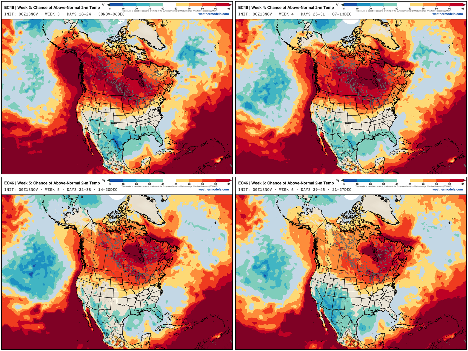
Next 6-weeks —> Excitement for El Niño fueled late fall pattern with plenty of precipitation from the Pacific
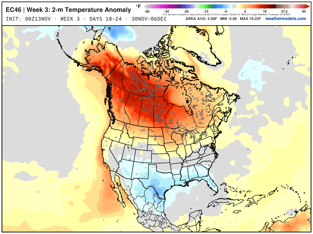
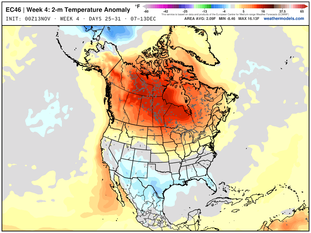
ECMWF EPS 46-day forecast runs each morning (00z) with 100-members at slightly lower resolution.
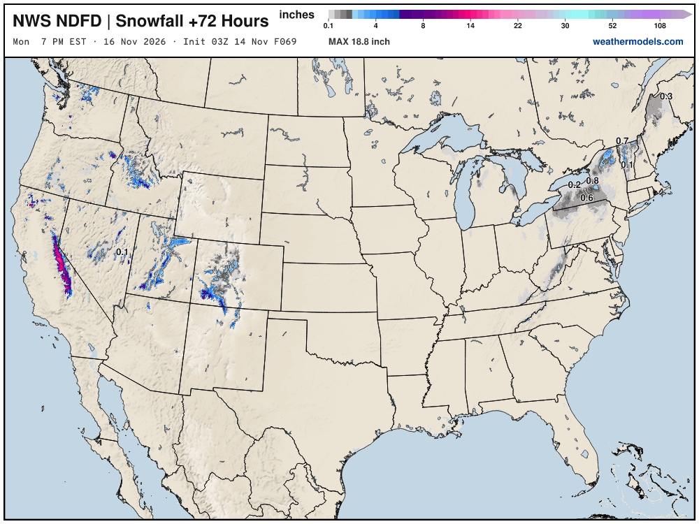
We have minimal snowfall coming this weekend across the Northeast with scattered flurries and light snow showers. Next 60-hours (Monday 7 AM) from new RRFS
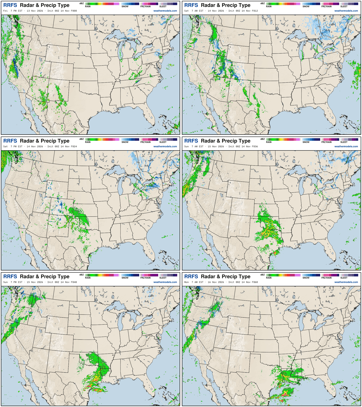
Deep trough digging into the Southeast … and then slowly eroded with some return flow moisture from the Gulf and Atlantic
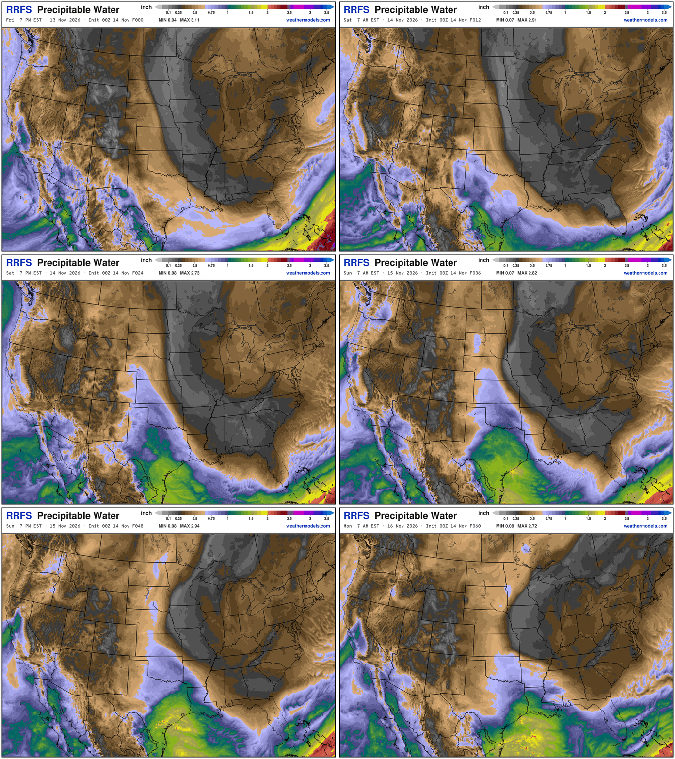
Apologies for the Late Update: I got sidetracked into evening … I am going to push the maps and do a better job tomorrow with new products.
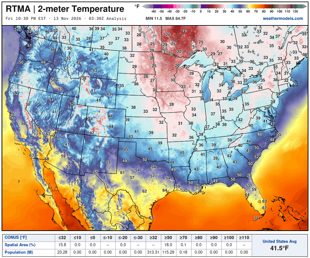
Temperature Analysis Friday at 10:30 PM ET
Temperature Analysis | Anomaly from Normal
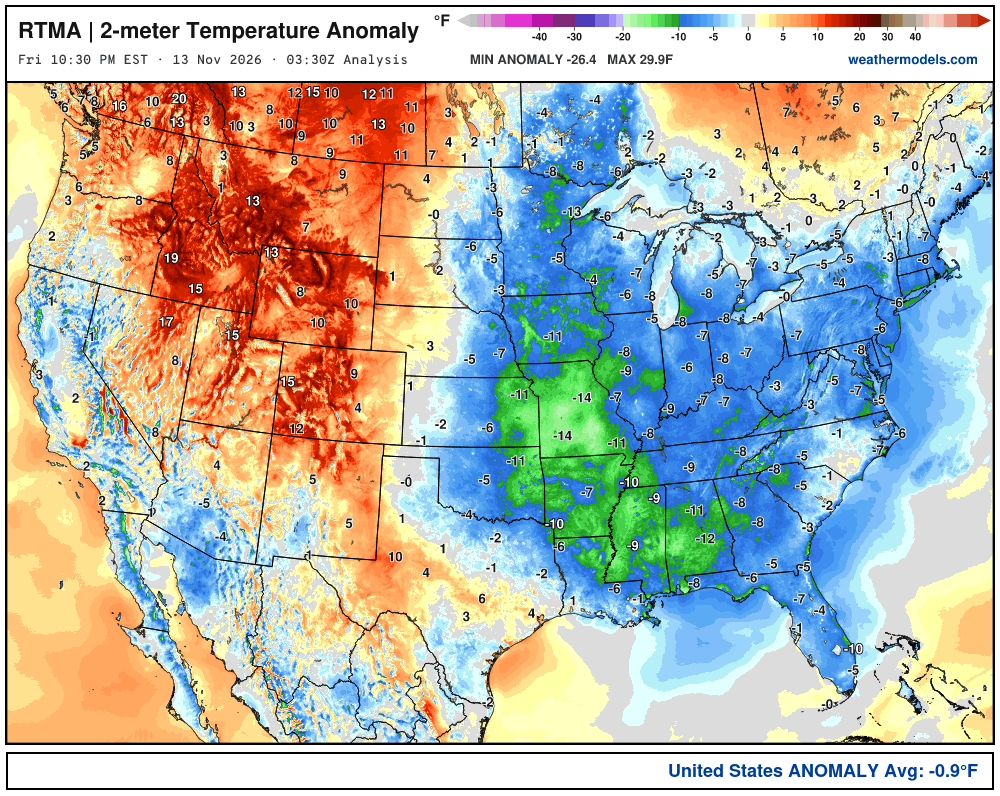
Lower 48 was -0.9ºF below normal
Low Temperatures Saturday Morning
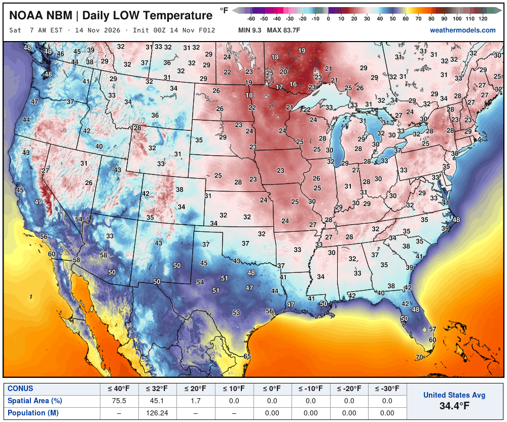
126 million below freezing | Lower 48 only 34.4°F on average for the low
High Temperatures on Saturday
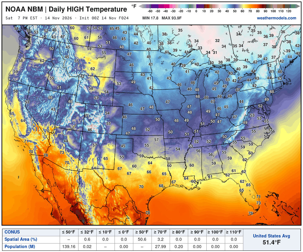
High Temperatures on Sunday
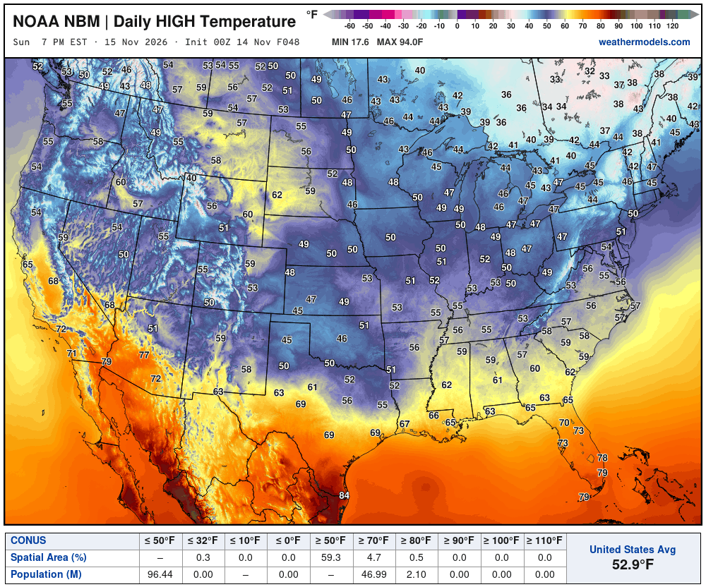
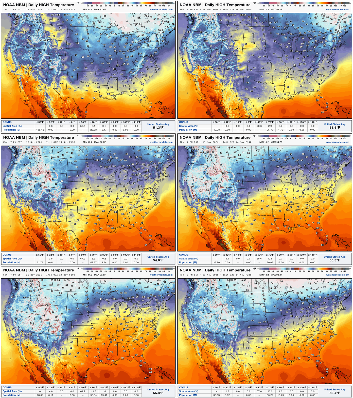
High Temperatures next 9-Days through November 23rd
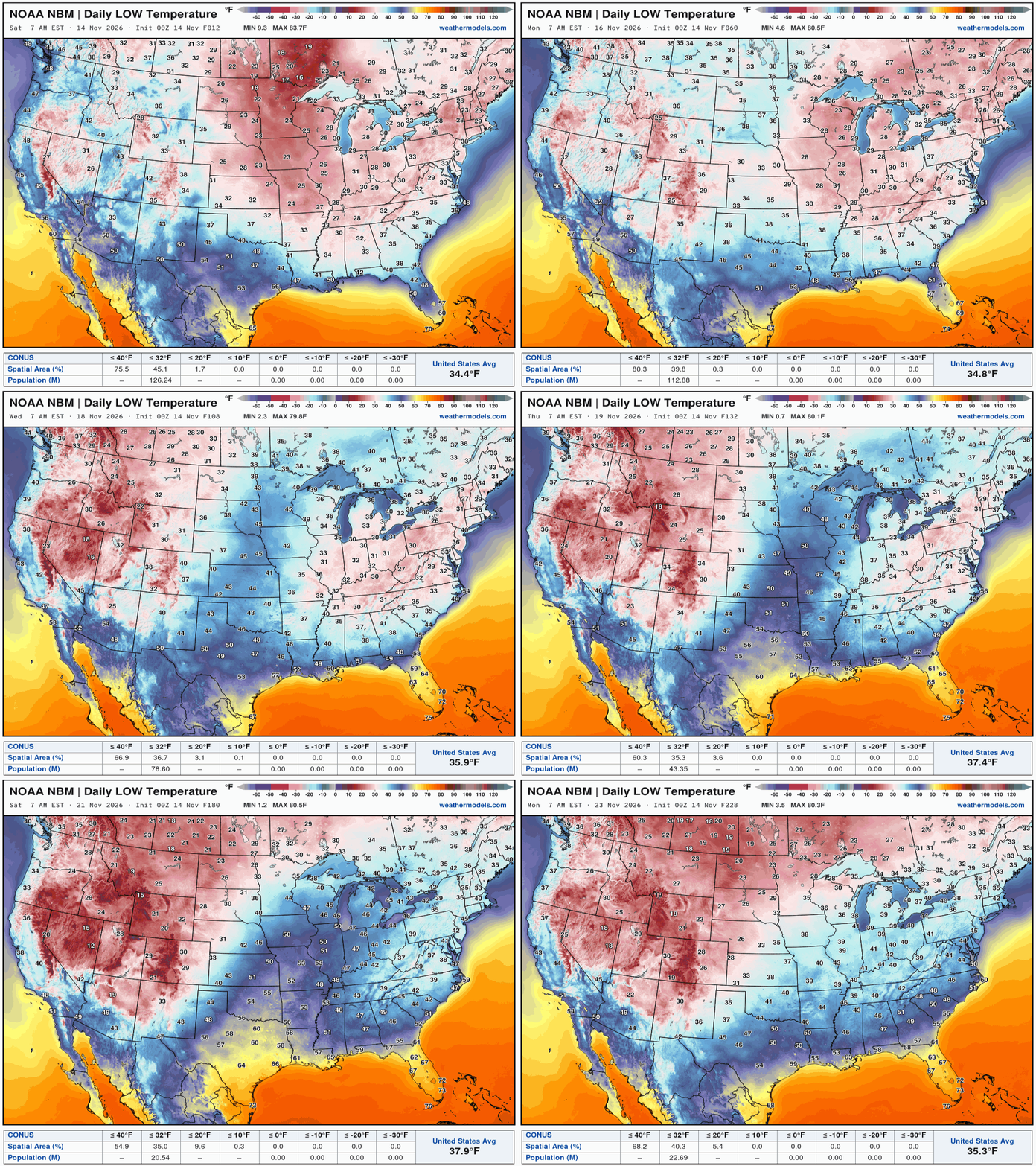
Low Temperatures next 9-Days through November 23rd
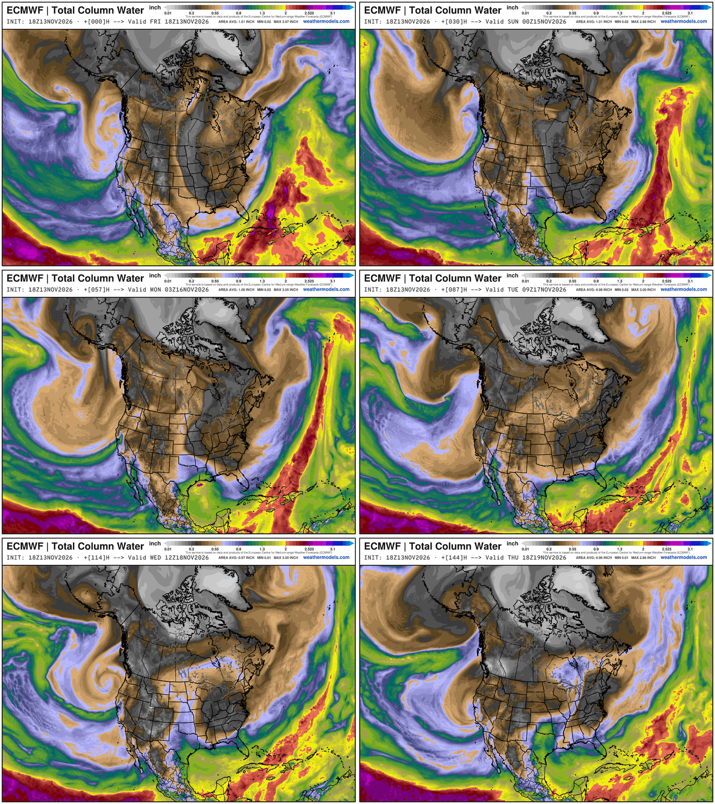
My favorite parameter — precipitable water | ECMWF 18Z next 6-days
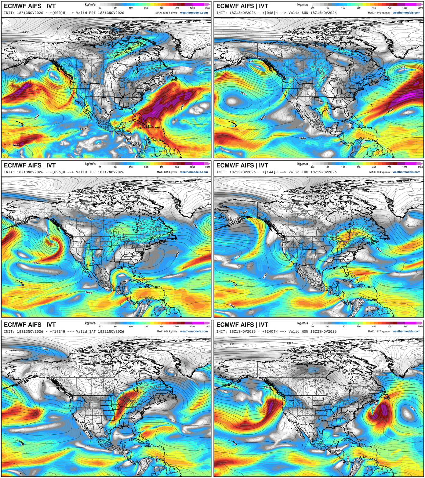
Integrated Vapor Transport Next 10-days | ECMWF AIFS 18z
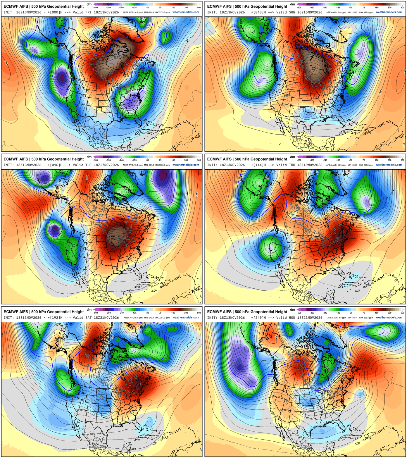
Height Anomaly Pattern | Next 10-days | AIFS 18z | Flagship model
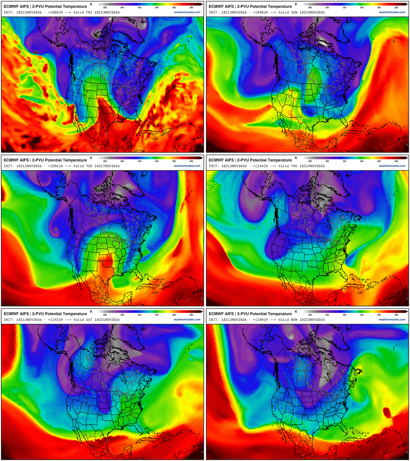
New map for AIFS: Dynamic Tropopause (2 PVU potential temperature) to show the colliding air masses: Arctic into subtropical/tropical. Cold grays = polar vortex and we need to monitor the progress of the main lobe formed/dumping out of Greenland via Hudson Bay
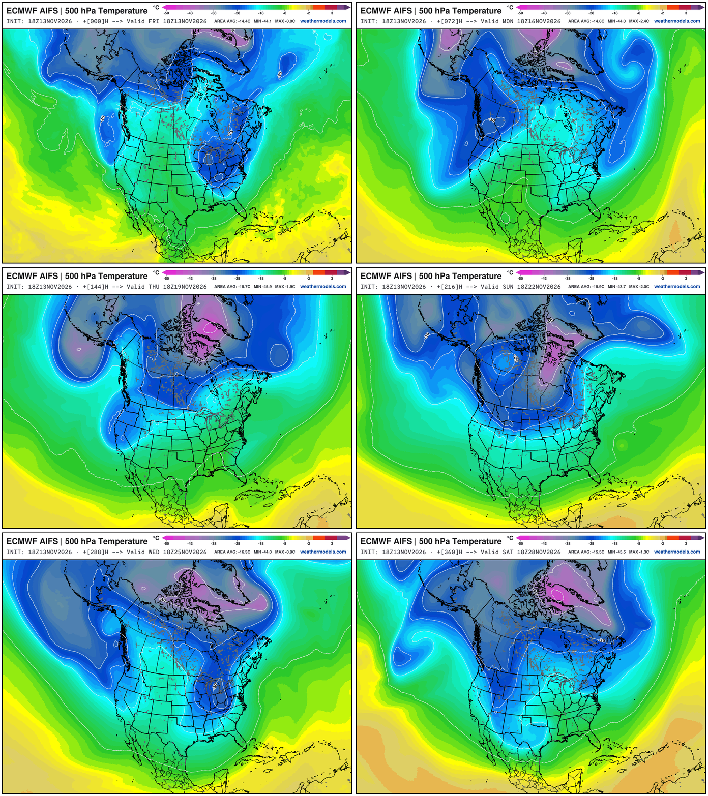
And, we can match up the 2-PVU surface with the 500-mb Temperatures for the outline of the polar (vortex) front
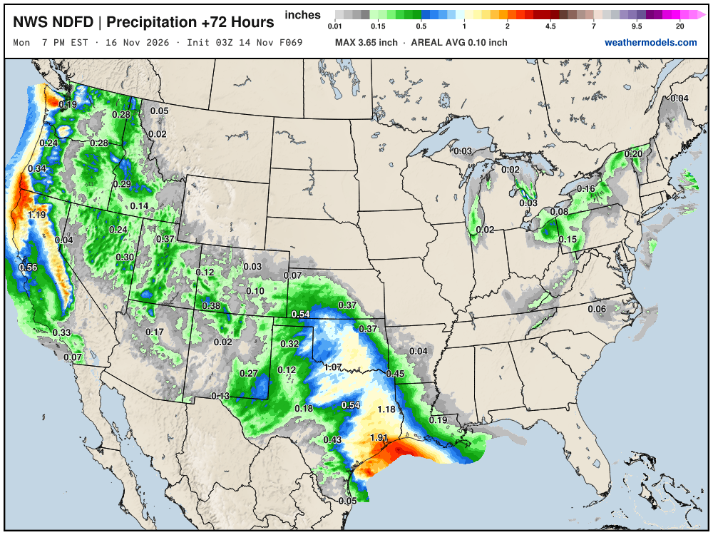
NWS NDFD Next 3-days precipitation
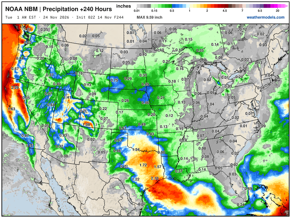
Blend of Models Precipitation Next 10-days
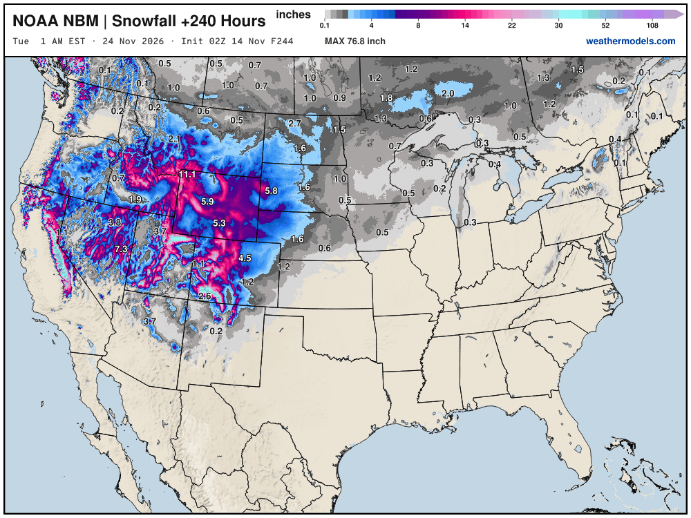
Blend of Models Snowfall Next 10-days | Western US massive dump
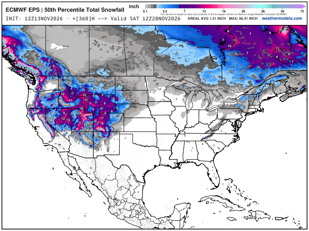
Snowfall Next 15-days | ECMWF Ensemble 12z Median
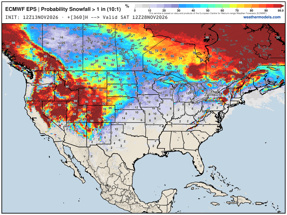
Probability of 1-inch or more of snowfall through November 28th
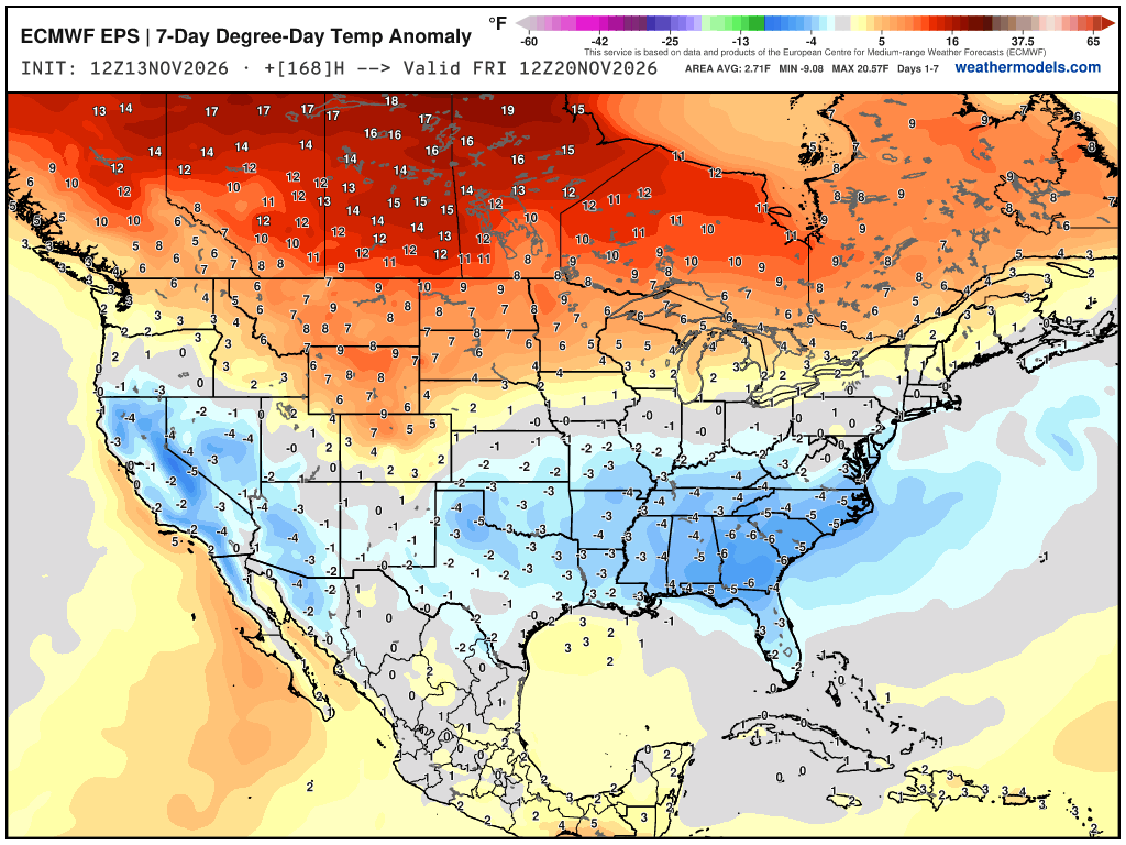
Week 1 Chunk of Temperature Anomaly | Nov 13 - Nov 20
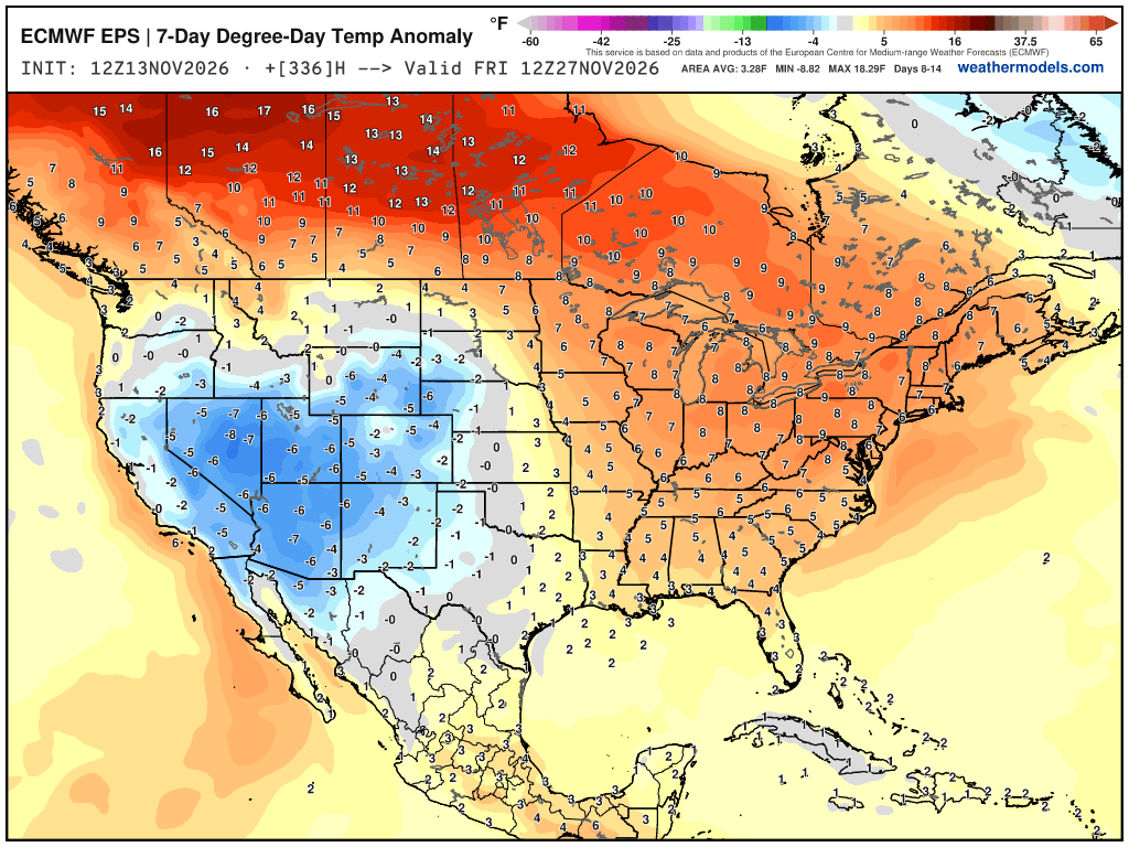
Week 2 Chunk of Temperature Anomaly | Nov 20 - Nov 27
Week 3 Extended Forecast from EPS 46-day
Week 4 Extended Forecast from EPS 46-day
Chance of Above Normal Temperatures for Weeks 3-6 —> El Niño pattern
Thank you for visiting / reading — always more to come!
Visit Global Tropical Cyclones w/Dr. Pielke Jr. for more ACE information, as well as my original climatlas.com/tropical site with much new research including a calibrated “Best Track” and historical tropical cyclone browser with plenty of interesting features like rankings of storms by their IKE (size).
2026 Global ACE —> 964
Satellite imagery from Squall Cloud. Maps sourced from weathermodels.com designed and innovated entirely by Ryan. Please subscribe there for real-time access to the newest maps, charts from all of the weather models including ECMWF and AIFS, and NOAA GFS/GEFS, HRRR/RRFS and Blend of Models (NBM). NOAA WPC and SPC for fronts/convective outlooks. Our own content is sourced from forecast.city and weather.city and celsius.earth and weathertrader.com
Previous in this storyline: First significant taste of winter chill and precipitation for the Eastern US (NOV 11)
- Milepost
- 1686 · laid 2026-11-14T04:08:59Z
- Source
- https://weather.substack.com/p/november-12-2026-friday-weather-update · November 12, 2026 Friday Weather Update
- Tagged
- I-32 Winter · Winter 2026–27 · Florida (28.1, -81.7) · by rule, at build
- Digest
- 98fd9cbfa02de1ba5f088eb097fb44d95fb6b9e75e6251d0bbdb608526cf4c84