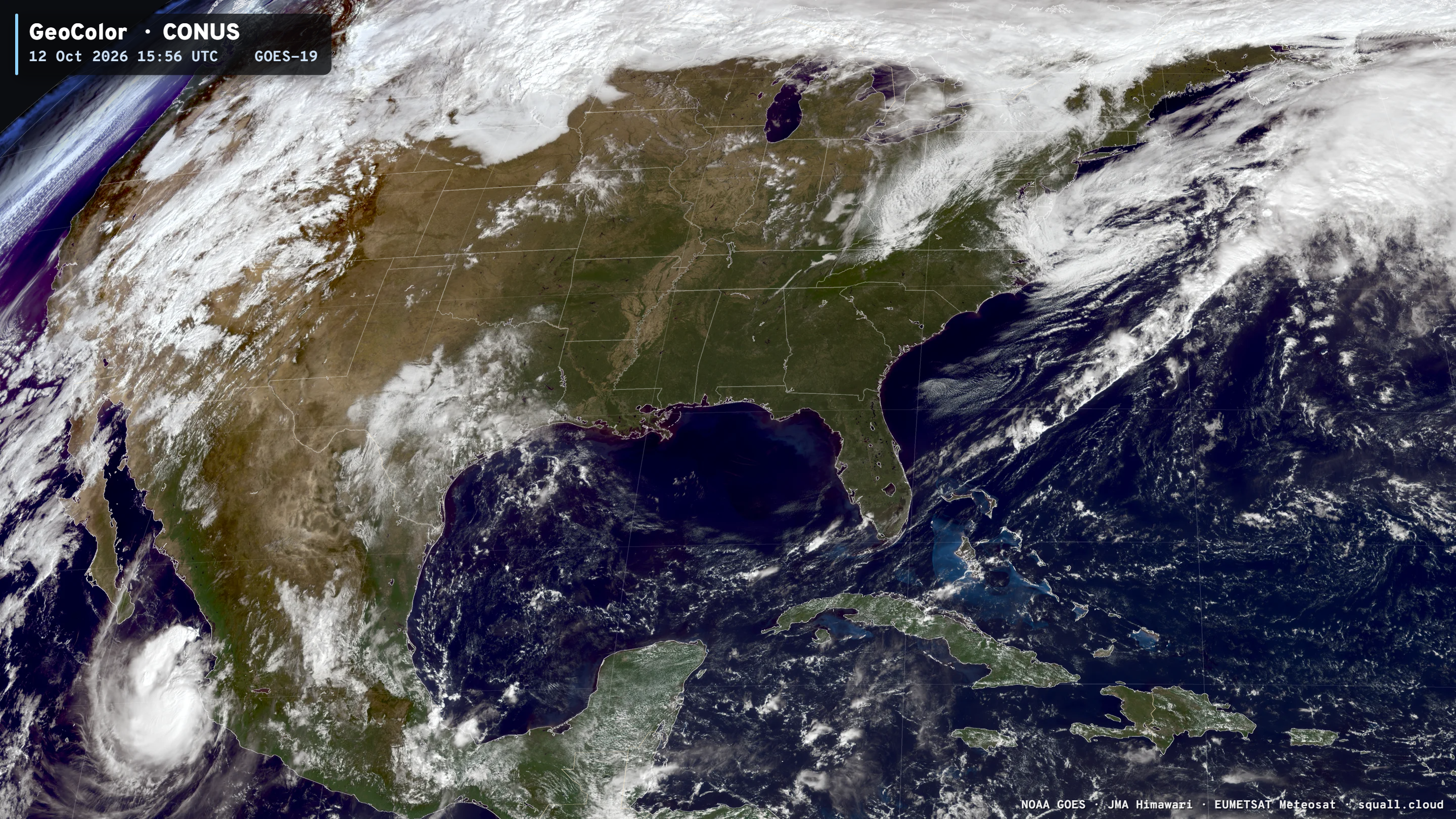
Beautiful stretch of weather across the Eastern U.S. while it snows out west

2026 Eastern Pacific Hurricane Factory — Climate Atlas
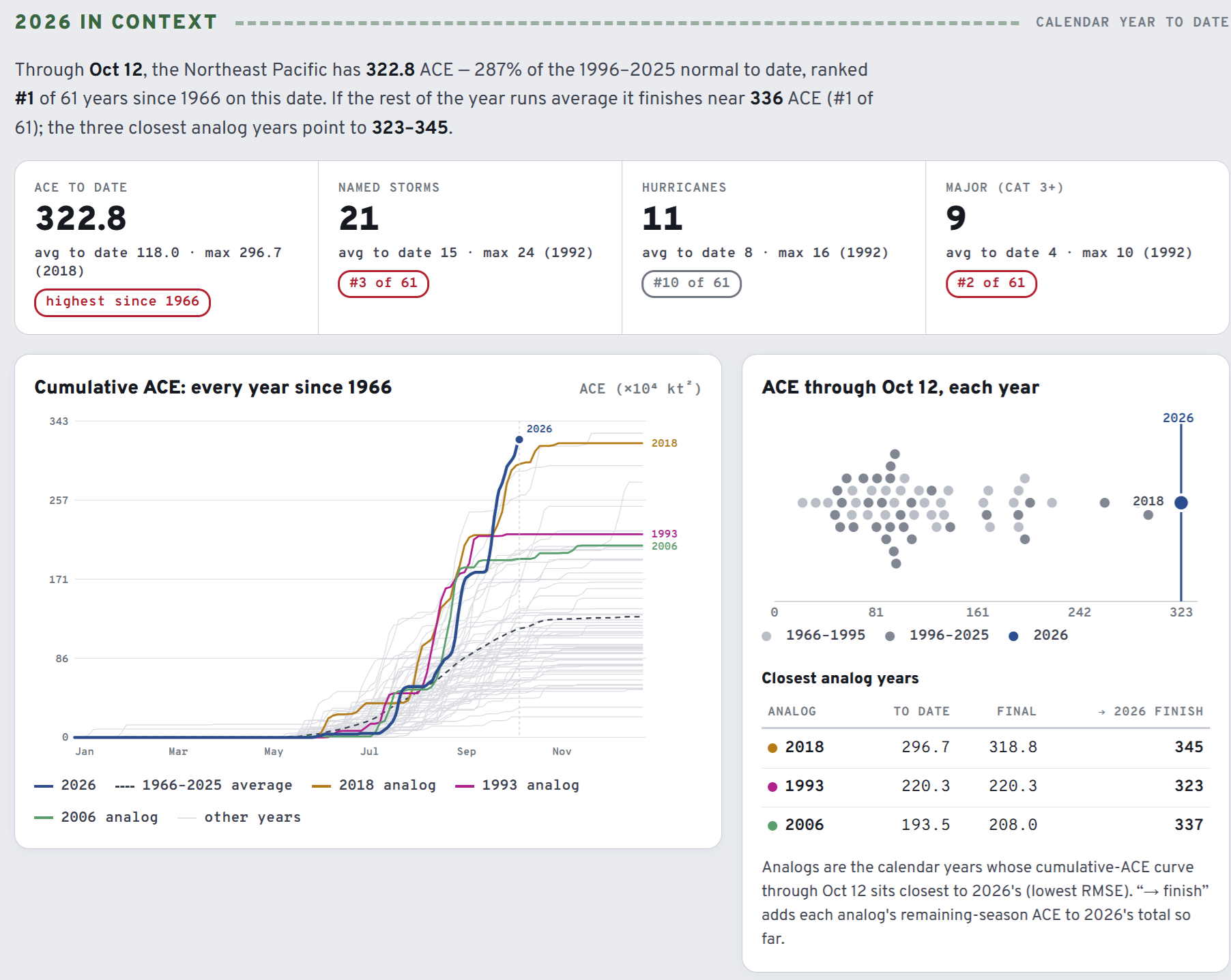
2026 has blown past the record for ACE year-to-date and looks like a lock to become the busiest year on record (2015). We have “good enough” records since the mid-1960s to provide these rankings, so since 1979 might be a better qualifier.
9 major hurricanes so far — one behind 1992 — also an El Niño year (+Pinatubo effects)
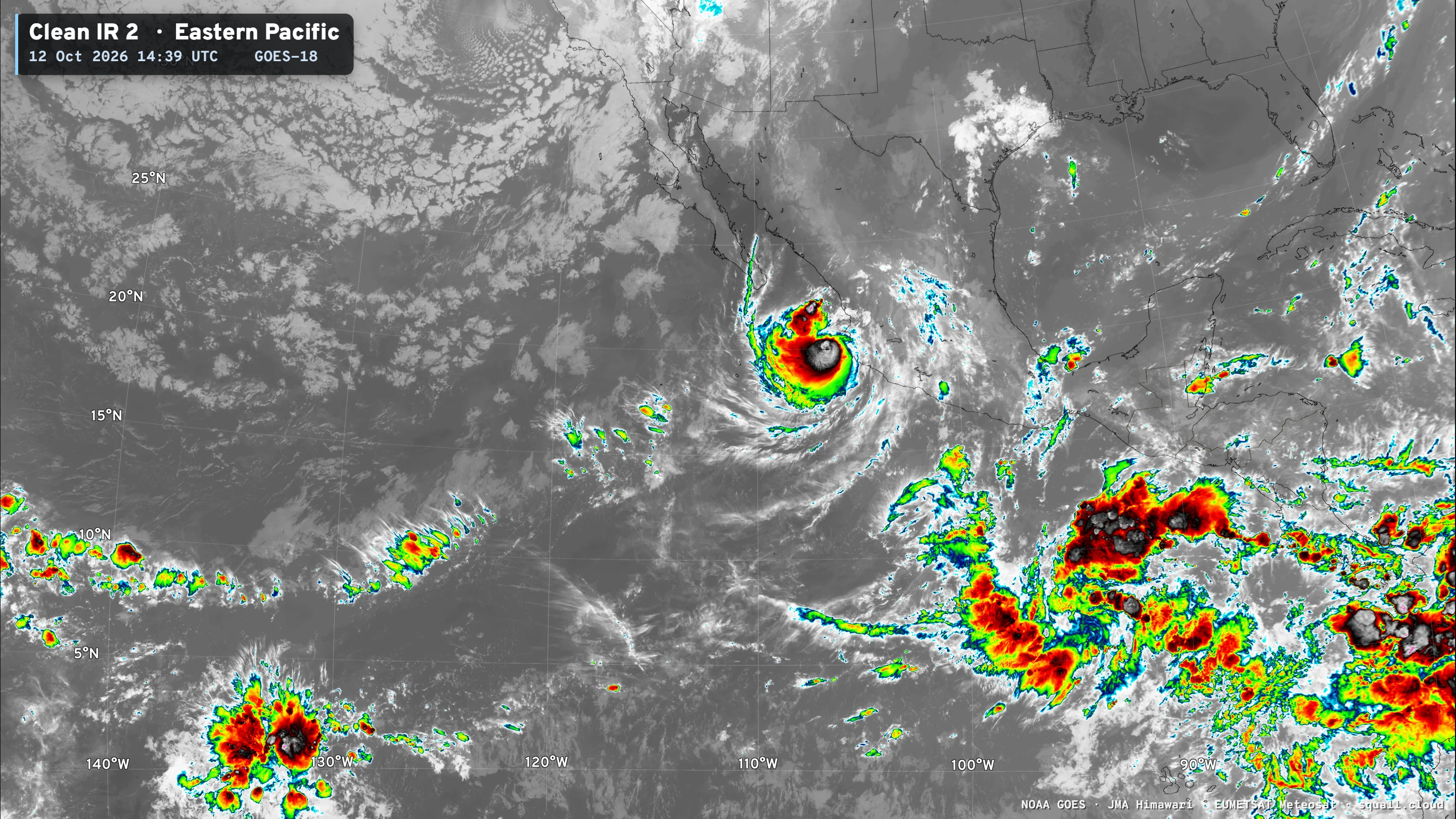
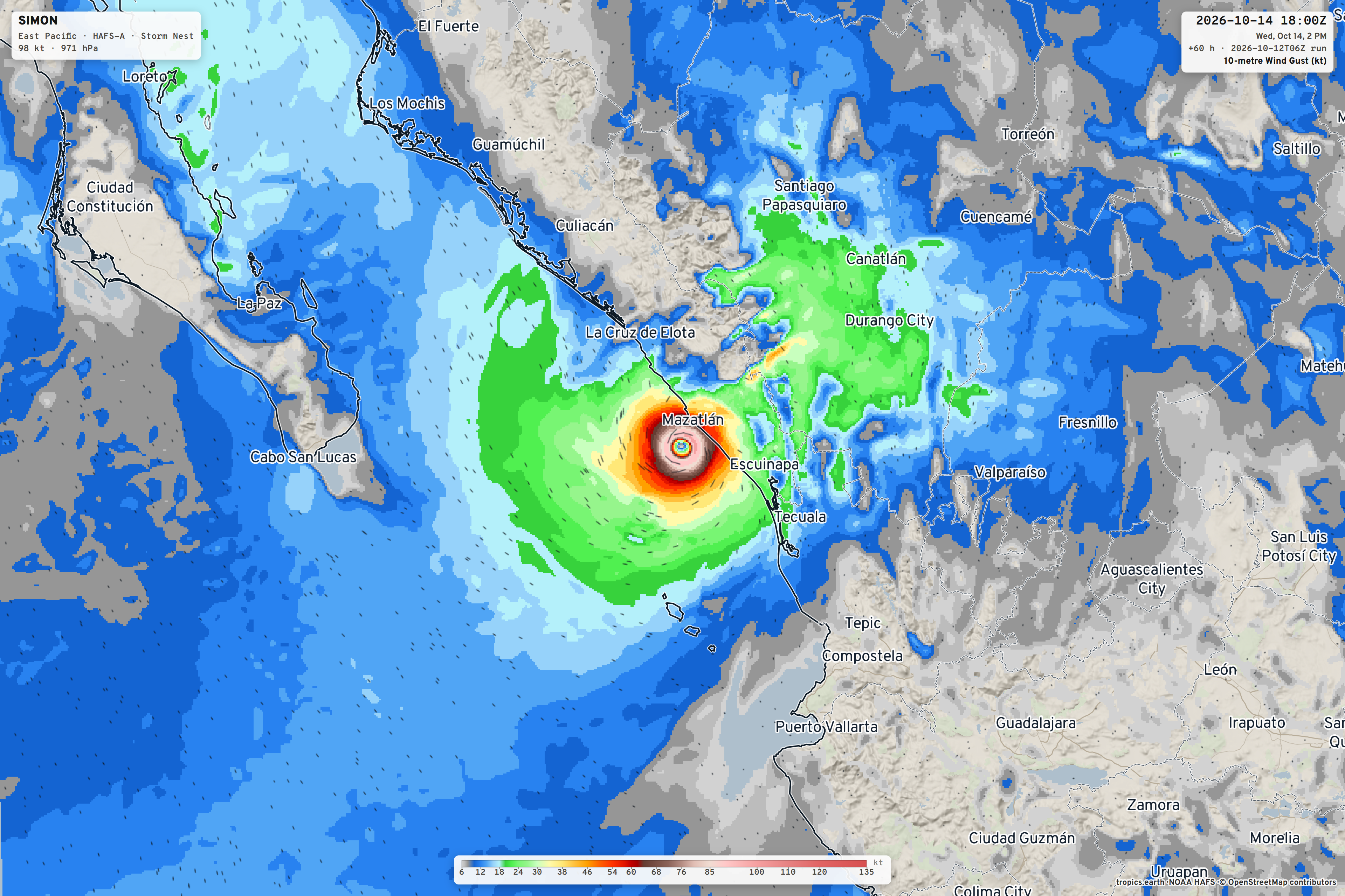
Today, Hurricane Simon churns right along the coast of Mexico, while another system brews —> Invest 93E to become likely major Hurricane Trudy.
Temperature Analysis at 11:30 AM ET
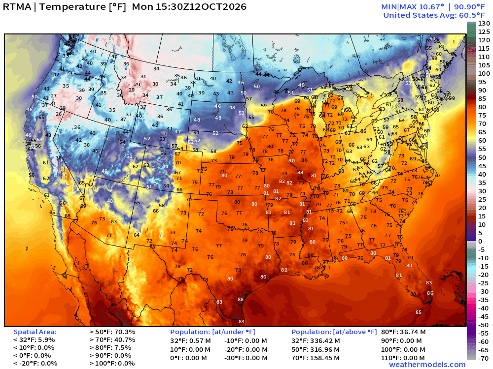
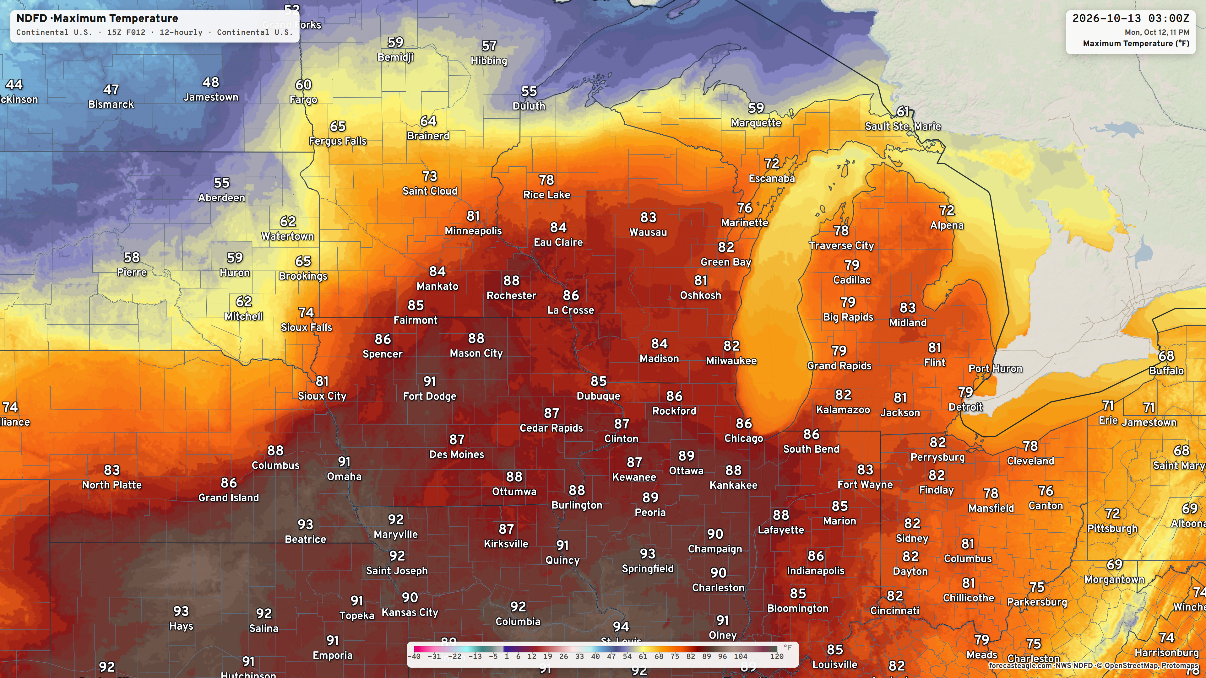
Quite mild / warm across the central U.S. into the Great Lakes with 70s and 80s while the Northeast is comfortably cool. Chilly / cold across the northern Rockies with snowfall.
Temperature Anomaly
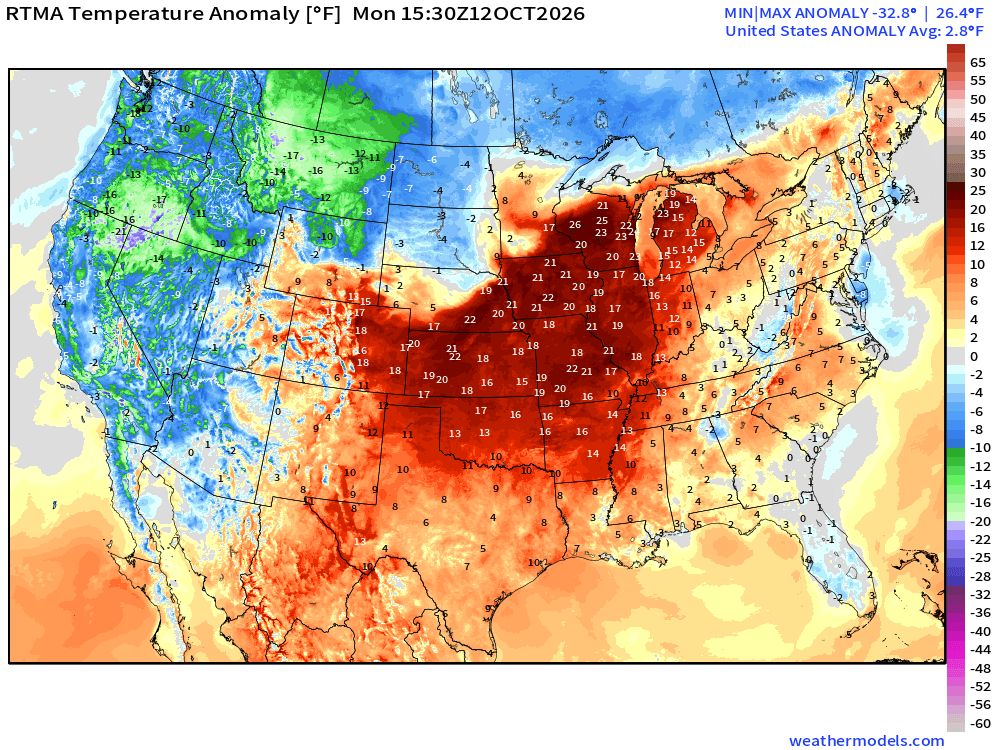
Averaged up across the Lower 48: +2.8ºF above normal — but you can find -20°F relative to normal (the last 30-years) vs. +25°F in Wisconsin
My Favorite Parameter | Precipitable Water Next 6-days
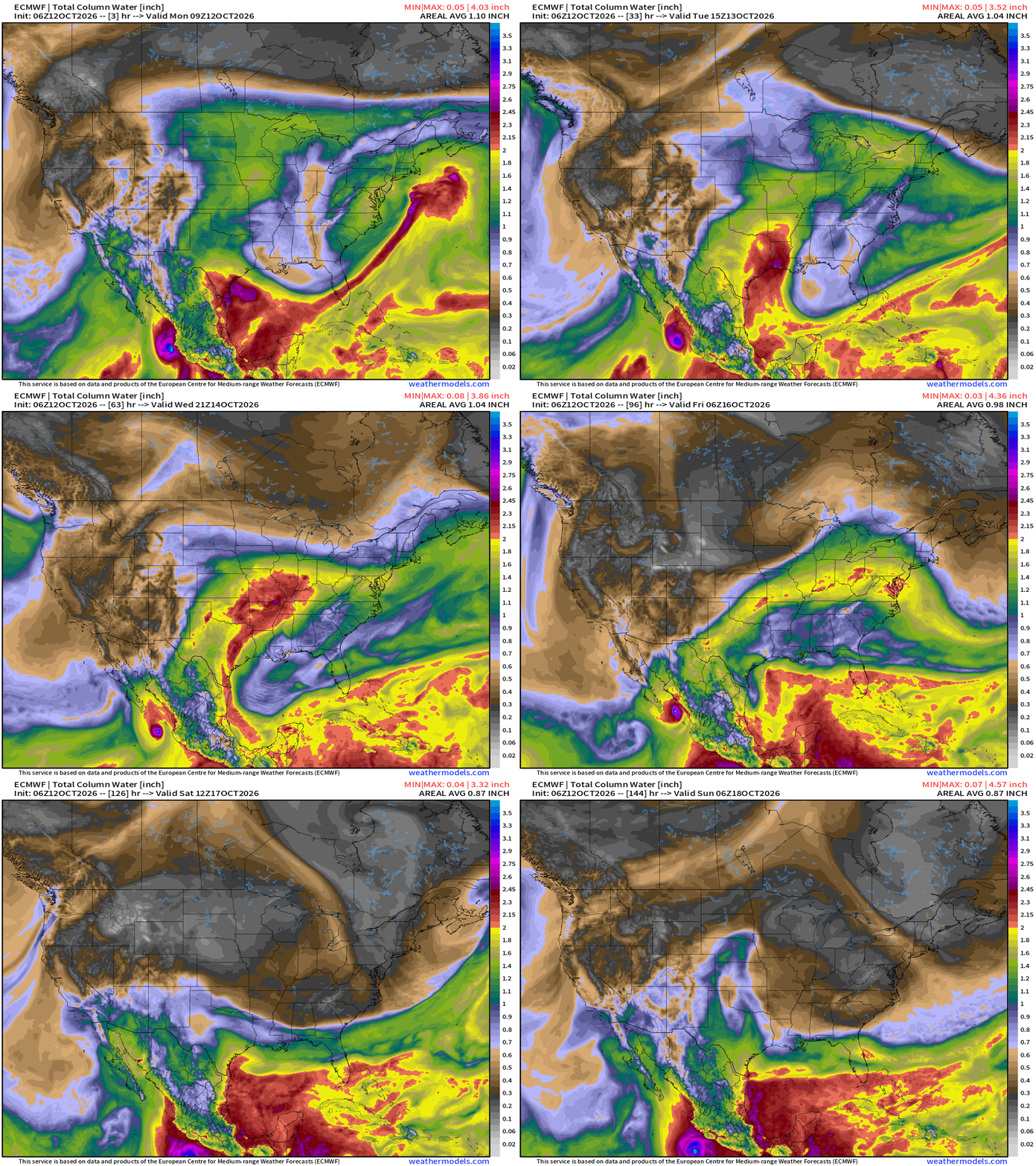
A trough is cutting through the Southeast behind former Hurricane Isaias and finally clearing out the humidity from Florida. A little ridge feature then retrogrades through the western Gulf and tropical moisture is brought northward through Texas into the Central U.S.
Hurricane Simon is very small so its moisture really doesn’t add much to the U.S. Southwest as much of it is wrung out by the mountains in Mexico.
Major trough Friday into weekend crashes through the Midwest, Great Lakes, into the Eastern U.S. with major taste of fall (and some winter).
MSLP Loop Next 6-days
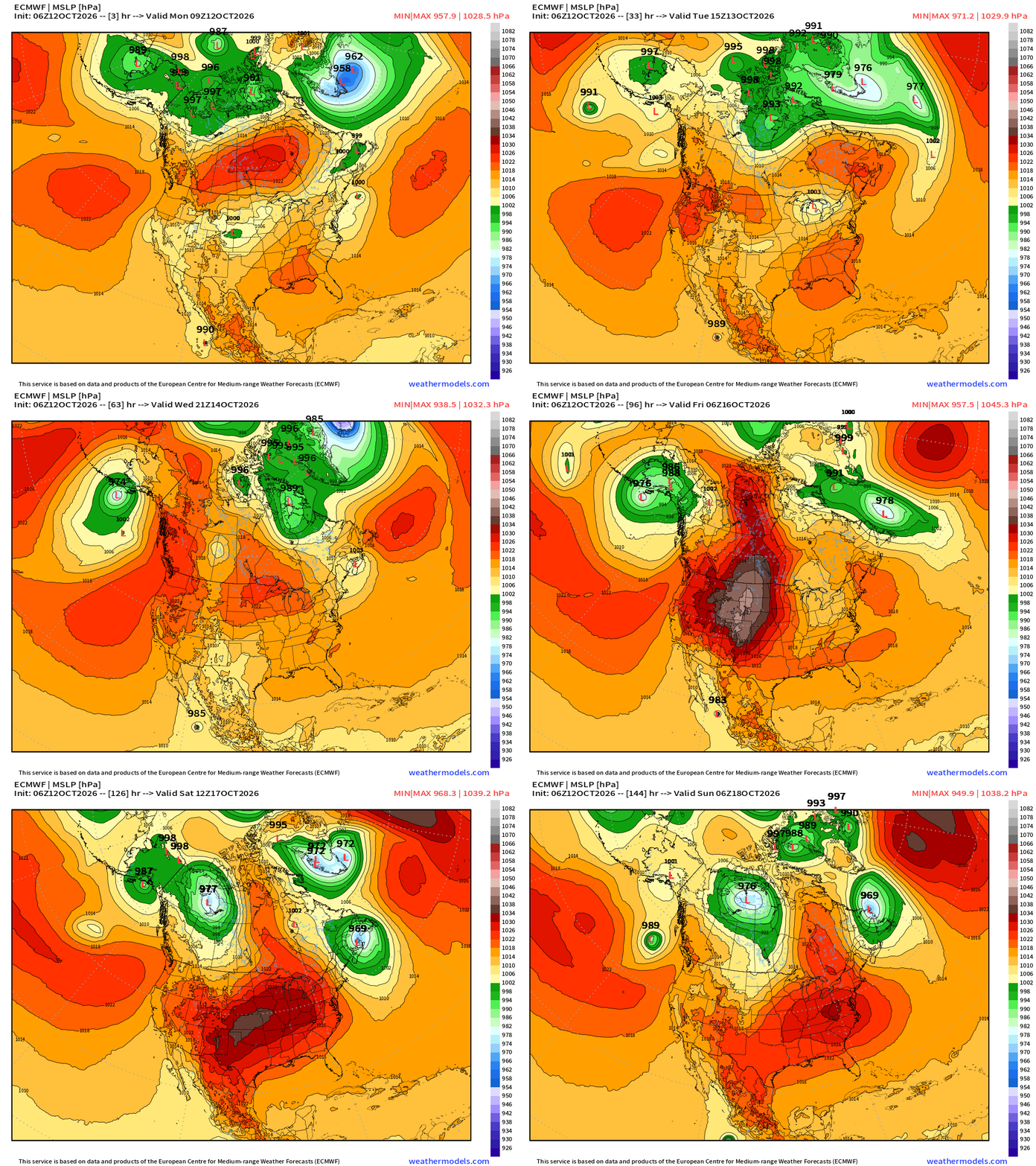
Going to show this North America view of MSLP going into the winter … to highlight various large scale features: interesting to see a strong high pressure cell form in Western Canada and then dip into the Lower 48 — sort of like what we’d see with a winter Arctic blast.
A storm system forms this weekend off New England, and is part of a strong upper-level trough that will help usher in much cooler air out of Canada.
Temperature Anomaly Next 6-days
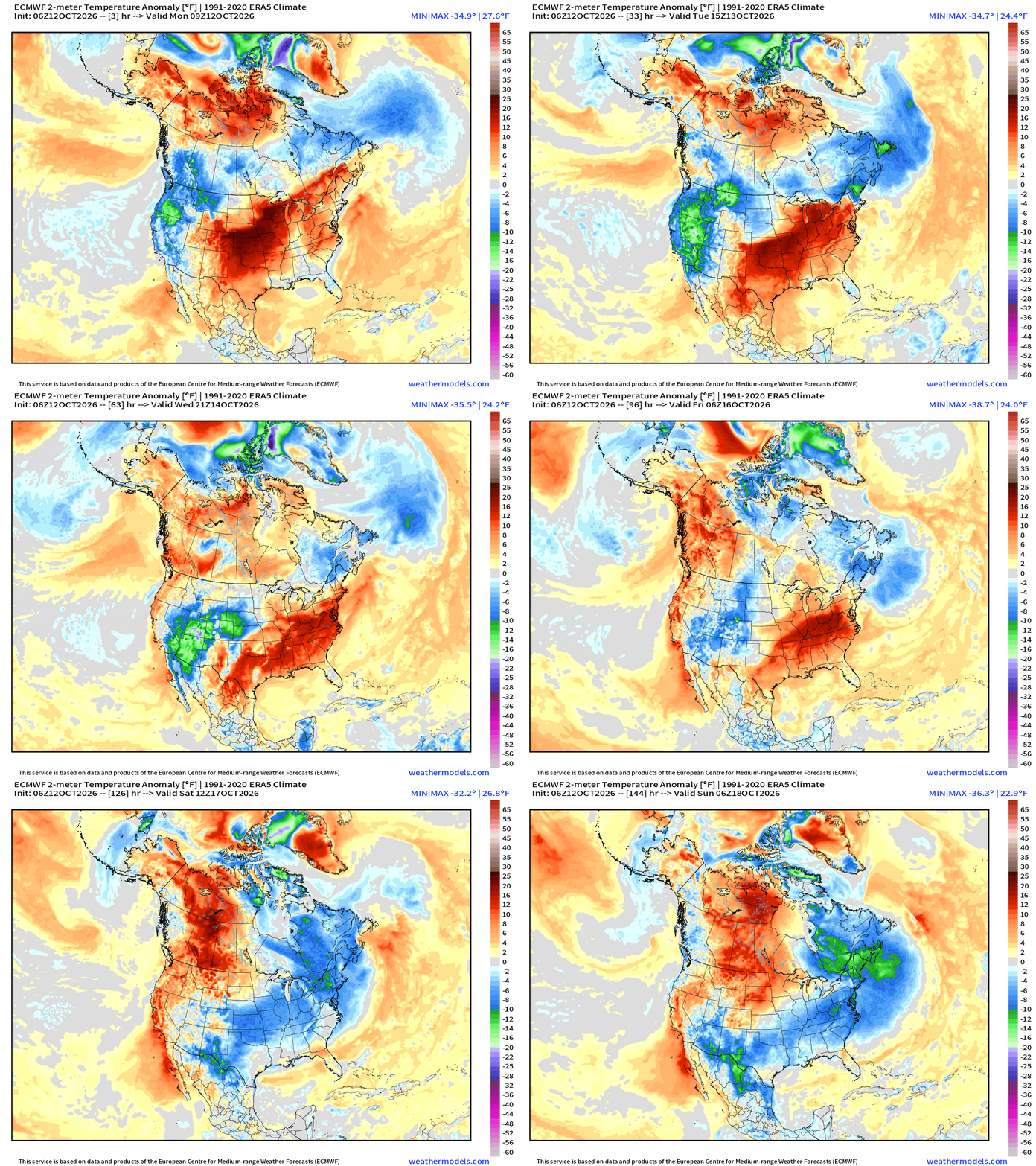
Considerable warmth across the Eastern U.S. is finally wiped out by the Canadian cold front and trough. The next wave of Pacific air follows behind as we are in a typical mid-October progressive weather pattern.
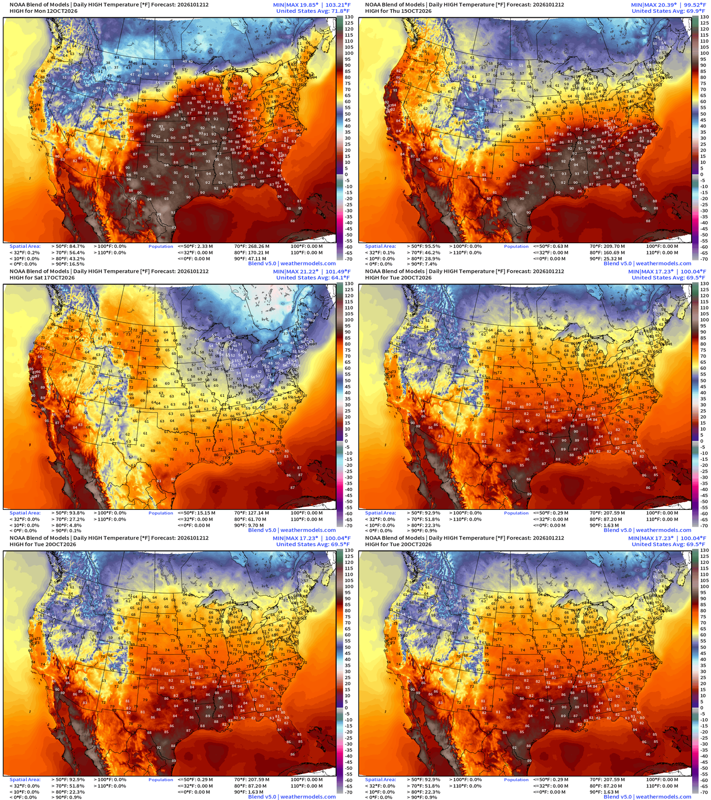
High Temperatures Today | Monday
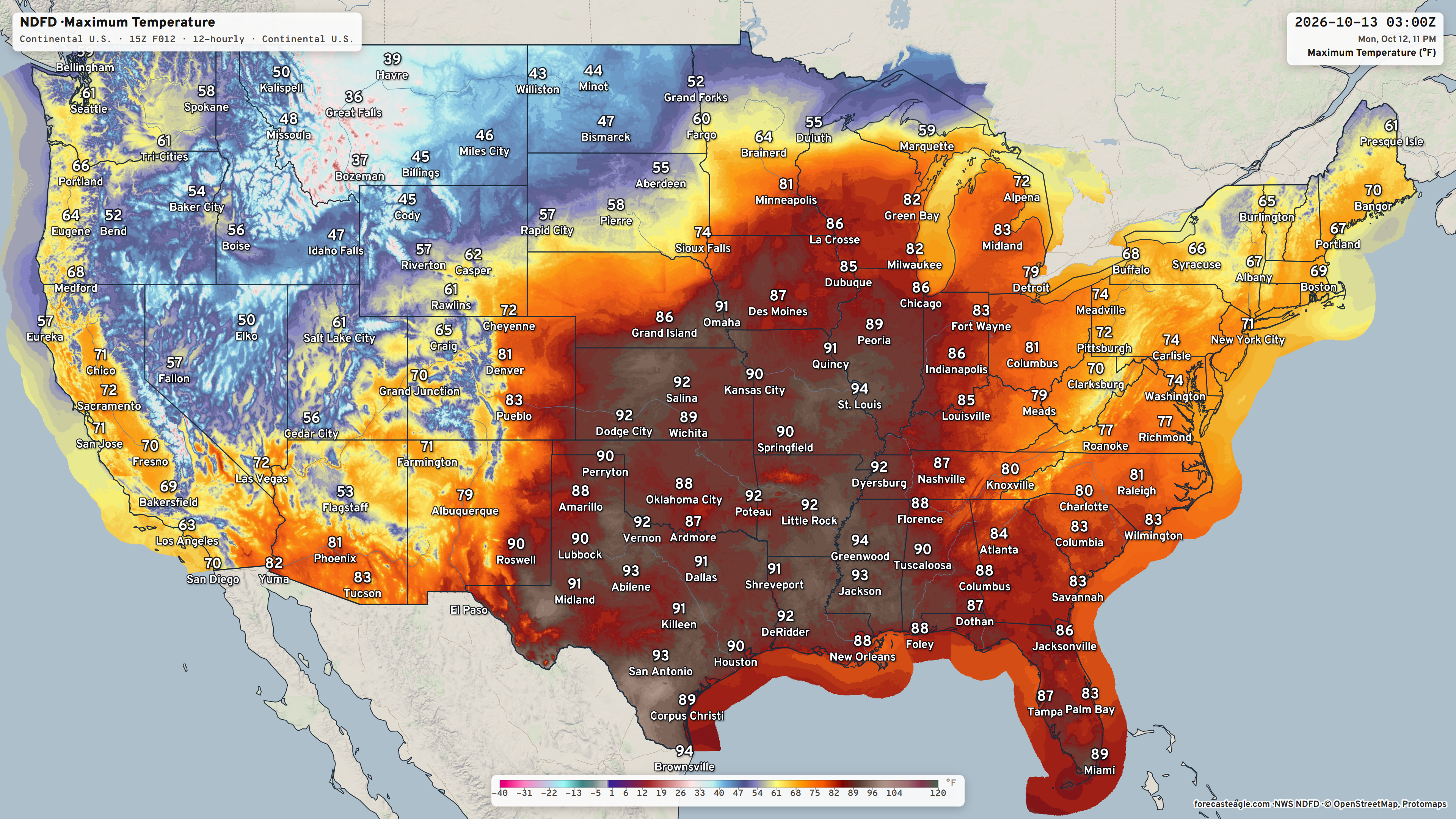
80s and 90s into the Midwest and Great Lakes
Next 48-hours Simulated Radar from old trusty HRRR | 12z
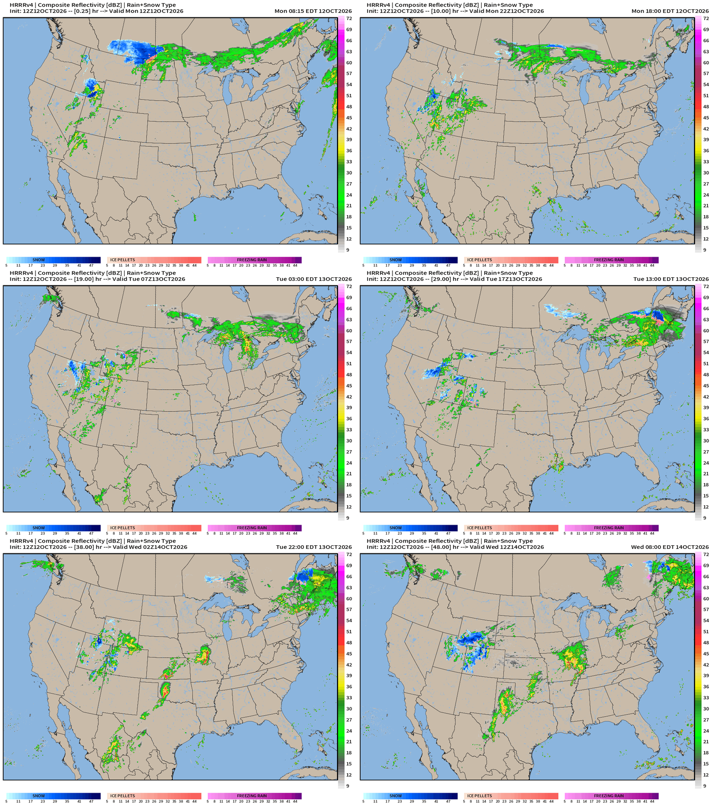
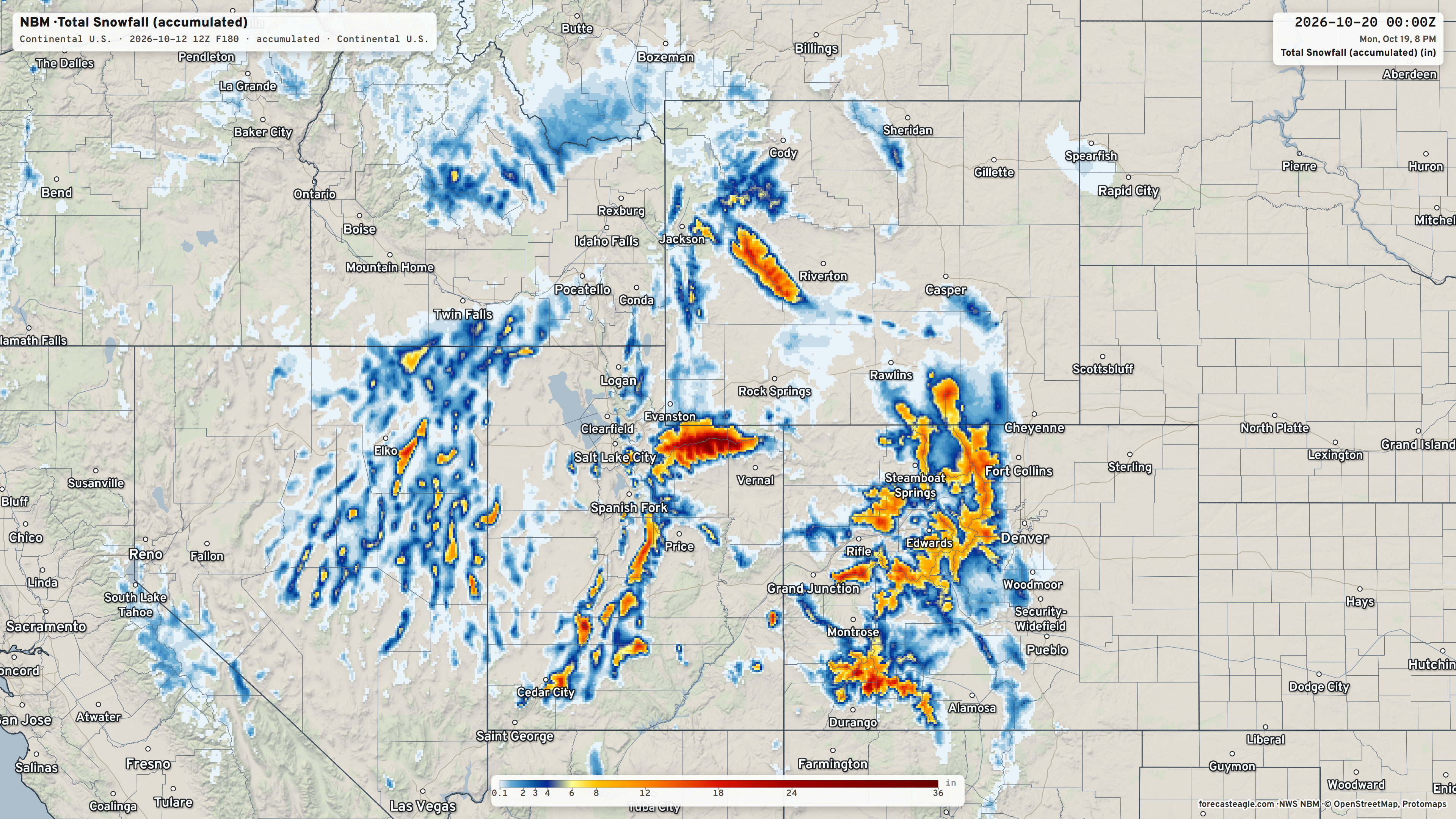
Wonderfully welcome moisture continues to stream into the Great Basin with an area of low pressure swirling over Nevada and Utah —> heavy snowfall. Then, the rain/snow bends eastward along the Canadian border into the Midwest and Great Lakes.
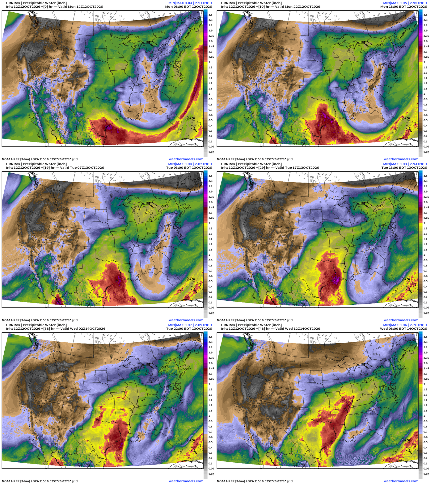
HRRR Precipitable Water next 48-hours shows the trough digging hard into the Southeast / Gulf from east to west.
NDFD 3-day rainfall totals (Forecast Eagle maps)
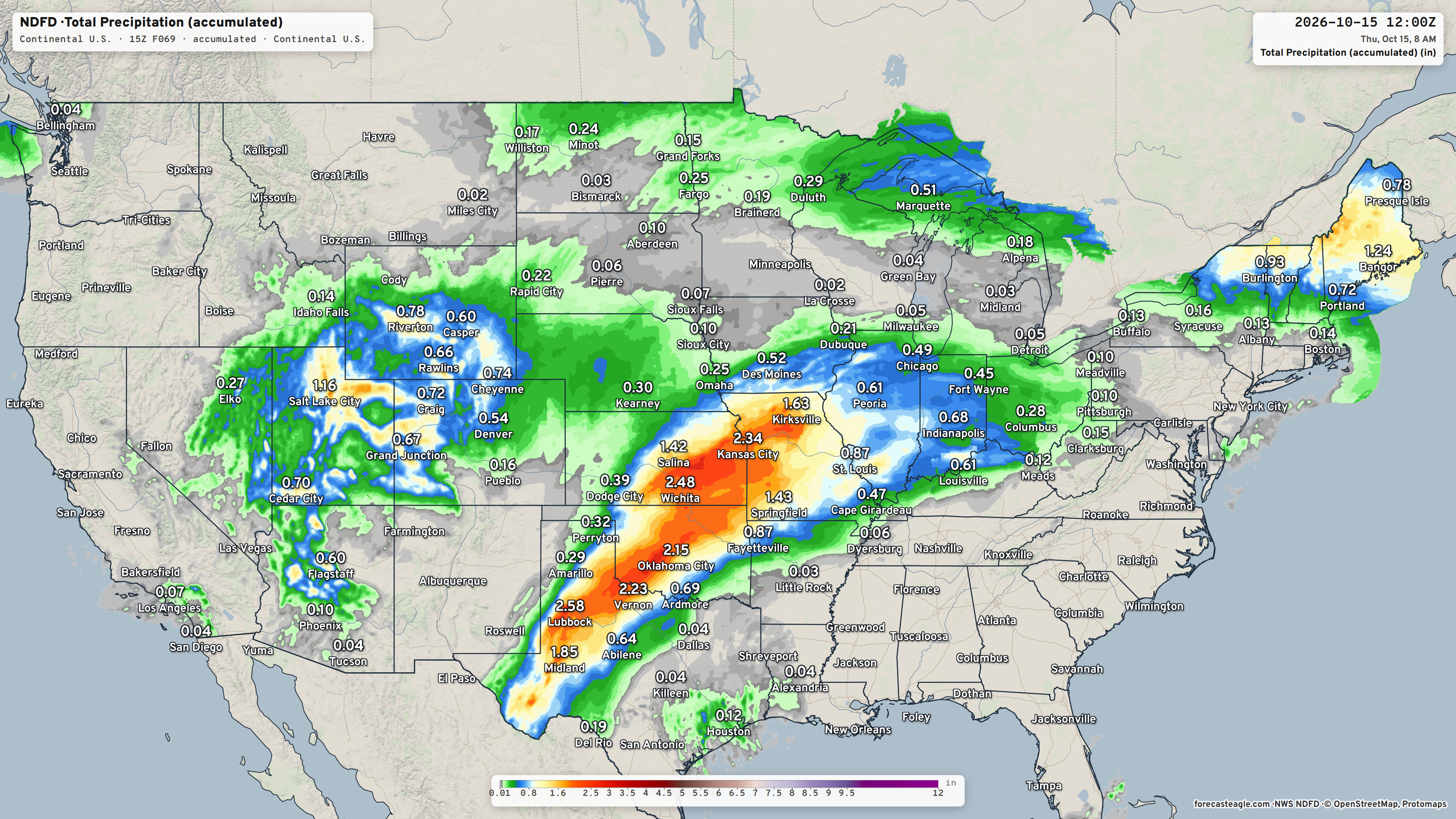
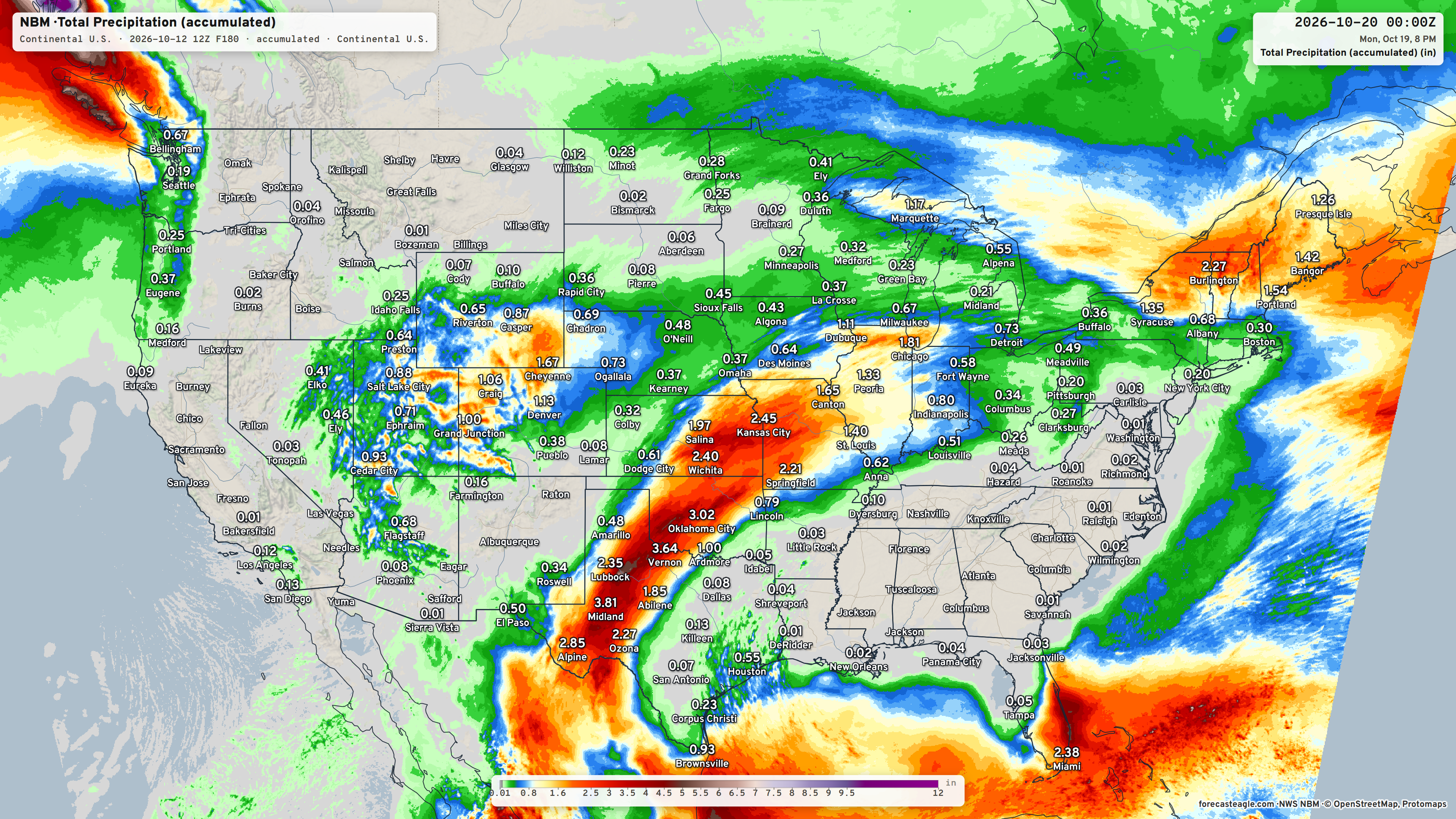
7-day Total Rainfall Blend of Models from Forecast Eagle
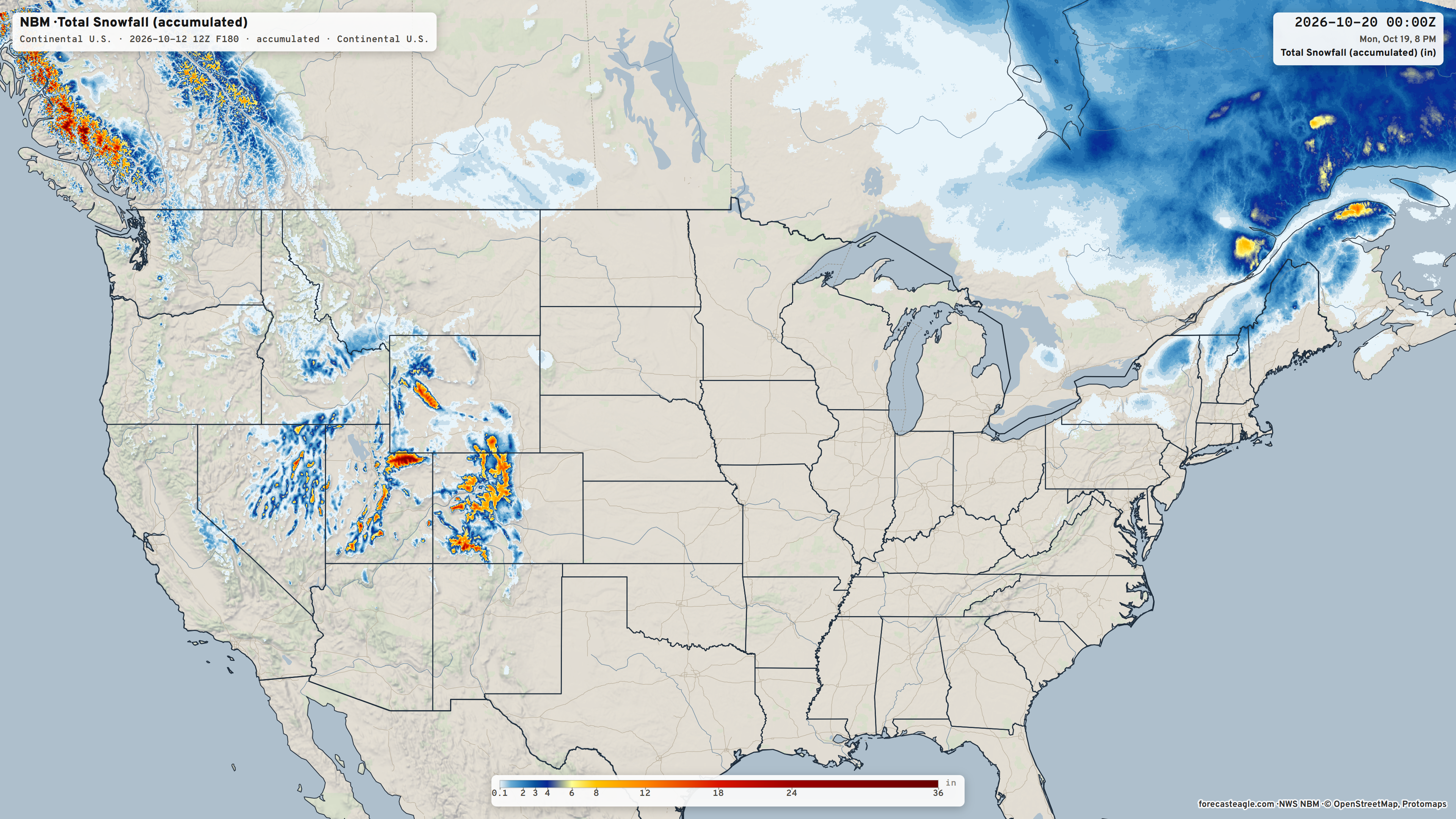
7-day total Snowfall Blend of Models
After Montana (Great Falls) got well over a foot of snow, the colder air is now far enough south to dump moisture out as heavy snow over Nevada, Utah, and Colorado.
Integrated Vapor Transport Next 10-days | AIFS 06z Flagship Model
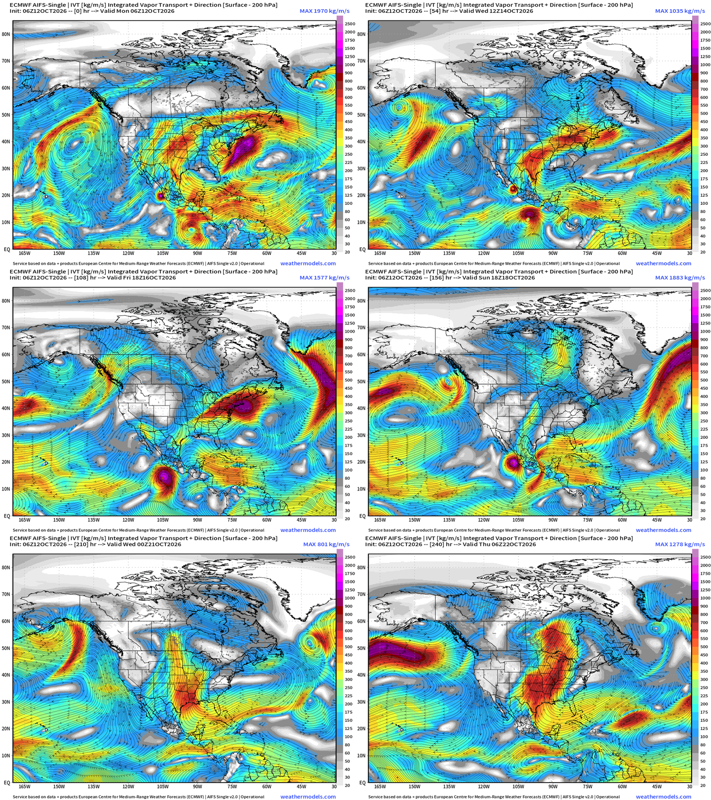
Trudy forms — and looks to make landfall right near Simon’s current position. Flow from the east across the Gulf from the Atlantic then bends northward into Texas and the central U.S. keeping the southern U.S. warmer/moister into mid-October battling back any troughs from Canada as minor blips.
Height Anomaly next 10-days | AIFS 06z
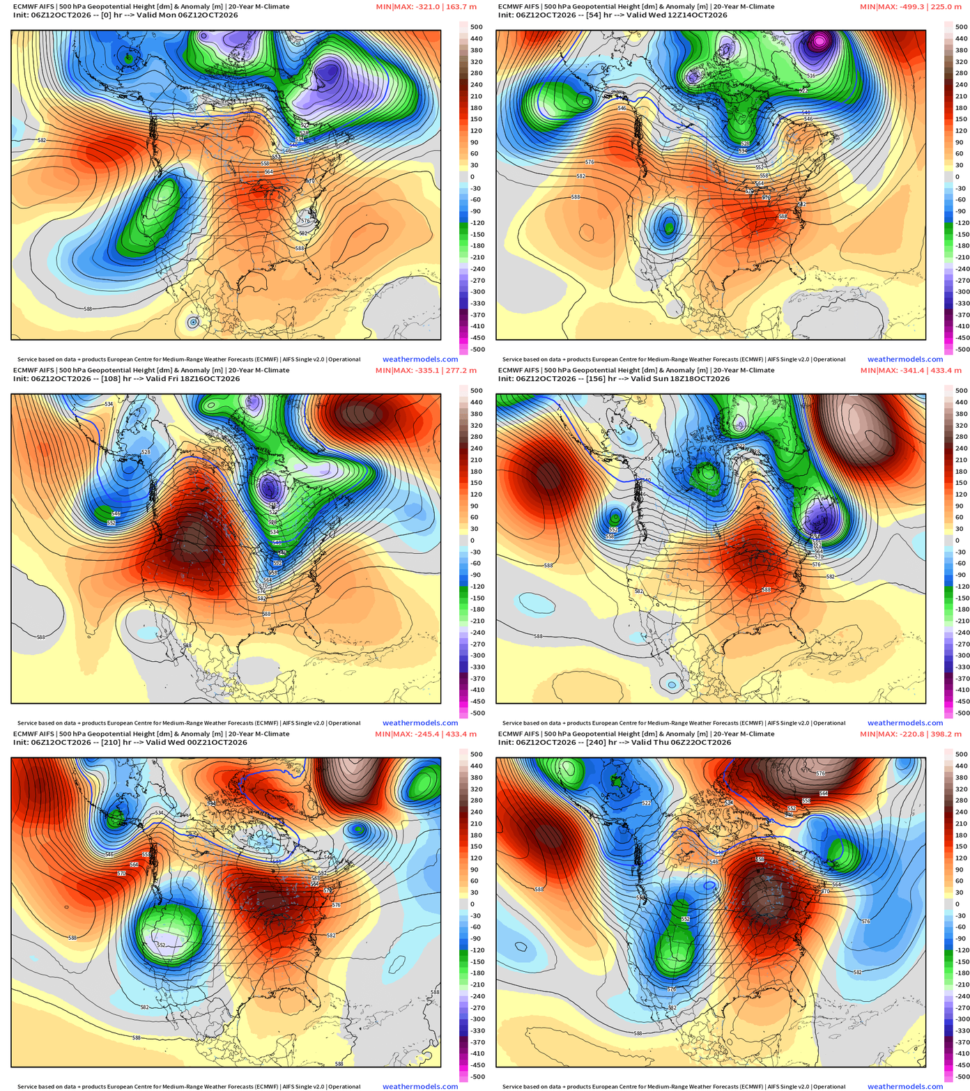
Upper-level pattern is much more progressive heading into mid-October across North America. Mobile troughs/shortwaves + ridges operate on 2-3 day time scales, and we have changeable weather = more exciting.
Also, note the patterns tend to repeat — with the heating and convection in the Pacific tropics forcing downstream Rossby wave response —> highly amplified pattern into Week 2! Since this mostly Pacific influenced / origin air + the Gulf of Mexico moisture channel —> much warmer than normal temperatures take control.
High Temperatures Next 9-days
Week 1 Temperature Anomaly | Oct 12 - Oct 18
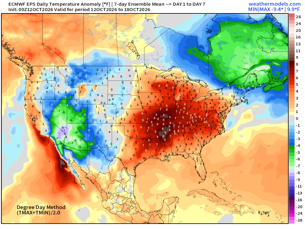
Western Trough —> cool and even snowy in the northern Rockies, very warm in the central and eastern U.S.
Week 2 Temperature Anomaly | Oct 19 - Oct 25
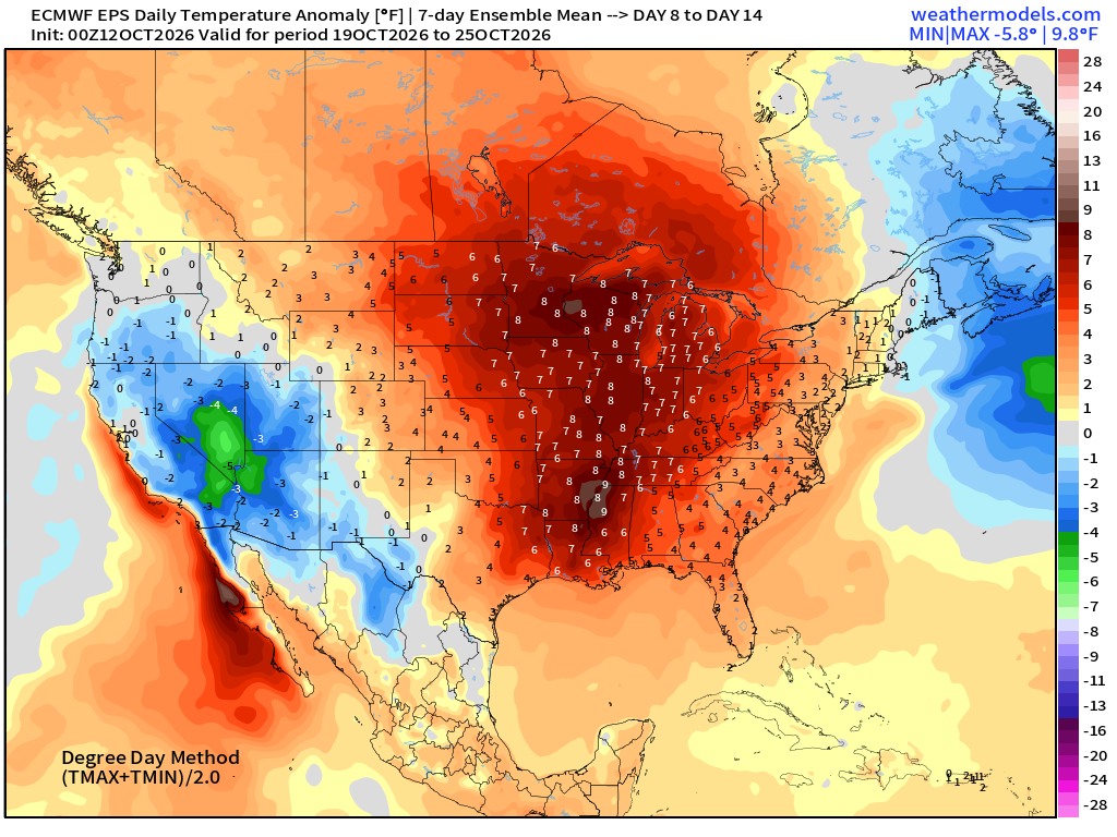
Significantly above normal temperatures continue into final week of October
Atlantic Tropical Outlook
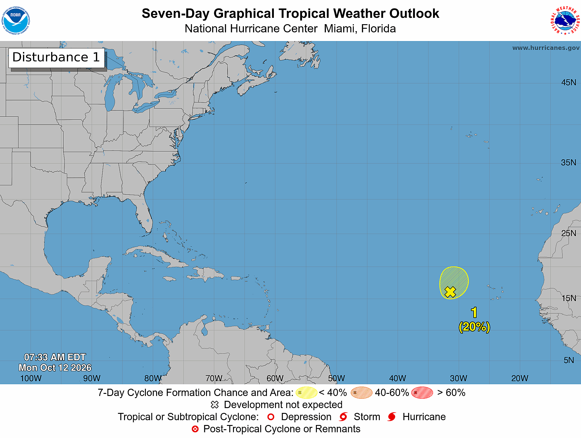
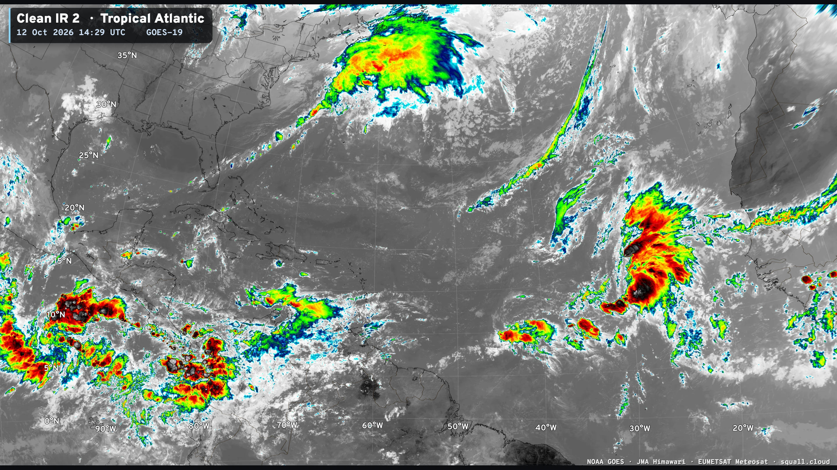
Strong tropical wave interacting with upper-level trough firing a lot of convection — but only 20% chance of development.
Atlantic Satellite shows the tropical wave — only show in town
ECMWF Ensemble 00z full-physics tracks next 15-days
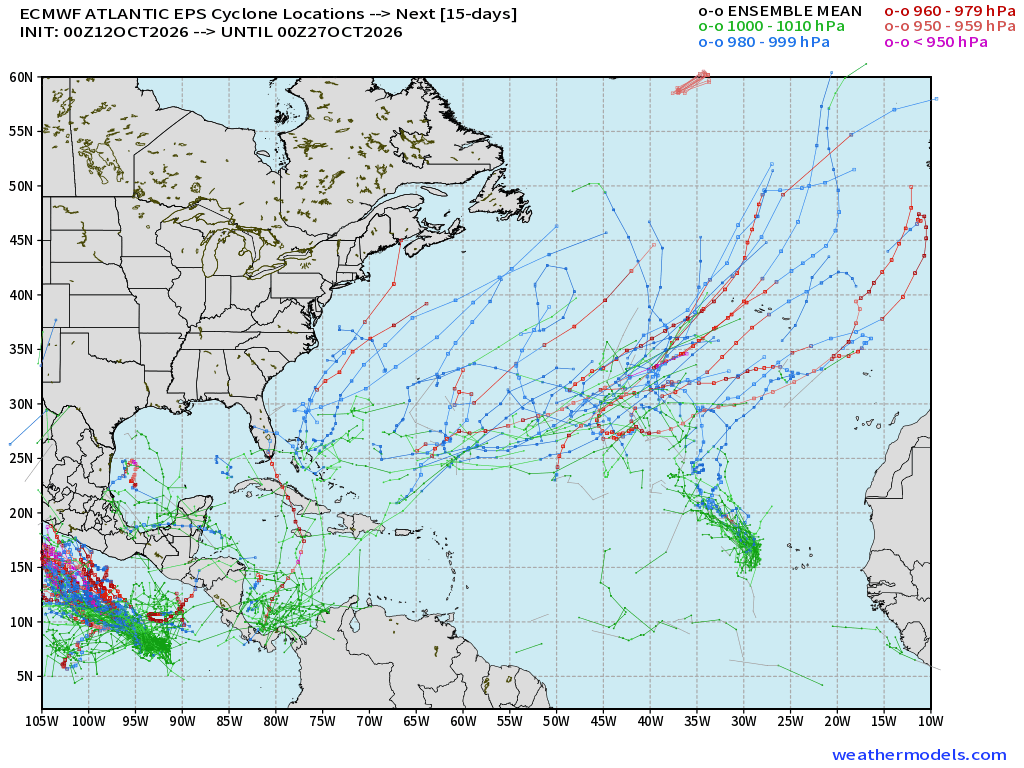
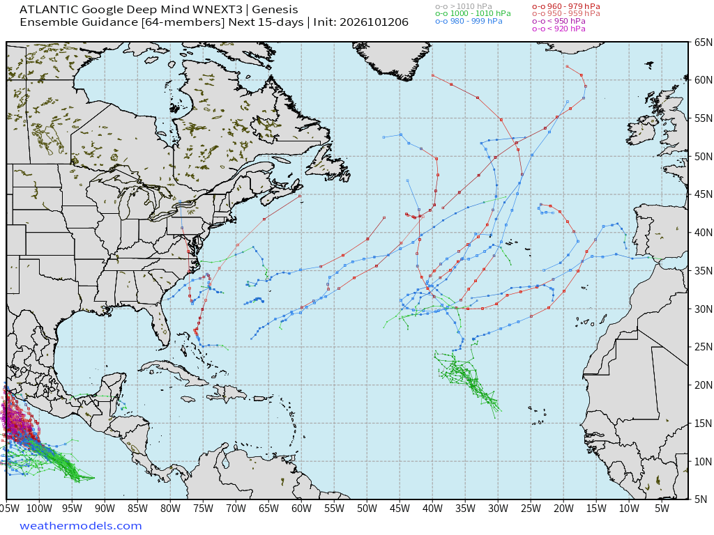
Quite a bit of subtropical activity again showing up in the full-physics system, but the Gulf has almost entirely cleared out of members showing development in next 15-days
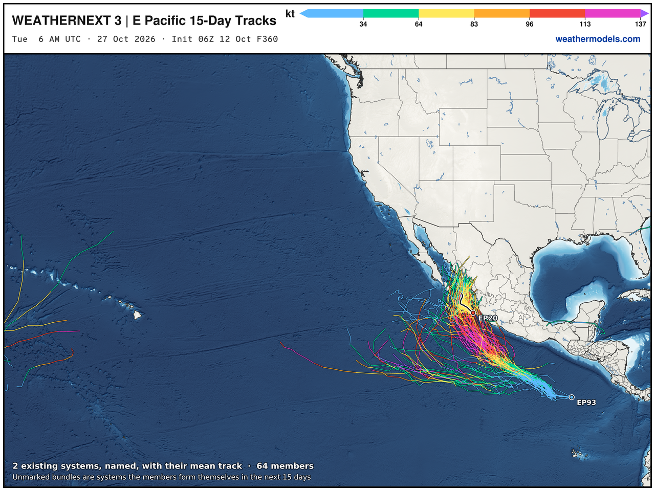
Google Deep Mind | Weather Next 3 | 06z Tracks (64-members)
Eastern Pacific Tropics | Simon and soon Trudy
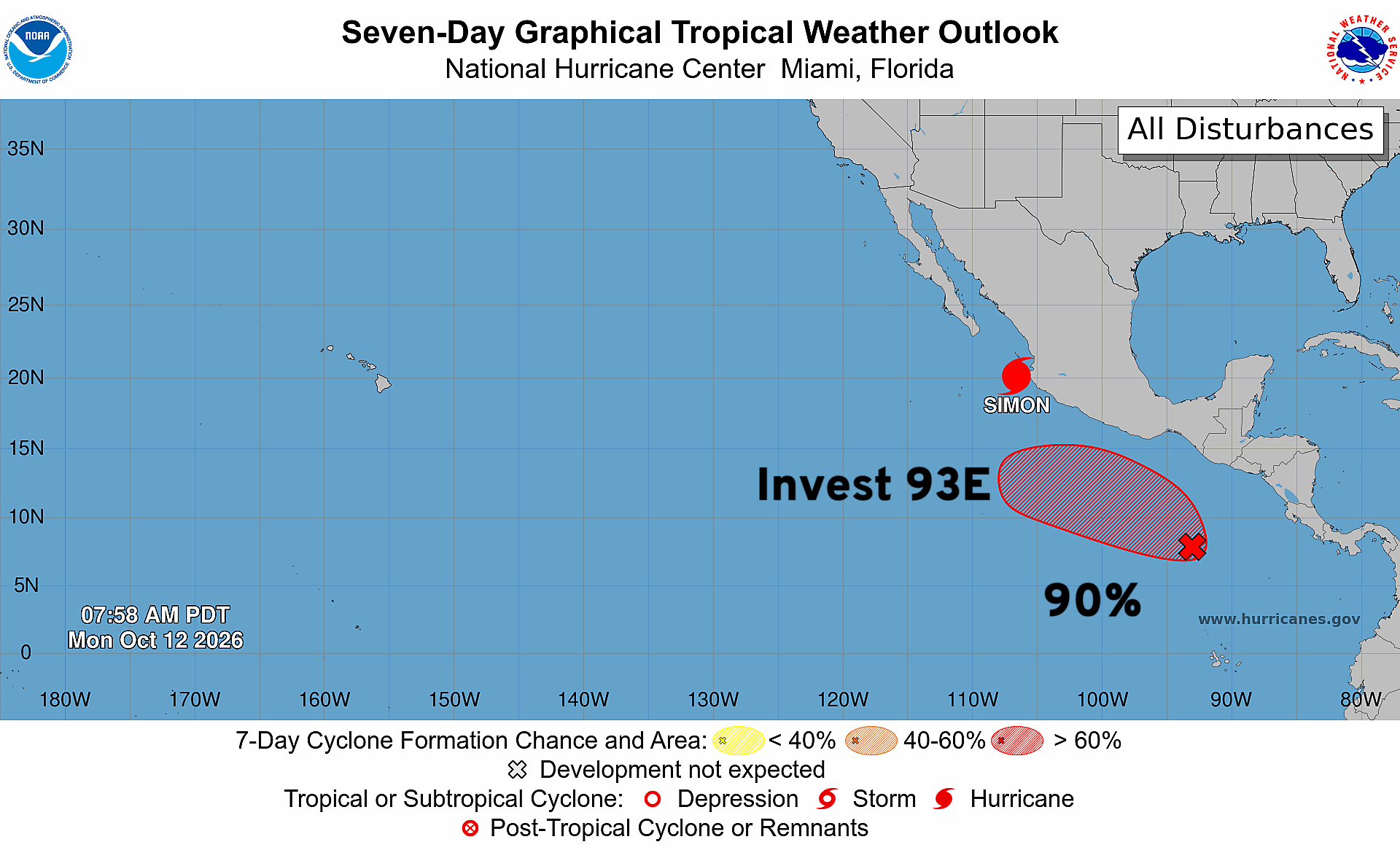
Next storm is Trudy … and Invest 93E now has a 90% of development (sure thing)
Category 2 Hurricane Simon | 110 mph Winds | 962 mb
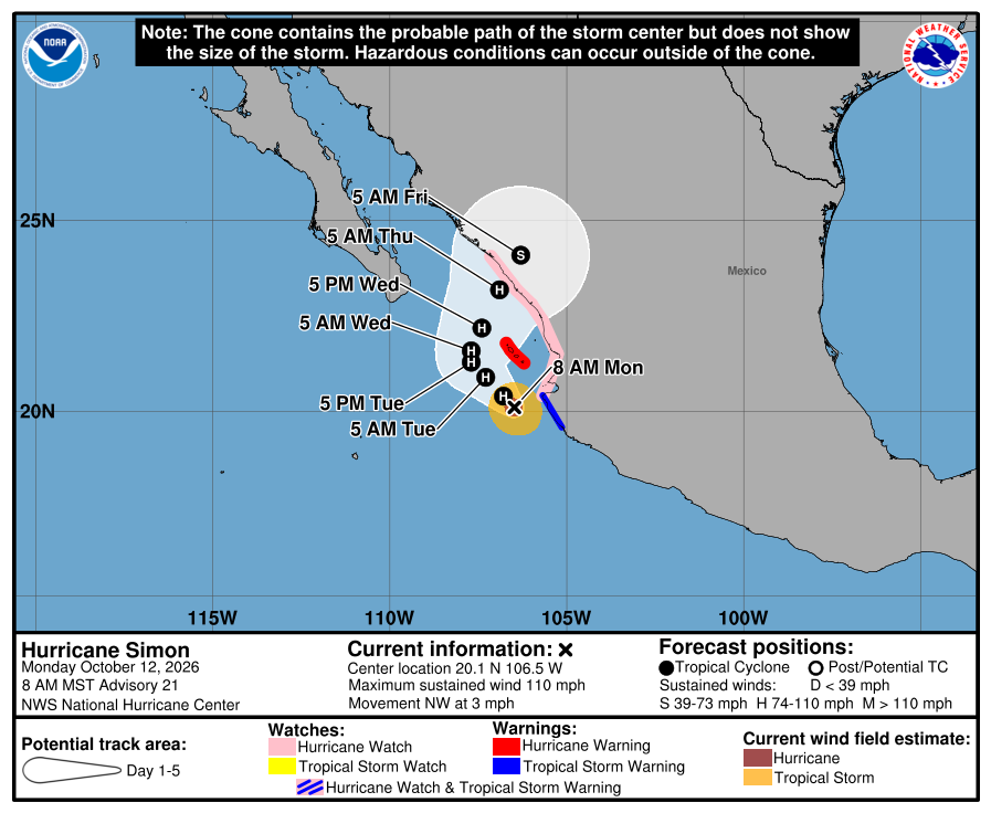
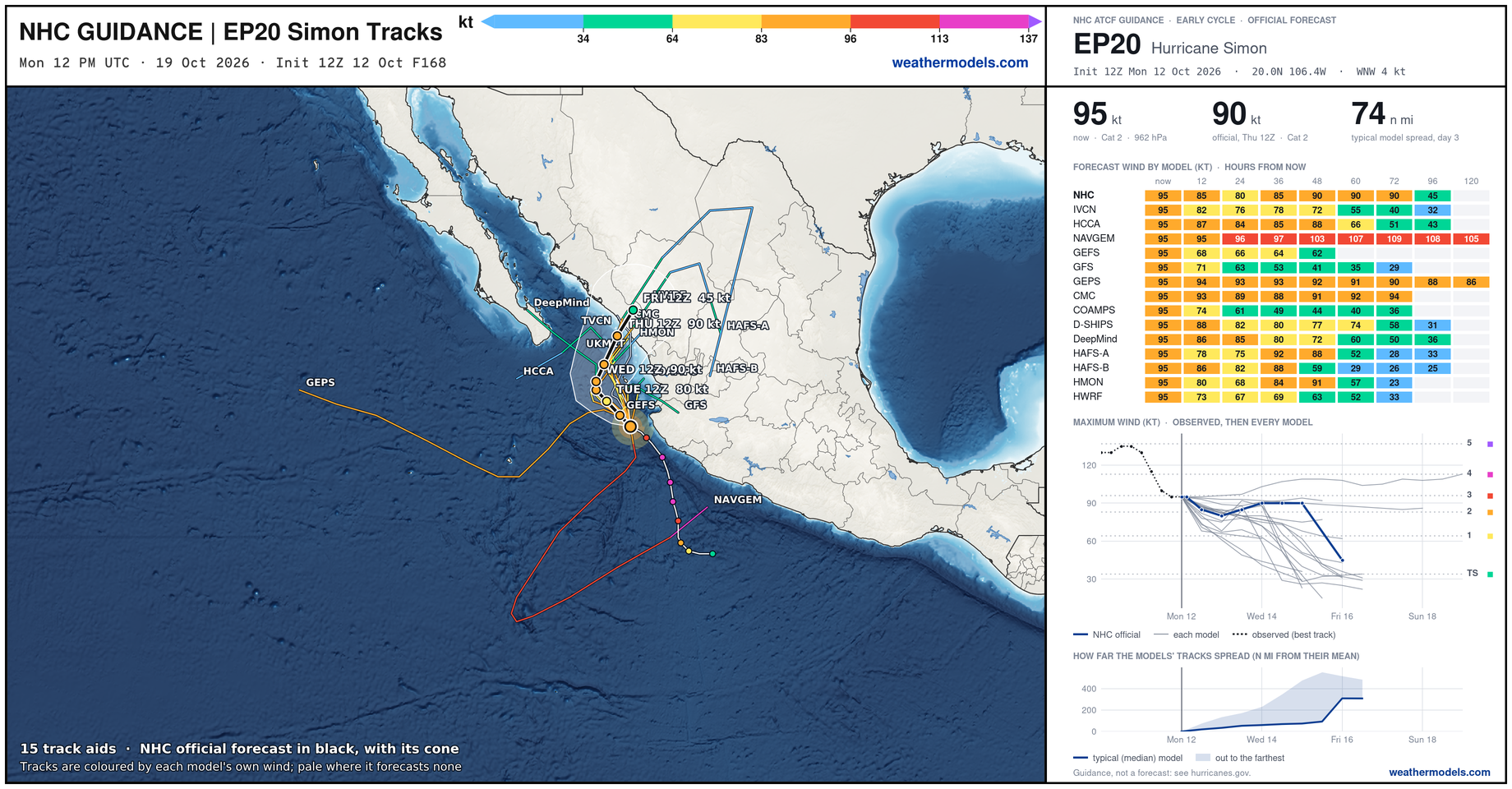
Simon could easily become a major hurricane again — perhaps Category 4 as these very small systems can rapidly fluctuate up and down intensity.
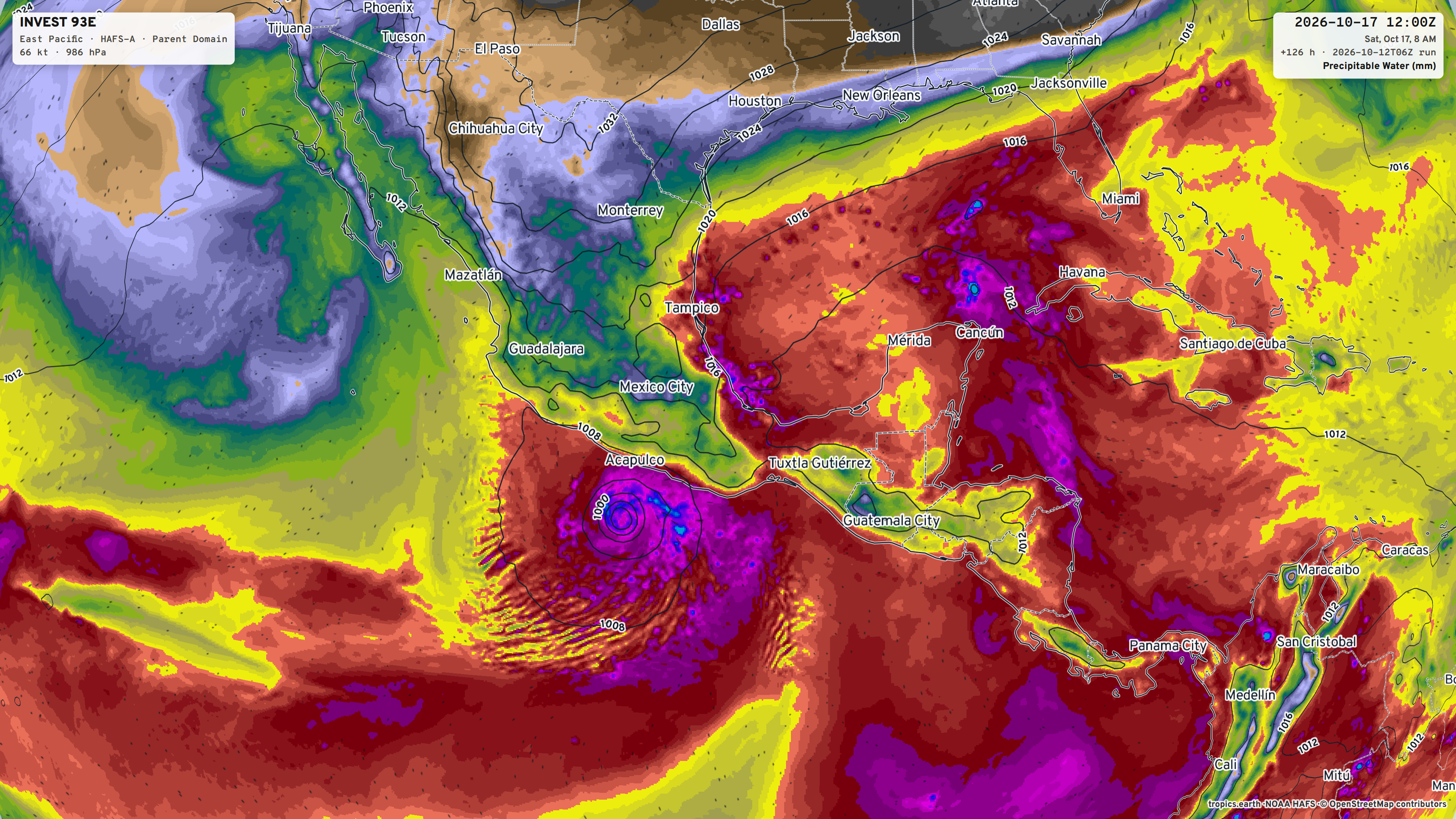
Invest 93E —> Hurricane Trudy on a similar course as Simon in next 7-10 days
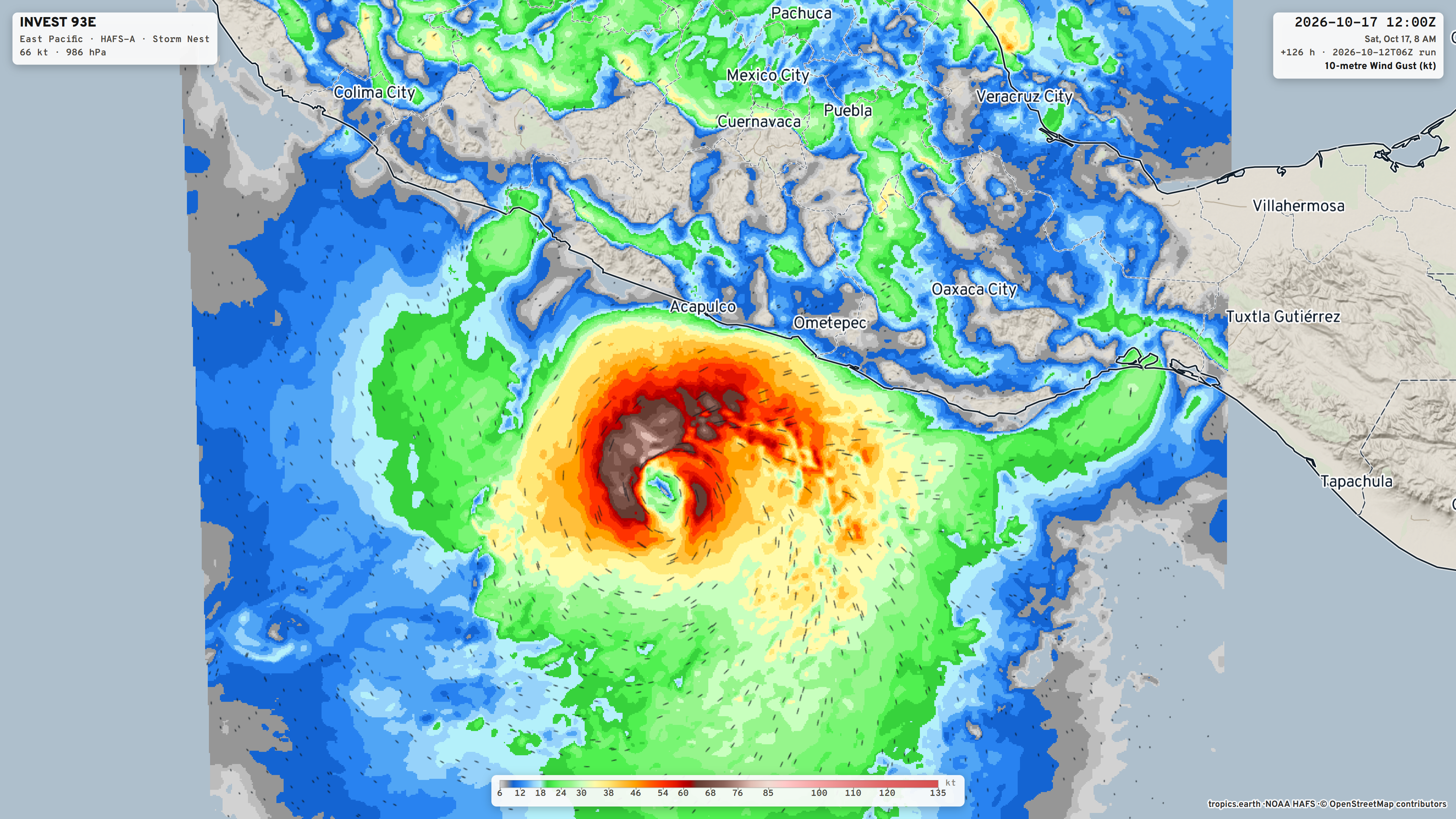
Trudy will be south of Acapulco in 5-days — Saturday as a hurricane
Trudy will be much larger than Simon.
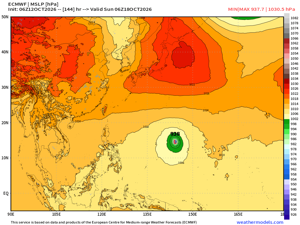
Western Pacific Tropics
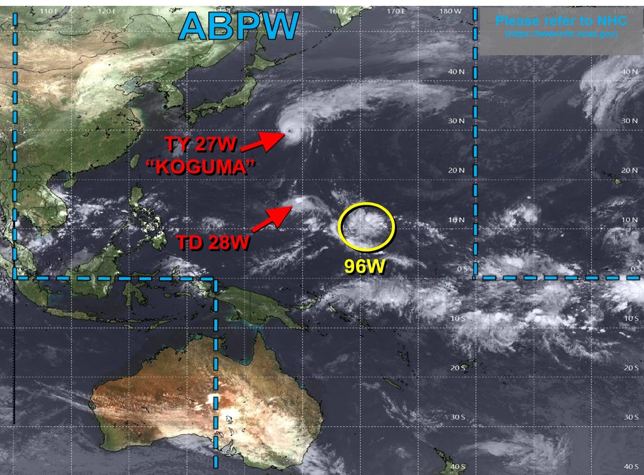
TD 28W is not expected to amount to much, but holy moly, Invest 96W sure will!
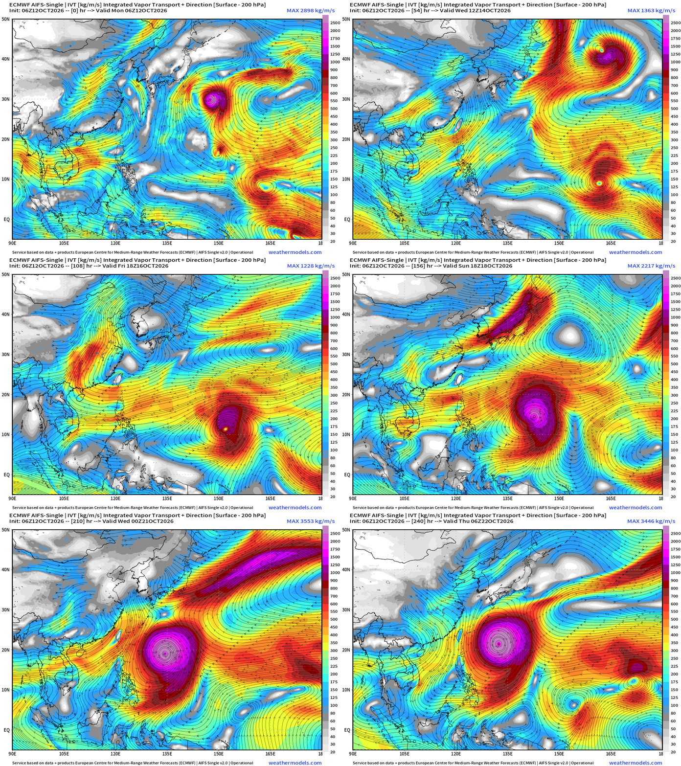
All systems go for a monster Super Typhoon — easily Category 5 heading WNW from the far eastern corner of the WPAC basin. Plenty of warm water, untapped oceanic heat content … expect sub-900 mb pressure.
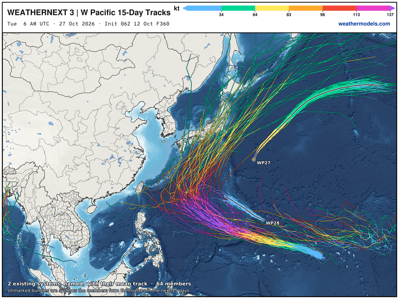
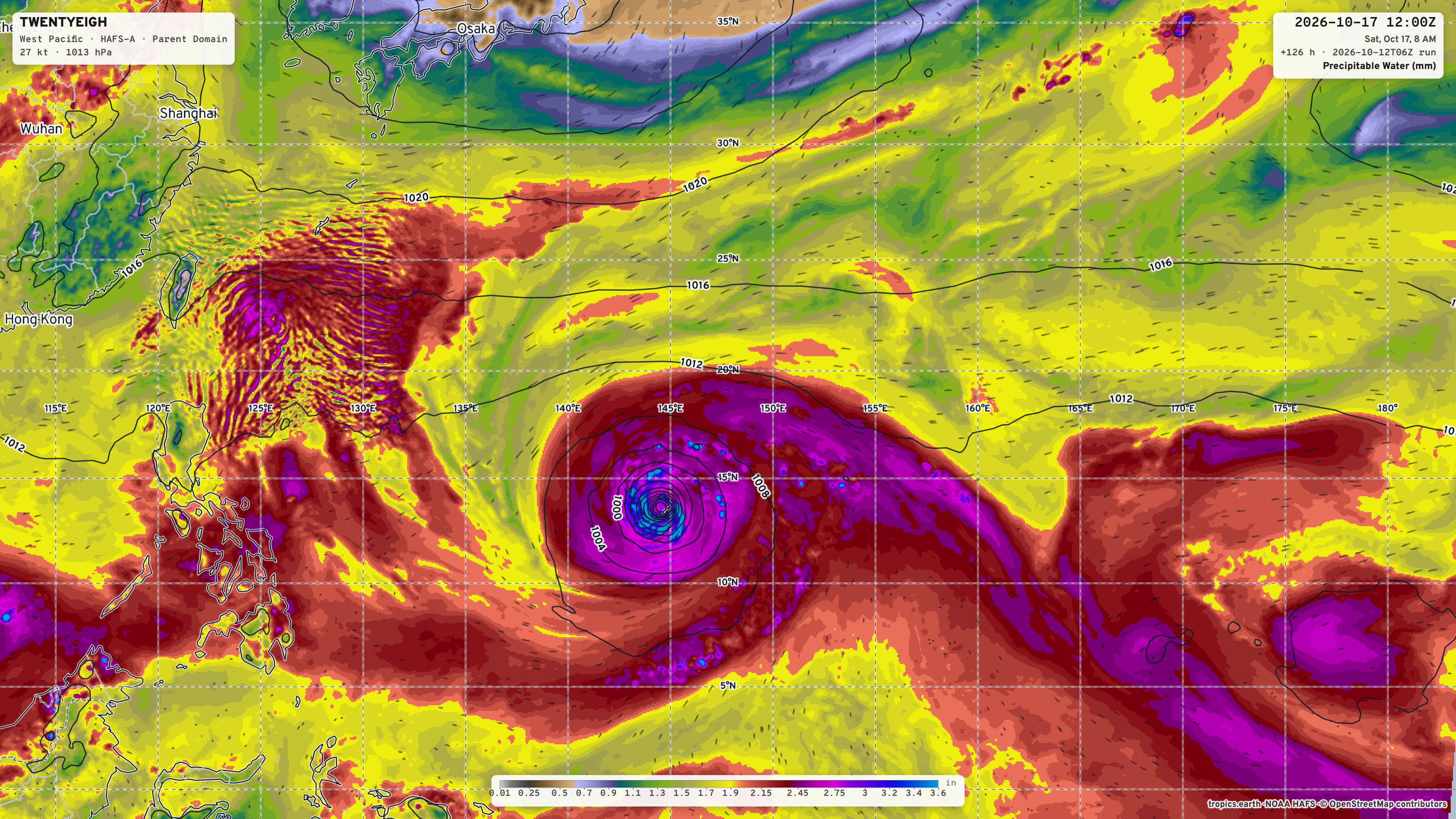
Already 938 mb in 6-days from ECMWF 06z modeling
Visit Global Tropical Cyclones for more ACE information, as well as my original climatlas.com/tropical site with much new research including a calibrated “Best Track” and historical tropical cyclone browser with plenty of interesting features like rankings of storms by their IKE (size). ACE up to 812.

Satellite imagery from Squall Cloud. Maps sourced from weathermodels.com designed and innovated by yours truly! Please subscribe there for real-time access to the newest maps, charts from all of the weather models including ECMWF and AIFS, and NOAA GFS/GEFS, HRRR/RRFS and Blend of Models (NBM). NOAA WPC and SPC for fronts/convective outlooks. Our own content is now sourced from hottestsince.com and weather.city and celsius.earth, and squall.cloud and weather.football and global-tropical-cyclones.com and precip.earth and forecastcanada.com
My Atlantic Hurricane Season Forecast (2026)
From April 7, 2026: Atlantic Seasonal Hurricane Forecast: (11/5/2)
9-13 Named Storms (11 most likely)
4-7 Hurricanes (5 or 6 most likely)
1-3 Major Hurricanes (2 most likely)
Accumulated Cyclone Energy: 75-85 (well below normal)
NOAA 2026 Atlantic Hurricane Season Forecast
- Milepost
- 1622 · laid 2026-10-12T17:06:10Z
- Source
- https://weather.substack.com/p/october-12-2026-monday-weather-update · October 12, 2026 Monday Weather Update
- Tagged
- I-32 Winter · Winter 2026–27 · Eastern U.S. (37.0, -78.0) · by rule, at build
- Digest
- 88ebc00db508f2bed5c557b85c1bcea26a8a31fe49076b6ab3fa401743b80ec2