First significant taste of winter chill and precipitation for the Eastern US

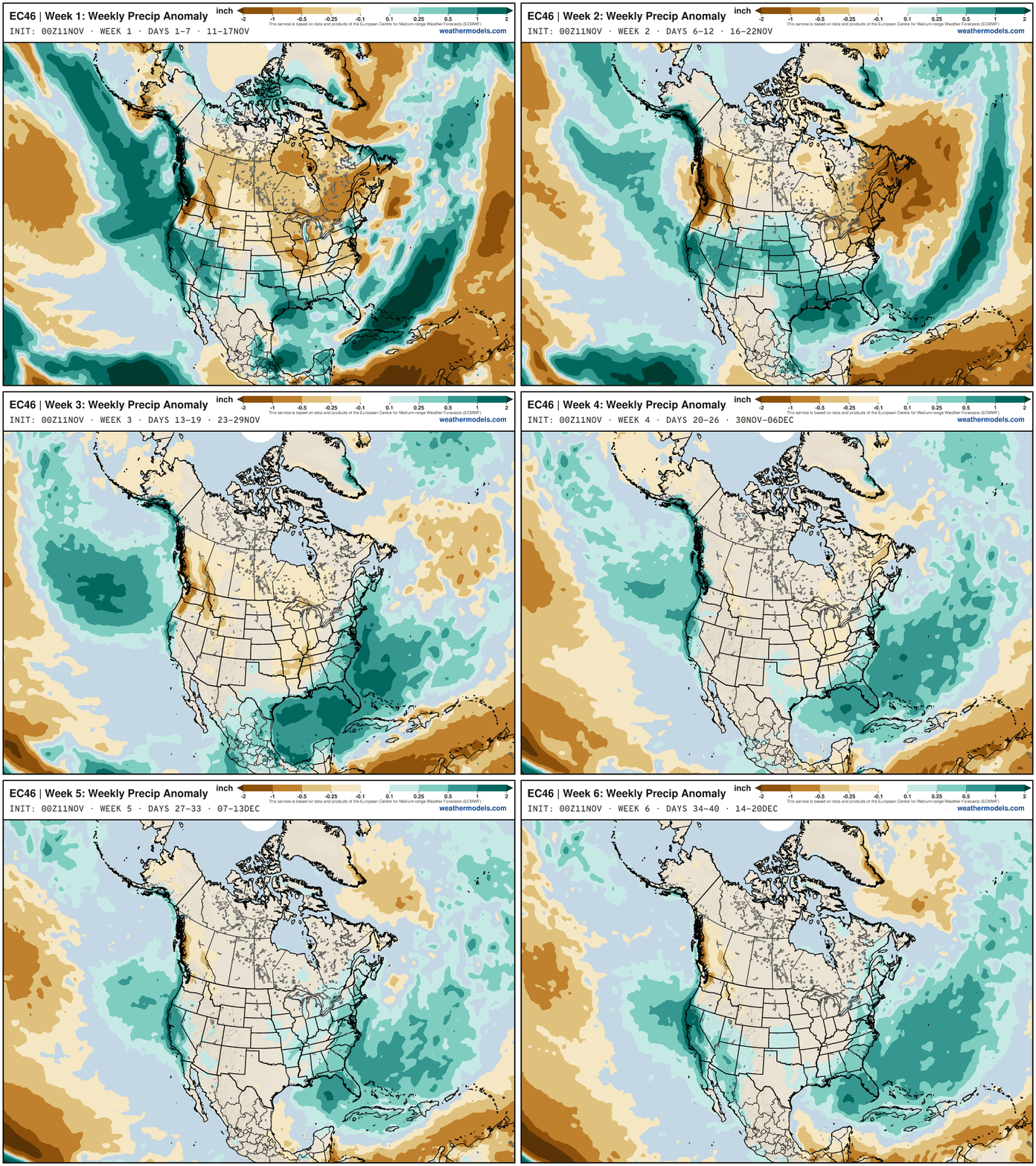
Next 6-weeks —> Excitement for El Niño fueled late fall pattern with plenty of precipitation from the Pacific
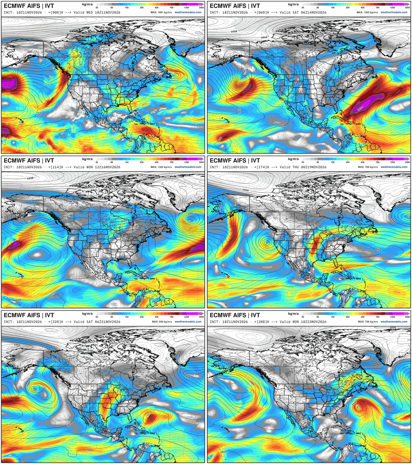
EPS 46-day forecast runs each morning (00z) with 100-members at lower resolution than the main ensemble suite — and will be joined soon by AIFS-SUBS hopefully soon. The signal for much above normal precipitation across California is exactly the El Niño forced / fueled North Pacific storm track with multiple atmospheric rivers trailing strong Gulf of Alaska low pressure systems — parade of bombs. And, the subtropical jet stream screams along picking up more moisture from the Gulf to load up the Southeast — especially Florida with boatloads of rain.
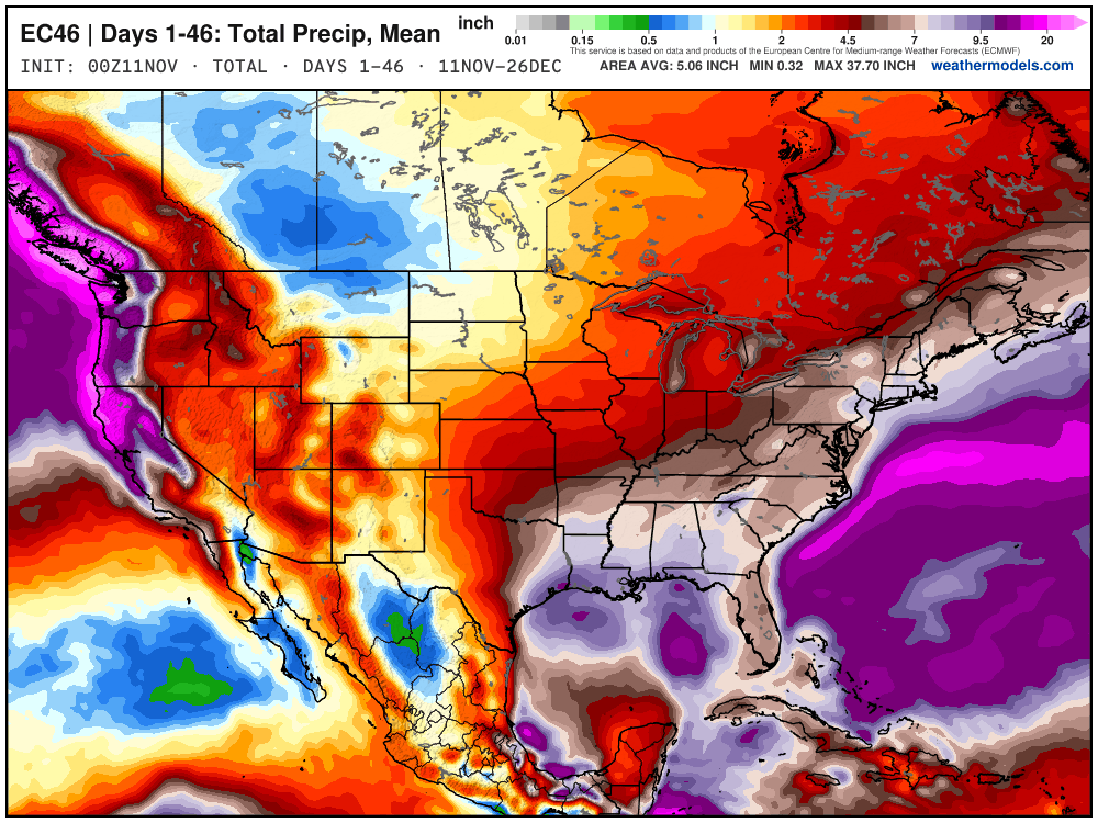
Total precipitation … ensemble mean through 46-days
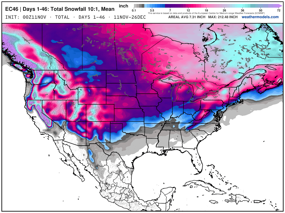
Total Snowfall Next 46-days — the ensemble mean takes “any snow” across areas and shows it as non-zero e.g. Atlanta, even if there’s a very low probability And, I show those other maps through 15-days every post. Through Christmas, there’s certainly a lot more snowfall on this map than I’d expect. What if we have a slightly warmer but MUCH more moist atmosphere for the winter ahead? Imagine the fun we’ll have talking about “climate fueled” blizzards and atmospheric rivers for the next 4-months?
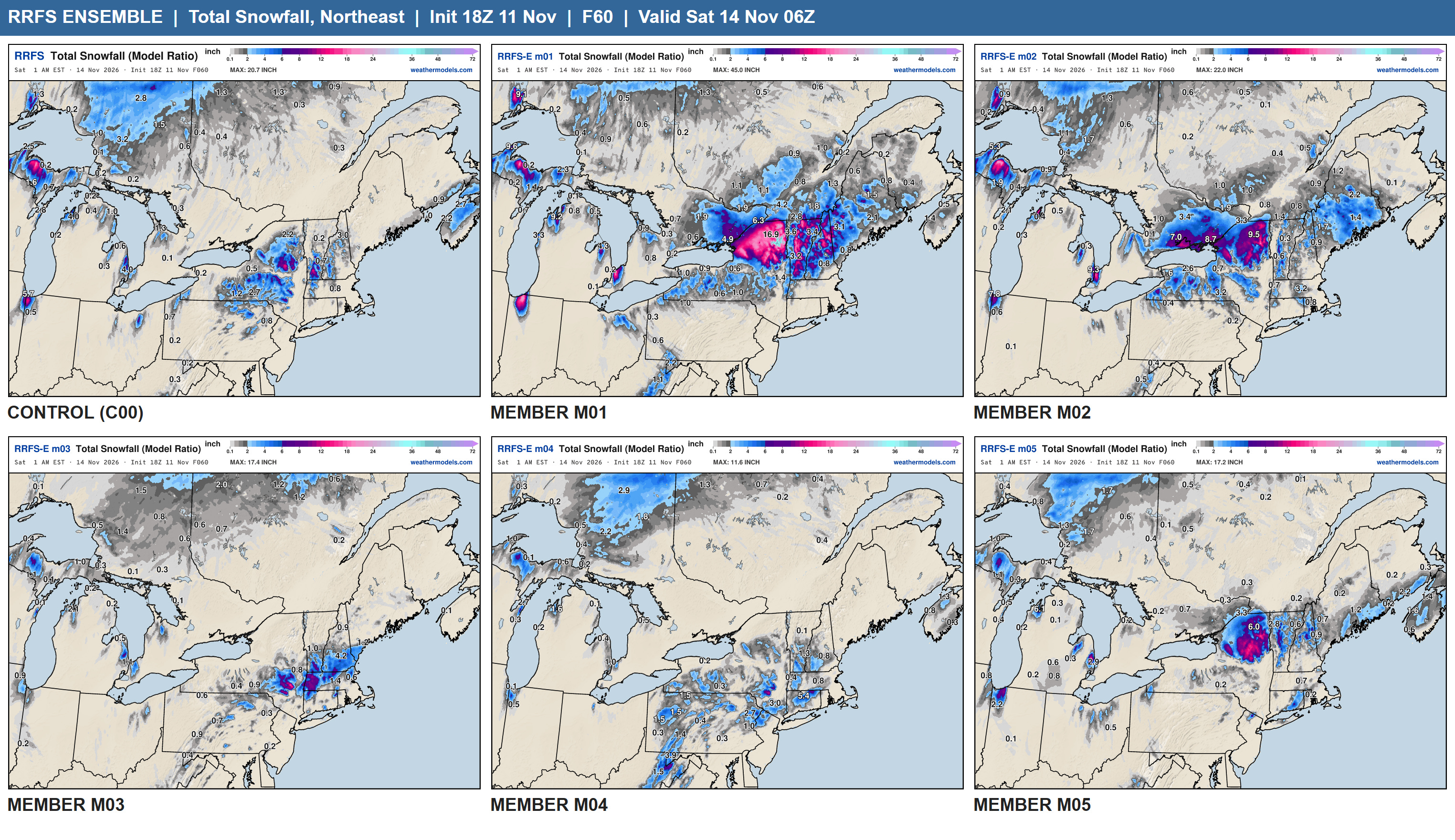
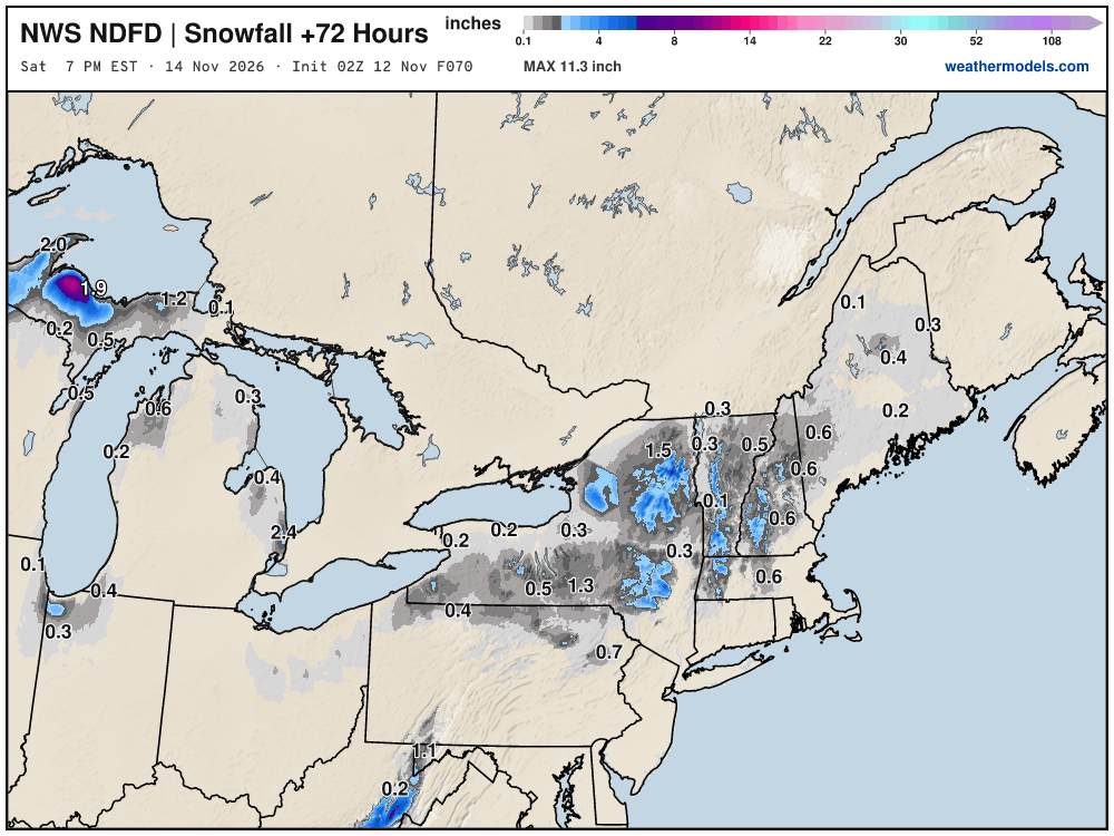
We have a little snowfall coming this weekend.
The new RRFS Ensemble system is 6-differently configured models but the same underlying model core (FV3) … and holy moly this system is a circus with “diverse solutions” in the short-range. I don’t know how this can be used properly in operations, as there are too few members (only 6) and they are not truly perturbed members. I guess you just pick your favorite one.
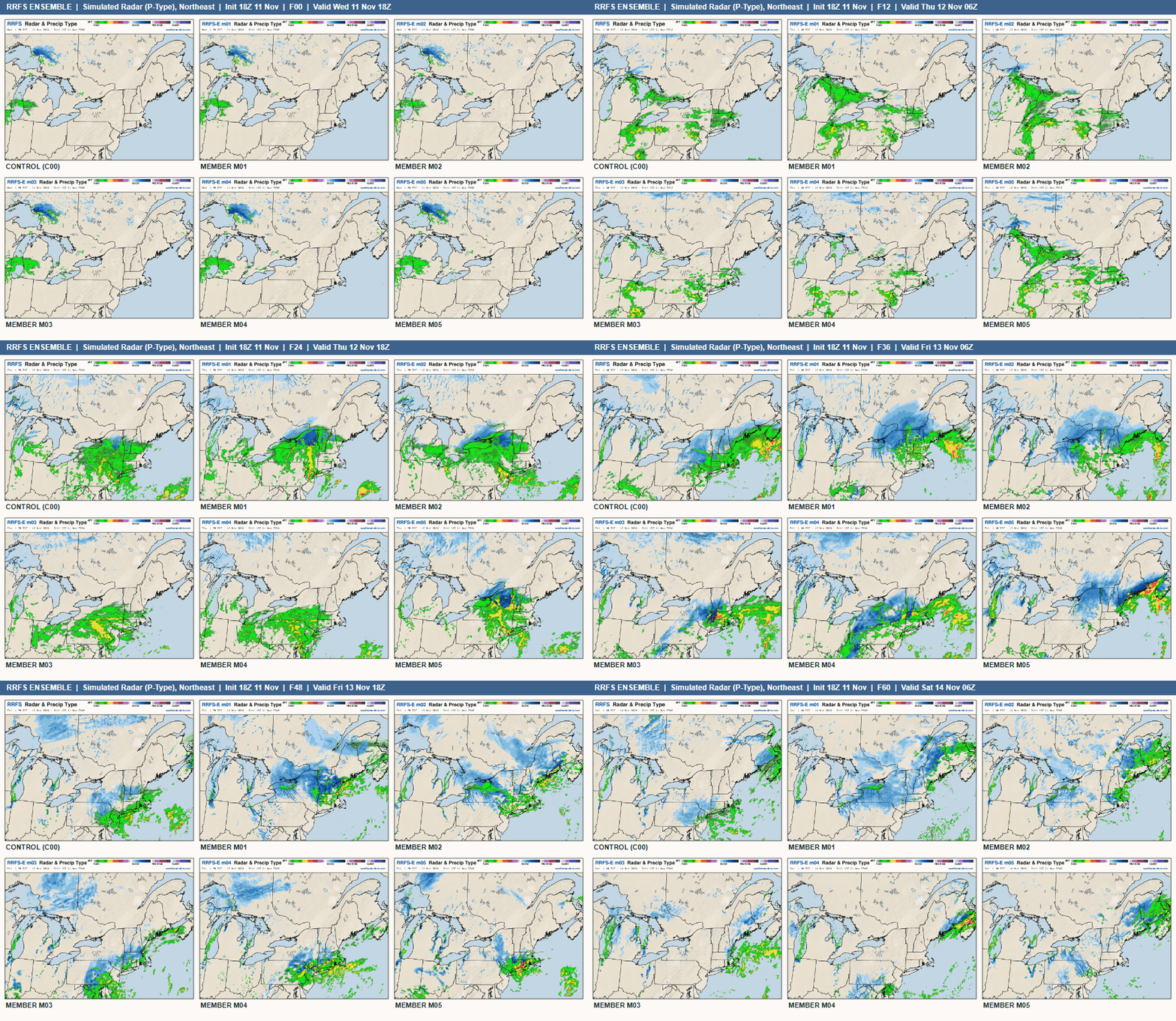
Member 01 is crazy … might be interesting to dig into the reason why — maybe it performs better elsewhere, or not.
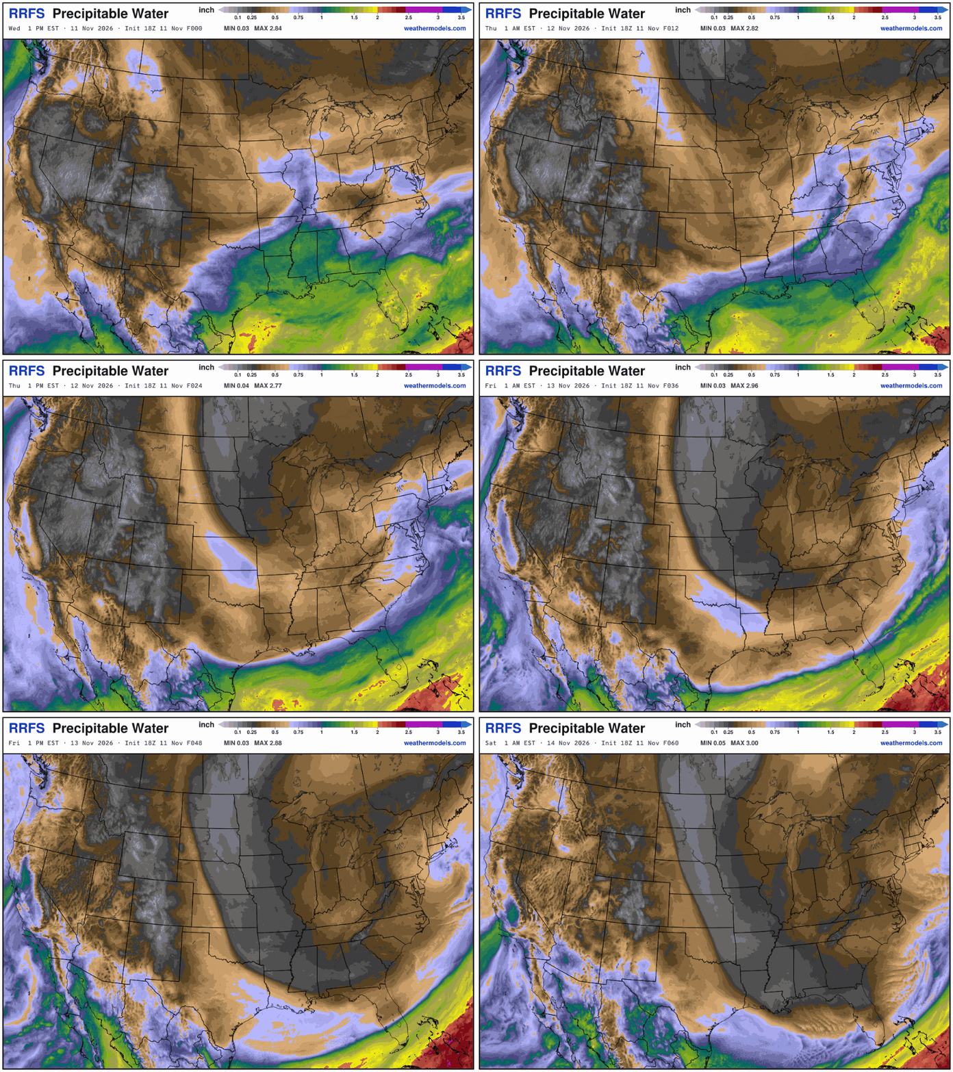
The area of low pressure spins off the Northeast coast — not particularly intense, but plenty of moisture for rain/snow … not a bomb cyclone. My favorite parameter (PWAT) shows the massive trough dipping out of Canada down the Mississippi to the Gulf of Mexico. Even “bone dry” air invades Florida as the front clears Miami (maybe).
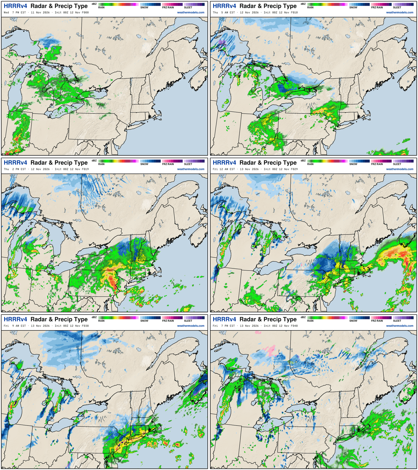
Trusty HRRR Simulated Radar through Friday 7 PM ET
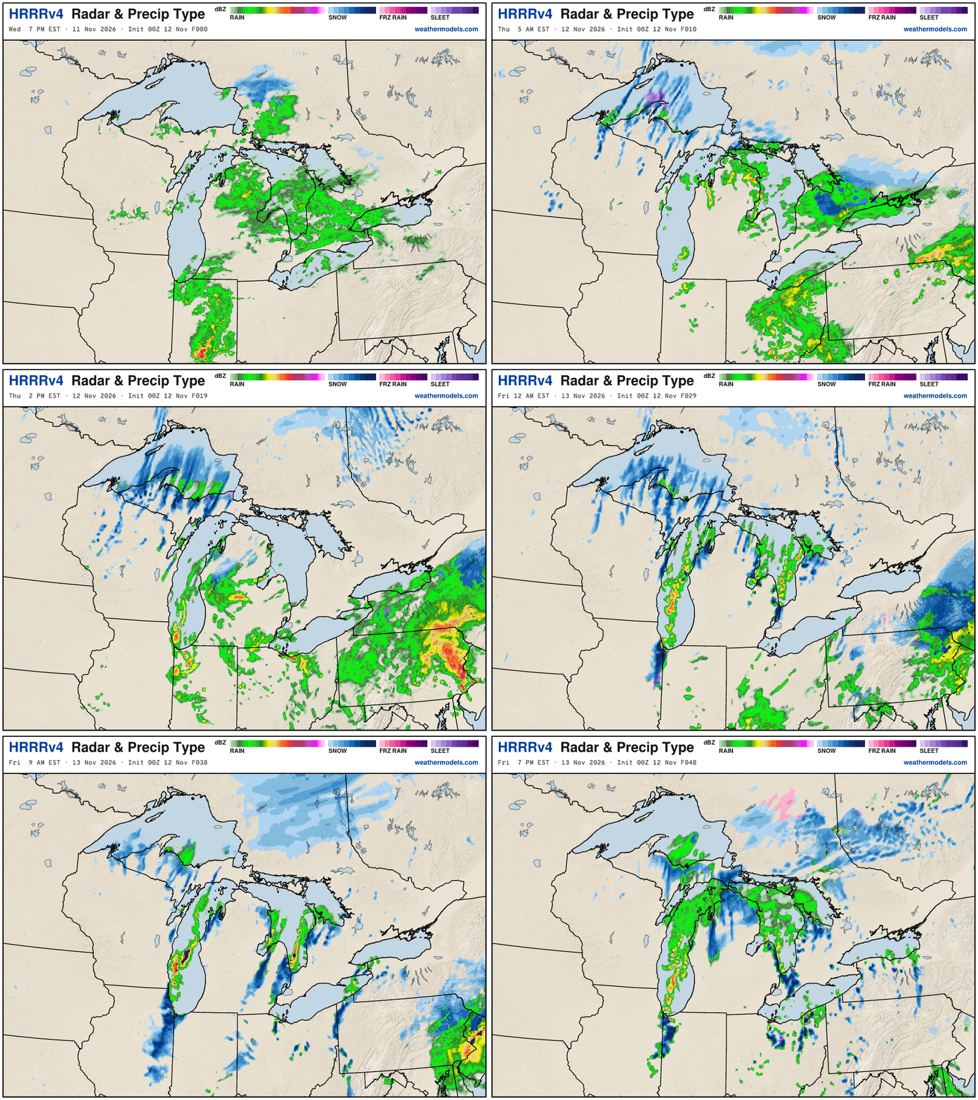
This looks like a reasonable solution … for the storm system with some Lake Effect snowfall across Michigan
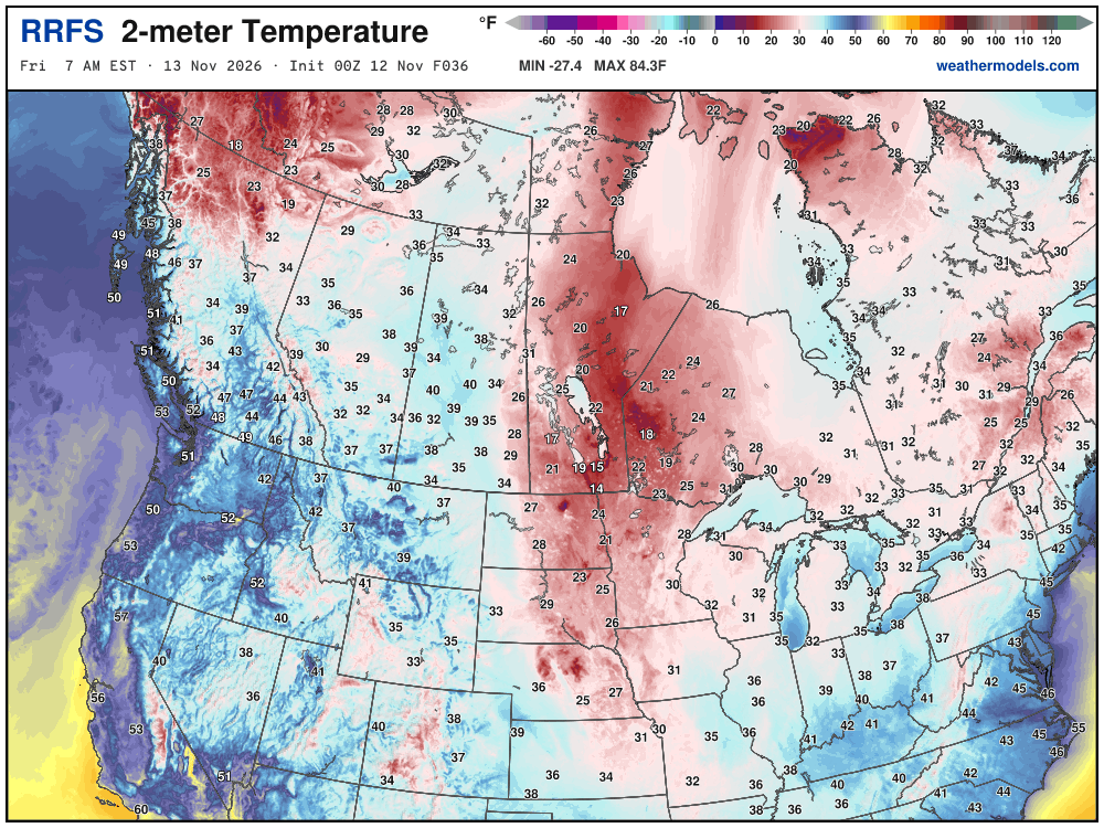
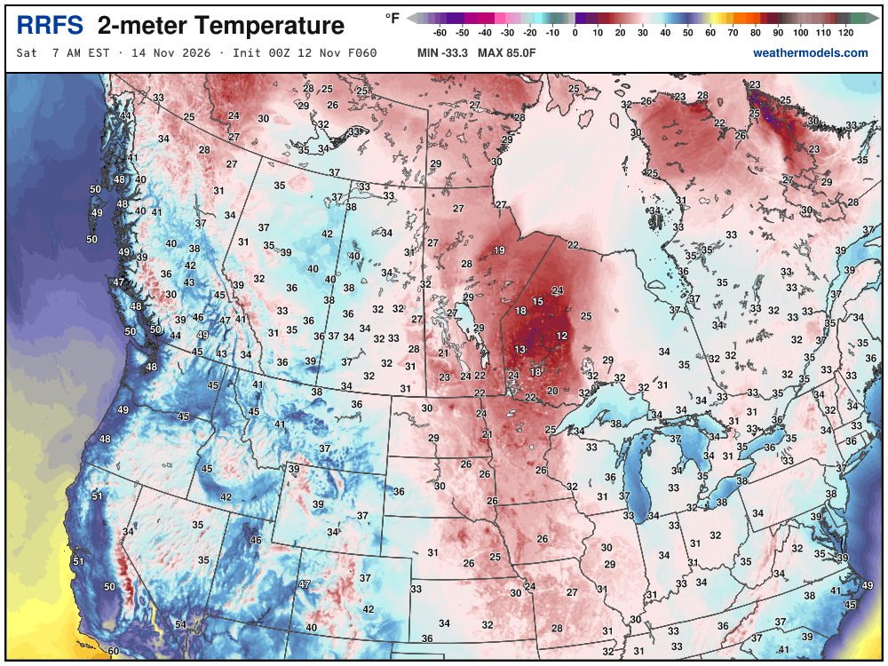
Canadian Cold coming — isn’t too bad — could be much colder but it’s only mid-November: Friday at 7 AM
Saturday at 7 AM
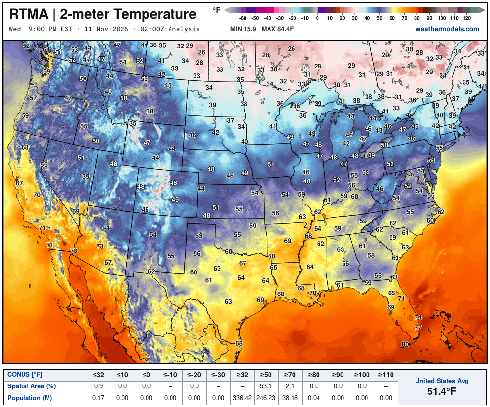
Temperature Analysis Friday at 9:00 PM ET
Temperature Analysis | Anomaly from Normal
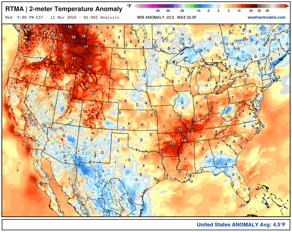
Lower 48 was 4.5ºF above normal
Low Temperatures Thursday Morning
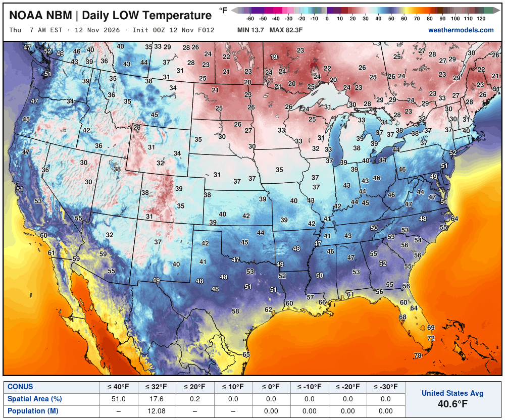
12 million below freezing
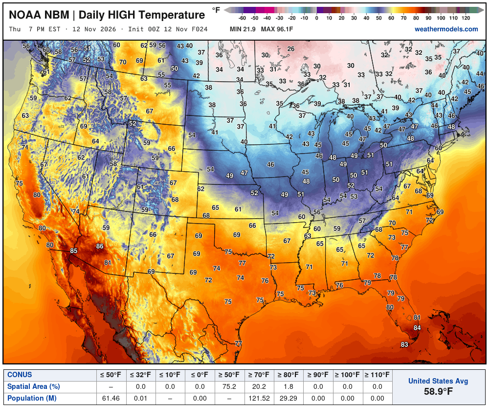
High Temperatures on Thursday | Only 20 million at least 70°F
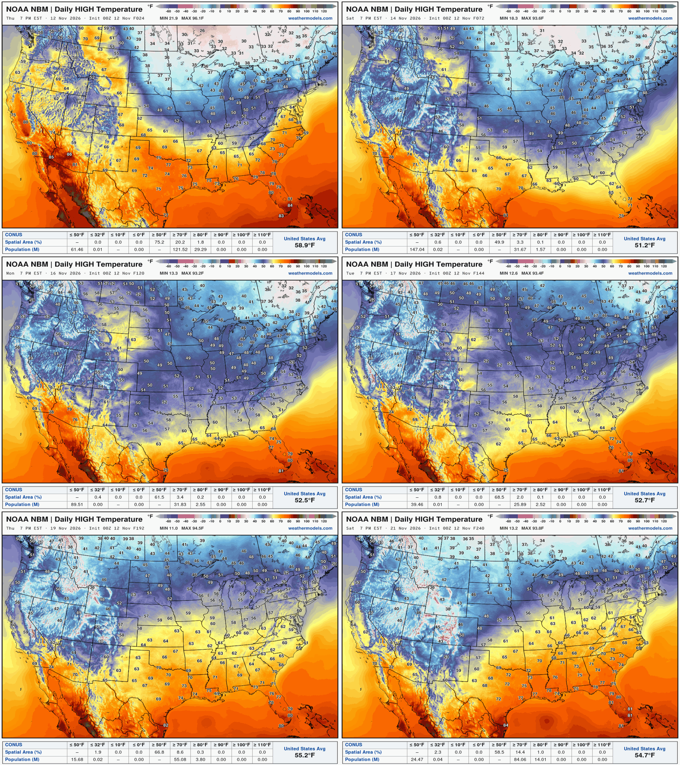
High Temperatures next 9-Days through November 21st
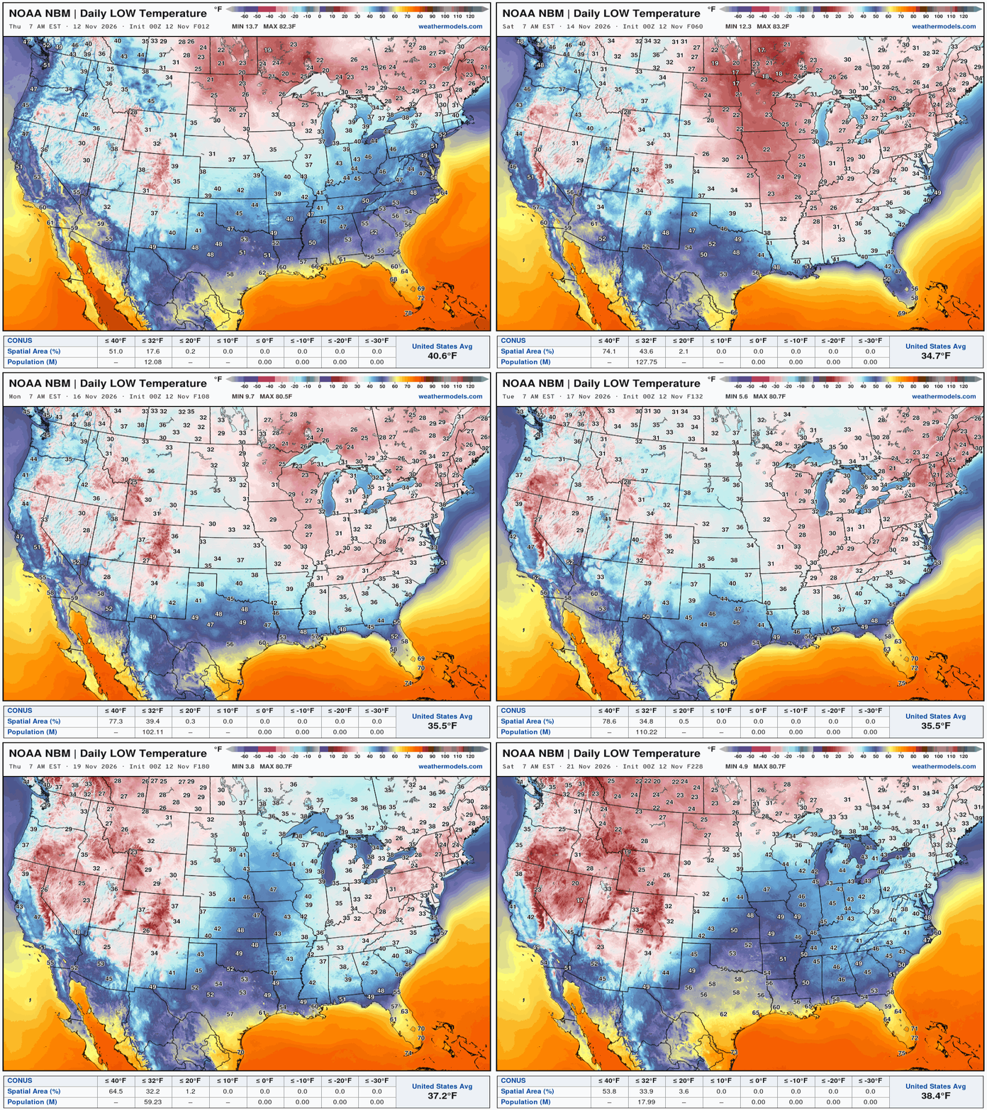
Low Temperatures next 9-Days through November 21st
My favorite parameter — precipitable water | ECMWF 18Z next 6-days
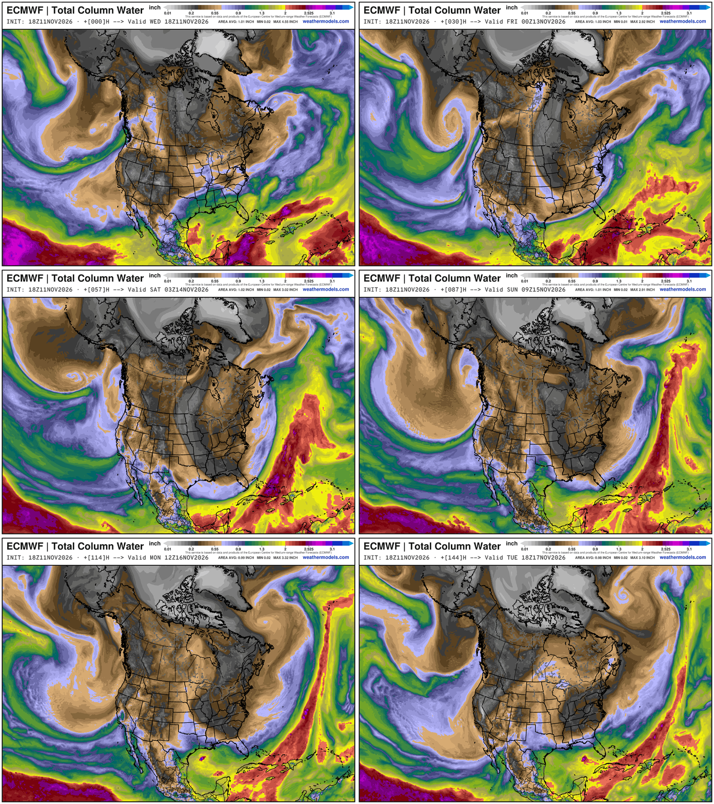
Major trough — with very dry Canadian Arctic air drains out of Canada into the Southeast and even into Florida. Here come the atmospheric rivers for California!
Integrated Vapor Transport Next 10-days | ECMWF AIFS 18z
Height Anomaly Pattern | Next 10-days | AIFS 18z | Flagship model
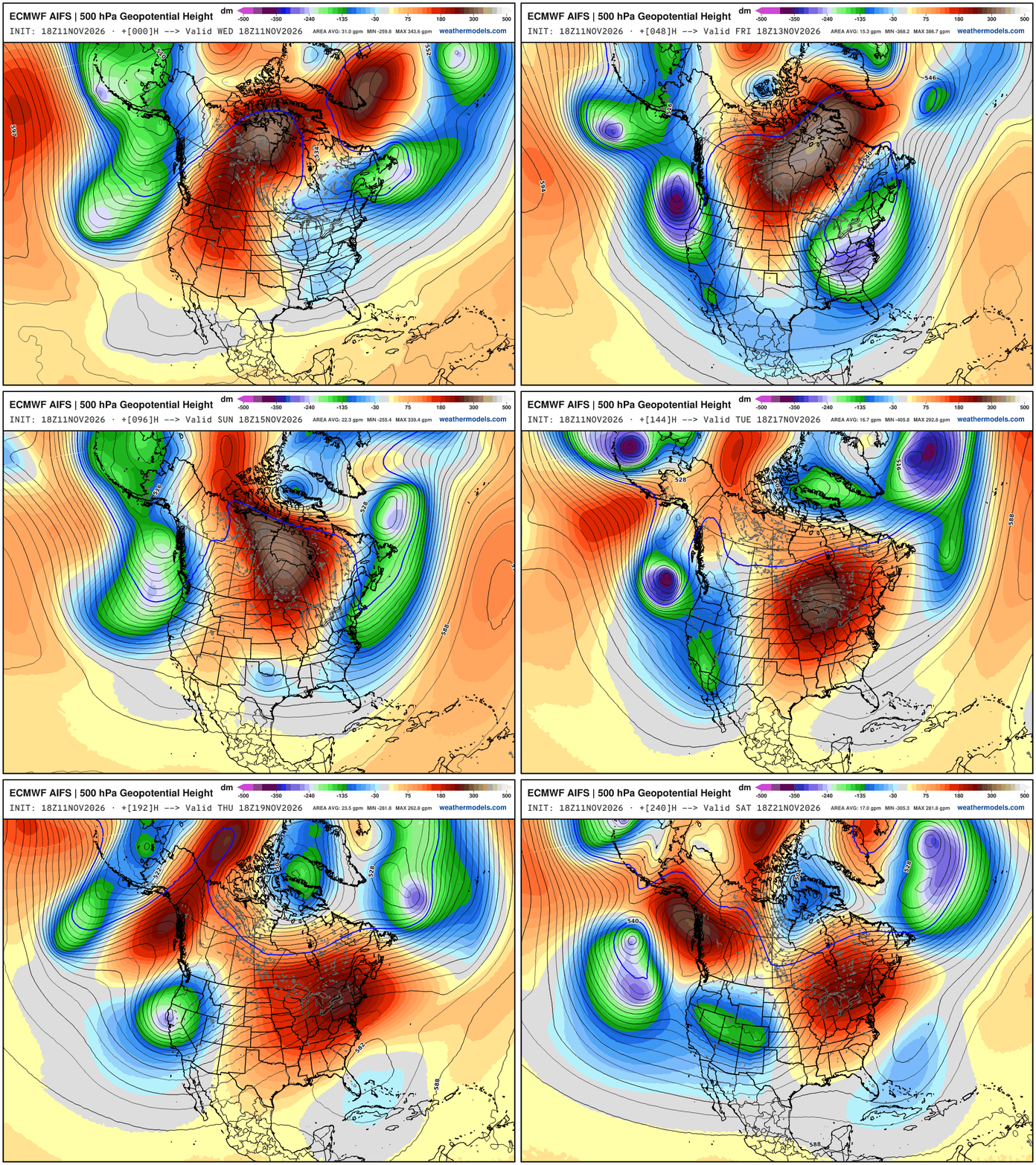
Omega block cannot be broken down … troughs on both sides / Pacific West Coast and Atlantic East Coast are powerful — but it can be pushed east to make way for sequence of major western troughs. Holy moly.
My post from X — please follow me there, too!
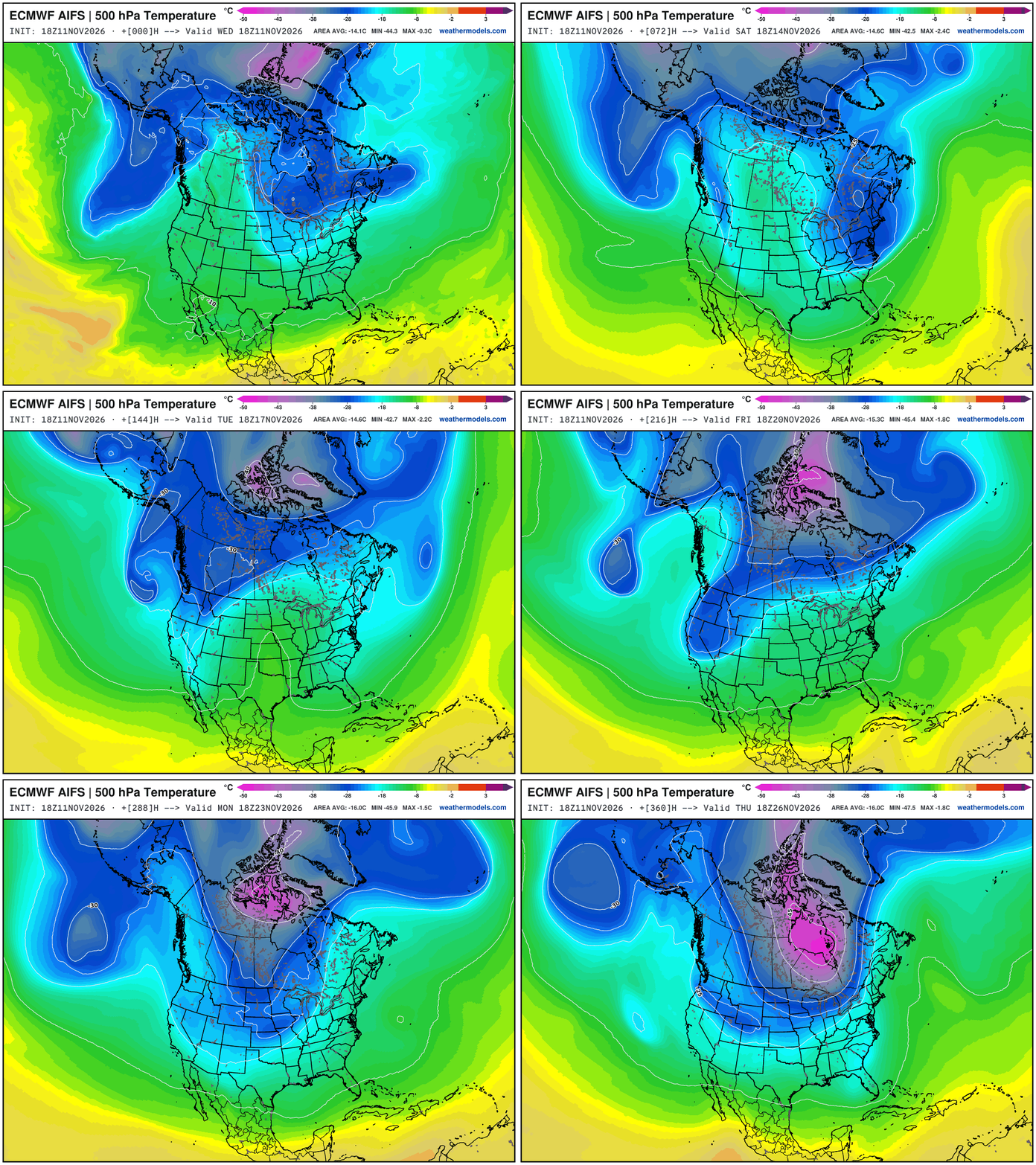
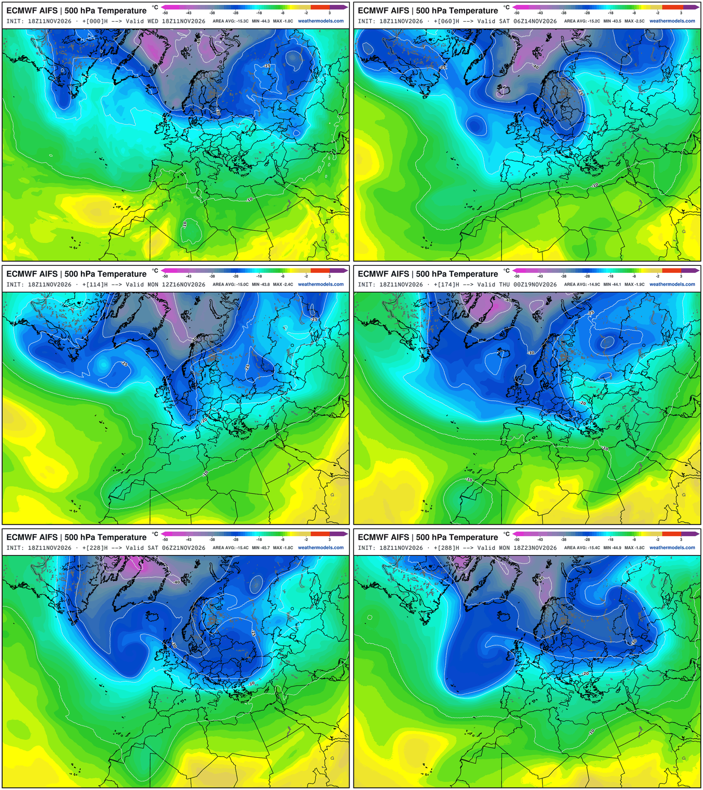
You’re going to see this mid-level (500 mb) temperature forecast updated on my feed for the next 90-days --> to keep track of the Polar Vortex -- at least the tropospheric version (not the stratospheric, which I don’t understand)
Even with El Niño, we’ll be discussing the “whole load” of Arctic air dumping into the Eastern U.S.
The coldest week is “gentler” and Arctic blasts are less intense, but they don’t need to be. I’d qualify this -47°C centroid of the PV over James Bay as the “whole load” but the surface cold pool isn’t developed yet -- only late November.
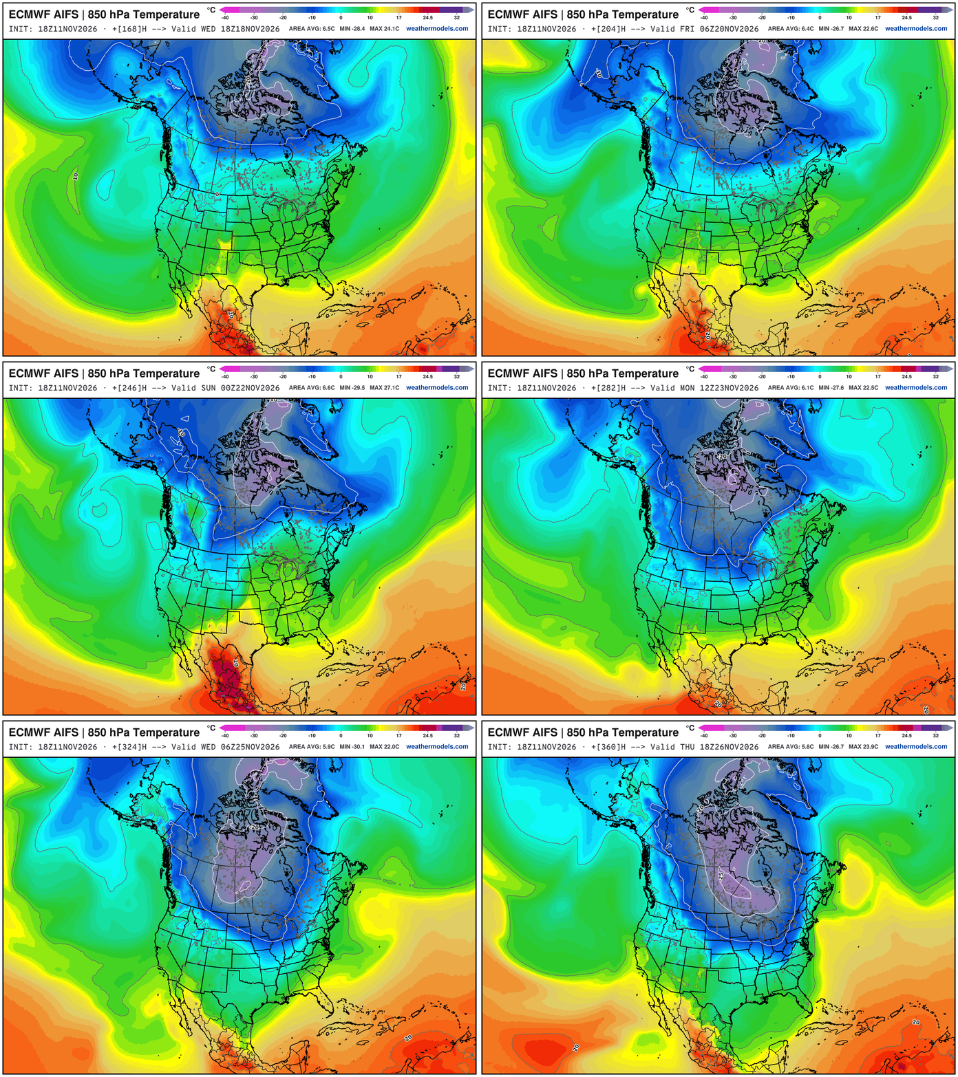
Just don’t look to the Pacific for any help -- the Western Canada cold pool isn’t happening. You’ll need the Trans-Siberian Orchestra to bring the cold across the North Pole.
Cold Pool Formation at 850 mb — not impressive — but trying to form over Greenland and Arctic Canada battling the Pacific influenced air … down to -25°C is a start.
European Weather Patterns
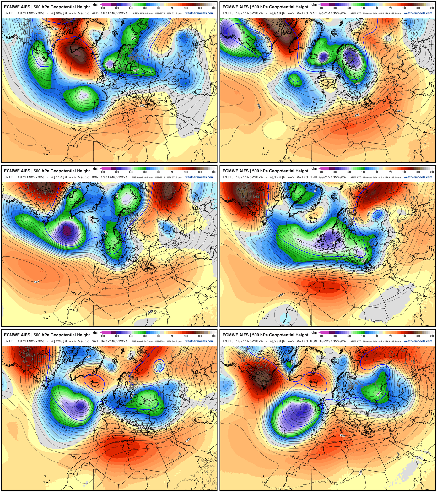
Europe —> powerful troughs downstream of the Canadian block — but they are of Atlantic origin so warmer, marine air — and only brief Arctic blasts can sneak in from Iceland through Scandinavia. These are major / impressive anomalies.
NWS NDFD Next 3-days precipitation
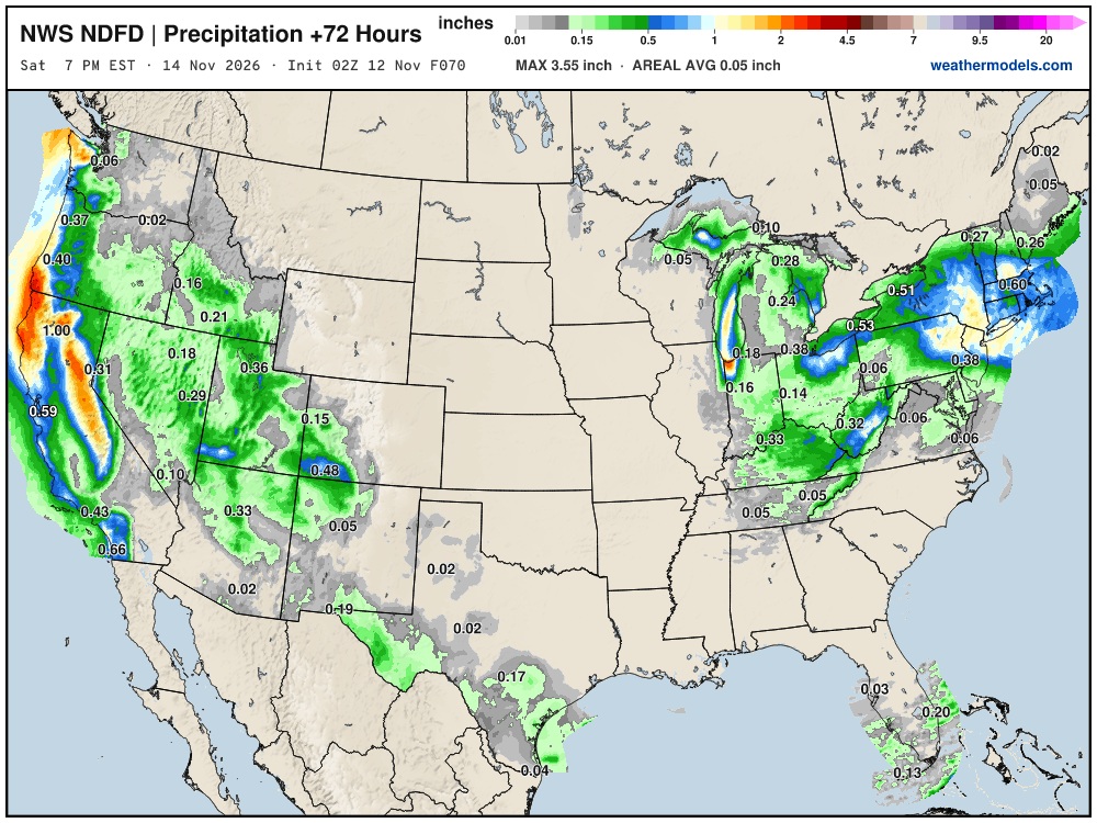
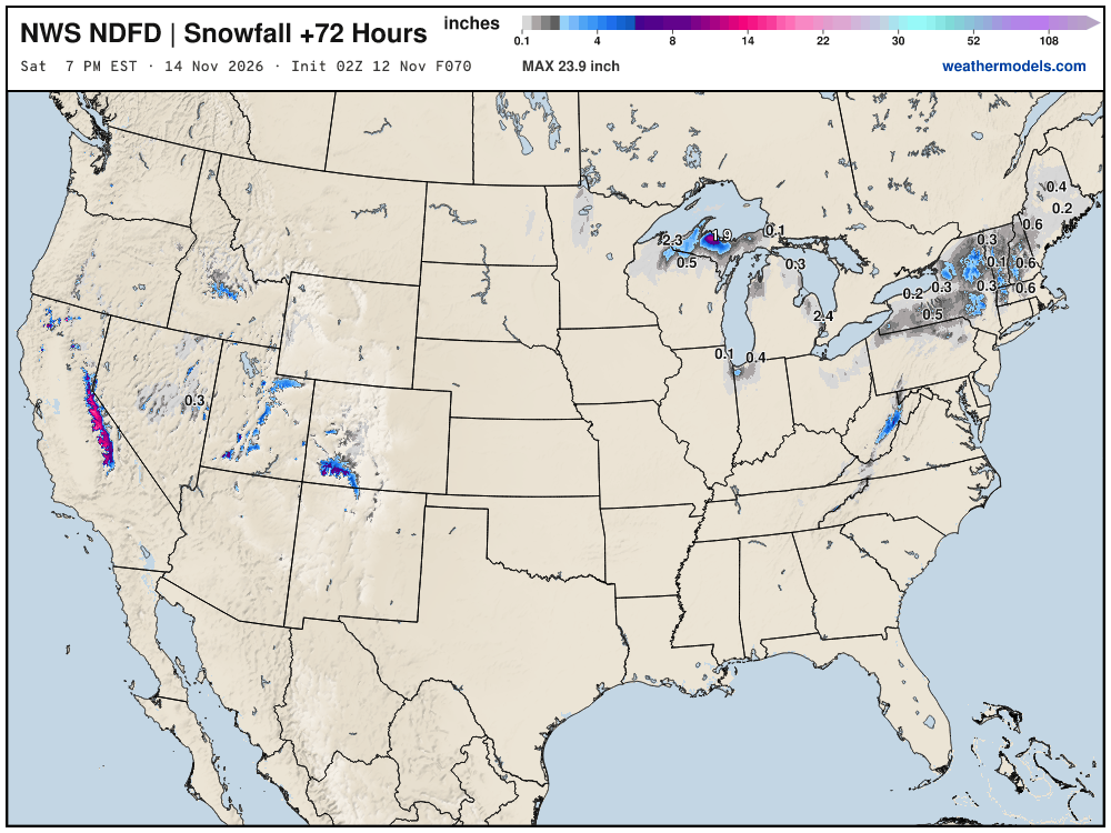
NWS going with minimal accumulations through Saturday evening … 1-3” or so
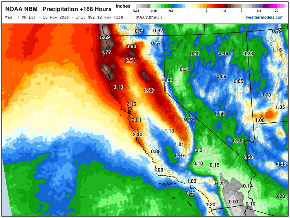
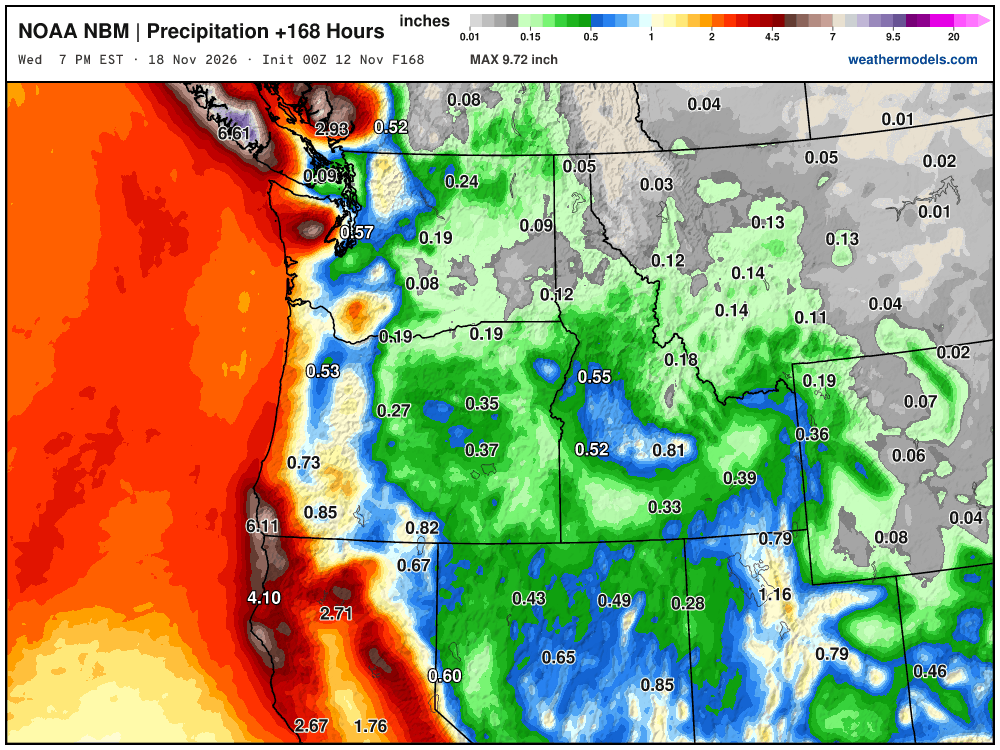
Blend of Models Precipitation Next 7-days
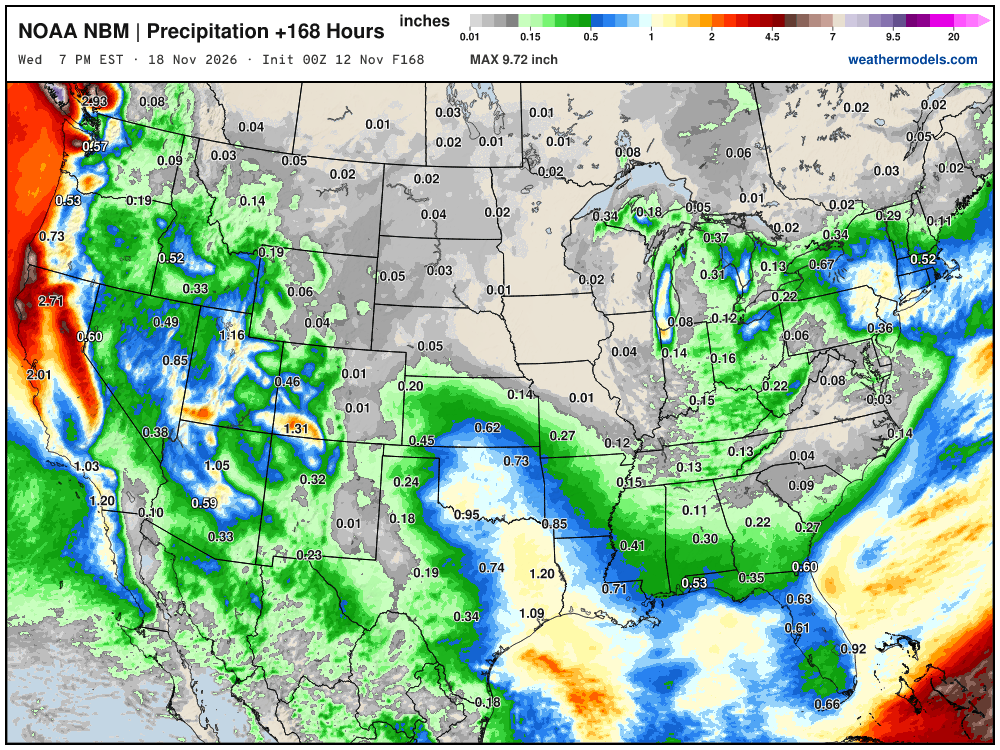
Here comes the “boatload” of coastal rain / atmospheric rivers + mountain snow.
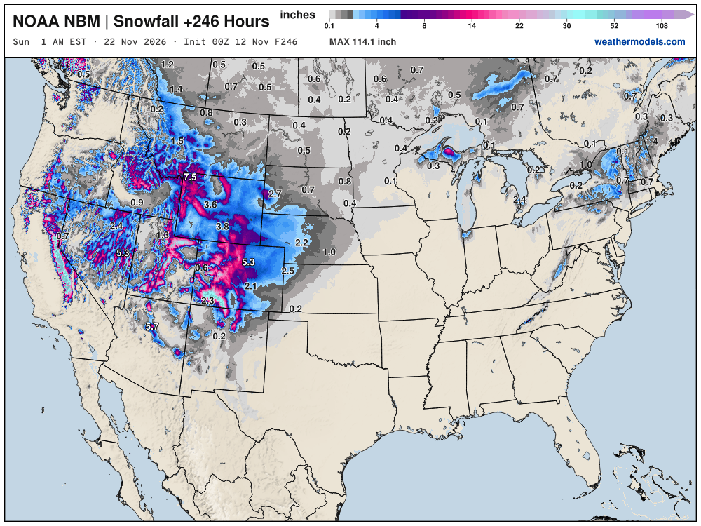
Blend of Models Snowfall Next 10-days | Western US massive dump
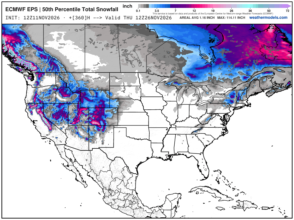
Snowfall Next 15-days | ECMWF Ensemble 12z Median
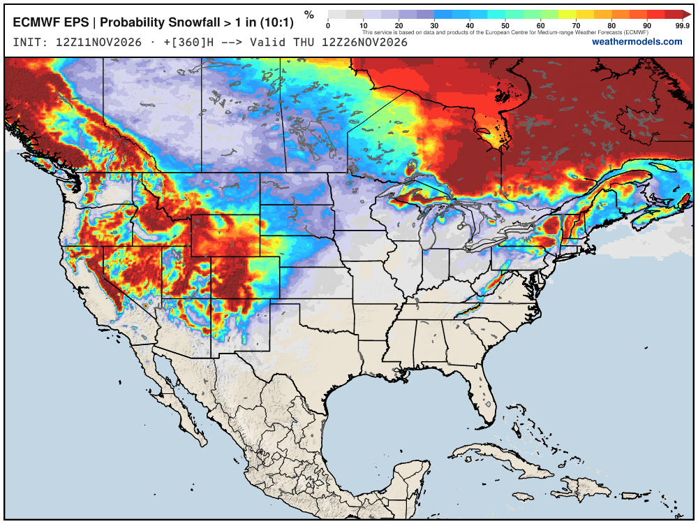
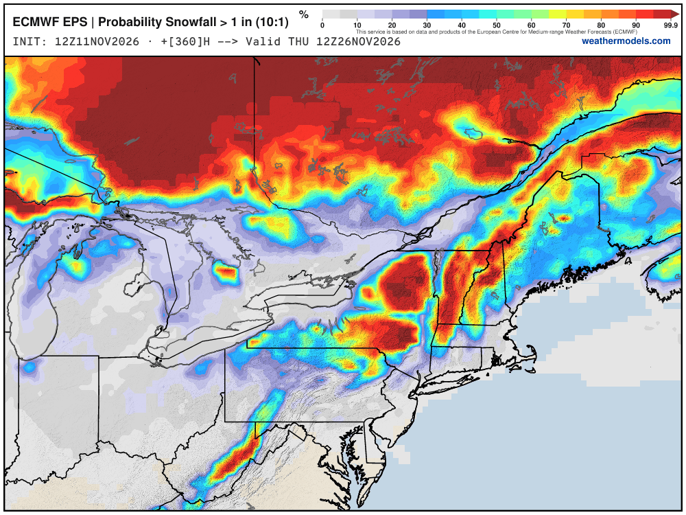
Probability of 1-inch or more of snowfall through November 26th
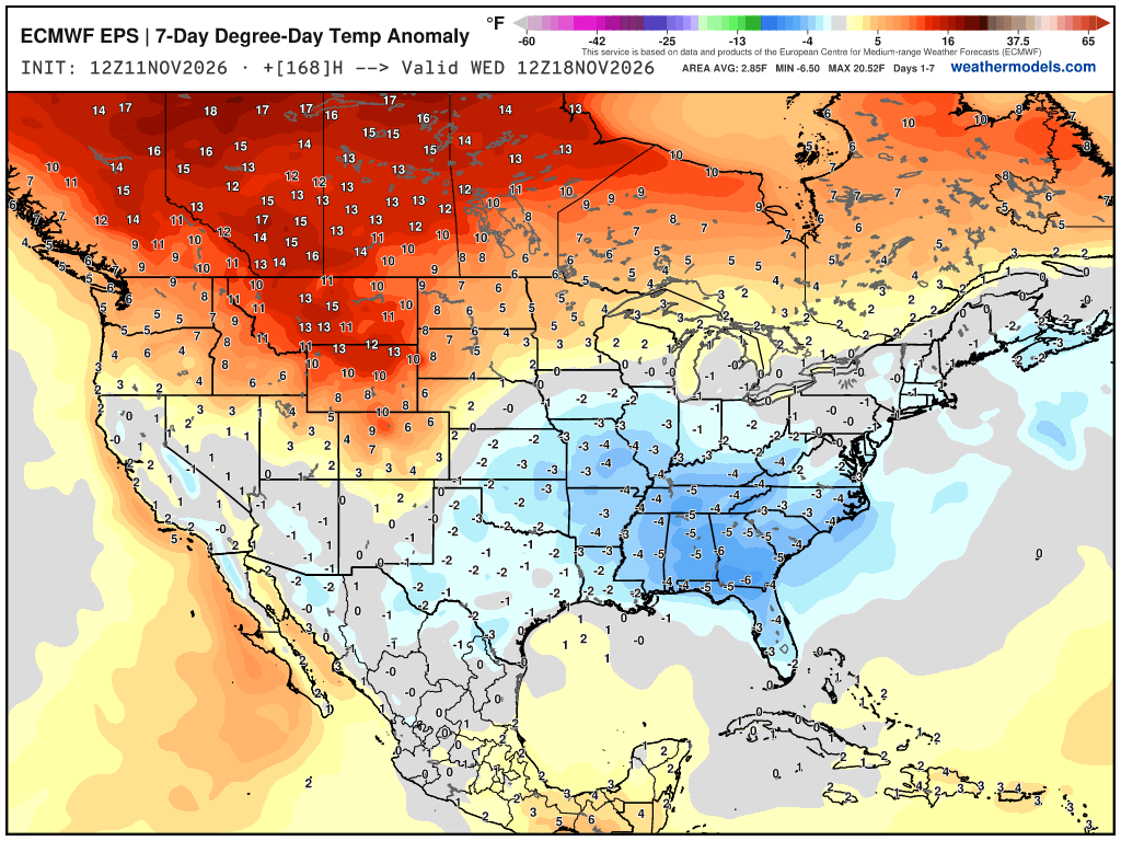
Week 1 Chunk of Temperature Anomaly | Nov 11 - Nov 18
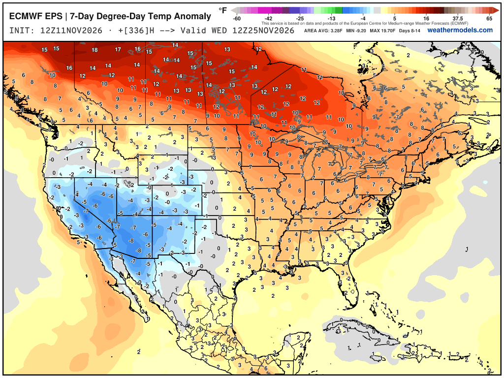
Week 2 Chunk of Temperature Anomaly | Nov 18 - Nov 25
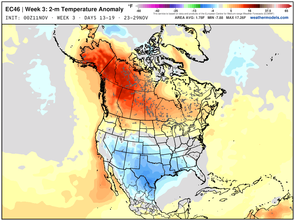
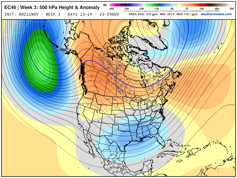
Week 3 Extended Forecast from EPS 46-day
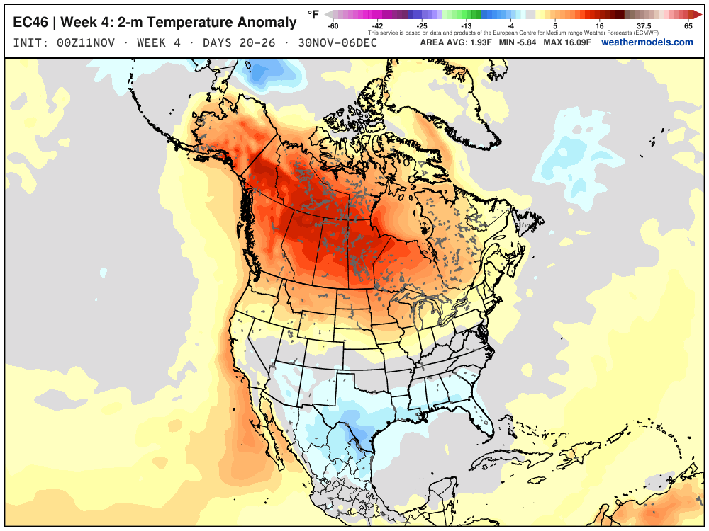
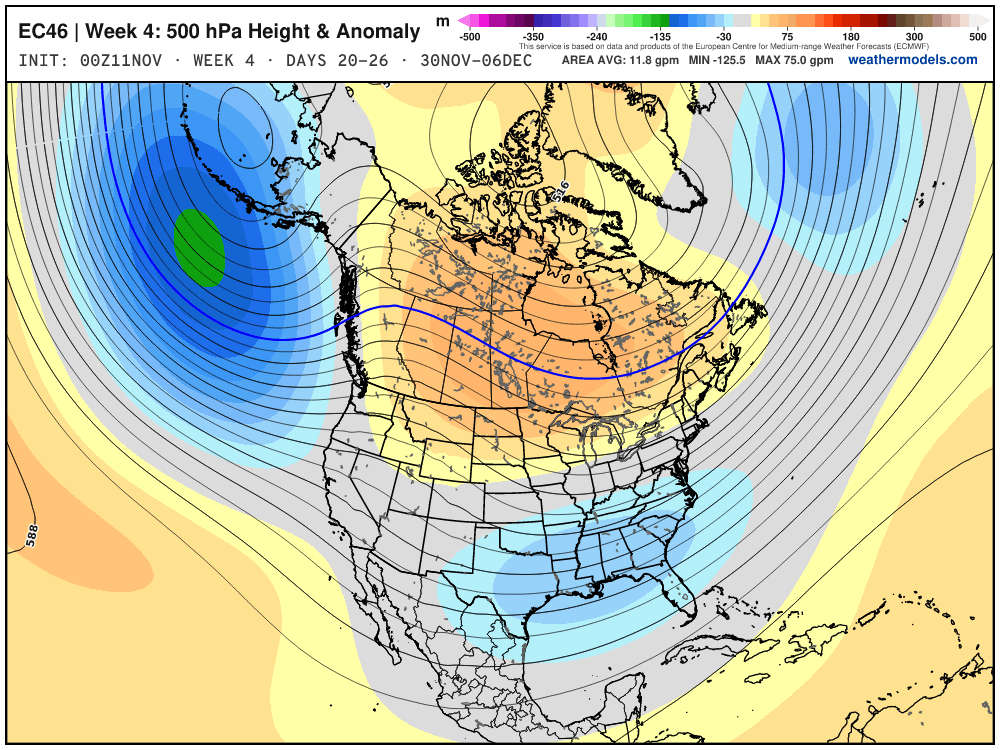
Week 4 Extended Forecast from EPS 46-day
Thank you for visiting / reading — always more to come!
Visit Global Tropical Cyclones w/Dr. Pielke Jr. for more ACE information, as well as my original climatlas.com/tropical site with much new research including a calibrated “Best Track” and historical tropical cyclone browser with plenty of interesting features like rankings of storms by their IKE (size).
ACE up to 964
Satellite imagery from Squall Cloud. Maps sourced from weathermodels.com designed and innovated entirely by Ryan. Please subscribe there for real-time access to the newest maps, charts from all of the weather models including ECMWF and AIFS, and NOAA GFS/GEFS, HRRR/RRFS and Blend of Models (NBM). NOAA WPC and SPC for fronts/convective outlooks. Our own content is sourced from forecast.city and weather.city and celsius.earth.
Atlantic Hurricane Season | YTD: 10 Named Storms, ACE = 19.5
NE Pacific Hurricane Season: YTD: 24 Named Storms, ACE = 355
My Atlantic Hurricane Season Forecast (2026)
From April 7, 2026: Atlantic Seasonal Hurricane Forecast: (11/5/2)
9-13 Named Storms (11 most likely)
4-7 Hurricanes (5 or 6 most likely)
1-3 Major Hurricanes (2 most likely)
Accumulated Cyclone Energy: 75-85 (well below normal)
NOAA 2026 Atlantic Hurricane Season Forecast
Previous in this storyline: Weak coastal storm this weekend with mini-cold snap for Eastern US (NOV 9)
- Milepost
- 1665 · laid 2026-11-12T04:13:07Z
- Source
- https://weather.substack.com/p/november-11-2026-wednesday-weather · November 11, 2026 Wednesday Weather Update
- Tagged
- I-32 Winter · Winter 2026–27 · Eastern U.S. (37.0, -78.0) · by rule, at build
- Digest
- b2aee1429b3034a595274b96b09562653989f94308e66f942be8475d9e3cfabe