Warmth continues for at least another week before a brief cold snap in 8-10 days across Eastern U.S

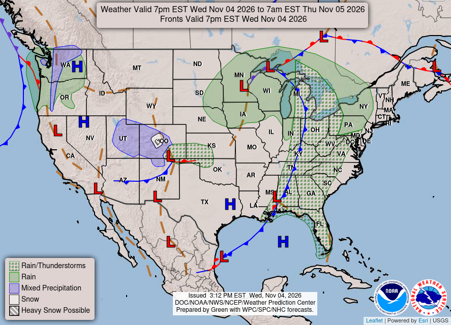
Strong storm system tracking through the Great Lakes with a cold front helping to clear out the very warm and moist air mass stuck over the Southeast and Mid-Atlantic —> unseasonably mild! A little system in Colorado will provide a quick hit of mountain snowfall. The Pacific Northwest with more rainfall and mountain snow as the parade of powerful Gulf of Alaska storms + atmospheric rivers gets underway for quite a while!
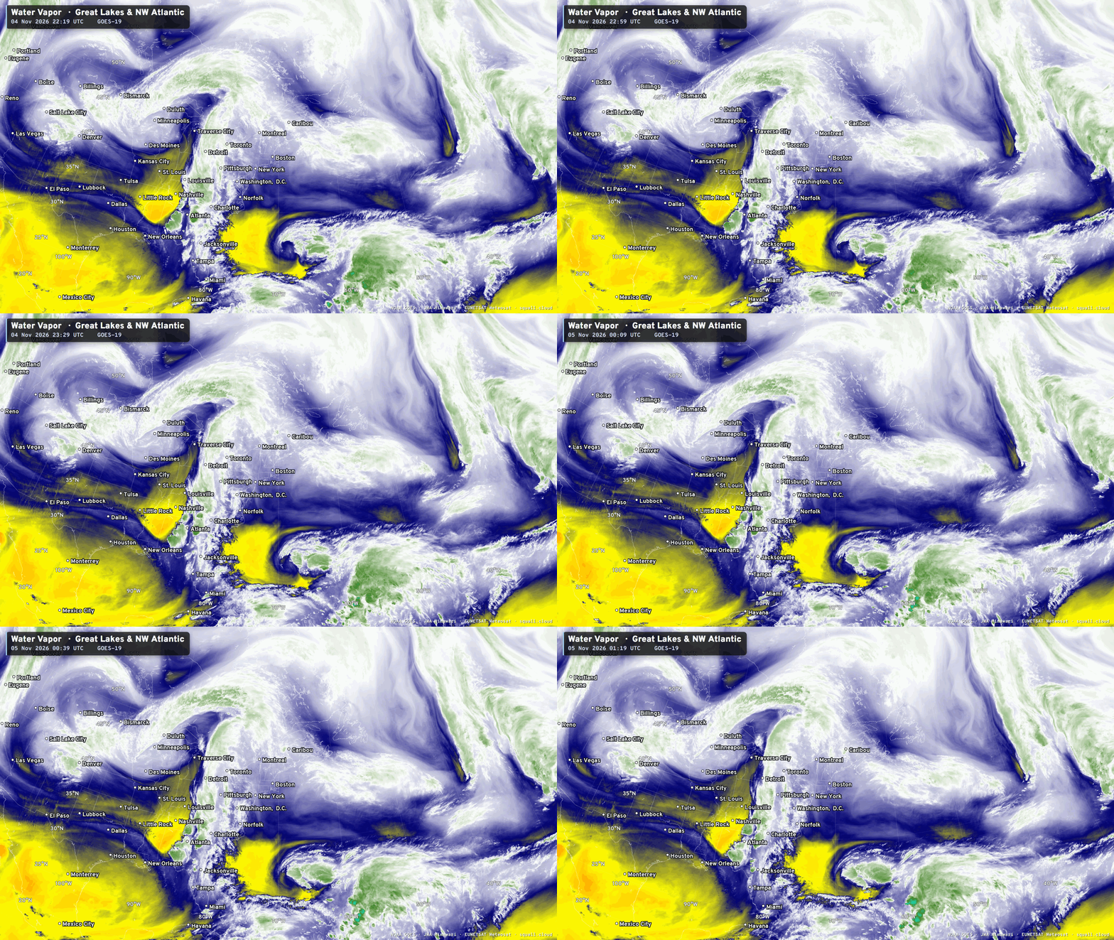
East of Florida, a subtropical storm is forming and NHC gives it a 50% chance of receiving the next name on the list: Kyle.
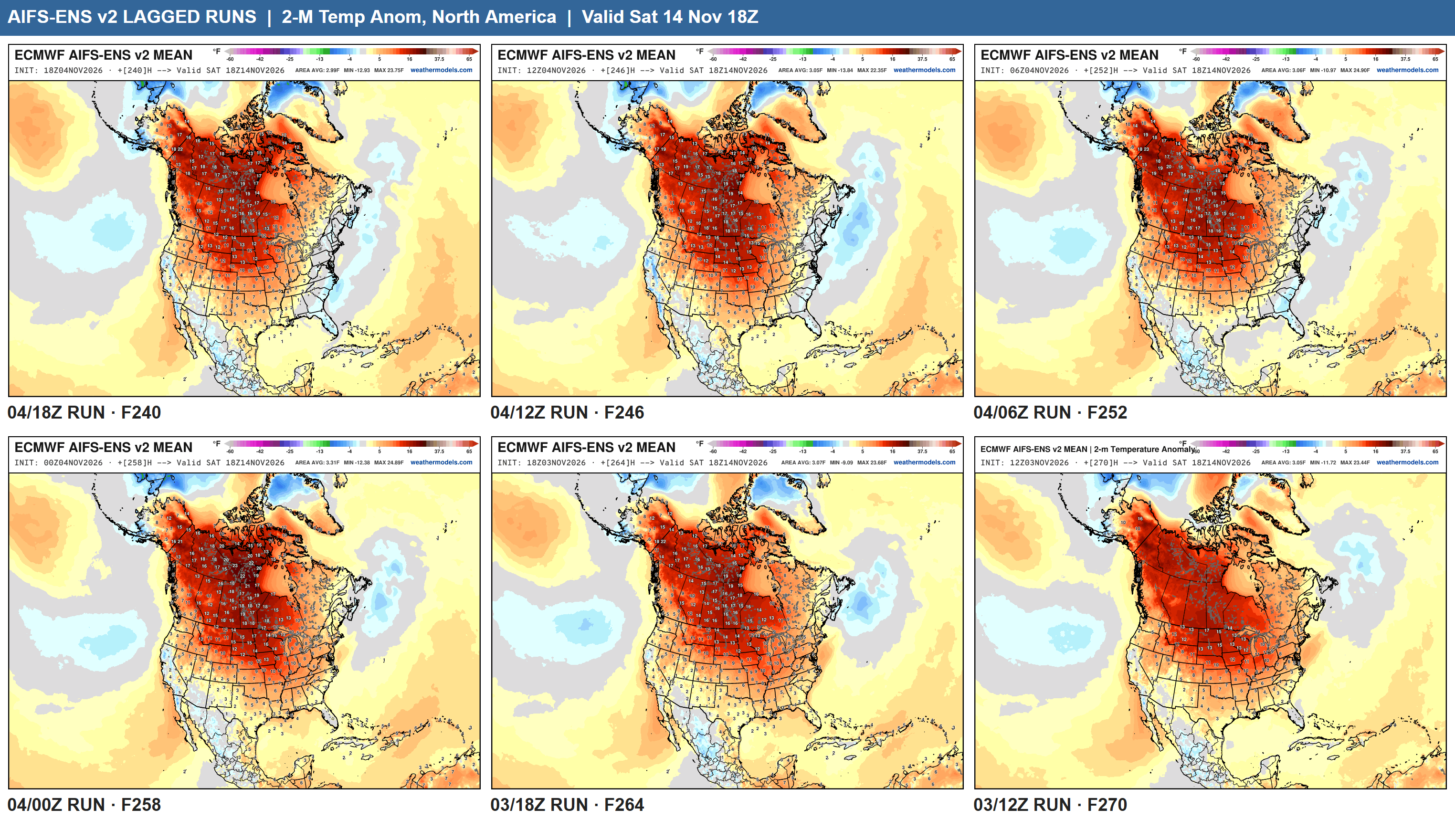
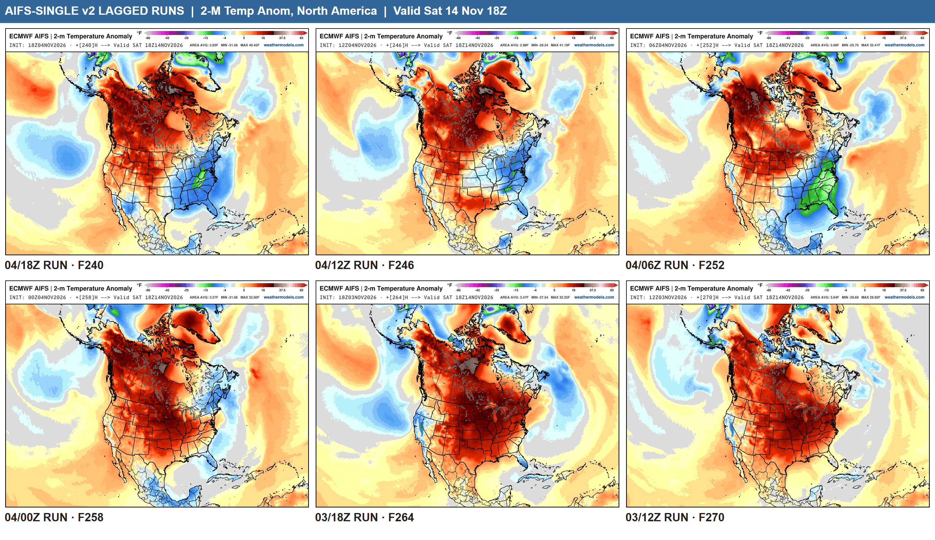
AIFS-Ensemble 18z Warmth — Into Next Weekend (Saturday the 14th) is eroding across the Eastern U.S. —> which is why the “ensemble mean” can hide information about impending extremes (like a brief cold snap) … no doubt about the “blow torch” over Canada but we see some blue emerging along the East Coast when looking at the previous 6-cycles (most recent is upper left)
AIFS-Single Temperature Anomaly +10 days
When we head into deterministic space, we see the potential for a “cold snap” more clearly across the Eastern U.S. and then we’ll see the ensemble mean catch up.
HRRR Simulated Radar through Friday 1 PM ET
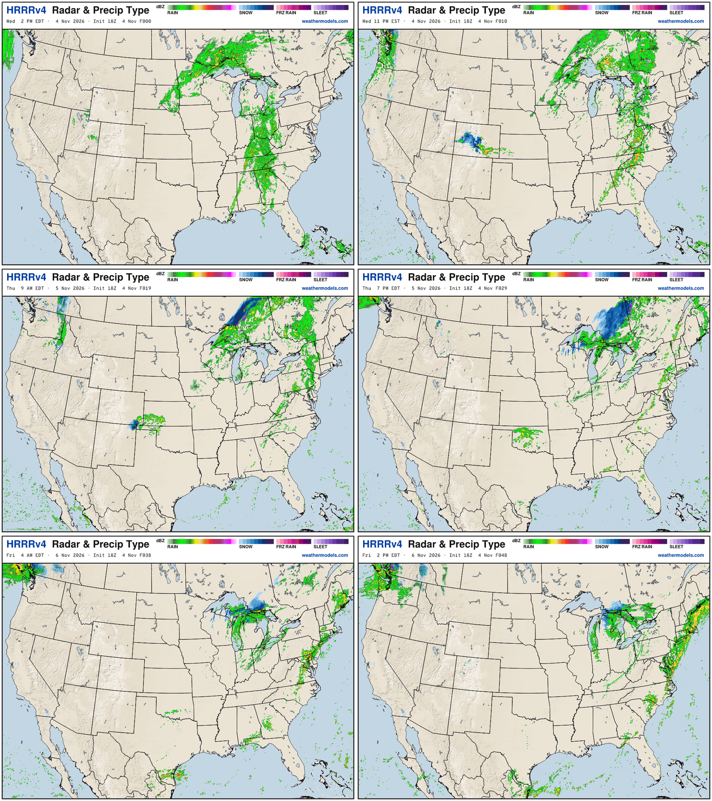
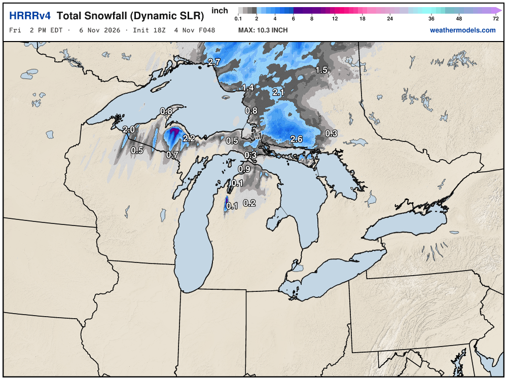
Storm system tracks into Ontario and there’s some Lake effect snow showers on the backside with just enough cold air over the much, much warmer Great Lakes mainly late Thursday into Friday morning.
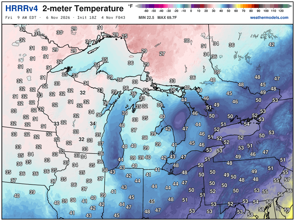
Friday morning temperatures in the 30s
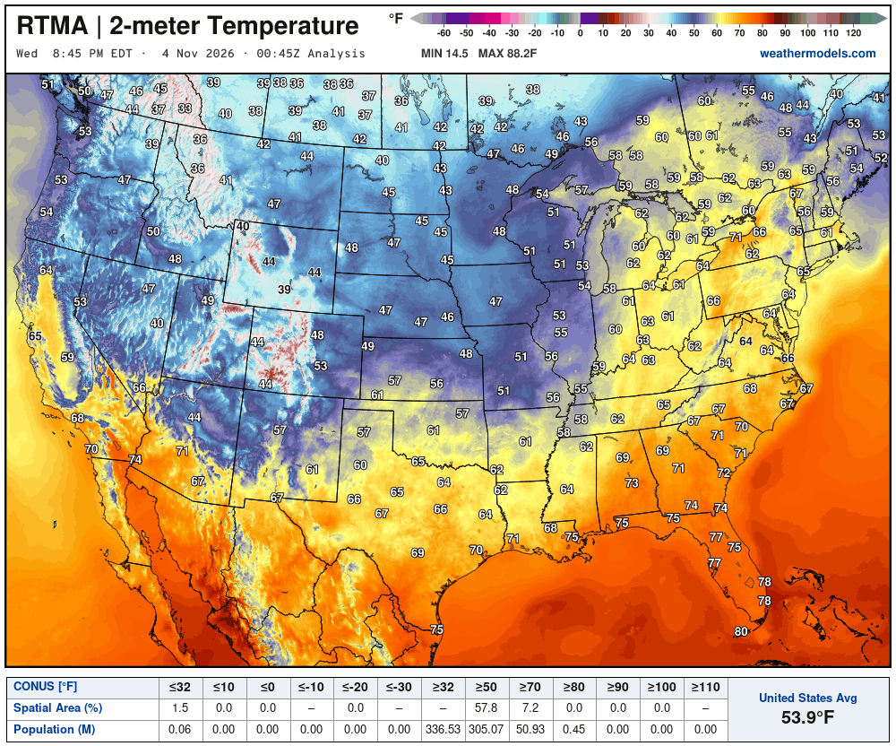
Temperature Analysis Wednesday at 7:45 PM ET
Temperature Analysis | Anomaly from Normal
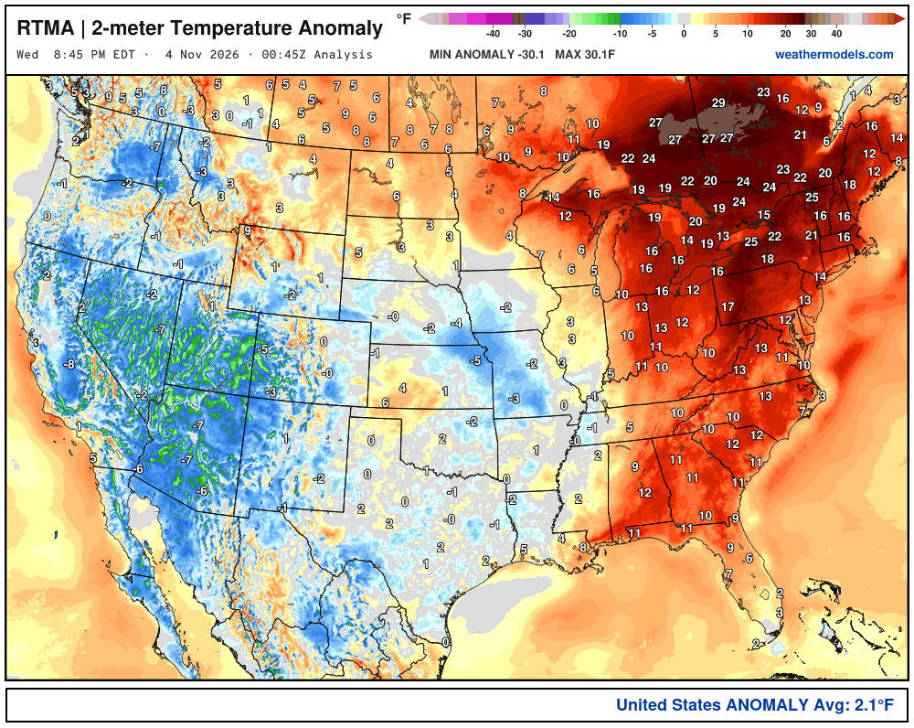
Lower 48 was 2.1ºF above normal
Low Temperatures Thursday Morning
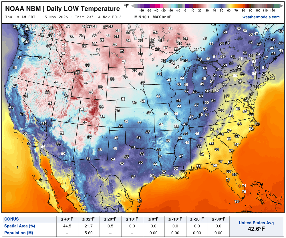
22% of spatial area below freezing but only 5.6 million population
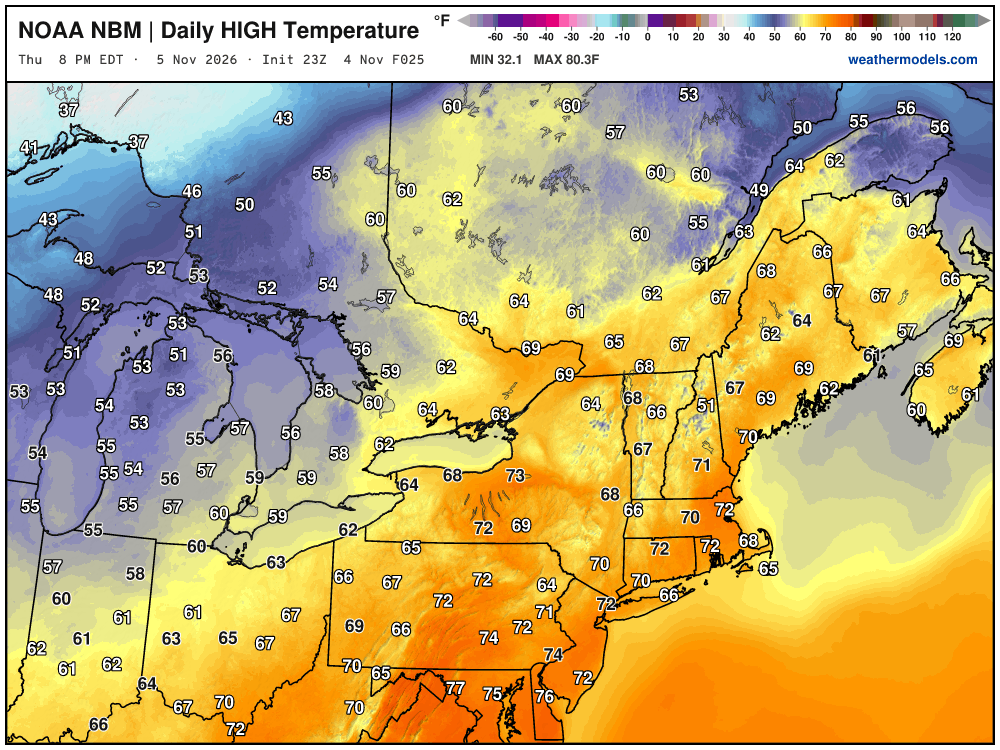
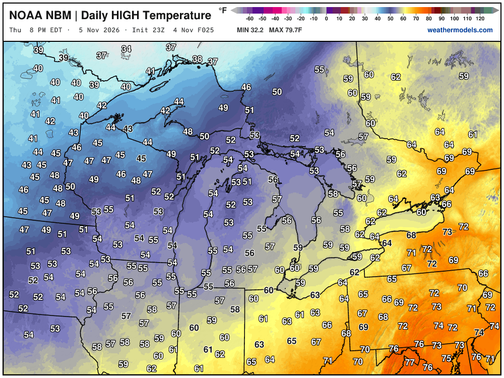
High Temperatures on Thursday
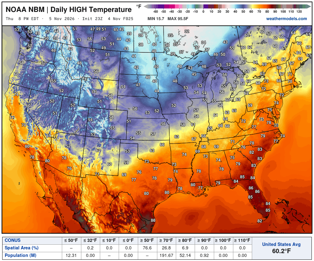
Still quite warm in the Southeast and across the Mid-Atlantic into the Northeast as the cold front makes slow progress. 60s and 70s in New England yet again!
High Temperatures next 9-Days through November 14th
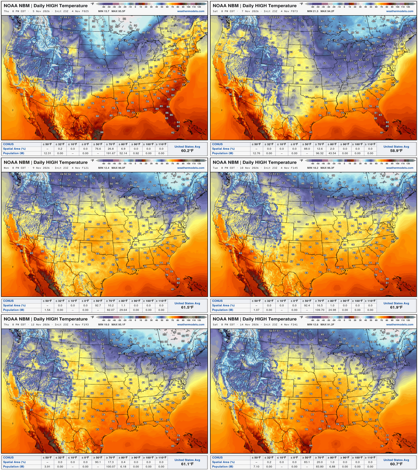
Well above normal temperatures continue into mid-November as any Arctic air is bottled up somewhere up in the Arctic near Greenland.
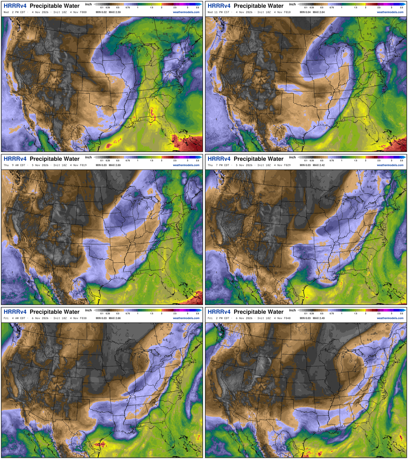
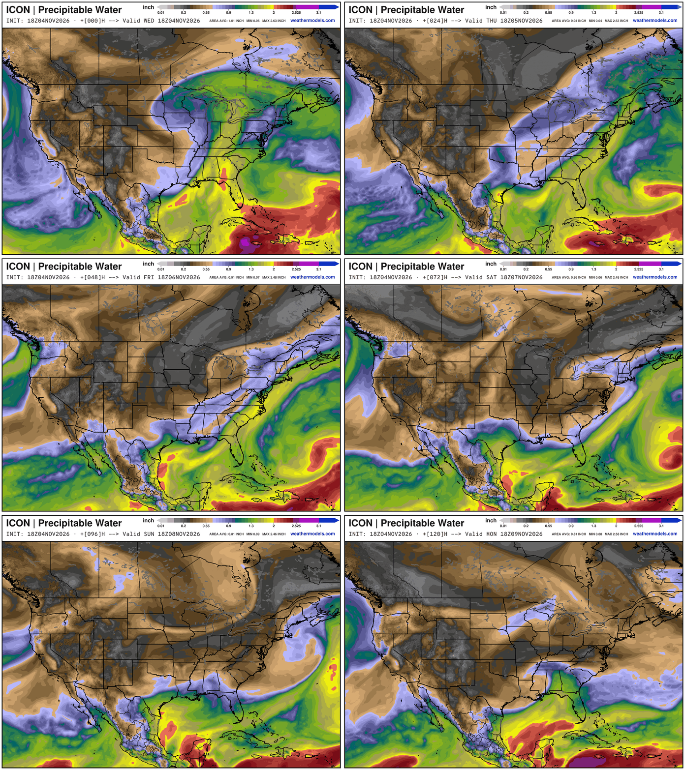
My favorite parameter — precipitable water | ICON 18Z next 5-days
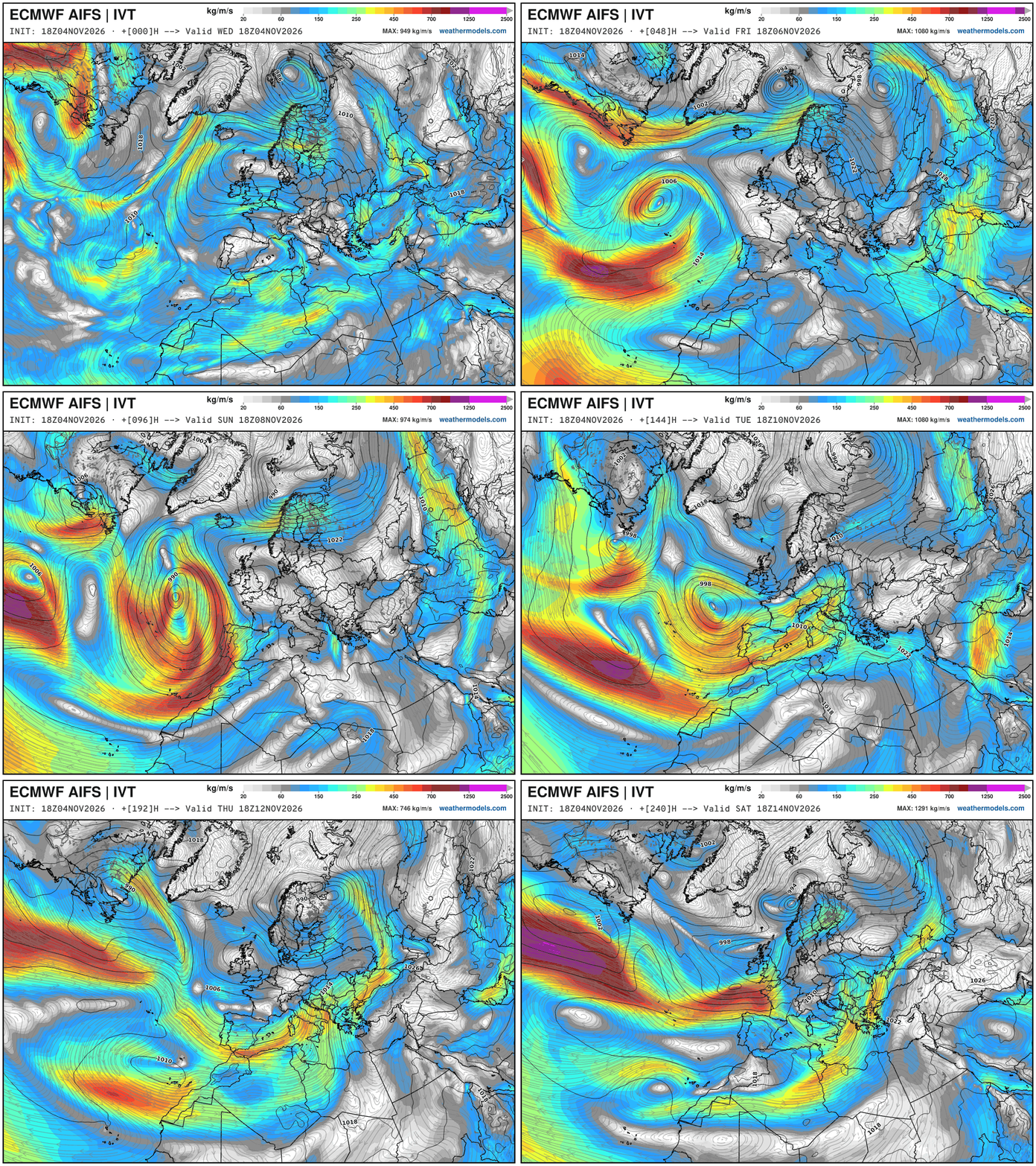
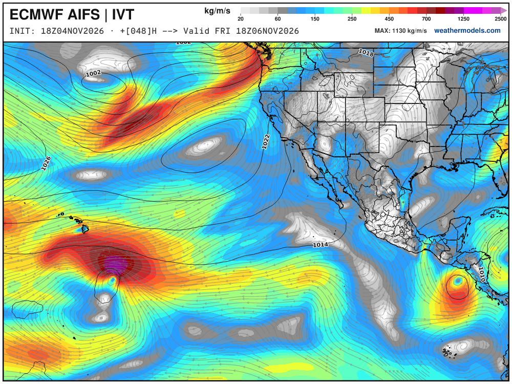
Integrated Vapor Transport Next 10-days | ECMWF AIFS 18z
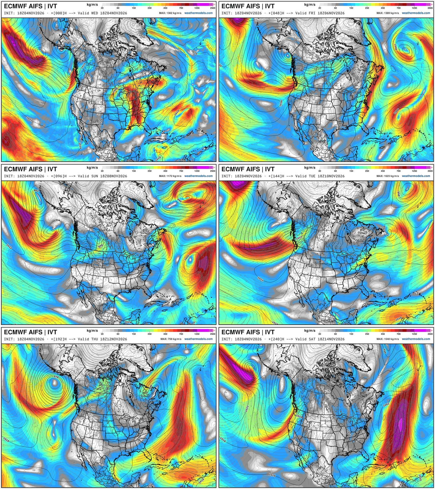
Pattern has shifted to a parade of sometimes strong Pacific troughs — crashing southward along the Pacific NW coast … until perhaps California gets involved in 10-days.
The ridging in the central U.S. and across Canada means a warm central and Eastern U.S. but we are watching the Northeast for shortwaves, and then a cut-off on the downstream flank of the omega block —> trending stronger with AIFS Single 18z
A likely named Subtropical Storm Kyle (50%) forms well east of the Bahamas, and continues out to sea.
Height Anomaly Pattern | Next 10-days | AIFS 18z | Flagship model
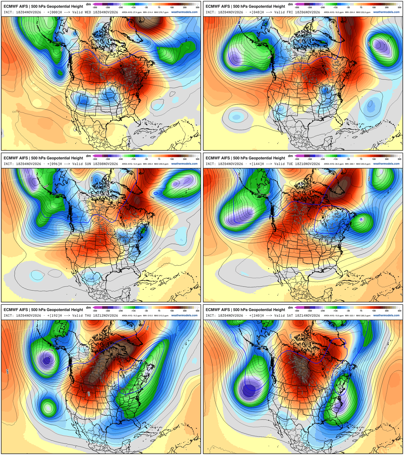
Large scale pattern —> Parade of troughs dipping across the West Coast — and ridging east of the Rockies most anomalous over Canada —> formation of an Omega Block. But, the new feature for late next week is one of these Pacific cut-offs travels through the southern U.S. under the block, and then finds access to the polar front again, accessing some colder Arctic air … 500 hPa Temperature is the best way to show the “polar vortex” intrusions. We should watch for some interior New England snowfall potential into next weekend and Lake Effect Snowfall.
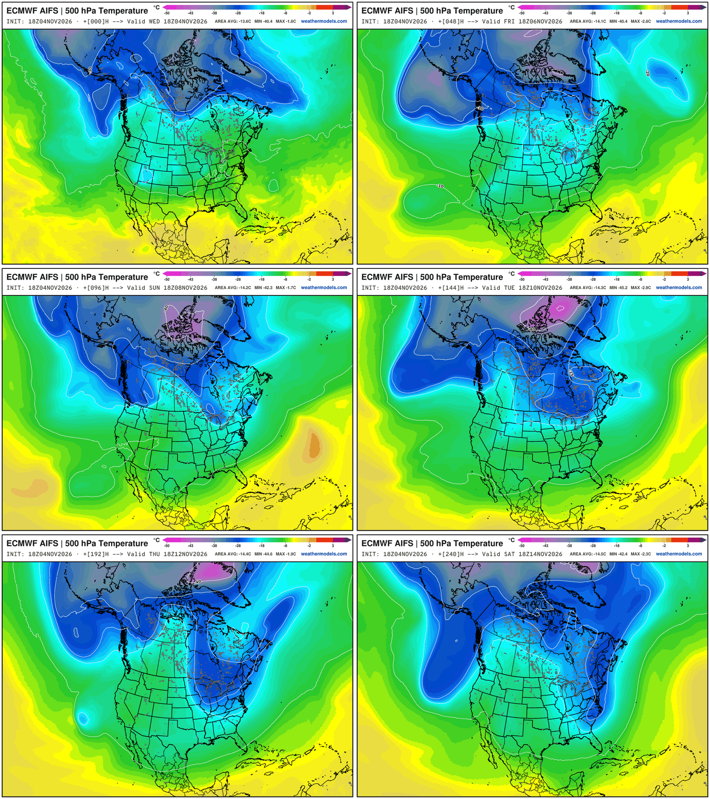
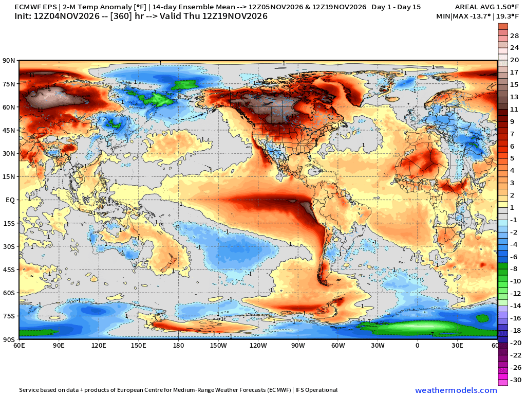
Nice to see the -40°C “cold pool” showing up at 500 mb across the Arctic — mainly Greenland — suggesting the “Polar Vortex” is powering up into Mid-November. El Niño adds about 1°C of global warming emanating from the tropical Pacific — and all of the teleconnections that come with that — but we can’t cancel winter!
European Weather Pattern
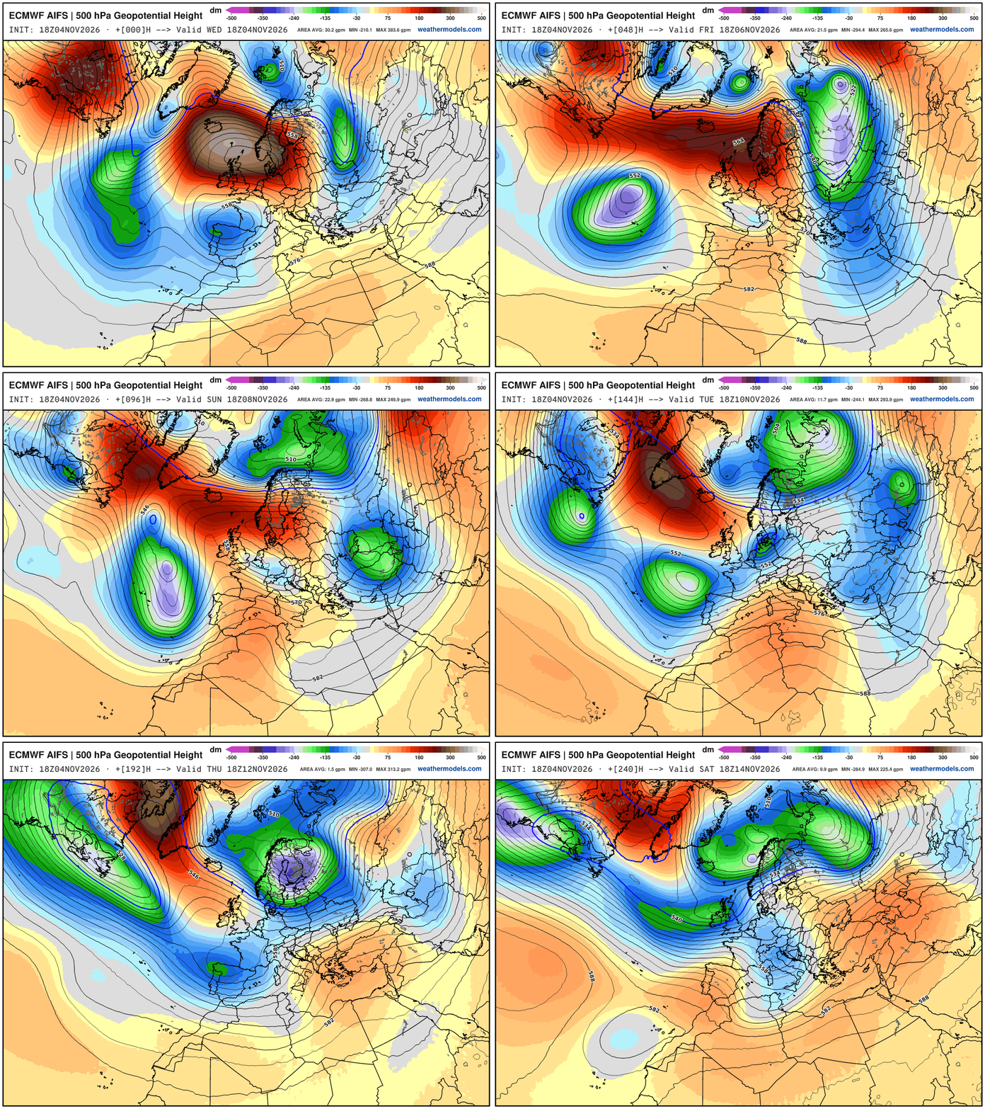
Huge cold dip across Eastern Europe with a lobe of the tropospheric polar vortex and then a general movement of that Greenland created cold toward Scandinavia.
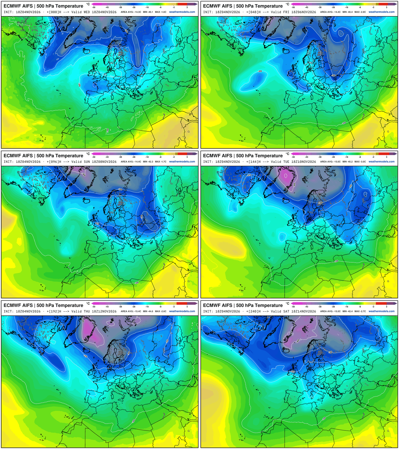
Cut-off storm off Iberian Peninsula will force plenty of moisture through southern Europe … but colder to the north as the pattern is dominated by North Atlantic / Arctic air for the upcoming 7-10 days, at least.
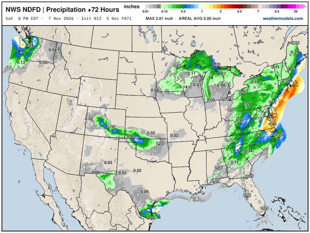
NWS NDFD Next 3-days precipitation
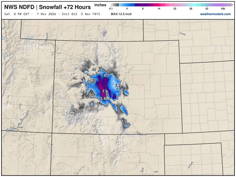
Up to 1 foot of snow in Colorado Rockies!
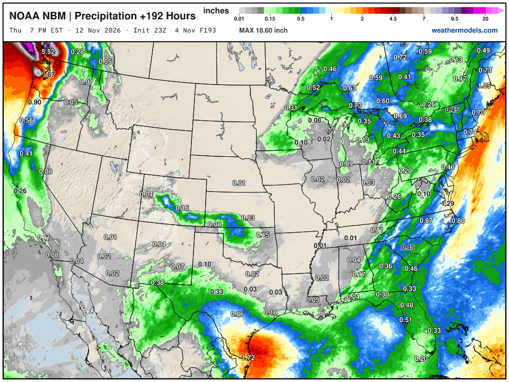
Blend of Models Precipitation Next 8-days | Lower 48
Blend of Models Snowfall Next 10-days
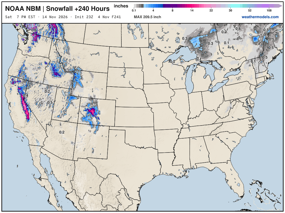
Still waiting on our first Eastern U.S. snowfall through first 14 days of November.
Snowfall Next 15-days | ECMWF Ensemble 12z Median
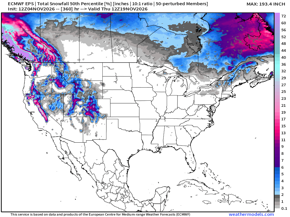
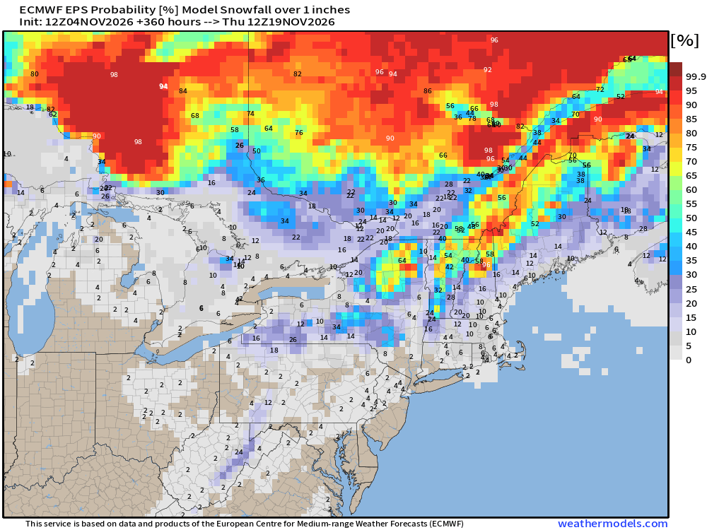
Slowly but surely as these maps head into early November — we’ll see our first legitimate chances of a snow storm for the Midwest, Great Lakes, and Northeast — not yet. But maybe Lake Effect snowfall!
Probability of 1-inch or more of snowfall through November 19th
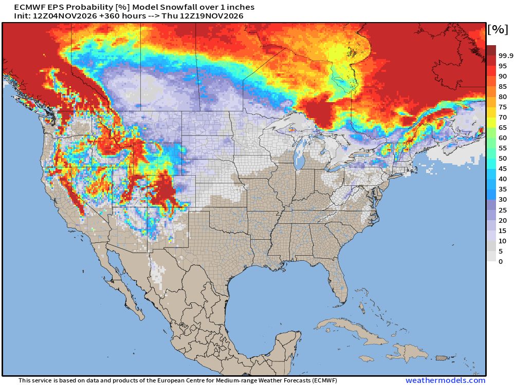
Interior New England snowfall likely, but don’t look elsewhere yet!
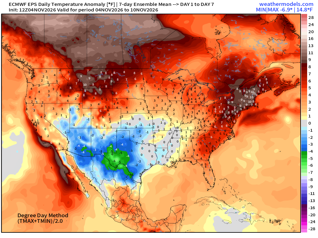
Week 1 Temperature Anomaly | Nov 4 - Nov 10
Week 2 Temperature Anomaly | Nov 11 - Nov 17
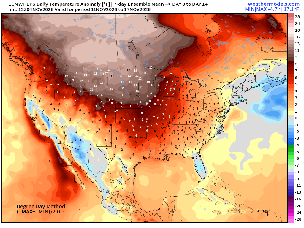
Blow torch continues into second week of November across Canada, and much of the Lower 48 with any cold snaps very brief / transient.
El Nino Global Temperature Pattern + 15 days
North Atlantic Hurricane Season
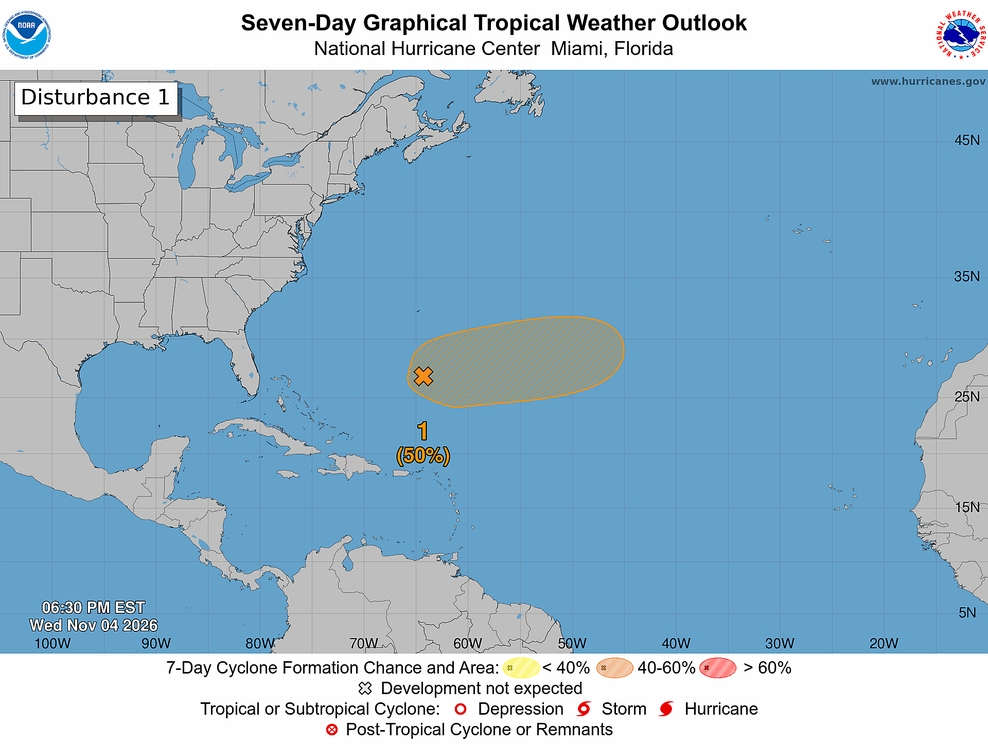
50% chance of subtropical storm formation
The storm system ahead of the Subtropical System is extratropical — and associated with a trough (cut-off) and might be impactful for Portugal and Spain.
A little swirl is apparent east of the Bahamas — should be more so on Thursday. Not expecting a powerful system — and arguably — it’s not tropical — so why are we bothering?
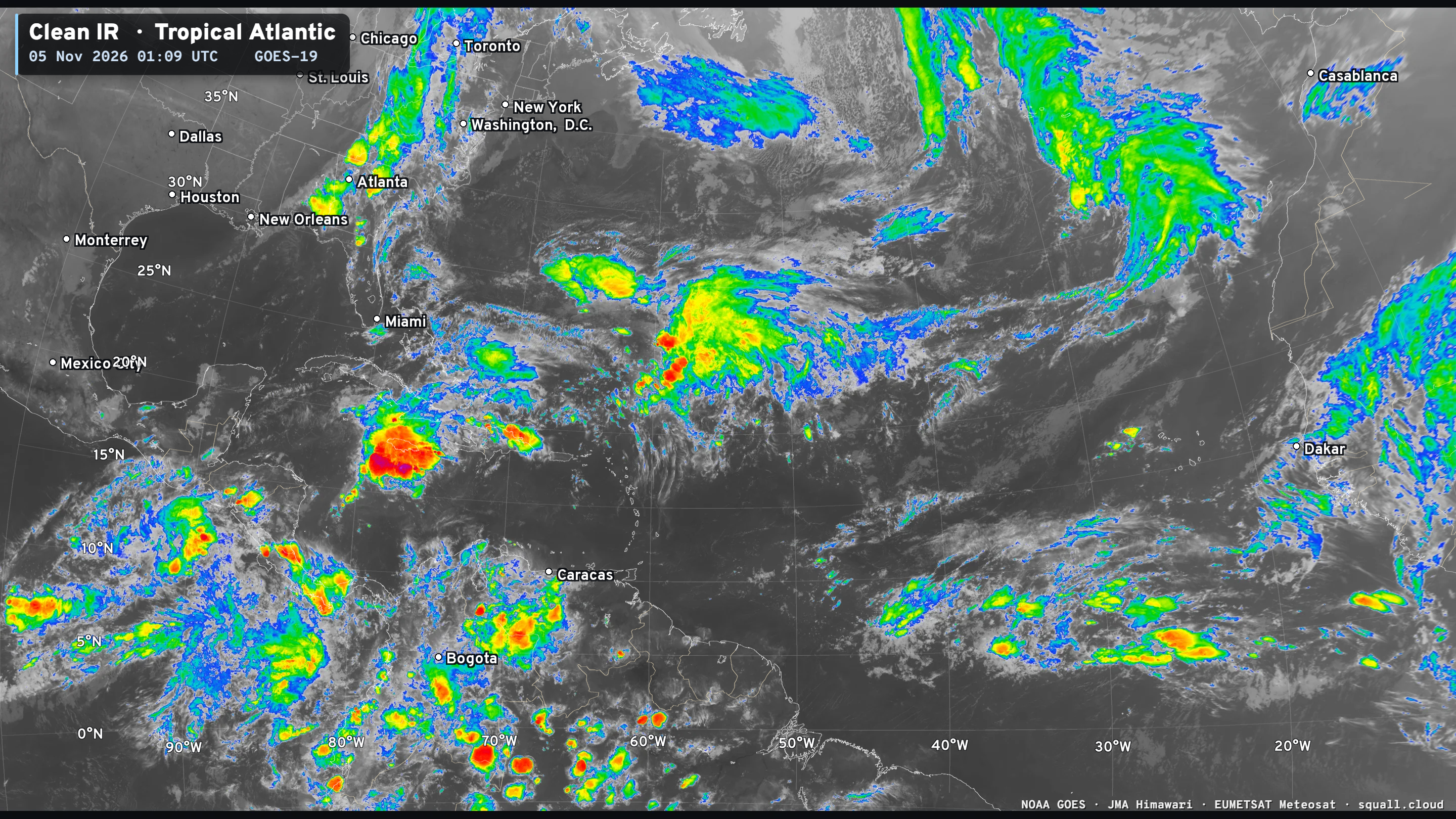
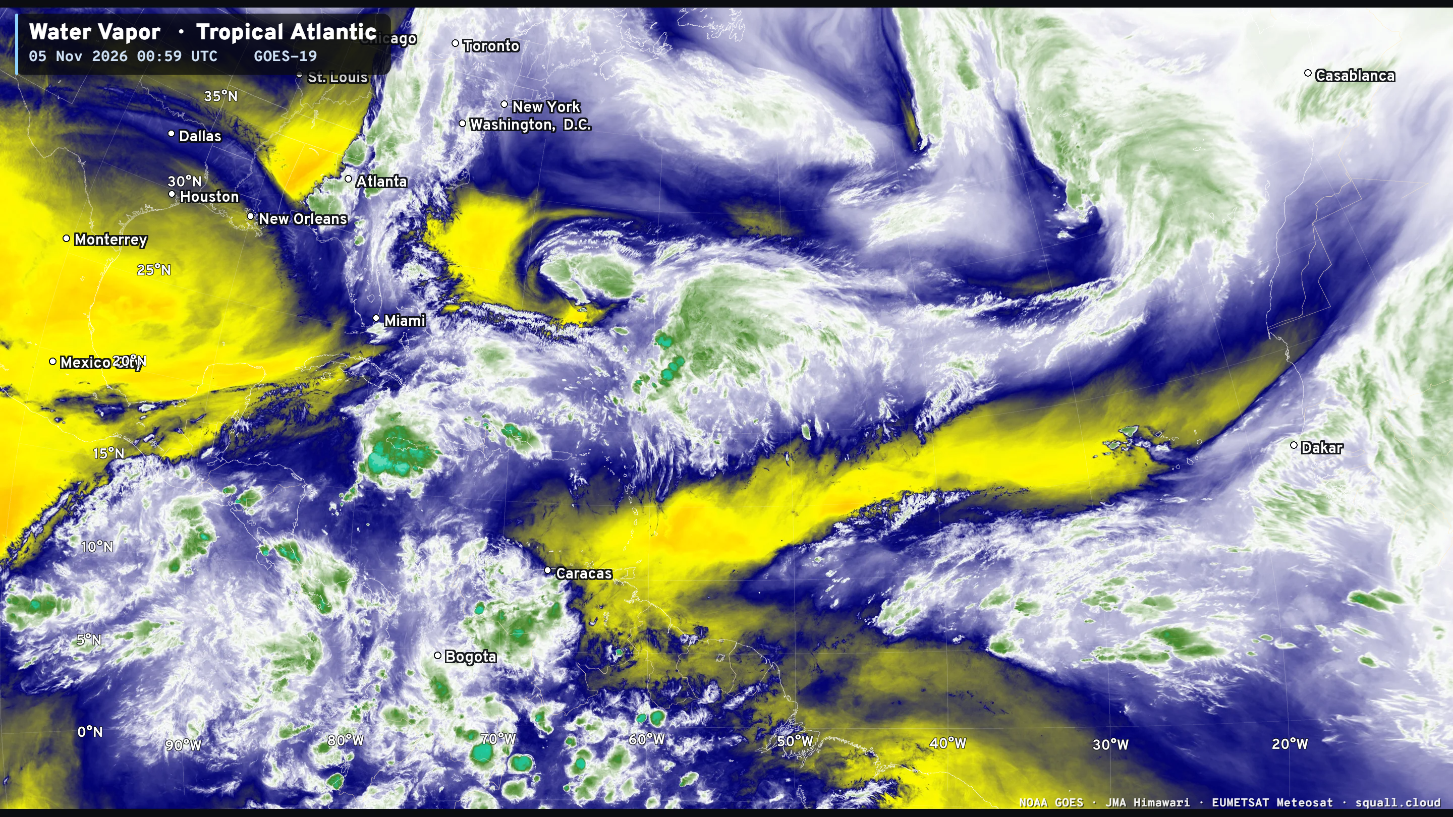
Hurricane season continues w/named subtropical storms. Next name is Kyle.
Eastern and Central Pacific
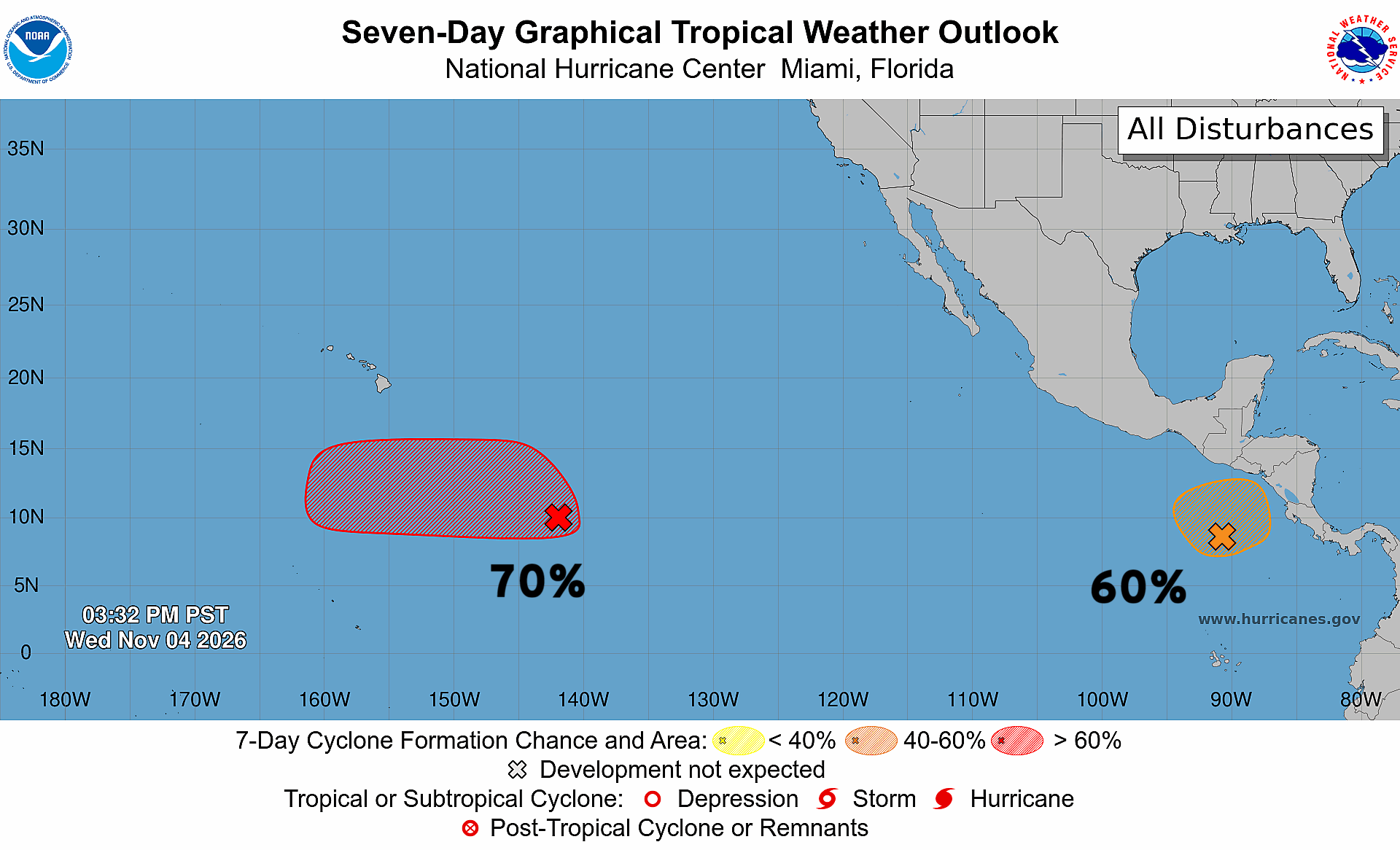
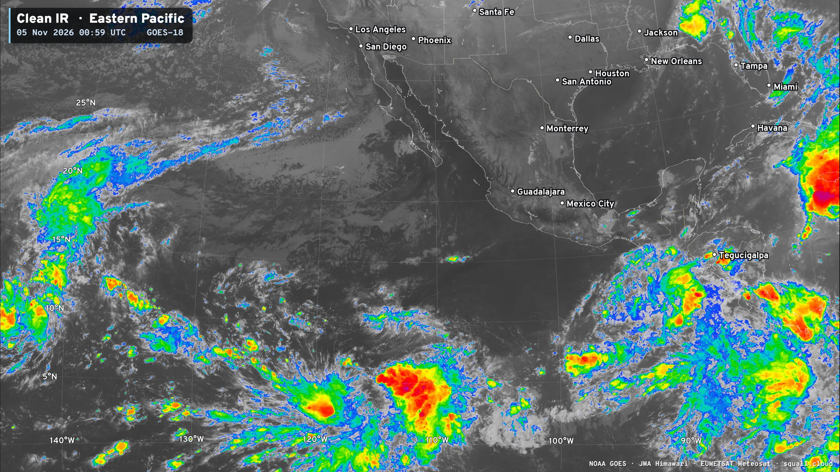
Two areas of interest — both cold become brief tropical depressions or storms.
Thank you for visiting / reading — always more to come!
Visit Global Tropical Cyclones w/Dr. Pielke Jr. for more ACE information, as well as my original climatlas.com/tropical site with much new research including a calibrated “Best Track” and historical tropical cyclone browser with plenty of interesting features like rankings of storms by their IKE (size). ACE up to 937

Satellite imagery from Squall Cloud. Maps sourced from weathermodels.com designed and innovated by yours truly! Please subscribe there for real-time access to the newest maps, charts from all of the weather models including ECMWF and AIFS, and NOAA GFS/GEFS, HRRR/RRFS and Blend of Models (NBM). NOAA WPC and SPC for fronts/convective outlooks. Our own content is now sourced from hottestsince.com and weather.city and celsius.earth, and global-tropical-cyclones.com and precip.earth and forecastcanada.com and forecastgermany.com
Atlantic Hurricane Season | YTD: 10 Named Storms, ACE = 19.5
NE Pacific Hurricane Season: YTD: 24 Named Storms, ACE = 355
My Atlantic Hurricane Season Forecast (2026)
From April 7, 2026: Atlantic Seasonal Hurricane Forecast: (11/5/2)
9-13 Named Storms (11 most likely)
4-7 Hurricanes (5 or 6 most likely)
1-3 Major Hurricanes (2 most likely)
Accumulated Cyclone Energy: 75-85 (well below normal)
NOAA 2026 Atlantic Hurricane Season Forecast
Previous in this storyline: Strong cold front has mostly swept through leaving a windy and cool weekend (OCT 16)
- Milepost
- 1635 · laid 2026-11-05T01:52:54Z
- Source
- https://weather.substack.com/p/november-4-2026-wednesday-weather · November 4, 2026 Wednesday Weather Update
- Tagged
- I-32 Winter · Winter 2026–27 · Eastern U.S. (37.0, -78.0) · by rule, at build
- Digest
- a8d4d4c8ffccf7cf15b17630d08ce09ba8593b446ee8736ffe5bd69224ceeda8