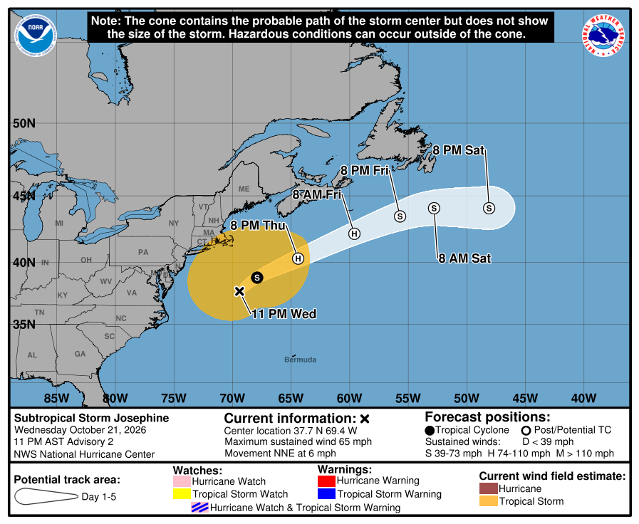
Subtropical Storm Josephine will spin away from the East Coast and become extratropical

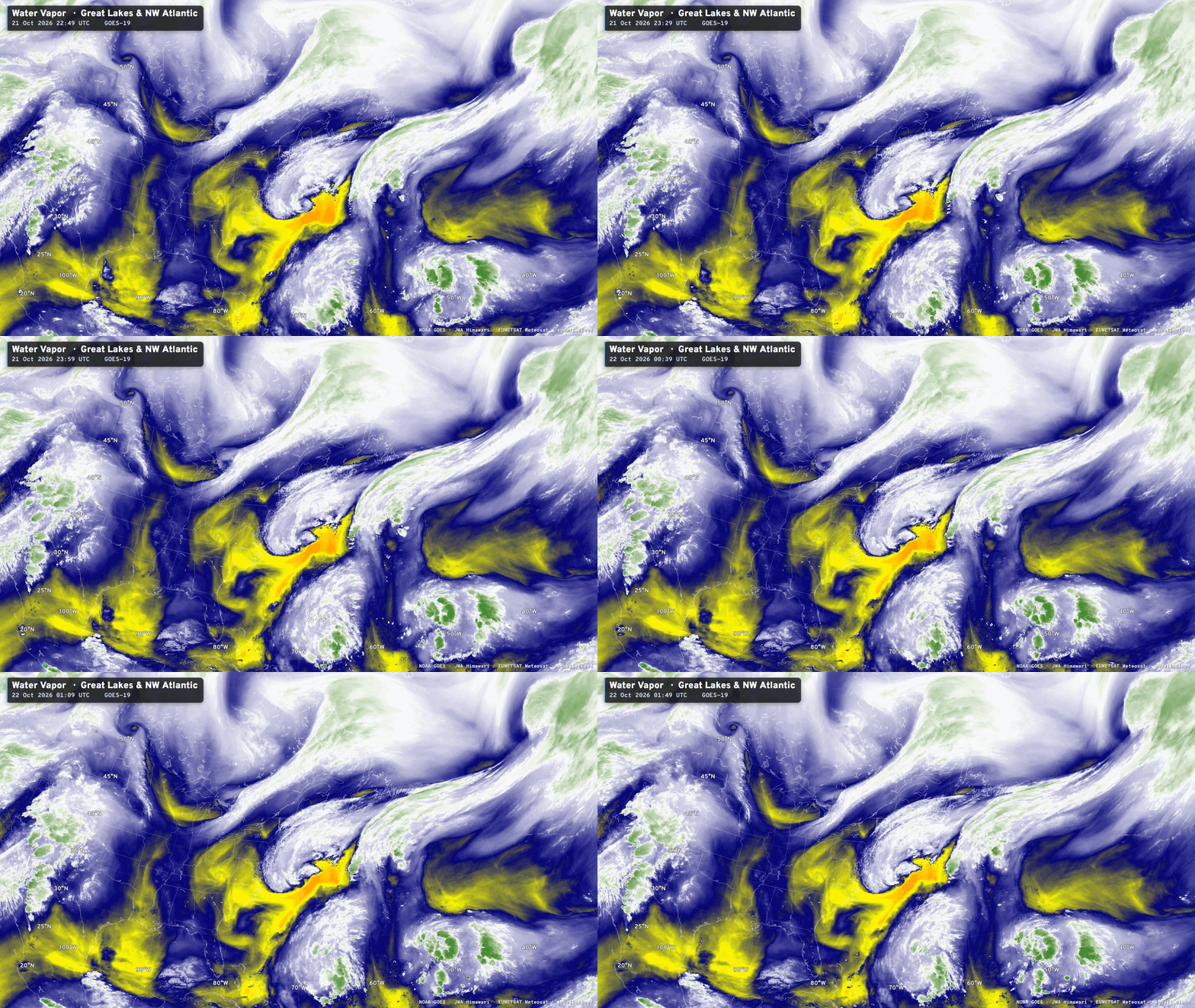
Subtropical Storm Josephine
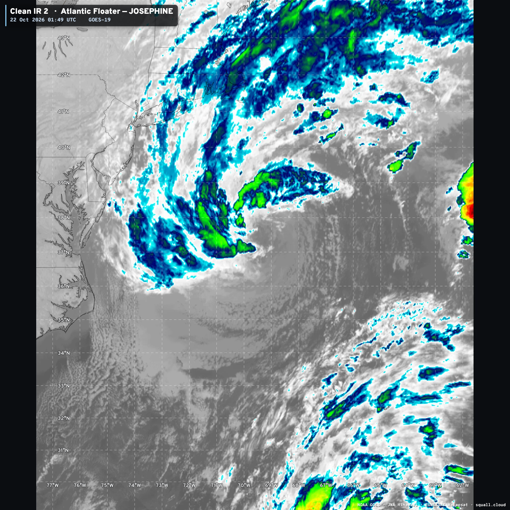
Convection fired up earlier on Wednesday + frontal boundaries mostly detached so NHC triggered advisories on Subtropical Storm Josephine. However, the system ingested a lot of nearby dry air, and the ocean temperatures are marginal, so we’ll see a quick transition to extratropical cyclone — but then intensification again — with hurricane force winds. Central pressure into the low 980s on Thursday.
I’m not the biggest fan of naming Subtropical Storms that are not expected to transition into fully tropical storms or hurricanes. NHC changed their policy in 2002 to name all Subtropical Storms — taking the name from the main Atlantic list. In decades prior, these hybrid systems just received a number designation. Not going to get too worked up about it — expect to mention that Josephine counts just the same as any other TS or Hurricane. And, that means we are up to 10 named storms for 2026, including Major Hurricane Isaias. However, the ACE hasn’t hit 20 yet.
Bomb Cyclones — Sequence of 3 storms in Europe + UK over next week
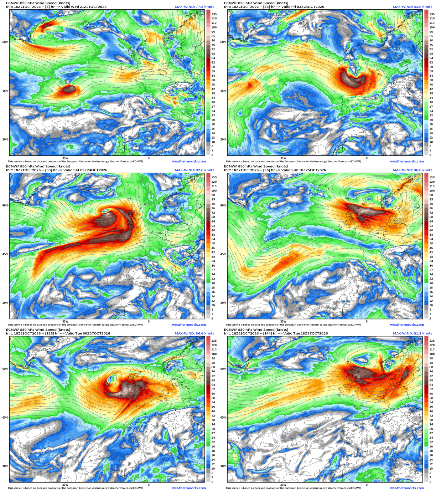
I always like 850 mb winds (1.5 km up) to show the strong “chevron shaped” band of often hurricane force winds on the back side of the powerful bomb cyclones. This was a major chunk of my dissertation back at Florida State more than 2-decades ago.
The first bomb cyclone into early Friday is a fast moving, lower latitude system that cruises along as a frontal wave, slowly building up its tower of potential vorticity (PV) to phase with the upper-level jet stream, extract kinetic energy through baroclinic instability.
These smaller systems are more potent and can bring damaging winds to Ireland, London, and France. I see 970s mb and hurricane force wind gusts, at least over water on Friday.
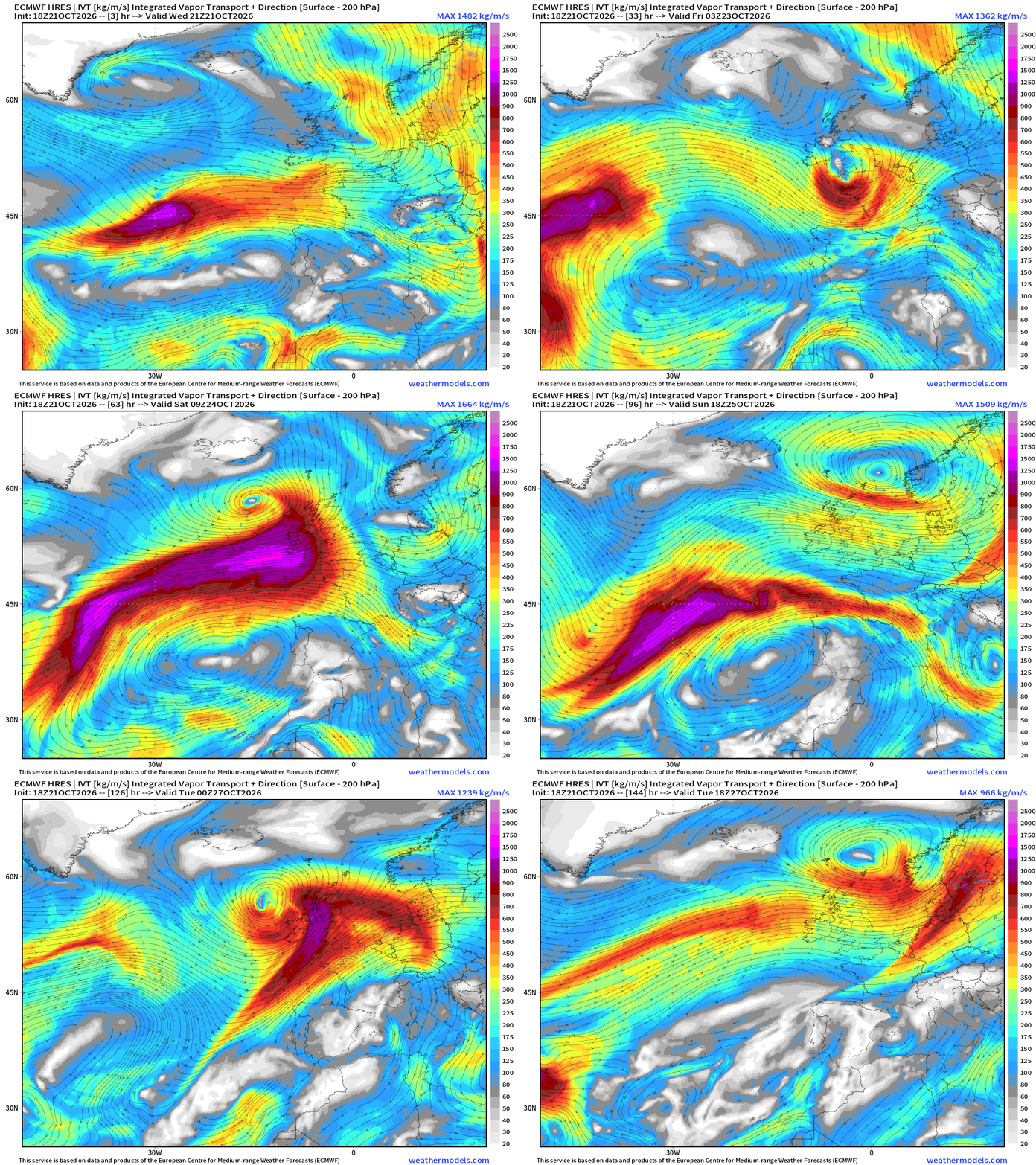
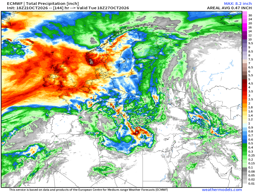
The next 2 bombs are typical Icelandic Lows … more intense but larger/sprawling. The huge “parent lows” all have atmospheric rivers or conveyor belts of subtropical moisture —> heavy rain for UK and Europe
Integrated Vapor Transport (IVT) next 6-days
Rainfall next 6-days for Europe —> 2” to 4” (red)
Blend of Models Precipitation Next 7-days | Lower 48
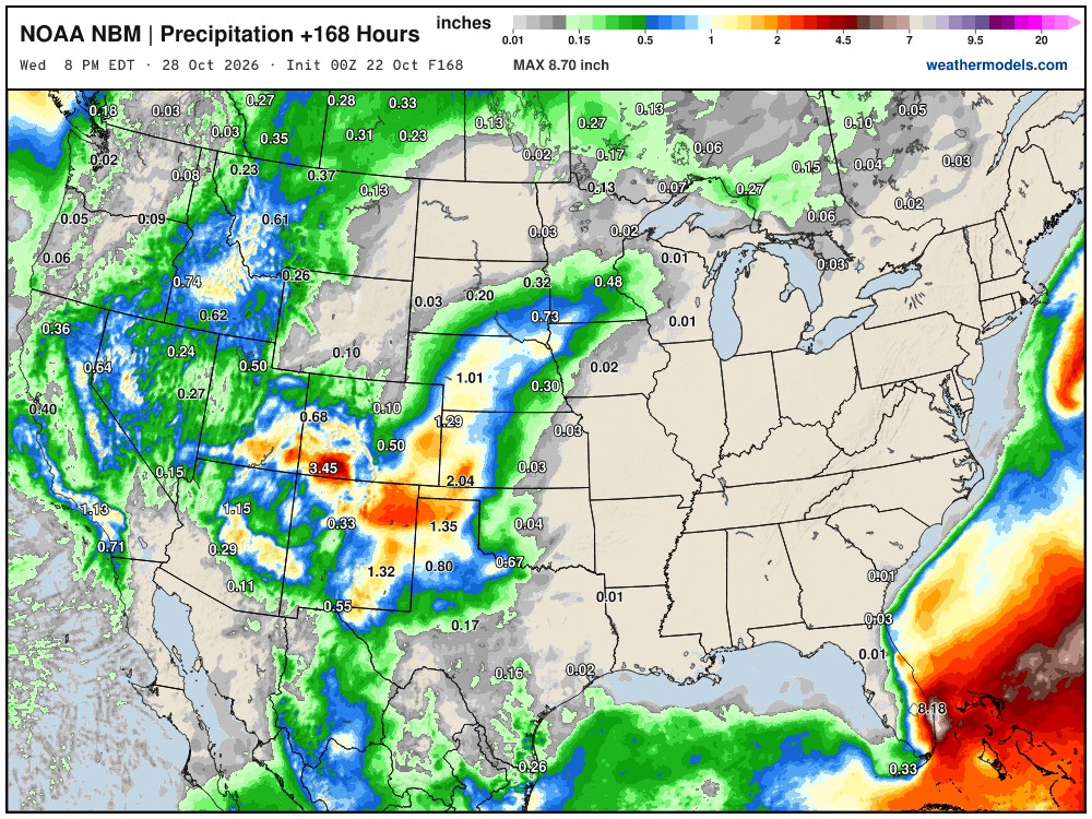
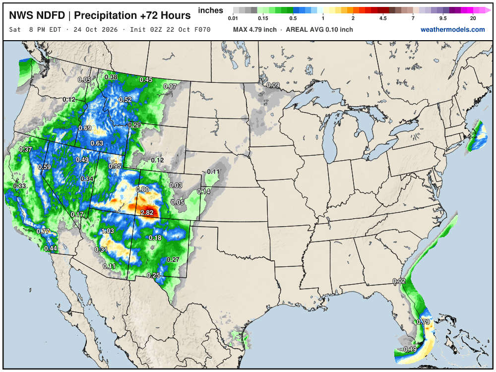
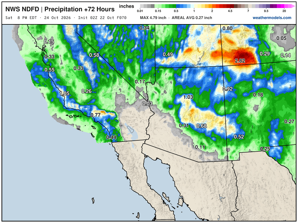
Nice spurt of rain and moisture for the California water year (started October 1) and additional 1” or more up through Great Basin into Idaho. All bonus for mid-October.
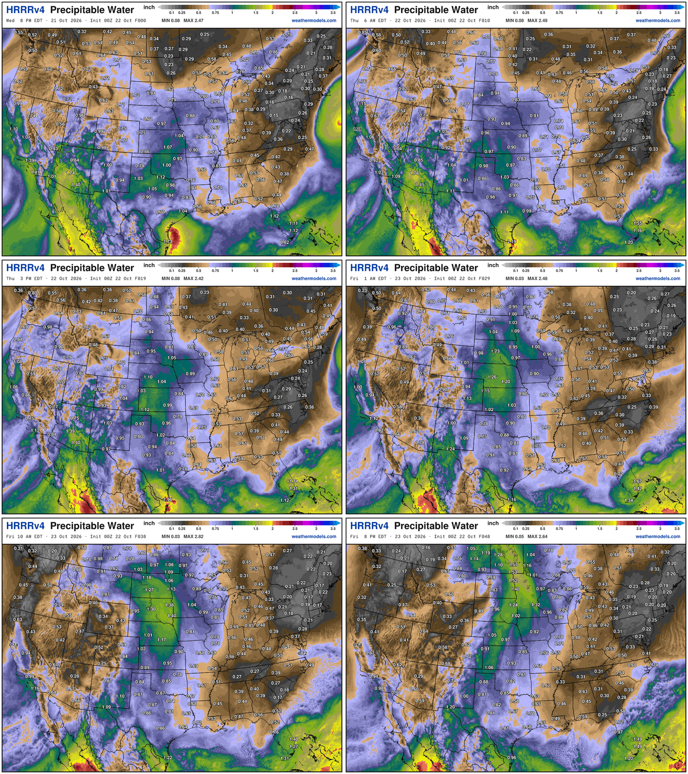
My favorite parameter — precipitable water | ECMWF 18z next 6-days
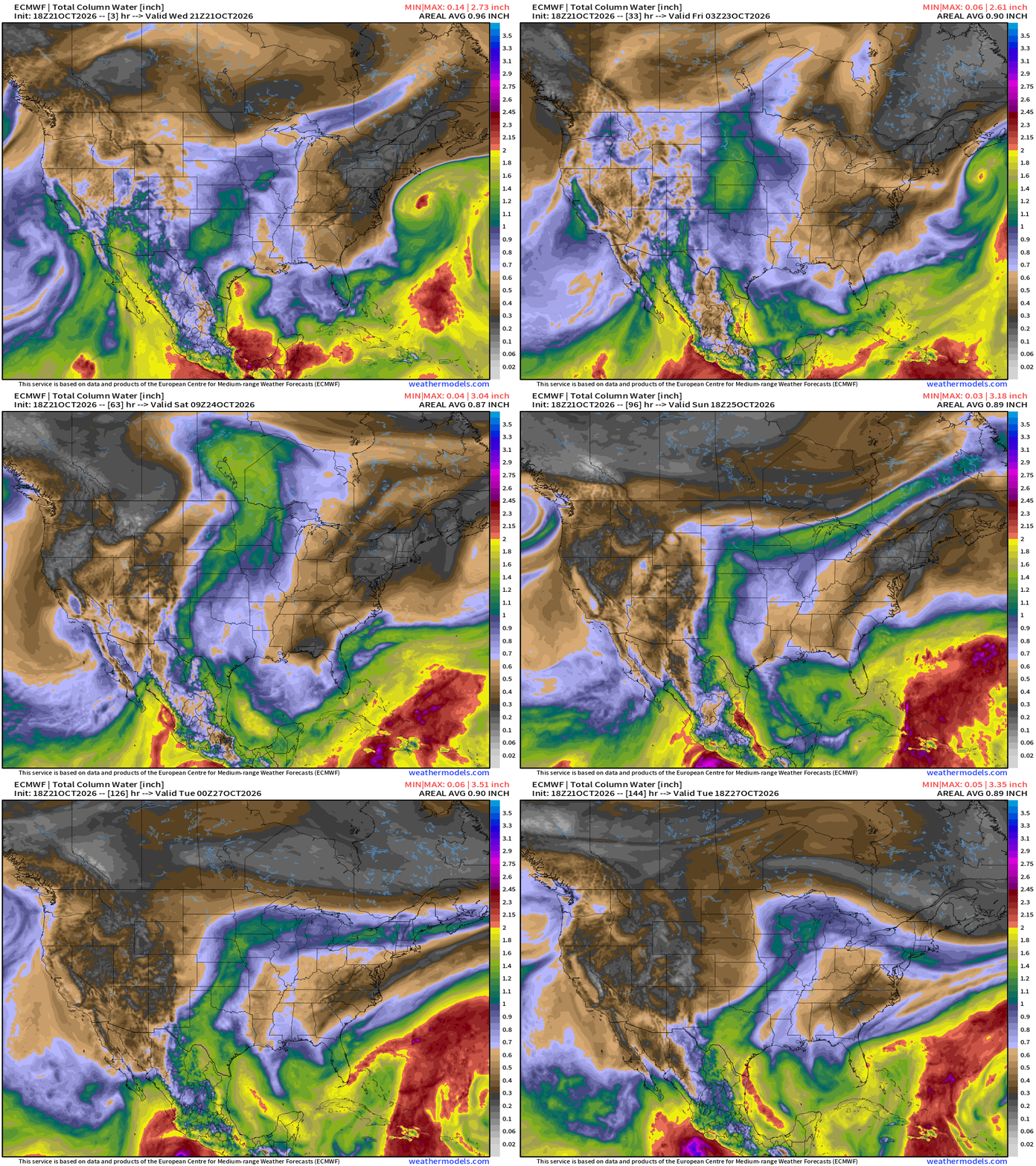
Josephine swirls away from the East Coast … more dry air dips out of Canada down the Eastern Seaboard into the Southeast —> dry and sunny.
Cut-off low + moisture plume out of Pacific subtropics links up with some Gulf moisture —> warmth
Temperature Analysis at 9:30 PM ET
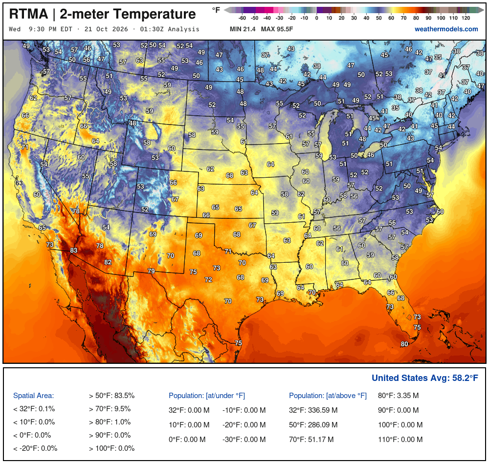
Temperature Analysis | Anomaly from Normal
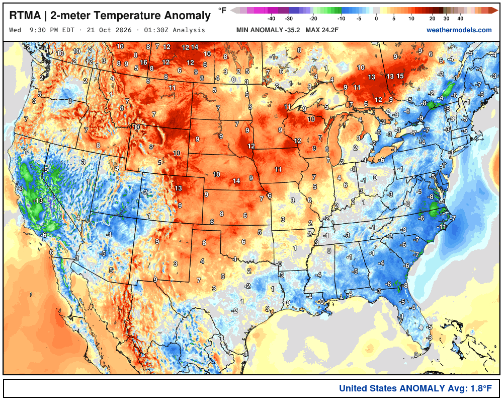
Lower 48 was 1.8ºF above normal
High Temperatures next 9-Days
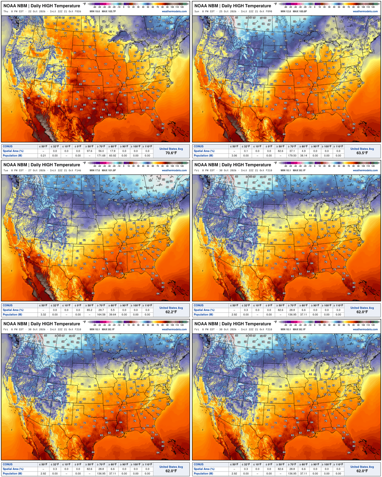
We lose the 70s and 80s —> Cooler weather returns for a few days into next week across the Midwest and Great Lakes, but then moderation again into end of the month.
Next 48-hours HRRR precipitable water
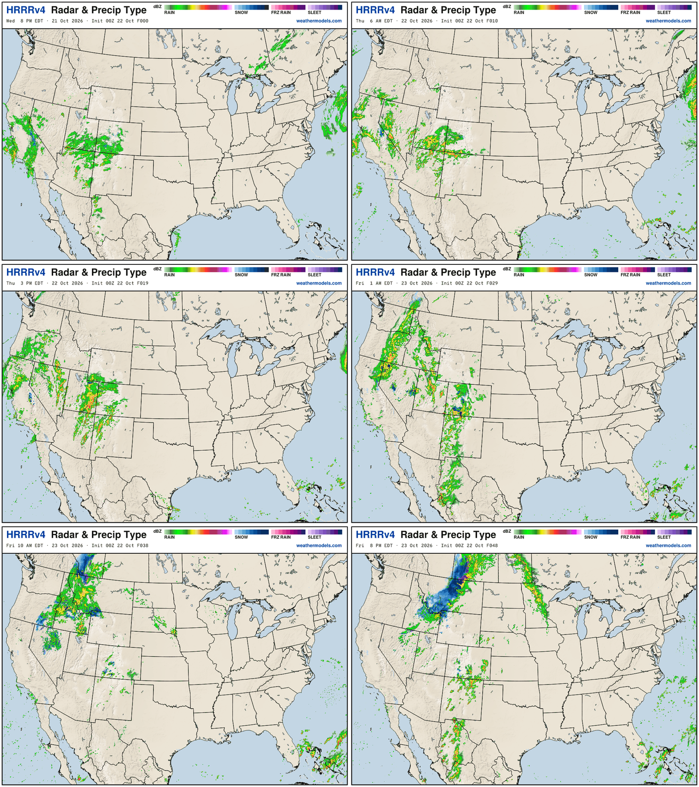
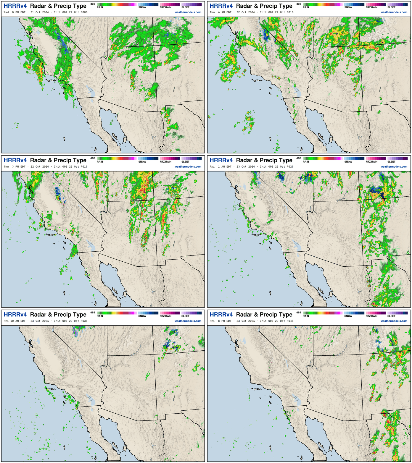
California moisture from cut-off low (trough) swirls onshore … and it heads across the Rockies to join a storm system in the Midwest on Friday
Simulated radar into Friday 8 PM ET
NWS NDFD Next 3-days precipitation
Low Temperatures Thursday Morning
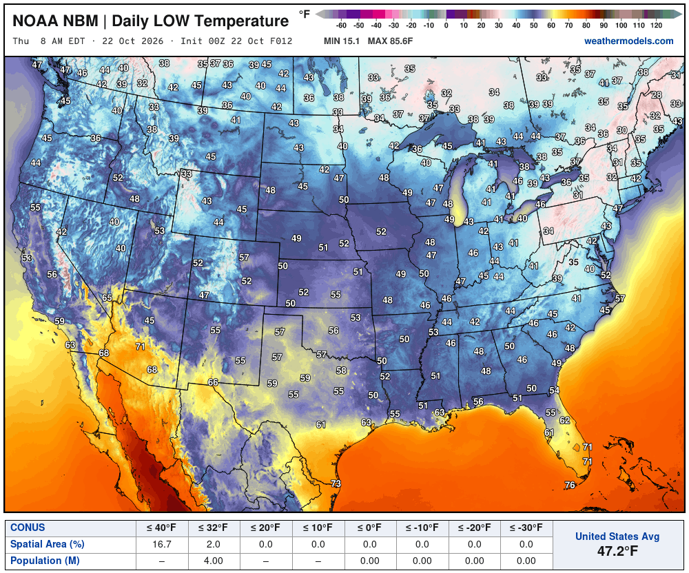
Exactly 4 million below freezing mainly in the Northeast
High Temperatures on Thursday
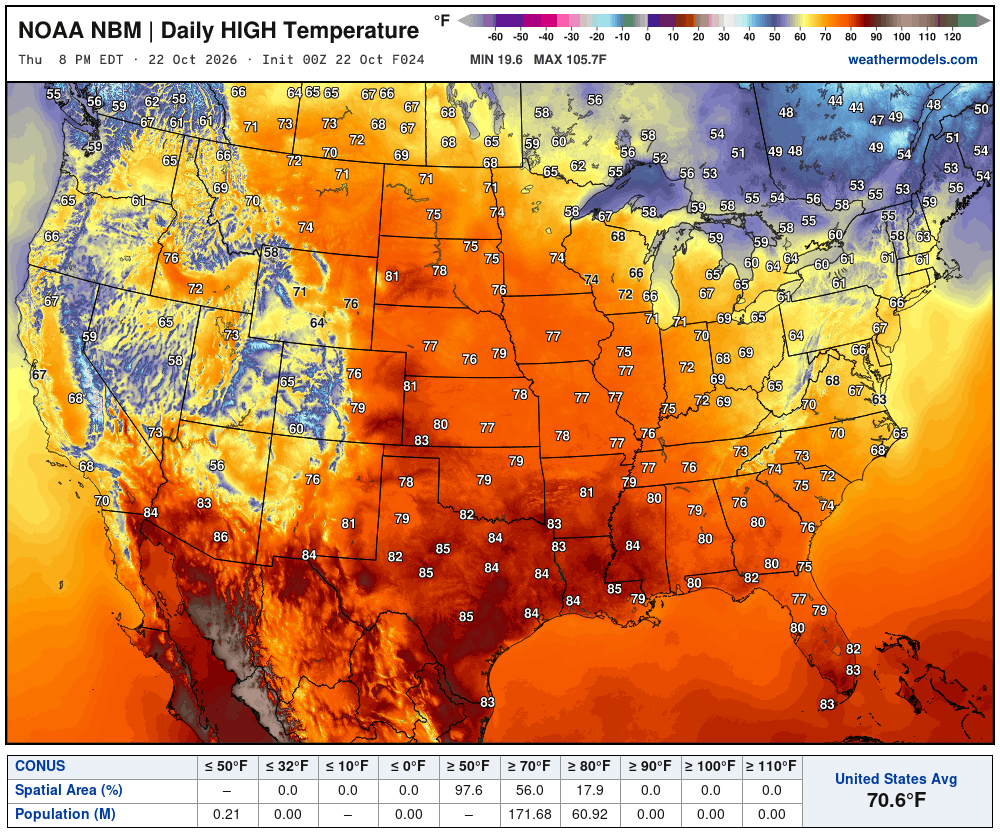
Another day of 70s most widespread across the Lower 48 with 60s in the Northeast.
The Lower 48 average is 70.6°F
Blend of Models Snowfall Next 7-days
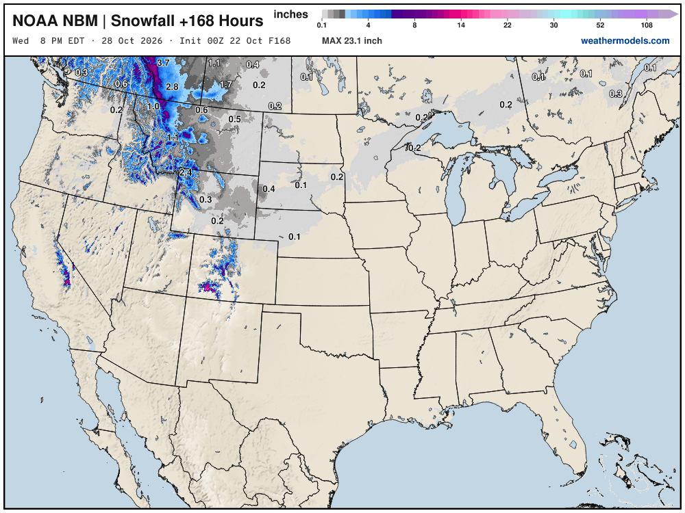
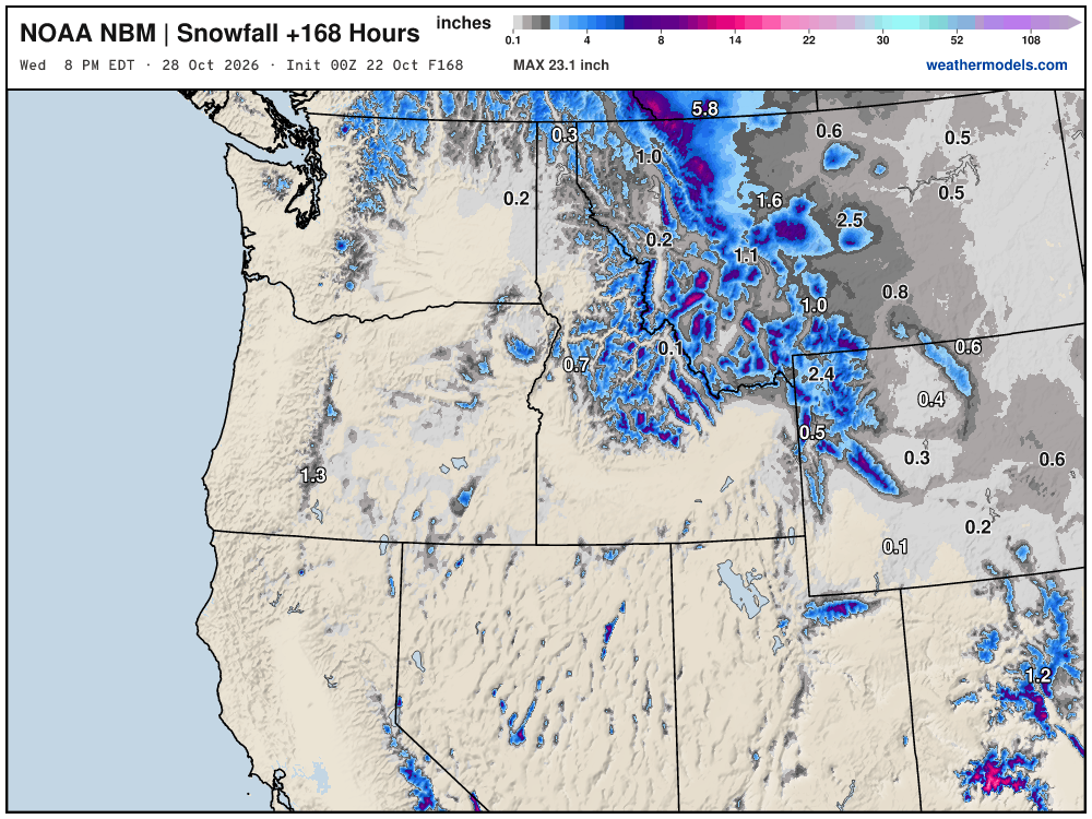
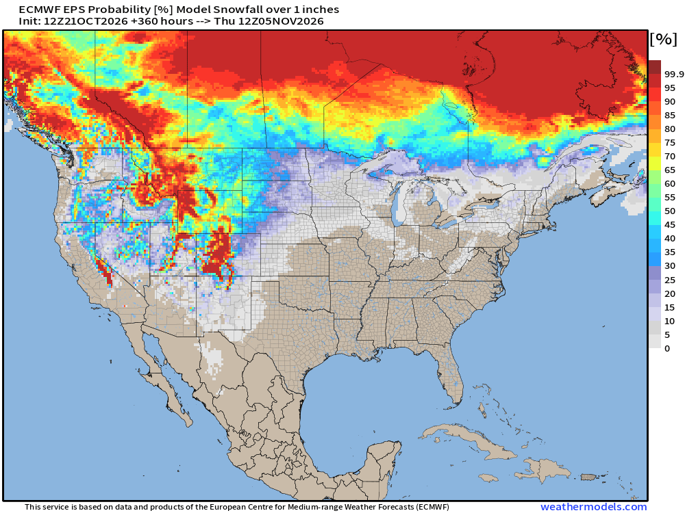
Snowfall Next 15-days | ECMWF Ensemble Median
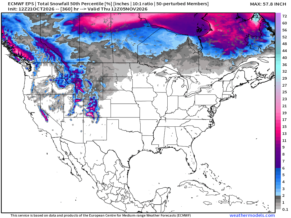
Slowly but surely as these maps head into early November — we’ll see our first chances of a snow storm for the Midwest, Great Lakes, and Northeast — not yet.
Probability of 1-inch or more of snowfall into early November
Integrated Vapor Transport Next 10-days | ECMWF AIFS 18z
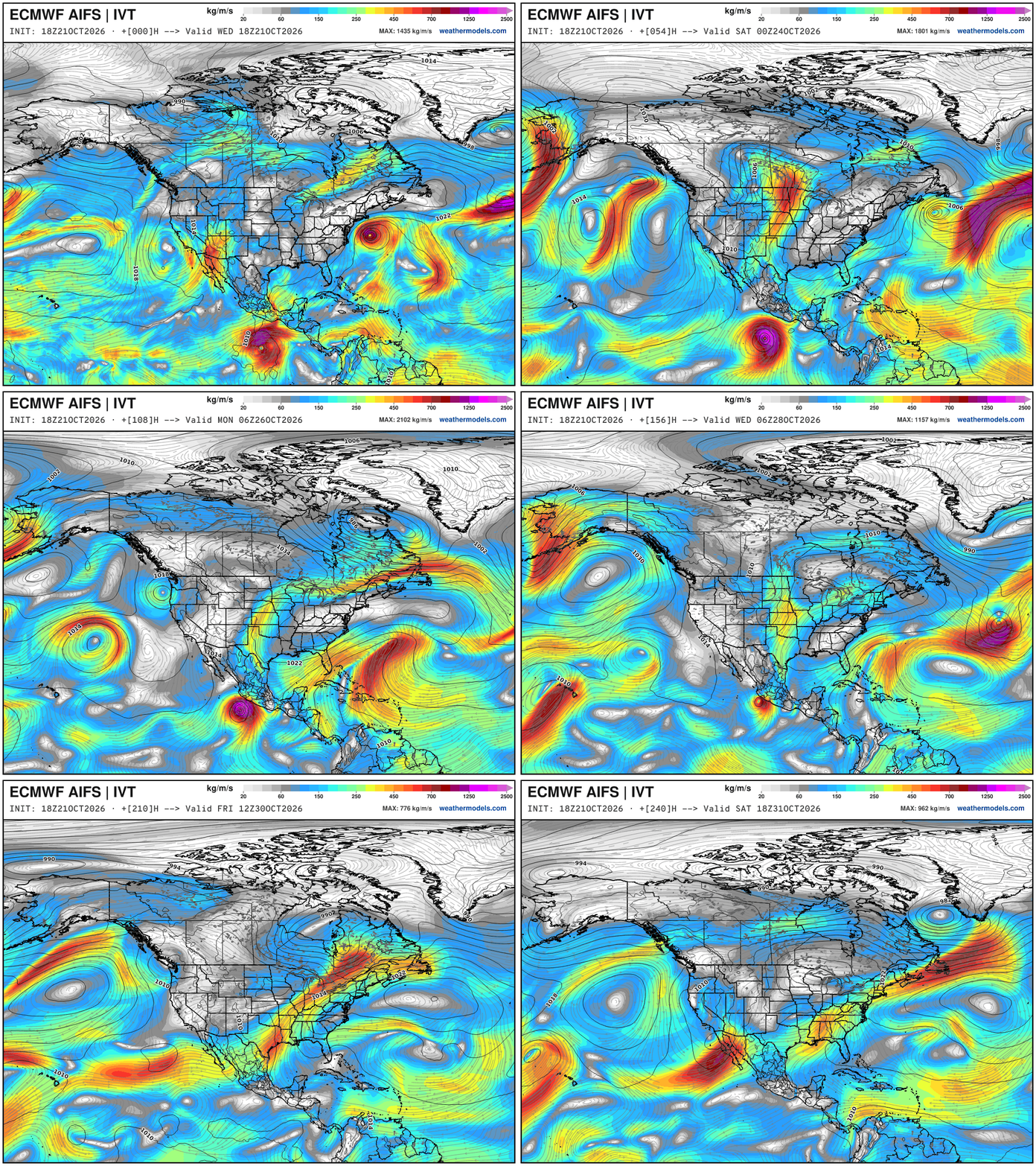
Hurricane Vance forms off the coast of Mexico and drifts northward … and otherwise mostly dry easterly flow across the Gulf —> shuts down the moisture flow into the eastern U.S. —> dry and cool —> and as I said before — perfect weather for raking leaves or decorating your yard for Halloween.
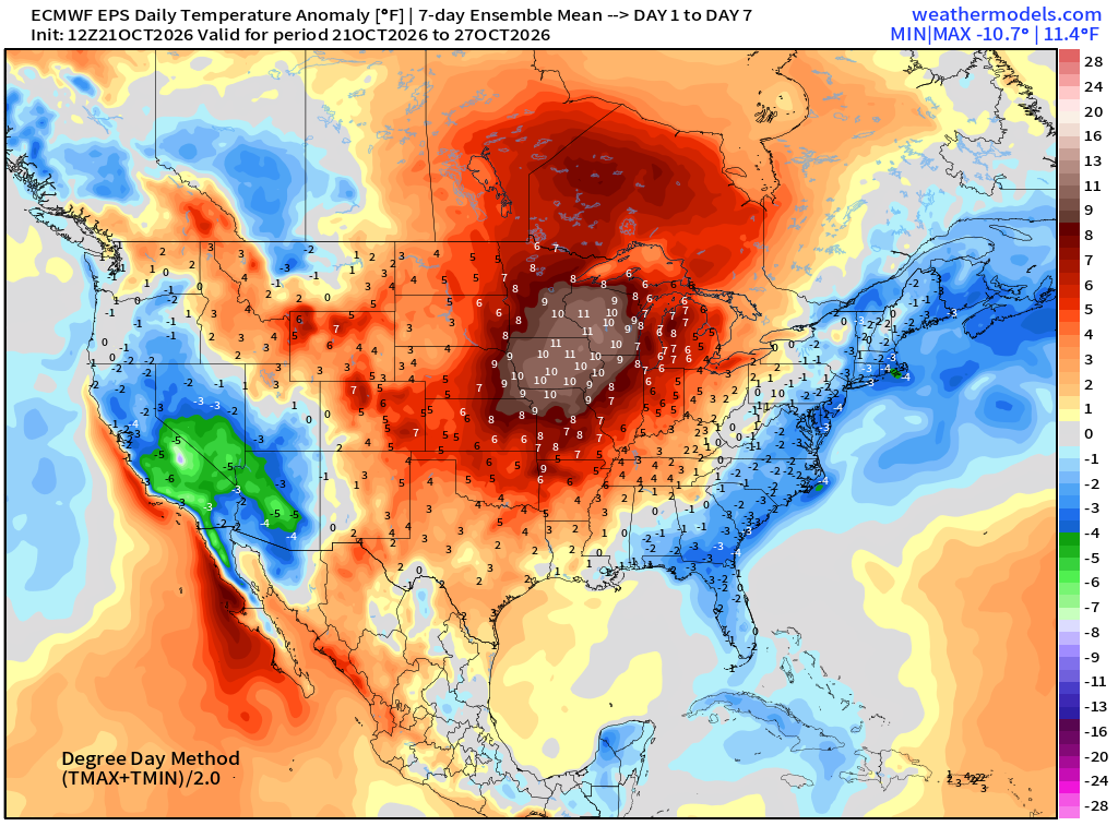
Week 1 Temperature Anomaly | Oct 21 - Oct 27
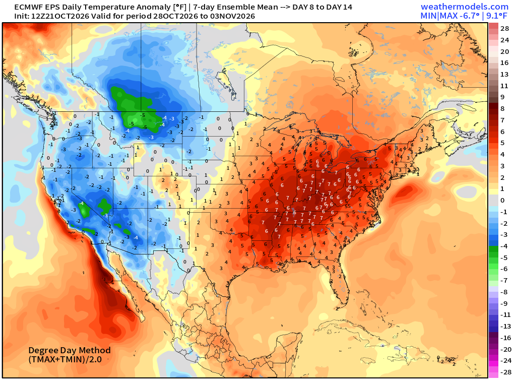
Week 2 Temperature Anomaly | Oct 28 - Nov 3
Atlantic Tropical Outlook
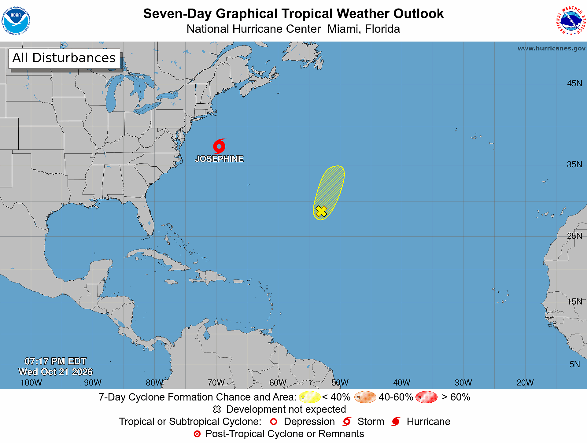
Another little area at 10% popped up … in the subtropics, of course. Subtropical Storm Josephine will become a hurricane force extratropical storm by Thursday evening heading out to sea over much cooler water
ECMWF Ensemble 12z full-physics tracks next 15-days
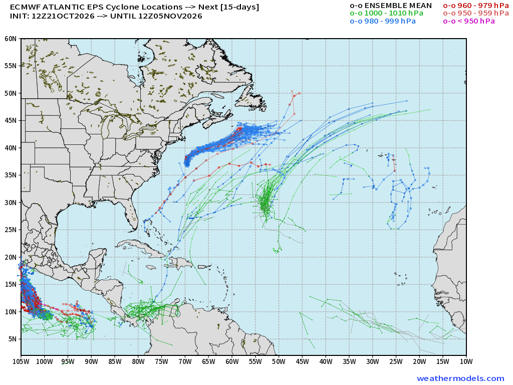
The secondary area in the SW Atlantic near the Bahamas has mostly poofed … same in the Google WN3 ensembles —>
Google Deep Mind | Weather Next 3 | 12z Tracks (64-members)
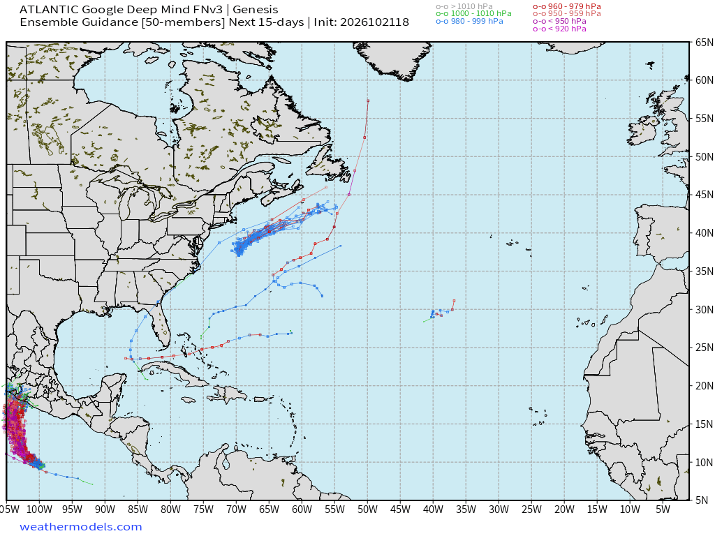
Only a tiny signal … under 5% with Google WN3
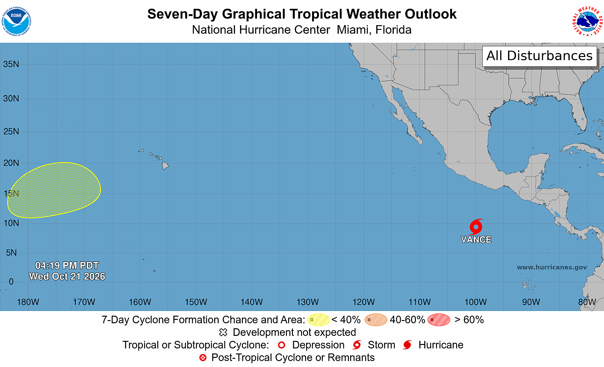
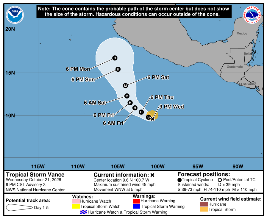
Eastern Pacific Tropics | Vance Powering Up
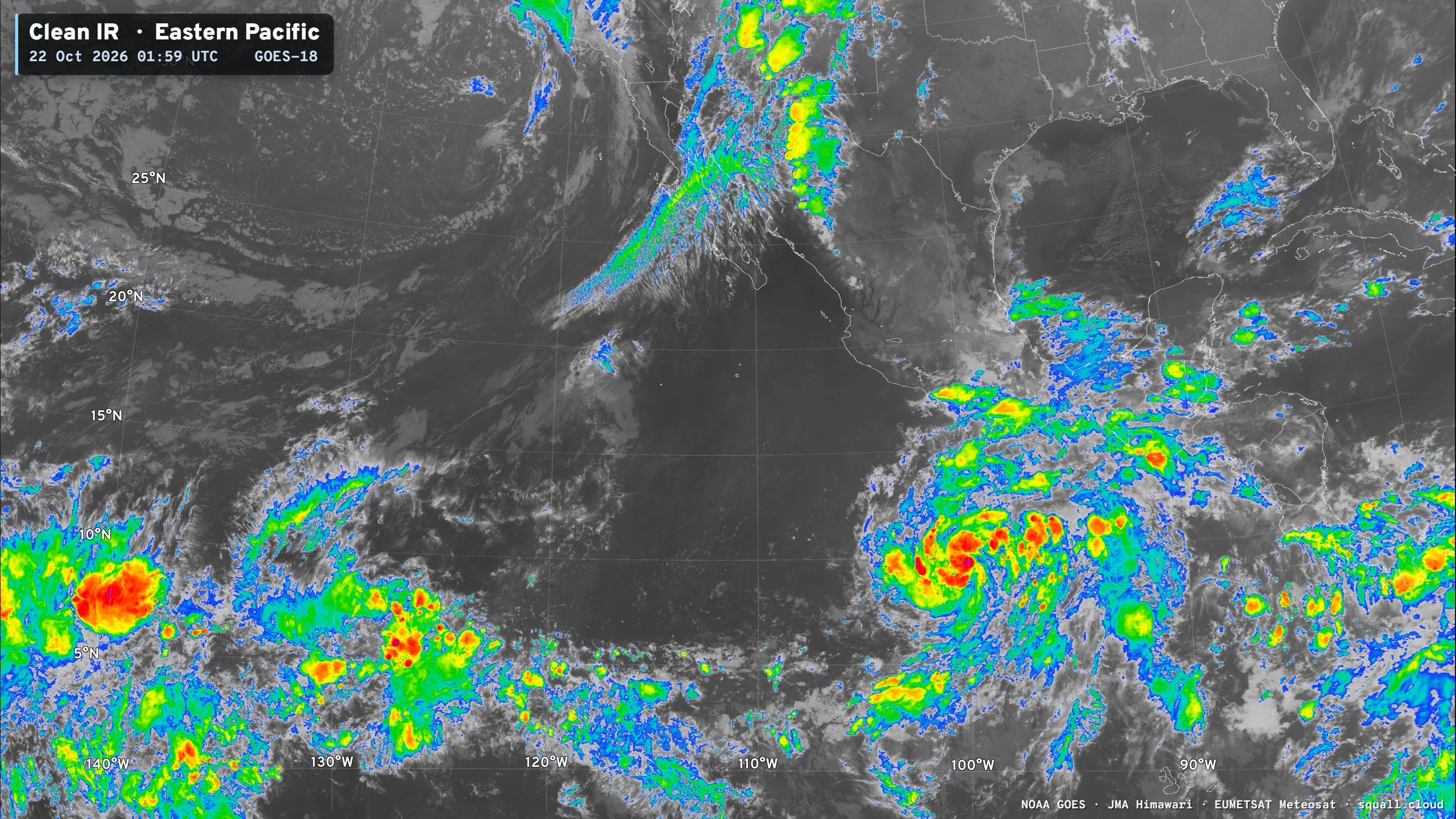
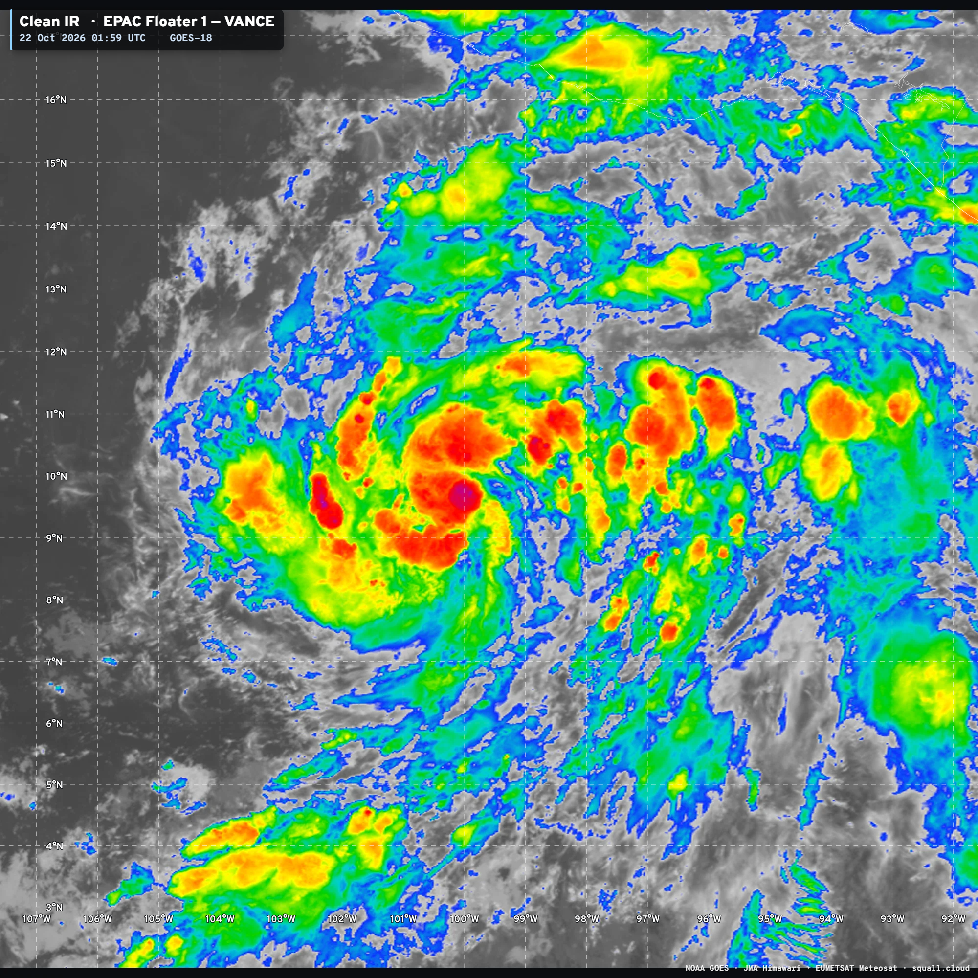
Vance expected to become a Major Hurricane — plenty of runway over warm water and we should see a rapid intensification episode
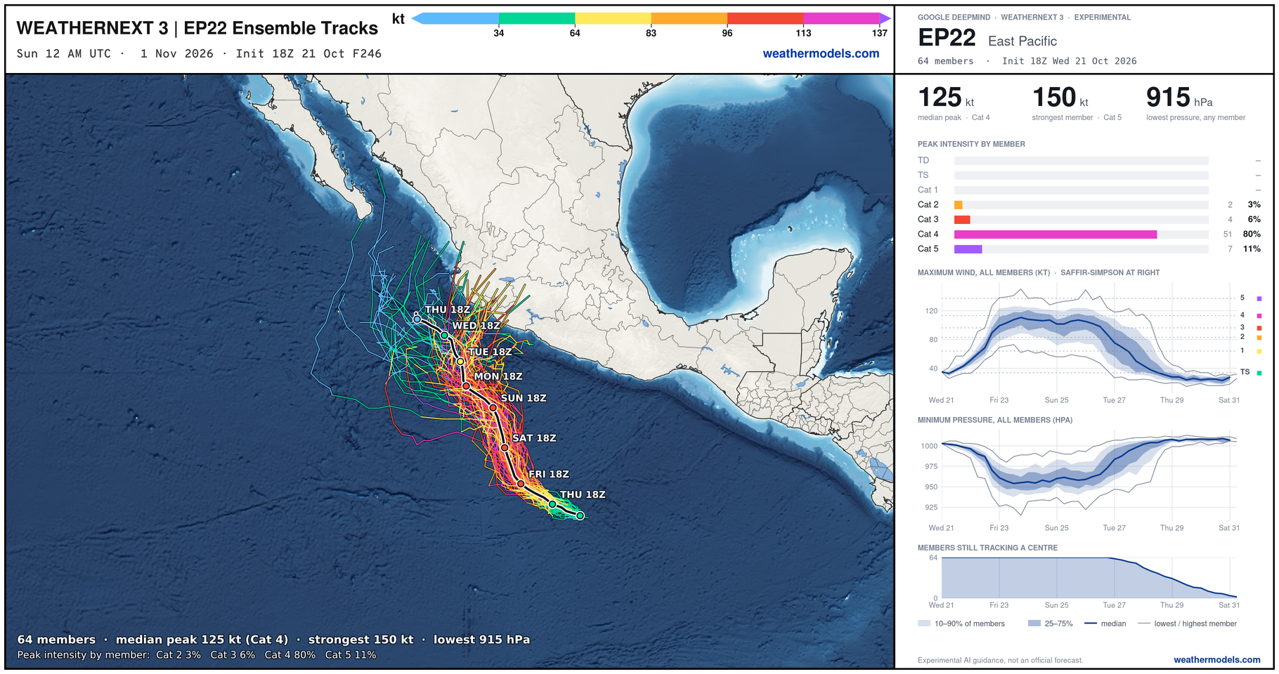
Weather Next 3 is more in the Category 4 camp — 125 knots median maximum intensity
NHC goes to 105-knots (Category 3)
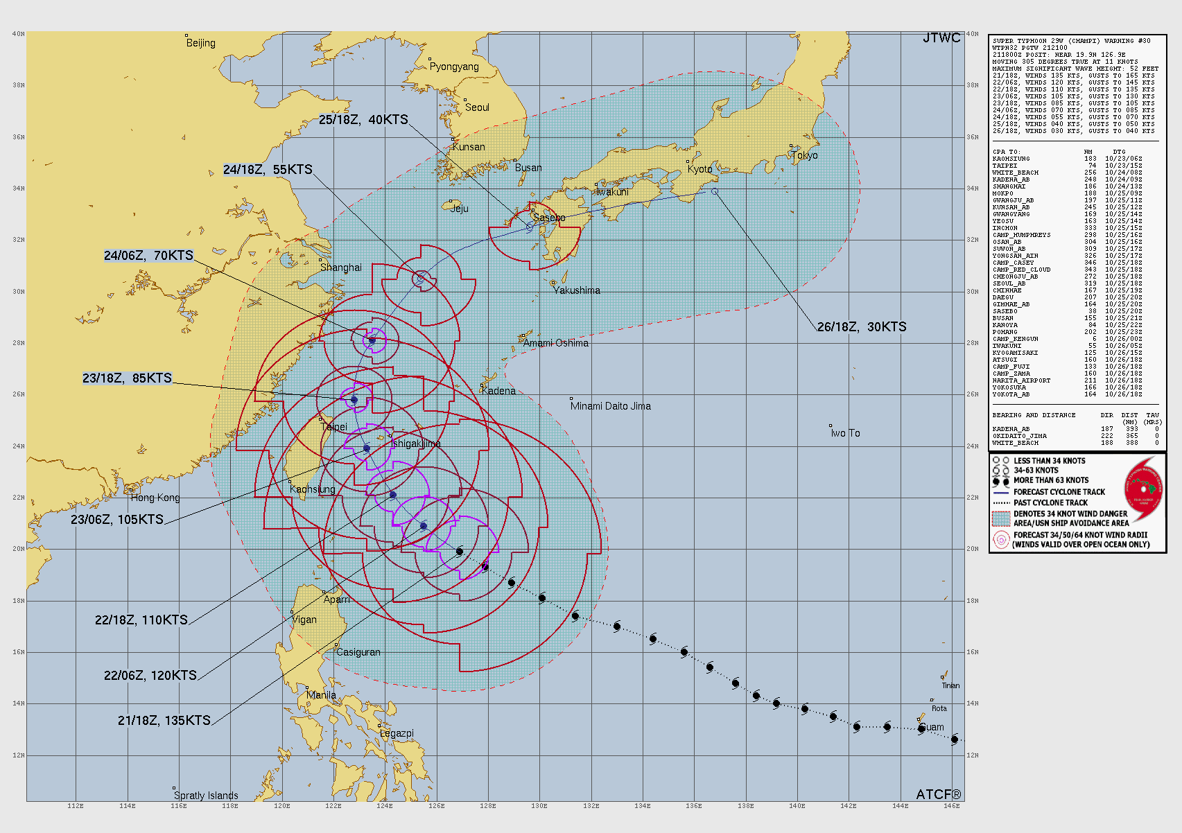
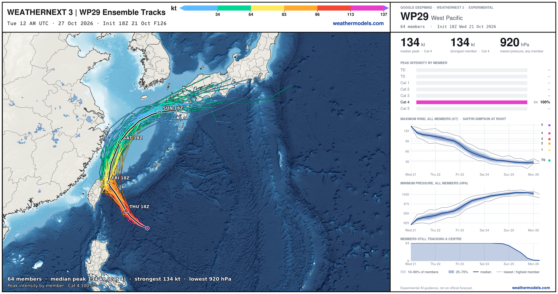
Western Pacific Tropics | Super Typhoon Champi
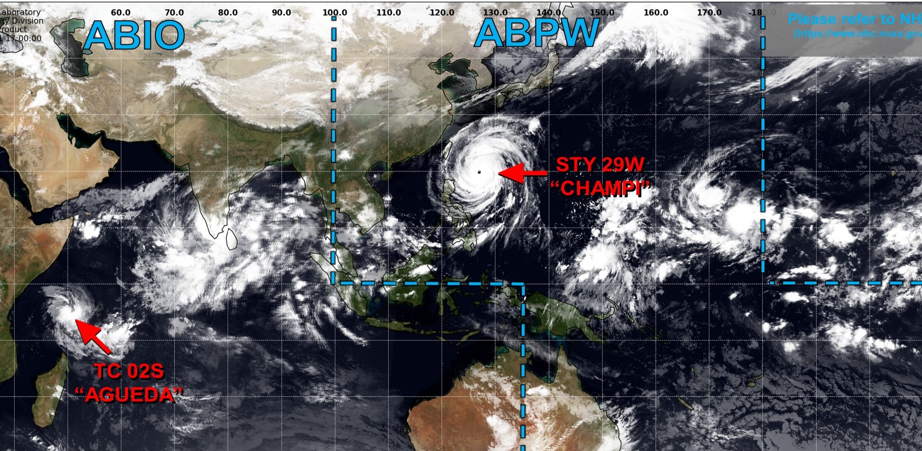
Very large Super Typhoon Champi has really expanded in side — slightly weaker as the wind field broadened.
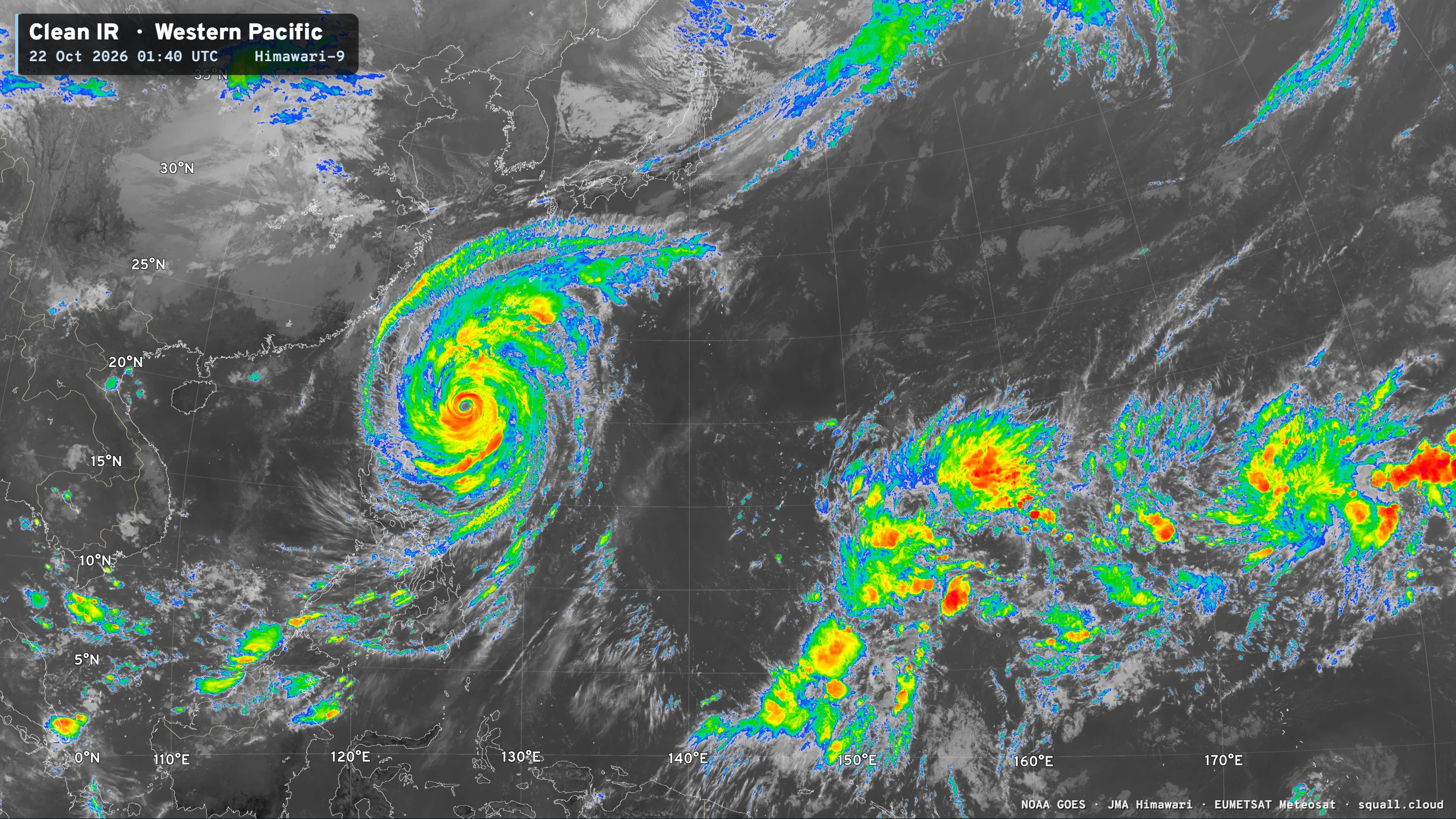
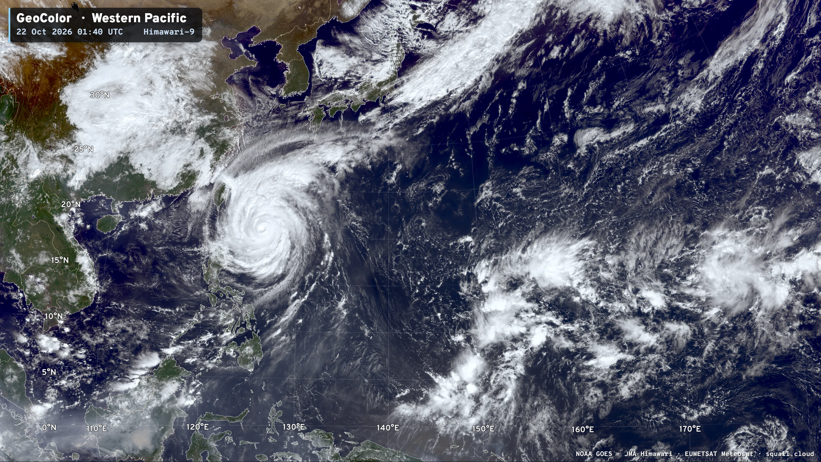
Maximum sustained winds around 135-knots
Champi is still forecast to miss Taiwan to the North and East — just barely.
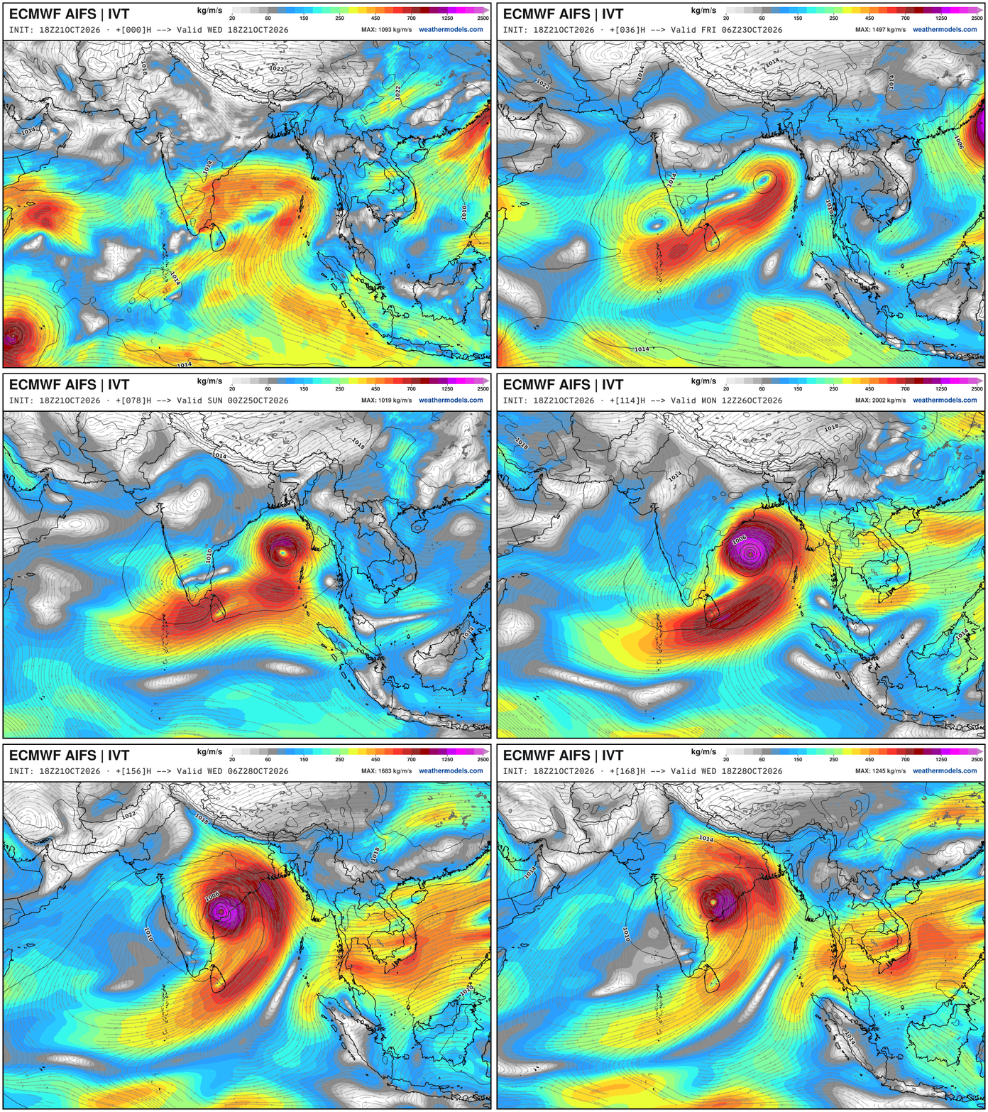
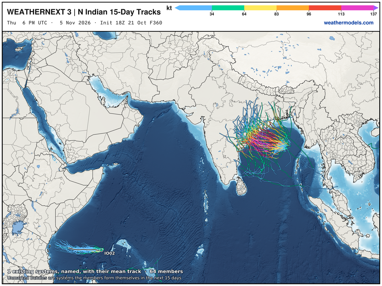
Bay of Bengal — formation of a storm / cyclone (could be powerful) this weekend
Thank you for visiting / reading — always more to come!
Visit Global Tropical Cyclones for more ACE information, as well as my original climatlas.com/tropical site with much new research including a calibrated “Best Track” and historical tropical cyclone browser with plenty of interesting features like rankings of storms by their IKE (size). ACE up to 874.

Satellite imagery from Squall Cloud. Maps sourced from weathermodels.com designed and innovated by yours truly! Please subscribe there for real-time access to the newest maps, charts from all of the weather models including ECMWF and AIFS, and NOAA GFS/GEFS, HRRR/RRFS and Blend of Models (NBM). NOAA WPC and SPC for fronts/convective outlooks. Our own content is now sourced from hottestsince.com and weather.city and celsius.earth, and squall.cloud and weather.football and global-tropical-cyclones.com and precip.earth and forecastcanada.com
My Atlantic Hurricane Season Forecast (2026)
From April 7, 2026: Atlantic Seasonal Hurricane Forecast: (11/5/2)
9-13 Named Storms (11 most likely)
4-7 Hurricanes (5 or 6 most likely)
1-3 Major Hurricanes (2 most likely)
Accumulated Cyclone Energy: 75-85 (well below normal)
NOAA 2026 Atlantic Hurricane Season Forecast
Previous in this storyline: Invest 93L off East Coast may transition into Josephine by Wednesday (OCT 20)
- Milepost
- 1628 · laid 2026-10-22T03:14:18Z
- Source
- https://weather.substack.com/p/october-21-2026-wednesday-weather · October 21, 2026 Wednesday Weather Update
- Tagged
- I-26 Tropics · Josephine · Off the East Coast (39.0, -64.0) · by rule, at build
- Digest
- fc837f2822cca631caf2c522bc52f98acefa221f9af5d58c9b9c6a809b8bce90