Invest 93L off East Coast may transition into Josephine by Wednesday

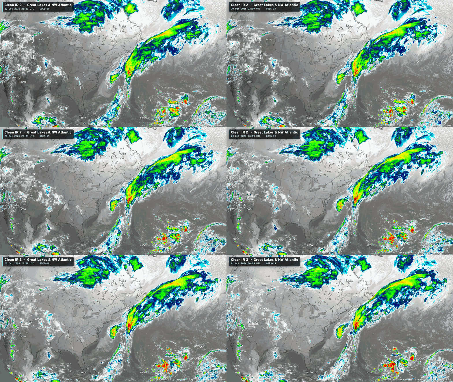
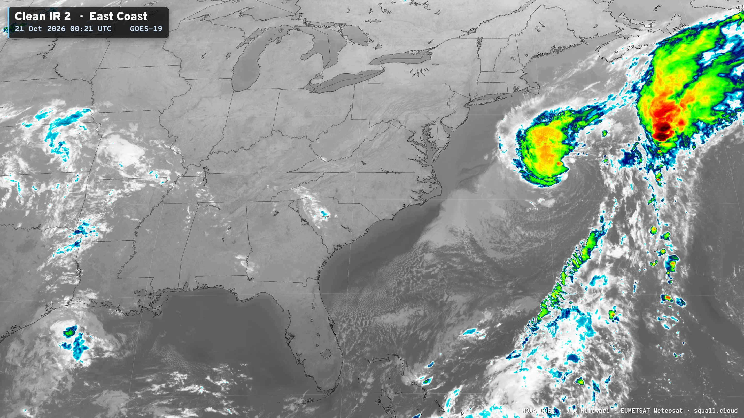
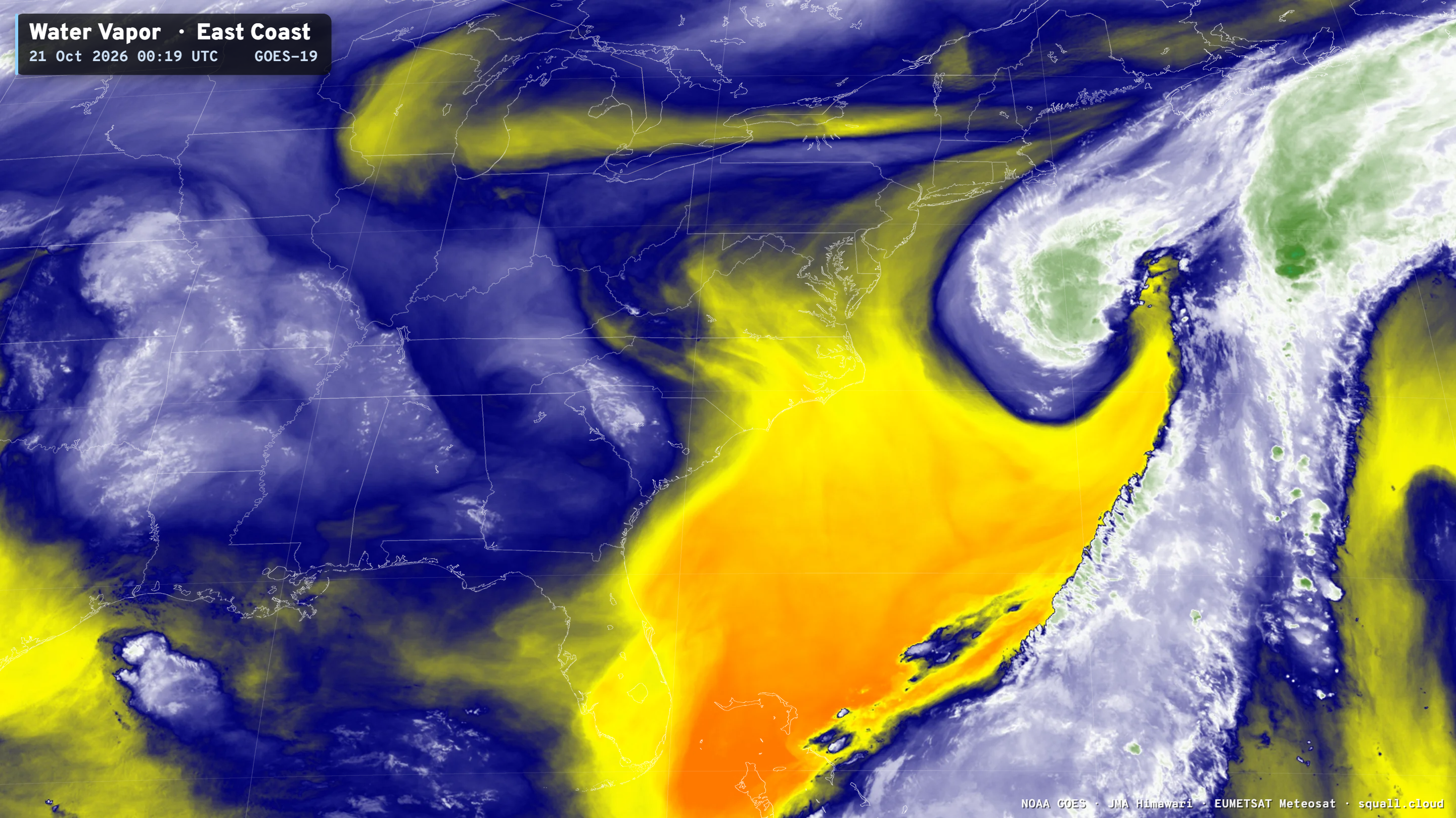
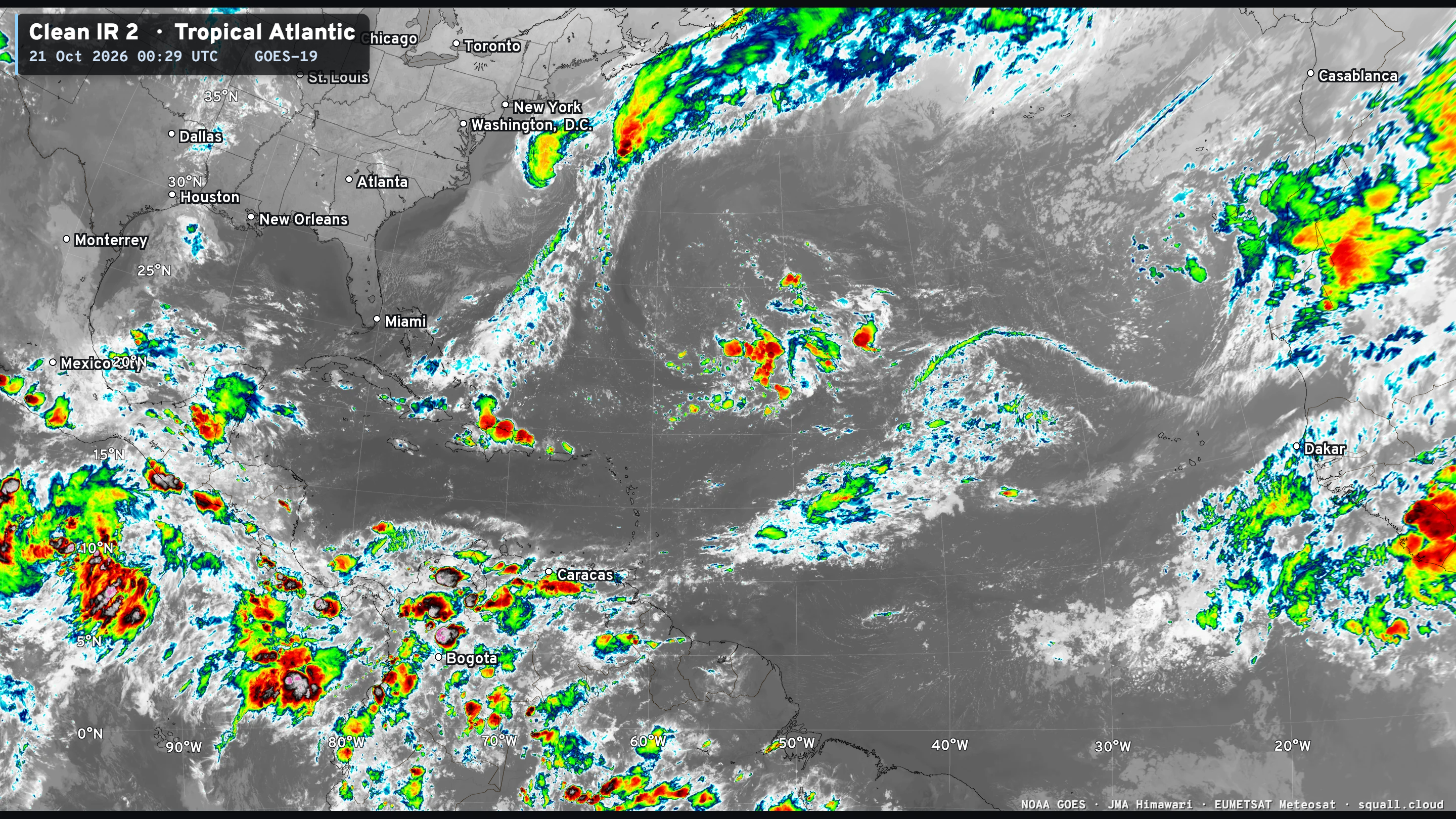
Invest 93L off the U.S. East Coast of New Jersey is showing convective organization consistent with a developing tropical storm. It may actually skip the subtropical designation (or is already Subtropical Storm Josephine in my opinion) and become a fully tropical storm — and potentially a hurricane on Wednesday. The key will be completely detaching the frontal boundary, which looks mostly complete on IR and water vapor imagery. In the next 12-hours, this low pressure system will wrap up and may form an eye-like feature, too!
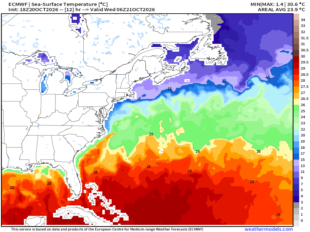
Ocean temperatures are 25°C to 26°C — so just warm enough to sustain vigorous tropical mode convection — and with the upper-levels being cooler in the middle-latitudes, we can get a tropical storm on the edge of the Gulf Stream into late October.
ECMWF 18z has hurricane force winds on the western side of the storm due to the gradient with the ridge / high pressure to the west. Battering waves and erosion continues from the northeasterly waves + long duration fetch, but not expecting rain to reach the East Coast — only gusty winds.
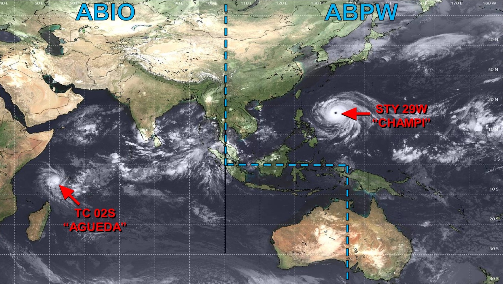
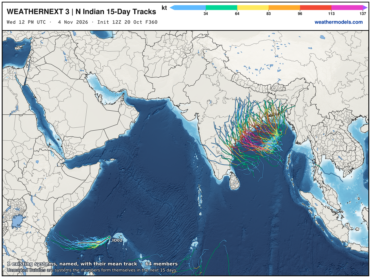
Overall Global Tropics —> Busy and each basin around the world may be active in this second half of October. The South Pacific already had Tropical Cyclone Wati (01P) and a system has formed north of Madagascar in the Southern Indian Ocean (Agueda 02S)
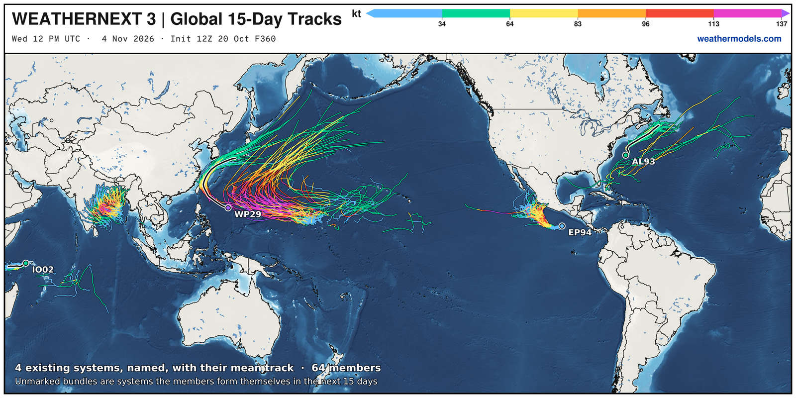
Another Super Typhoon may form being Champi and we have Vance coming online in the Eastern Pacific shortly, too. The Bay of Bengal is also activated with a major intensity Tropical Cyclone possible — that could landfall India, too. Watching that closely.
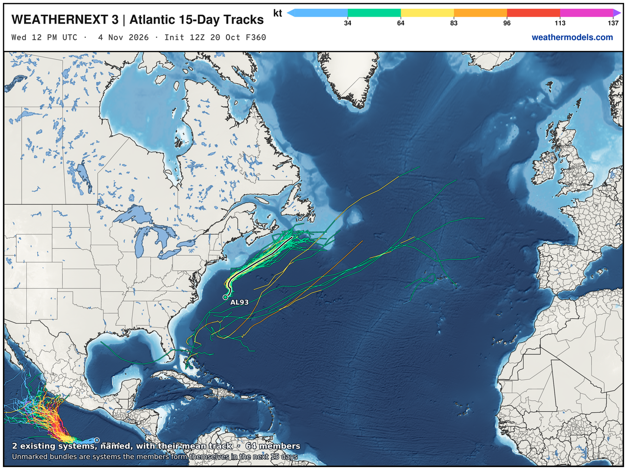
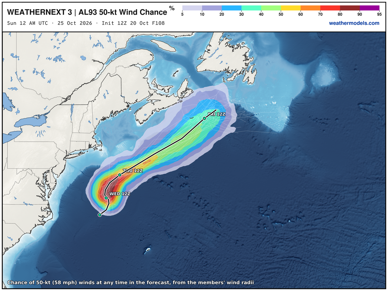
No doubt about the wind speed reaching TS or nearly hurricane force … so I think Josephine will be named shortly.
Blend of Models Precipitation Next 10-days | Huge 4-Corners totals
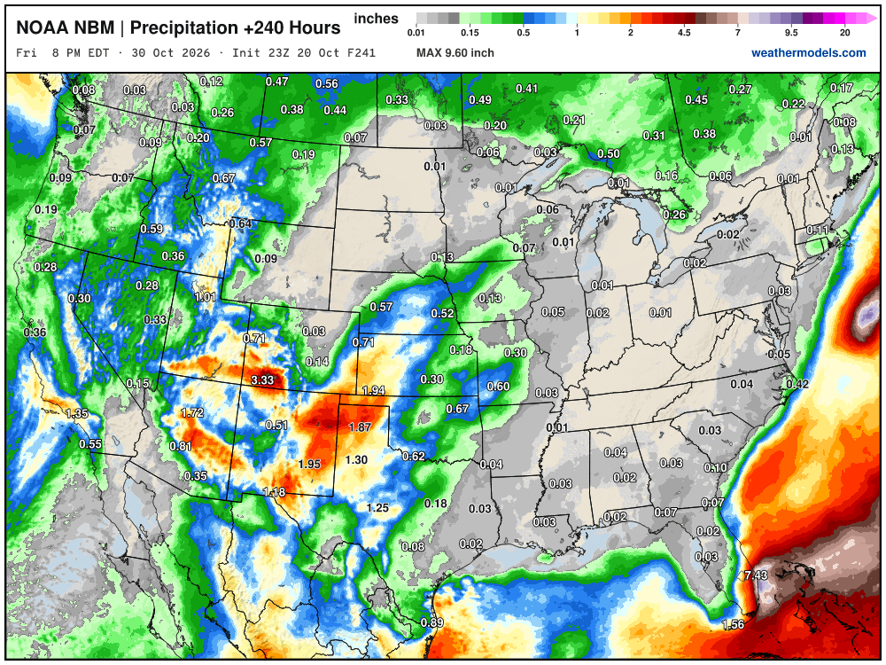
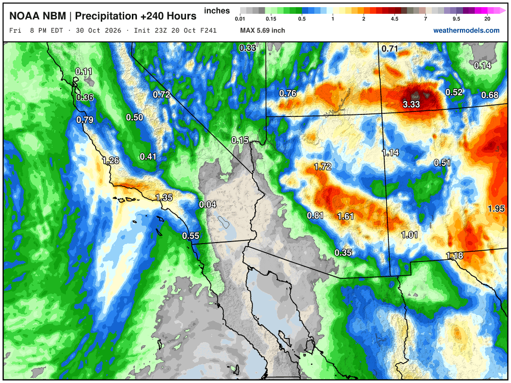
Focus for active weather remains on the Western U.S. with a strong trough and moisture flowing out of the subtropical/tropical Pacific into the Southwest.
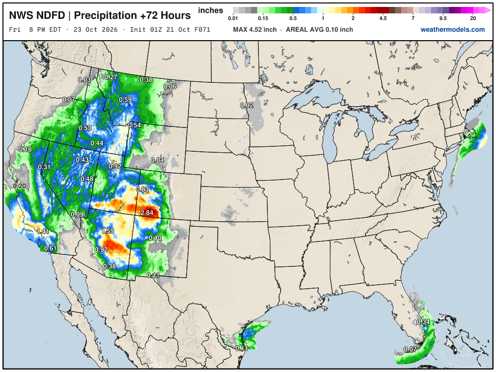
A solid inch of rain along the Southern California coast including Los Angeles. 1” to 2” around Phoenix and upwards of 3” to 4” in SW Colorado (Cortez and Durango)
My favorite parameter — precipitable water | ECMWF 18z next 6-days
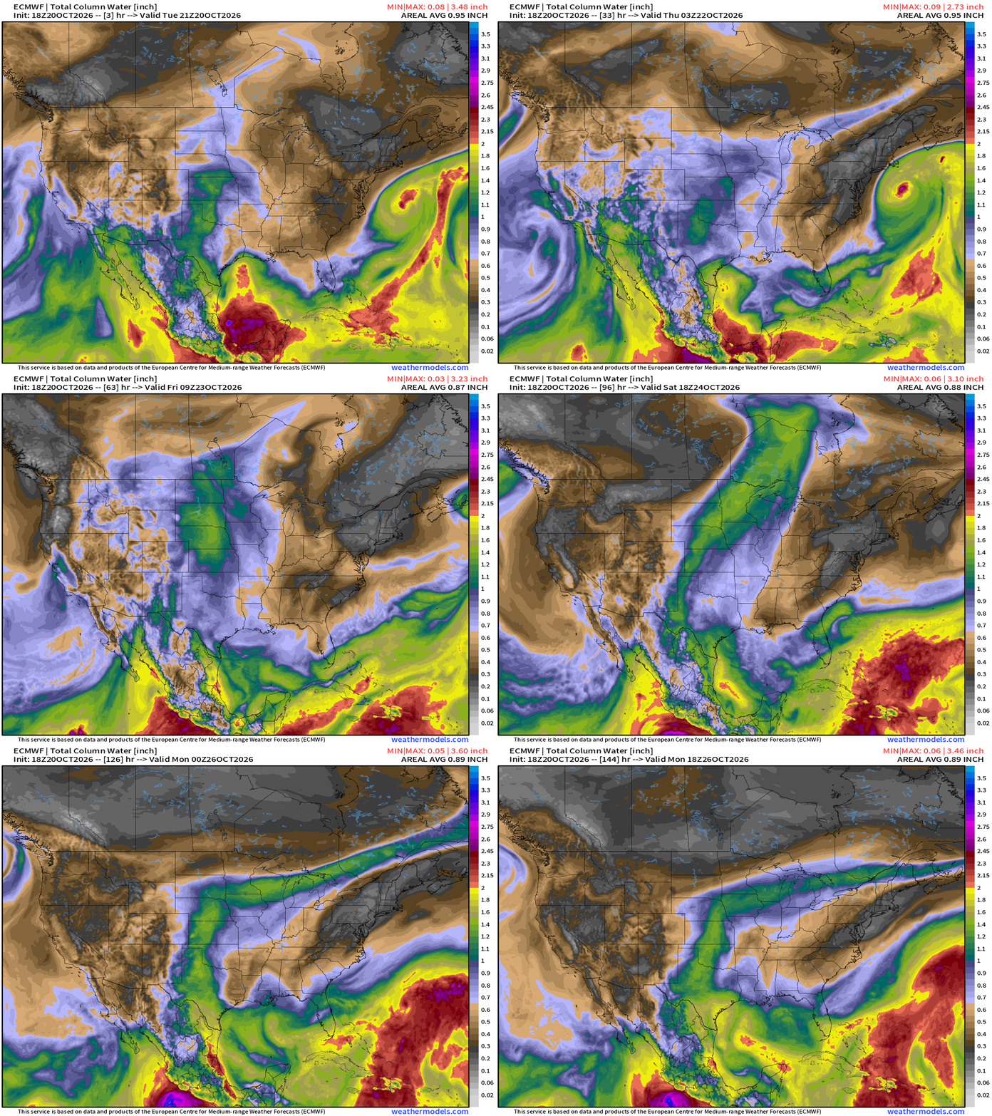
Developing Josephine is perfectly situated off the East Coast that any moisture impacts (heaviest rain) will miss land entirely.
A cut-off low is swirling off the California coast bringing atmospheric river flow into California. The remnants of Hurricane Trudy are pulled northward ahead of the cut-off low into the Southwest — and boost rainfall amounts considerably for AZ/NM/CO
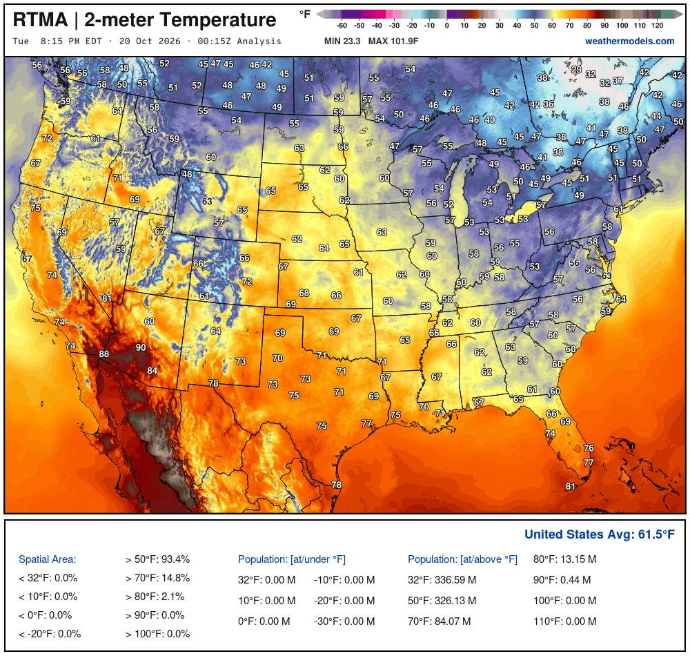
Temperature Analysis at 8:15 PM ET
Temperature Analysis | Anomaly from Normal
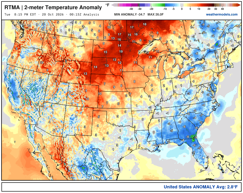
Lower 48 was 2.8ºF above normal
High Temperatures next 9-Days
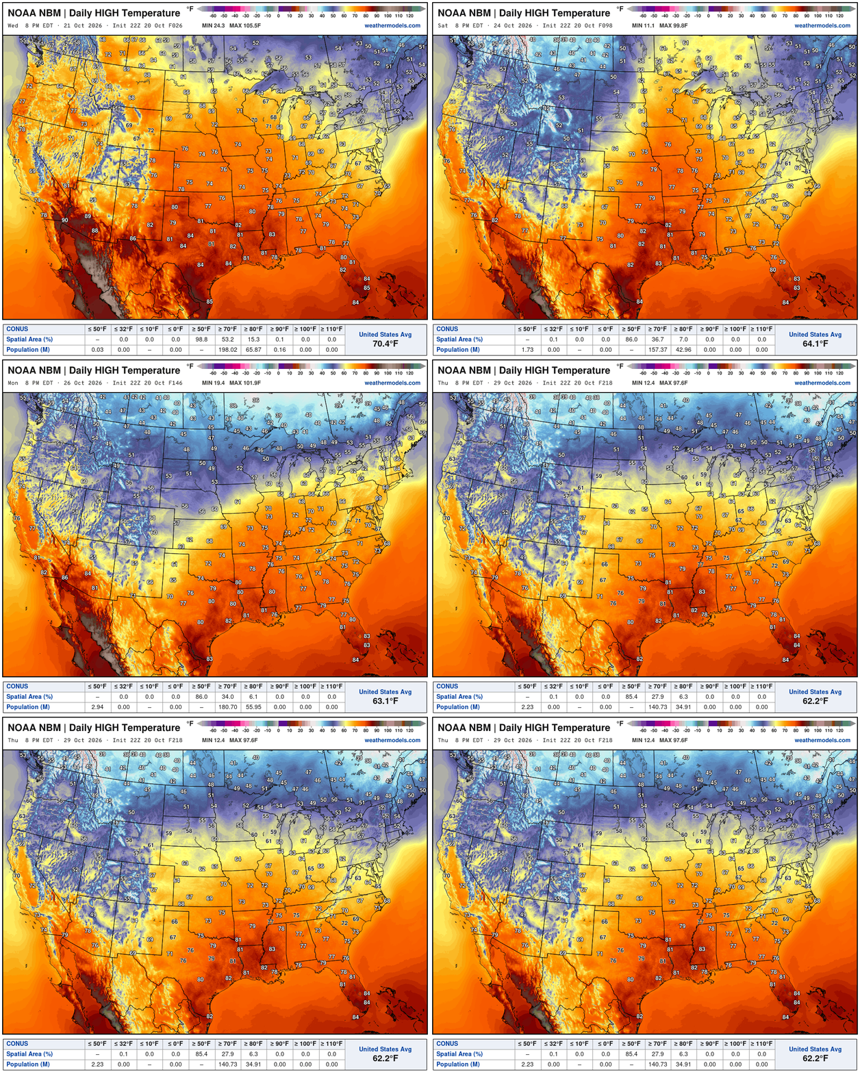
Comfortable late-October weather with temperatures in the 50s and 60s across the Midwest and Great Lakes into the weekend … with 70s further south.
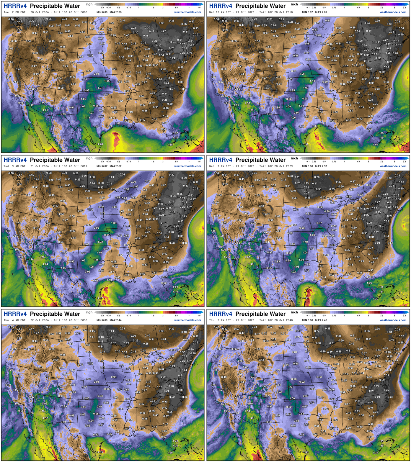
Next 48-hours HRRR precipitable water — boatloads of moisture into the Western U.S. while dry air is draining along the East Coast into the Southeast behind the developing coastal low.
Simulated radar into Tuesday 8 PM ET
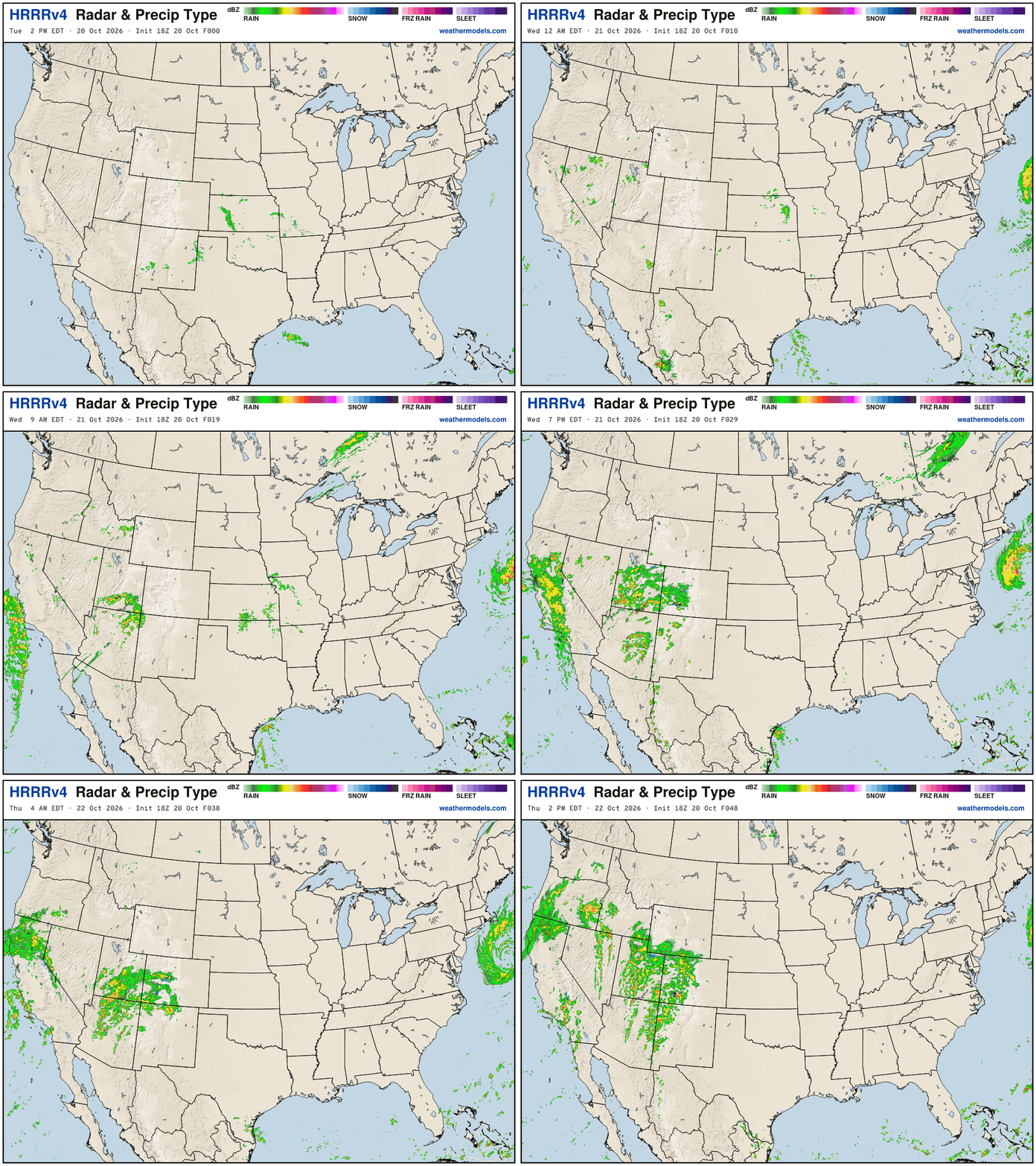
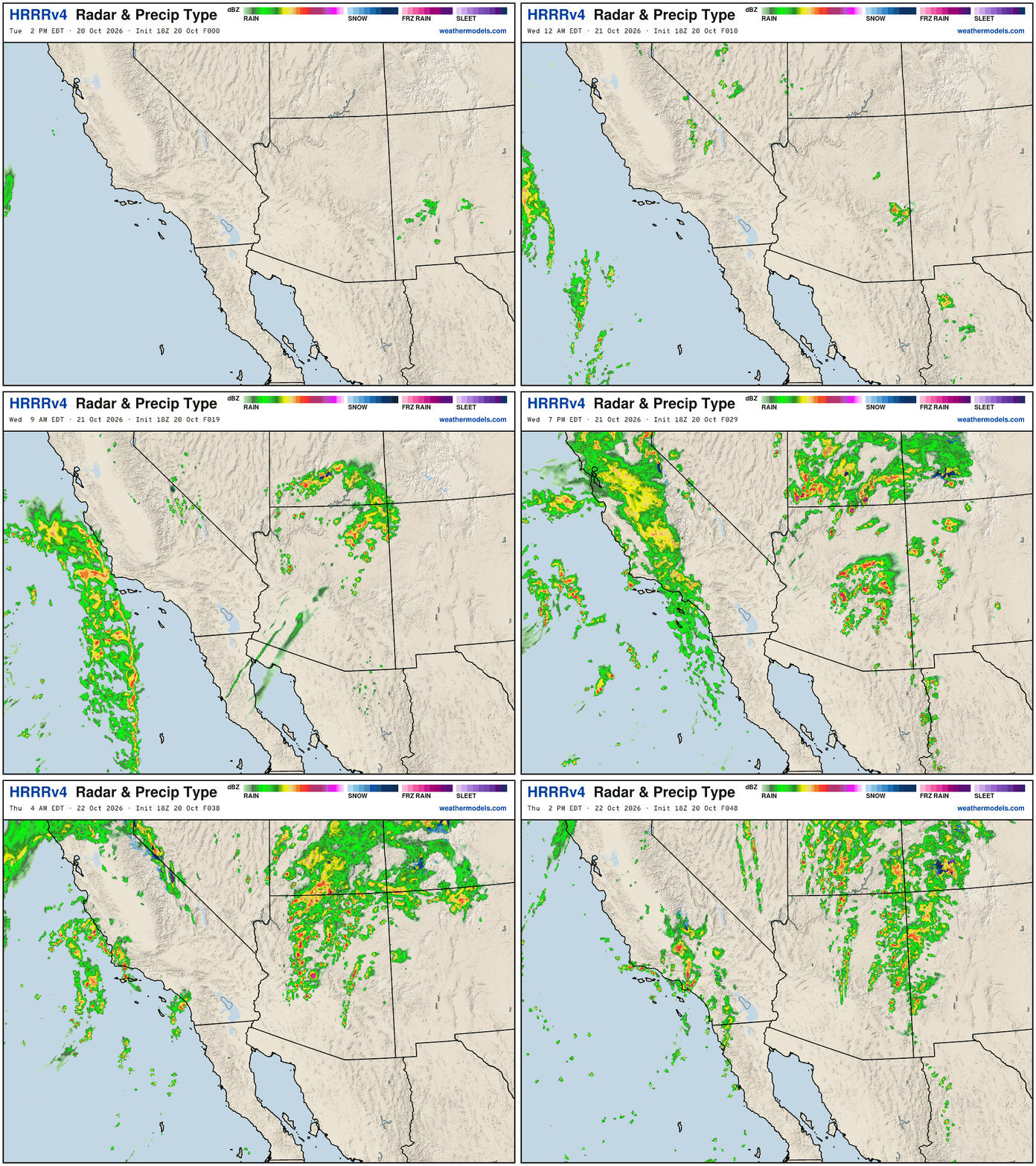
Quite convective on Wednesday across the Southwest with Phoenix under threat of severe weather including hail and tornadoes!
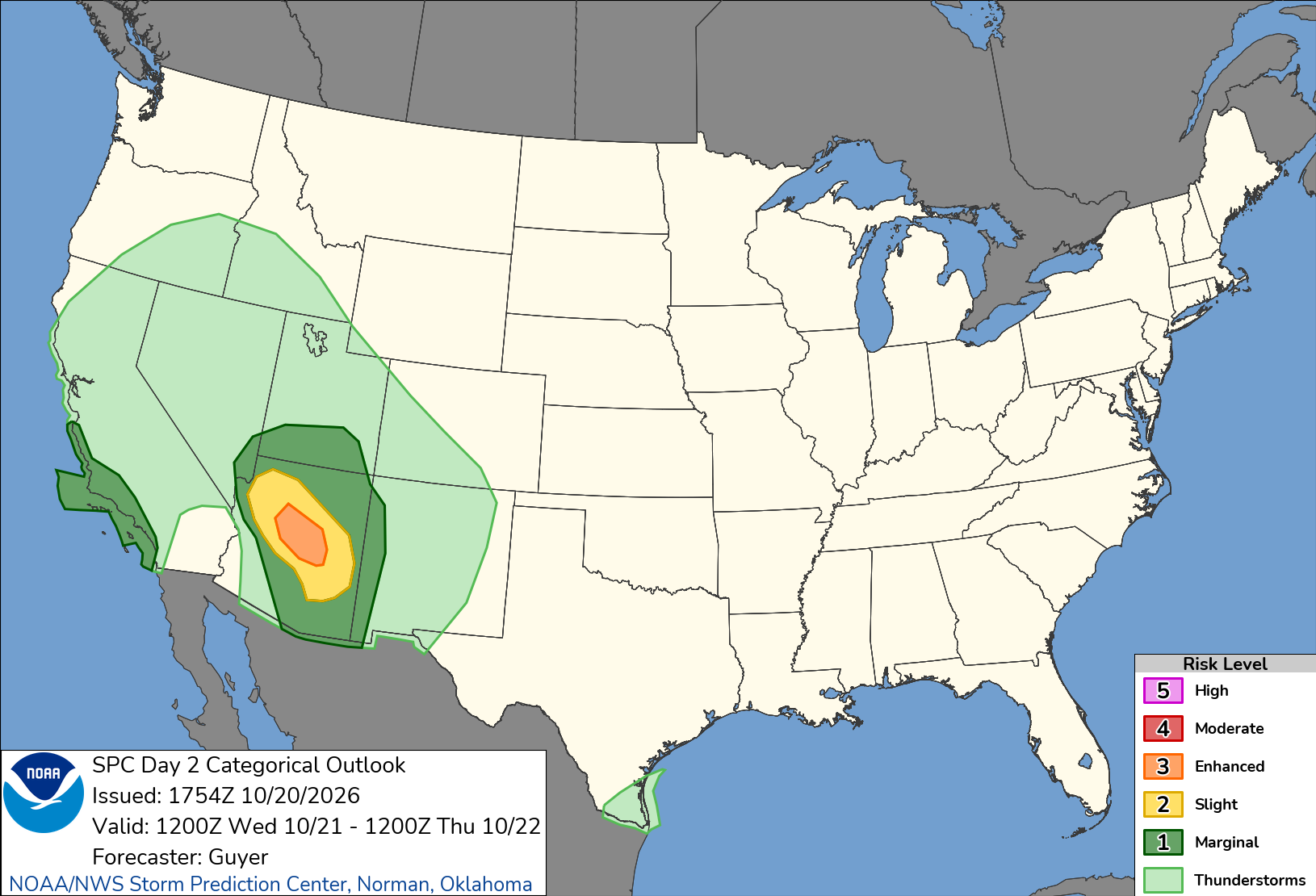
SPC: Severe thunderstorms including large hail and tornado risks are expected on Wednesday especially across Arizona and nearby parts of the Four Corners area and Lower Colorado River Valley. A localized severe risk may also exist along the coast of central/southern California.
NWS NDFD Next 3-days precipitation — very welcome “boatloads” across the Western U.S.
Low Temperatures Wednesday Morning
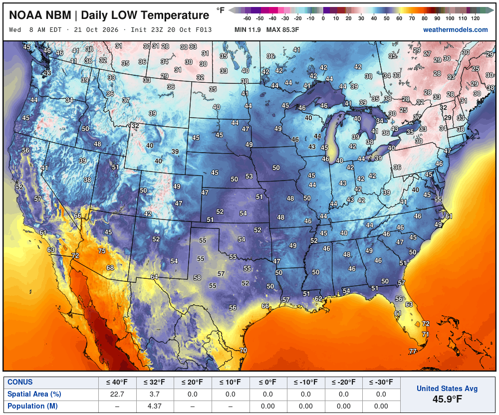
Over 4 million below freezing mainly in the Northeast
High Temperatures on Wednesday
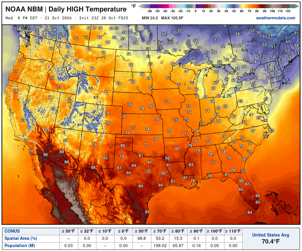
70s most widespread across the Lower 48.
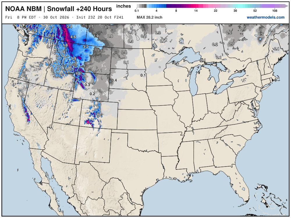
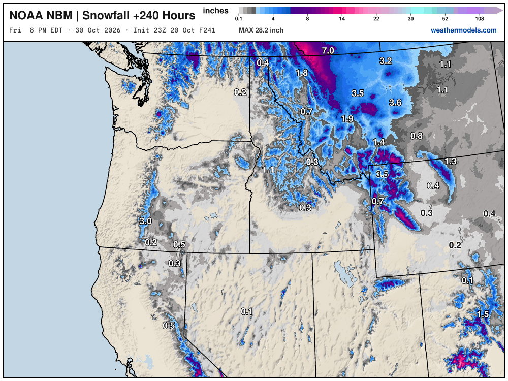
Blend of Models Snowfall Next 10-days
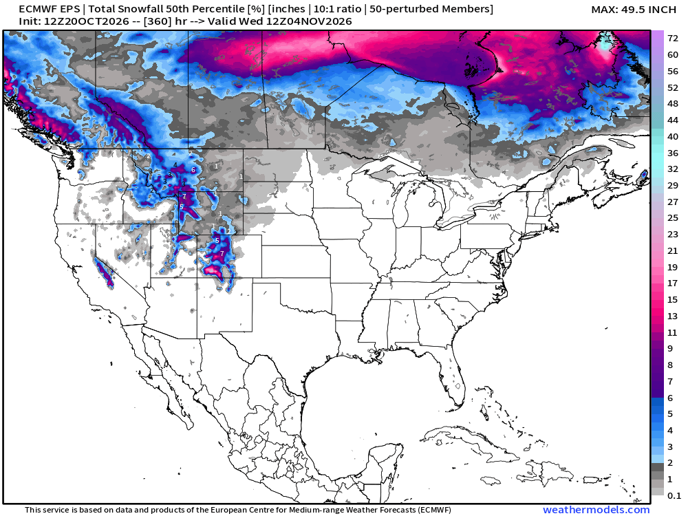
Snowfall Next 15-days | ECMWF Ensemble Median
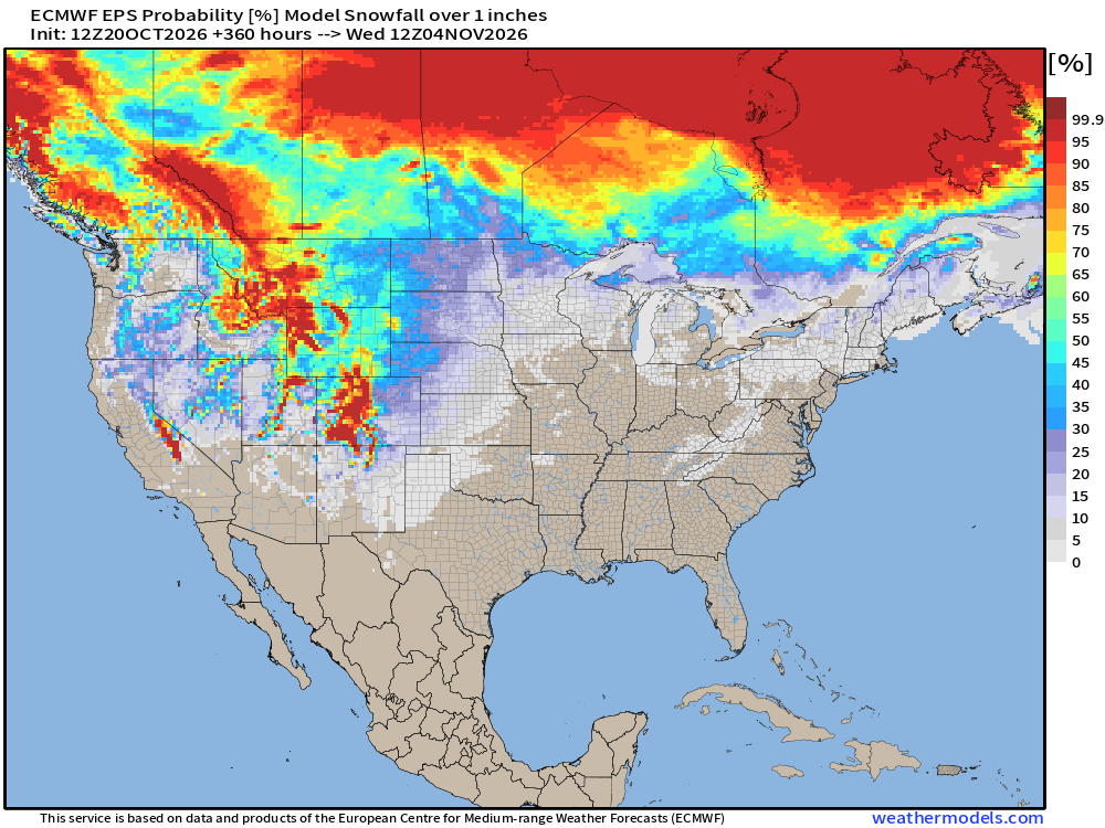
Probability of 1-inch or more of snowfall into early November
Integrated Vapor Transport Next 6-days | ECMWF 18z Flagship Model
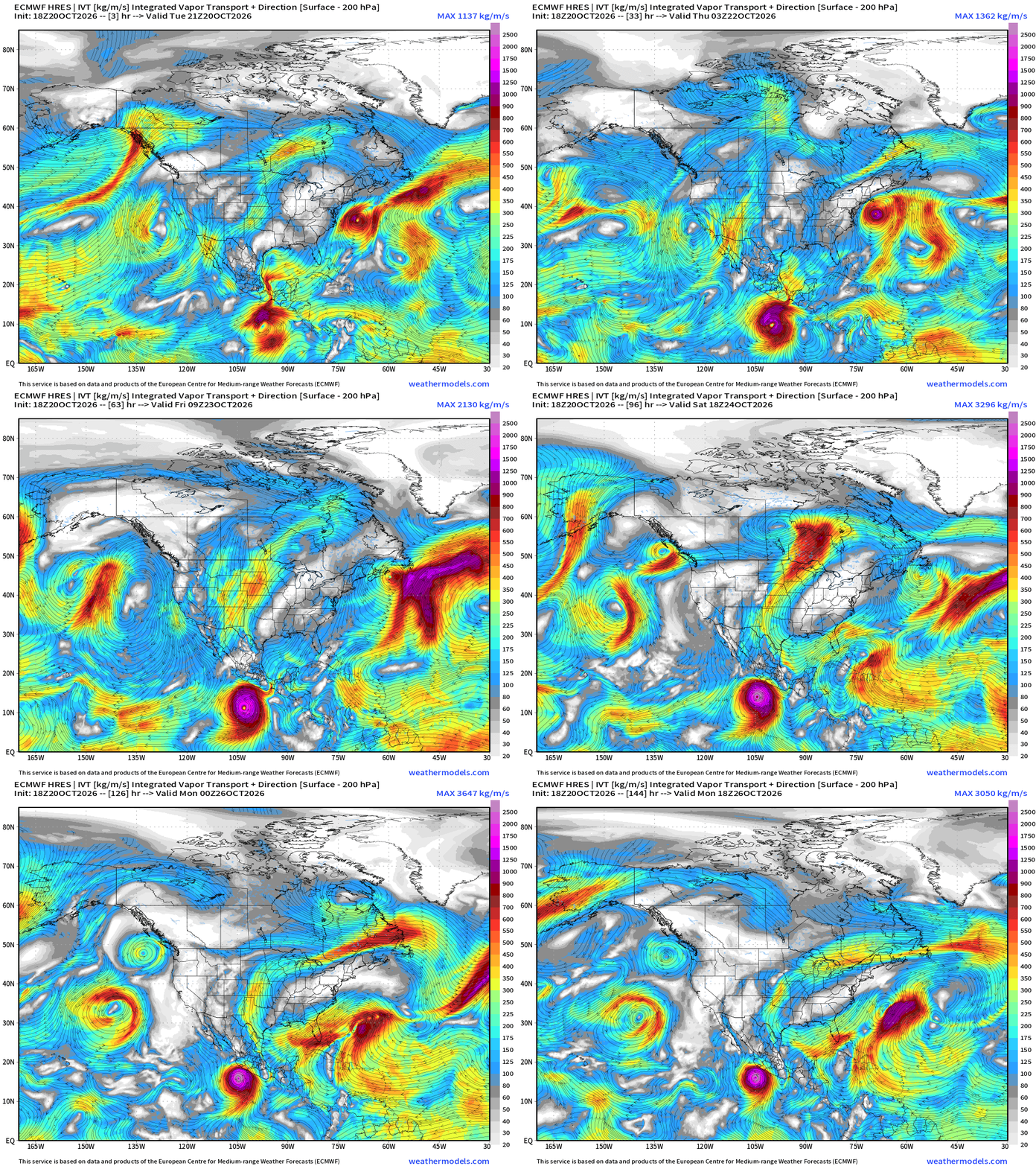
Hurricane Vance forms off the coast of Mexico and drifts northward … and otherwise mostly dry easterly flow across the Gulf —> shuts down the moisture flow into the eastern U.S. —> dry and cool —> and as I said before — perfect weather for raking leaves or decorating your yard for Halloween.
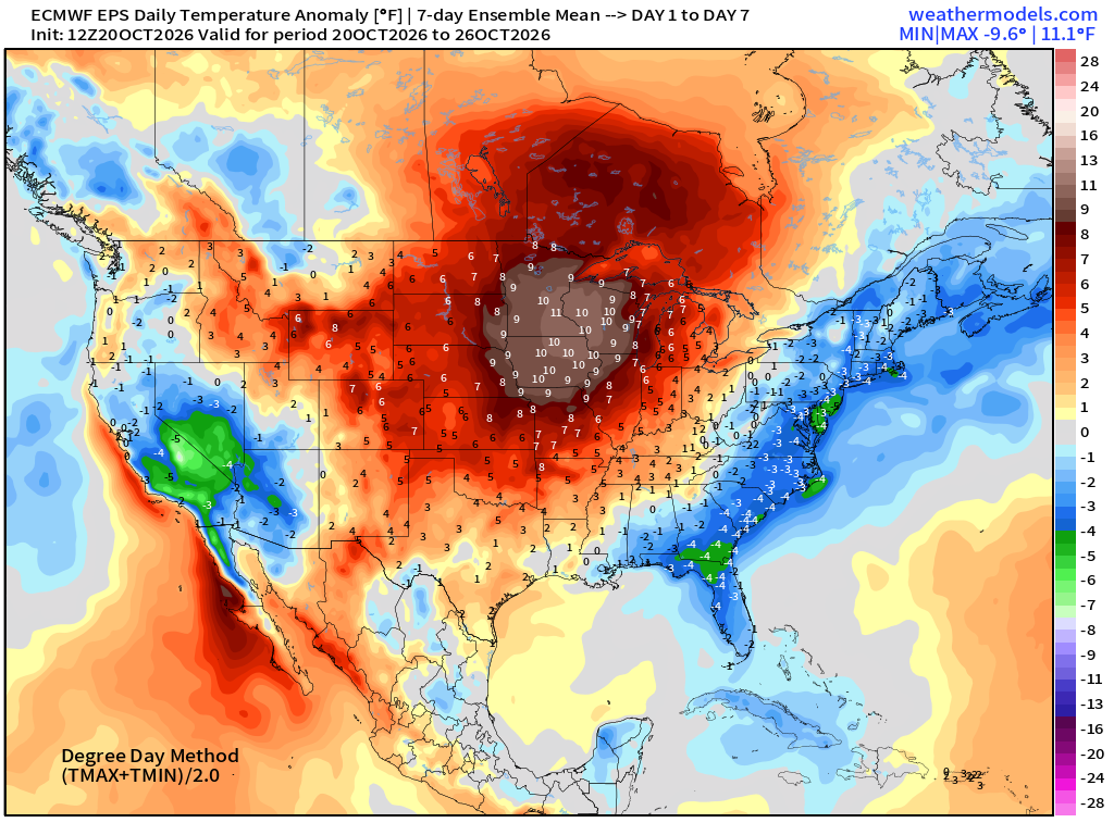
Week 1 Temperature Anomaly | Oct 20 - Oct 26
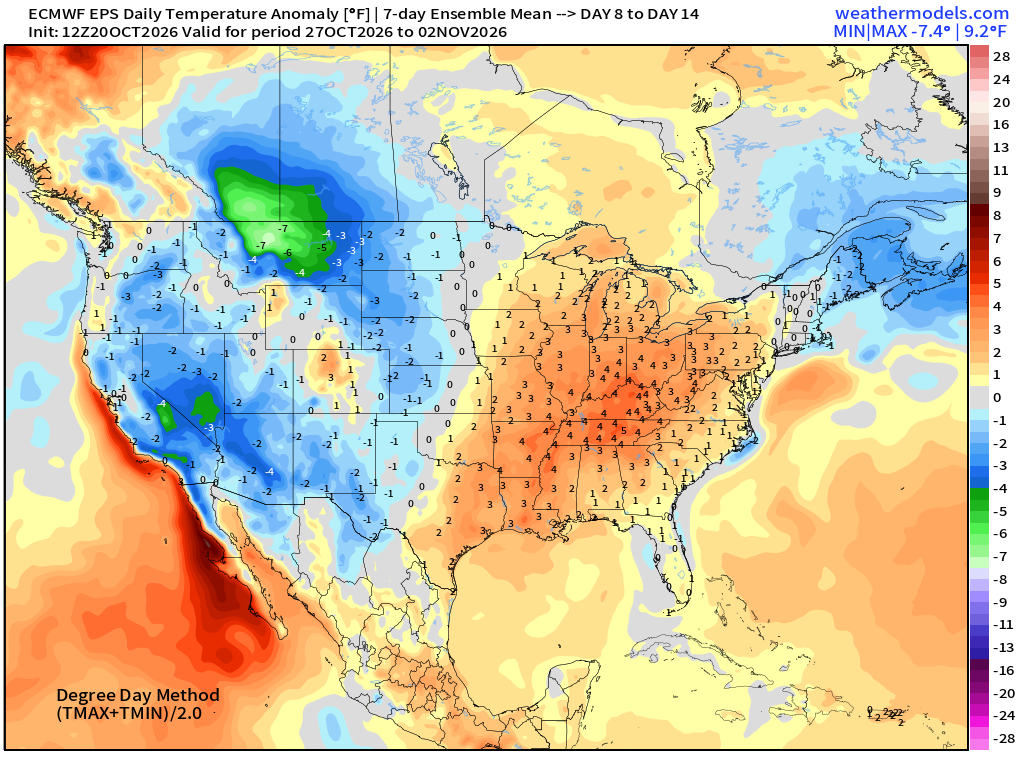
Week 2 Temperature Anomaly | Oct 27 - Nov 2
Atlantic Tropical Outlook | Invest 93L 40%
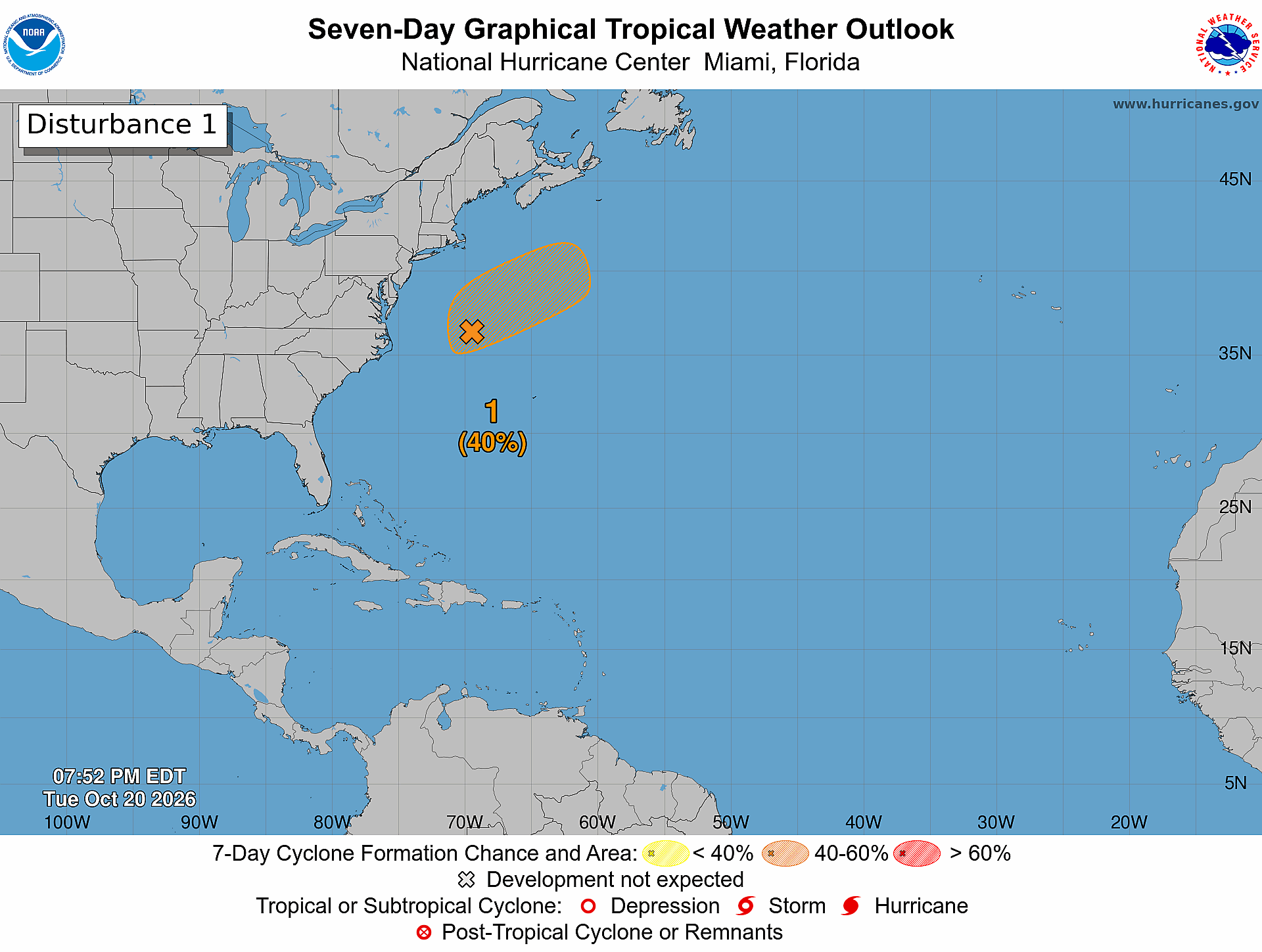
I think this turns into Josephine quickly
ECMWF Ensemble 12z full-physics tracks next 15-days
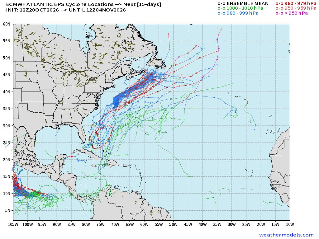
Still watching area around the Bahamas for a tail end of frontal boundary / trough to form something next week
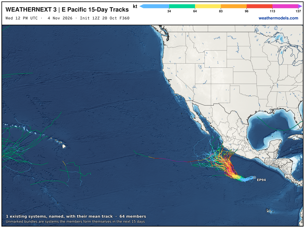
Google Deep Mind | Weather Next 3 | 12z Tracks (64-members)
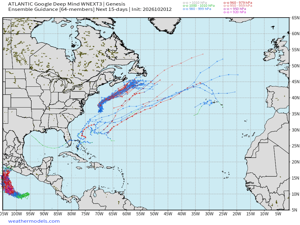
Only a tiny signal … under 10% with Google WN3
Eastern Pacific Tropics | Next up is Vance
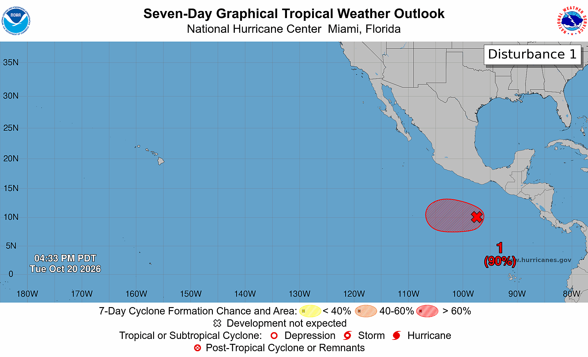
Next storm is Vance and it should easily become a major hurricane as it is starting further south and east — more runway (warm water) ahead.
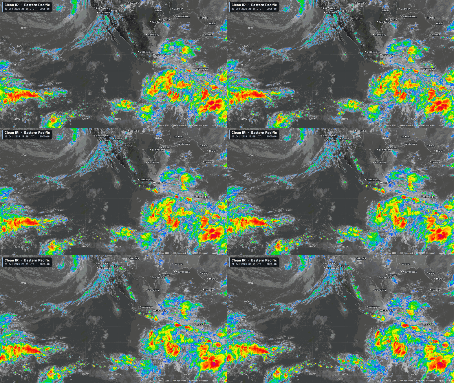
HAFS A/B down to 960s = major hurricane in 4-5 days
Western Pacific Tropics | Super Typhoon Champi
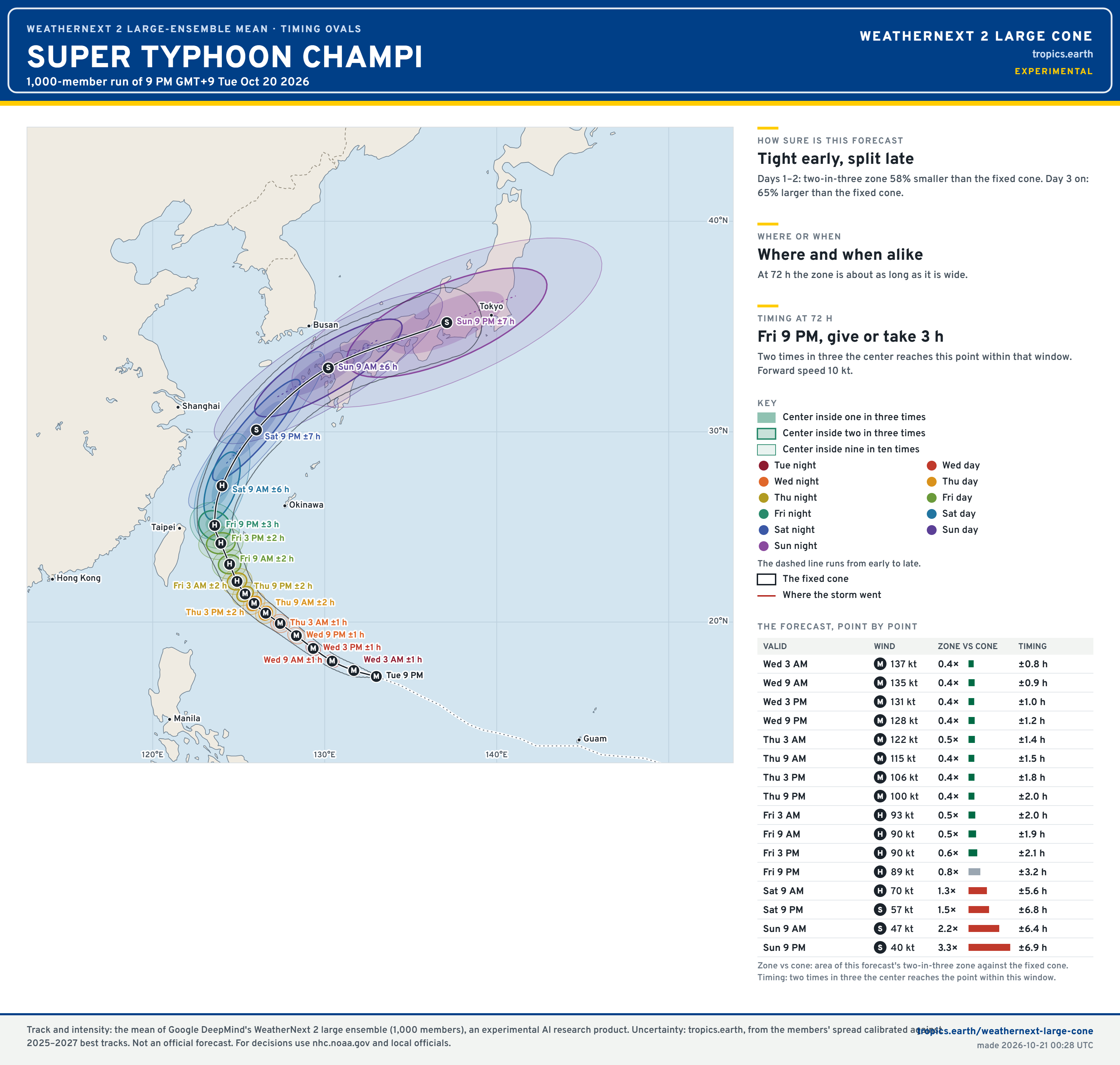
Champi is forecast to miss Taiwan to the North and East
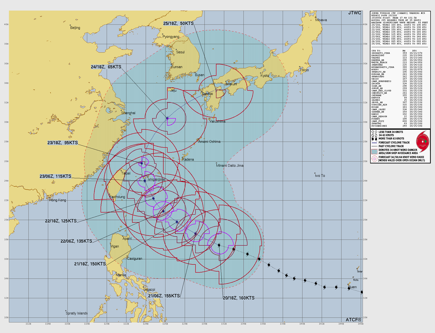
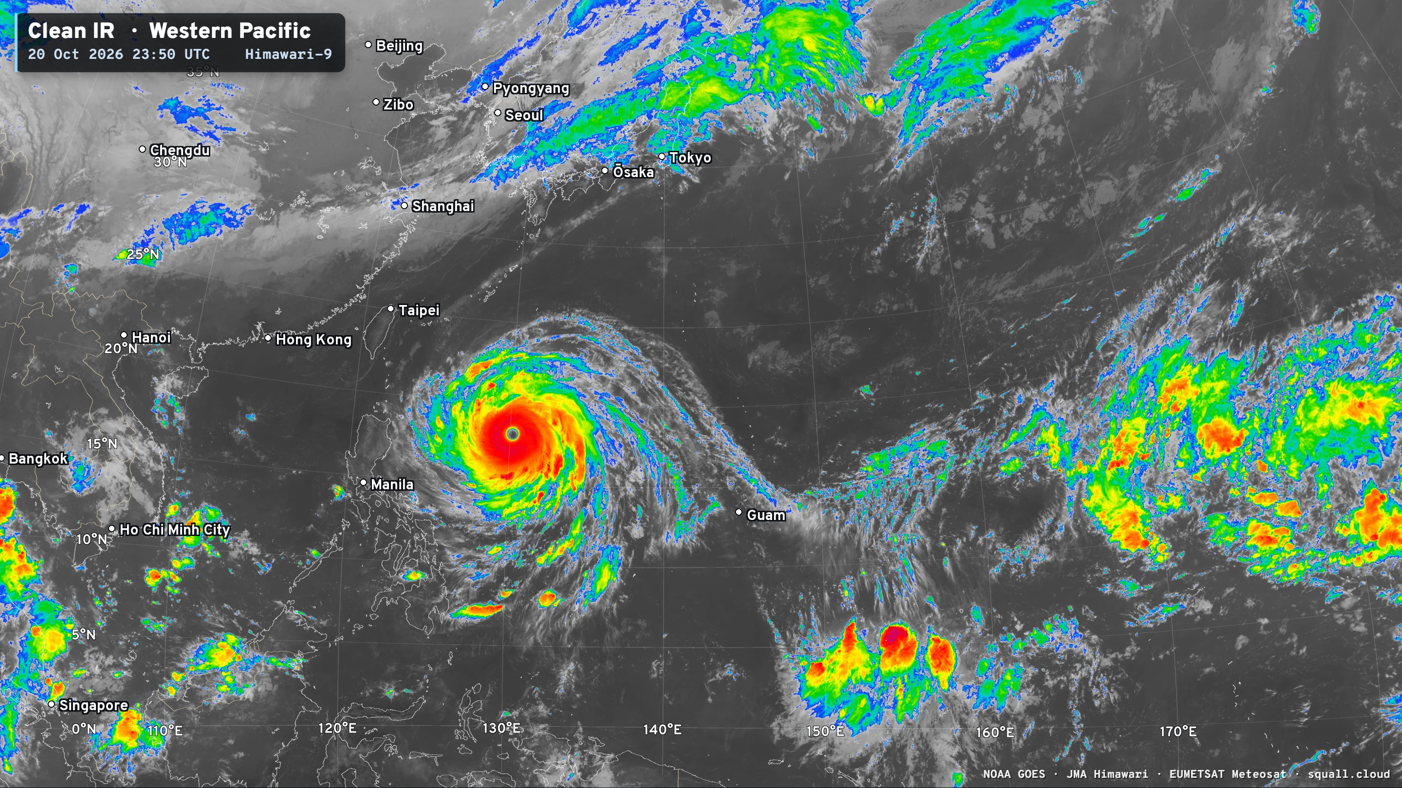
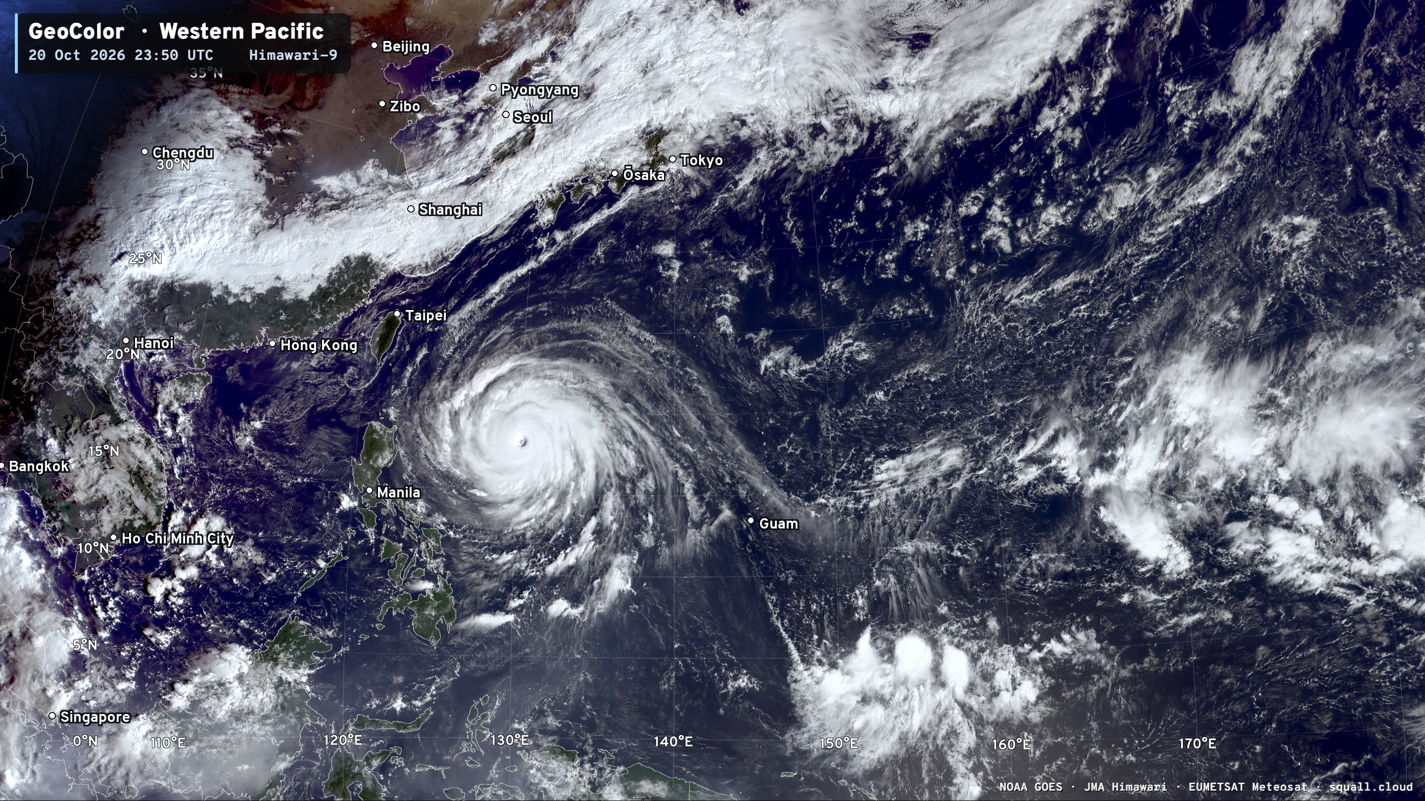
Intensity peaked at 160-knots — T 7.5 on the Dvorak satellite intensity algorithm (human) — as the ADT (automated) system couldn’t handle the enormous eye properly and maxed out at T 6.5. That’s another story.
Weather Next 3 Ensemble Cone —> Tropics Earth
Global Genesis and Tracks — multiple basins active … including Southern Indian Ocean + Bay of Bengal
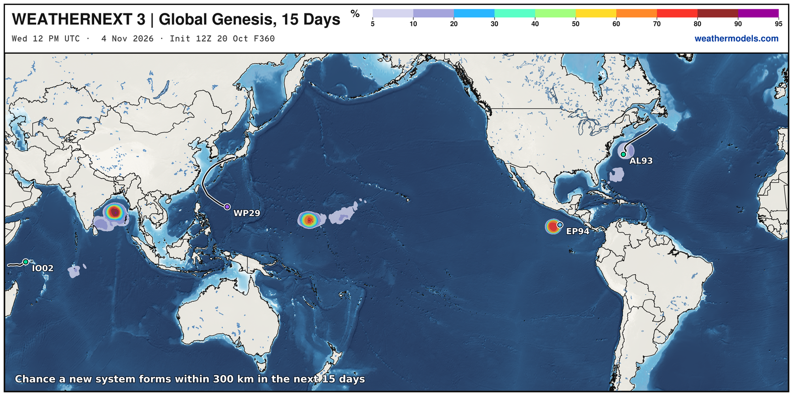
Bay of Bengal — formation of a storm / cyclone (could be powerful)
Thank you for visiting / reading — always more to come!
Visit Global Tropical Cyclones for more ACE information, as well as my original climatlas.com/tropical site with much new research including a calibrated “Best Track” and historical tropical cyclone browser with plenty of interesting features like rankings of storms by their IKE (size). ACE up to 863.

Satellite imagery from Squall Cloud. Maps sourced from weathermodels.com designed and innovated by yours truly! Please subscribe there for real-time access to the newest maps, charts from all of the weather models including ECMWF and AIFS, and NOAA GFS/GEFS, HRRR/RRFS and Blend of Models (NBM). NOAA WPC and SPC for fronts/convective outlooks. Our own content is now sourced from hottestsince.com and weather.city and celsius.earth, and squall.cloud and weather.football and global-tropical-cyclones.com and precip.earth and forecastcanada.com
My Atlantic Hurricane Season Forecast (2026)
From April 7, 2026: Atlantic Seasonal Hurricane Forecast: (11/5/2)
9-13 Named Storms (11 most likely)
4-7 Hurricanes (5 or 6 most likely)
1-3 Major Hurricanes (2 most likely)
Accumulated Cyclone Energy: 75-85 (well below normal)
NOAA 2026 Atlantic Hurricane Season Forecast
Previous in this storyline: Subtropical storm forming off East Coast but otherwise a beautiful week ahead (OCT 18)
- Milepost
- 1627 · laid 2026-10-21T01:46:19Z
- Source
- https://weather.substack.com/p/october-20-2026-tuesday-weather-update · October 20, 2026 Tuesday Weather Update
- Tagged
- I-26 Tropics · Josephine · Off the East Coast (35.0, -74.0) · by rule, at build
- Digest
- 97c146ead8a32eca94e0b1f1ee16cfd7b3e6672b1659b61f85772d835f660210