Strong cold front this weekend brings chilly air to eastern US and lead to development of subtropical storm off East Coast next week

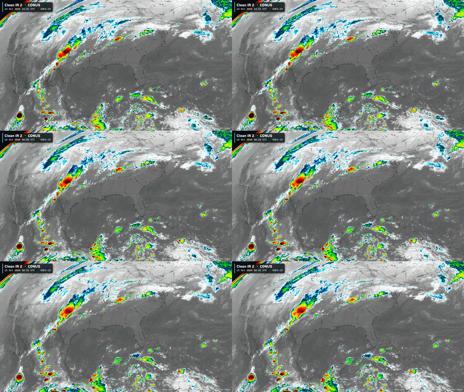
GFS “bogus” hurricanes are back, and better than ever!
This is a long-standing flaw in the model (likely the FV3 core) that creates spurious vorticity shed off the mountains of coastal Venezuela and Colombia.
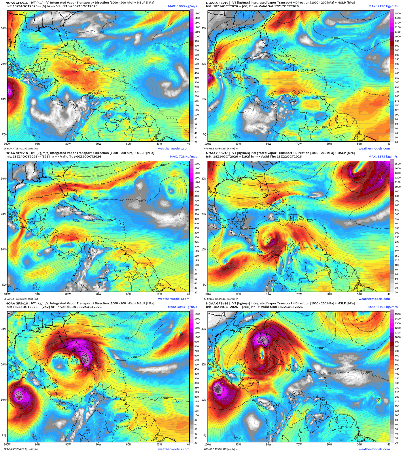
No need to panic or worry about this if you see it advertised on your Facebook feed. This is not going to happen.
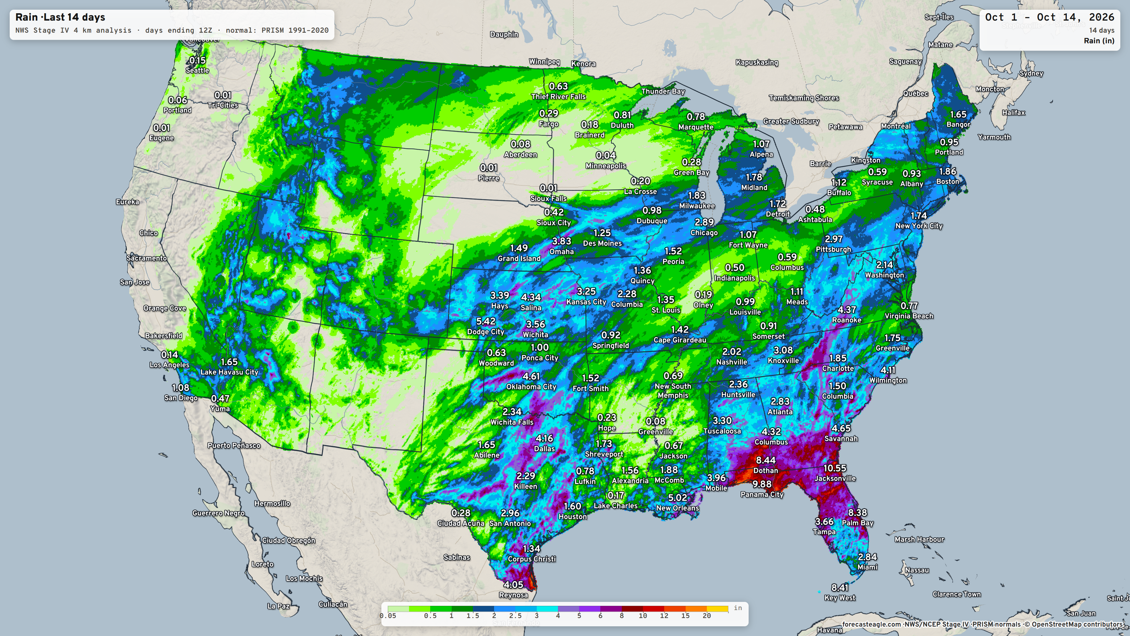
Useful: Observed Rainfall over the last 14-days at Forecast Eagle
My favorite parameter — precipitable water | ECMWF 18z next 6-days
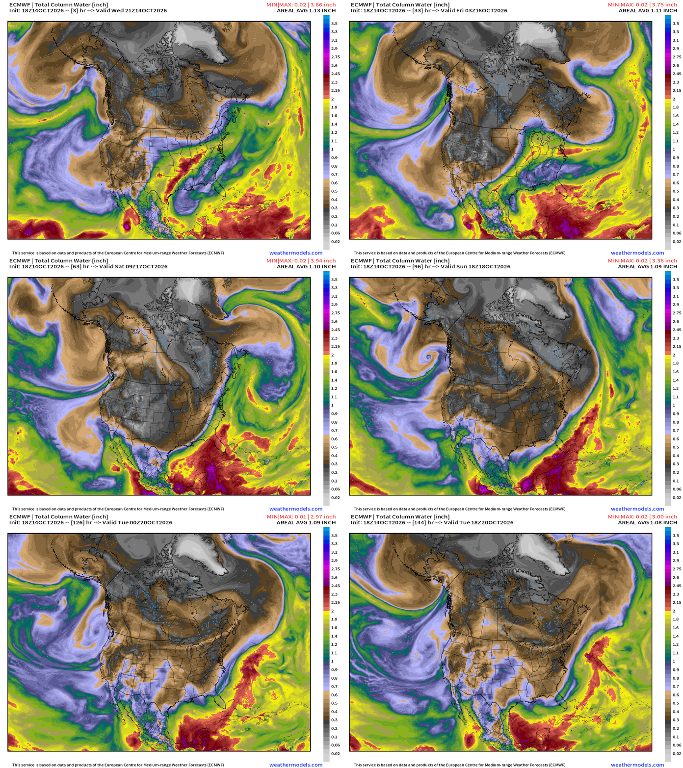
Impressive cold front blasts through Texas and the Southeast but hangs up in Florida into this weekend.
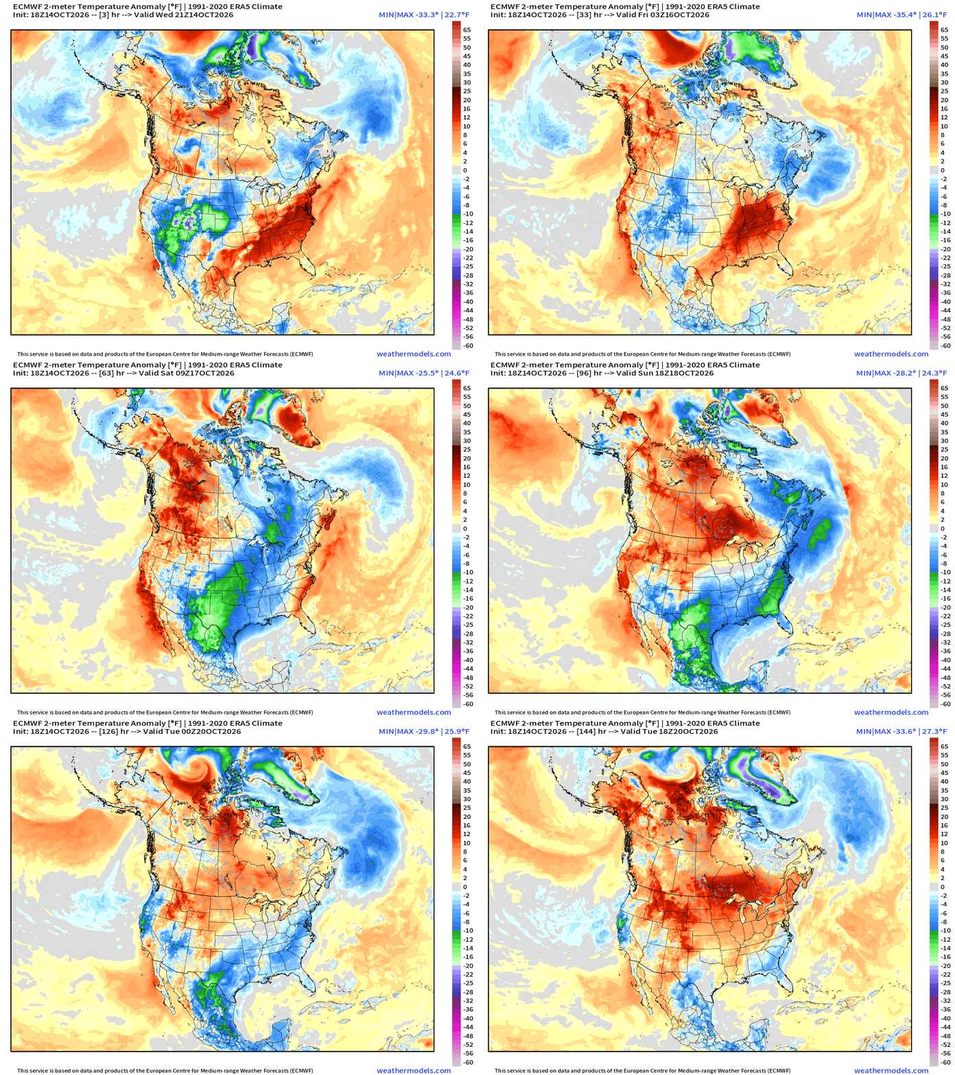
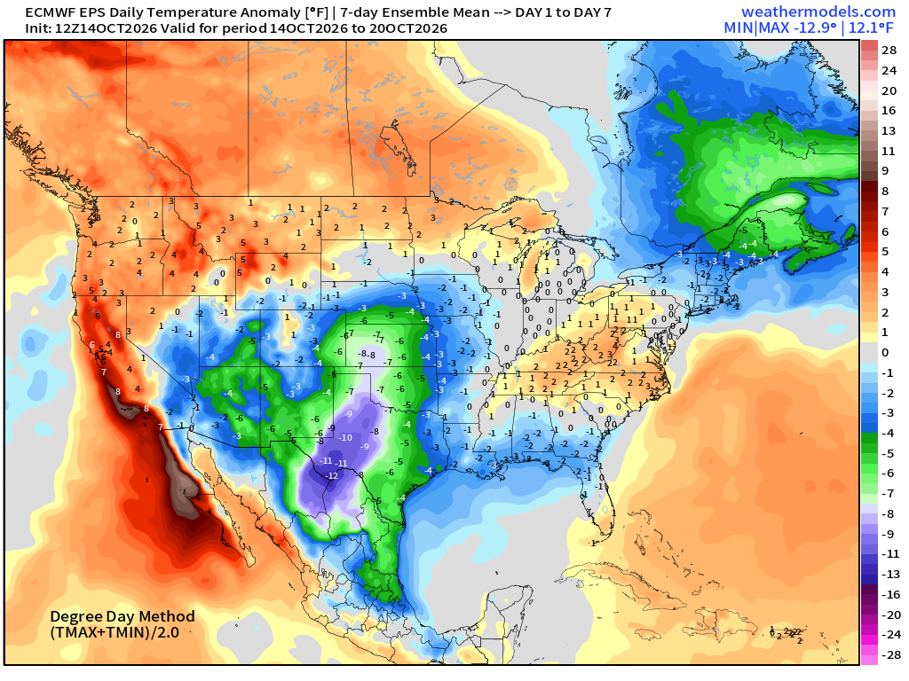
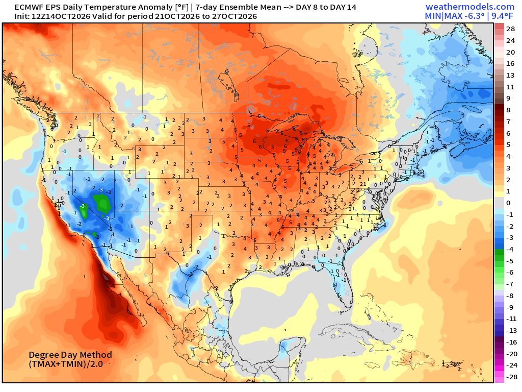
The summer-like heat and tropical moisture is erased. Temperatures will recover next week as the weather pattern favors warmer than normal / southerly / Pacific origin air masses. Temperature anomaly next 6-days:
Temperature Analysis earlier at 8:45 PM ET
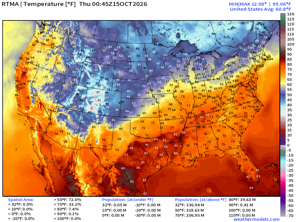
Mostly 70s for almost 207 million population — mild and comfortable evening
Temperature Analysis | Anomaly from Normal
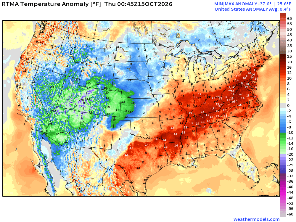
Lower 48 was +0.4°F above normal but plenty of -12°F vs. +12° to +18°F
High Temperatures next 9-Days
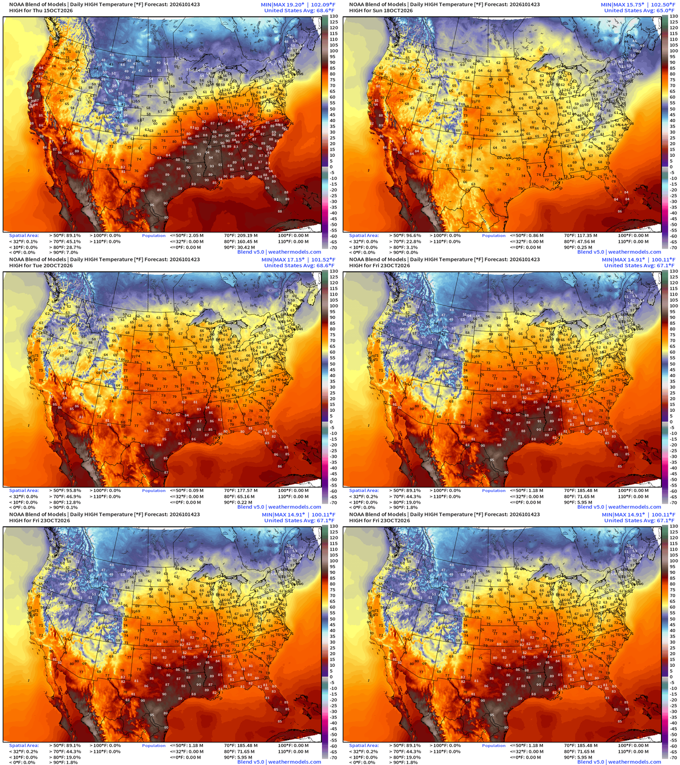
Highs plummet behind the cold front with 60s instead of 80s in the southeast and Texas, then a slow recovery into the 70s.
Chilly Weekend Ahead!
Saturday High Temperatures except in Central and South Florida + California
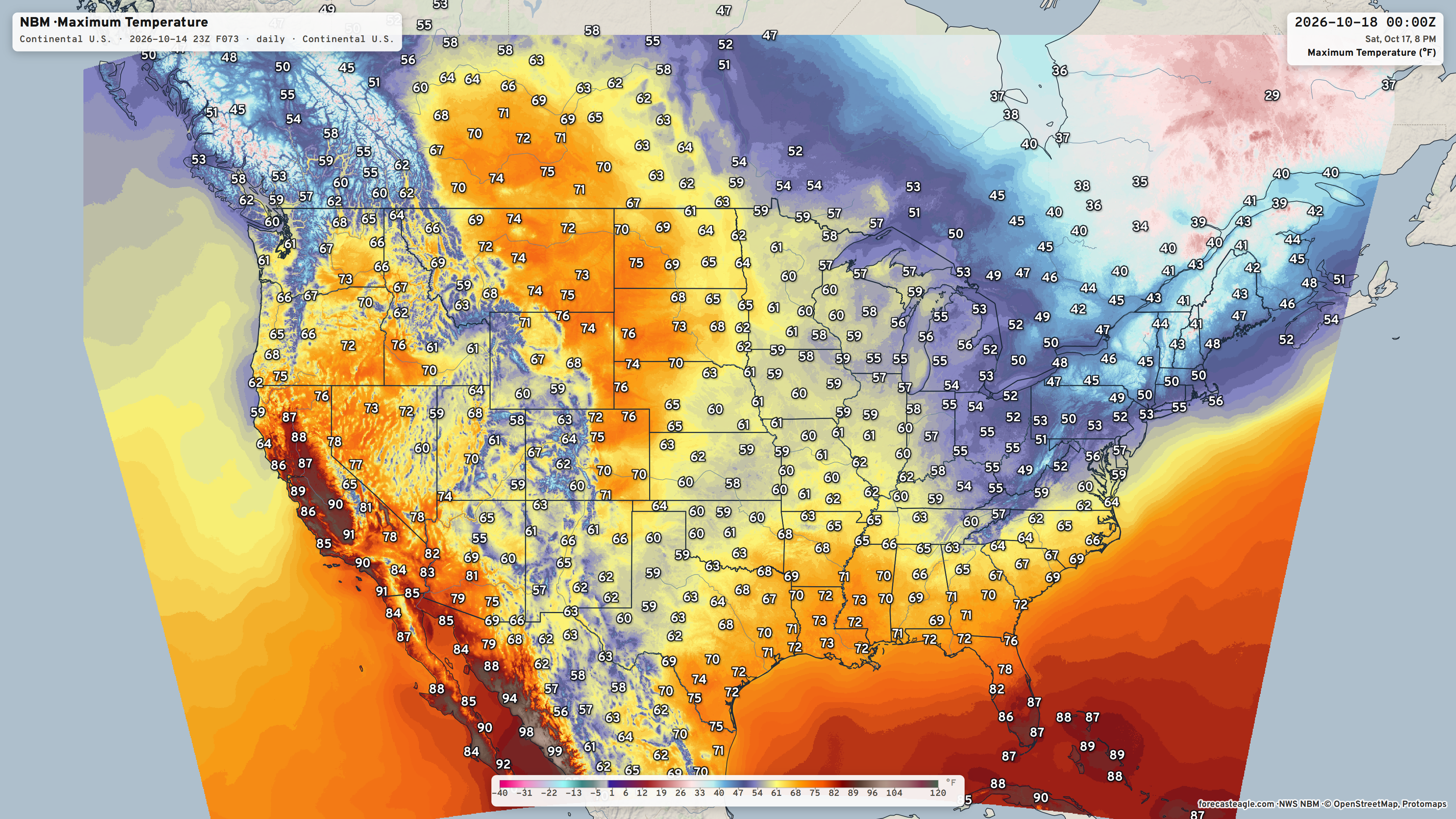
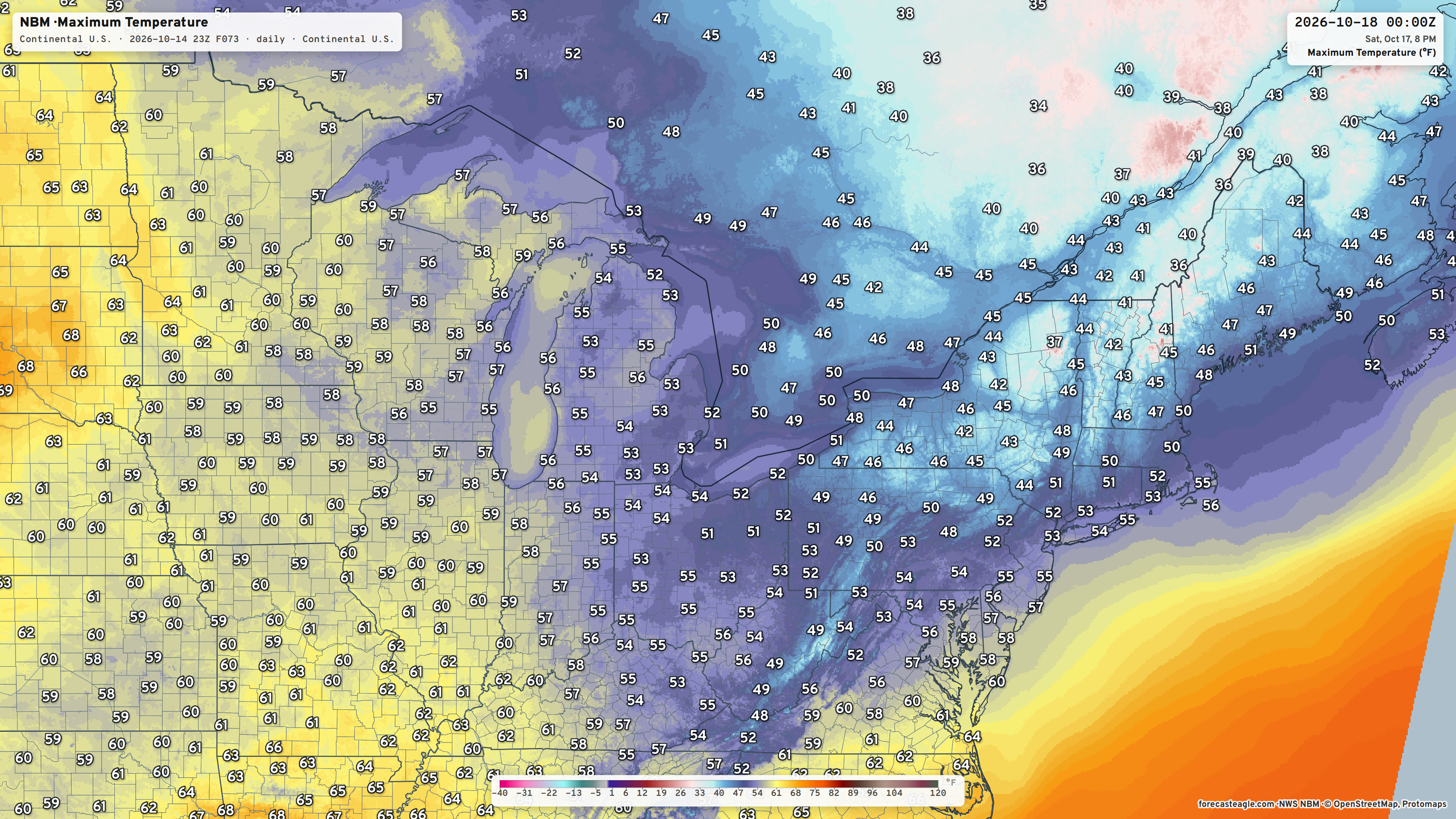
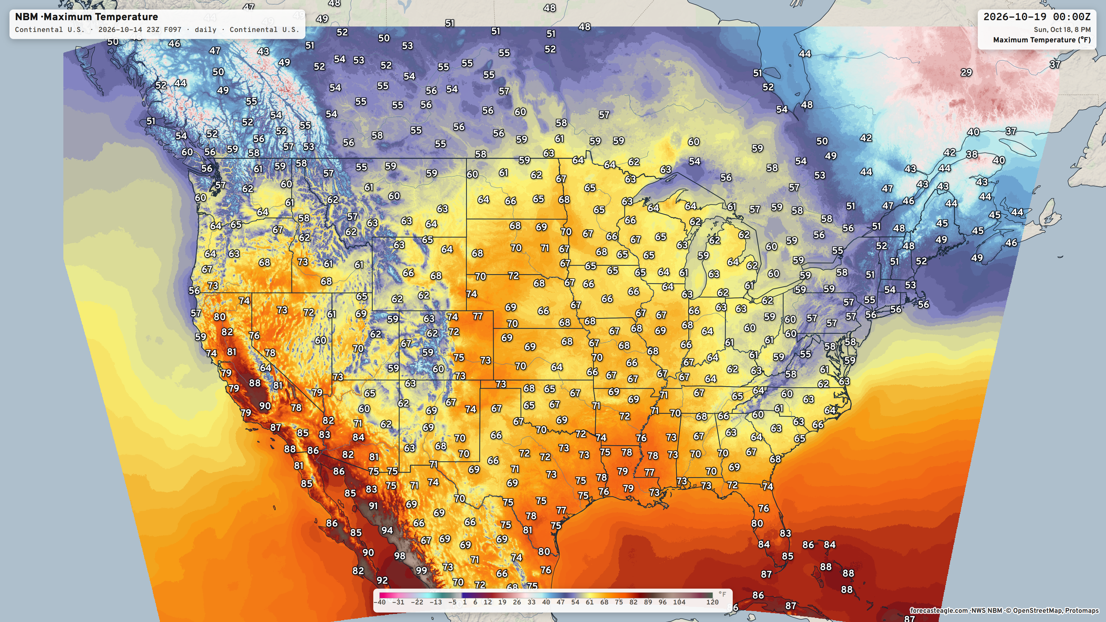
Sunday High Temperatures | Mostly 60s and 70s across the central U.S. and 40s and 50s in the Northeast.
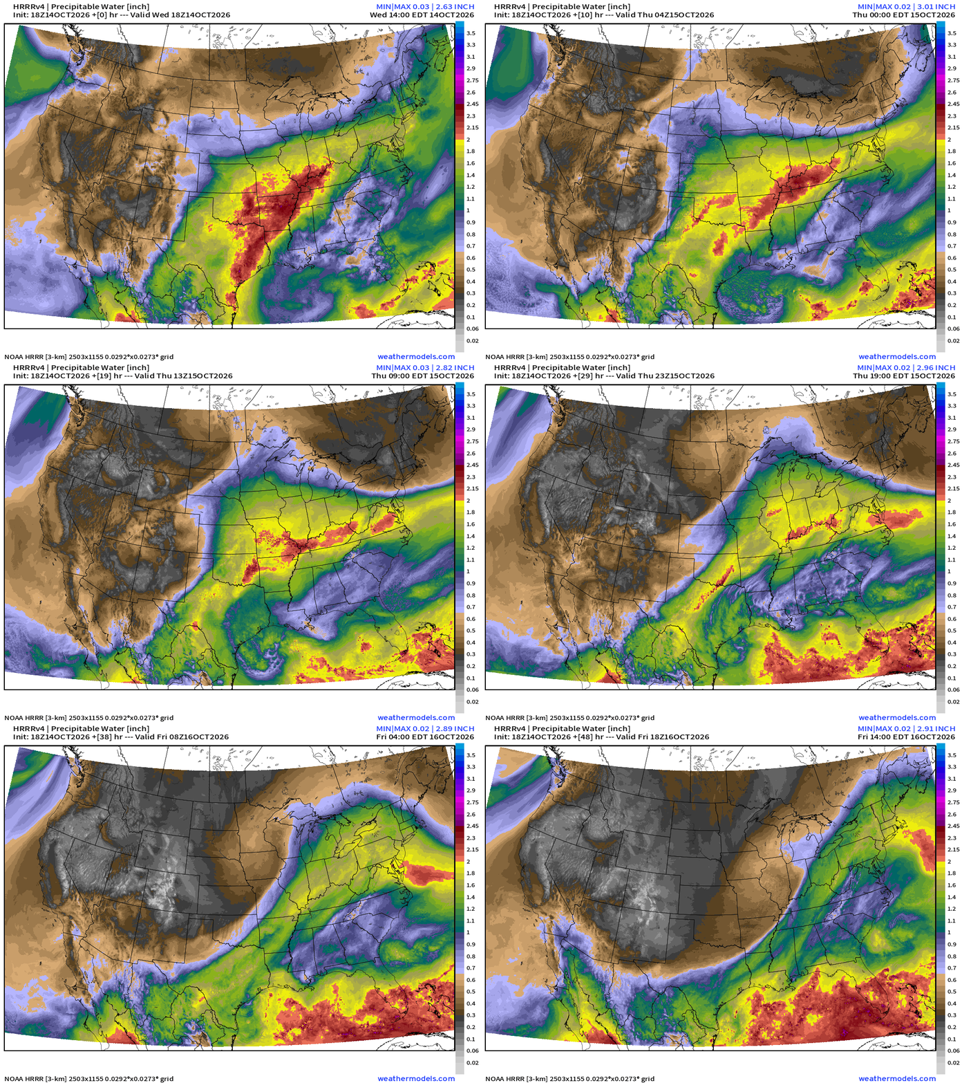
This evening’s HRRR precipitable water … the strong cold front plunges southward into Friday
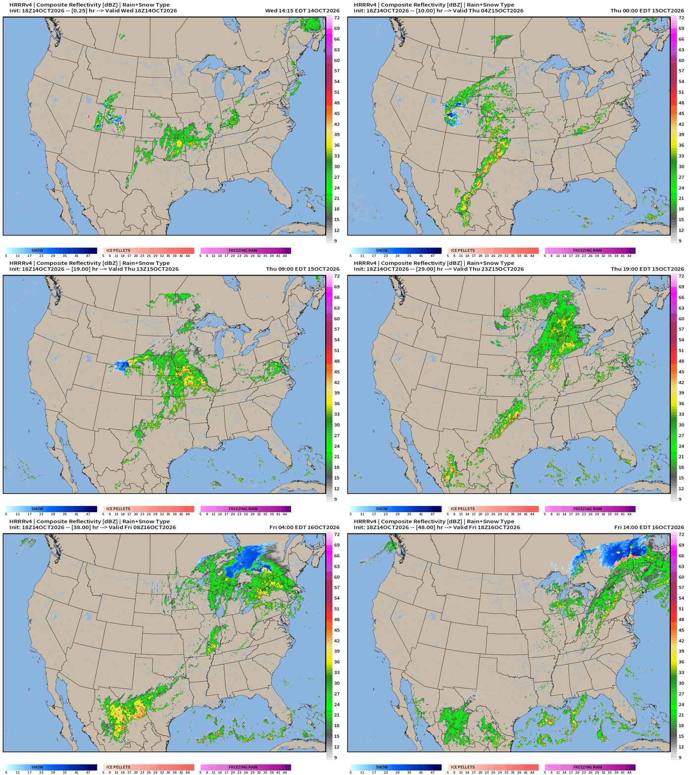
The rain moves eastward with some snowfall in the cold air in Ontario and Quebec: Simulated radar into Friday 2 PM ET
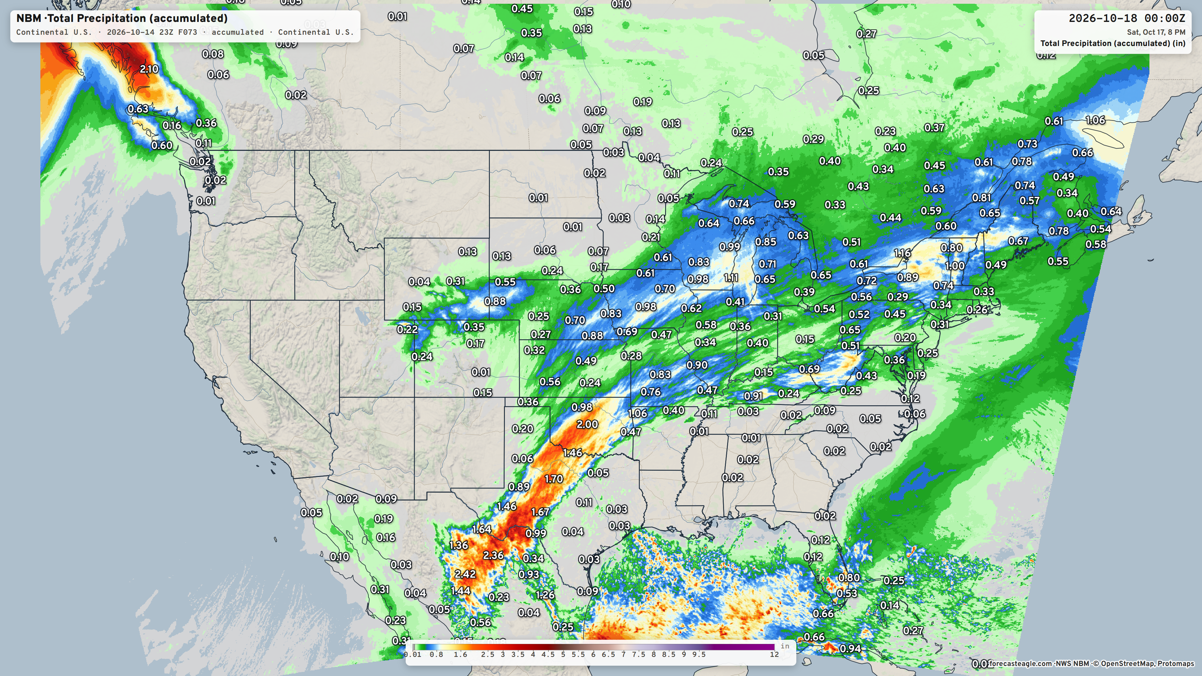
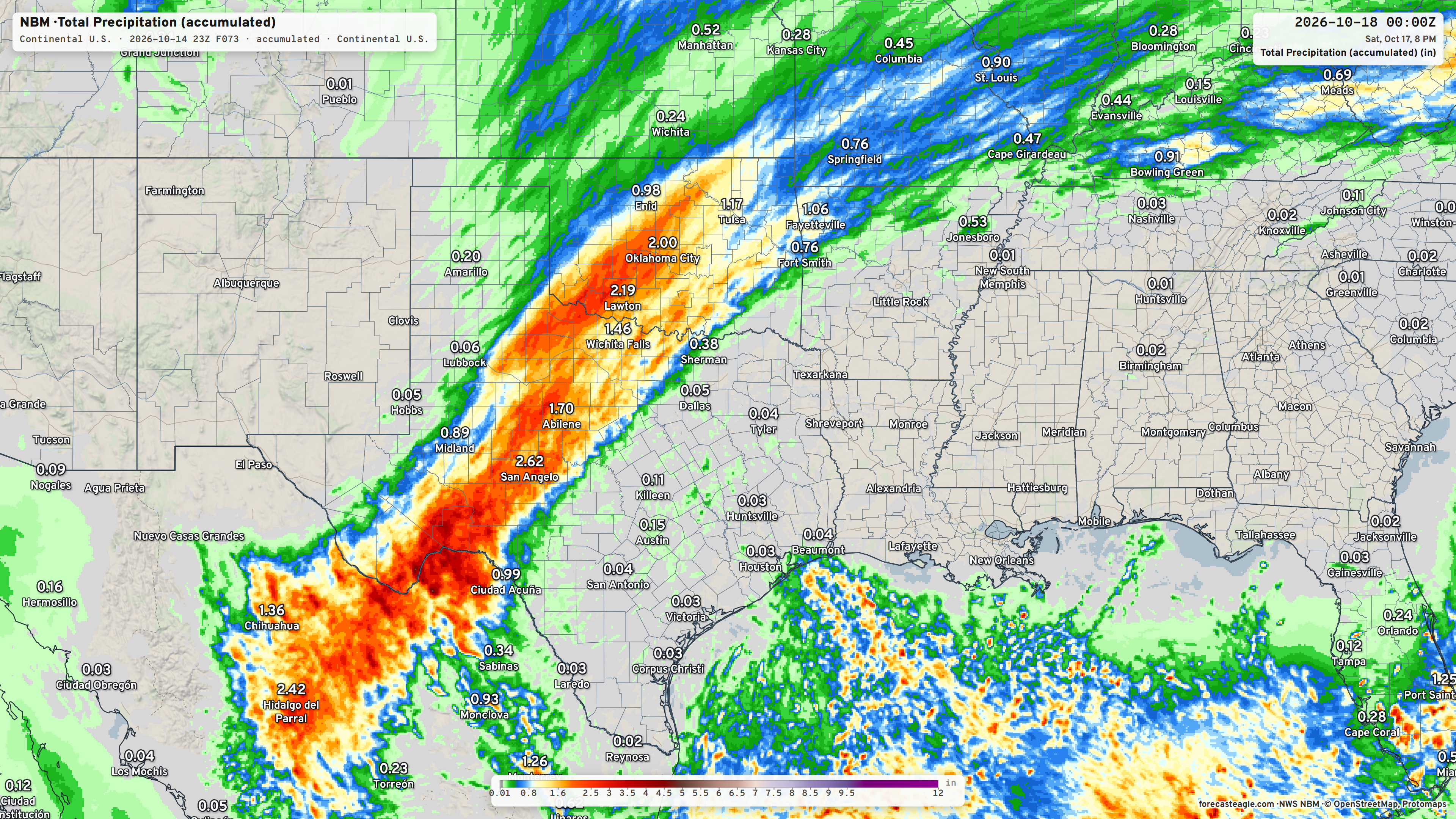
Blend of Models Precipitation Next 3-days
Low Temperatures Thursday Morning
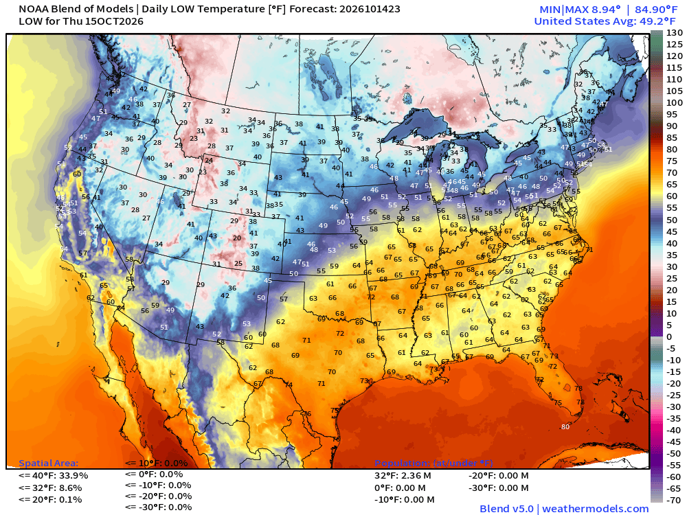
8.6% of the Lower 48 real estate freezing | 2.36 million population
High Temperatures on Thursday
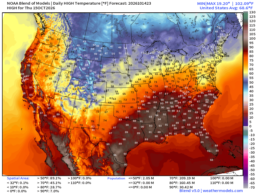
Still 30 million at least 90°F
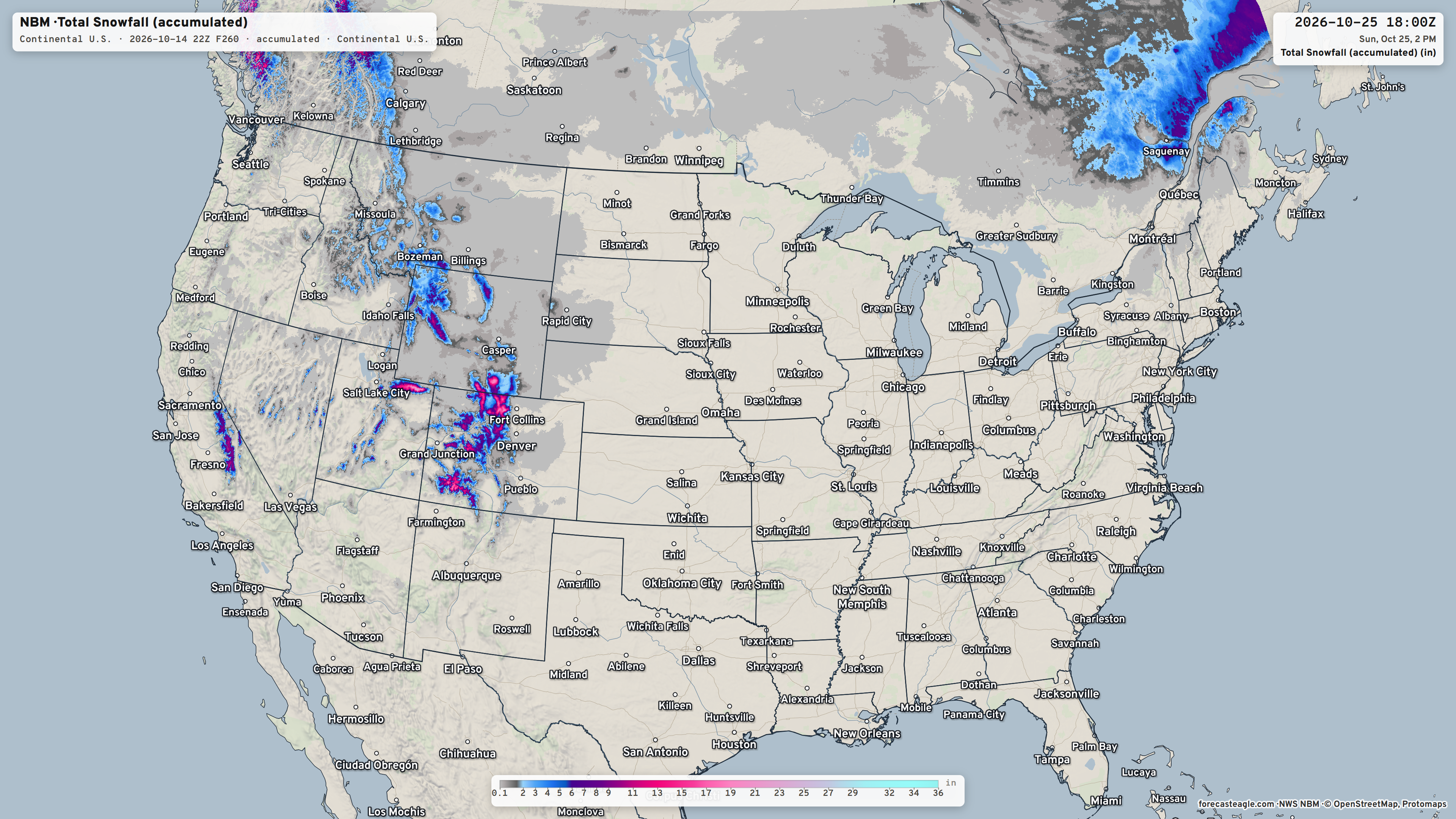
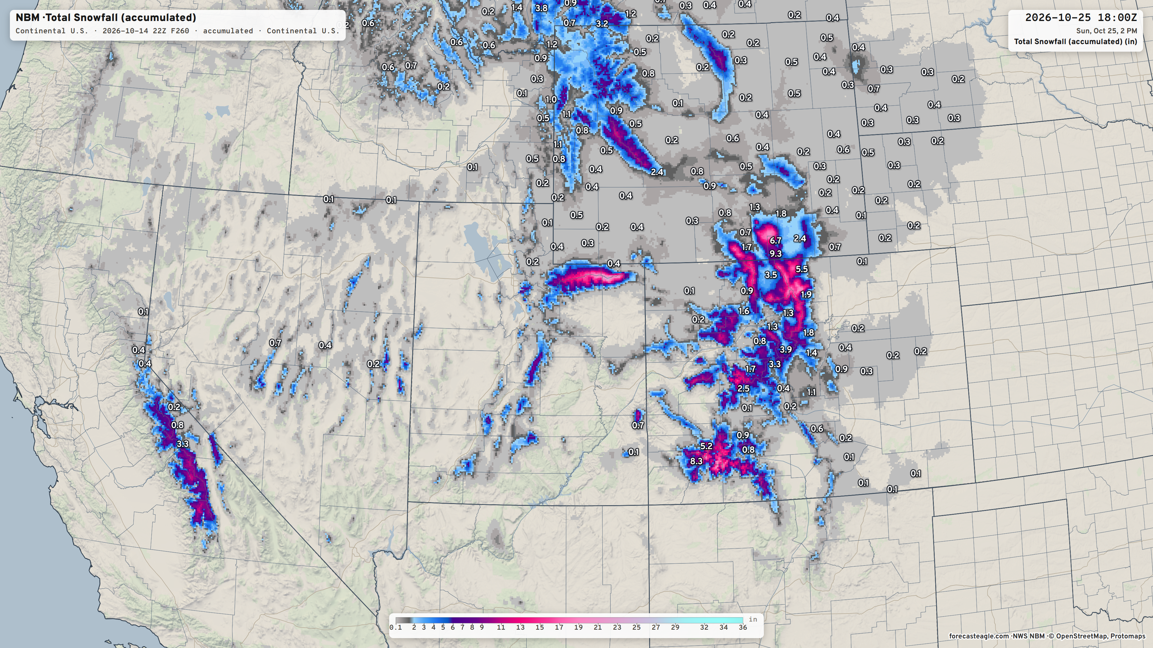
Blend of Models Snowfall Next 10-days
Integrated Vapor Transport Next 10-days | AIFS 18z Flagship Model
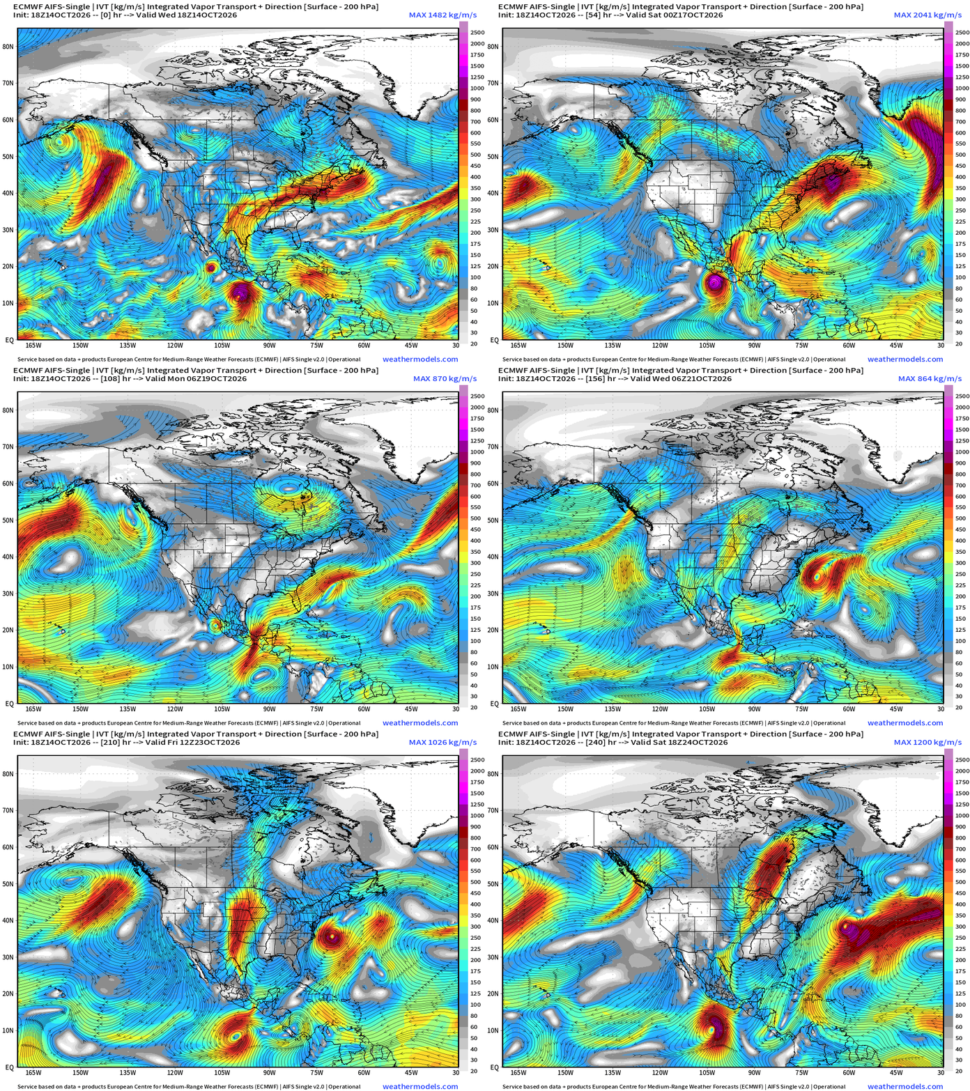
The cold front blasting through the Lower 48 forces a “gap flow” event through the southern Gulf across the Tehuantepec gap — and may help spin up another hurricane in the Eastern Pacific.
An interesting cut-off low develops off the U.S. East Coast next week beneath a blocking ridge (omega block) and could find enough warm water to develop into a Subtropical / Tropical Storm — and stays out to sea. Something to watch!
Height Anomaly Next 10-days
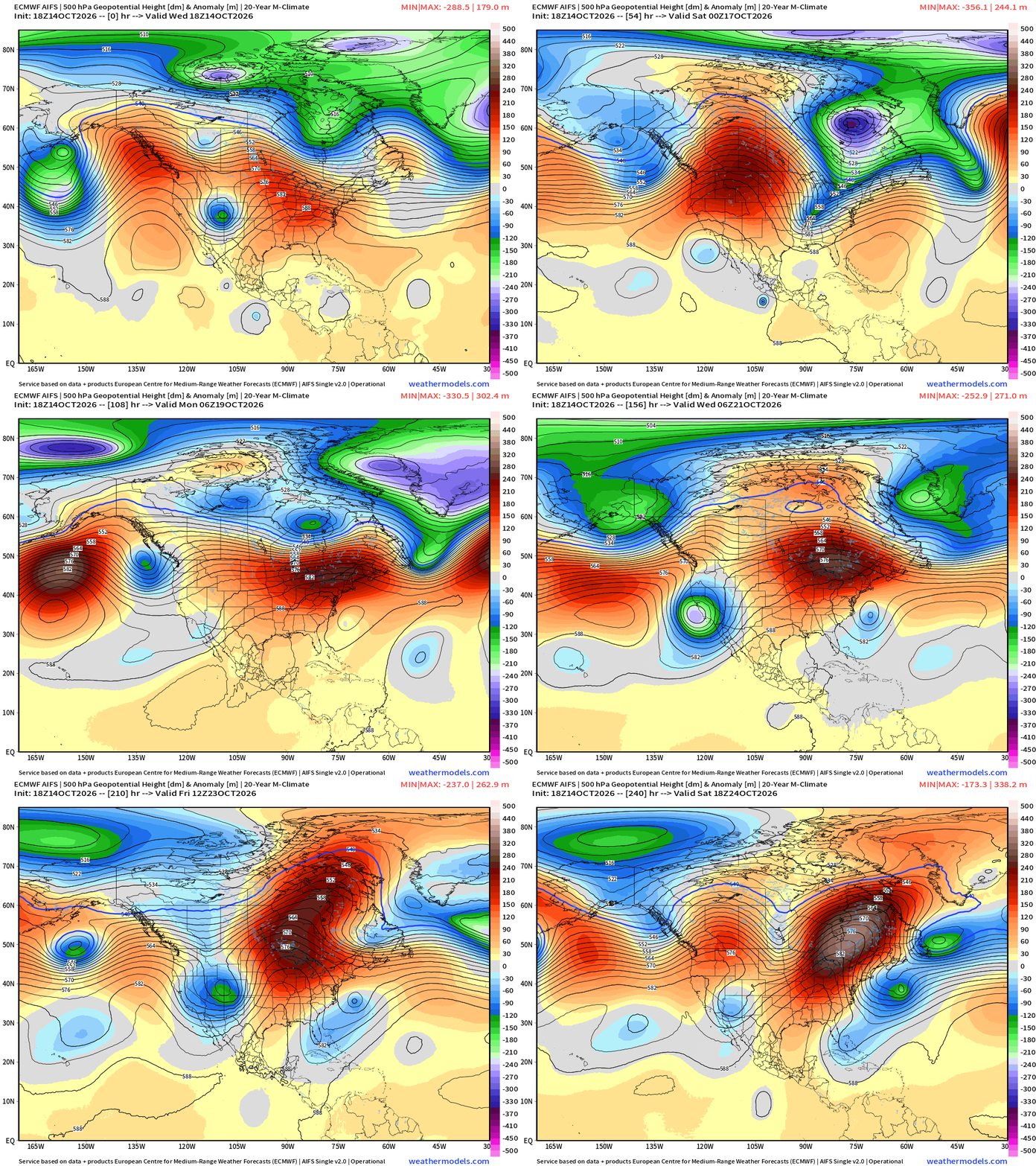
The Canadian Arctic “blast” or cold front is associated with a tropospheric polar vortex lobe — fast moving this weekend. Doesn’t look like much! The tail end of this trough is what cuts off the East Coast. A “honking ridge” builds over eastern Canada.
Week 1 Temperature Anomaly | Oct 14 - Oct 20
Week 2 Temperature Anomaly | Oct 21 - Oct 27
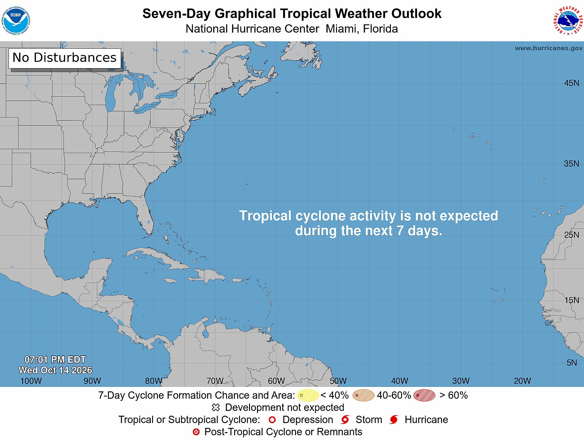
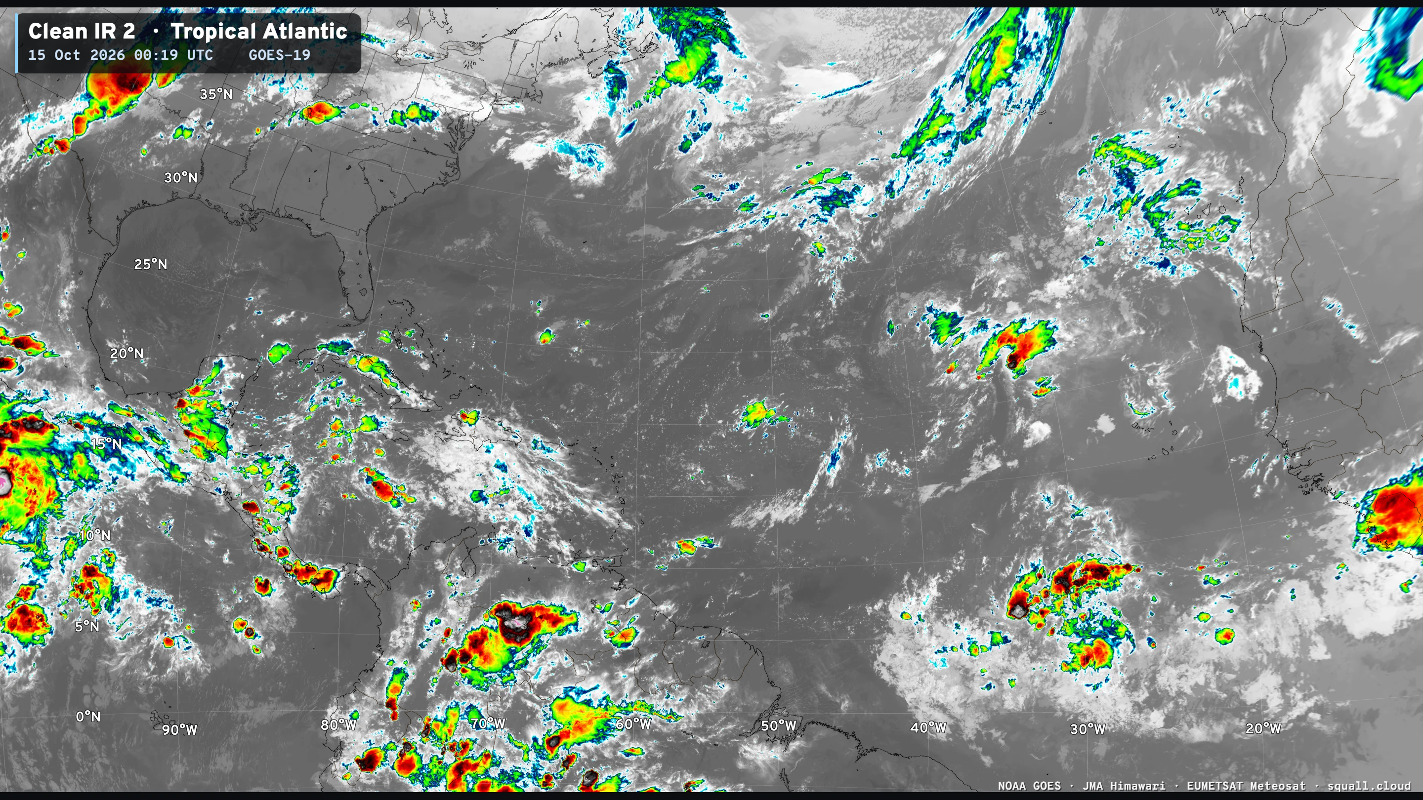
Atlantic Tropical Outlook | Quiet Next 7-days
Atlantic Satellite shows only scattered convection, but nothing organized.
ECMWF Ensemble 12z full-physics tracks next 15-days
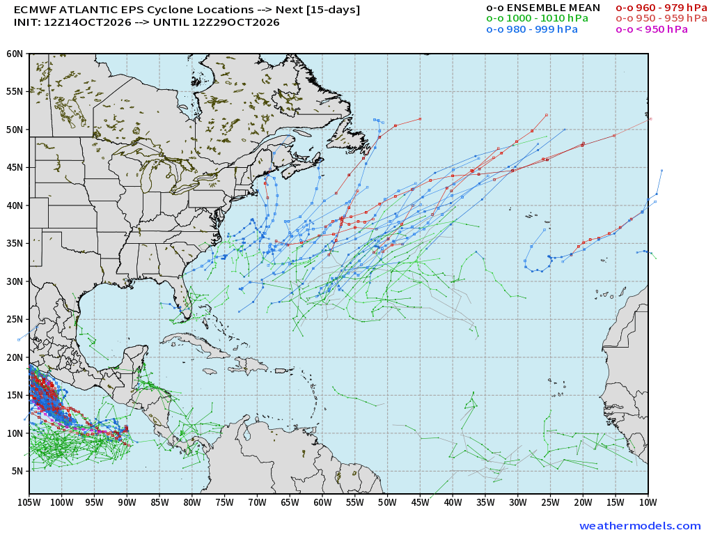
The storm tracking from ECMWF also picking up subtropical/non-tropical lows in the subtropical Atlantic off the U.S. East Coast — similar to AIFS-Single. Elsewhere, ghost town!
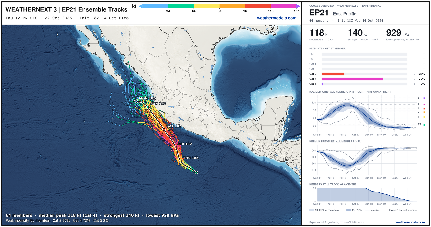
Google Deep Mind | Weather Next 3 | 18z Tracks (64-members)
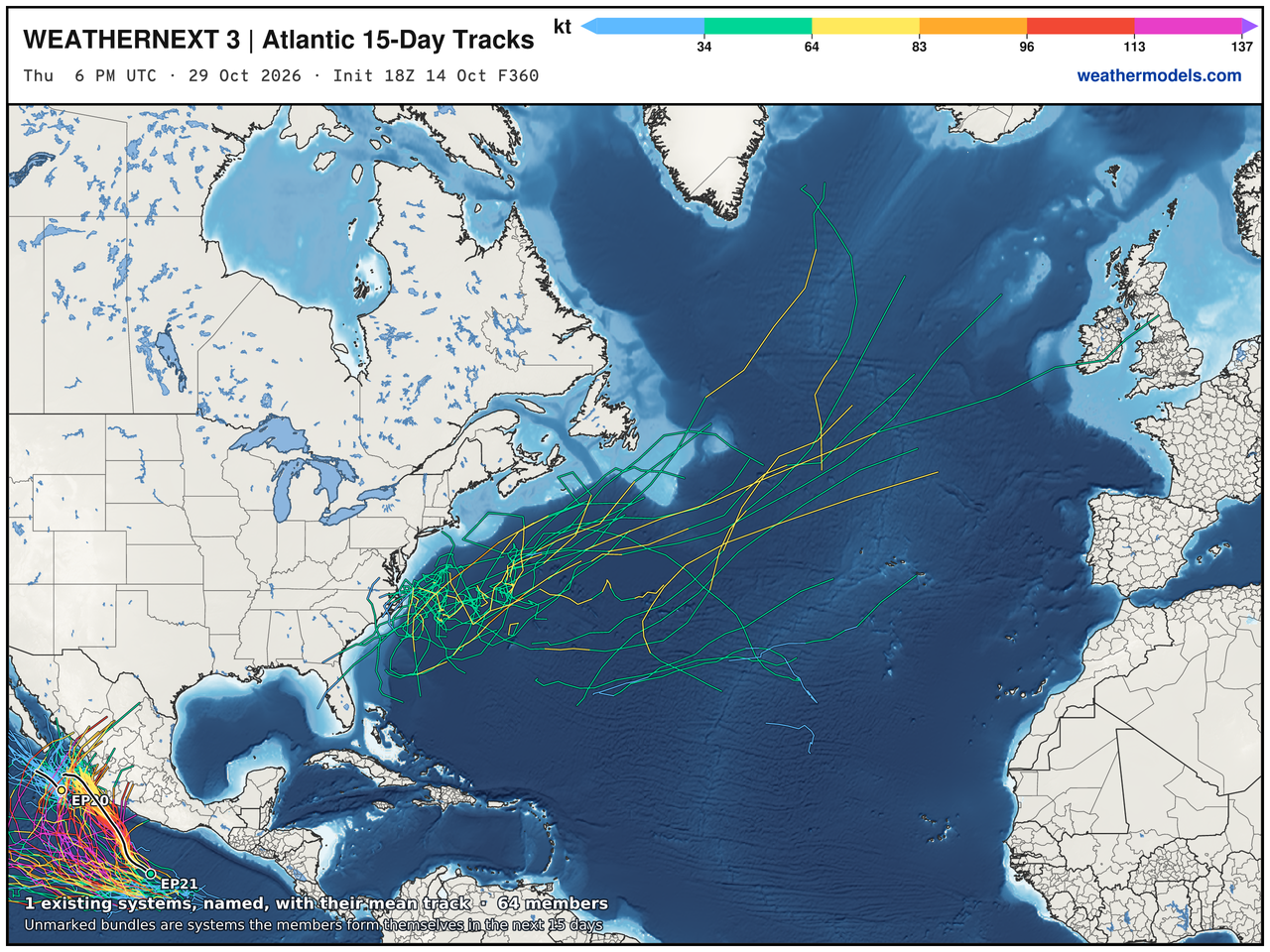
WN3 also shows the mess of spaghetti off the East Coast, so that might be our hot-spot next week after the major cold front and trough swing through!
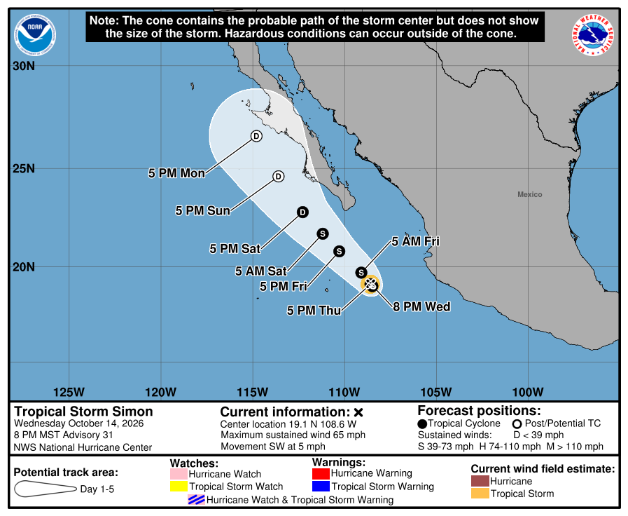
Eastern Pacific Tropics | Simon and Trudy
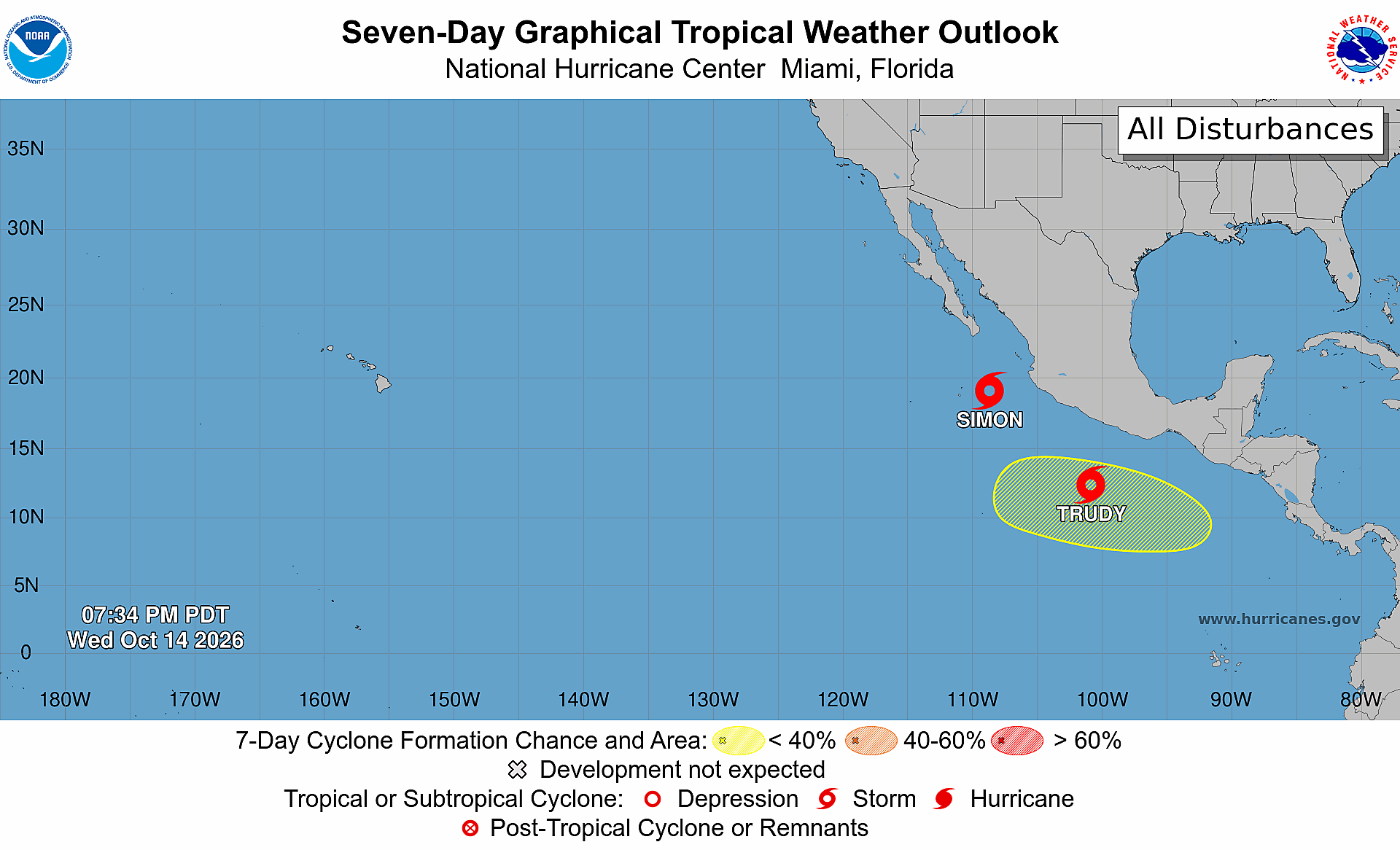
Simon and Trudy both tropical storms but heading in different lifecycle trajectory!
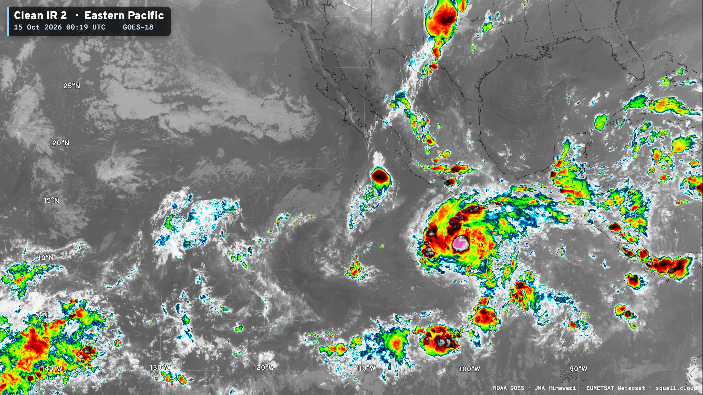
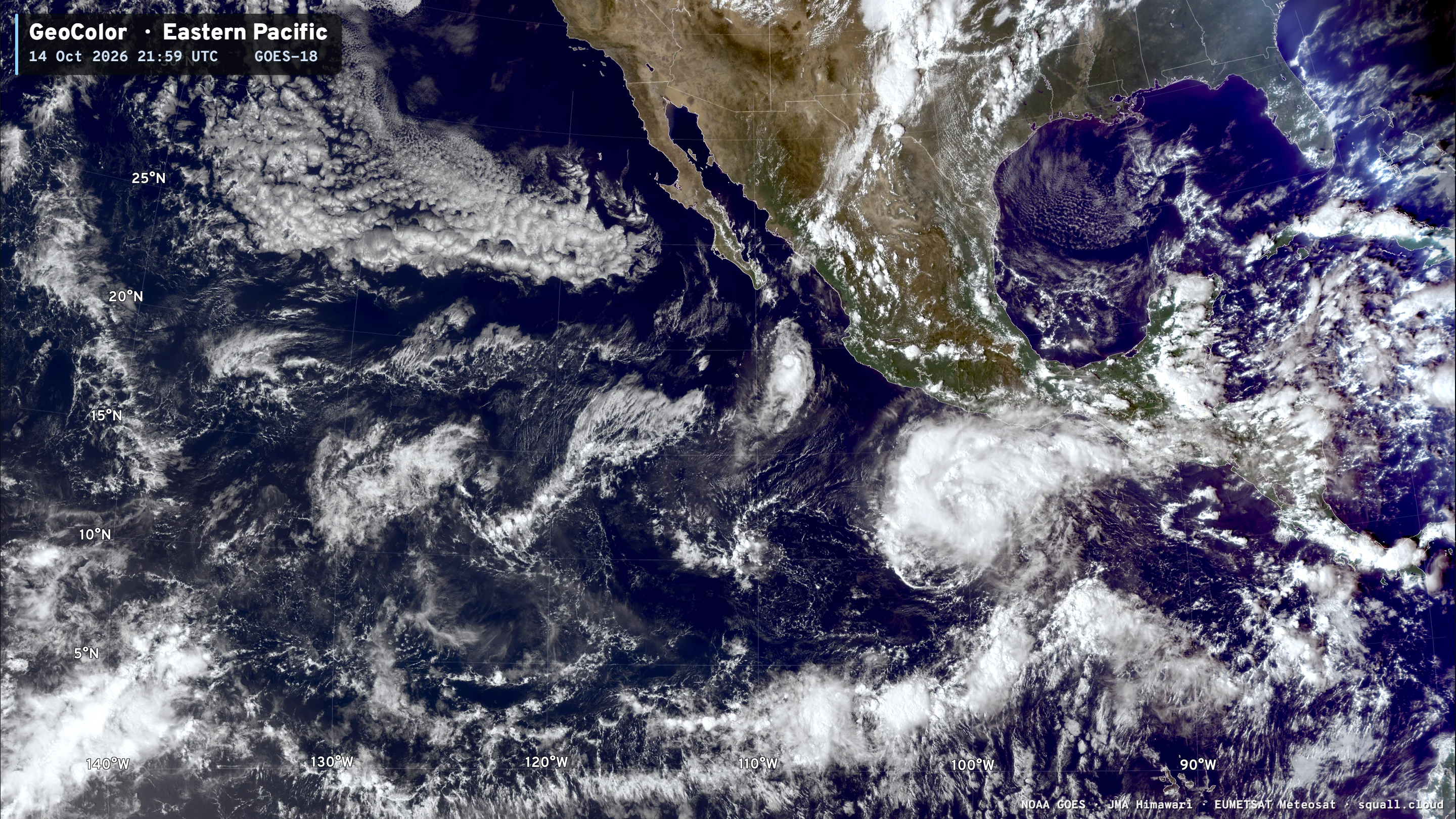
Trudy
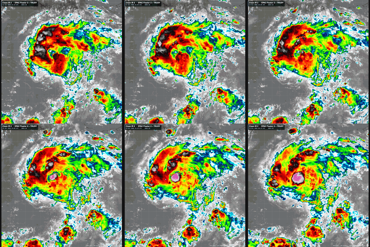
Trudy nearly a hurricane and expected to rapidly intensify to Category 4 (115-knots)
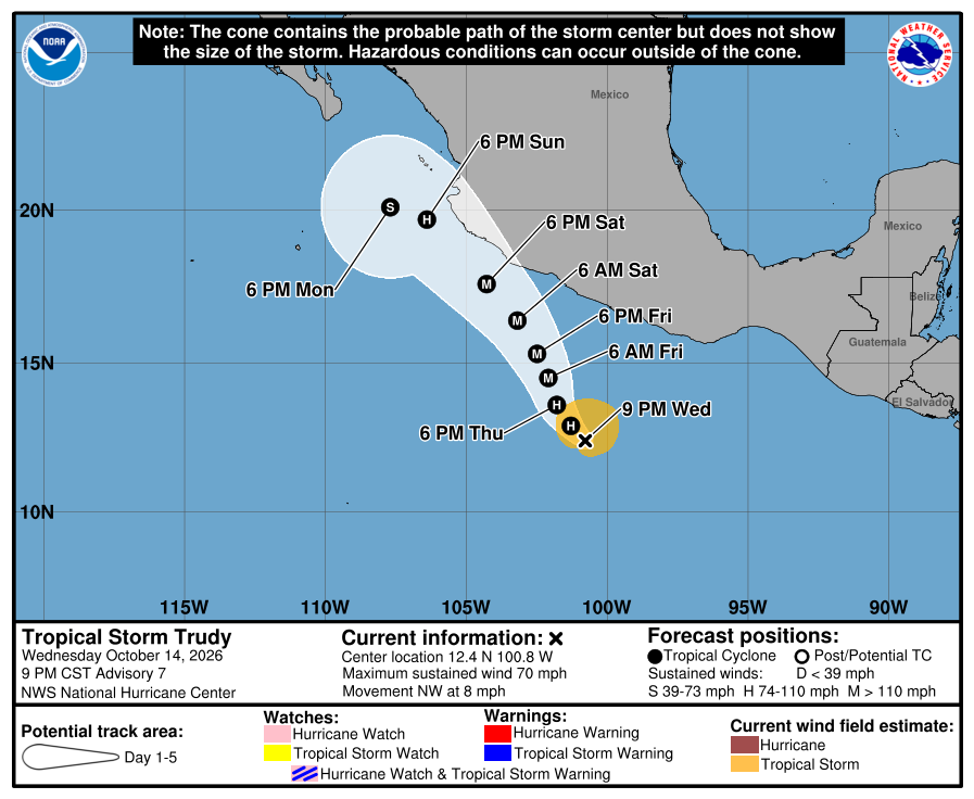
Category 3 or Category 4 maximum intensity / split 25% to 75% from WN3
Tiny Tropical Storm Simon no longer going into the Gulf of California but will weaken west of Baja California.
Western Pacific Tropics
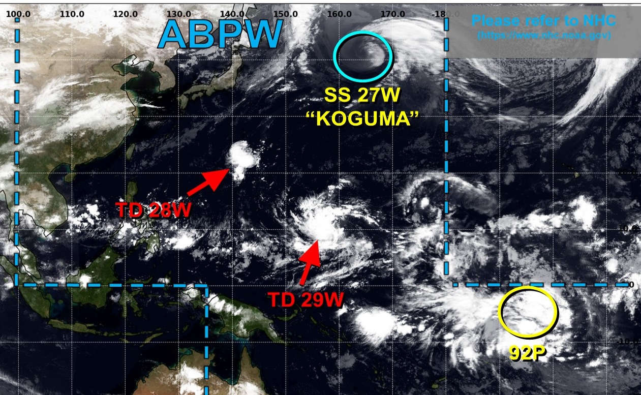
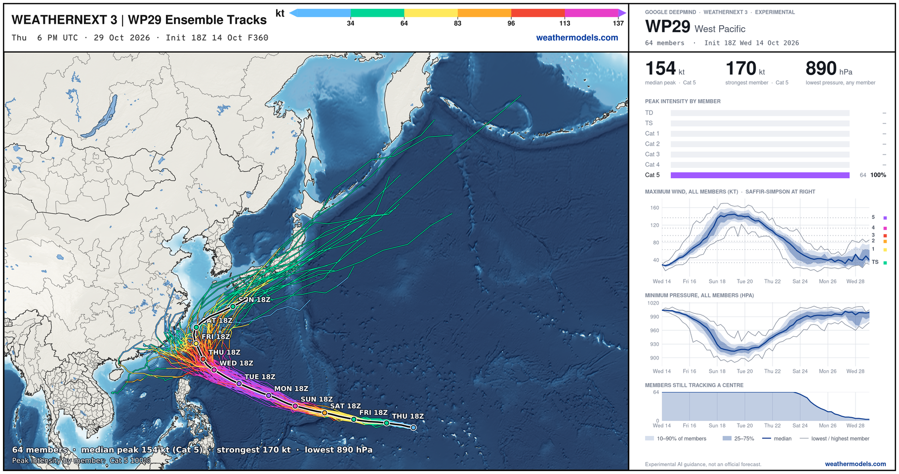
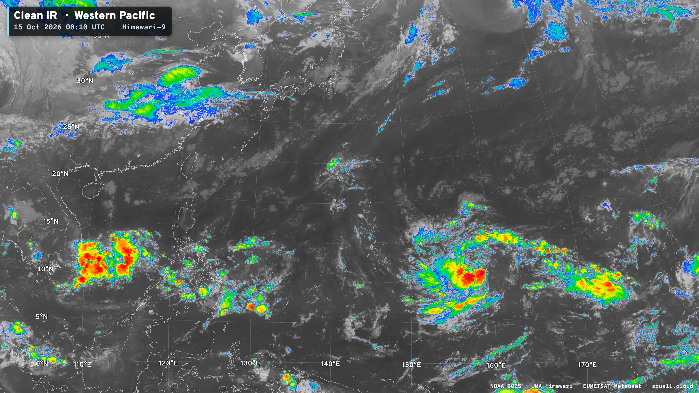
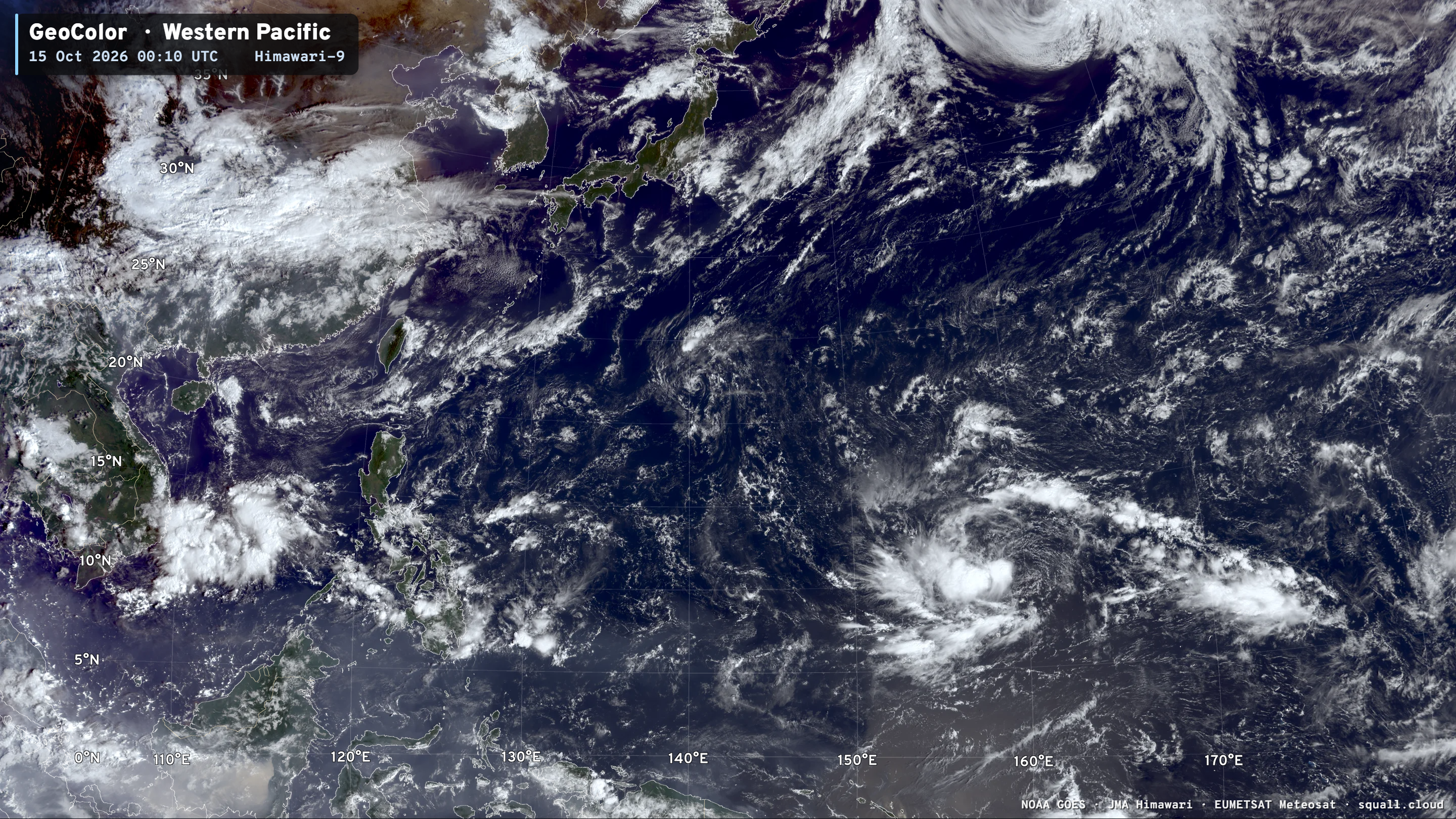
TD 29W —> Typhoon Champi — threat to Guam in next 72-hours.
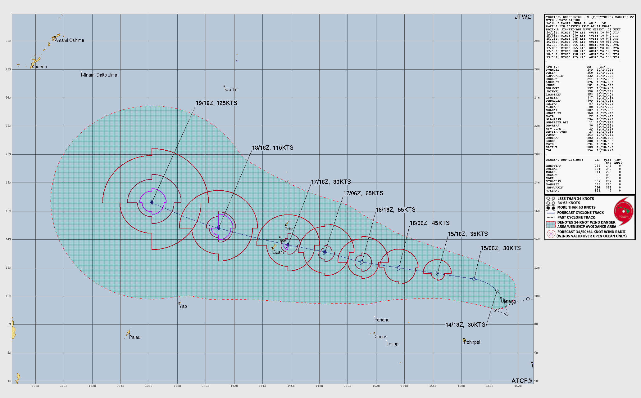
100% of Weather Next 3 Members at Category 5 — 155 knots Median = T 7.5 on Dvorak and could become more intense up to 170-knots (T 8.0)
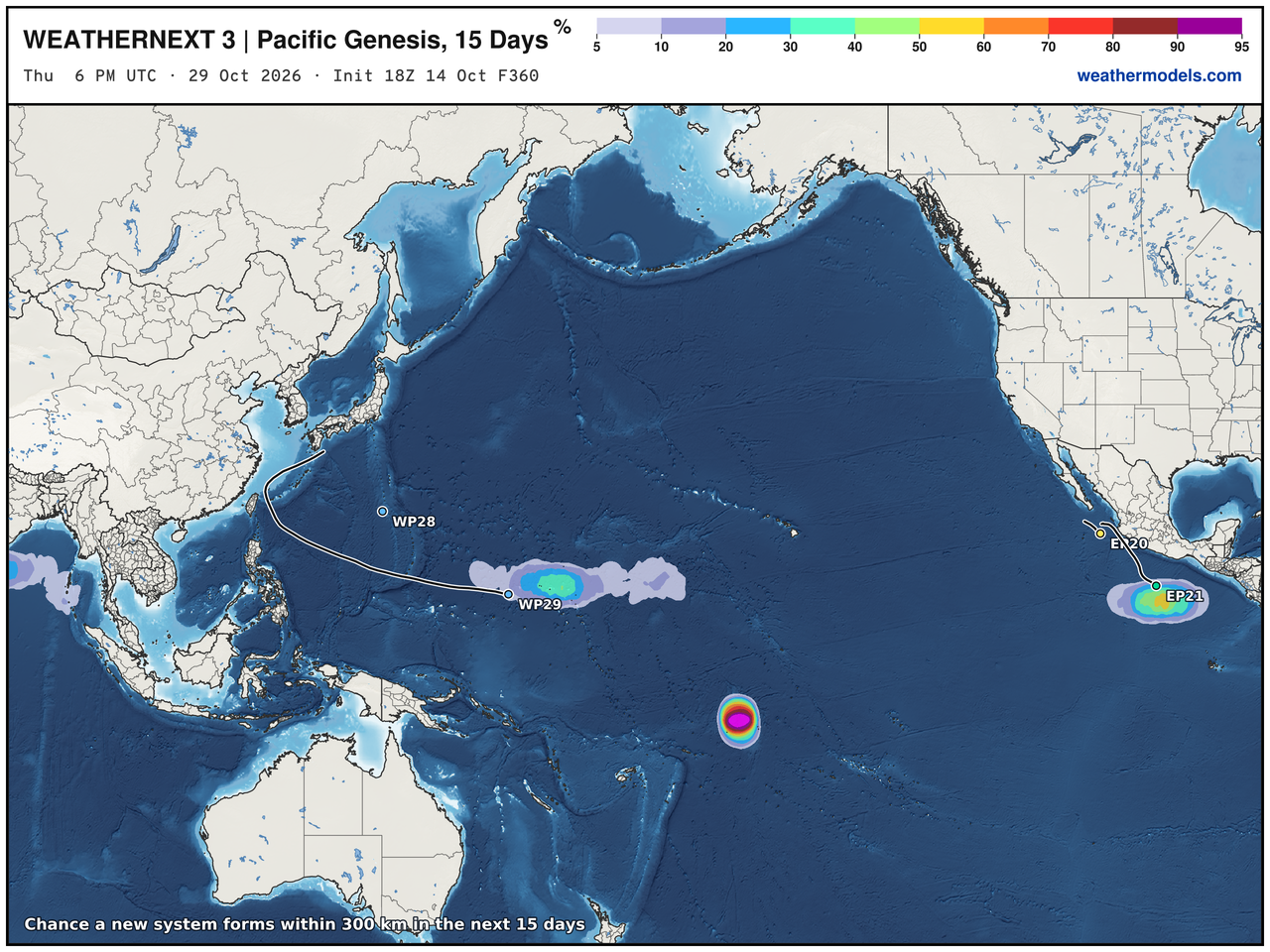
Also, we’ll see a South Pacific Tropical Cyclone, too!
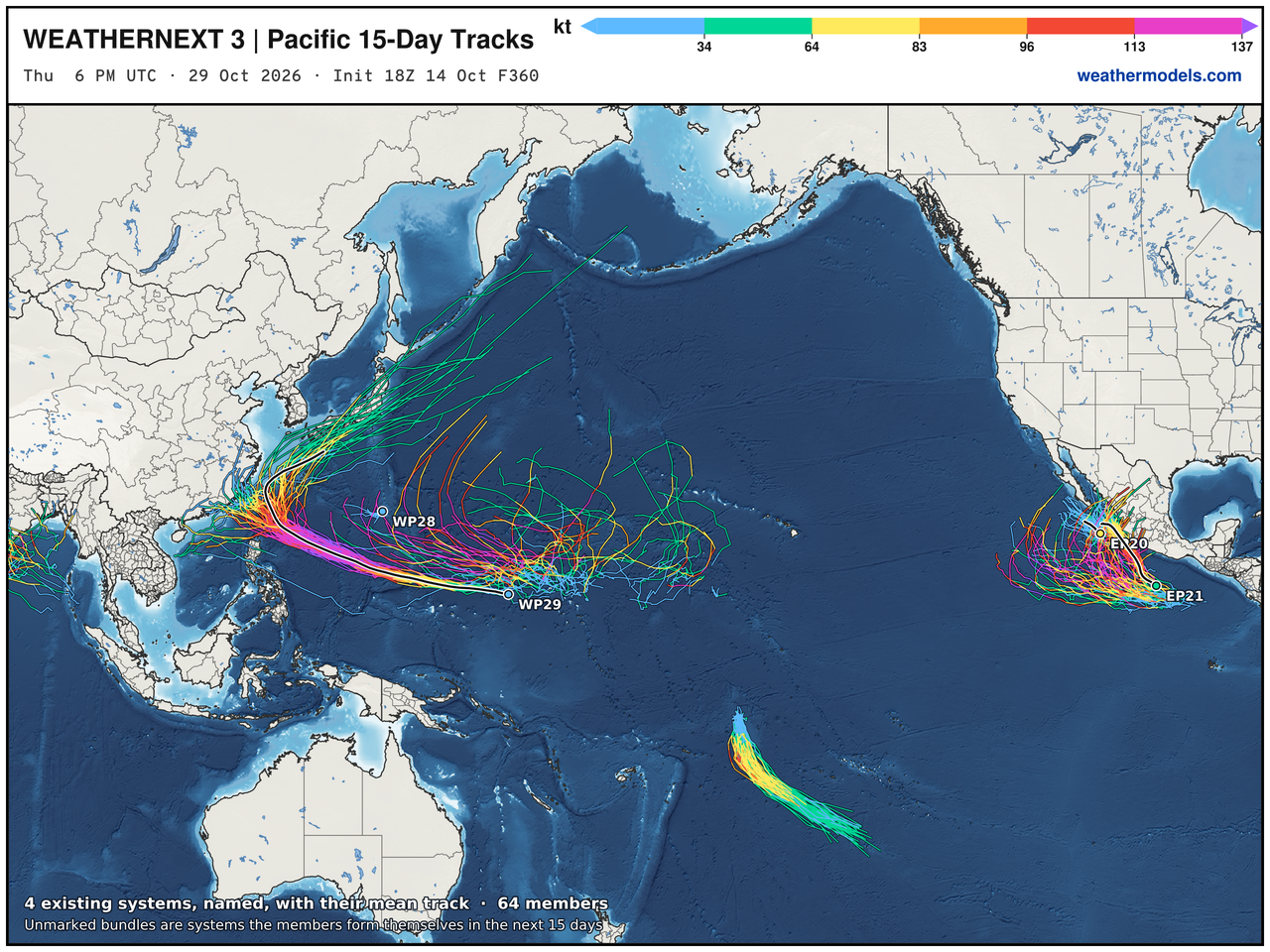
Genesis next 15-days
Thank you for visiting / reading — always more to come!
Visit Global Tropical Cyclones for more ACE information, as well as my original climatlas.com/tropical site with much new research including a calibrated “Best Track” and historical tropical cyclone browser with plenty of interesting features like rankings of storms by their IKE (size). ACE up to 821.

Satellite imagery from Squall Cloud. Maps sourced from weathermodels.com designed and innovated by yours truly! Please subscribe there for real-time access to the newest maps, charts from all of the weather models including ECMWF and AIFS, and NOAA GFS/GEFS, HRRR/RRFS and Blend of Models (NBM). NOAA WPC and SPC for fronts/convective outlooks. Our own content is now sourced from hottestsince.com and weather.city and celsius.earth, and squall.cloud and weather.football and global-tropical-cyclones.com and precip.earth and forecastcanada.com
My Atlantic Hurricane Season Forecast (2026)
From April 7, 2026: Atlantic Seasonal Hurricane Forecast: (11/5/2)
9-13 Named Storms (11 most likely)
4-7 Hurricanes (5 or 6 most likely)
1-3 Major Hurricanes (2 most likely)
Accumulated Cyclone Energy: 75-85 (well below normal)
NOAA 2026 Atlantic Hurricane Season Forecast
- Milepost
- 1624 · laid 2026-10-15T03:05:10Z
- Source
- https://weather.substack.com/p/october-14-2026-wednesday-weather · October 14, 2026 Wednesday Weather Update
- Tagged
- I-26 Tropics · Josephine · Western Atlantic (32.0, -70.0) · by rule, at build
- Digest
- 748346d7b6f285a2c55f40000cff30b1a548588d589df8c69fcded521452a888