Wind shear not having an impact this morning with continued strengthening likely

Thank you for supporting my R&D! As you’ve seen over the past month, products have been launched left and right. There’s a method to my madness and there is more to come!
Hurricane Isaias was upgraded to a major (Category 3) based upon aircraft recon data
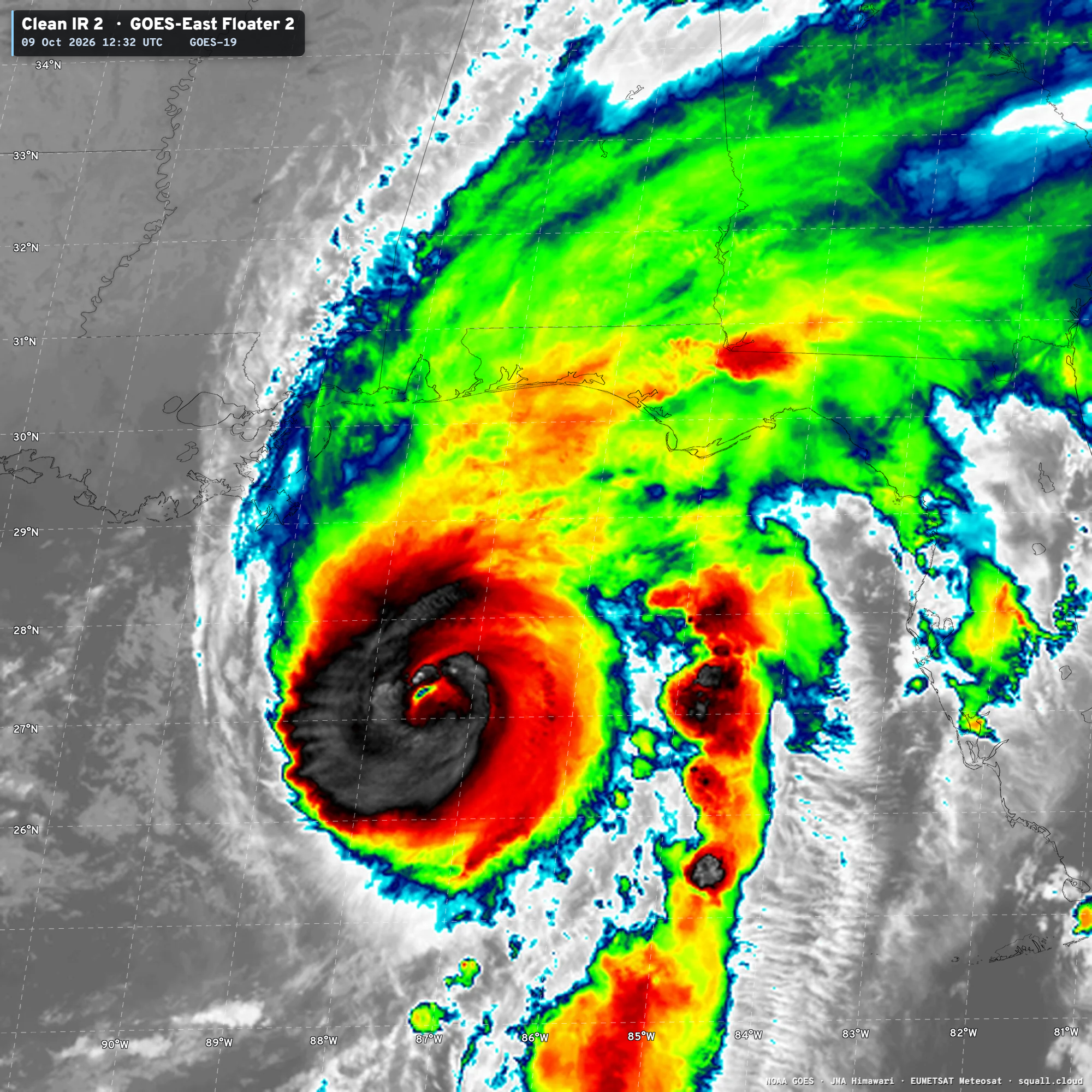
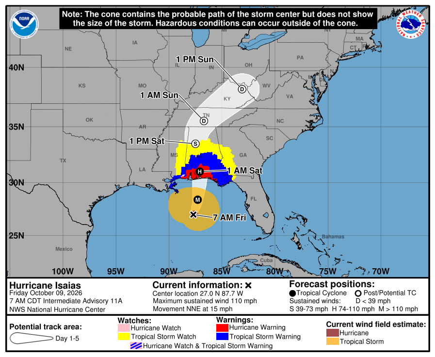
Upgraded 8:20 AM ET: Major Hurricane Isaias 09L (120 mph winds) and 958 mb
Additional intensification likely in next 6-12 hours into Category 3 (125-130 mph)
Somewhat faster motion northward at 15 mph, unlikely to see much in the way of weakening, and vertical wind shear discombobulation might actually create a larger, most damaging wind field footprint.
Impacts will be major well inland especially in Alabama and the Florida panhandle with hurricane force wind gusts, and torrential rain. A feeder band forced by convergence (like a front) will train over the same ground for hours on end with threat of embedded tornadoes.
Over the central Gulf — on top of Loop Current —> close to a major hurricane!
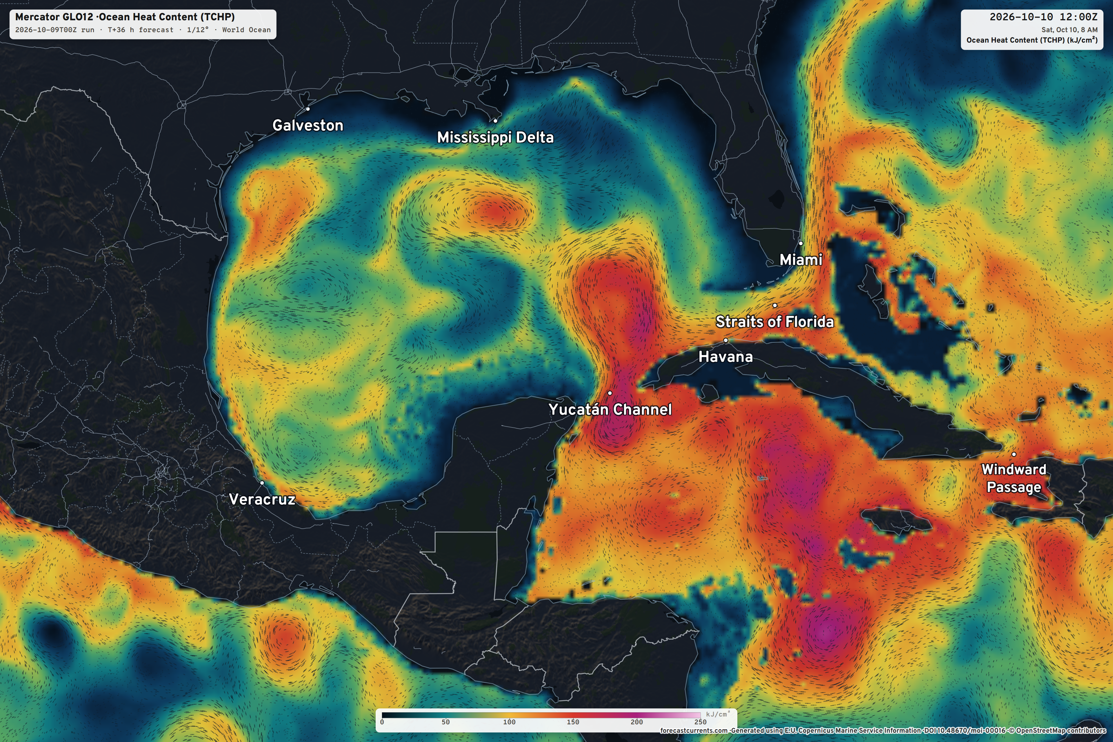
New: Tropical Cyclone Heat Potential —> Forecast Currents
ECMWF 06z Precipitable Water — My Favorite Parameter
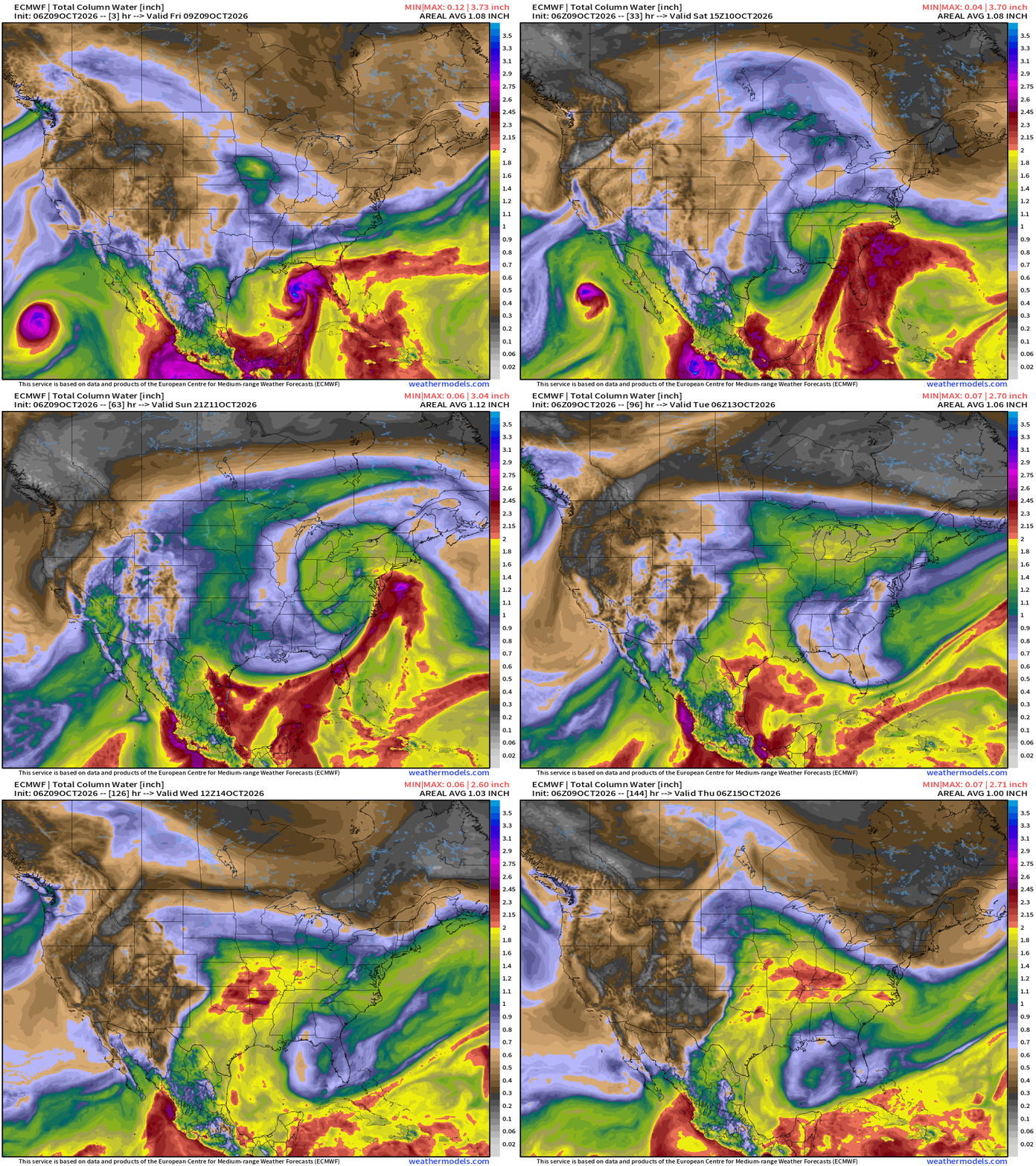
Major Hurricane Isaias will make landfall — and the center will loop over northern Mississippi briefly before accelerating into the Mid-Atlantic as a post-tropical system.
Tropical Storm Rachel “could” make landfall as a legitimate tropical storm in Southern California or Northern Mexico … with significant flooding impacts over the deserts.
Through next week, the Gulf / tropical moisture flow continues around a ridge that sits over the Southeast.
The trough is digging west of Isaias — but it is not currently impacting the storm in a negative manner — as the two features seem to have figured out a way to co-exist in a helpful way.
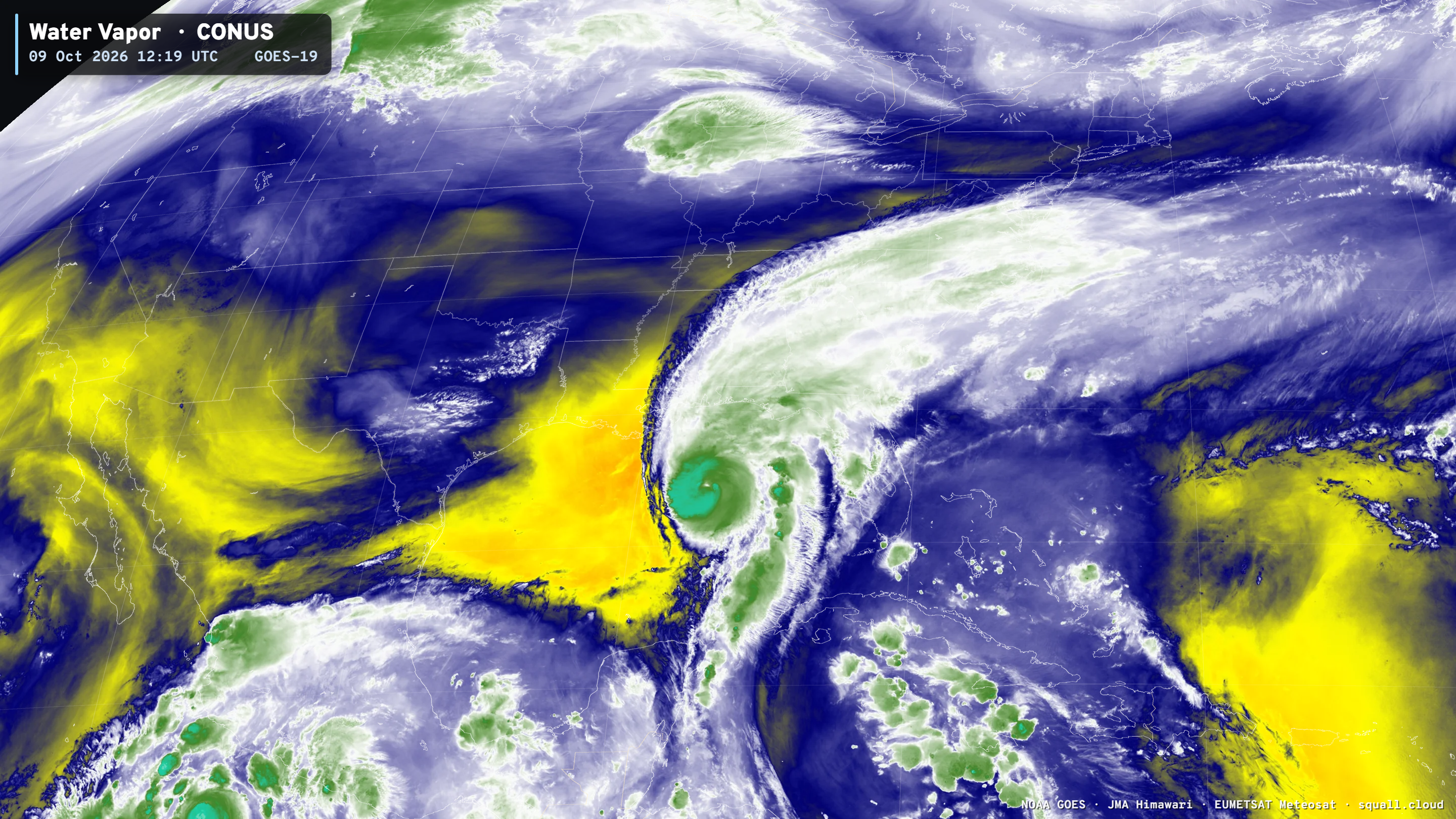
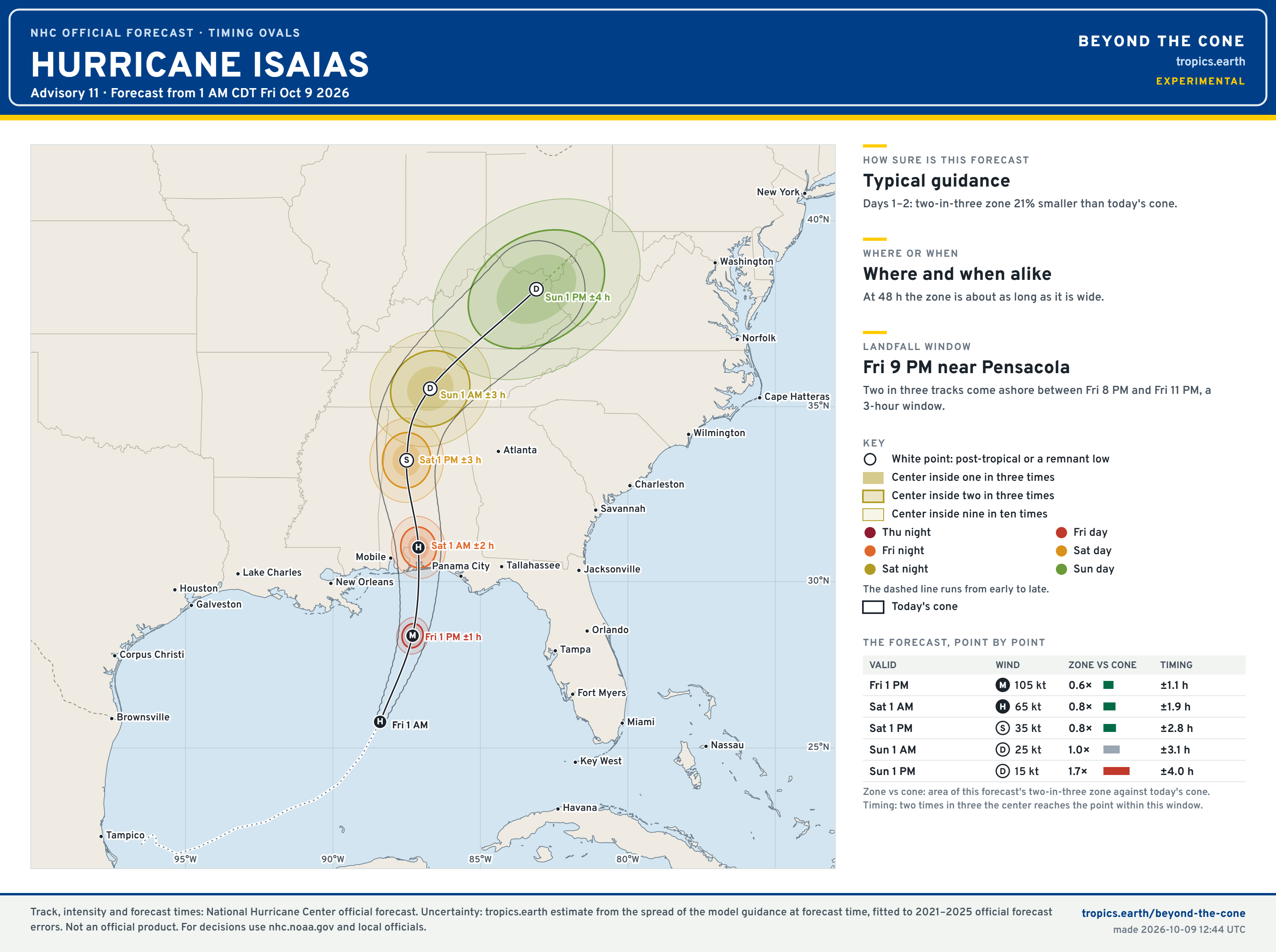
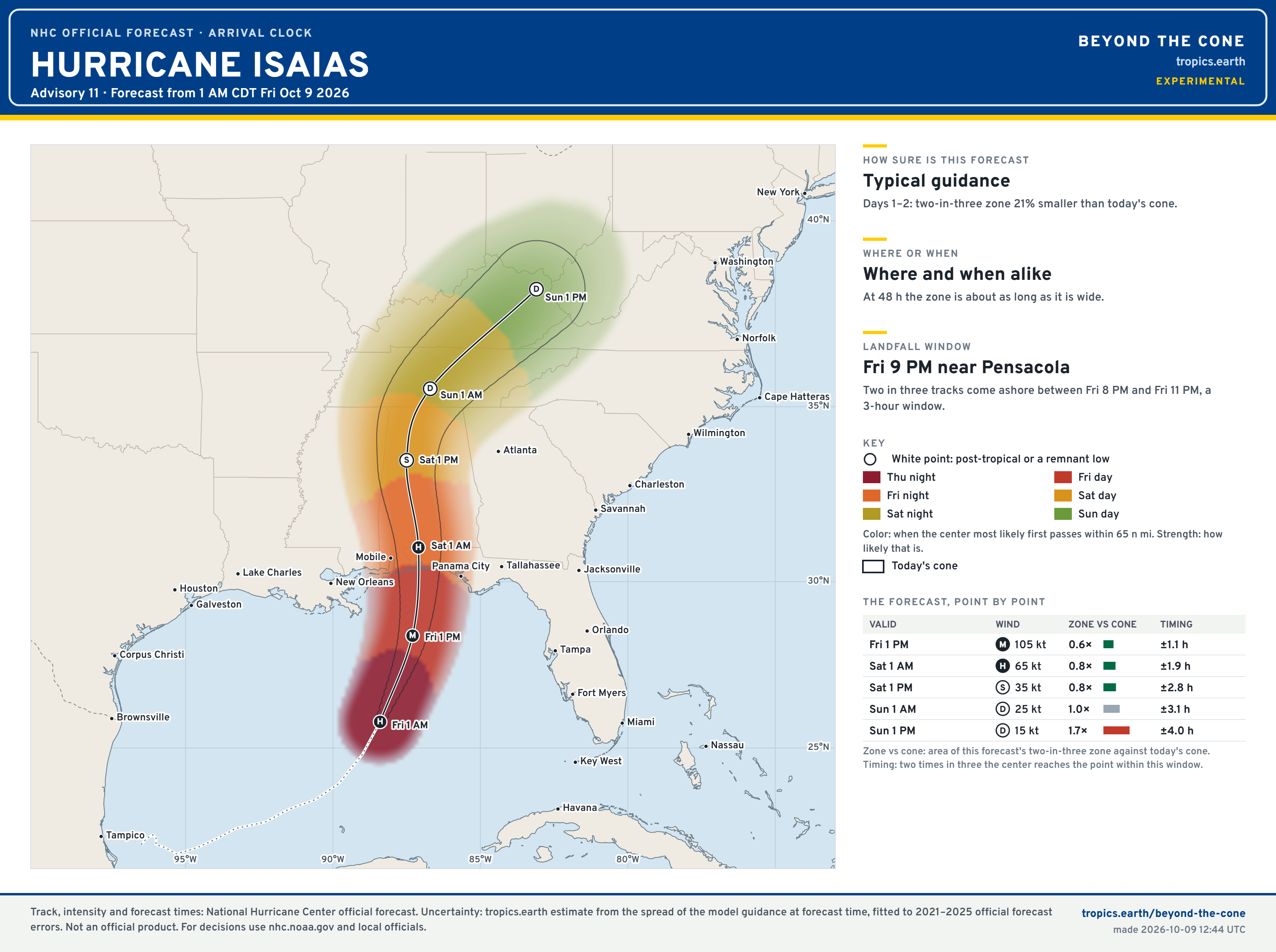
Timing for Landfall — late Friday evening 9 PM just east of Pensacola
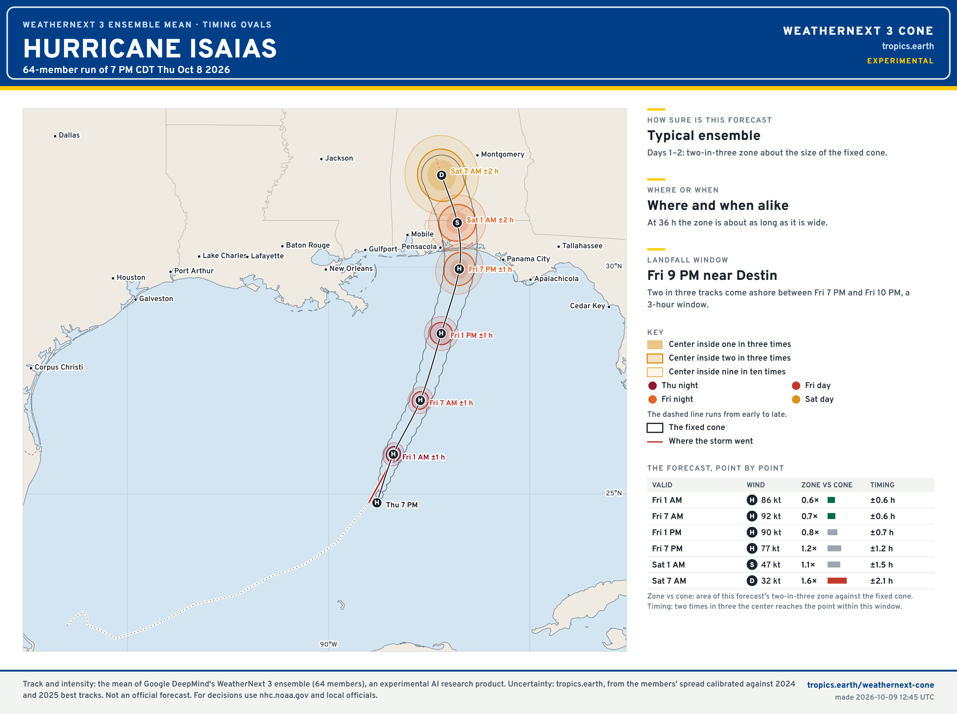
Google Weather Next 3 Cones — Closer to Destin
My new “Beyond the Cone” maps — experimental but colorful and helpful/informative, at least I hope so! —> Tropics Earth
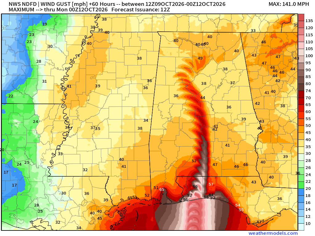
NDFD Wind Impacts > 80-100 mph gusts along the coast and inland with hurricane force gusts into central Alabama
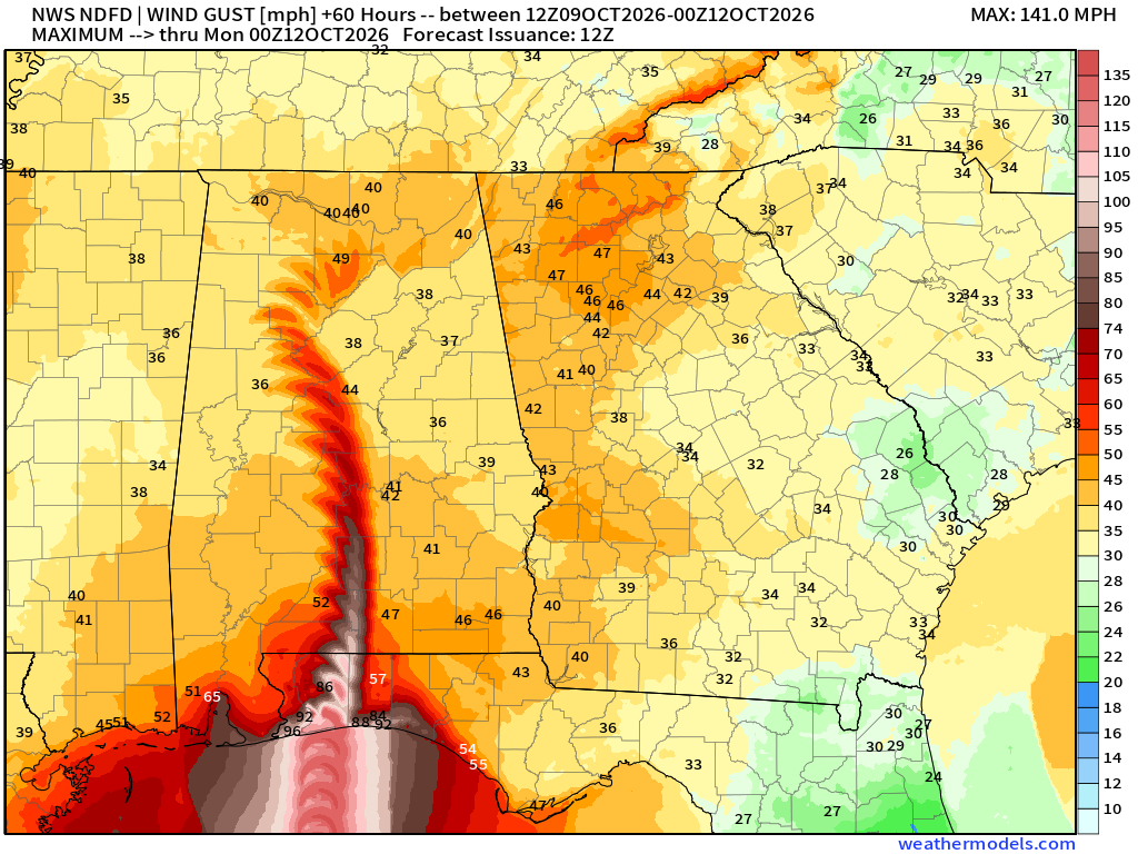
Wind gusts in the 40s into North Georgia, including Atlanta
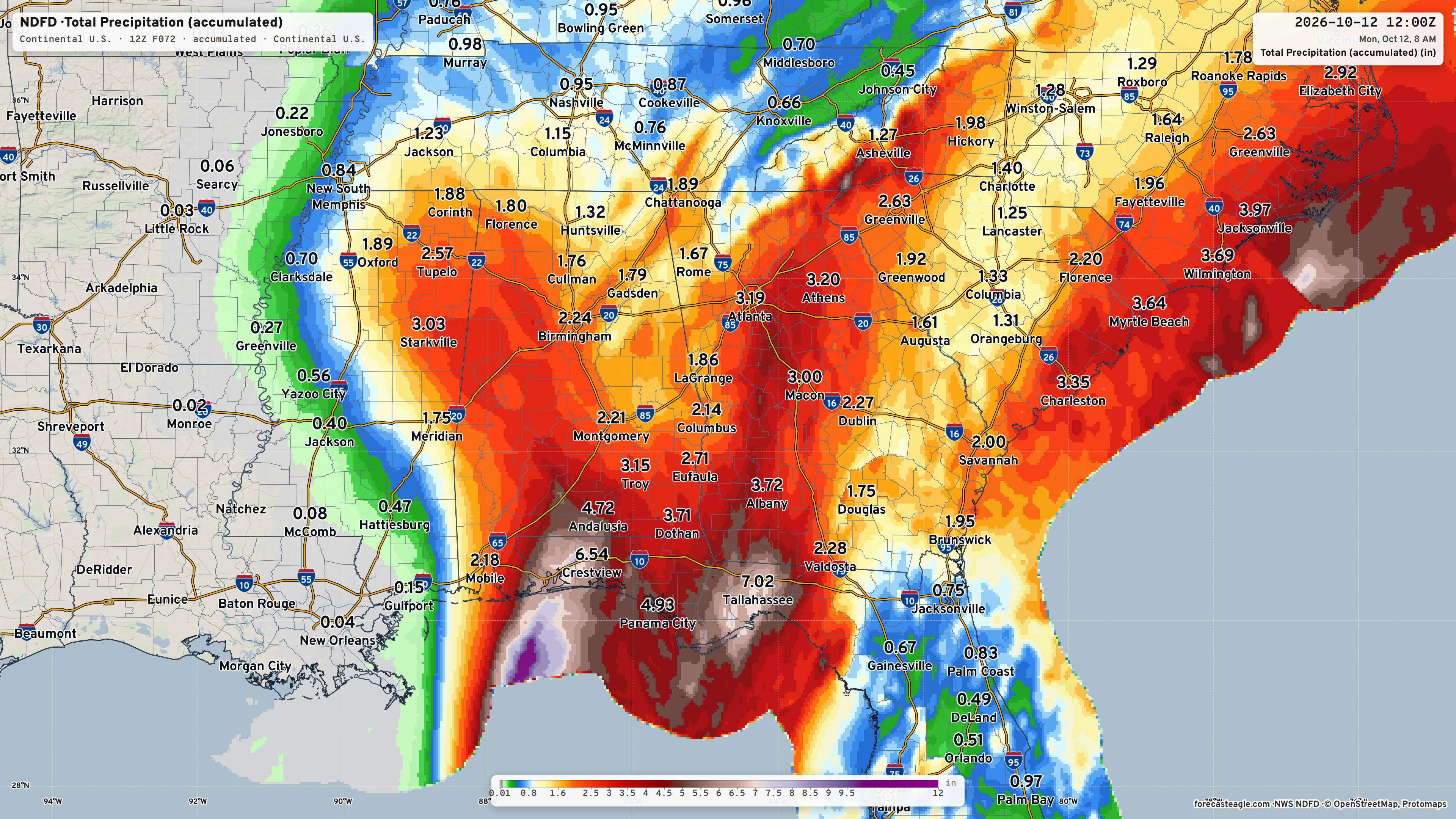
Rainfall will be heaviest near Tallahassee — up to 7” and around the center near the landfall location from Mobile to Destin. Over 3” in Atlanta and Athens
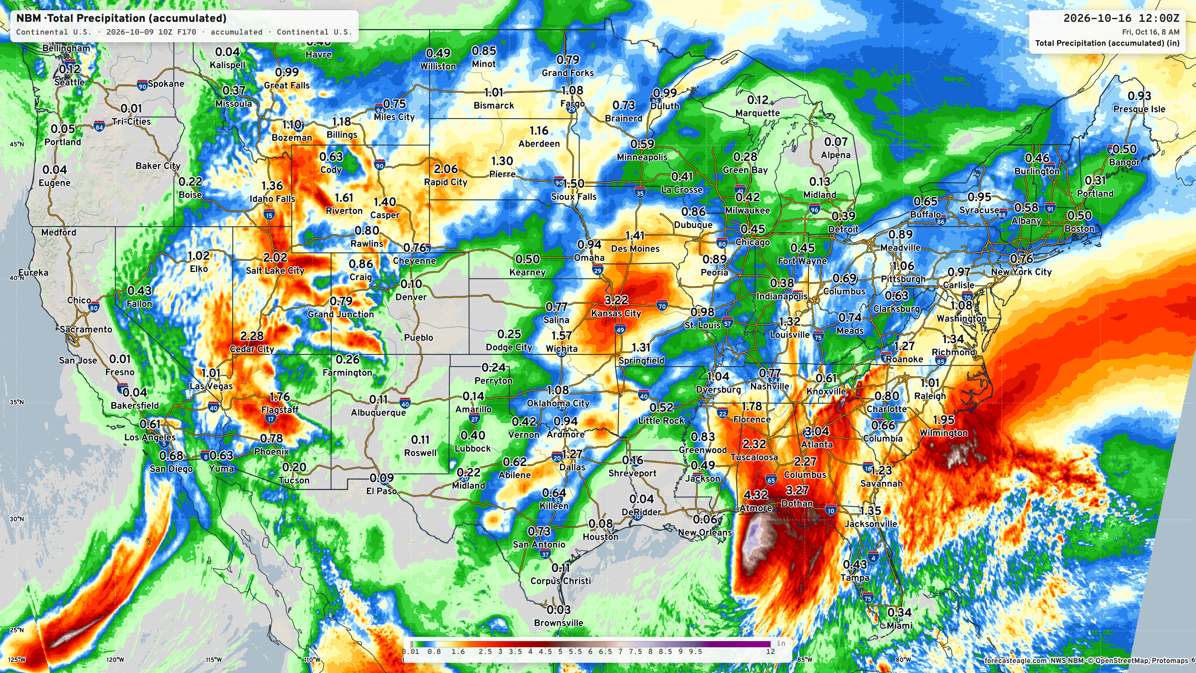
Blend of Models Next 7-days shows the heavy rain from Isaias and remnants of Hurricane Rachel from Southern California into the Great Basin.
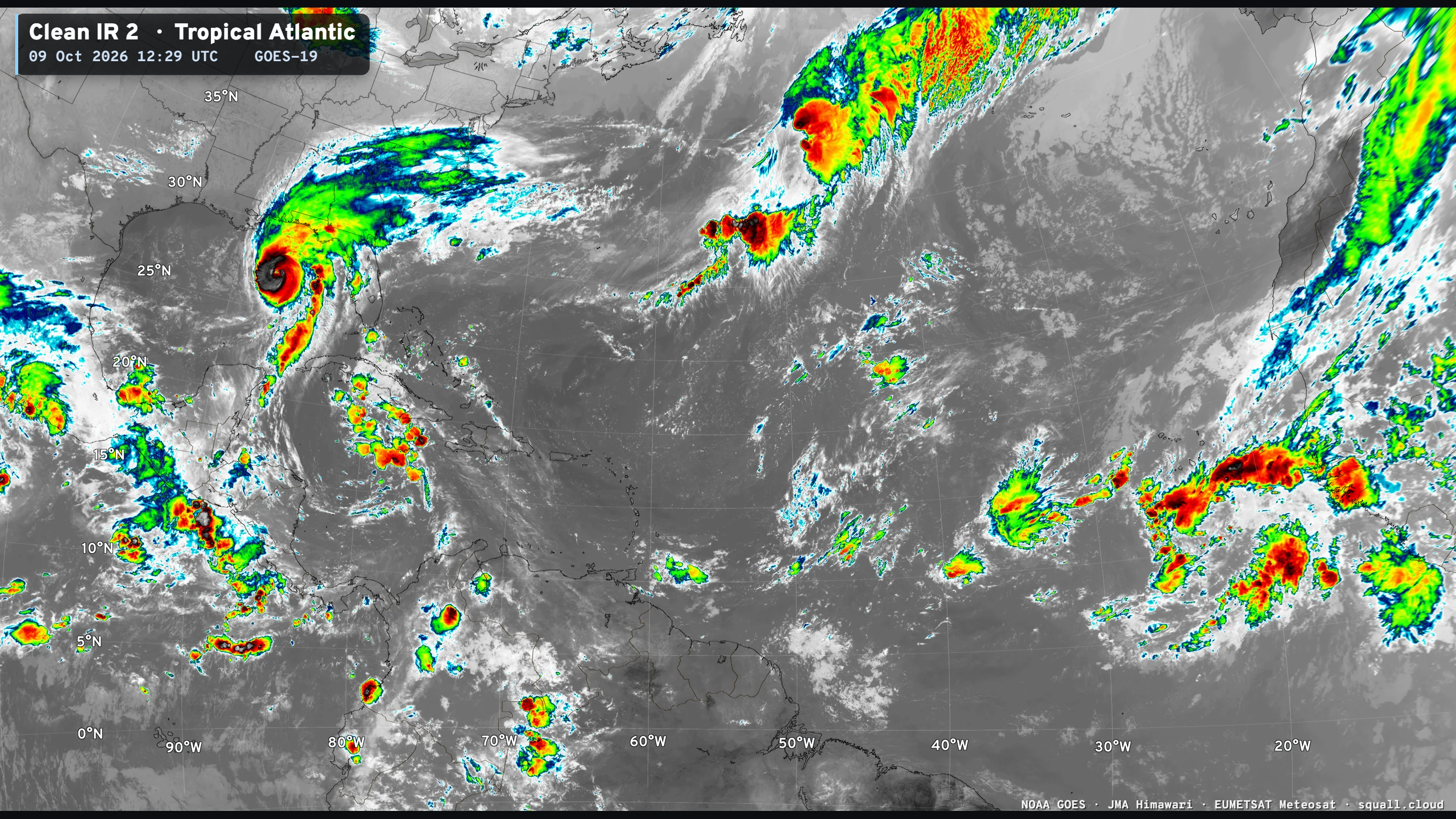
IR Satellite — Squall Cloud | GOES-East | Rest of Atlantic Quiet

Integrated Vapor Transport Next 10-days | AIFS 06z Flagship Model
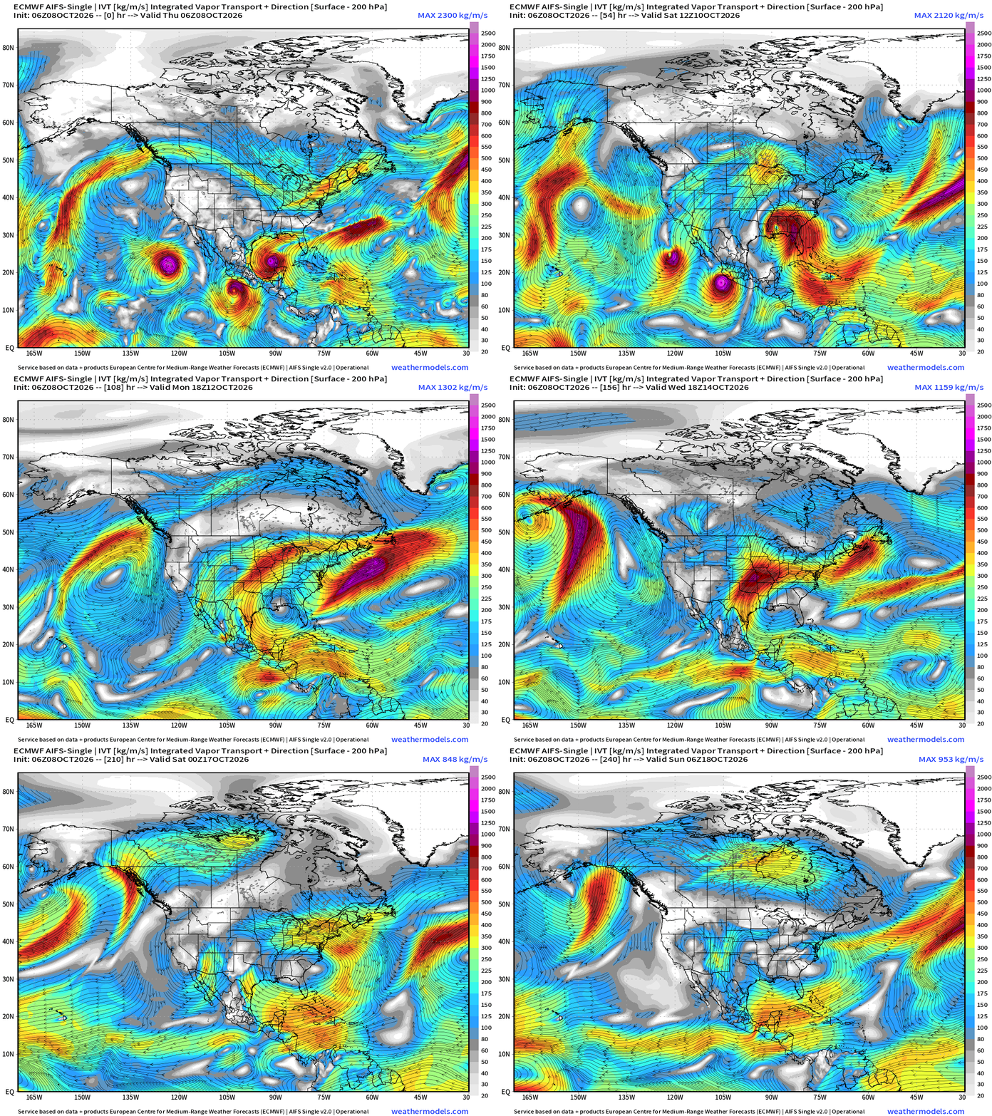
The IVT loop is always very interesting with the 3 tropical systems (Rachel, Simon, and Isaias) all sort of get swept away around a briefly strong ridge that builds across the Gulf.
Rachel’s remnants head through Southern California into the Southwest U.S.
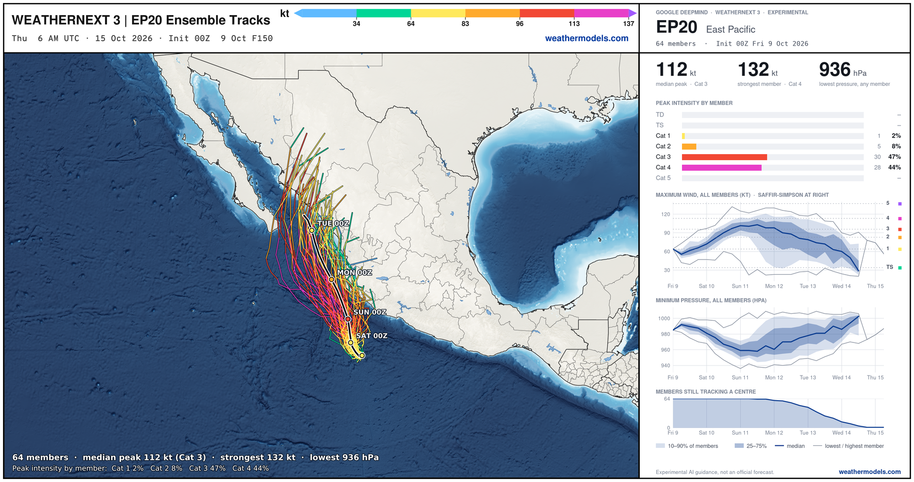
Eastern Pacific Tropics | Hurricane Simon powering up
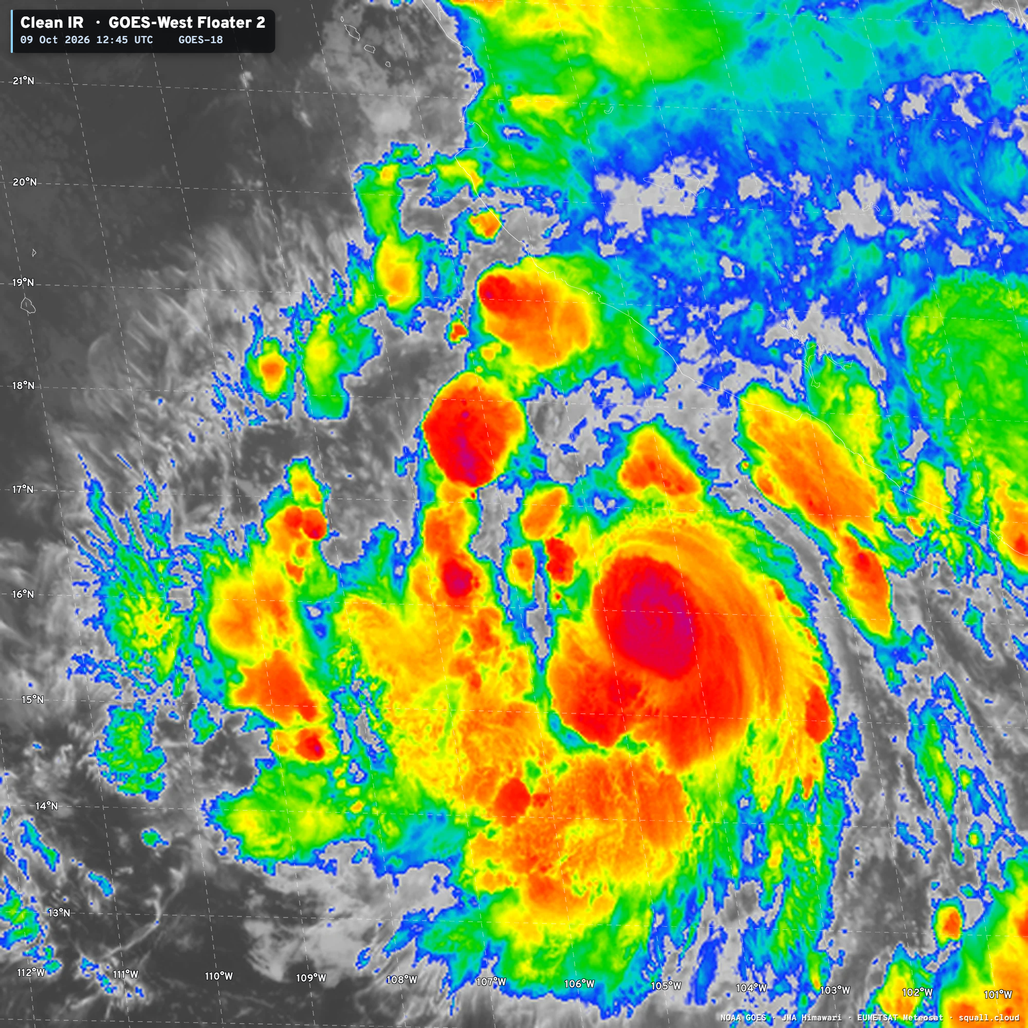
Simon has the potential to become a strong Category 4 hurricane later today, and maintain major intensity into landfall in Mexico, but Weather Next 3 does not bring Simon inland until much later/further north.
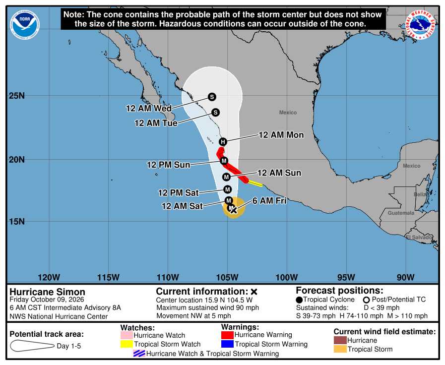
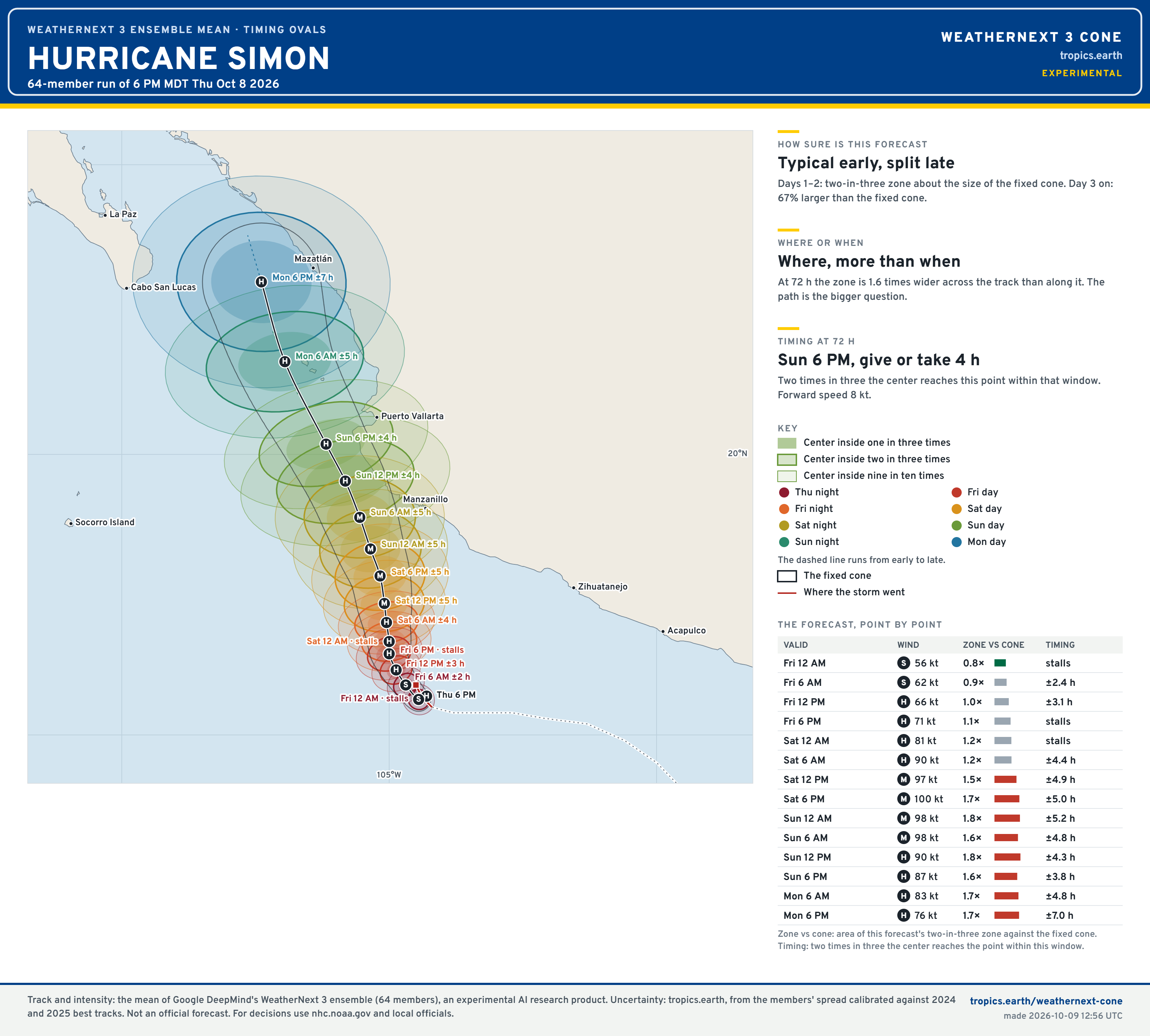
Cat 3/4 as the maximum intensity but I’d take the over.
Visit Global Tropical Cyclones for more ACE information, as well as my original climatlas.com/tropical site with much new research including a calibrated “Best Track” and historical tropical cyclone browser with plenty of interesting features like rankings of storms by their IKE (size). ACE up to 751
Forecast Eagle maps explorer is operational and serving many product!

Satellite imagery from Squall Cloud. Maps sourced from weathermodels.com designed and innovated by yours truly!
Please also subscribe there for real-time access to the newest maps, charts from all of the weather models including ECMWF and AIFS, and NOAA GFS/GEFS, HRRR/RRFS and Blend of Models (NBM). NOAA WPC and SPC for fronts/convective outlooks. Our own content is now sourced from hottestsince.com and weather.city and celsius.earth, and squall.cloud and weather.football and global-tropical-cyclones.com and precip.earth and forecastcanada.com and weathertrader.com and forecastscores.com
My Atlantic Hurricane Season Forecast (2026)
From April 7, 2026: Atlantic Seasonal Hurricane Forecast: (11/5/2)
9-13 Named Storms (11 most likely)
4-7 Hurricanes (5 or 6 most likely)
1-3 Major Hurricanes (2 most likely)
Accumulated Cyclone Energy: 75-85 (well below normal)
NOAA 2026 Atlantic Hurricane Season Forecast
Previous in this storyline: Major hurricane status expected but some weakening prior to landfall late Friday (OCT 8)
- Milepost
- 1620 · laid 2026-10-09T12:59:10Z
- Source
- https://weather.substack.com/p/october-9-2026-major-hurricane-isaias · October 9, 2026 Major Hurricane Isaias
- Tagged
- I-26 Tropics · Isaias · by rule, at build
- Digest
- 4ae3cc5ffe3d74a6a74e6b780d0ced0ed2b0537f64dcf5ec1f93a0bfe9c0685f