Isaias is nearing hurricane intensity over the warm Gulf but is battling wind shear

Precipitable Water — My Favorite Parameter
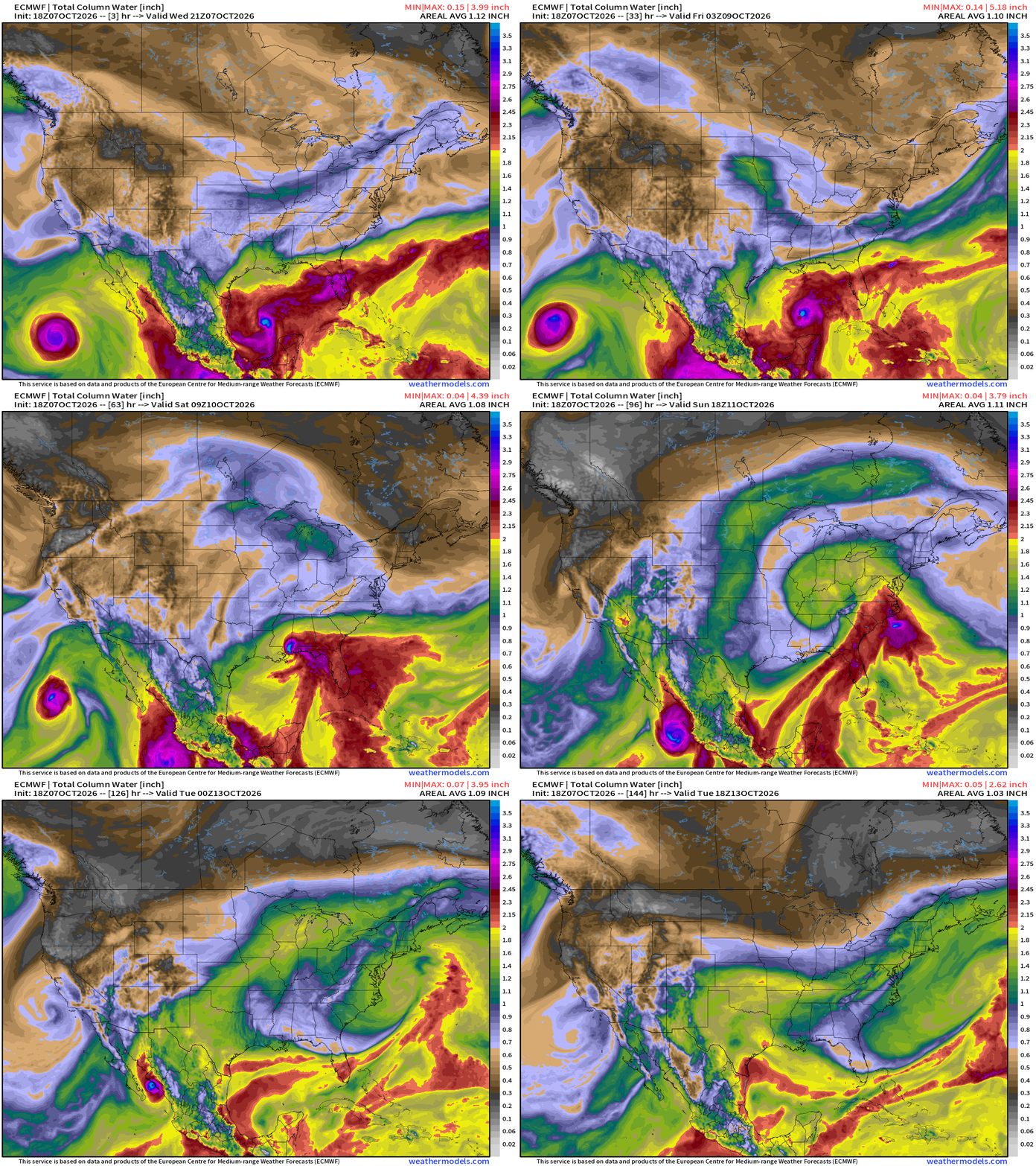
My favorite parameter — precipitable water — is beautiful this evening! October weather patterns are both tropical and winter like with a more energetic jet stream combining with tropical storms and hurricanes.
Isaias will intensify into a hurricane but encounter strong upper-level winds + wind shear as it reaches the Gulf coast. This is not a positive trough interaction like some other October hurricanes (Opal, Michael) that received significant “baroclinic” enhancement from the upper-level winds — phased perfectly.
That’s good news as Hurricane Isaias will hopefully be knocked down a peg from its otherwise maximum potential. However, this isn’t going to be a picnic, either, with significant impacts inland.
Good news is that Isaias will be moving very fast — accelerating through the Tennessee River Valley into the Mid-Atlantic by Sunday.
Tropical Storm Isaias 09L (65 mph winds) almost a hurricane
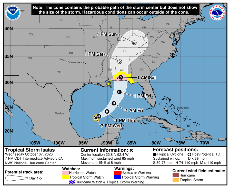
Steady intensification to 95-knots (100 mph) in 2-3 days in the central Gulf over high oceanic heat content water
Due to wind shear, it is likely that the system peaks in strength before reaching the coast as a hurricane, and may actually come apart upon / shortly after landfall.
Over the central Gulf — on top of the Loop Current —> close to a major hurricane!
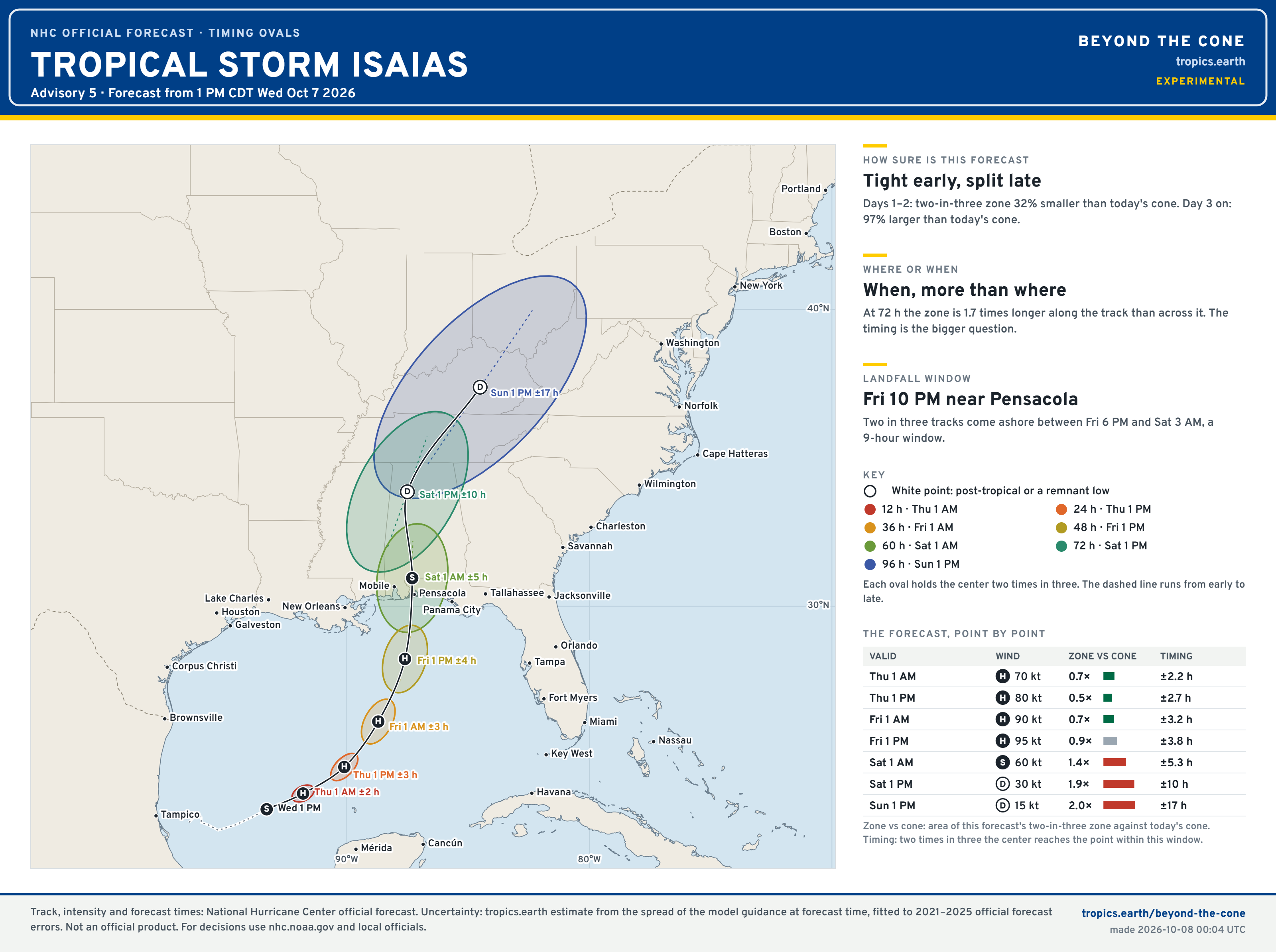
Timing for Landfall — late Friday into early Saturday Morning
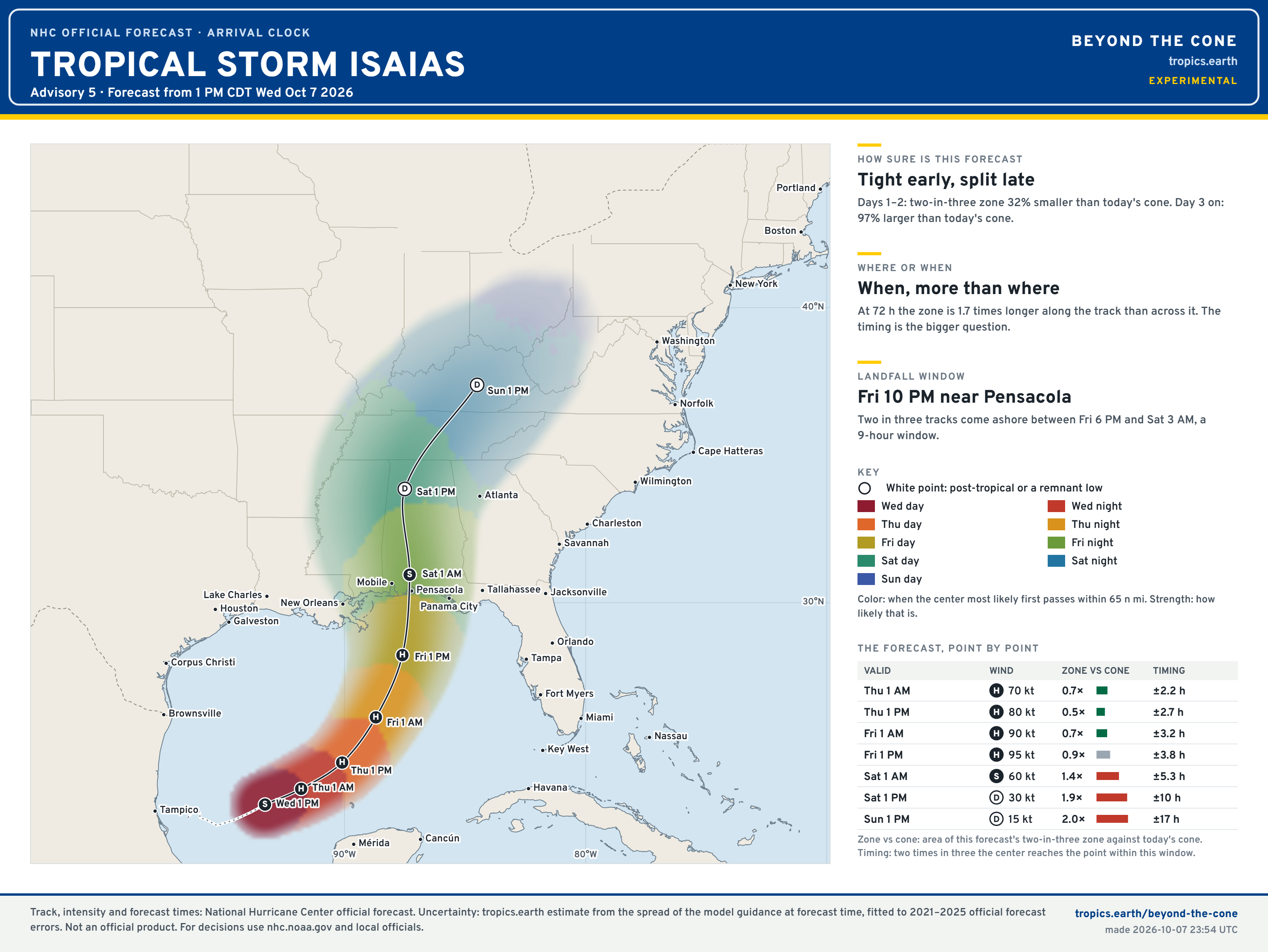
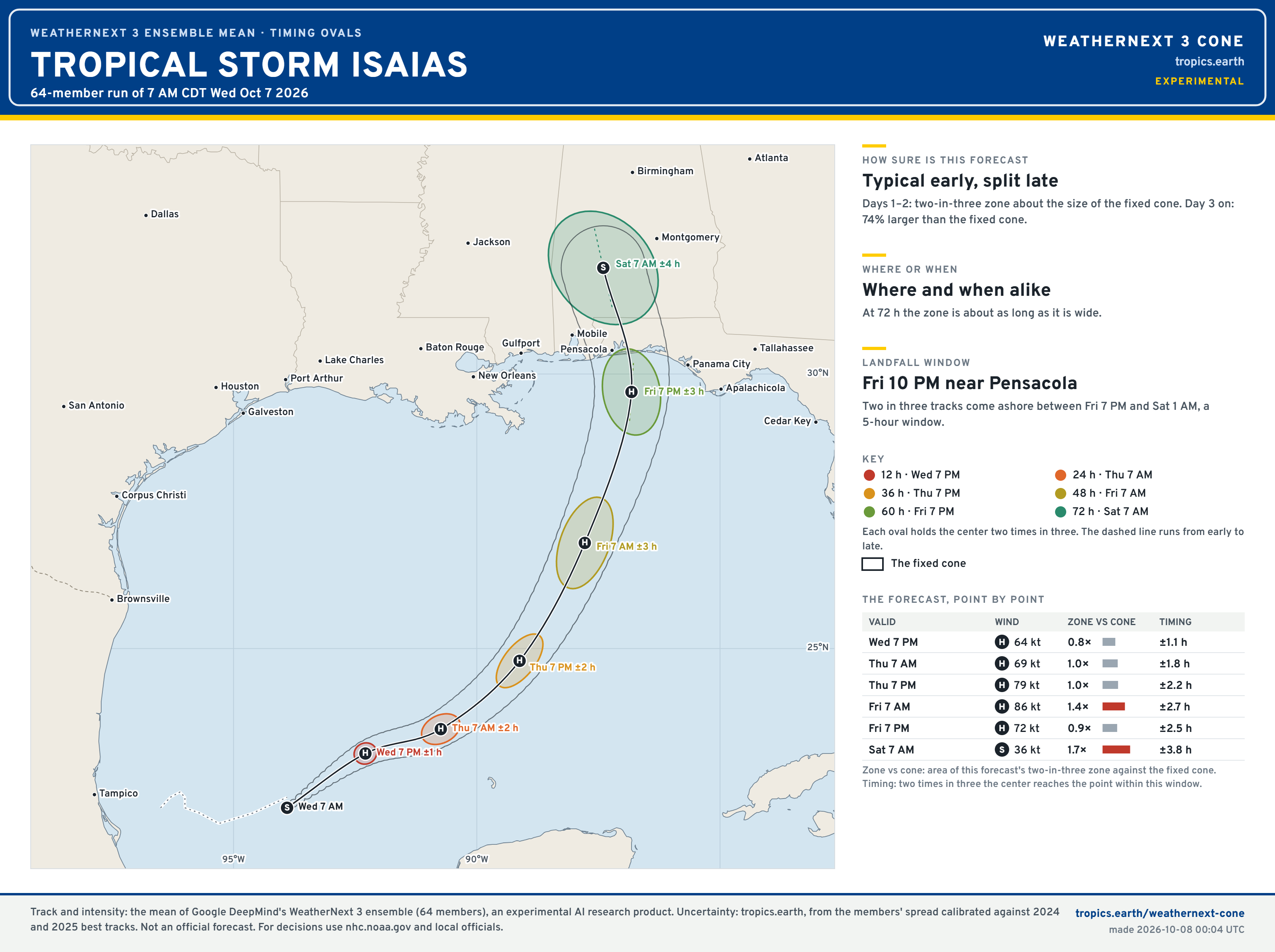
My new “Beyond the Cone” maps — experimental but colorful and helpful/informative, at least I hope so! —> Tropics Earth
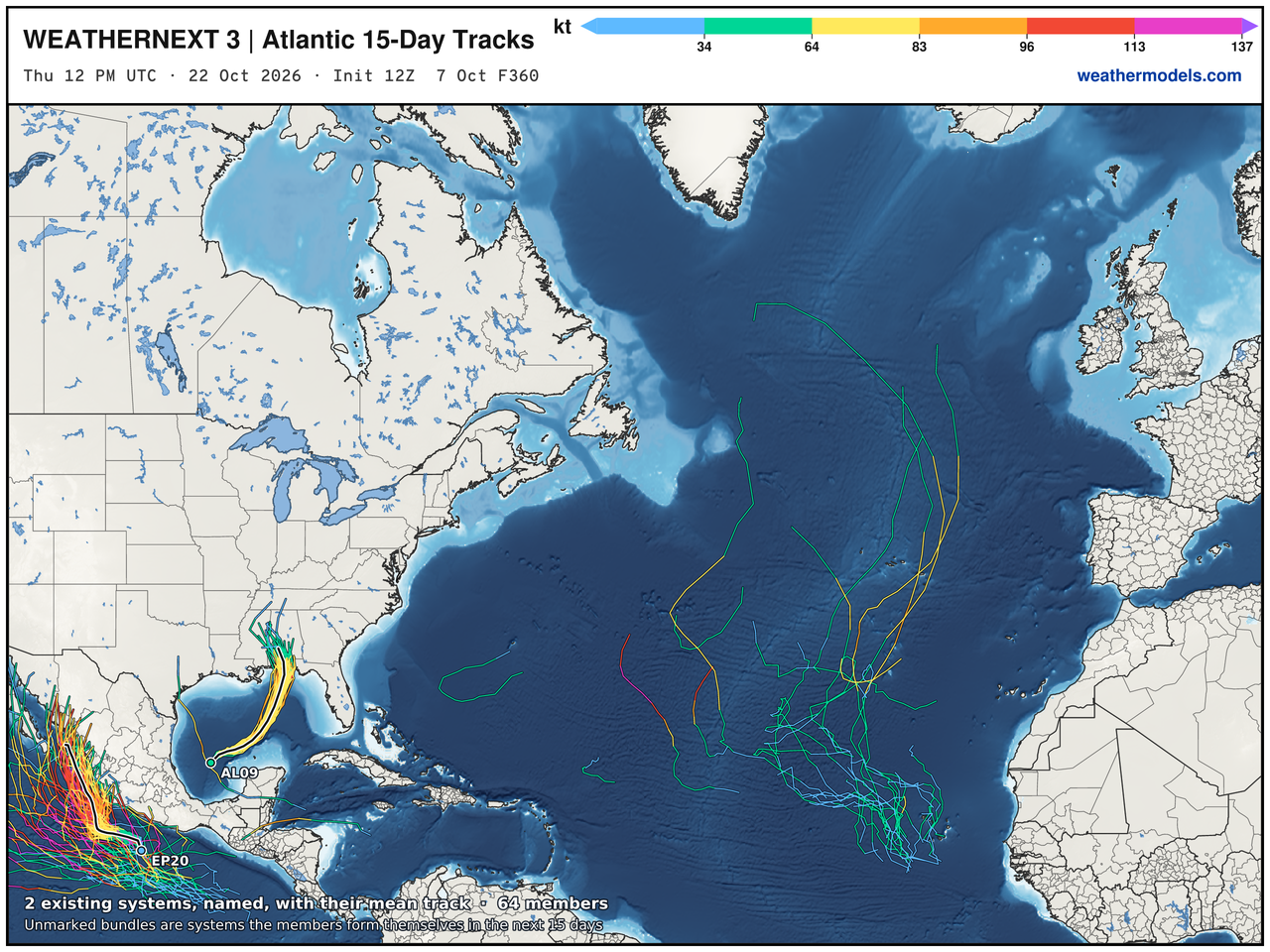
The tracks of the dynamical models has edged eastward — taking the NHC forecasts along with them — as the A.I. tools correct for that westward bias.
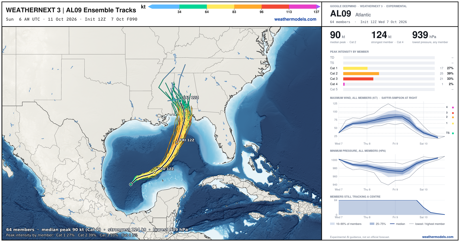
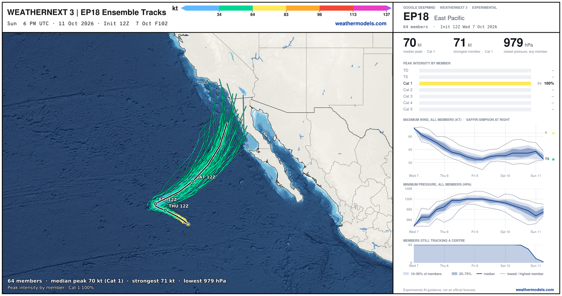
Weather Next 3 from Google has 60% of members Cat 1-2, and the other third Cat 3, but I’m taking the first batch … 80-90 mph seems like the maximum with the messy upper-level winds. At least I hope so!
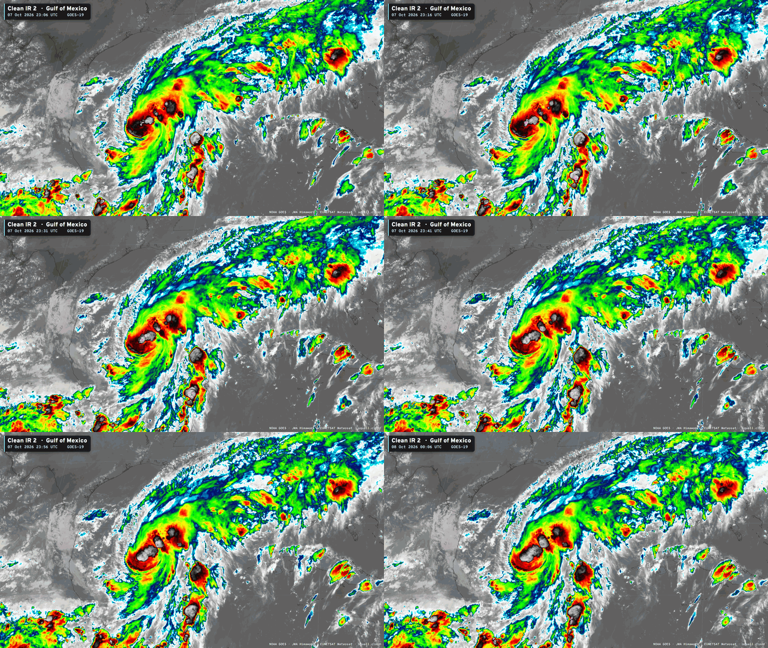
IR Satellite — Squall Cloud | GOES-East
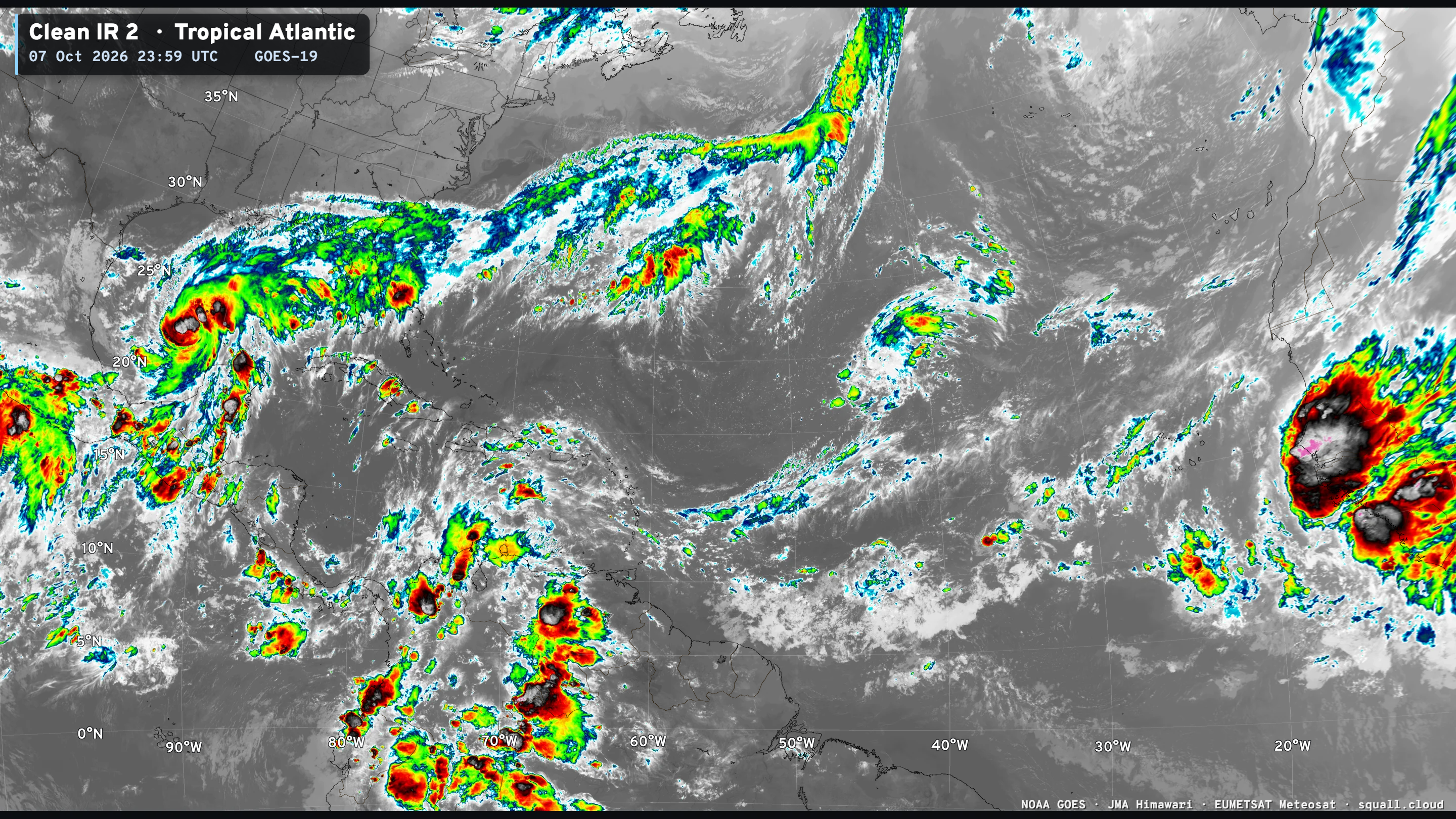
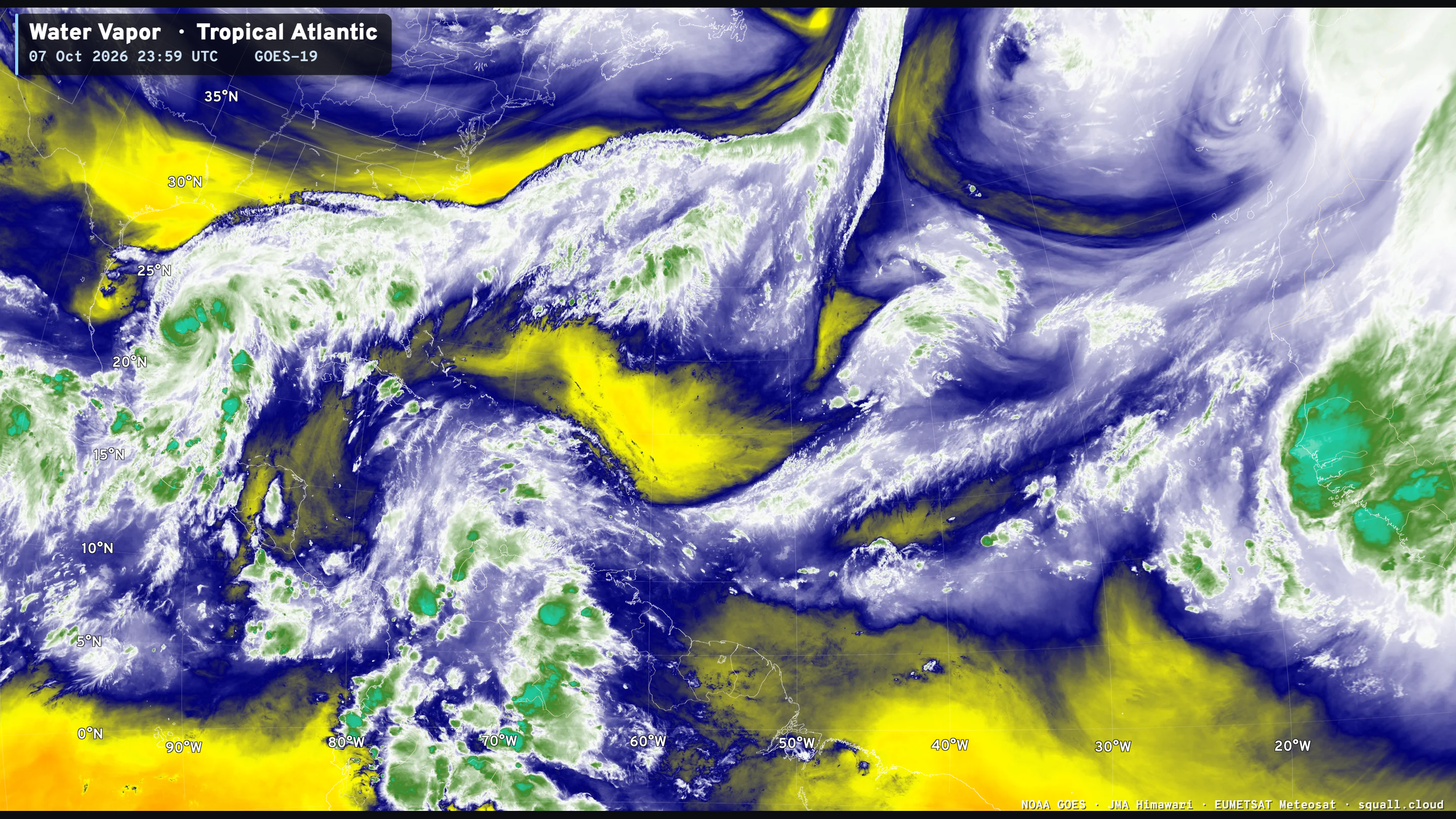

Otherwise, a low/medium signal in the far Eastern Atlantic for a tropical wave development, but not imminent.
Integrated Vapor Transport Next 10-days | AIFS 18z Flagship Model
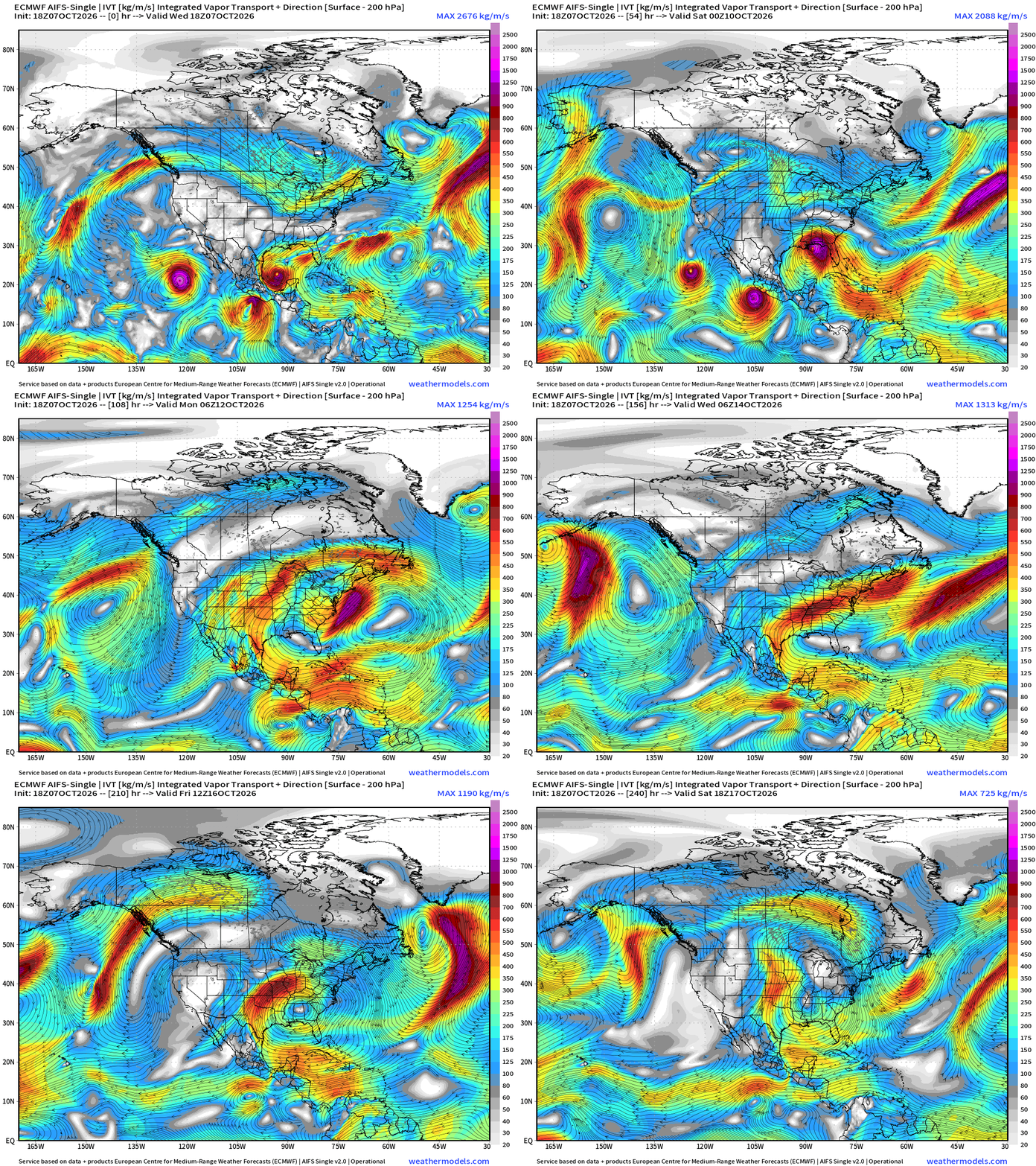
AIFS Single (18z) did a great job “sniffing out” the development of Isaias by nailing the large scale flow … and also Tropical Storm Simon.
The IVT loop is pretty cool, as you see the 3 tropical systems (Rachel, Simon, and Isaias) all sort of get swept away around a briefly strong ridge that builds across the Gulf.
Rachel’s remnants head through far Southern California into the Southwest U.S. and then combines with a storm in the Midwest U.S.
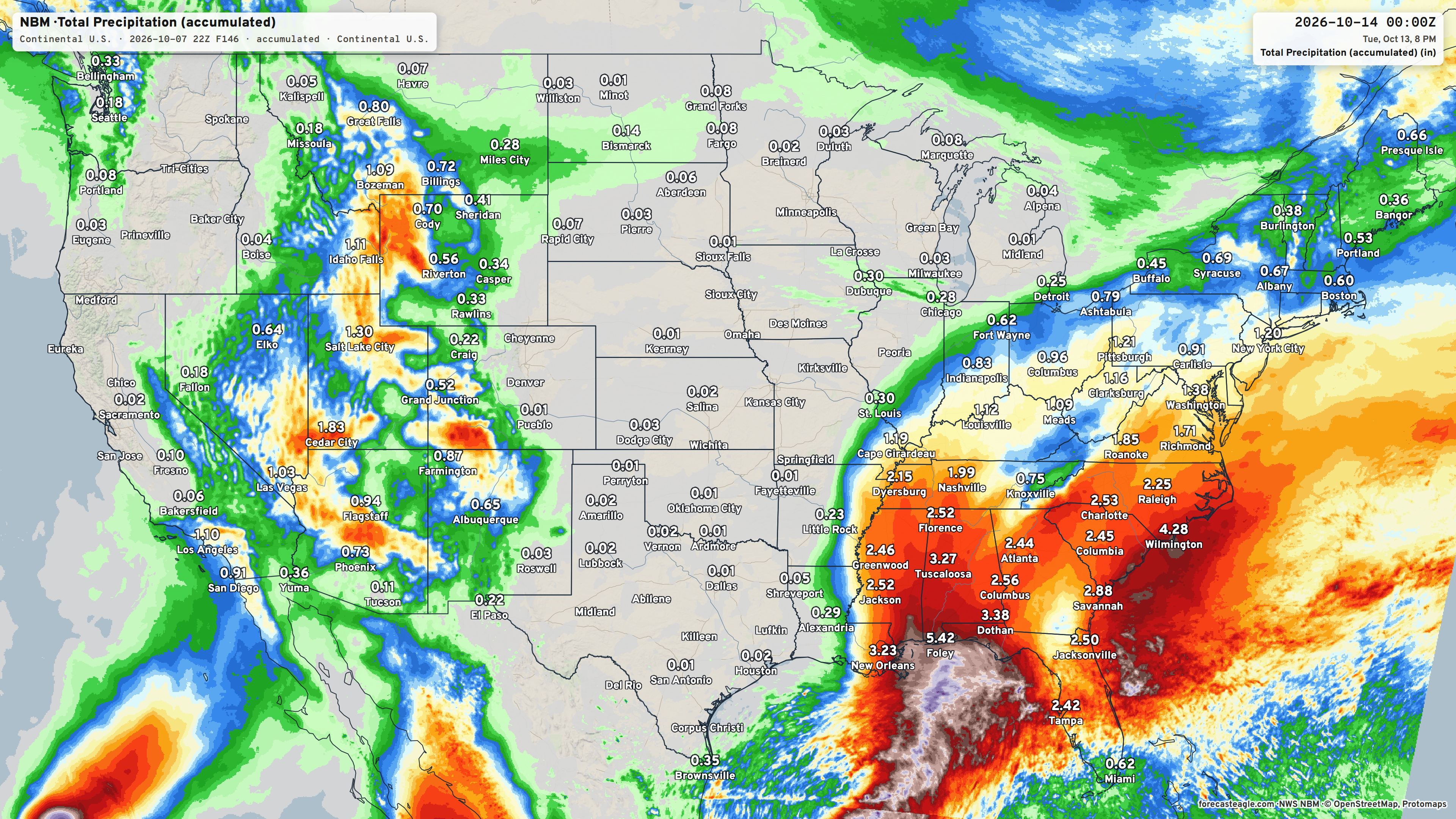
7-day Rainfall Blend of Models | Total impacts from Isaias better known Thursday when the mesoscale models become useful.
Eastern Pacific Tropics
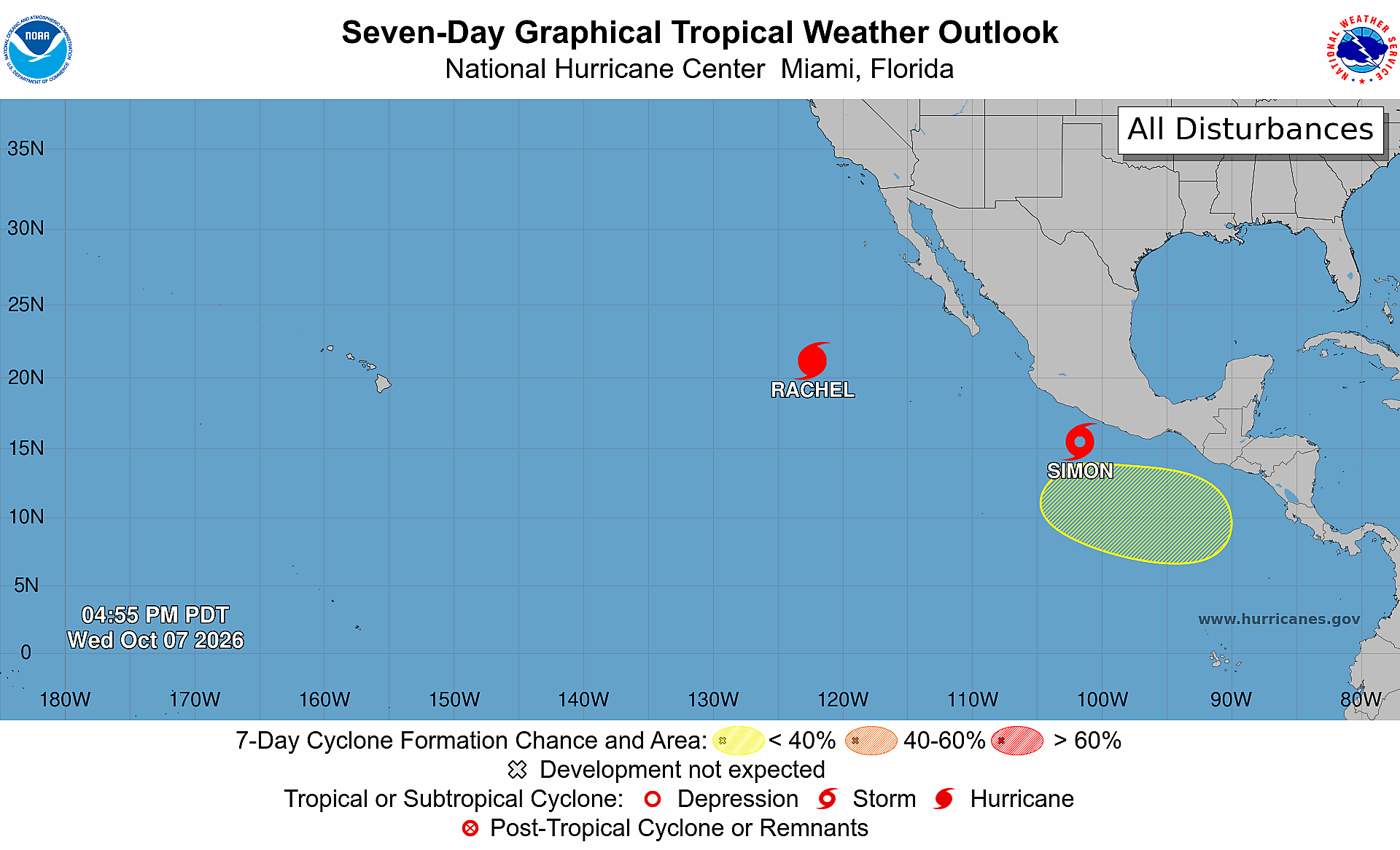
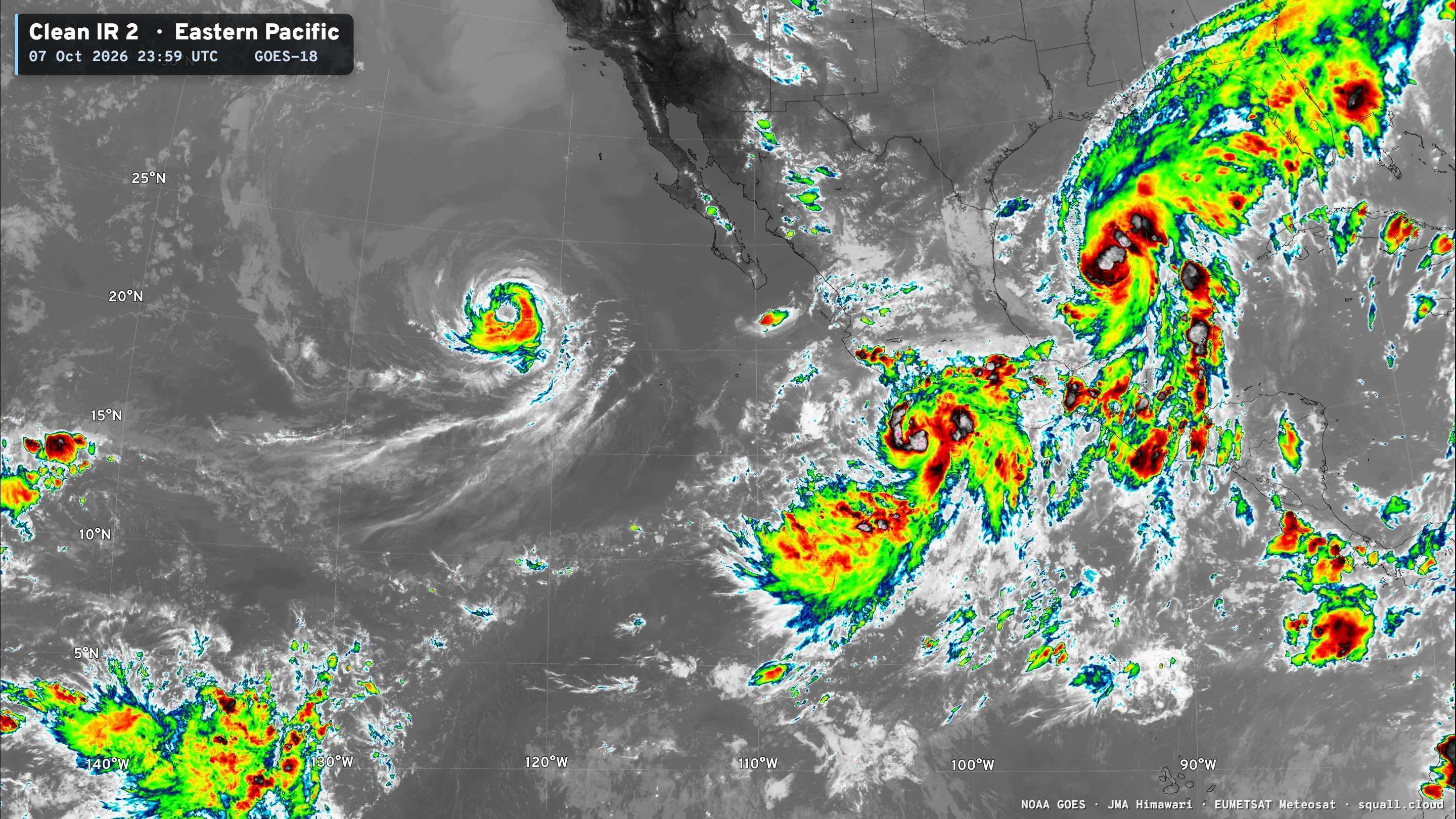
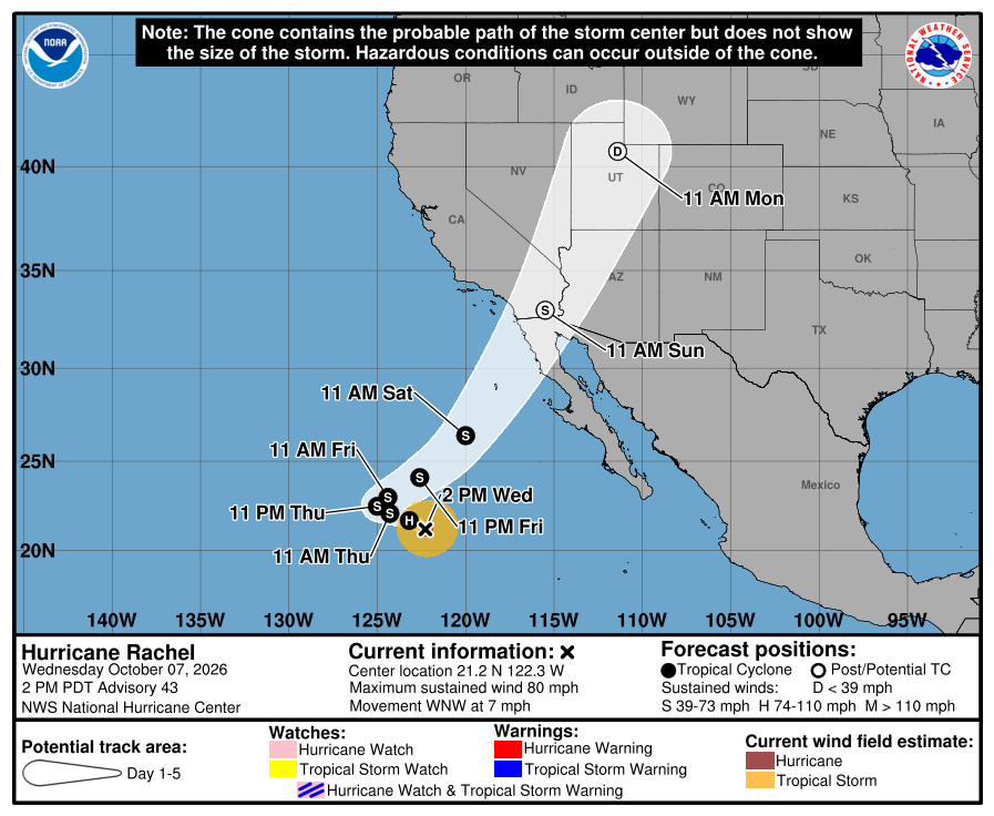
Hurricane Rachel will become “post-tropical” on Saturday … and continue into Southern California on Sunday and then Salt Lake City on Monday. This will still be a rainmaker, and potential for significant impacts — flooding over desert and canyons as rivers quickly swell.
And, we finally have Tropical Storm Simon (20E) after gestating as an Invest for several days. WN3 has Major (Cat 3) or Category 4 as the maximum intensity right along the Mexican coast.
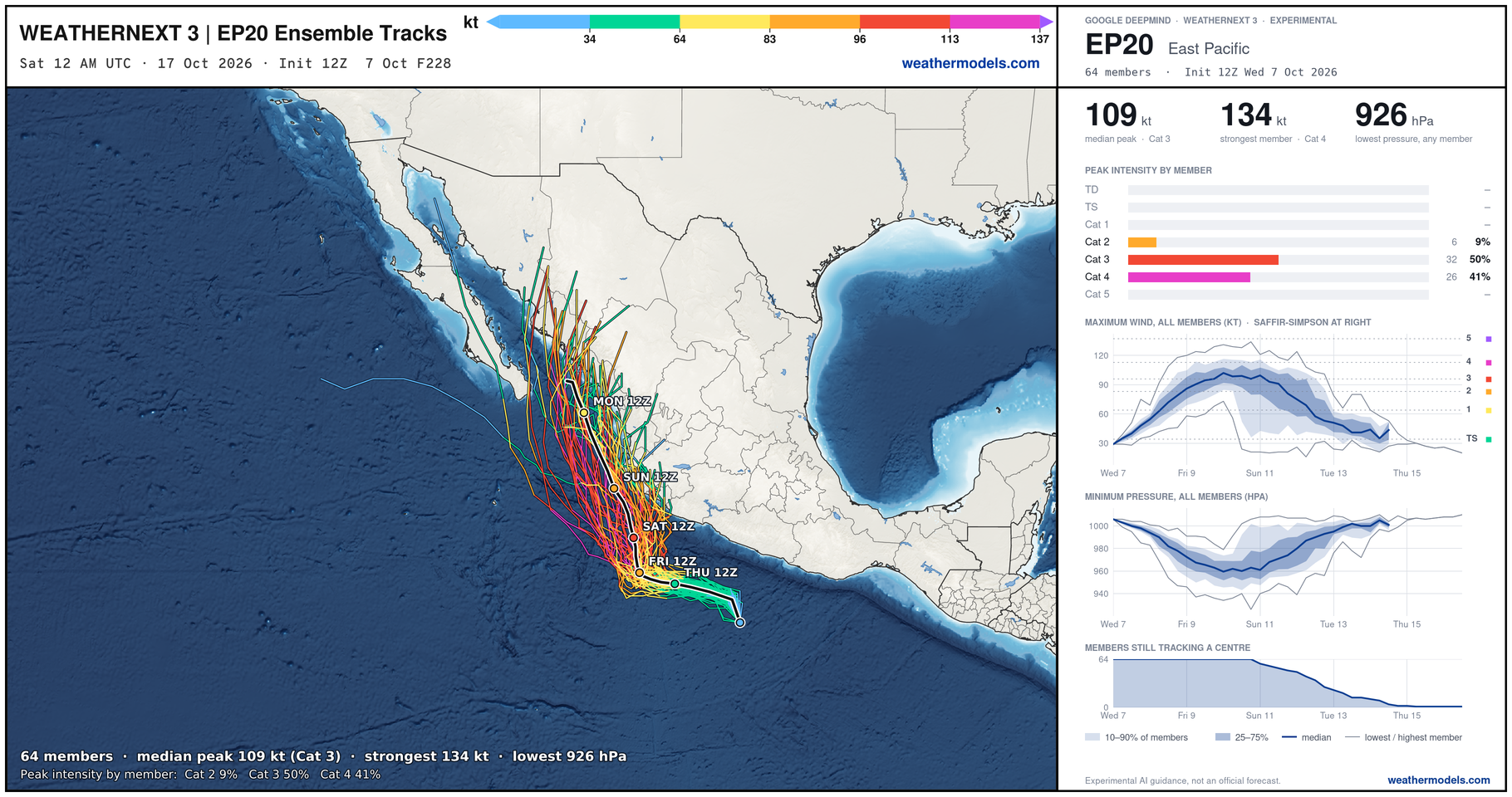
Simon is just getting underway.
NHC takes Simon to 110-knots — almost Category 4
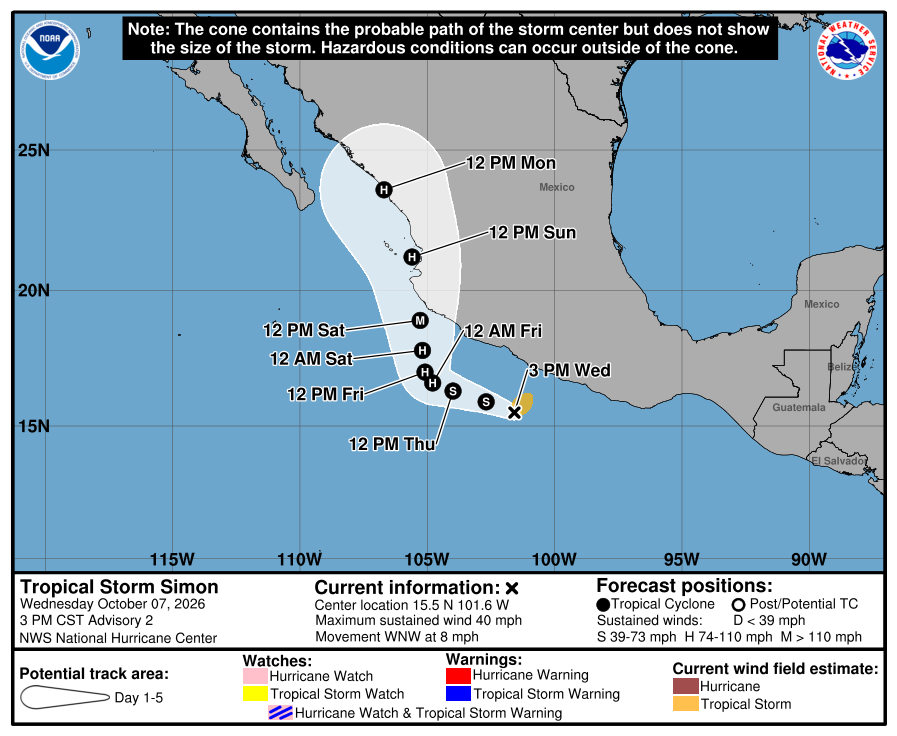
Western Pacific Tropics
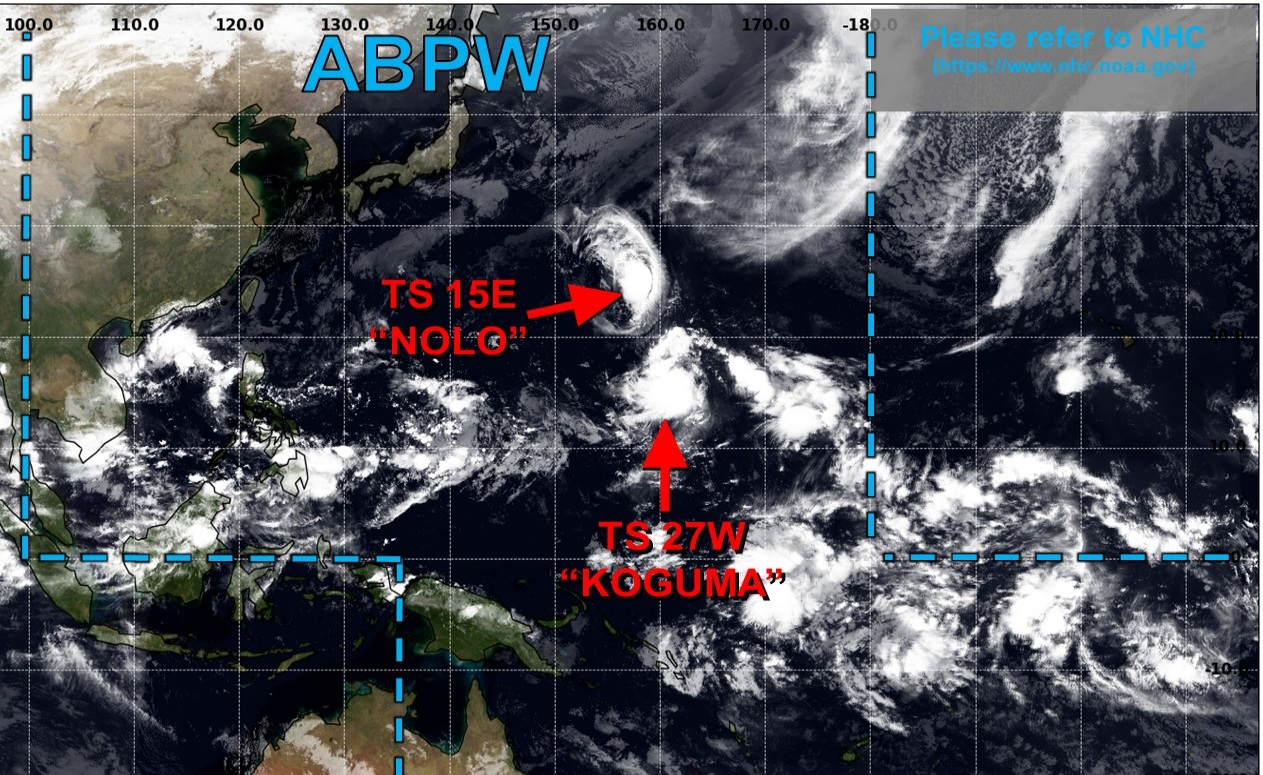
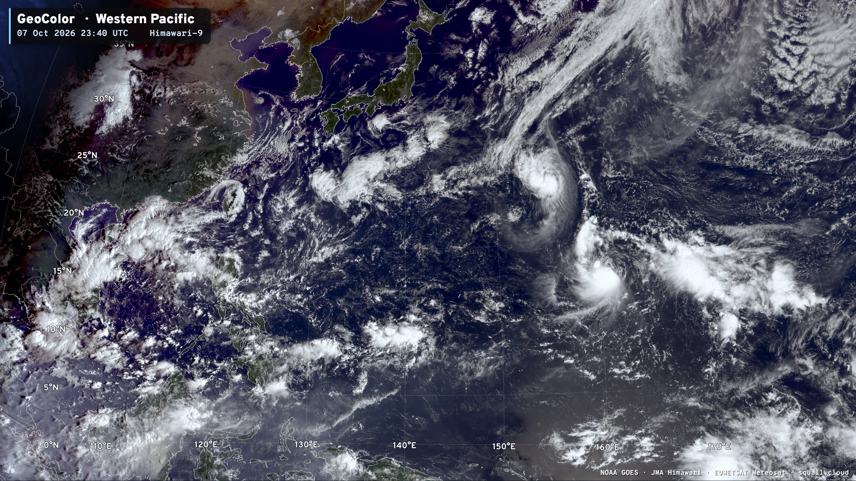
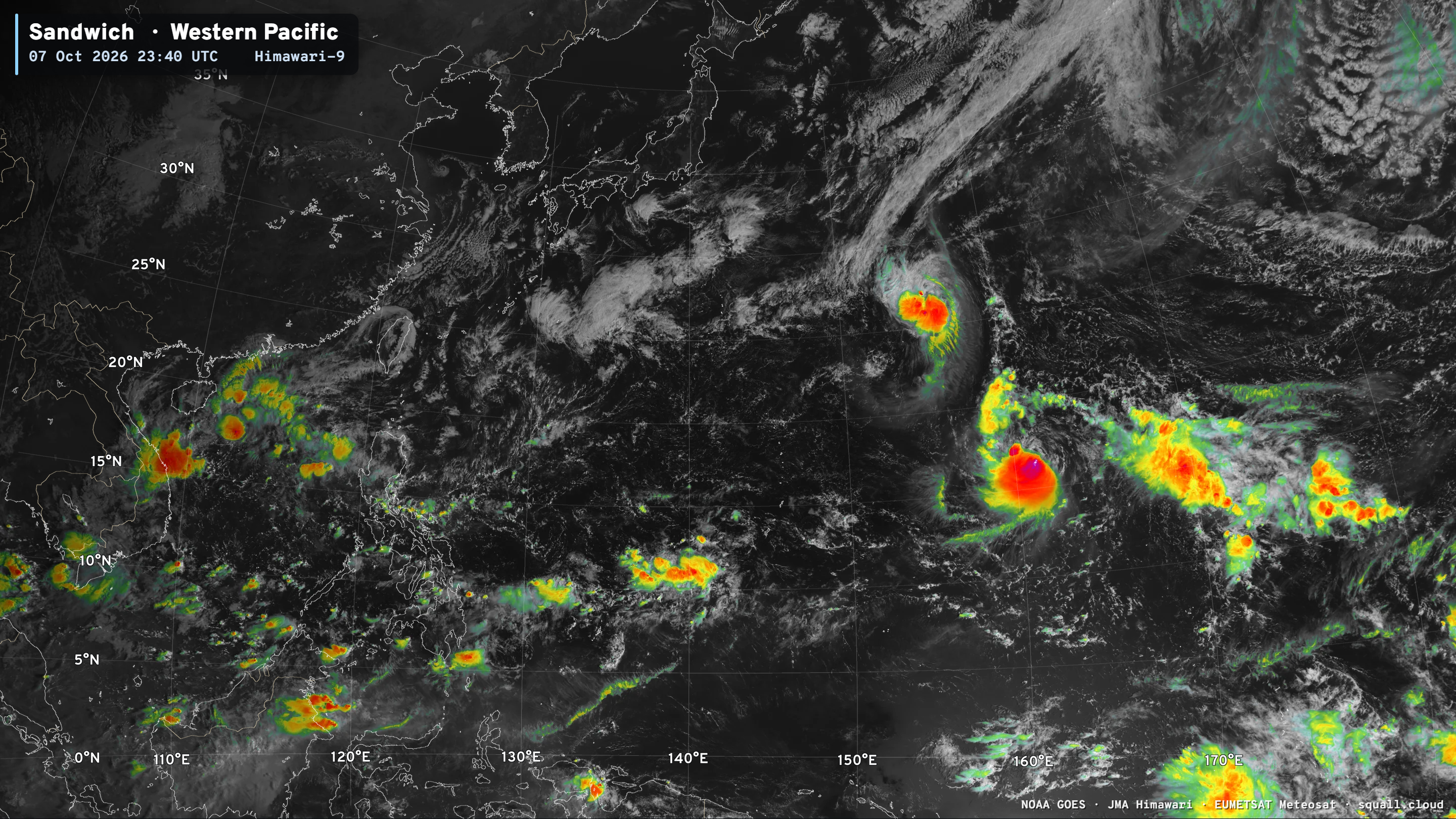
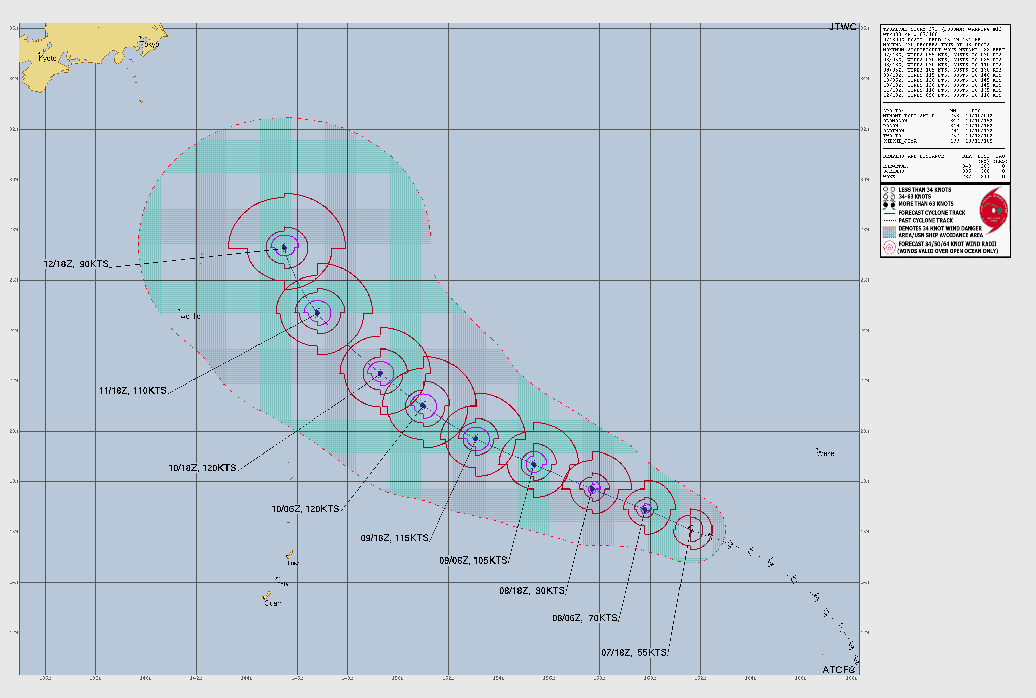
JTWC still forecasts a maximum of 120-knots for Koguma but it is battling northerly wind shear. Once that subsides, the compact core should rapidly intensify.
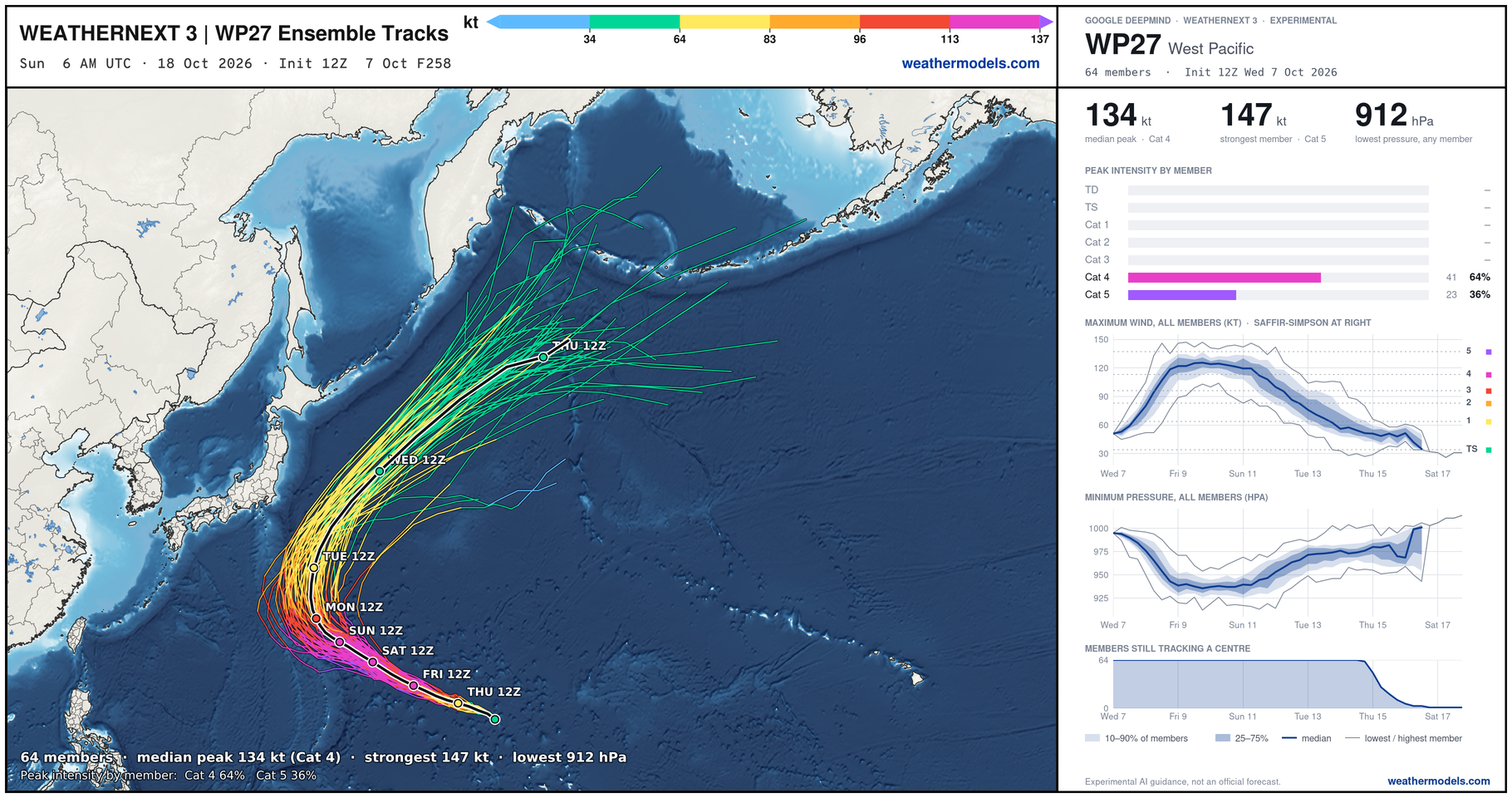
Weather Next 3 has all members at Category 4 (2/3) and 1/3 at Category 5.
Visit Global Tropical Cyclones for more ACE information, as well as my original climatlas.com/tropical site with much new research including a calibrated “Best Track” and historical tropical cyclone browser with plenty of interesting features like rankings of storms by their IKE (size). ACE up to 751
Forecast Eagle maps explorer is operational and serving many product!

Satellite imagery from Squall Cloud. Maps sourced from weathermodels.com designed and innovated by yours truly!
Please also subscribe there for real-time access to the newest maps, charts from all of the weather models including ECMWF and AIFS, and NOAA GFS/GEFS, HRRR/RRFS and Blend of Models (NBM). NOAA WPC and SPC for fronts/convective outlooks. Our own content is now sourced from hottestsince.com and weather.city and celsius.earth, and squall.cloud and weather.football and global-tropical-cyclones.com and precip.earth and forecastcanada.com and weathertrader.com and forecastscores.com
My Atlantic Hurricane Season Forecast (2026)
From April 7, 2026: Atlantic Seasonal Hurricane Forecast: (11/5/2)
9-13 Named Storms (11 most likely)
4-7 Hurricanes (5 or 6 most likely)
1-3 Major Hurricanes (2 most likely)
Accumulated Cyclone Energy: 75-85 (well below normal)
NOAA 2026 Atlantic Hurricane Season Forecast
- Milepost
- 1618 · laid 2026-10-08T00:54:18Z
- Source
- https://weather.substack.com/p/october-7-2026-tropical-storm-isaias · October 7, 2026 Tropical Storm Isaias
- Tagged
- I-26 Tropics · Isaias · Gulf of Mexico (26.0, -90.0) · by rule, at build
- Digest
- bbec55ae4c75802e38e864d9ad0413b45c3ebb925dac603e3578c6792e5a5173