July 30, 2026 Thursday Tropical Update
Super Typhoon Dolphin with multiple eyewall replacement cycles. Tropical Atlantic about to be blanketed in Saharan Air Layer and dust to end July, but may perk up into August 10th.
July 2026 was the warmest July in the 132-year national record (1895–2026), at 76.9°F against a 1991–2020 normal of 74.4°F (+2.5°F).
July 2026 was the 26th-driest July in the 132-year national record (1895–2026), at 2.5in against a 1991–2020 normal of 2.9in (-0.3in).
NOAA/NCEI Climate at a Glance, contiguous United States. This is the observed record for the month, not a score of anything said in this piece — the forecast ledger begins 2026-08-17 and cannot reach earlier posts.
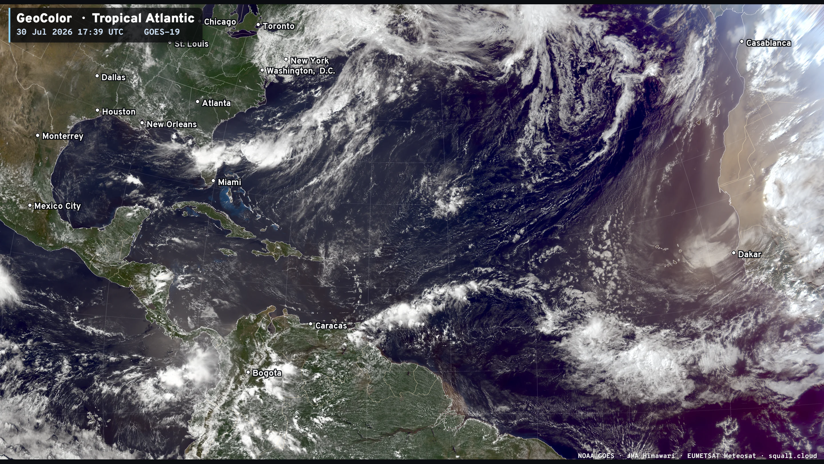
Huge plume of Saharan desert dust coming off the African continent this evening to squelch and suppress tropical convection. To say the Atlantic tropical basin is dead would be an understatement. This part of the puzzle is less related to El Niño and the typical SAL + dust inhibitor. However, as the tropical waves head westward in the Main Development Region, they encounter strong wind shear and interact with upper-level troughs = complete buzzkill for storm formation — at least until the tropical waves reach the Eastern Pacific or even the Central Pacific (like Dolphin, which was probably an African Easterly Wave, too)
The Gulf of Mexico (America) is rather clear except for storms related to a frontal boundary and digging trough hung up over the Florida peninsula.
CONUS Water Vapor and the Unusually Strong Mid-Level Trough
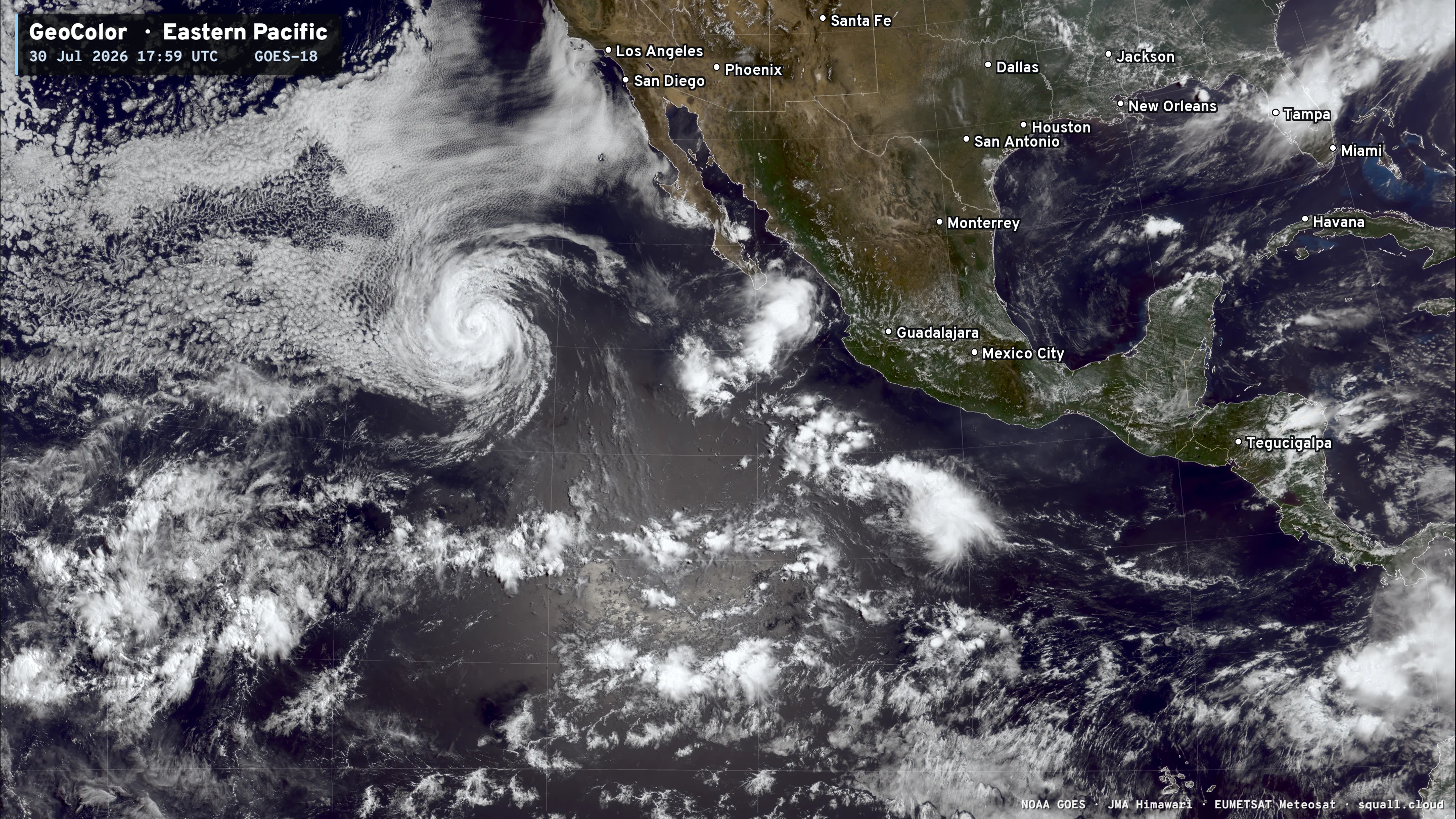
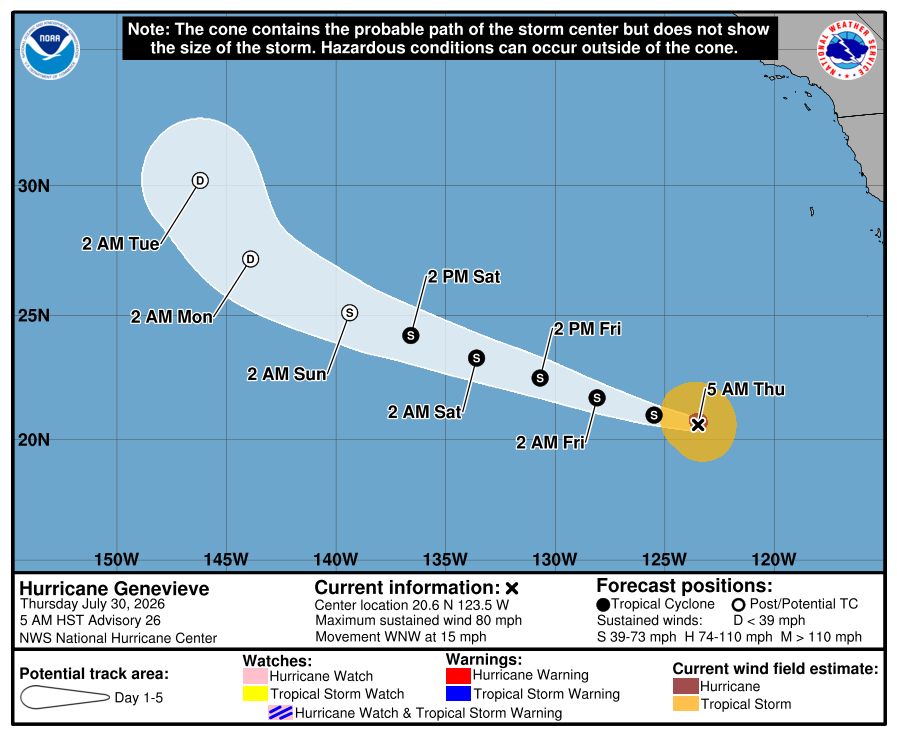
Eastern Pacific: Hurricane Genevieve is slowly weakening over much cooler < 26°C ocean temperatures. But it will take a while to spin down the vigorous formerly Category 5 circulation.
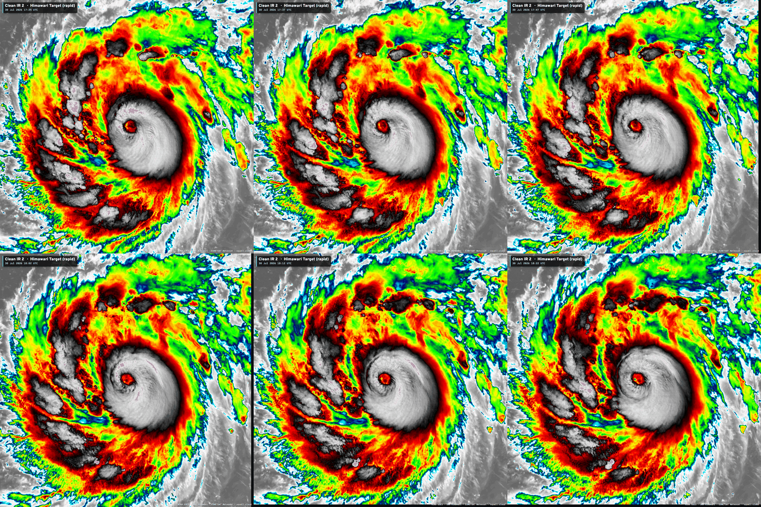
Super Typhoon Dolphin (12W) has been repeatedly undergoing eyewall replacement cycles and cannot figure out how to keep an eye intact — and therefore has probably peaked at Category 5 already. We’ll see if this next version of Dolphin can achieve a stable inner-core. Regardless, it is 8-10 days from landfall — potentially in China.

Welcome to renewing paid subscribers and supporters! Your trust and support is greatly appreciated. Forecast post 1,000 in a week!
Weather Trader is entirely reader-supported publication (no ads). To receive all new posts and support our work, consider becoming a paid subscriber. I am open to suggestions for building new products or services.

Now Operational: Squall Cloud global weather satellite viewer. Paid subscribers support these services, and I am very appreciative as well as the rest of Earth that can use them for free.
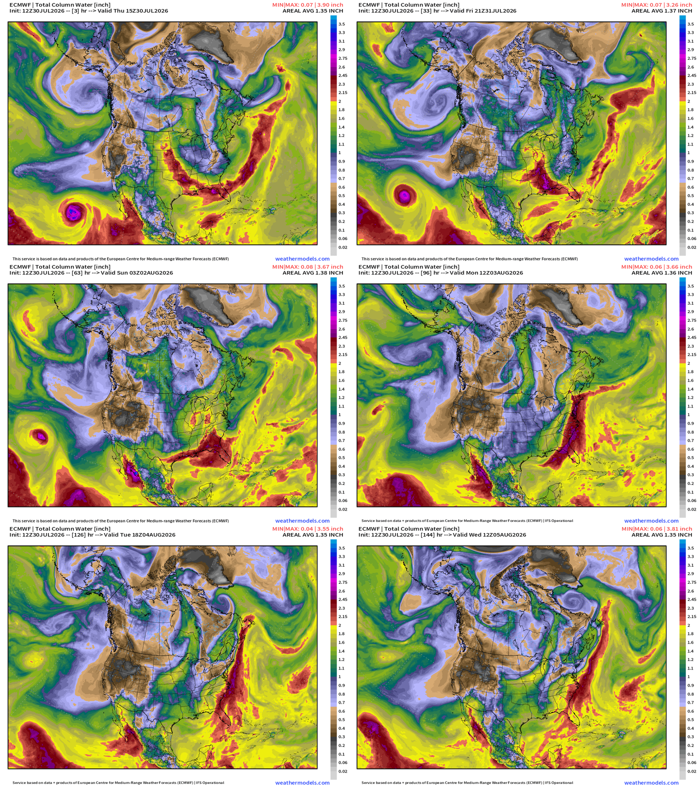
North America Precipitable Water Next 6-days
Genevieve heads out into much cooler central Pacific while gaining latitude
The sharp trough along the Gulf coast has pooled moisture, which will be picked up by a developing storm system in the Great Lakes and Northeast — this moisture will turn into an atmospheric river type flow into the NNE, but most of the rainfall will remain off the coast.
Next 7-days Blend of Models Precipitation
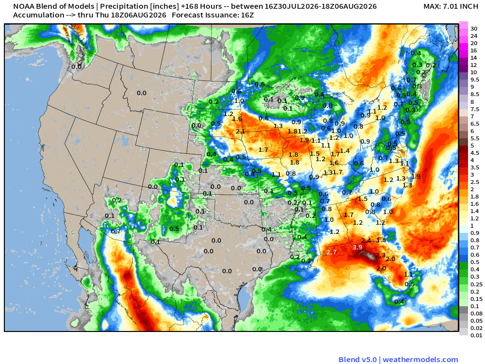
Nothing out west and for Texas … but significant rain for the Midwest and Corn Belt + the southeast including Florida.
ECMWF HRES | Precipitable Water | My Favorite Parameter | Atlantic Tropics
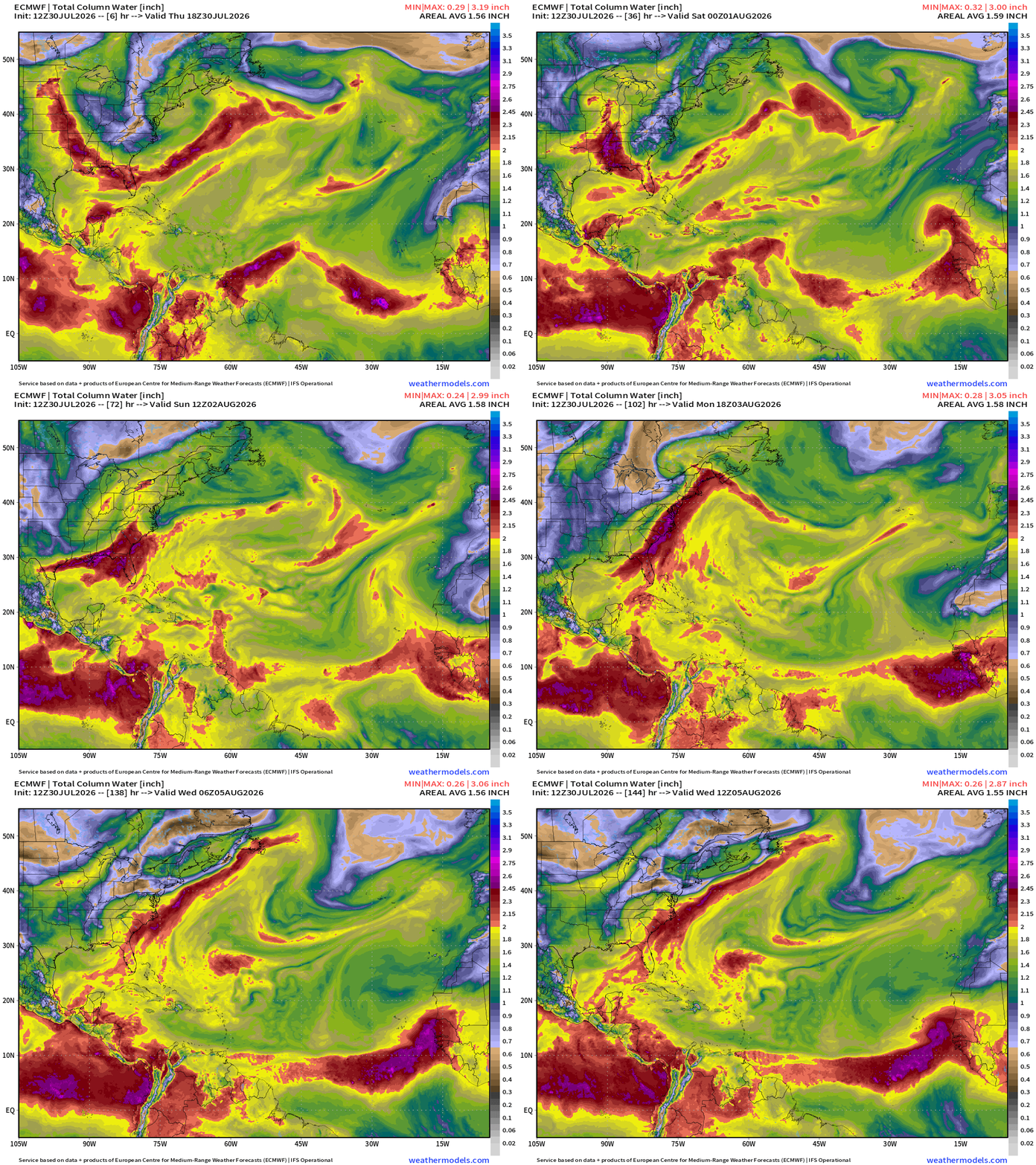
A vigorous tropical wave exits after way too far north — over much cooler water necessary for storm formation —> poof to the convection.
Easy to see the Saharan Air Layers like giant frontal boundaries sweeping through the Main Development Region.
Next stronger tropical wave at a lower latitude in 6-days e.g. next Tues/Wed may have a better chance to form into a depression.
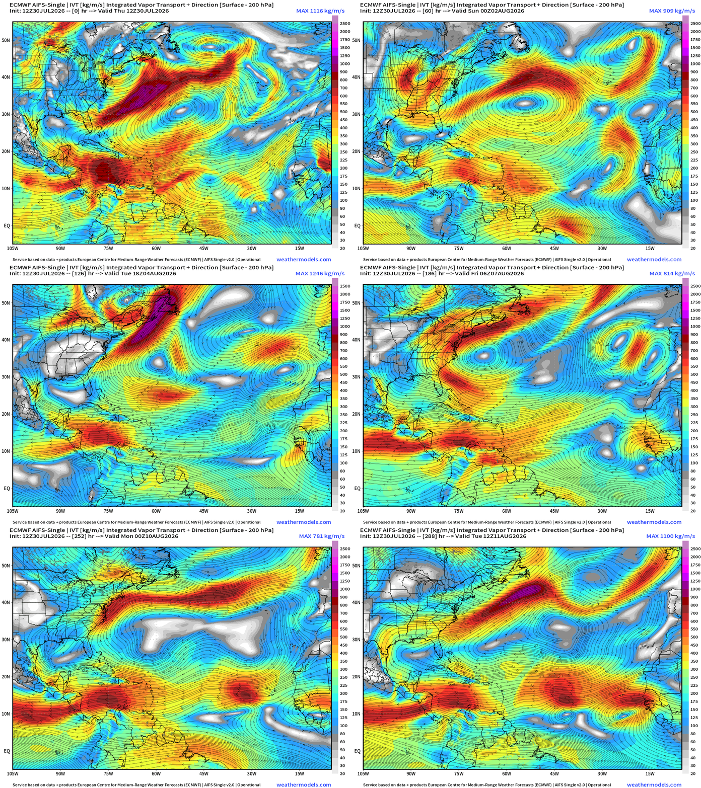
Flagship model: ECMWF AIFS 12z —> Integrated Vapor Transport next 10-days
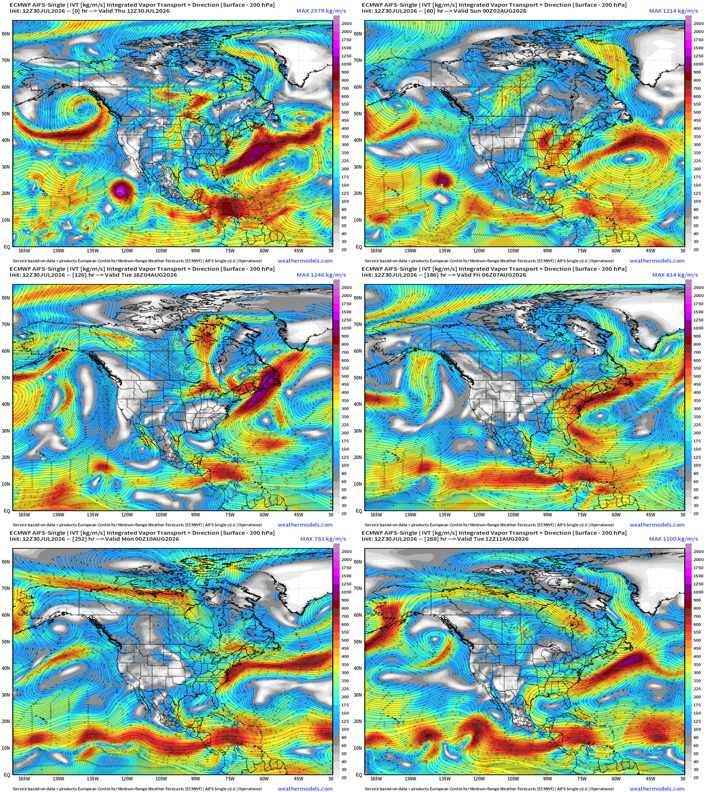
Troughing and flow out of Canada continues across the Eastern U.S. with two storm system forming across the Northeast during the next week
Genevieve holding onto Category 1 intensity over cooler water
The rest of the Atlantic tropical basin is quiet — while tropical waves are still being produced over Africa, but nothing catching fire. Instead, the waves seem to find much better conditions in the Eastern Pacific.
A parade of waves along the ITCZ / monsoon trough line up into August 10th, suggesting a flurry of activity out here as the MJO enters the basin.
Then, perhaps in mid to late August, the MJO enhancement will spawn an Atlantic storm or two. If not, then it might be curtains for the entire season.
Mid-Level 500 mb Height Anomaly next 12-days
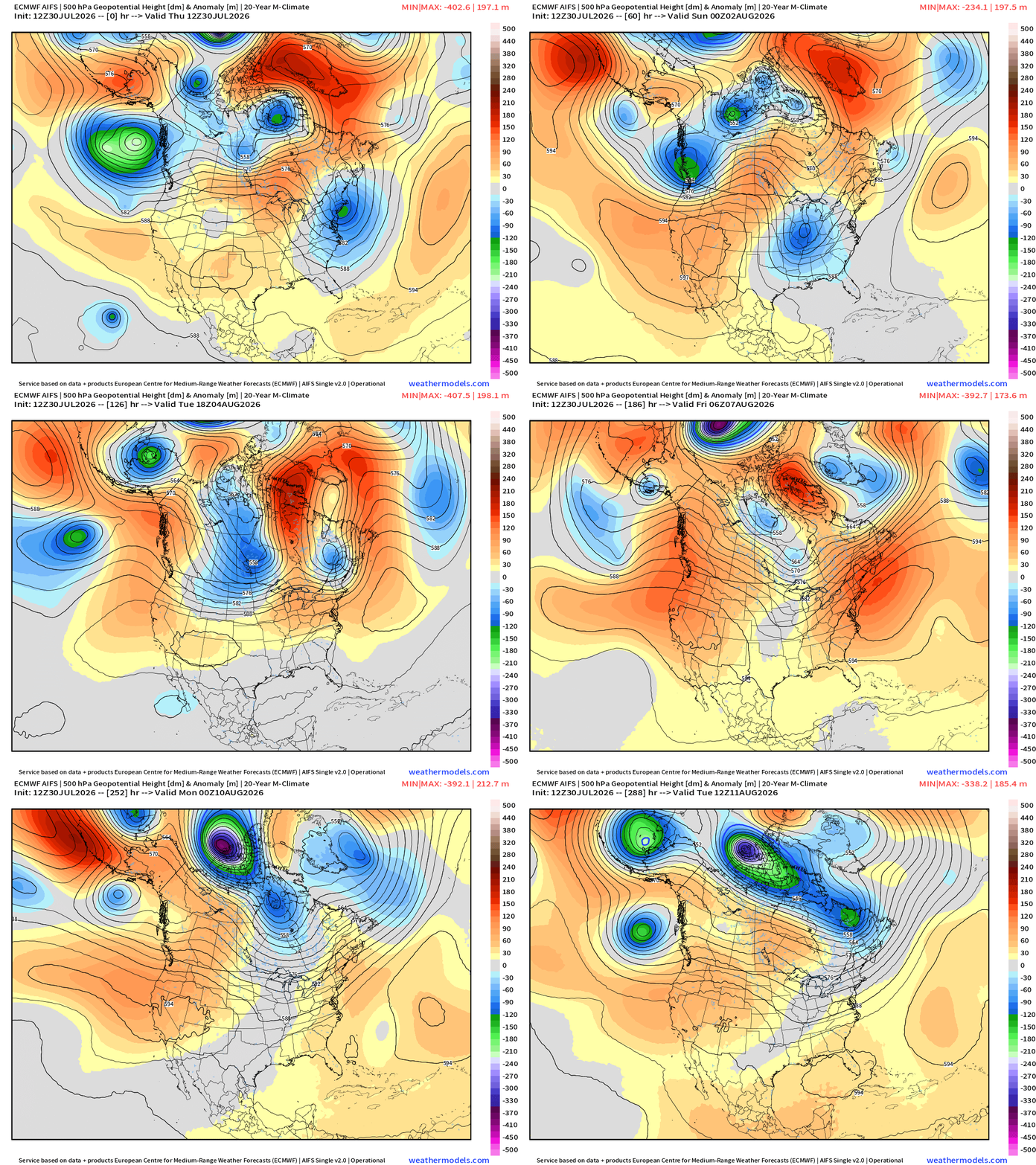
Plenty of troughs / shortwaves coming from the Pacific and Arctic into the northern Lower 48 to disrupt heat dome formation. Running out of summer quickly!
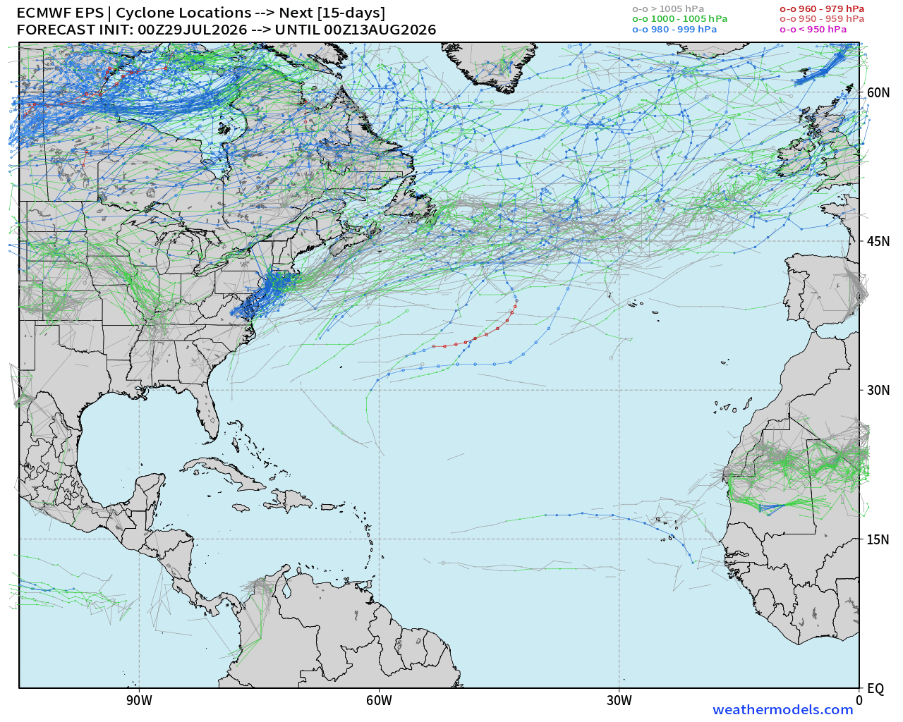
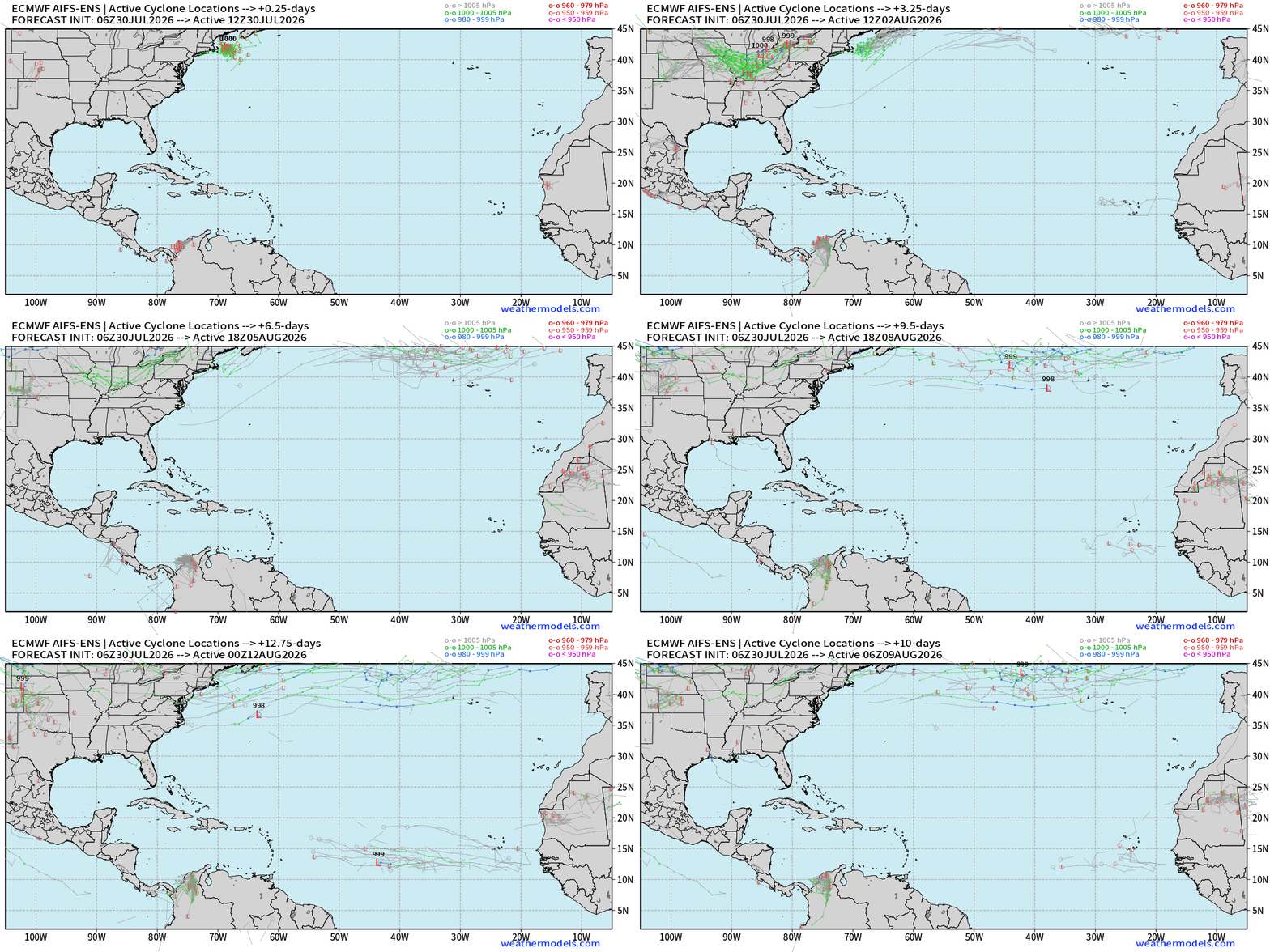
Atlantic Tropics —> dead quiet for next 7-days and ensembles show 15-days of “ghost town” through August 12th
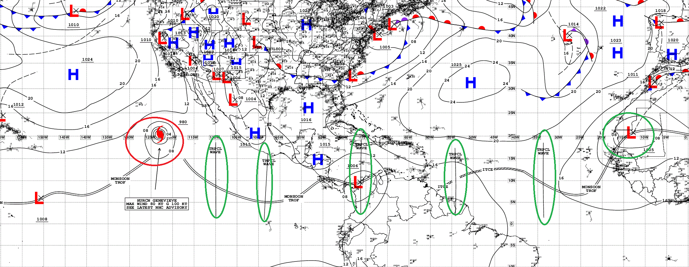
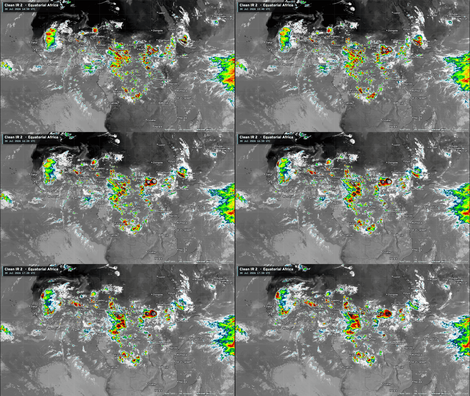
Tropical Waves — active circulation over Senegal with heavy convection, but the water is too cool once it emerges over the Atlantic
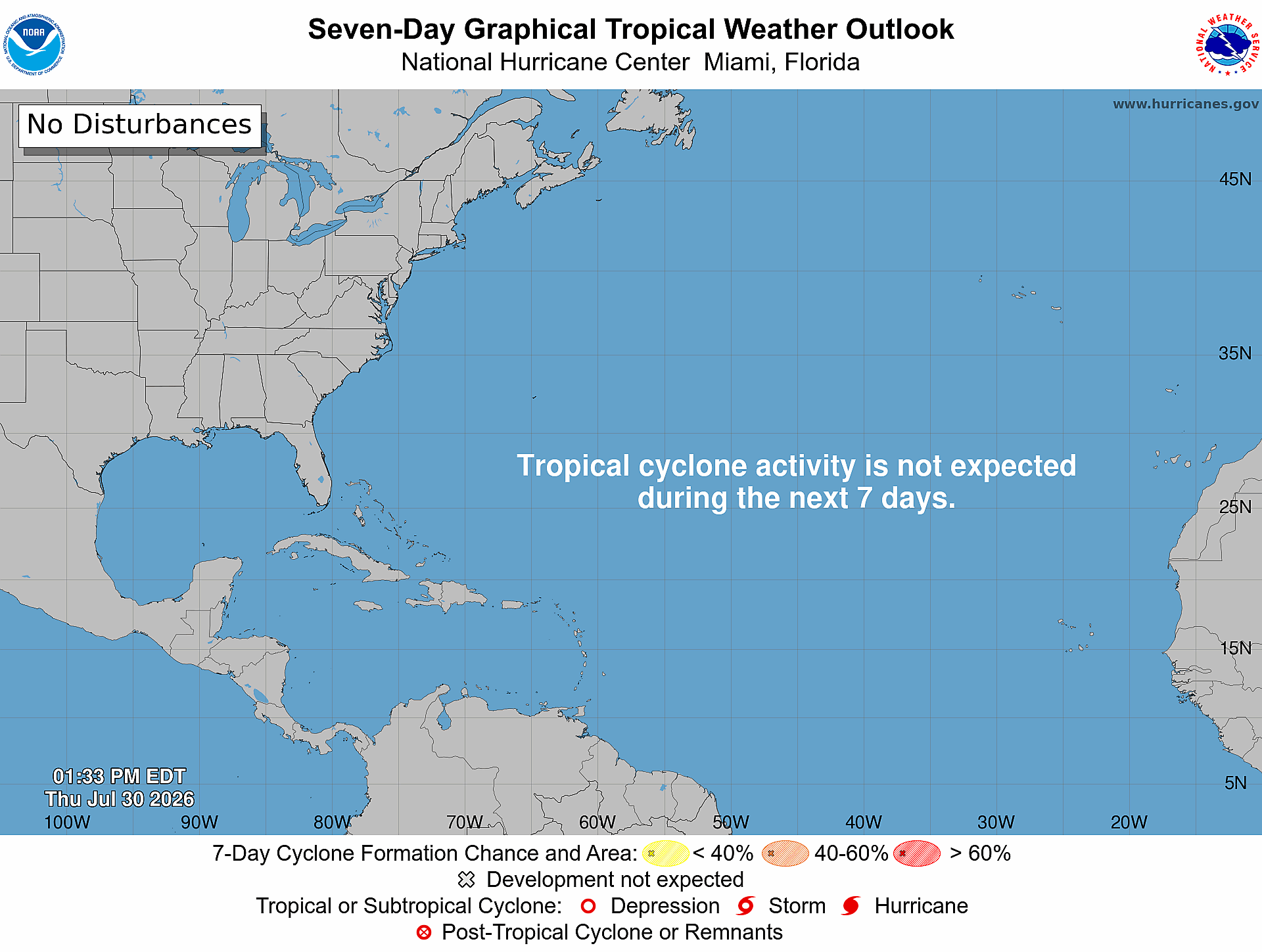
None of the waves in either Eastern Pacific or North Atlantic are marked through 7-days for development. 0%
Tropical Atlantic Convection from Squall Cloud
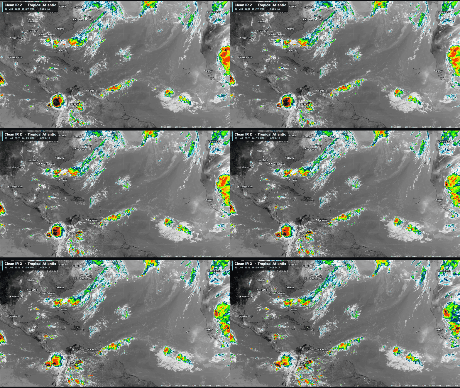
It saves me 10-minutes each day by having my own satellite imagery. Hopefully you can enjoy it too!
SST and Anomaly
sub-26°C = green still cutting into the MDR through the central Atlantic. That’s near the 30-year climatology so the “bare minimum”. Atlantic is not open for business until you get in to the Gulf and Caribbean, and there the wind shear is wiping everything out.
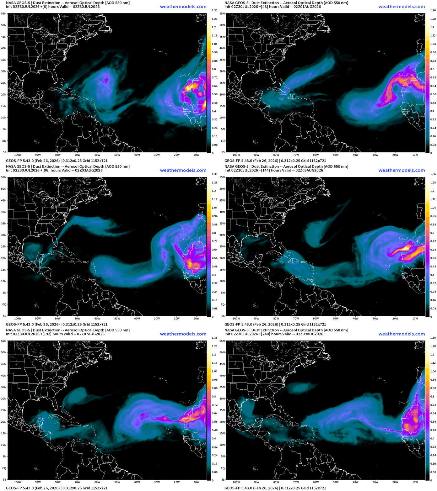
NASA Dust (GEOS-5) — Saharan Air Layers continue to cruise across the Atlantic doing damage to tropical waves and stabilizing the tropical environment with warmth at lower levels. Enormous SAL event happening now.
Tropical Waves are more convectively active over the African continent this evening (squall.cloud) — a strong one about to emerge into the Atlantic but too far north.
Ensembles during the next 15-days (AIFS) do show a hint off something in the 10-15 days range across the MDR
AIFS Integrated Vapor Transport next 12-days —> tropical waves churn westward but nothing catches fire or even looks like it — and into second week of August, the trade winds are screaming westward through the Caribbean. Again, peeping the twin waves in the MDR in 10-12 days. Something to believe in!
Eastern Pacific | Cat 1 Hurricane Genevieve
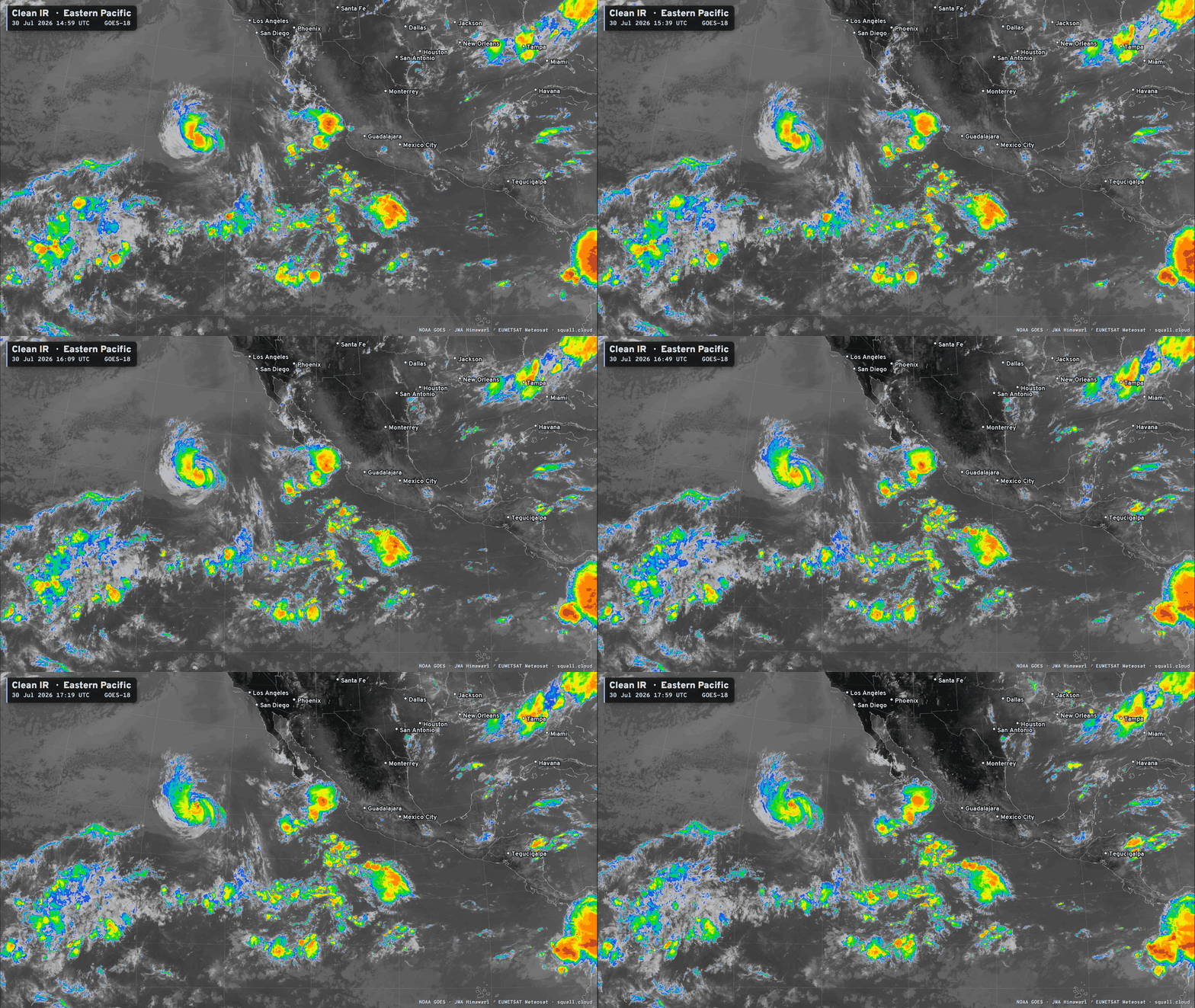
Weakening to a tropical storm in next 12-hours, and becomes a remnant TS force low by this weekend
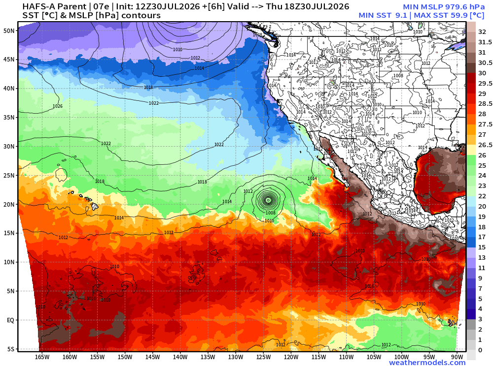
Still plenty of wind energy with Genevieve — it was briefly a Category 5
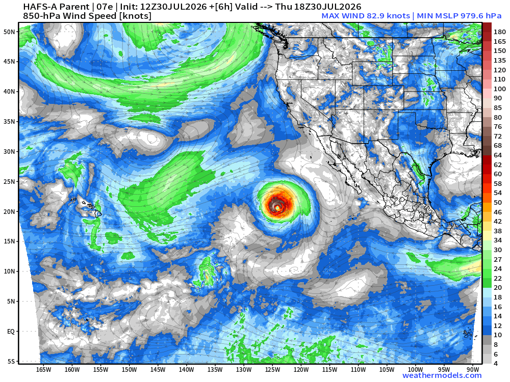
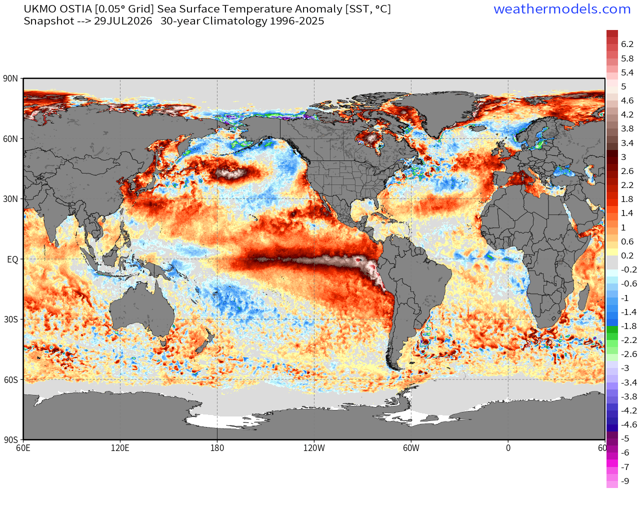
Global SST Anomaly — full tilt El Niño
Western Pacific Typhoon Basin
Massive Super Typhoon Dolphin has plateaued with repeated “eyewall replacement cycles” —> ERC but may be making another comeback.
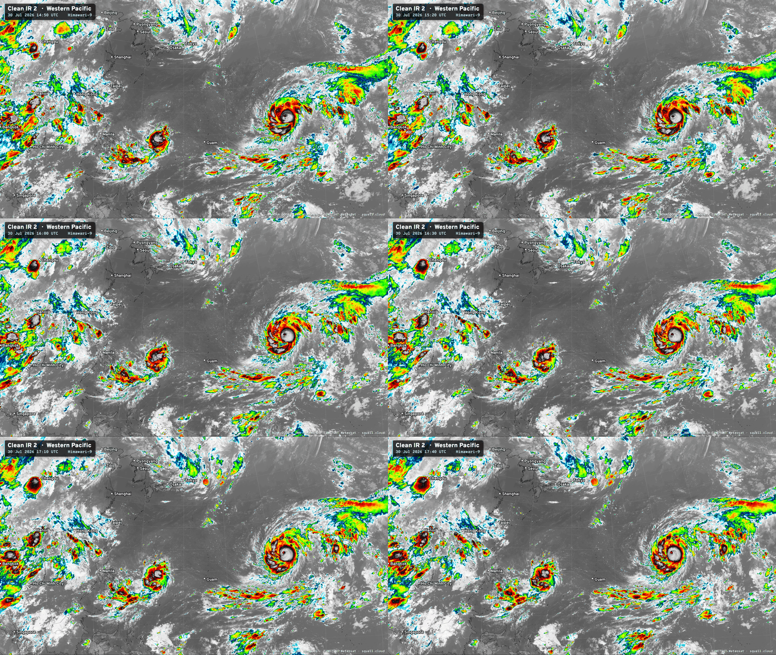
At times, Dolphin has looked great, but lately eyewall issues —> More of this WPAC floater at squall.cloud
JTWC at 130-knots but not indicate re-intensification. That might be too conservative.
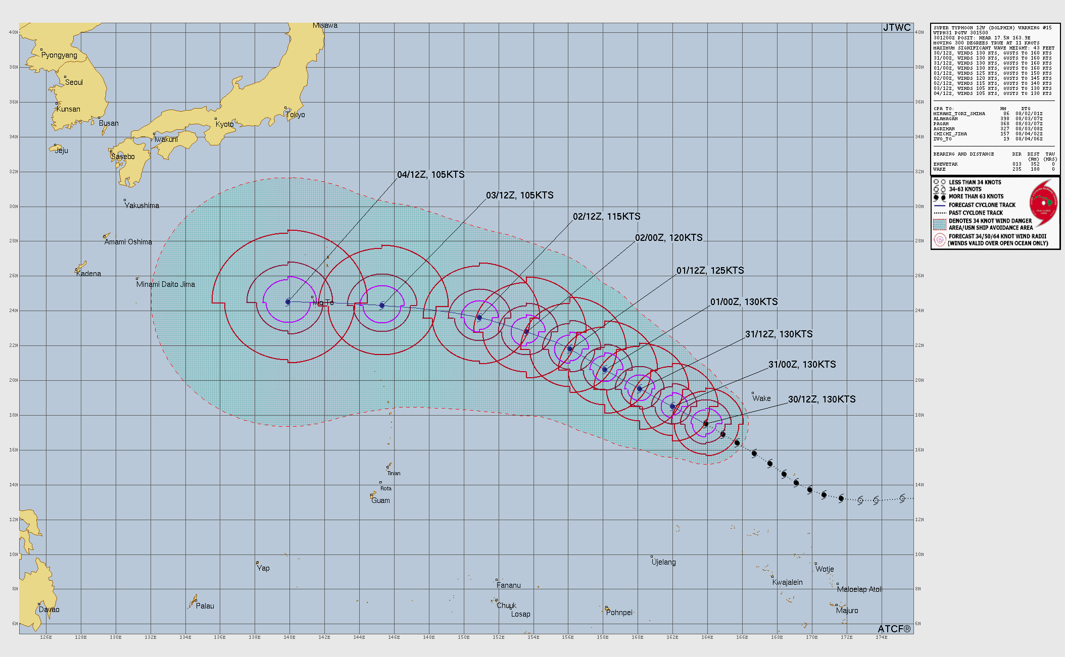
JTWC: THE PRIMARY FACTOR CAPPING INTENSIFICATION IS SUCCESSIVE EYEWALL REPLACEMENT CYCLES AND THE CONCOMITANT EXPANSION OF THE EYE.
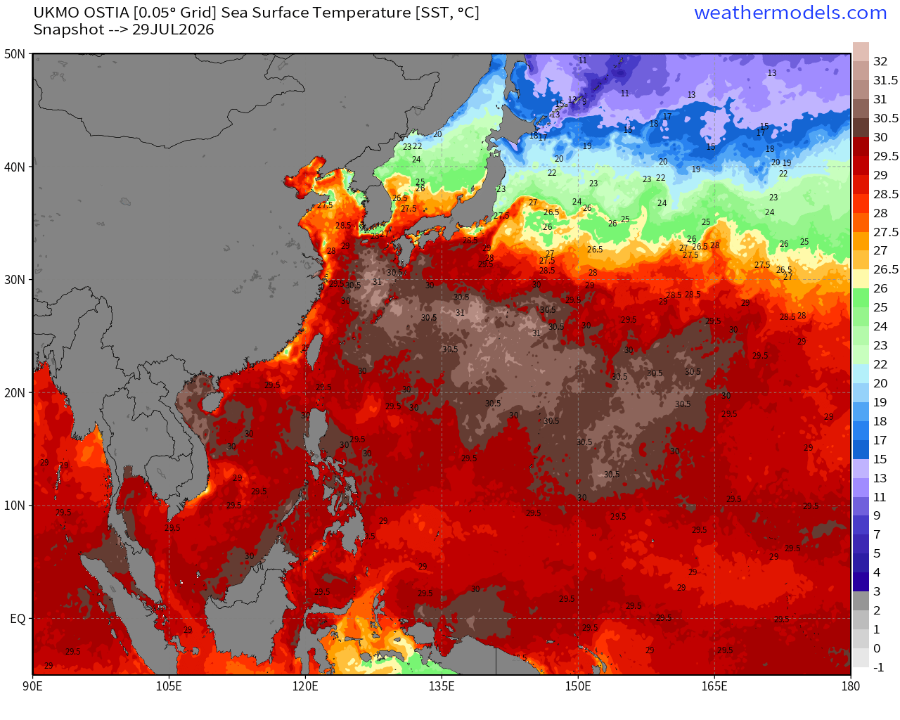
SSTs —> still a massive expanse of 30°C to 31°C water in the path of Dolphin
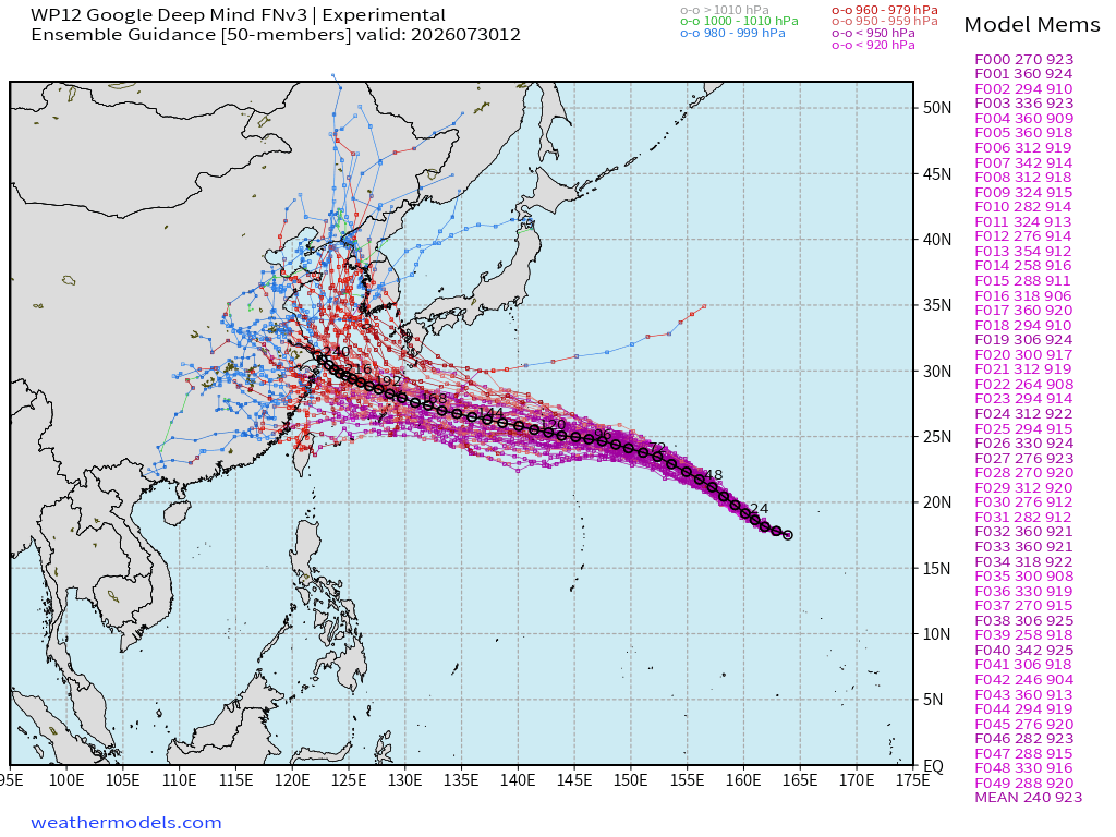
Ensemble Track into China from Google Deep Mind in 10-days (risk!)
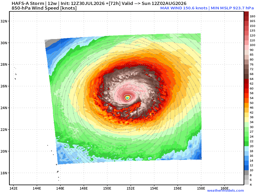
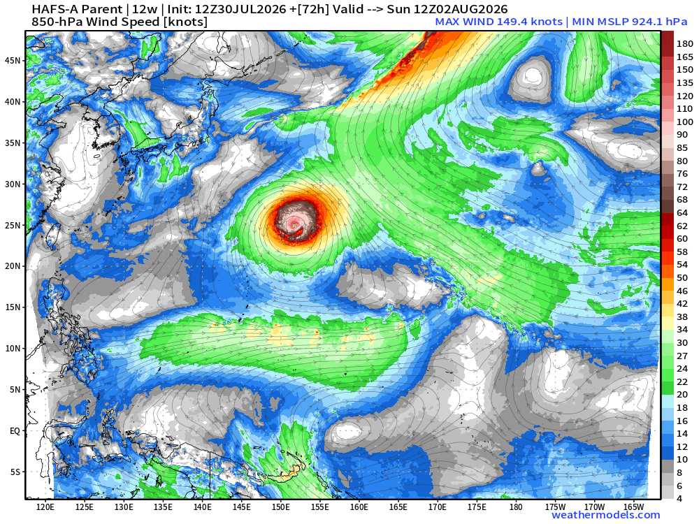
923 mb from HAFS-A in 72-hours is probably still Category 5! It will massively increase in size.
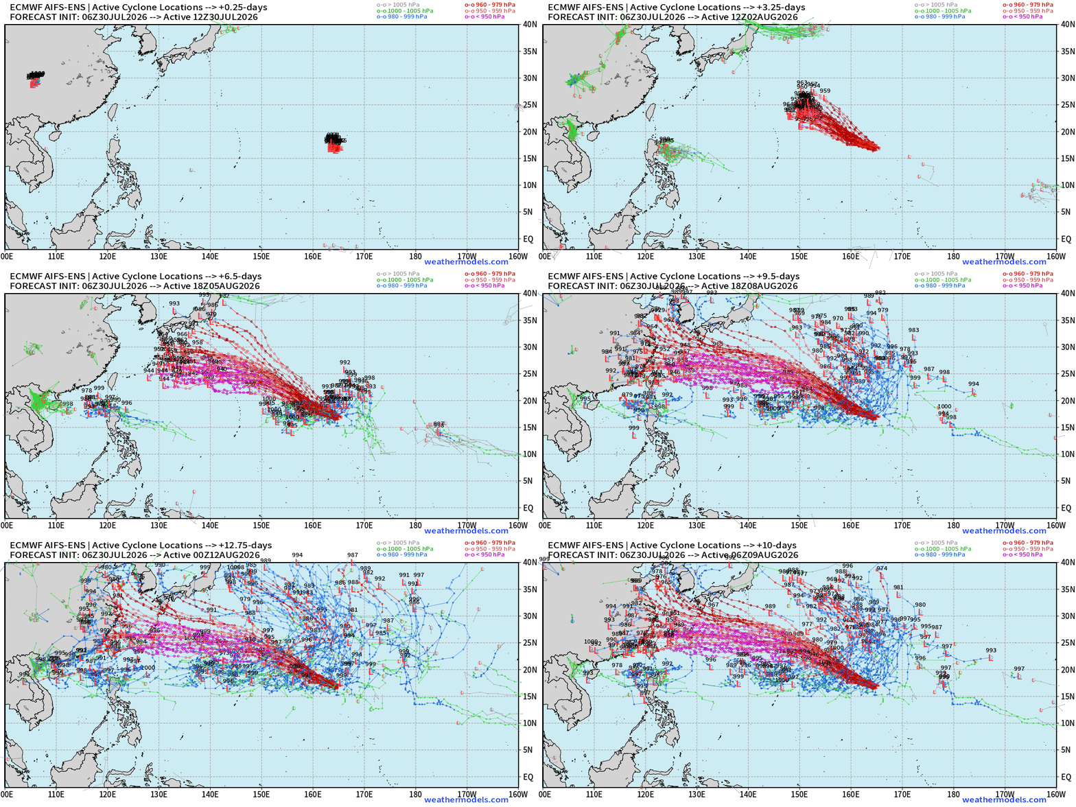
Integrated Vapor Transport from ECMWF AIFS 12z shows evolution of Super Typhoon — will be long-lasting = lots of ACE and potential impacts to Japan or Korea or China. Way too soon to say.
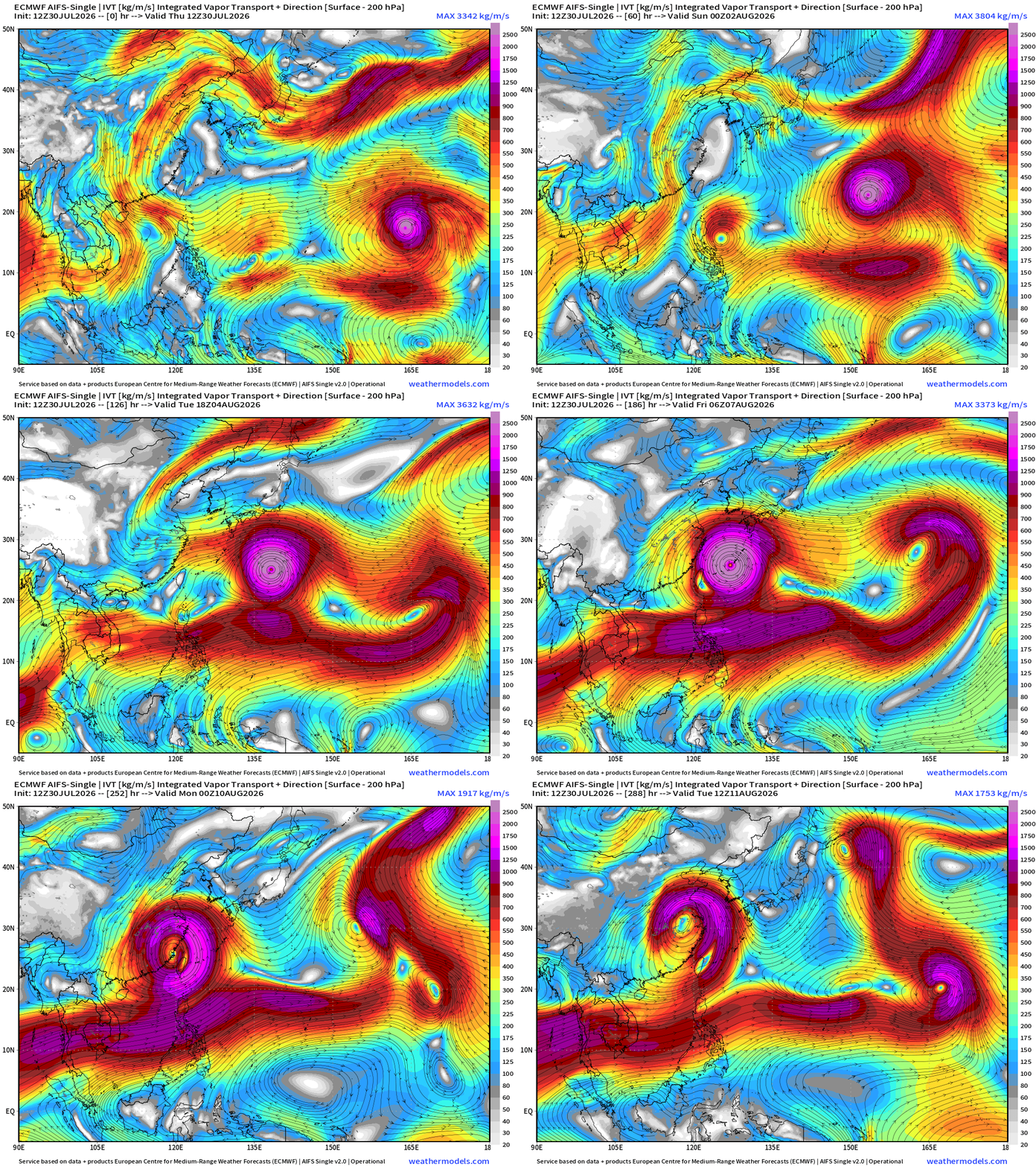
More activity on the way in the Western Pacific Typhoon Factory!
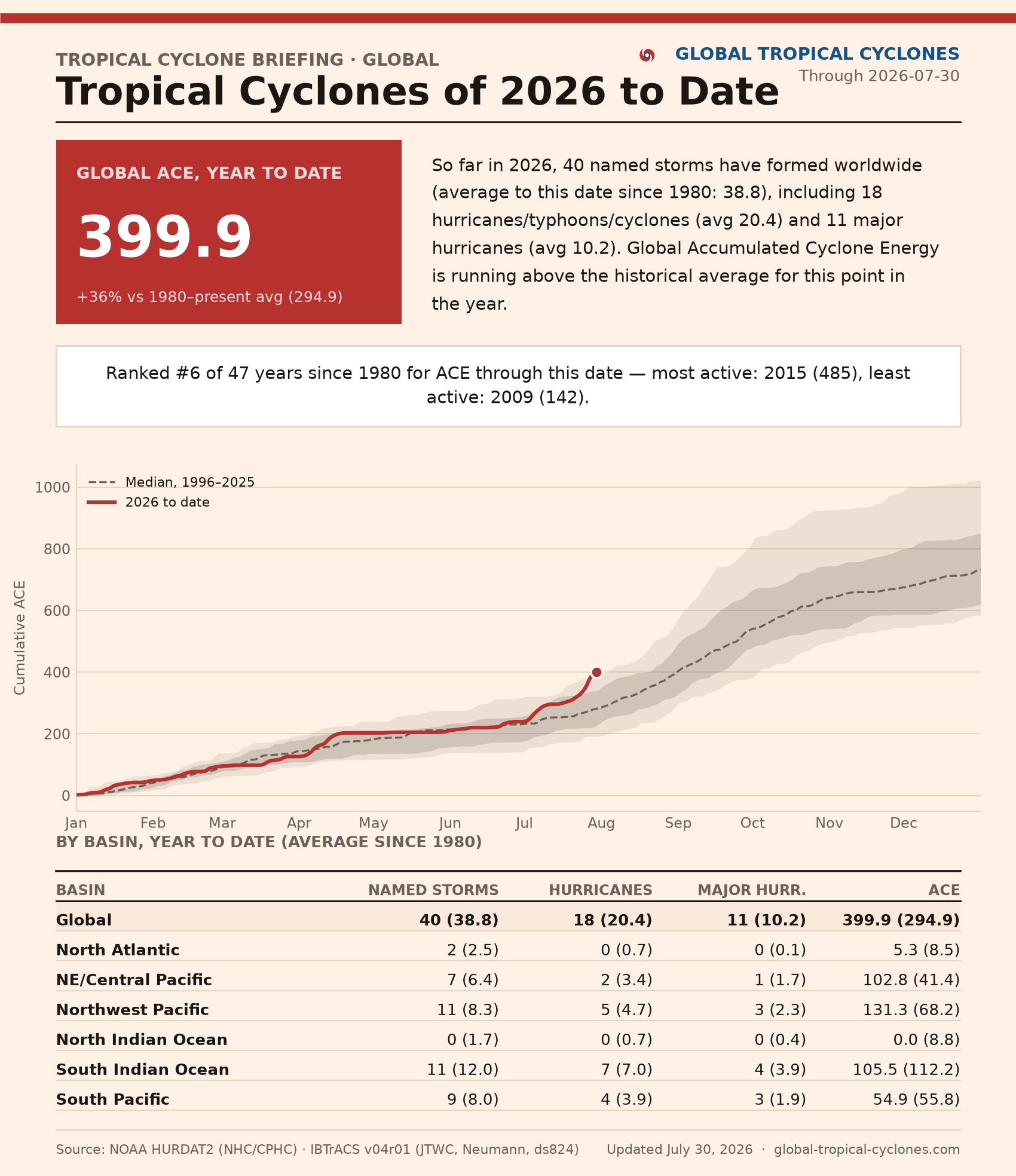
See Global Tropical Cyclones for more ACE information | 400 for Year-To-Date!
Maps sourced from weathermodels.com designed and innovated by yours truly! Please subscribe there for real-time access to the newest maps, charts from all of the weather models including ECMWF and AIFS, and NOAA GFS/GEFS, HRRR/RRFS and Blend of Models (NBM). NOAA WPC and SPC for fronts/convective outlooks.
Our own content is now sourced from hottestsince.com and weather.city and celsius.earth, and squall.cloud and weather.football
My Atlantic Hurricane Season Forecast (2026)
From April 7, 2026: Atlantic Seasonal Hurricane Forecast: (11/5/2)
9-13 Named Storms (11 most likely)
4-7 Hurricanes (5 or 6 most likely)
1-3 Major Hurricanes (2 most likely)
Accumulated Cyclone Energy: 75-85 (well below normal)
NOAA 2026 Atlantic Hurricane Season Forecast
- Milepost
- 996 · laid 2026-07-30T19:30:34.767000Z
- Source
- https://weather.substack.com/p/july-30-2026-thursday-tropical-update
- Digest
- d3d940b44e36c6aef6d993d34968f6079cb9151ed9663d43a4602d940bc59c0a
- Machine
- JSON