July 27, 2026 Monday Tropical Update
Atlantic tropics very quiet into mid-August but Pacific is full tilt El Niño with Fausto, Genevieve, and soon monster Super Typhoon Dolphin
July 2026 was the warmest July in the 132-year national record (1895–2026), at 76.9°F against a 1991–2020 normal of 74.4°F (+2.5°F).
July 2026 was the 26th-driest July in the 132-year national record (1895–2026), at 2.5in against a 1991–2020 normal of 2.9in (-0.3in).
NOAA/NCEI Climate at a Glance, contiguous United States. This is the observed record for the month, not a score of anything said in this piece — the forecast ledger begins 2026-08-17 and cannot reach earlier posts.
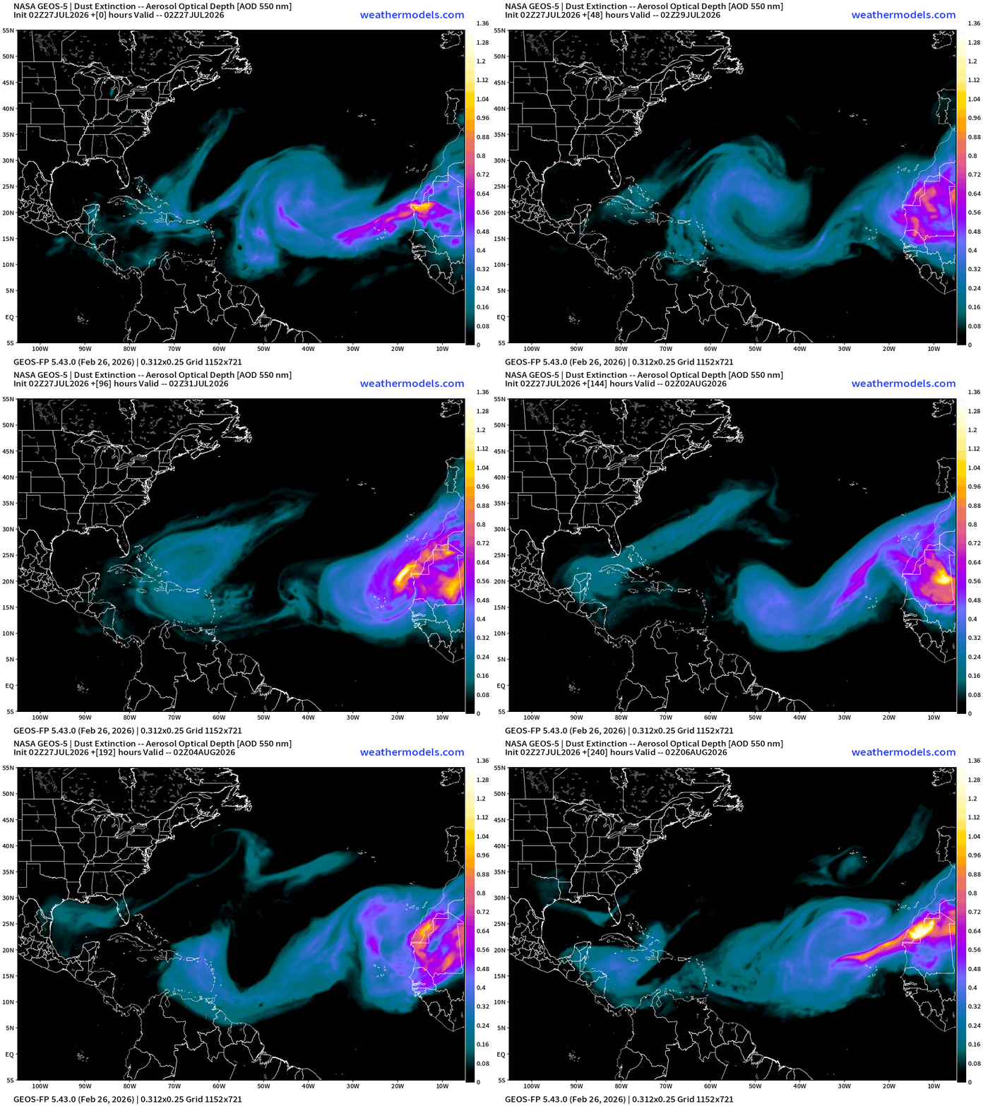
Atlantic tropics remain very quiet this evening — with minimal convective activity with tropical waves from Africa to the Caribbean and Gulf. Saharan Dust Layers continue to track westward with the trade winds.
Two systems in the Eastern Pacific: Hurricane Fausto on its way north of Hawaii in next few days but weakening to a tropical storm, and powerhouse Major Hurricane Genevieve at Category 4 (130-knots) off the coast of Mexico also slowly weakening after reaching Category 5 earlier on Monday.
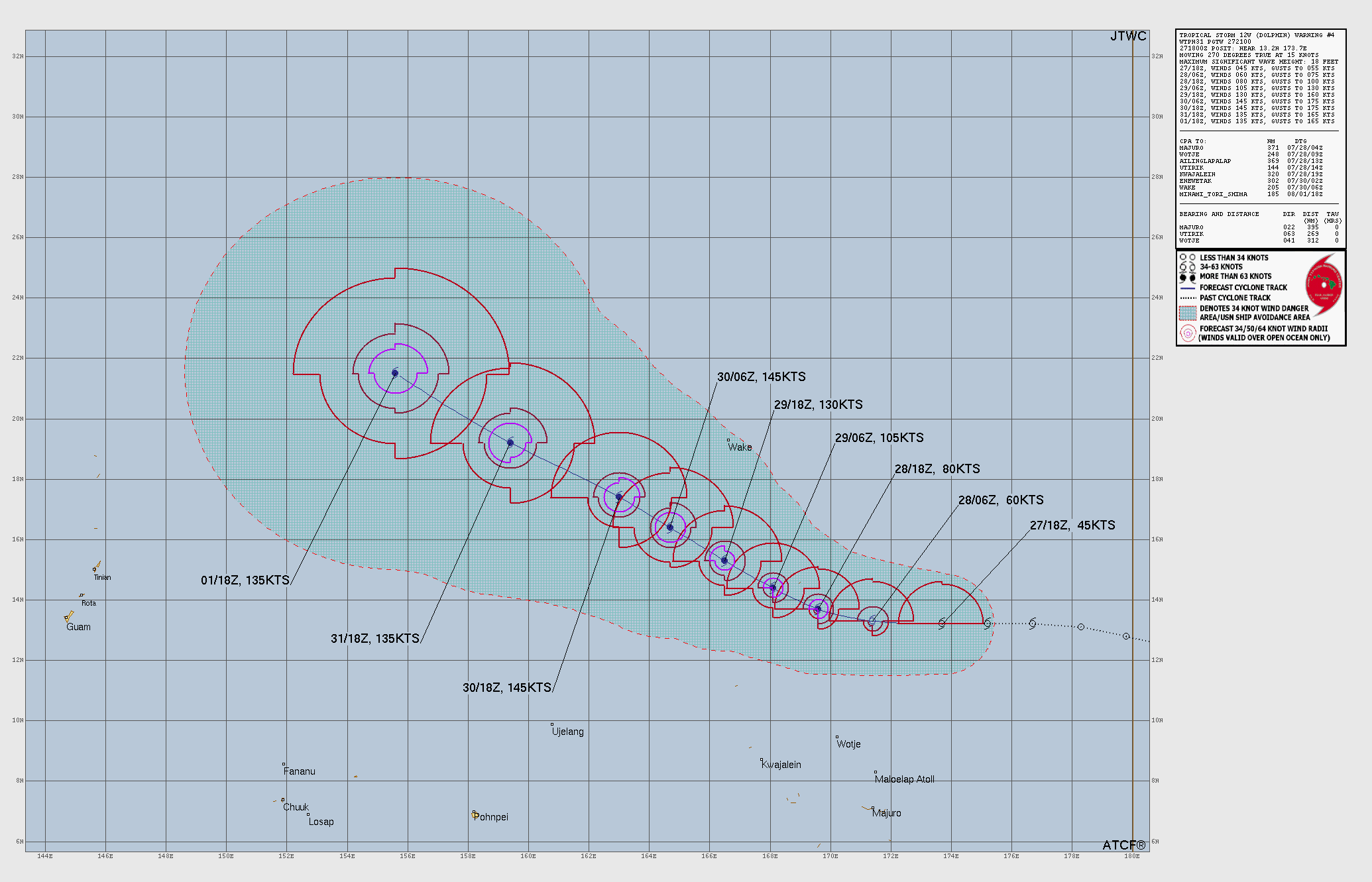
Massive Super Typhoon Dolphin (12W) will rapidly intensify to Category 5 with potential of T 8.0 (170-knots) on the table assuming the structure of Dolphin does not entrain dry air or see any shear. This would be a good candidate as a “Sprinter” rapid intensification case.


Now Operational: Squall Cloud global weather satellite viewer plus MRMS radar coverage for the United States with some fun surprises. Paid subscribers support these services, and I am very appreciative as well as the rest of Earth that can use them for free.
ECMWF HRES | Precipitable Water | My Favorite Parameter | Atlantic Tropics
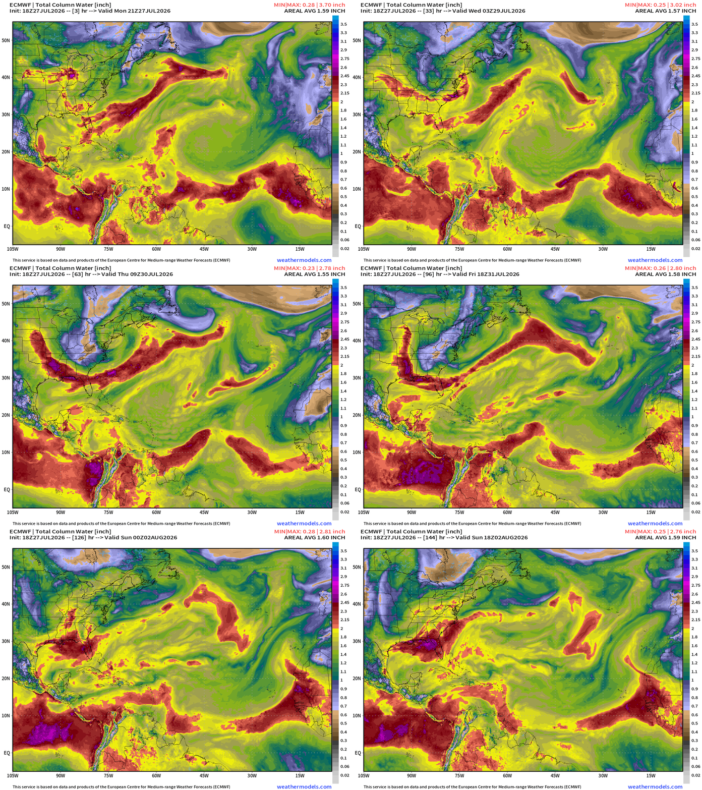
Easy to eyeball the Saharan Air Layers like giant frontal boundaries sweeping through the Main Development Region. Plenty of tropical moisture in the ITCZ and monsoon trough at roughly 10°N and especially right off the coast of Africa, but tropical waves can’t catch fire.
Strong troughs continue to dip through the Eastern U.S. and even into the Southeast.
ECMWF HRES | Precipitable Water | My Favorite Parameter | North America
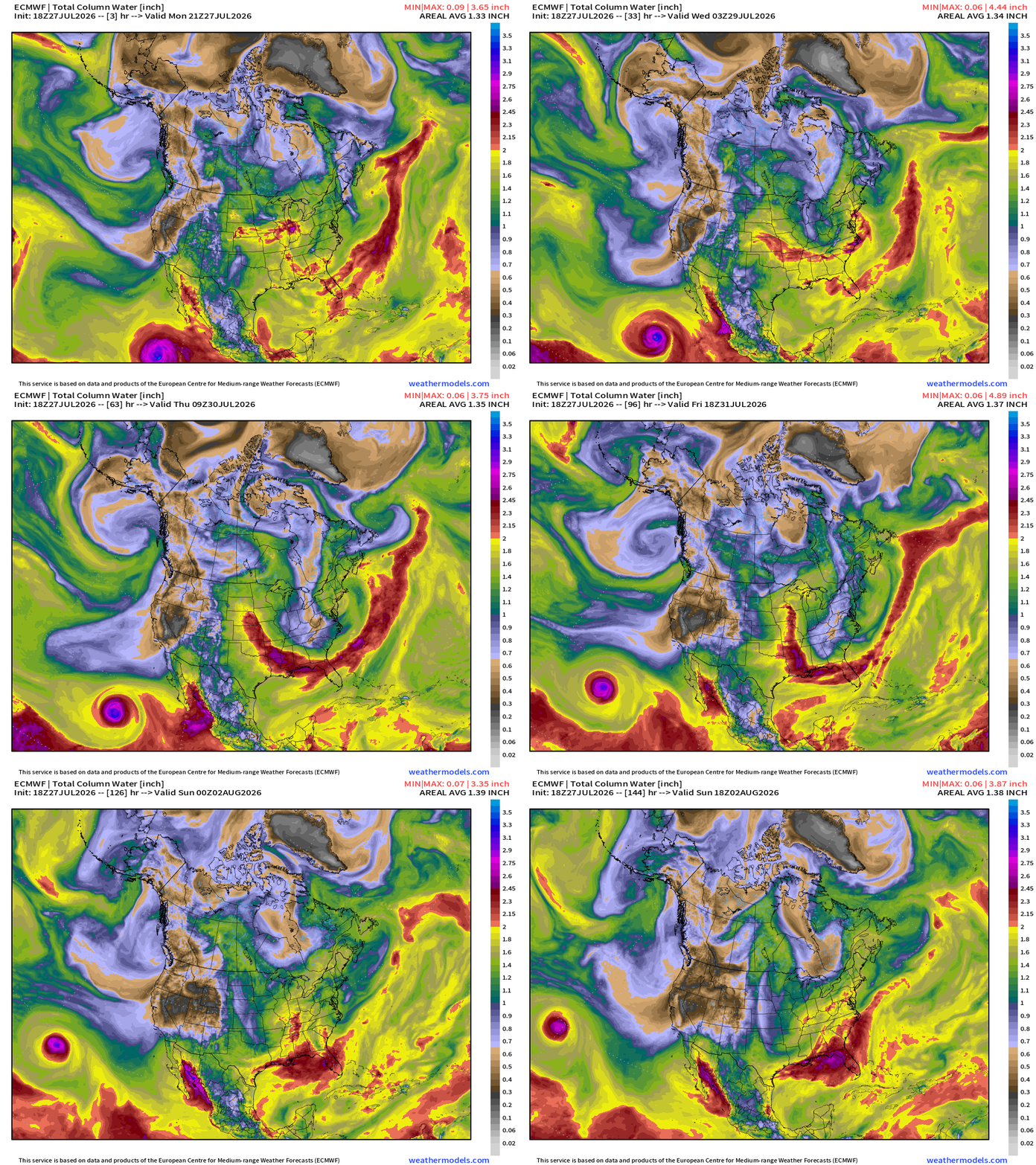
Major Hurricane Genevieve (07E) will track WNW over next few days, and then weaken over cooler water by 5-days to a tropical storm
A sharp trough digs into the eastern U.S. and even the Southeast with a frontal boundary hung up along the Gulf coast —> focus for more rainfall and squelching any heat dome thoughts.
Flagship model: ECMWF AIFS 18z —> Integrated Vapor Transport next 10-days
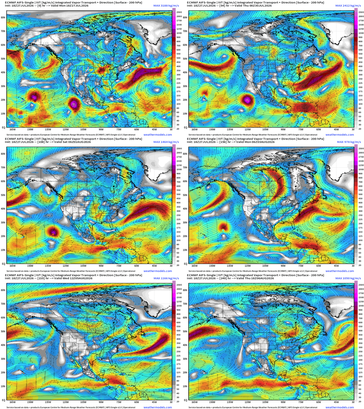
Troughing and flow out of Canada continues across the Eastern U.S. with a strong storm system forming across the Northeast
Genevieve maintaining Category 4 intensity
Fausto passing safely north of the Hawaiian Islands as a tropical storm
The rest of the Atlantic tropical basin is quiet — while tropical waves are still being produced over Africa, but nothing catching fire. Instead, the waves seem to find much better conditions in the Eastern Pacific.
Blend of Models —> Precipitation Next 7-days
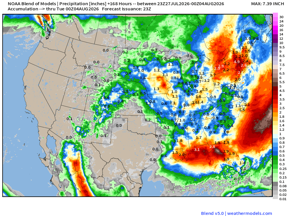
Dry as a bone and hot across Texas and beneath the Western U.S. heat dome with minimal monsoon moisture making it out of the Pacific. Huge rainfall totals yet again across the Gulf coast and Northeast
Upper-Level Height Anomaly | AIFS-Single Next 10-days
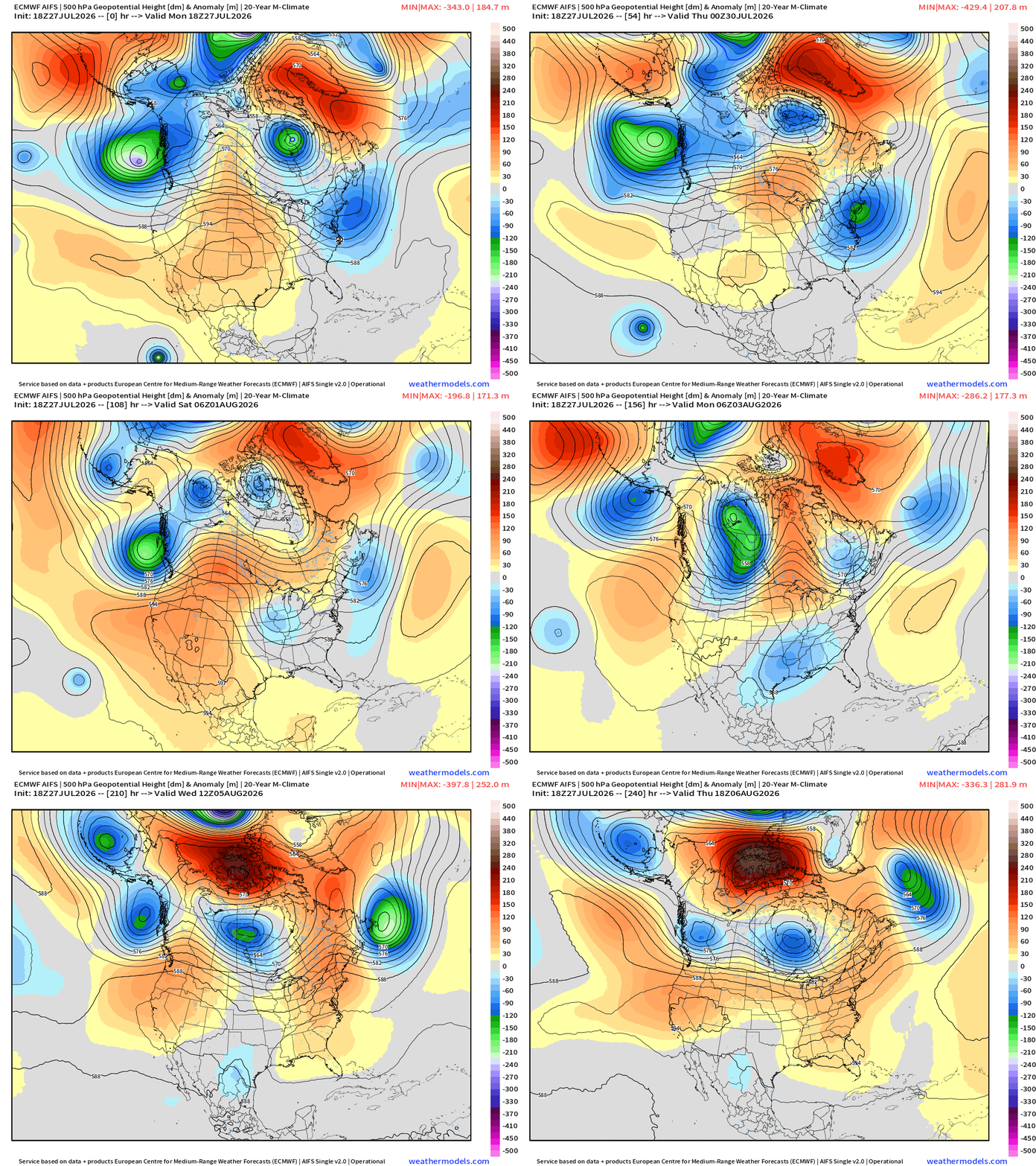
Northeast —> trough after trough —> cooler and unsettled.
Massive Western Heat Dome builds from Texas into the Southwest —> very hot and the monsoon moisture flow is shut down.
Heat dome maintains its grip for next 7-8 days
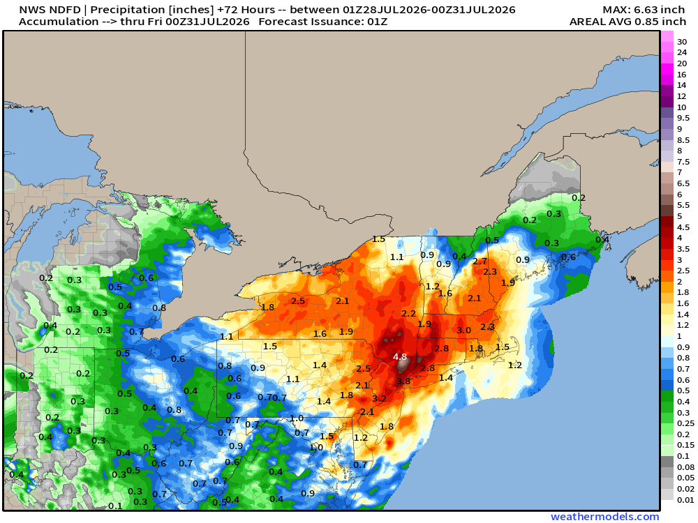
NWS Precipitation Next 72-hours —> Wednesday Evening
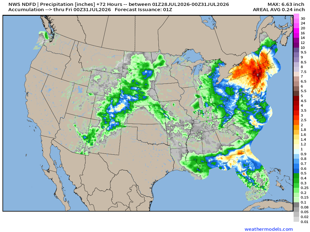
Western Lower 48 turning dryer in the coming days, and weeks ahead with a major heat dome building for the dog days of Summer.
Major exception: the Northeast with unsettled and wet weather due to multiple troughs and strong storm system
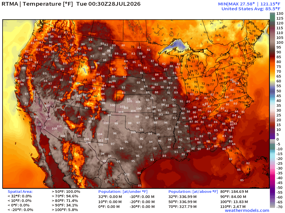
RTMA Current Temperature Analysis | 8:30 PM ET
RTMA Current Temperature Anomaly | 8:30 PM ET
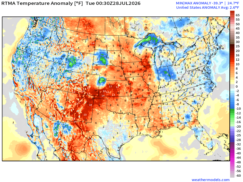
Lower 48 was 2.6ºF above normal
High Temperatures next 9-days through Wednesday August 5th
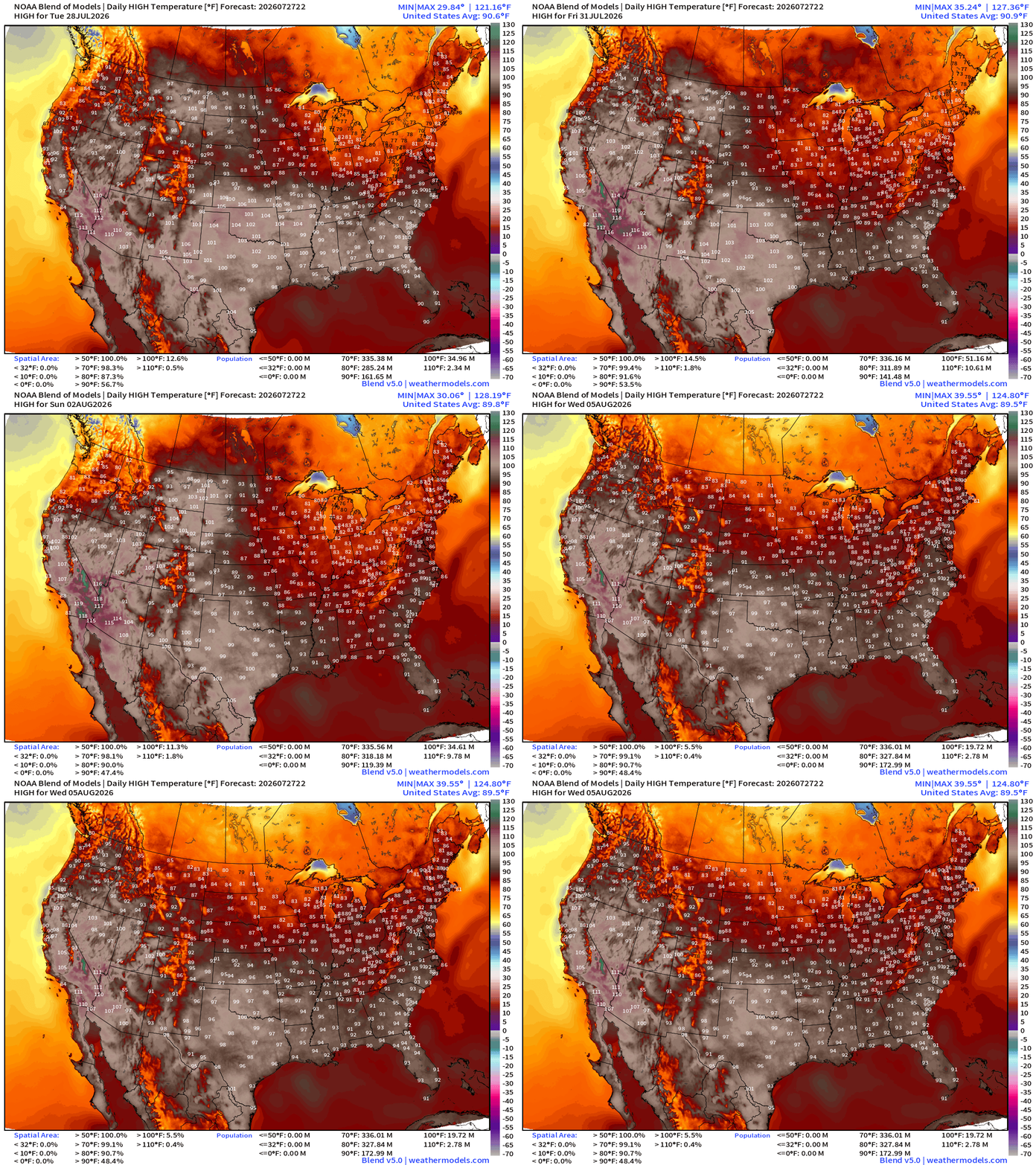
Major heat across the Western half of the Lower 48 with the Great Lakes and Northeast largely escaping it with much cooler 70s and 80s rather than 100s.
Low Temperatures Tuesday Morning
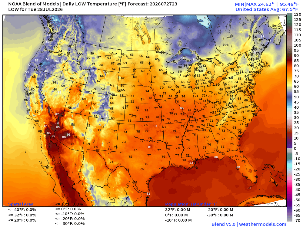
Still comfortably cool across the Great Lakes Northeast with 50s and 60s.
High Temperatures on Tuesday
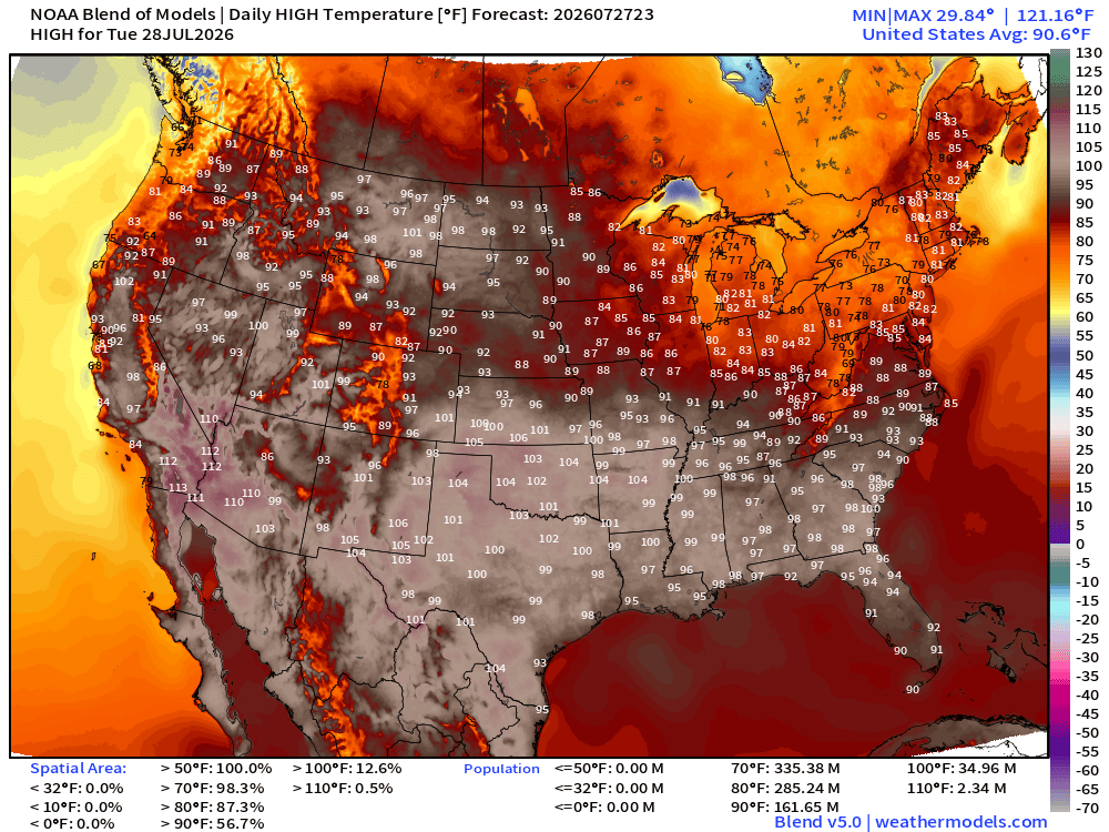
Lower 48 average high at 90.6°F with 13% of the Lower 48 real estate over 100°F —> heat dome baking!
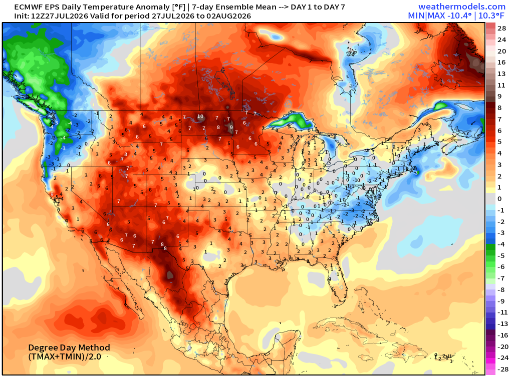
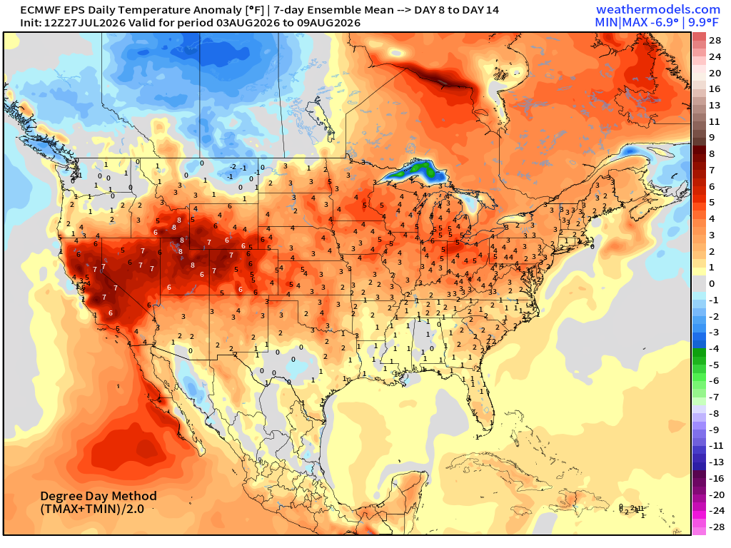
ECMWF Flagship Ensemble Mean Temperature Anomaly next 14-days
Week 1 —> July 27 to August 2
Week 2 —> August 3 to August 9
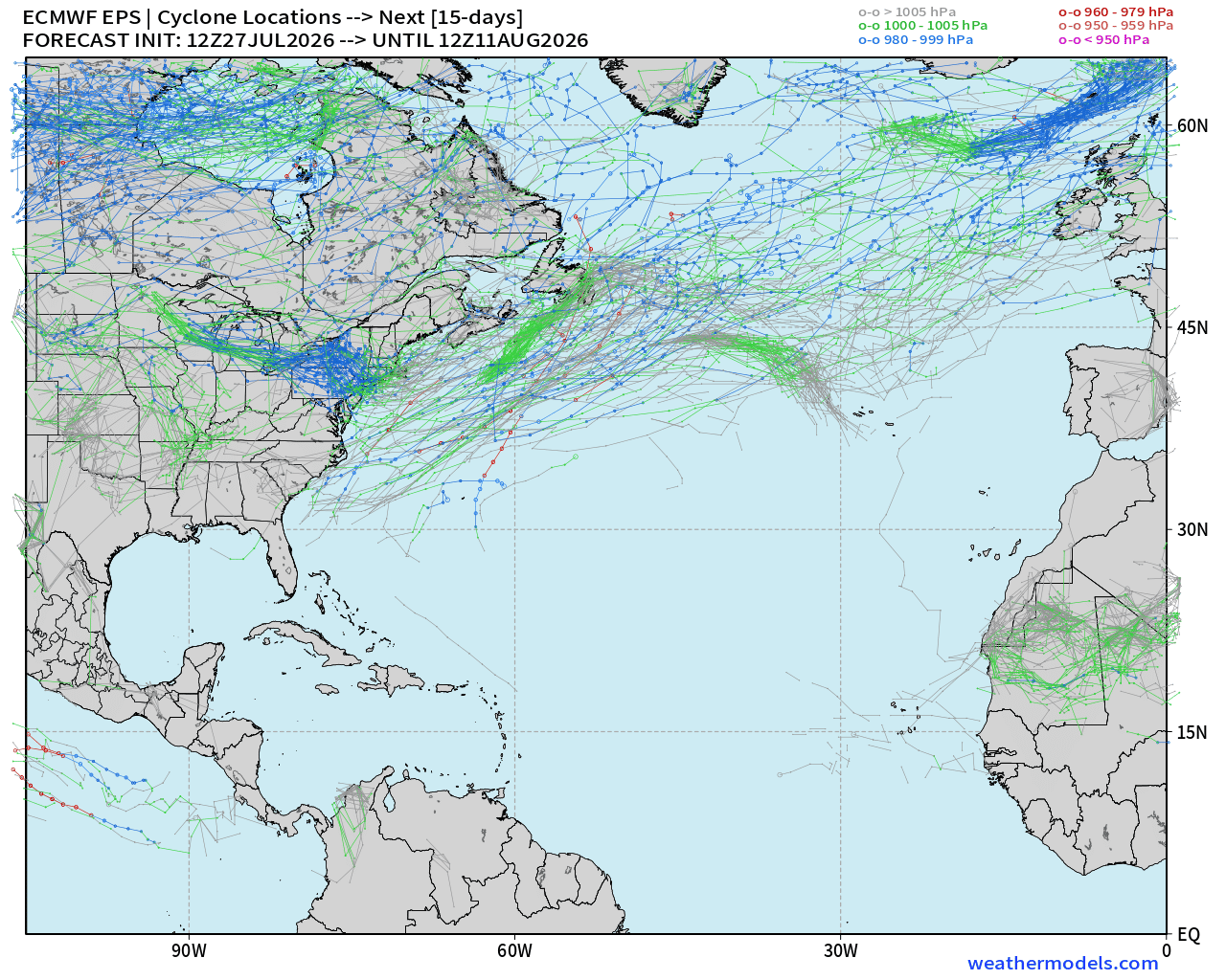
Atlantic Tropics —> dead quiet for next 7-days and ensembles show 15-days of “ghost town” through August 11th
NASA Dust (GEOS-5) — Saharan Air Layers continue to cruise across the Atlantic doing damage to tropical waves and stabilizing the tropical environment with warmth at lower levels.
Tropical Waves are more convectively active over the African continent this evening (squall.cloud)
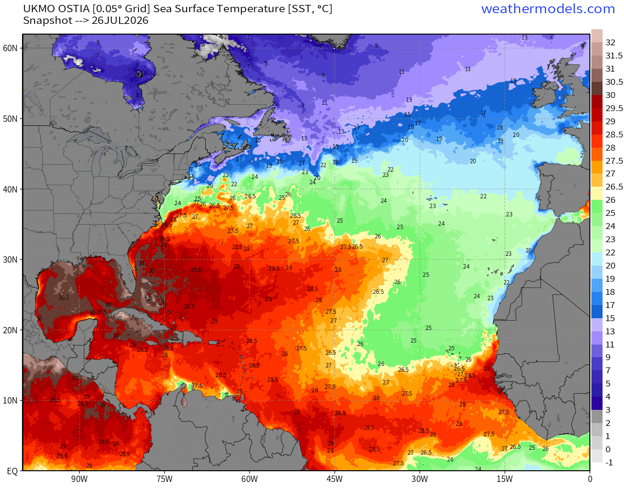
SSTs still show the sub-26°C green shading intruding into the central MDR and eastern MDR (Main Development Region)
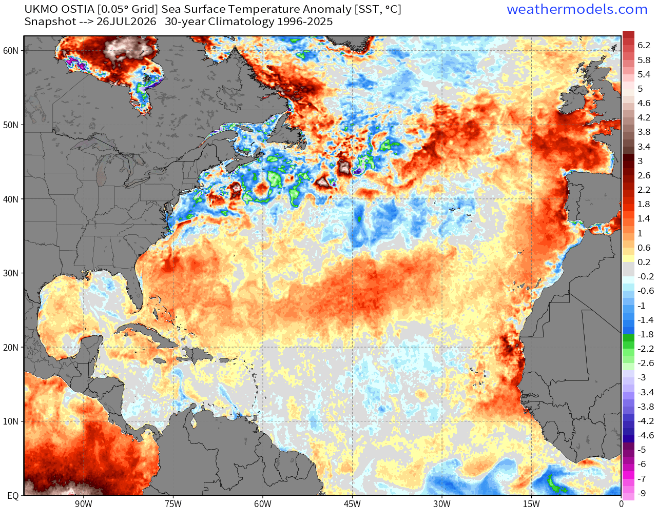
And, the overall MDR is cooler than normal with warmth heading into the subtropics between 20°N to 30°N
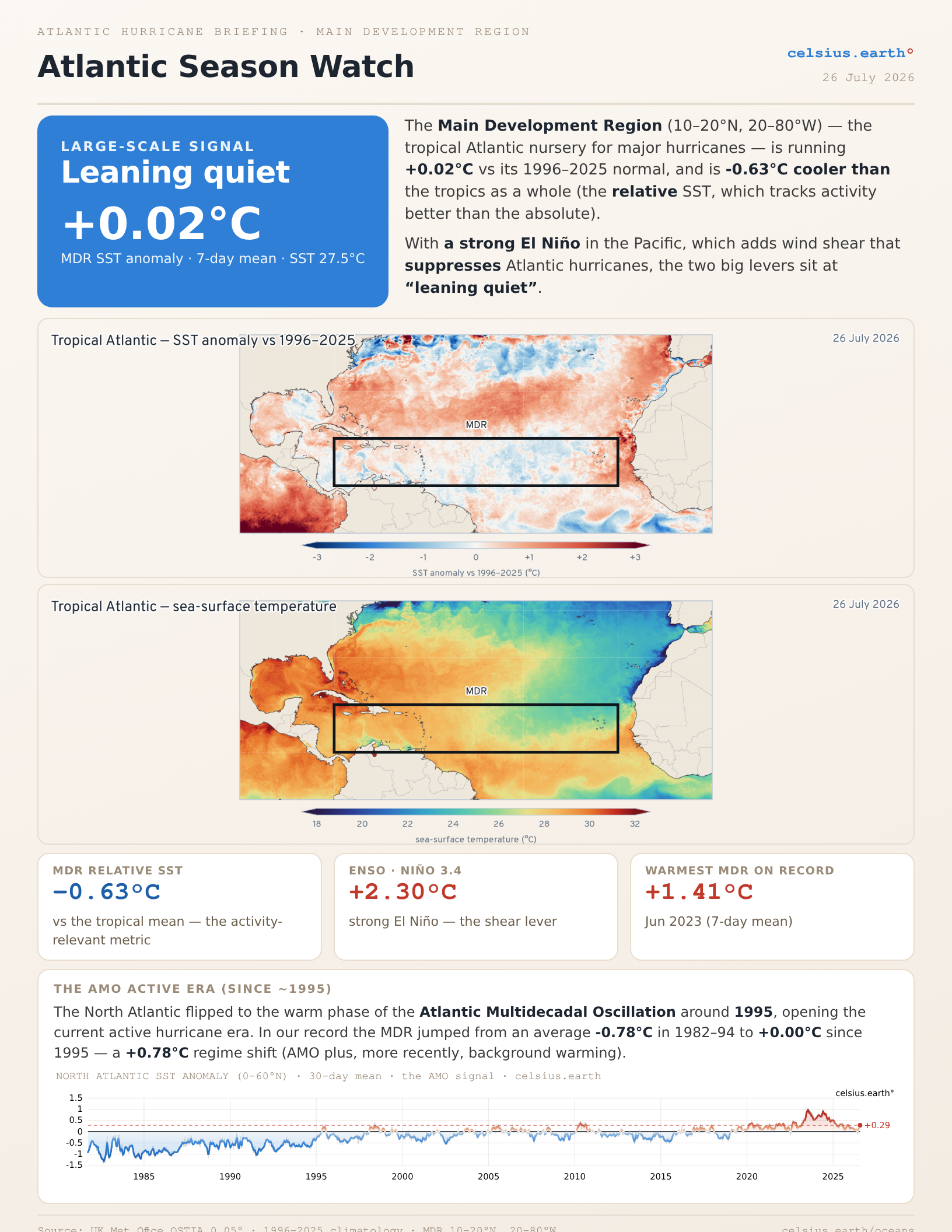
Briefing from celsius.earth/oceans shows the MDR is running near the last 30-years climatology but the Atlantic MDR SST is -0.63°C cooler than the tropical mean (relative SST) —> large scale signal = Leaning Quiet
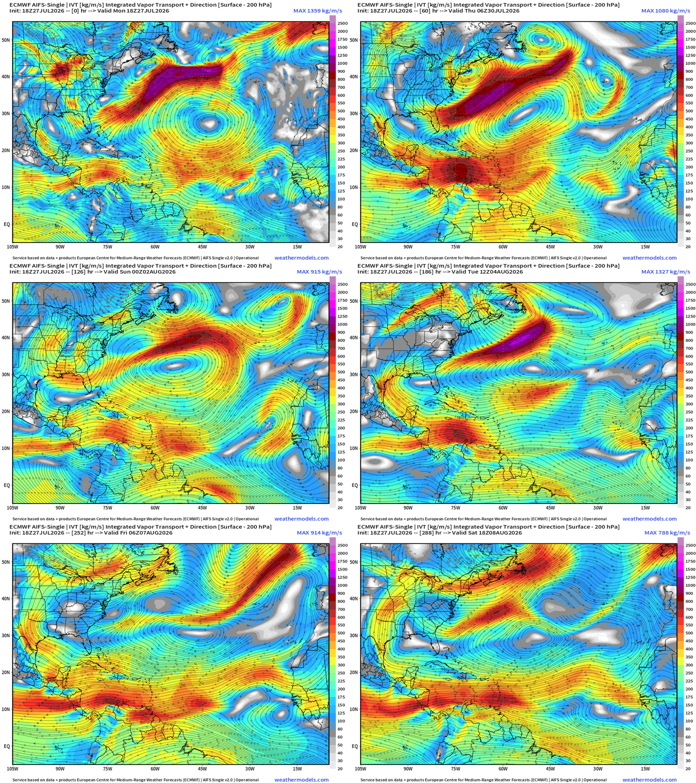
AIFS Integrated Vapor Transport next 12-days —> tropical waves churn westward but nothing catches fire or even looks like it — and into second week of August, the trade winds are screaming westward through the Caribbean.
Eastern Pacific Hurricanes | Cat 4 Genevieve and Cat 1 Fausto
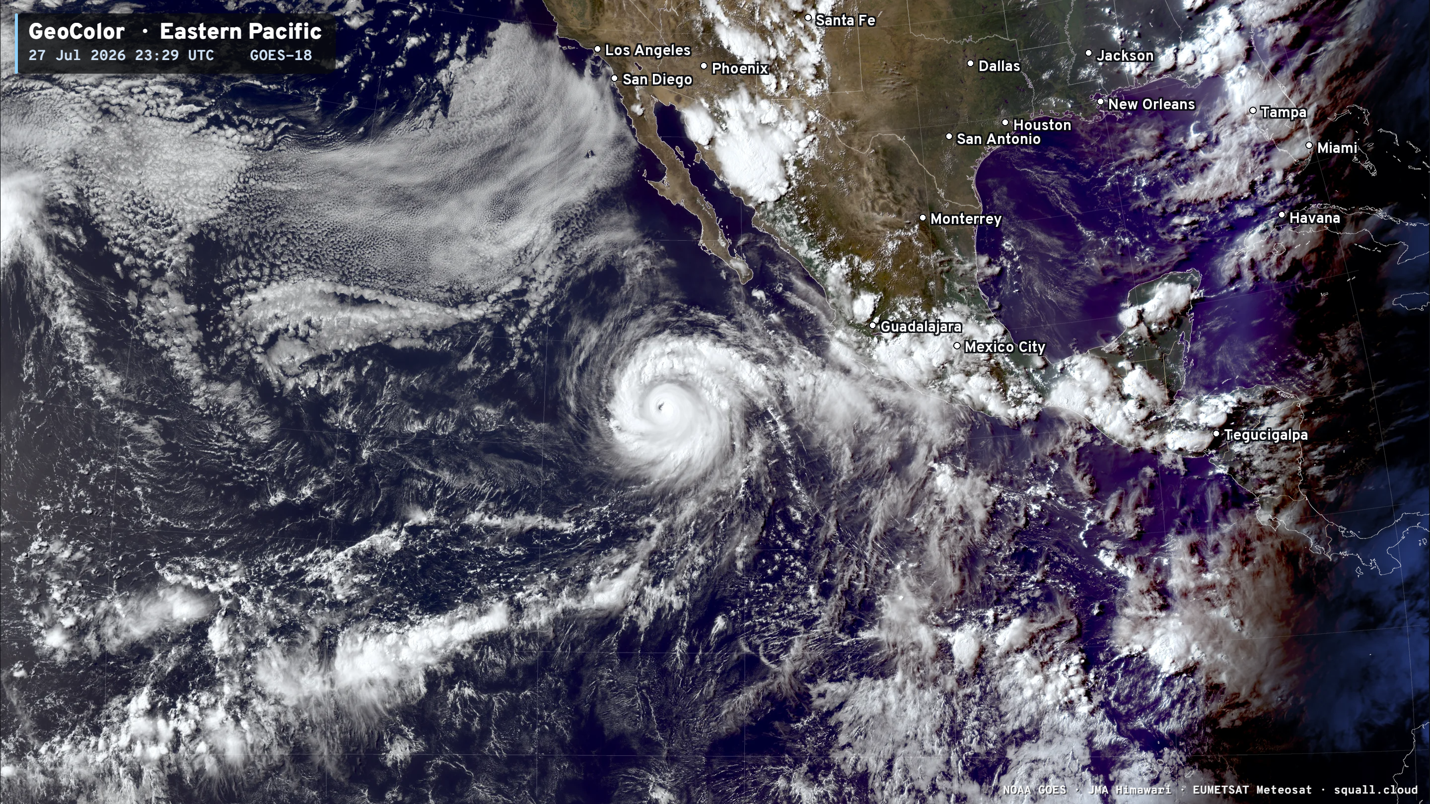
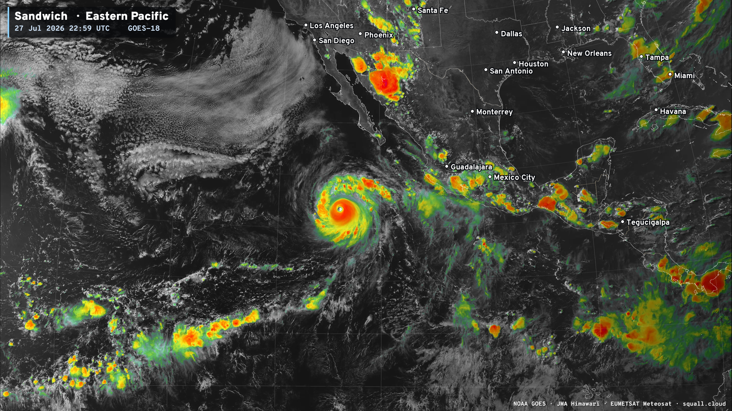
Satellite Imagery for Eastern Pacific basin: Squall Cloud link
Major Hurricane Genevieve at 150 mph (Category 4) — slow weakening underway
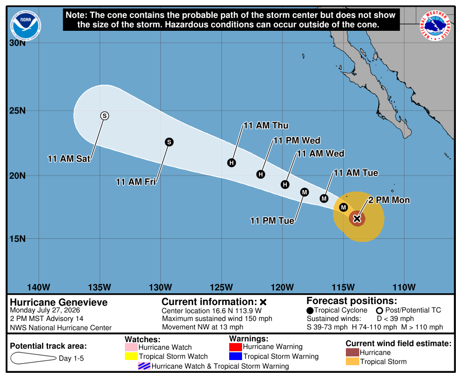
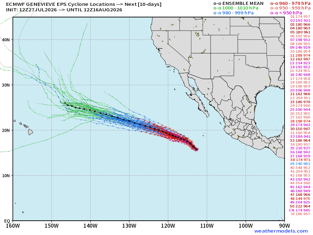
Fausto + Genevieve happily continue their lifecycles for next several days not directly affecting land
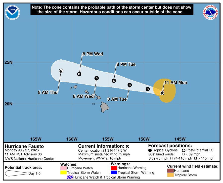
Fausto maintains Tropical Storm status skirting just north of the Hawaiian Islands
Western Pacific: Massive Super Typhoon Dolphin soon to rapidly intensify far out by Wake island
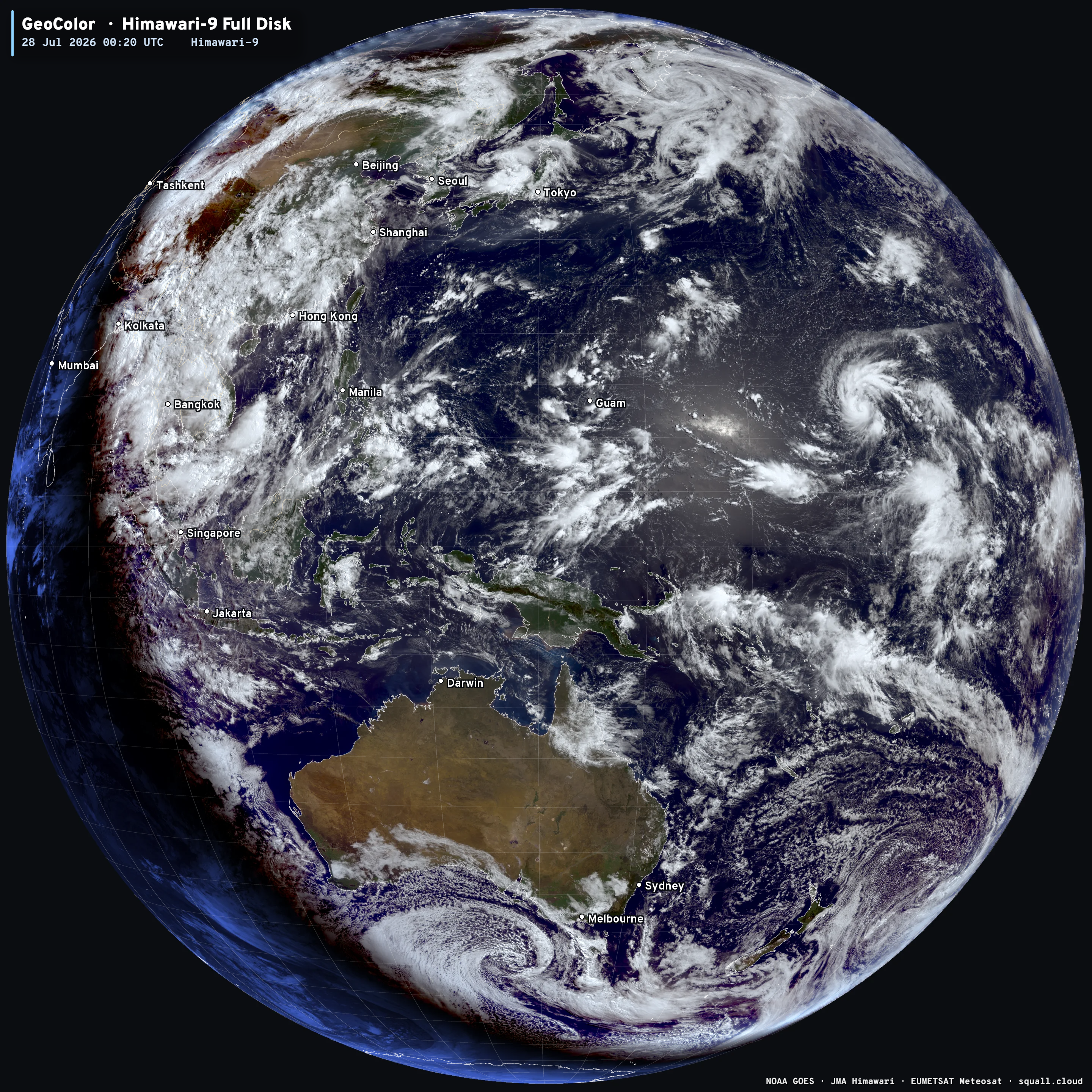
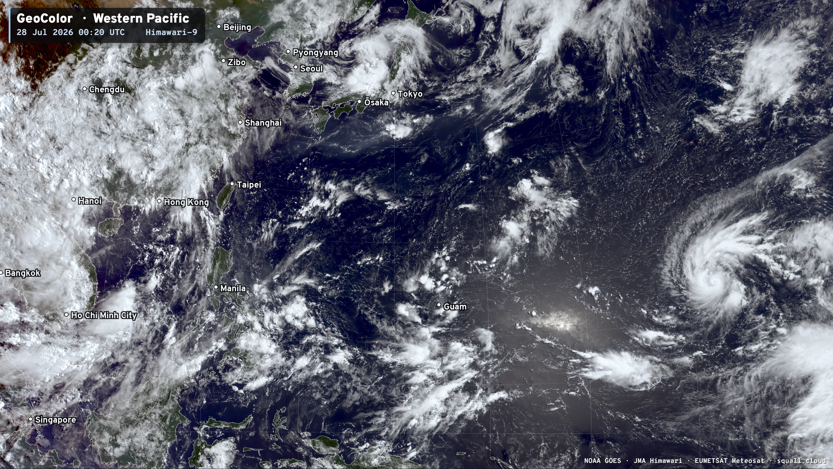
JTWC is up to 145-knots at 72-hours (very rapid intensification) and I suspect we’ll be there in 24-hours (this time tomorrow)
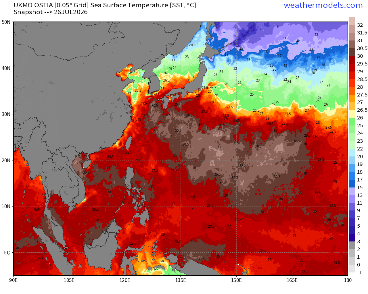
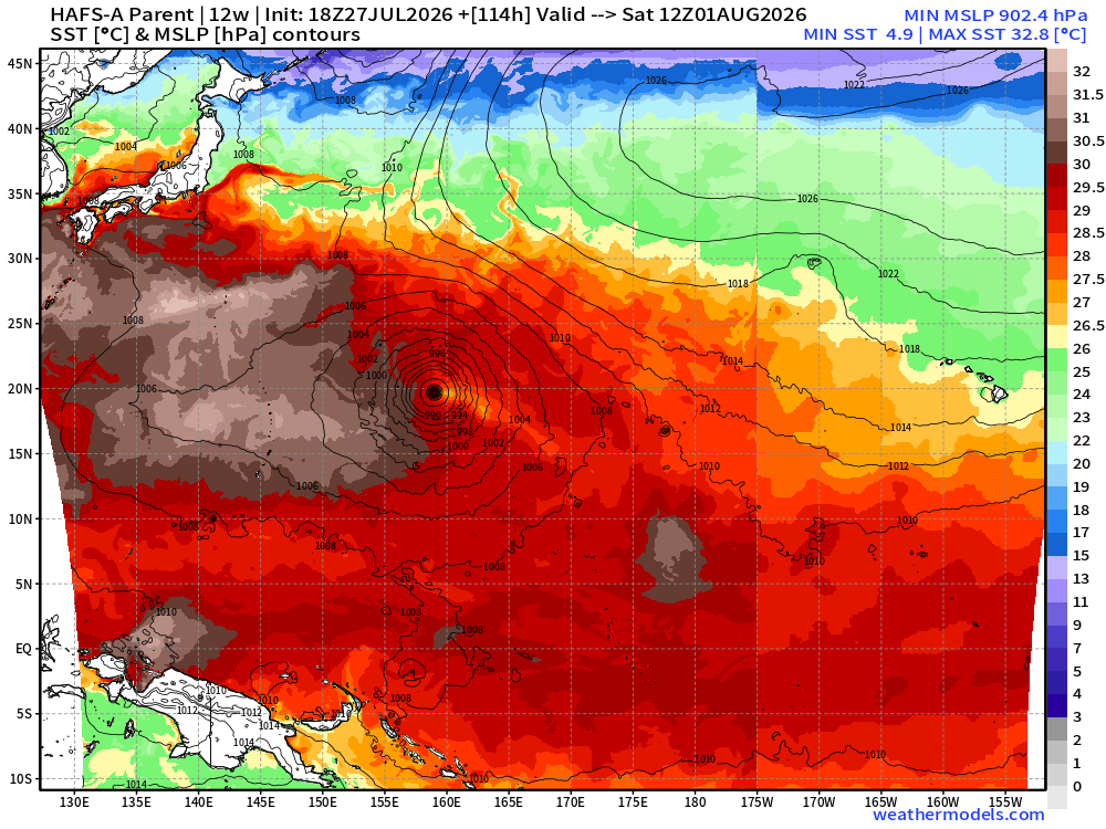
SSTs —> massive expanse of 30°C to 31°C water in the path of Dolphin —> Super Typhoon in 3-4 days
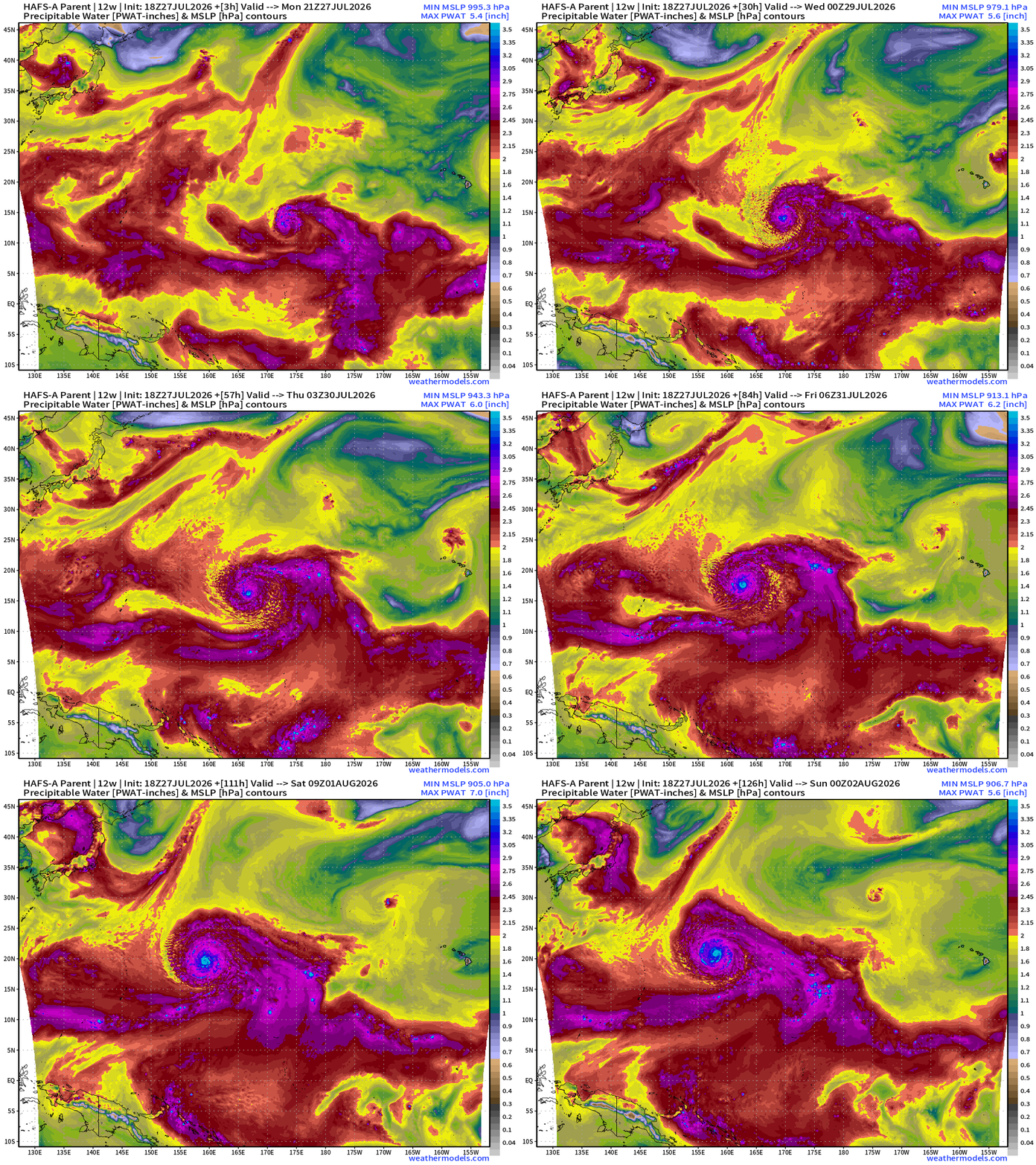
HAFS-A seems to have some numerical stability issues with the full-tilt buzzsaw structure of Dolphin in next 48-72 hours —> Category 5+
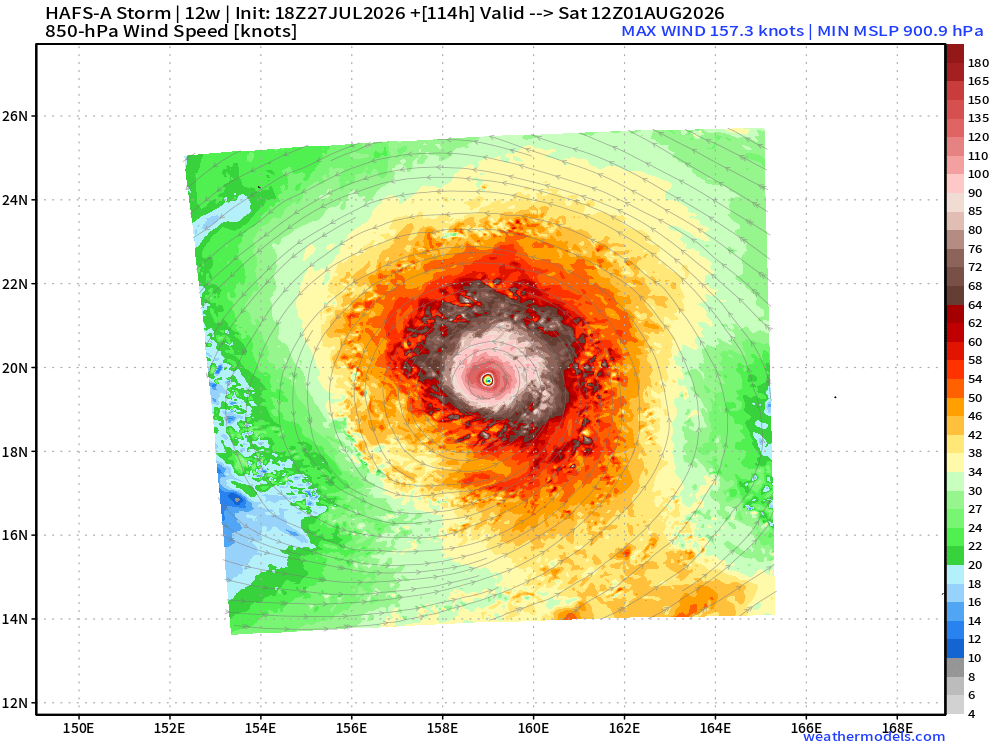
HAFS-A drops to 901 mb —> Category 5
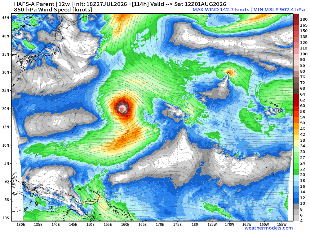
And, the system goes right over some of the warmest water on the planet on its way toward Japan > 30°C
Integrated Vapor Transport from ECMWF AIFS 18z also shows development of massive central Pacific Typhoon — will be long-lasting = lots of ACE and potential impacts to Japan.
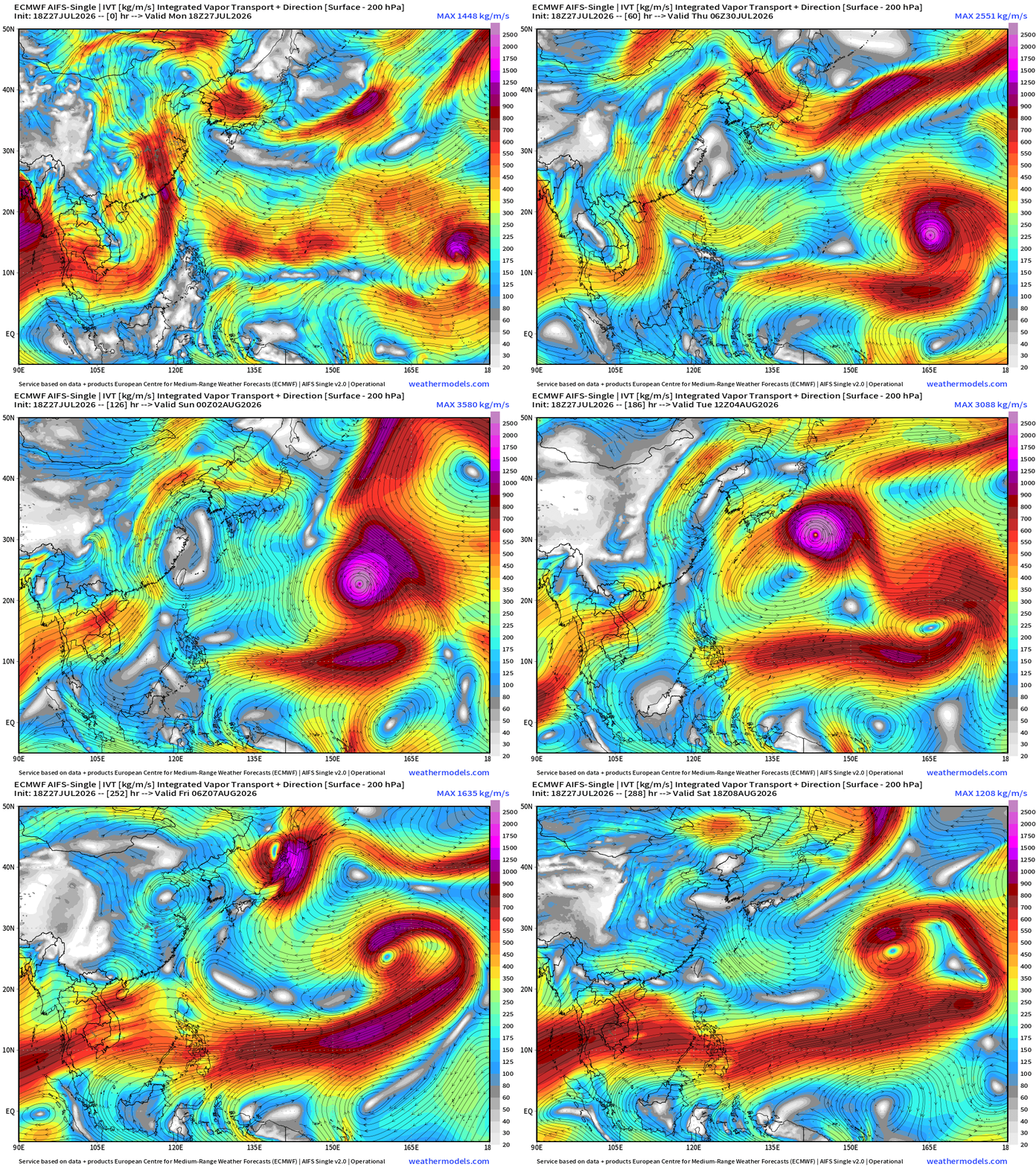
See Global Tropical Cyclones for more ACE information!
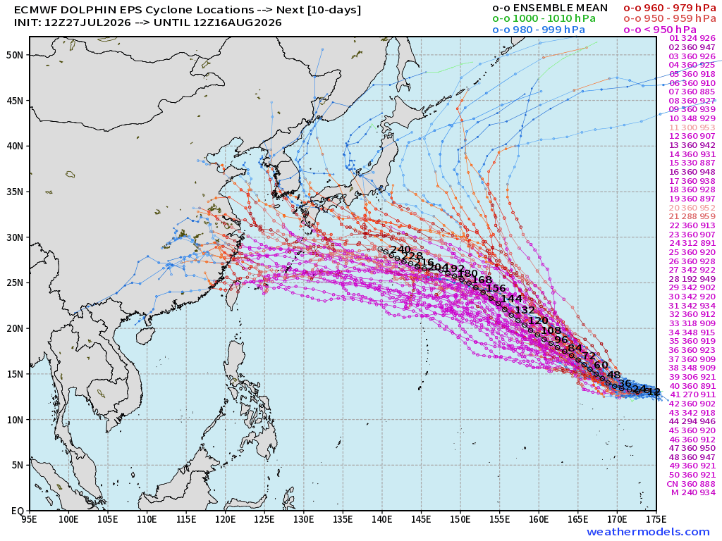
Next 10 to 15 days: Ensemble Tracks (50-members ECMWF EPS 12z) shows huge number of members with landfall risk
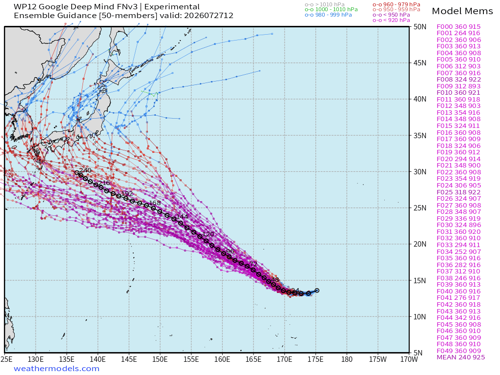
Similar story for Google Deep Mind —> but this is a 15-day forecast as Dolphin will take all that time to cross the western north Pacific!
Maps sourced from weathermodels.com designed and innovated by yours truly! Please subscribe there for real-time access to the newest maps, charts from all of the weather models including ECMWF and AIFS, and NOAA GFS/GEFS, HRRR/RRFS and Blend of Models (NBM). NOAA WPC and SPC for fronts/convective outlooks.
Our own content is now sourced from hottestsince.com and weather.city and celsius.earth, and squall.cloud and weather.football
My Atlantic Hurricane Season Forecast (2026)
From April 7, 2026: Atlantic Seasonal Hurricane Forecast: (11/5/2)
9-13 Named Storms (11 most likely)
4-7 Hurricanes (5 or 6 most likely)
1-3 Major Hurricanes (2 most likely)
Accumulated Cyclone Energy: 75-85 (well below normal)
NOAA 2026 Atlantic Hurricane Season Forecast
- Milepost
- 993 · laid 2026-07-28T01:18:12.703000Z
- Source
- https://weather.substack.com/p/july-27-2026-monday-tropical-update
- Digest
- ac629c2de55b18321af181f4ce1d3bf2bbf5f370f0c6d35647fc0999e7a4781d
- Machine
- JSON