July 20, 2026 Monday Summer Weather
Tropical Storm Bertha has formed in the Gulf and will impact the coastline through the weekend with rain and wind.
July 2026 was the warmest July in the 132-year national record (1895–2026), at 76.9°F against a 1991–2020 normal of 74.4°F (+2.5°F).
July 2026 was the 26th-driest July in the 132-year national record (1895–2026), at 2.5in against a 1991–2020 normal of 2.9in (-0.3in).
NOAA/NCEI Climate at a Glance, contiguous United States. This is the observed record for the month, not a score of anything said in this piece — the forecast ledger begins 2026-08-17 and cannot reach earlier posts.

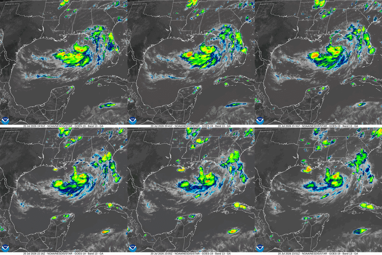
Tropical Storm Bertha (02L) has formed in the northern Gulf just south of Panama City, Florida. Maximum sustained winds are a minimal 40 mph, and pressure at 1004 mb.
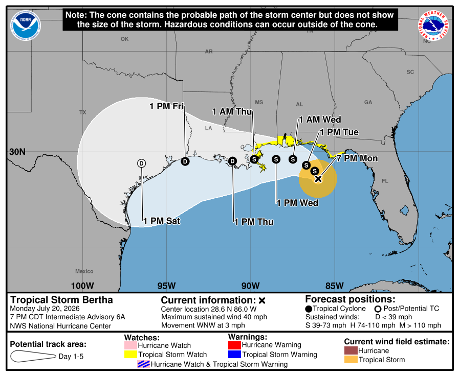
The track of Bertha will bend to the west into early Wednesday with landfall in Louisiana. The proximity to land + northerly wind shear will limit further intensification and keep impacts to a less degree. The system may keep tropical depression status even over land due to expectation of an “asymmetric” convection shape — blobs of storms will be well offshore.
Please give weather.city a try — more features added today: Severe Weather Alerts archive, and Heating/Cooling Degree Days + climatology — and Energy Weather will be coming up soon, too.
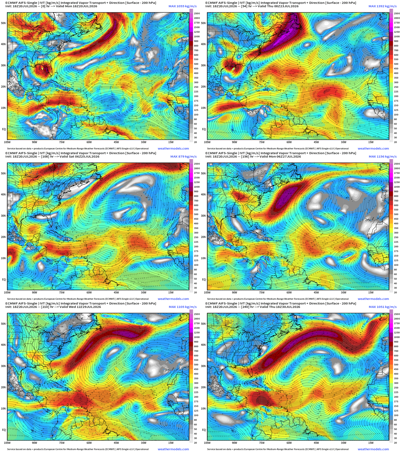
Flagship model: ECMWF AIFS 18z —> Integrated Vapor Transport next 10-days
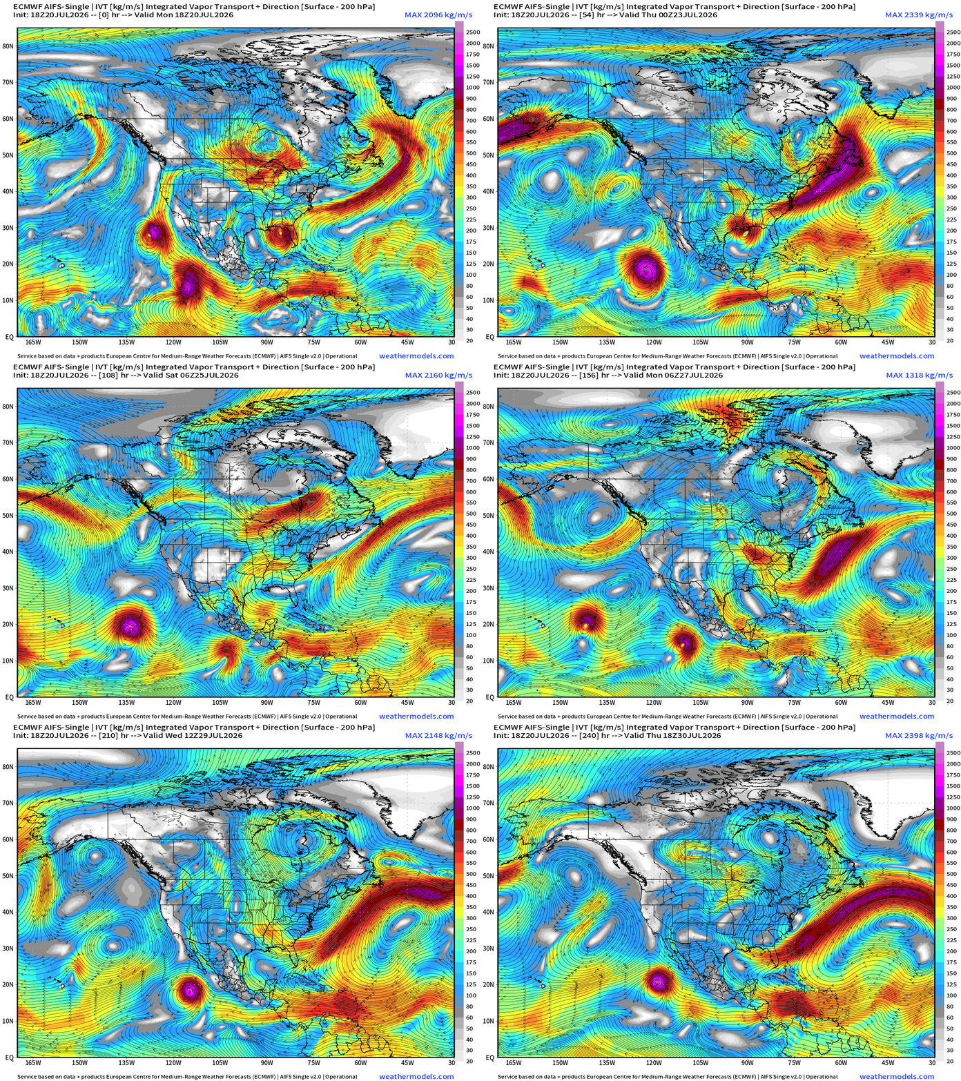
The heat dome across the Great Lakes shows up as a clockwise closed circulation within the moisture parameter (IVT)
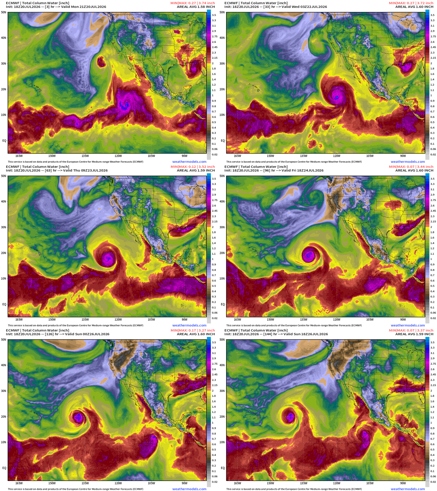
1 or 2 Eastern Pacific hurricanes likely in next 3-7 days
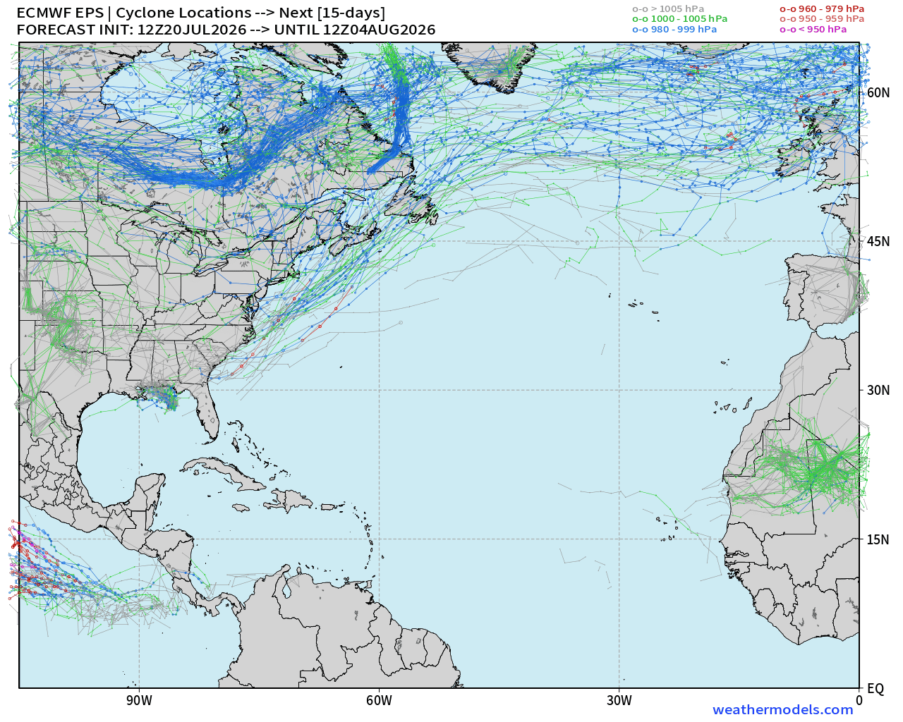
Otherwise, the Atlantic tropical basin is quiet — tropical waves are still being produced, but nothing catching fire.
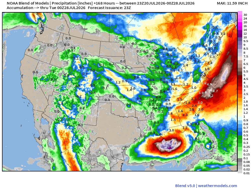
Blend of Models —> Precipitation Next 7-days
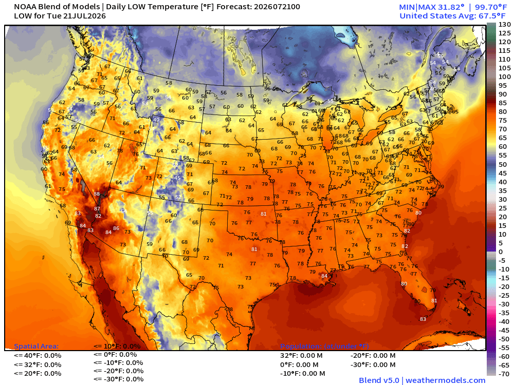
Tuesday Low Temperatures
High Temperatures on Tuesday
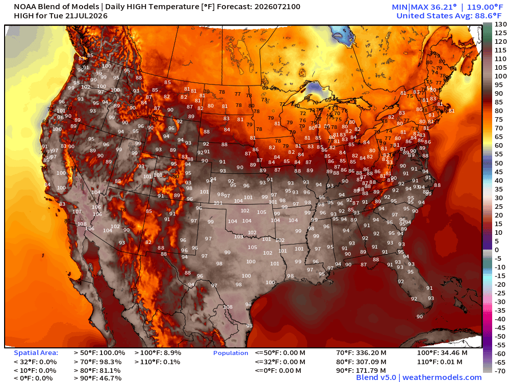
Lower 48 average high is 88.6°F and 172 million at least 90°F and 35 million at least 100°F
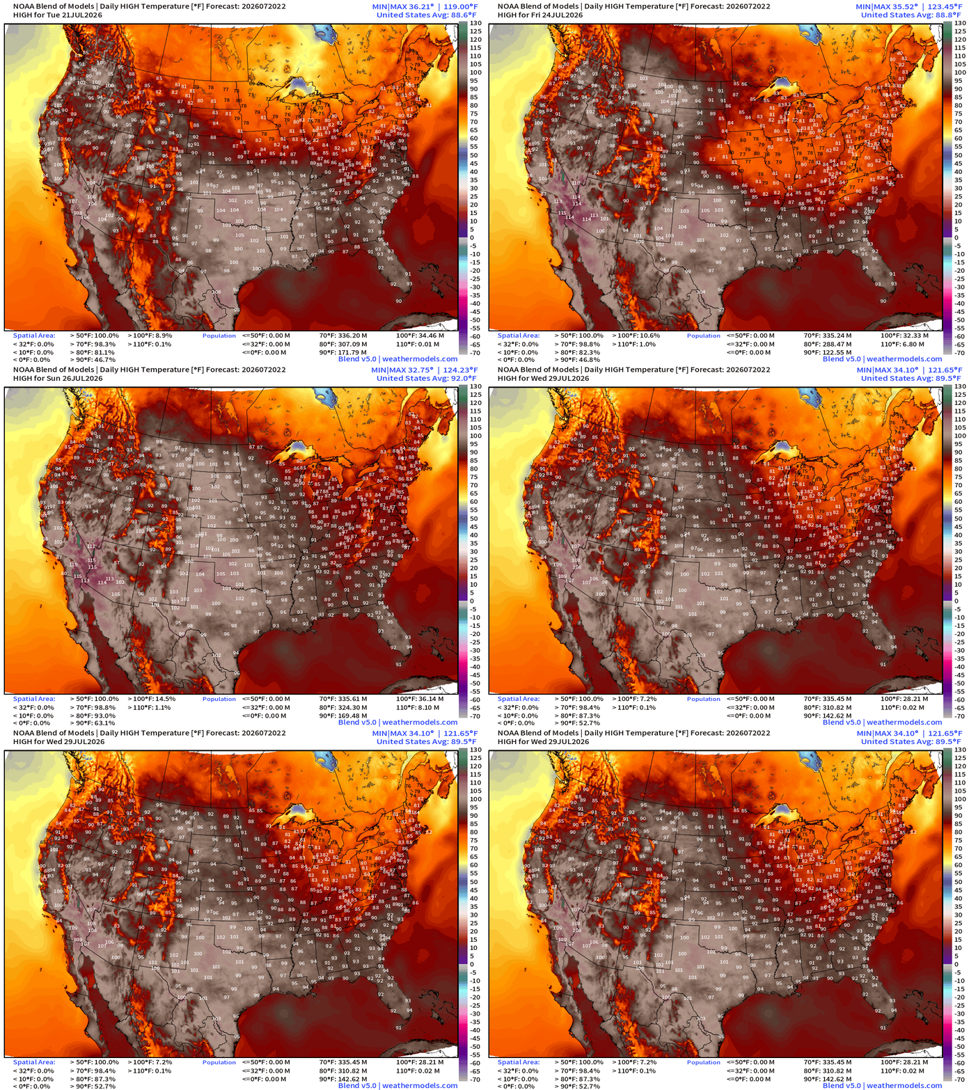
High Temperatures Next 8-days — until Wed, July 29, 2026
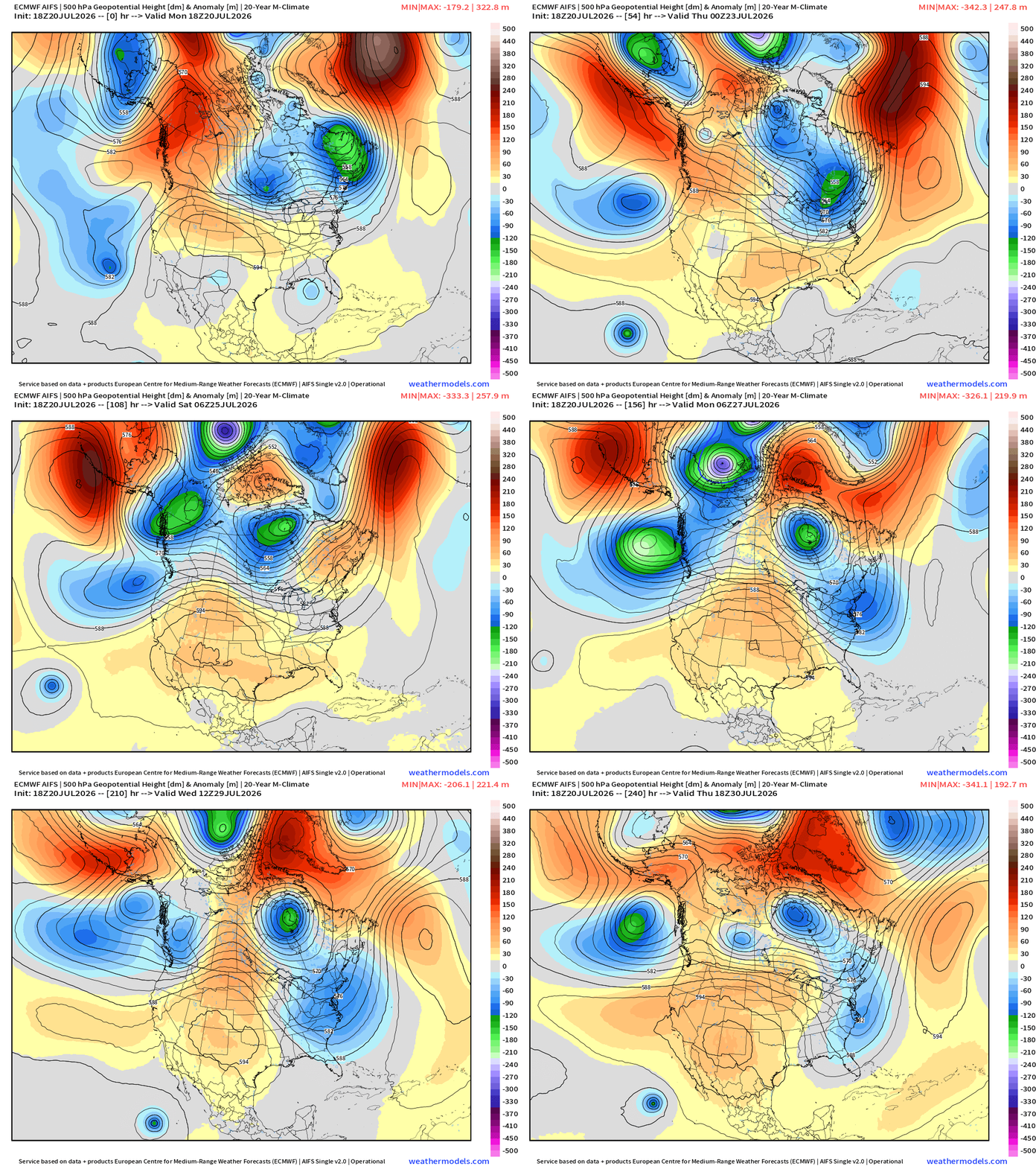
Upper-Level Height Anomaly | AIFS-Single Next 10-days
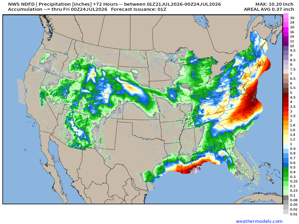
NWS Precipitation Next 72-hours —> Friday Evening
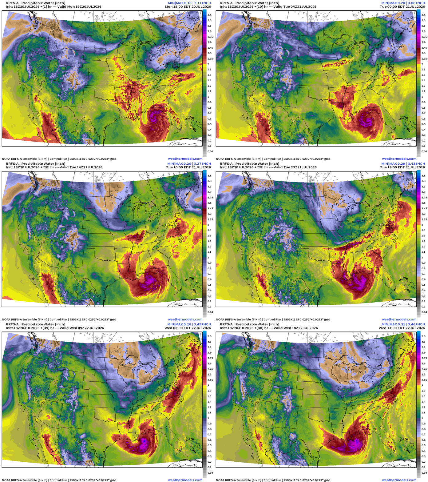
My favorite parameter — next 48-hours of RRFS Precipitable Water
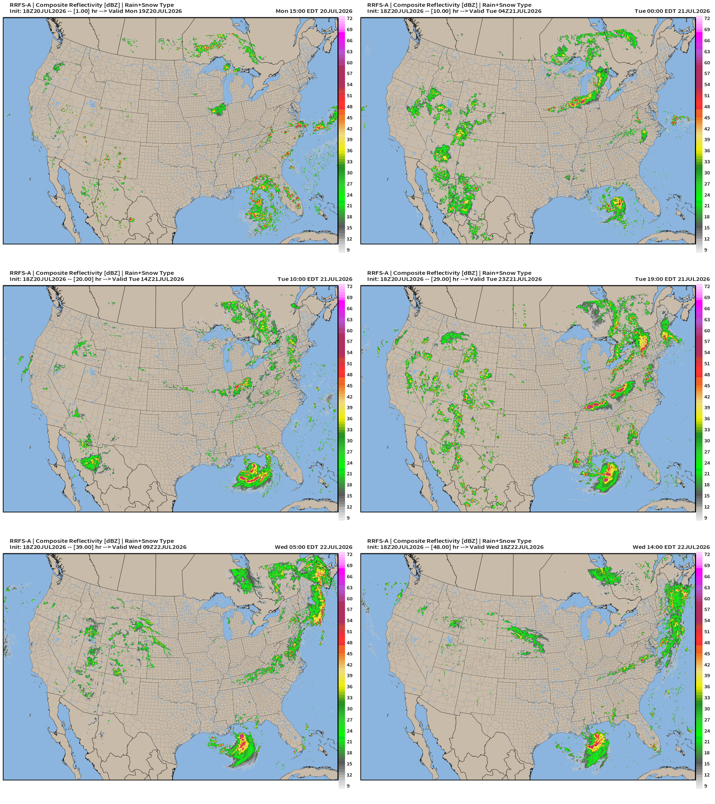
RRFS Next 48-hours simulated Radar through Wednesday 2 PM ET
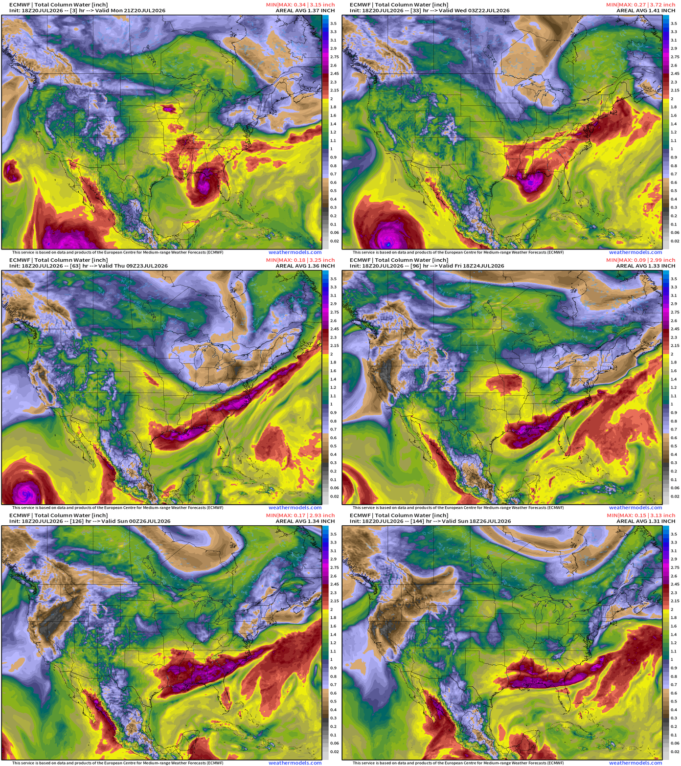
ECMWF HRES 18z | Precipitable Water | My Favorite Parameter
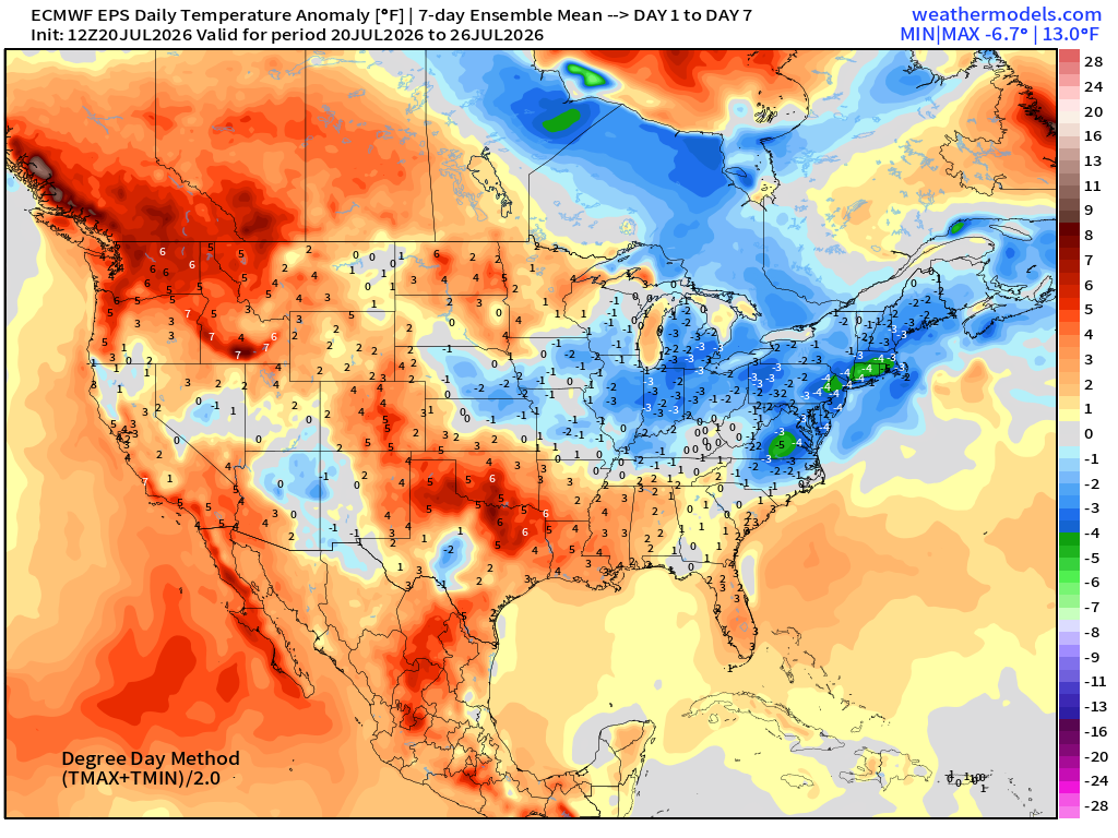
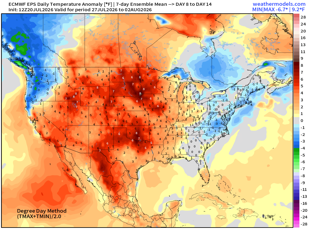
ECMWF Flagship Ensemble Mean Temperature Anomaly next 14-days
Week 1 —> July 20 to July 26
Week 2 —> July 27 to August 2
Atlantic Tropics —> Tropical Storm Bertha (02L) only show in town
Good consensus from ATCF spaghetti + Deep Mind ensembles that landfall will keep Bertha from intensifying significantly.
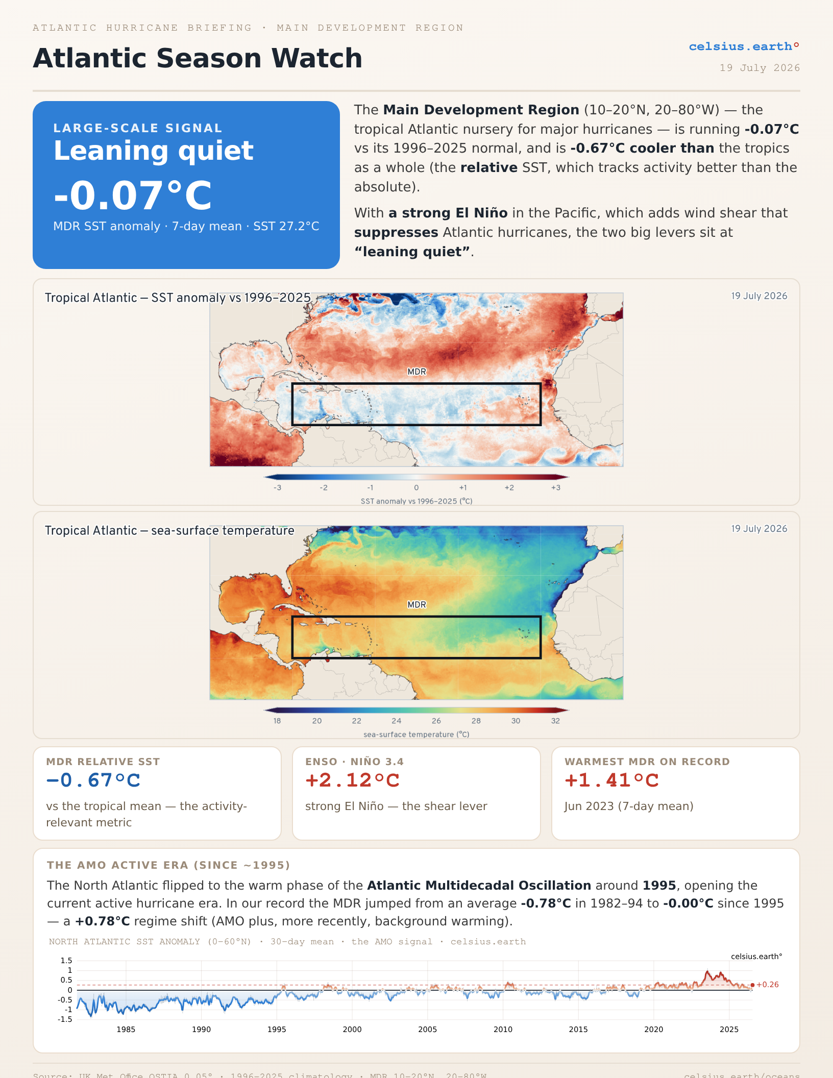
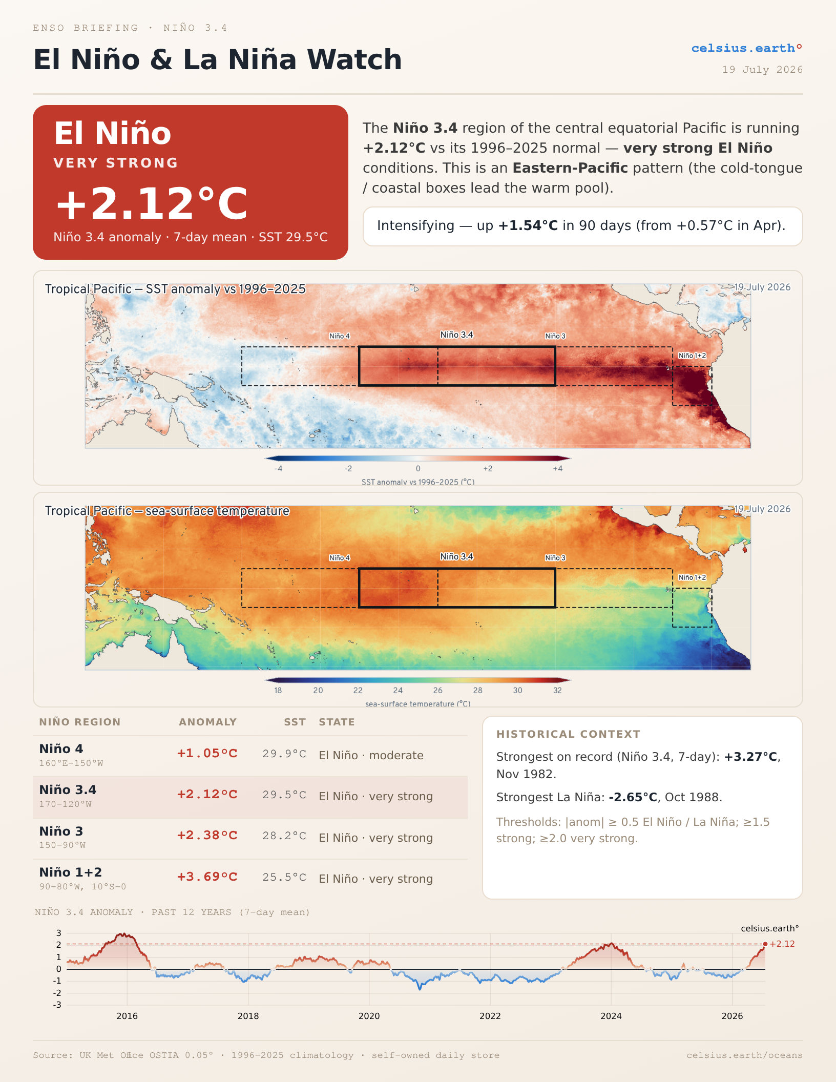
NEW: Atlantic MDR ocean report —summary/briefing from celsius.earth oceans
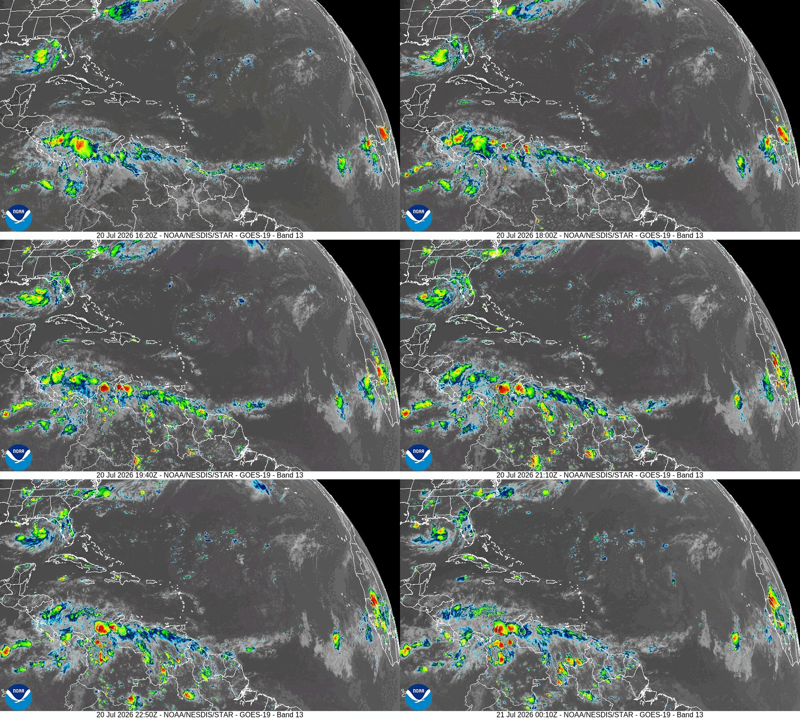
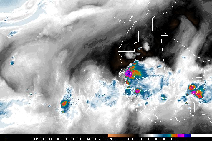
There are convectively active tropical waves far out in the Eastern MDR of Atlantic over warm enough water at lower-latitude to actually produce a depression, but the organization isn’t there, and the overall environment is hostile with Saharan dry air to the north.
My favorite parameter — Precipitable Water next 6-days
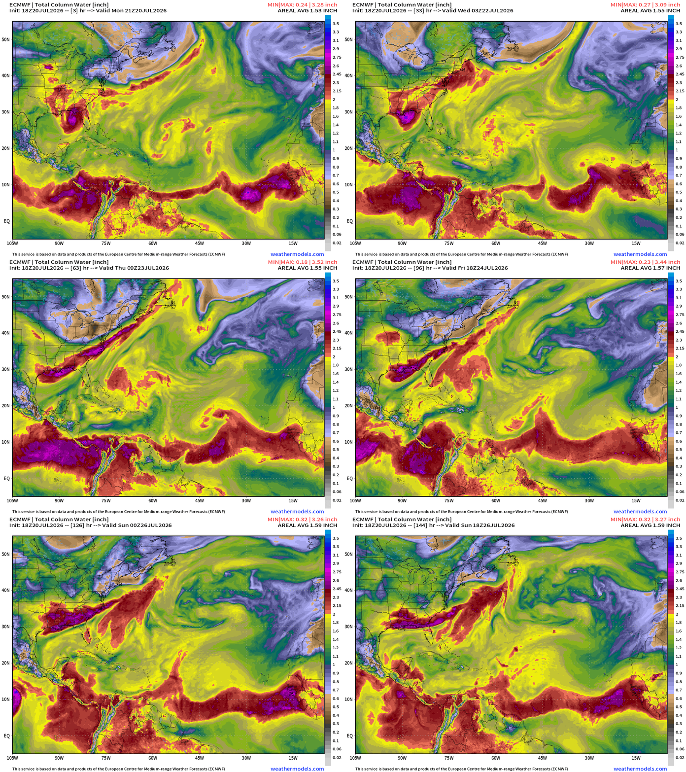
You can see the tropical waves within the ITCZ — monsoon trough — plenty of deep tropical moisture, and even some rotation/circulation apparent. That tropical wave out in the far Eastern Atlantic looks better than Bertha.
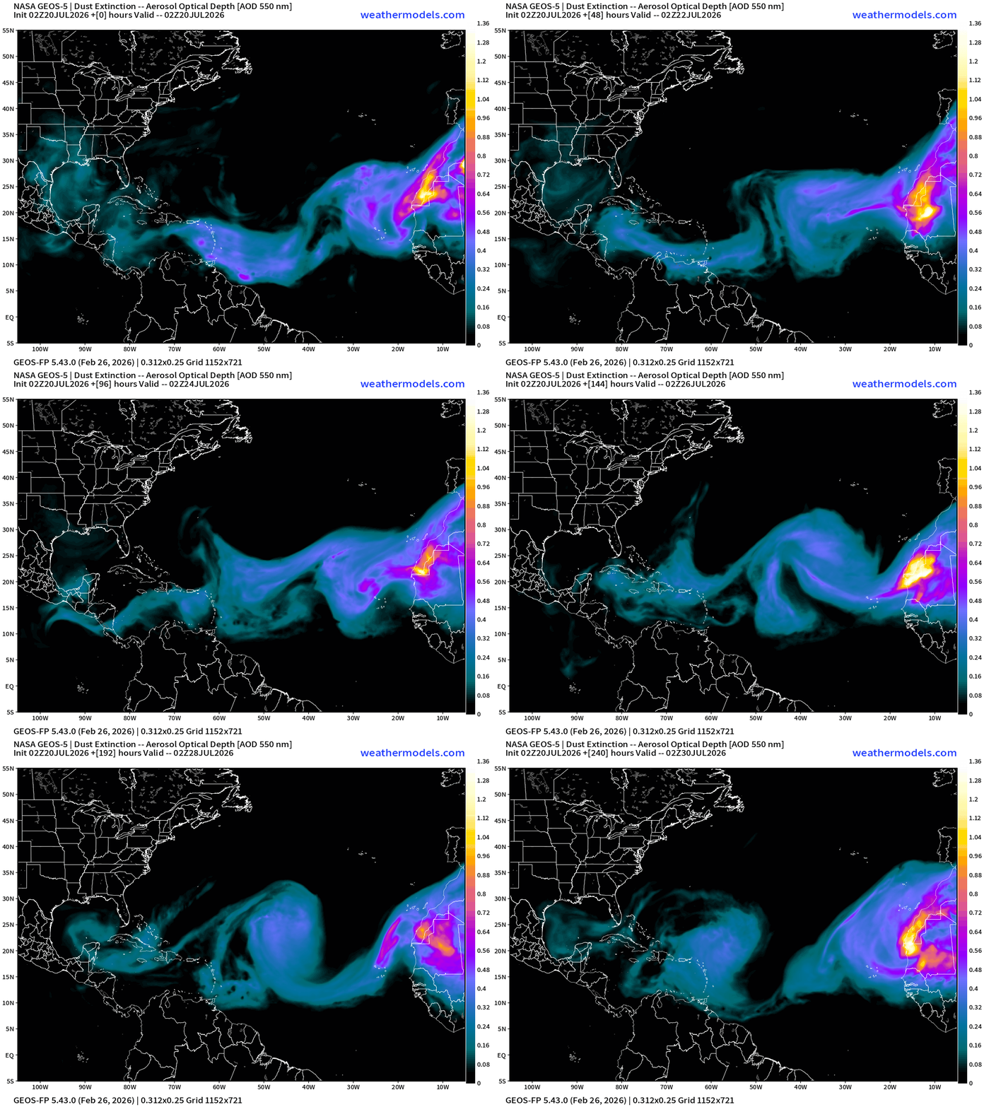
NASA Dust — Saharan Air Layers continue to cruise across the Atlantic doing damage to tropical waves
Integrated Vapor Transport | Next 10-days AIFS-18z shows tropical waves … but nothing else catching fire in the next 10-days
Ensembles Next 15 days —> Ghost Town until Aug 4th (minus Bertha)
Eastern Pacific Tropics
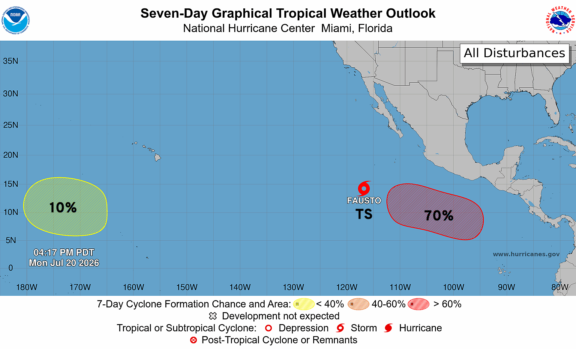
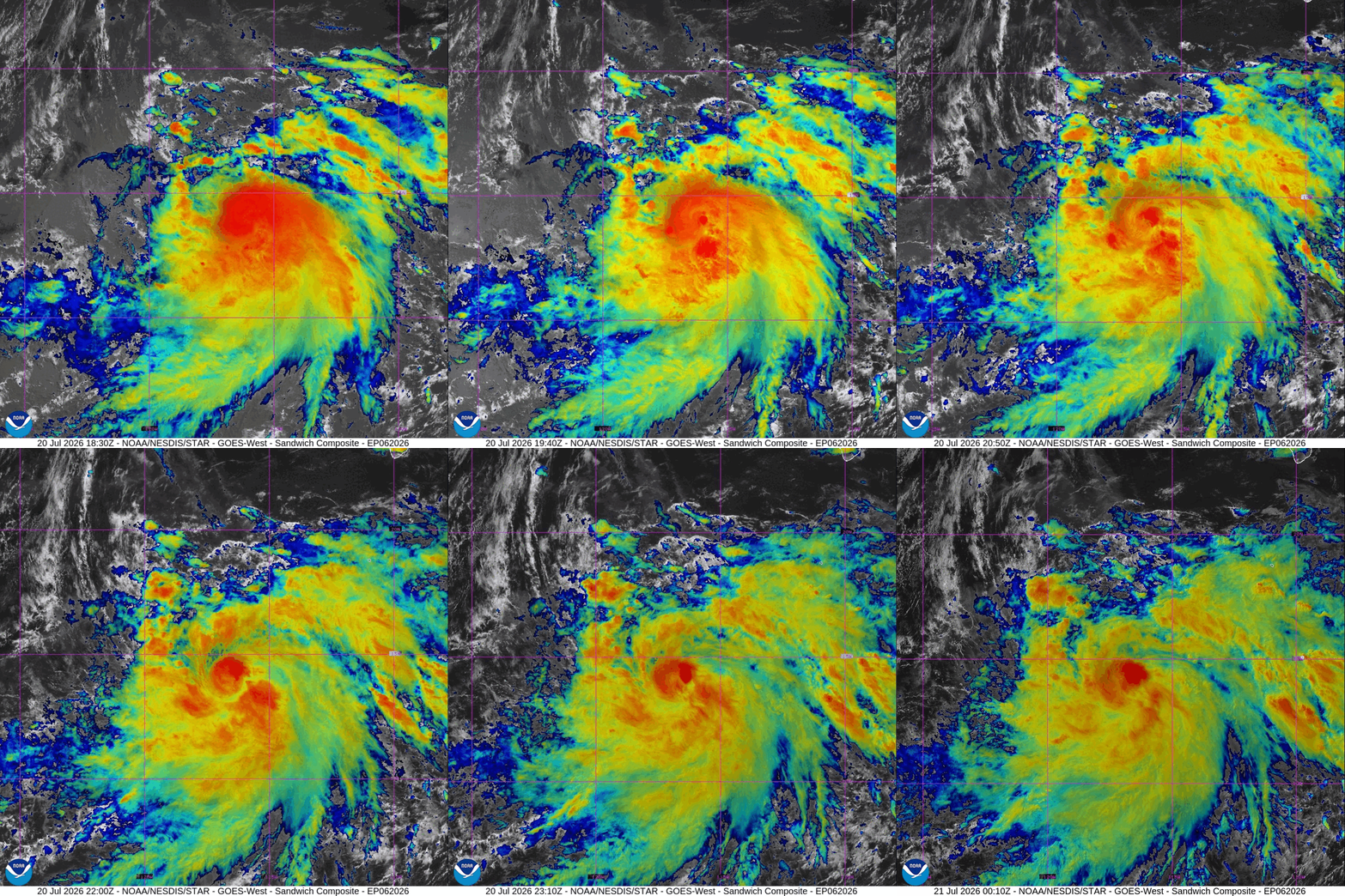
Tropical Storm Fausto soon to become a hurricane — perhaps a major hurricane. Another system follows behind Fausto in the next few days.
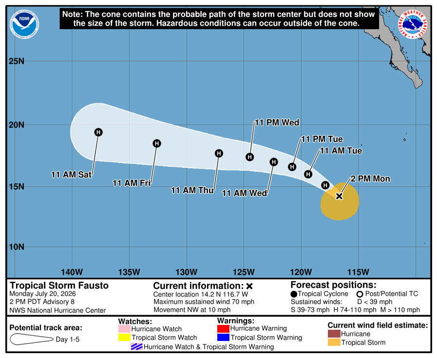
Nothing particularly special about Fausto — a typical hurricane (soon) in the Eastern Pacific “hurricane factory” during El Niño.
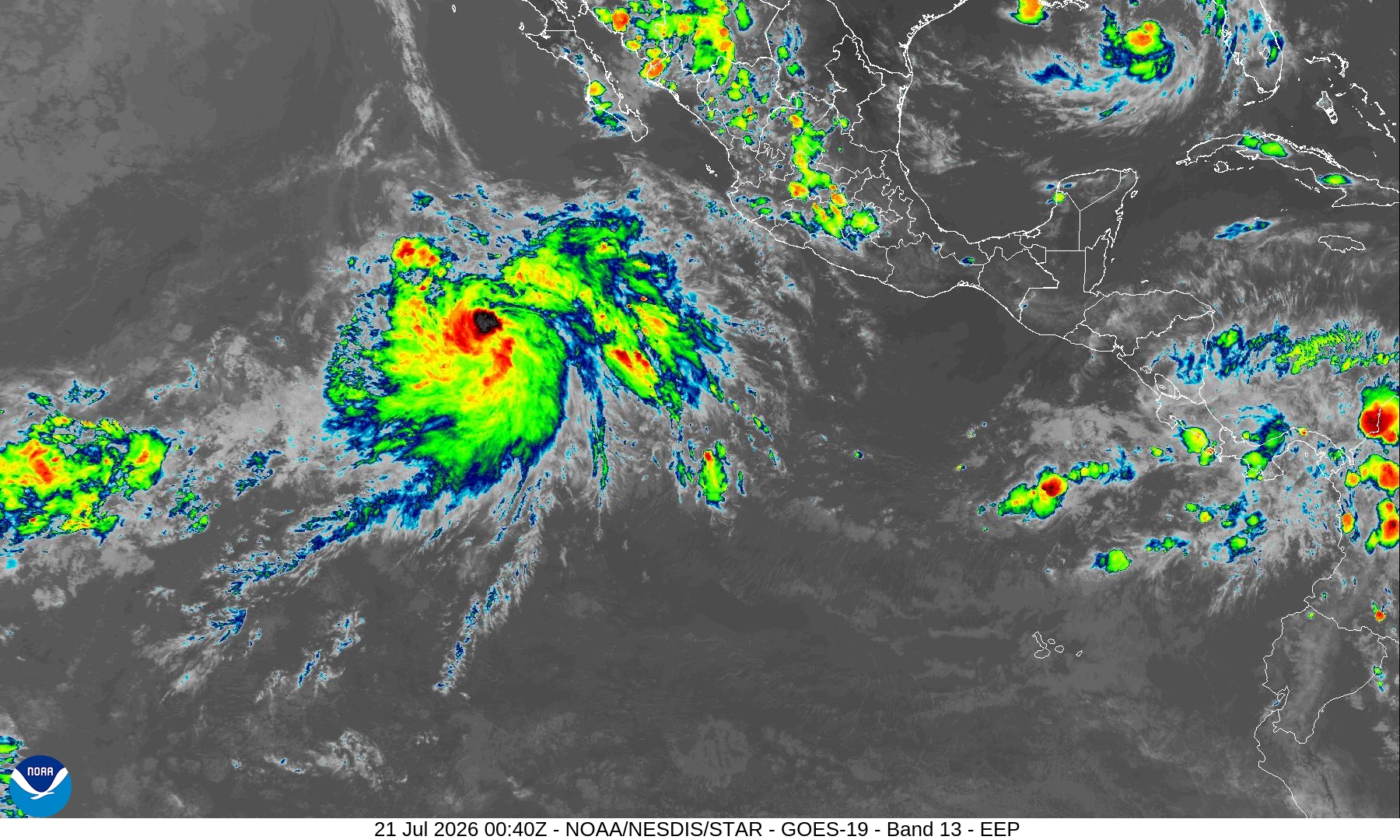
An inner-core has formed, but still working out some kinks before forming an eye
Fausto will head west toward Hawaii but probably miss the islands to the north over cooler water. Genevieve (07E) will form by this weekend.
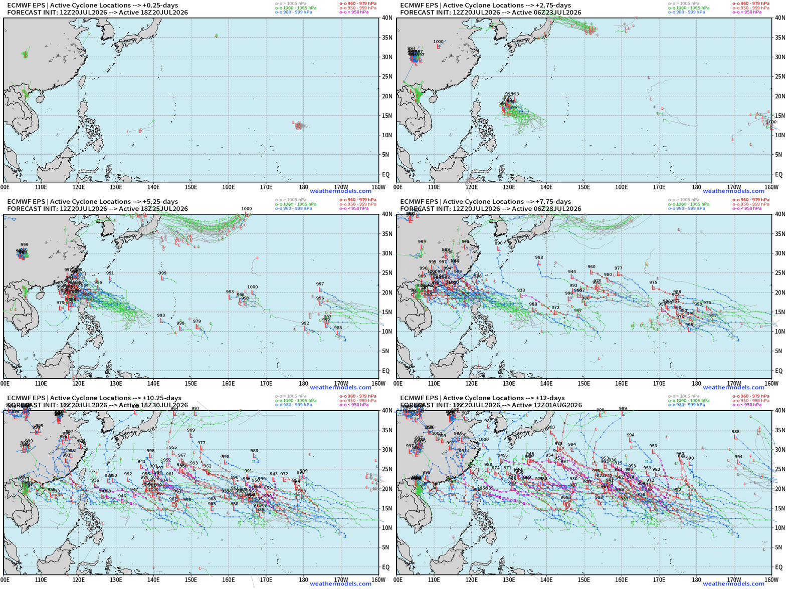
Western Pacific has gone quiet but perhaps depression on the other side of the Equator with Invest 98P
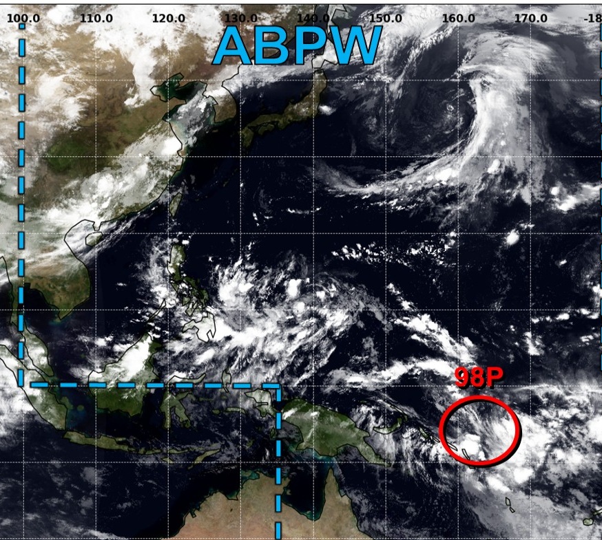
Still might be a hangover in the basin from Super Typhoon Bavi but we should see a return to normal operating business next week.
Maps sourced from weathermodels.com designed and innovated by yours truly! Please subscribe there for real-time access to the newest maps, charts from all of the weather models including ECMWF and AIFS, and NOAA GFS/GEFS, HRRR/RRFS and Blend of Models (NBM). NOAA WPC and SPC for fronts/convective outlooks.
Our own content is now sourced from hottestsince.com and weather.city
My Atlantic Hurricane Season Forecast (2026)
From April 7, 2026: Atlantic Seasonal Hurricane Forecast: (11/5/2)
9-13 Named Storms (11 most likely)
4-7 Hurricanes (5 or 6 most likely)
1-3 Major Hurricanes (2 most likely)
Accumulated Cyclone Energy: 75-85 (well below normal)
NOAA 2026 Atlantic Hurricane Season Forecast
- Milepost
- 986 · laid 2026-07-21T01:45:52.541000Z
- Source
- https://weather.substack.com/p/july-20-2026-monday-summer-weather
- Digest
- 2f80c73262f2141b2891cd4ff71bdd063f90c2ebc4ab0b3841ab8f6665e8e31b
- Machine
- JSON