July 19, 2026 Sunday Tropical Depression 02L Update
Tropical Depression 02L formed in the northern Gulf with intensification likely in the coming days with outside shot of a hurricane if Bertha takes a slightly south of due westerly course
July 2026 was the warmest July in the 132-year national record (1895–2026), at 76.9°F against a 1991–2020 normal of 74.4°F (+2.5°F).
July 2026 was the 26th-driest July in the 132-year national record (1895–2026), at 2.5in against a 1991–2020 normal of 2.9in (-0.3in).
NOAA/NCEI Climate at a Glance, contiguous United States. This is the observed record for the month, not a score of anything said in this piece — the forecast ledger begins 2026-08-17 and cannot reach earlier posts.

Tropical Depression 02L is expected to become Tropical Storm Bertha by Monday morning.
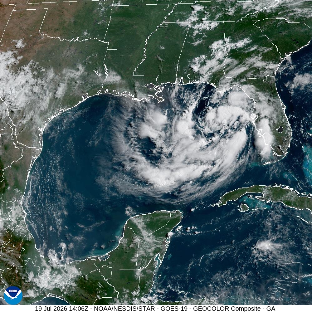
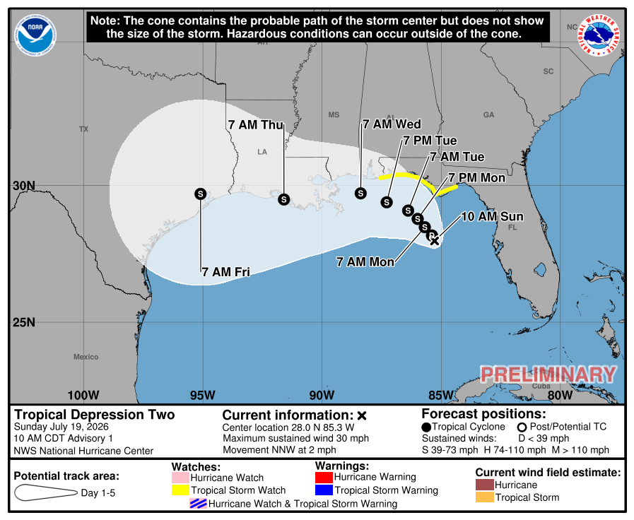
NHC 11 AM discussion: “The Air Force Hurricane Hunters are scheduled to investigate this system later today, and their data will be helpful to better assess the system’s initial structure.”
“The NHC track forecast lies a touch to the south of middle of the guidance envelope, in best agreement with the usually best-performing aids HCCA, TVCN, and GDMI.”
A tropical storm watch has been issued for the Florida panhandle
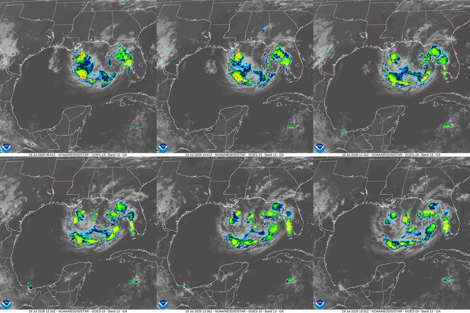
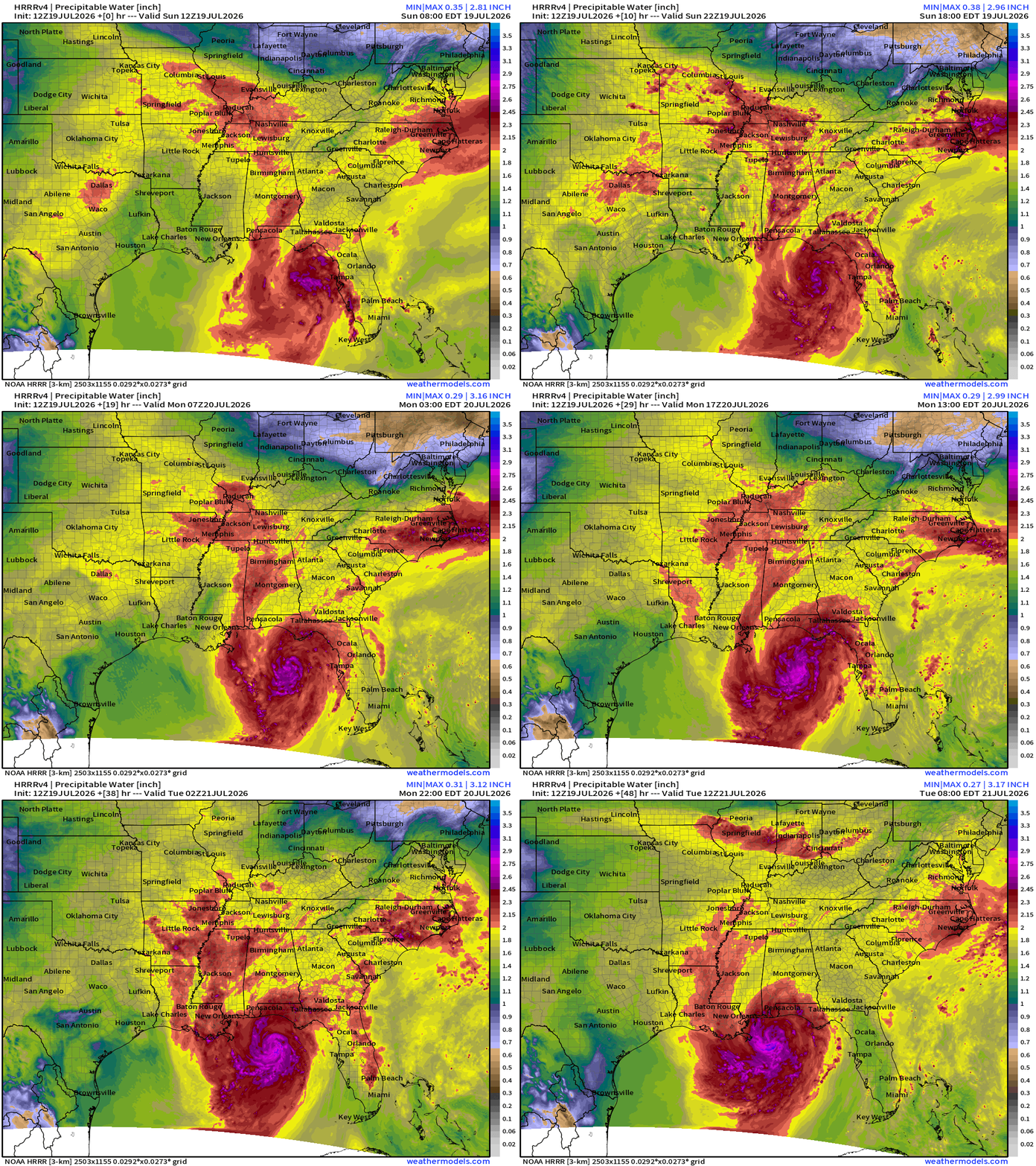
You can easily see the mid-level circulation, rather broad, but little organized showers near the center, and pressures remain high around 1011 mb. However, we can expect further consolidation of the convection near the center, and a more typical “tropical storm” look on Monday.
Weather Trader is entirely reader-supported publication (no ads). To receive all new posts and support our work, consider becoming a free or paid subscriber. I’m building many companion sites in addition to weather.city
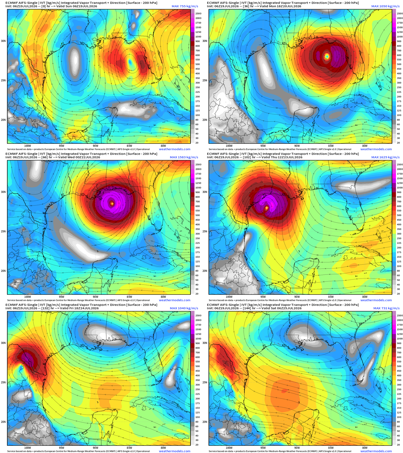
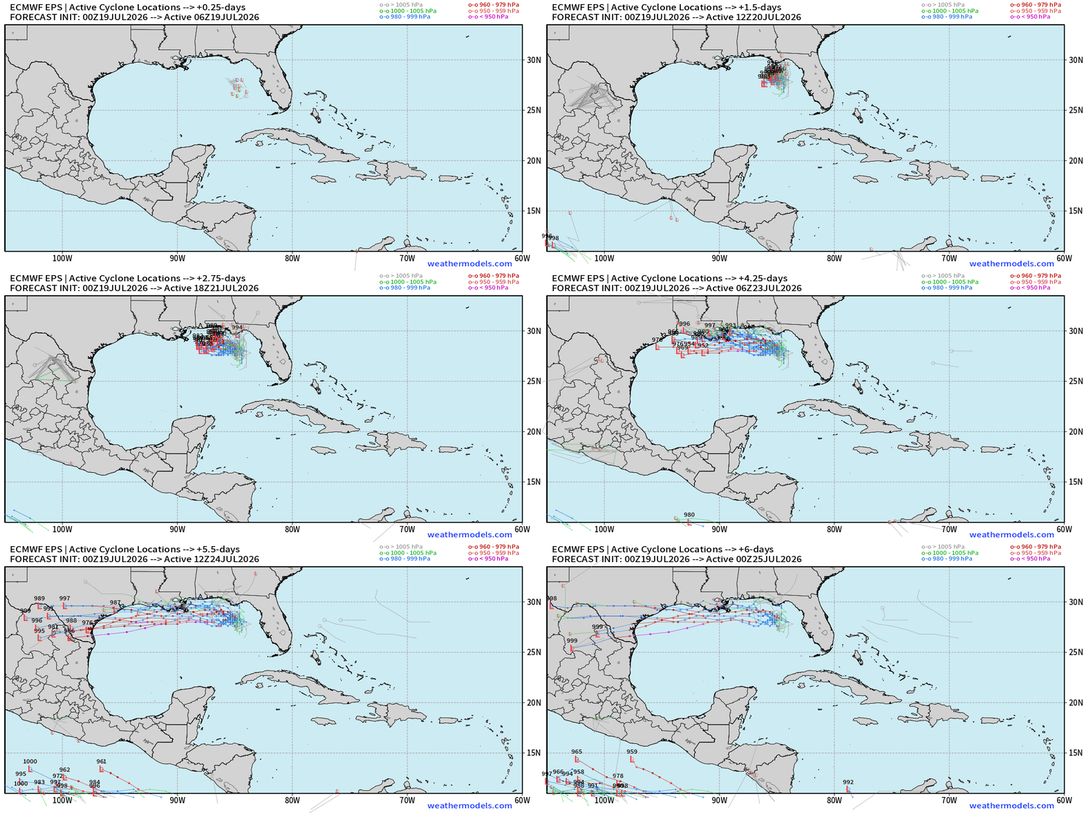
The ECMWF AIFS 06z — highly skillful model — shows a more south of due westward course, and that’s the significant concern if the system does not reach landfall along the Gulf coast. However, that is not the official NHC forecast but within the cone of uncertainty!
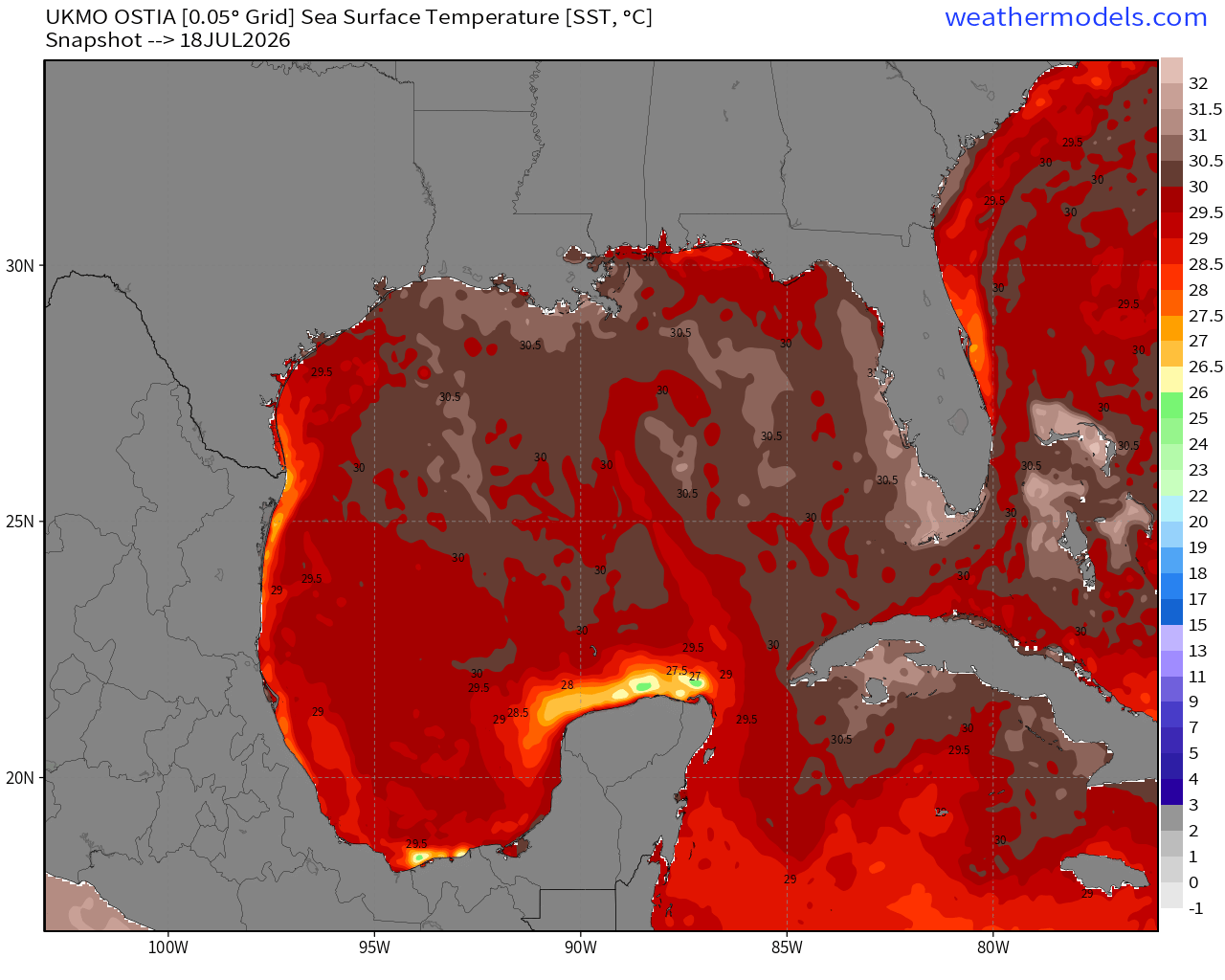
Gulf of Mexico SSTs are very warm > 29.5 to 30°C — typical for mid-July
Any hurricane intensity can be supported
Higher End Solutions on a Southern — Westerly Track! Many major hurricane tracks, but currently that is not the favored solution by NHC. If the system remains disorganized and drifts inland, then limited further development is likely.
ECMWF EPS 00z ensembles next 6-days
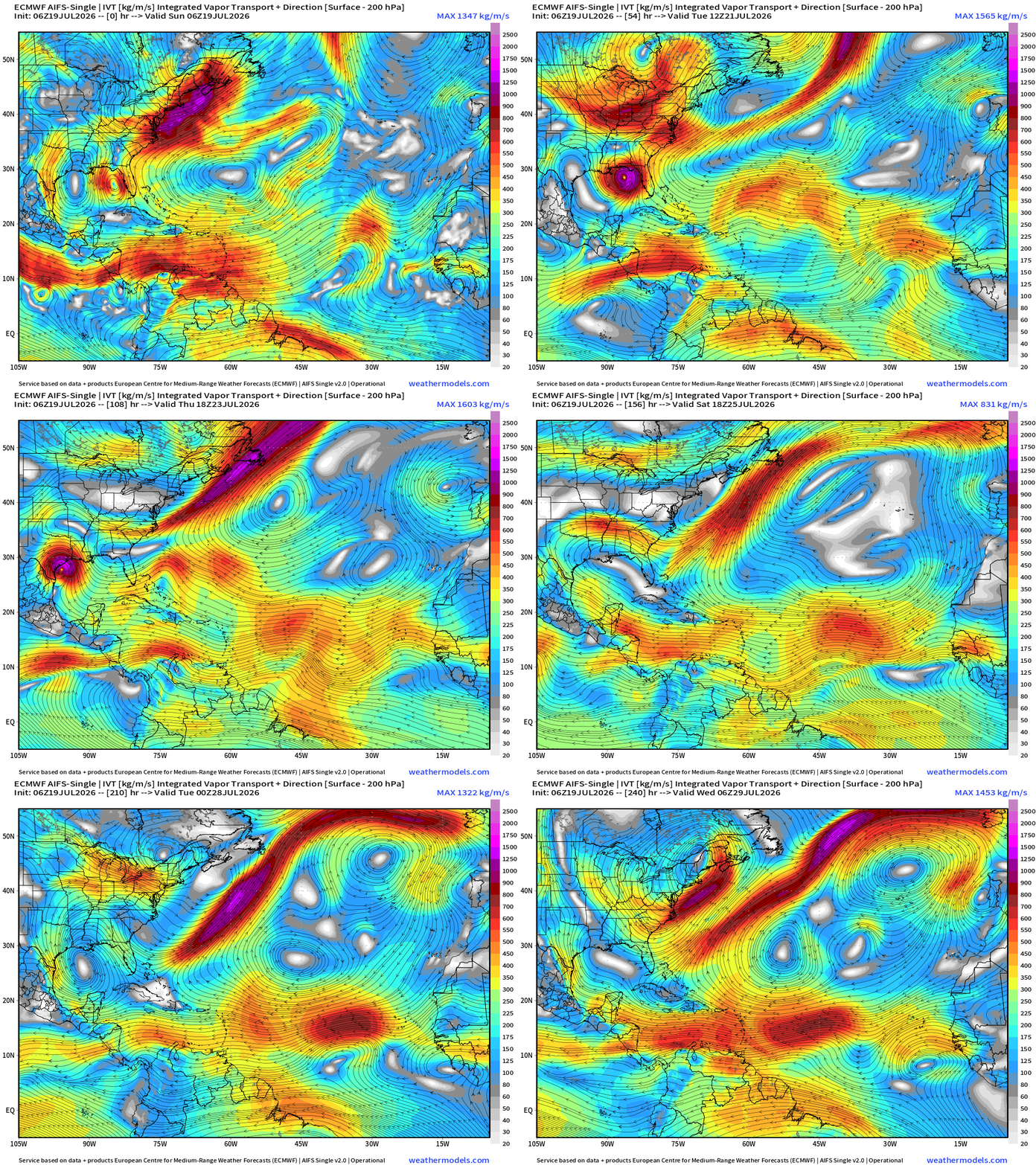
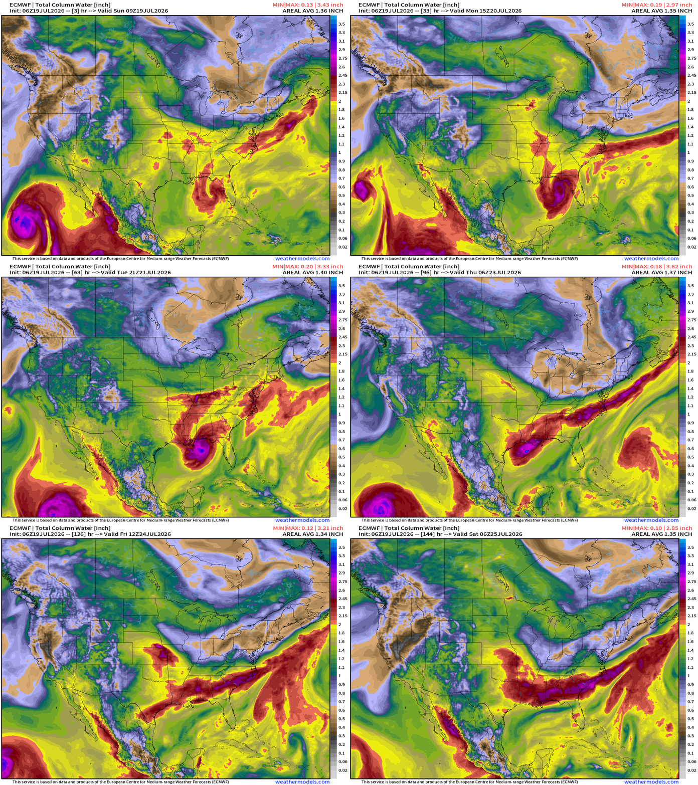
Flagship model: ECMWF AIFS 06z —> Integrated Vapor Transport next 10-days
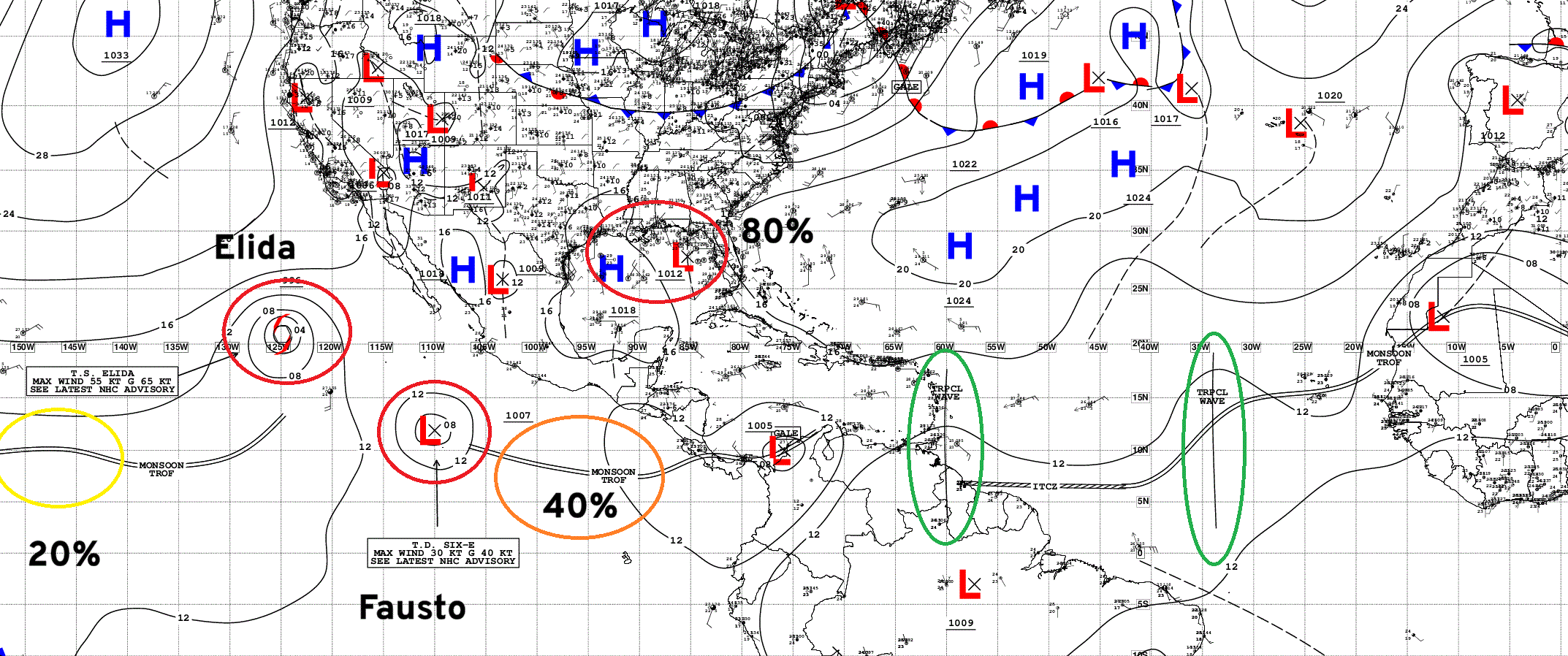
Tropical waves continue to emerge off Africa and cruise westward under a strong subtropical ridge — to arrive in the Eastern Pacific where conditions are much more favorable for development with Elida, Fausto, and Genevieve in a span of 10-days.
Tropical Depression 02L — intensifies into Tropical Storm Bertha and takes a more westward course toward Texas.
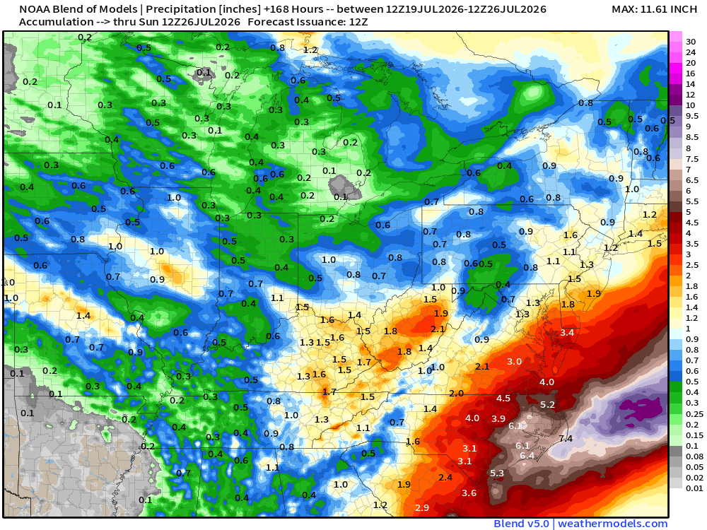
Blend of Models —> Precipitation Next 7-days
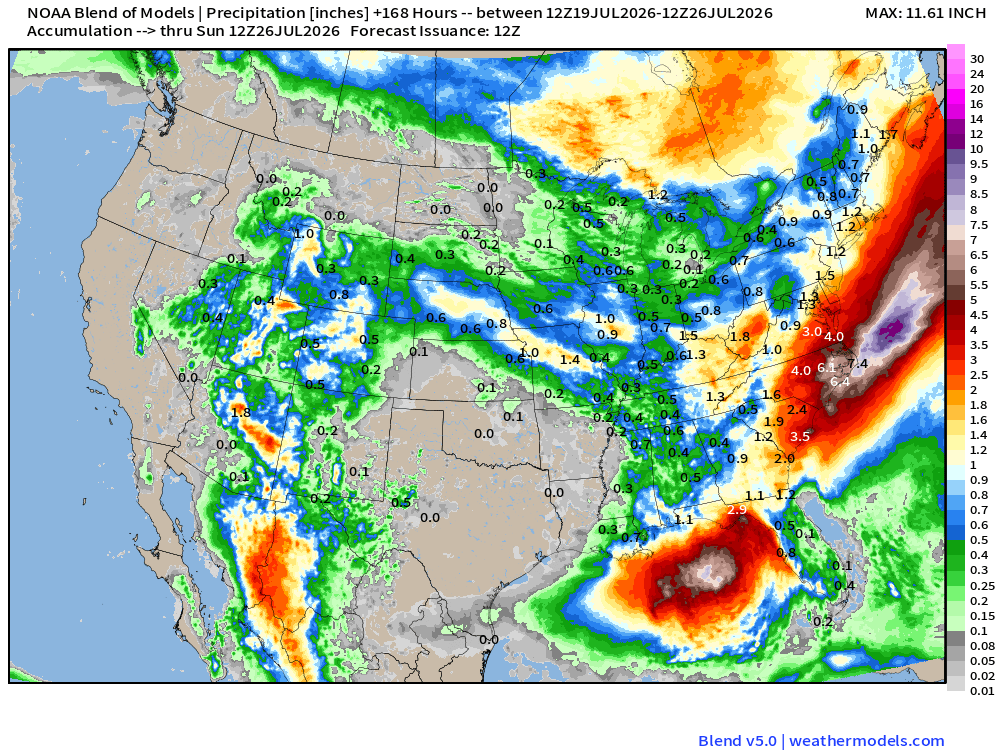
Southwest Monsoon: More rainfall across Arizona and into the Great Basin — very welcome, but we want to avoid lightning as much as possible even w/rain
TD 02L (to become Bertha) in northern Gulf may be a prolific rainmaker for the Florida panhandle and western Gulf coastline even if a tropical system does not form.
A trough in the Northeast —> unsettled weather. Hopefully end the smoke problems — although the Canadian forest fires will likely continue for weeks. Boatloads of rainfall likely with cooler conditions.
Upper-Level Height Anomaly | AIFS-Single Next 10-days
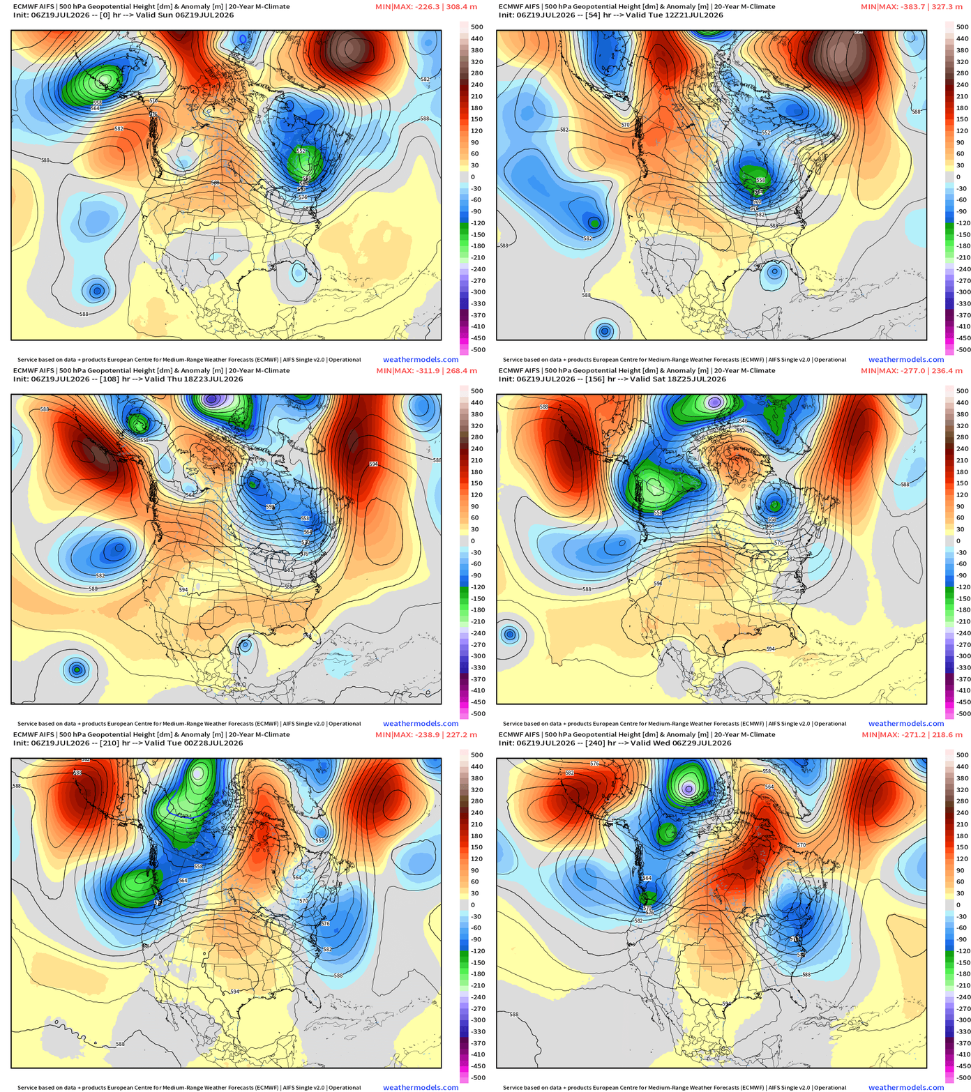
Impressive period of troughing across the Northeast —> cooler than normal, unsettled for second half of July.
ECMWF Flagship Ensemble Mean Temperature Anomaly next 2-Weeks
Week 1 —> July 19 to July 25
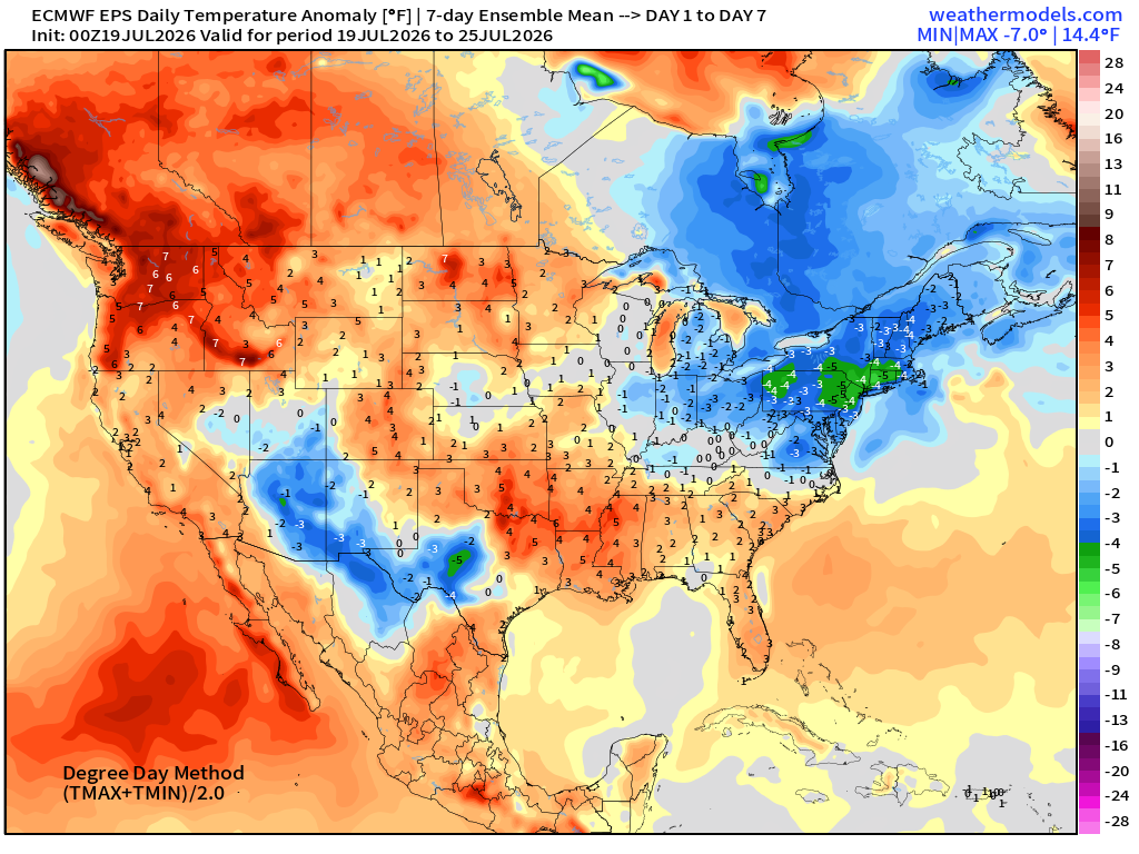
The Northeast cool spot shows up well (blue+ green) + Arizona + Texas clouds and rain. Otherwise summer time heat reigns.
Week 2 —> July 26 to August 1
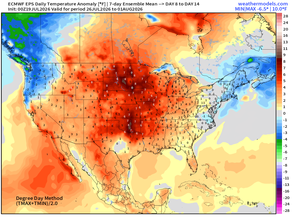
Week 2 also slightly below normal in the Northeast. But much of the Lower 48 is very warm
14-day Global Ensemble Mean Temperature Anomaly Pattern
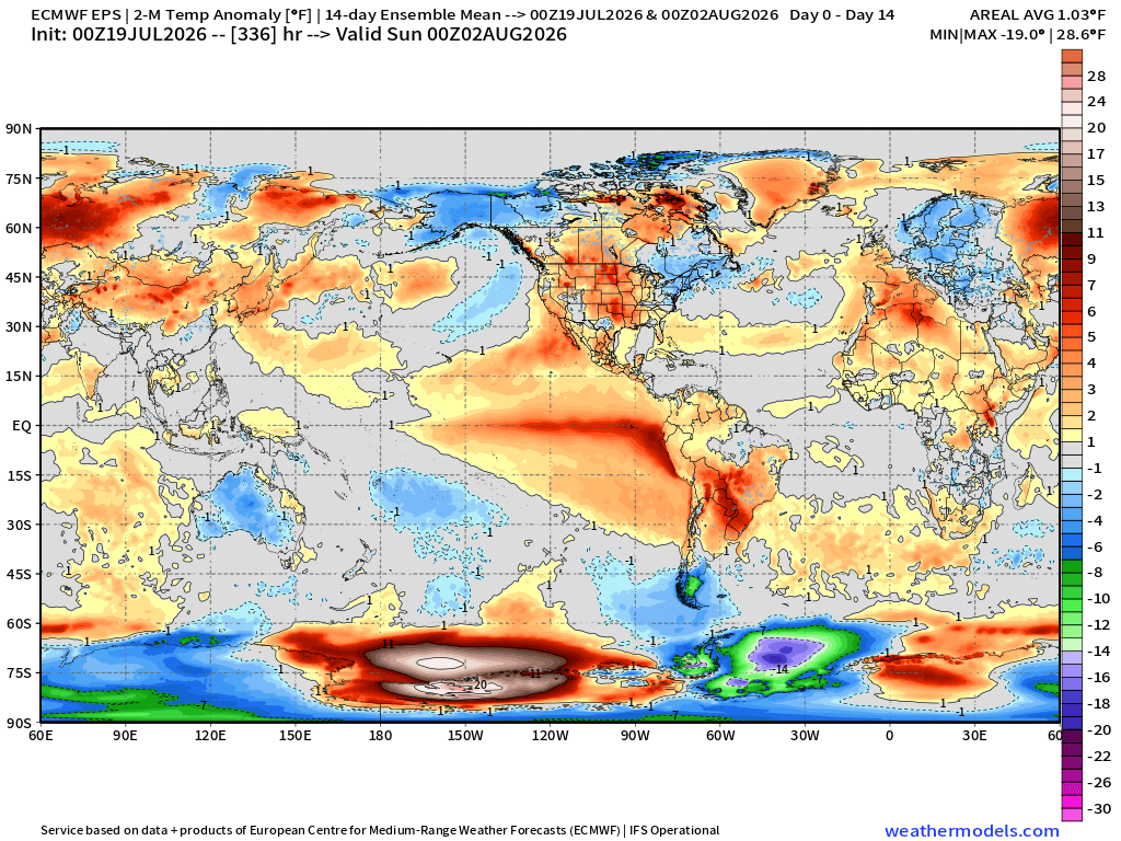
Impressive El Niño pattern … and generally warm continents in the Northern Hemisphere. Antarctica is much colder than normal.
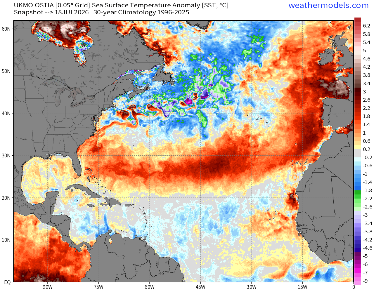
Global SST Anomaly —> full tilt El Niño
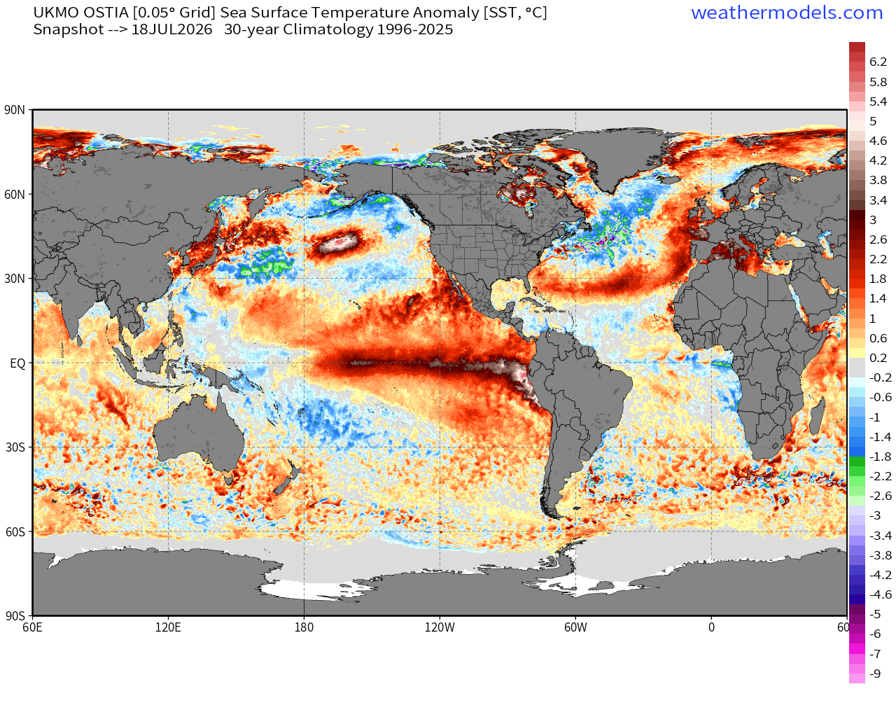
Central —> Eastern Tropical Pacific very warm (relative to climatology)
Subtropical band of warmth in the Atlantic
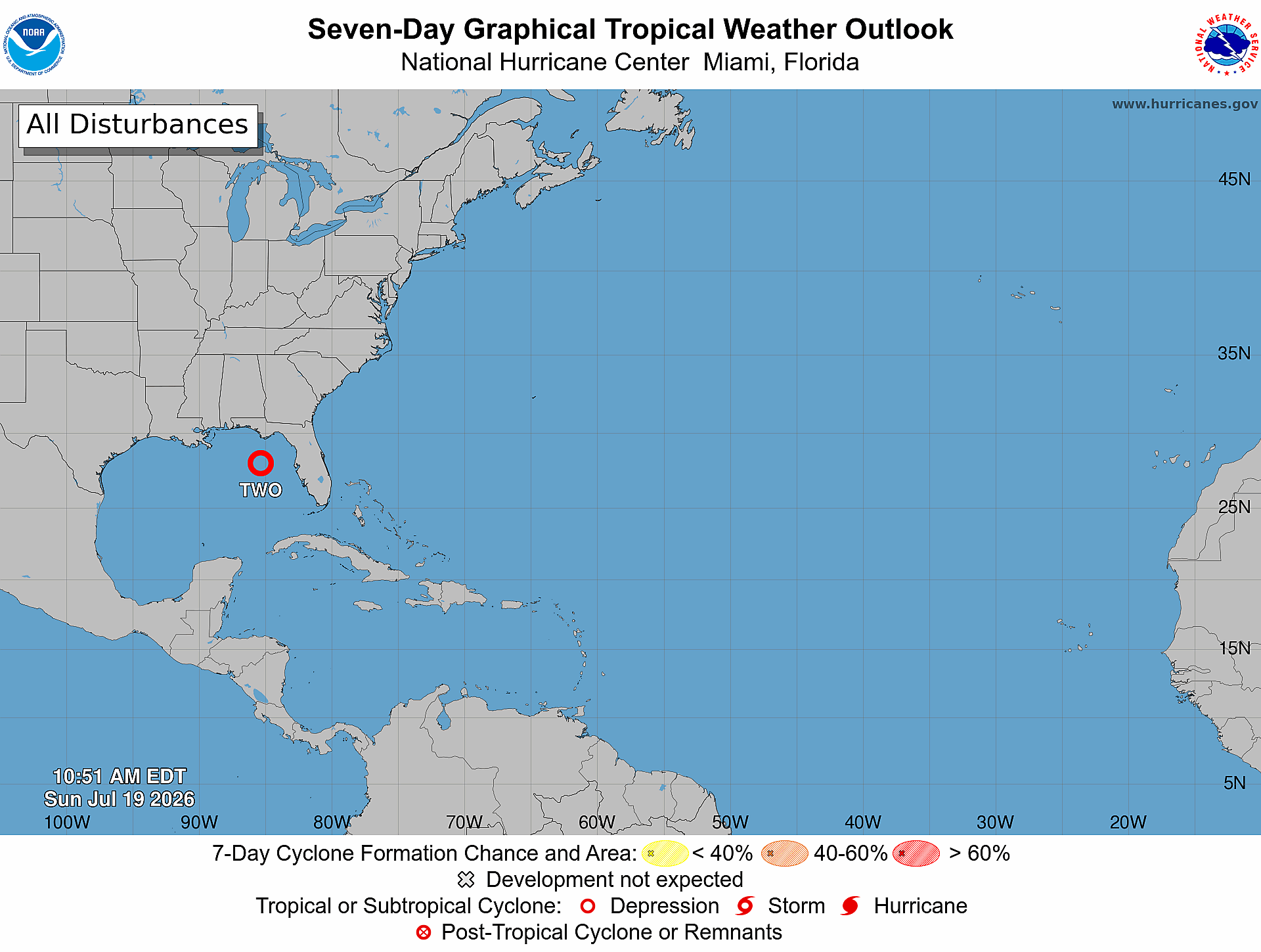
Atlantic Tropical Outlook next 7-days
Tropical Storm 02L in the Gulf of Mexico
Sea Surface Temperatures still in the under 26°C (green) cutting into 15°N latitude in the Main Development Region (MDR)
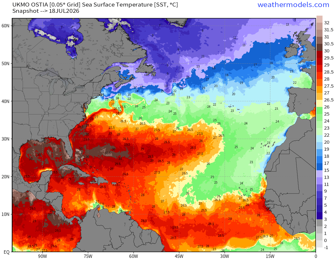
The subtropics are much warmer than normal in a band … but neutral or even cooler that normal in the MDR tropical Atlantic. The waters off coast of Northeast U.S. and Canada are chilly! SST Anomaly:
Tropical Waves
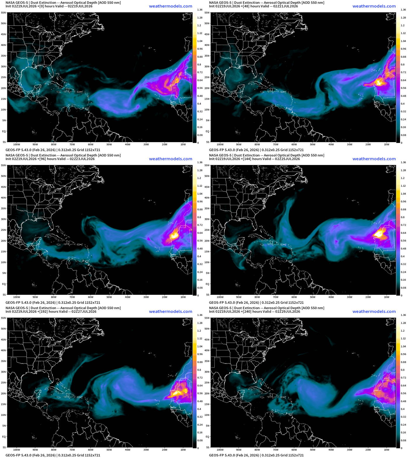
2 in the Atlantic but neither convectively active due to presence of Saharan Air
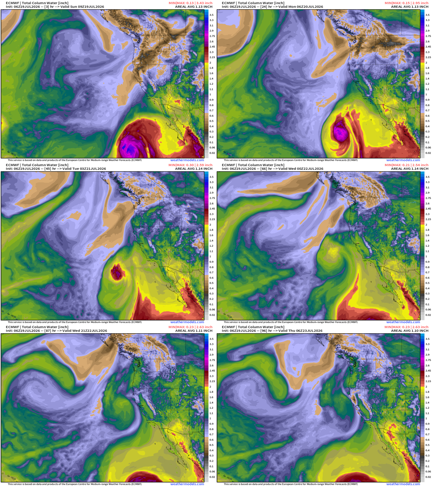
ECMWF 06z | Precipitable Water | My Favorite Parameter
HRRR 12z shows evolution of Bertha over the next 48-hours on a WNW track to east of boot of Louisiana
NASA Dust Forecast next 10-days
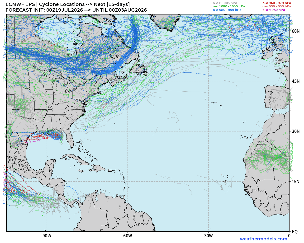
Next 15-days — not seeing any strong signals through end of July outside of the Gulf (Tropical Depression 02L)
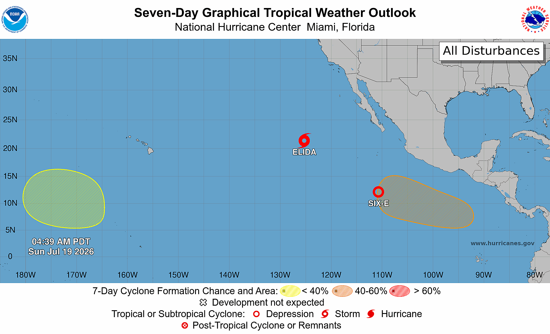
Eastern Pacific Tropics
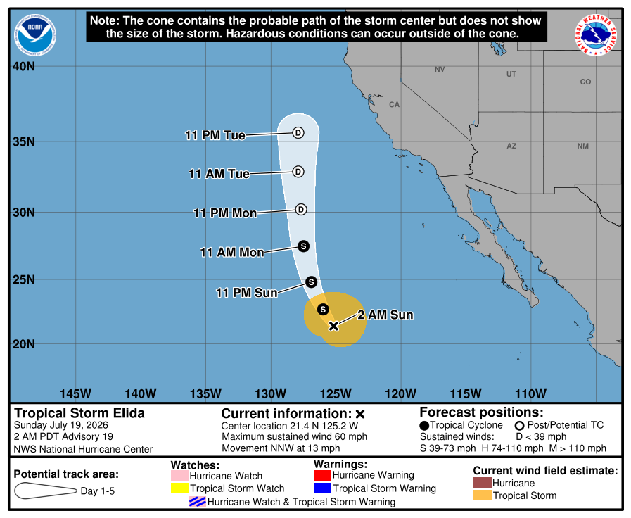
Tropical Storm Elida (05E) continues on a northward track. Tropical Depression 06E will become Hurricane Fausto.
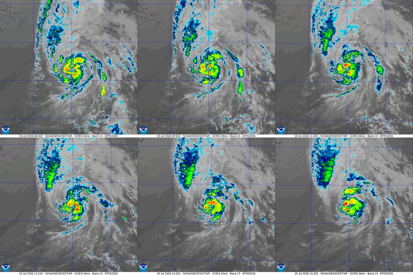
Elida’s convection if being maintained by a trough interaction — as you can see the fanning out of cloud shield to the north ahead of the hurricane … similar to a recurving Atlanta hurricane off the east coast of the U.S.
Elida eventually loses its convection and inner-core, but tropical moisture will push northward (quite far indeed) — but not expecting showers in California.
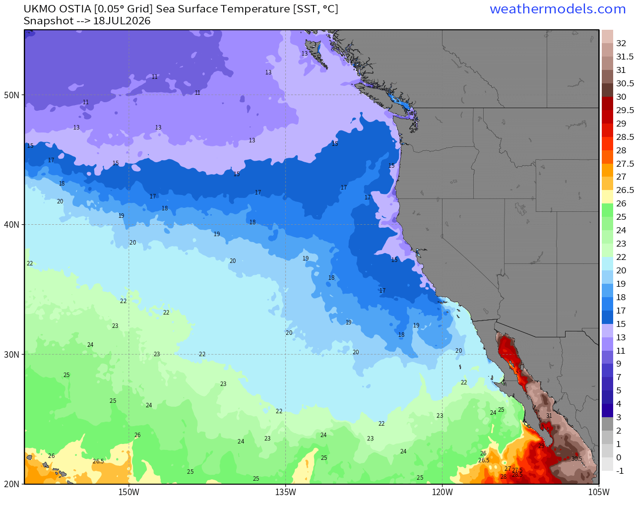
Ocean Temperatures off the West Coast are very chilly (as usual) and can’t support a hurricane, but Elida is going to have some help with a mid-latitude trough
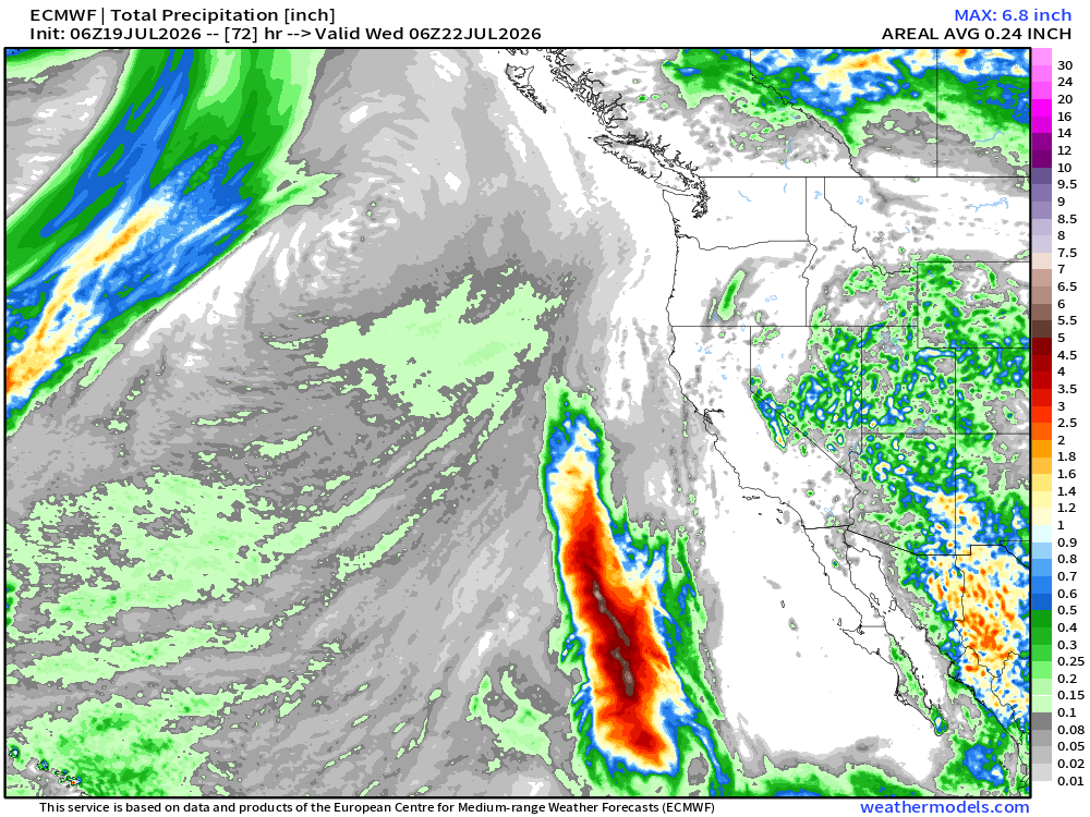
Even with chilly ocean surface temperatures, the presence of an upper-level trough to the west of Elida is maintaining convection, and quite far north! Check out the rainfall plume up to latitude of San Francisco Bay.
Parade of systems lined up … 2 more of them could become named storms
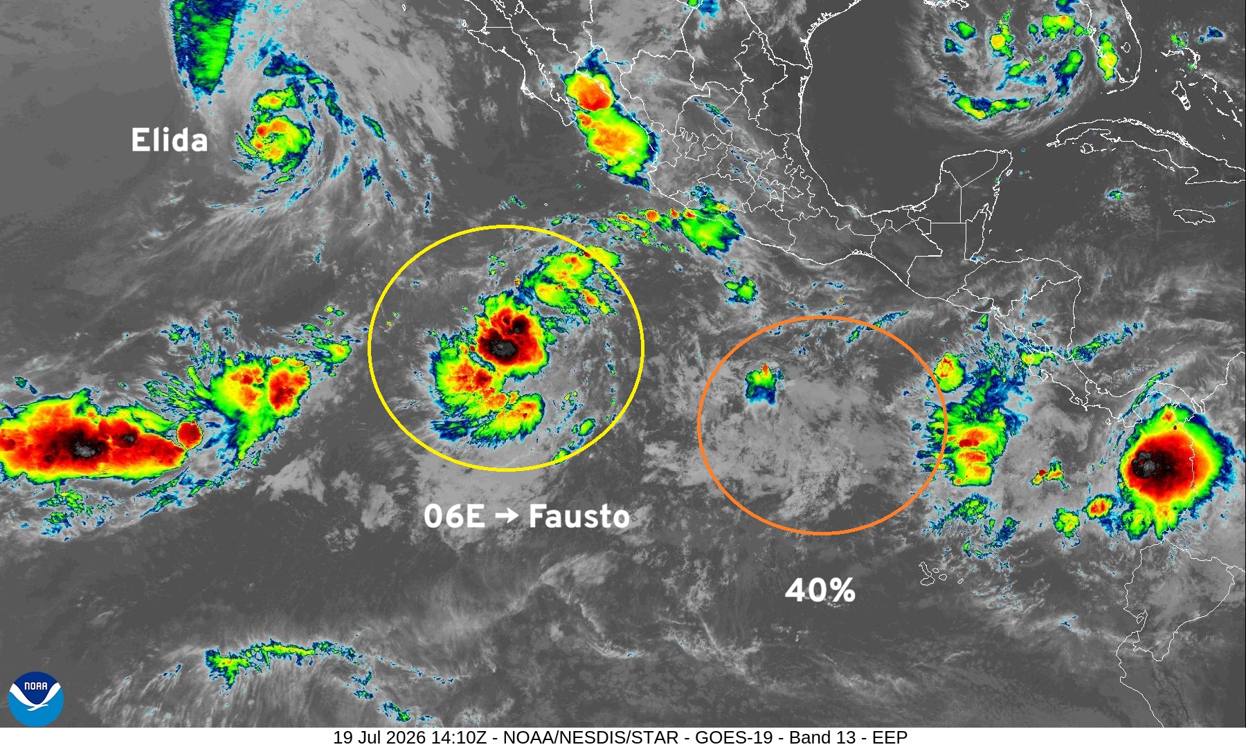
Elida will become post tropical by Monday … and keep heading north with some gusty winds.
Fausto follows Elida, but takes a westerly course for the next 5-7 days, and then Genevieve forms down the road.
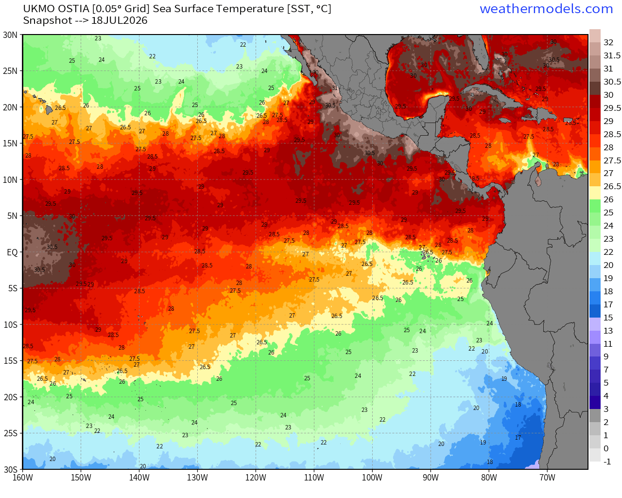
SST —> very warm across entire tropical Eastern Pacific basin
Tropical Depression 06E —> Fausto tracking WNW through next 5-days remaining a powerful hurricane into late coming week.
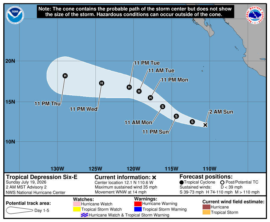
Heading in the general direction of Hawaii … we’ll see if it can get close to the Big Island as the SSTs are quite warm to keep Fausto alive. NHC has a maximum intensity in the 24-hour forecast points of 95 knots, on the precipice of Category 3 (major)
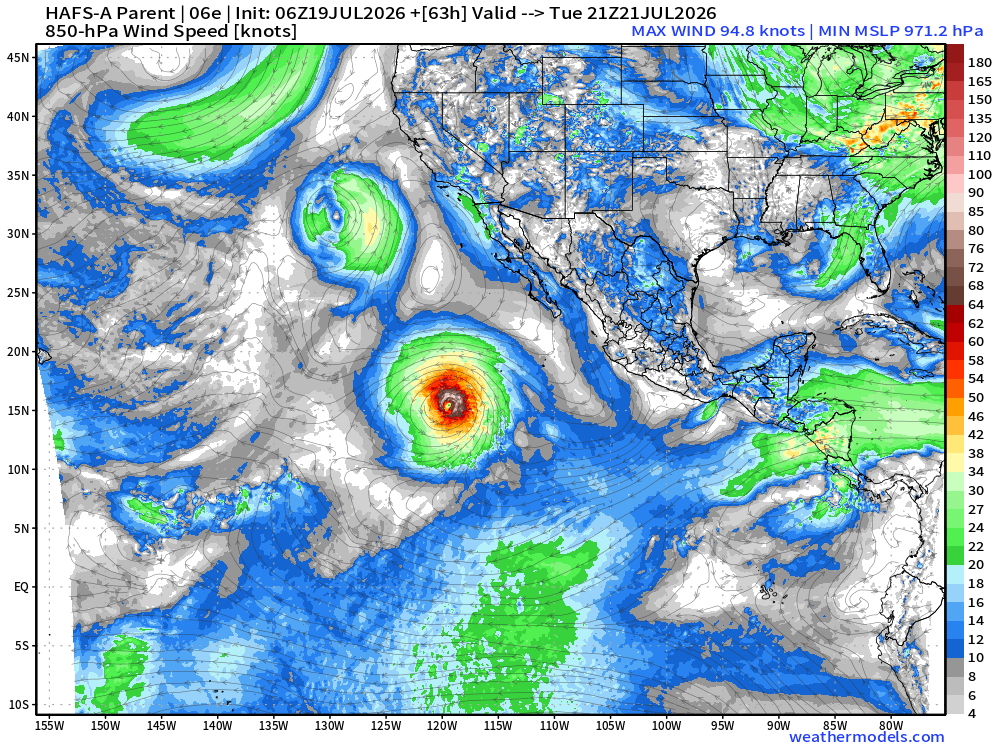
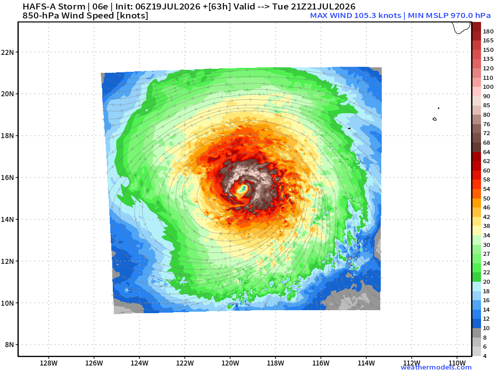
Fausto should become a Major Hurricane
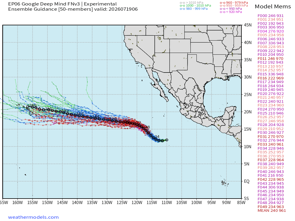
More storms on the way — 2 or perhaps 3 in next 12-days
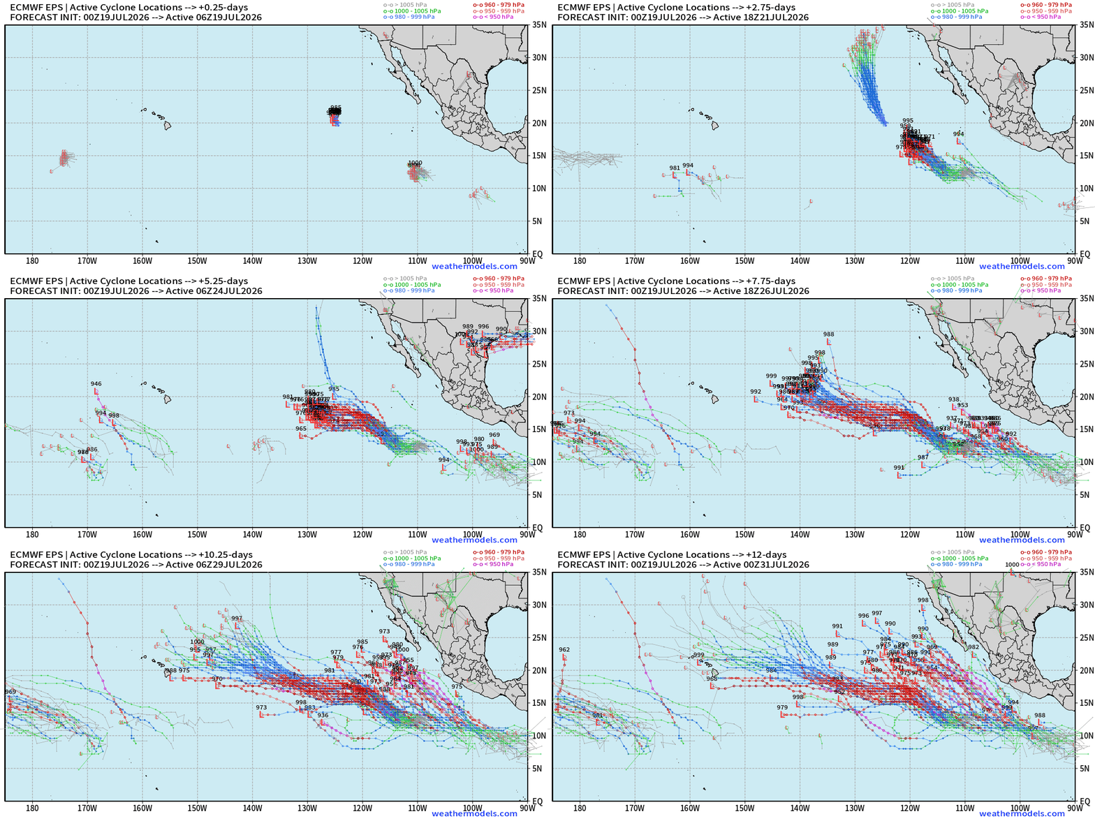
Activity in the Eastern Pacific continues to be ramped up into August.
Western Pacific
No currently active systems but watching the Philippines in 4-days for a depression to form and then move westward in the South China Sea
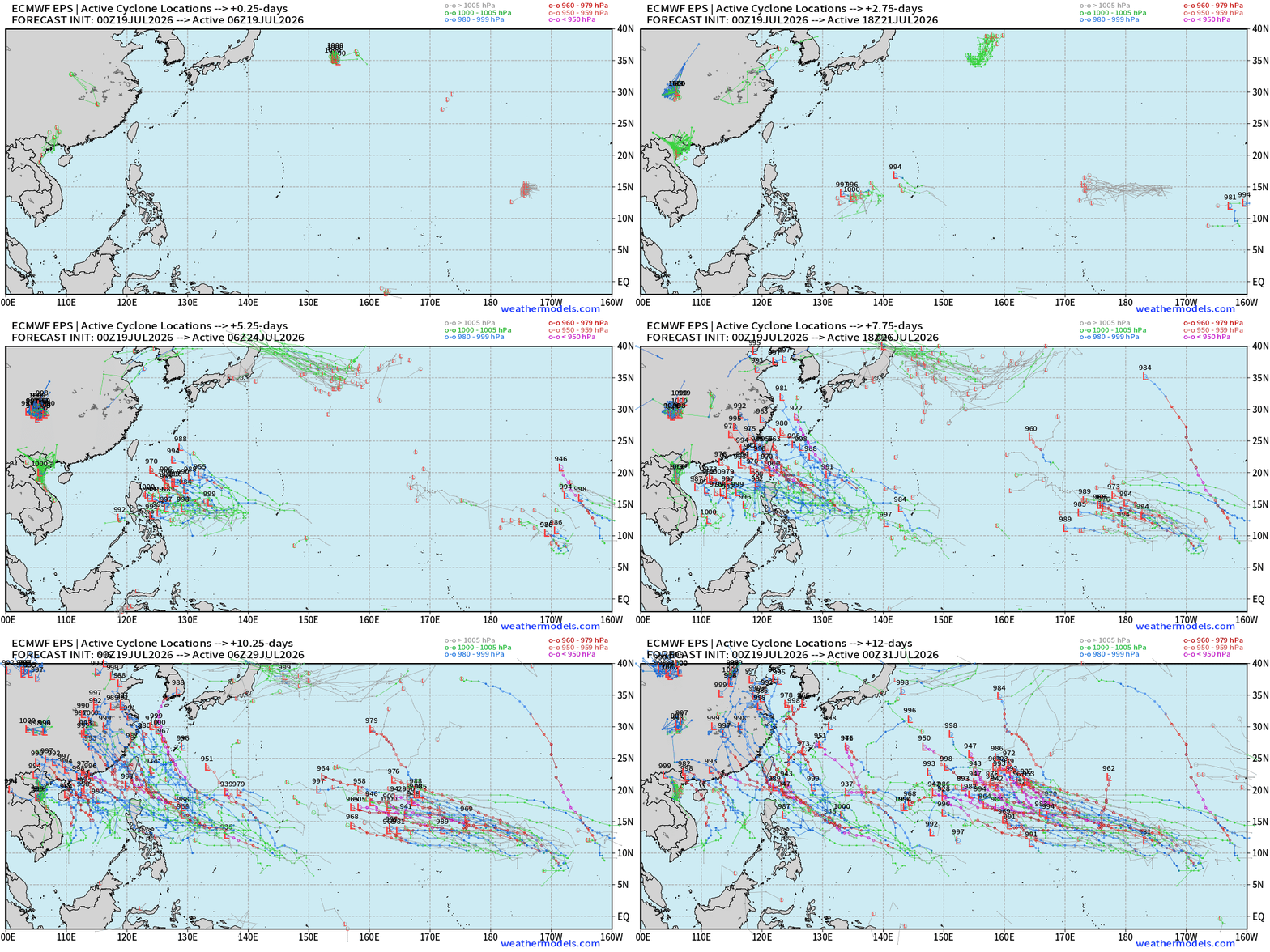
Rather quiet out here on the heels of Super Typhoon Bavi, which makes sense for the tropical atmosphere in mid-July to take 2-weeks to “recover” from a massive storm. But with the Super El Niño, any area of convection could spin-up relatively quickly once the basin moistens back up.
Maps sourced from weathermodels.com designed and innovated by yours truly! Please subscribe there for real-time access to the newest maps, charts from all of the weather models including ECMWF and AIFS, and NOAA GFS/GEFS, HRRR/RRFS and Blend of Models (NBM). NOAA WPC and SPC for fronts/convective outlooks.
Our own content is now sourced from hottestsince.com and weather.city
My Atlantic Hurricane Season Forecast (2026)
From April 7, 2026: Atlantic Seasonal Hurricane Forecast: (11/5/2)
9-13 Named Storms (11 most likely)
4-7 Hurricanes (5 or 6 most likely)
1-3 Major Hurricanes (2 most likely)
Accumulated Cyclone Energy: 75-85 (well below normal)
NOAA 2026 Atlantic Hurricane Season Forecast
Weather Trader Roadmap
Where is this “Weather Trader” newsletter headed? No where, and this Substack hosted blog will continue onward. I will have more time/opportunity to expand into other topics, too, once I can pre-wire all of the maps/content that is currently download, and cut-and-paste. There will be companion sites, and services that will allow (paid) subscribers to interrogate the models, get their own customized point forecasts and/or regional views, including maps and charts. The development is extremely rapid with Claude Code (not joking), and your continued support is appreciated but also necessary. What has been shipped in the past week? Freely available services: hottestsince.com / coldestsince.com / wettestsince.com / driestsince.com / weather.city, and precipitation.earth is being built with celsius.earth after that. I currently have a list of 20 high-priority additional sites/services.
How am I able to build these so quickly? Well, I have all of the data already, and I knew how to stage it for turn-key wiring into the web interfaces. I already did the hard part of ingesting and processing the weather data, so passing off the web design to Claude eliminates much of the ridiculously time intensive work. I’ve literally done at least 20,000 man hours (10-years) of full time web design required in 2025. No longer.
So, what’s the play here? I am going to produce everything as if I am a power-user, from my professional level of experience and expertise. I want all of you to be able to see under the hood with how the weather enterprise works today, and give as much away for free (non-commercial) but maintain a “value-added” structure for subscribers. I am making shareable cards, interactive tools, and broadcast quality maps. And, I already have the ability to ship individualized PDFs through weathertrader.com And, that’s the crown jewel — the weather trading market interface (but not for money, and humans aren’t involved. In the coming weeks/months, you’re going to see some incredible things!
- Milepost
- 984 · laid 2026-07-19T15:07:31.156000Z
- Source
- https://weather.substack.com/p/july-19-2026-sunday-tropical-depression
- Digest
- 7da66bd2dc80812011e01fc49b6fe263aa8746b9c4e4578a965da09e09139e5b
- Machine
- JSON