July 14, 2026 Tuesday Summer Weather
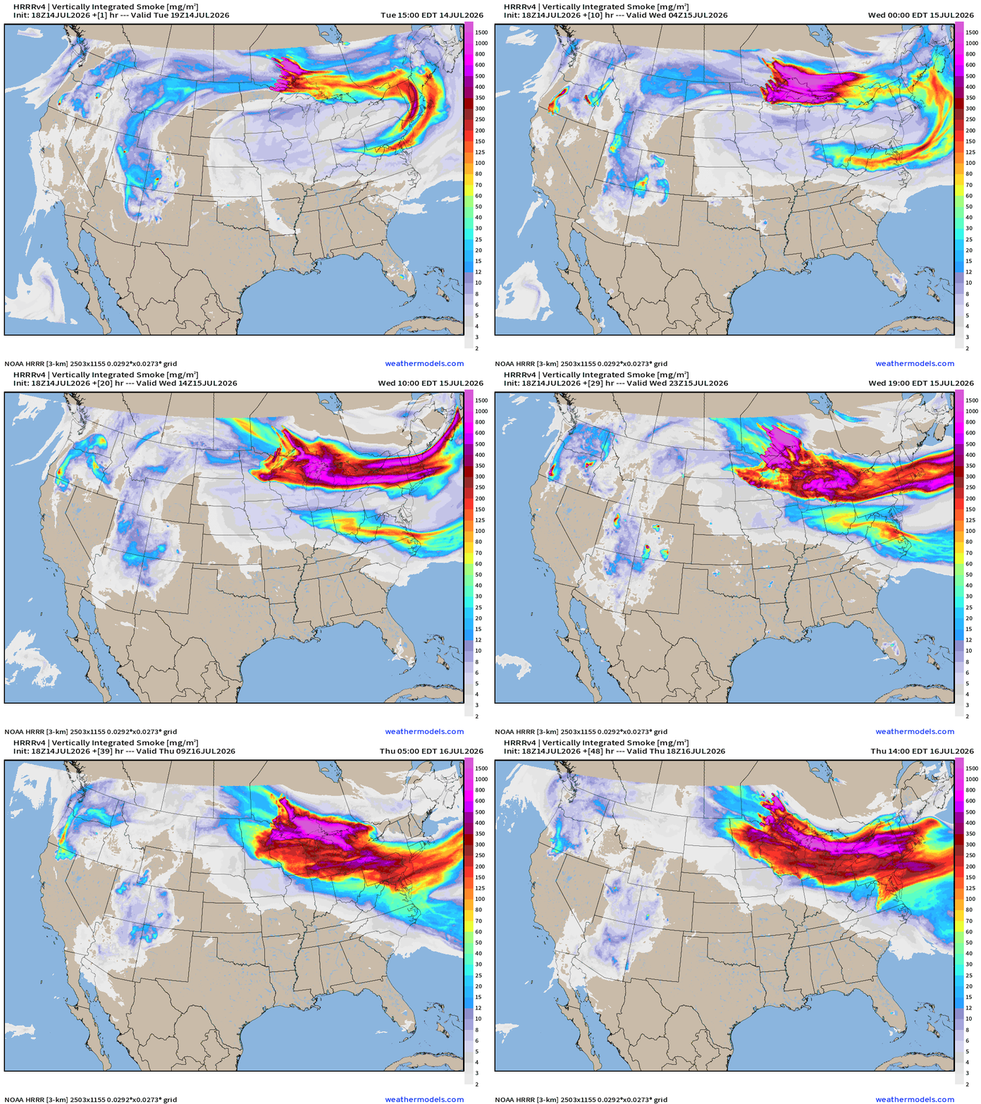
Thick smoke from Canadian wildfires will ride the ridge (heat dome) with temperatures in the 100s around Washington D.C.
July 2026 was the warmest July in the 132-year national record (1895–2026), at 76.9°F against a 1991–2020 normal of 74.4°F (+2.5°F).
July 2026 was the 26th-driest July in the 132-year national record (1895–2026), at 2.5in against a 1991–2020 normal of 2.9in (-0.3in).
NOAA/NCEI Climate at a Glance, contiguous United States. This is the observed record for the month, not a score of anything said in this piece — the forecast ledger begins 2026-08-17 and cannot reach earlier posts.

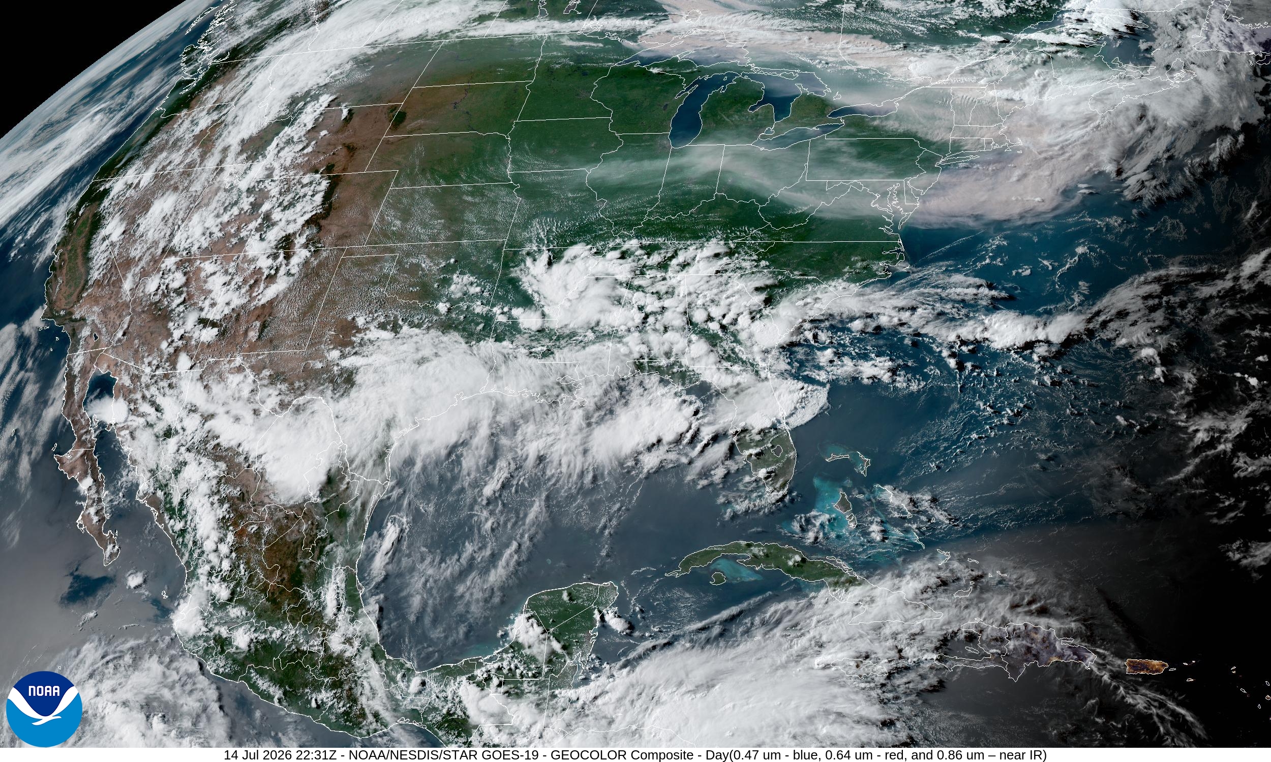
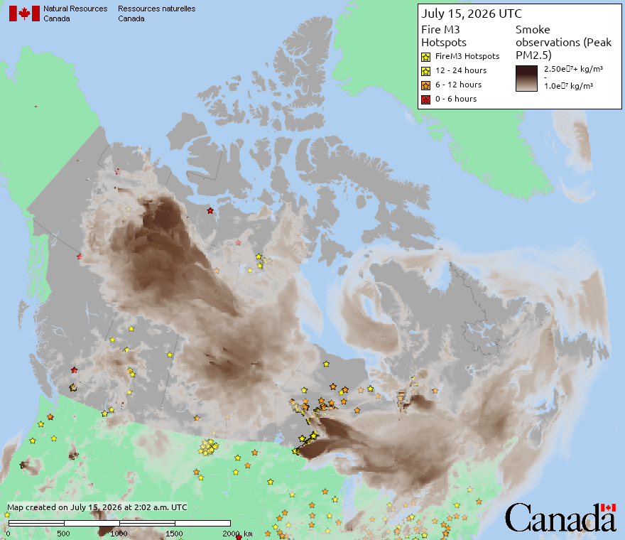
Major Canadian Fires will blanket thick smoke across the Northeast U.S. downstream of a massive heat dome
Visible satellite earlier today showed the very dense smoke aloft.
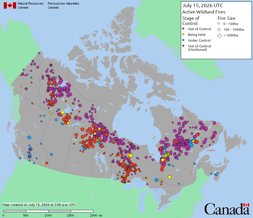
From Canada’s Wildfire Service
However, a byproduct is thick smoke downstream into the Northeast that blankets huge population is a dystopian cityscape especially with added extreme heat. The thicker upper-level smoke will likely keep temperatures much cooler than otherwise acting as a haze blocking some solar radiation.
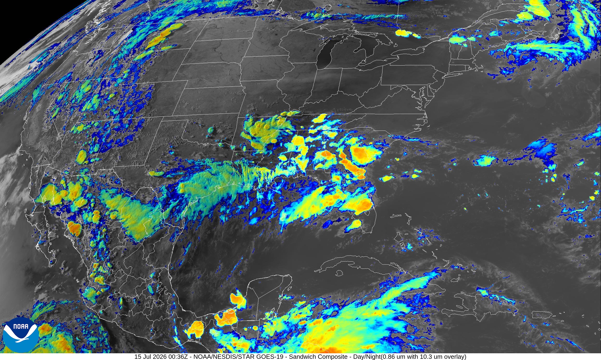
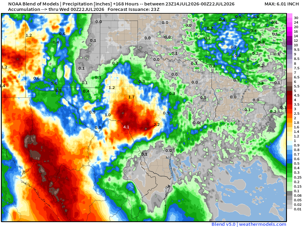
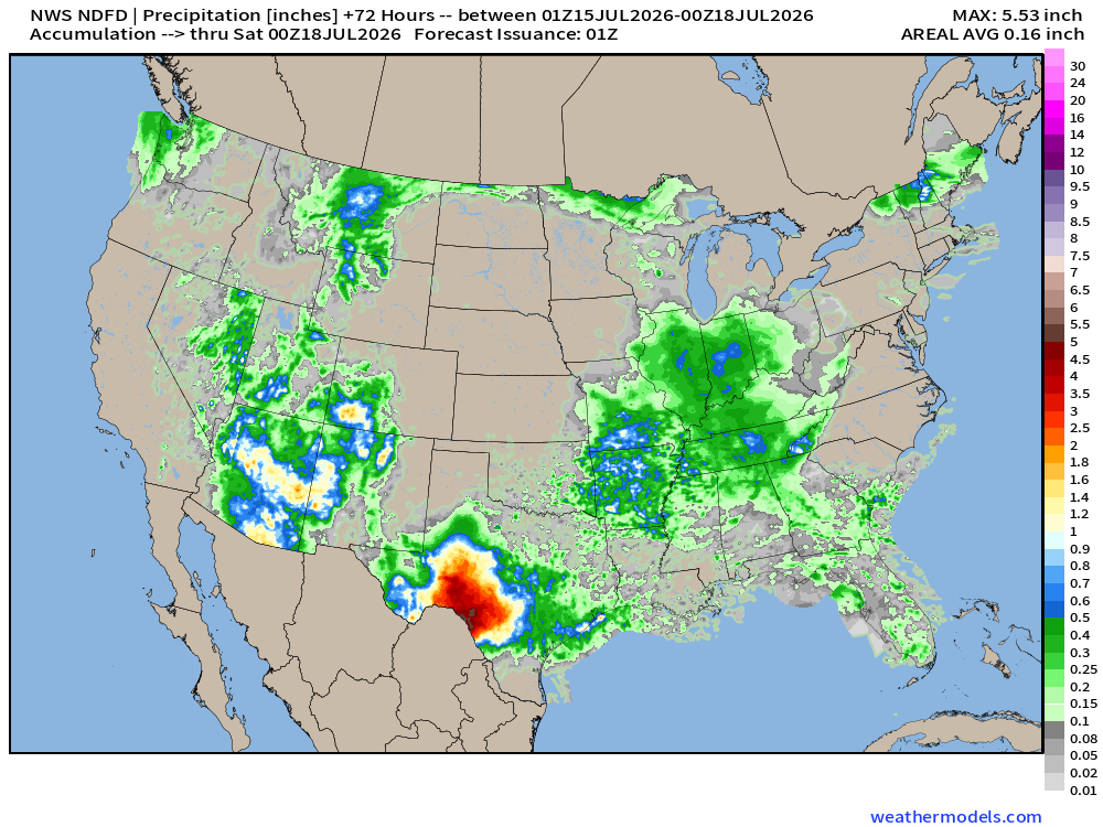
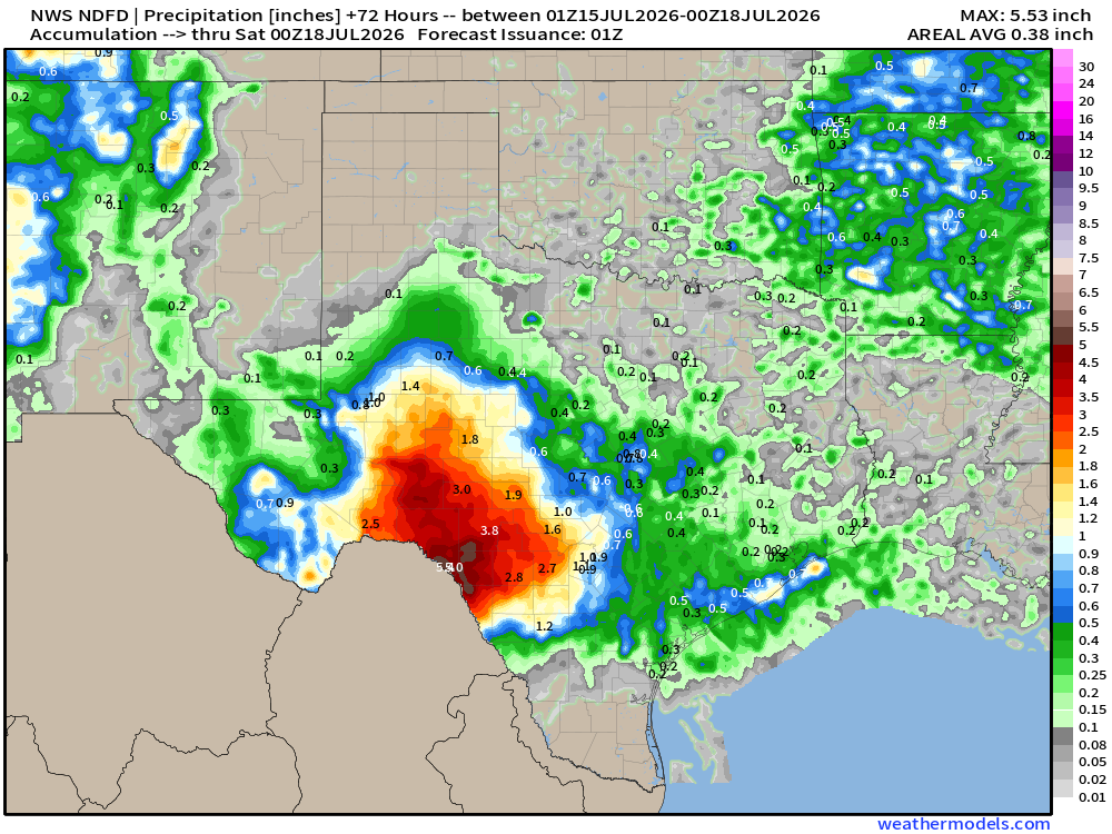
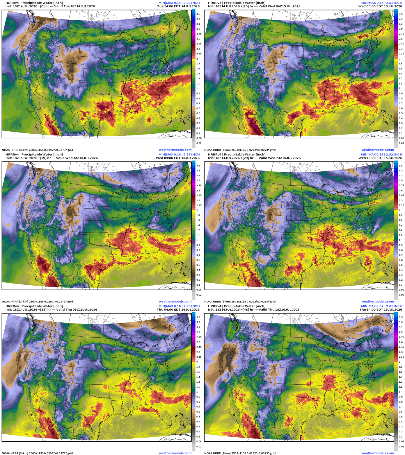
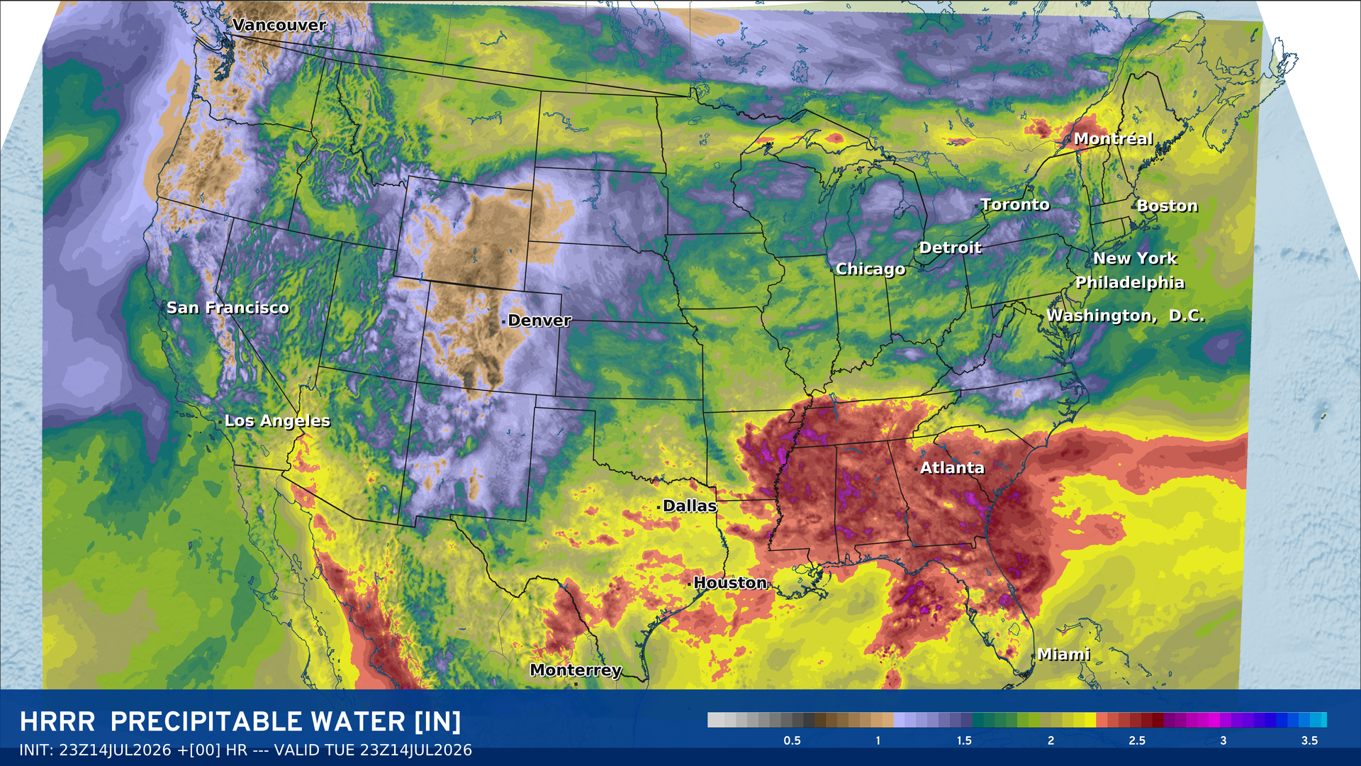
Most active current convective situation is in Texas and across the Deep South into Southeast
Weather Trader is entirely reader-supported publication (no ads). To receive all new posts and support our work, consider becoming a free or paid subscriber. Current subscribers can add gift subscriptions at 50% off, or upgrade to the Founder’s Level for additional perks.
Please give weather.city a try … more features added daily, including Areal Impacts, Population Impacts, and Costco Store location weather — next is Dollar Generals (19,000+)
HRRR Smoke Forecast (entire column, not surface) over the next 48-hours
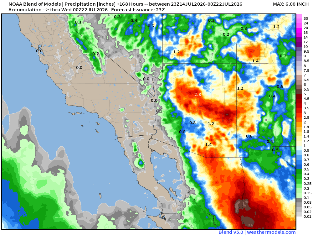
Blend of Models —> Precipitation Next 7-days
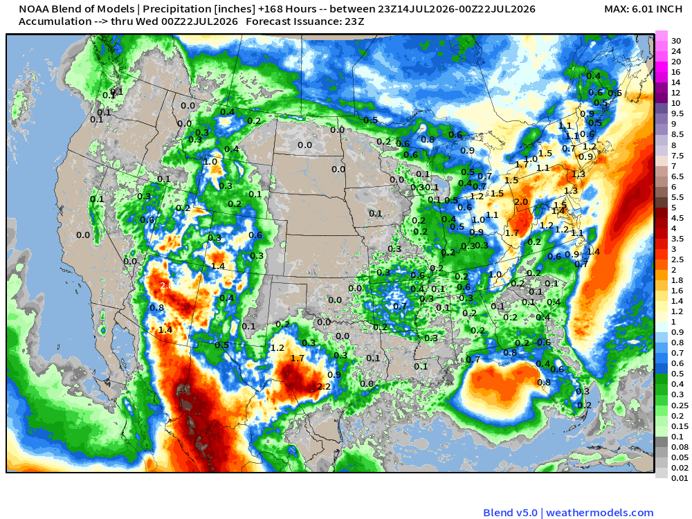
Check out the Southwest Monsoon! Huge rainfall across Arizon
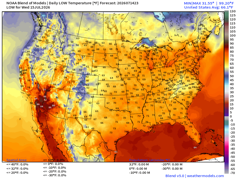
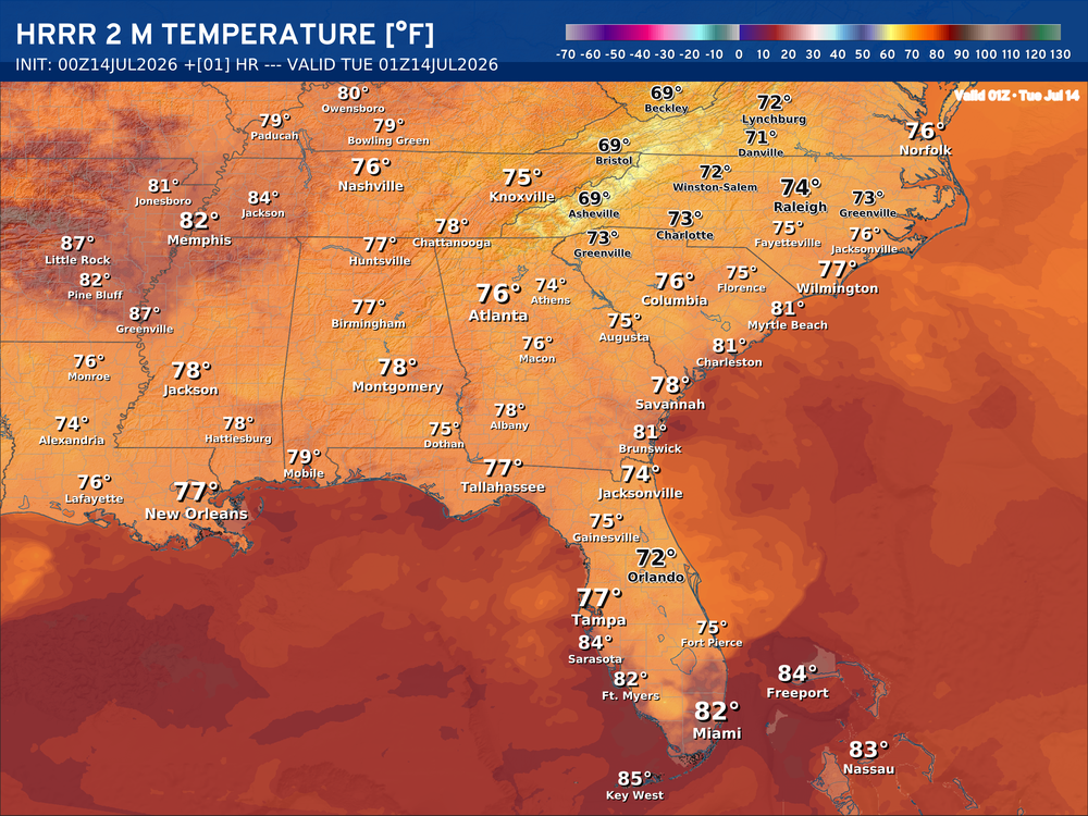
Wednesday Low Temperatures
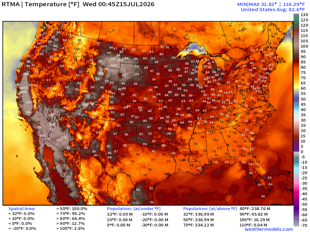
High Temperatures on Wednesday
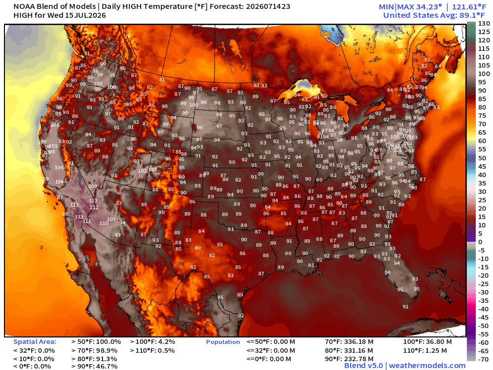
Lower 48 average high is 89.1°F and 233 million at least 90°F —> HOT
and 37 million at least 100°F
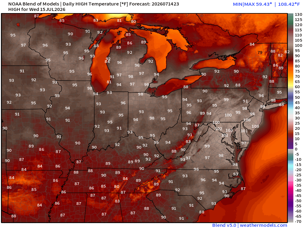
Washington D.C. —> 101°F would tie the record high for Wednesday, July 15 —> Hottestsince.com
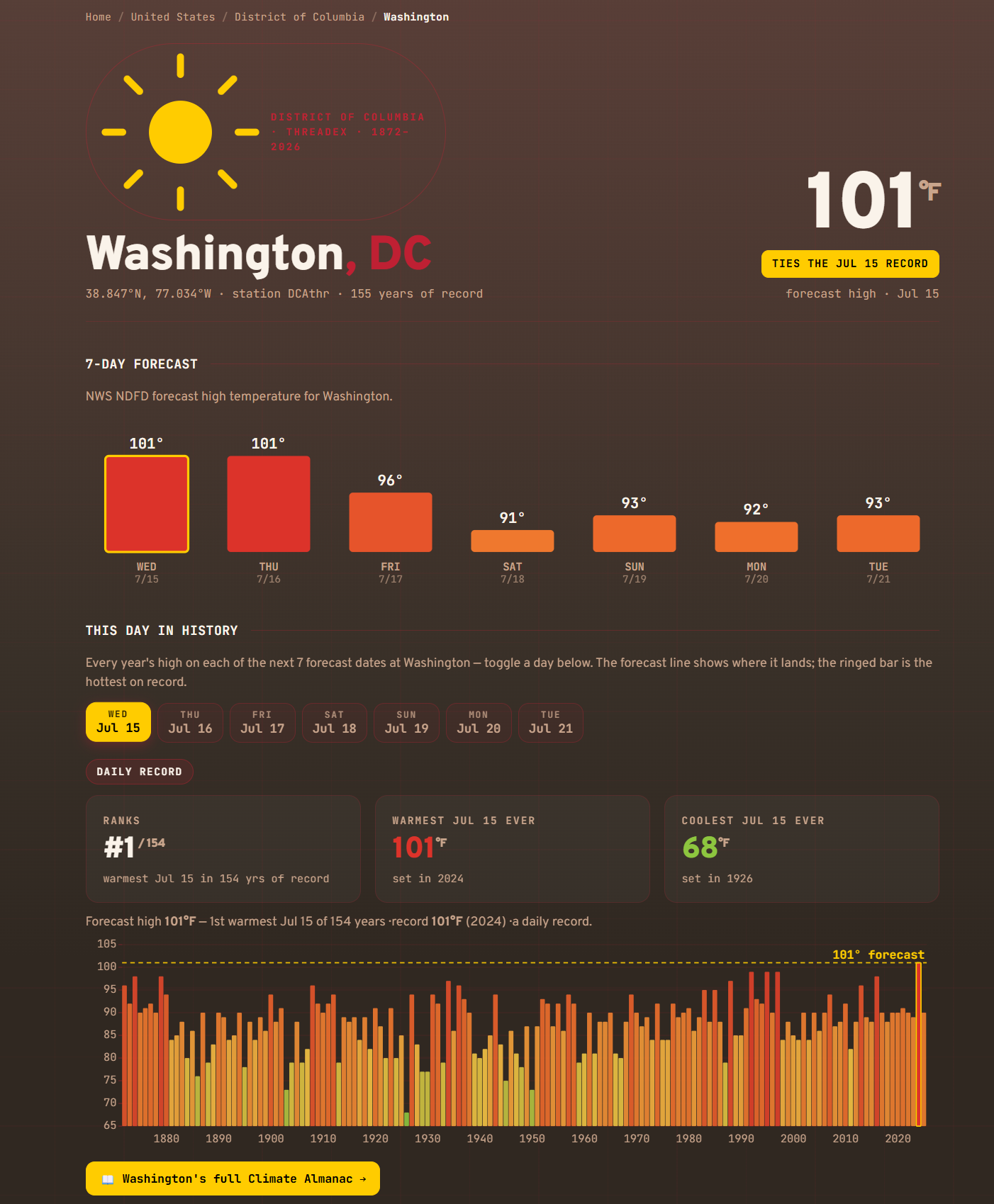
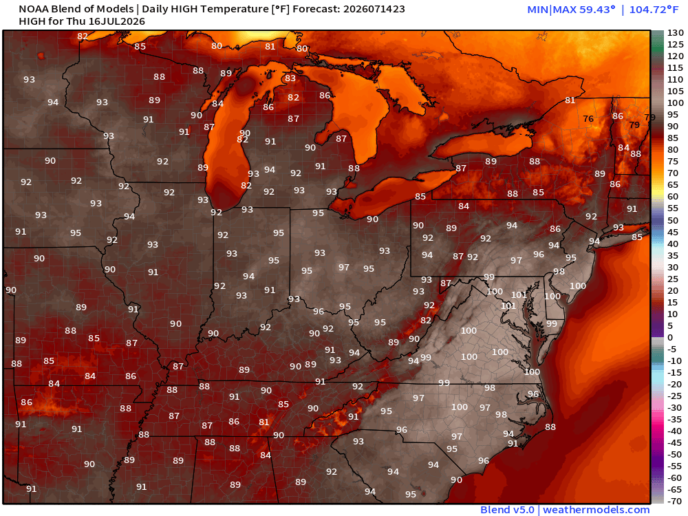
Thursday High Temperatures
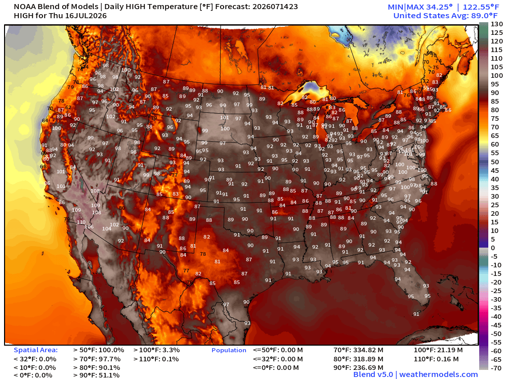
Similar Story for Thursday
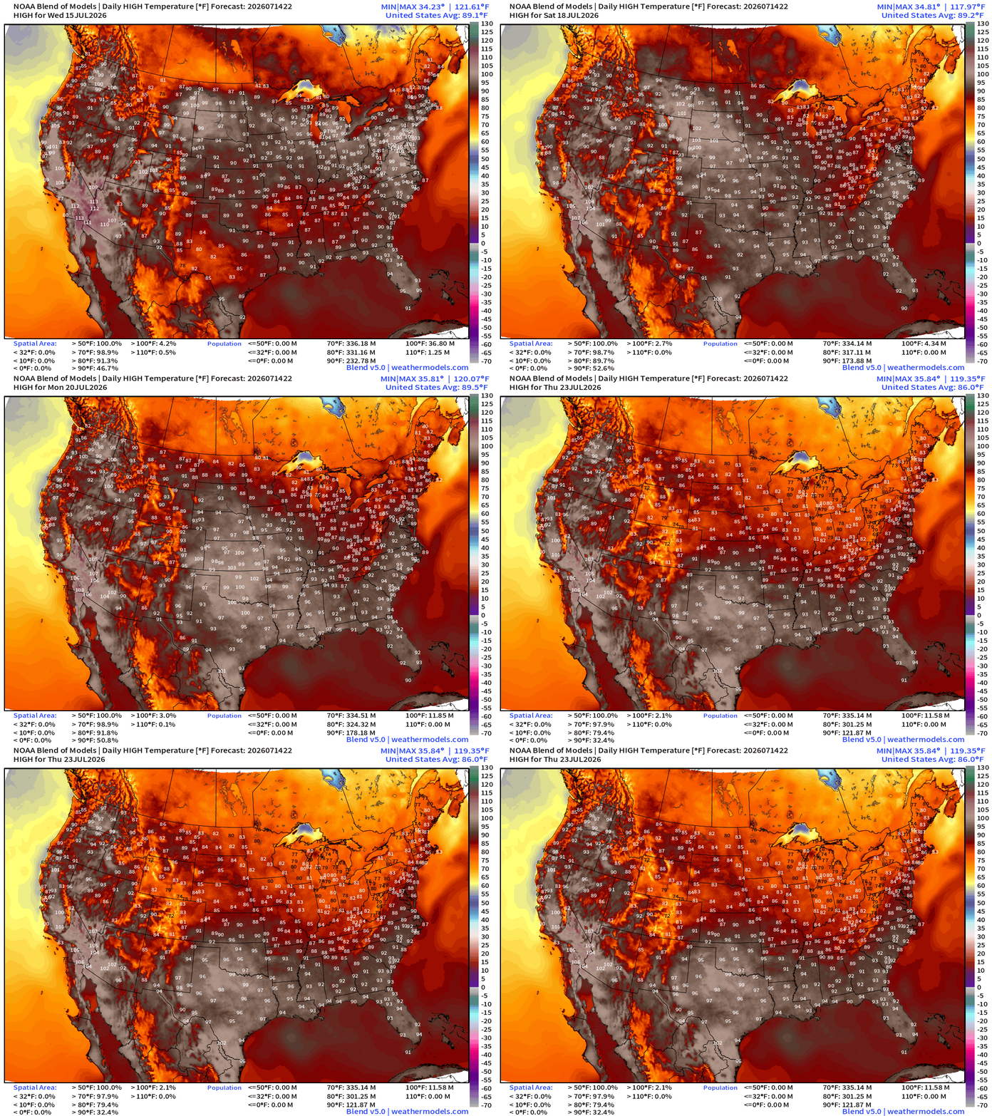
High Temperatures Next 8-days — until Thursday, July 23rd
Into Summer —> Height Anomalies don’t tell entire story … actual height does!
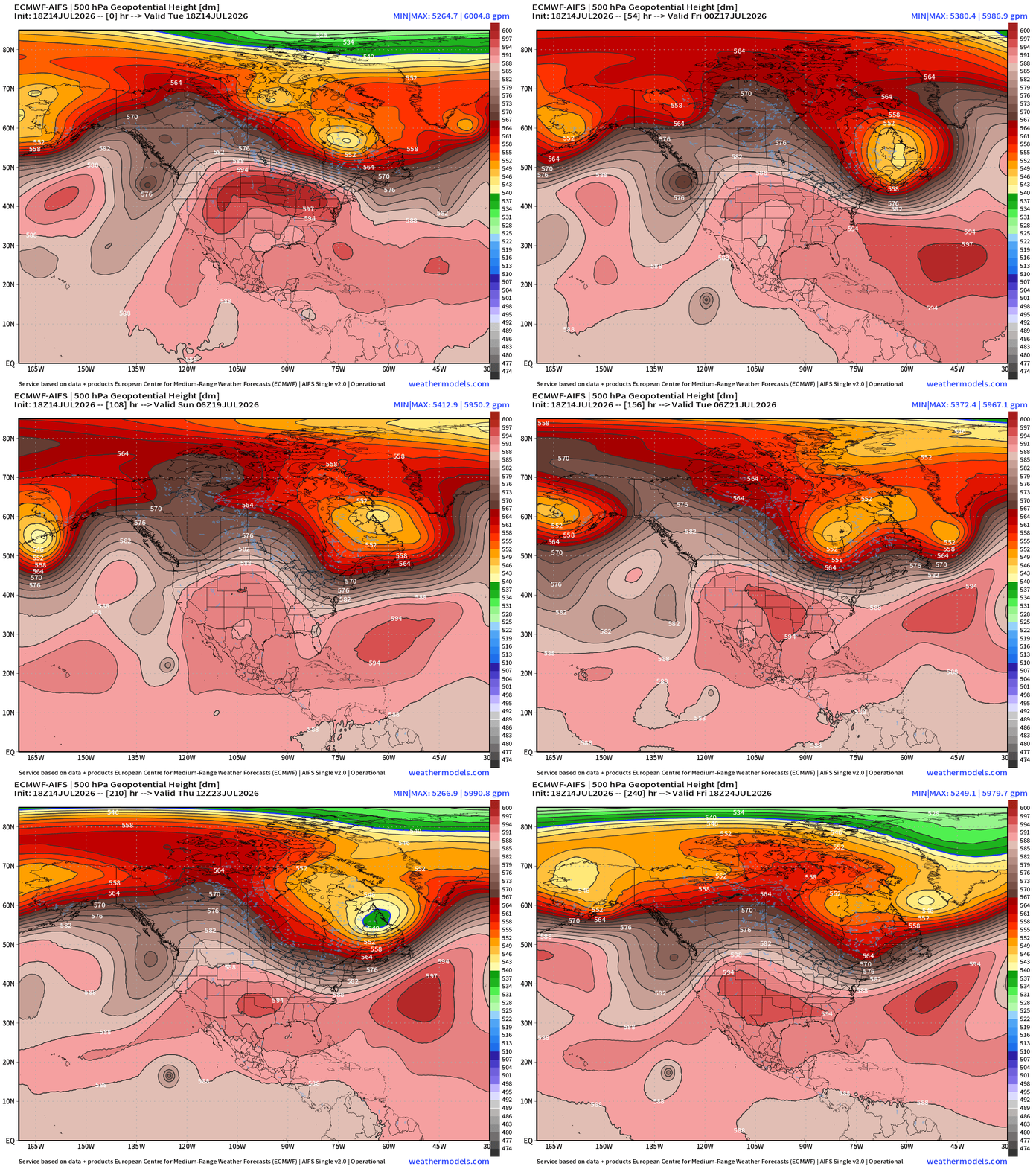
ECMWF AIFS 18z —> a trough over the Northeast erodes the “heat dome” by end of the week. No longer expecting any tropical development in Gulf.
Normally when you’d see 600 dm, it’d be a major panic for potential record high temperatures everywhere with the entire Lower 48 broiling off the face of the Earth. However, the worst / most anomalous heat is on northern periphery while clouds and rain with tropical moisture is on the underside!
Upper-Level Height Anomaly | AIFS-Single Next 10-days
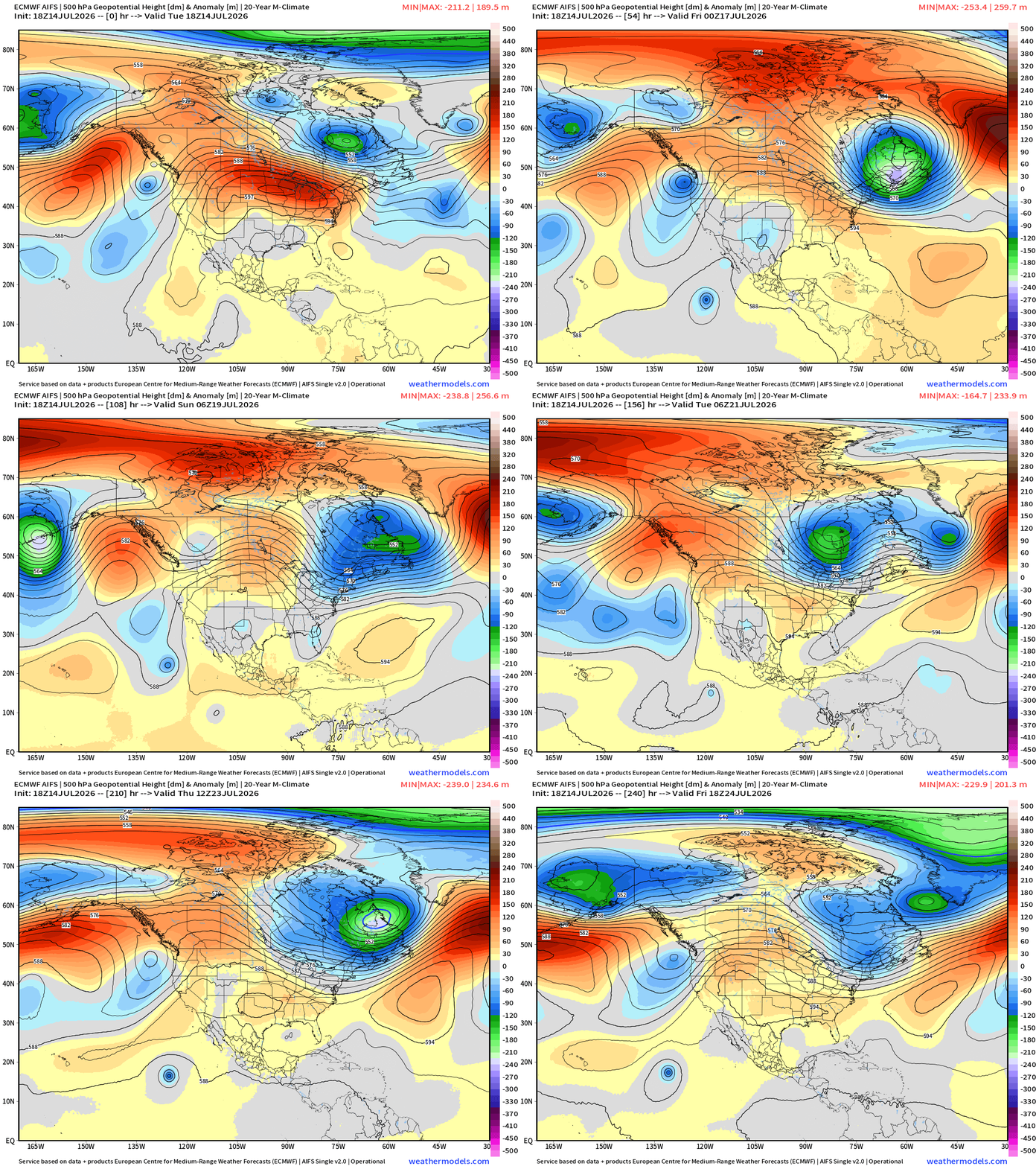
The impressive central U.S. ridge + a series of digging troughs out of the Gulf of Alaska and Pacific Northwest.
Also, note the troughs digging into the Northeast into Days 5-8 —> back to the cooler/unsettled pattern for mid-July.
NWS Precipitation Next 72-hours —> Friday Evening
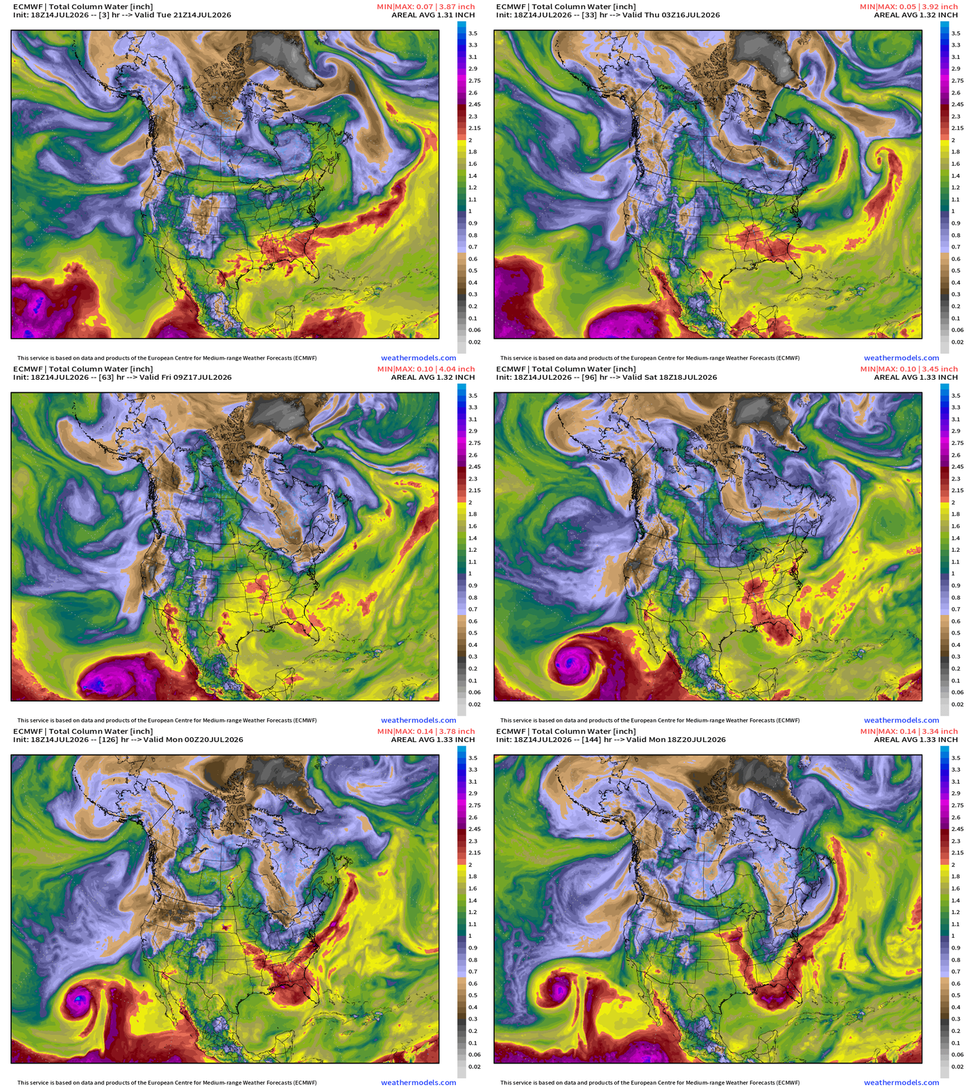
My favorite parameter — next 48-hours of HRRR Precipitable Water
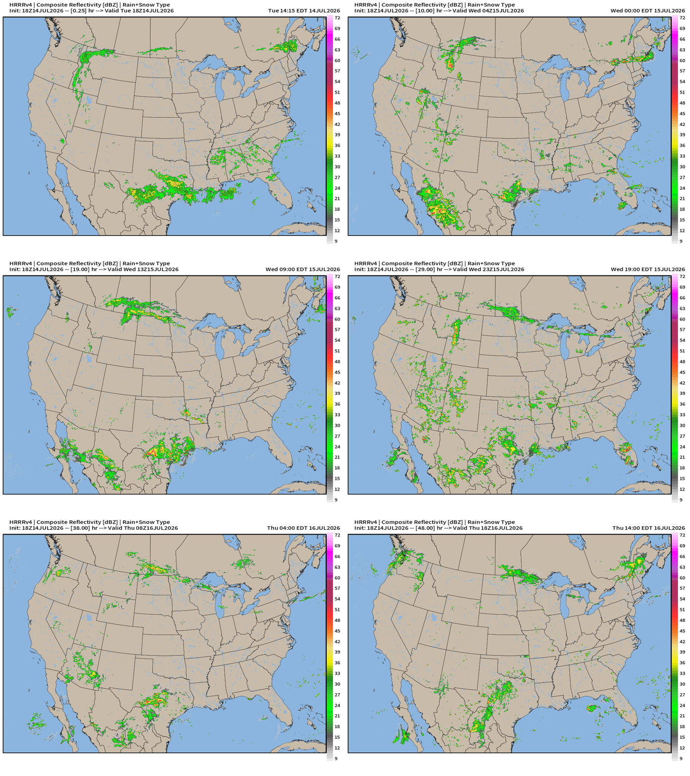
HRRR Next 48-hours simulated Radar through Friday 2 PM ET
Flagship model: ECMWF AIFS 18z —> Integrated Vapor Transport next 10-days
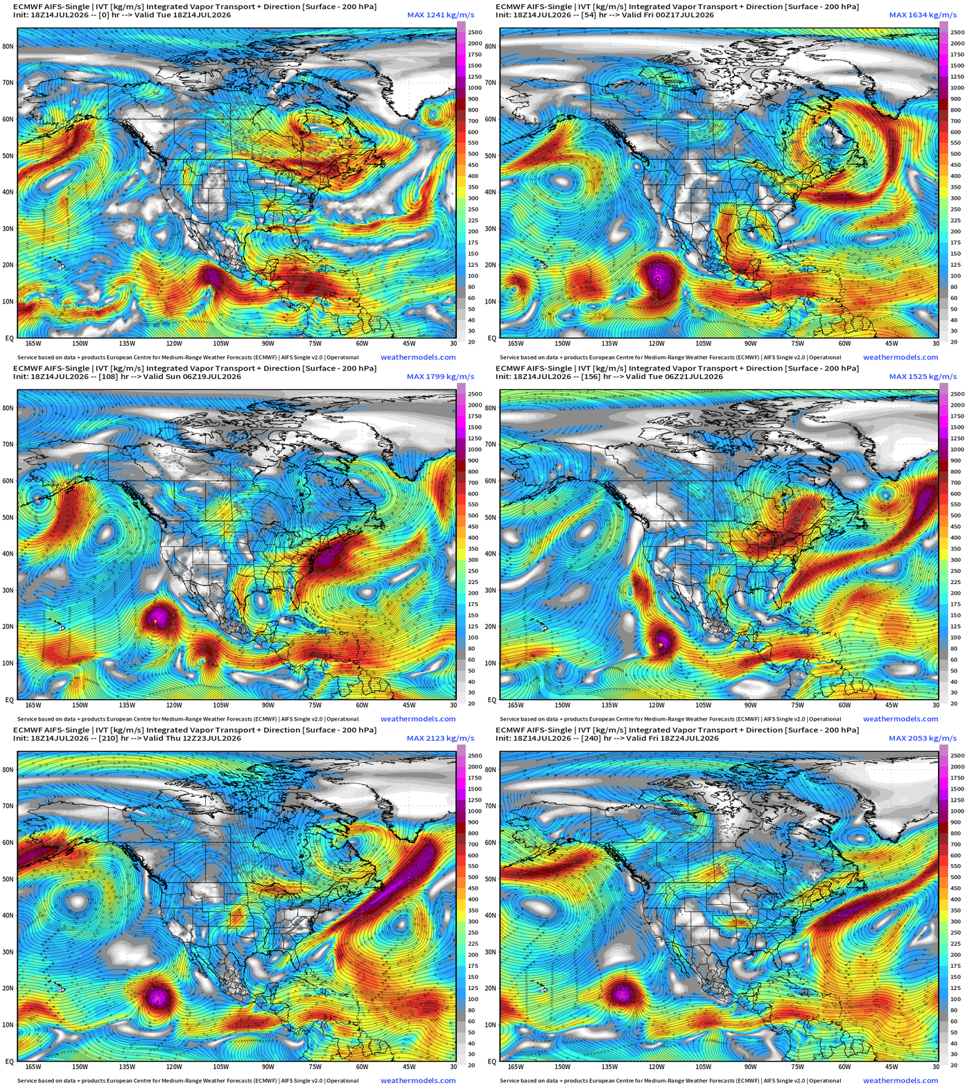
The heat dome across the Great Lakes shows up as a clockwise closed circulation within the moisture parameter (IVT)
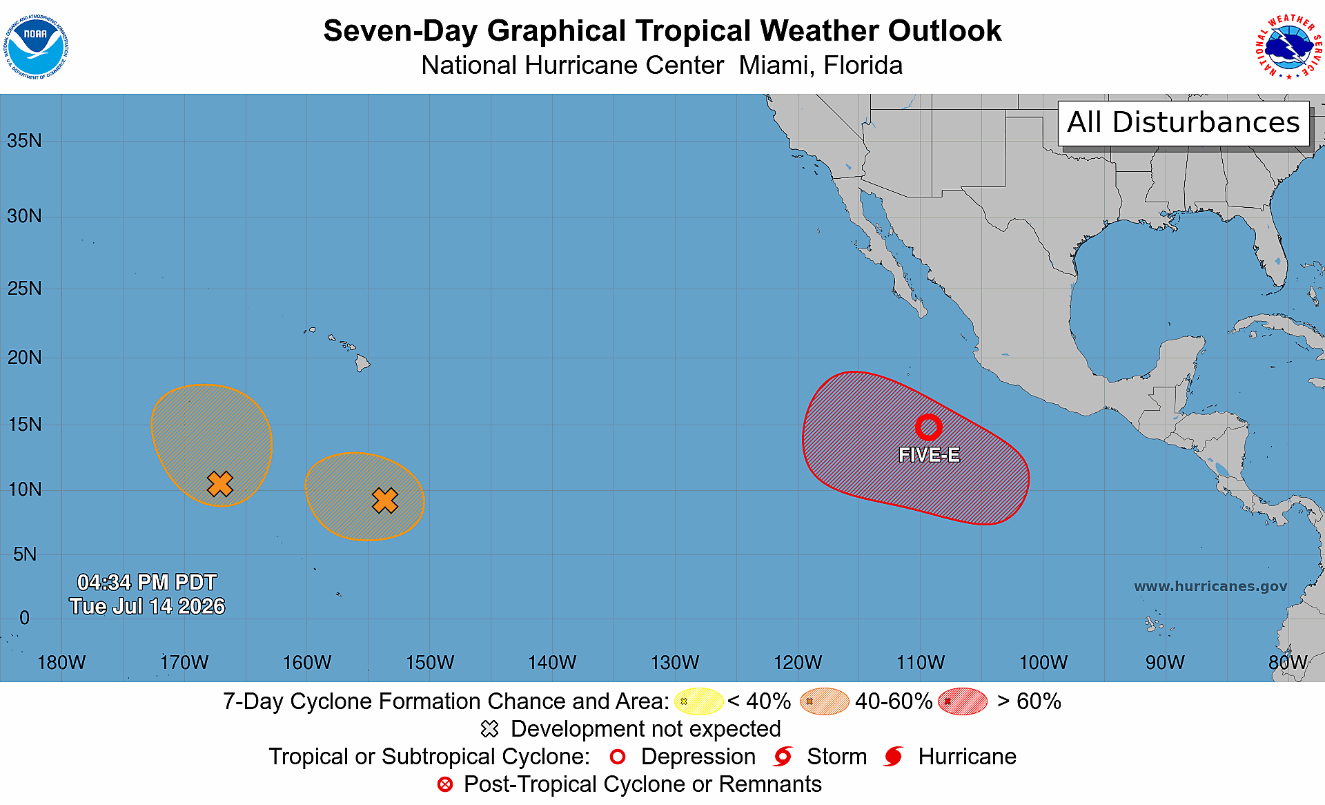
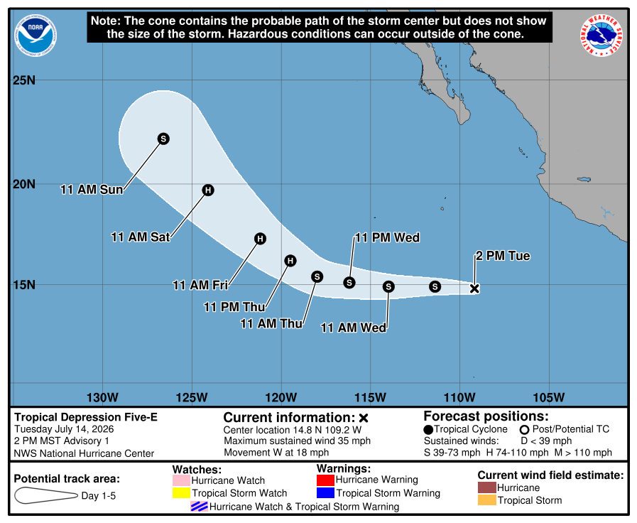
1 or 2 Eastern Pacific hurricanes likely in next 3-7 days
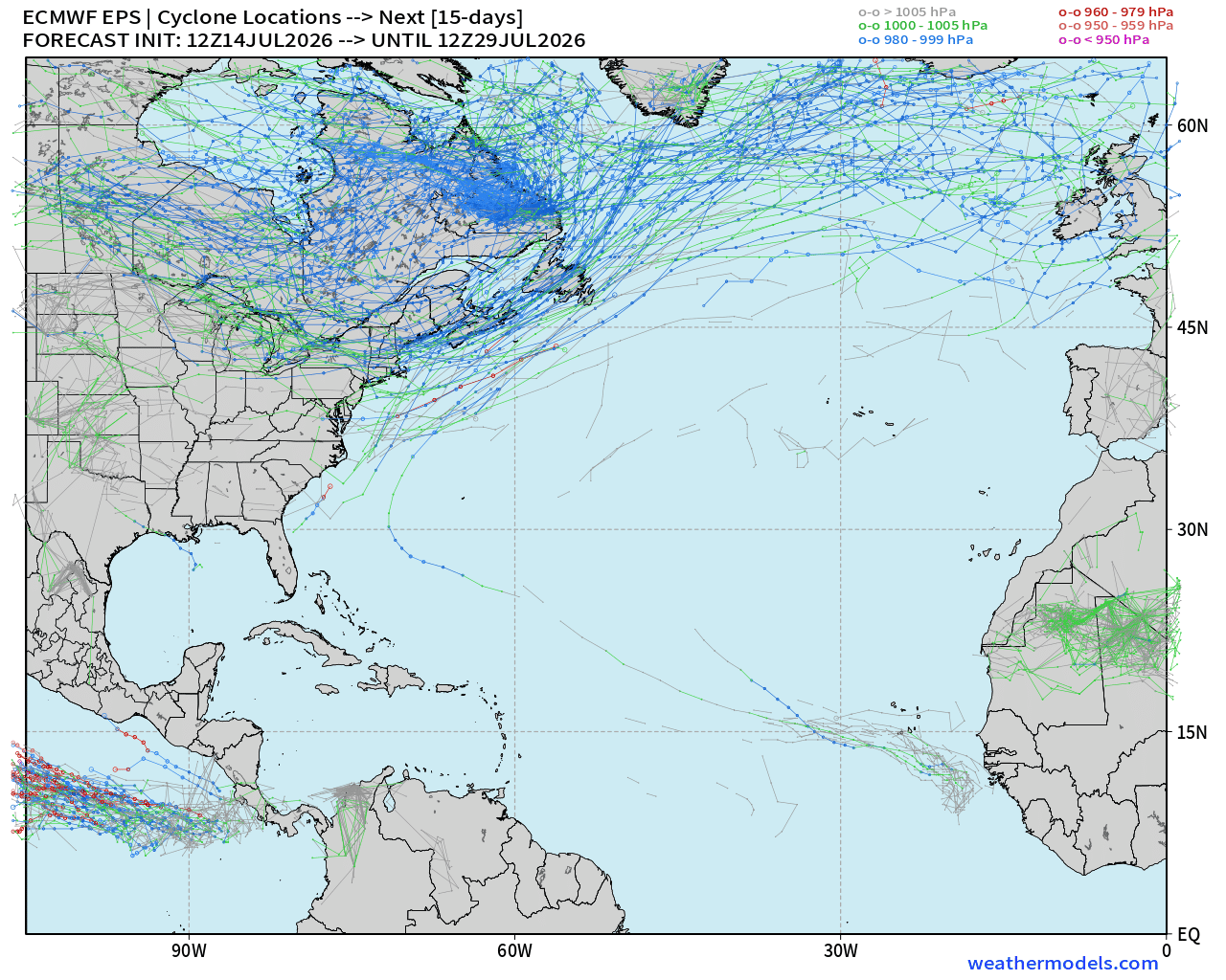
Otherwise, the Atlantic tropical basin is quiet — tropical waves are still being produced, but nothing catching fire.
ECMWF HRES 18z | Precipitable Water | My Favorite Parameter
Heat Index Earlier on Tuesday —> the shores of Lake Ontario and Erie saw heat index > 110°F
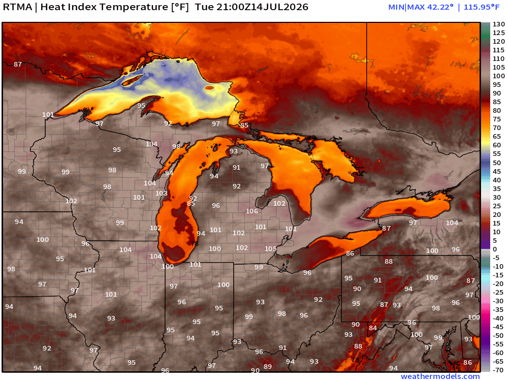
Temperature Analysis | RTMA | 8:45 PM ET
Temperature Anomaly | RTMA | 8:45 PM ET
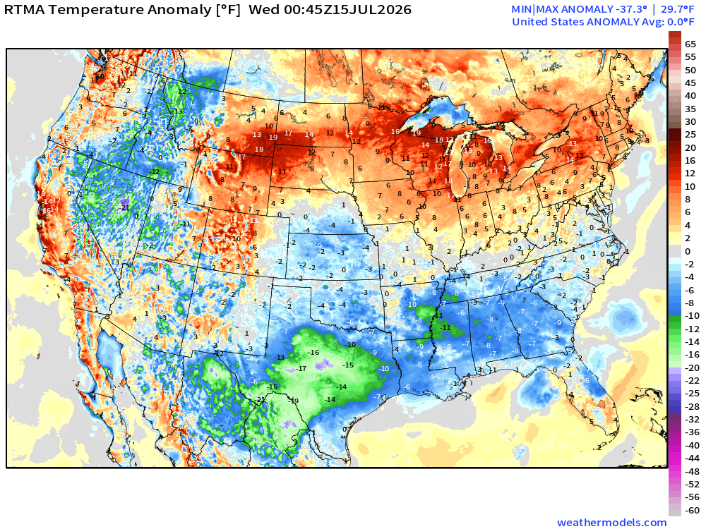
Lower 48 was normal 0.0°F — the heat dome is creating wet/cloudy conditions on the underside and canceling out the heat in Montana and Dakotas.
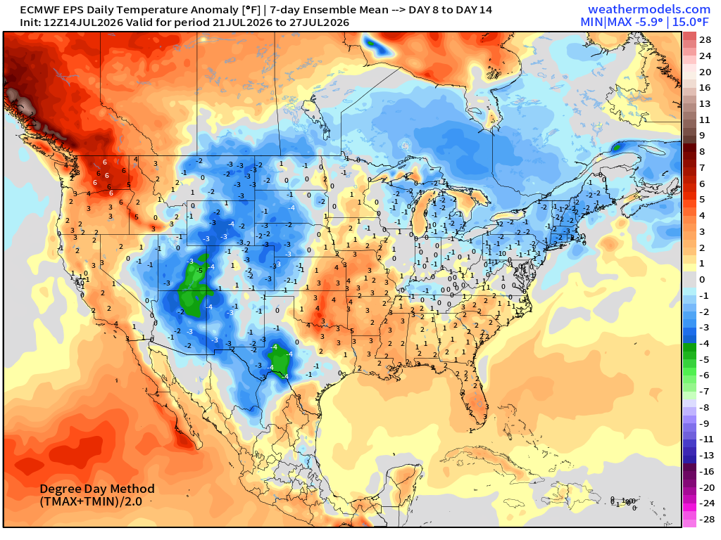
ECMWF Flagship Ensemble Mean Temperature Anomaly next 15-days
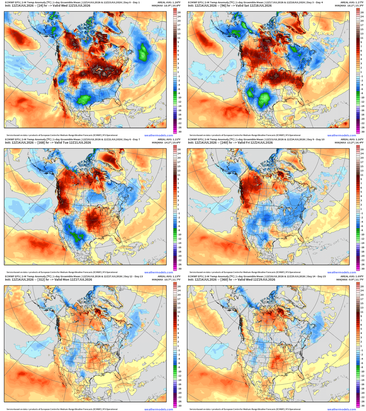
Heat dome breaks down finally and cooling into the Northeast by Week 2
Week 1 —> July 14 to July 20
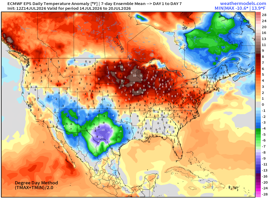
Week 2 —> July 21 to July 27
Atlantic Tropics —> Back to a Ghost Town
Eastern Pacific Tropics —> Tropical Depression 05E
Major become a mid-range Category 2 Hurricane Elida — then comes Fausto
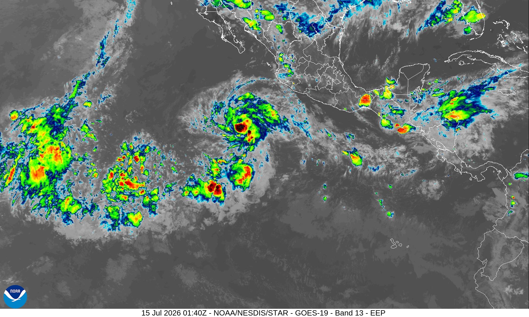
Western Pacific has gone quiet.
Working on upgraded map library (for paid subscribers) here at Weather Trader.
Maps sourced from weathermodels.com designed and innovated by yours truly! Please subscribe there for real-time access to the newest maps, charts from all of the weather models including ECMWF and AIFS, and NOAA GFS/GEFS, HRRR/RRFS and Blend of Models (NBM). NOAA WPC and SPC for fronts/convective outlooks.
Our own content is now sourced from hottestsince.com and weather.city
My Atlantic Hurricane Season Forecast (2026)
From April 7, 2026: Atlantic Seasonal Hurricane Forecast: (11/5/2)
9-13 Named Storms (11 most likely)
4-7 Hurricanes (5 or 6 most likely)
1-3 Major Hurricanes (2 most likely)
Accumulated Cyclone Energy: 75-85 (well below normal)
NOAA 2026 Atlantic Hurricane Season Forecast
- Milepost
- 980 · laid 2026-07-15T02:27:47.344000Z
- Source
- https://weather.substack.com/p/july-14-2026-tuesday-summer-weather
- Digest
- 05f63e8de8dd5c2dcef7f4b4552b6edbaf4bf23a55c8a09abc2481f004139242
- Machine
- JSON