Tropical Storm Arthur Forecast to Deliver Boatloads of Rainfall to Southeast
Tuesday June 16 -- Eastern USA very soggy weather pattern
June 2026 was the 18th-warmest June in the 132-year national record (1895–2026), at 70.6°F against a 1991–2020 normal of 69.5°F (+1.2°F).
June 2026 was the 32nd-wettest June in the 132-year national record (1895–2026), at 3.3in against a 1991–2020 normal of 3.1in (+0.2in).
NOAA/NCEI Climate at a Glance, contiguous United States. This is the observed record for the month, not a score of anything said in this piece — the forecast ledger begins 2026-08-17 and cannot reach earlier posts.

Help support this newsletter (nearing post 1,000!) —> June 2026 Coupon
Help Support these posts (now nearing 1,000!) —> June 2026 Coupon
Tuesday Headline
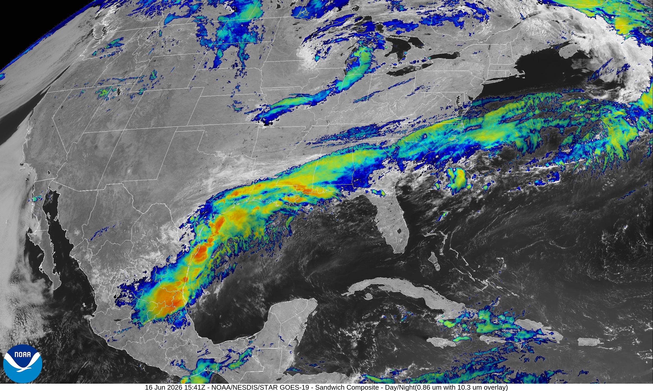
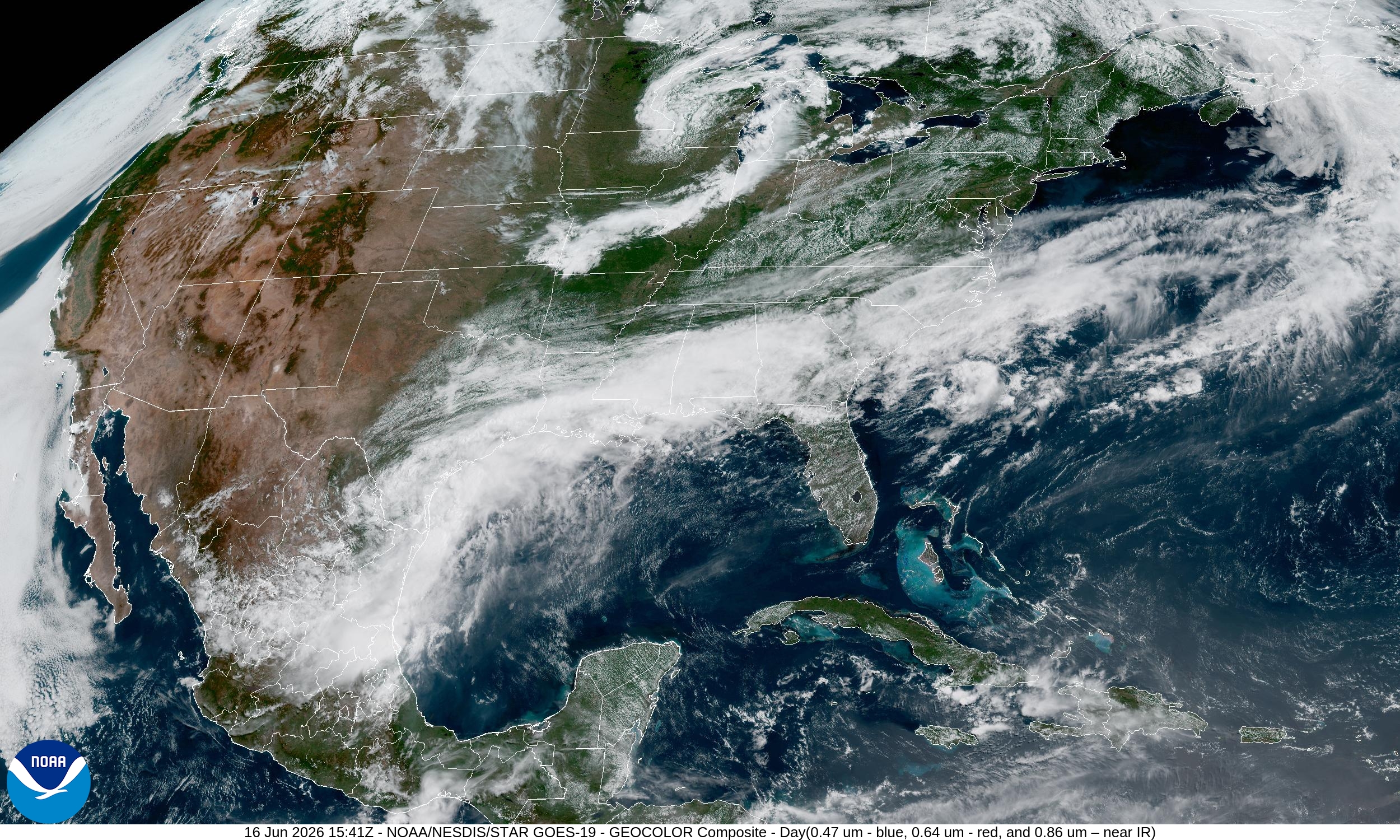
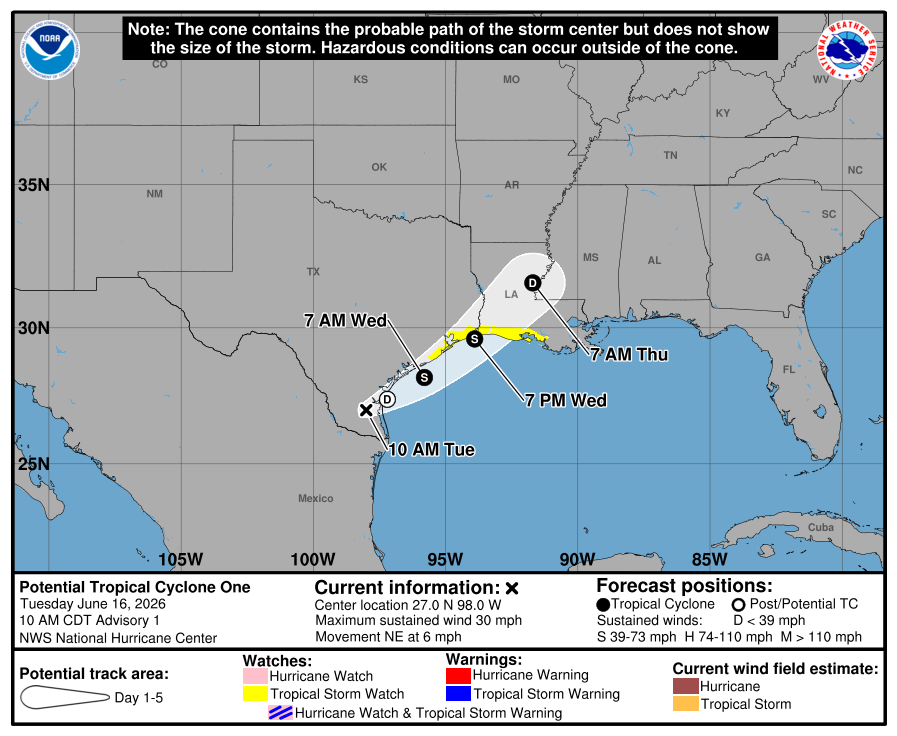
The Tropical Disturbance over South Texas now expected to emerge over the very warm waters of the Gulf of America —> and qualify as a tropical depression or tropical storm —> first name is Arthur. NHC has issued a “Potential Tropical Cyclone” advisory for 01L (no name yet)
NHC Discussion (11 AM ET)
The upper-level environment is not particularly conducive for much intensification with a fair bit of shear and close proximity to land. However, there is enough upper-level support from a jet to the north to cause large-scale deepening, along with convective support from warm Gulf waters, so some intensification is anticipated through Wednesday. This forecast is similar to the model consensus IVCN. It should be noted that this system will likely never have a pure tropical appearance on satellite due to the upper trough and shear, with a highly asymmetric appearance with the rainfall and winds favoring the eastern semicircle.
Regardless of any “named storm” development the deep tropical moisture will inundate the coast and deliver “boatloads” — upwards of 4”-6”+ from Texas into the Mississippi River Valley over next 7-days. This is separate from a powerful Great Lakes storm system with severe weather and also heavy — and not needed — rain (update on that later this evening).
Timeline:
Wednesday morning —> named storm formation off coast of Corpus Christi, Texas
Landfall later into early Thursday along TX/LA state line
Continued track through the Deep South — continuing to focus heavy rainfall with Gulf tropical moisture
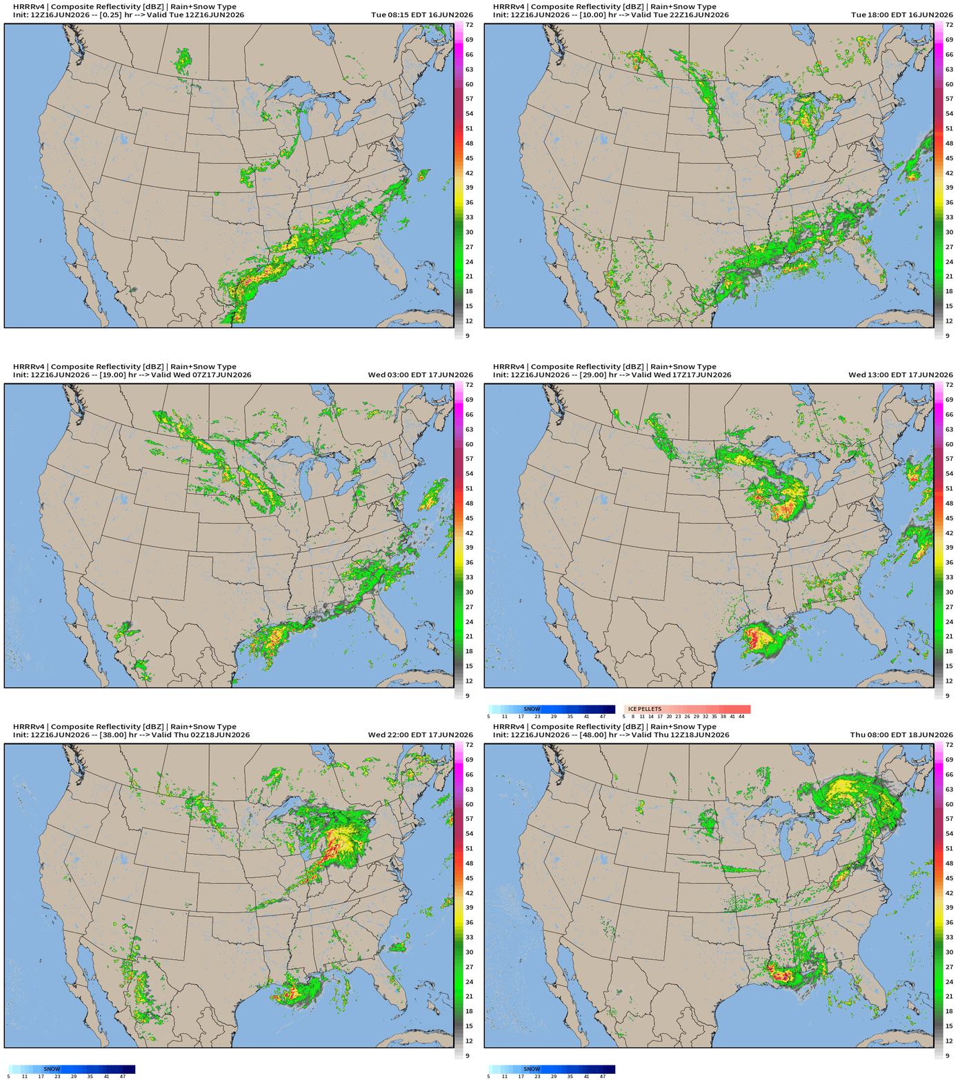
A predecessor rainfall event (PRE) is setting up downstream of PTC 01L (Arthur)
Next 48-hours Simulated Radar
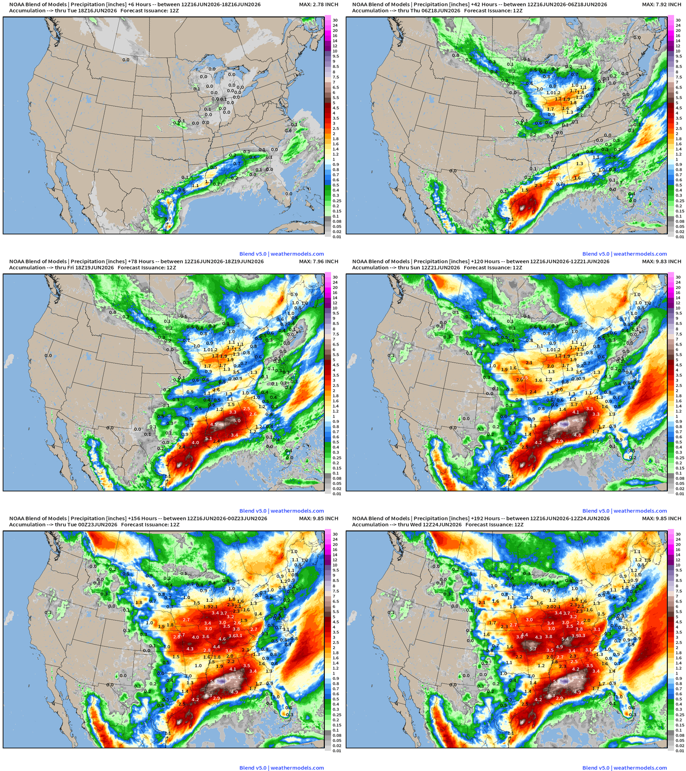
Very soggy pattern! 7-day Rainfall Totals from Blend of Models —> astounding.
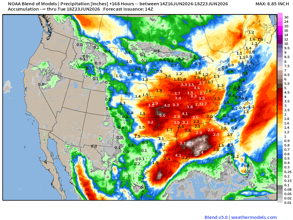
All of this red is at least 2” with many areas of 4” to 6” embedded within … and we should expect these tropical downpours to deliver a LOT of rain in short order —> gullywashers!
Integrated Vapor Transport — Next 6-days
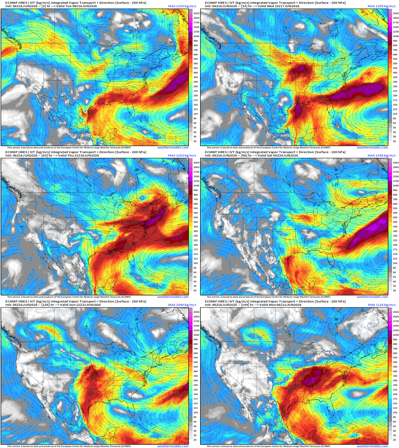
The Tropical System is embedded within a “deep layer tropical moisture plume” with origin in Caribbean and into the Gulf of America.
There is also a strong upper-level trough to the north associated with Canadian origin air mass — and the influence of the mid-latitude weather system (strong trough for mid-June) will provide upper-level jet stream energy to provide a “baroclinic kick” to the tropical disturbance —> assisting its intensification to Arthur.
This unusual situation can occur when a surface low encounters the jet stream quadrant (right rear) and phases to increase convergence and ascent —> intensification of the surface circulation.
ECMWF 06z | Precipitable Water | My Favorite Parameter
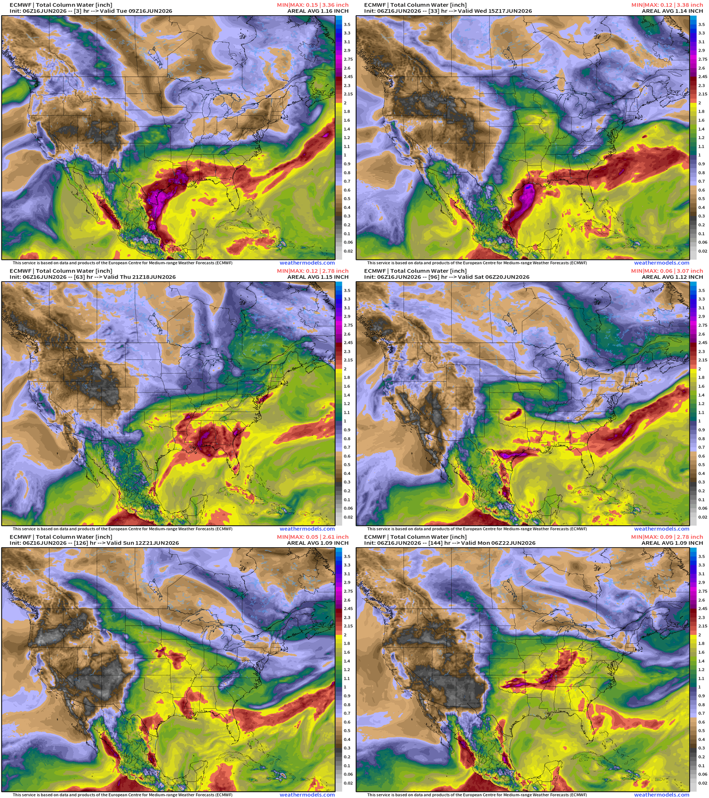
The red PWAT > 2” and even some 3” areas embedded within the tropical low. Note how the system retains much of its circulation / coherence while within the frontal boundary draped along the Deep South / Gulf coast.
This is a recipe for HUGE rainfall totals with daytime heating + tropical moisture.
Great Lakes Powerful Storm System into Thursday
More on this later today — unusually strong land cyclone aided by a Canadian trough —> severe weather and heavy rain
Zooming Out on Atlantic
Flagship model: ECMWF AIFS 06z —> Integrated Vapor Transport next 10-days
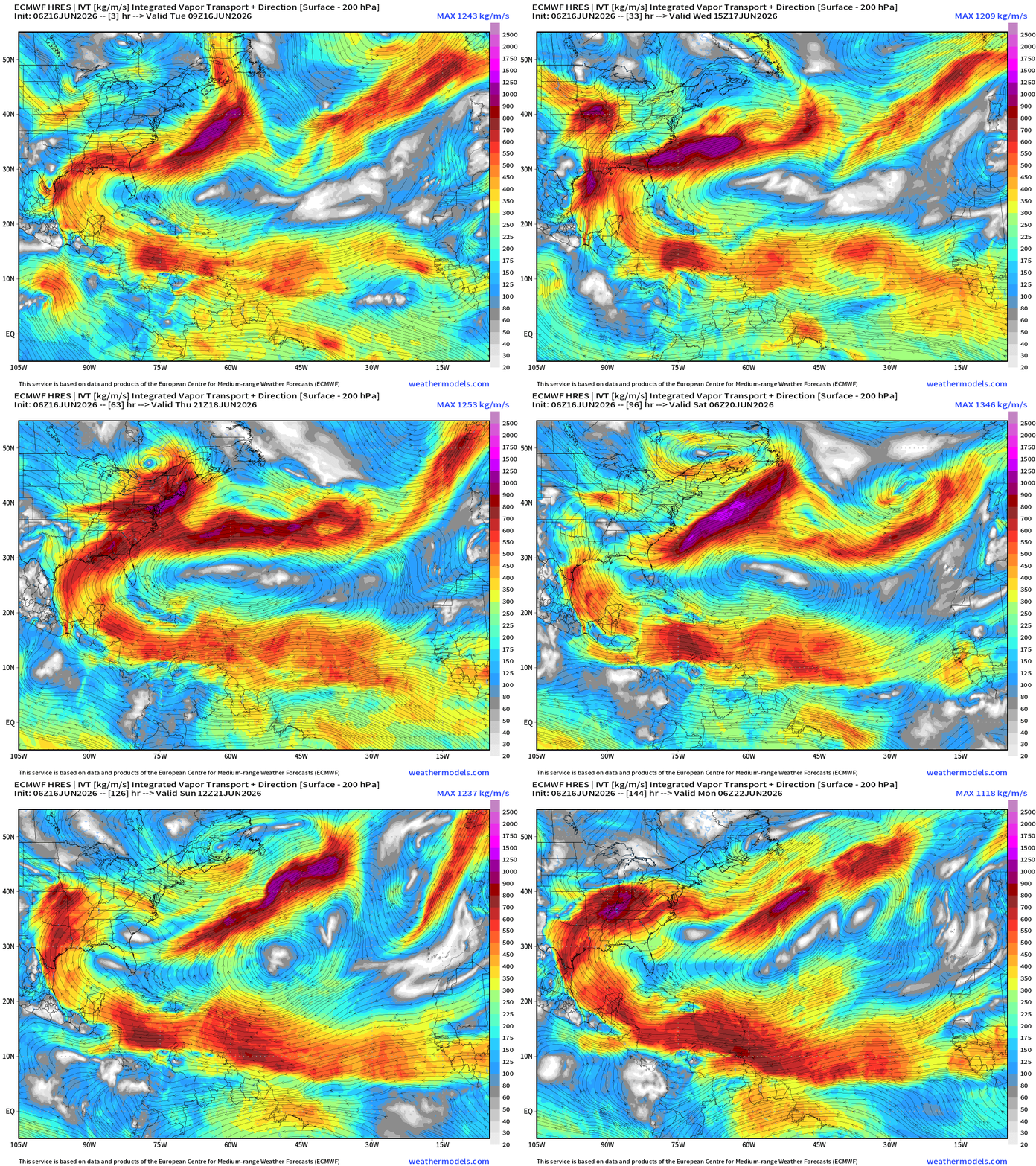
The tropical moisture plume finally breaks down into the Gulf and southern U.S. when a chunk or westward extension of the Bermuda high moves westward to dominate the Gulf of Mexico with high pressure … but until then, another 5-7-days of deep layer tropical moisture right into the Texas and the Deep South —> rainfall
Saharan Air — African Dust Next 10-days
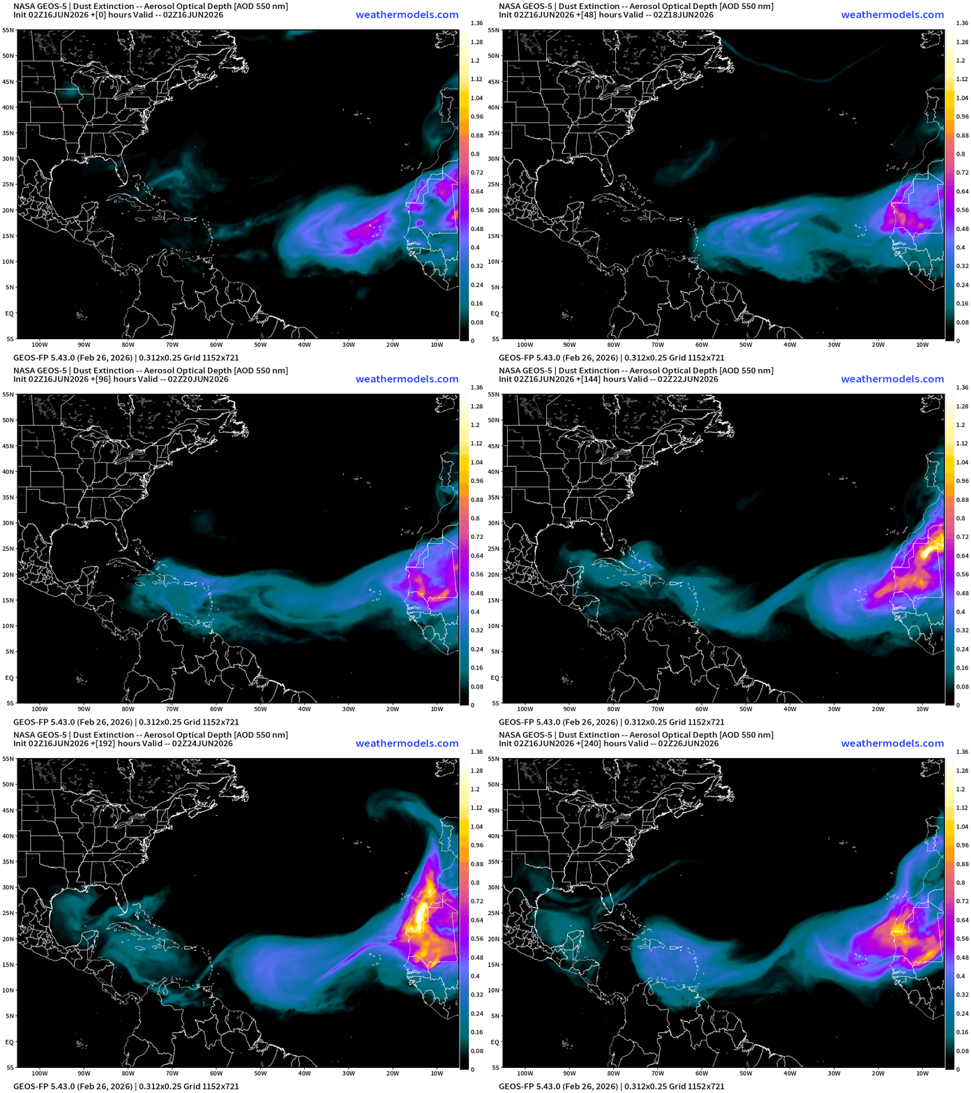
A moderate Dust Layer (with Saharan Air) moving across the Main Development Region — and will reach the Caribbean in 2-3 days before decaying/wringing out with gravity and some convection/storms. Another SAL emerges in 5-6 days to repeat the pattern — typical for mid-to-late June.
Sea Surface Temperature Anomaly | Atlantic
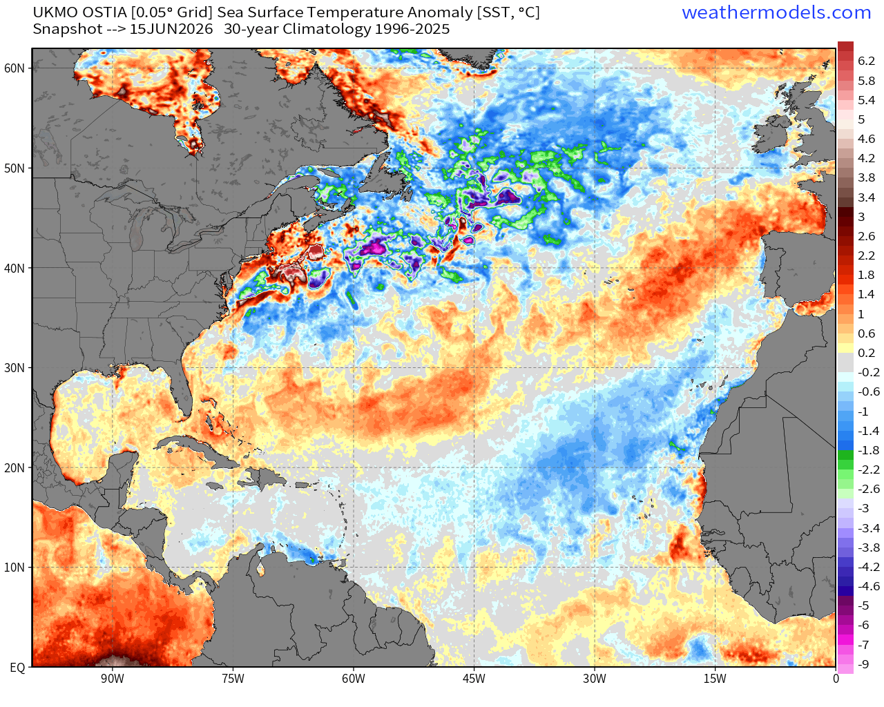
The Eastern Atlantic much cooler than normal < 26°C (green actual SST map) and blue anomaly (chilly) —> signal for stability and difficulty sustaining tropical convection = no storm development and squelching of tropical waves.
Change in Actual SST | 2026 minus 2025
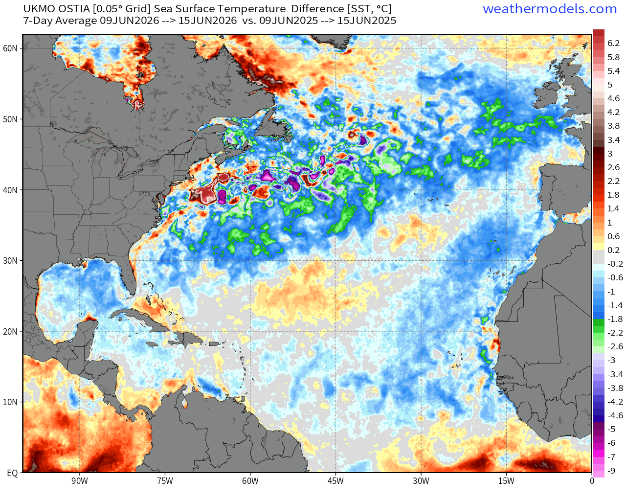
Huge cooling across much of the North Atlantic basin compared to last year!
Global SST Anomaly
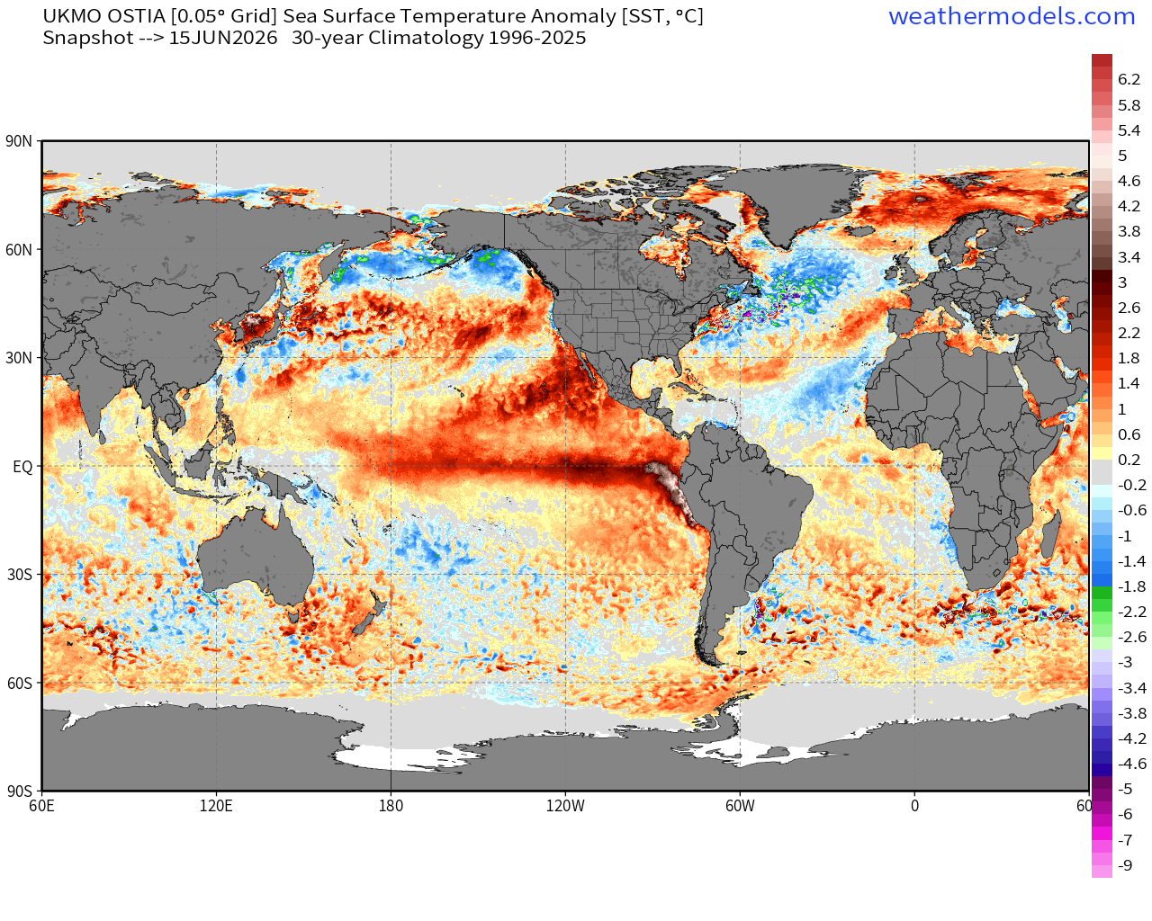
El Niño underway! Very warm SST anomaly along the equatorial Pacific
But we don’t usually show the actual SST near the Galapagos Islands
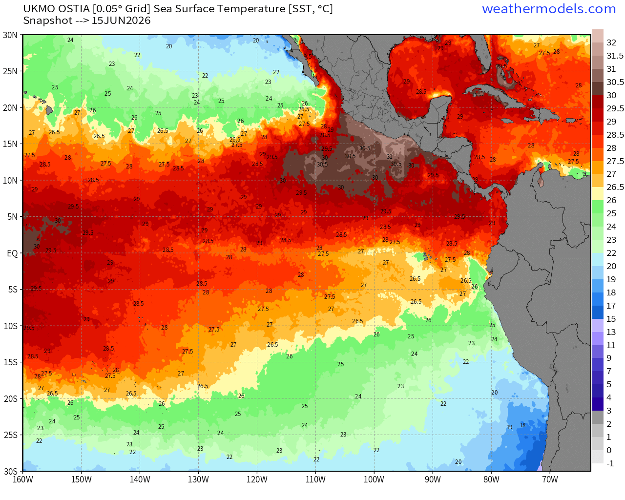
The famous tortoises live on islands usually within cool Equatorial waters … but we see 27°C actual SST surrounding their home. Galapagos Giant Tortoise

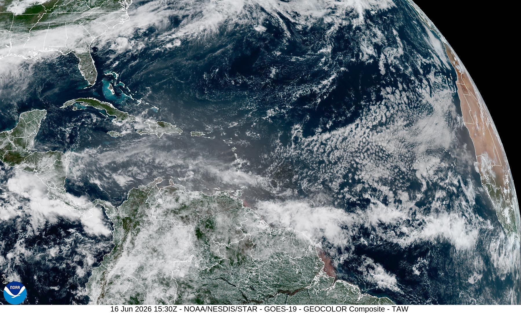
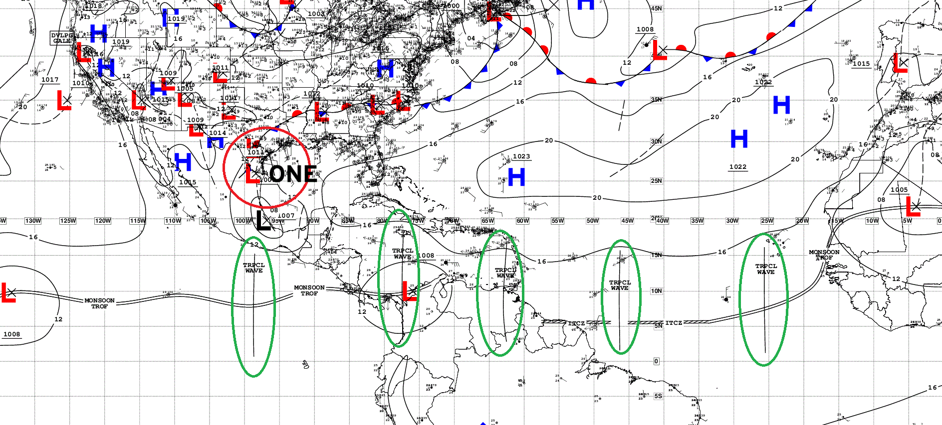
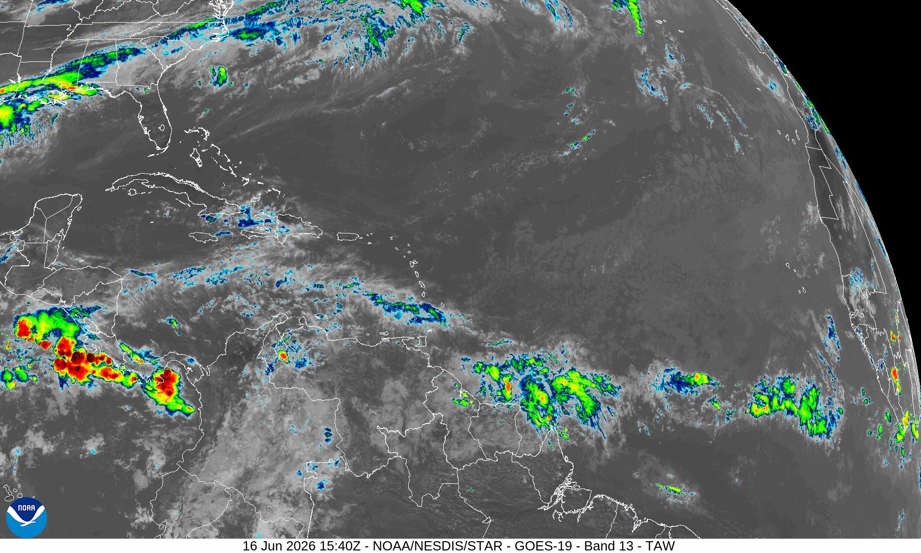
Atlantic basin outside of the Gulf of America is rather quiet — typical for mid-June.
Tropical Wave Analysis: n = 4 in Atlantic + 1 in Eastern Pacific = none developing.
Some convection along the ITCZ displaced well south
HUGE Rainfall Totals for mid-June
Blend of Models —> Precipitation Next 8-days
ECMWF 06z | Precipitation + MSLP | Next 6-days
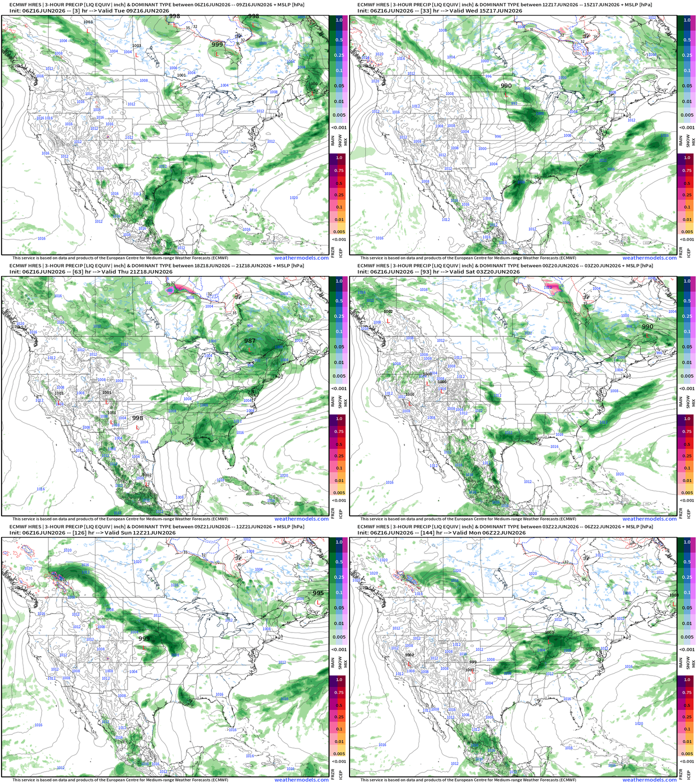
Surface low ~1004 mb does develop right along the Texas coast —> Arthur
Weather Pattern: 500 mb Height Anomaly | AIFS-Single Next 10-days
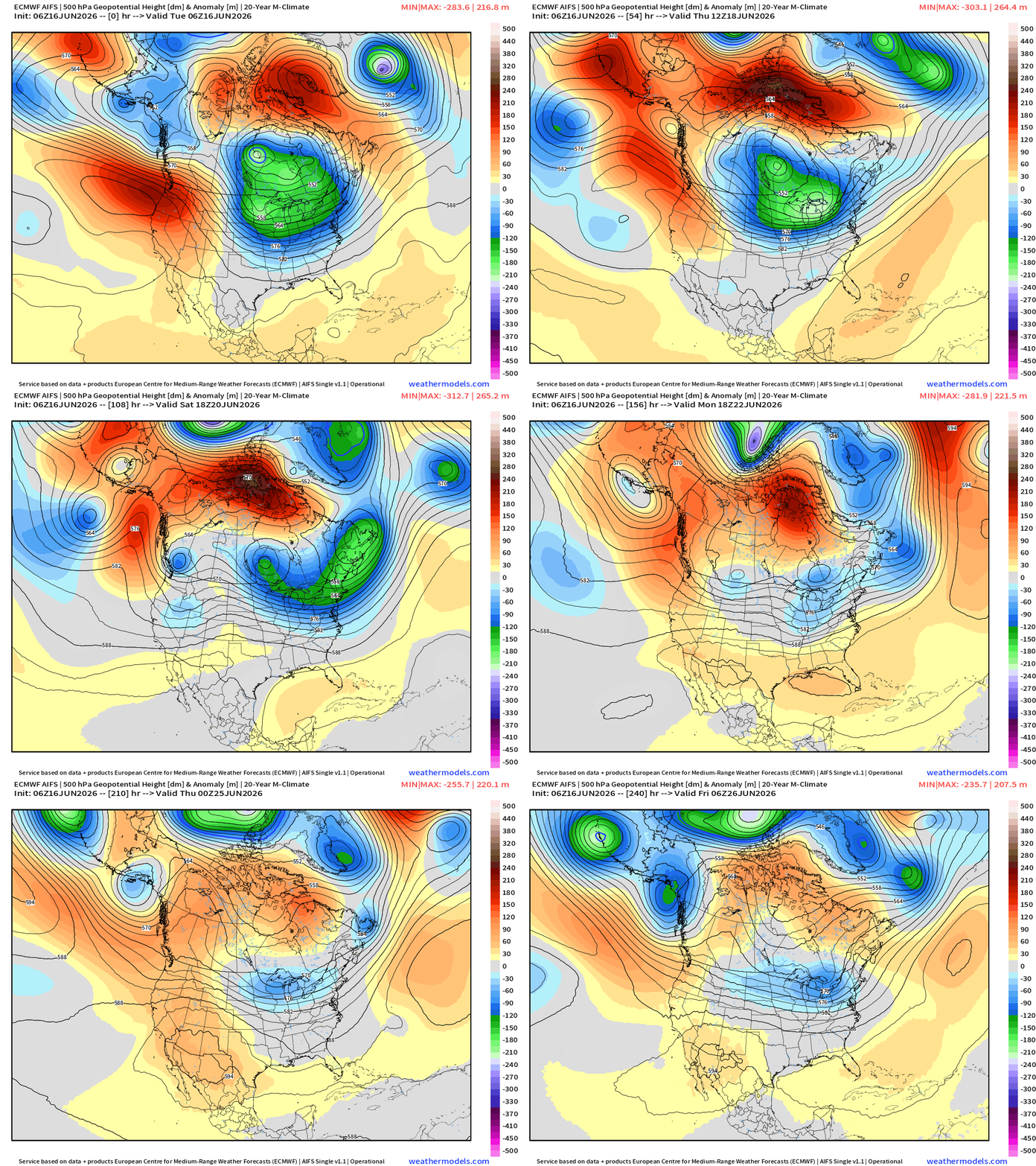
Very strong mid-level trough maintains its grip on the Midwest and Great Lakes for the next 7-days. The flow out of the Northwest is straight from the Arctic = cool and dry … very intense trough for mid-June. This trough will fuel a powerful storm system (Low 985 mb)
A Pacific origin trough swoops into the replace the Canadian vortex into next weekend.
Eastern Pacific — One area of interest Invest 93E (10% chance)
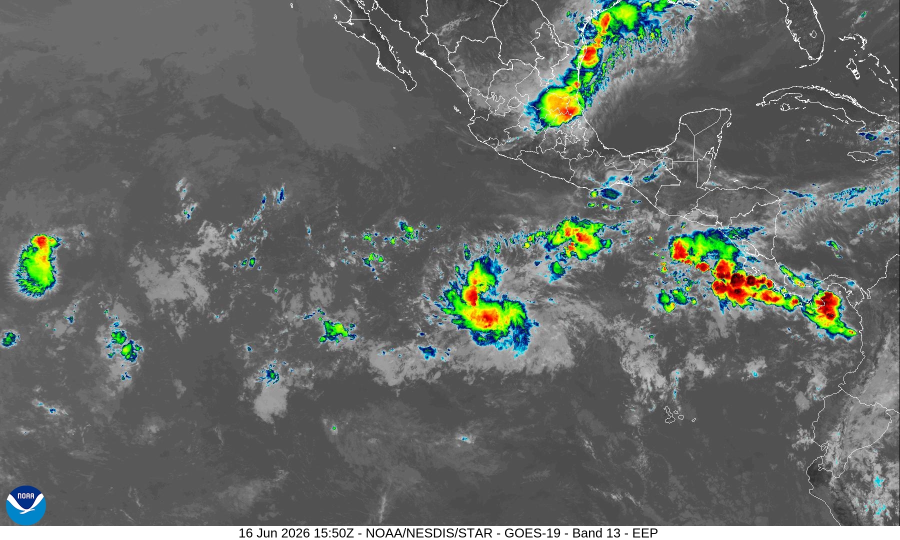
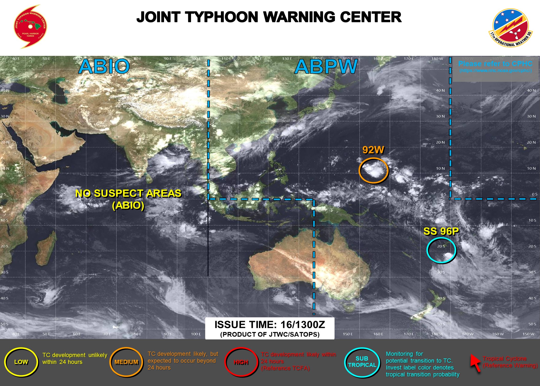
Western Pacific Typhoon — Slow but steady development of a system in next several days —> Invest 92W
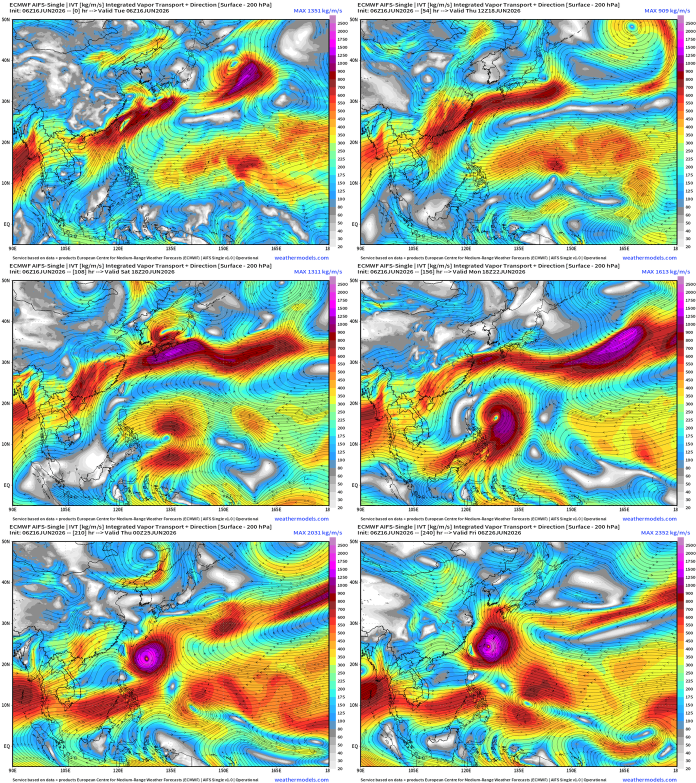
Moisture Transport — Next 10-days
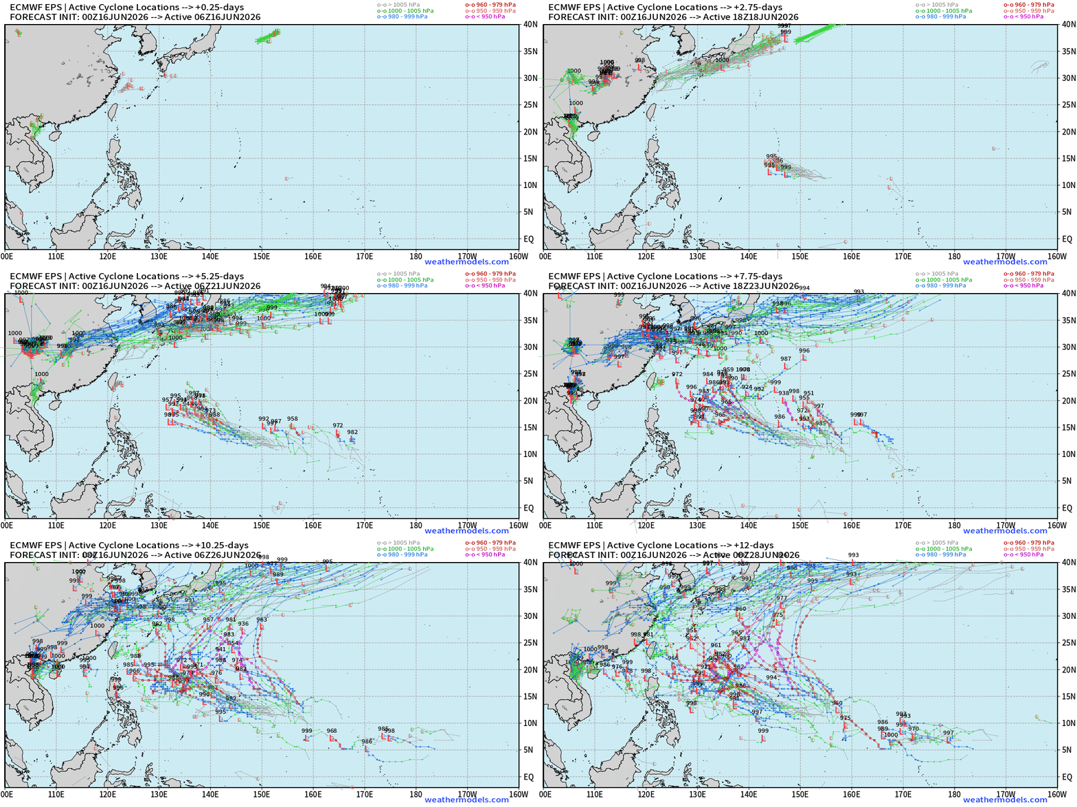
Full Physics Ensemble Tracks — 2 systems likely … another following 92W
Thank you for reaching the end of this post! Hopefully you enjoyed the beautiful weather maps. Please help increase the visibility of Weather Trader on Substack: Share or Like!
Help support this newsletter (nearing post 1,000!) —> June 2026 Coupon
Maps sourced from weathermodels.com designed and innovated by yours truly! Please subscribe there for real-time access to the newest maps, charts from all of the weather models including ECMWF and AIFS, and NOAA GFS/GEFS, HRRR/RRFS and Blend of Models (NBM). NOAA WPC and SPC for fronts/convective outlooks.
My Atlantic Hurricane Season Forecast (2026)
From April 7, 2026: Atlantic Seasonal Hurricane Forecast: (11/5/2)
9-13 Named Storms (11 most likely)
4-7 Hurricanes (5 or 6 most likely)
1-3 Major Hurricanes (2 most likely)
Accumulated Cyclone Energy: 75-85 (well below normal)
NOAA 2026 Atlantic Hurricane Season Forecast
- Milepost
- 960 · laid 2026-06-16T16:26:22.840000Z
- Source
- https://weather.substack.com/p/tropical-storm-arthur-forecast-to
- Digest
- ea212f108ddb2ef8d3216e526da39dfa1714d4492431a5b18073fe97995b5c89
- Machine
- JSON