May 20, 2026 Wednesday Spring Weather
One more day of extreme heat across Mid-Atlantic and Northeast before cold front
May 2026 was the 29th-warmest May in the 132-year national record (1895–2026), at 61.7°F against a 1991–2020 normal of 61.0°F (+0.6°F).
May 2026 was the 63rd-driest May in the 132-year national record (1895–2026), at 2.9in against a 1991–2020 normal of 3.1in (-0.2in).
NOAA/NCEI Climate at a Glance, contiguous United States. This is the observed record for the month, not a score of anything said in this piece — the forecast ledger begins 2026-08-17 and cannot reach earlier posts.

Tip: This newsletter is best viewed in the Substack App as email may clip contents
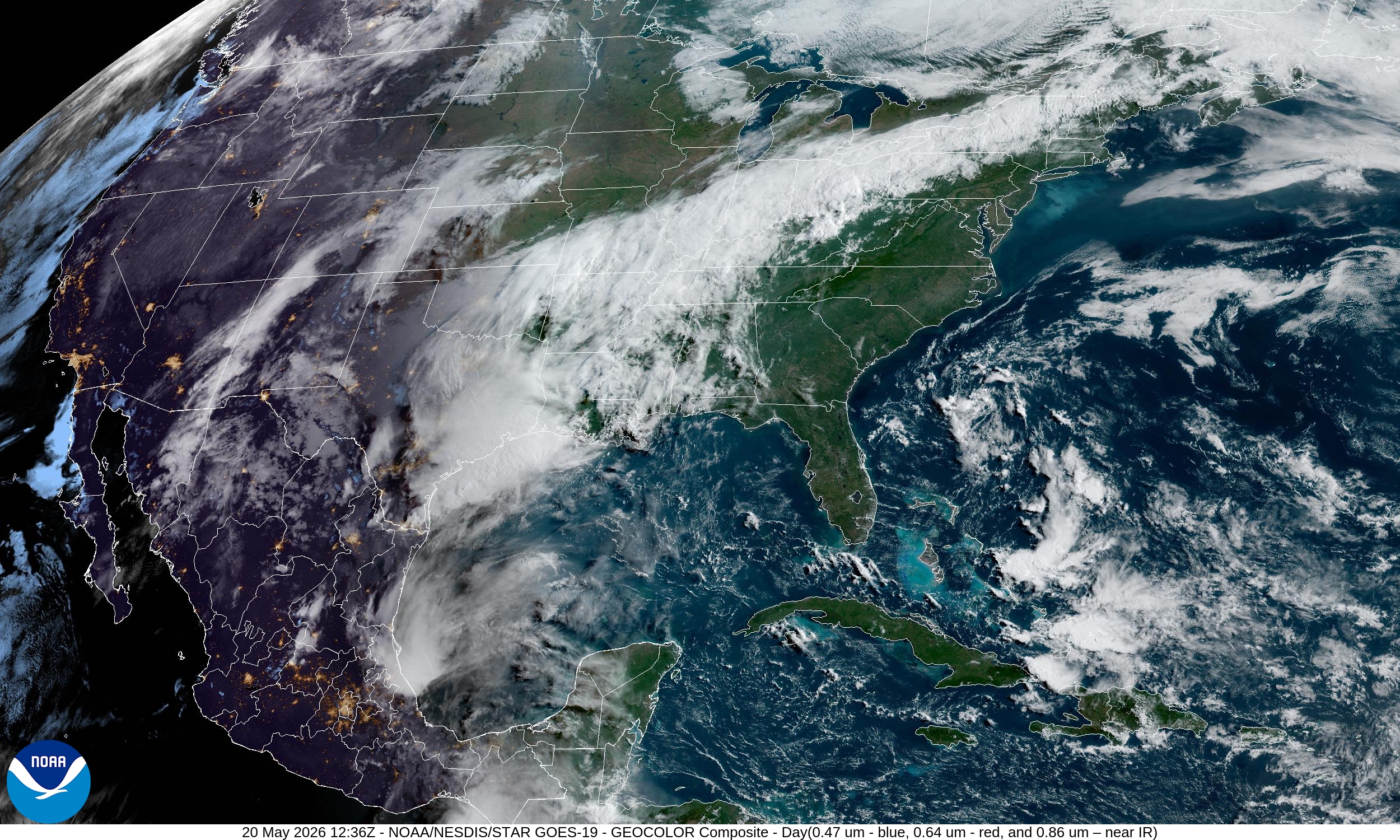
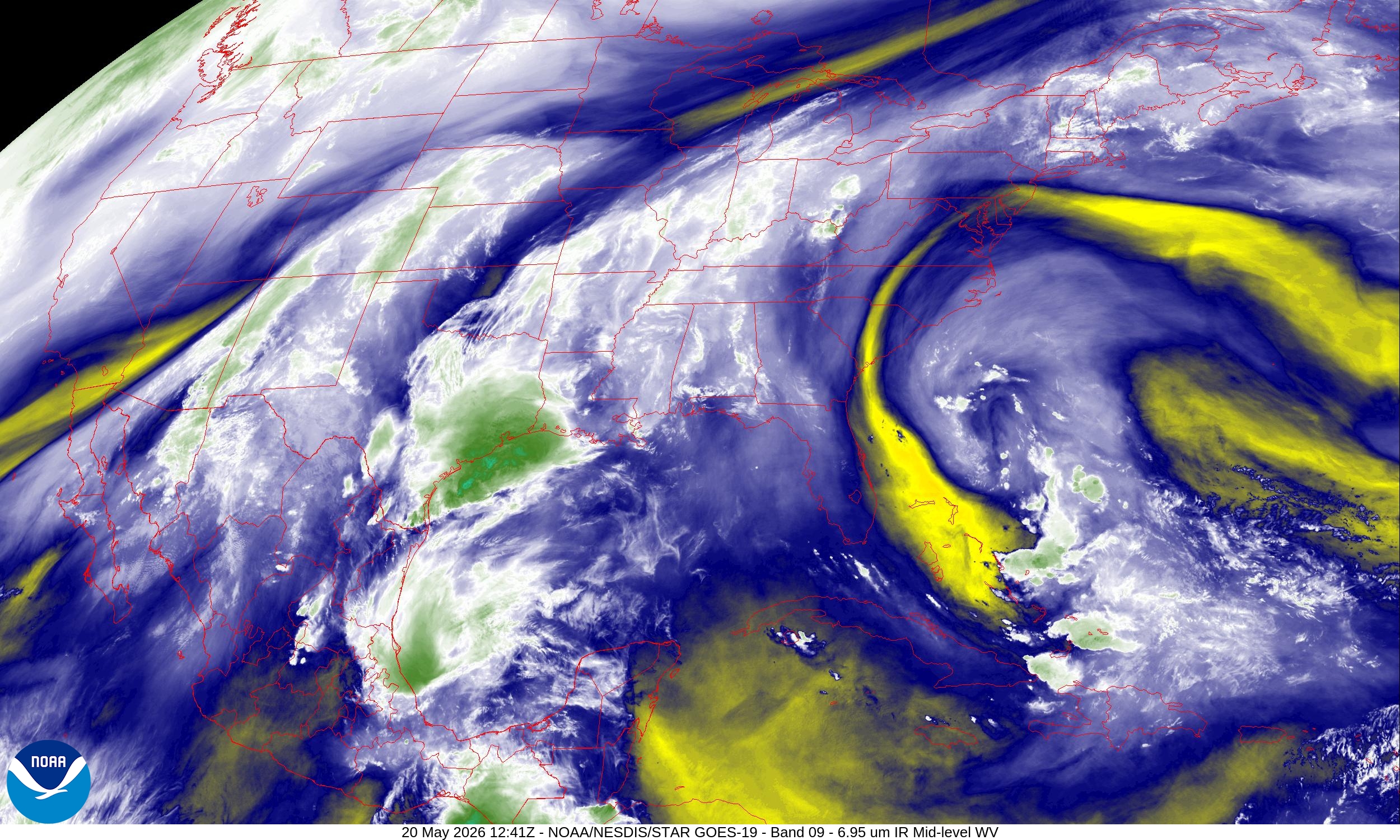
Southerly flow out of the Gulf of Mexico bringing boatloads of moisture into Texas, and along a frontal boundary extending into the Ohio River Valley. This pattern will persist into early June!
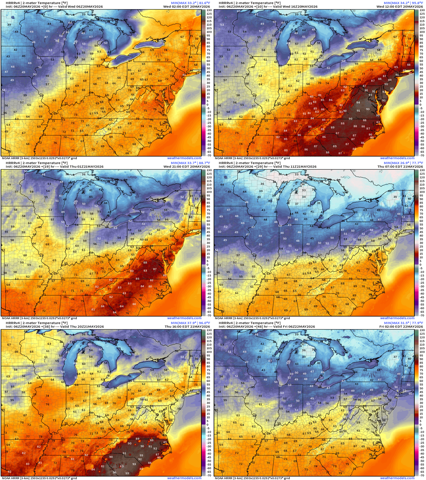
Cold Front is on the way! Temperatures will cool from the 90s today to 60s and 70s tomorrow. Temperatures next 48-hours (HRRR 06z)
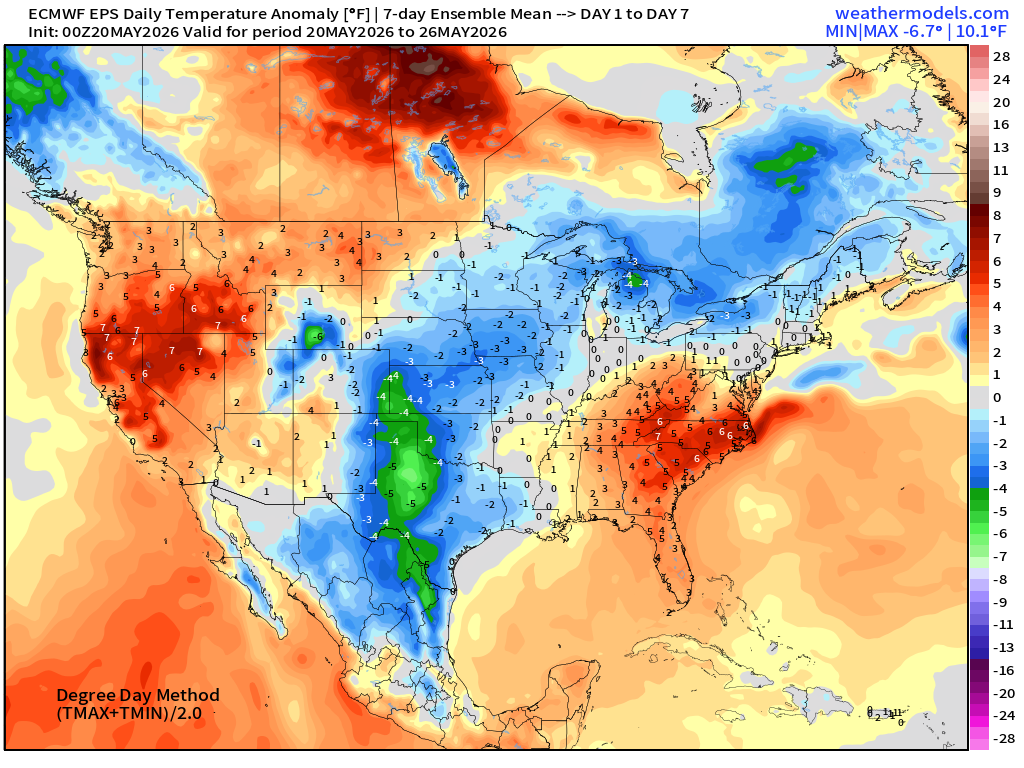
Temperature Anomaly Next 6-days — into next Tuesday morning
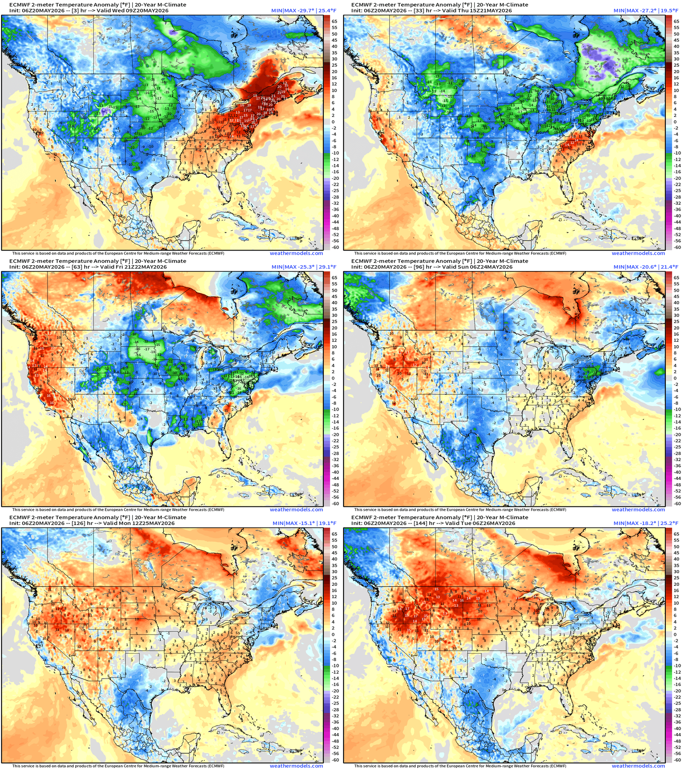
Heat wave breaks on Wednesday behind a strong cold front, and much cooler air continues into early next week
Extensive cold pool across the Western U.S. shifts eastward — a lot of blue and green across the Lower 48 into Memorial Day Weekend.
Warmth builds across the West into the northern Rockies.
Clouds and rain out of the Gulf will keep the southern U.S. muggy
Wednesday Morning Top Headline
Boatloads of rainfall expected through next 10-days as a conveyor belt of moisture out the Caribbean and Gulf of Mexico flows into Texas, the lower Mississippi River Valley, and across the Southeast. This persistent wet pattern is very good news!
Precipitation Next 10-days | Blend of Models (v5.0)
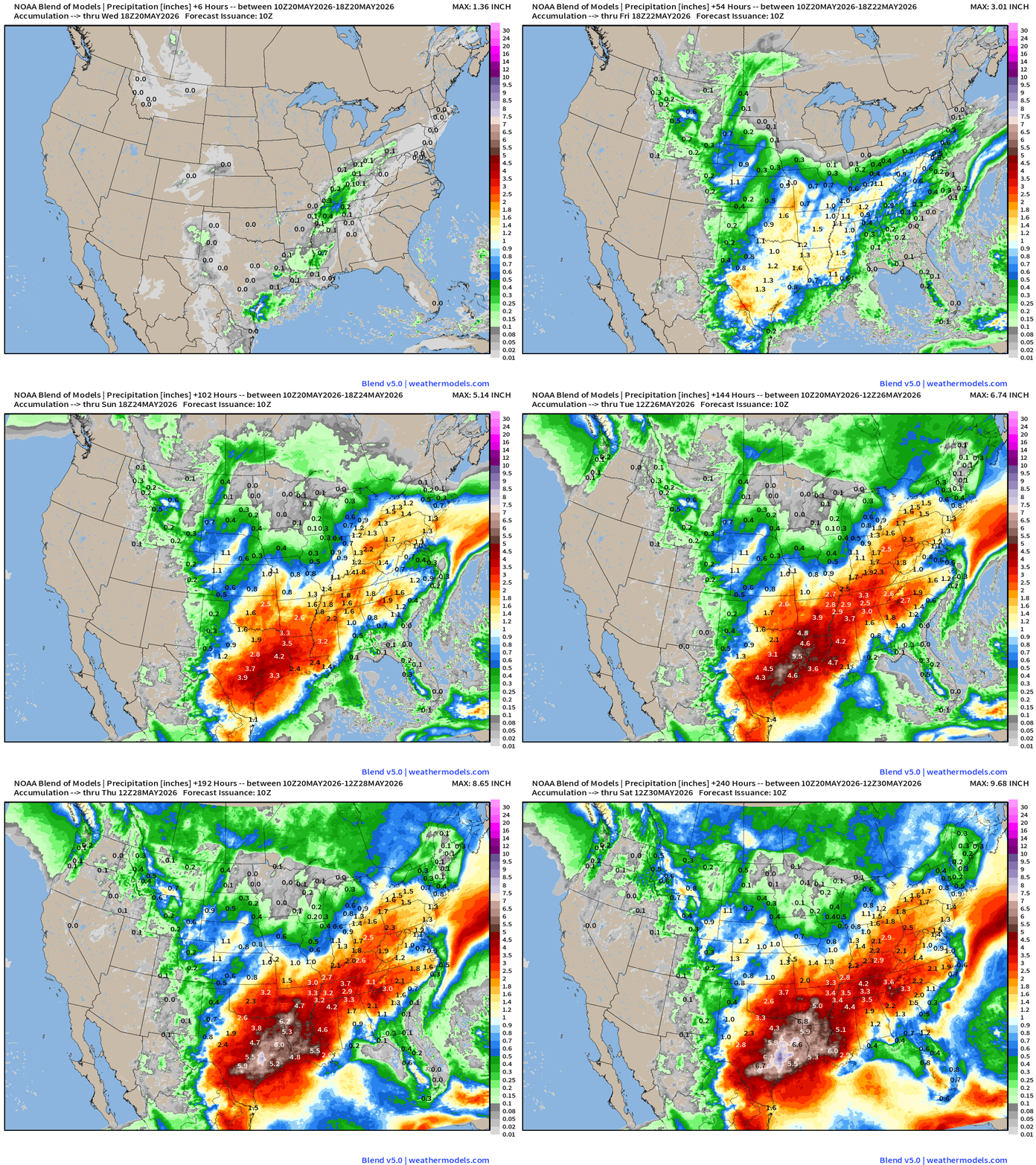
Over next 10-days, upwards of 6-8” of rain across eastern Texas with a wet eastern U.S. from the Plains into the Great Lakes, and Ohio River Valley
High Temperatures Next 9-days until Thursday, May 28th
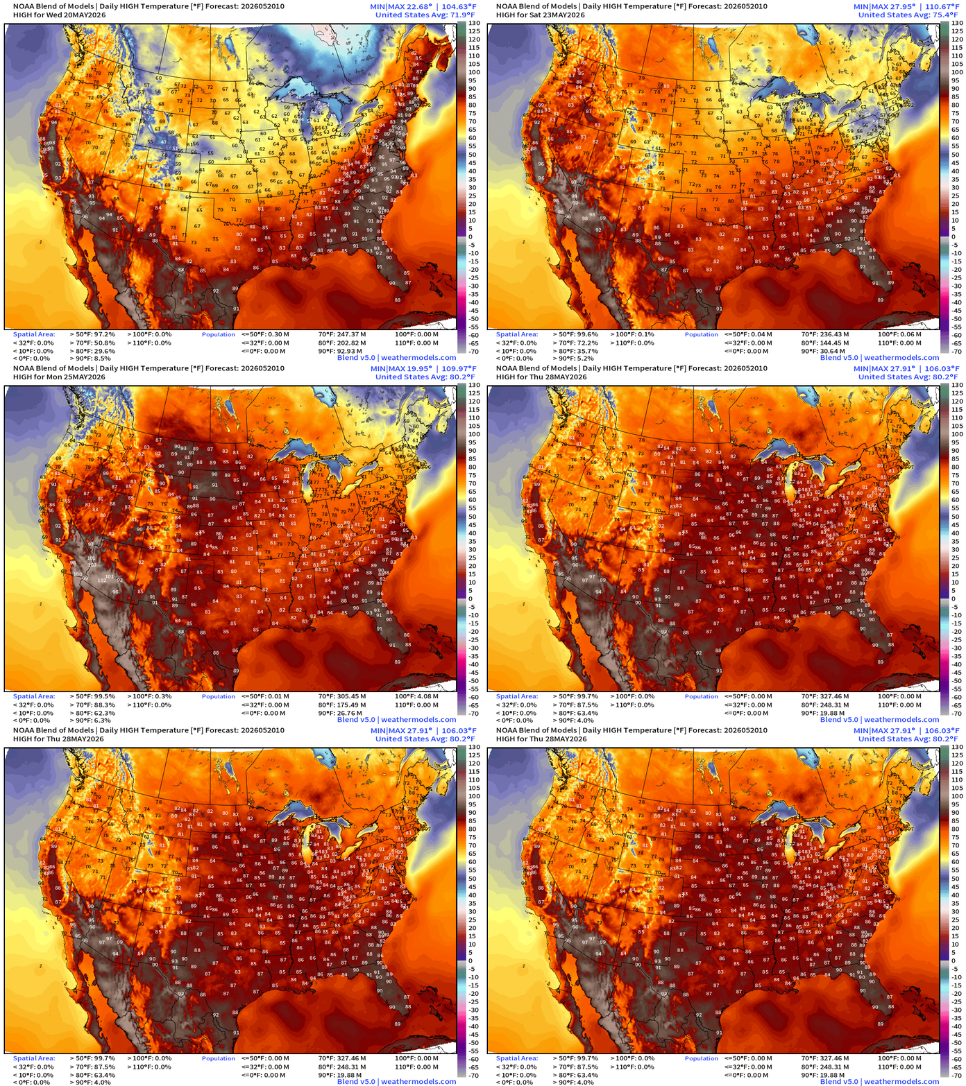
Cooler air behind a strong cold front sweeps eastward into Friday, and then slow moderation/heating again into weekend and Memorial Day. Not seeing widespread 90s into late-May and early June, but instead 80s!
ECMWF 06z | Precipitation Type + MSLP | Next 6-days
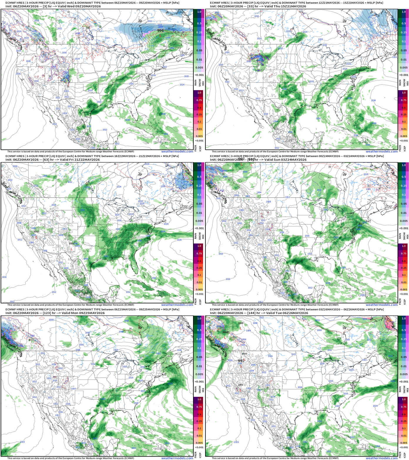
Notable weather systems: just blobs of moisture along frontal boundaries
Quite a bit of moisture —> rainfall without the presence of a strong low-pressure (typical for late-May) = pop-up or convective storms as we head through late Spring.
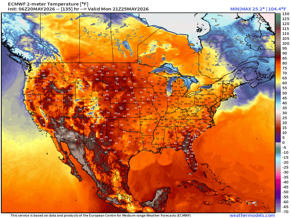
Memorial Day Afternoon —> soggy across Southern U.S.
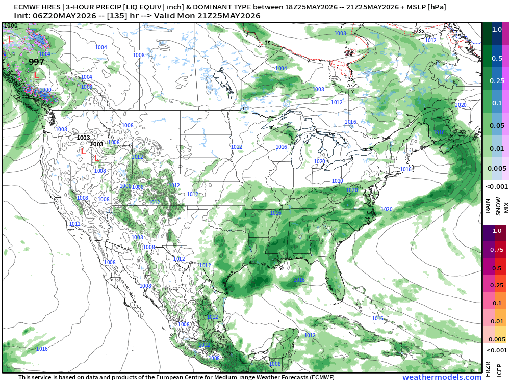
Huge moisture surge from Gulf of Mexico to Ohio River Valley
Temperatures mostly in the 70s and 80s — not 90s!
ECMWF Flagship Ensemble Temperature Outlook
Temperature Anomaly | Next 15-days | ECMWF EPS 00z Ensemble Mean
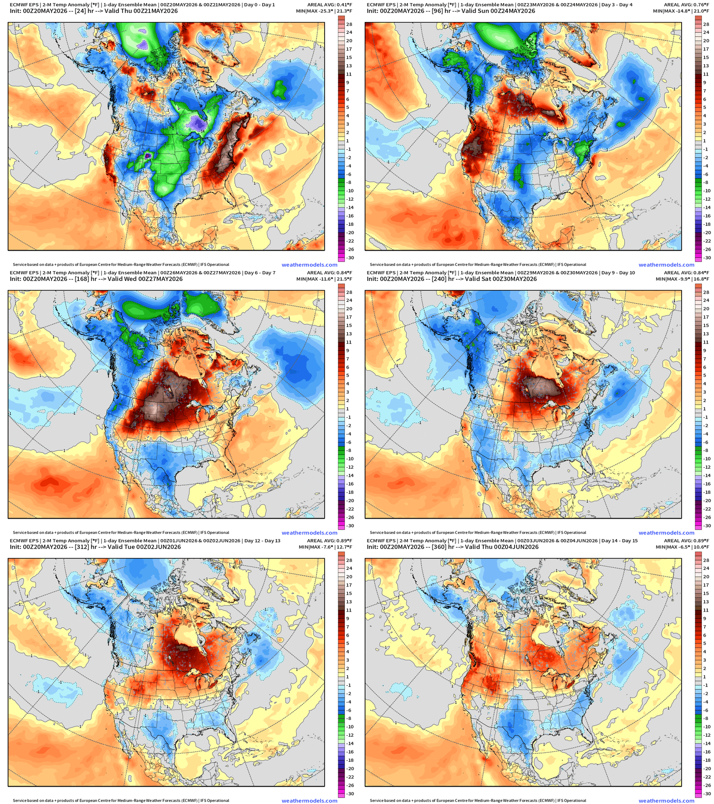
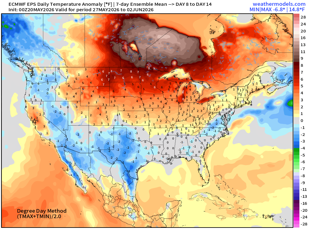
Western warmth rebuilds and then moves into Canada … but cooler weather on the periphery due to moisture flow out of tropics
Week #1 | Temperature Anomaly | May 20- May 26
Week #2 | Temperature Anomaly | May 27 - June 2
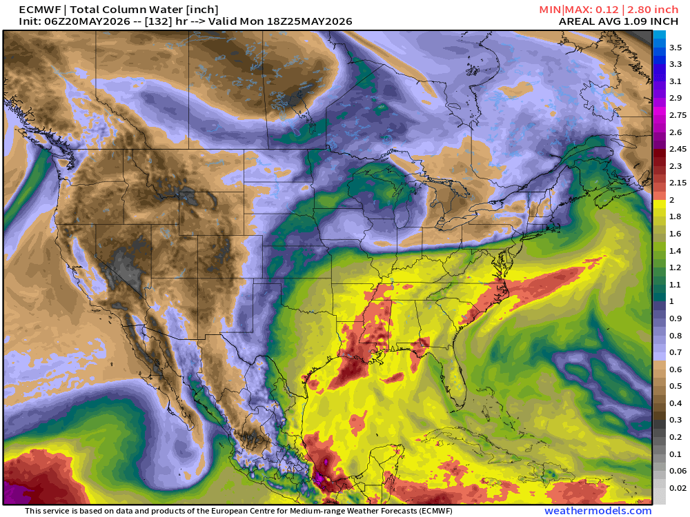
ECMWF 06z | Forecast 6-days of Precipitable Water (my favorite parameter!)
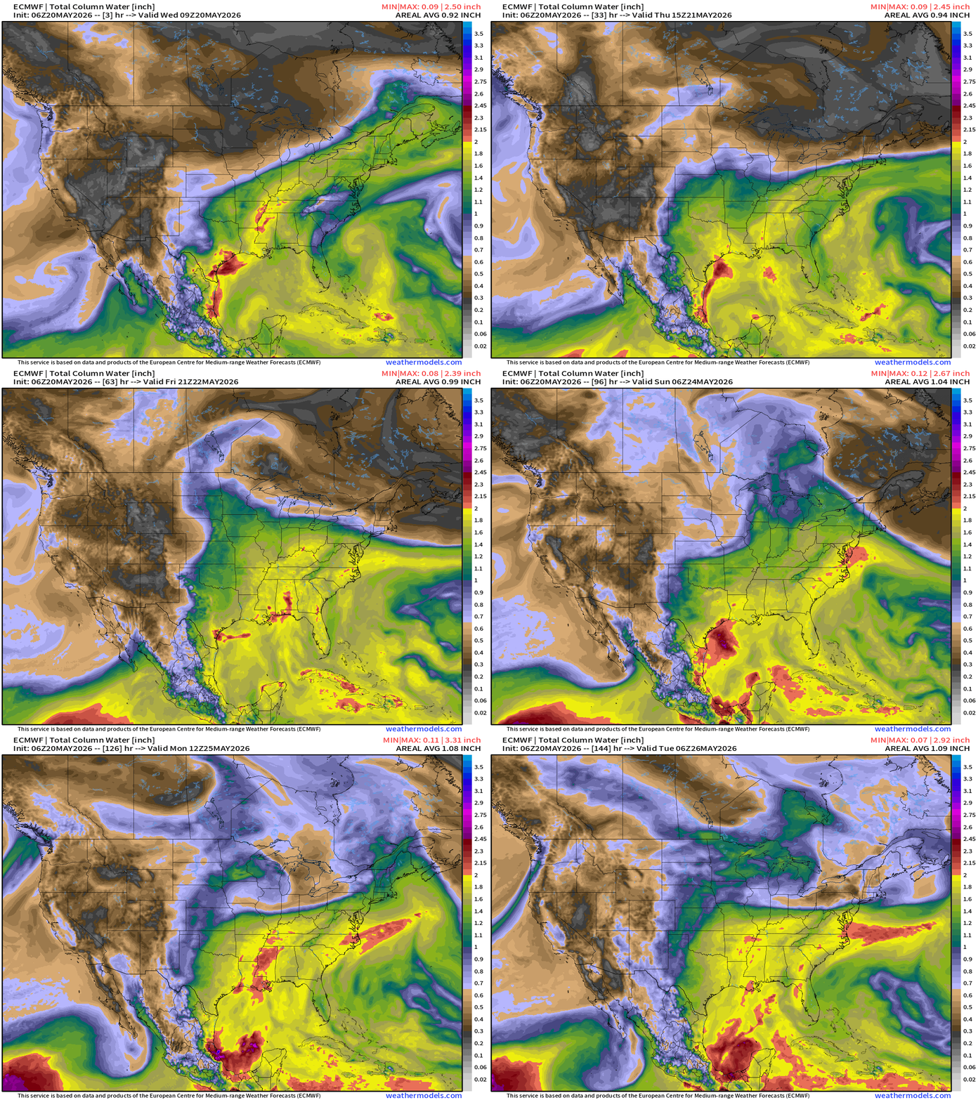
Boatloads of moisture surging out of the Gulf — welcome to summer!
Integrated Vapor Transport | Next 10-days
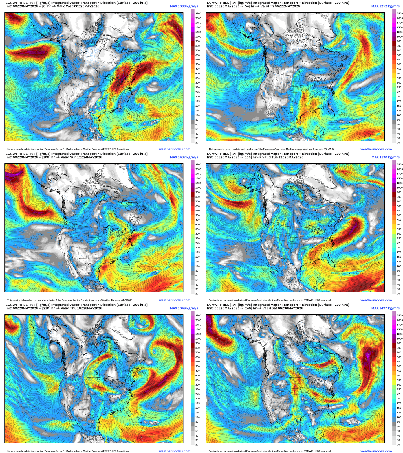
I see a persistent pattern shaping up for the south from Texas into the Southeast with strong southerly flow around the Bermuda / subtropical high / ridge anchored off the Eastern U.S.
—> boatloads of moisture/rainfall for Texas into the Lower Mississippi River Valley and hopefully more in the Central Plains to dent the ongoing drought conditions.
RTMA Current Temperature Analysis | 8:15 AM ET
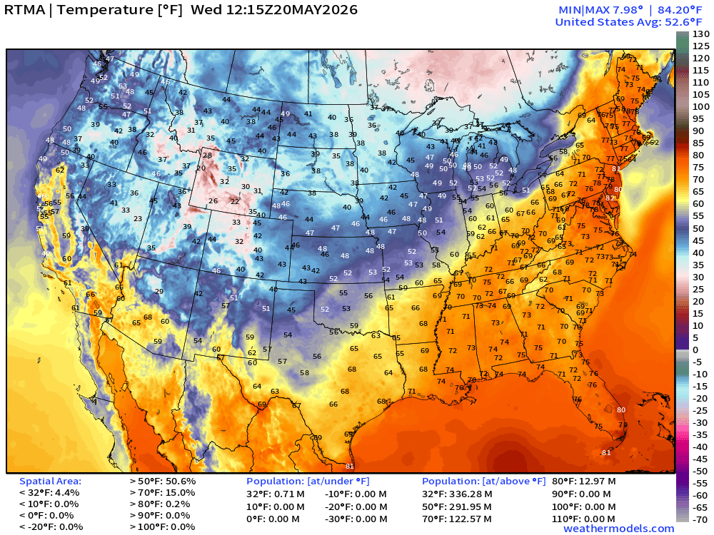
RTMA Current Temperature Anomaly Analysis | 8:15 AM ET
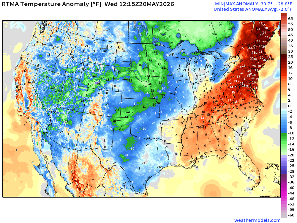
Lower 48 was -2.0°F BELOW normal on balance between exceptional chill behind cold front vs. heat wave centered on the mid-Atlantic and Northeast, for now.
Lower 48 Weather This Evening into Thursday Morning
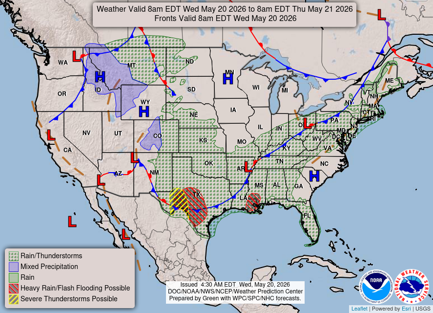
Rain — could be heavy in Texas — along the cold front
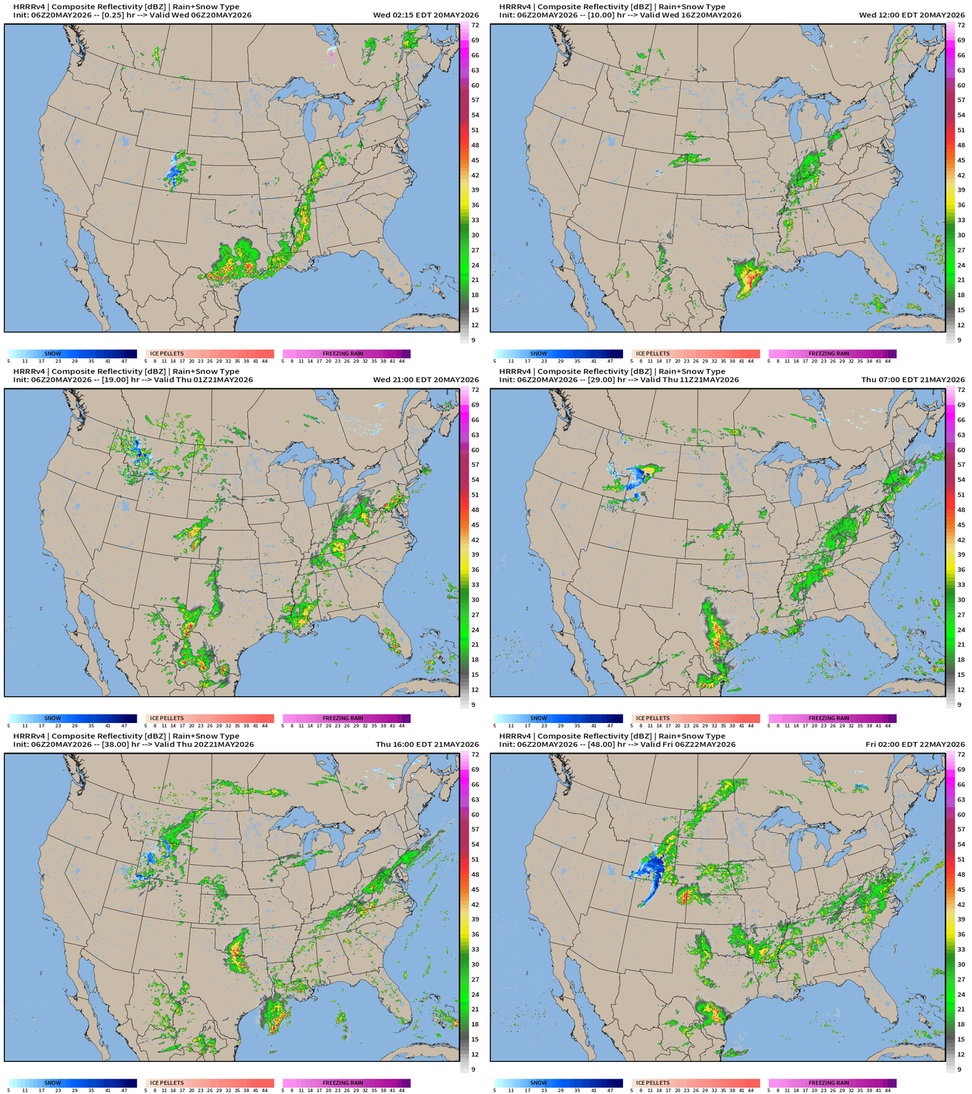
Radar Simulation (HRRR) next 18-hours
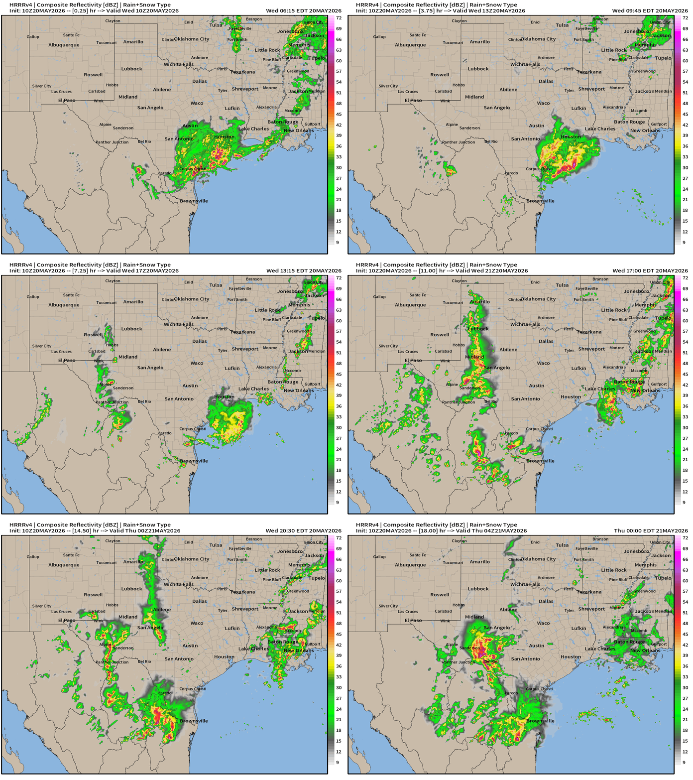
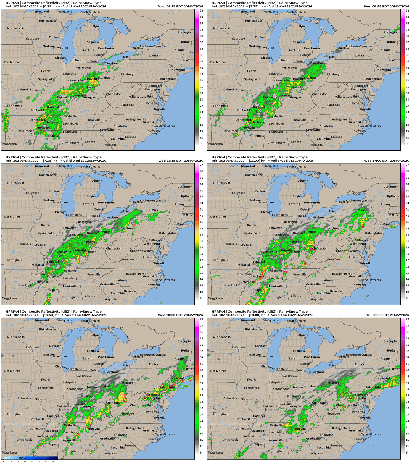
HRRR 06z — Radar Simulation Next 48-hours to Thursday 2 AM ET
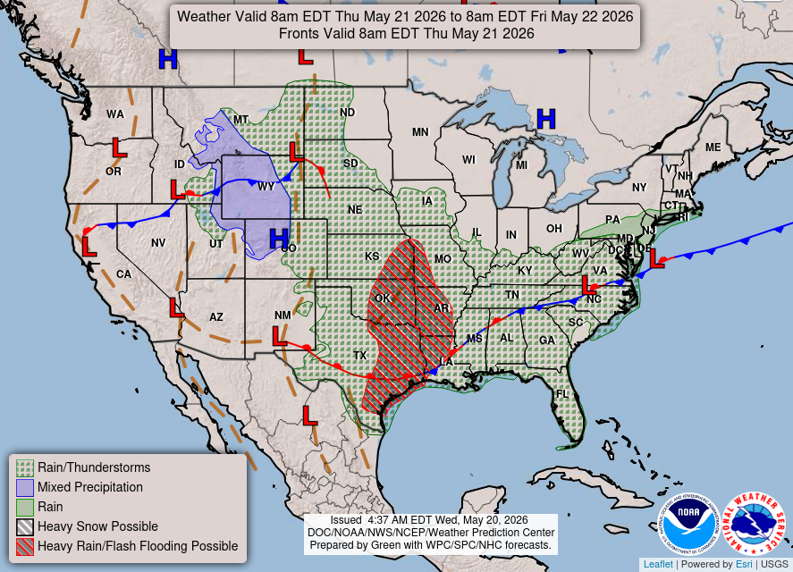
Weather on Thursday — heavy rain threat from Kansas City to Houston
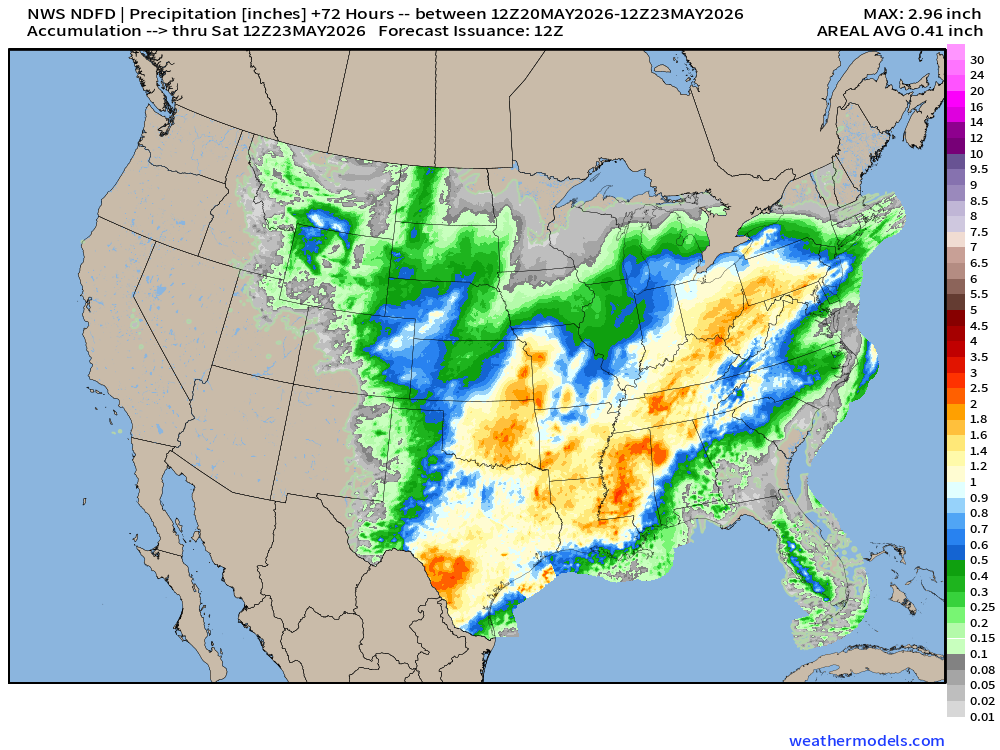
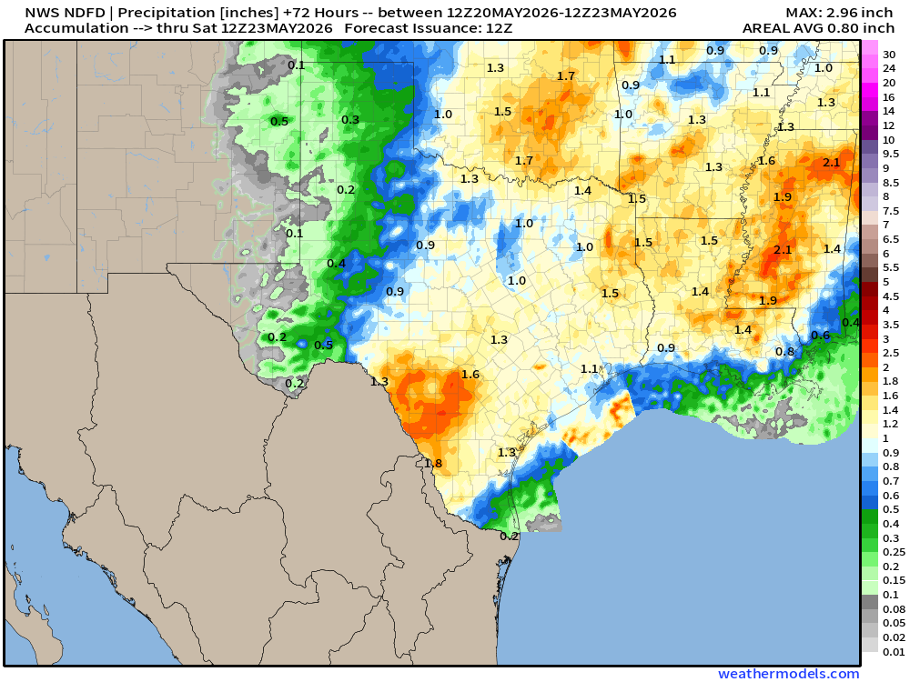
NDFD NWS Total Precipitation Next 72-hours through Thursday Afternoon
7-Day Total Precipitation | Blend of Models | Through next Wed morning
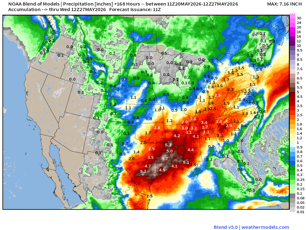
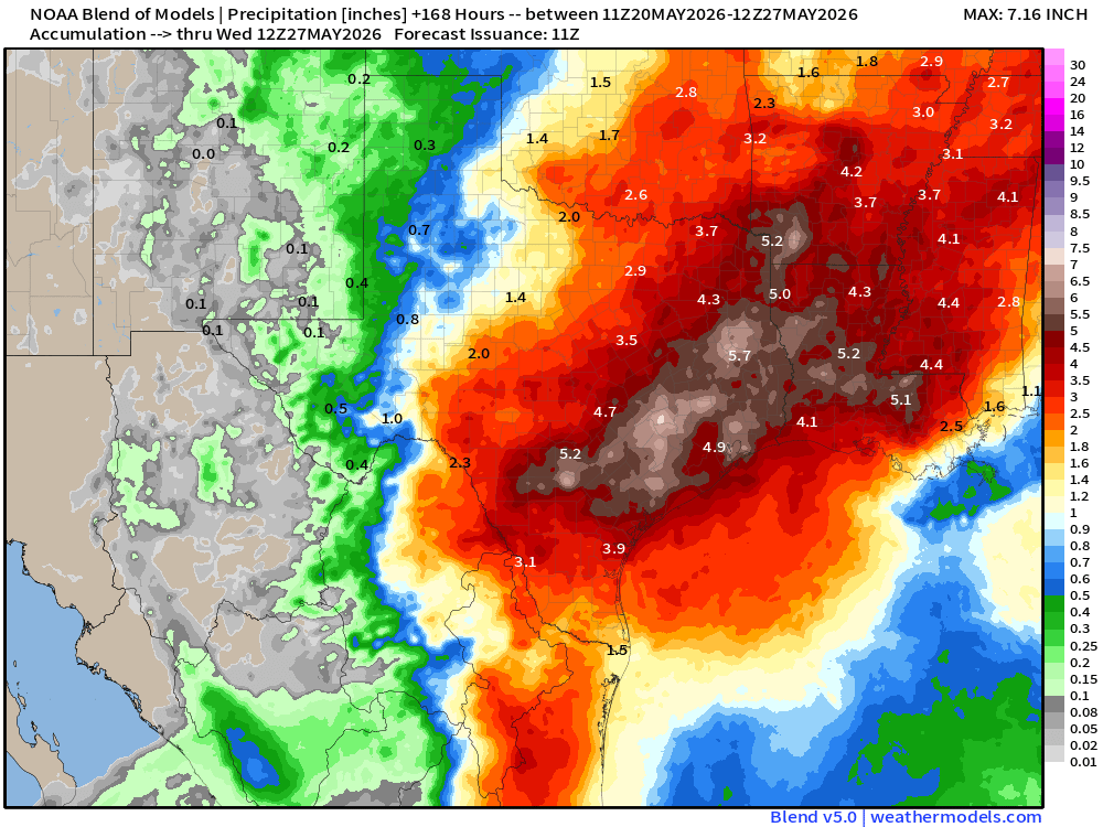
Boatloads of rainfall for Texas into the Lower Mississippi River Valley
Upper-Level Circulation Pattern
ECMWF AIFS-Single 06z | 500 mb Height Anomaly Next 10-days
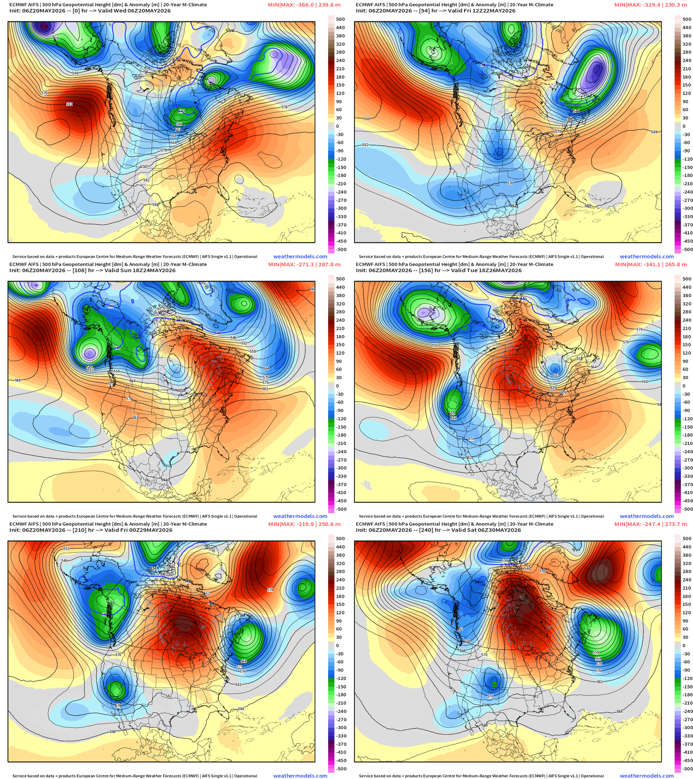
Ongoing Eastern U.S. heat dome / ridge breaks down today.
However, a new persistent blocking pattern sets up with the ridge axis centered along Hudson Bay and Ontario with troughs on either side … this would keep the Western U.S. and Northeast cooler than normal, and allow the moisture flow out of the Gulf to sustain the ridge on the backside
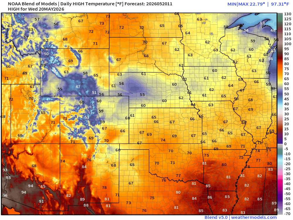
High Temperatures Today | Wednesday
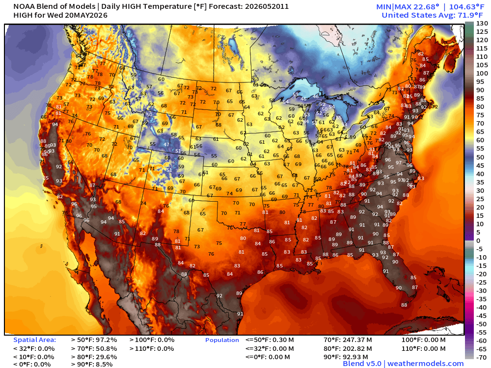
Still well into the 90s for NYC, Washington D.C.
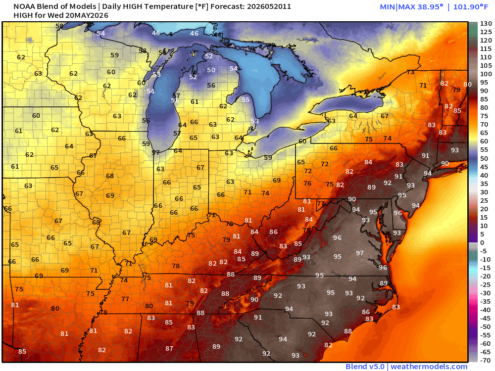
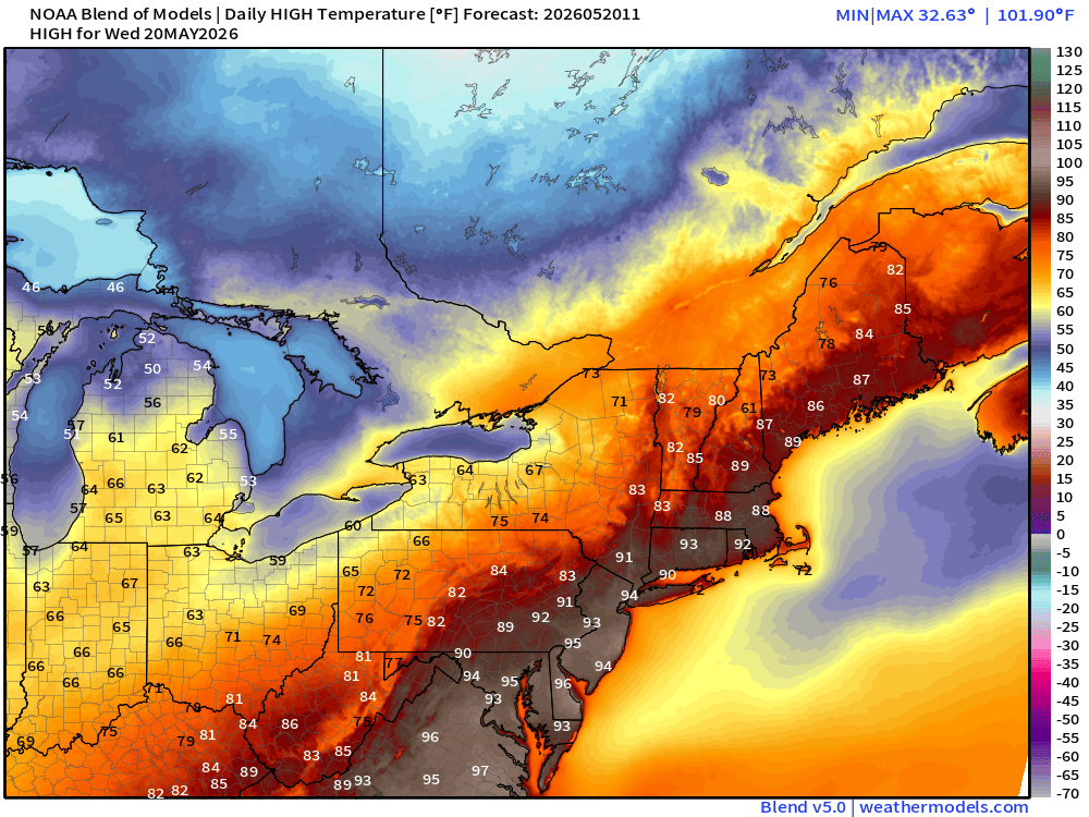
But much cooler — 60s across the Midwest and Plains
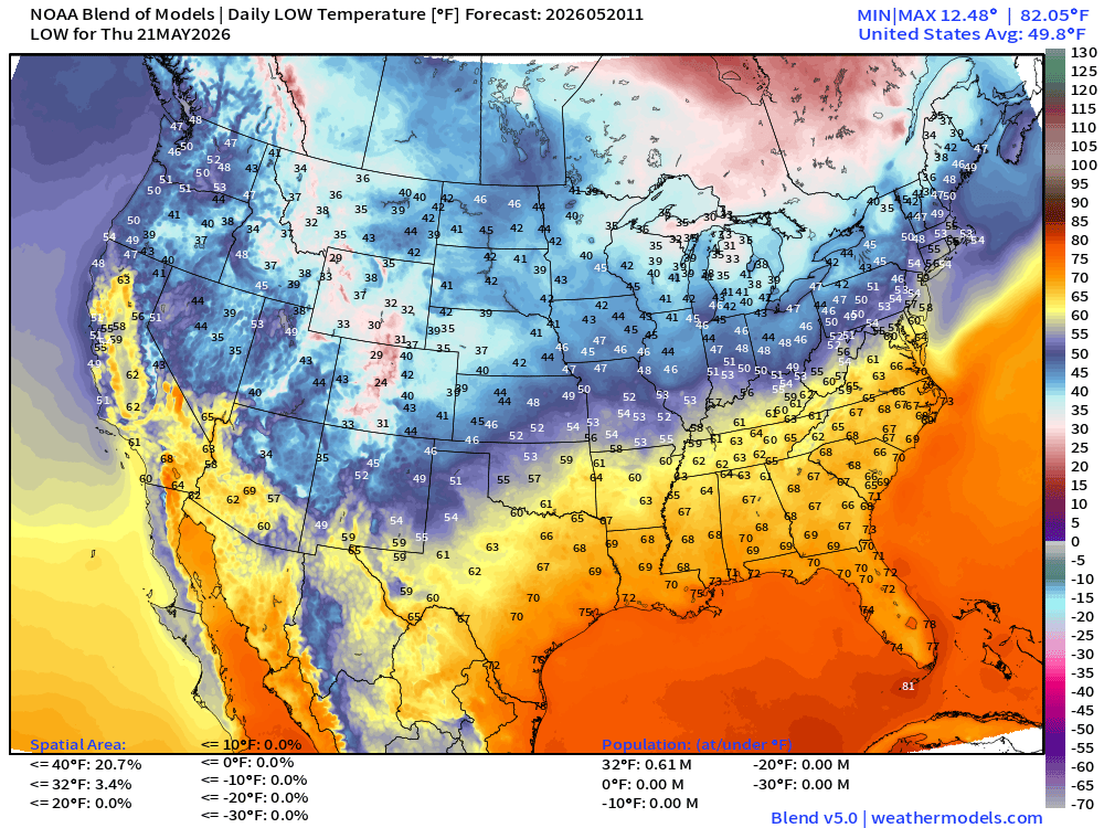
Low Temperatures Thursday Morning
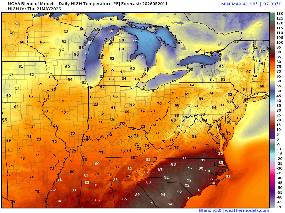
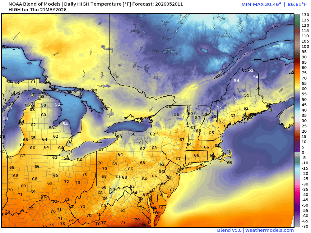
High Temperatures on Thursday —> Much cooler!
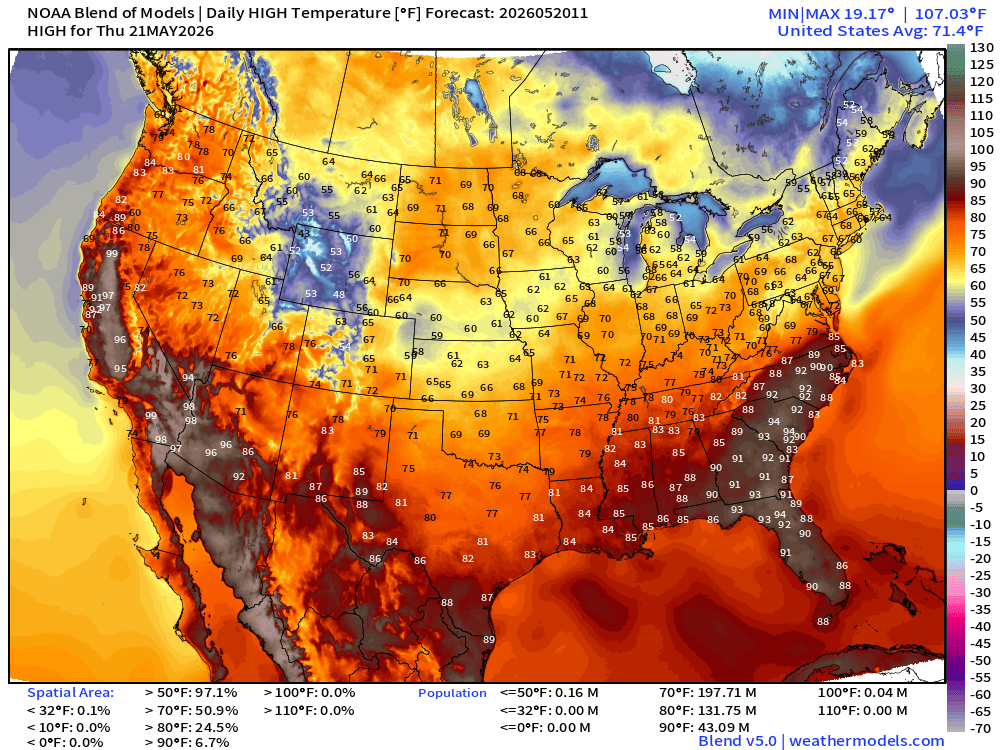
Wow, only 60s and lower 70s instead of mid-90s. Perfect!
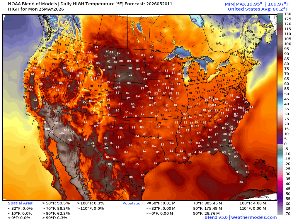
Memorial Day Weekend High Temperatures —> Saturday
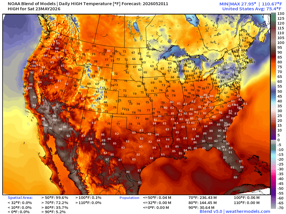
Memorial Day Weekend High Temperatures —> Sunday
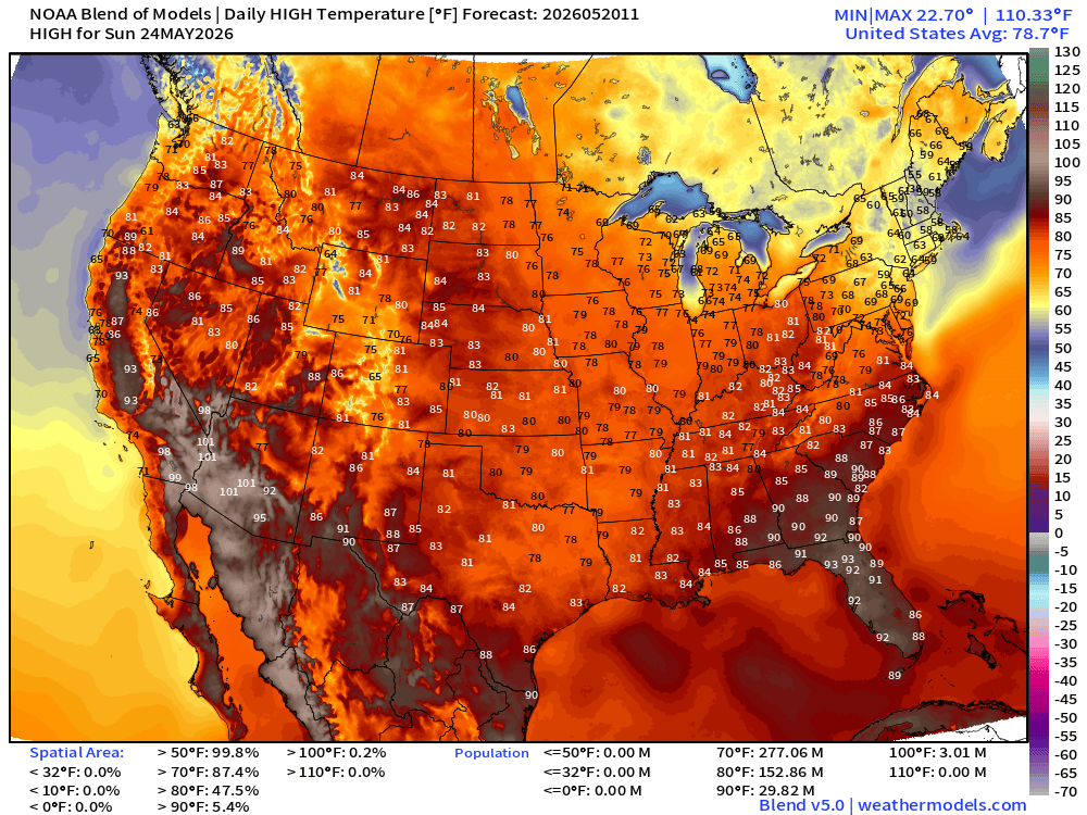
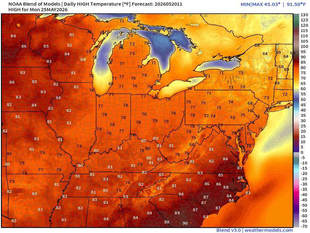
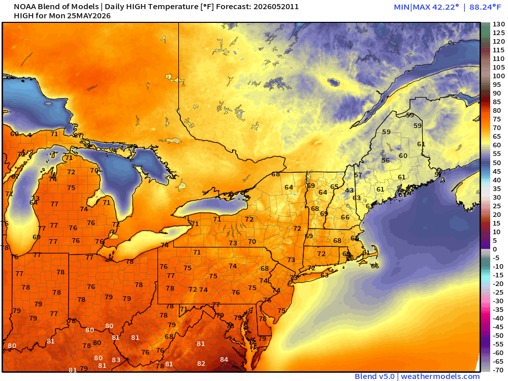
Memorial Day Weekend High Temperatures —> Monday
15-day Ensemble Median Precipitation | ECMWF 00z
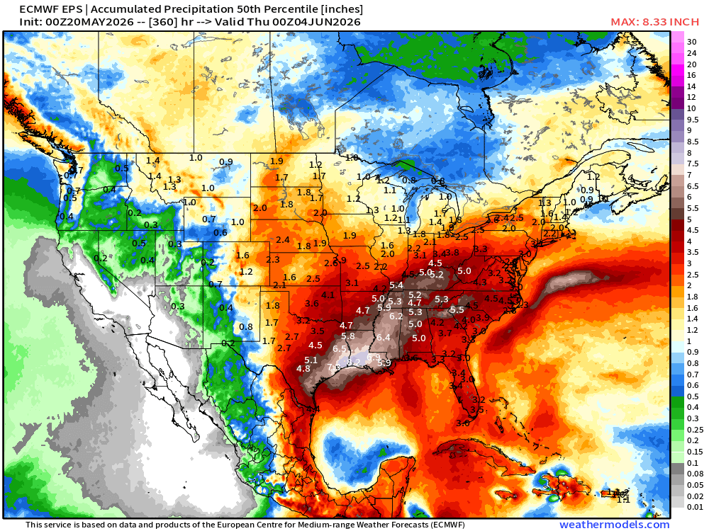
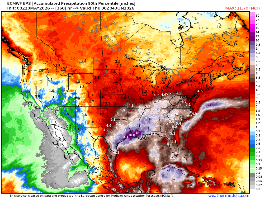
What about the 90th percentile? Potential for a LOT more rainfall is possible.
\
Tropical Update Post from Tuesday
Forecast from April 7, 2026: Atlantic Seasonal Hurricane Forecast: 11/5/2
9-13 Named Storms (11 most likely)
4-7 Hurricanes (5 or 6 most likely)
1-3 Major Hurricanes (2 most likely)
ACE: 75-85
Maps sourced from weathermodels.com designed and innovated by yours truly! Please subscribe there for real-time access to the newest maps, charts from all of the weather models including ECMWF and AIFS, and NOAA GFS/GEFS, HRRR/RRFS and Blend of Models (NBM). NOAA WPC and SPC for fronts/convective outlooks.
- Milepost
- 940 · laid 2026-05-20T13:35:38.692000Z
- Source
- https://weather.substack.com/p/may-20-2026-wednesday-spring-weather
- Digest
- c29a39c5aae7f2cc5423681d34933aee53d241dda723eb521bbe094d9d8eb246
- Machine
- JSON