May 4, 2026 Monday Spring Weather
Heavy snowfall in Denver contrasts with extreme heat in Central Florida into mid-week
May 2026 was the 29th-warmest May in the 132-year national record (1895–2026), at 61.7°F against a 1991–2020 normal of 61.0°F (+0.6°F).
May 2026 was the 63rd-driest May in the 132-year national record (1895–2026), at 2.9in against a 1991–2020 normal of 3.1in (-0.2in).
NOAA/NCEI Climate at a Glance, contiguous United States. This is the observed record for the month, not a score of anything said in this piece — the forecast ledger begins 2026-08-17 and cannot reach earlier posts.

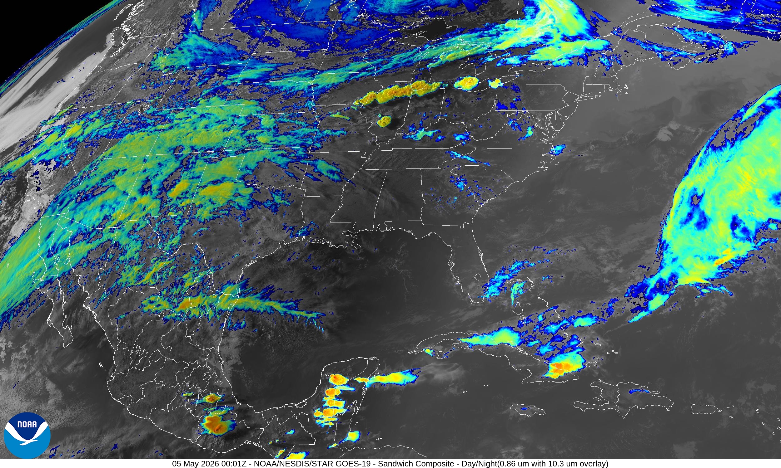
Mostly quiet across the Lower 48 with northerly flow out of Canada behind a strong cold front keeping the Southeast, Mid-Atlantic, and Northeast dry and very comfortable. Beautiful weather on Monday for vast majority of the population of the United States.
A moisture plume out of the Eastern Pacific subtropics is crossing into the Southwest and Texas — good news for additional heavy rainfall in the southern states in coming days.
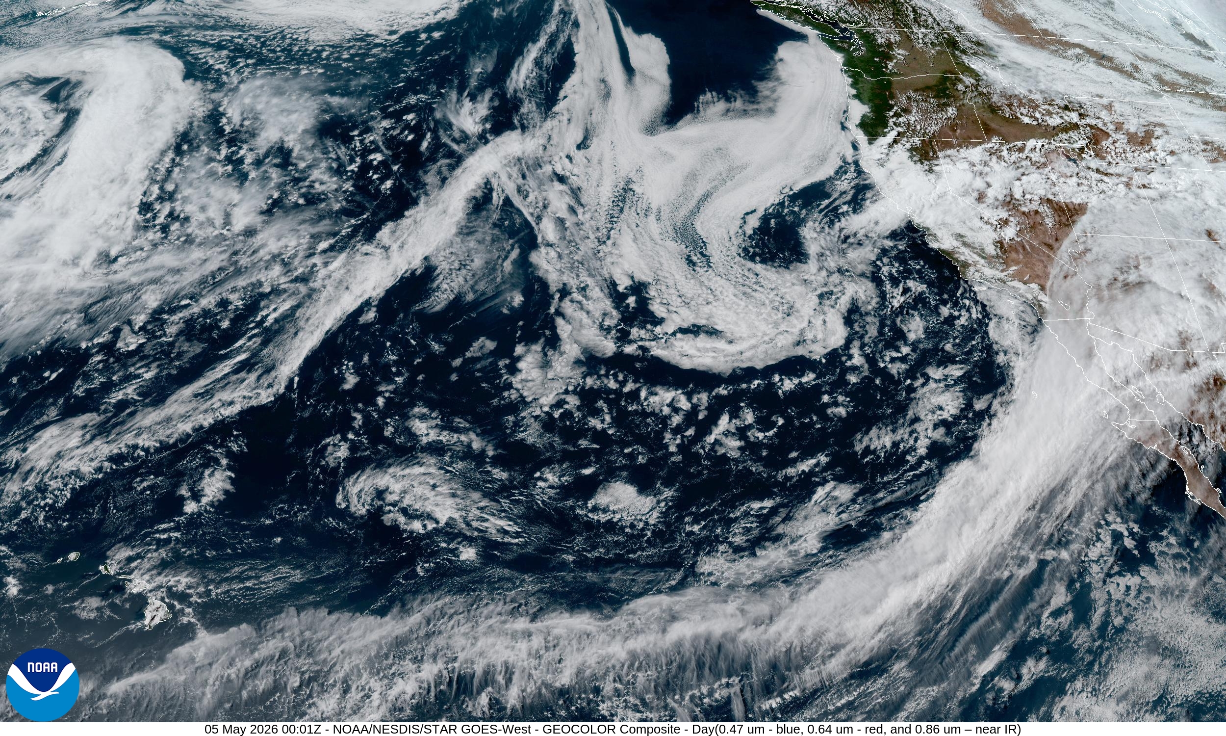
Headlines for Monday
East and Great Lakes: A large cyclonic gyre involved with trough over Canada will continue to swing disturbances through the Great Lakes and Northeast with cooler air = unsettled through next week.
Southeast: heavy rain risk into Wed/Thurs with frontal boundary
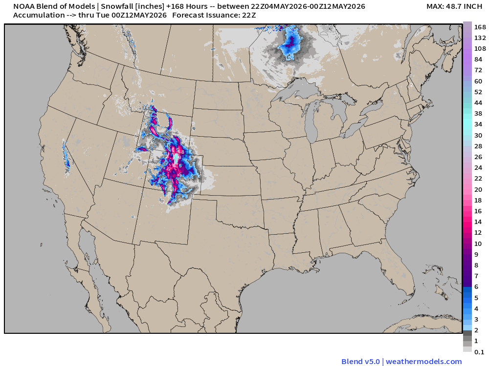
Great Basin and Mountain West: heavy snowfall in Colorado including Denver.
Another “cold blast” early next week in the Great Lakes and Northeast!
Tomorrow May 5th is ECMWF Seasonal Forecast Update!
ECMWF 18z Precipitation Type + Intensity | Next 6-days
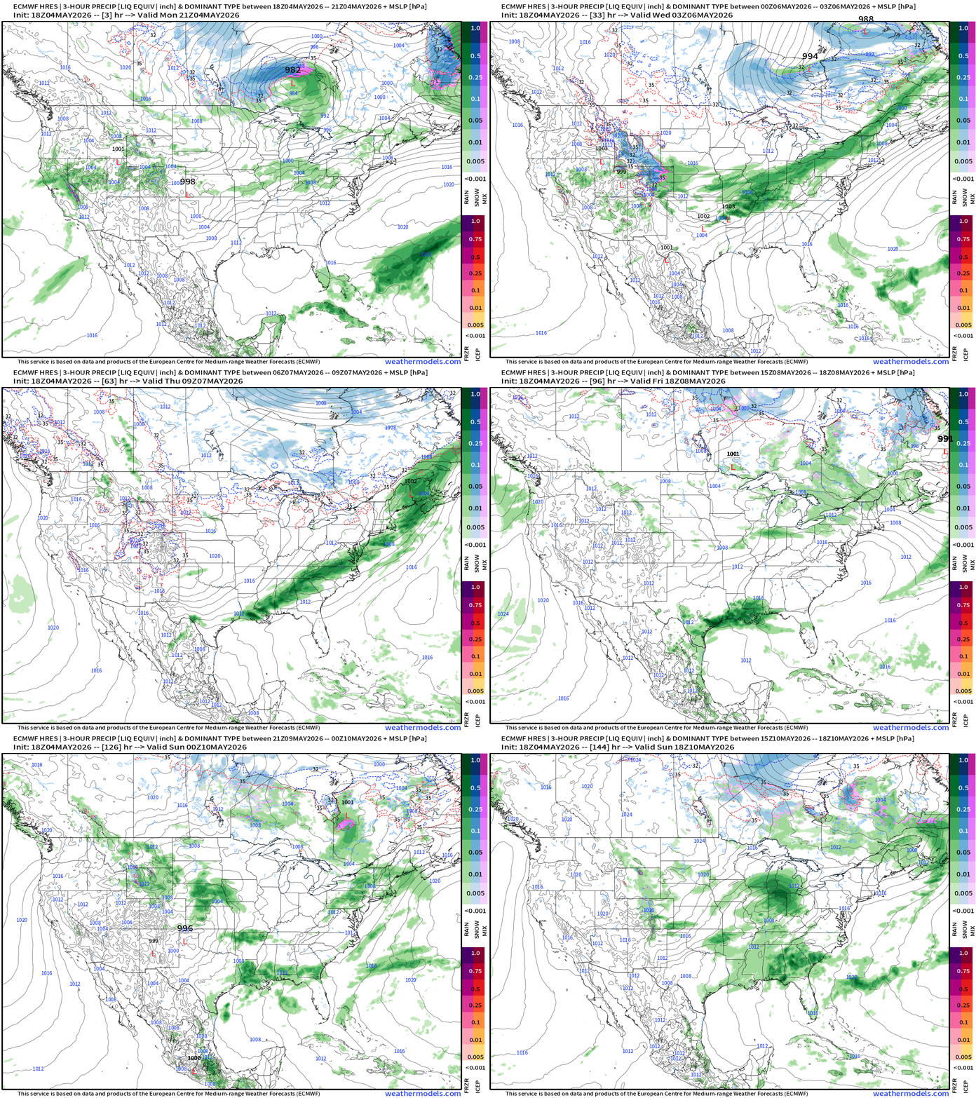
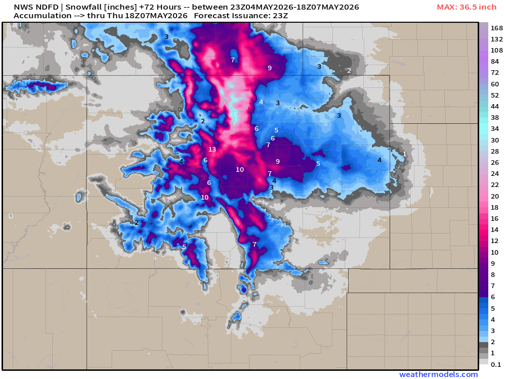
Not really a strong storm system but plenty of moisture and cold air combine over Colorado to dump a LOT of snowfall even for early May.
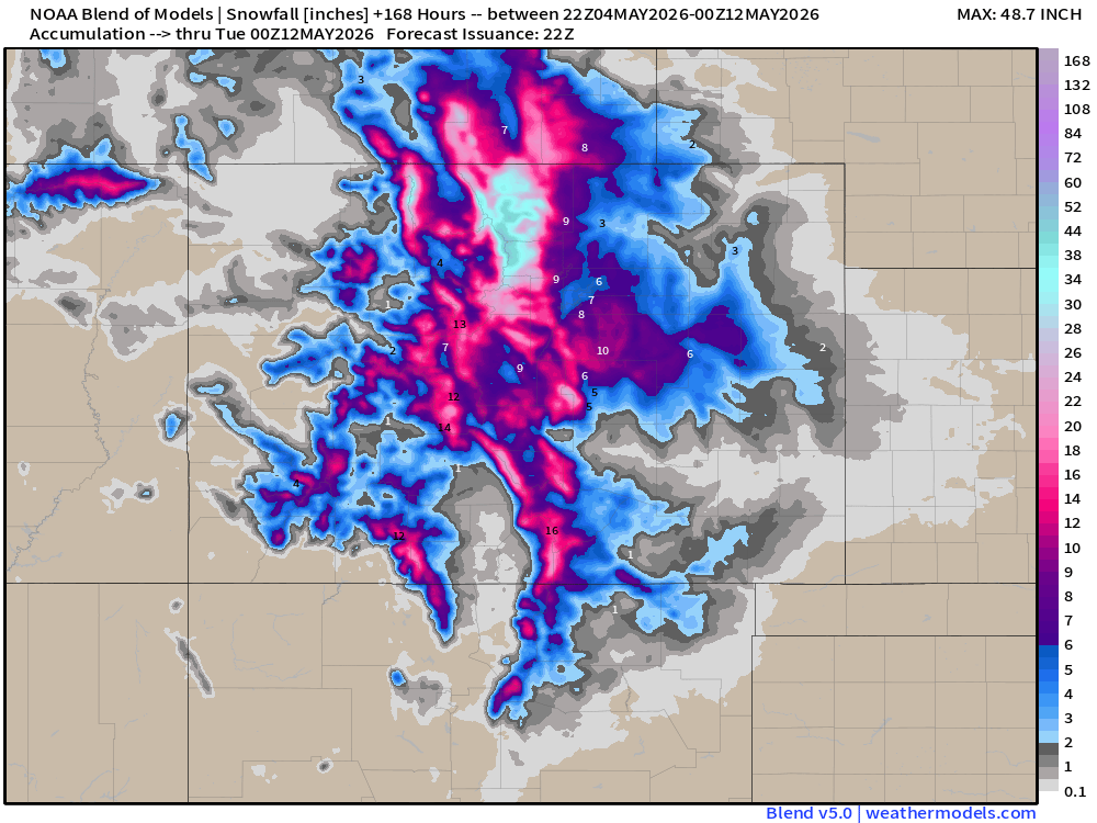
Boulder WFO (NWS Office) is at 13.5” of snowfall for the upcoming event. Denver is pushing up to 5” and the metro may seen widespread 6”-12” with at least 1.0” to 1.5” QPF. The actual amount of snow is dependent upon lower-level temperatures, which should be quite cold in the 20s.
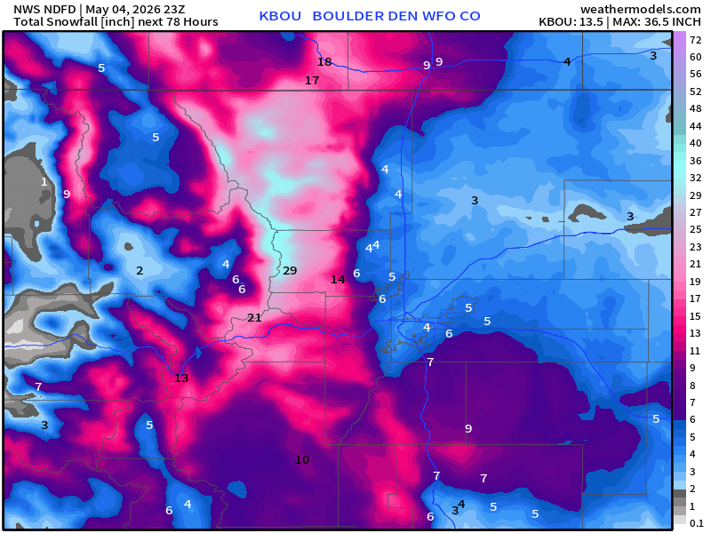
NWS Snowfall — next 3-days for Colorado and Denver Metro Zoom
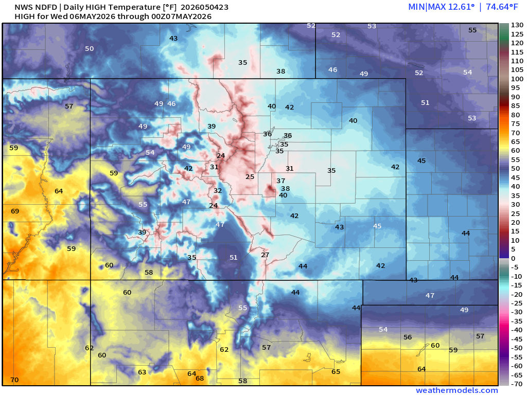
High Temperatures on Wednesday only in the mid-30s across Denver Metro —> chilly!
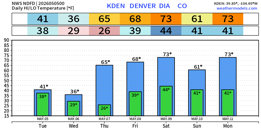
Next 7-day Roller Coaster — Denver down to 26°F and into the 70s by Saturday.
On the flip side —> HOT in Florida by Wed/Thurs with mid-90s maybe 97°F along Interstate 4 around Orlando. NWS Highs Wed & Thurs:
Another Cold Blast early next week!
Next week: Tuesday yet another Canadian Arctic cold front and “blast” of cool air and subfreezing temperatures across the Great Lakes into New England.
ECMWF Flagship Ensemble Temperature Outlook
Week #1 | Temperature Anomaly | May 4 - May 10
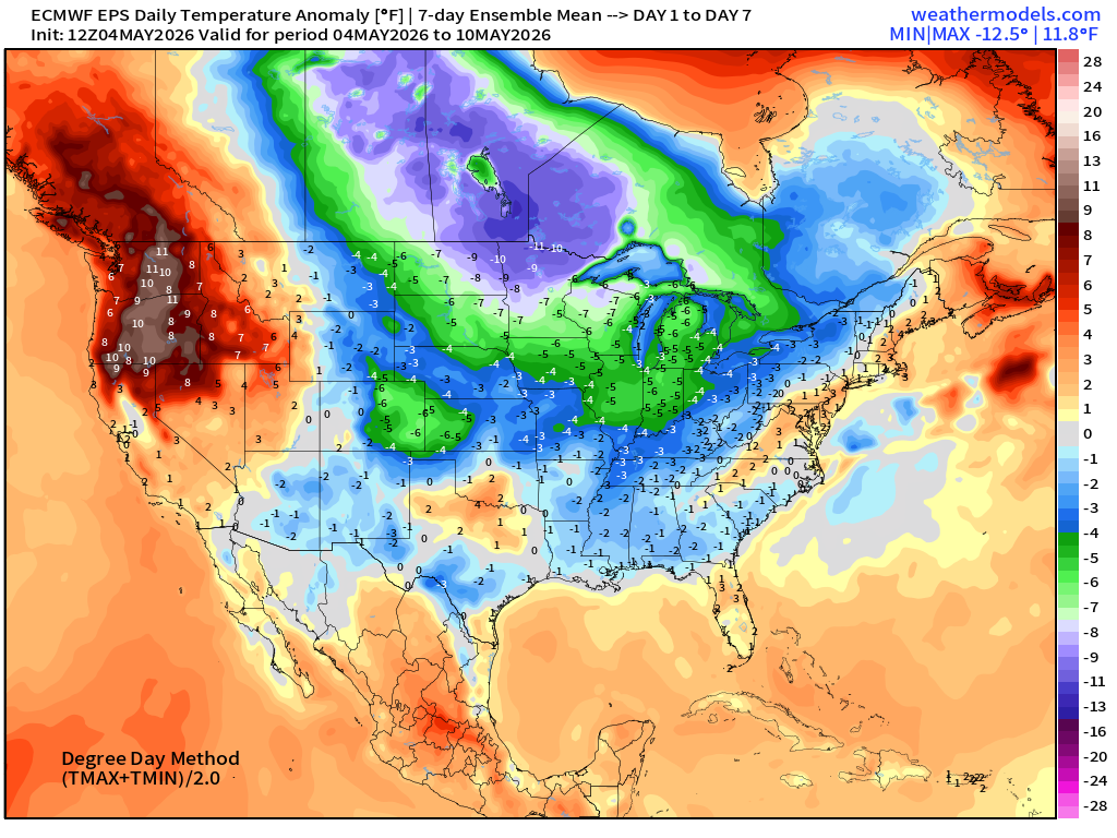
Tough sledding — more than 6°F to 10°F below normal for a 7-day period from Canadian Prairies into Midwest and Great Lakes including Minnesota, Chicago, and Detroit.
Very warm: 10°F above normal across the Pacific Northwest
Week #2 | Temperature Anomaly | May 11 - May 16
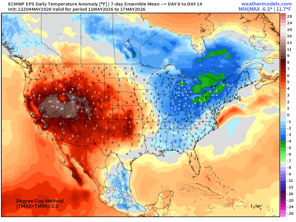
Warmth expands across the Western U.S. centered on the Great Basin vs. cooler across Great Lakes and Northeast
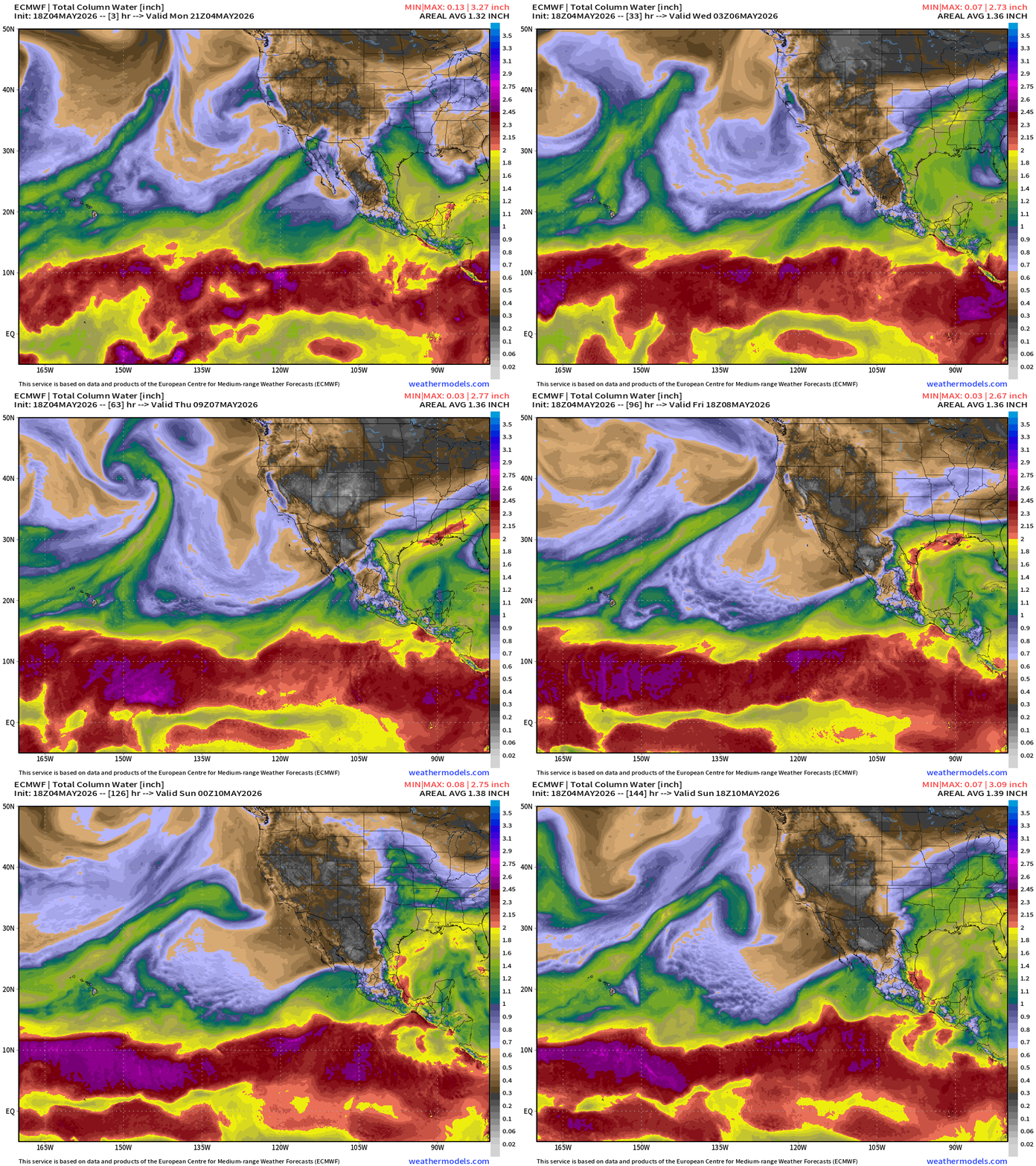
ECMWF 18z | Forecast 6-days of Precipitable Water (my favorite parameter!)
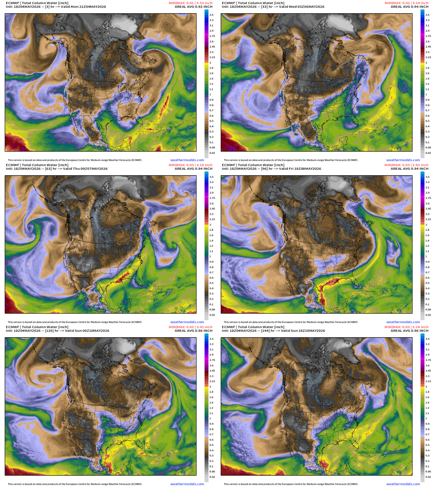
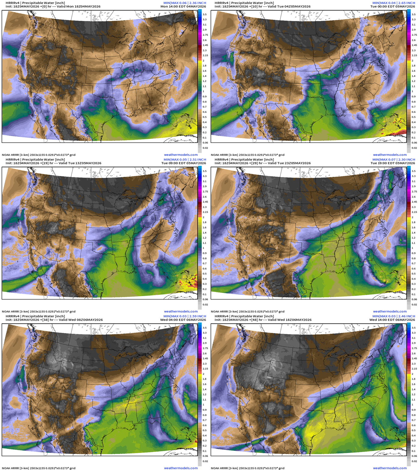
Moisture plume out of Subtropical Pacific extends eastward through Texas to combine with Gulf of Mexico (open for business) but only south of a stationary front as the Canadian trough wins the battle over the next week!
RTMA Current Temperature Analysis | 7:30 PM ET
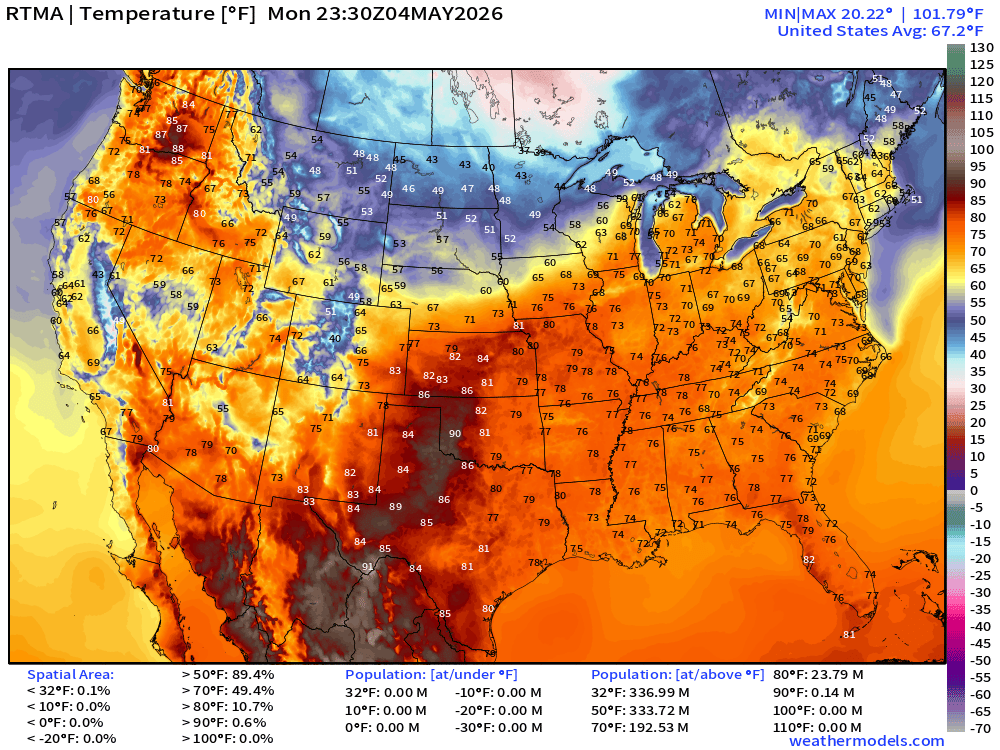
Lower 48 average was 67.2°F with 192 million at least 70°F — mild!
RTMA Current Temperature Anomaly Analysis | 7:30 PM ET
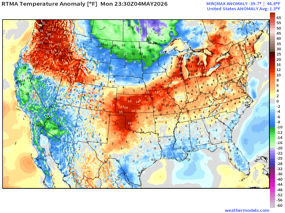
Lower 48 was only 1.3°F ABOVE normal
Lower 48 Weather This Evening into Tuesday Morning
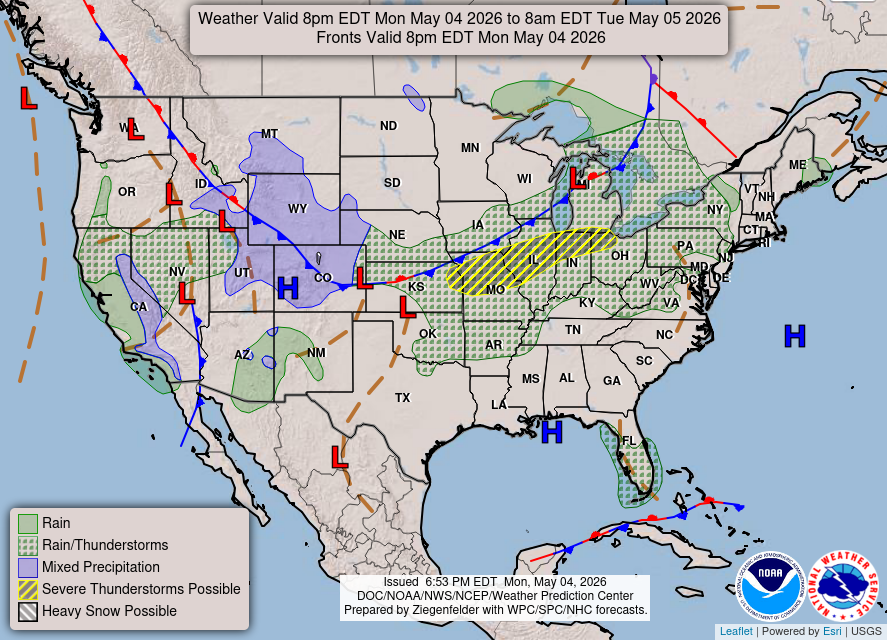
Some storms along a cold front from Kansas City to St. Louis and along Interstate 80 into Southern Michigan —> only a slight chance these become severe.
Mixed / frozen precipitation + snowfall along polar front extending through Colorado and Wyoming!
HRRR precipitable water next 48-hours:
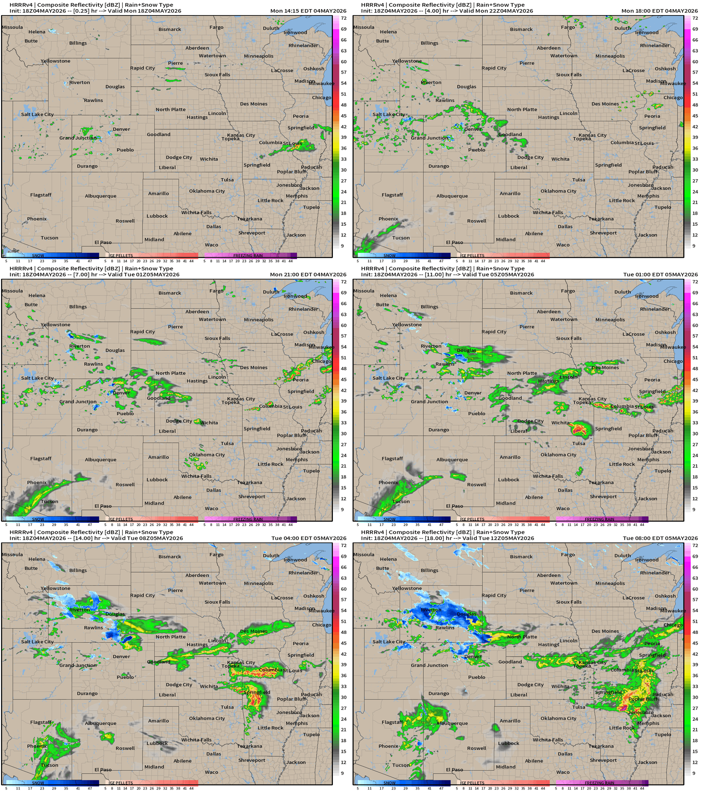
HRRR Model Forecast Radar next 18-hours —> Tuesday 8 AM ET
Heavier snowfall showing up in Wyoming
Cyclonic circulation over California = light showers … definitely welcome!
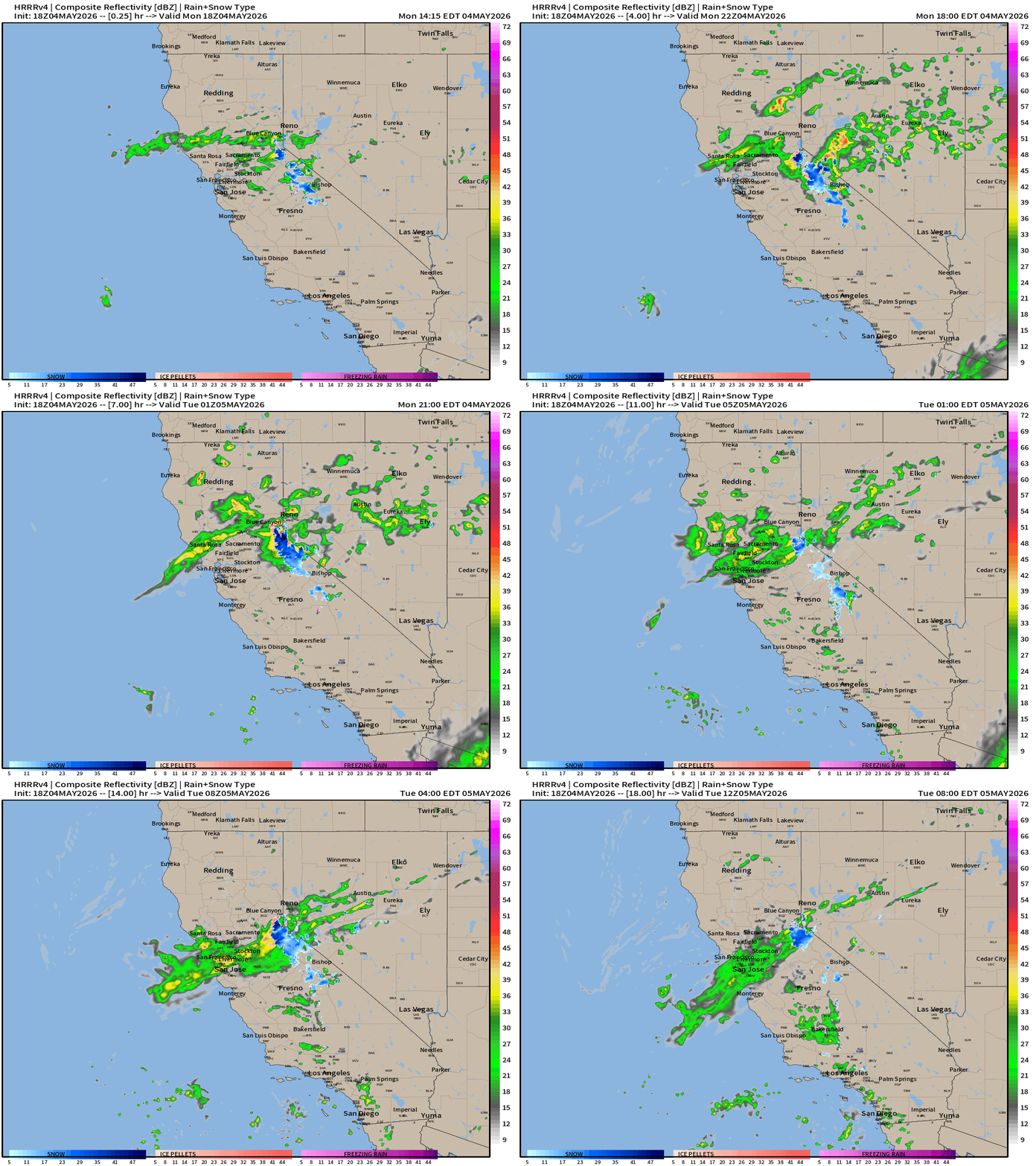
HRRR 18z — Radar Simulation Next 48-hours to Wednesday 2 PM ET
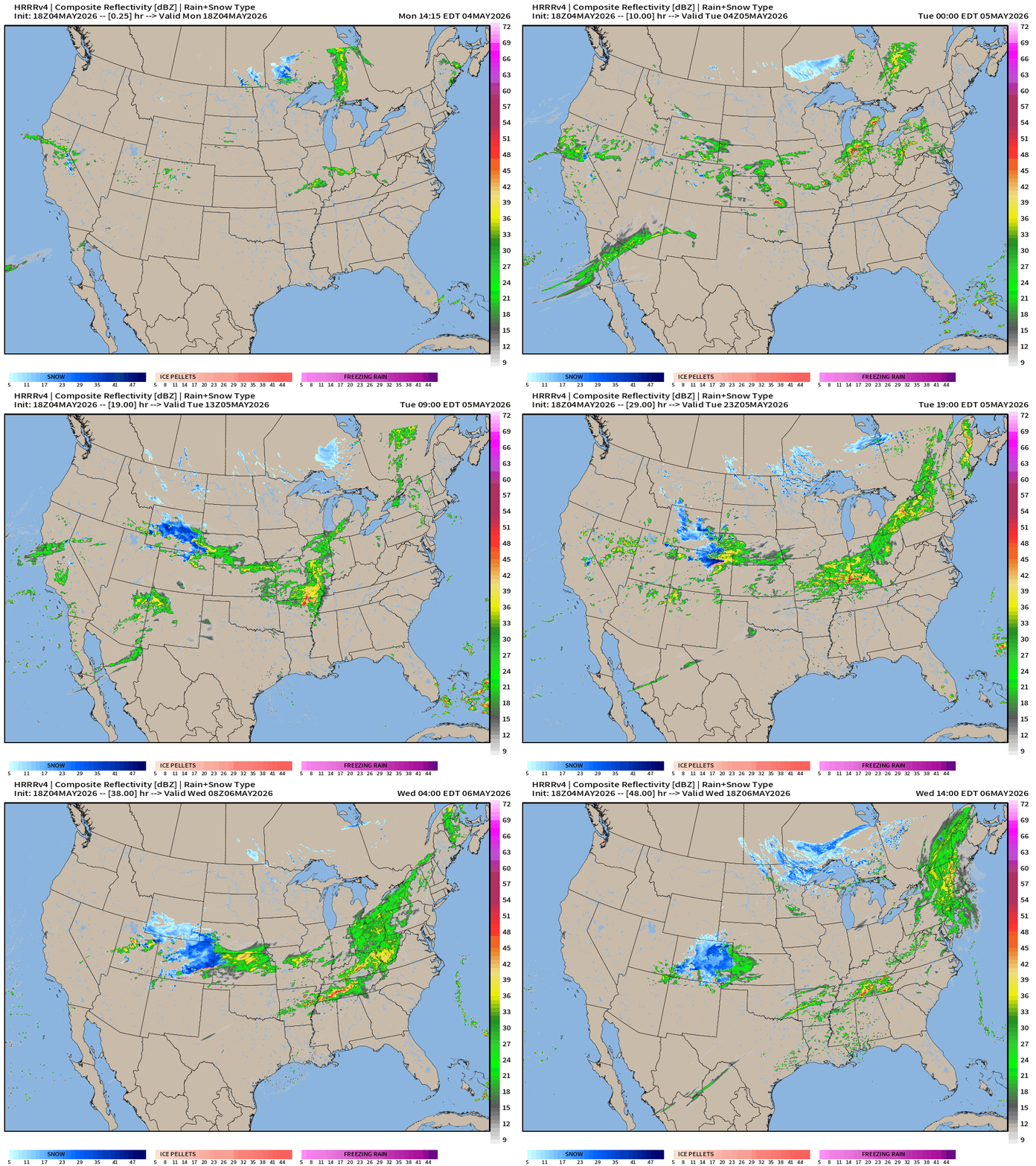
Look at that dark blue over Colorado and Denver — it will be snowing to “beat the band” on Wednesday!
Weather on Tuesday
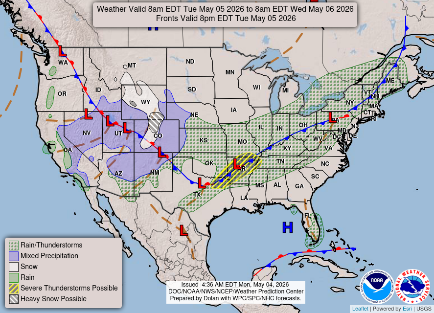
Looks more like late March than first week of May with the snowfall across the Rockies. Otherwise, unsettled along cold front from Dallas to New England.
Weather on Wednesday
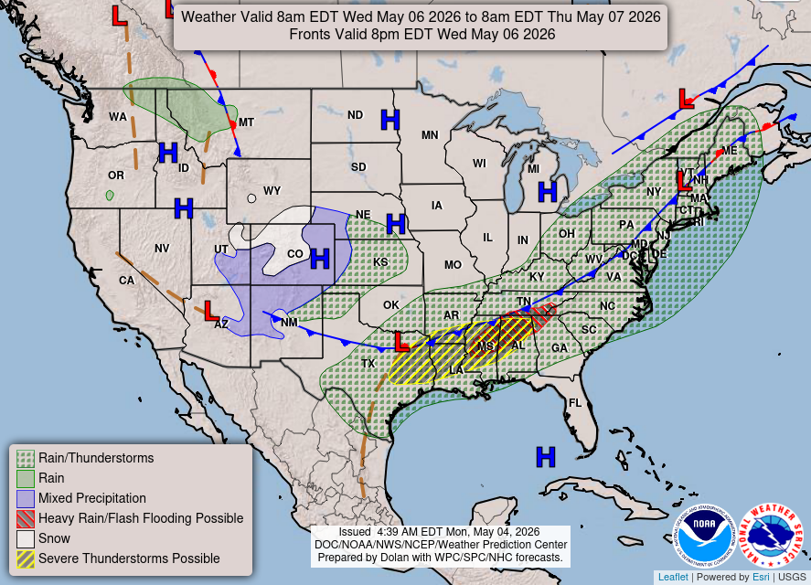
Storms + Heavy Rain from eastern Texas into North Georgia = again, very welcome with only a slight chance of severe storms.
Upper-Level Weather Pattern
ECMWF AIFS-Single 18z | 500 mb Height Anomaly Next 10-days
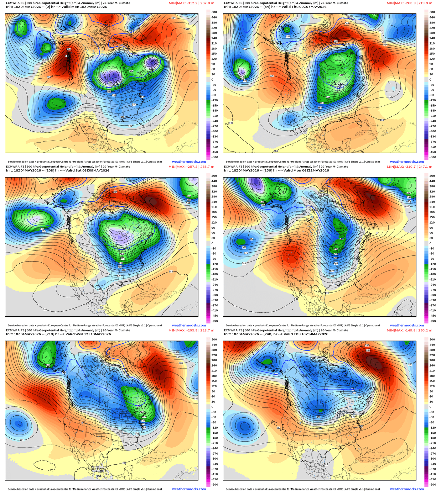
A cool and unsettled pattern continues through mid-May with repeated / persistent troughing centered on Ontario/Quebec — spinning away and completely unbothered.
The trough / cut-off across the U.S. Southwest = cool for Phoenix + Vegas!
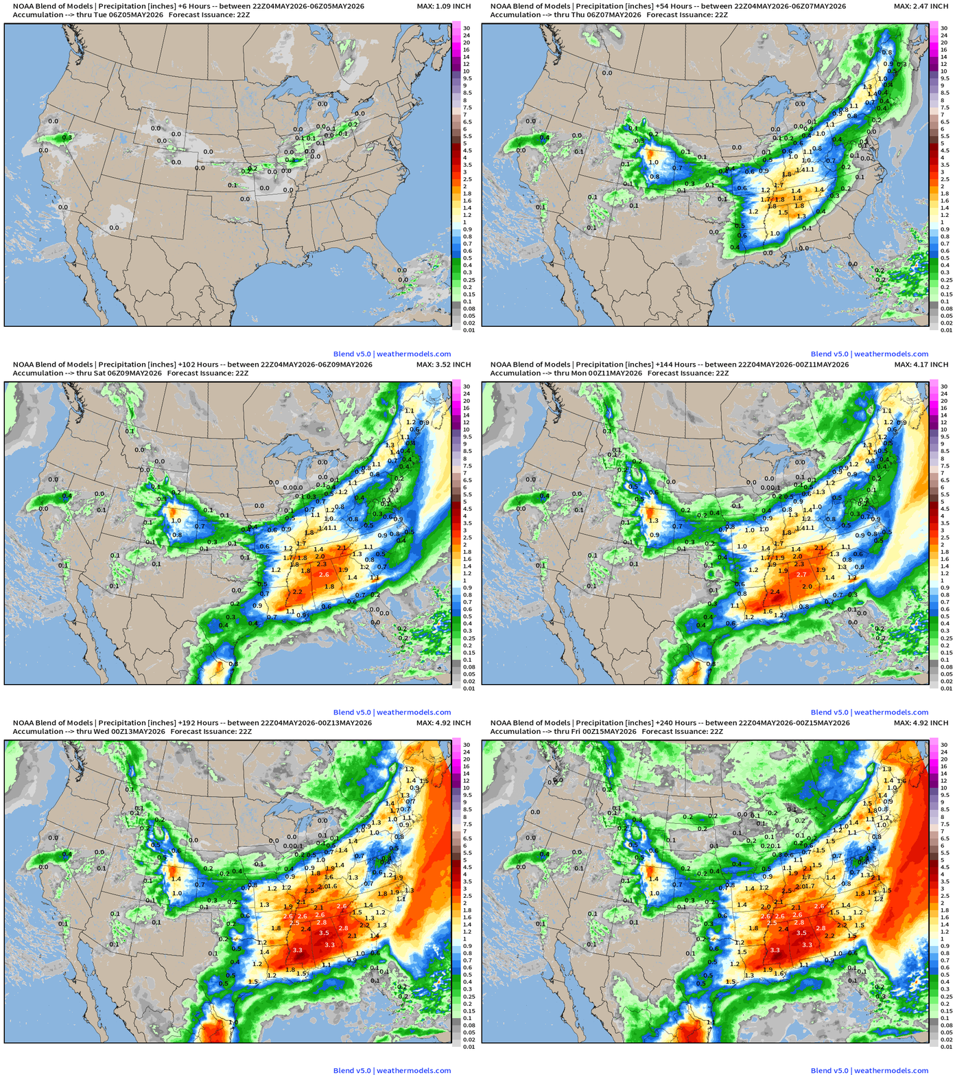
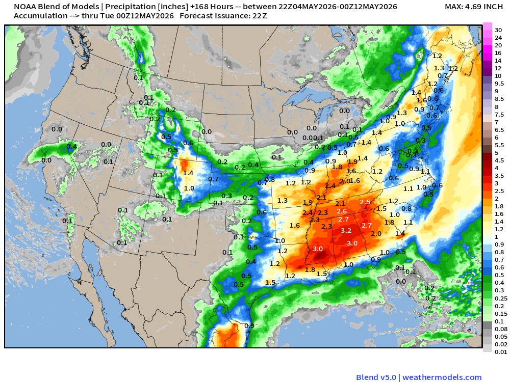
10 day Precipitation Forecast | New Blend of Models v5.0
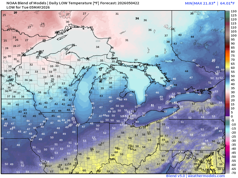
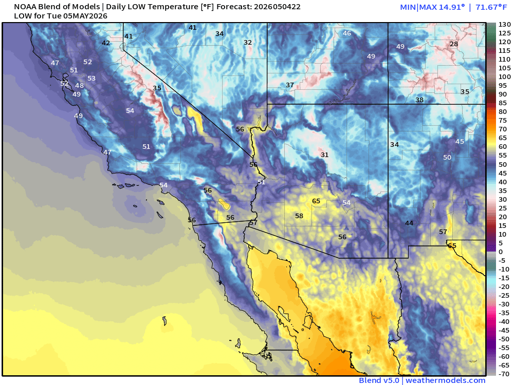
. Low Temperatures Tuesday Morning
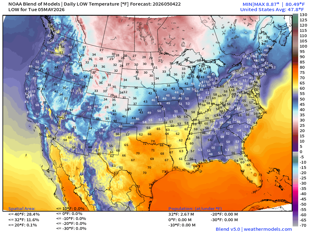
Below freezing in the upper-Midwest
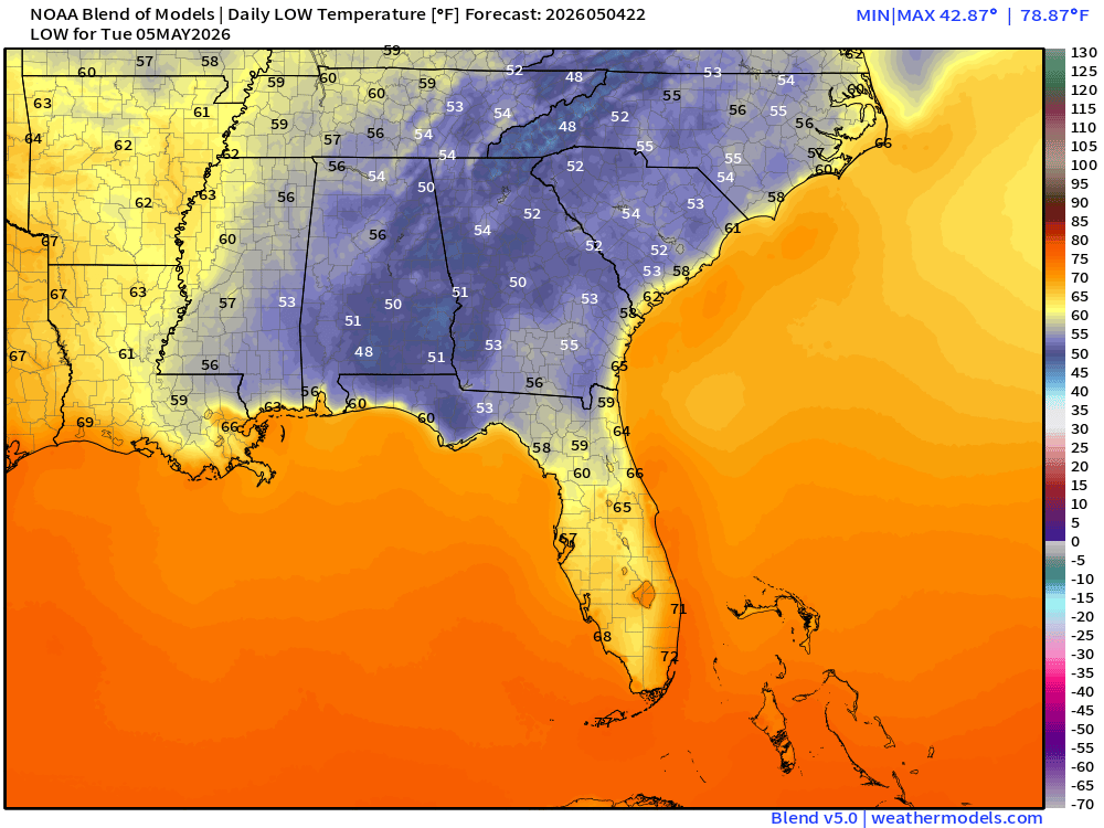
Comfortably cool in the lower 50s and maybe upper-40s into North Florida
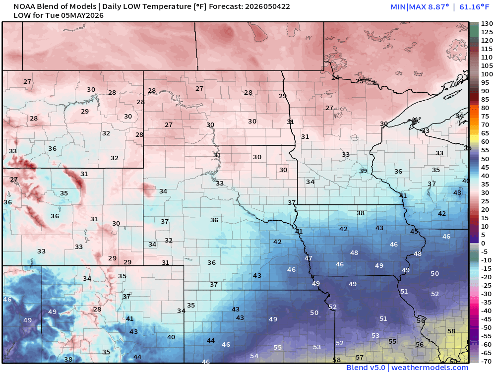
Great Lakes and Midwest still chilly!
Low of 65°F in Phoenix and 56°F in Las Vegas
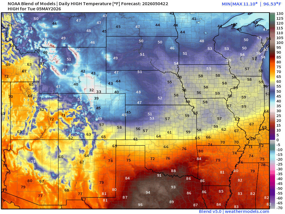
High Temperatures Tuesday
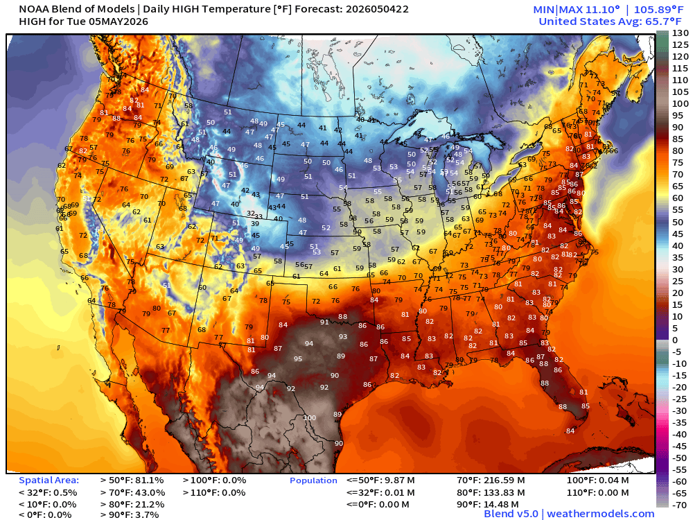
Only 14.5 million at least 90°F over Texas and Florida … with 70s in Las Vegas and 80°F in Phoenix. Amazing.
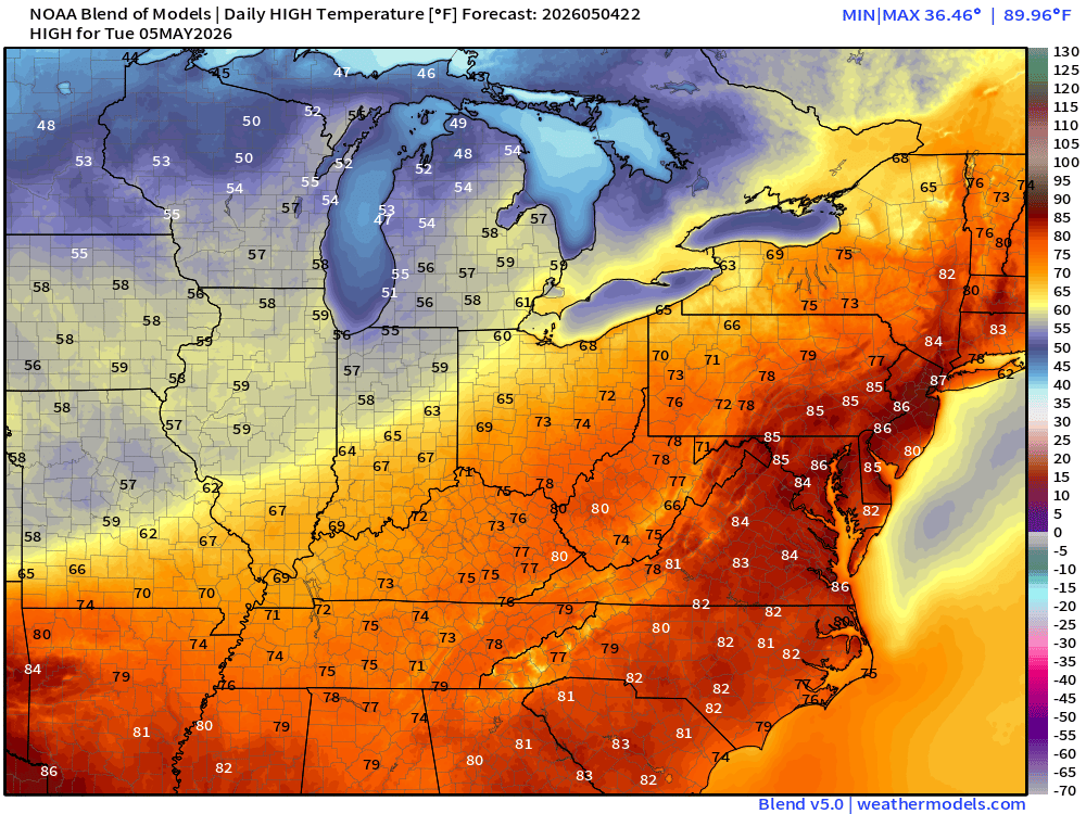
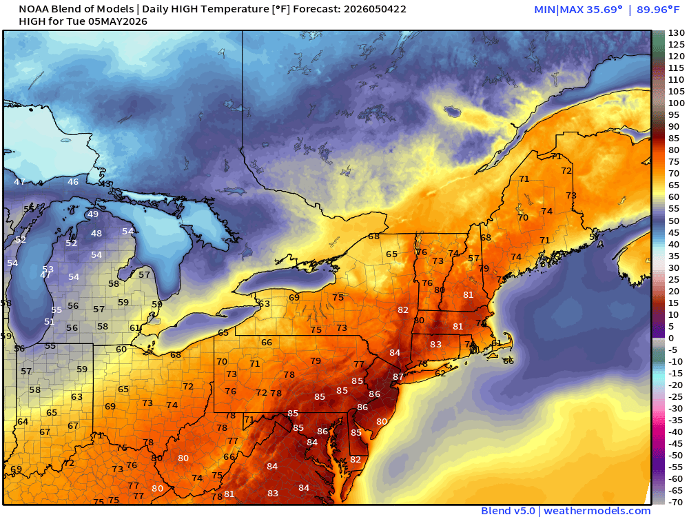
84°F in Washington D.C. and 87°F in NYC
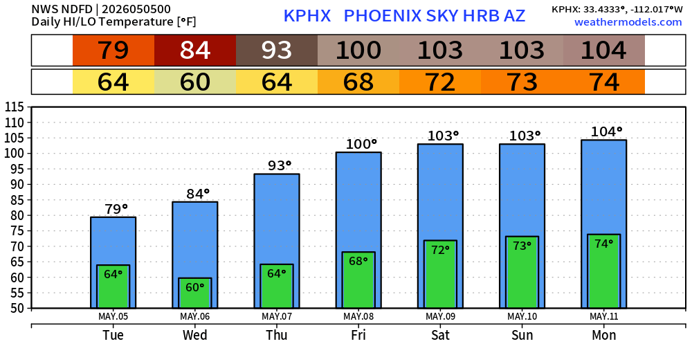
Phoenix back into the 100s soon enough!
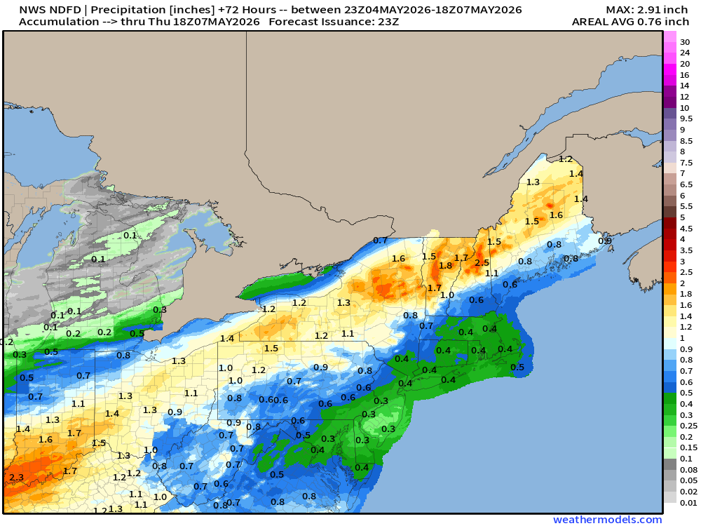
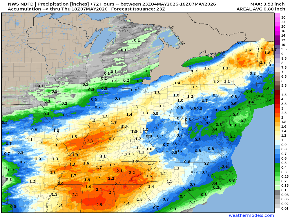
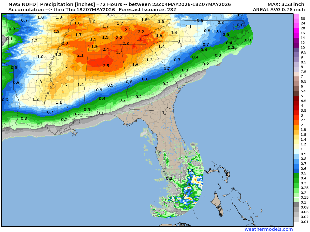
NDFD NWS Total Precipitation Next 72-hours through Thursday mid-day
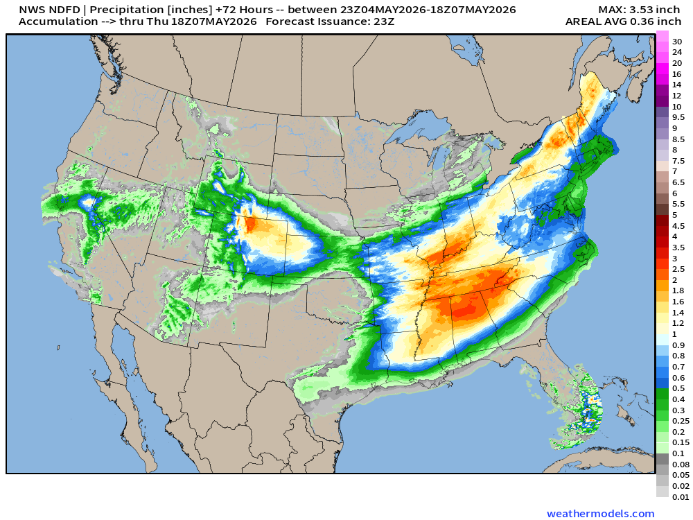
Plenty of rainfall for many areas including Southeast, Ohio River Valley and Northeast
Total Precipitation Next 7-days | Blend of Models
Blend of Models | Total Snowfall Next 7-Days
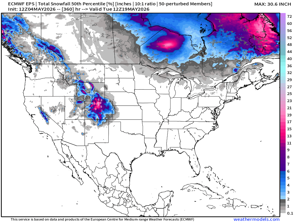
Snowfall from ECMWF EPS Ensemble Median (15-days)
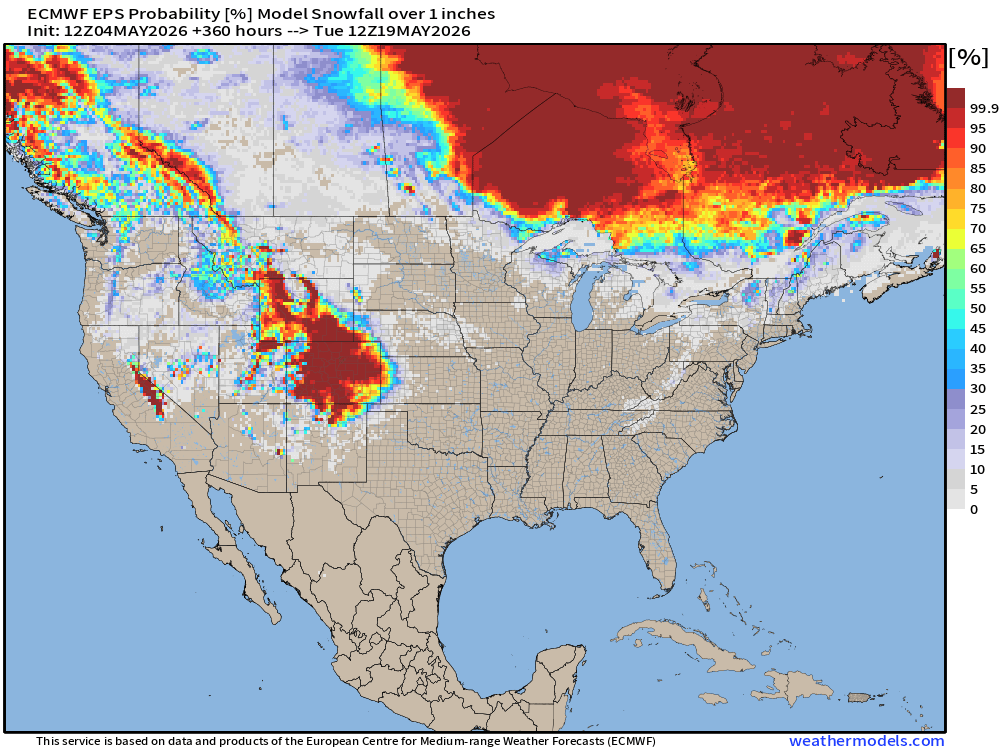
Snowfall probability of at least 1-inch into May 19th
Temperature Anomaly | Next 15-days | ECMWF EPS 12z Ensemble Mean
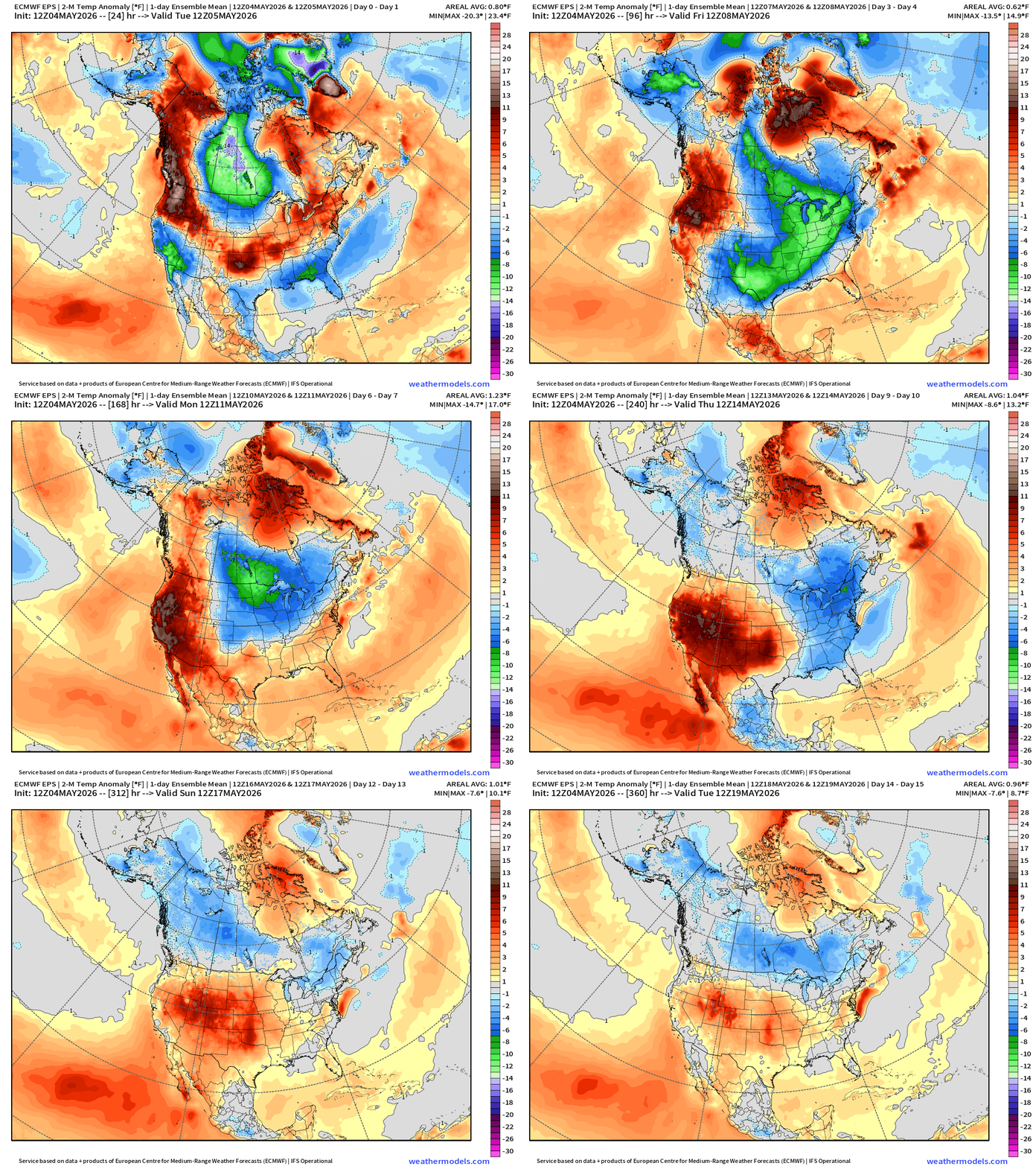
Extended period of “below normal” temperatures dips into the Lower 48 east of the Rockies extending back into northwest Canada through first 2-weeks of May.
Much warmer than normal across the Western U.S.
Tropical Update
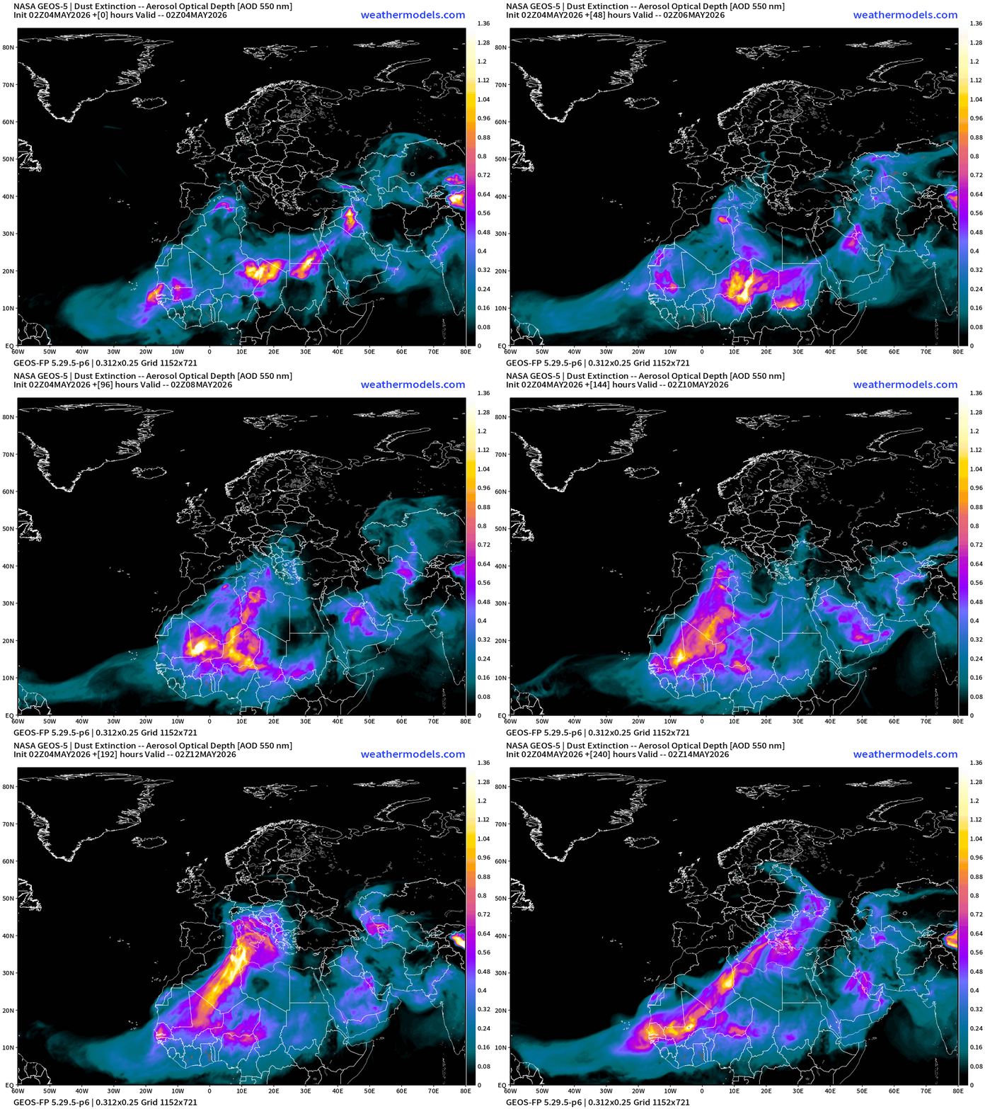
African dust plume forecast next 10-days
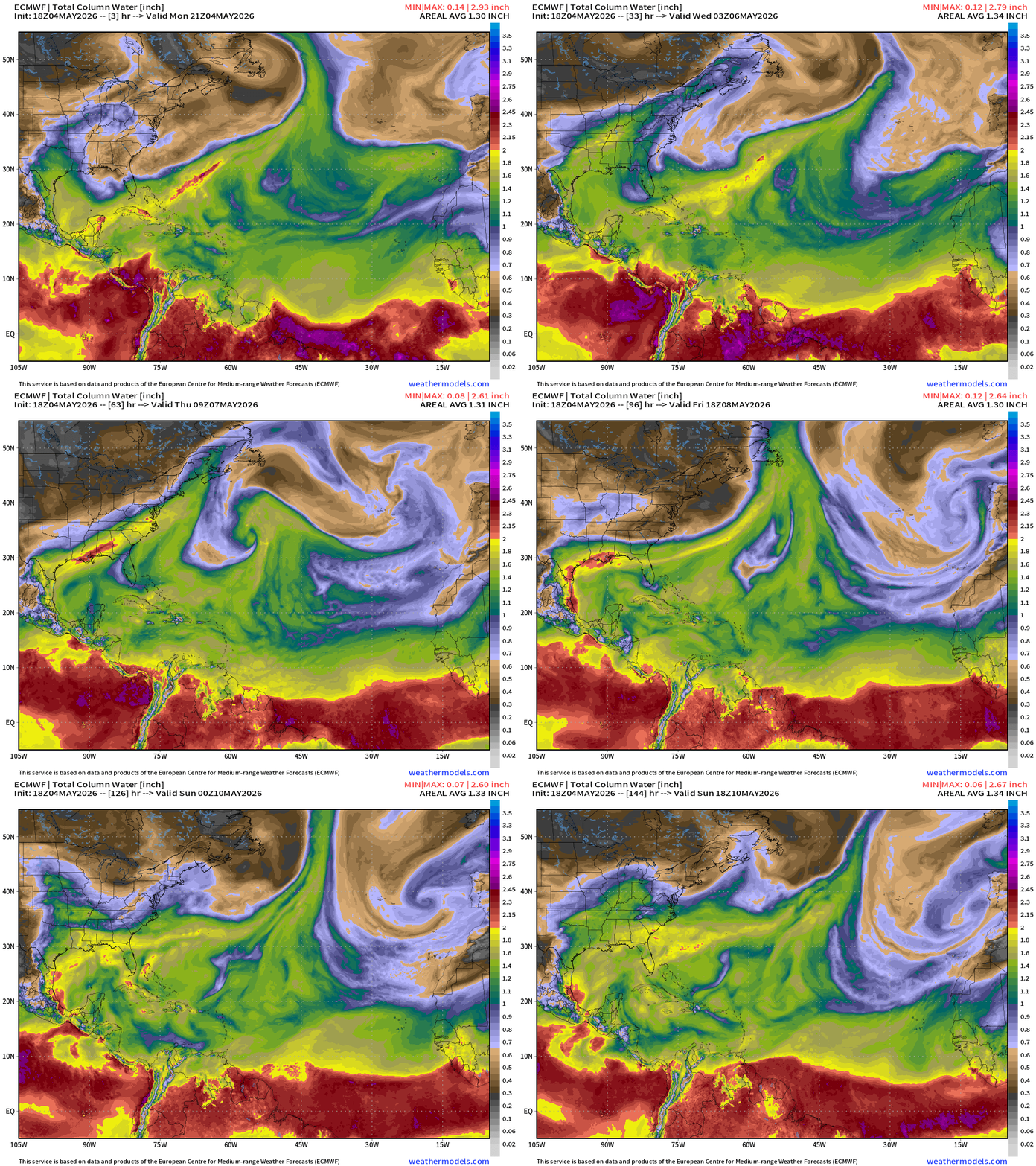
North Atlantic tropics — precipitable water next 6-days = dead quiet / no surprise
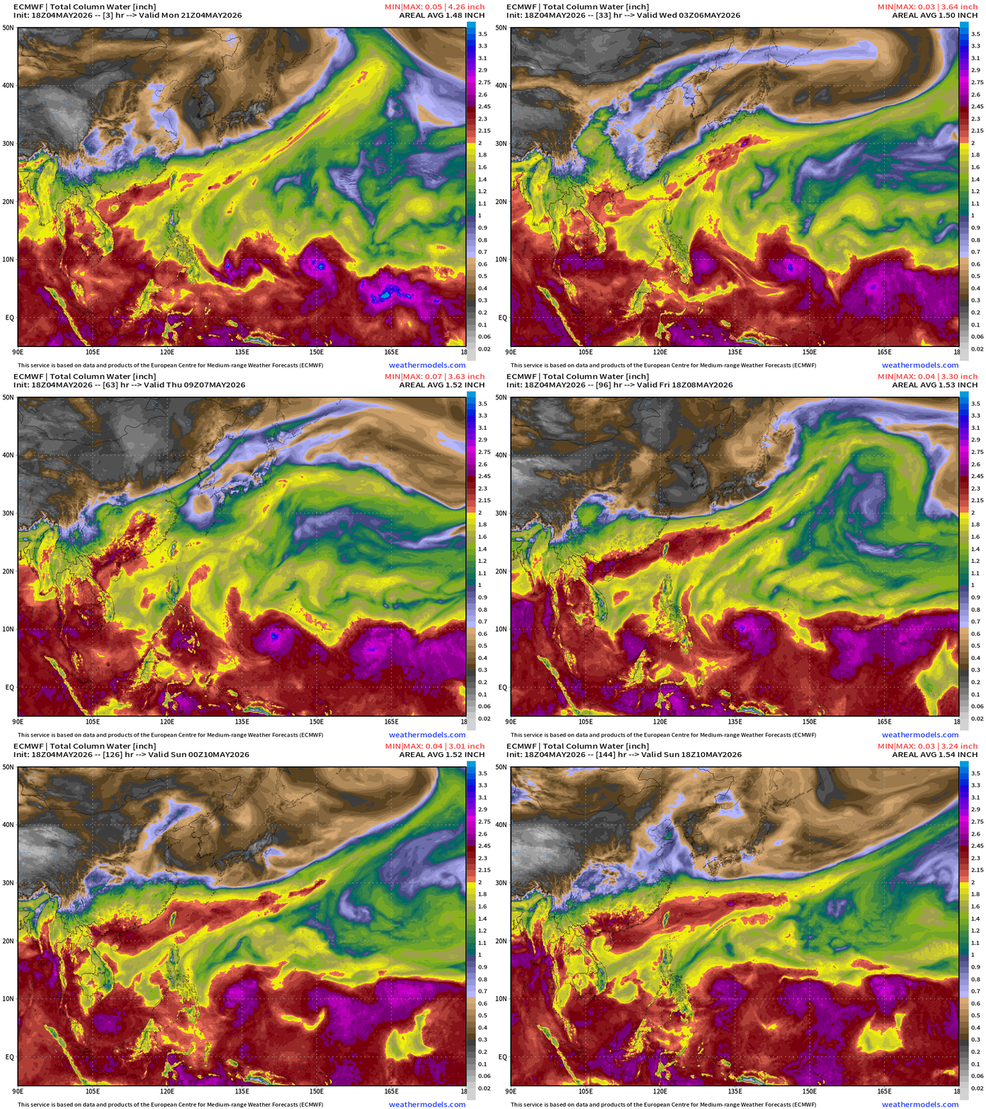
Western Pacific shows multiple “waves” — you can eyeball a parade of potential storms but maybe 1 will briefly develop or catch fire as the basin is still in La Niña mode and unfavorable for Typhoon development.
Eastern Pacific Tropics — nothing development — waiting on tropical waves to cross from the North Atlantic toward end of the month to get the party started out here — which should be an active season with developing Super El Niño.
Forecast from April 7, 2026: Atlantic Seasonal Hurricane Forecast: 11/5/2
9-13 Named Storms (11 most likely)
4-7 Hurricanes (5 or 6 most likely)
1-3 Major Hurricanes (2 most likely)
ACE: 75-85
Maps sourced from weathermodels.com designed and innovated by yours truly! Please subscribe there for real-time access to the newest maps, charts from all of the weather models including ECMWF and AIFS, and NOAA GFS/GEFS. NOAA WPC and SPC for fronts/convective outlooks.
- Milepost
- 930 · laid 2026-05-05T00:56:28.650000Z
- Source
- https://weather.substack.com/p/may-4-2026-monday-spring-weather
- Digest
- 0e41ce2c2c16001b51f437efd3f64cb8e9090b3d88575ebcf9faea390105b0e4
- Machine
- JSON