April 29, 2026 Wednesday Spring Weather
First half of May looks very cool across much of the Lower 48 with plenty of rain
April 2026 was the 3rd-warmest April in the 132-year national record (1895–2026), at 54.7°F against a 1991–2020 normal of 51.8°F (+2.9°F).
April 2026 was the 46th-wettest April in the 132-year national record (1895–2026), at 2.7in against a 1991–2020 normal of 2.7in (+0.0in).
NOAA/NCEI Climate at a Glance, contiguous United States. This is the observed record for the month, not a score of anything said in this piece — the forecast ledger begins 2026-08-17 and cannot reach earlier posts.

ECMWF 18z | Forecast 6-days of Precipitable Water (my favorite parameter!)
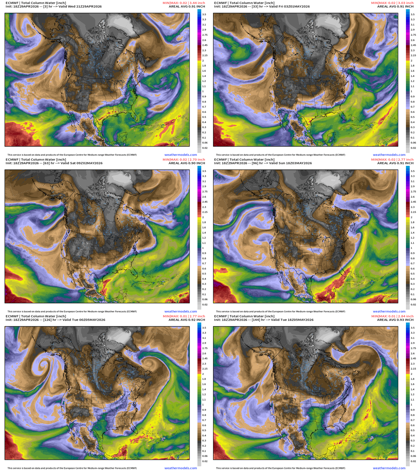
Northerly flow behind cold front = dry Canadian air almost to the Gulf coast by this weekend
RTMA Current Temperature Analysis | 7:30 PM ET
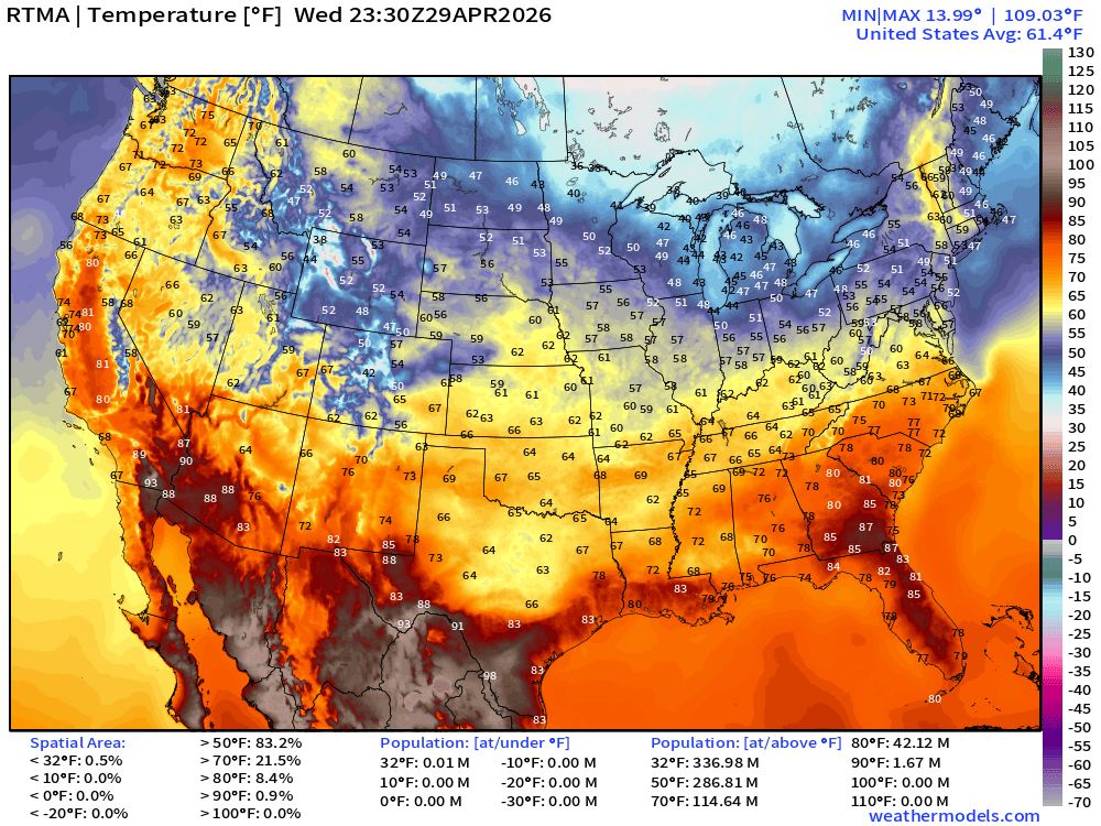
Lower 48 average was 61.4°F with 30s and 40s in the Great Lakes
RTMA Current Temperature Anomaly Analysis | 7:30 PM ET
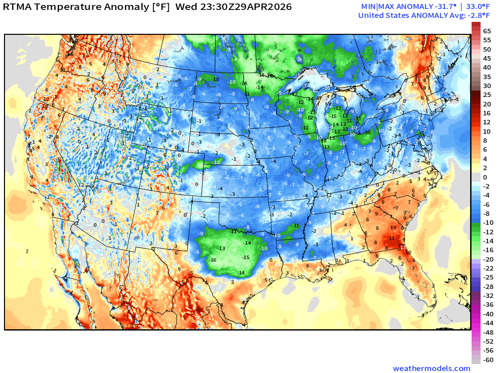
Lower 48 was only -2.8°F BELOW normal with rain cooled / clouds in Texas keeping temperatures down
This Evening’s Satellite Imagery
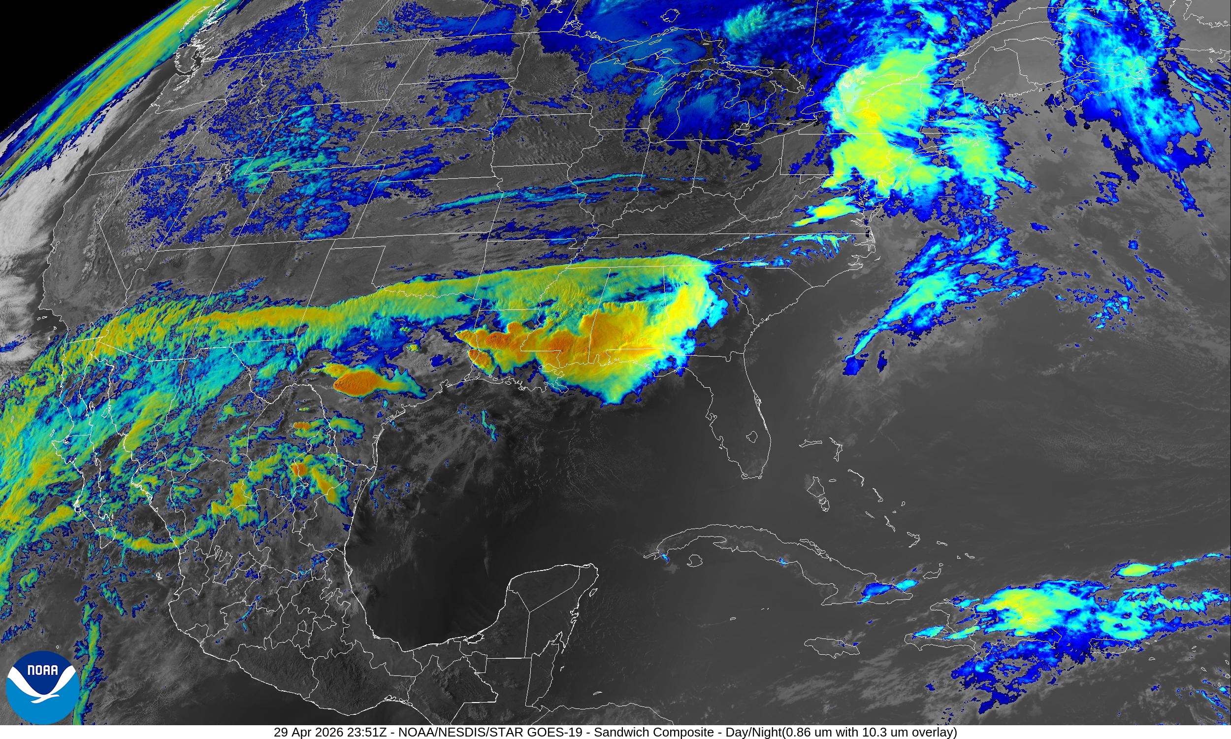
Area of rain and thunderstorms extending along subtropical jet stream from Baja California through Texas and into the Gulf coast / Southeast.
Storm system tracking into the Northeast (no severe storms) just drenching + cool rain.
Lower 48 Weather This Evening | Wednesday surface analysis
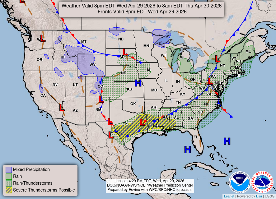
Frontal boundary extends from Texas across the Tennessee River Valley into the Mid-Atlantic and Northeast separately moist/warm air to the south from cool Canadian continental dry air especially in the Great Lakes.
Convective Outlook into Thursday Morning
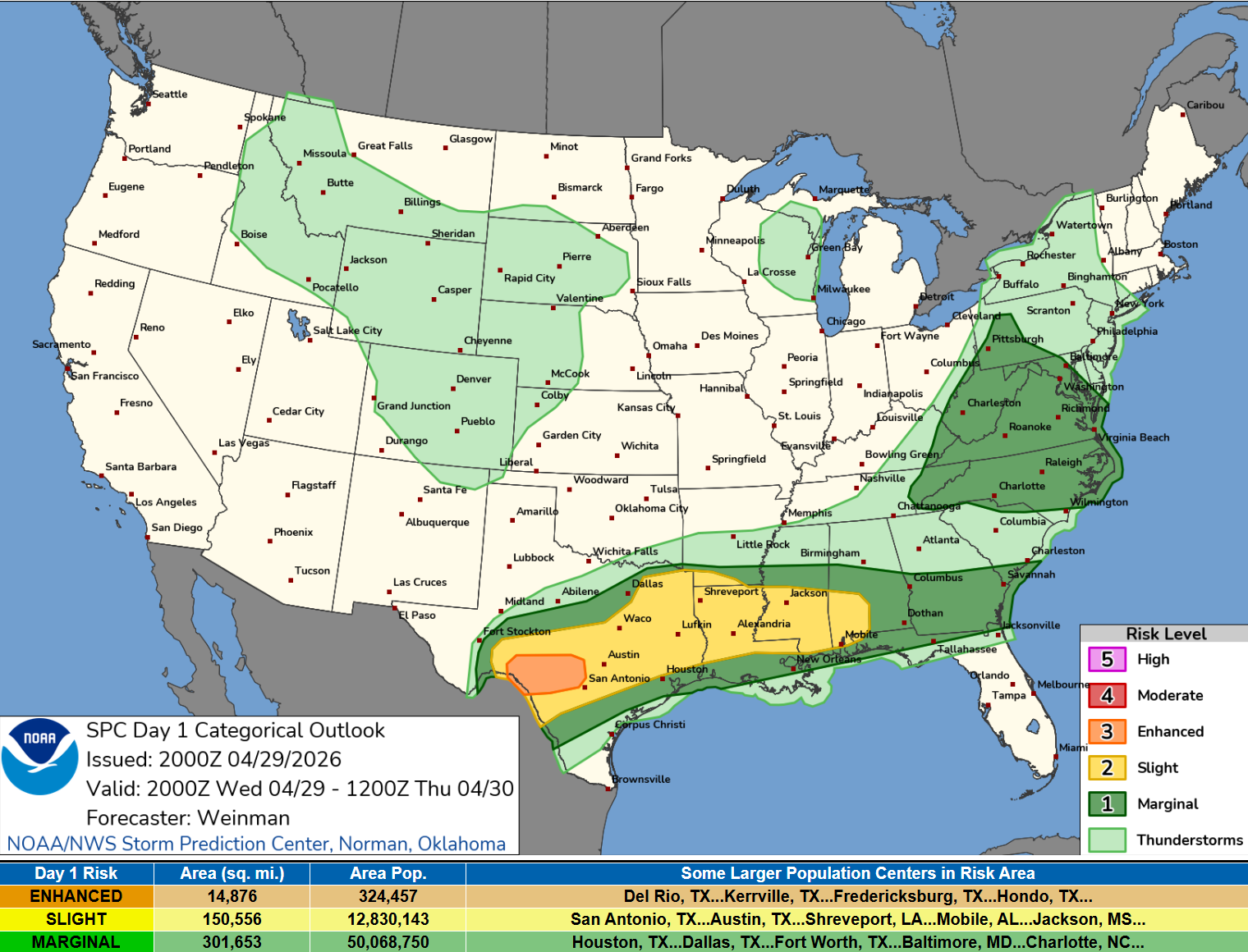
SPC watching an enhanced risk of severe storms in South Central Texas + severe thunderstorms eastward along the Gulf Coast states. Main threat is large hail and gusty/damaging winds.
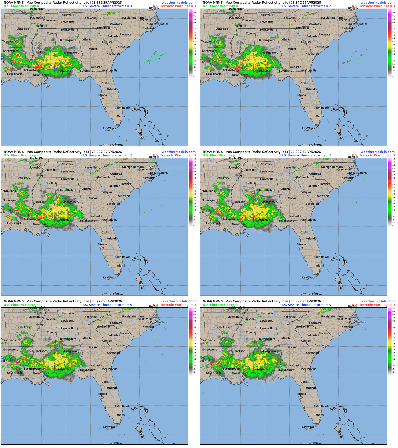
Convective Watches at 8 PM ET

Fortunately, not many warnings with any of these watch boxes … seem to be overdone.
Radar Summary through 8:38 PM ET —> more heavy rain from Louisiana into western Panhandle of Florida pushing E/SE
HRRR precipitable water next 48-hours:
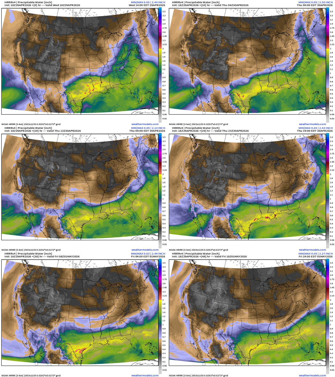
The edge of the cold front (dry to north) is very sharp from Texas through the Southeast with some undulation as low pressure systems and waves move along the stationary boundary into this weekend.
HRRR Model Forecast Radar next 18-hours —> Thursday Noon ET
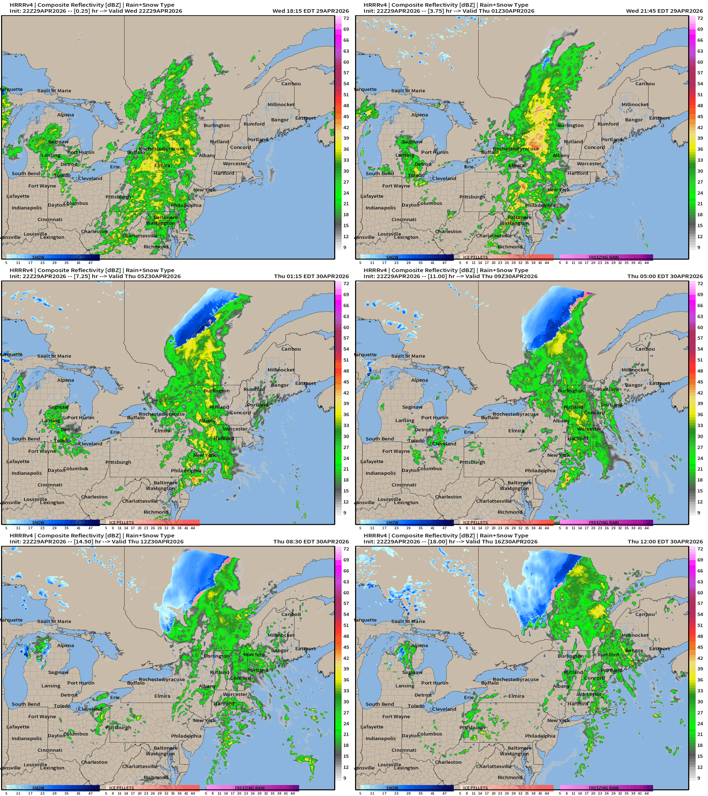
Rain across the Northeast throughout the day on Thursday … clears NYC by mid-morning.
HRRR Model Forecast Radar Next 18-hours —> Thursday Noon ET
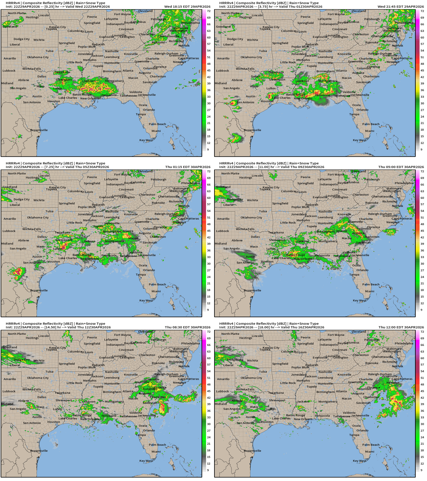
Rain spreads eastward off the Carolina coast by Noon tomorrow.
HRRR 18z — Radar Simulation Next 48-hours to Friday 2 PM ET
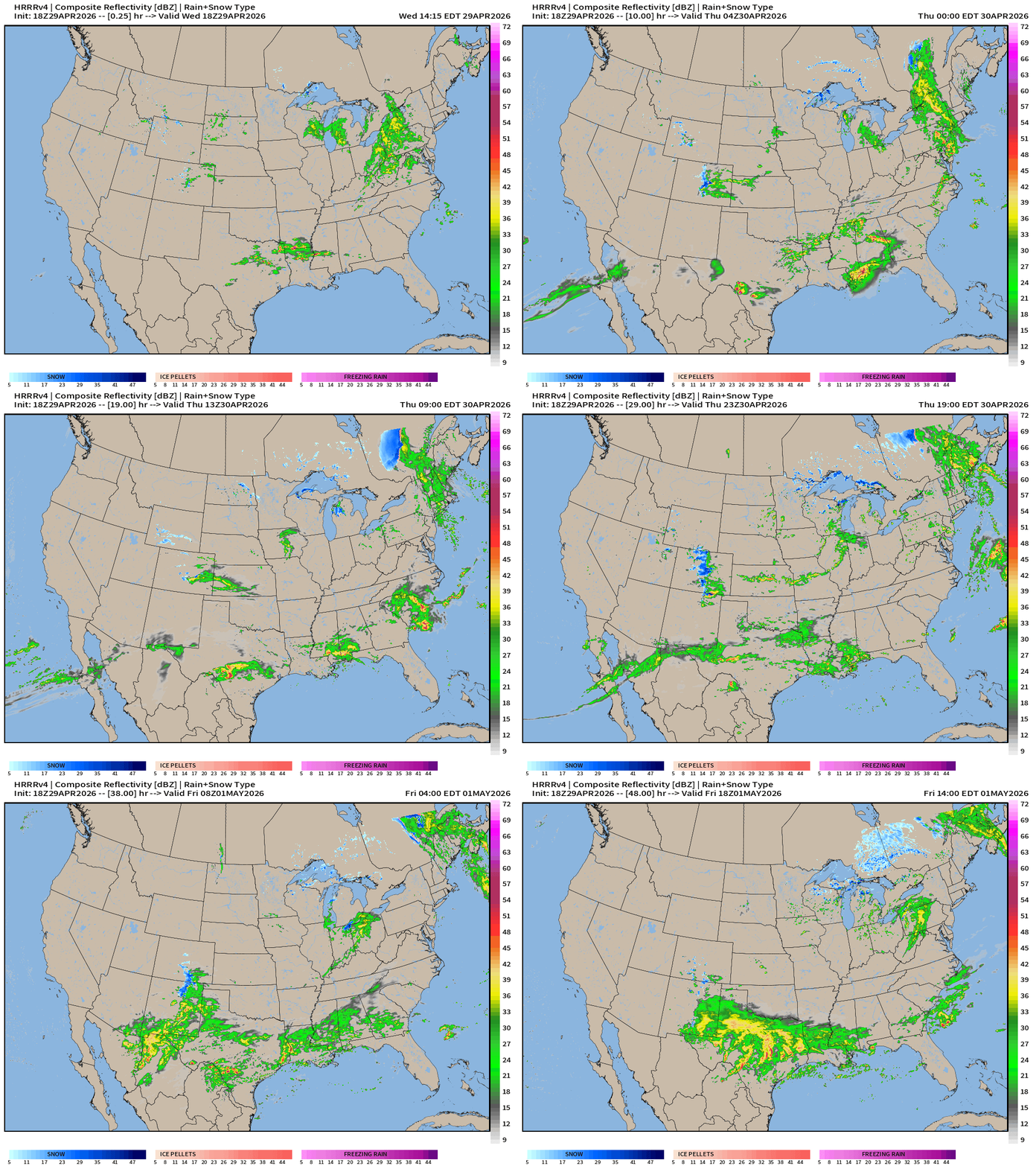
Another massive batch of rain with a Pacific origin batch of moisture and low pressure system builds across Texas on Friday!
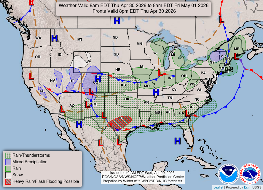
Weather on Thursday — heavy rain in Texas … stationary frontal boundary remains in place along Gulf coast … Storm system off New England keeps area cool/damp unsettled.
Below normal temperatures next 10-days+ | East of Rockies
ECMWF AIFS 18z | 500 mb Height Anomaly Next 10-days
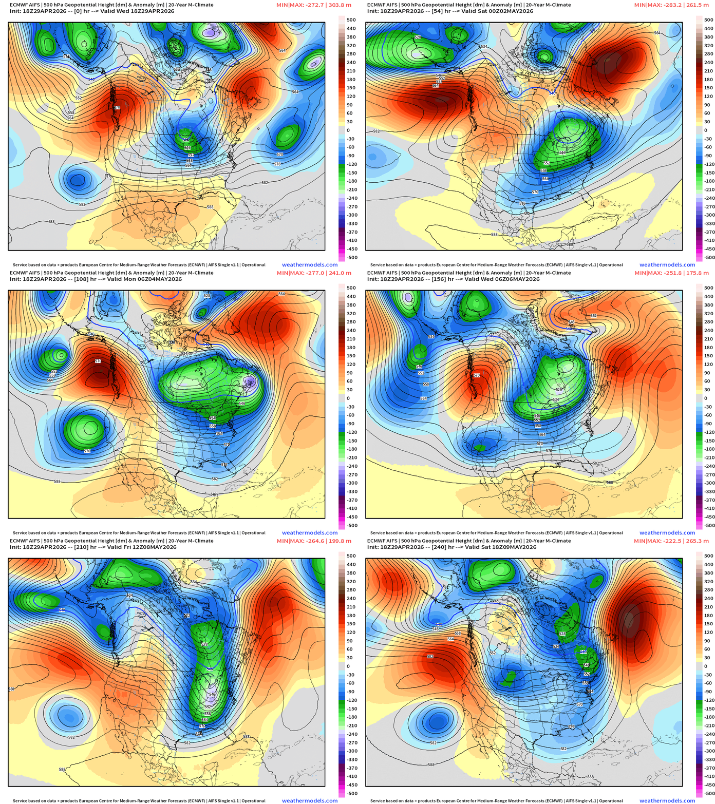
A cool and unsettled pattern from the northern Rockies into the Great Lakes and Northeast for the next 10-days with significant / persistent troughing connecting to the cooler Canadian Arctic pool of air mainly out of the north (still snow covered ground).
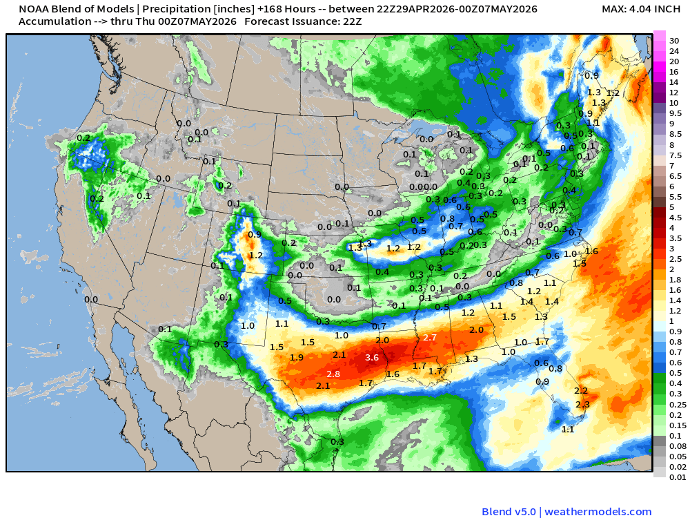
10 day Precipitation Forecast | New Blend of Models v5.0
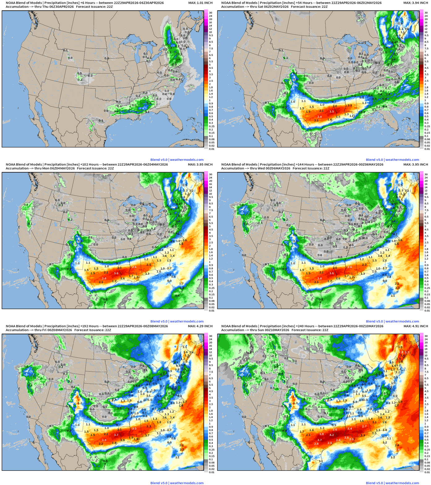
Several bouts of rainfall across the Southern U.S. from Texas to Florida — good news for the next 1-2 weeks as May starts out wet and cool.
ECMWF 18z Precipitation Type + Intensity | Next 6-days
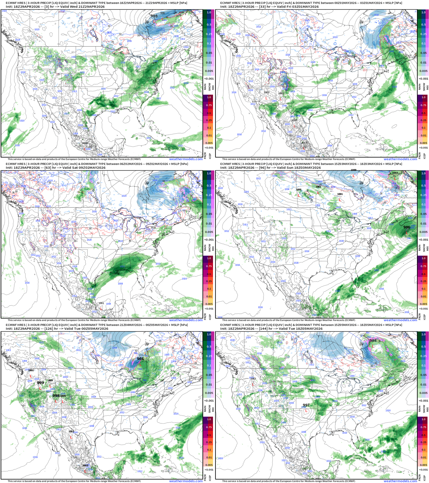
Into weekend — general cyclonic flow over the Great Lakes and Northeast taps into cooler Canadian air mass — with moisture could be come snowfall in higher elevations of New England into the weekend.
A clipper system drops out of Ontario into the Great Lakes Sun/Mon for potential snowfall in the UP of Michigan!
ECMWF 18z | Temperature Anomaly Next 6-days
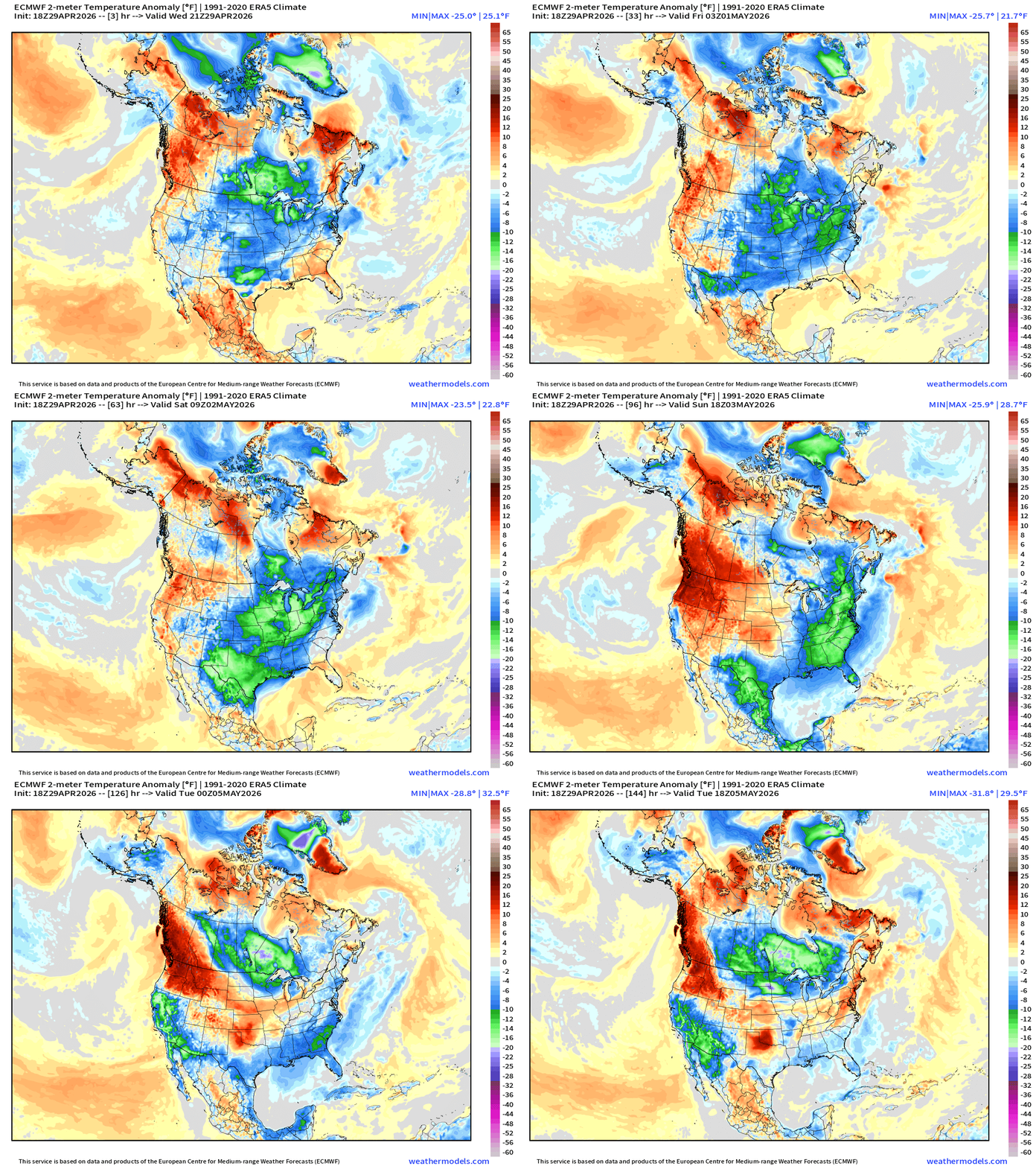
Amazing period of well below normal temperatures (10°F to 20°F cooler than typical in early May) with flow out of Canada associated with still lingering (but weaker) polar vortex in the troposphere
Low Temperatures Thursday Morning
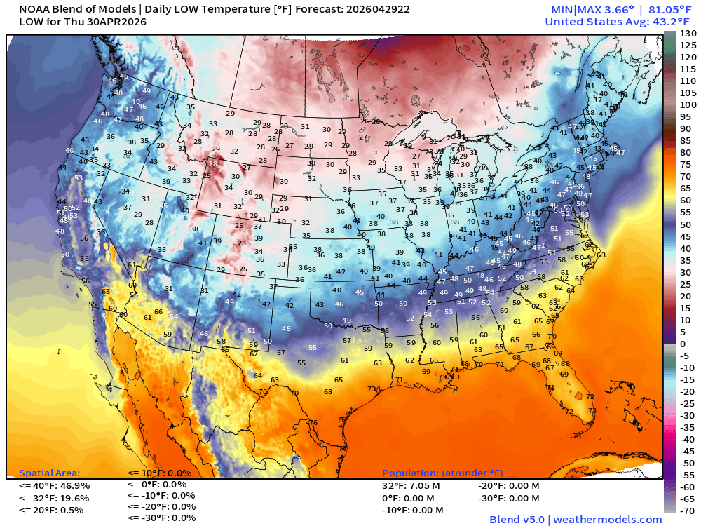
Still 20% of the Lower 48 area below freezing (7 million population)
High Temperatures Thursday
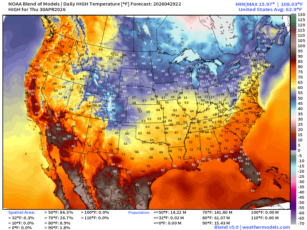
Remarkably cool for Plains into Mississippi River Valley and into the Northeast … only 61 million at least 80°F
Temperature Anomaly on Thursday for High
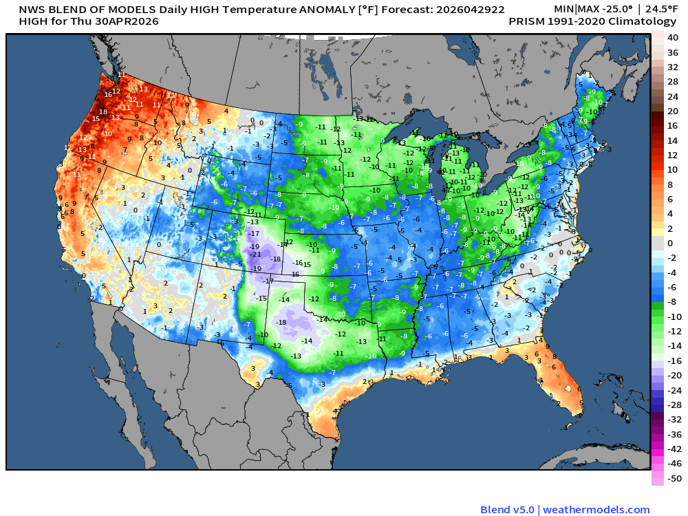
Highs in the 40s and 50s across the Great Lakes into New England.
NDFD NWS Total Precipitation Next 72-hours through Saturday Afternoon
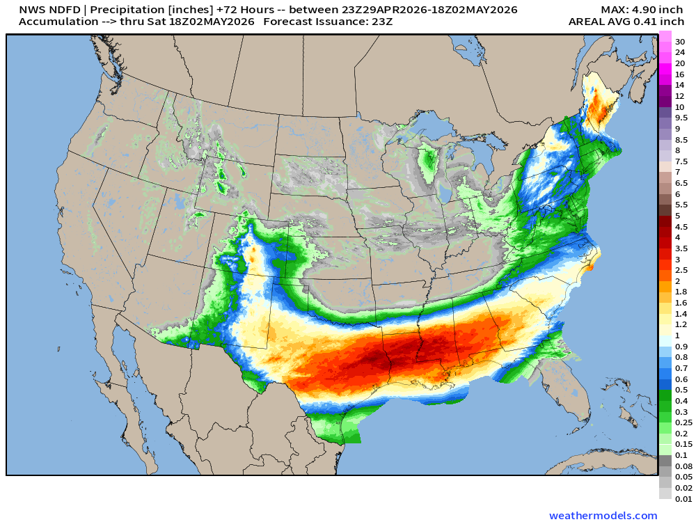
Very welcome — heavy rainfall for Texas into the Southeast … just what we need!
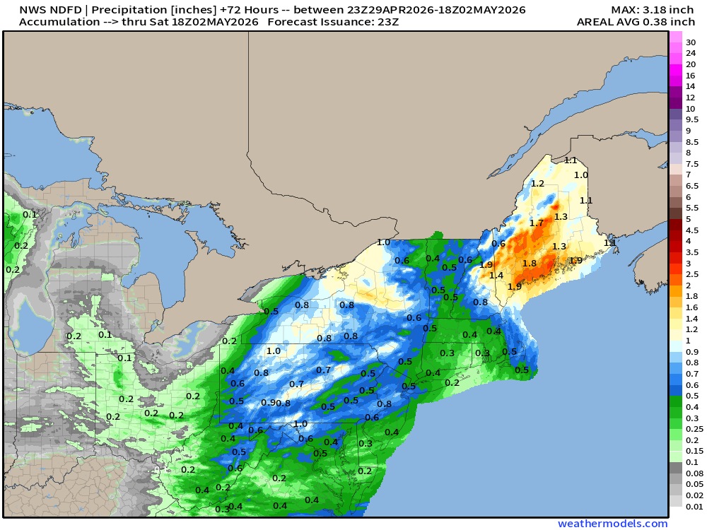
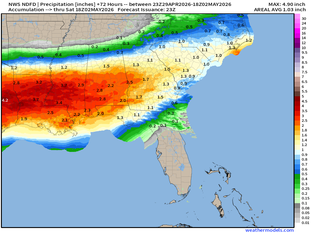
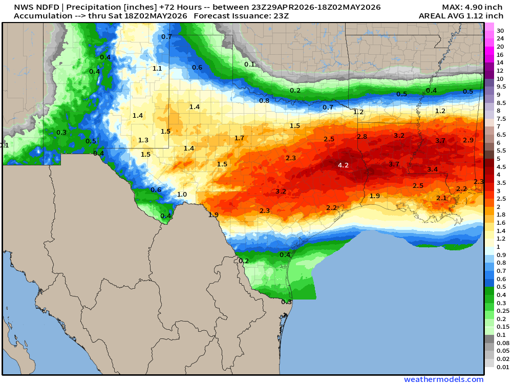
Total Precipitation Next 7-days | Blend of Models
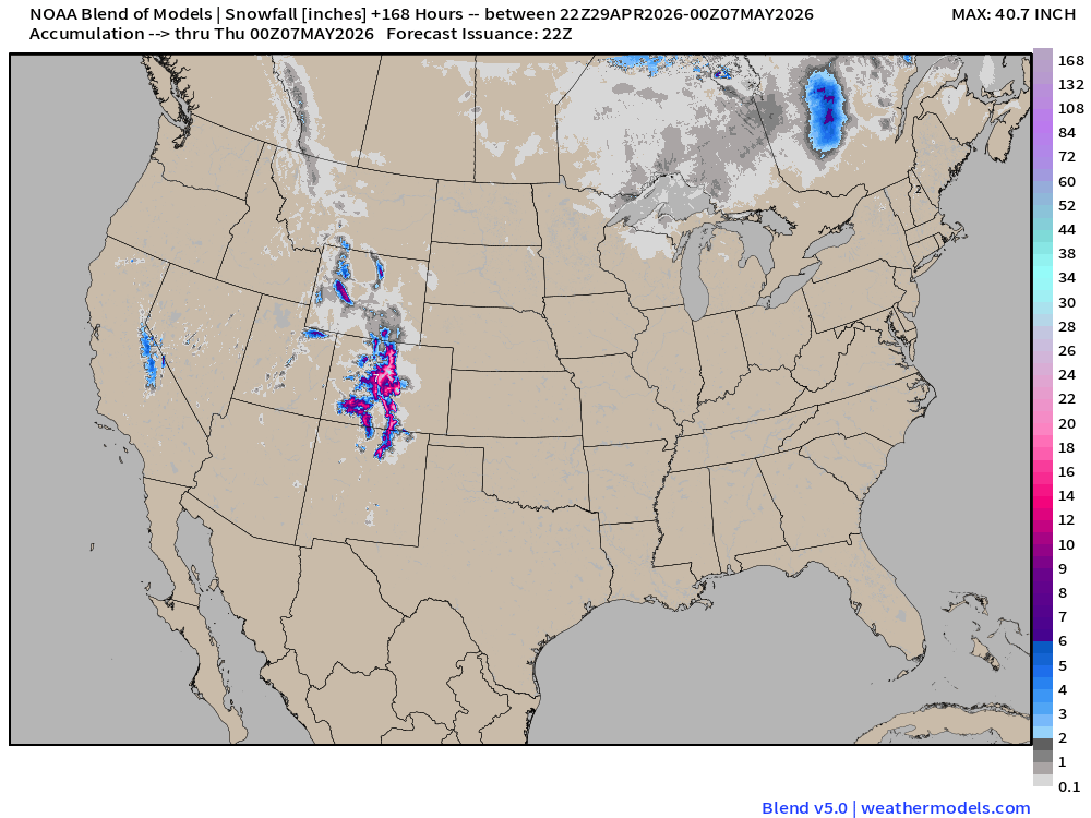
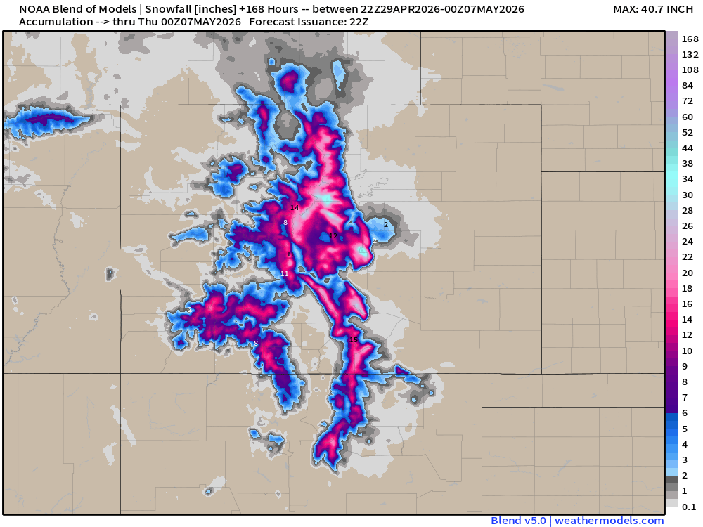
Blend of Models | Total Snowfall Next 7-Days
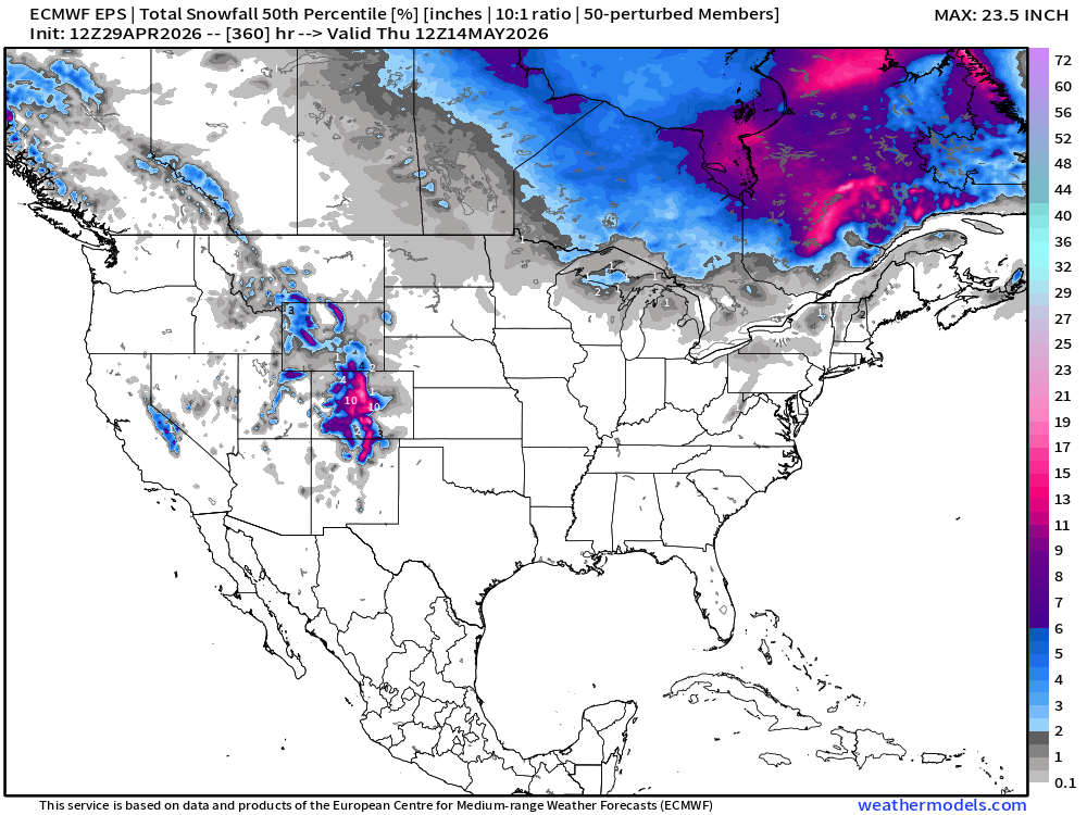
Snowfall from ECMWF EPS Ensemble Median (15-days)
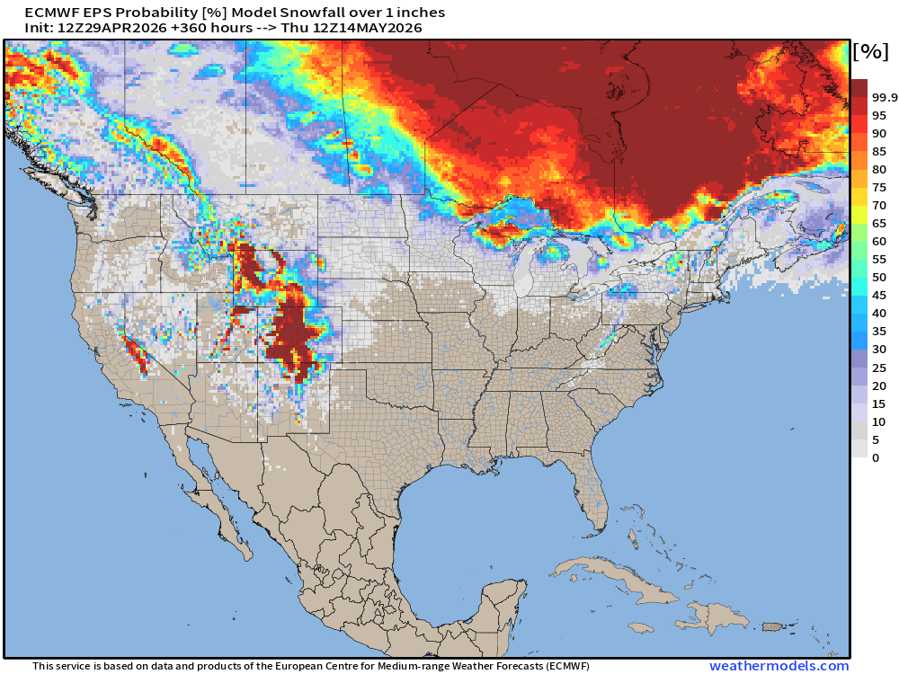
Snowfall probability of at least 1-inch into May 14th —> LOL
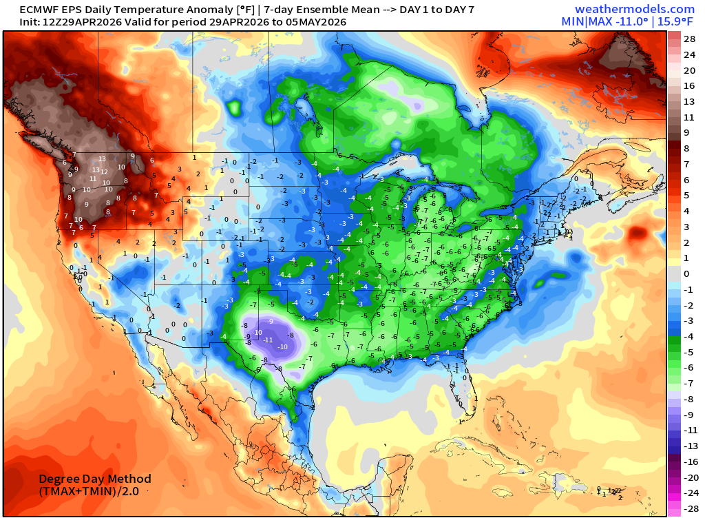
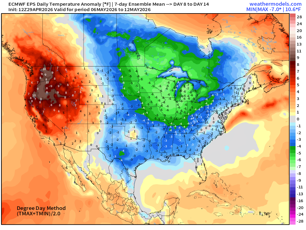
Temperature Anomaly | Next 15-days | ECMWF EPS 12z Ensemble Mean

Extended period of “below normal” temperatures dips into the Lower 48 east of the Rockies extending back into northwest Canada through first 2-weeks of May.
Where’s the heat dome? Along the Pacific Northwest and into California during next 1-2 weeks.
Week #1 | Temperature Anomaly | April 29 - May 5
Week #2 | Temperature Anomaly | May 6 - May 12
April 7: 2026 Atlantic Seasonal Hurricane Forecast: 11/5/2
9-13 Named Storms (11 most likely)
4-7 Hurricanes (5 or 6 most likely)
1-3 Major Hurricanes (2 most likely)
ACE: 75-85
Maps sourced from weathermodels.com designed and innovated by yours truly! Please subscribe there for real-time access to the newest maps, charts from all of the weather models including ECMWF and AIFS, and NOAA GFS/GEFS. NOAA WPC and SPC for fronts/convective outlooks.
- Milepost
- 928 · laid 2026-04-30T01:04:11.778000Z
- Source
- https://weather.substack.com/p/april-29-2026-wednesday-spring-weather
- Digest
- 1321a2c02f5bd727f926a66a6b6638e42115616cb4e8835e233dbbadedf7a6d3
- Machine
- JSON