April 23, 2026 Thursday Spring Weather
Drought relief on the way next week as southern U.S. sees warm, moist flow pattern
April 2026 was the 3rd-warmest April in the 132-year national record (1895–2026), at 54.7°F against a 1991–2020 normal of 51.8°F (+2.9°F).
April 2026 was the 46th-wettest April in the 132-year national record (1895–2026), at 2.7in against a 1991–2020 normal of 2.7in (+0.0in).
NOAA/NCEI Climate at a Glance, contiguous United States. This is the observed record for the month, not a score of anything said in this piece — the forecast ledger begins 2026-08-17 and cannot reach earlier posts.

Starting out with the upper-level pattern from the world-leading “skill” data driven system from ECMWF (AIFS-Single v1) … v2 is upgrading on May 12th.
ECMWF AIFS 12z | Height Anomaly Next 10-days
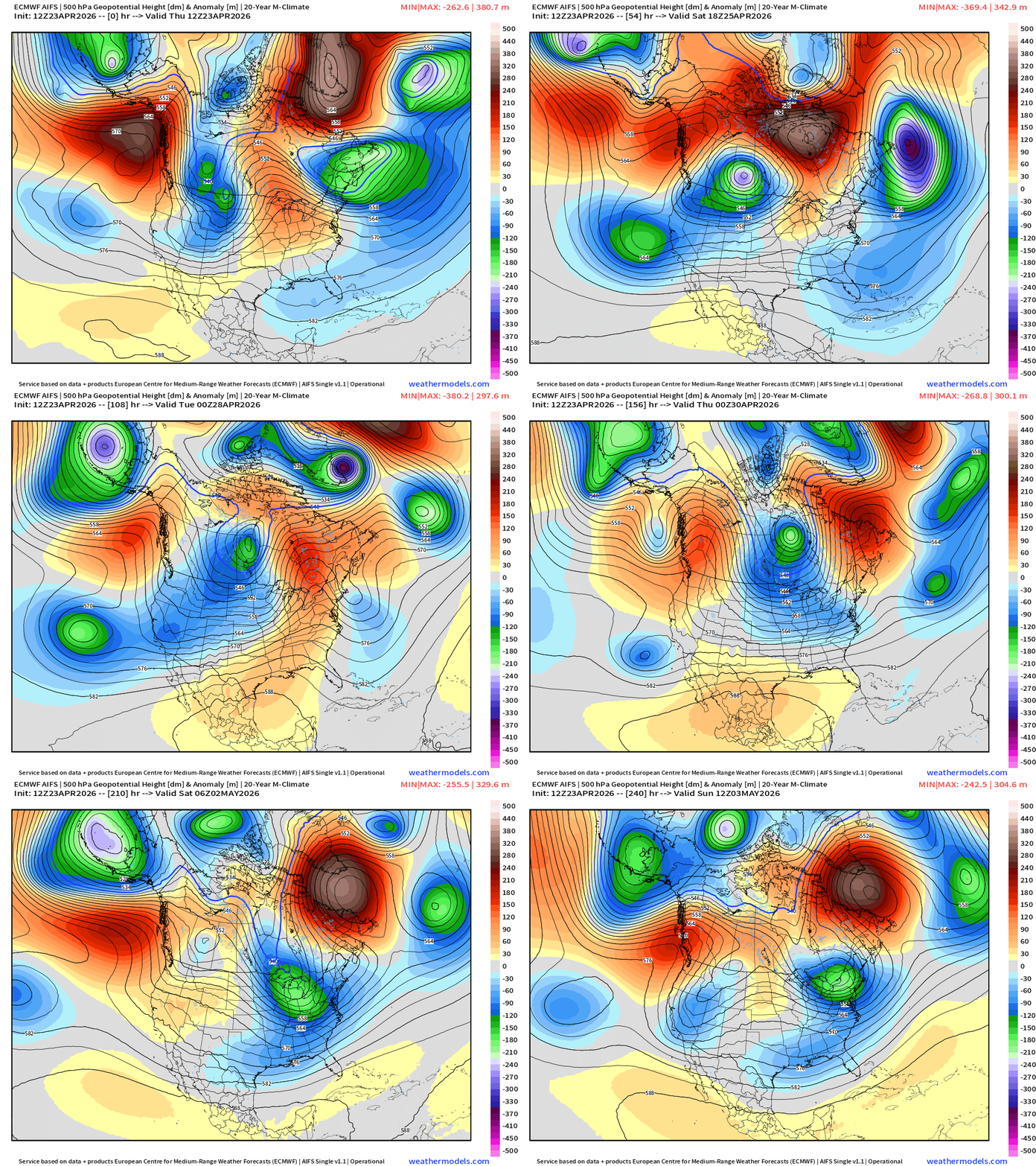
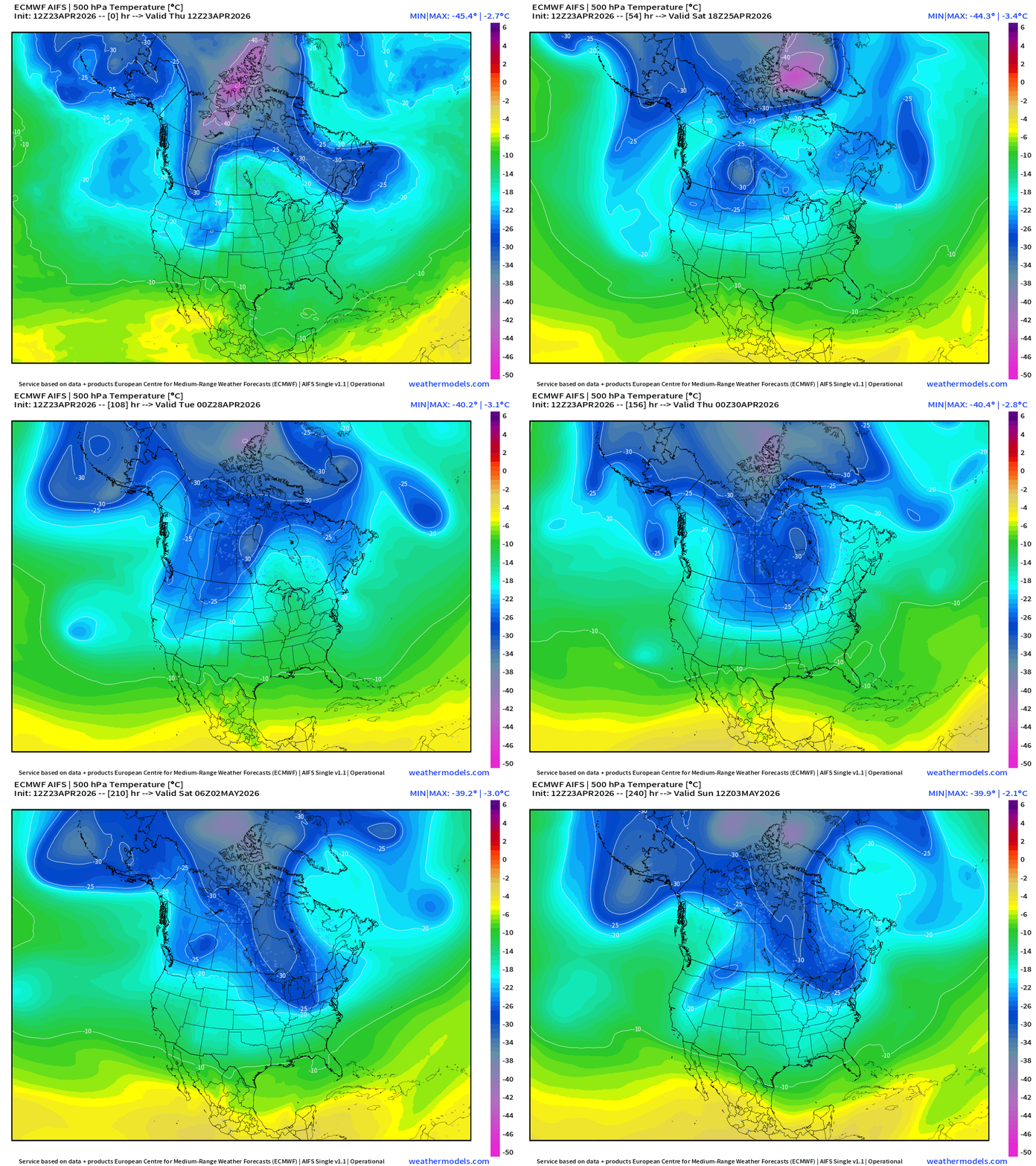
A very strong trough loops over Montana and Alberta with cold air … heads into Canada but another “polar vortex” lobe dips into the Great Lakes and Northeast into early May. Overall, this is a cool and unsettled pattern from the northern Rockies into the Great Lakes and Northeast with warmth across the South — and yes, more rainfall/storms on the way as the southerly flow increases. No heat domes for the next 2-weeks across the Lower 48.
Precipitation Observed Last 2-weeks
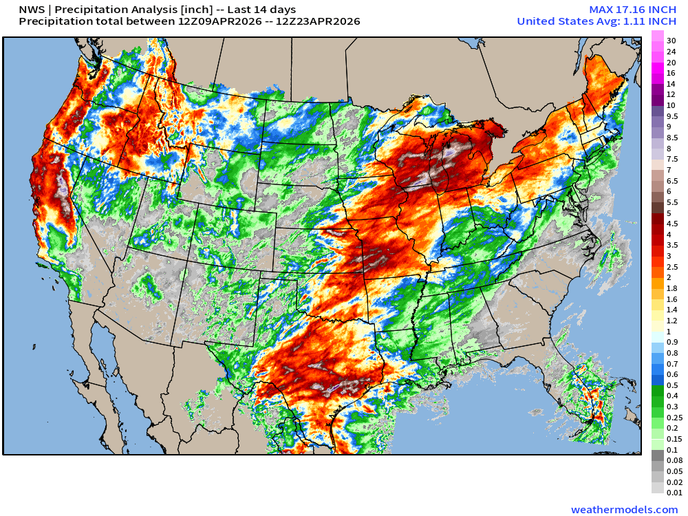
Heavy precipitation observed from Texas to the Great Lakes especially in Wisconsin and Michigan … also across California and along the Pacific coast.
However, nothing across Georgia and South Carolina and little northward into Washington D.C. and NYC.
Drought Monitor Updated Today | Thursday April 23, 2026
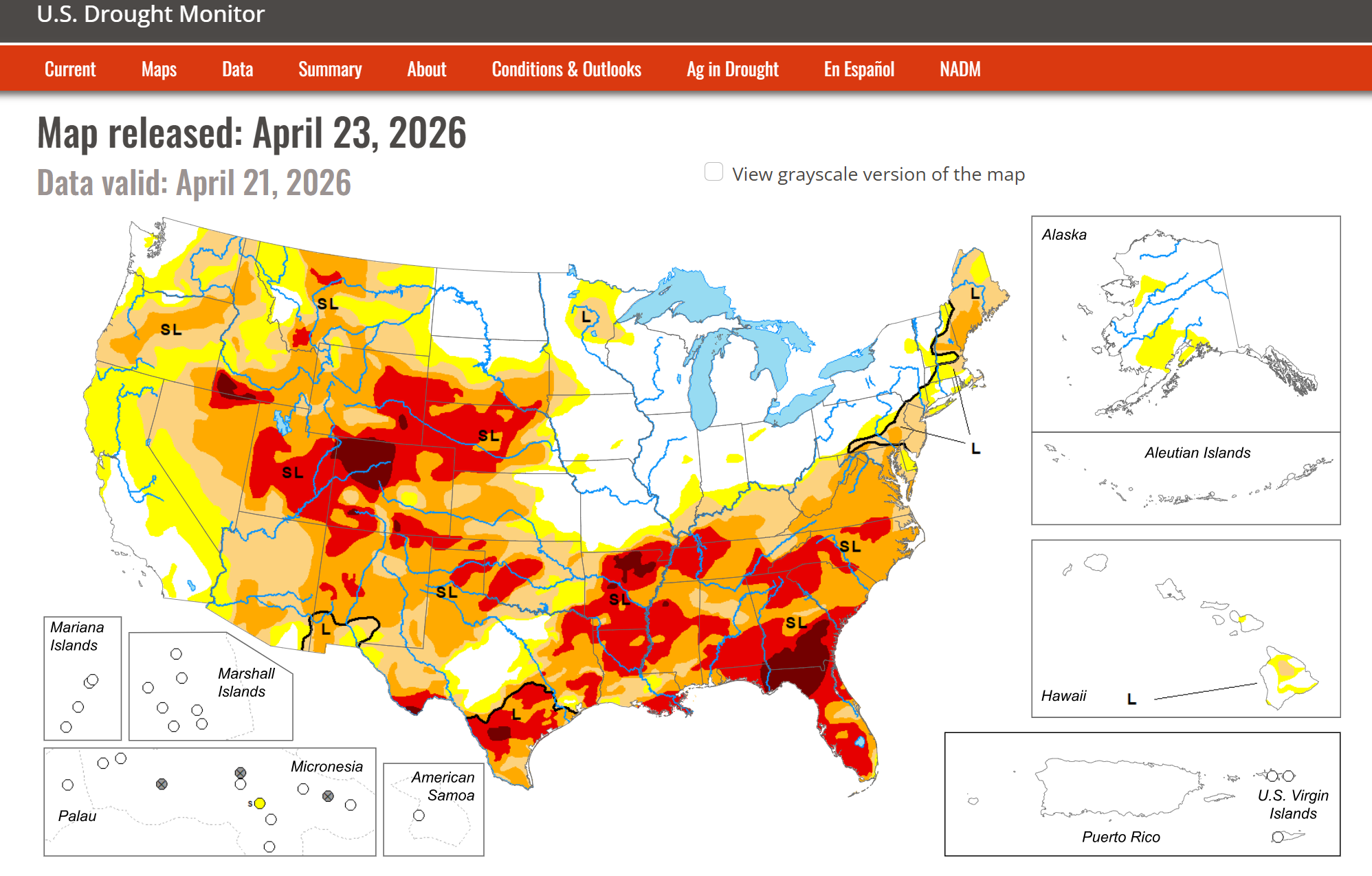

Bone dry across the Southeast = extreme to exceptional drought (D3+D4) with more D3 from Texas to Carolinas + front range of Rockies and into the central Plains.
We desperately need precipitation to dent/bust the drought. Good news, we’re going to get boatloads!
10 day Precipitation Forecast | New Blend of Models v 5.0
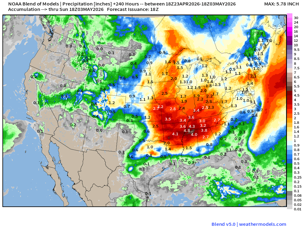
Relief is coming to the Tennessee River Valley and Southeast mainly next week as a much wetter pattern takes us into early May!
Beautiful Weather Across the Eastern U.S. — warm and sunny!
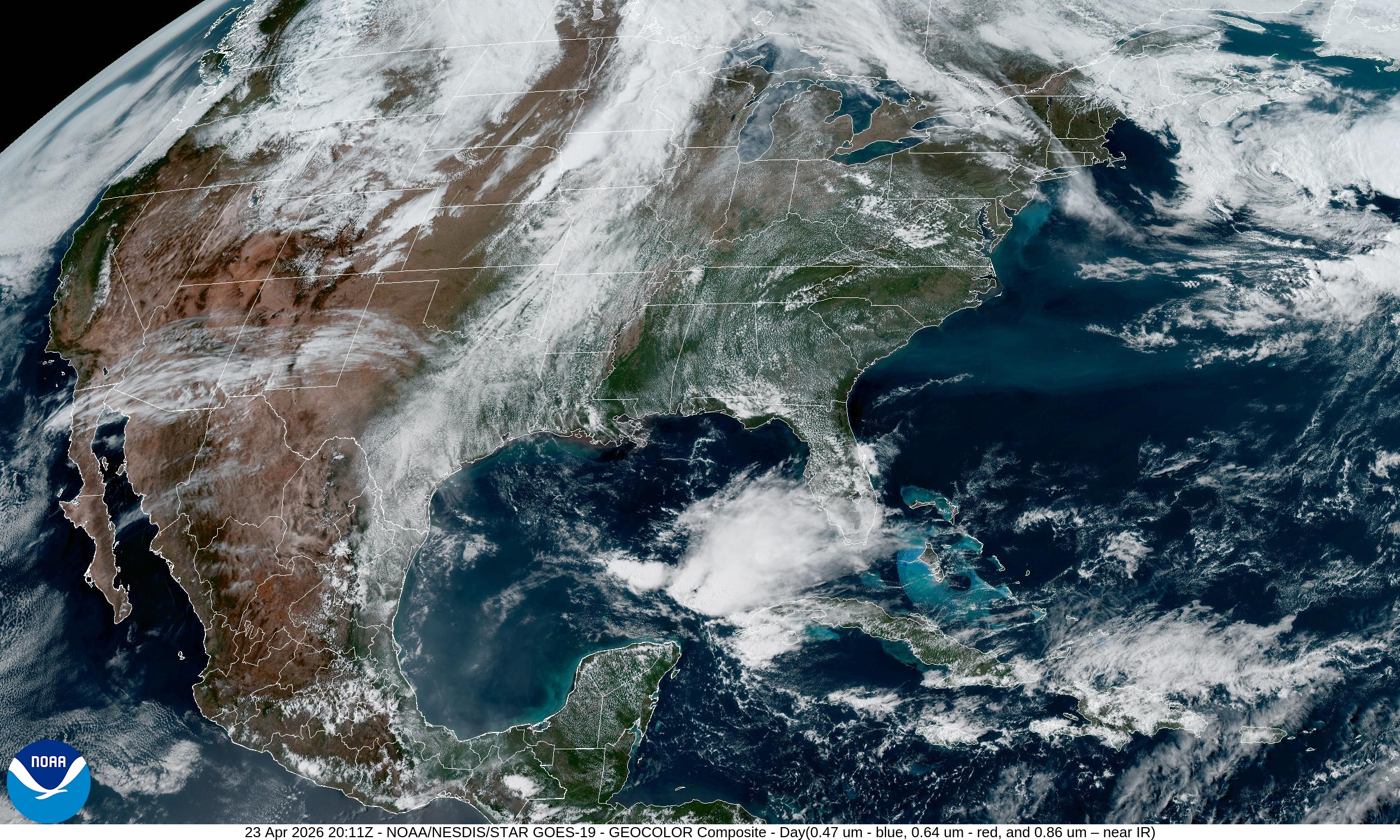
Sunny and beautiful + warm across the Great Lakes and Southeast
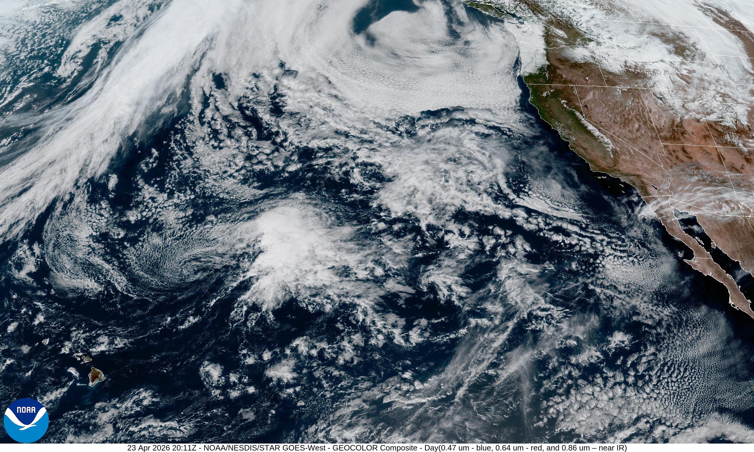
This is post number 924: Good Afternoon! Day 113 of 2026.
Author: Dr. Ryan Maue (X @RyanMaue X @weathertrader)
Special April 2026 Coupon for new/upgrade Annual Subscribers, or gifts. Substack algorithm has almost zeroed out platform visibility of this newsletter presumably because it is chock full of maps and not easily digestible (for AI) text. That’s a concern going forward into Hurricane Season. I’m going to need to branch this newsletter out, and always looking for ideas/partners to share the beauty of Earth’s weather and climate via very colorful maps (from NWP).
ECMWF 12z Precipitation Type + Intensity | Next 10-days
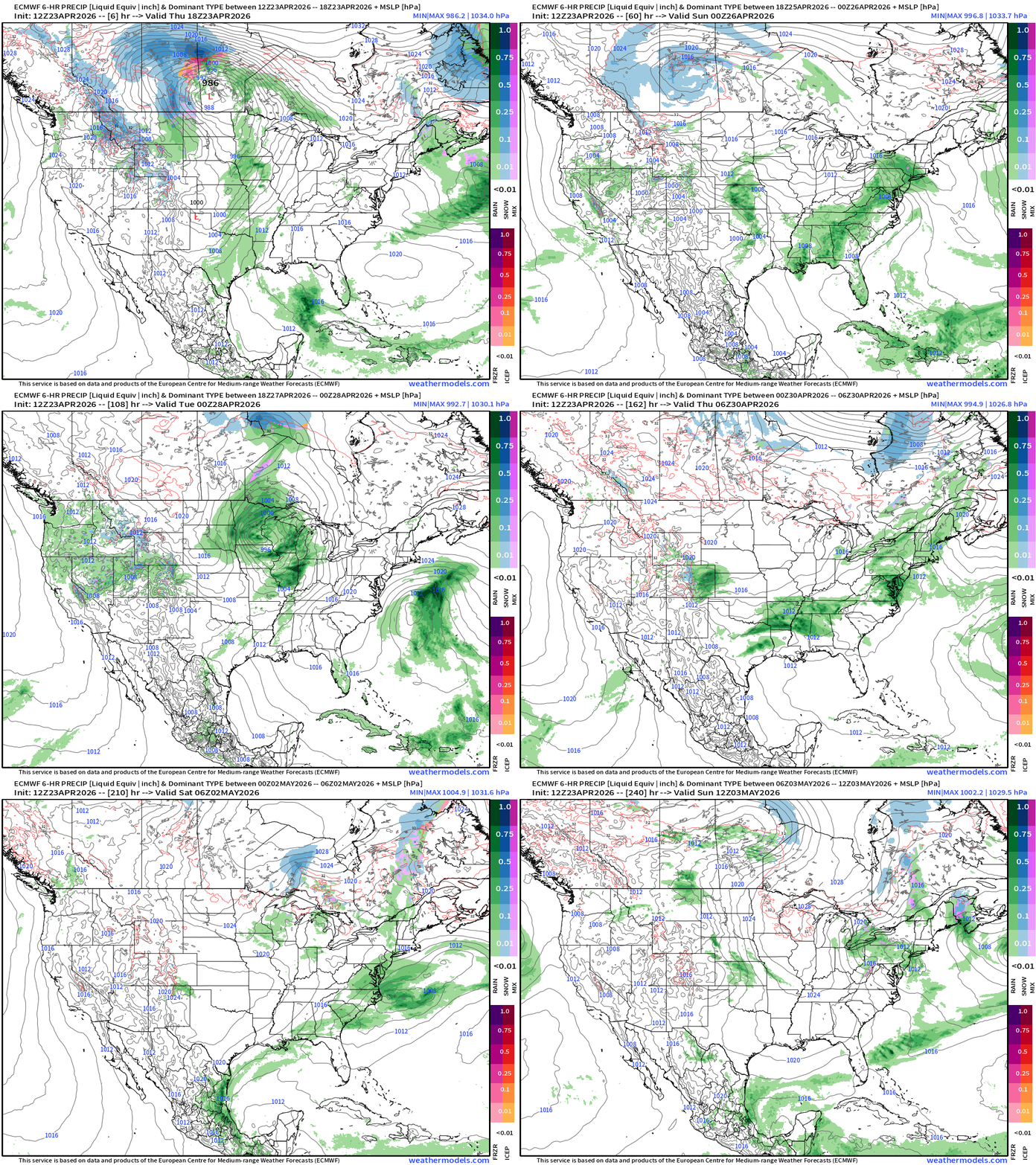
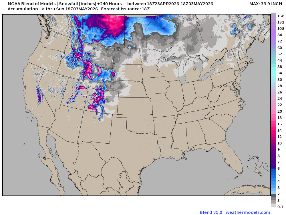
Impressive storm system that deepens into the 980s mb central pressure over Montana and the Canadian Prairies with significant snowfall — and cold air on the back side tapping into the “polar vortex” linked “cold pool” still operating over the Arctic.
Severe weather along the cold front attached to storm system in the Plains and Midwest from Kansas to Minnesota — will fizzle out while pushing off the East Coast, but hopefully we’ll get 0.25” of rainfall over the Southeast including the Carolinas.
Sunday into next week: another powerful Plains —> Great Lakes storm system with likely severe weather threat along a sharp cold front as cold air again clashes with the “heat and humidity” supplied by the Gulf of Mexico.
Unfortunately, does not look like significant rain for the Southeast this weekend — maybe we’ll get 1/4” or hopefully more in a thunderstorm. We’ll need to wait until middle of next week for the moisture/flow out of the Gulf to fuel convective storms — heading into May. The pattern looks much wetter!
High Temperatures Today | Thursday April 23, 2026
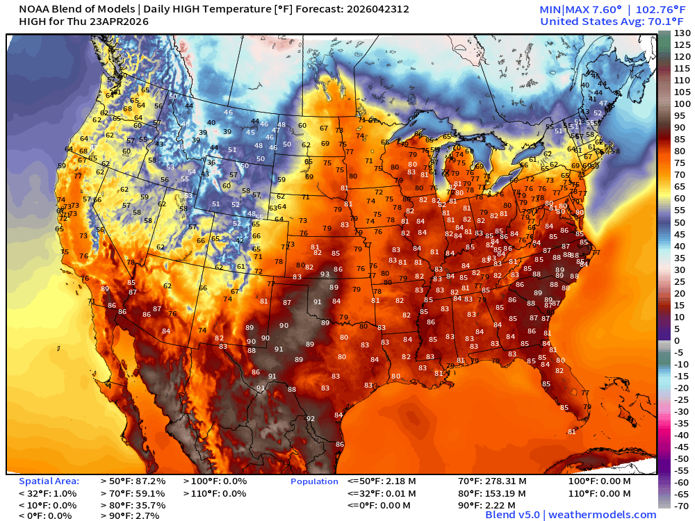
278 million at least 70°F … and 153 million at least 80°F
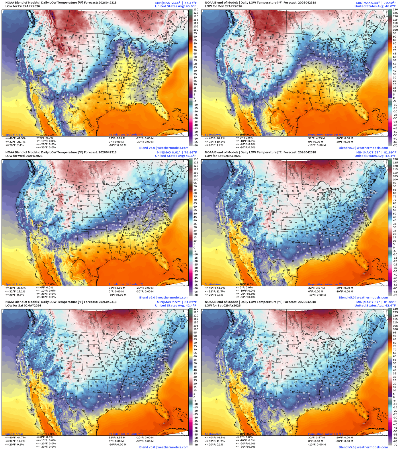
Low Temperatures on Friday
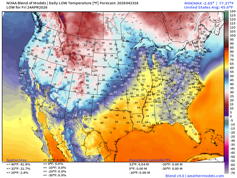
6 million below freezing including New England and the Dakotas to Montana/Wyoming
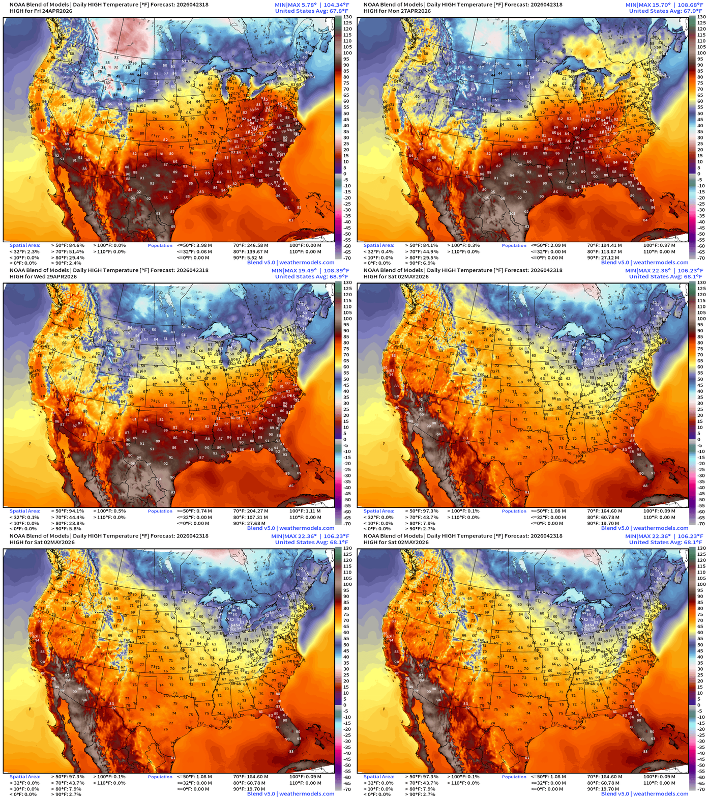
High Temperatures Friday
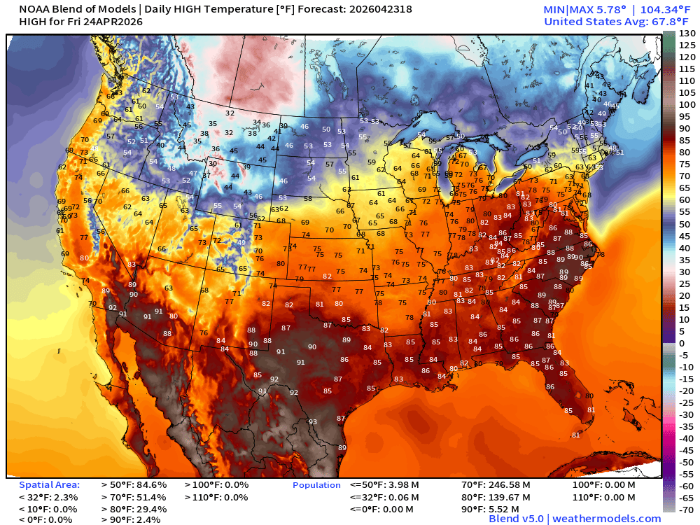
Still cool across New England but NYC should come near 70°F
Only 5.5 million at least 90°F — major heat at end of April is held in abeyance
High Temperatures Saturday
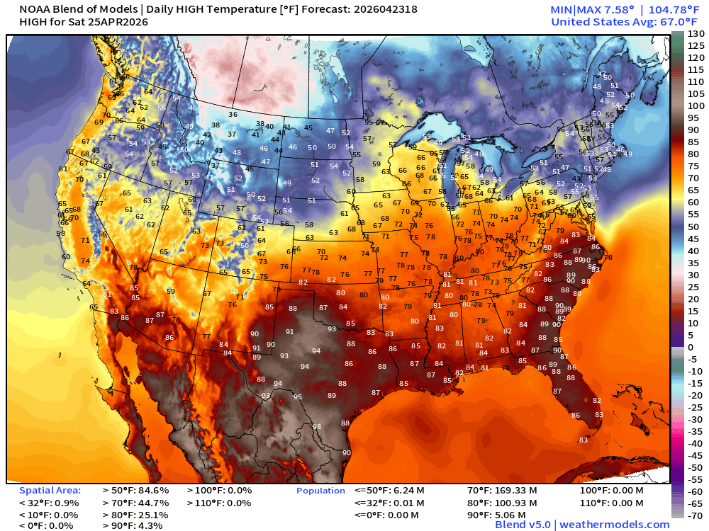
Still 101 million at least 80°F but not in the Northeast or Great Lakes!
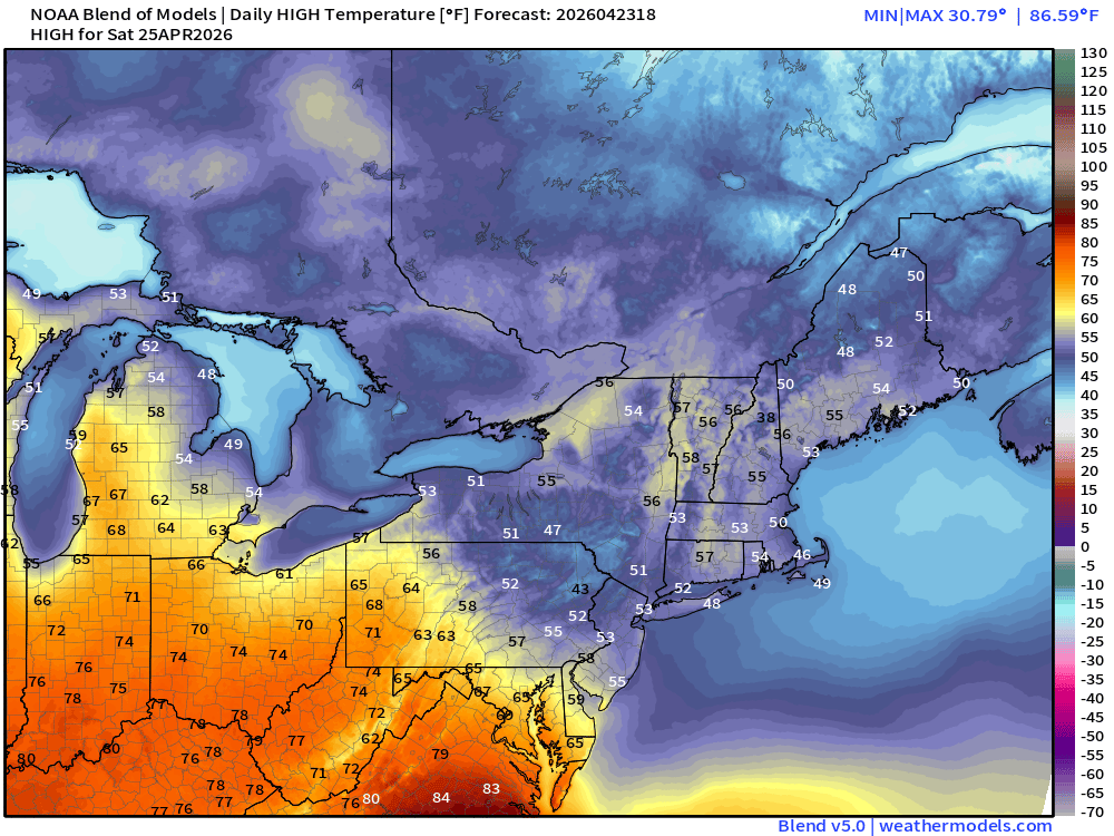
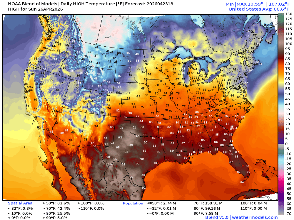
High Temperatures Sunday
RTMA Current Temperature Analysis | 3:00 PM ET
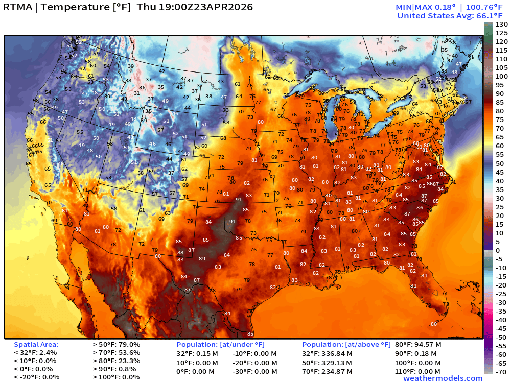
Lower 48 average was 66.1°F with 235 million at least 70°F
RTMA Current Temperature Anomaly Analysis | 3:00 PM ET
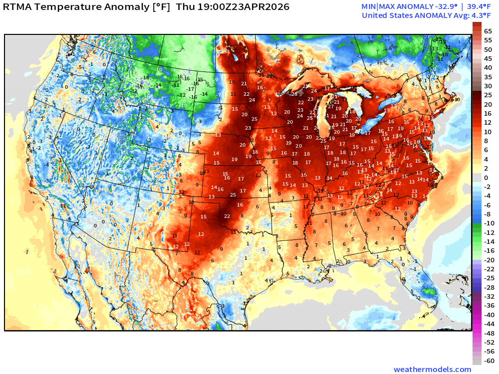
Lower 48 was 4.3°F ABOVE normal
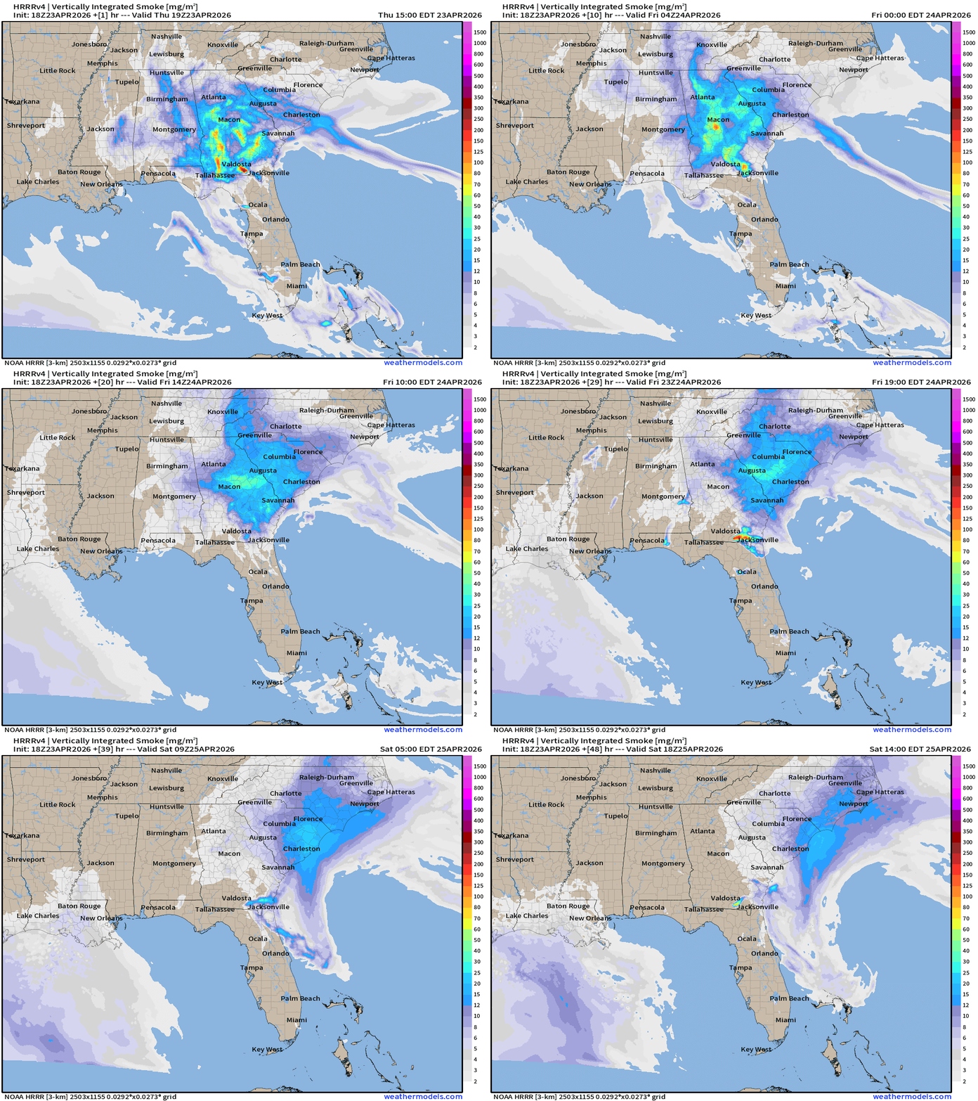
With the recent dry conditions (D4 drought) and gusty winds, fire danger is severe in Georgia, including ongoing “Brantley Fire” creating hazy/smoky conditions across Atlanta. Southerly flow will unfortunately bring more wildfire smoke further north into Atlanta and much of South Carolina. HRRR Smoke next 48-hours:
Lower 48 Weather Today | Thursday
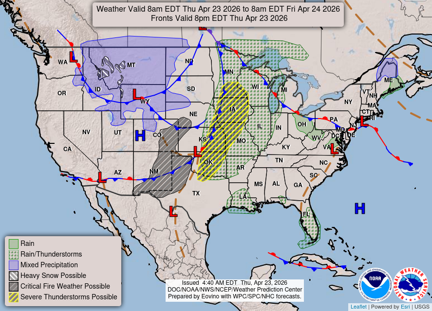
Severe weather underway this afternoon in the central Plains into the western Great Lakes and Midwest. Winter weather in Montana with plenty of snowfall.
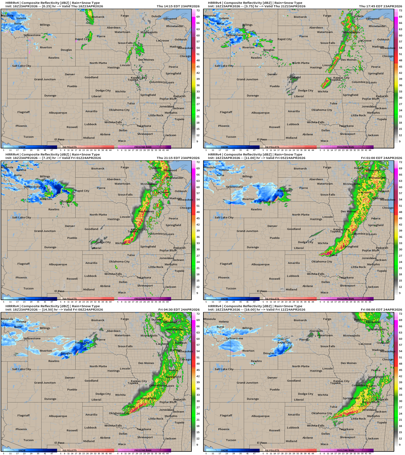
Radar next 18-hours —> Friday morning 8 AM ET
The risk of severe weather is “Enhanced” from SPC from northern Oklahoma across eastern Kansas
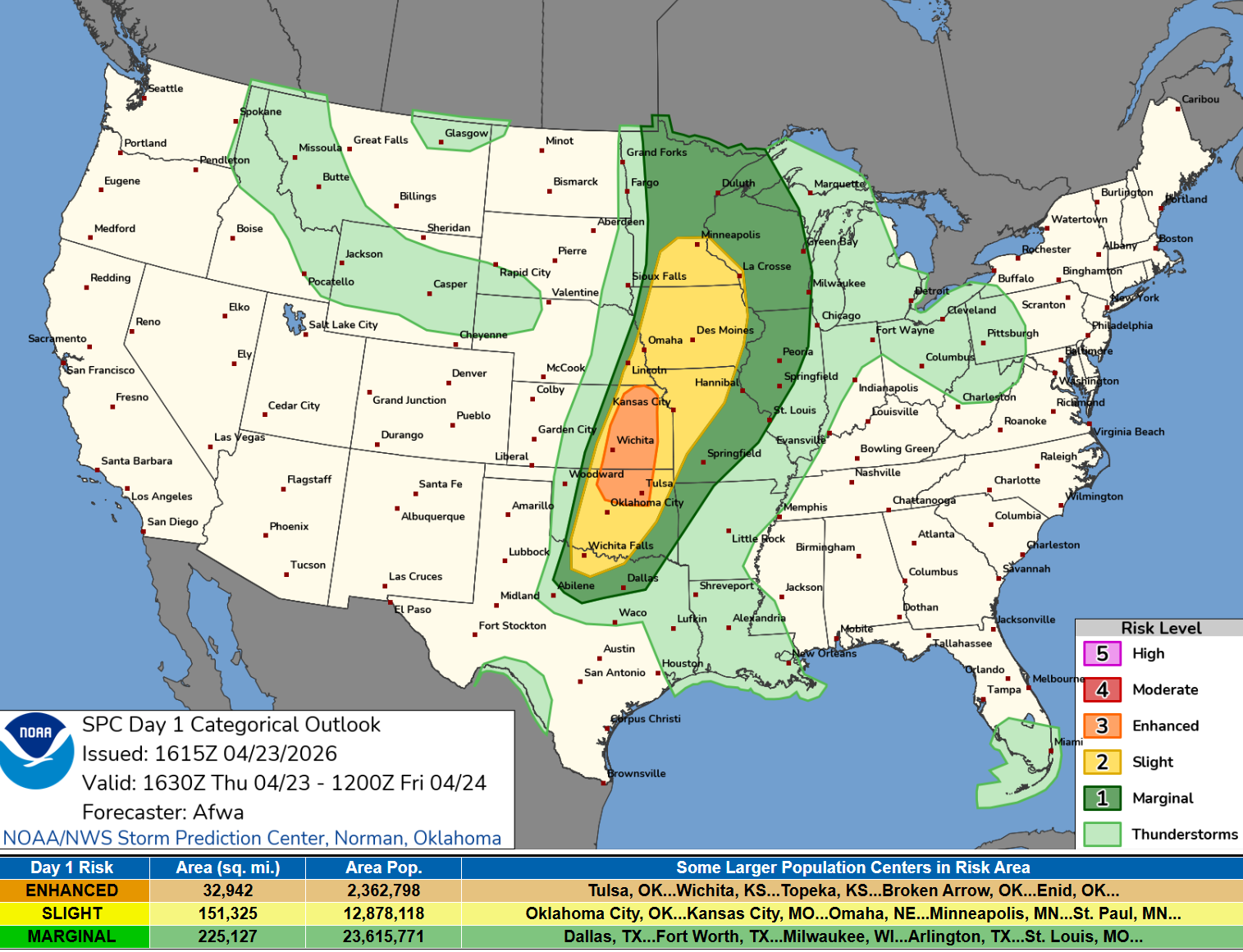
   ...THERE IS AN ENHANCED RISK OF SEVERE THUNDERSTORMS EASTERN
   KANSAS...NORTHERN OKLAHOMA...

   ...SUMMARY...
   Severe thunderstorms are expected to develop this afternoon and
   evening from the southern and central Plains into the lower to mid
   Missouri Valley, and upper Mississippi Valley. Tornadoes, large hail
   and severe wind gusts will be possible.
Current Radar | 3:24 PM CT
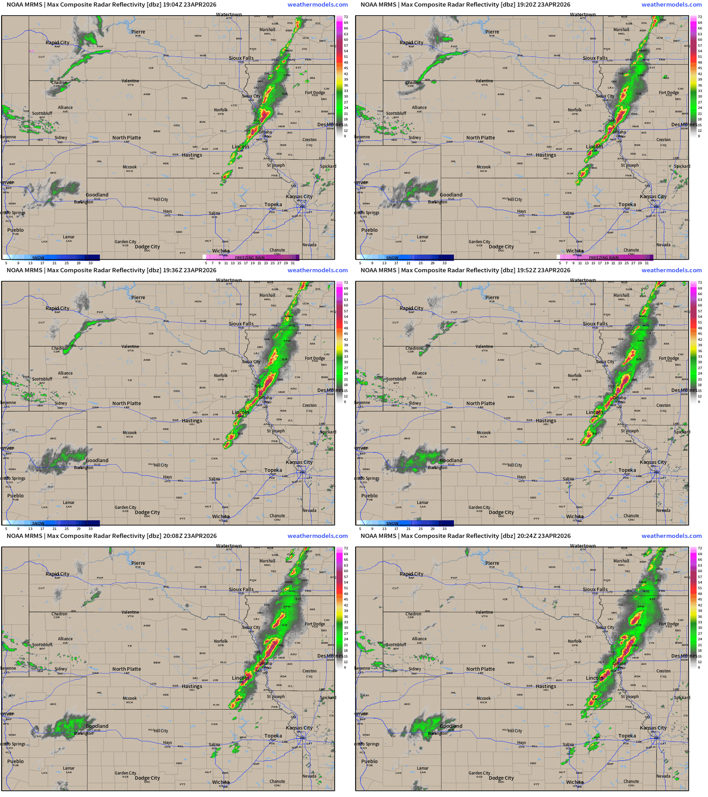
Current severe weather watches — 2 tornado + 1 severe thunderstorm
HRRR 18z — Radar Simulation Next 48-hours to Saturday 2 pm ET
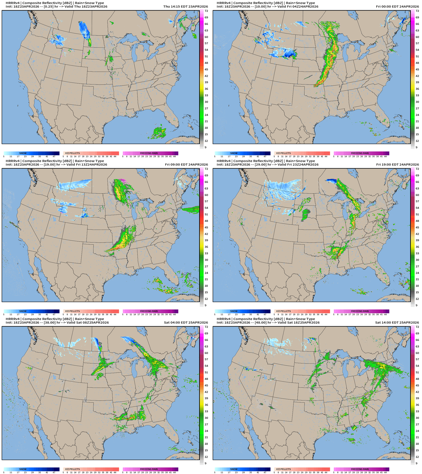
The front largely fizzles into the Southeast but hopefully some showers/storms survive and provide a drink of water in Georgia.
The low pressure center swirls out of Montana into Canada with snow showers!
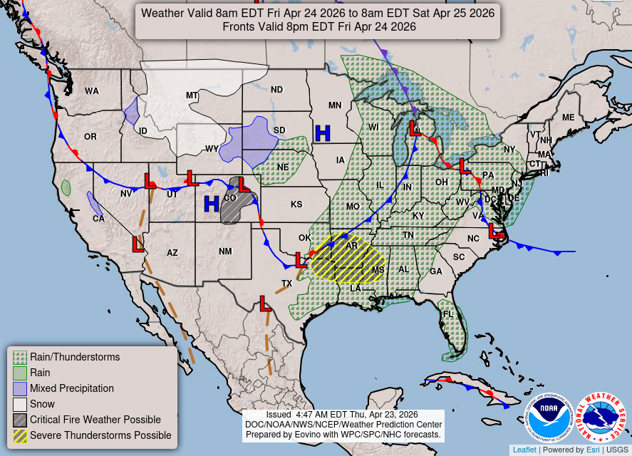
Weather on Friday
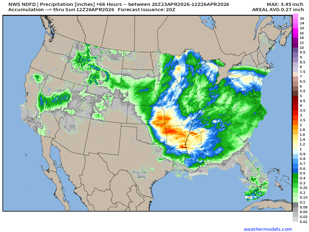
NDFD NWS Total Precipitation Next 66-hours through Sunday Morning
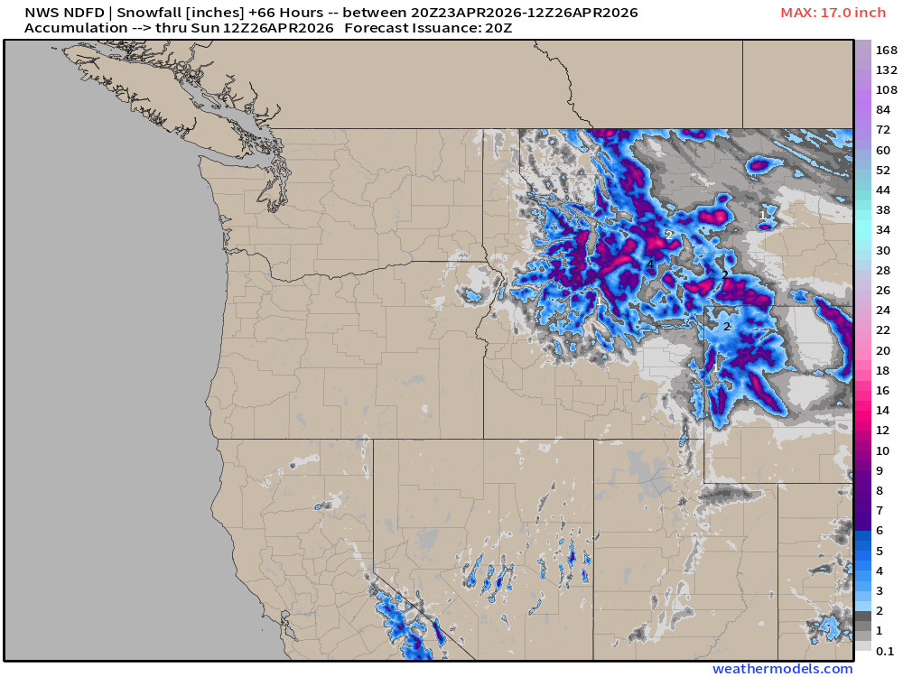
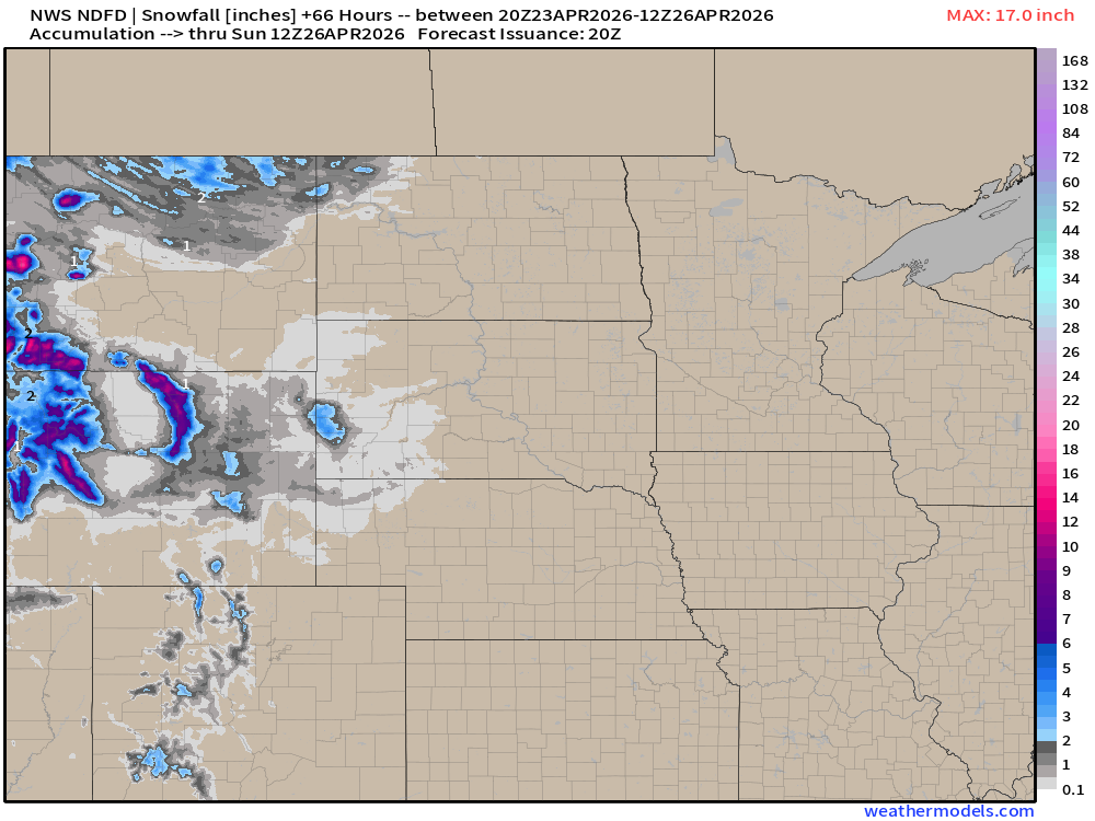
NWS Snowfall Next 66-hours — through Sunday Morning
ECMWF 12z | Forecast 10-days of Precipitable Water (my favorite parameter!)
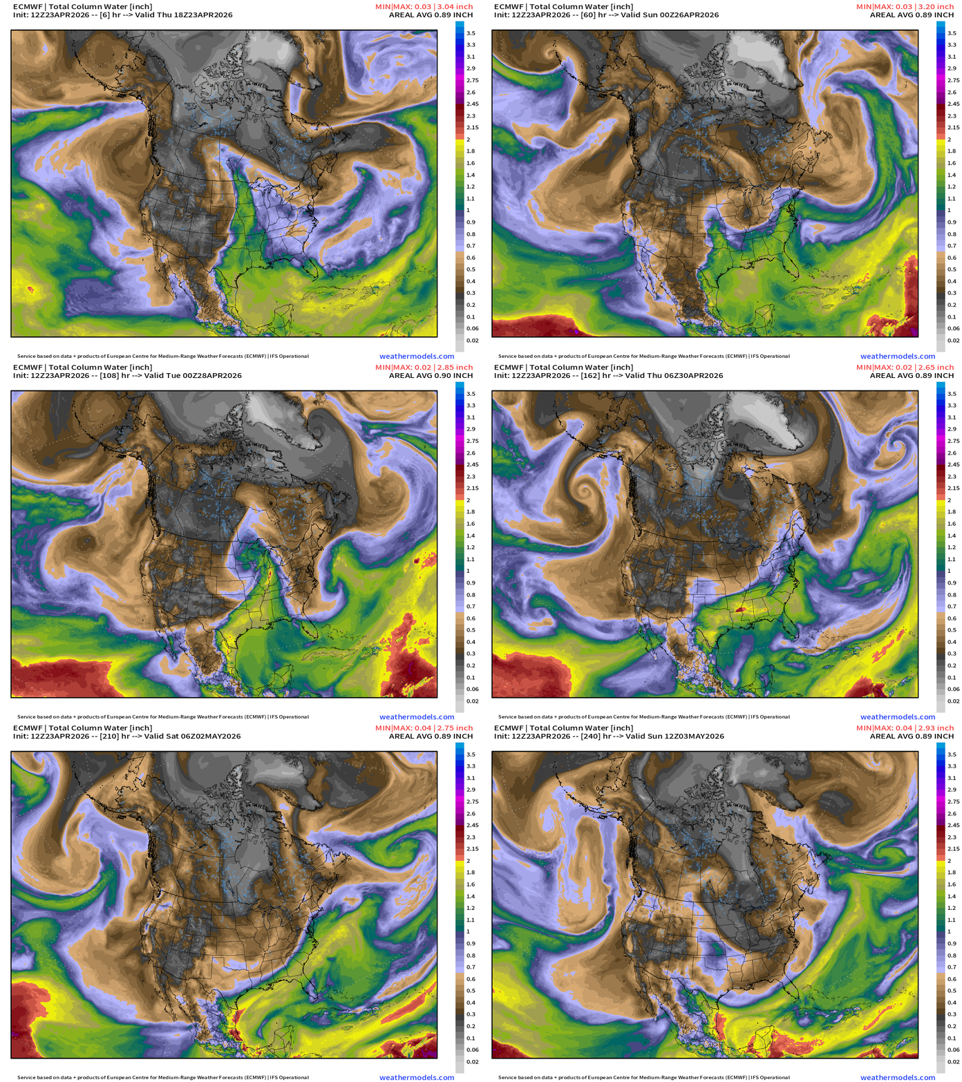
We are not done with the Canadian cold fronts into early May!
Moisture Transport (IVT) next 10-days
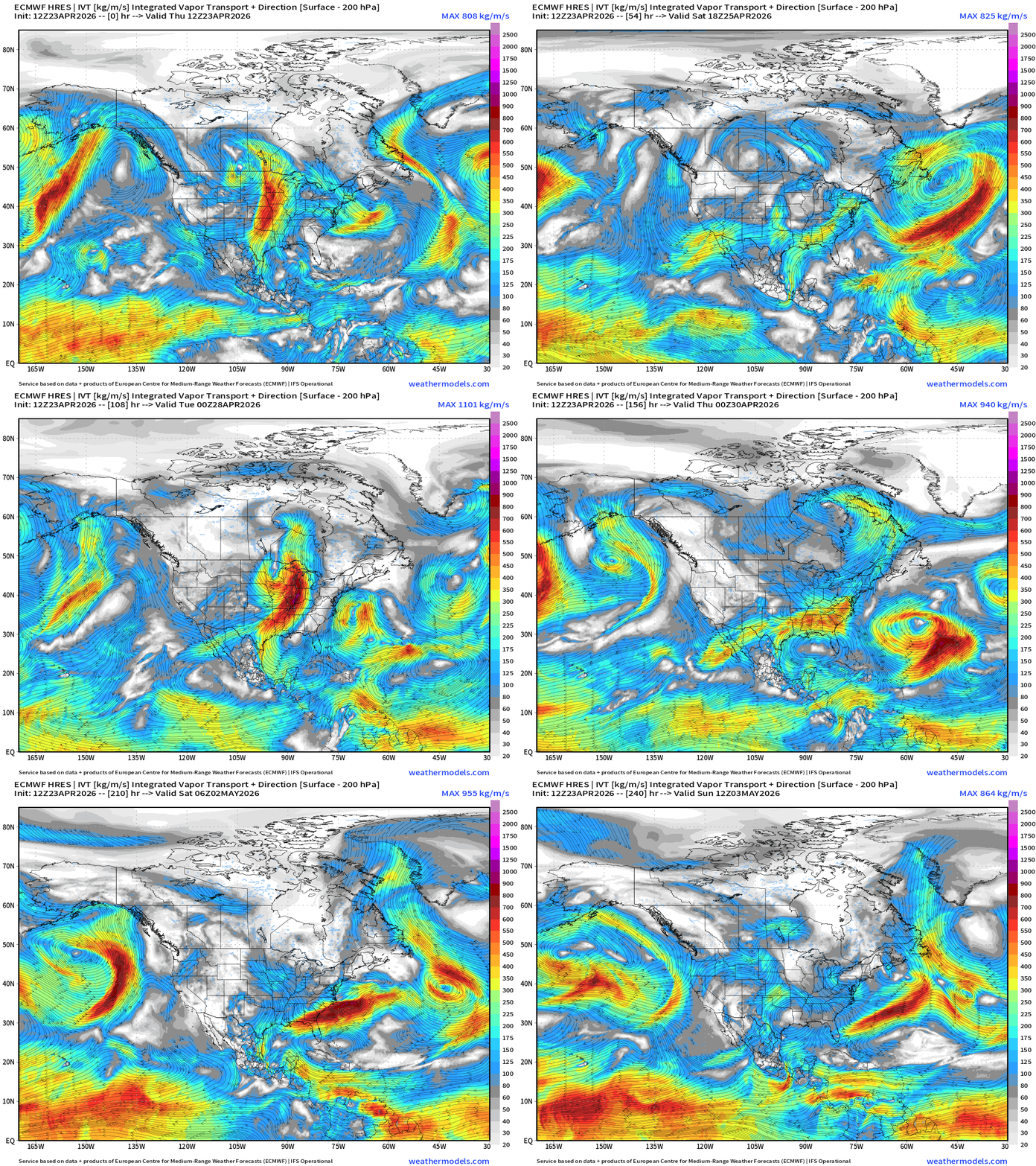
Next best chance for heavy rain in the Deep South and Southeast will be early next week, but that won’t cover the ongoing and growing deficit (and drought). We need a sustained “tropical” origin airmass + 80s temperatures to fire convective or pop-up storms on a daily basis heading into May.
Total Precipitation Next 10-days | Blend of Models
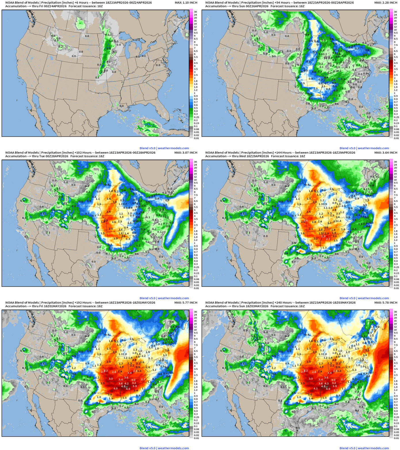
I really like the look of next week with significant rainfall totals centered on Tennessee and hopefully expanding in all directions.
Blend of Models | Total Snowfall Next 10-Days
ECMWF AIFS 12z next 10-days of 500 mb Temperature
Blend of Models Temperatures | Highs through Saturday May 2nd
Blend of Models Temperatures | Lows through Saturday, May 2nd
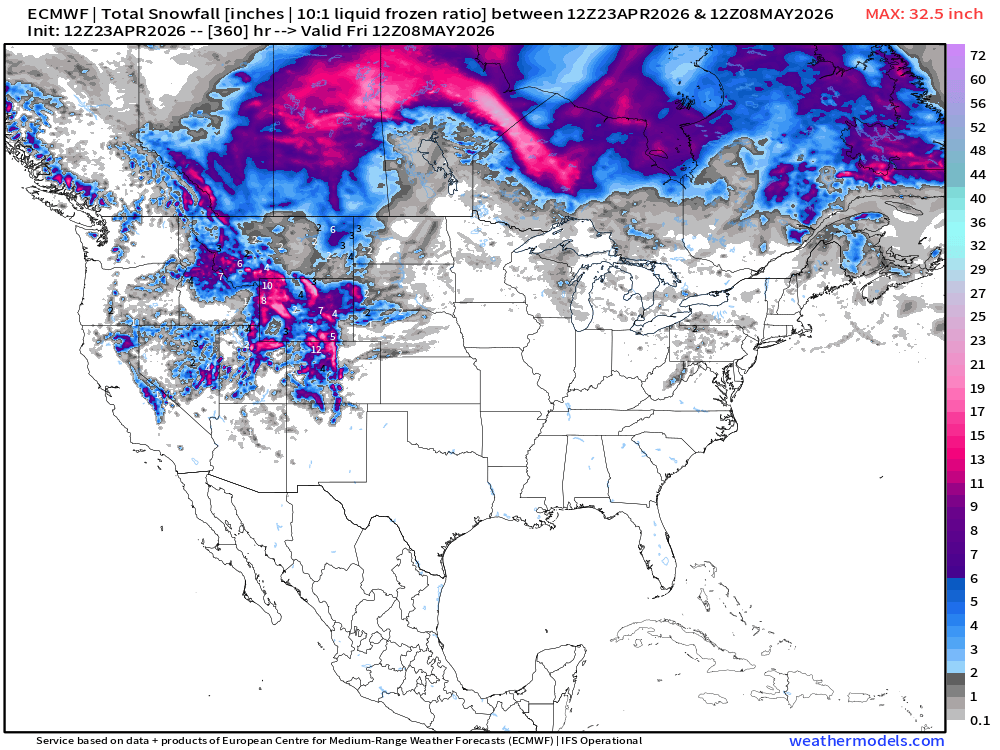
Snowfall from ECMWF HRES (15-days)
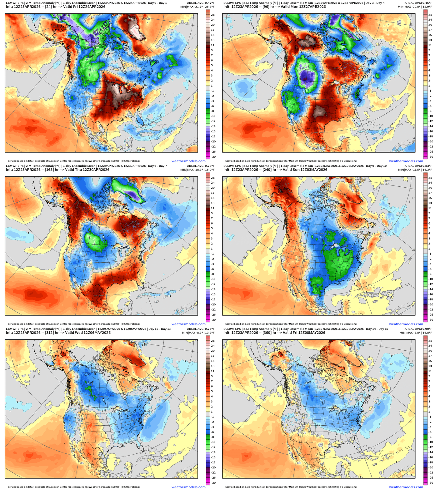
Temperature Anomaly | Next 15-days | ECMWF EPS 12z Ensemble Mean
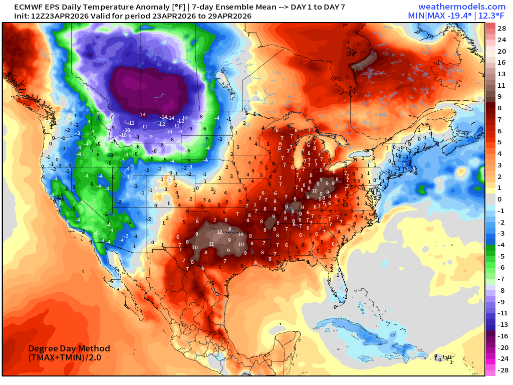
Week #1 | Temperature Anomaly | April 23 - April 29
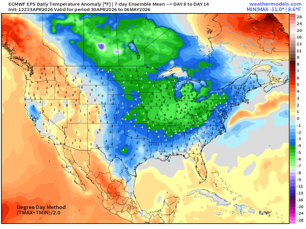
Week #2 | Temperature Anomaly | April 30 - May 6
Quiet Tropical Update | Atlantic Basin | Next 10-days Precipitable Water
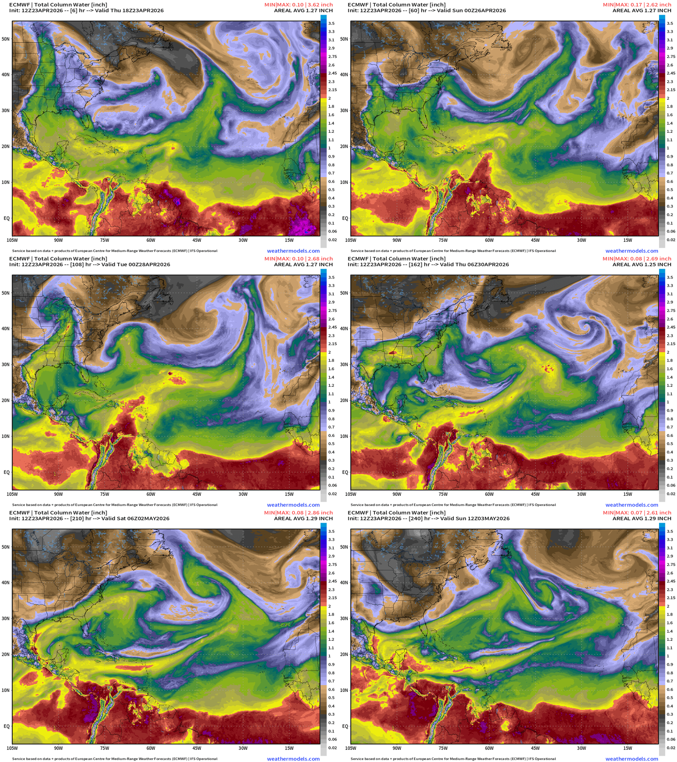
Cold fronts still reach well into the Atlantic including Bahamas with dry air to about 25°N latitude. The ITCZ is depressed to the equator or 5°N latitude into the end of April climatologically, so we don’t expect any tropical waves to develop out in the Main Development Region (MDR) until late June or early July. The tropical waves that do come off Africa often survive the trip across Central America into the Eastern Pacific to form early season (May/June) tropical storms.
Special April 2026 Coupon for new/upgrade Annual Subscribers, or gifts
Eastern Pacific Basin
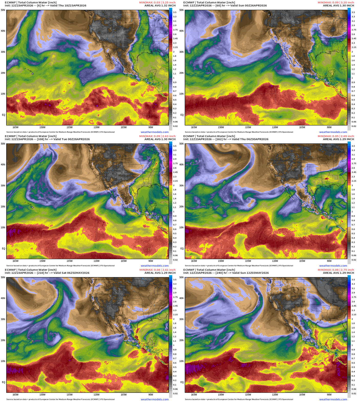
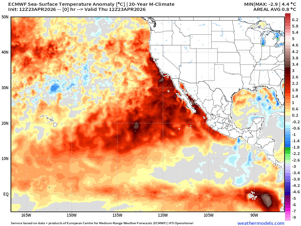
Still another few weeks before we expect to see tropical waves develop in the Eastern Pacific … but the very warm ocean temperatures (SST) favor early season activity especially with a building/growing El Niño.
Western Pacific Warm Pool
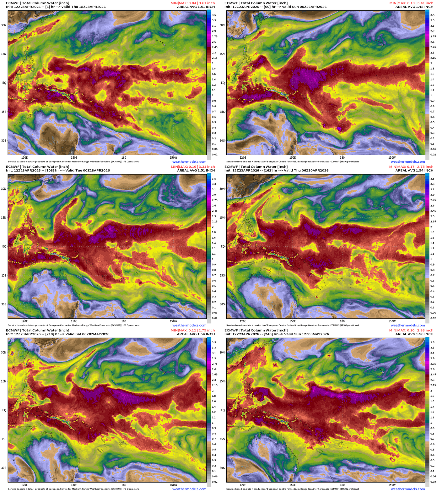
Nothing else on the horizon for next 10-days+ in the Western Pacific
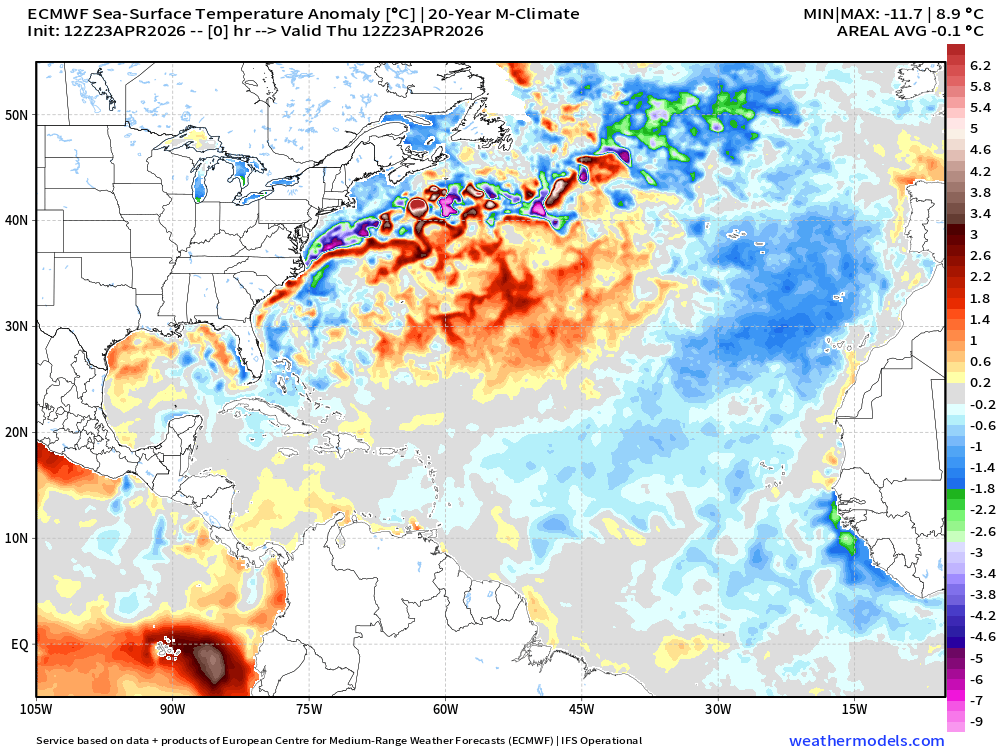
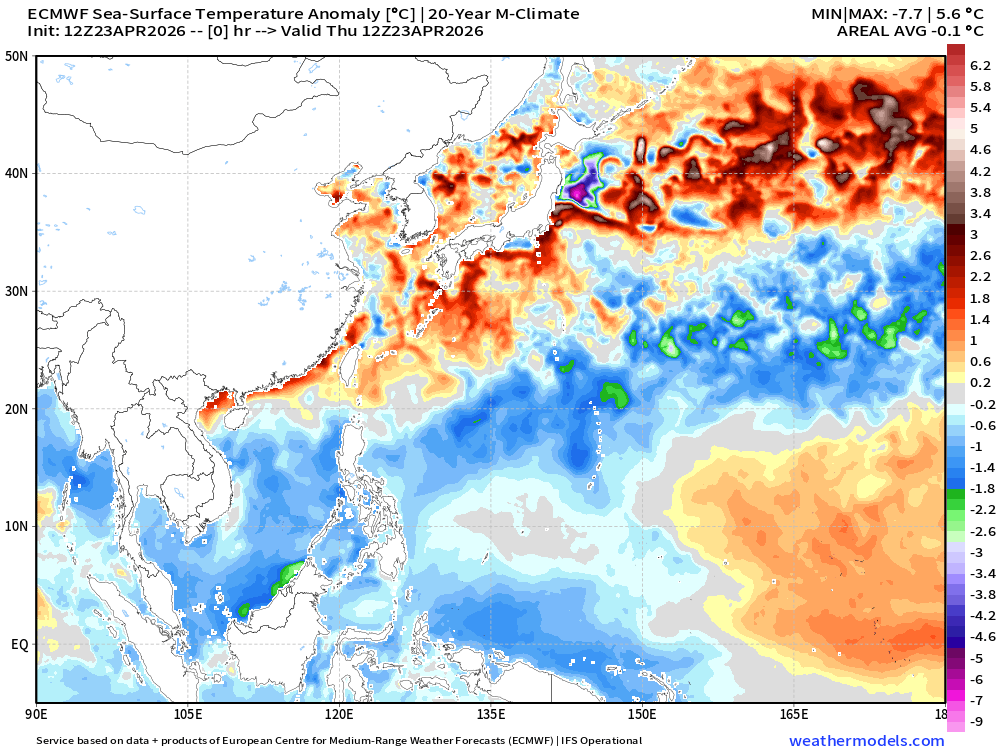
Ocean Temperature (SST) Anomaly from ECMWF global model
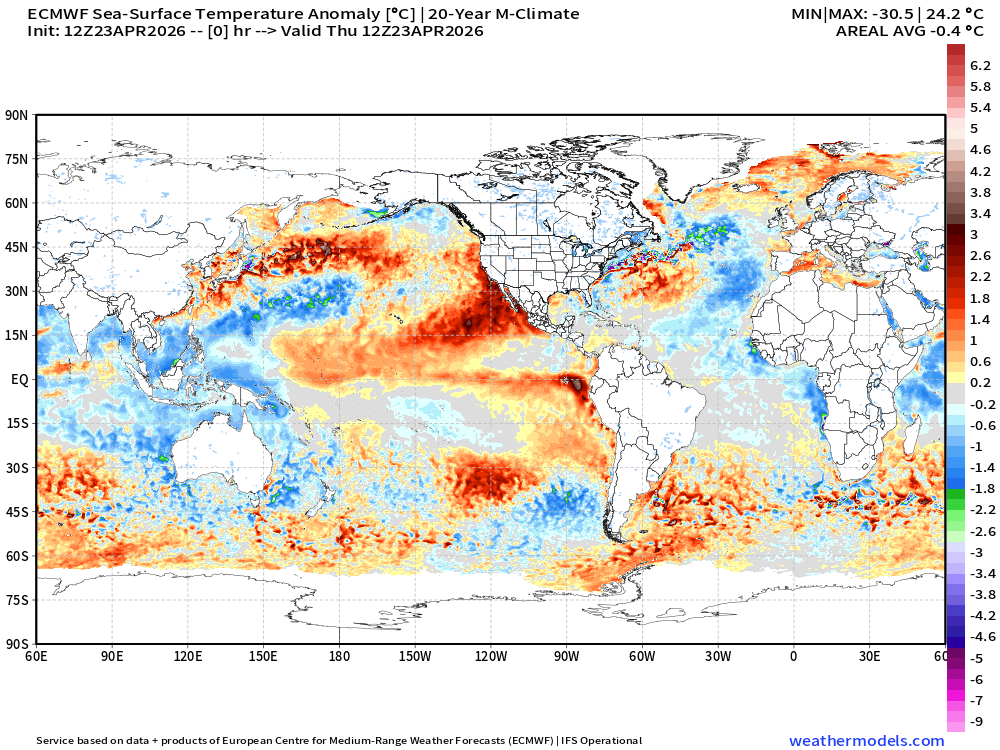
A bit different perspective to use NWP model based SST and climatology to highlight the SST anomaly across the Earth’s oceans … using a 20-year (2006-2025) recent M-Climate (model climatology)
There’s no particular reason to use 30-years or 1991-2020, as that climate baseline seems outdated, and could be misleading. The Atlantic tropics are quite cool except for area underneath Bermuda High.
The Western Pacific is also cooler than past 20-years especially where Super Typhoon Sinlaku moved through the Northern Mariana Islands.
Eastern Pacific “Marine Heat Wave”
April 7: 2026 Atlantic Seasonal Hurricane Forecast: 11/5/2 9-13 Named Storms (11 most likely)
4-7 Hurricanes (5 or 6 most likely)
1-3 Major Hurricanes (2 most likely)
ACE: 75-85
Maps sourced from weathermodels.com designed and innovated by yours truly! Please subscribe there for real-time access to the newest maps, charts from all of the weather models including ECMWF and AIFS, and NOAA GFS/GEFS. NOAA WPC and SPC for fronts/convective outlooks.
- Milepost
- 924 · laid 2026-04-23T20:58:15.147000Z
- Source
- https://weather.substack.com/p/april-23-2026-thursday-spring-weather
- Digest
- 0e723e5bc5cbdc172dd2f630c38d9dbfdc0d80423721432b1a69df23c7866847
- Machine
- JSON