April 9, 2026 Thursday Spring Weather
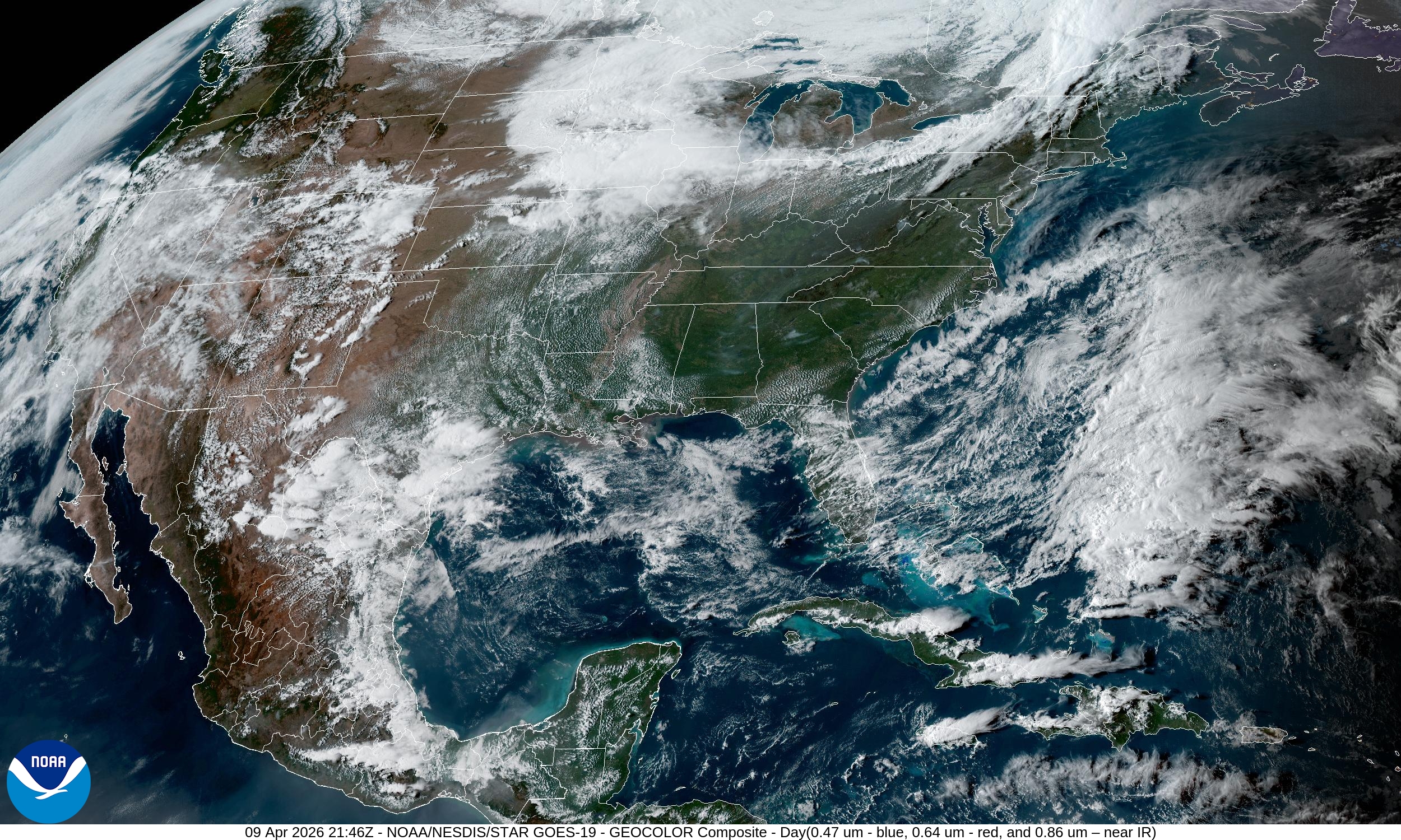
Beautiful weather across much of Lower 48 with significant warming trend into next week
April 2026 was the 3rd-warmest April in the 132-year national record (1895–2026), at 54.7°F against a 1991–2020 normal of 51.8°F (+2.9°F).
April 2026 was the 46th-wettest April in the 132-year national record (1895–2026), at 2.7in against a 1991–2020 normal of 2.7in (+0.0in).
NOAA/NCEI Climate at a Glance, contiguous United States. This is the observed record for the month, not a score of anything said in this piece — the forecast ledger begins 2026-08-17 and cannot reach earlier posts.

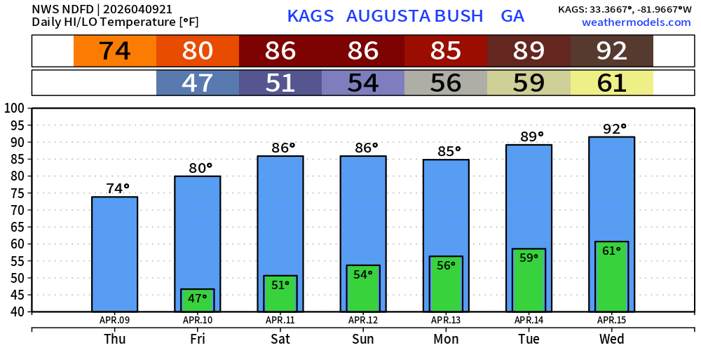
Golf Masters in Augusta: Perfect Sunny Weather through Weekend becoming hot into the mid-80s and then 90s next week
Lower 48 Weather into Friday Morning
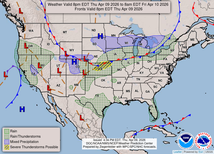
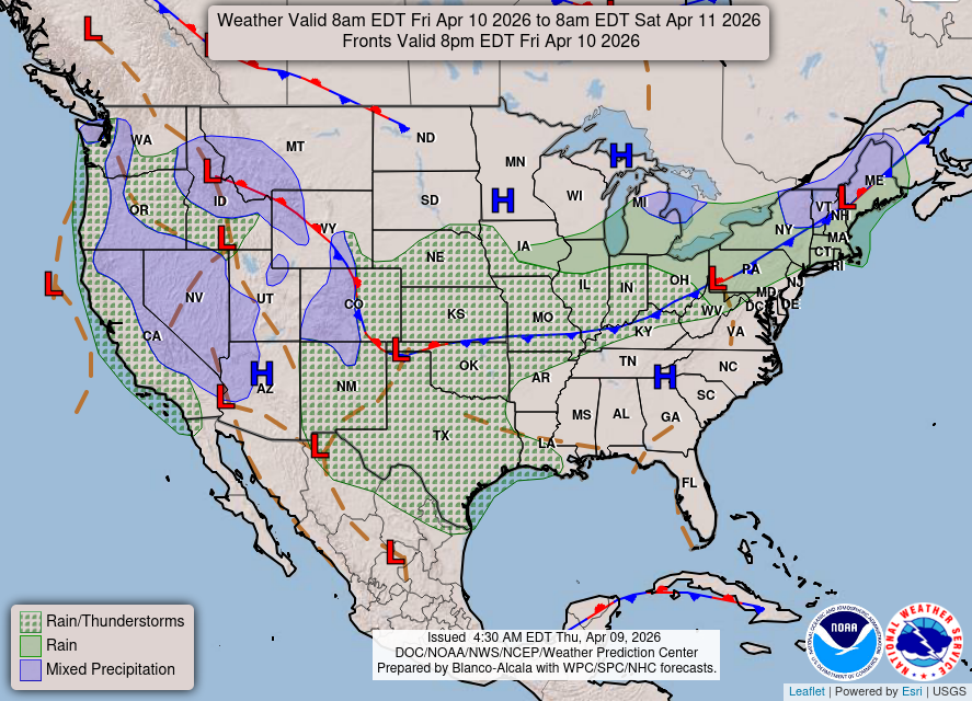
Frontal boundary with some showers across the central Plains into the Great Lakes + storm system coming ashore in California w/beneficial moisture
HRRR 18z — Radar Simulation Next 48-hours to Saturday 2 PM ET
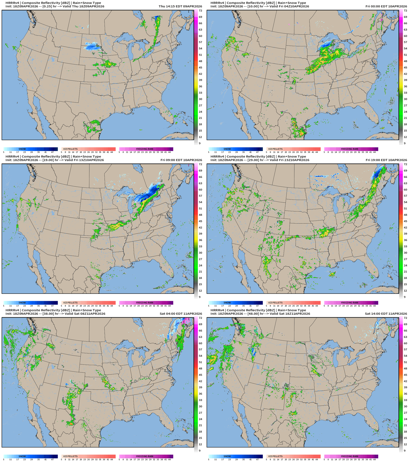
Southeast remains dry for the Masters
HRRR 18z Precipitable Water Next 48-hours (my favorite parameter)
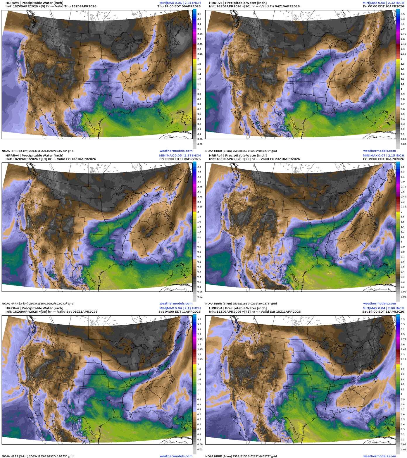
Weather on Friday similar story with a weak frontal boundary draped across the middle of the U.S from the Plains into New England w/unsettled weather along it
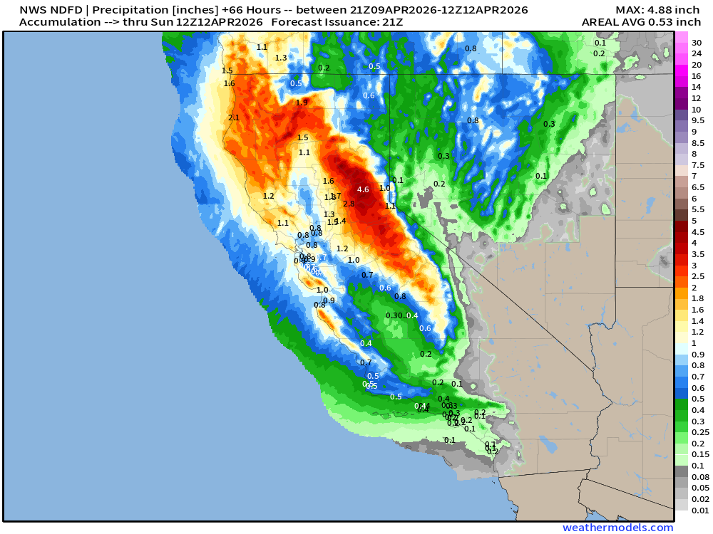
NDFD NWS Total Precipitation Next 66-hours through Sunday Morning
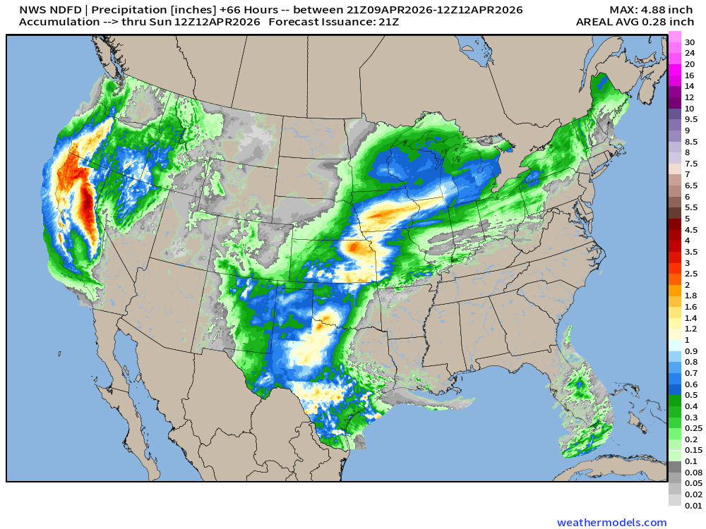
Maximum of almost 5-inches of precipitation in the Sierra in California, wow!
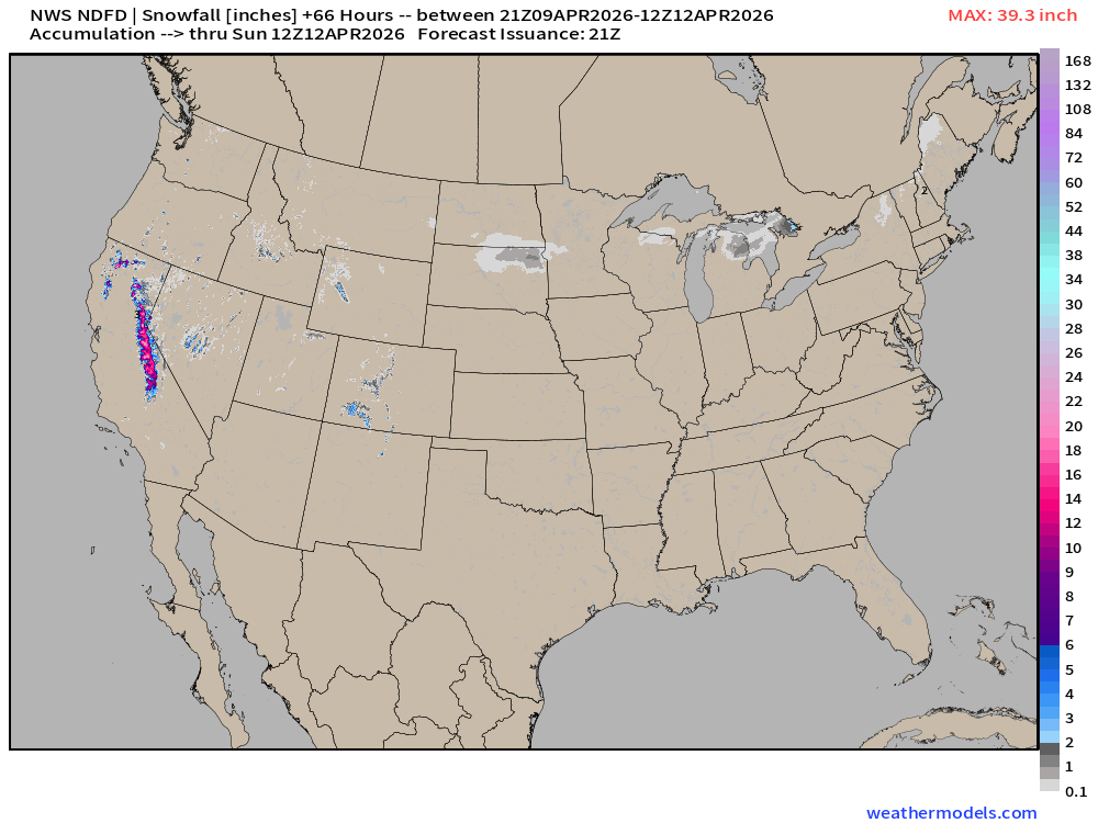
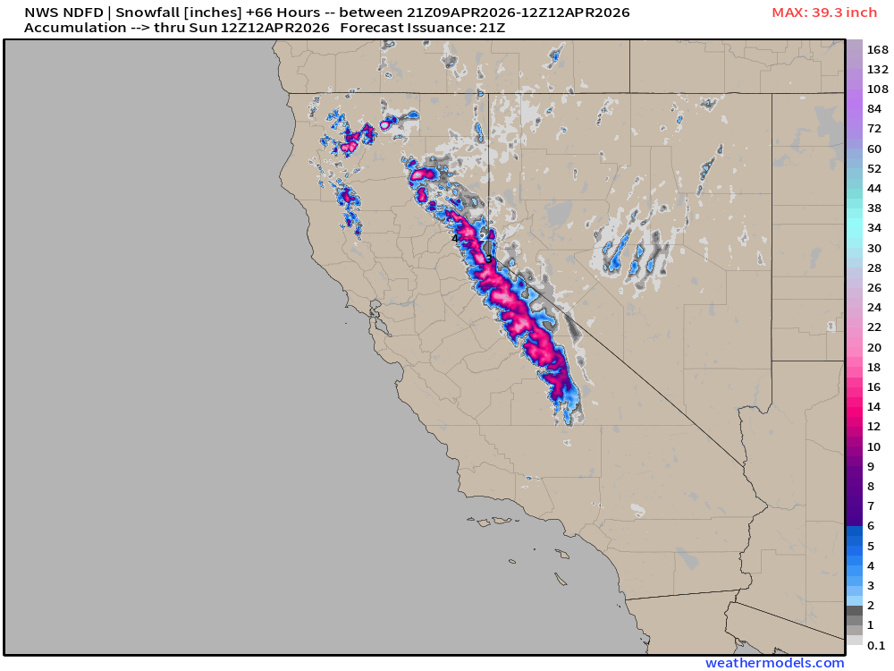
NWS Snowfall Next 66-hours — through Sunday Morning
Germany ICON 18z | Forecast 5-days of Precipitable Water (my favorite parameter)
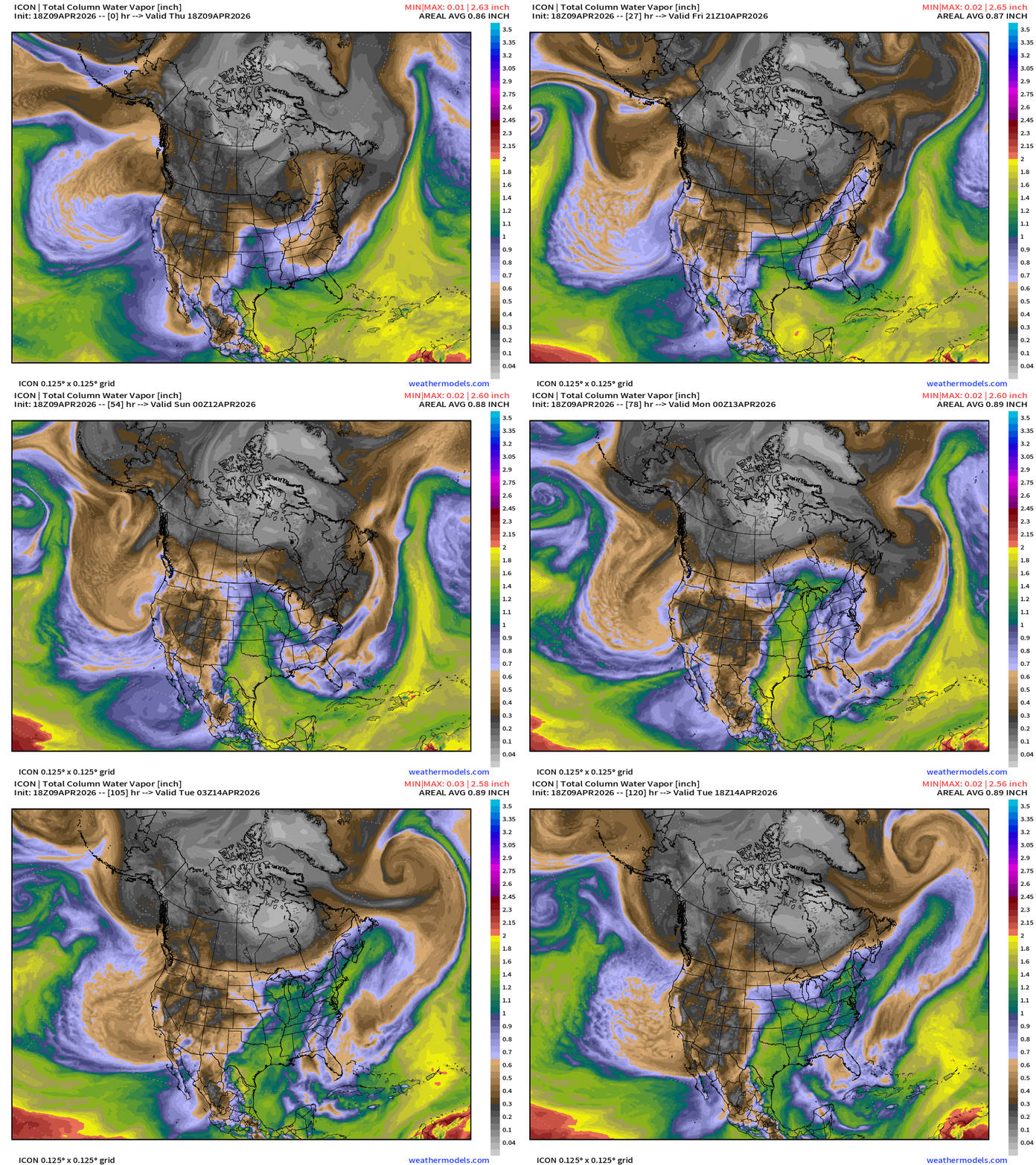
Moist flow out of the Gulf of Mexico will increase into next week across Texas into the central Plains and Midwest — watching for severe weather potential if a surface cyclone can catch fire in the Midwest
ECMWF 12z Precipitation Type + Intensity | Next 7-days
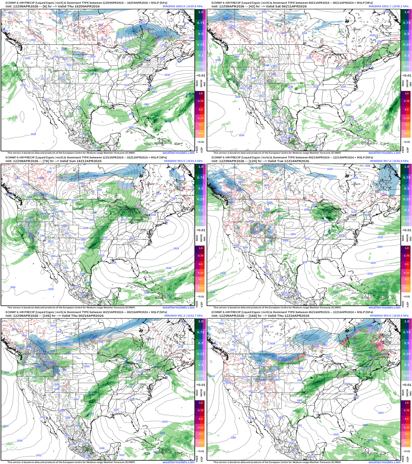
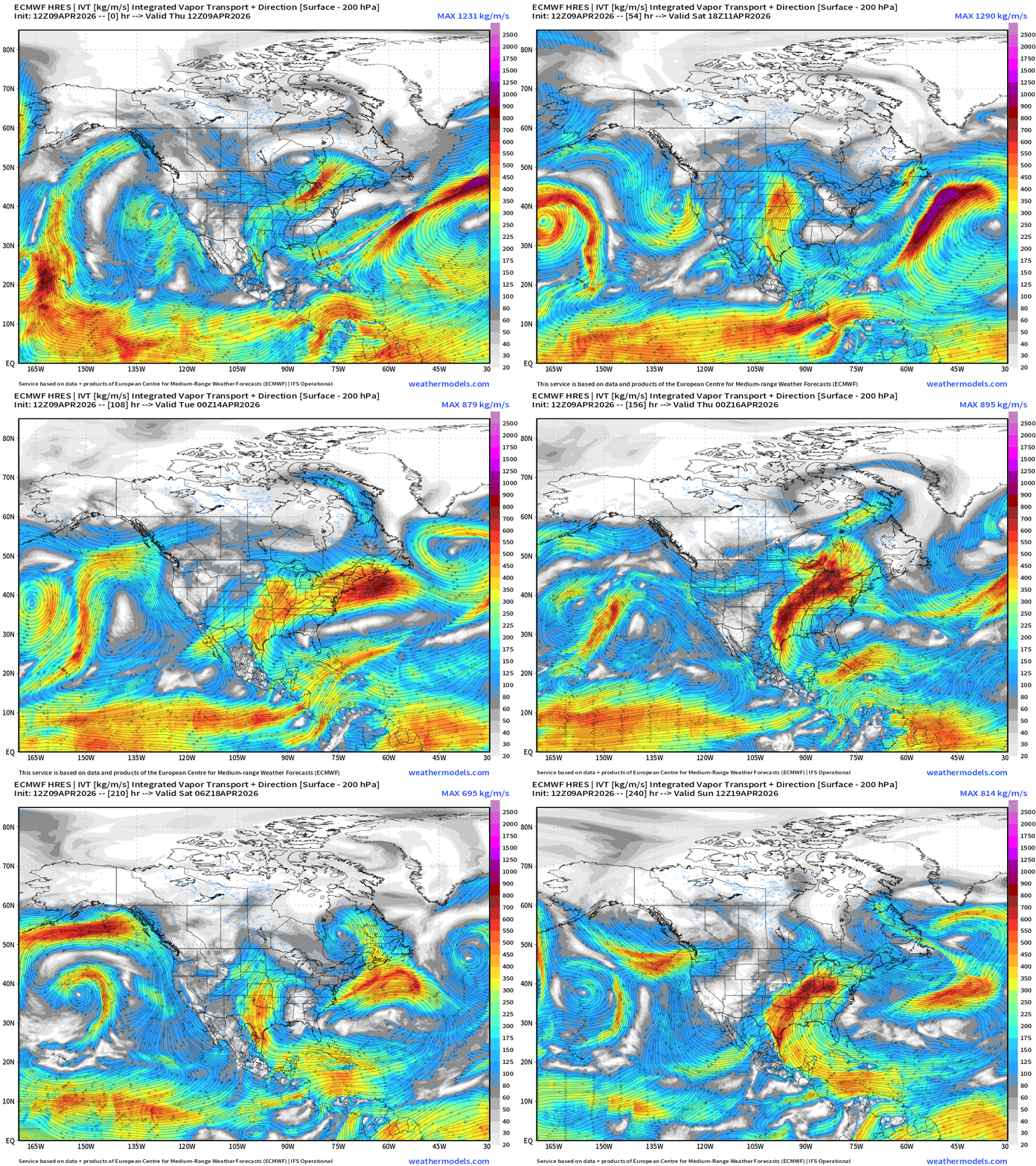
Moisture Transport (IVT) next 10-days for reopening of the Gulf of Mexico and southerly flow (moist and warm) by Sun/Mon with more subsequent pulses/bursts of moisture as a strong ridge sets up shop along/off the East Coast = “ring of fire” pattern with downright hot weather for the Southeast, Mid-Atlantic and Ohio Valley by middle of next week.
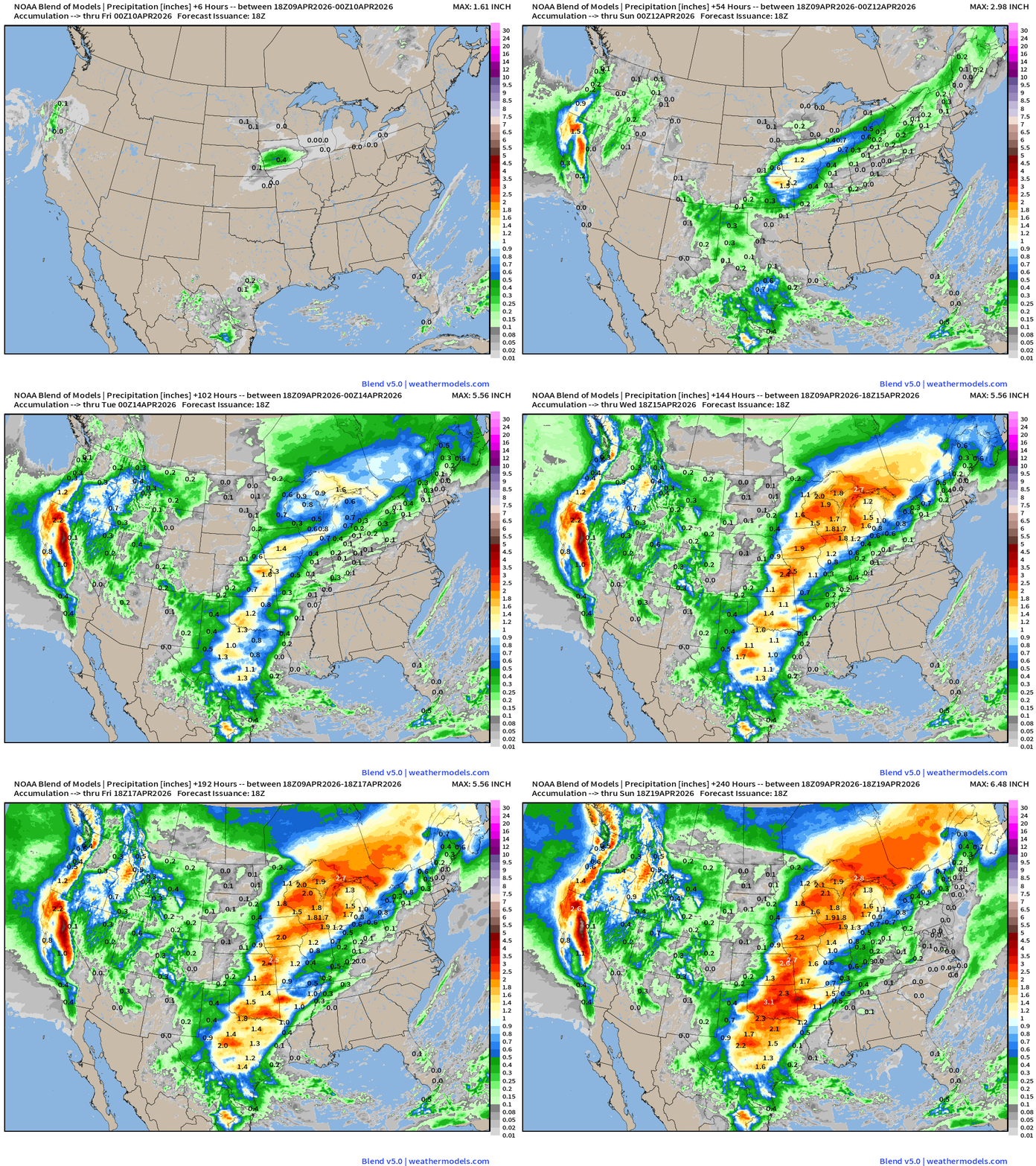
Total Precipitation Next 10-days | Blend of Models
Ring of fire pattern with zip/zero rainfall across the Southeast.
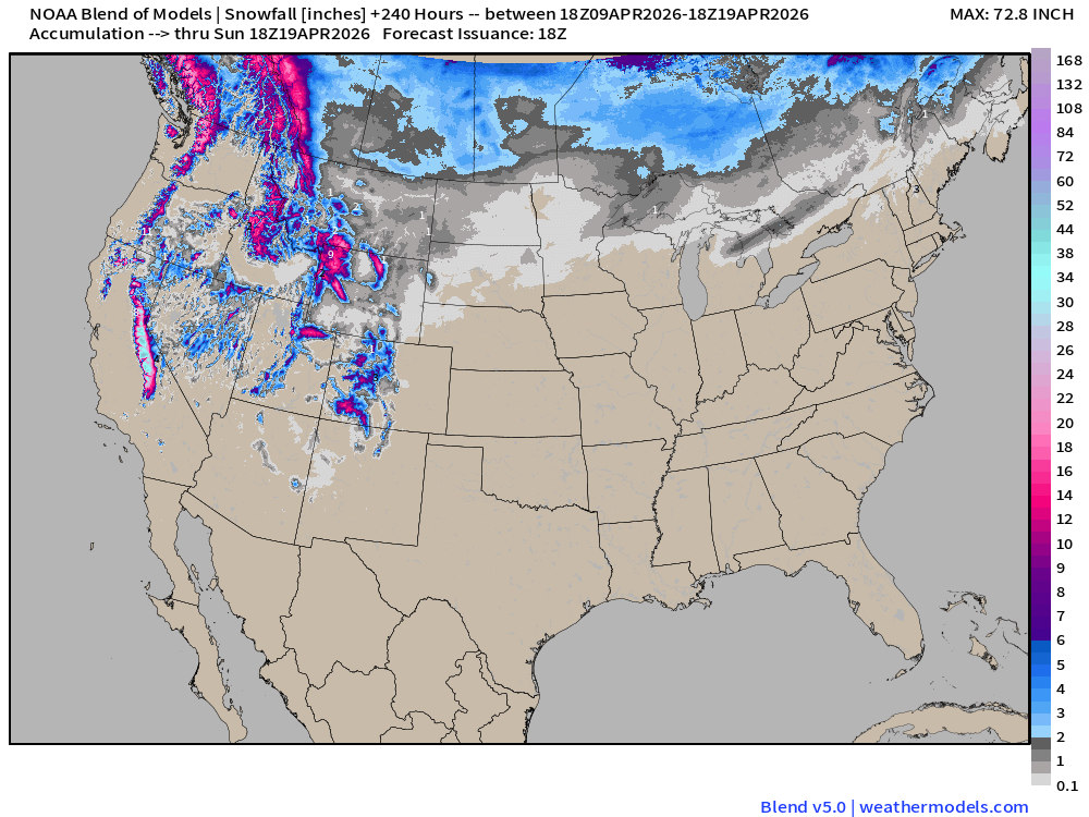
Blend of Models | Total Snowfall Next 10-Days
RTMA Current Temperature Analysis | 5:45 PM ET
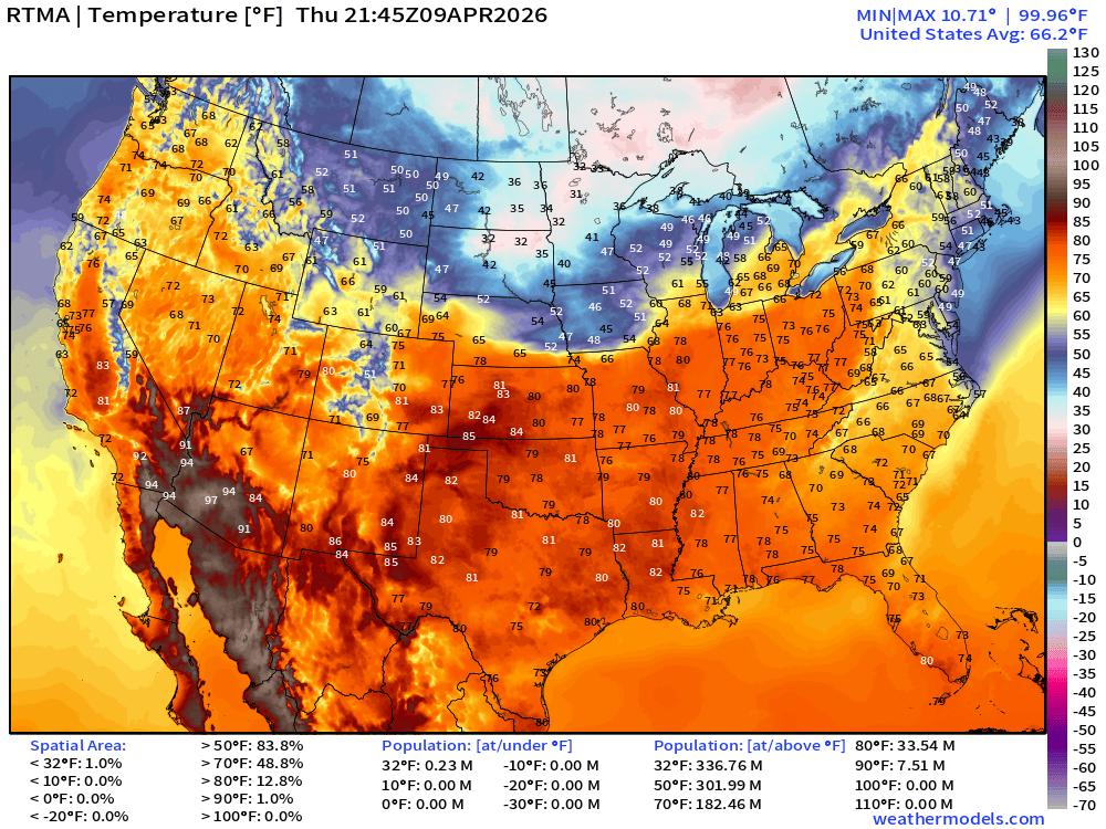
Lower 48 average was 66.2°F
RTMA Current Temperature Anomaly Analysis | 5:45 PM ET
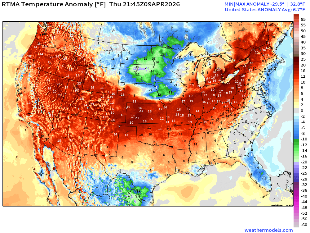
Lower 48 was 6.7°F ABOVE normal
ECMWF AIFS 12z next 10-days of 500 mb Height Anomaly
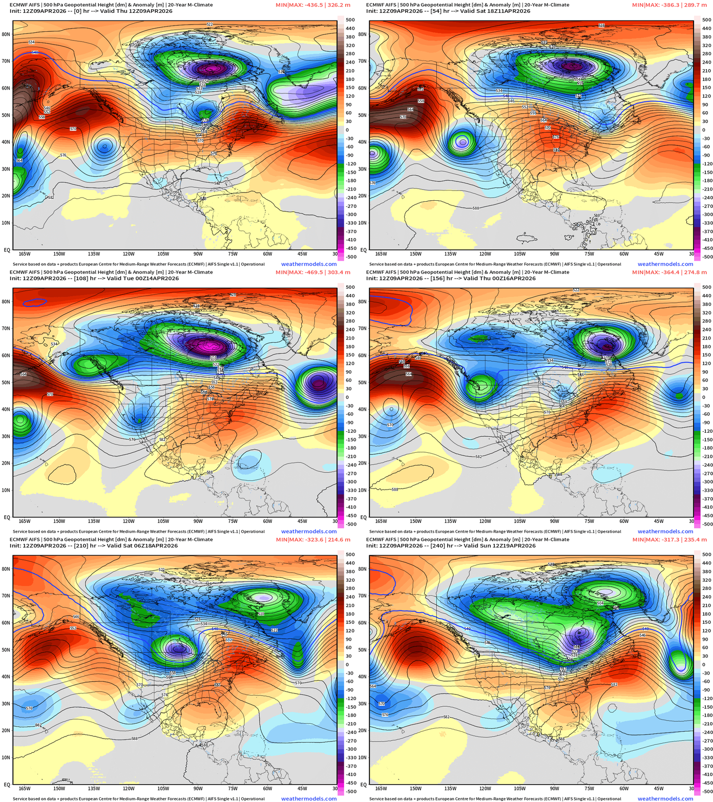
The Hudson Bay Polar Vortex continues to spin for the next 10 days … with a ridge forming over the Eastern U.S. = significant warming trend, as the western U.S. sees multiple troughs = cooler and unsettled with more mountain snowfall (excellent news)
Blend of Models Temperatures | Highs through Saturday, April 18
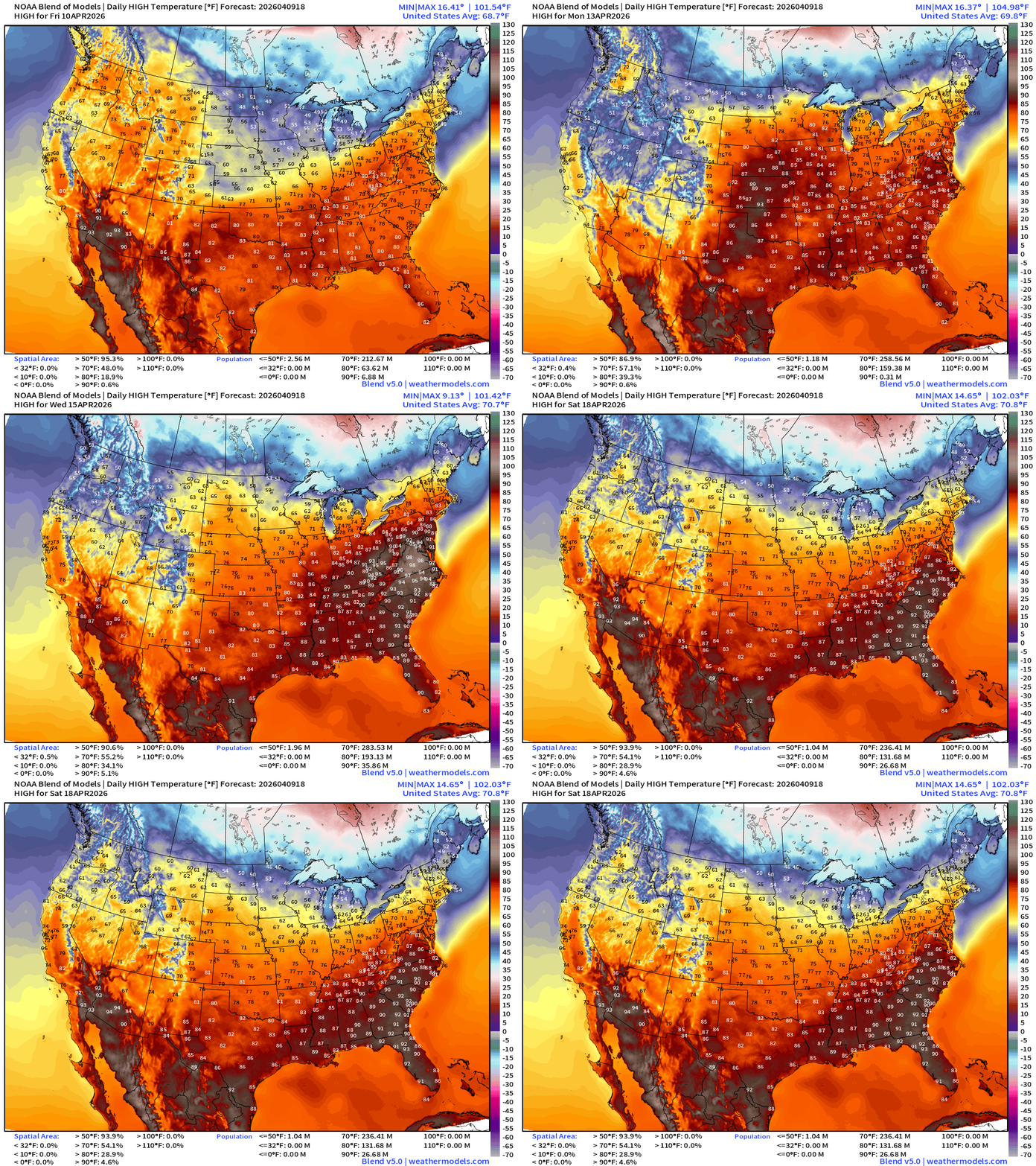
Much hotter into next week with 90s appearing in the Mid-Atlantic … 94°F DC on Wed
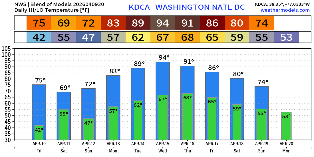
Blend of Models Temperatures | Lows through Saturday, April 18
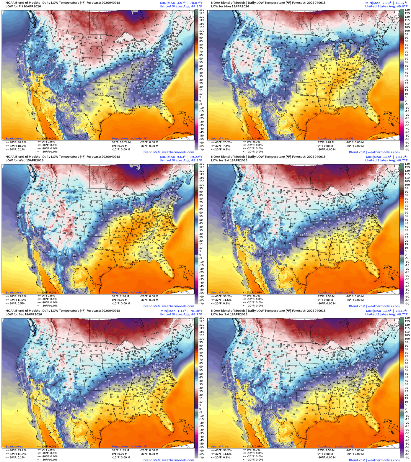
Low Temperatures Friday
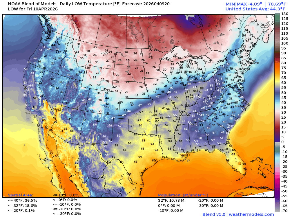
Only 10.7 million below freezing — cold across Northeast into the Mid-Atlantic
High Temperatures on Friday
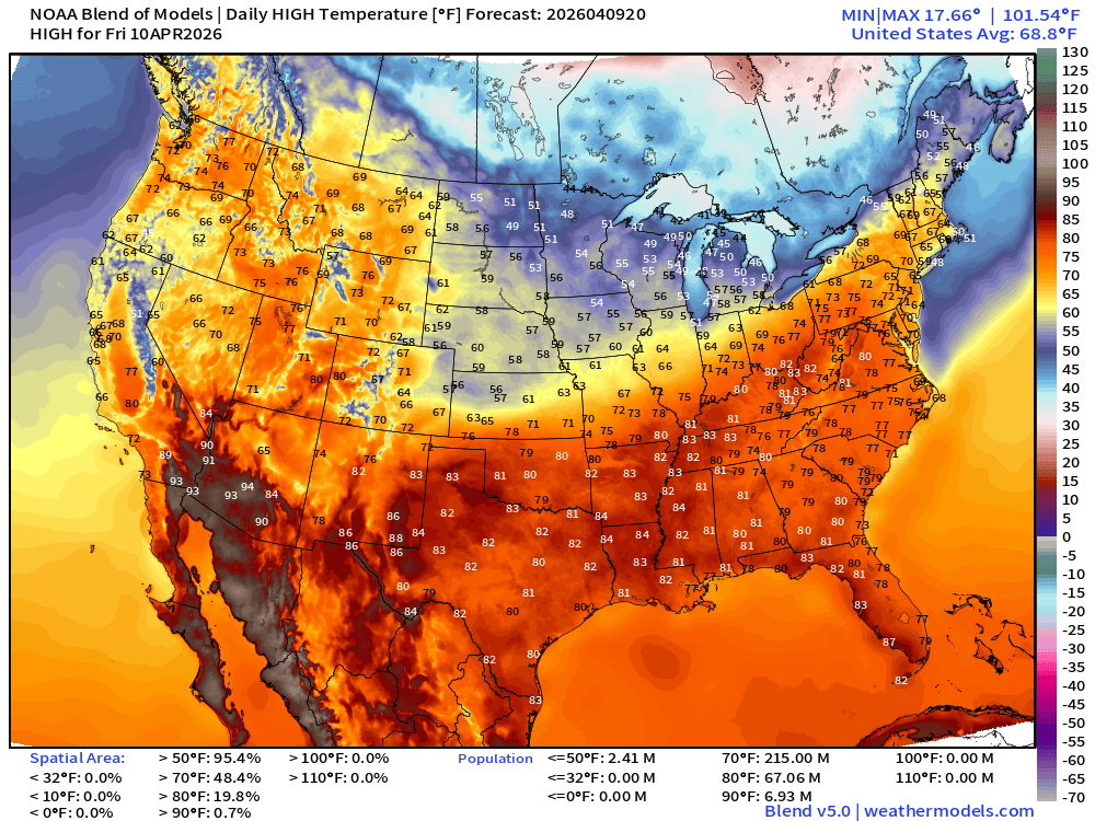
Major warming trend underway across eastern U.S. with 70s and 80s pushing into the mid-Atlantic … 215 million above 70°F
ECMWF AIFS 12z | Temperature at 500 mb | Next 10-days
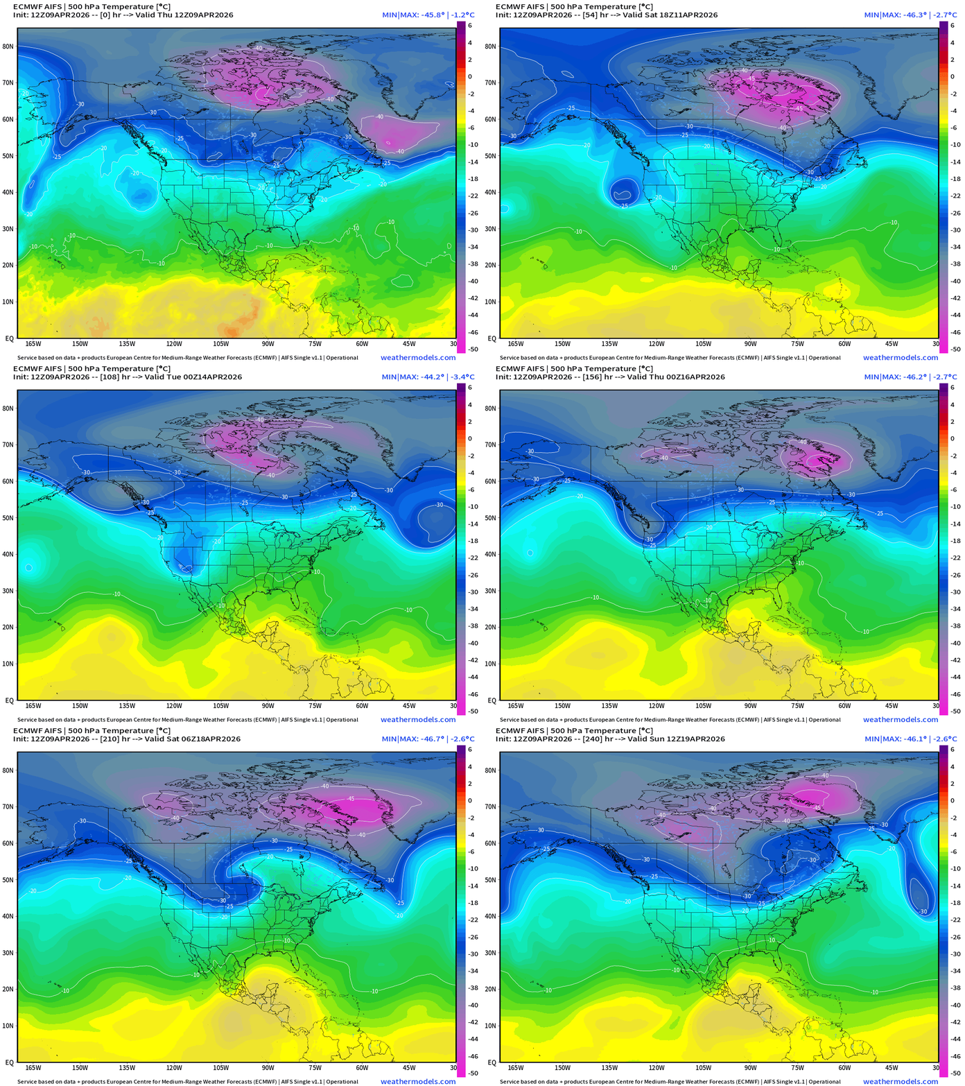
There’s STILL a -45°C contour of the polar vortex at 500 mb holding on for dear life in Canada for the next 7-10 days, and drifts toward Greenland. Bizarre!
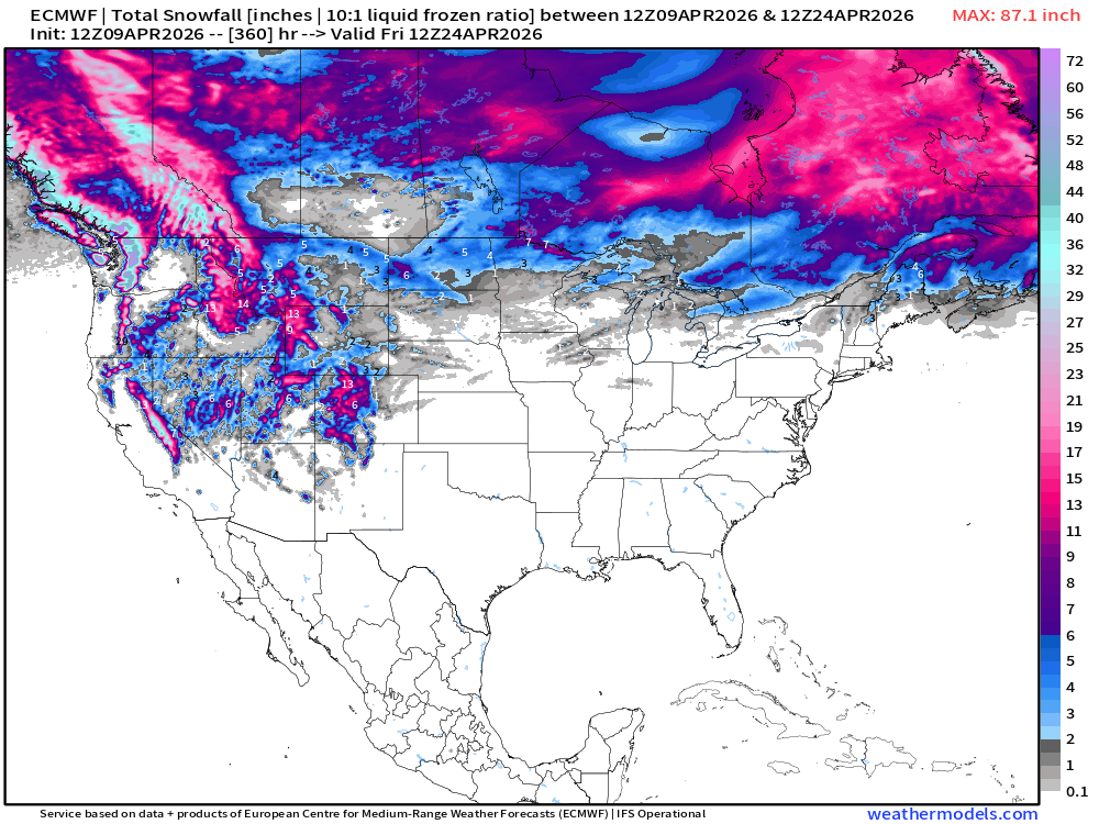
Snowfall from ECMWF HRES (15-days)
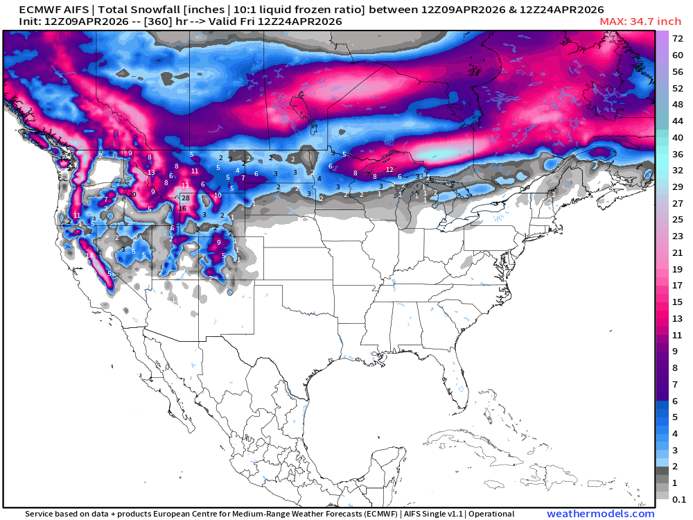
Snowfall from ECMWF AIFS-Single (18z) next 15-days
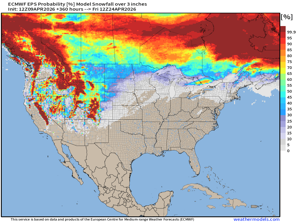
EPS 12z Probability of Snowfall At least 3-inches
Temperature Anomaly | Next 15-days | ECMWF EPS 12z Ensemble Mean
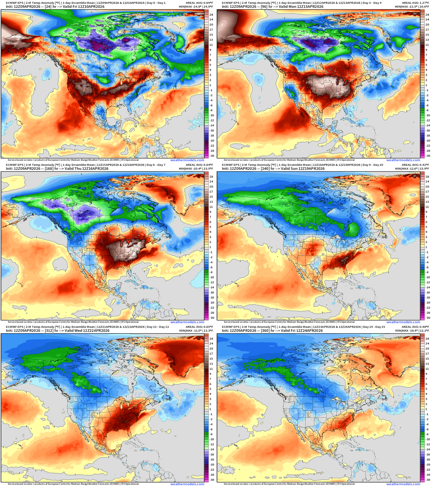
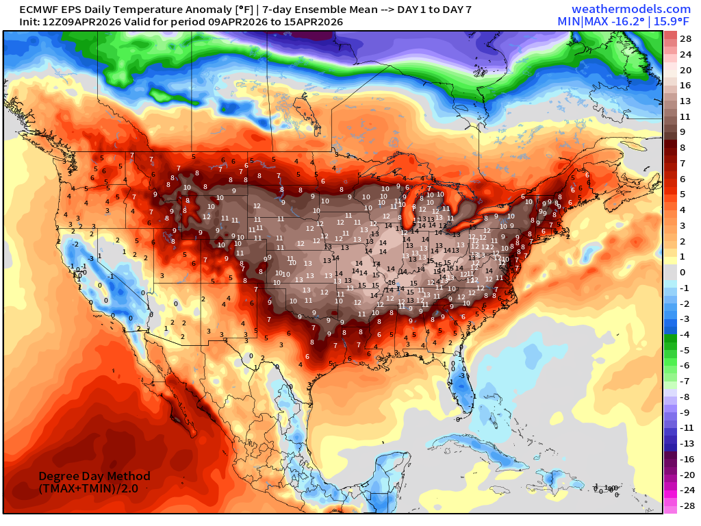
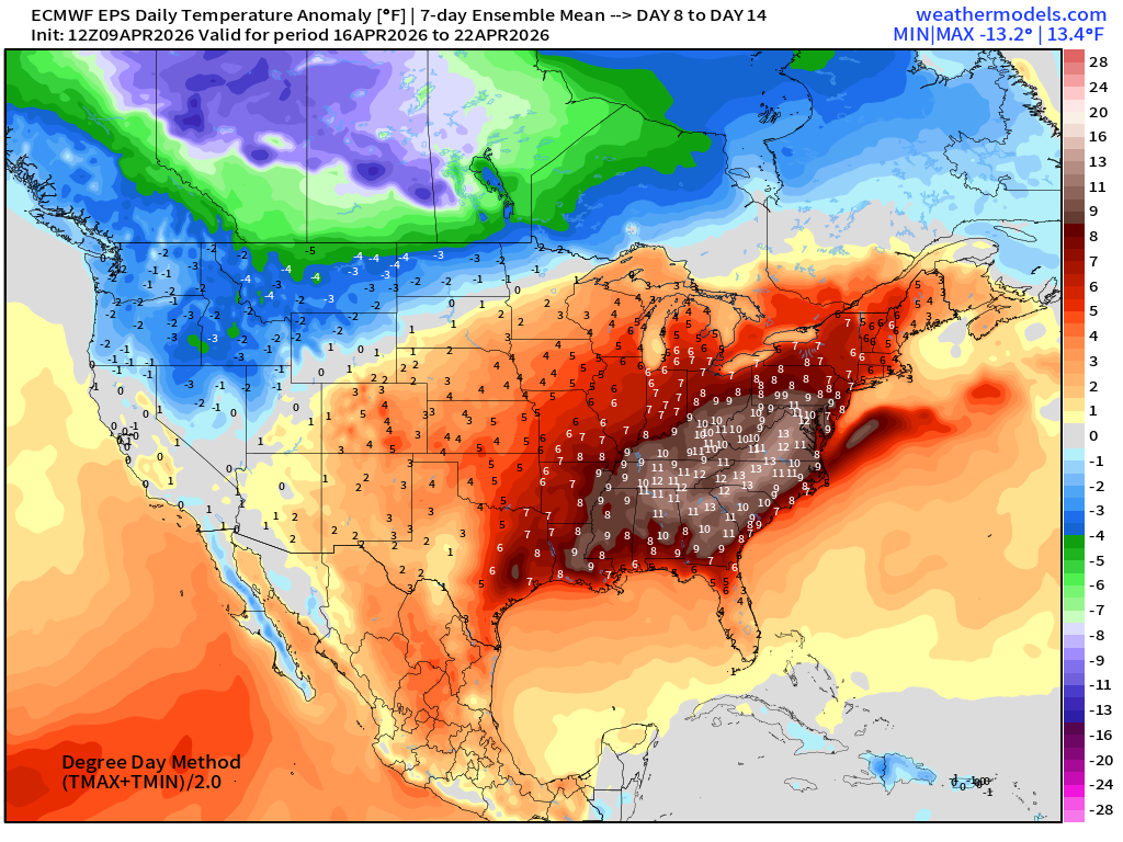
Major warm spell on the way … lasting for 10-12 days
Week #1 | Temperature Anomaly | April 9 - April 15
Week #2 | Temperature Anomaly | April 16 - April 22
Normally the blog update would be over — but we have tropics to discuss!
Tropical Update: South West Pacific and North West Pacific
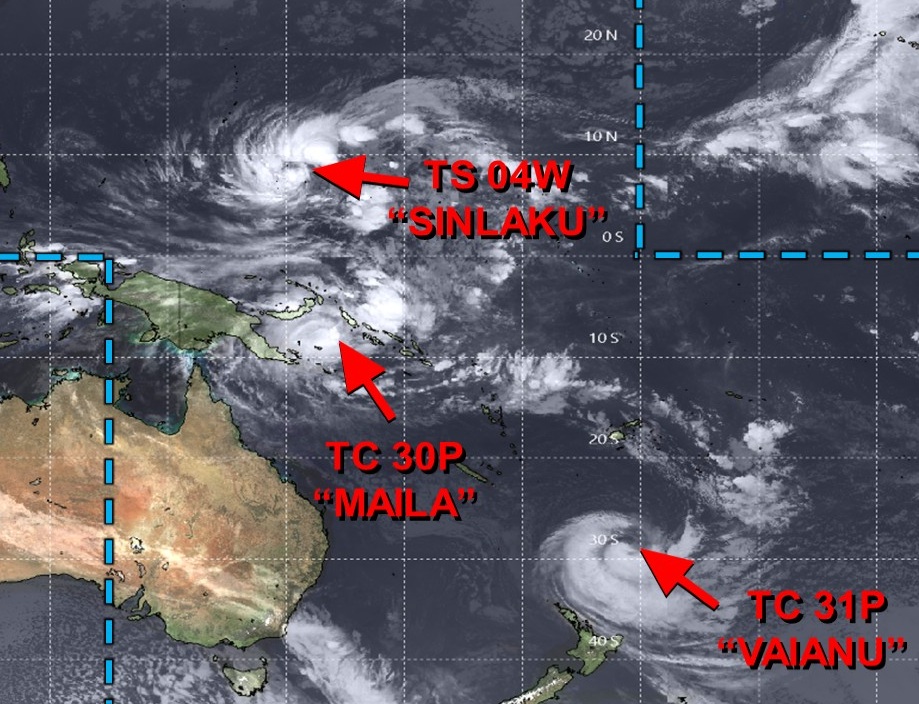
Tropical Storm Sinlaku (04W) was upgraded this afternoon — and is well on its way to becoming a powerful Super Typhoon. Cyclone Maila (30P) near Papua New Guinea has fallen apart due to wind shear and very cold upwelling water.
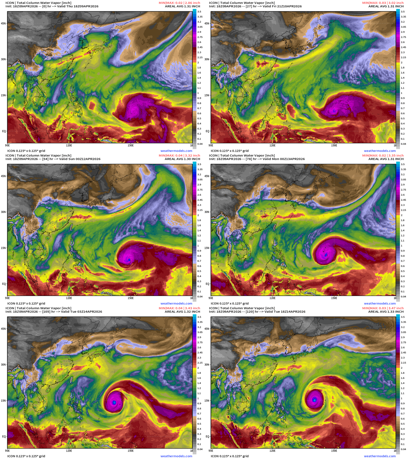
Germany ICON 18z Precipitable Water (my favorite parameter) through 5-days shows rapid intensification of Sinlaku (04W) into a Category 5 Super Typhoon tracking WNW.
HAFS-A (mesoscale hurricane model) for Sinlaku (04W) shows a “behemoth” developing rapidly and moving near Guam, but uncertainty about the track/course
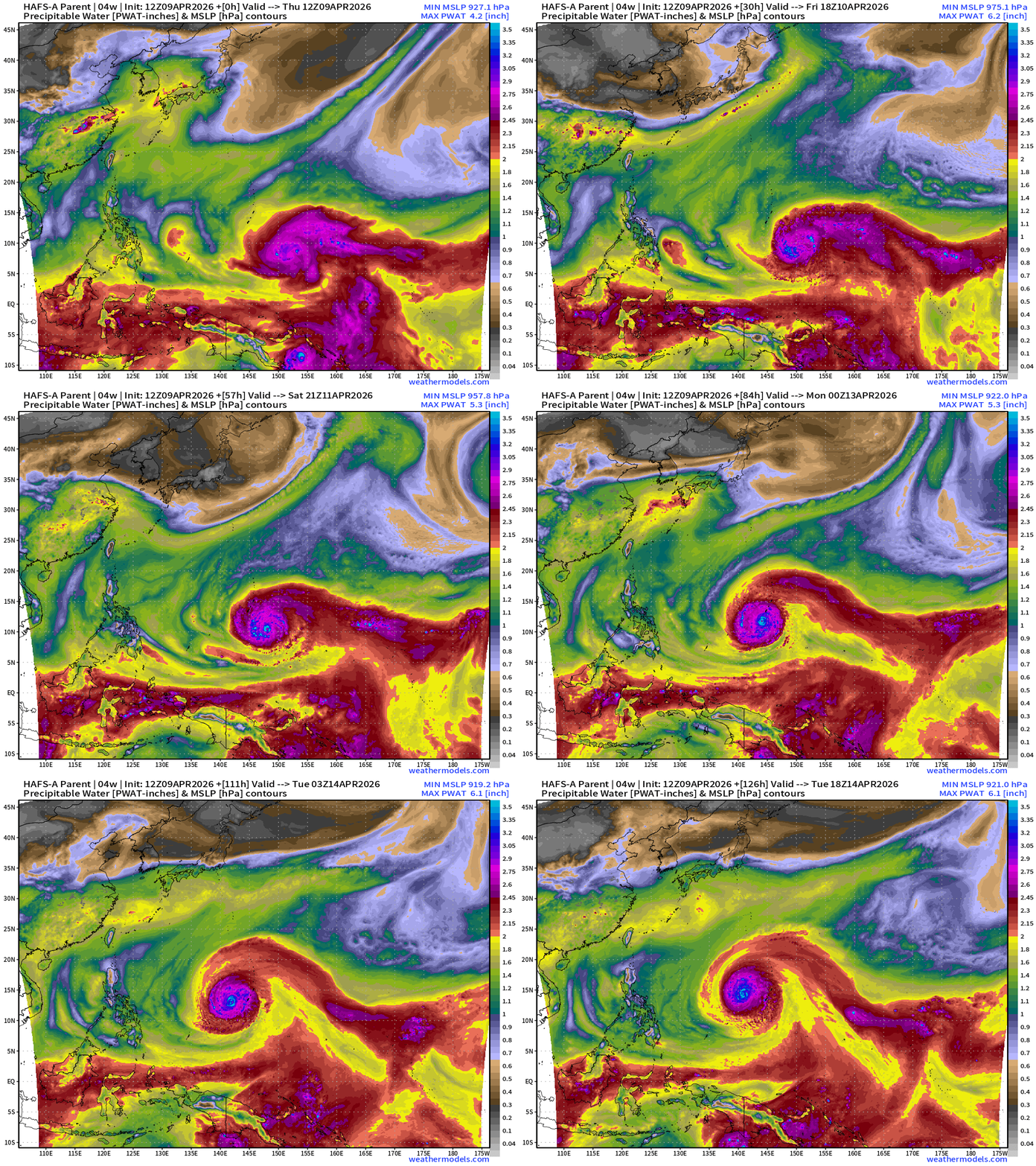
HAFS-A 12z goes around Guam to the south, but that’s just one solution out of the spaghetti.
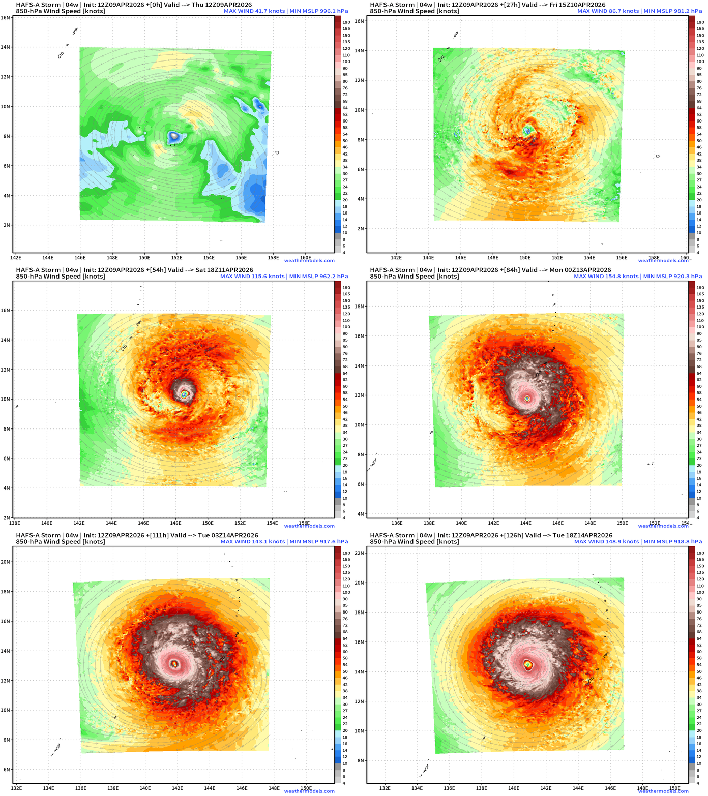
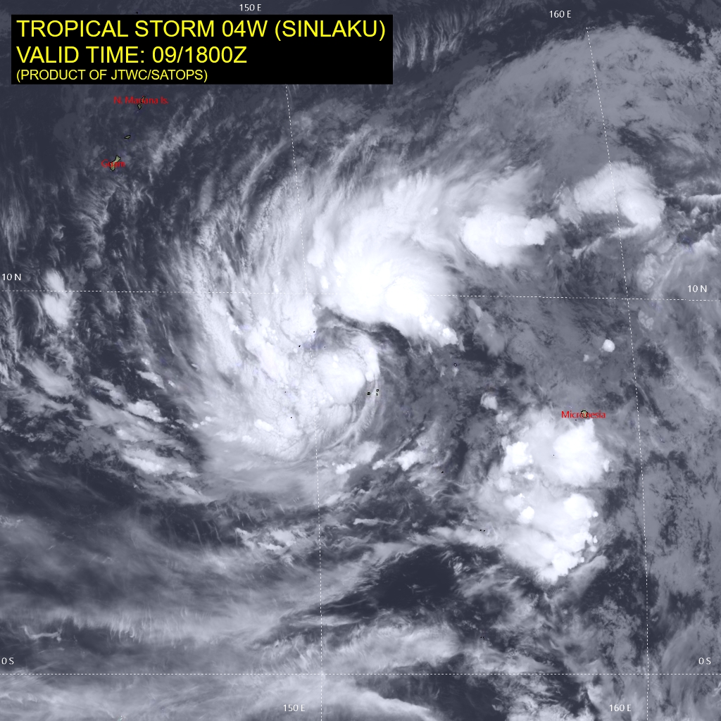
Sinlaku will be VERY large in size. JTWC has the eye/center going right over Guam at Category 4 intensity but could certaintly be Category 5+ by that point, as there is only warm water, low wind shear, and plenty of time to blow up into a monster.
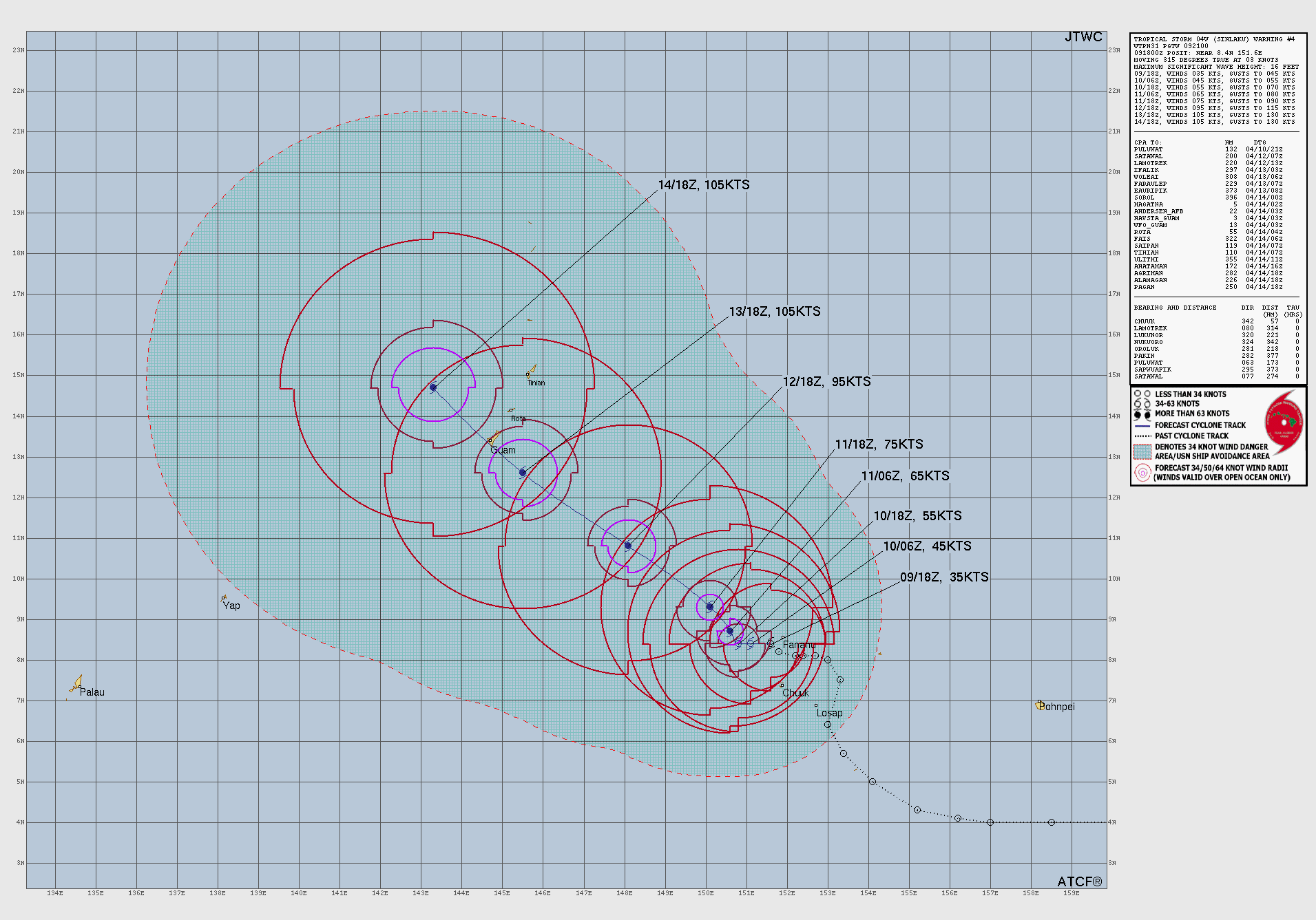
Sinlaku will develop as the Northern Hemisphere twin of Maila on the SH side of the equator, and the winds out of the west will burst from Indonesia across the warm pool triggering an equatorial (oceanic) downwelling Kelvin wave — that will later modulate the ocean’s thermocline depth, heat content, sea surface temperature, sea surface height, and currents —> transitioning Central and Eastern Pacific to El Niño.
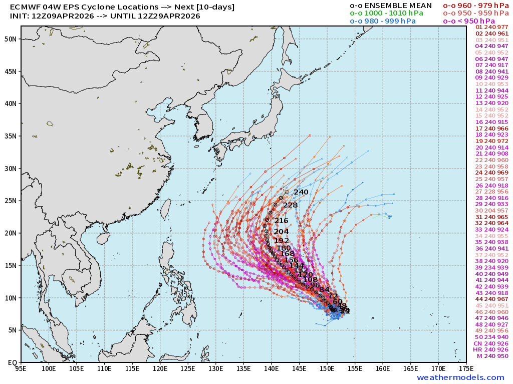
ECMWF Ensemble Spaghetti 12z through 10-days | Sinlaku (04W)
The cluster of tracks furthest west = most intense (Super Typhoon Category 5) with others more quickly recurving to the north.
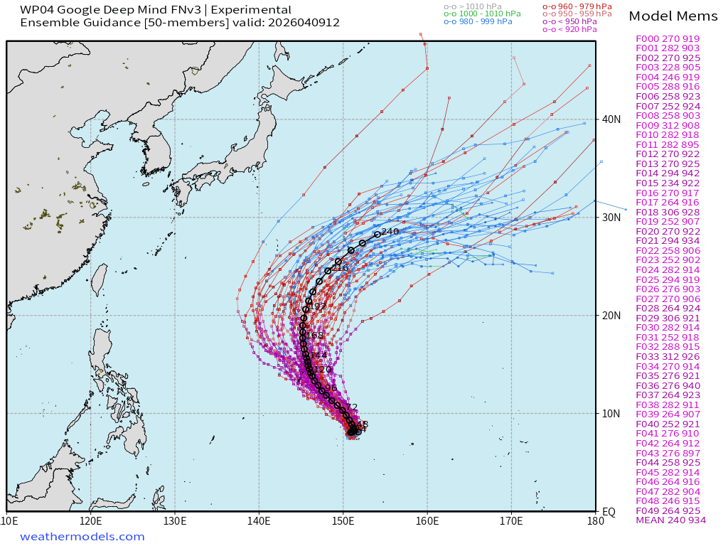
Google Deep Mind FNV3 12z | Highest Skill — north of Guam
Maila (30P) | Category 1 | 75-knots —> falling apart quickly.
The inner-core (eye) is disrupted and a rapid weakening process is underway. Cold water was upwelled/mixed up beneath Maila … even below 16°C instead of the normal 28°C+ to fuel a major hurricane. Amazing case study in near-equatorial tropical cyclone induced upwelling — imagine the biological production / boom in critters in this area in the coming days/weeks.
North Atlantic African Dust | Next 10-days
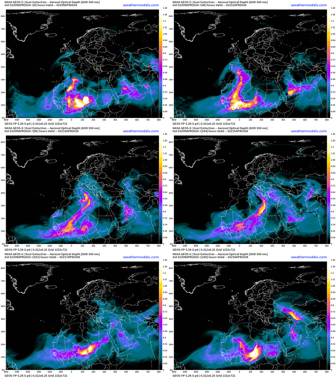
Dust over the north Atlantic and Africa — as any early season tropical waves will be wiped out by dust. We’ll also get a sense of the activity into June by the circulation pattern in the Eastern MDR of the Atlantic, and how dust flows over the ocean.
Tropical Update: Central Pacific —> Kona Low to north of Hawaii
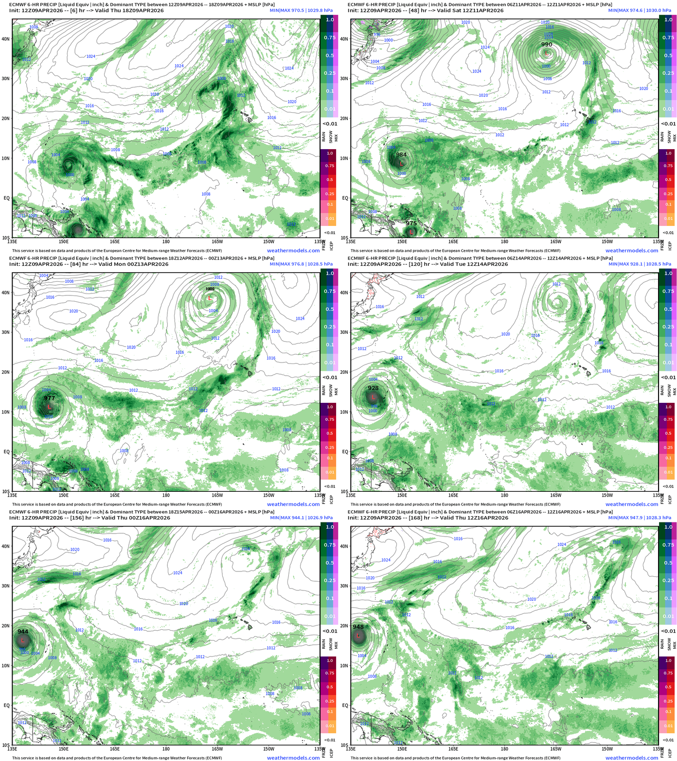
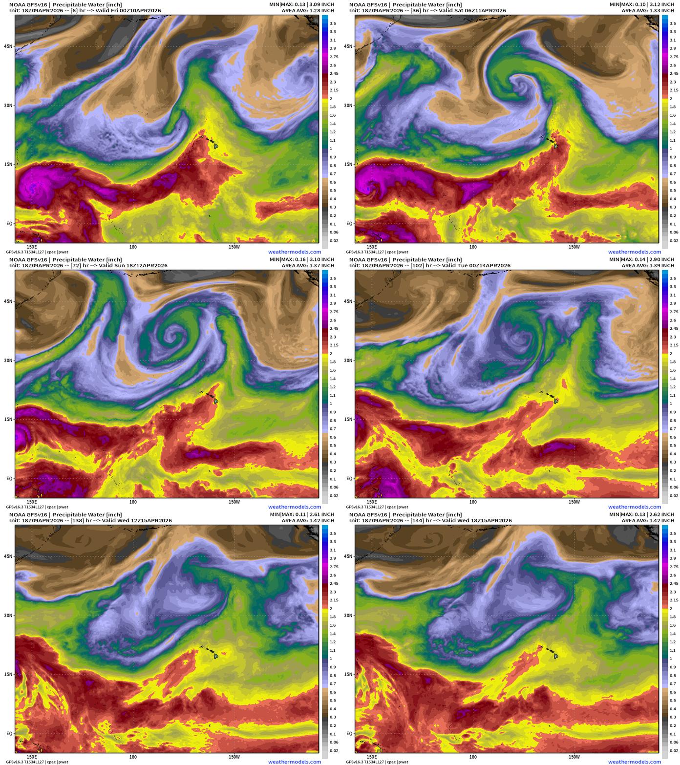
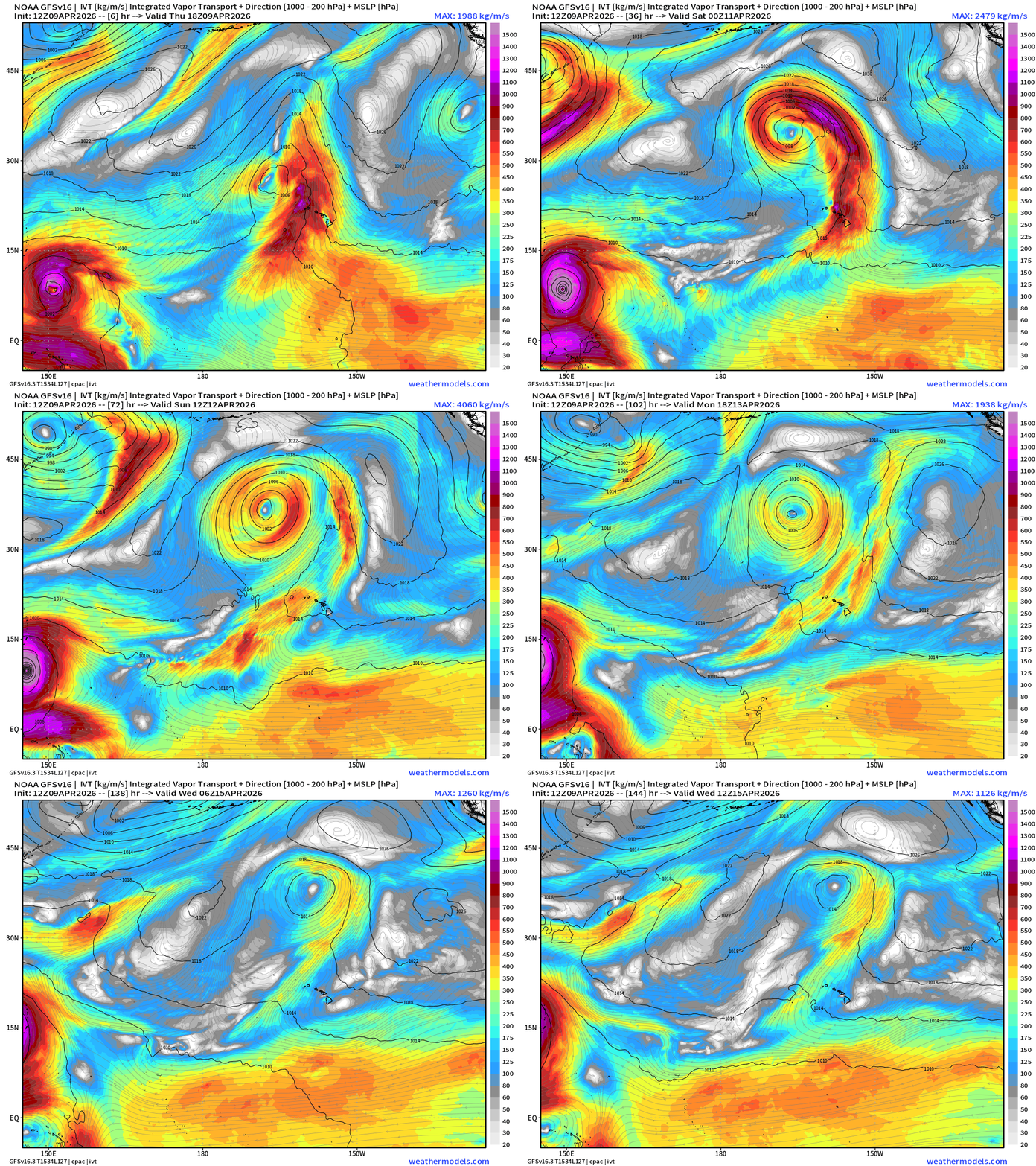
Into the Central Pacific — Kona Low and atmospheric river over Hawaii
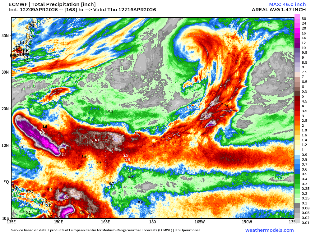
Intense tropical moisture plume is pulled across the Hawaiian Islands = flooding very likely with downpours
Precipitable Water and Integrated Vapor Transport (IVT) next 6-days | GFS 18z
Total Precipitation Next 7-days — Tropical western Pacific —> Central Pacific pipeline!
April 7: 2026 Atlantic Seasonal Hurricane Forecast: 11/5/2
9-13 Named Storms (11 most likely)
4-7 Hurricanes (5 or 6 most likely)
1-3 Major Hurricanes (2 most likely)
ACE: 75-85
Maps sourced from weathermodels.com designed and innovated by yours truly! Please subscribe there for real-time access to the newest maps, charts from all of the weather models including ECMWF and AIFS, and NOAA GFS/GEFS. NOAA WPC and SPC for fronts/convective outlooks.
- Milepost
- 915 · laid 2026-04-09T23:02:33.693000Z
- Source
- https://weather.substack.com/p/april-9-2026-thursday-spring-weather
- Digest
- 01dac9fef248b2ba45f80a2afcc433ecf27001b7dea2a968243071f5fcb3c1bf
- Machine
- JSON