April 3, 2026 Friday Spring Weather
Two powerful tropical cyclones in Southwest Pacific forming
April 2026 was the 3rd-warmest April in the 132-year national record (1895–2026), at 54.7°F against a 1991–2020 normal of 51.8°F (+2.9°F).
April 2026 was the 46th-wettest April in the 132-year national record (1895–2026), at 2.7in against a 1991–2020 normal of 2.7in (+0.0in).
NOAA/NCEI Climate at a Glance, contiguous United States. This is the observed record for the month, not a score of anything said in this piece — the forecast ledger begins 2026-08-17 and cannot reach earlier posts.

Weather Trader is an entirely reader-supported publication. To receive all new posts [daily] via email or the Substack App, and support our work, consider becoming a paid subscriber (April Coupon) — ALL content is generated by Ryan (not A.I.) including the maps. Thank you to new (and renewing) subscribers in March (free and paid) who support this newsletter and development behind the scenes.
Tropical Updates are back! South West Pacific
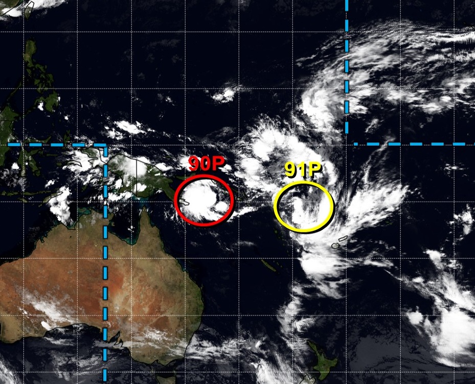
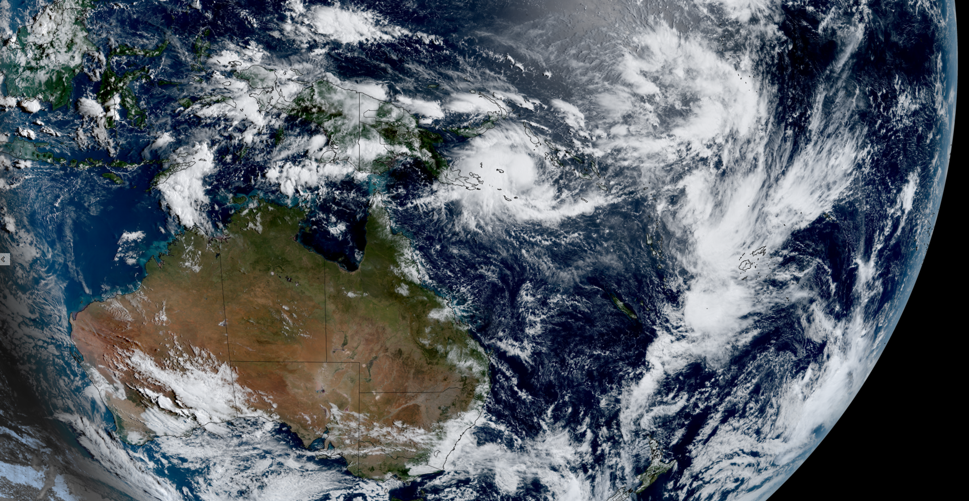
After several months of prolonged winter weather, we can look at the tropics for extreme weather that may eventually affect us in the months ahead: just south of the Equator in the Western Pacific near Papua New Guinea and Fiji: Invest 90P and Invest 91P. NOAA’s hurricane model (HAFS-A) also has a Northern Hemisphere circulation that may develop itself into a tropical storm later next week.
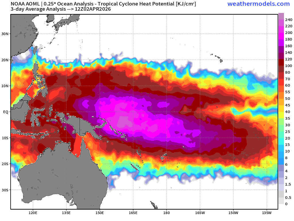
Invest 90P is just east of Papua New Guinea in an area of very warm and deep ocean heat content — some of the warmest on Earth. The Tropical Cyclone Heat Potential or “hurricane fuel” has the “fully loaded” Western Pacific warm pool ready for discharge.
La Niña is actually a heat storage mechanism for the global tropics in the Western Pacific and El Niño is a heat discharge.
Looking at the lower atmosphere wind speeds (850 hPa) we can see westerly winds along the Equator in between the two / twin tropical systems. We’ll see in the coming weeks of this westerly wind burst can trigger an equatorial Kelvin Wave to enhance / trigger El Niño in summer — perhaps a “Super” El Niño that would significantly suppress Atlantic Hurricane Season activity. More on that in the coming days.
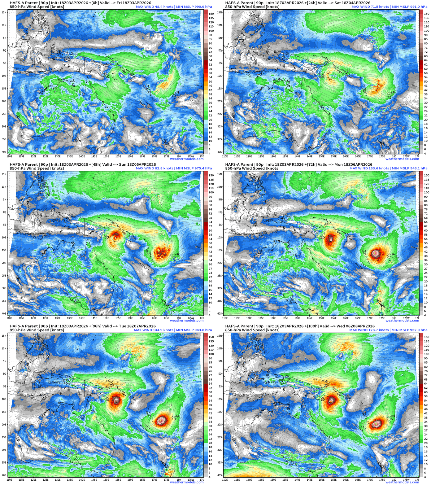
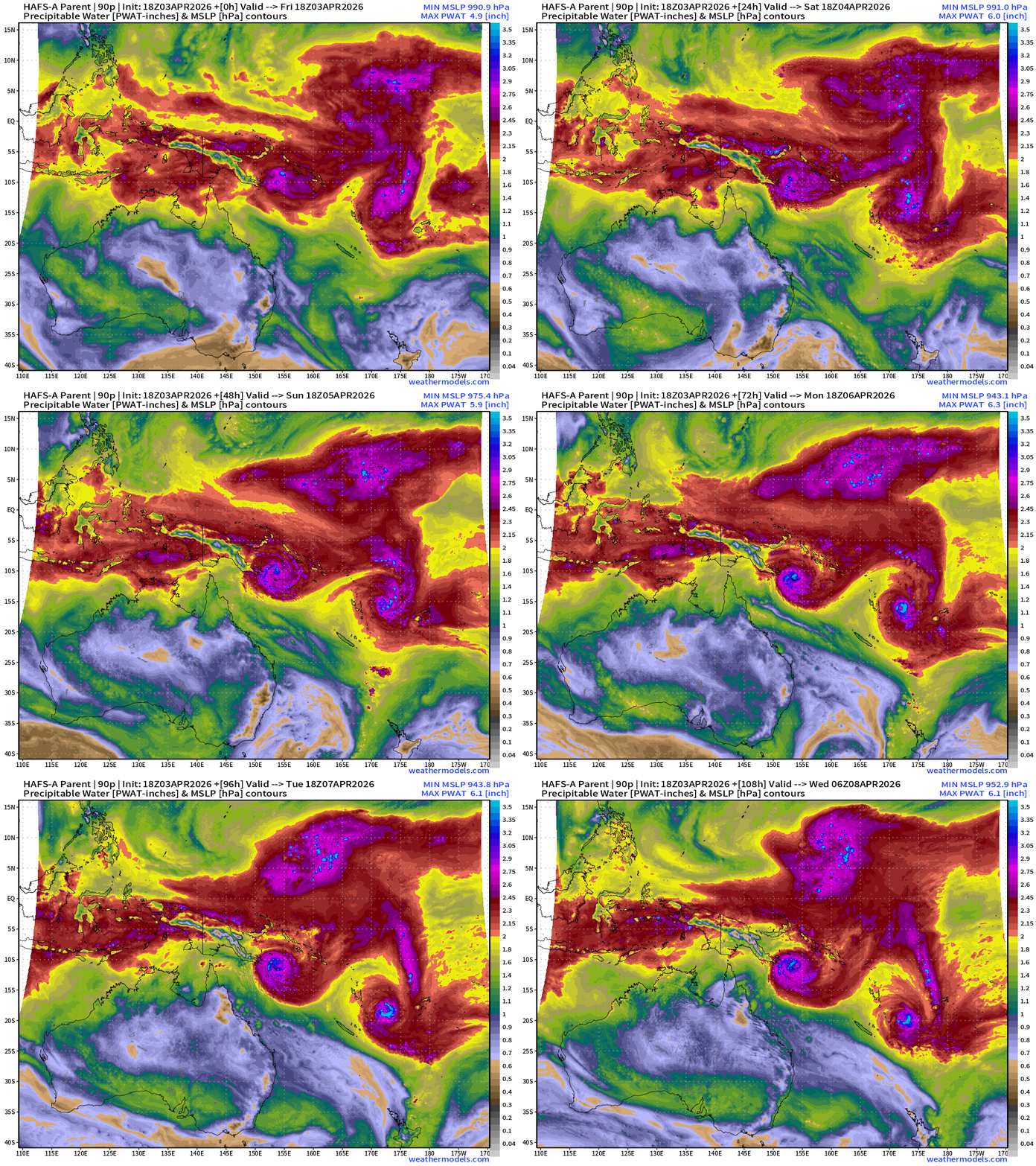
Invest 90P — Nest domain from HAFS-A: minimum pressure around 940 hPa = Category 4 — maybe we will see Category 5 (?). TC formation in the next 24-hours!
The other system Invest 91P does not have a HAFS-A nest quite yet.
The storms will both stick around the tropics for the next many days e.g. 90-hours forecast from ECMWF 18z (next Tuesday 12z)
Spring Storm System
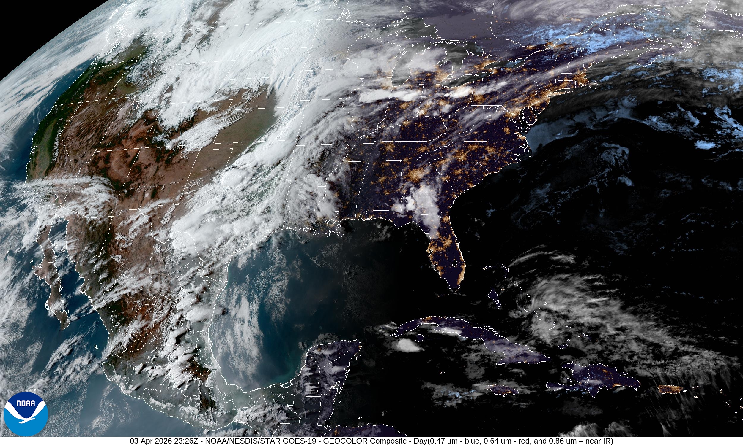
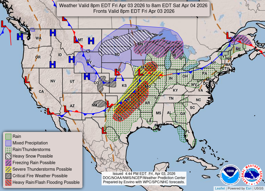
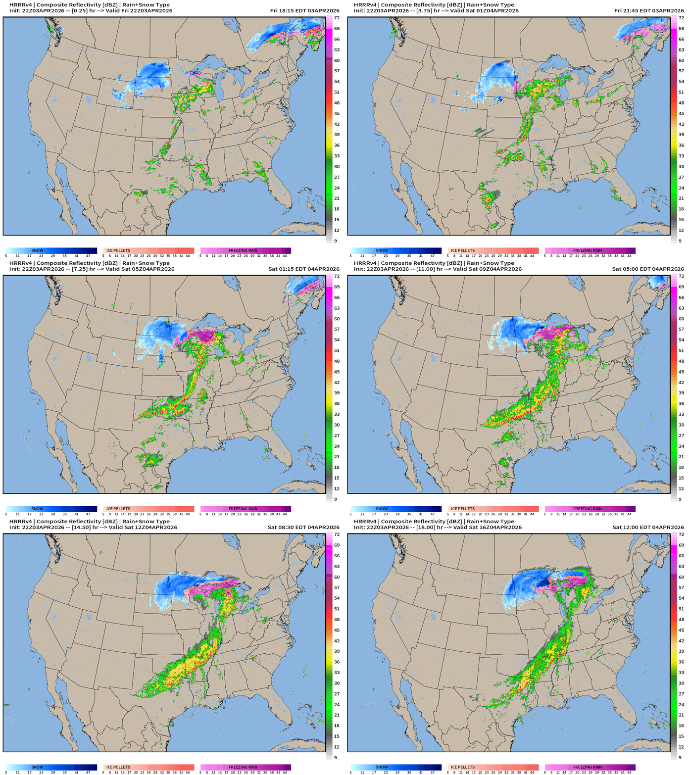
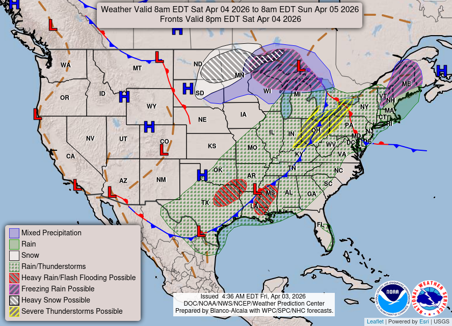
Weather/Fronts Today into Saturday morning
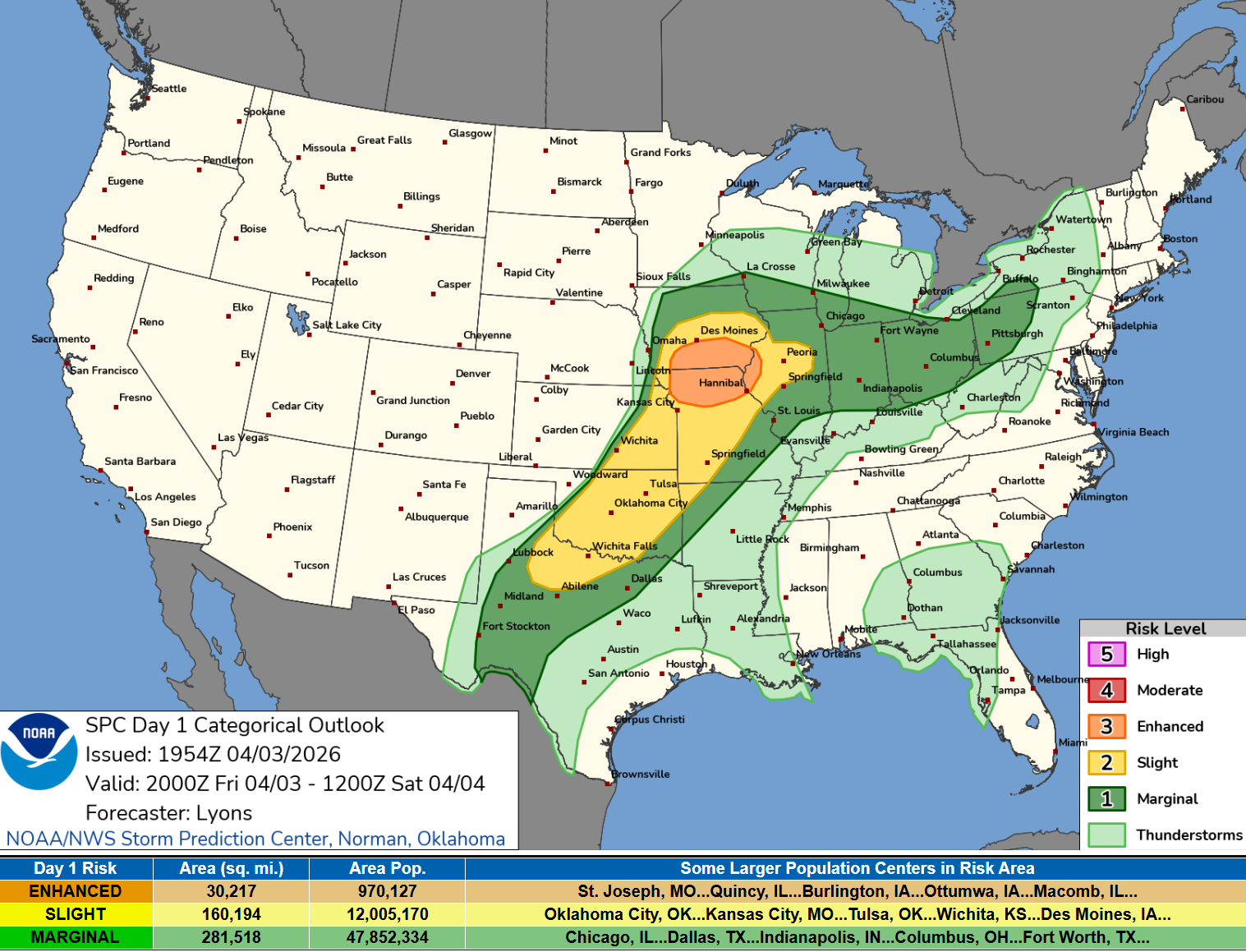
Enhanced Risk of Severe Weather (tornadoes) in Iowa and Illinois for next several hours
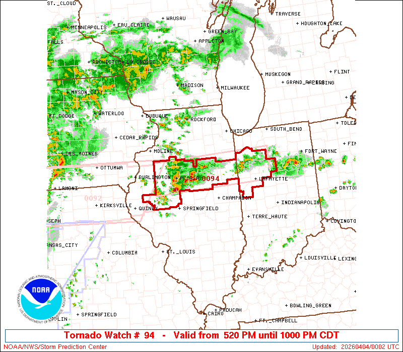
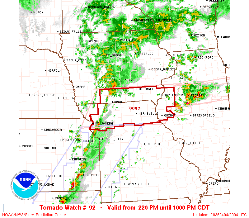
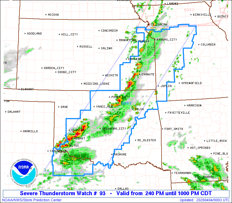
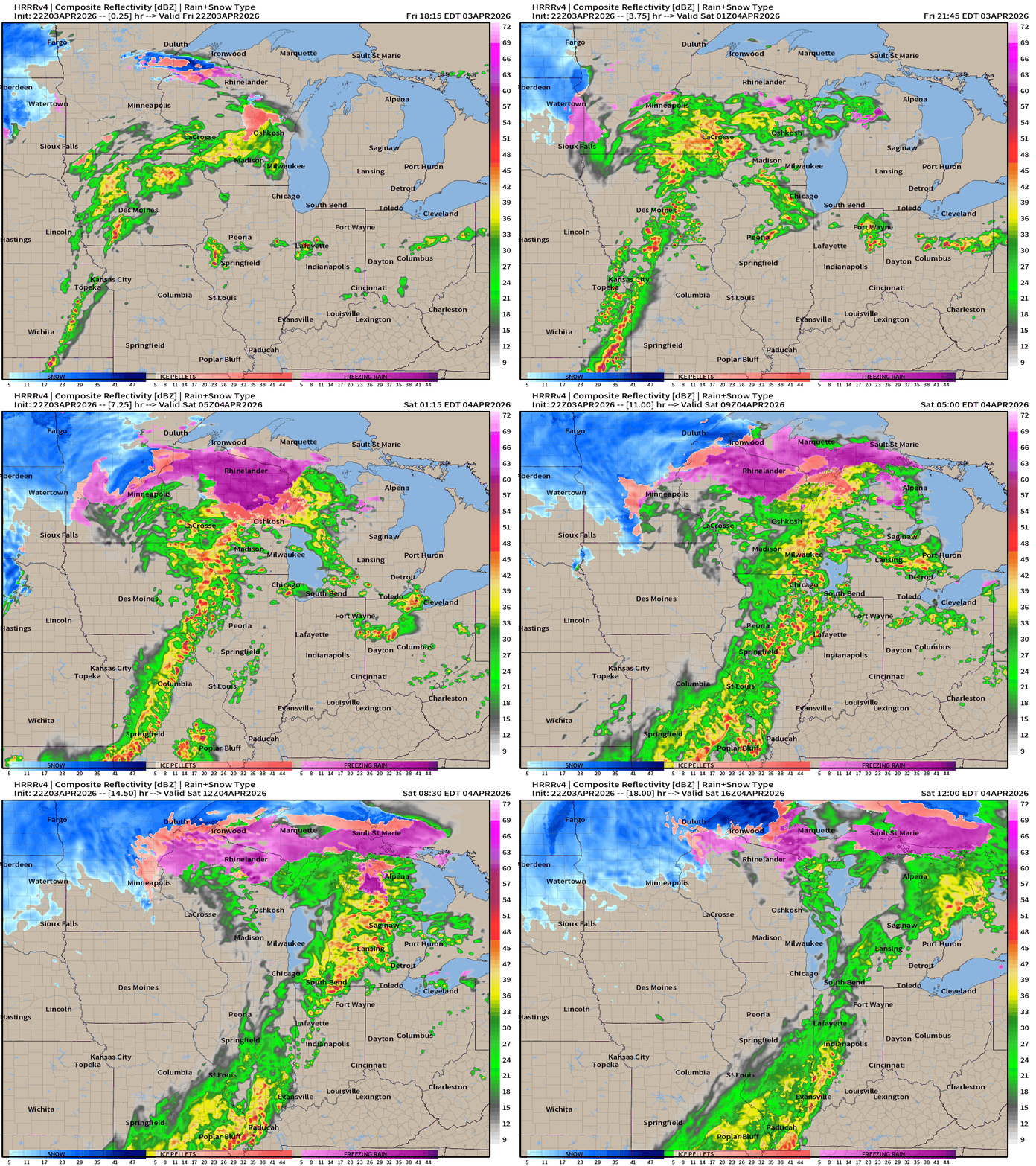
HRRR 22z Radar Simulation next 18-hours into Saturday Noon ET
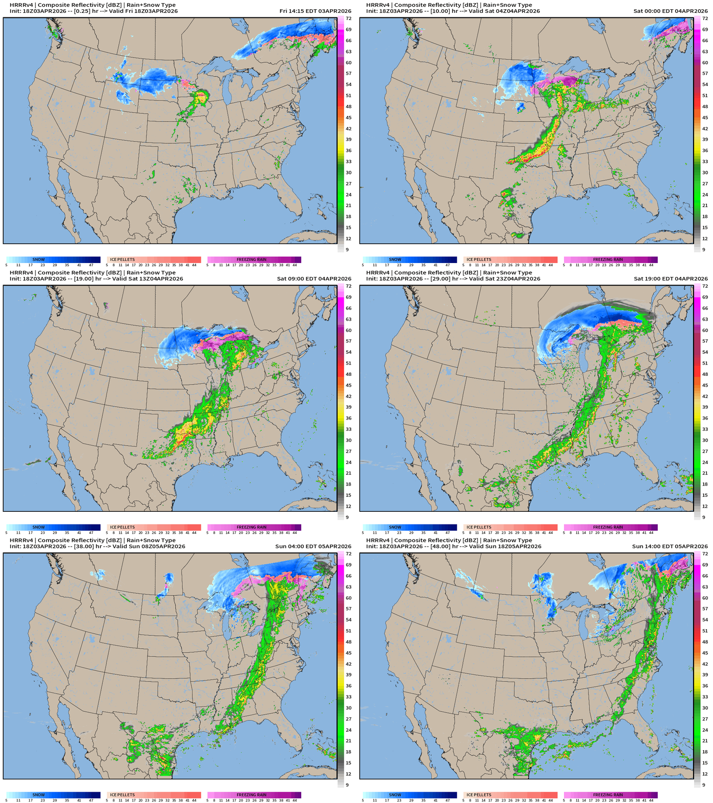
HRRR 18z — Radar Simulation Next 48-hours to Sunday 2 PM ET
Weather on Saturday into Sunday Morning
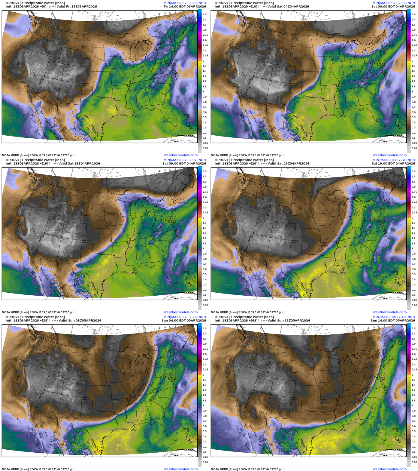
HRRR 18z Precipitable Water Next 48-hours (my favorite parameter)
ECMWF 18z | Forecast model 6-days of Precipitable Water (my favorite parameter)
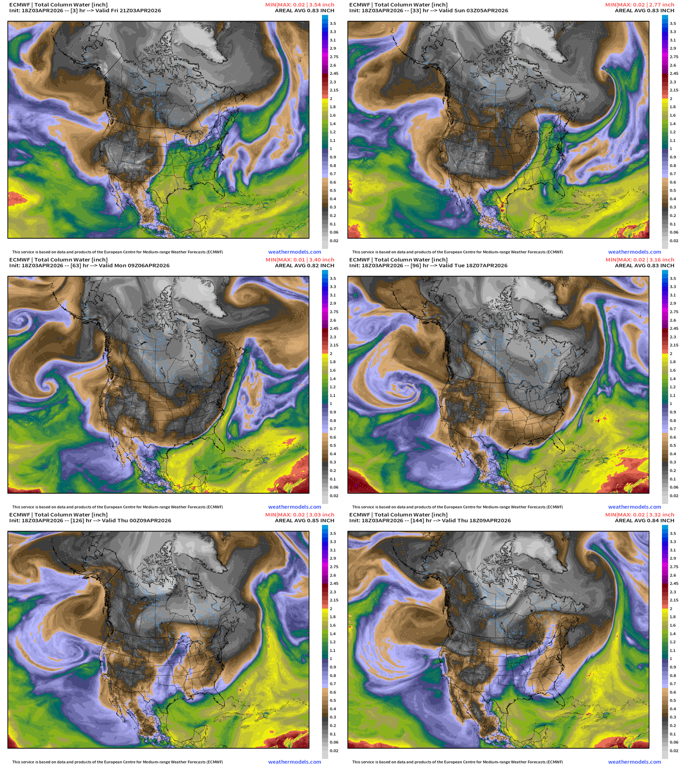
Storm system quickly tracks into Canada … and sweeps a sharp cold front through the Eastern U.S. but it hangs up before reaching Florida.
ECMWF 18z Precipitation Type + Intensity | Next 6-days
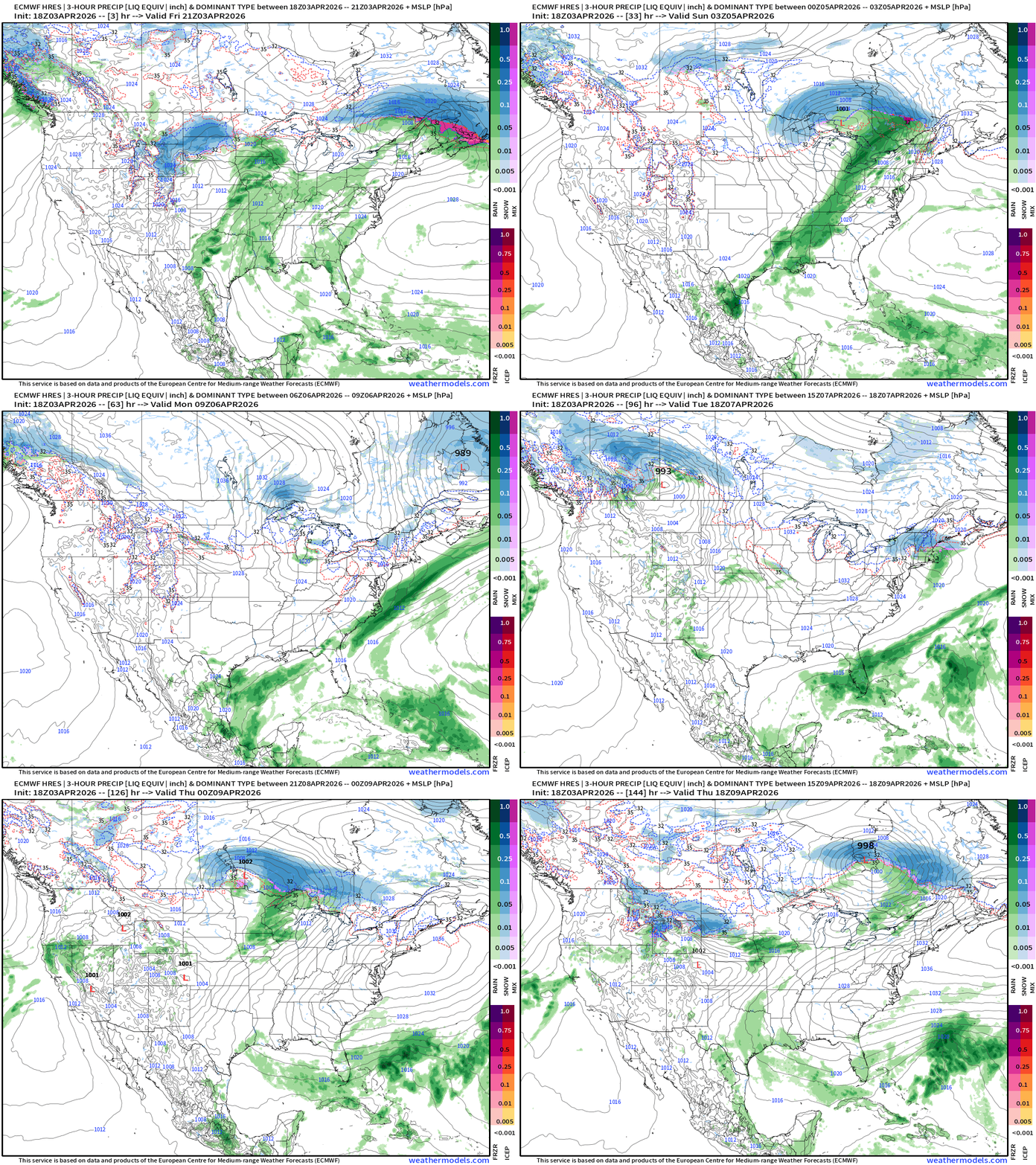
Only one major storm system left — today into Saturday with remaining showers along the cold front weakening for Easter Sunday
RTMA Current Temperature Analysis | 7:00 PM ET
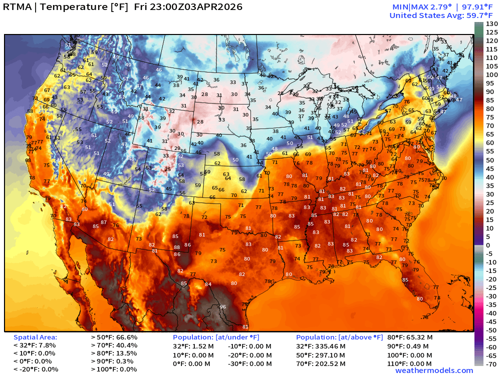
Lower 48 average was 59.7°F with only 202.5 million population above 70°F
RTMA Current Temperature Anomaly Analysis | 7:00 PM ET
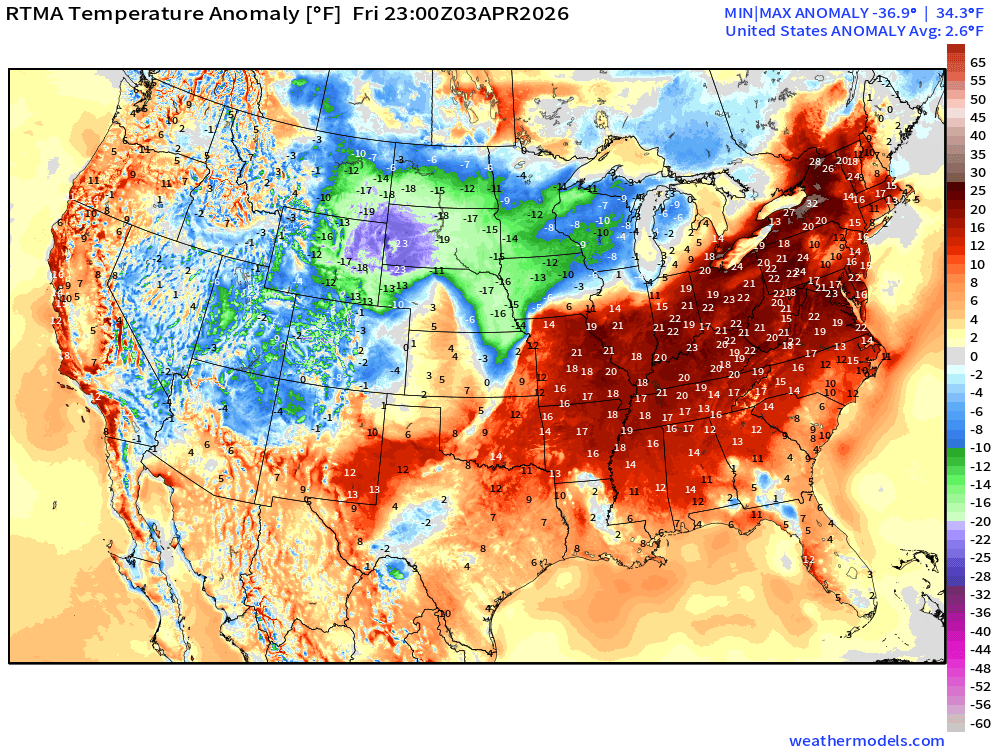
Lower 48 was 2.6°F ABOVE normal
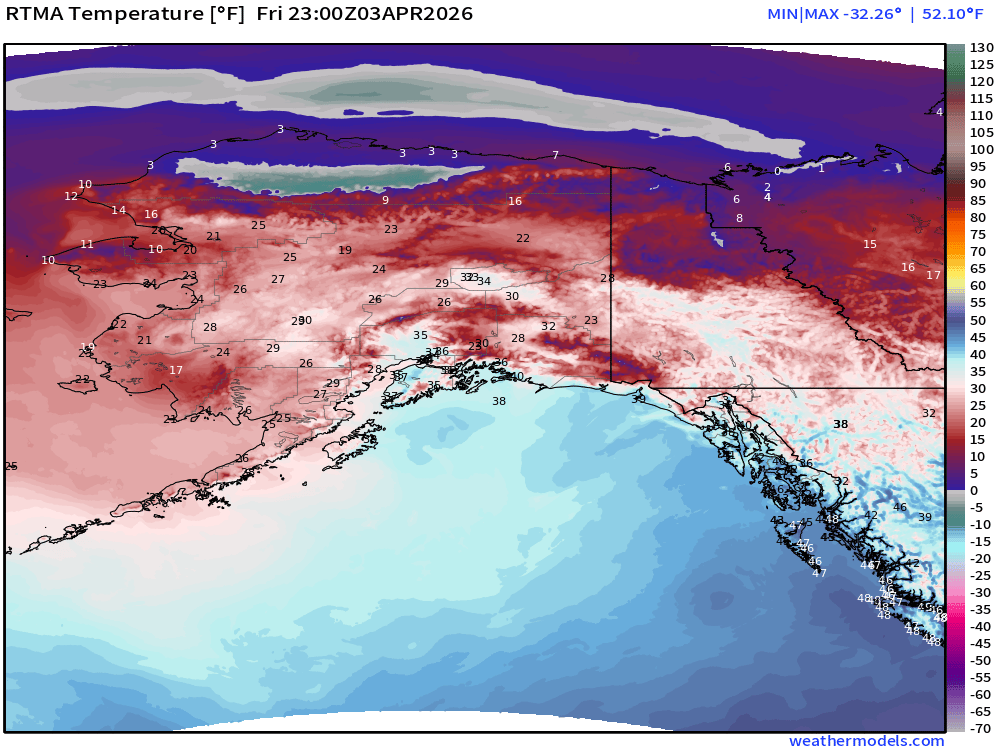
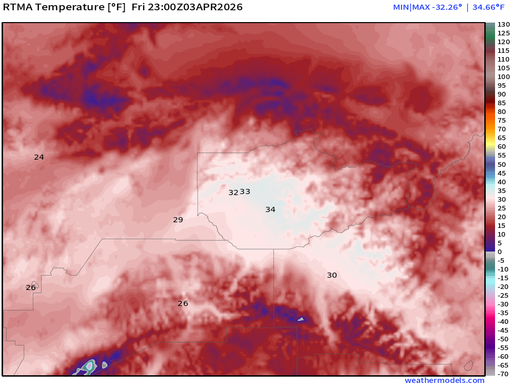
Fairbanks, Alaska has finally made it above freezing for the first day since October 31, 2025 — not kidding! Temperatures in the mid-30s today.
Model Predictions | ECMWF AIFS 18z next 10-days of 500 mb Height Anomaly
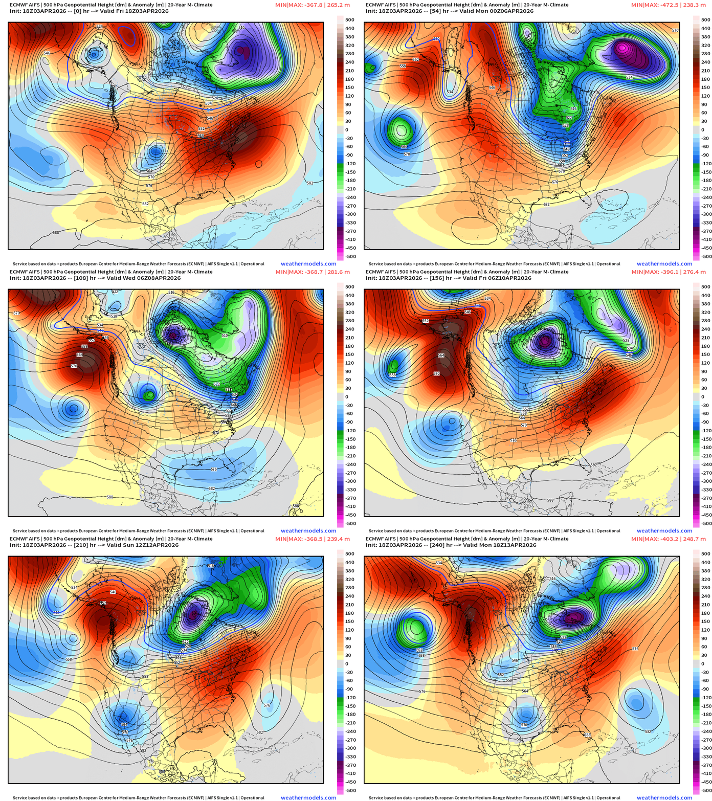
The Hudson Bay / Canadian polar vortex is back with reinforcement / help from Siberia via the North Pole. Impressive intensity / but shrinking size of the PV for next 10-days.
North America Temperature Anomaly Next 6-days
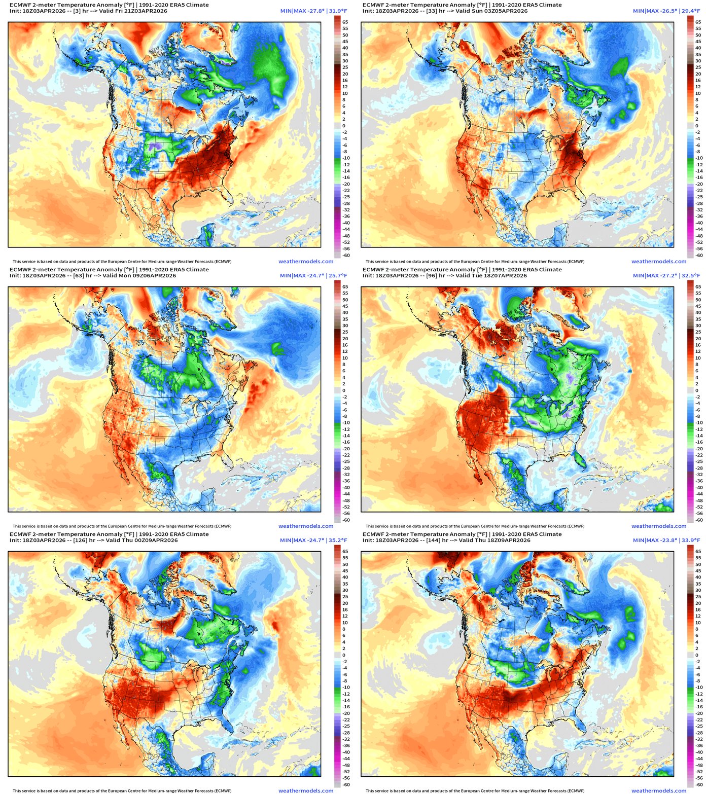
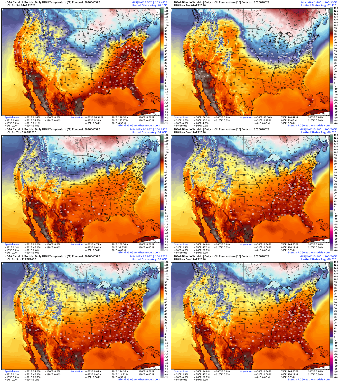
Blend of Models Temperatures | Highs through Sunday, April 12
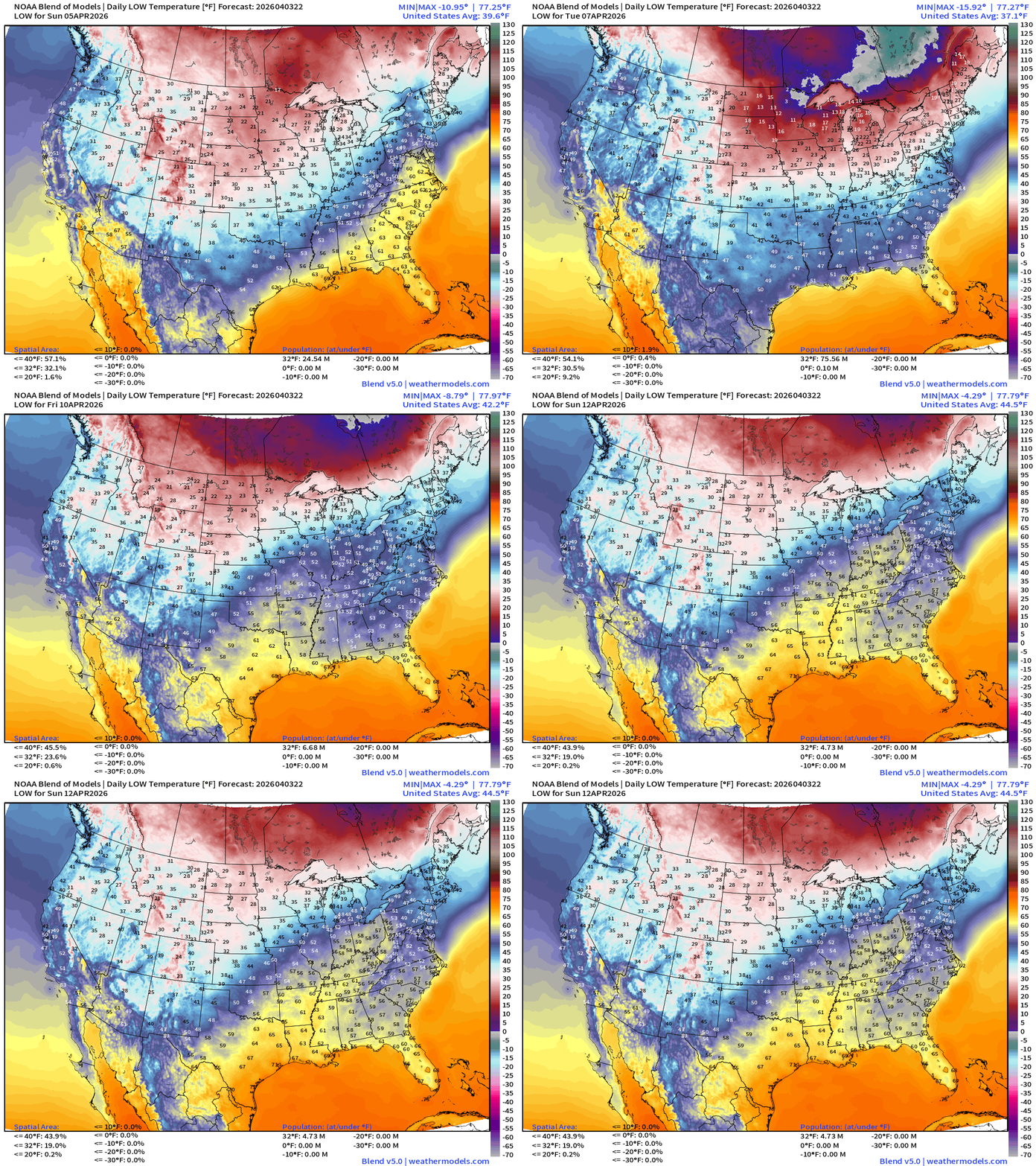
Blend of Models Temperatures | Lows through Sunday, April 12
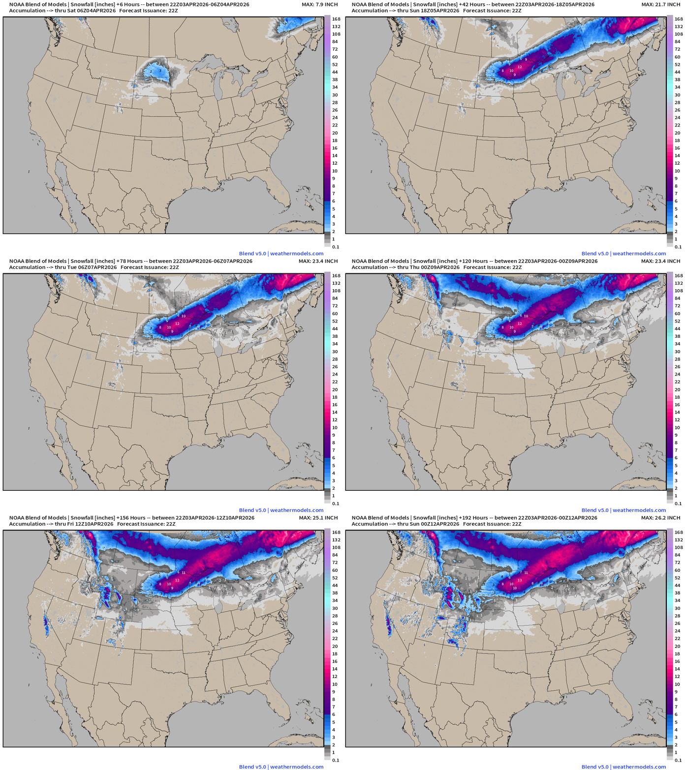
Blend of Models | Total Snowfall Next 8-Days
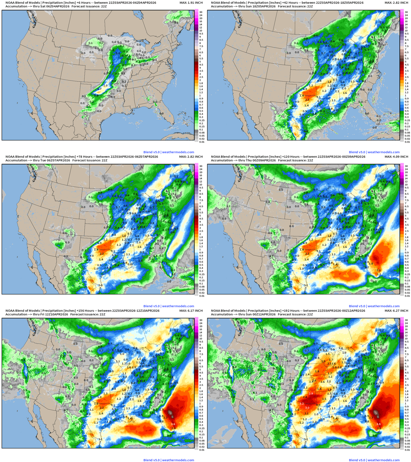
Blend of Models | 8-Days Precipitation Total
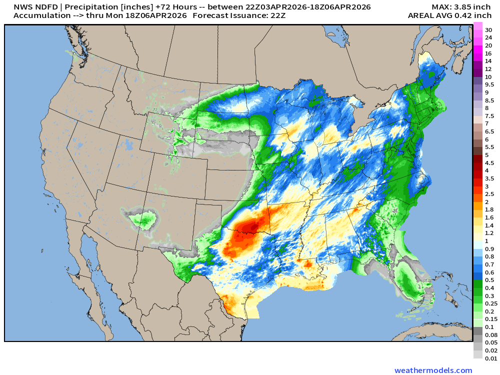
NDFD NWS Total Precipitation Next 72-hours through Sunday Morning
NWS Snowfall Next 72-hours — through Sunday Morning
Low Temperatures Saturday
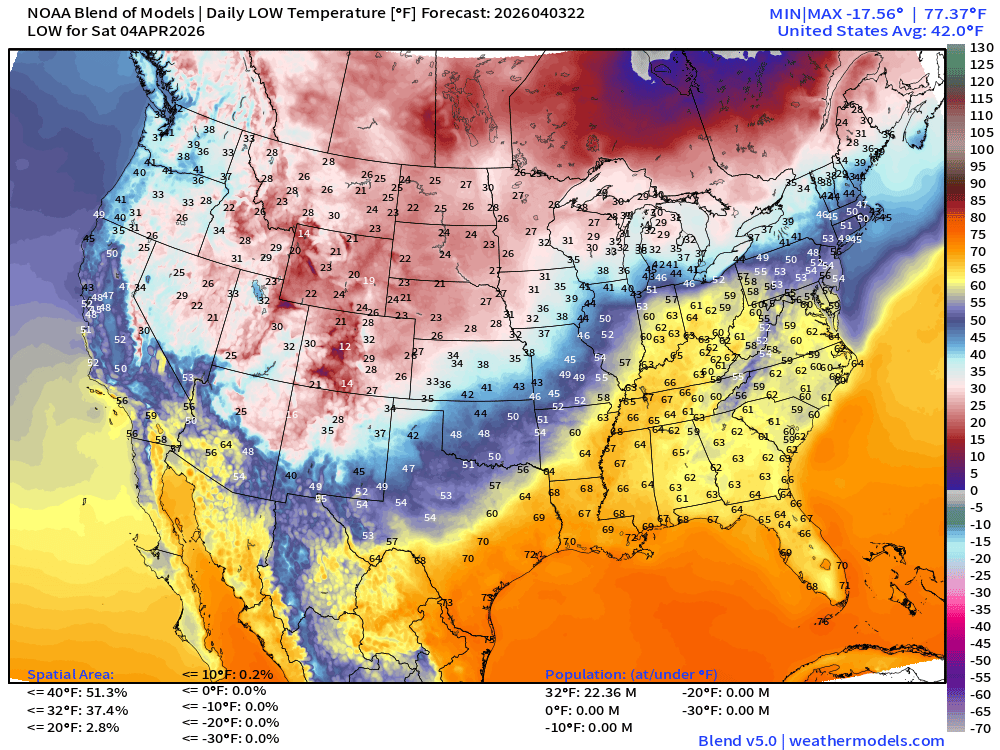
Only 22 million below freezing but 37% of real estate (across Rockies and Midwest)
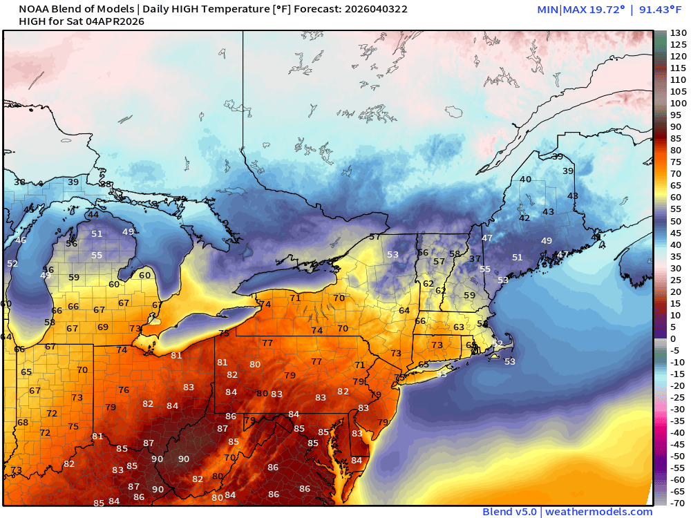
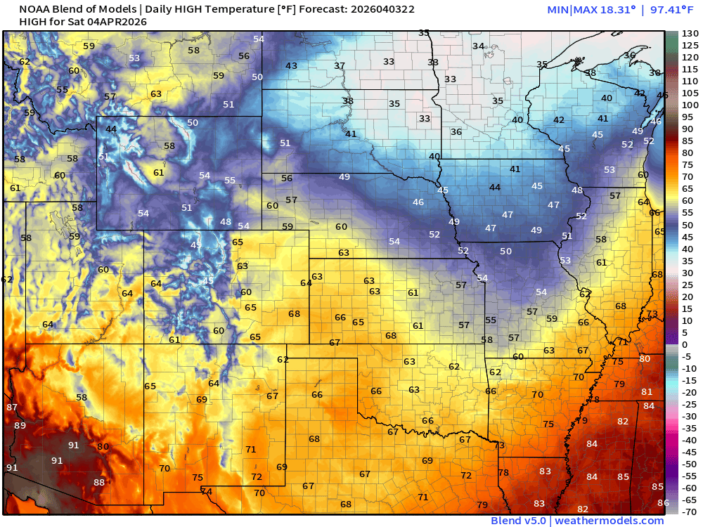
High Temperatures on Saturday
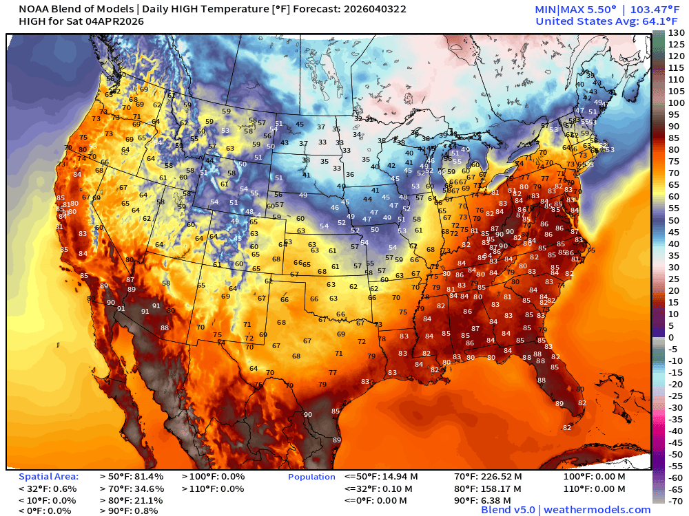
Hot in the 80s for 158 million+
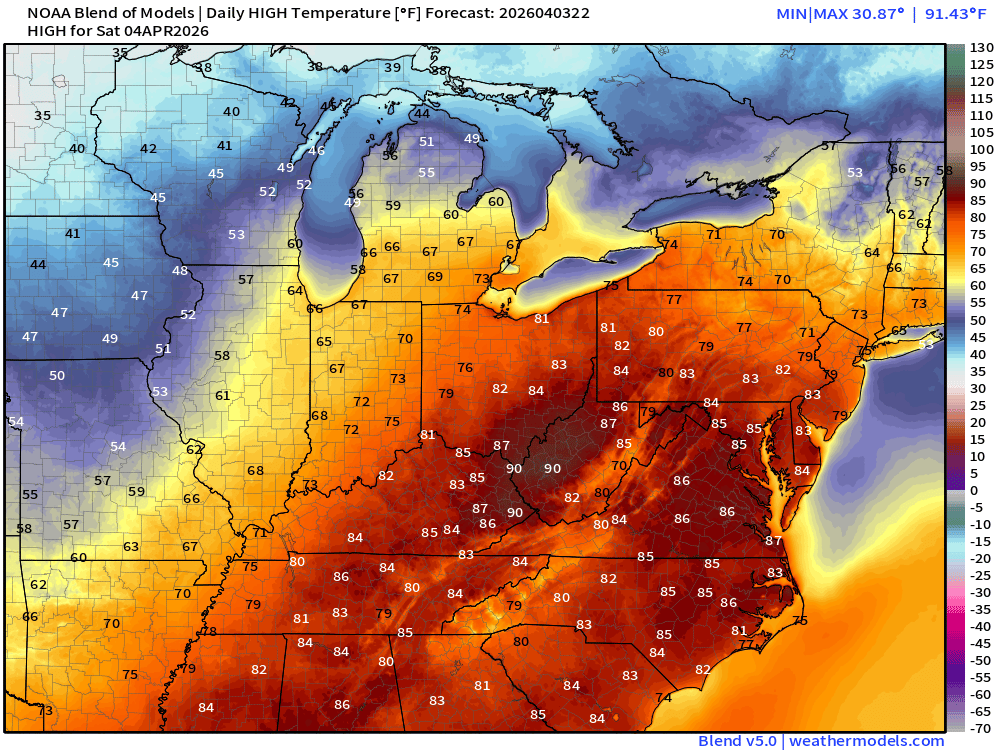
High Temperatures on Easter Sunday
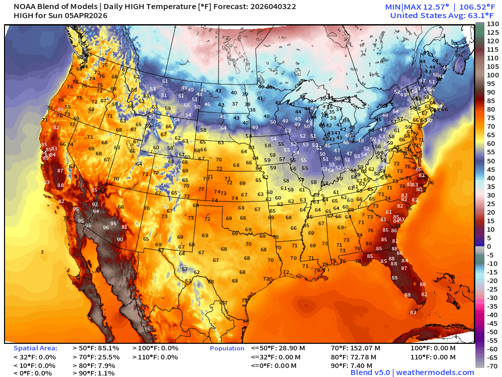
Cold front sweeps through — significant cool down but still mild with sunshine!
ECMWF AIFS 18z | Temperature at 500 mb | Next 10-days
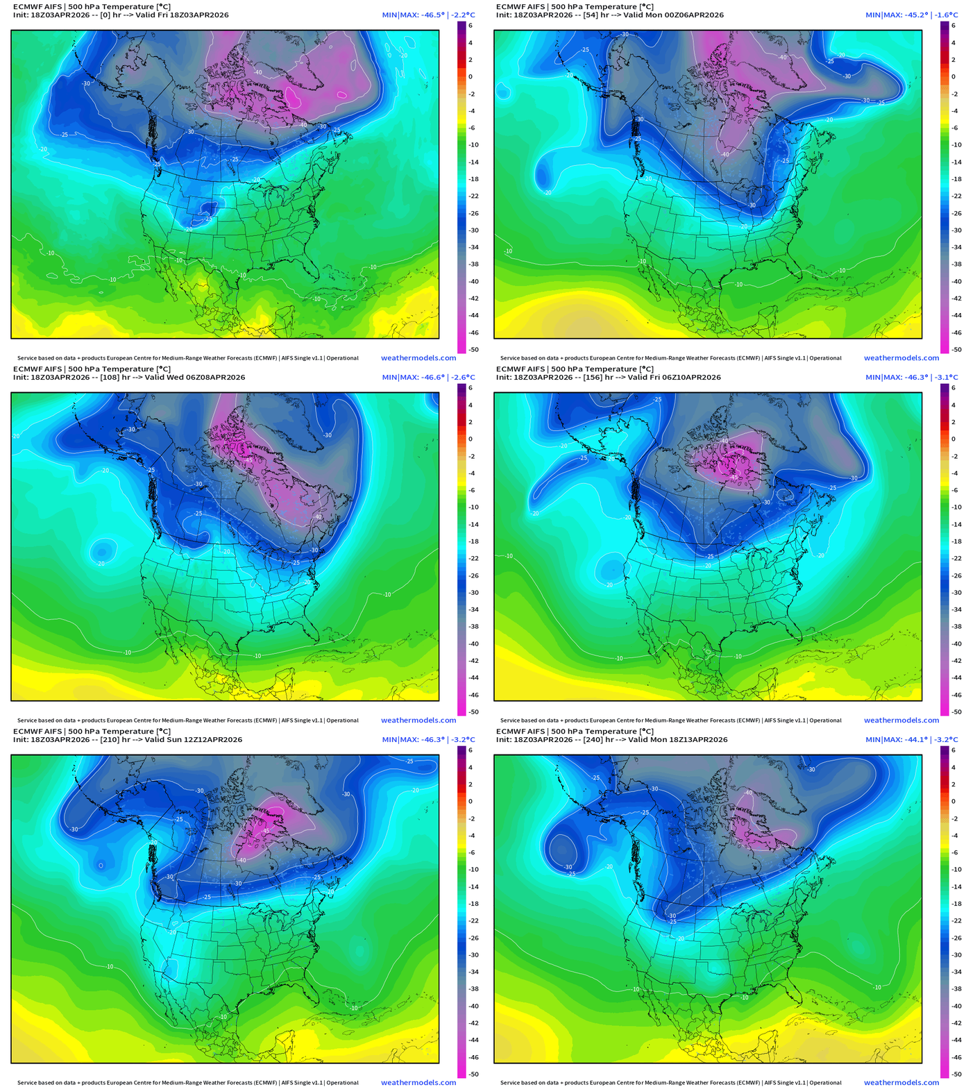
There’s a -45°C contour of the polar vortex at 500 mb holding on for dear life in Canada!
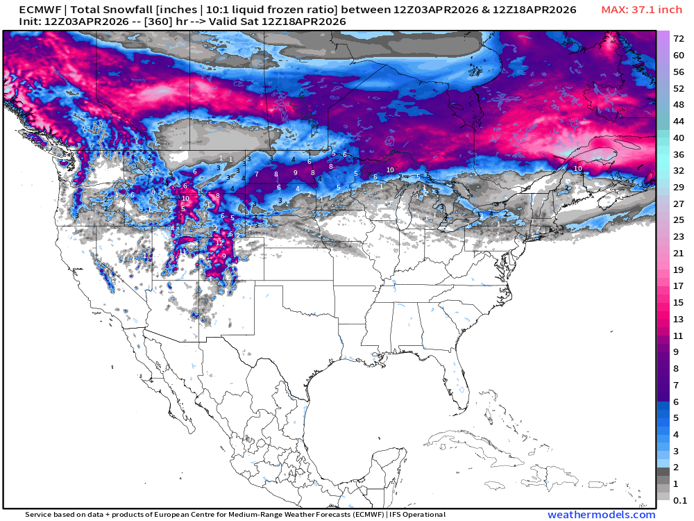
Snowfall from ECMWF HRES (15-days)
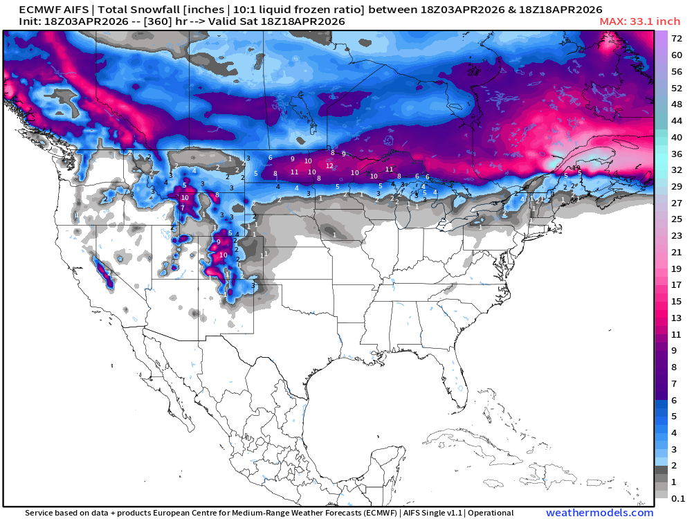
Snowfall from ECMWF AIFS-Single (18z) next 15-days
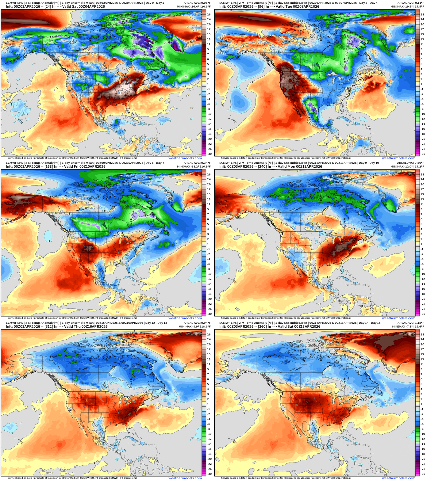
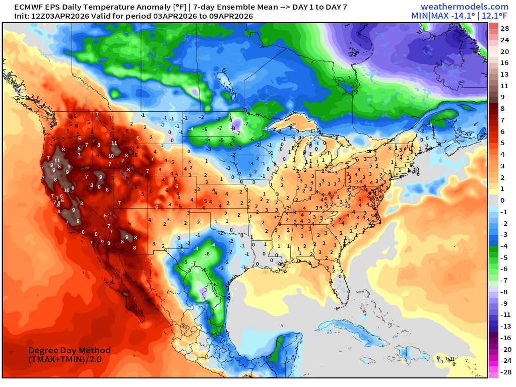
Temperature Anomaly | Next 15-days | ECMWF EPS 12z Ensemble Mean
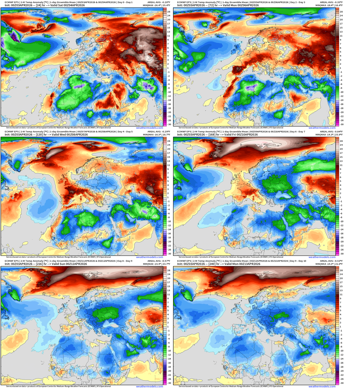
Europe temperature anomaly next 10-days
Week #1 | Temperature Anomaly | April 3 - April 9
Week #2 | Temperature Anomaly | April 10 - April 16
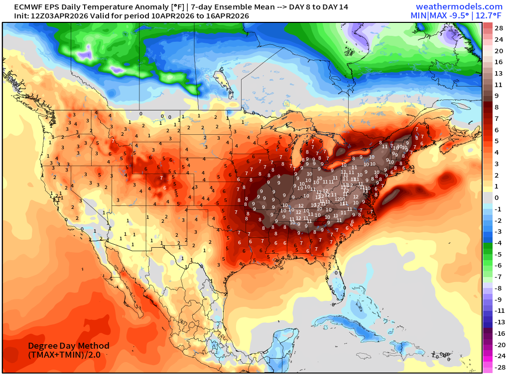
Significant warmth in week 2 with 10°F to 12°F above normal east of the Mississippi!
Maps sourced from weathermodels.com designed and innovated by yours truly! Please subscribe there for real-time access to the newest maps, charts from all of the weather models including ECMWF and AIFS, and NOAA GFS/GEFS. NOAA WPC and SPC for fronts/convective outlooks.
- Milepost
- 911 · laid 2026-04-04T00:42:22.645000Z
- Source
- https://weather.substack.com/p/april-3-2026-friday-spring-weather
- Digest
- a919dbe6212a625bab33f1001544e948999c54f538bc89bcaa6e71f9cb9f588b
- Machine
- JSON