March 30, 2026 Monday Spring Weather
Eastern U.S. begins a wetter period but snowfall across Midwest and Great Lakes will return
March 2026 was the warmest March in the 132-year national record (1895–2026), at 50.8°F against a 1991–2020 normal of 43.6°F (+7.3°F).
March 2026 was the 8th-driest March in the 132-year national record (1895–2026), at 1.8in against a 1991–2020 normal of 2.5in (-0.7in).
NOAA/NCEI Climate at a Glance, contiguous United States. This is the observed record for the month, not a score of anything said in this piece — the forecast ledger begins 2026-08-17 and cannot reach earlier posts.

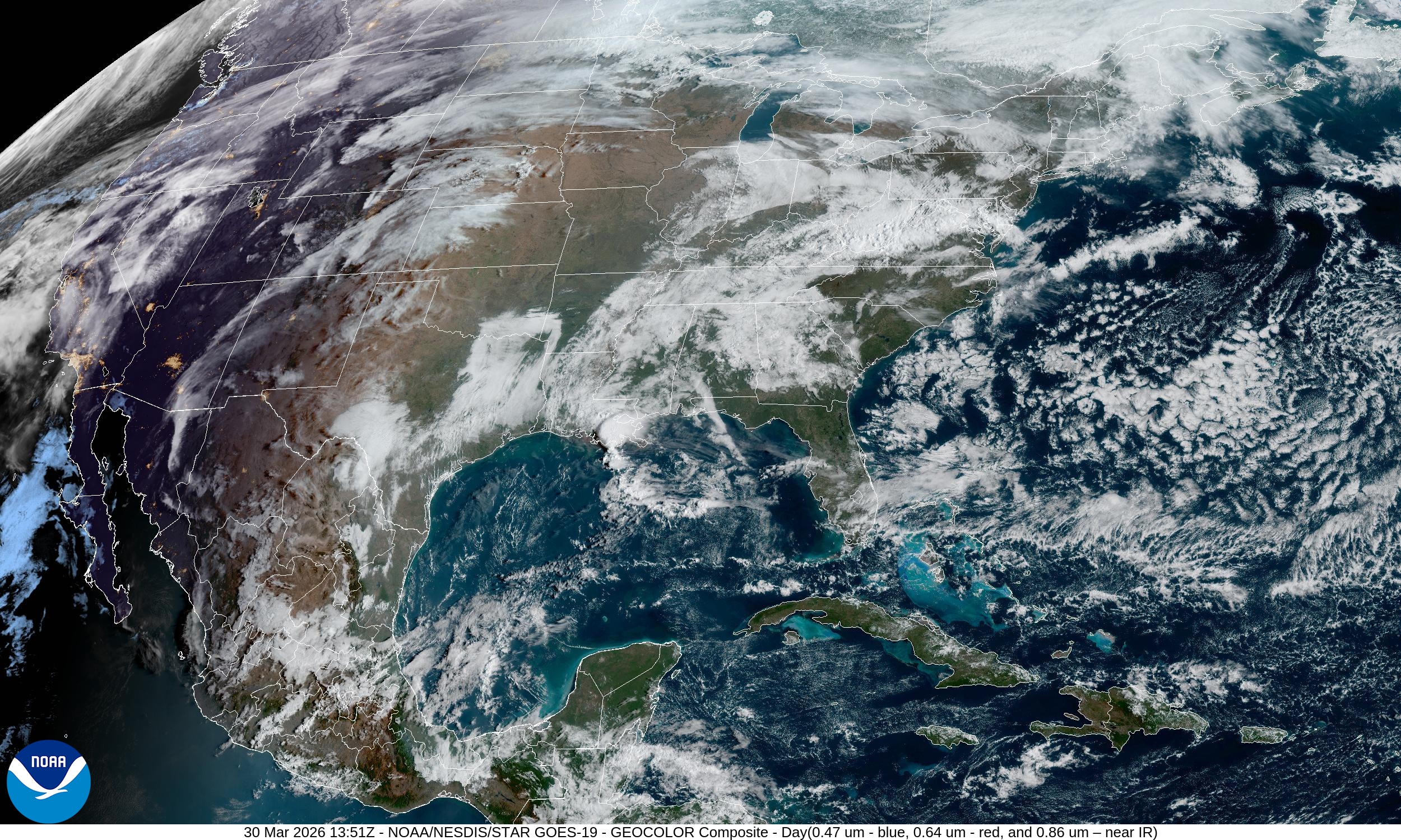
Monday Analysis | NOAA GFS Model
A look “current analysis” or “monitoring the situation” from the same model output used to generate the forecast animations. Precipitable Water is my favorite parameter: measure of the total moisture in the atmospheric column and nicely highlights polar air, frontal boundaries, and tropical plumes or atmospheric rivers.
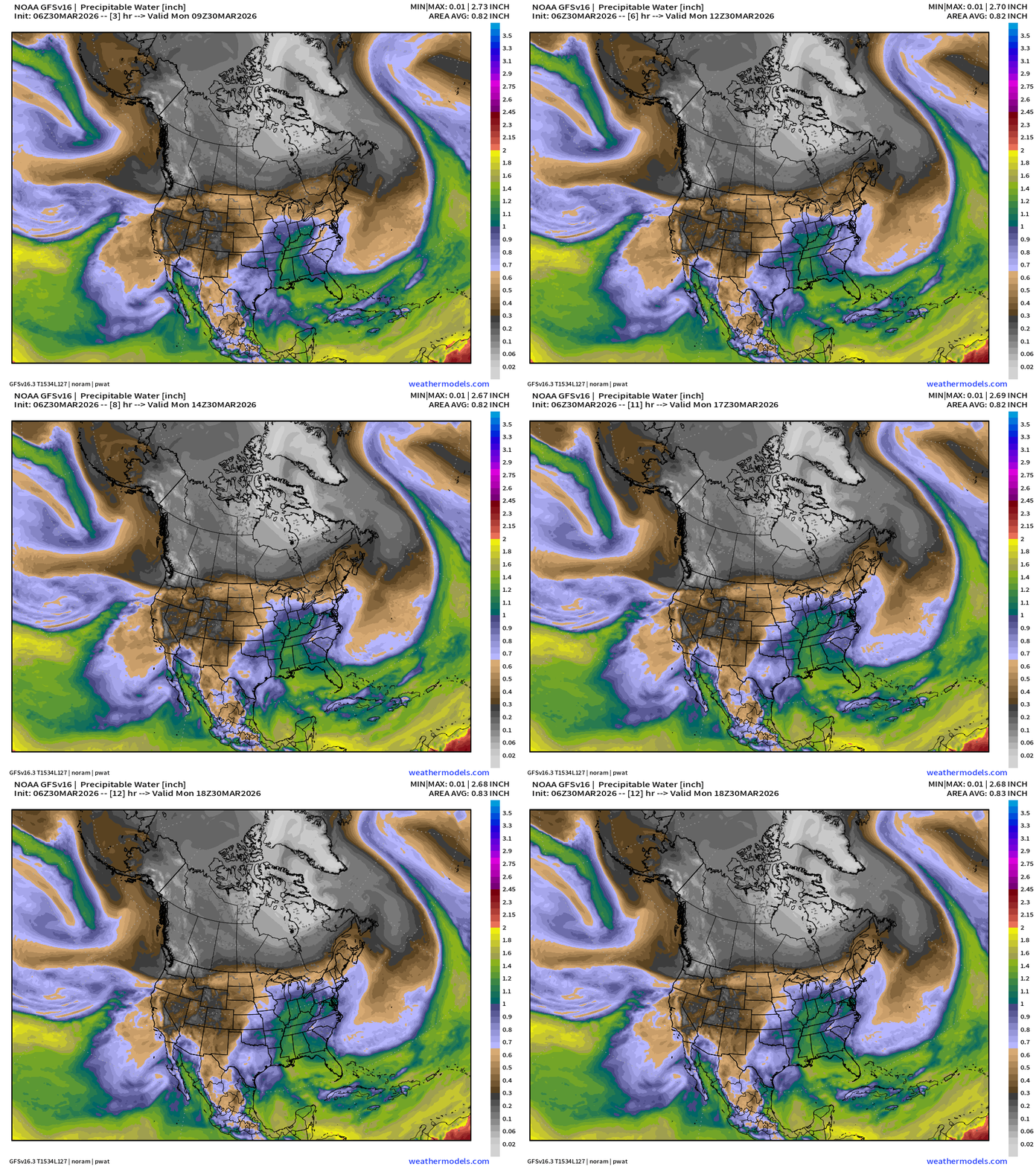
Return flow out of the Gulf of Mexico has brought moisture into the southern Great Lakes + much warmer, too.
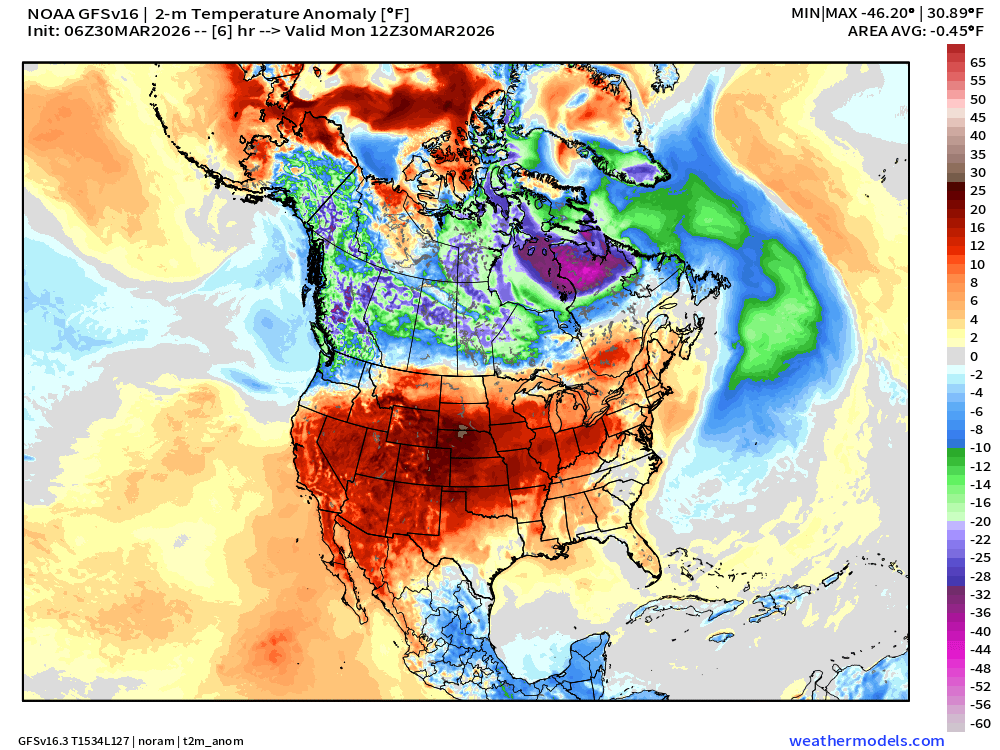
Temperature Anomaly — still very cold over much of Canada especially in Quebec with the “polar vortex” still strongly in control. Much above normal temperatures extend from the west coast into the Ohio River Valley.
Dynamic Tropopause (my second favorite map) also highlights the air masses at upper-levels near the jet stream e.g. polar (purple + white fuzzball), and tropical (red and black) colors on the map
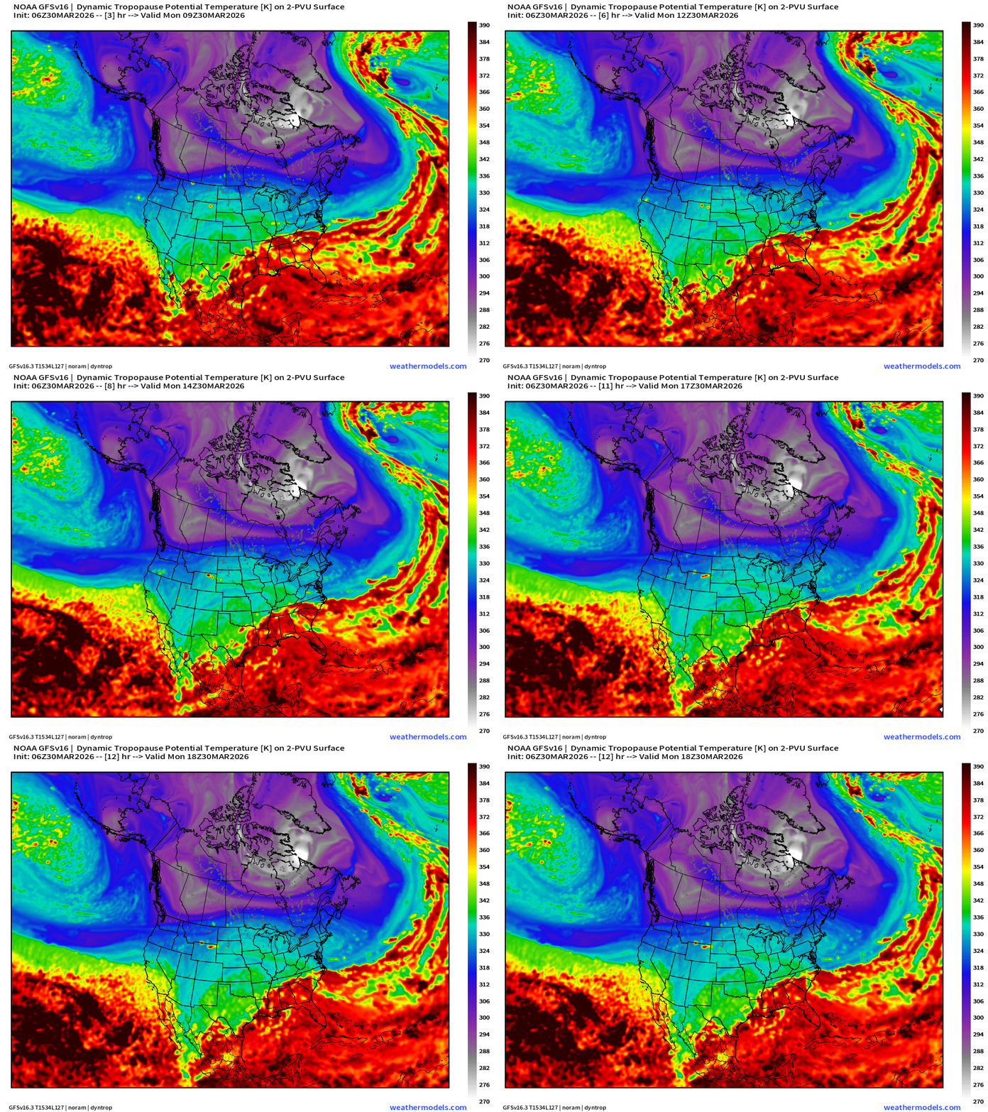
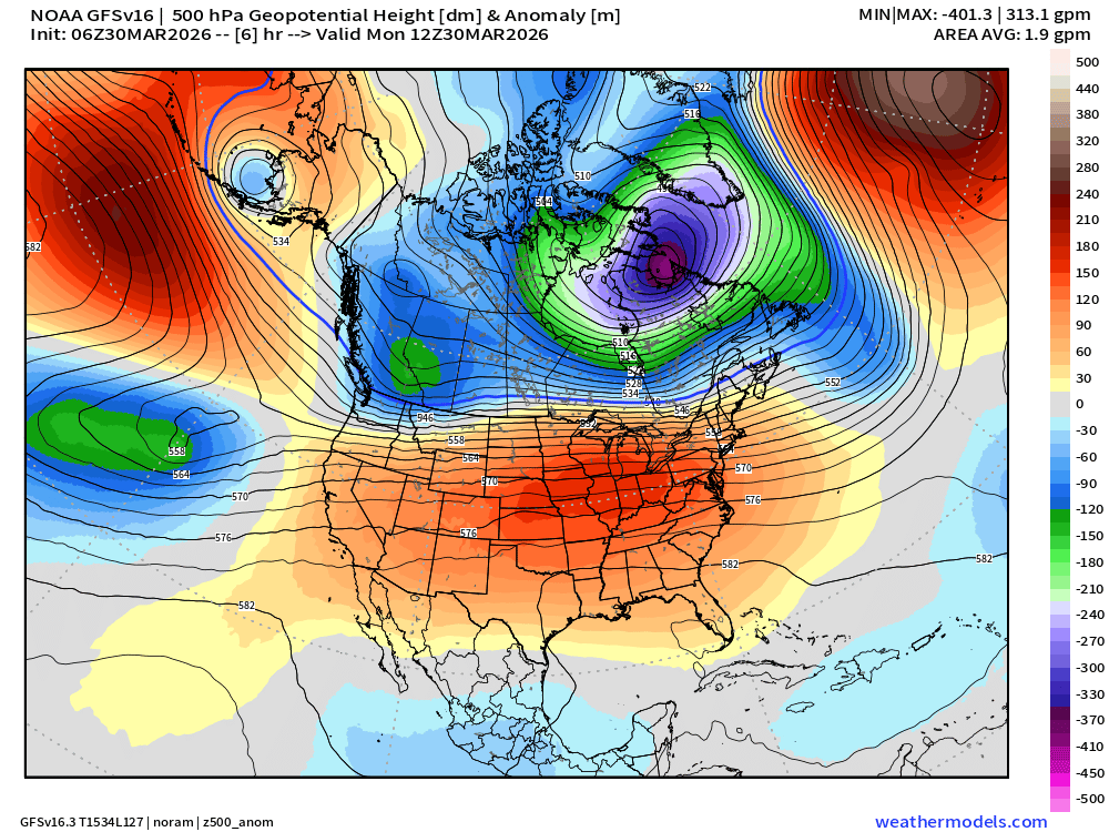
The coldest anomaly on the tropopause corresponds to continued very strong / anomalous troughing over Quebec and Northeast Canada extending around Greenland. This is the tropospheric “polar vortex” that has been driving the now extended winter weather across the Great Lakes and Northeast. The 500 mb height anomaly map also shows the ridging over the entire Lower 48.
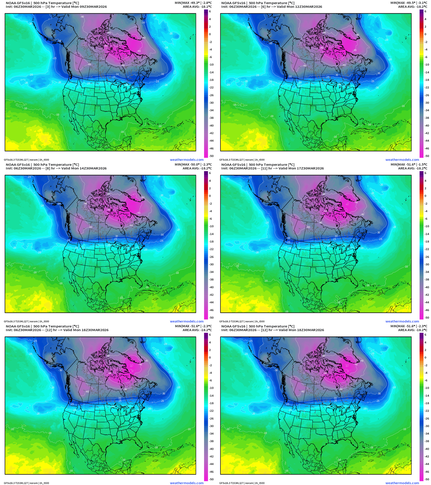
500 mb Temperature — coldest at mid-levels still over all of Canada. I’m amazed to see almost -52°C still just outside the Arctic at 55° to 60°N latitude just east of Hudson Bay for March 30th!
Finally, the Jet Stream (250 mb wind speed)
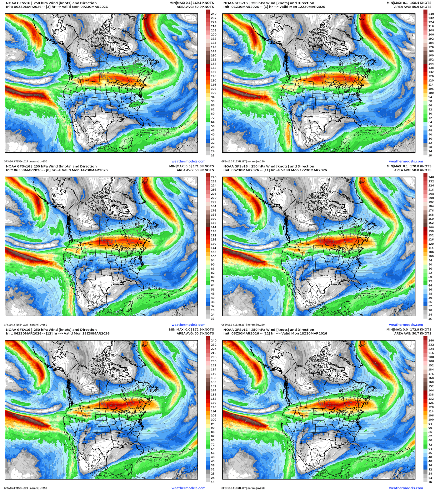
The jet stream splits once it reaches the U.S. West Coast and the ridge firmly in charge. A warm pattern for the eastern U.S. in the coming days.
Model Predictions | ECMWF AIFS 06z next 10-days of 500 mb Height Anomaly
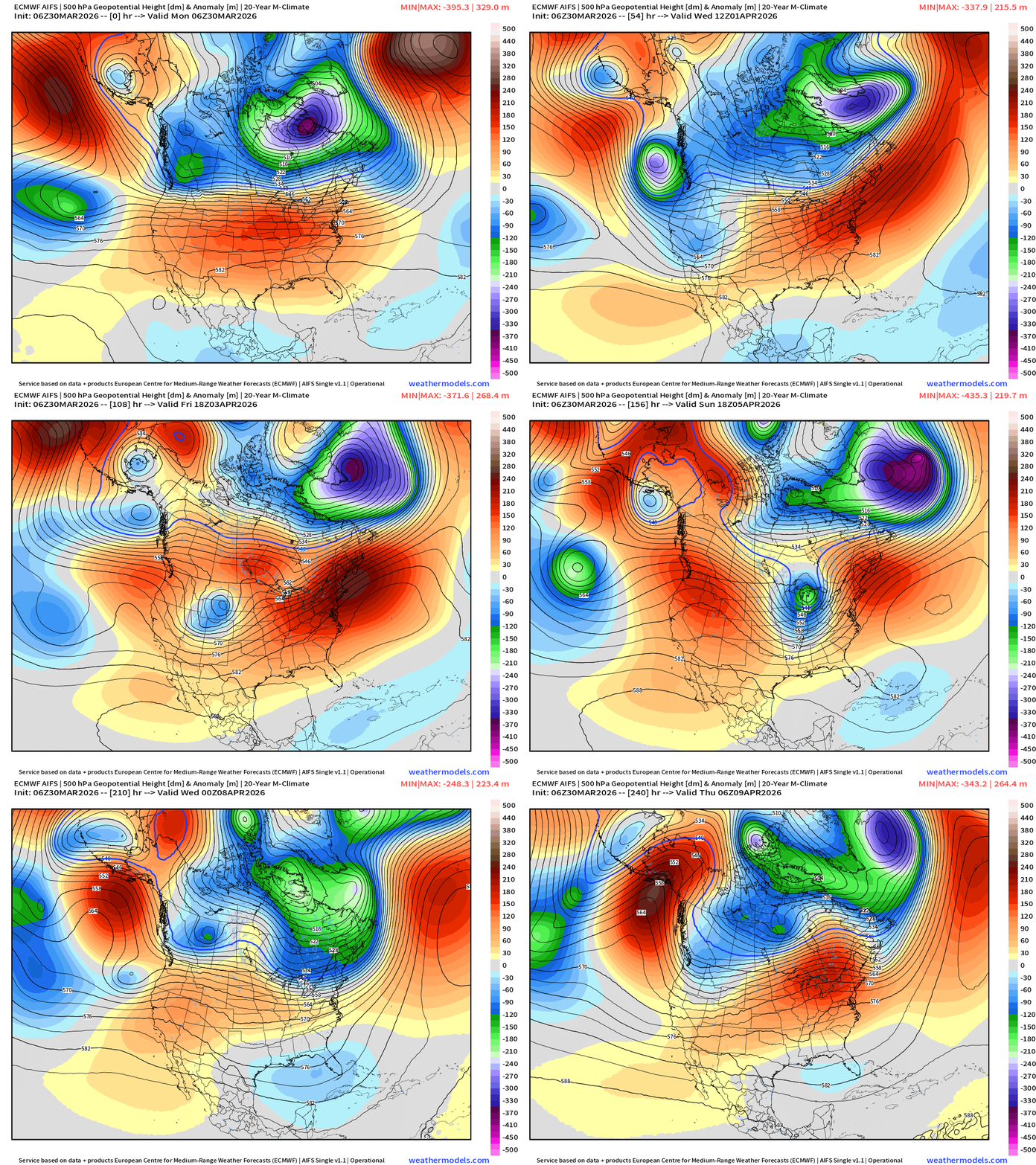
The “polar vortex” anomaly over Quebec shifts eastward — dislodged by the ridge over the Lower 48 to the south. It heads around Greenland and pushes into north Atlantic closer to Europe —> Brief pattern shift to see the Eastern U.S. more under control of a dome of high pressure — not exactly a “heat dome” ridge like we saw in the Southwest for more than week, but much warmer and wetter with southerly flow opening up the Gulf of Mexico.
Next several days: A trough dips out of the Gulf of Alaska, tracks across the northern Rockies into the Plains, and Great Lakes. This vorticity will power a surface cyclone and severe weather outbreak by Sunday across the central U.S.
Quick look at Europe’s Upper-Level Weather Pattern
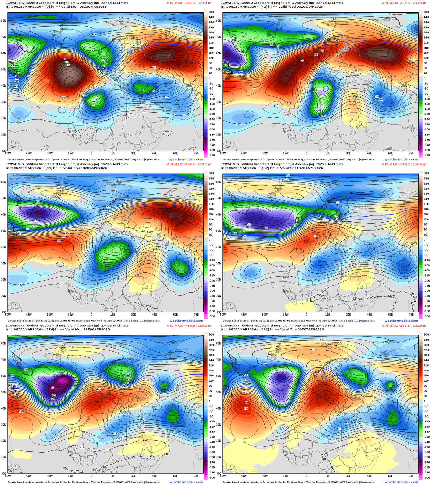
Very strong series of “cut-off lows” at mid-levels due to Rossby wave “trough thinning” dip into Libya and form a closed lower than 540 dm contour over the North Africa coast of the Mediterranean. This cold-core, polar vortex origin PV anomaly will “incubate” a surface low pressure (cyclone) of the relative warmer waters and drive a potential storm systems e.g. Medicane.
European Next 6-days | Precipitation Type and Intensity (ECMWF 06z)
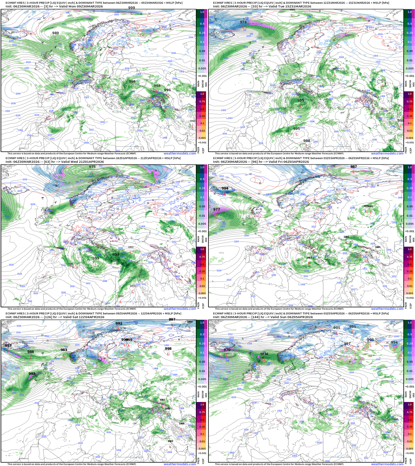
Unsettled weather across Italy and Greece — with one or two (?) surface cyclones in the 990s mb tracking out of Africa northward.
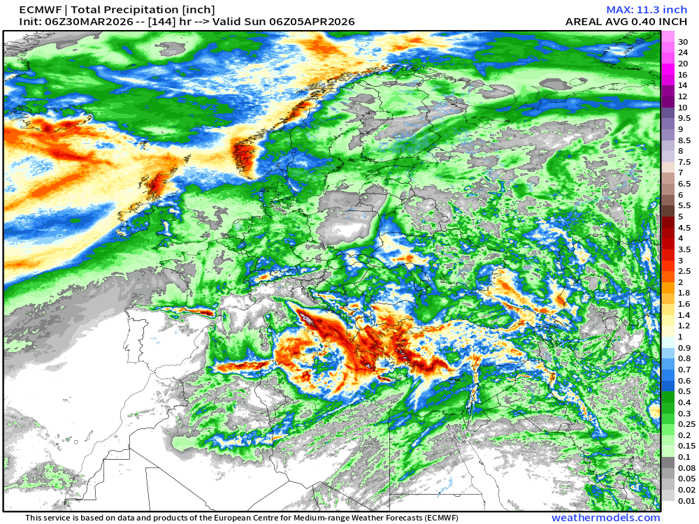
Total Precipitation Next 6-days across Europe
United States Temperature Anomaly Next 6-days
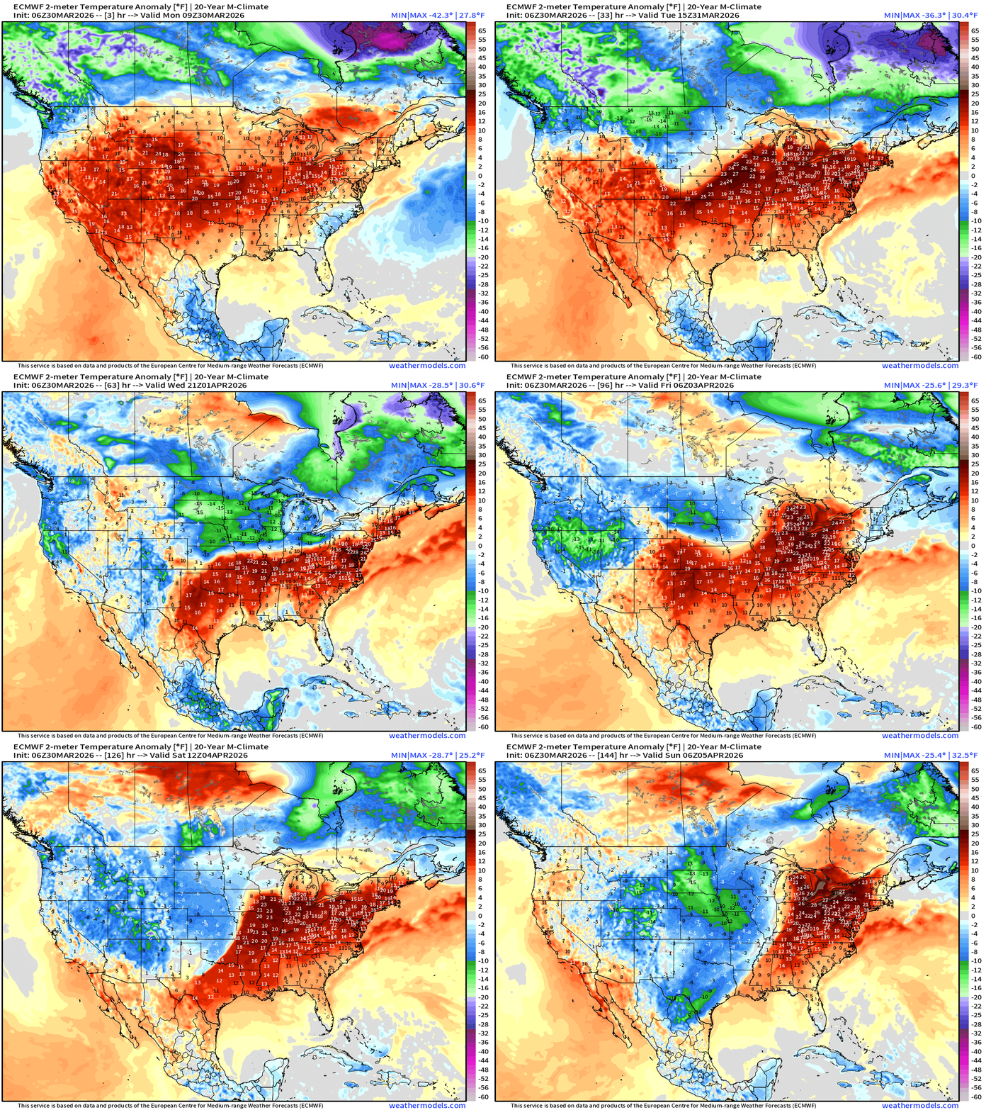
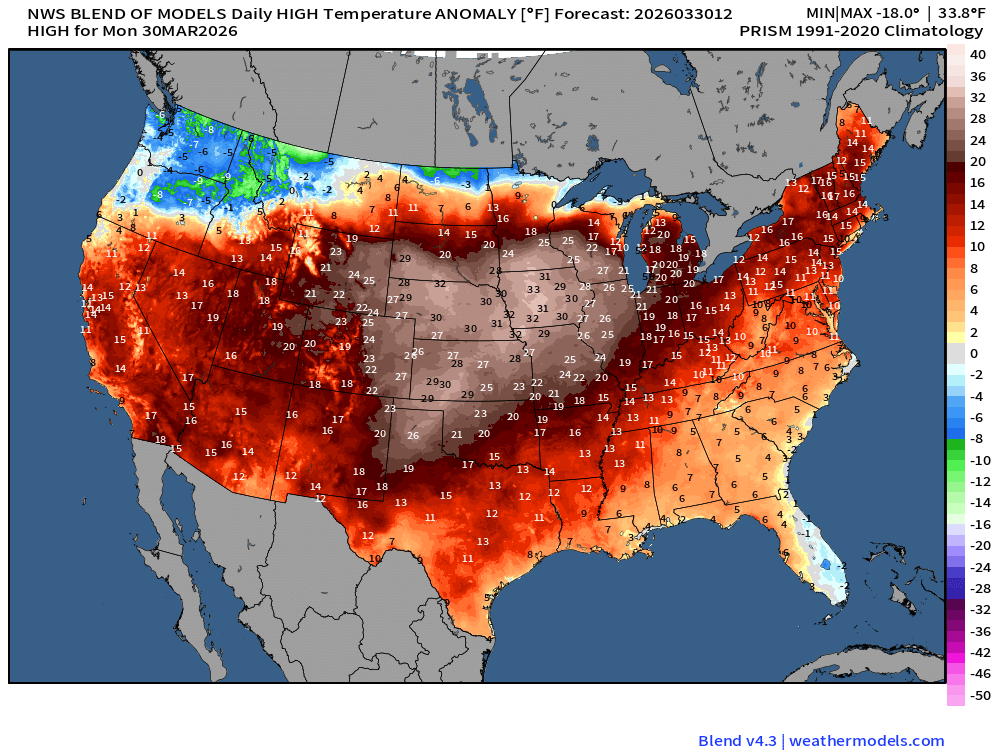
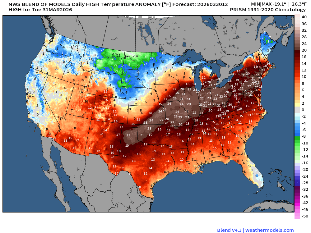
Much above normal temperatures > 20°F continue for next 6-8 days into the eastern U.S. including the big cities. Then, watching a strong cold front and storm system gathers across the Midwest and Great Lakes with snowfall on the backside and severe weather in the warm sector into the weekend.
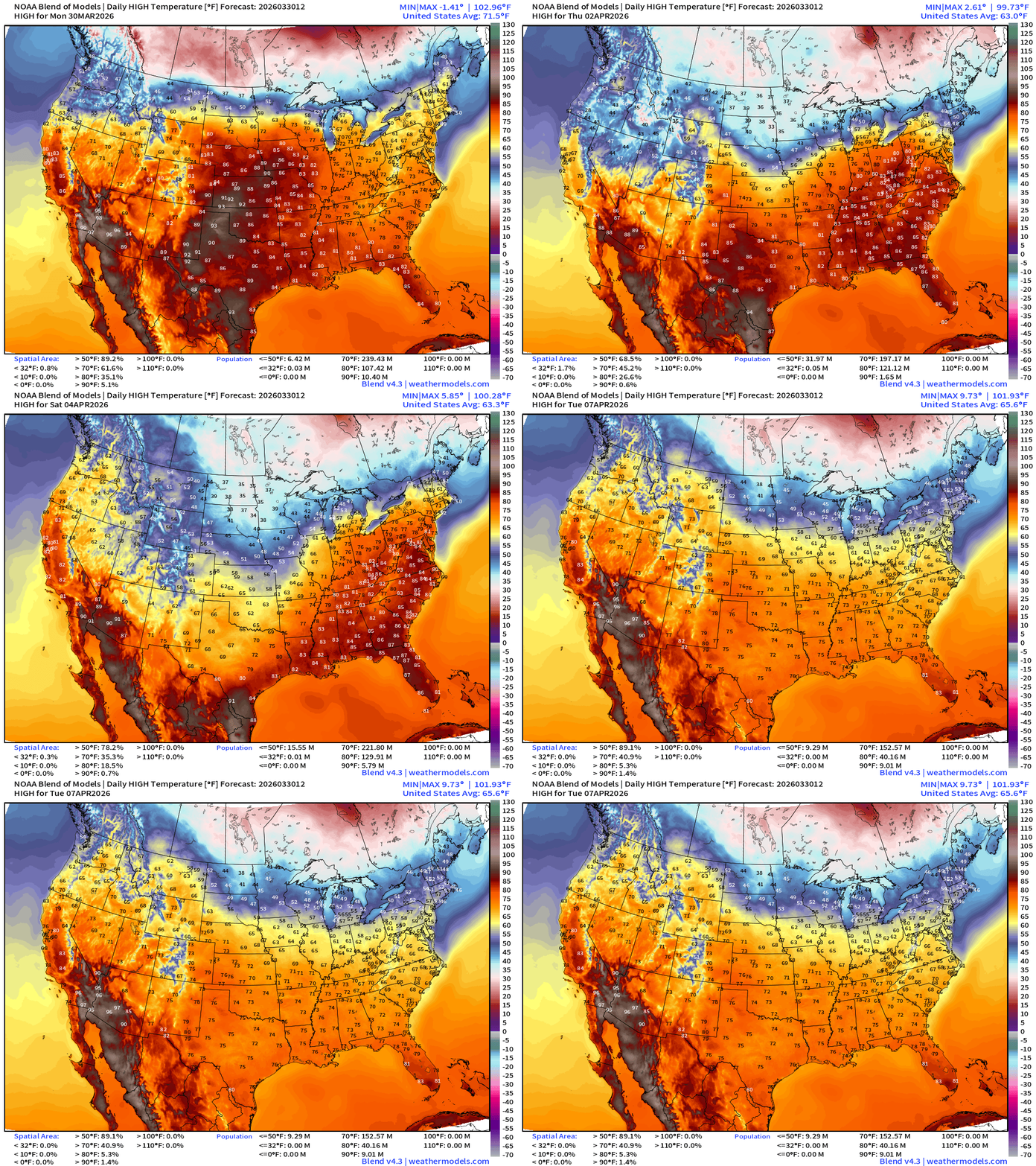
Blend of Models Temperatures | Highs through Tuesday. April 7
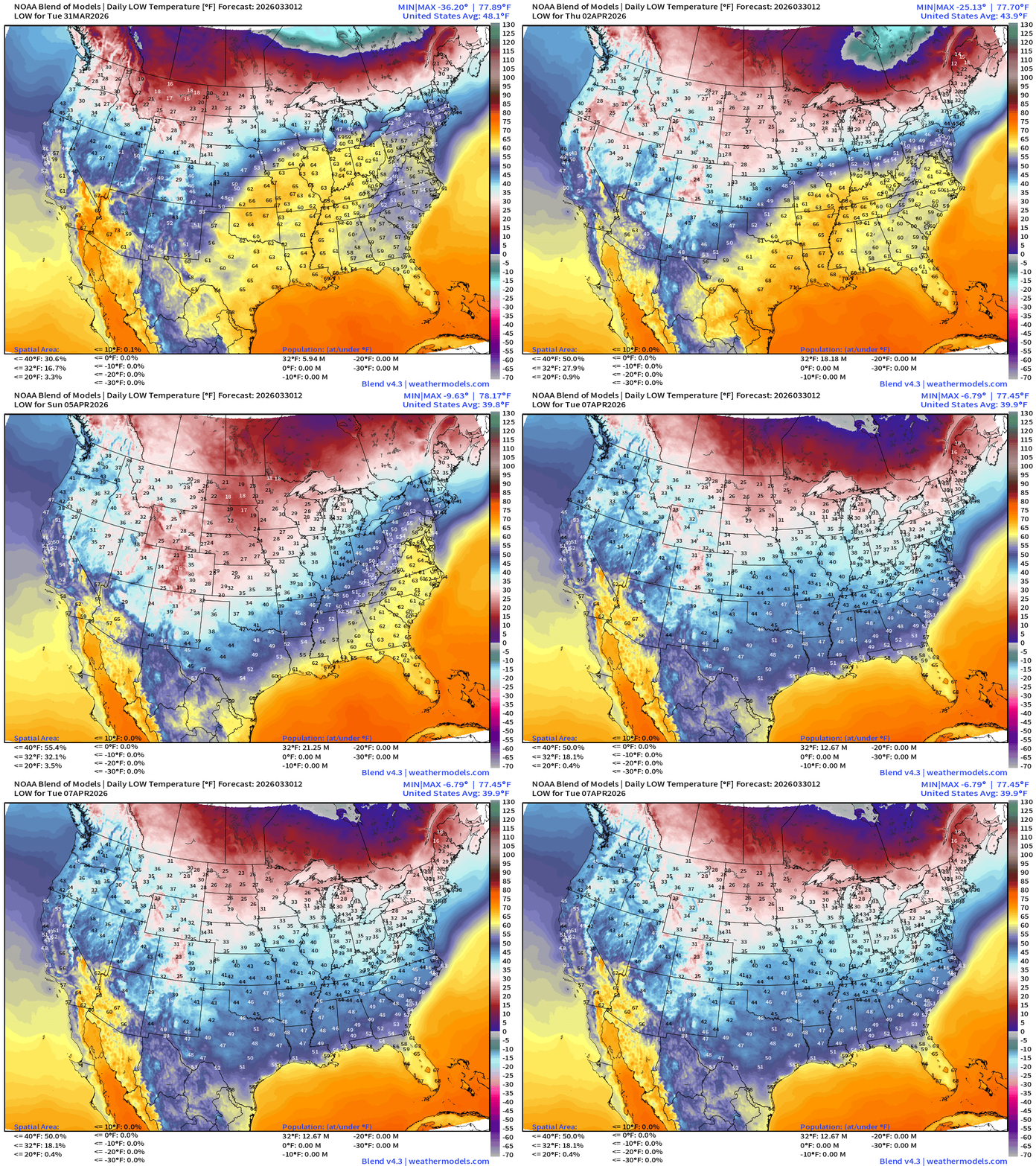
Blend of Models Temperatures | Lows through Tuesday, April 7
Blend of Models | Total Snowfall Next 10-Days
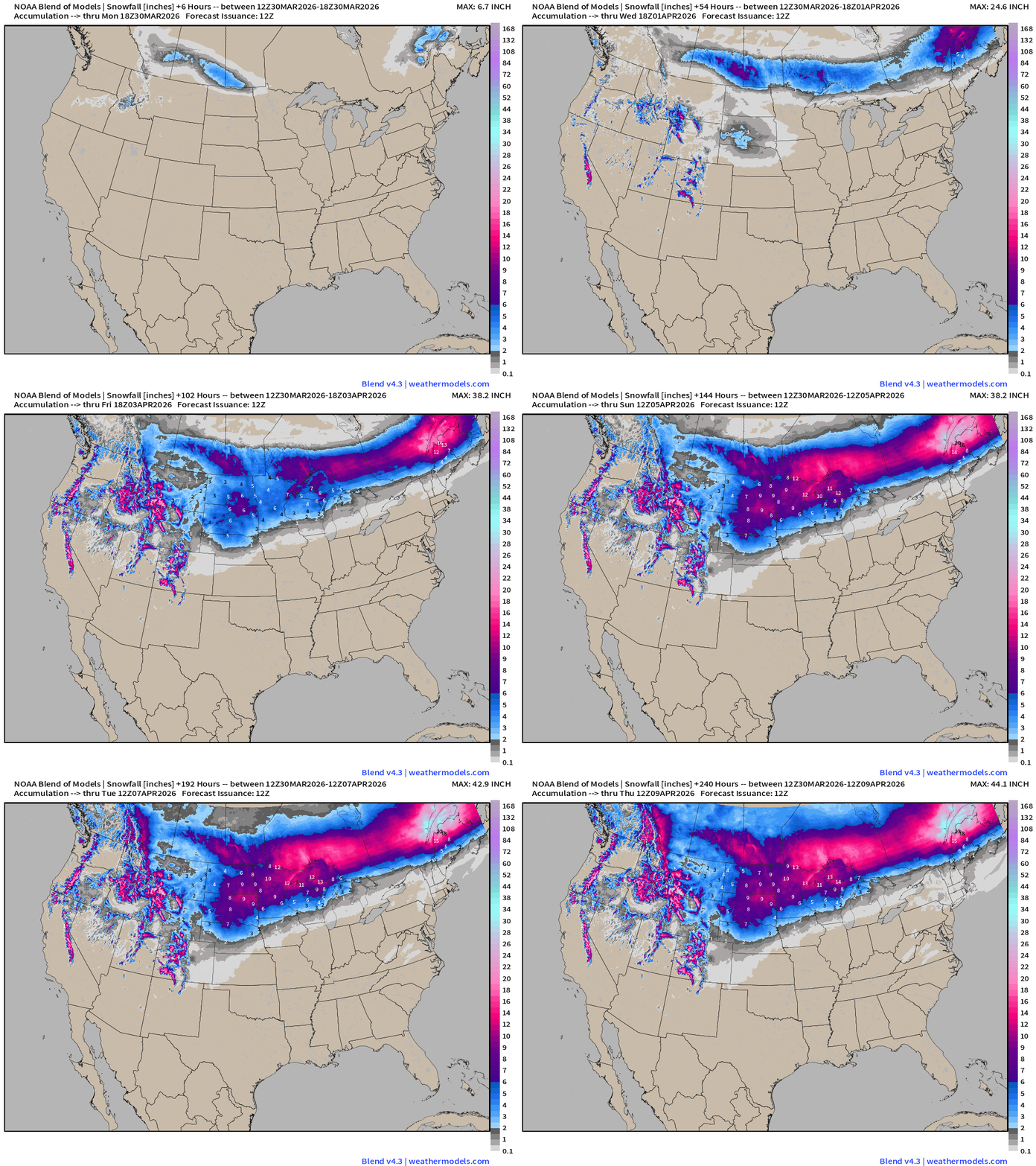
More winter — at least for another week across the Midwest.
Blend of Models | 10-Days Precipitation Total
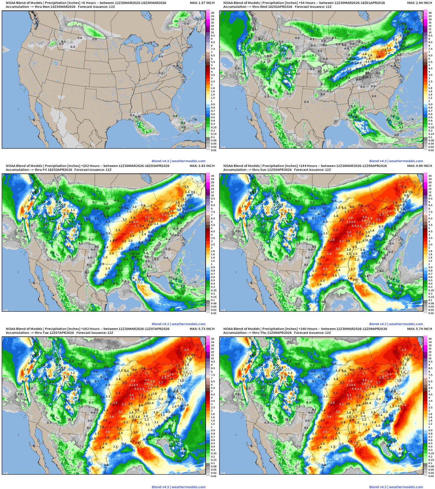
Boatloads of rainfall along and east of the Mississippi River. 10-day totals of 2 to 4-inches would be MOST welcome.
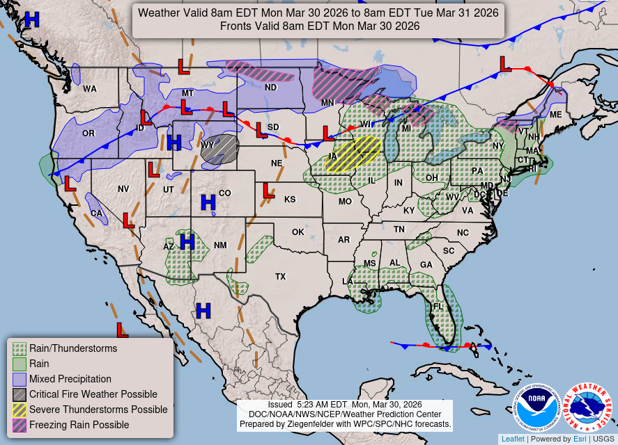
Weather/Fronts today into Tuesday morning: Slight chance of severe weather in eastern Iowa … maybe into Chicagoland.
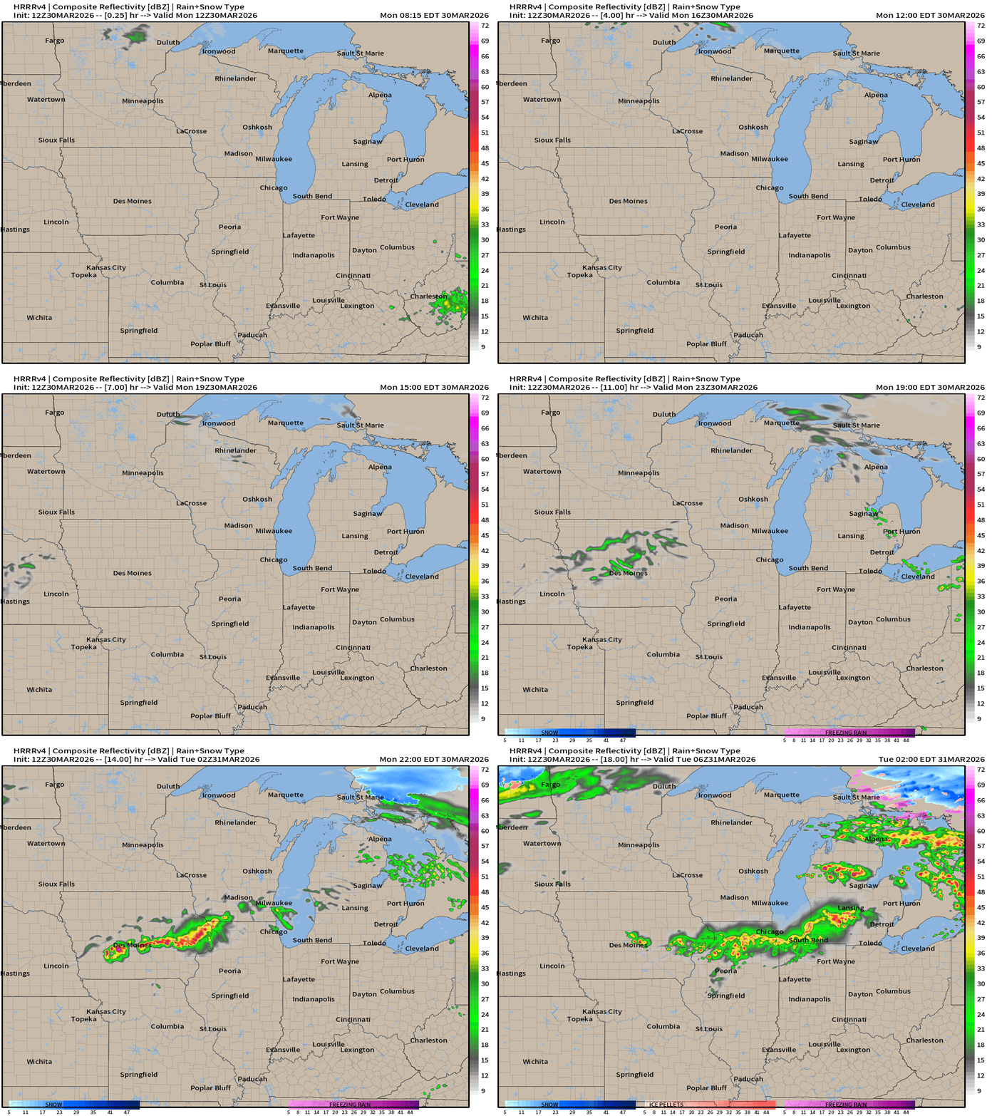
Storms will form in Iowa along warm front boundary and move due east into overnight hours. Additional storms fire in Michigan past midnight.
HRRR 12z — Radar Simulation Next 48-hours to Wednesday 8 AM ET
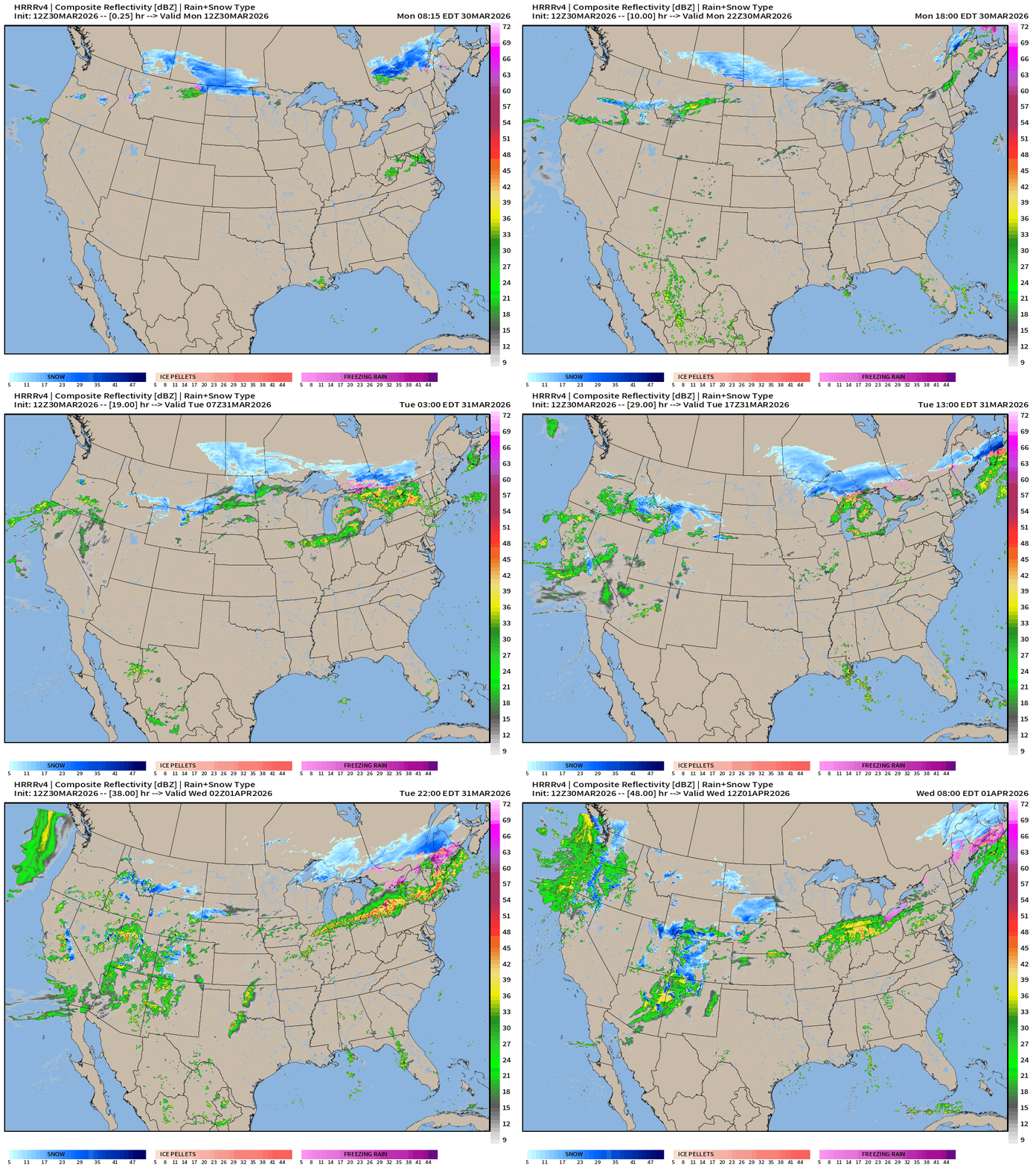
A lot of moisture into California and the Southwest — turns to snow in the Rockies. Very welcome pattern shift from the “heat dome” that decimate snow pack.
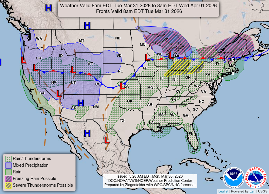
Weather on Tuesday … warm front boundary through Great Lakes and northern New England
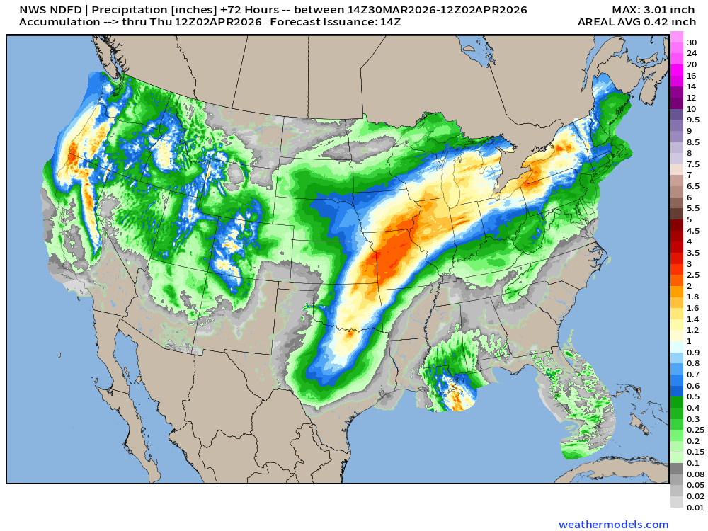
NDFD NWS Total Precipitation Next 72-hours through Thursday Morning
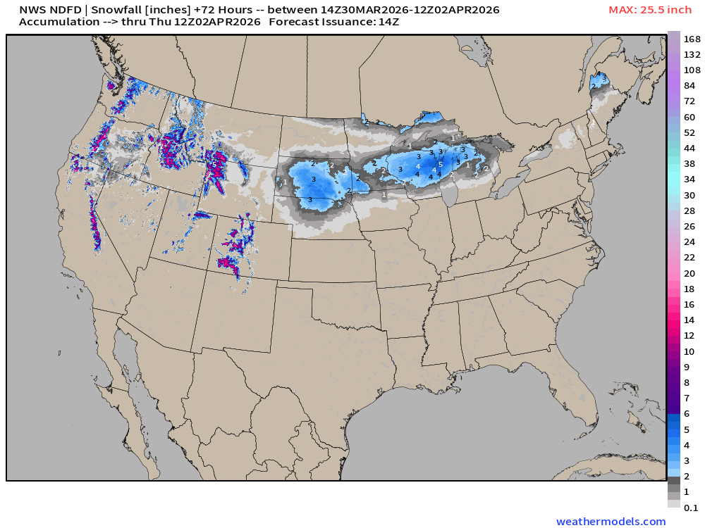
NWS Snowfall Next 72-hours — through Thursday Morning
RTMA Current Temperature Analysis | 9:45 AM ET
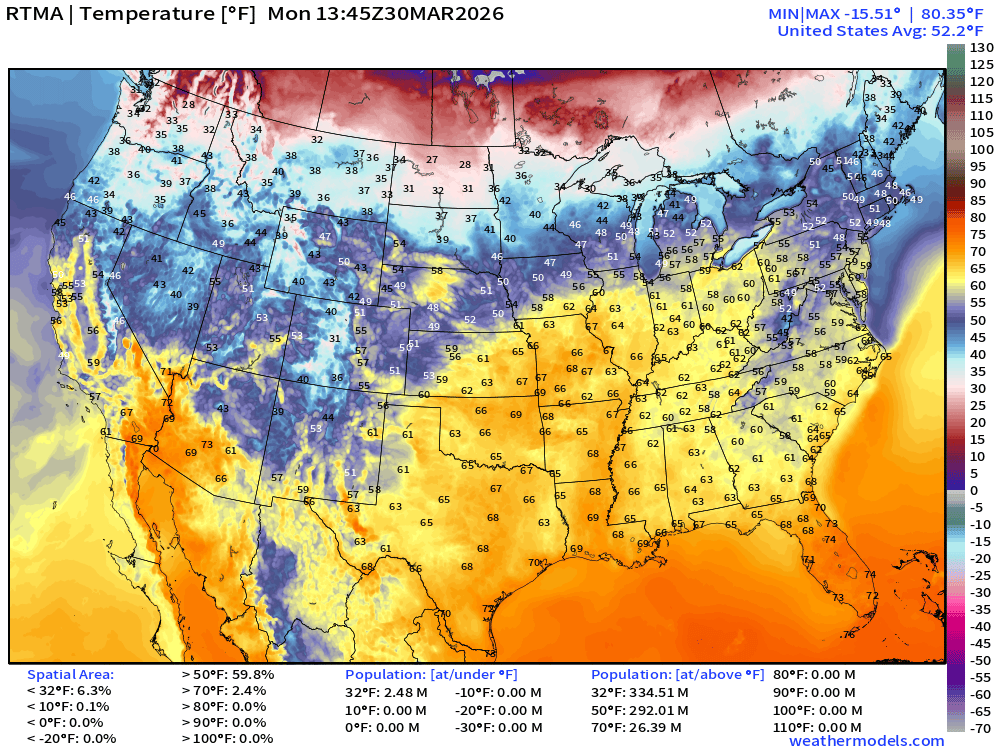
Lower 48 average was 52.2°F
RTMA Current Temperature Anomaly Analysis | 9:45 AM ET
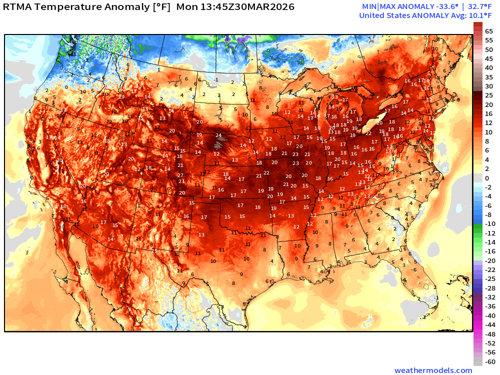
Lower 48 was 10.1°F ABOVE normal
High Temperatures Today | Monday
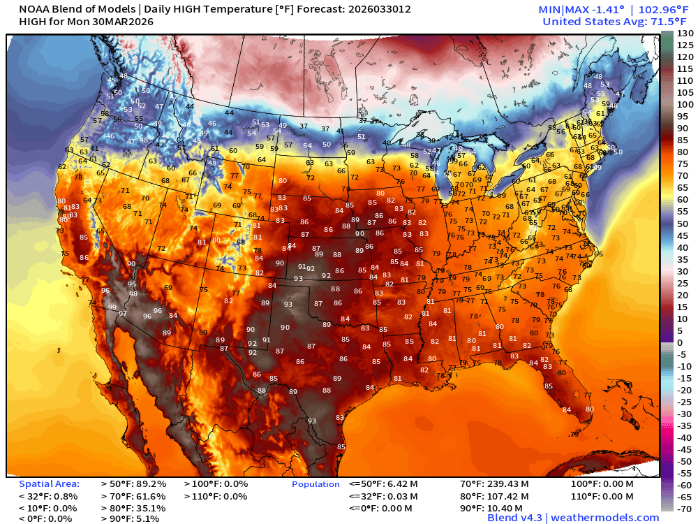
239 million at least 70°F — and 107 million at least 80°F = very warm / hot
Temperature Anomaly Today | Monday High
Low Temperatures Tuesday
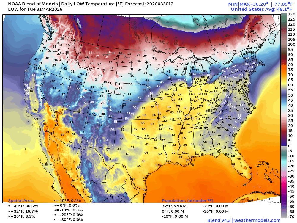
Only 6 million below freezing
High Temperatures on Tuesday
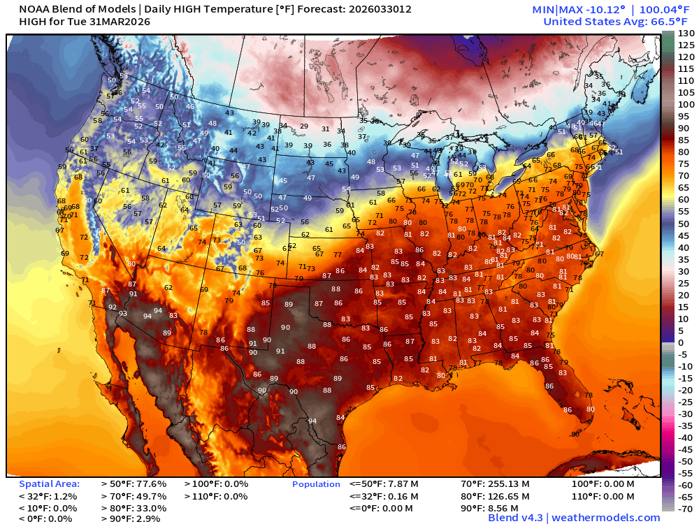
Even warmer for the eastern half of the U.S. except for the Mideast and Great Lakes south of the warm frontal boundary. 255 million at least 70°F and 127 million at least 80°F
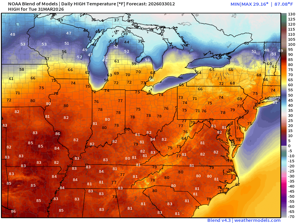
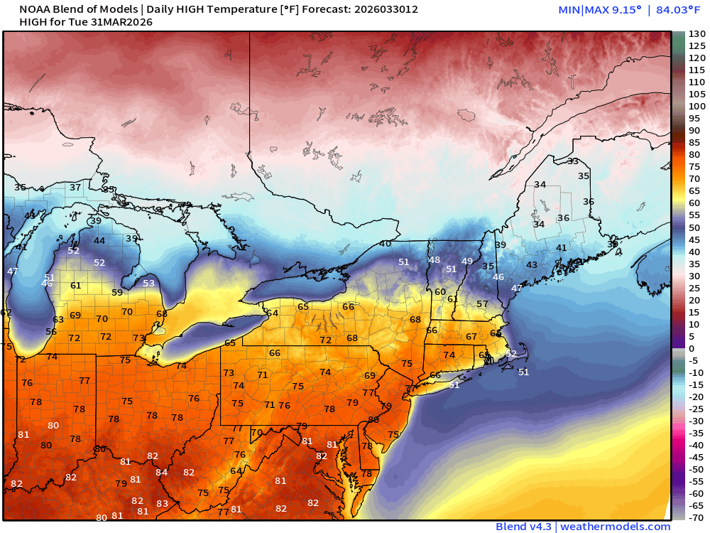
Temperature Anomaly | Tuesday Highs
ECMWF 06z Precipitation Type + Intensity | Next 6-days
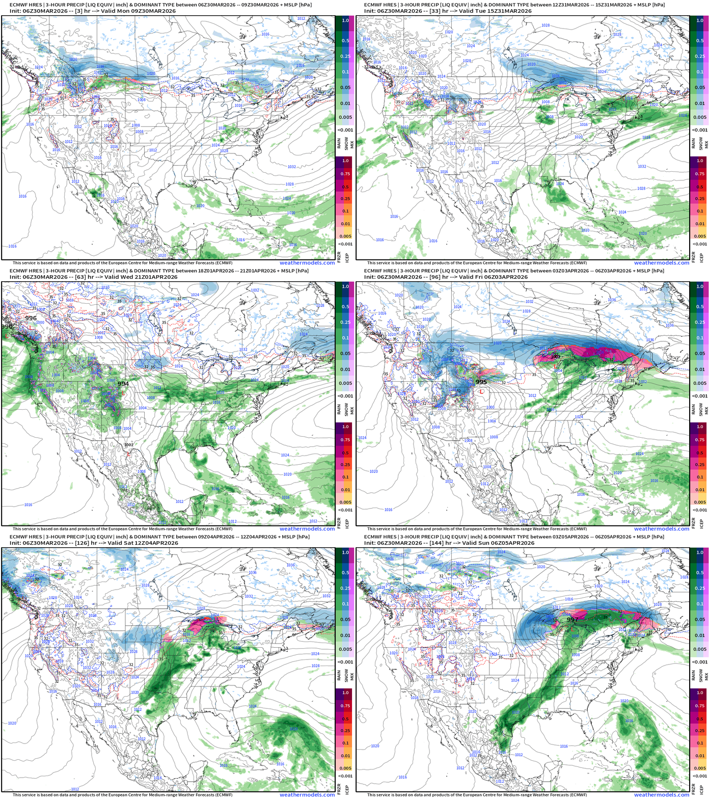
Two major storm systems more typical of Spring severe weather season — but still exceptionally cold air from the “Polar Vortex” in Canada available for potential blizzard conditions around the surface cyclones.
Thursday and Friday storm forms in plains and tracks into Great Lakes
More powerful low follows into the Great Lakes on Saturday and Sunday with severe weather along cold front and in the warm sector
Next 6-days of Precipitable Water (my favorite parameter)
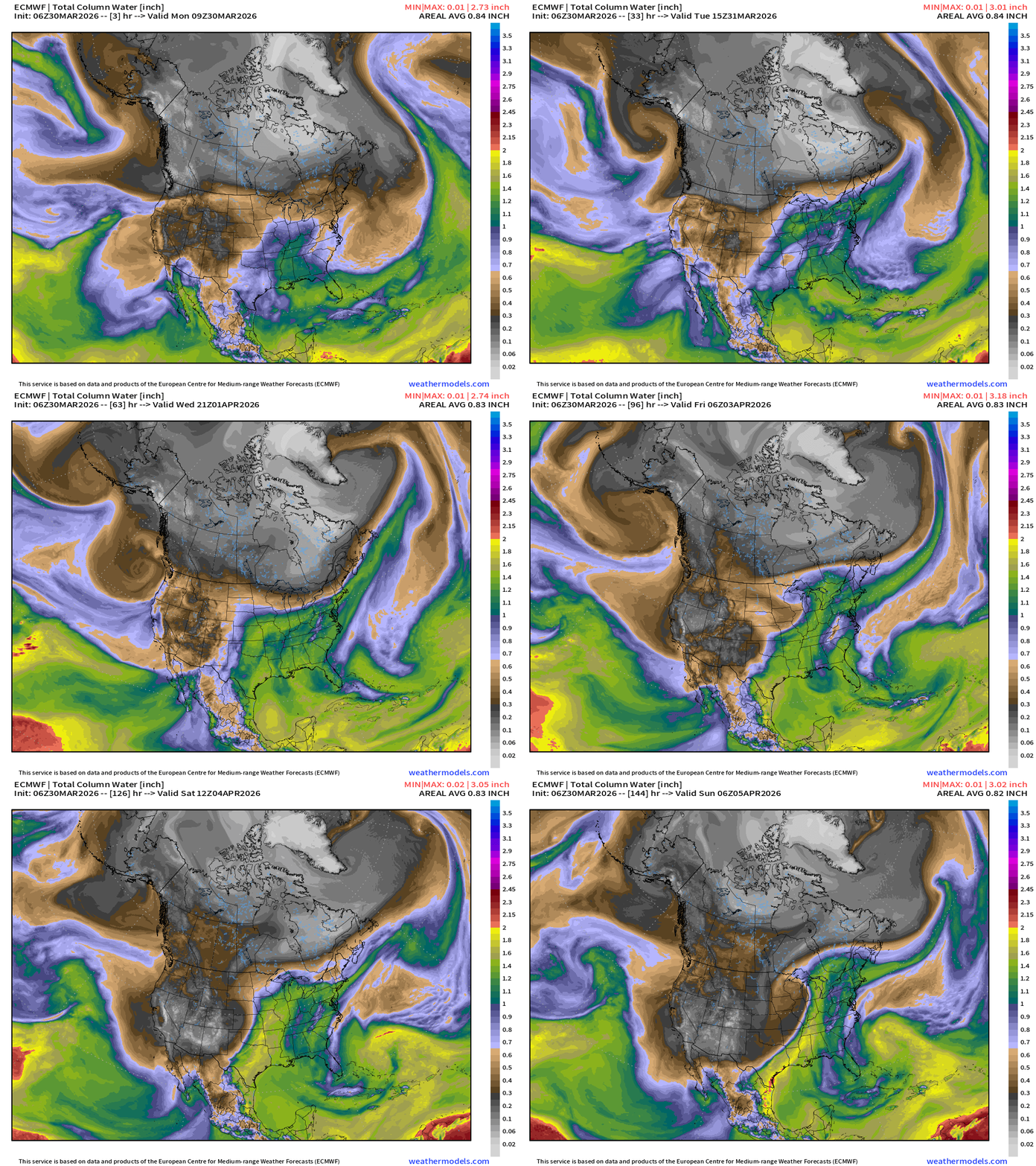
End of the loop shows the short-wave mid-level trough arriving into the Plains to power the surface cyclone and sharp cold front. Sunday 2 AM ET:
Moisture Transport | Next 12-days | ECMWF 00z
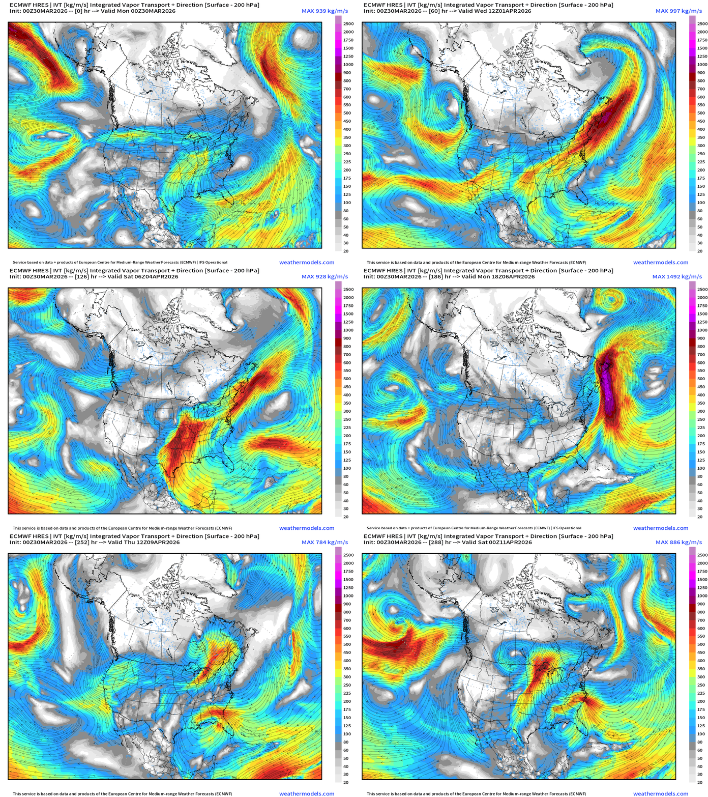
Multiple Gulf moisture surges —> potential for heavy rain and severe weather with at least 3 storm systems.
ECMWF AIFS 06z | Temperature at 500 mb | Next 10-days
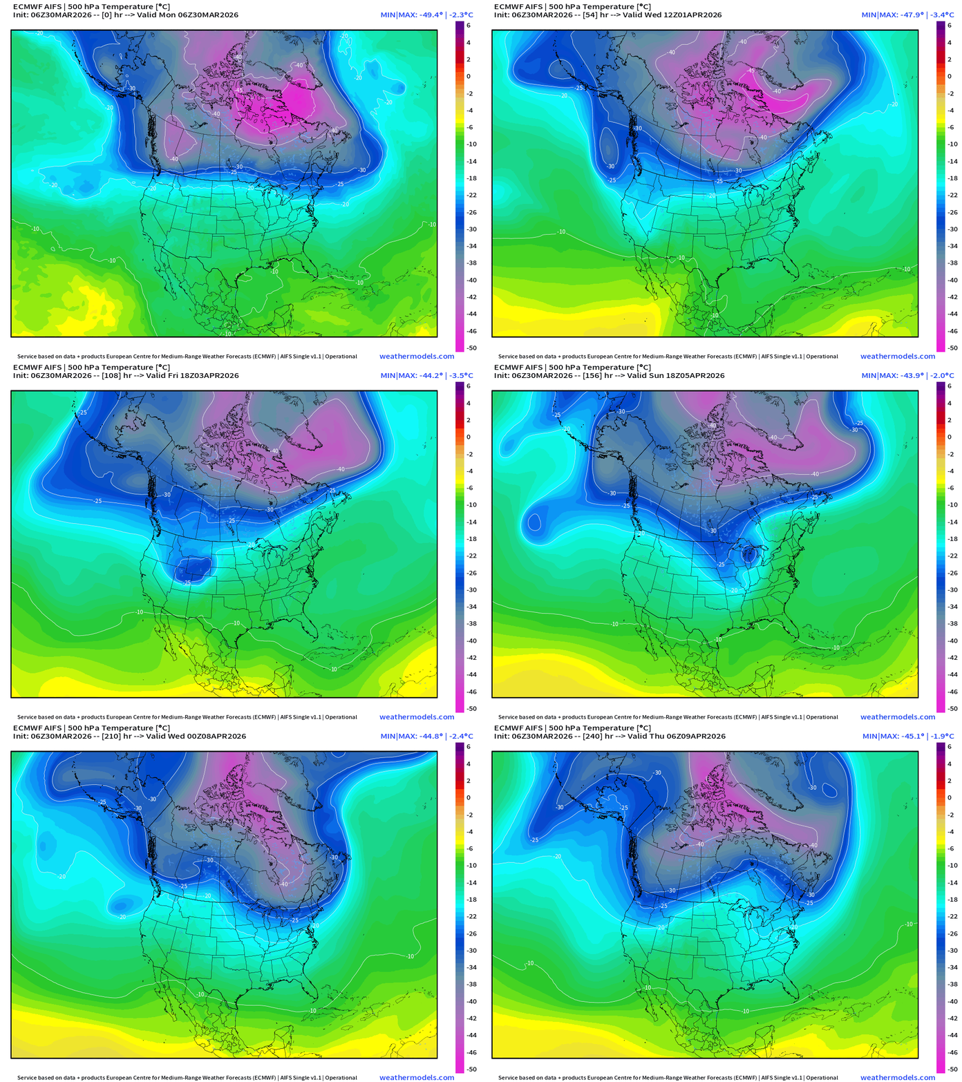
The -50°C super-cold pool pushes away from Canada, and we see a downtick in the overall cold pool strength over Canada at mid-levels into second week of April, transitioning into Spring (maybe?)
Snowfall | Median of ECMWF Ensembles [00z] | Next 15-days
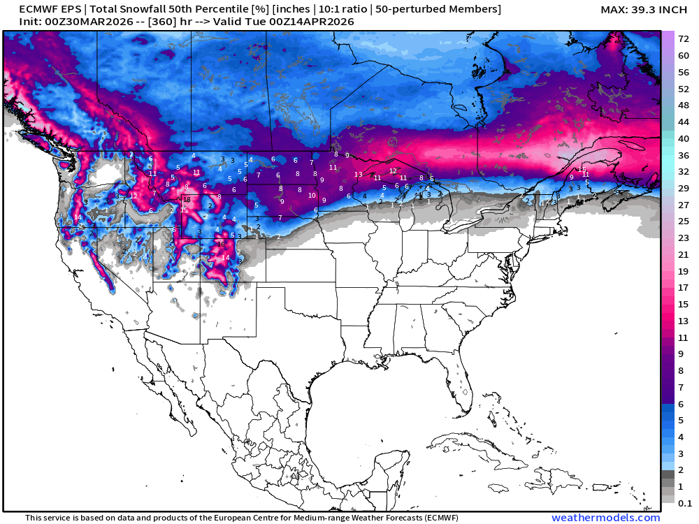
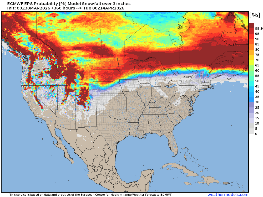
Probability of at least 3” of Snowfall Next 15-days
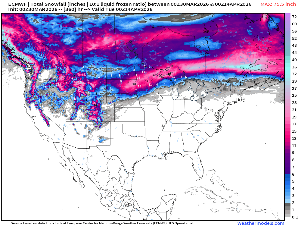
Snowfall from ECMWF HRES (15-days)
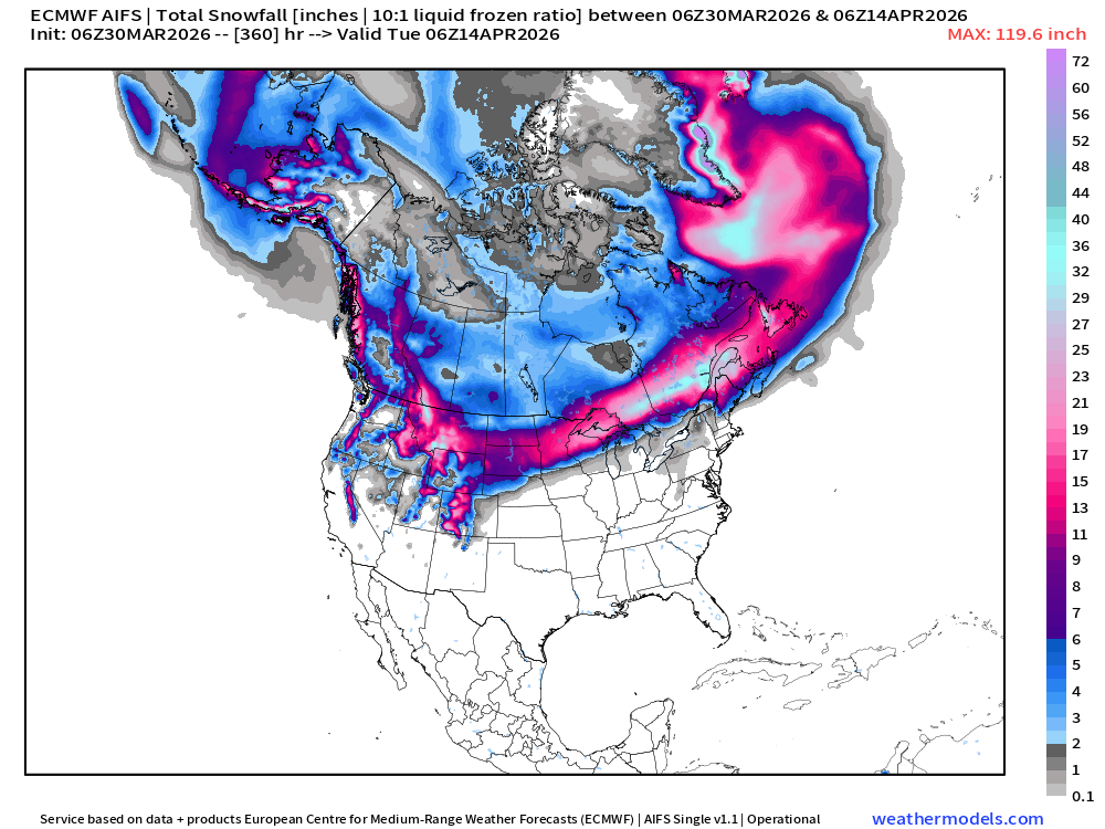
Snowfall from ECMWF AIFS-Single (06z) next 15-days
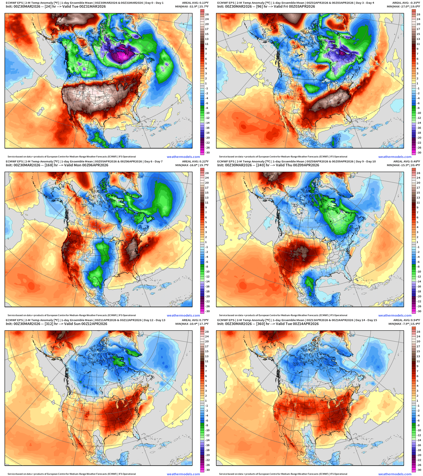
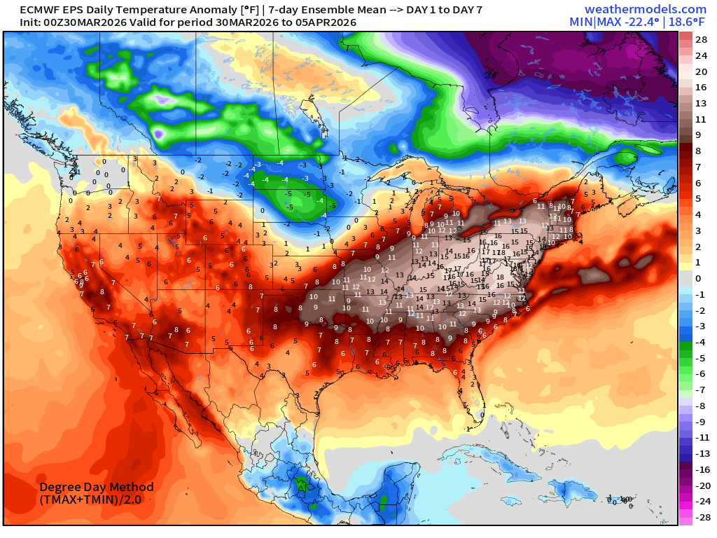
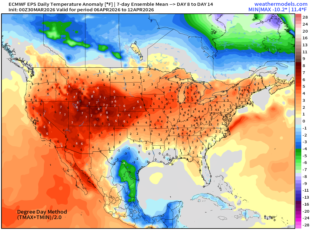
Temperature Anomaly | Next 15-days | ECMWF EPS 00z Ensemble Mean
Week #1 | Temperature Anomaly | March 30 - April 5
Week #2 | Temperature Anomaly | April 6 - April 12
Maps sourced from weathermodels.com designed and innovated by yours truly! Please subscribe there for real-time access to the newest maps, charts from all of the weather models including ECMWF and AIFS, and NOAA GFS/GEFS. NOAA WPC and SPC for fronts/convective outlooks.
- Milepost
- 907 · laid 2026-03-30T15:20:41.472000Z
- Source
- https://weather.substack.com/p/march-30-2026-monday-spring-weather
- Digest
- db543288c63dfdc4fffba8cb696a2fe9dad671e7b0bfcca4ae94bc4f71ca9b61
- Machine
- JSON