March 26, 2026 Thursday Weather Update
Canada will not give up on winter just yet as cold returns from Arctic into the Great Lakes
March 2026 was the warmest March in the 132-year national record (1895–2026), at 50.8°F against a 1991–2020 normal of 43.6°F (+7.3°F).
March 2026 was the 8th-driest March in the 132-year national record (1895–2026), at 1.8in against a 1991–2020 normal of 2.5in (-0.7in).
NOAA/NCEI Climate at a Glance, contiguous United States. This is the observed record for the month, not a score of anything said in this piece — the forecast ledger begins 2026-08-17 and cannot reach earlier posts.

ECMWF AIFS 18z next 10-days of 500 mb Height Anomaly
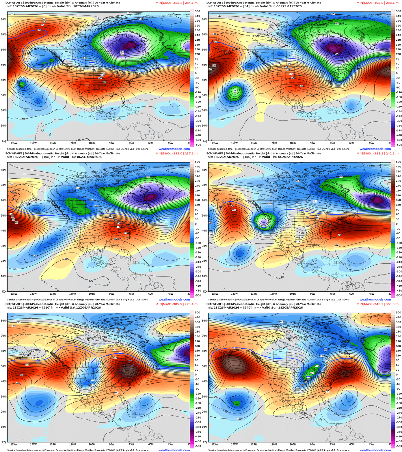
The Canadian Arctic polar vortex has shifted eastward over Quebec and will wobble off into the Atlantic around Greenland. Hopefully that’s the end of the road for winter in North America!
The heat dome “ridge” also shifts east and builds strongly into next week. A trough and much cooler weather arrives into the Western U.S. by mid-week = major pattern shift to dislodge the “blocks” and get the pattern progressing again into April.
Iraq and Middle East cut-off low pressure system
Very impressive surface cyclone similar to a tropical storm in appearance over Iraq at 993 mb with gusty winds and heavy rainfall.
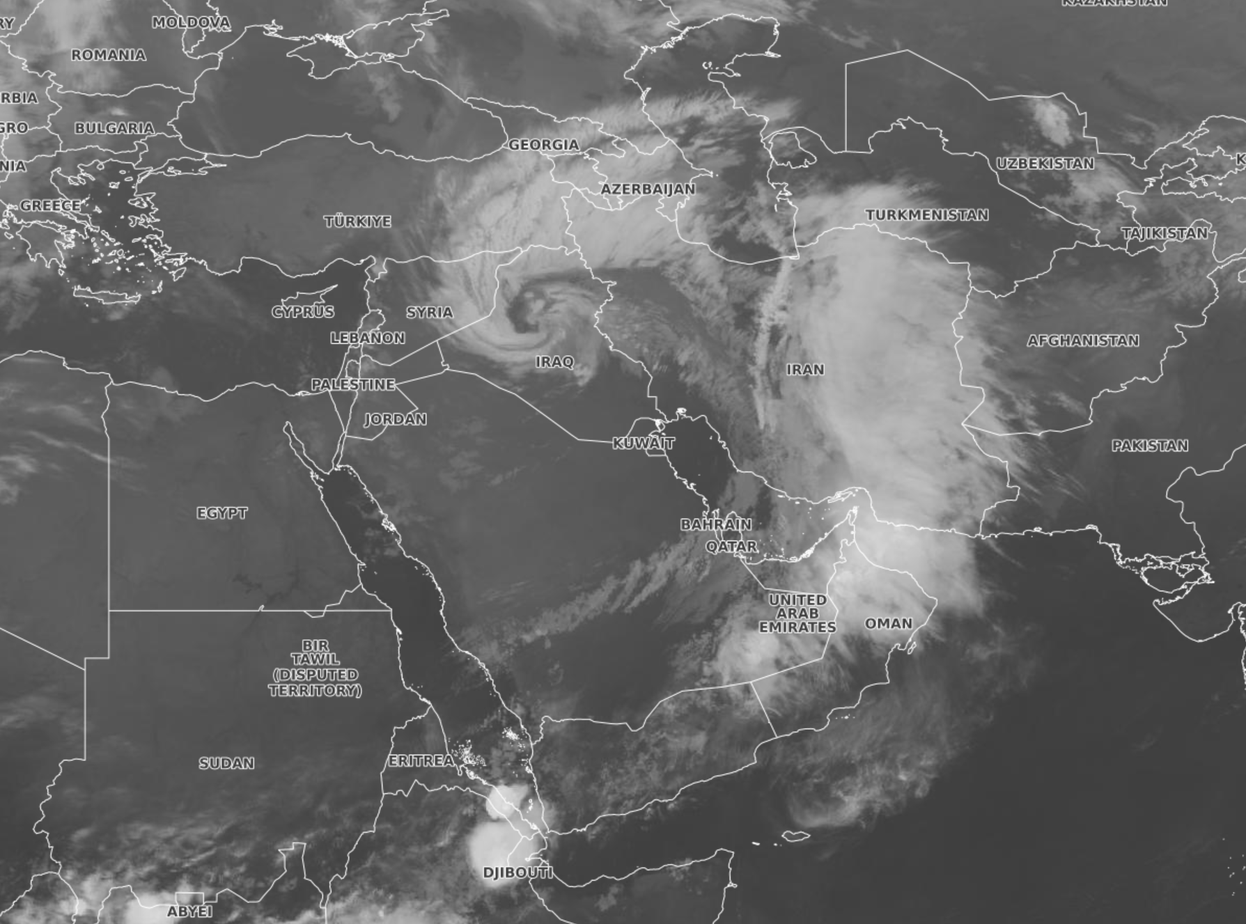
Analysis maps of the middle-east (MSLP, wind gusts, precipitable water)
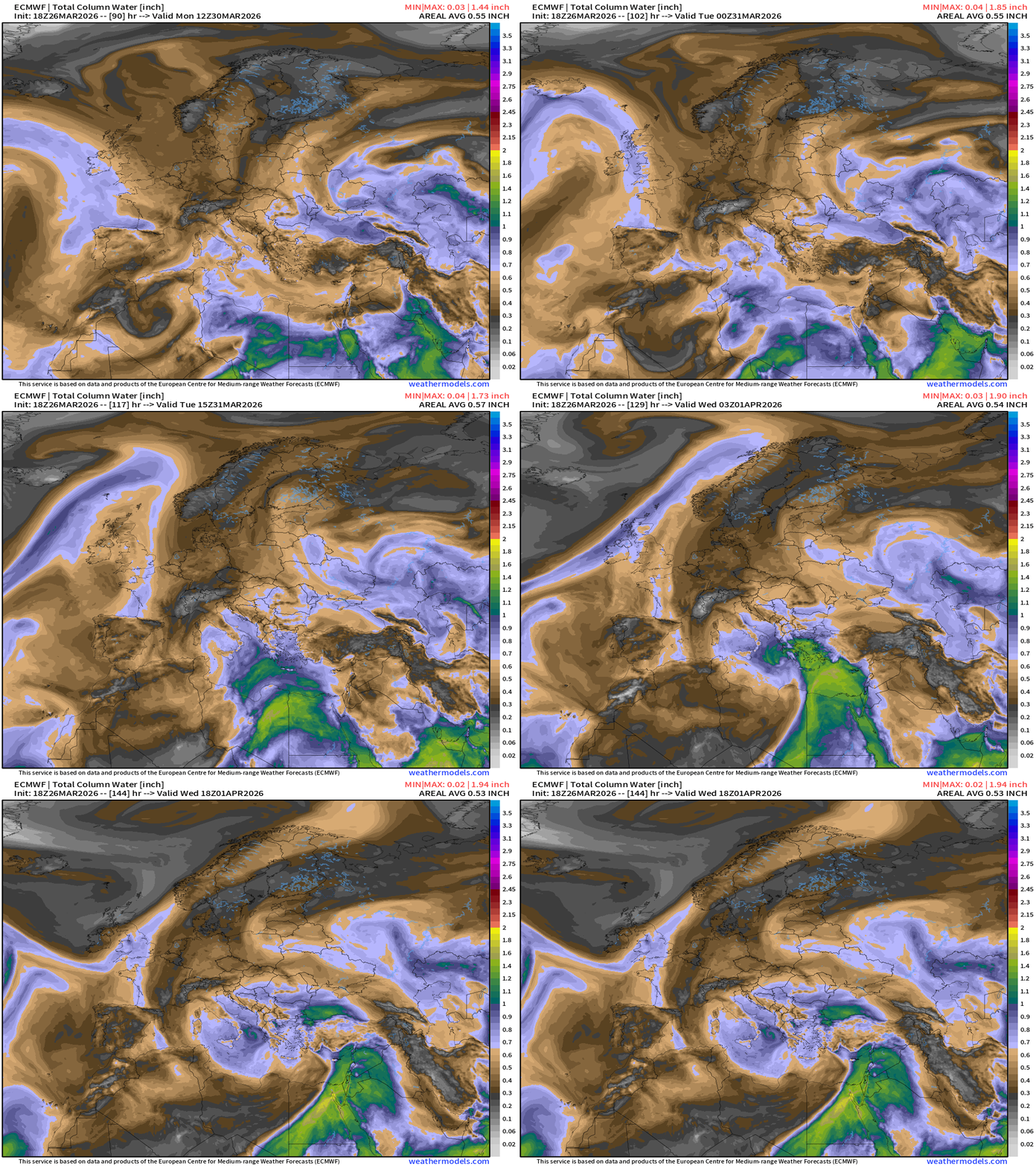
Note the tropical moisture “atmospheric river” plume (1.5” to 2”+) extending from Sudan across Arabian Peninsula into Iran
Upper-Level Weather Pattern Across Europe into the Middle East
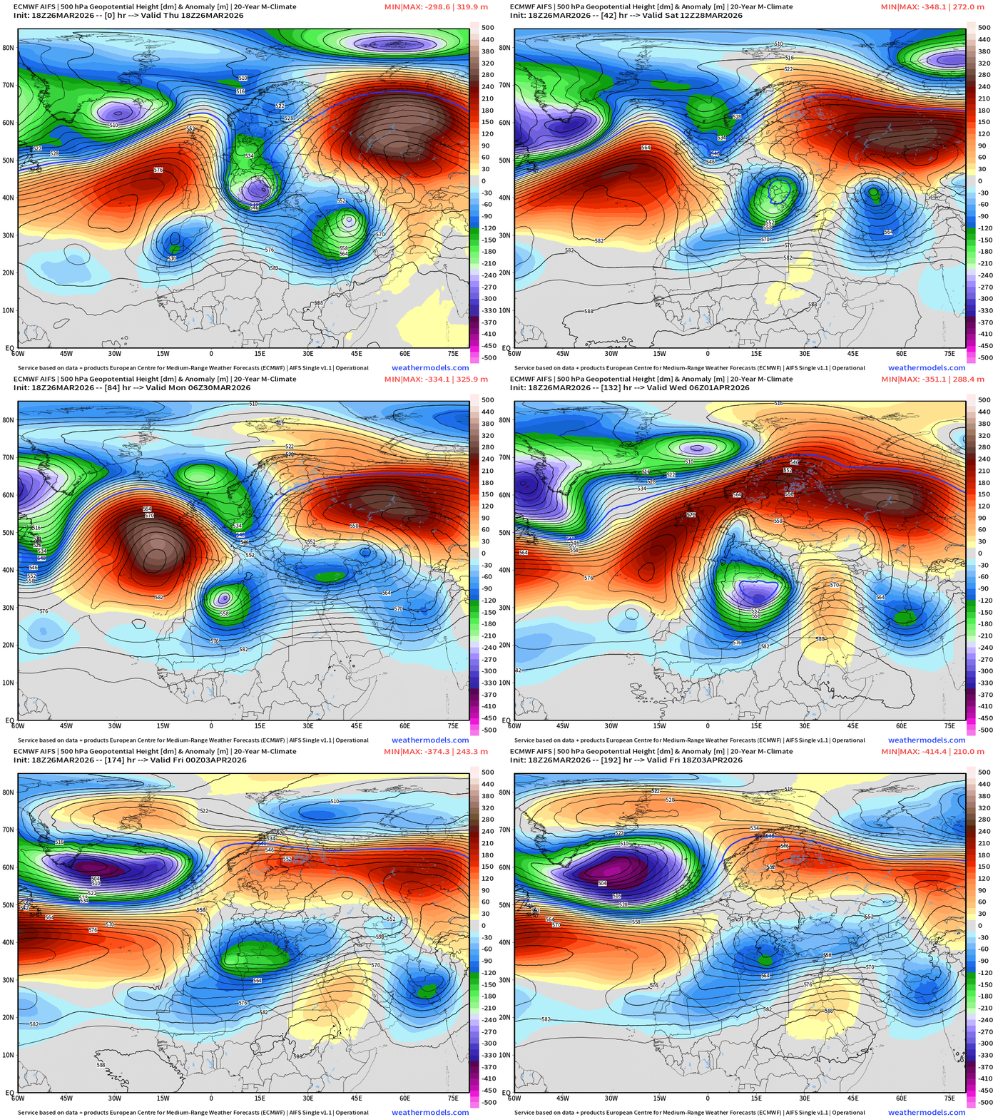
Two strong blocking highs are stuck in place … with “trough thinning” or Rossby “wave breaking” in between bringing higher PV air southward to combine with the moisture = instability and showers/storms. These “bowling balls” travel along the 30°N latitude and trigger all sorts of extreme weather conditions around the globe.
Cut-offs (n=2) dip into North Africa and form a powerful “Medicane”
Precipitation Type and Intensity next 6-days | ECMWF 18z
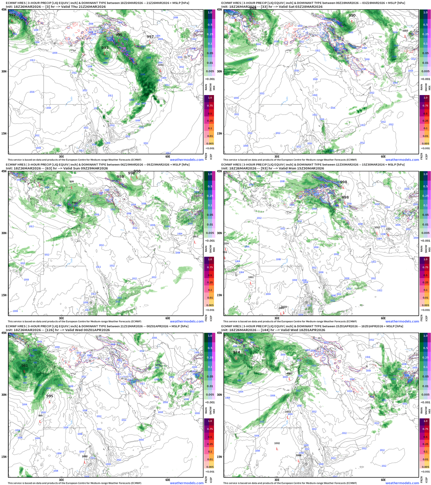
Another weaker storm system arrives into Turkey by the weekend but Iraq, Iran and Saudi Arabia dry out. Rain + Snow next 6-days:
European Weather Next 6-days | Precipitation Type and Intensity (ECMWF 18z)
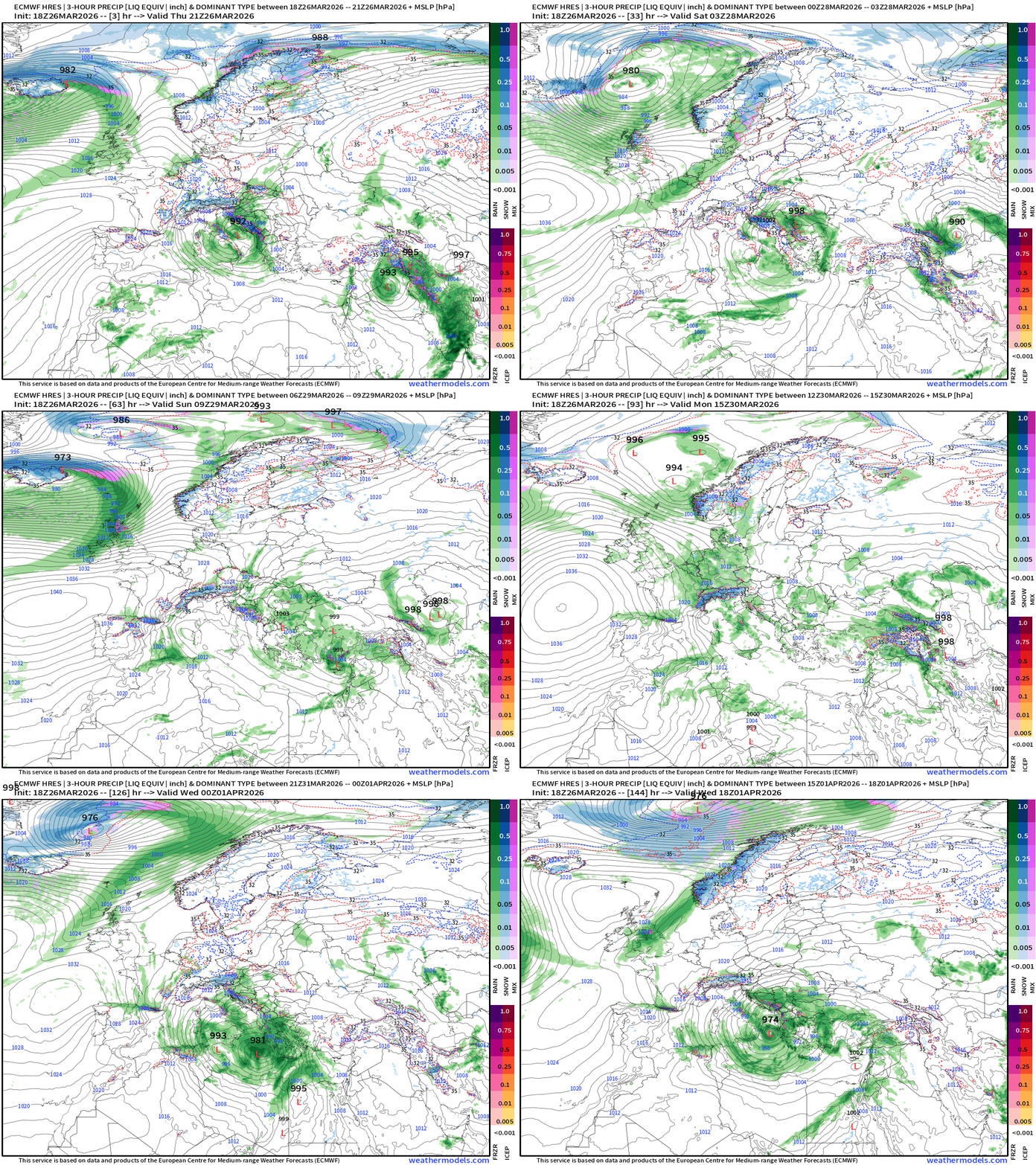
ECMWF 18z has a very powerful hurricane like system in the 5-6 day range forming from a surface cyclone over Libya. Bizarre — would become a powerful “Medicane”
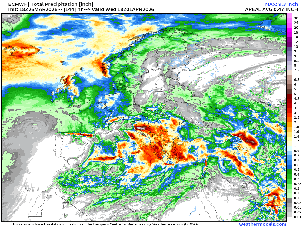
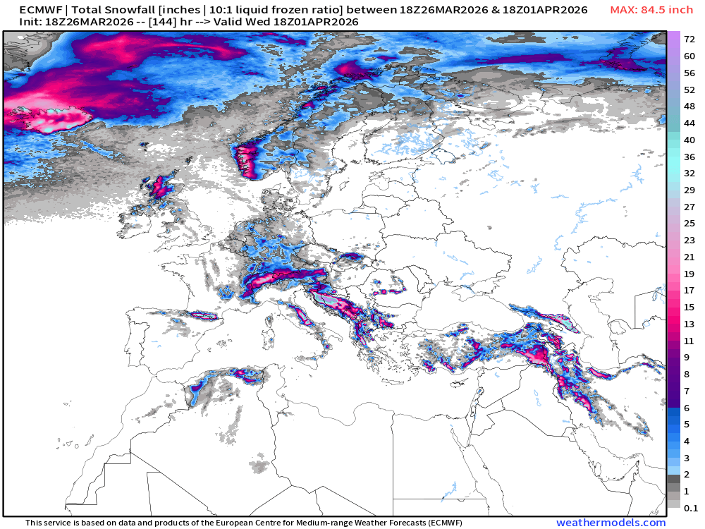
Total Snowfall & Precipitation Next 6-days across Europe
United States Temperature Anomaly Next 6-days
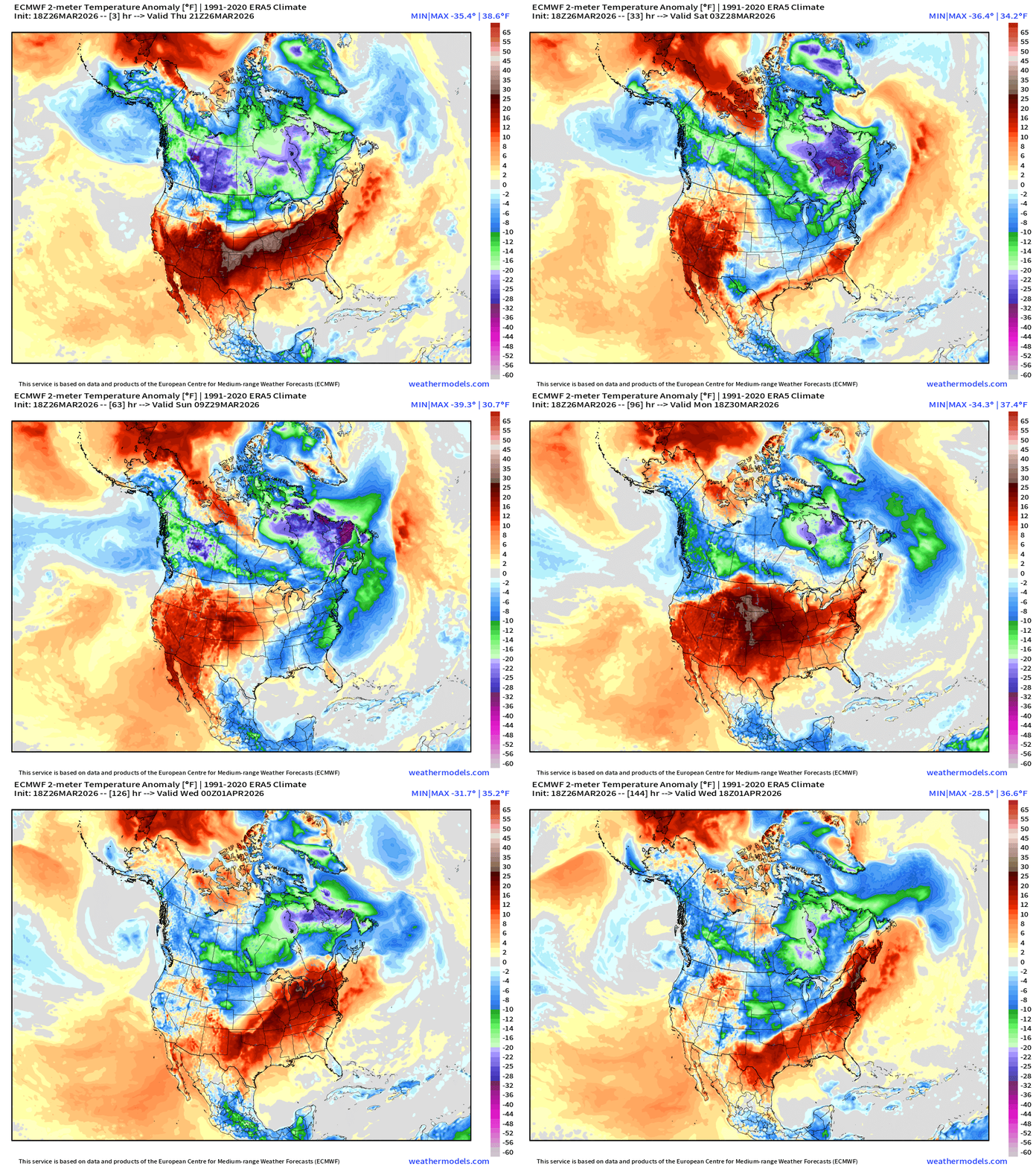
Impressive early Spring cold front delivers a “blast” of cold air to the Great Lakes and Northeast … hopefully the end of the road for “winter”
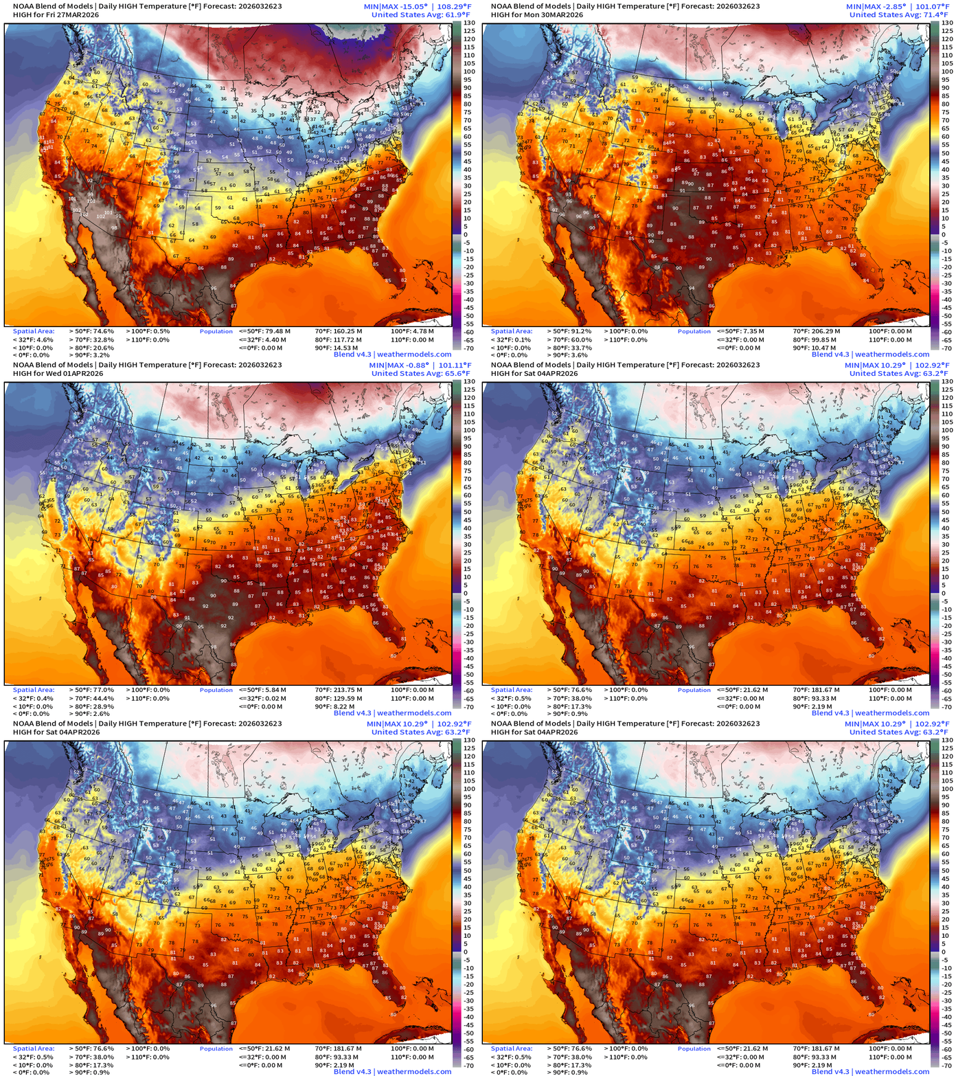
Blend of Models Temperatures | Highs through Saturday, April 4
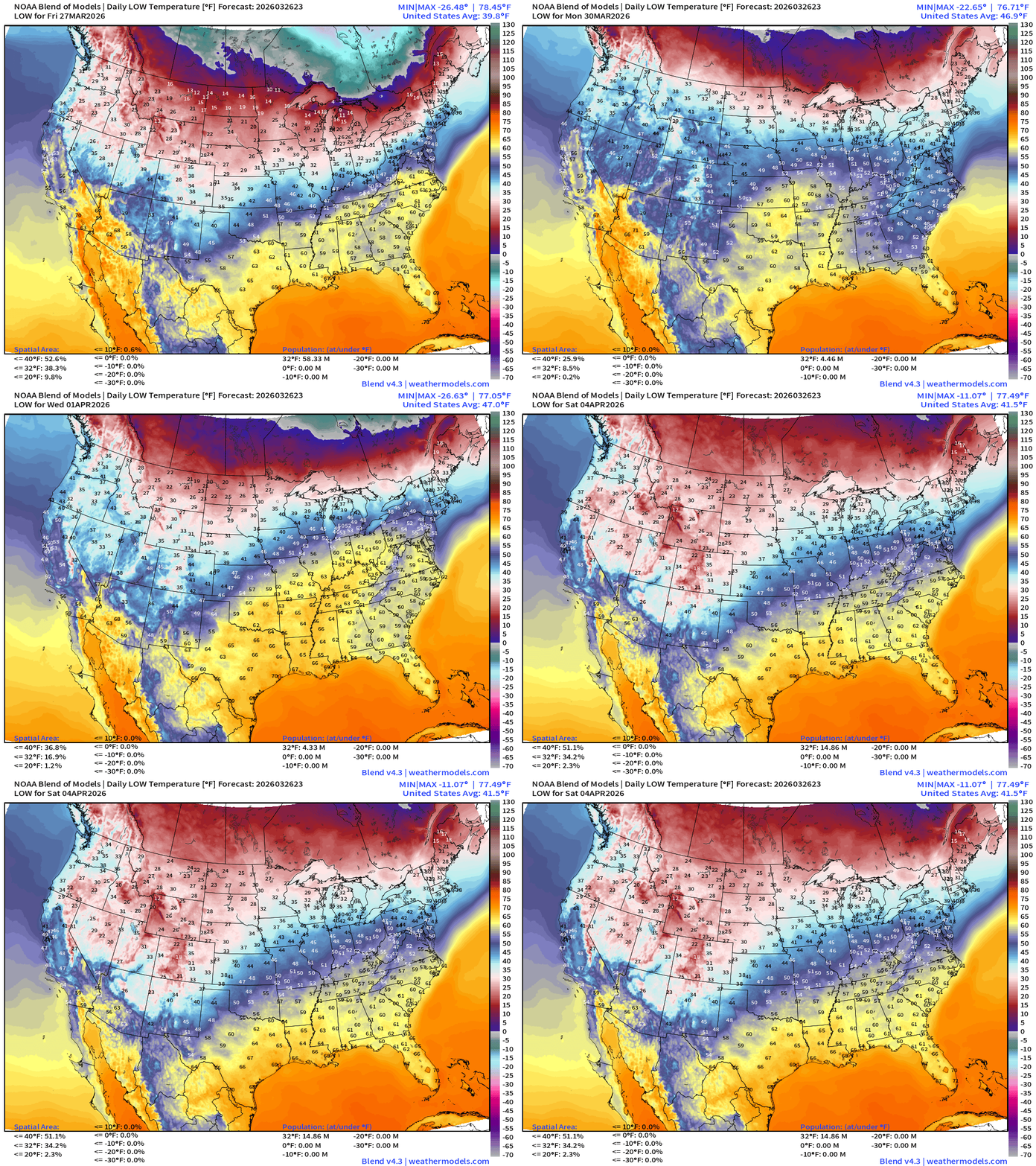
Blend of Models Temperatures | Lows through Saturday, April 4
Blend of Models | Total Snowfall Next 10-Days
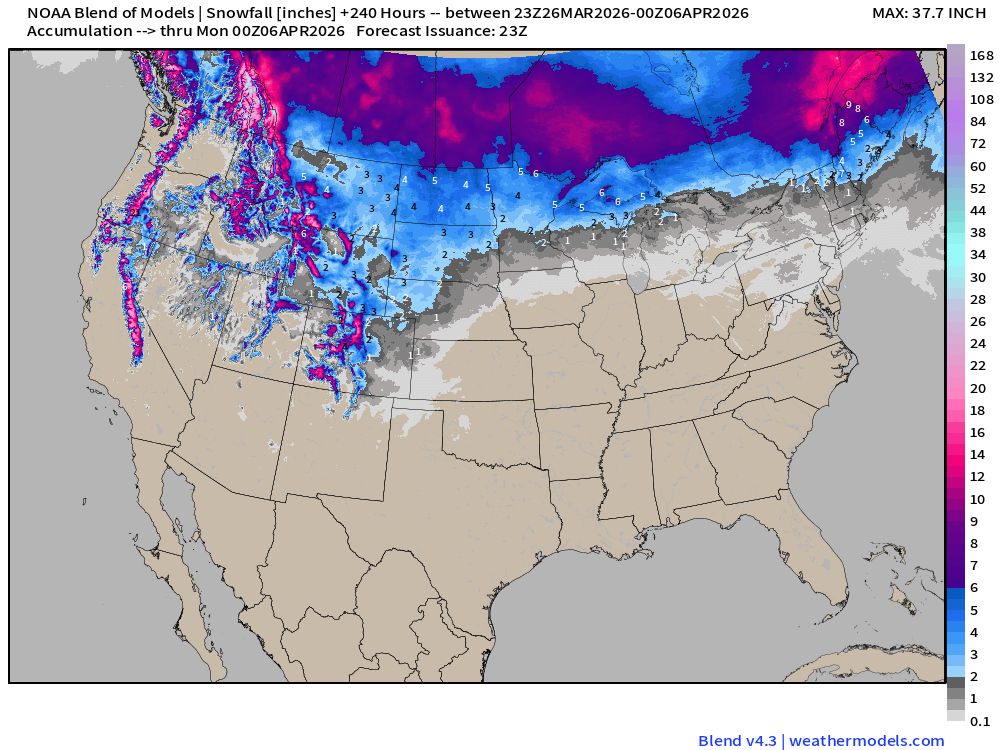
More Western U.S. snowfall in the Blend of Models ensembles. Good news as more typical cooler air dips out of Alaska.
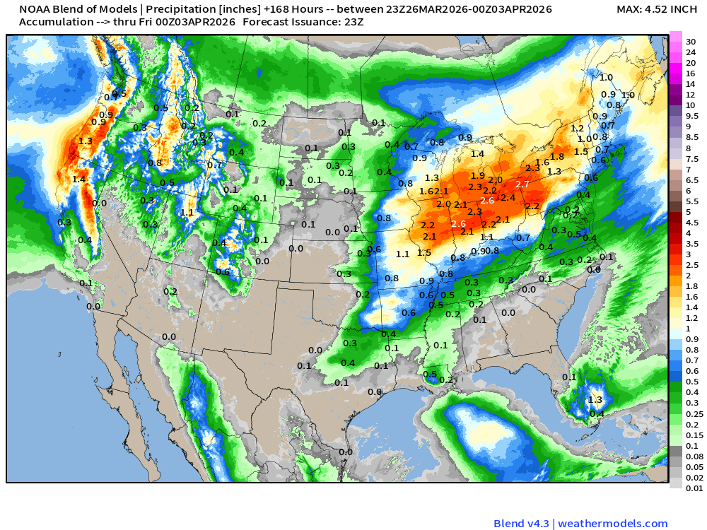
Blend of Models | 7-Days Precipitation Total
This evening: Ongoing severe weather along frontal boundary | Radar through 9:04 PM ET.
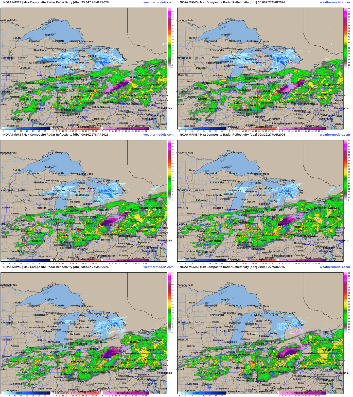
Two watch boxes extending from St. Louis to Pittsburgh — risk of tornadoes over Ohio.
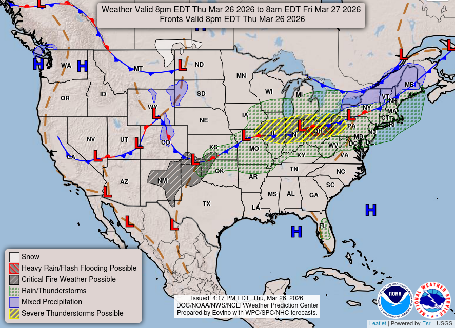
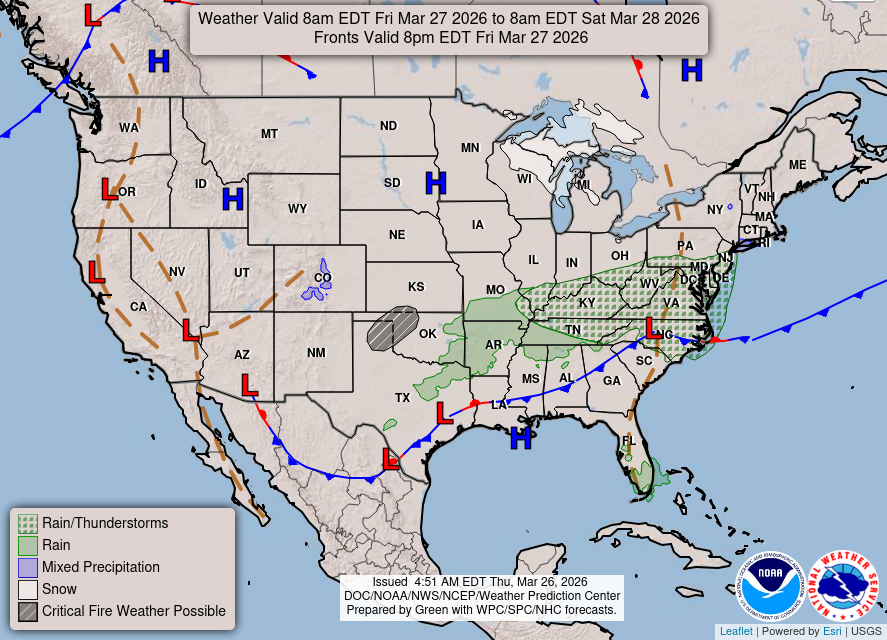
Weather/Fronts this Evening into Friday morning
HRRR Next 18-hours —> Friday 1 PM ET
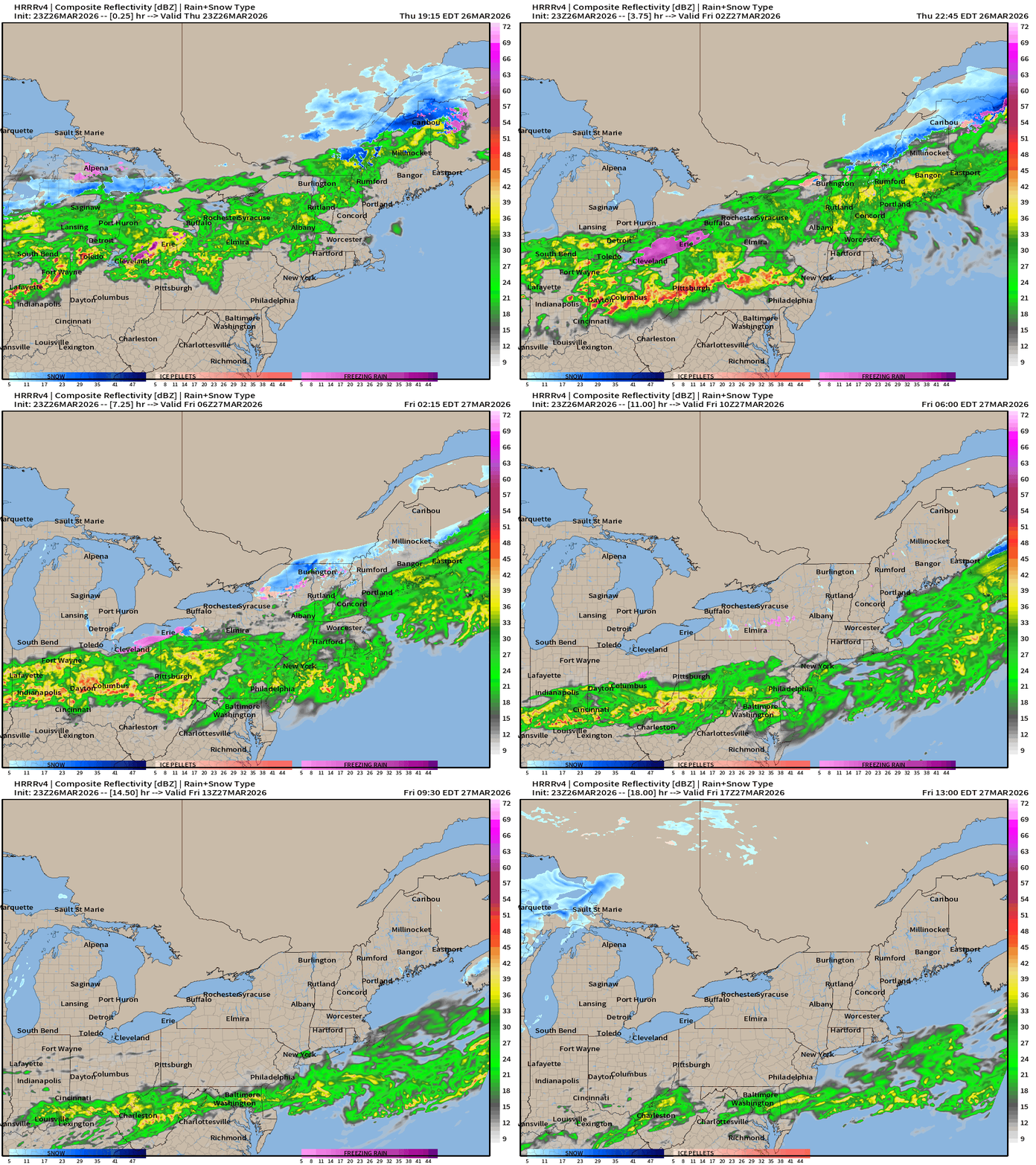
HRRR 18z — Radar Simulation Next 48-hours to Saturday, 2 PM ET
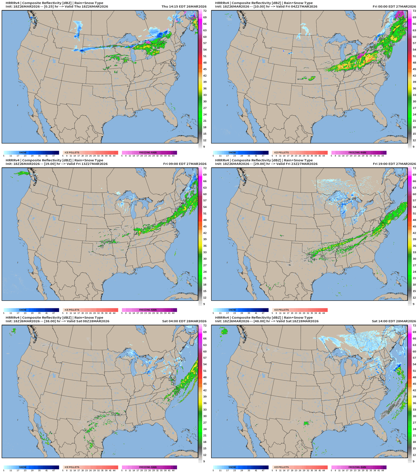
The rain and storms quickly lose their punch as the low pressure system sags southeastward along the frontal boundary
Weather on Friday
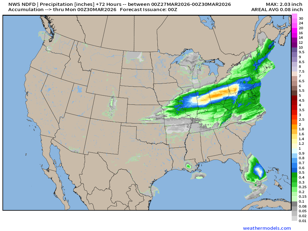
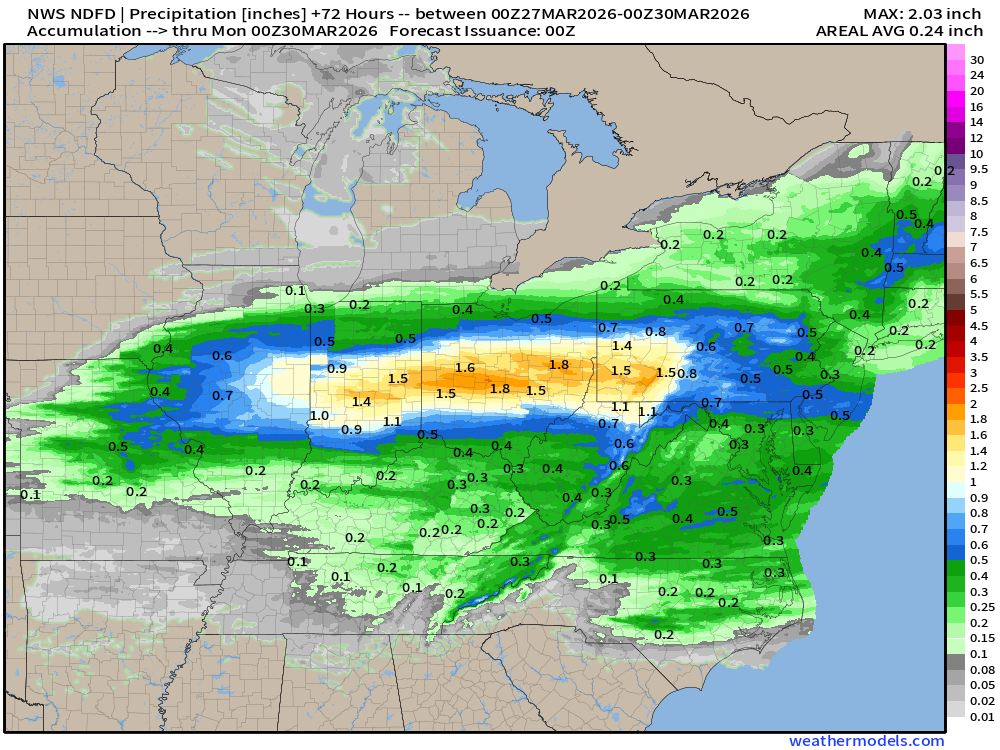
NDFD NWS Total Precipitation Next 72-hours through Sunday Evening
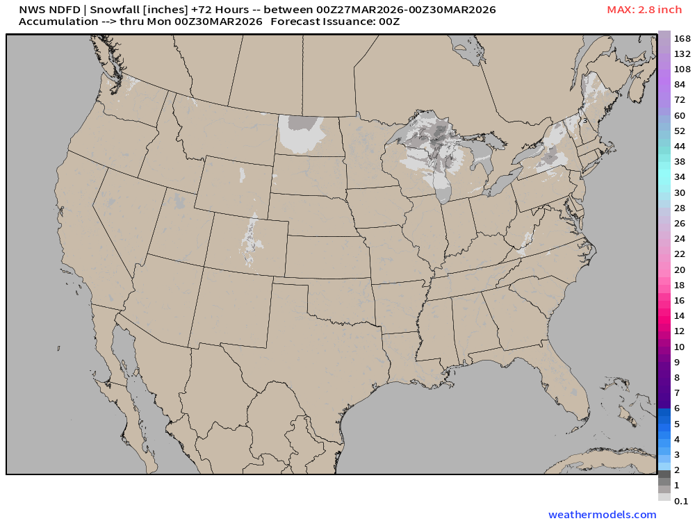
NWS Snowfall Next 72-hours — through Sunday Evening
RTMA Current Temperature Analysis | 8:30 PM ET
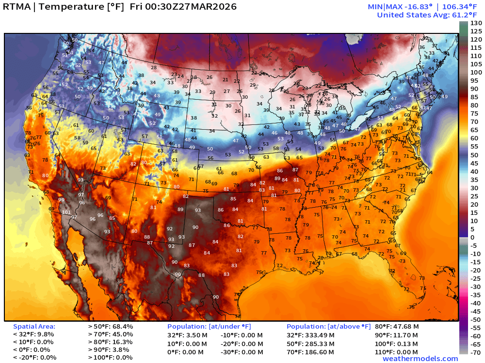
Lower 48 average was 61.2°F with 187 million at least 70°F
RTMA Current Temperature Anomaly Analysis | 8:30 PM ET
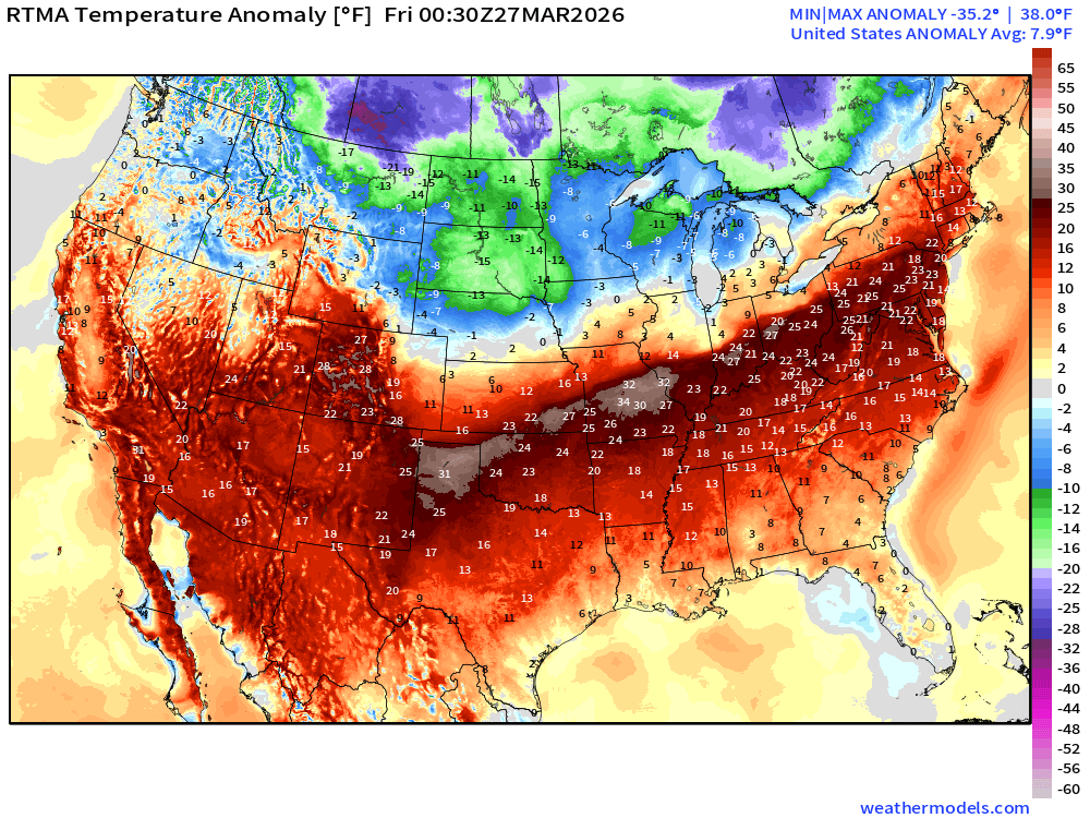
Lower 48 is 7.9°F above normal
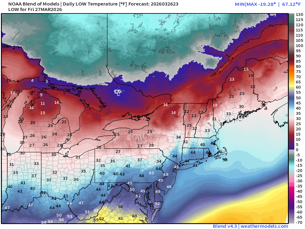
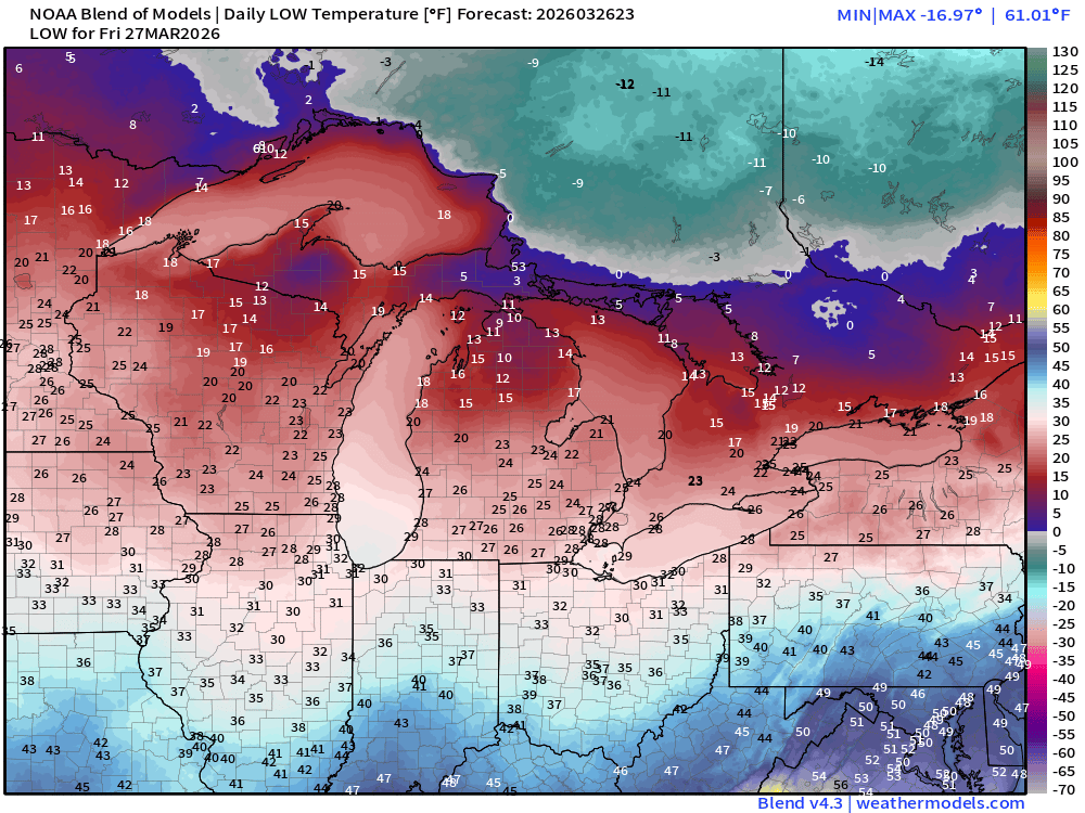
Low Temperatures Friday
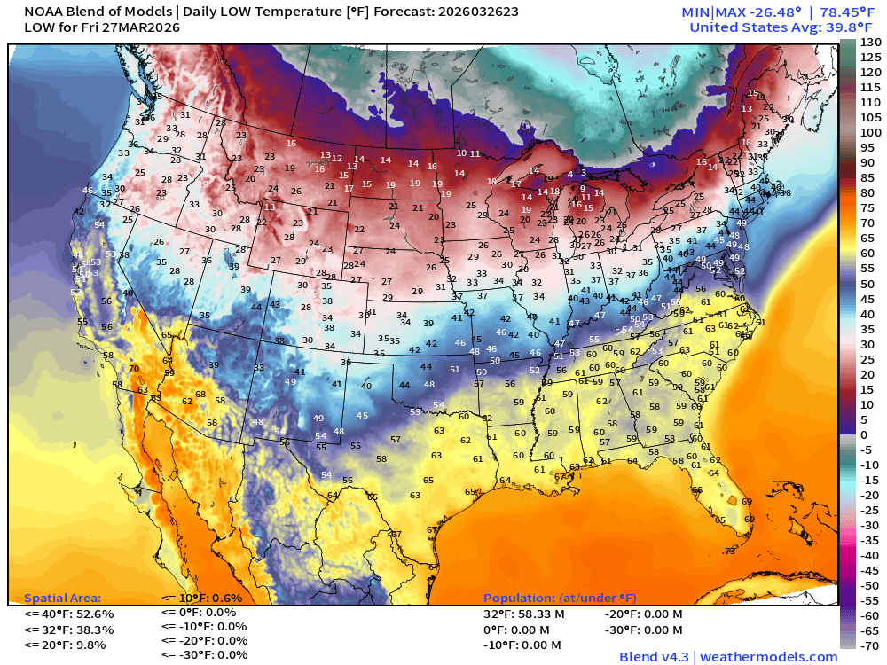
Back up to 58 million below freezing
High Temperatures on Friday
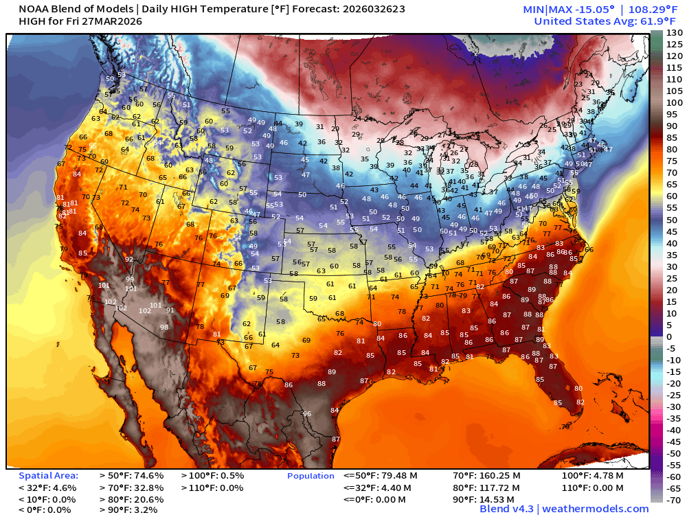
Still quite hot with 118 million at least 80°F but the area is reduced significantly to just 21% of the Lower 48 … much colder air moves into the Great Lakes and Northeast
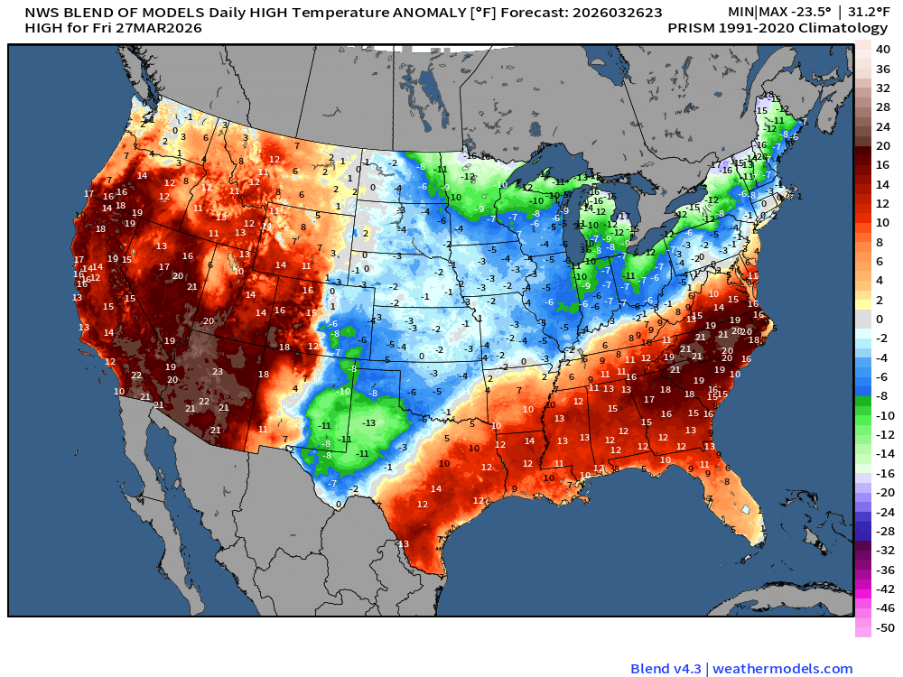
Temperature Anomaly | Warm Across Western 1/4 of the Lower 48 and Southeast
ECMWF 18z Precipitation Type + Intensity | Next 6-days
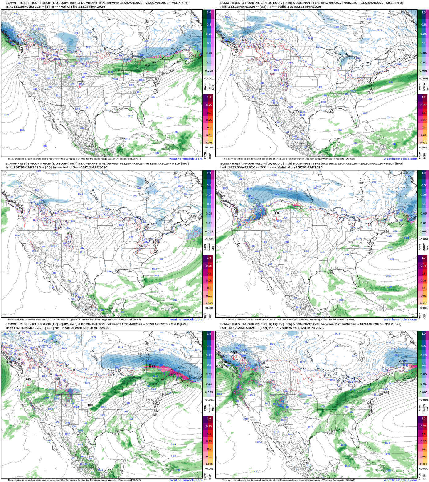
Next 6-days of Precipitable Water (my favorite parameter)
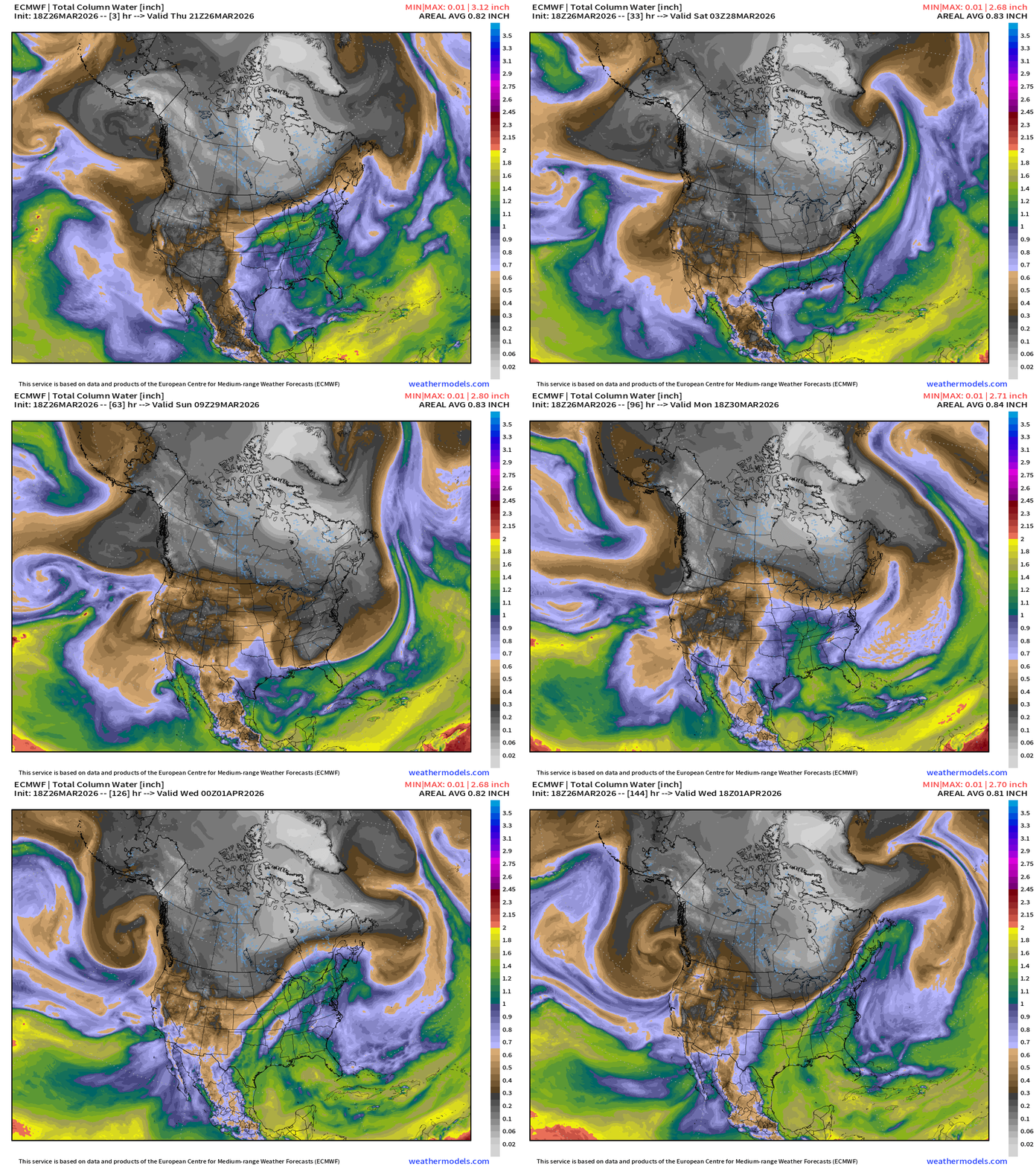
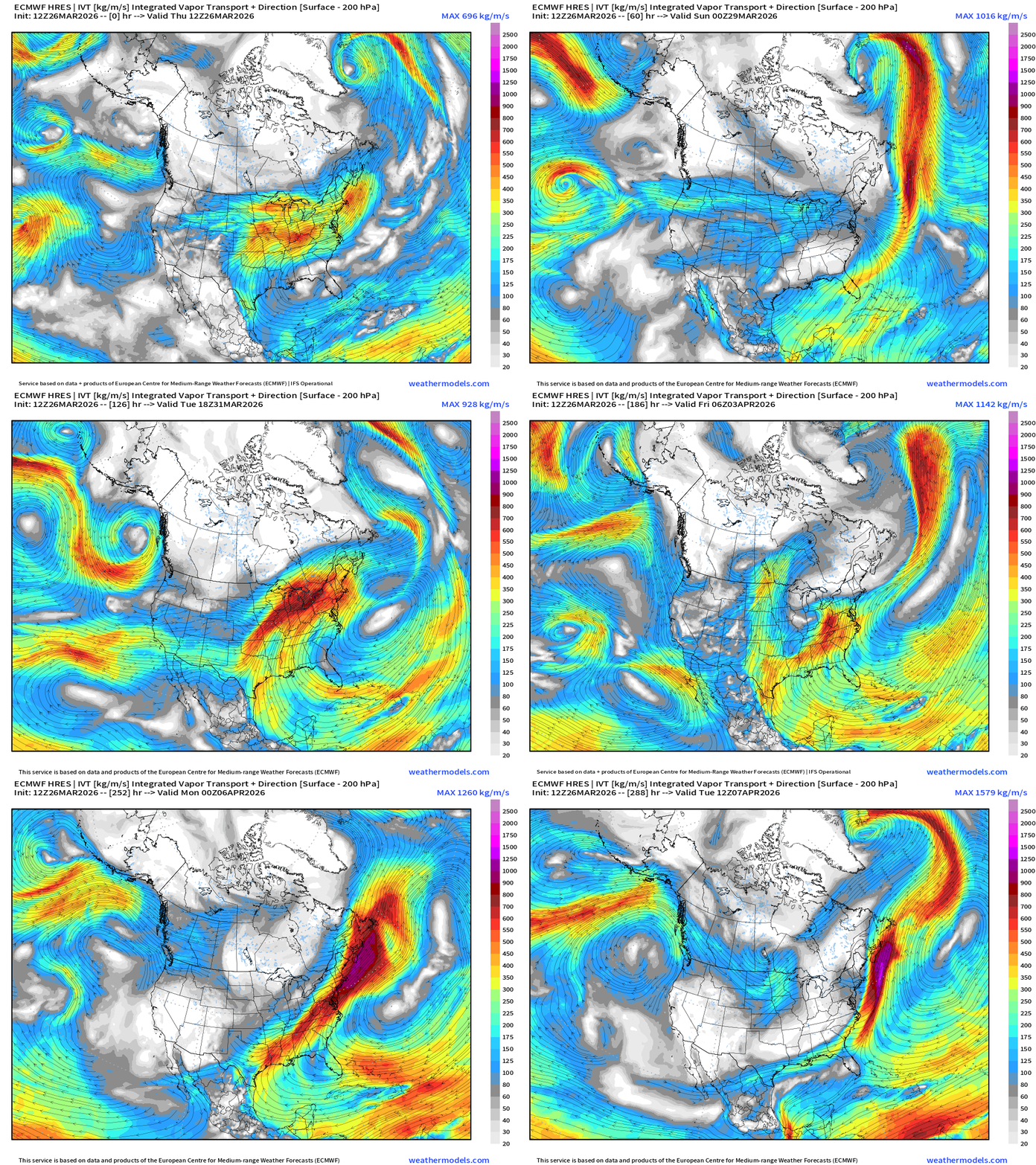
Moisture Transport | Next 12-days | ECMWF 12z
ECMWF AIFS 18z | Temperature at 500 mb | Next 10-days
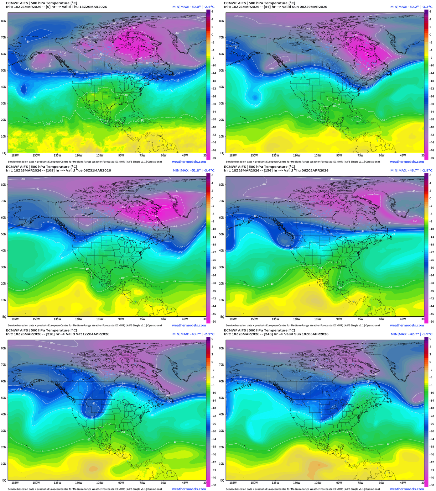
The tropospheric polar vortex remains “cold” and spinning strongly through end of March. The remarkable cold pool of -45°C to -51°C temperature air at 500 mb finally weakens in 10-days.
Snowfall | Median of ECMWF Ensembles [12z] | Next 15-days
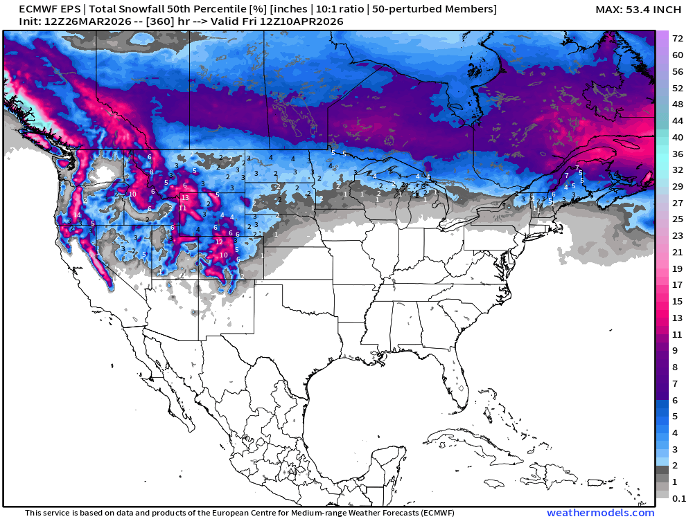
Western U.S. snowfall forecasts in the ensemble continue to dial upward
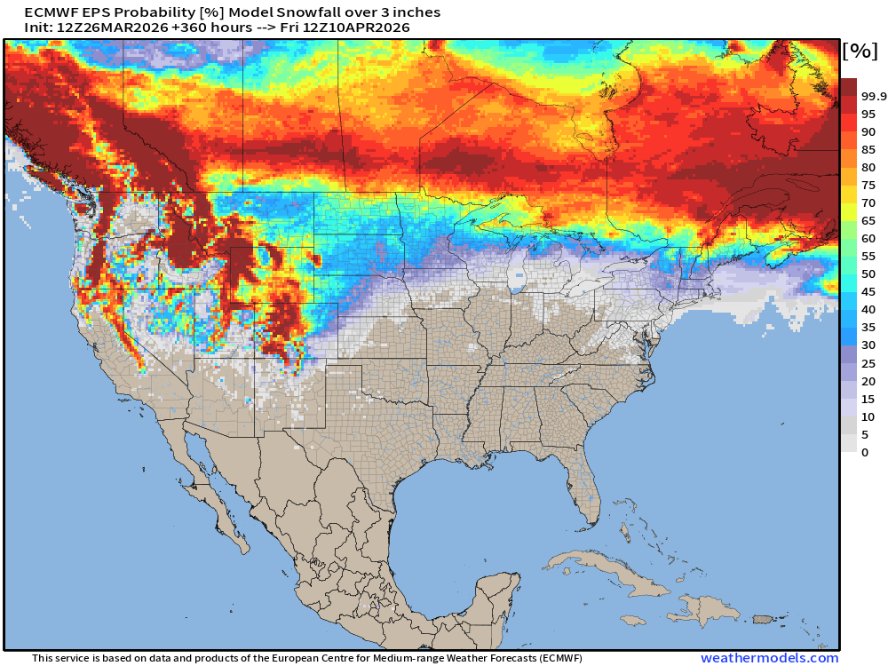
Probability of at least 3” of Snowfall Next 15-days
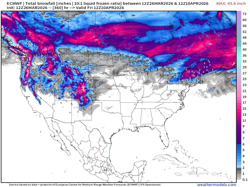
Snowfall from ECMWF HRES (15-days)
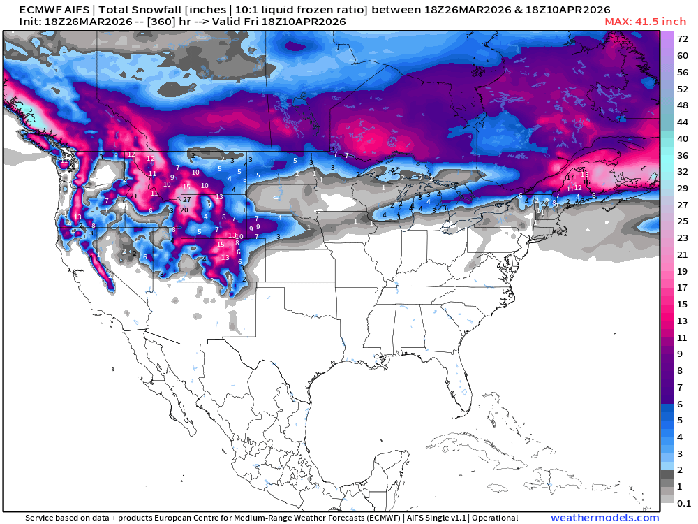
Snowfall from ECMWF AIFS-Single (18z) next 15-days
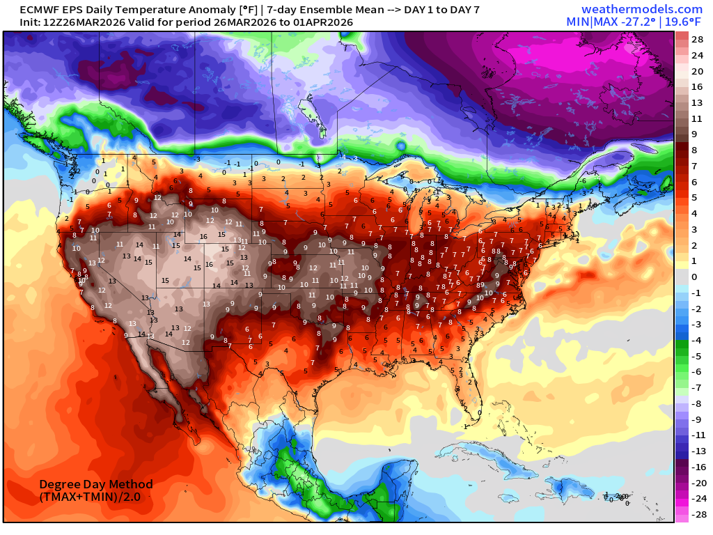
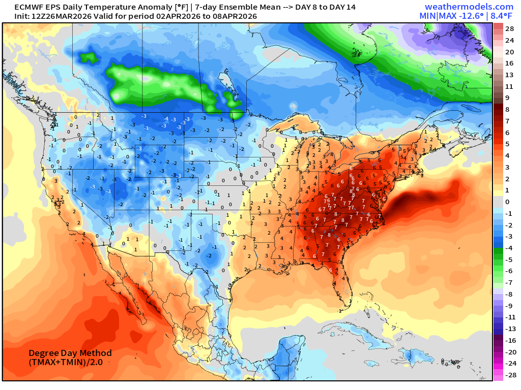
Temperature Anomaly | Next 15-days | ECMWF EPS 12z Ensemble Mean
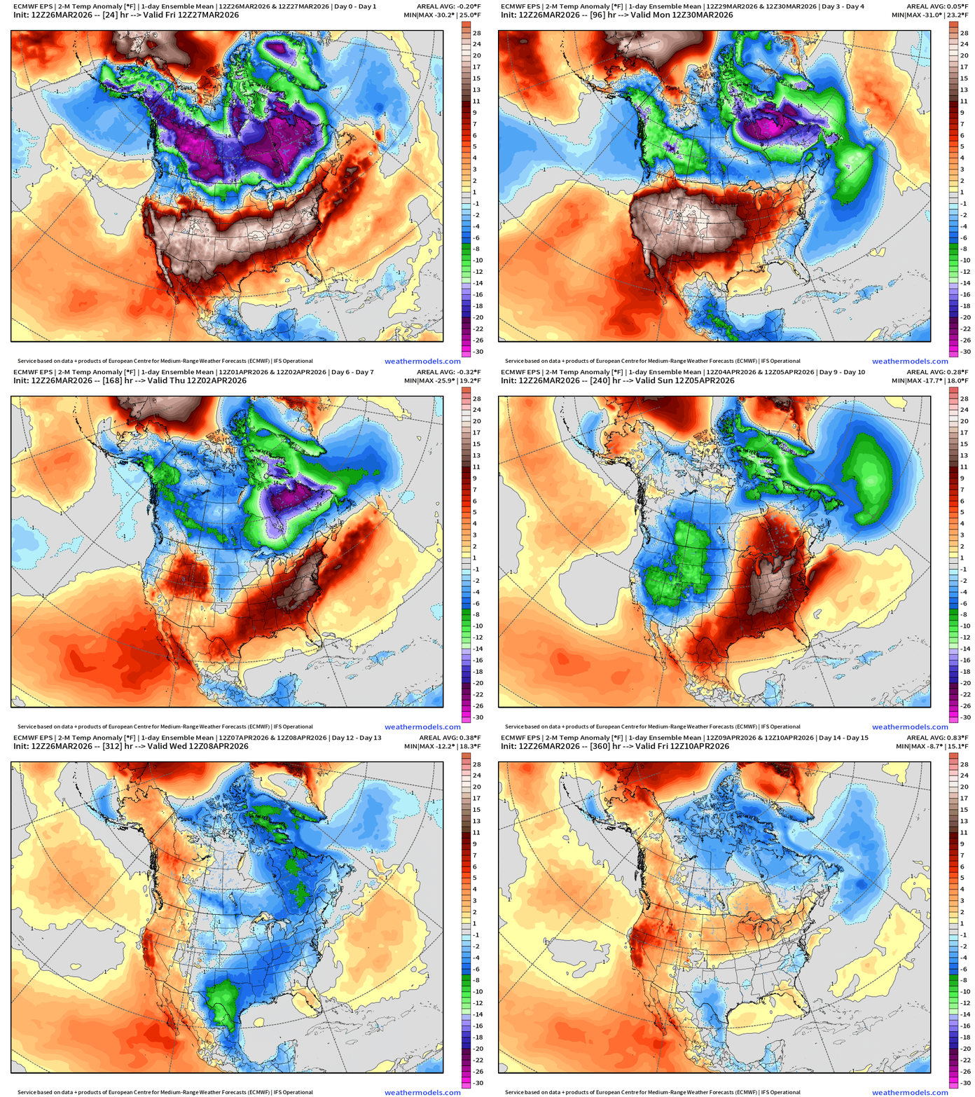
The most intense portion of the Canadian cold pool with the “Polar Vortex” will give up into first week of April.
Week #1 | Temperature Anomaly | March 26 - April 1
Week #2 | Temperature Anomaly | April 2 - April 8
Maps sourced from weathermodels.com designed and innovated by yours truly! Please subscribe there for real-time access to the newest maps, charts from all of the weather models including ECMWF and AIFS, and NOAA GFS/GEFS. NOAA WPC and SPC for fronts/convective outlooks.
- Milepost
- 905 · laid 2026-03-27T01:34:11.844000Z
- Source
- https://weather.substack.com/p/march-26-2026-thursday-weather-update
- Digest
- 4c774c3c35f6a76149cf18f80e7f8aa4d9e39e9323d77ef0d6e765e6ec5a6bfb
- Machine
- JSON