March 23, 2026 Monday Weather Update
Middle East to see heavy storms with extreme weather pattern
March 2026 was the warmest March in the 132-year national record (1895–2026), at 50.8°F against a 1991–2020 normal of 43.6°F (+7.3°F).
March 2026 was the 8th-driest March in the 132-year national record (1895–2026), at 1.8in against a 1991–2020 normal of 2.5in (-0.7in).
NOAA/NCEI Climate at a Glance, contiguous United States. This is the observed record for the month, not a score of anything said in this piece — the forecast ledger begins 2026-08-17 and cannot reach earlier posts.

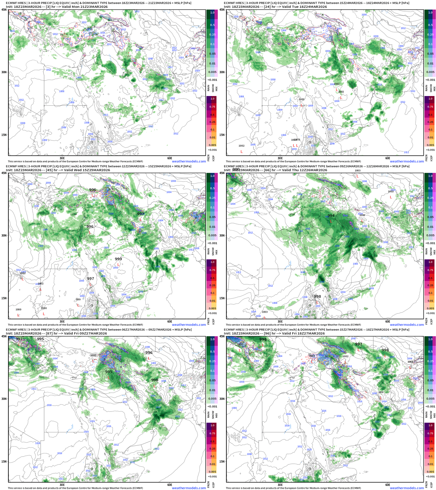
Severe weather upcoming for the Middle East with a swirling “cut-off” low in mid-levels translating to the surface with a trackable low pressure system over Iraq into the mid-980s central pressure. Plenty of moisture out of the Mediterranean and Red Sea will provide fuel for thunderstorms, some of which could have massive hail with the mid-level cooler air, and wicked ascent profiles over the desert landscape.
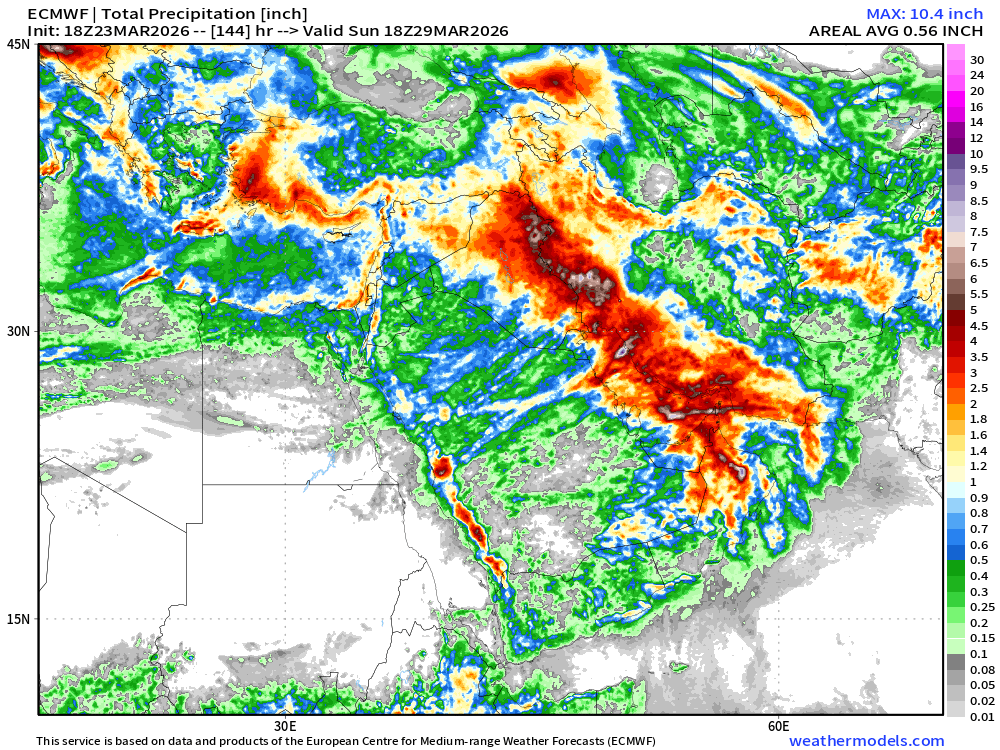
Total rainfall amounts will be exceptional across the entire Arabian Peninsula. But check out Iraq into Iran, and down through the Persian Gulf. That red is at least 2” of rainfall with embedded areas of 6” to 10” possible in heaviest downpours.
Major risk for flooding — perhaps catastrophic and historic in nature!
Upper-Level Weather Pattern Across Europe into the Middle East
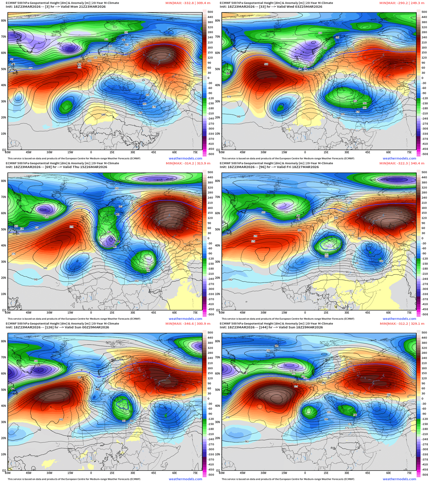
Two strong blocking highs are stuck in place … with “trough thinning” or Rossby “wave breaking” in between bringing higher PV air southward to combine with the moisture = instability and showers/storms. These “bowling balls” travel along the 30°N latitude and trigger all sorts of extreme weather conditions around the globe.
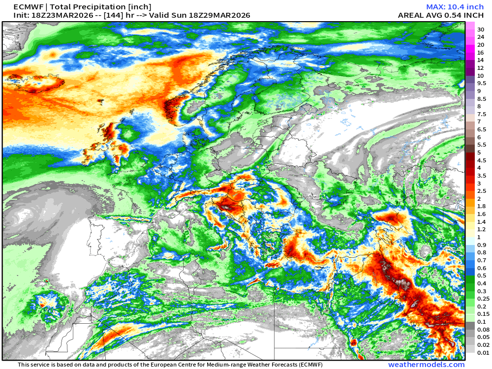
European Weather Next 6-days —> two major cut-off low events
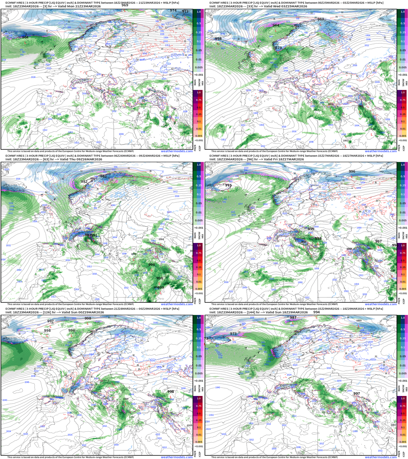
Total Precipitation Next 6-days across Europe
United States
Blend of Models Temperatures | Highs through Wednesday, April 1
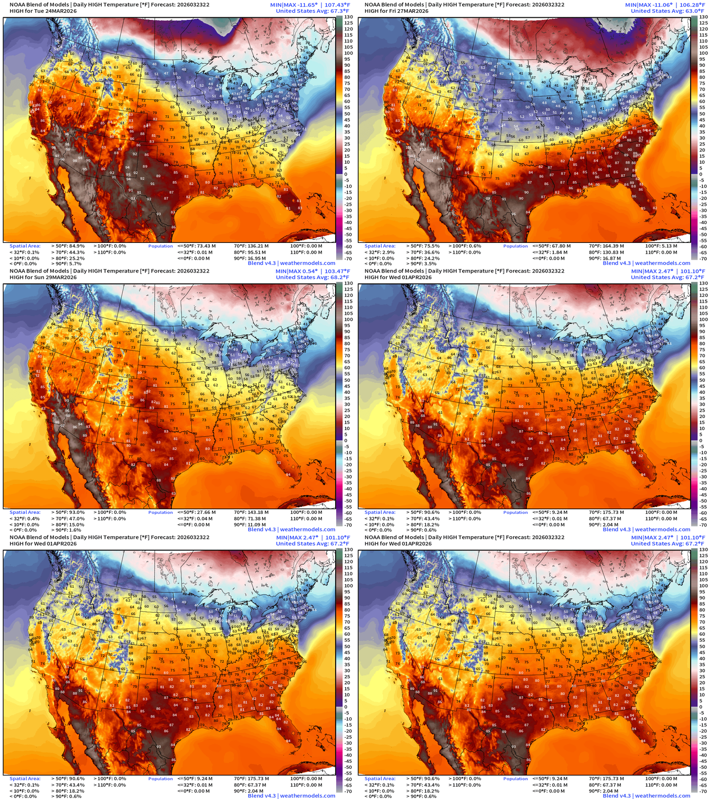
A bit cooler this weekend with a cold front across the Great Lakes and Northeast but then recovery into April as Spring battles back the Canadian cold pool
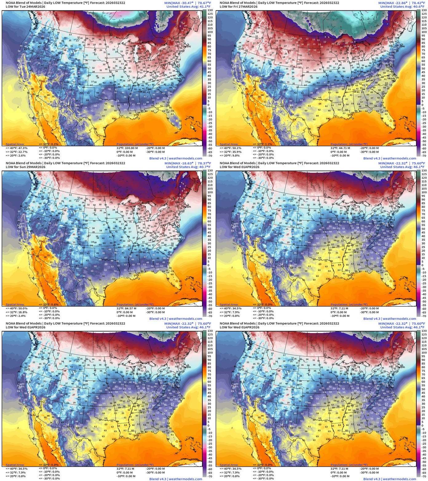
Blend of Models Temperatures | Lows through Wednesday, April 1
Blend of Models | Total Snowfall Next 10-Days
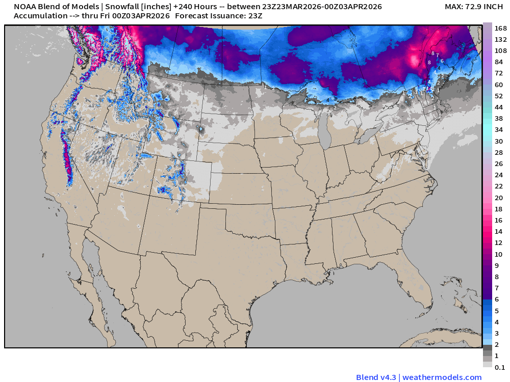
Running out of winter across the Lower 48 quickly … but some snowfall possible across the California Sierra and Rockies into April.
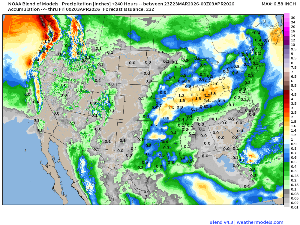
Blend of Models | 10-Days Precipitation Total
HRRR 18z — Radar Simulation Next 48-hours to Wednedsay 2 PM ET
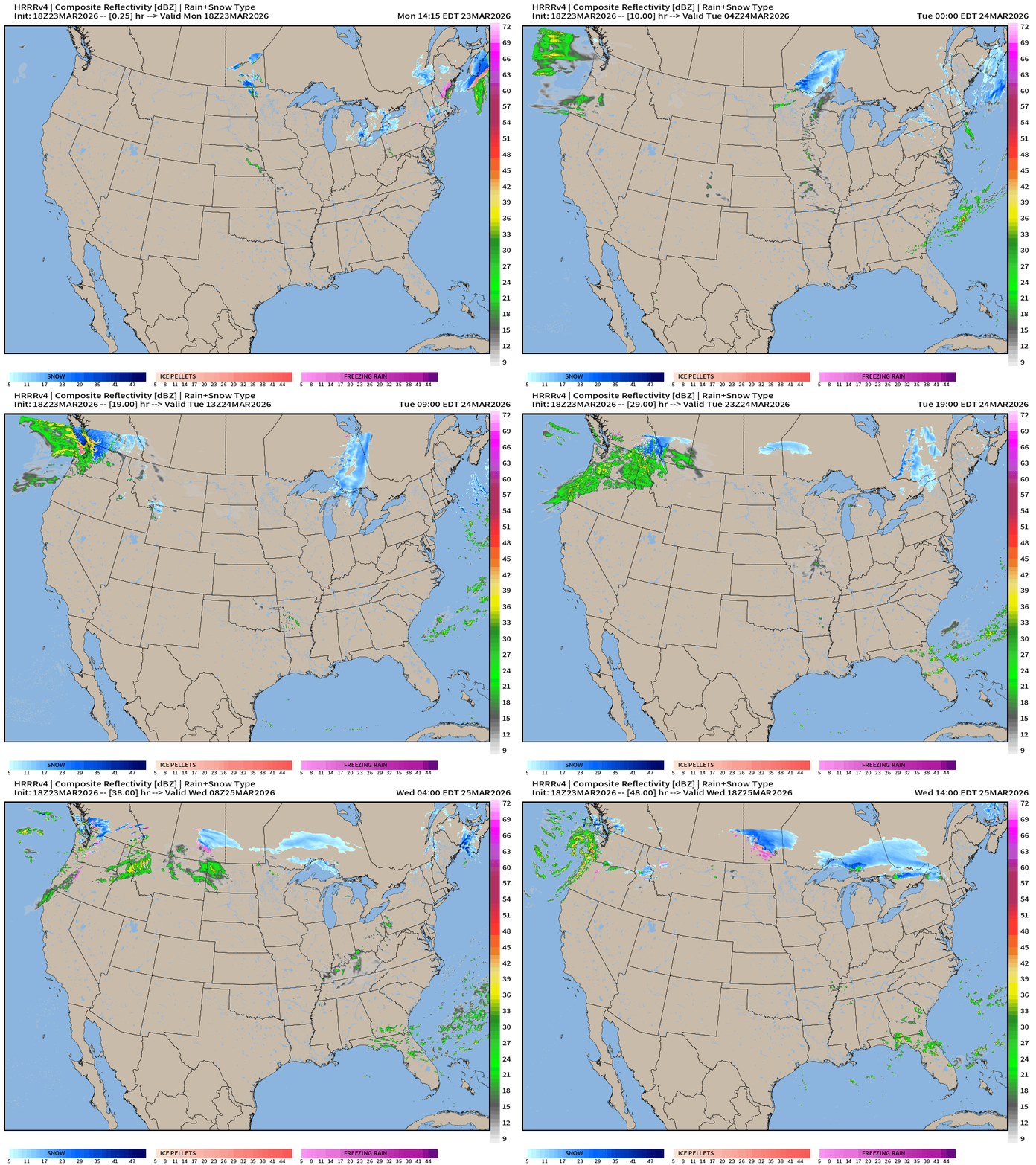
Light snowfall with passing Clipper Systems along northern tier storm track
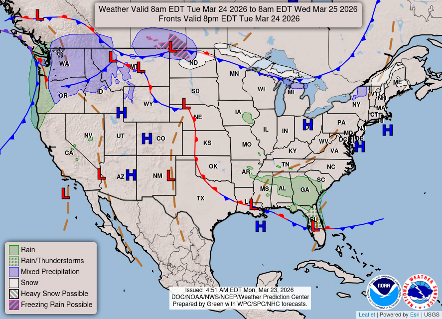
Weather on Tuesday
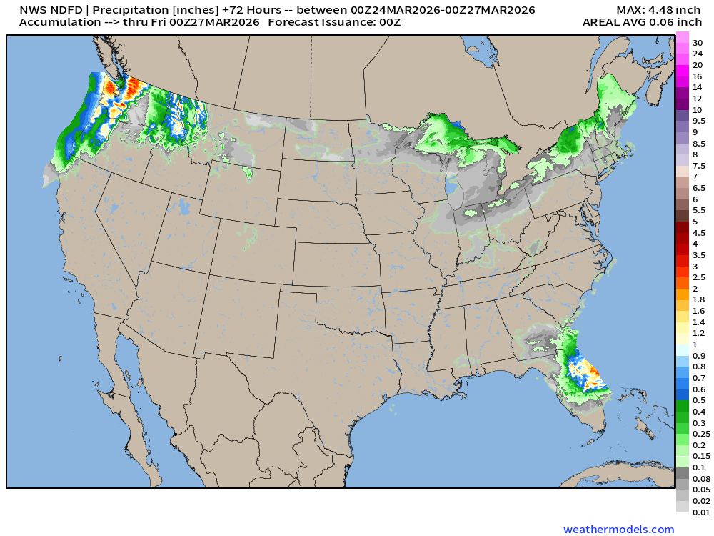
NDFD NWS Total Precipitation Next 72-hours through Thursday Evening
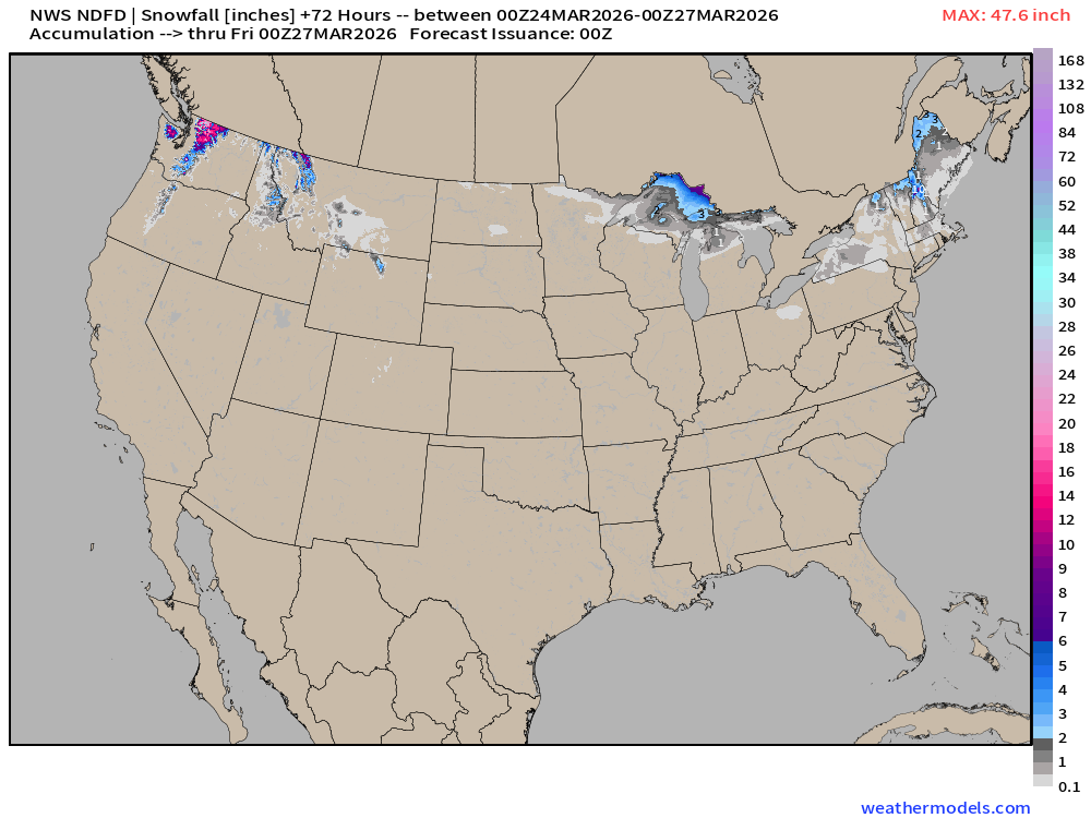
NWS Snowfall Next 72-hours — through Thursday Evening
RTMA Current Temperature Analysis | 8:15 PM ET
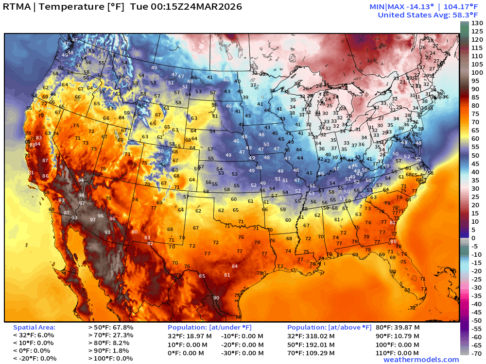
Lower 48 average was 58.3°F
RTMA Current Temperature Anomaly Analysis | 8:15 PM ET
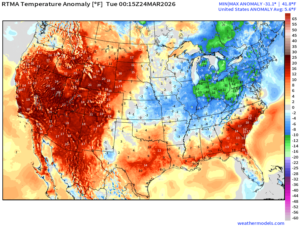
Lower 48 is 5.6°F ABOVE normal
RTMA 24-Hour Temperature Change | 8:15 PM ET
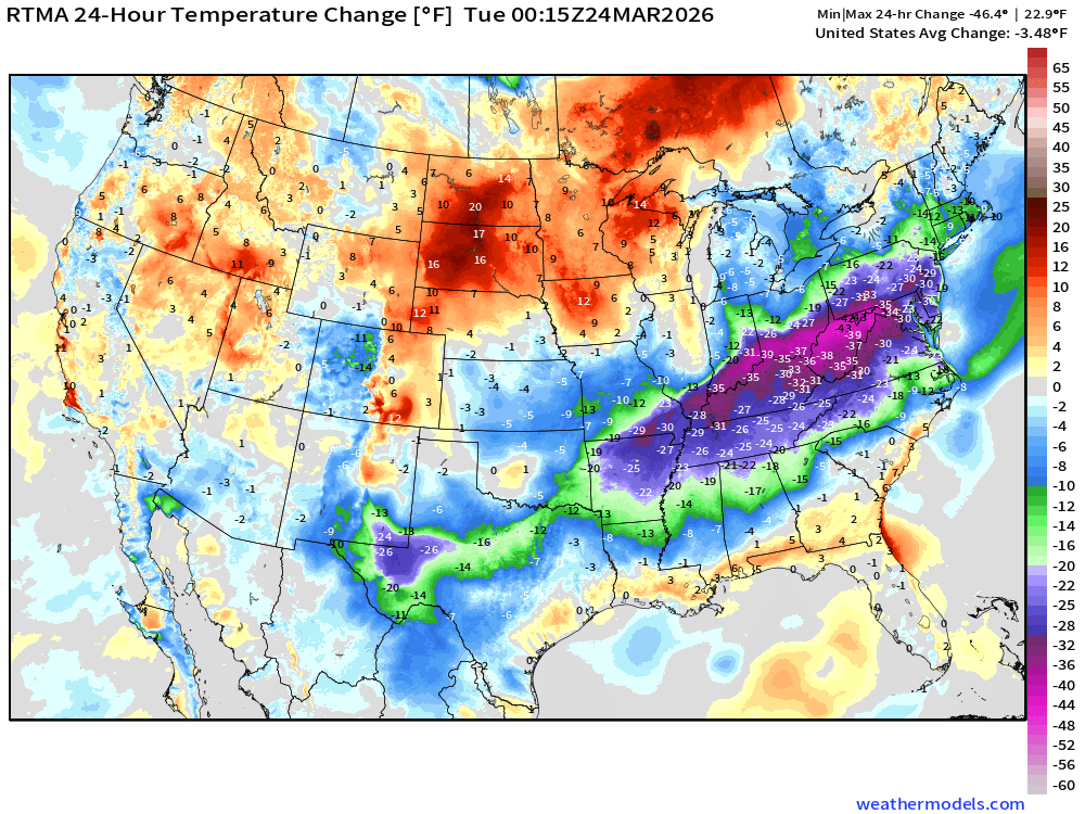
Cold front dropping temperatures upwards of 40°F along Ohio River Valley
Low Temperatures Tuesday
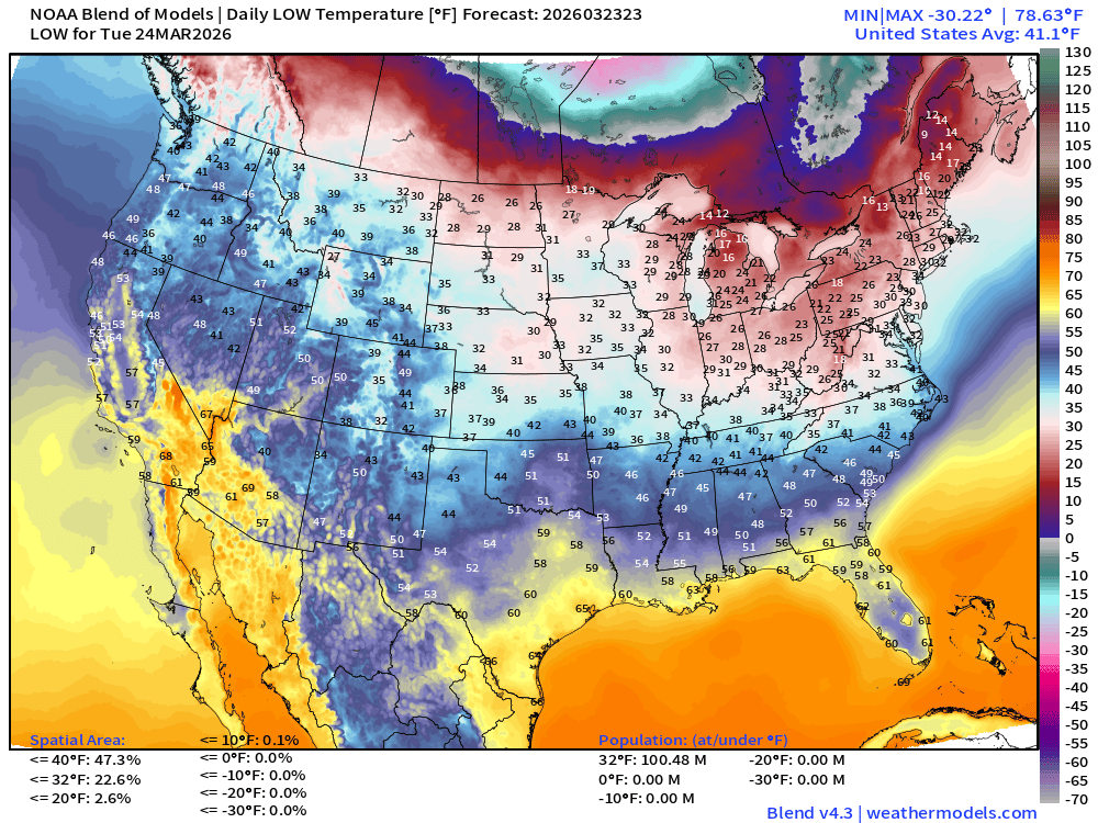
Over 100 million below freezing again!
High Temperatures on Tuesday
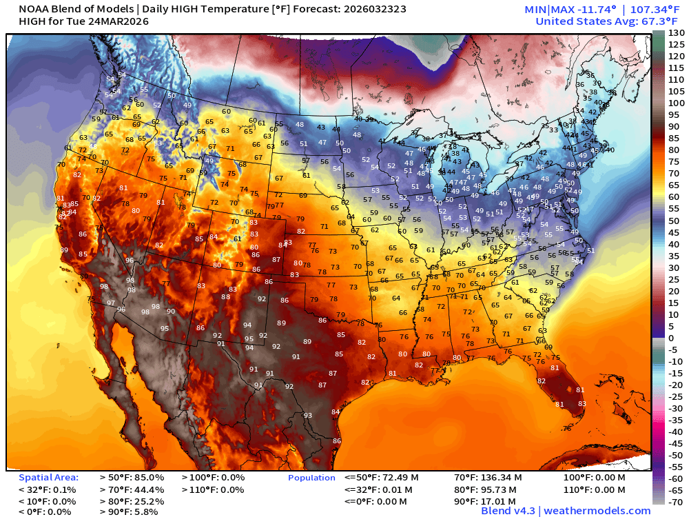
HOT across the Western U.S. and Texas into Denver …
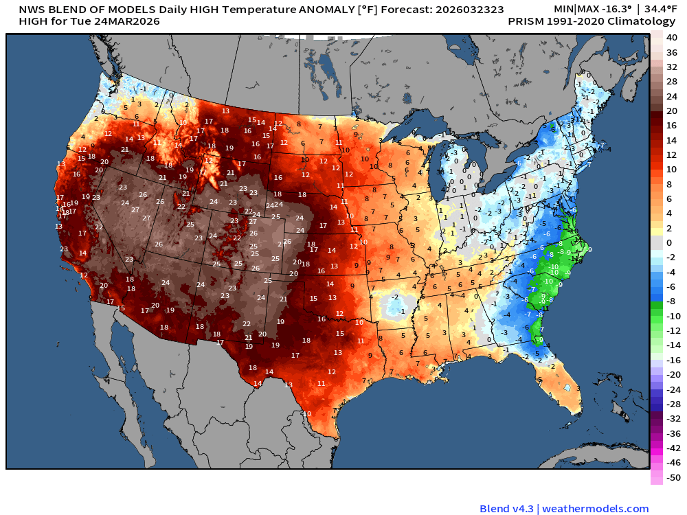
Temperature Anomaly | 20-25°F above normal
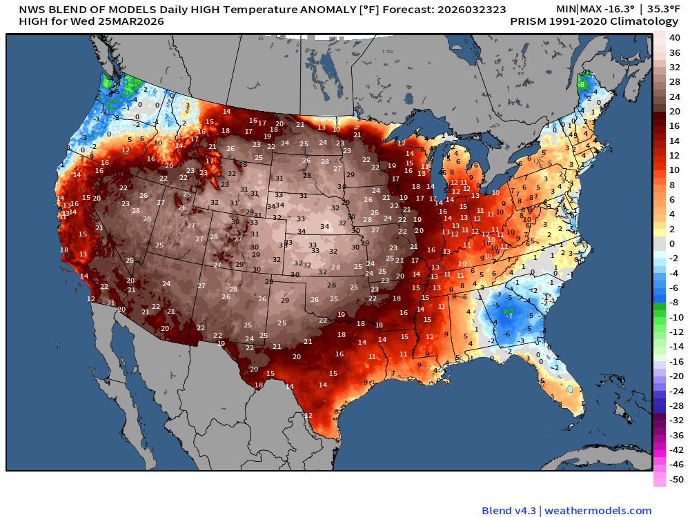
High Temperatures on Wednesday
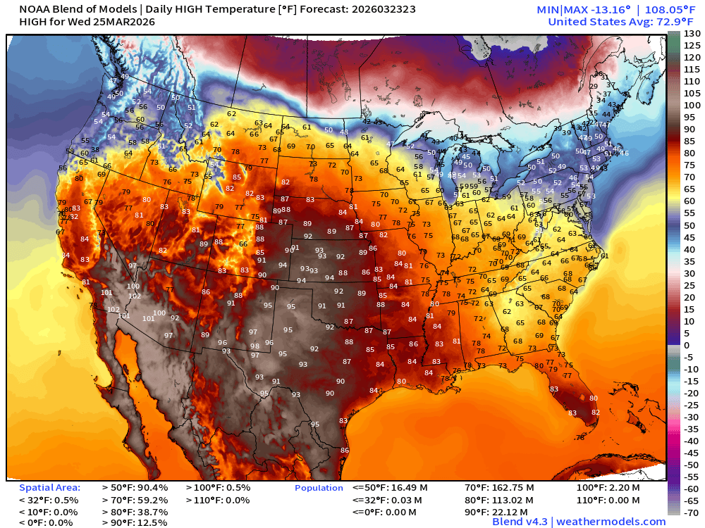
Warmth expands eastward into the Midwest … with nearly 70°F in Chicago and Minneapolis. Temperature anomaly maximum of 30°F to 35°F in the central Plains where temperatures will climb into the mid-90s (Kansas)
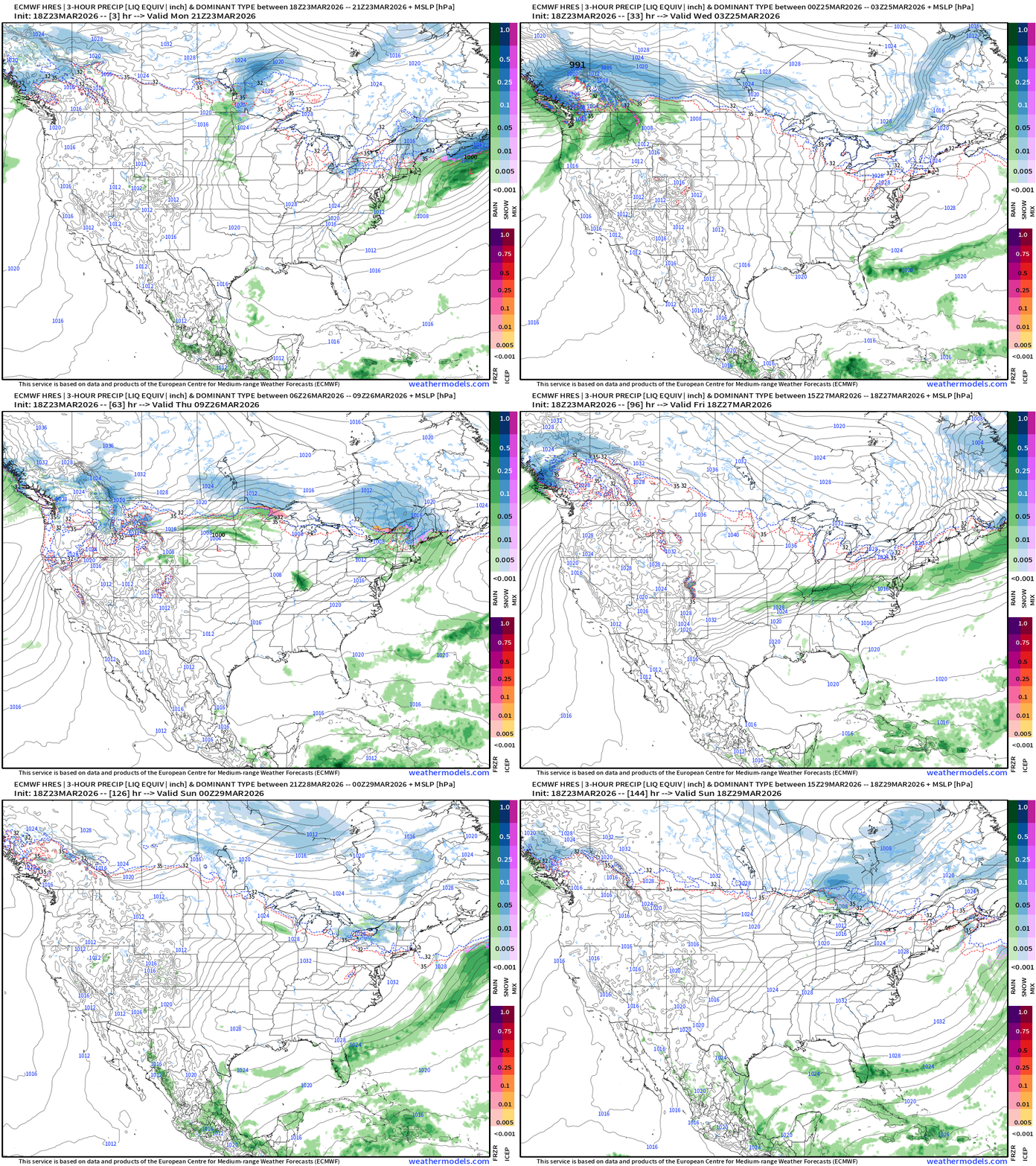
ECMWF 18z Precipitation Type + Intensity | Next 6-days
Next 6-days of Precipitable Water (my favorite parameter)
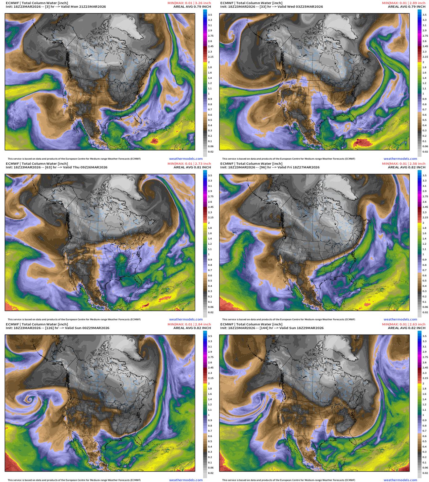
Atmospheric river into the Pacific Northwest … and perhaps into California.
Cold/dry Canadian Arctic still locked into winter mode — and that slides through the Great Lakes and Northeast this weekend
Moisture Transport | Next 10-days | ECMWF 12z
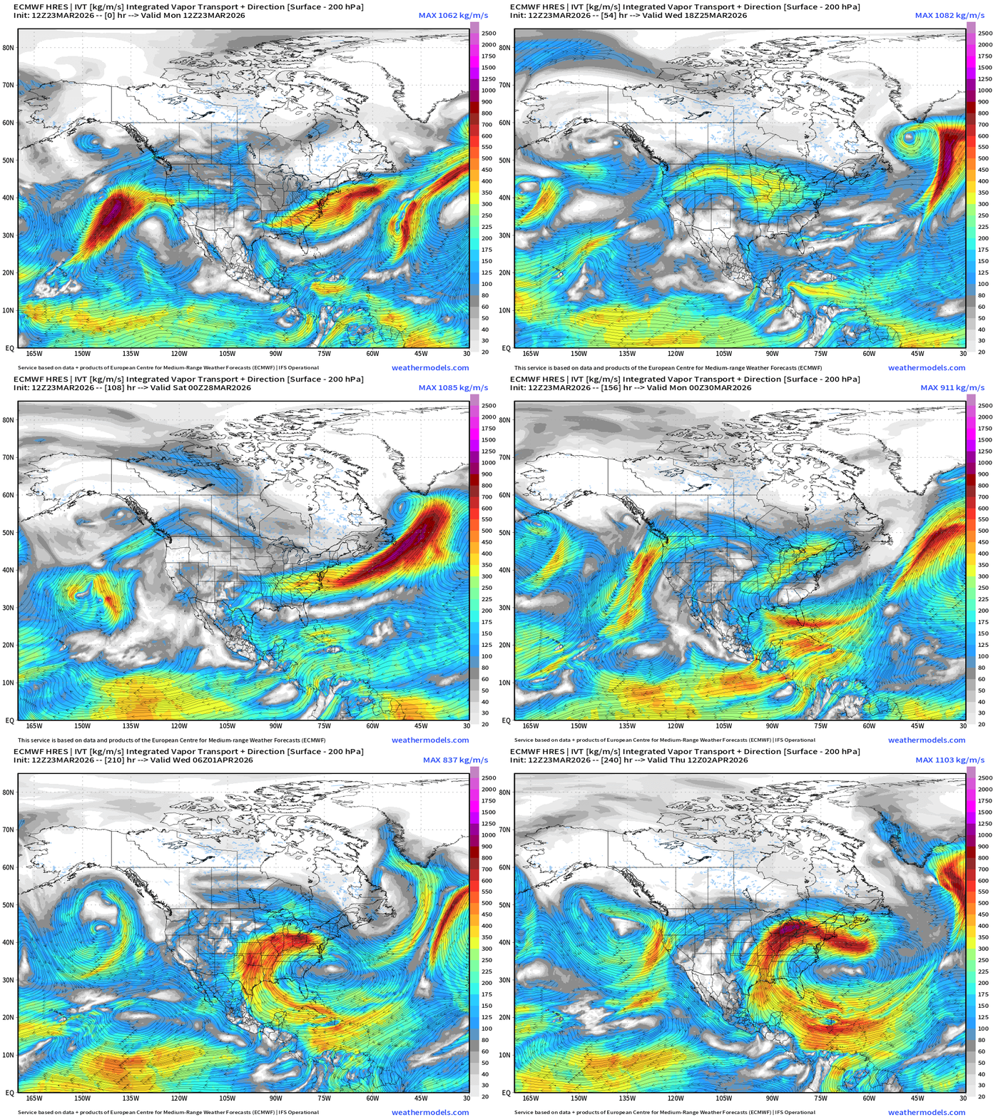
Gulf of Mexico returns to action by middle of next week!
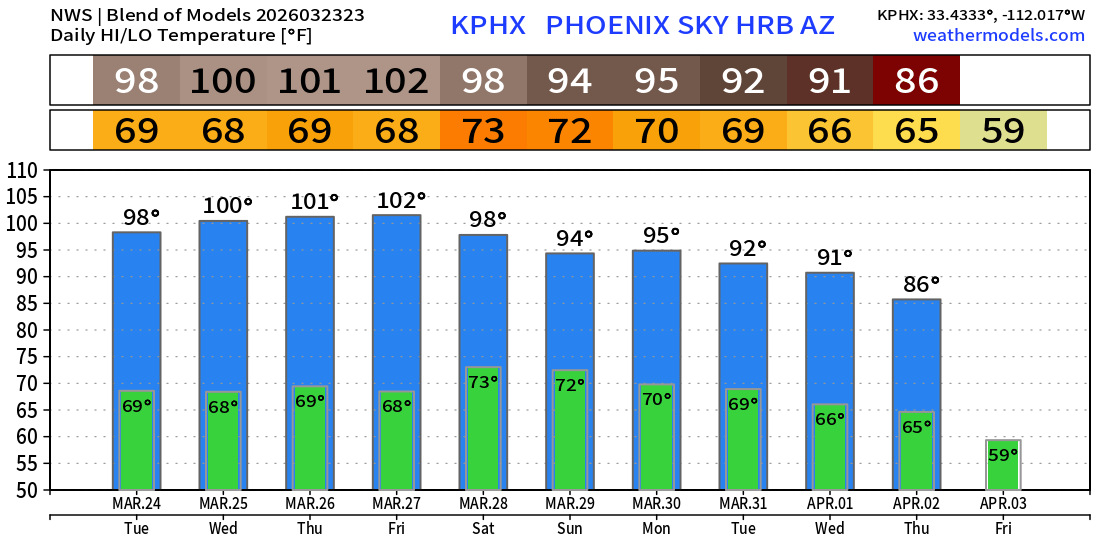
Phoenix next 10-days … the 100s will be done for a while by this weekend
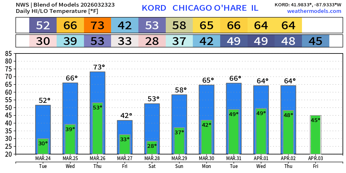
Chicago next 10-Days
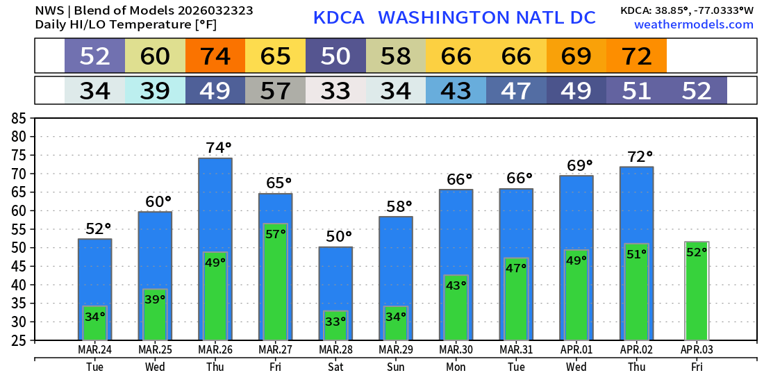
Washington D.C. next 10-days
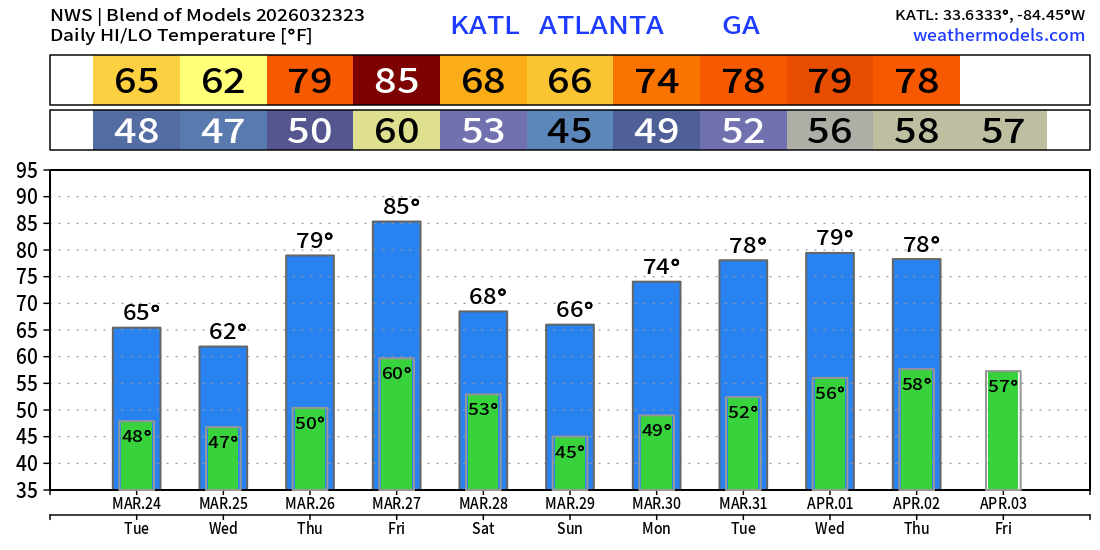
Atlanta next 10-days
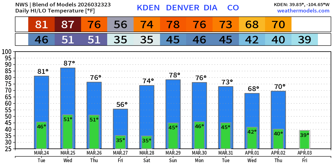
Denver next 10-days
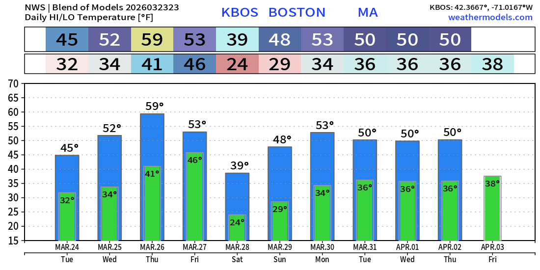
Boston next 10-days
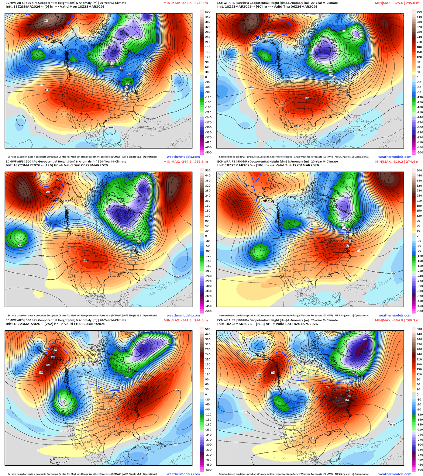
ECMWF AIFS 18z | Temperature at 500 mb | Next 12-days
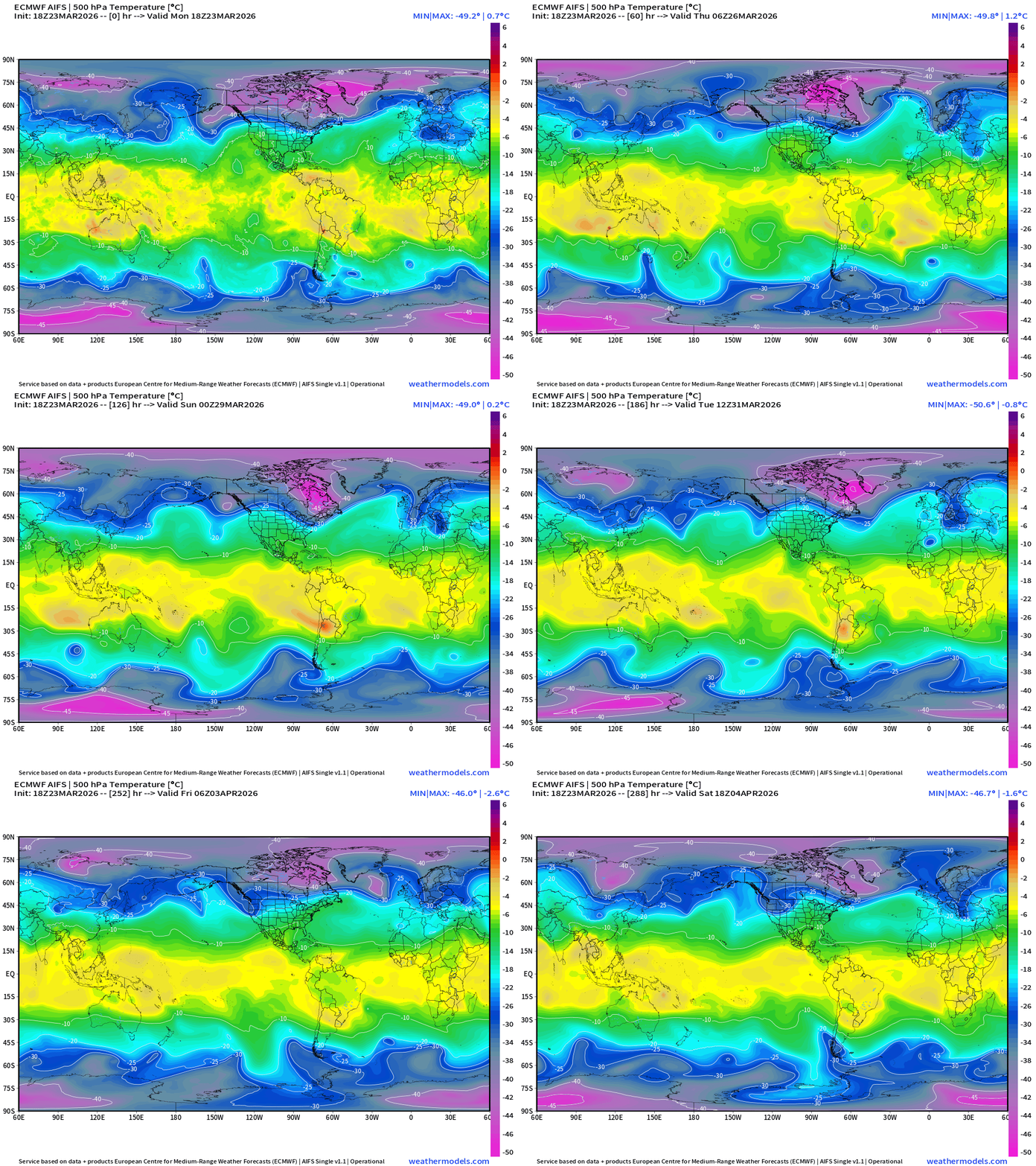
The tropospheric polar vortex remains “cold” and spinning strongly through end of March. Still a pool of -40°C to -48°C temperature air at 500 mb — but note how everything shifts 1/2 wavelength to the east … trough across the West vs. ridging across East — allowed by the Canadian Arctic cold pool moving toward Greenland.
Snowfall | Median of ECMWF Ensembles [12z] | Next 15-days
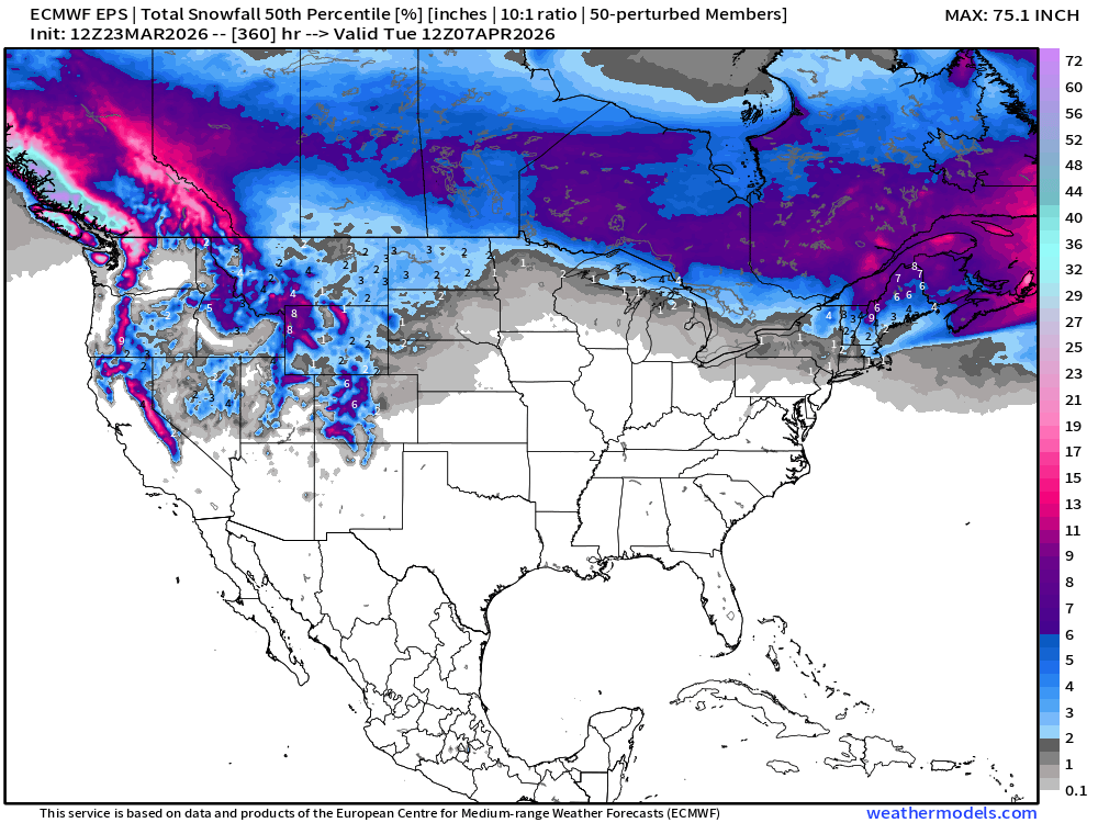
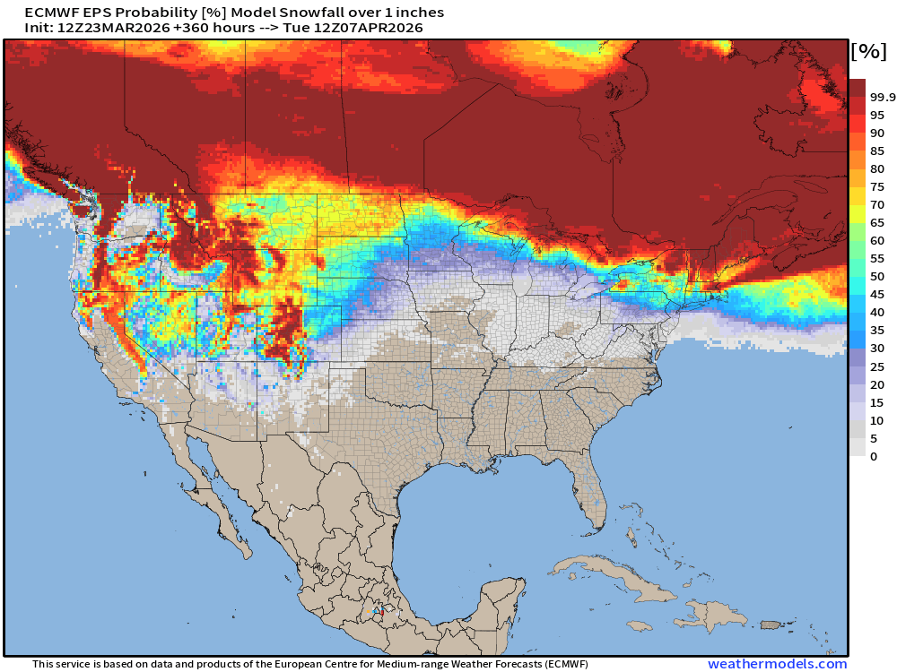
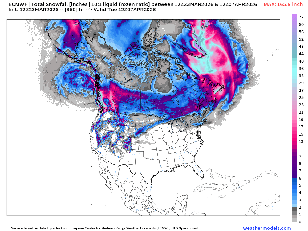
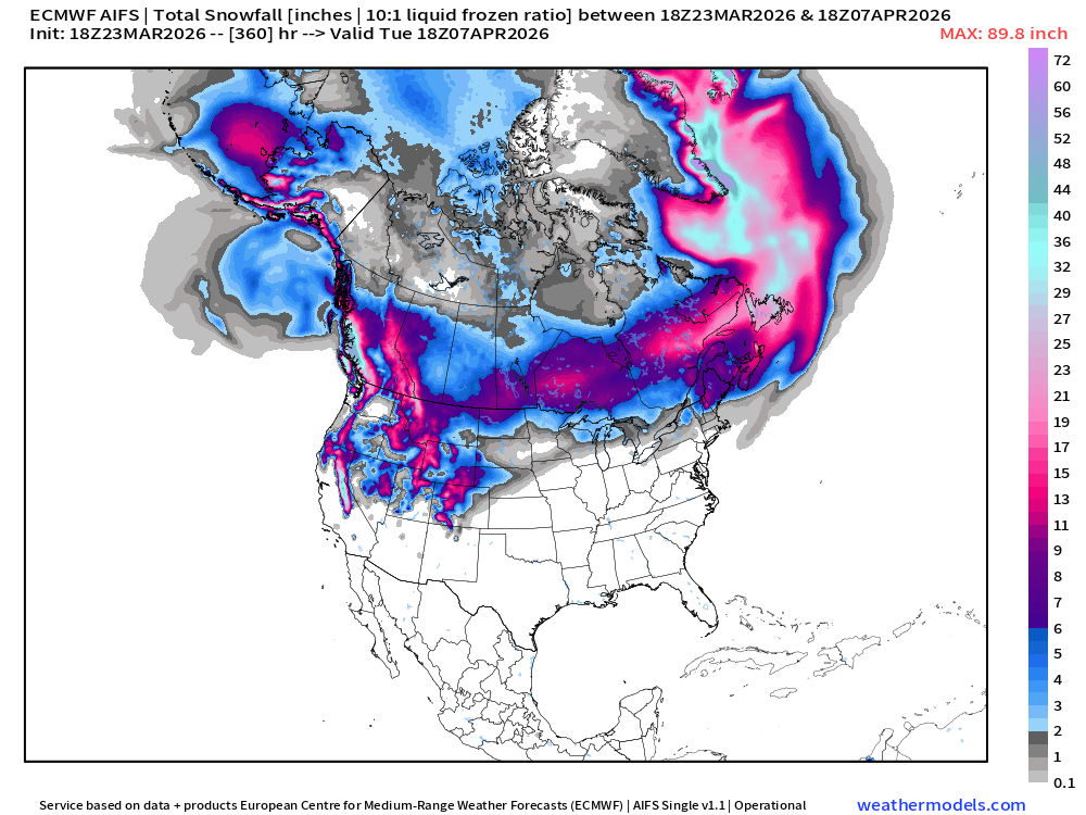
Western U.S. snowfall may not be “done with” after all … we’ll see if April snow showers can return once the “heat dome” breaks down. 90s to snow would be fun in Colorado!
Probability of at least 1” of Snowfall Next 15-days
Snowfall from ECMWF HRES (15-days)
Snowfall from ECMWF AIFS-Single (18z) next 15-days
Temperature Anomaly | Next 15-days | ECMWF EPS 12z Ensemble Mean
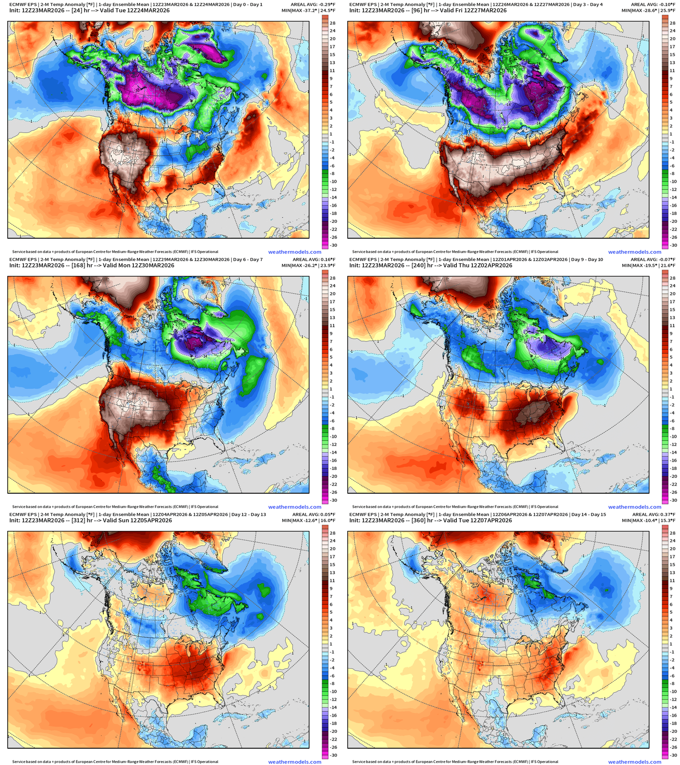
The Canadian cold pool with the “Polar Vortex” looks to finally give up into first week of April! The heat dome across the Lower 48 expands eastward into Days 6-10, and the west shifts neutral to cooler than normal.
AIFS next 12-days of Height Anomaly shows the persistence of the western ridge for next 10-days … with the Canadian / Hudson Bay polar vortex continuing to spin. Pattern change with a western U.S. trough by April 1st pushing the heat dome away.
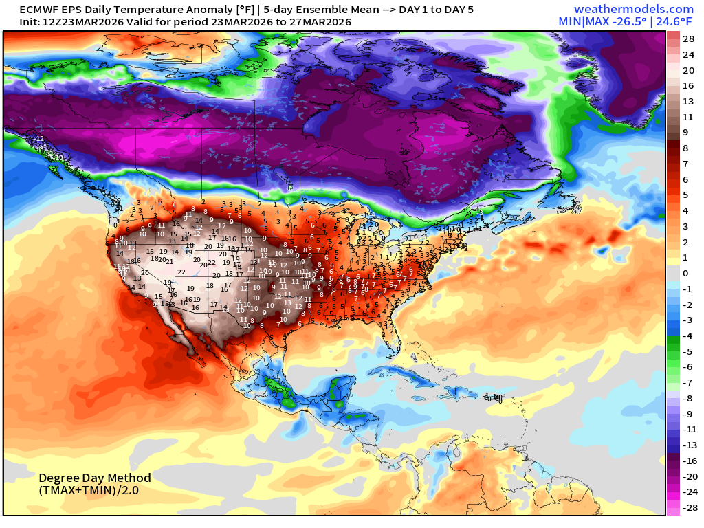
5-Day Chunk #1 | Temperature Anomaly | March 23 - March 27
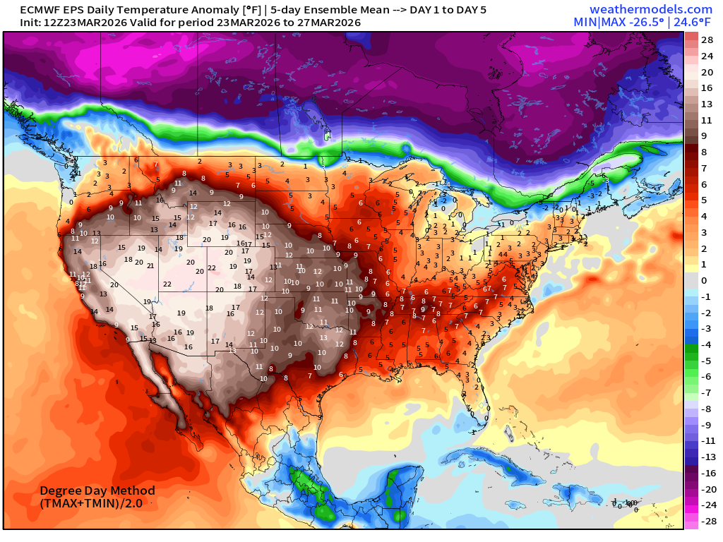
20°F to 24°F maximum temperature anomaly for 5-days across the Western U.S.
5-Day Chunk #2 | Temperature Anomaly | March 28 - April 1
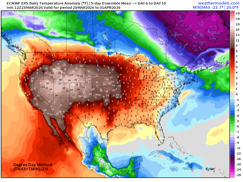
Much above normal warmth continues through end of March across Western U.S.
Zooming out to all of North America shows a cold pool pushed eastward over Quebec.
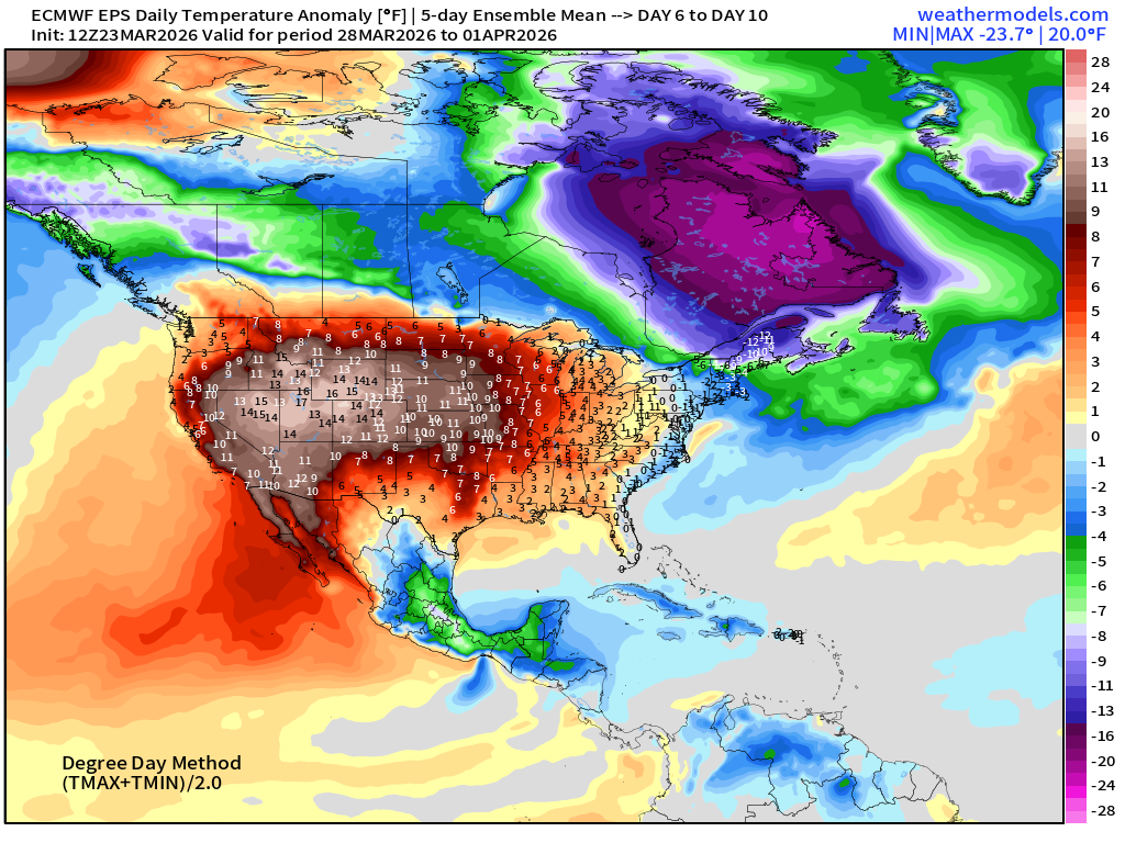
5-Day Chunk #3 | Temperature Anomaly | April 2 - April 6
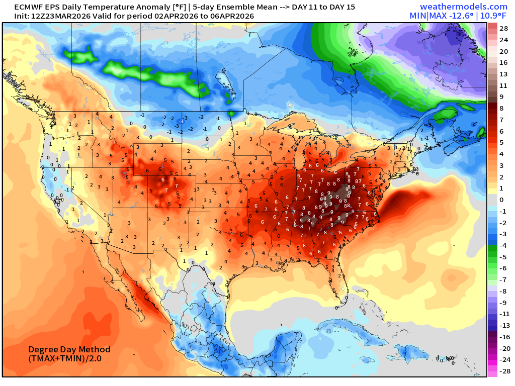
Eastern U.S. warmth for the first week of April.
Maps sourced from weathermodels.com designed and innovated by yours truly! Please subscribe there for real-time access to the newest maps, charts from all of the weather models including ECMWF and AIFS, and NOAA GFS/GEFS. NOAA WPC and SPC for fronts/convective outlooks.
- Milepost
- 902 · laid 2026-03-24T01:42:41.231000Z
- Source
- https://weather.substack.com/p/march-23-2026-monday-weather-update
- Digest
- 838b6cdae83e4ec9c6513c1fb5122c640d3366add94ad4b94ab64eff1ea2805b
- Machine
- JSON