March 10, 2026 Tuesday Weather Update
Evening severe weather event from Texas to Michigan
March 2026 was the warmest March in the 132-year national record (1895–2026), at 50.8°F against a 1991–2020 normal of 43.6°F (+7.3°F).
March 2026 was the 8th-driest March in the 132-year national record (1895–2026), at 1.8in against a 1991–2020 normal of 2.5in (-0.7in).
NOAA/NCEI Climate at a Glance, contiguous United States. This is the observed record for the month, not a score of anything said in this piece — the forecast ledger begins 2026-08-17 and cannot reach earlier posts.

Active convective watches (tornado and severe thunderstorm) at 8:46 PM ET
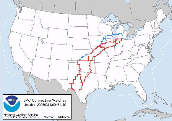
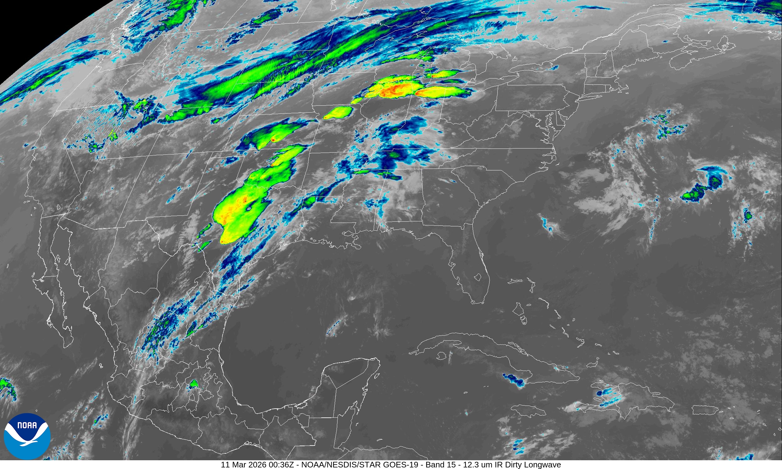
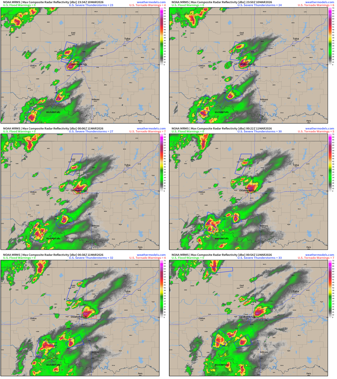
Convection blowing up along cold front boundary stretching from Texas to Illinois where the warm front / nose in northern Illinois has seen supercells with massive hail and observed tornadoes. I’m only providing an overview and hopefully everyone in the path of these dangerous storms is dialed into their local television station or monitoring the radar.
Oklahoma City Radar to 7:54 PM CT
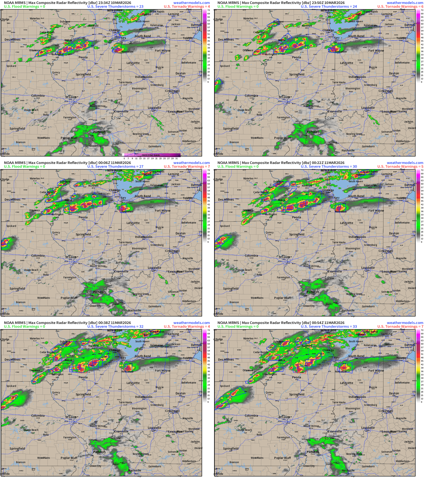
Northern Illinois into Indiana — massive supercells especially one through Kankakee
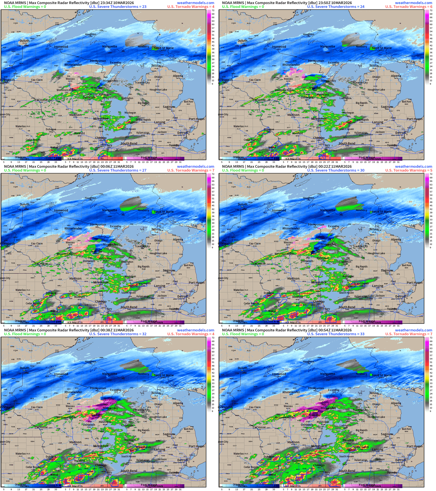
Heavy snowfall across northern Wisconsin and the Upper Peninsula of Michigan with severe thunderstorms from Holland to Grand Rapids.
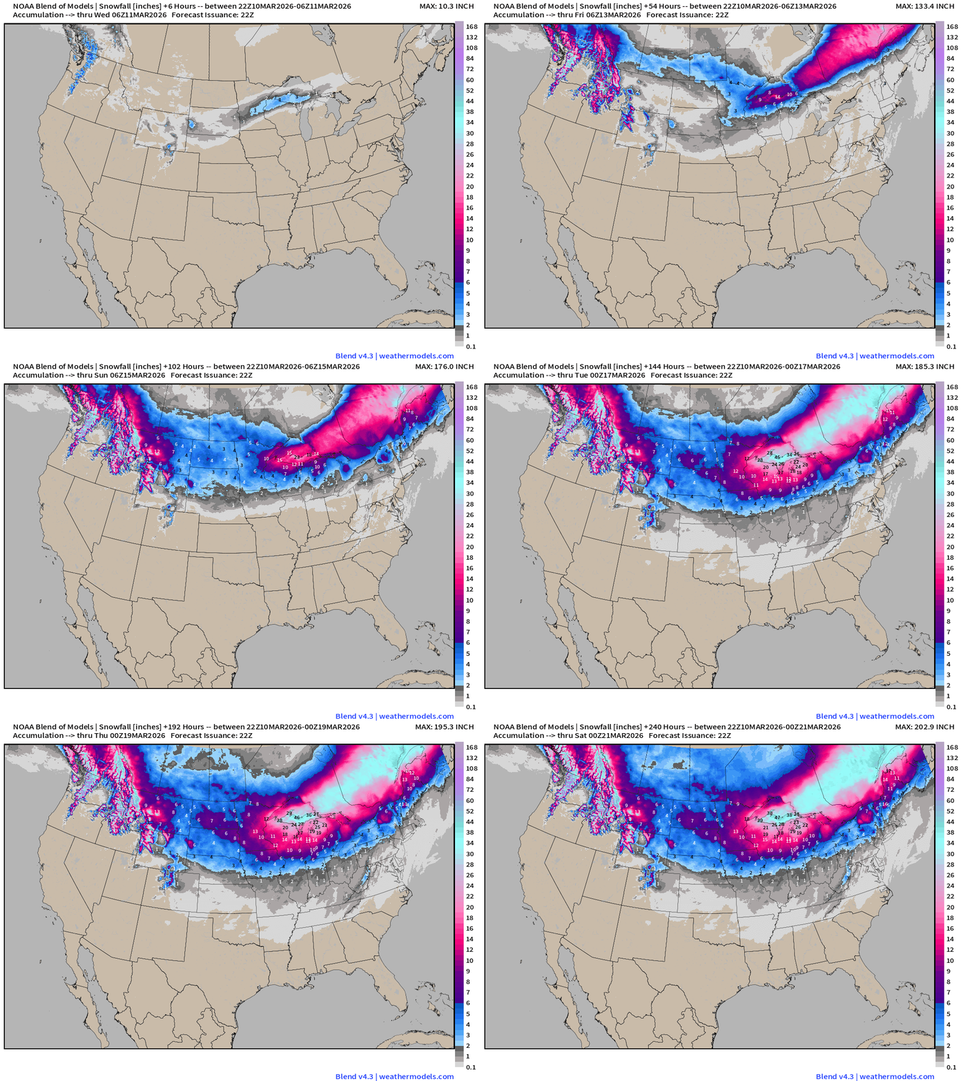
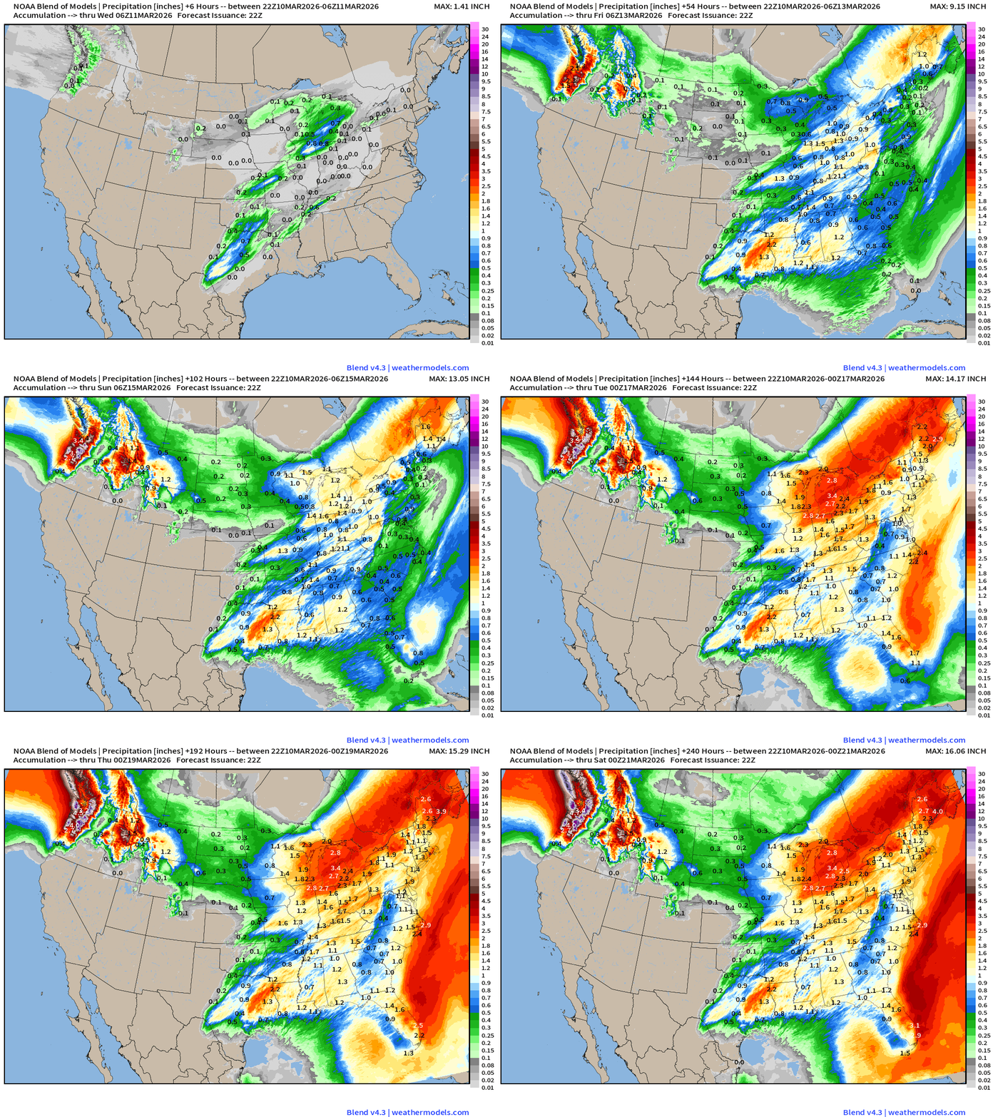
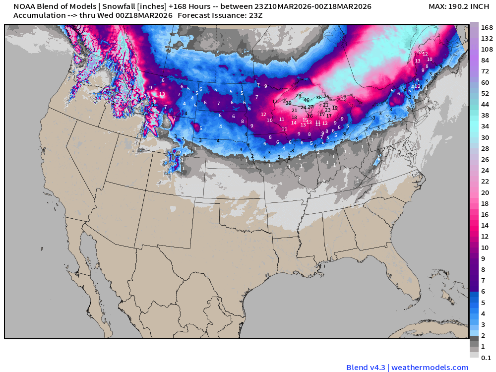
Snowfall from the Blend of Models for the next 10-days is incredible with upwards of 4-feet expected in the UP of Michigan and along a huge swath into Ontario and Quebec.
ECMWF 18z Precipitation Type + Intensity | Next 6-days
3 Major Storm Systems
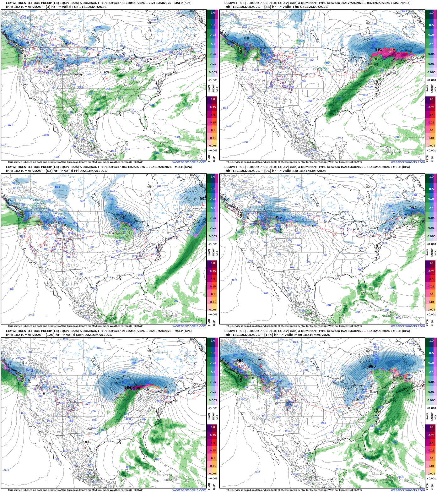
Ongoing storm with severe weather develops a strong surface low in Michigan and Canada into Wednesday and Thursday. The trailing cold front loses its punch with only slight severe weather chances on Wednesday.
Potent Alberta Clipper System scoots from Midwest into Great Lakes on Friday
Finally, a massive blizzard Sunday into Monday for Midwest and Great Lakes
Western U.S. — atmospheric river onslaught into Pacific Northwest
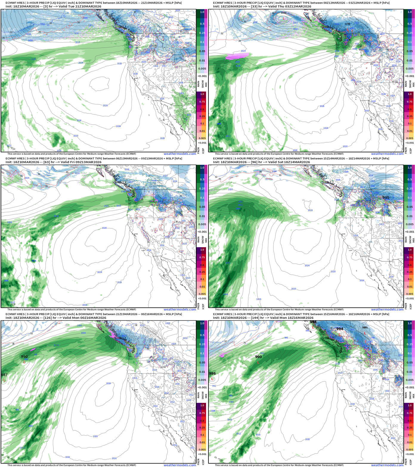
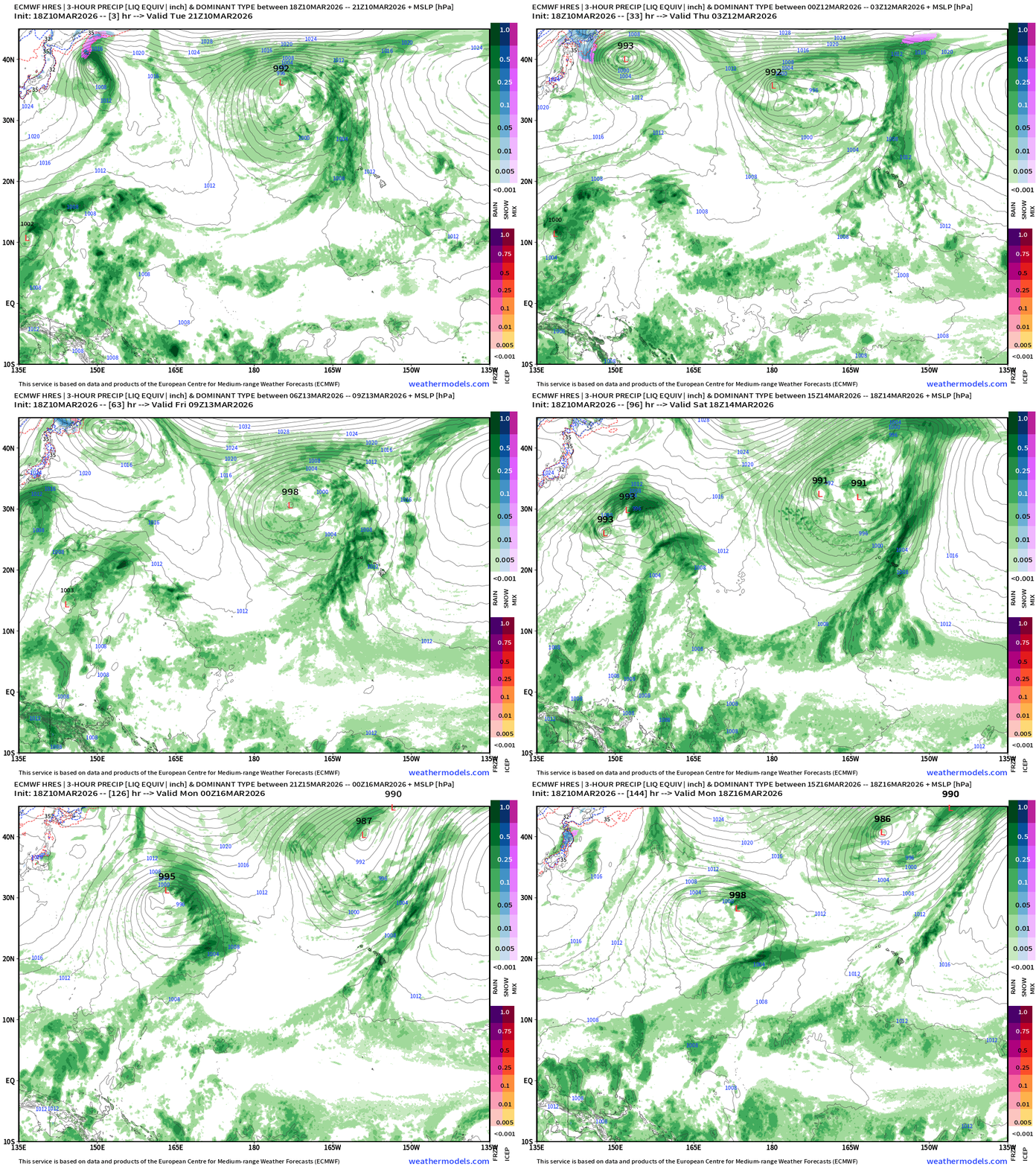
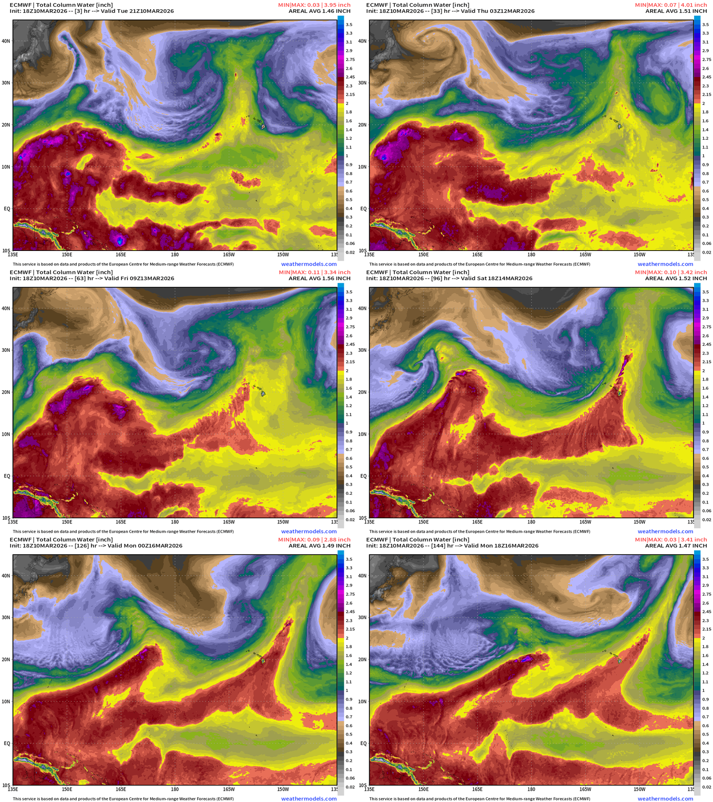
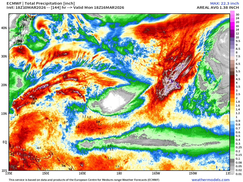
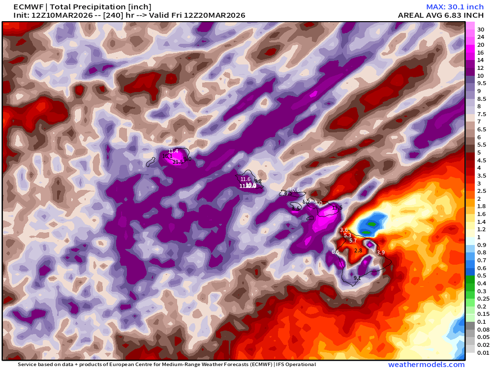
Hawaii Kona Low — incredible rainfall (10” to 30”+) from tropical atmospheric river feeds
Precipitable Water Across Central Pacific — Whoa — huge flow with 2 channels of 2”+ PWAT atmospheric rivers
Hard to nail down exact rainfall amounts … but potential for 10” to 20” likely for Hawaiian Islands next 6-10 days
Daily High Temperatures to Thursday March 19th
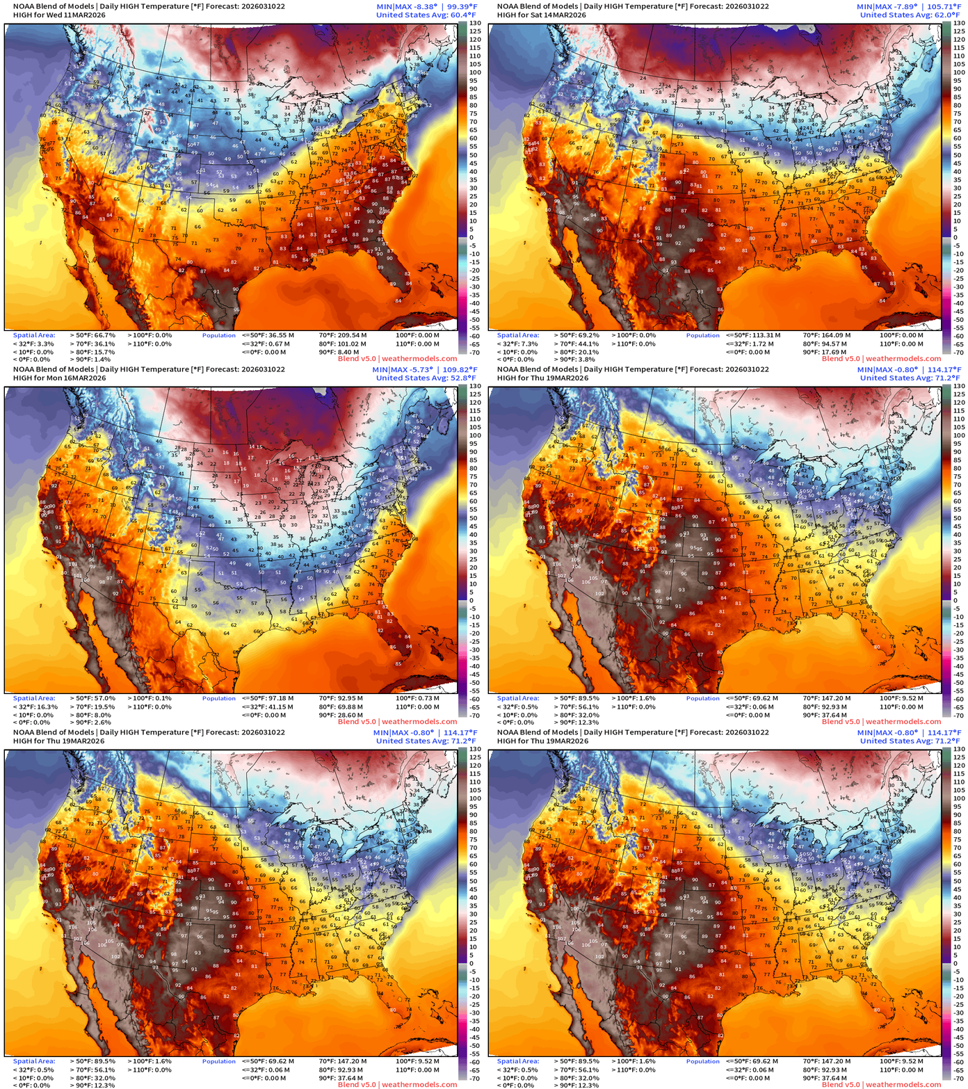
Heat Dome forms across the Western U.S. with temperatures in the Southwest pushing well into the 100s including Phoenix by next Tuesday.
The polar vortex enabled trough across the Eastern U.S. will drop freezing temperatures for daytime highs across the Midwest and Great Lakes early next week.
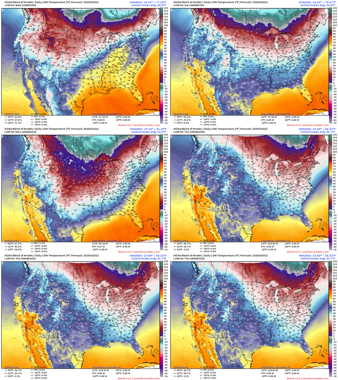
Lows to Next Thursday March 19th
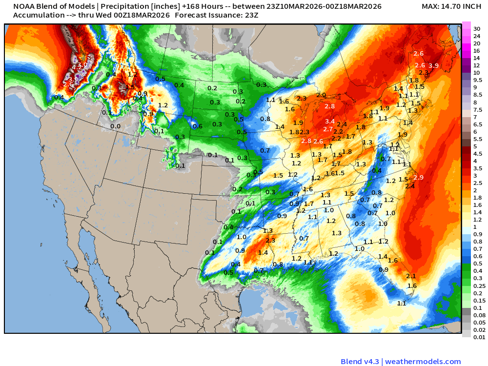
Boatloads of precipitation / heavy rainfall + snowfall for next 10-days
Next 6-days of Precipitable Water (my favorite parameter)
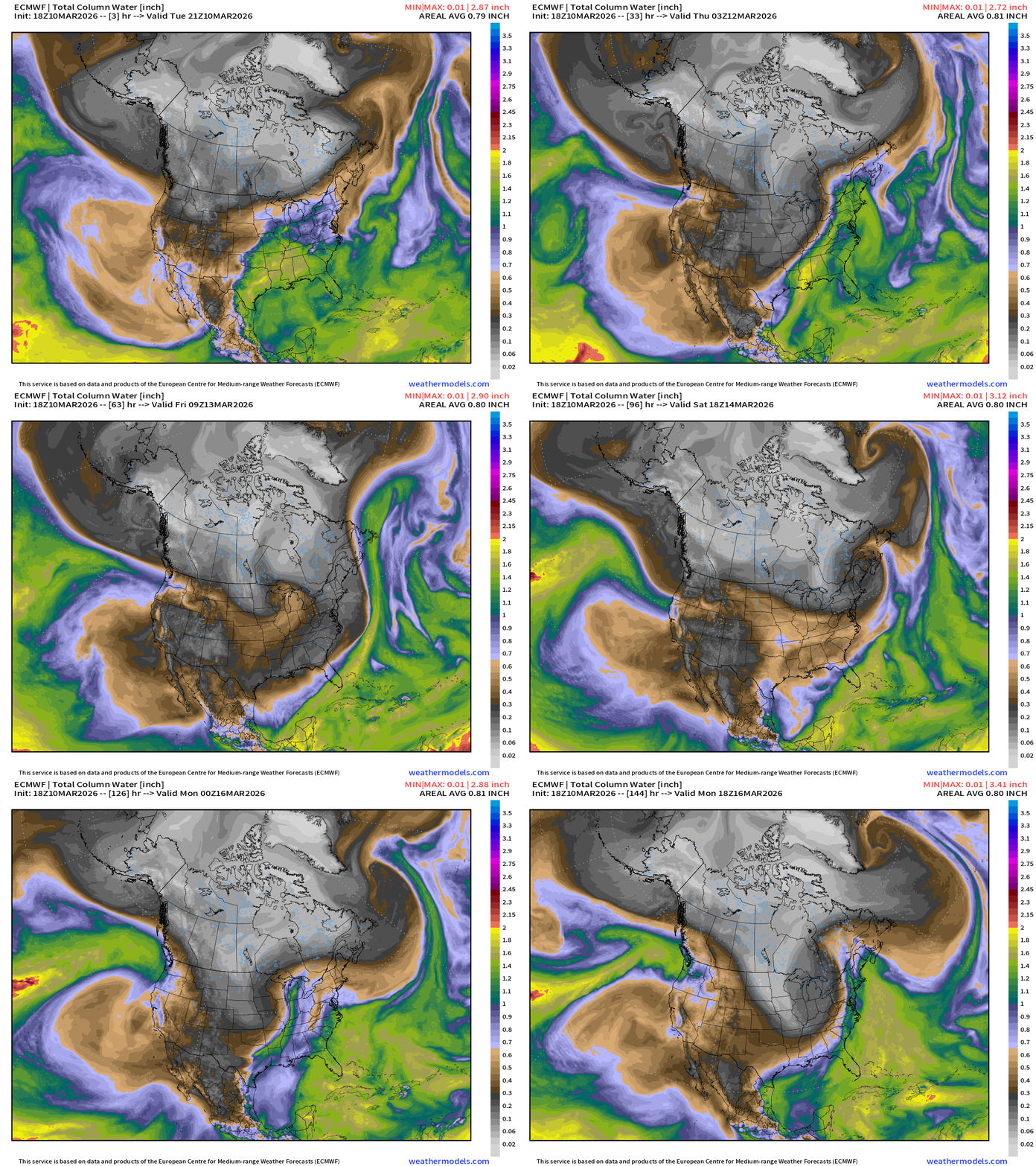
Arctic cold pool is mostly held back into Canada but the upcoming storm system Thu/Fri does sample that drier/cooler air mass.
Massive blizzard on Sunday / Monday has full weight of polar vortex (dry, cold) air behind it
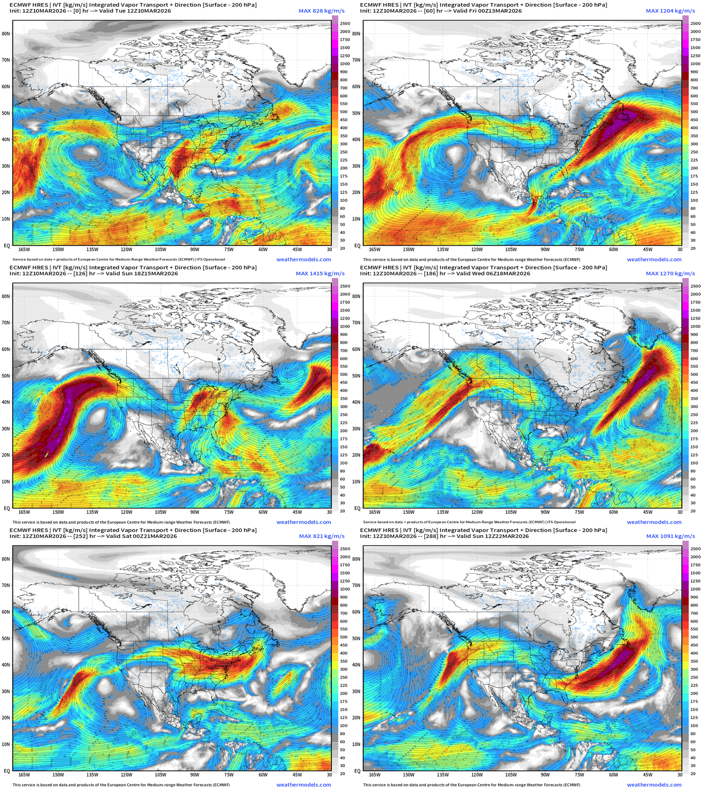
Next 12-days of Integrated Vapor Transport (ECMWF 12z)
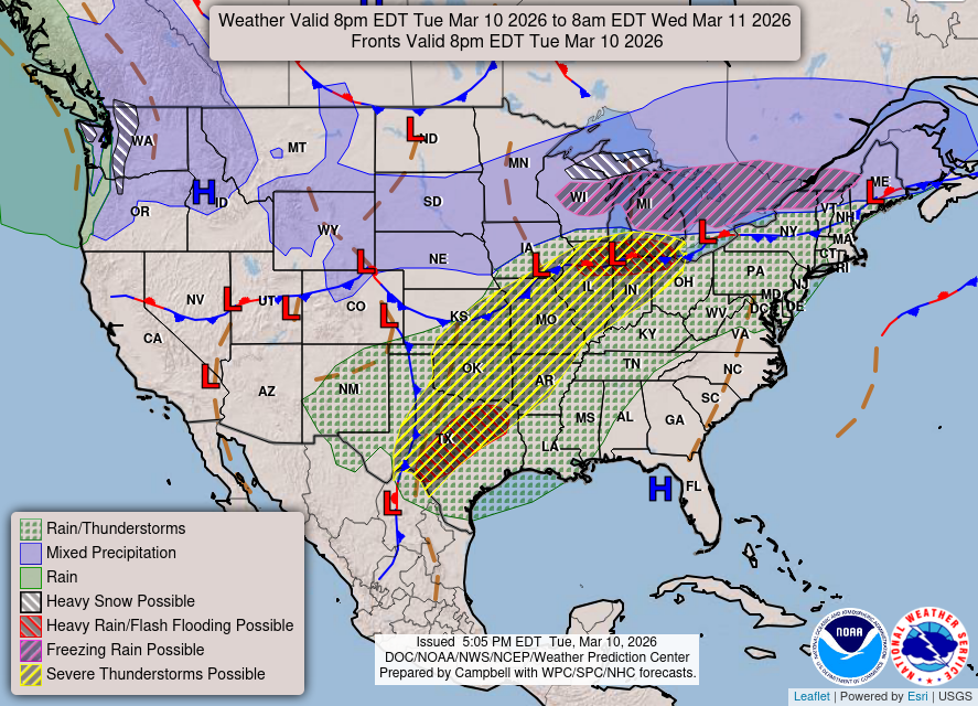
Weather into Wednesday morning — severe weather underway from Texas to Oklahoma and northwards into Iowa, Illinois, Michigan, and Indiana
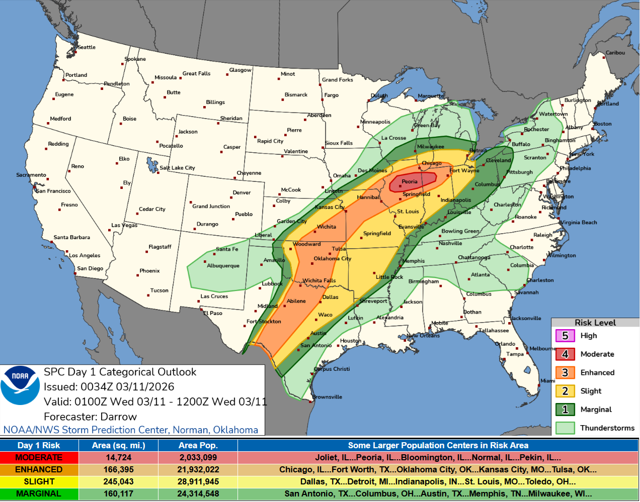
Moderate risk (4/5) from Peoria, Illinois into Indian
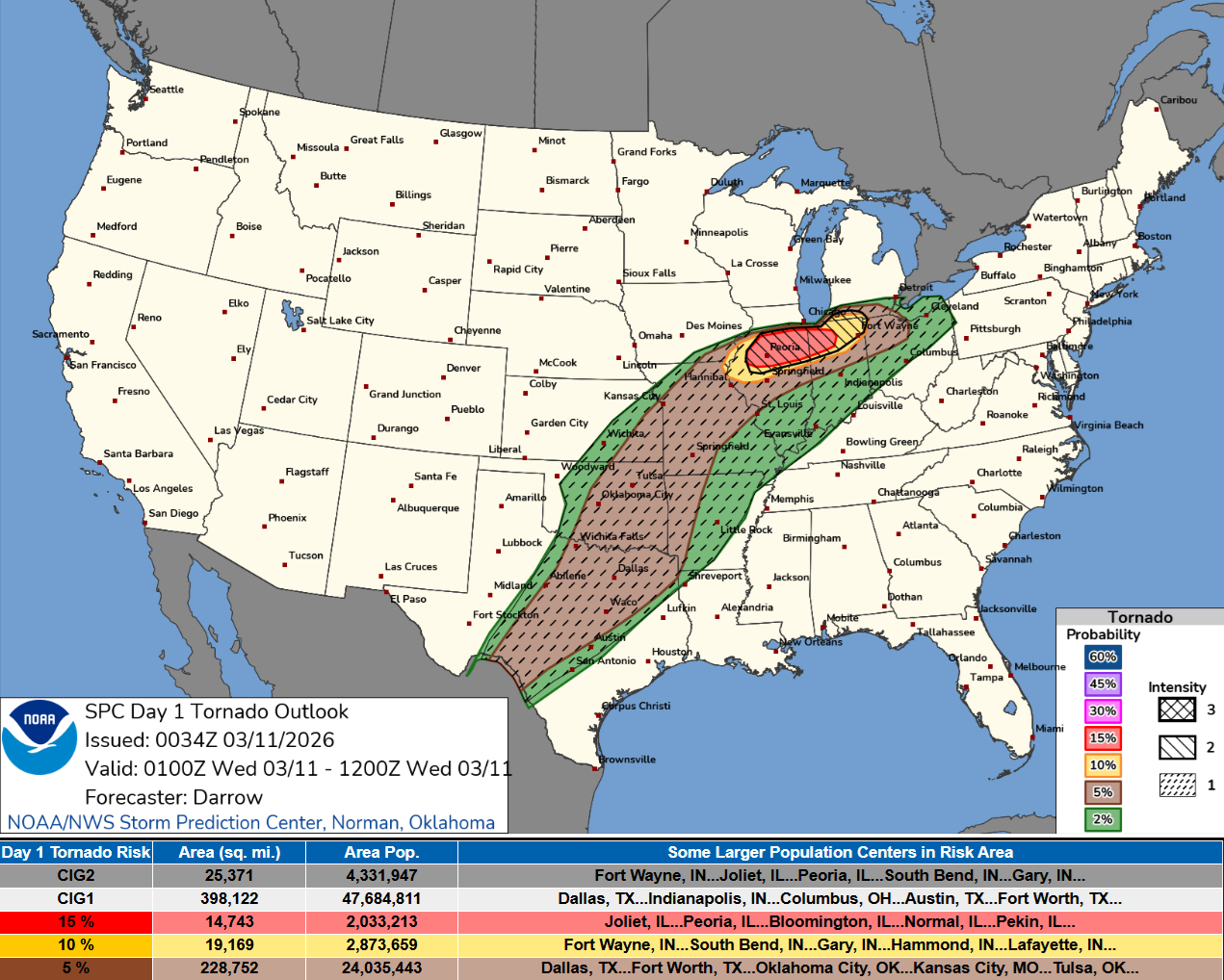
Strongest tornado threat + chance in that moderate zone
HRRR 22z —> Wednesday 12 PM ET
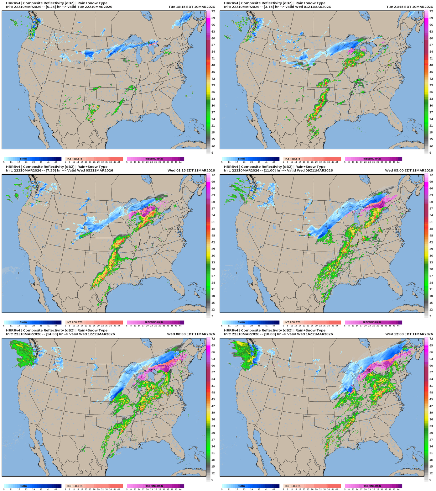
Weather on Wednesday into early Morning Thursday
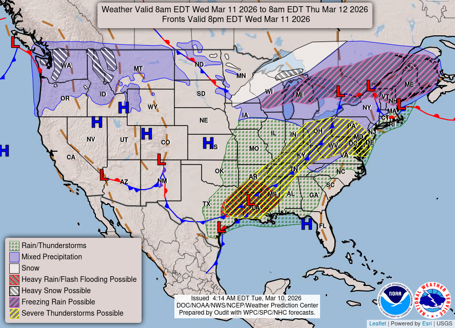
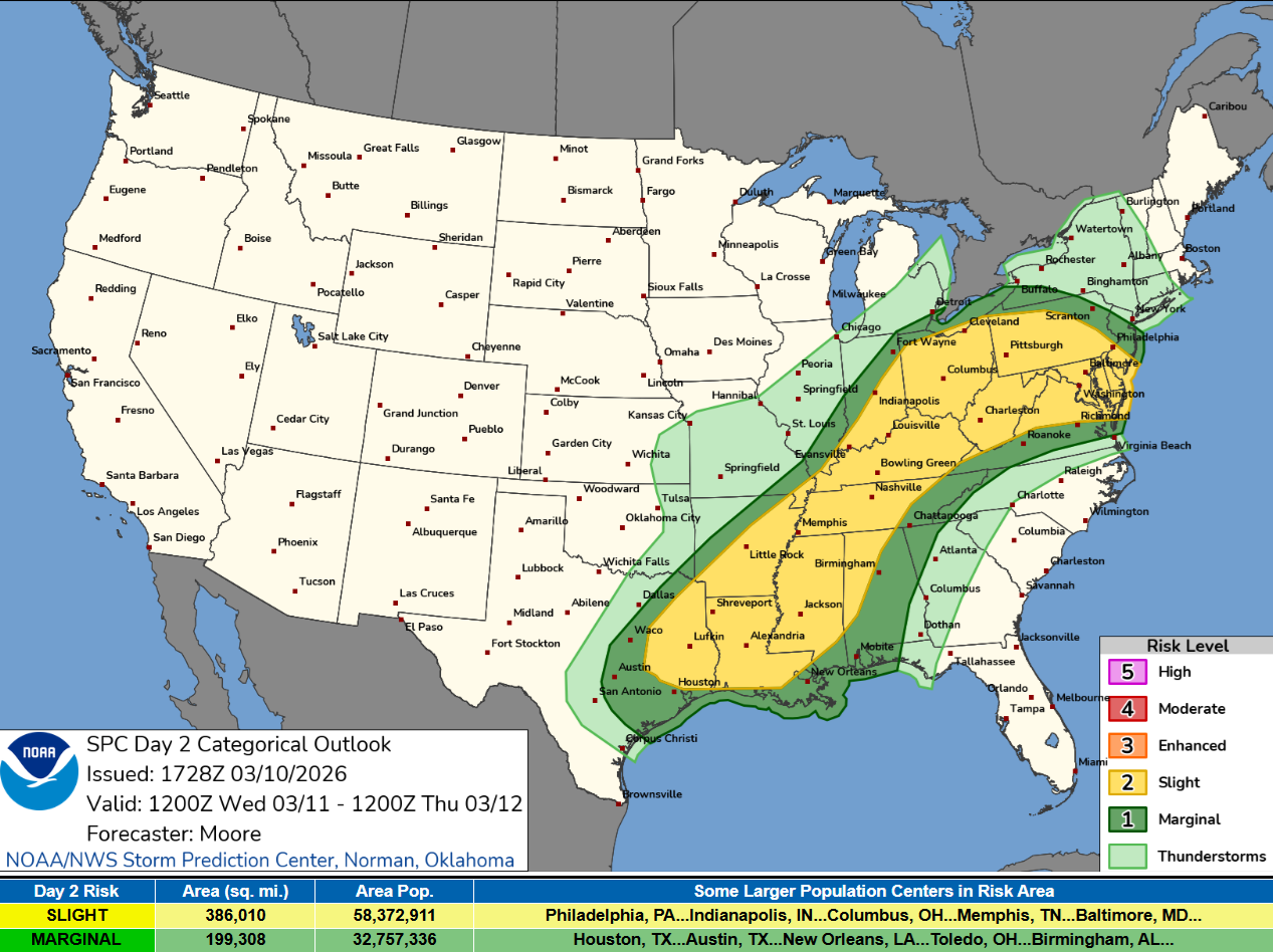
Slight Risk of Severe Storms from Houston to Washington D.C.
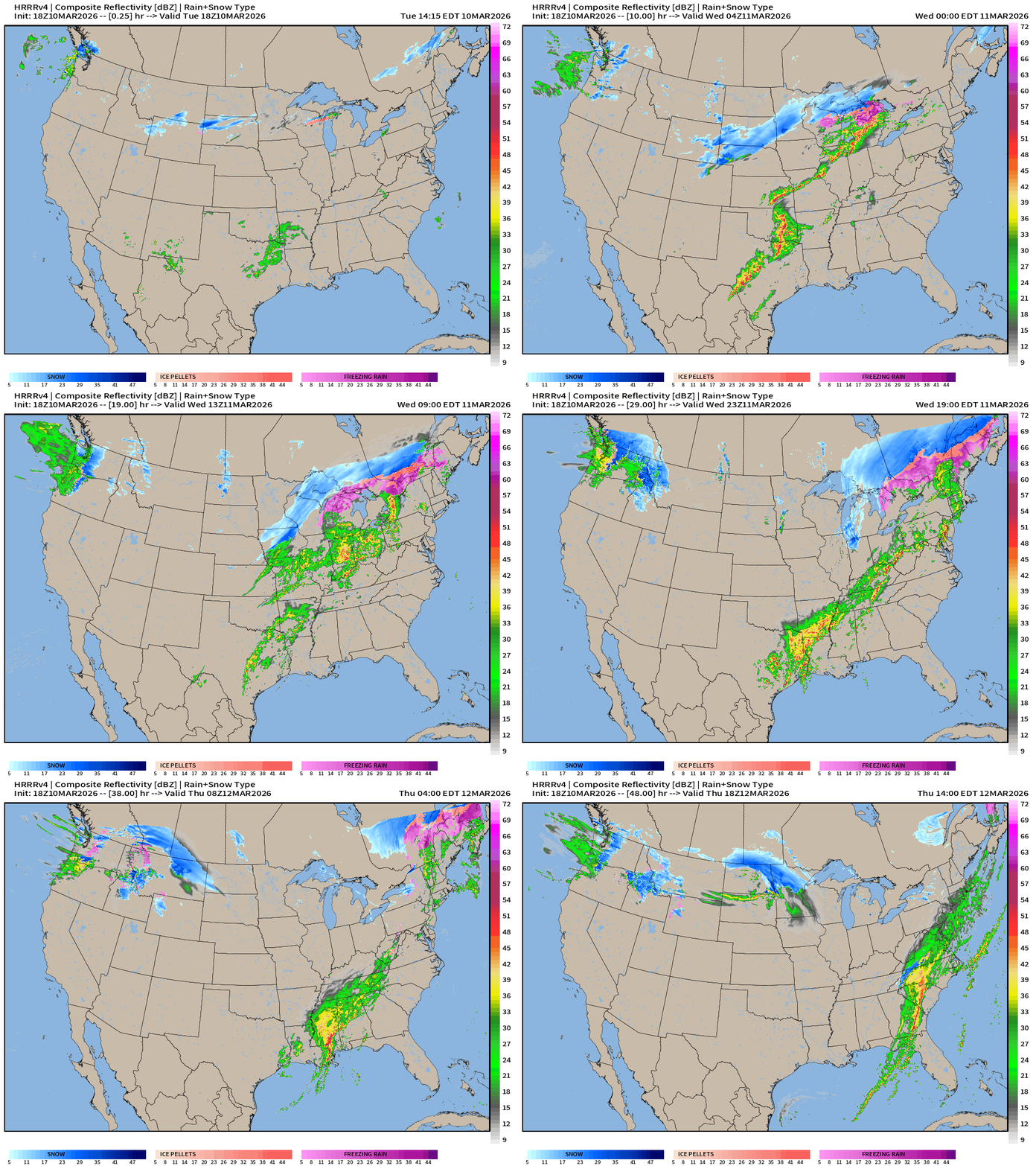
HRRR 18z — Radar Simulation Next 48-hours to Thursday 2 PM ET
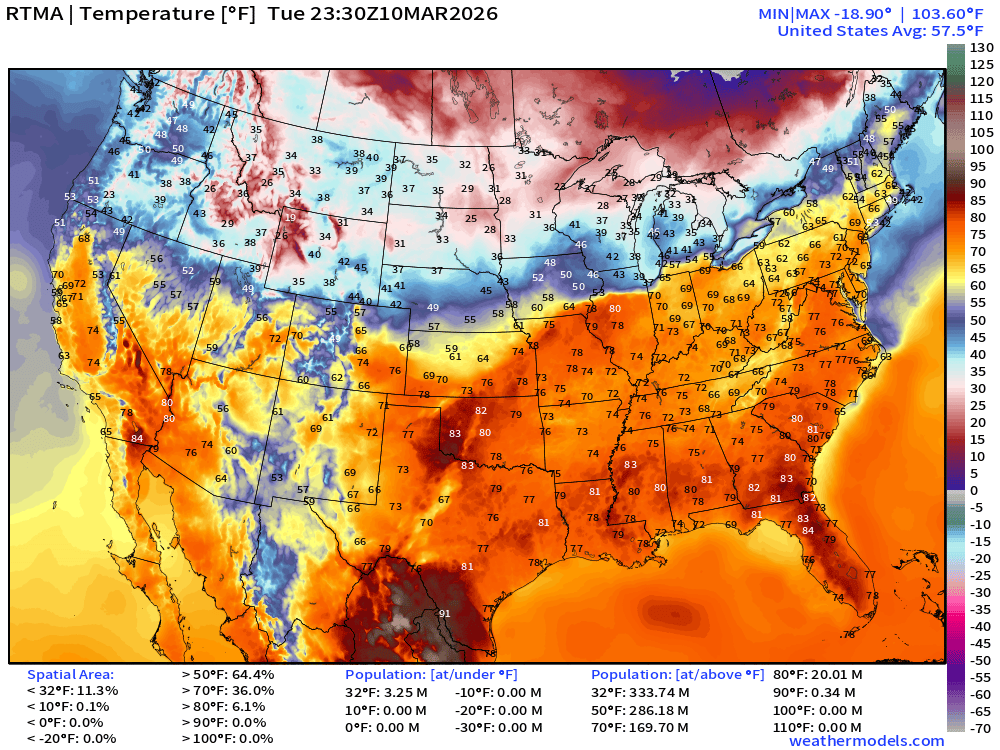
RTMA Current Temperature Analysis | 7:30 PM ET
RTMA Current Temperature Anomaly Analysis | 7:30 PM ET
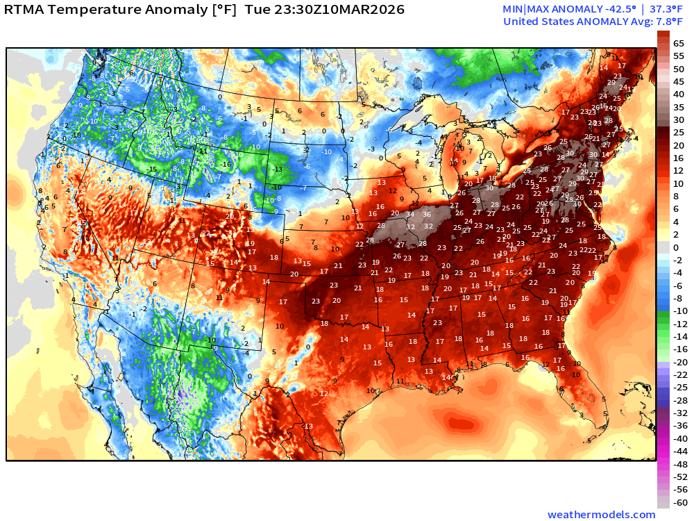
Lower 48 is 7.8°F above normal
Low Temperatures on Wednesday
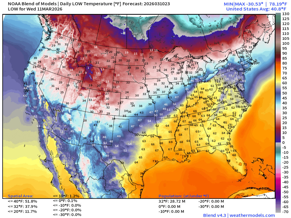
29 million below freezing
High Temperatures on Wednesday
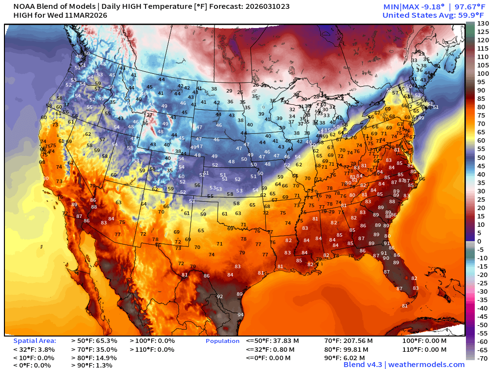
208 Million at least 70°F and 100 million at least 80°F
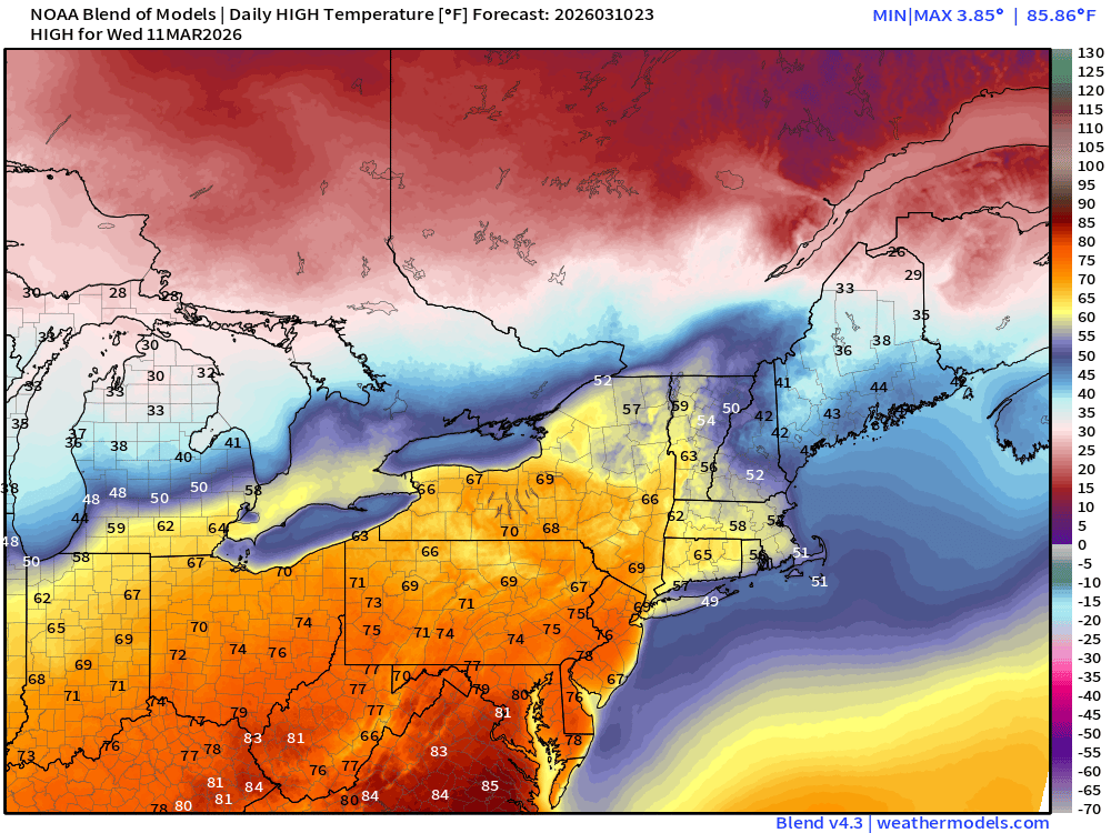
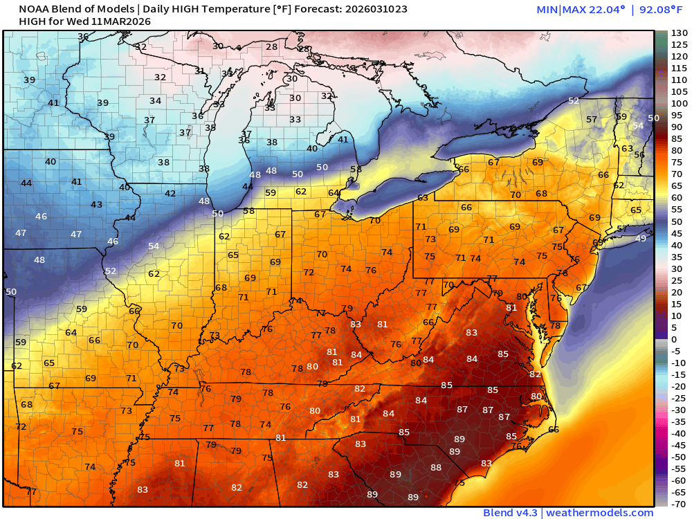
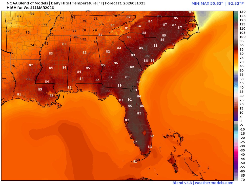
90s in Florida and the Carolinas possible
NDFD NWS Total Precipitation Next 72-hours through Friday Afternoon
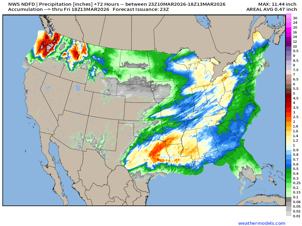
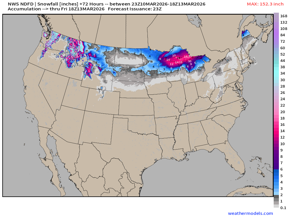
NWS Snowfall Next 72-hours — through Friday Afternoon
Blend of Models | 7 Days Precipitation Total
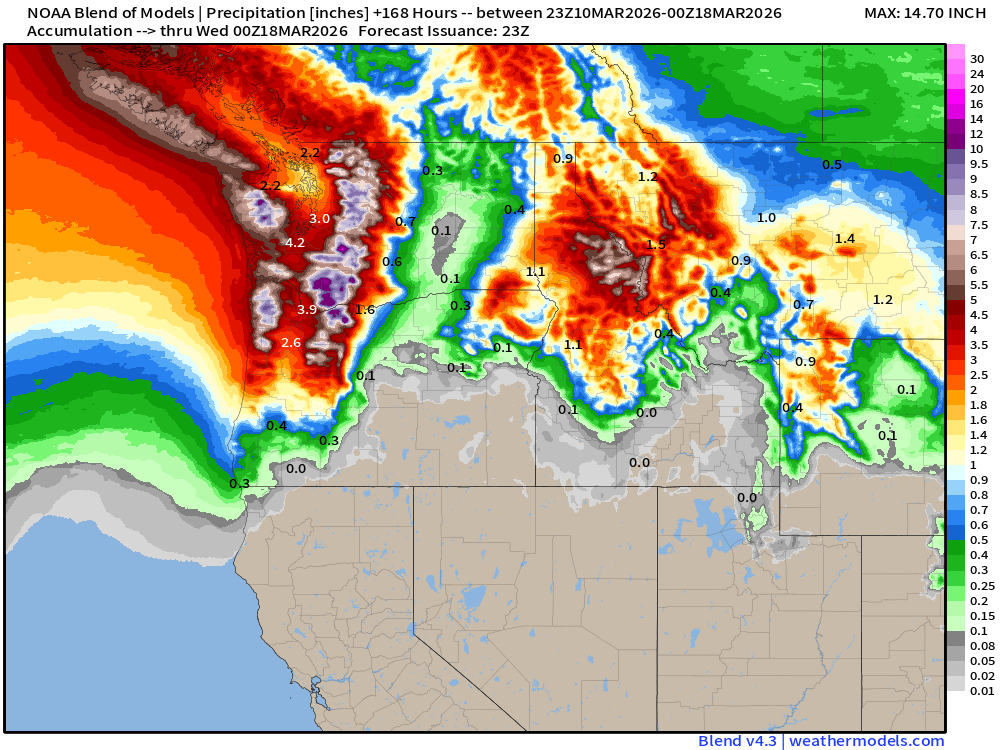
Blend of Models | Total Snowfall Next 7-Days
ECMWF AIFS 18z | Temperature at 500 mb | Next 12-days
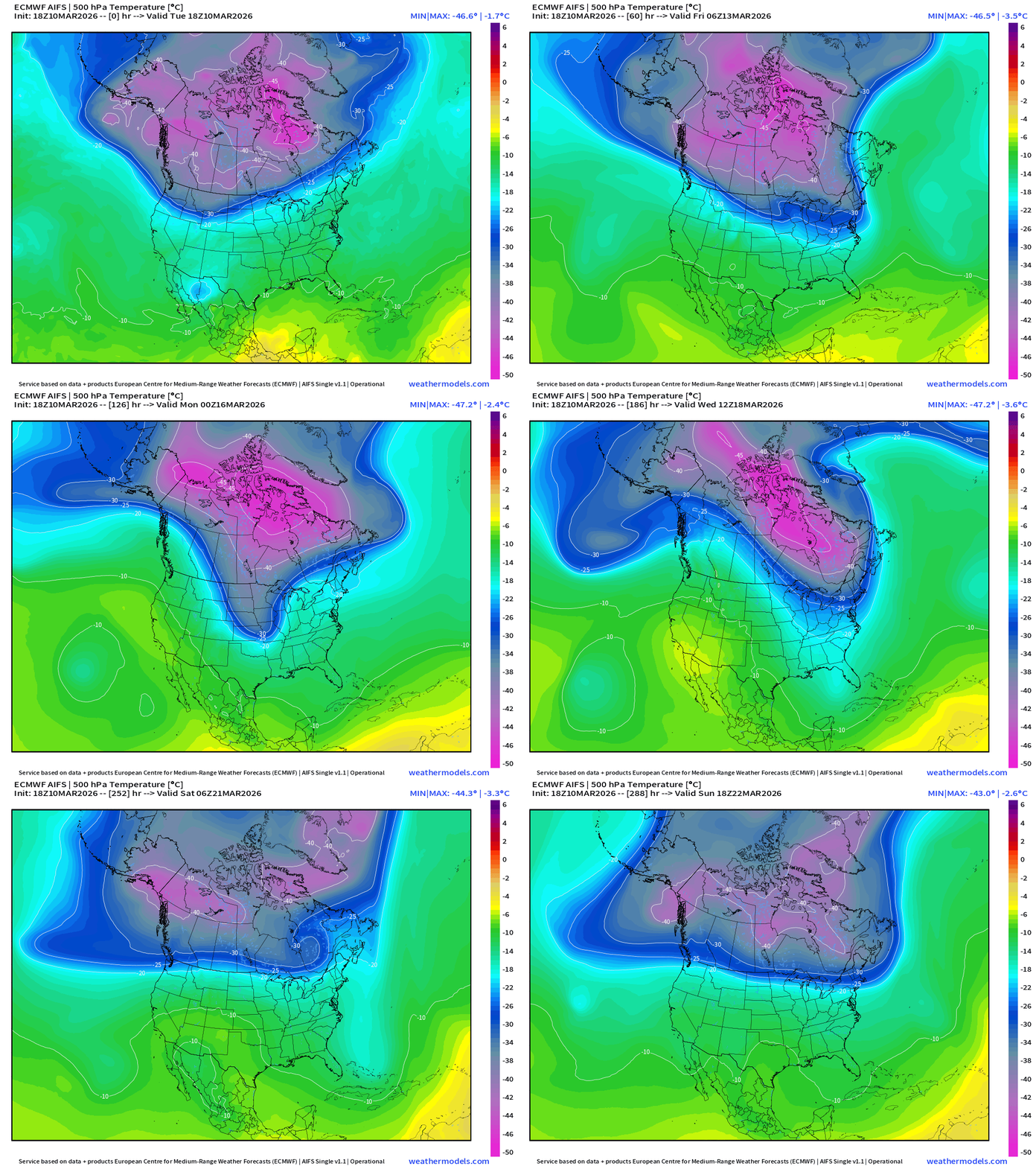
The entire PV descends / stretches southward … and plenty cold with the centroid at -45°C at 500 mb … with a lobe into Great Lakes / Northeast at Days 5-7. Remarkably strong PV / Arctic blast for mid-March!
ECMWF AIFS 18z | Height Anomaly at 500 mb | Next 12-days
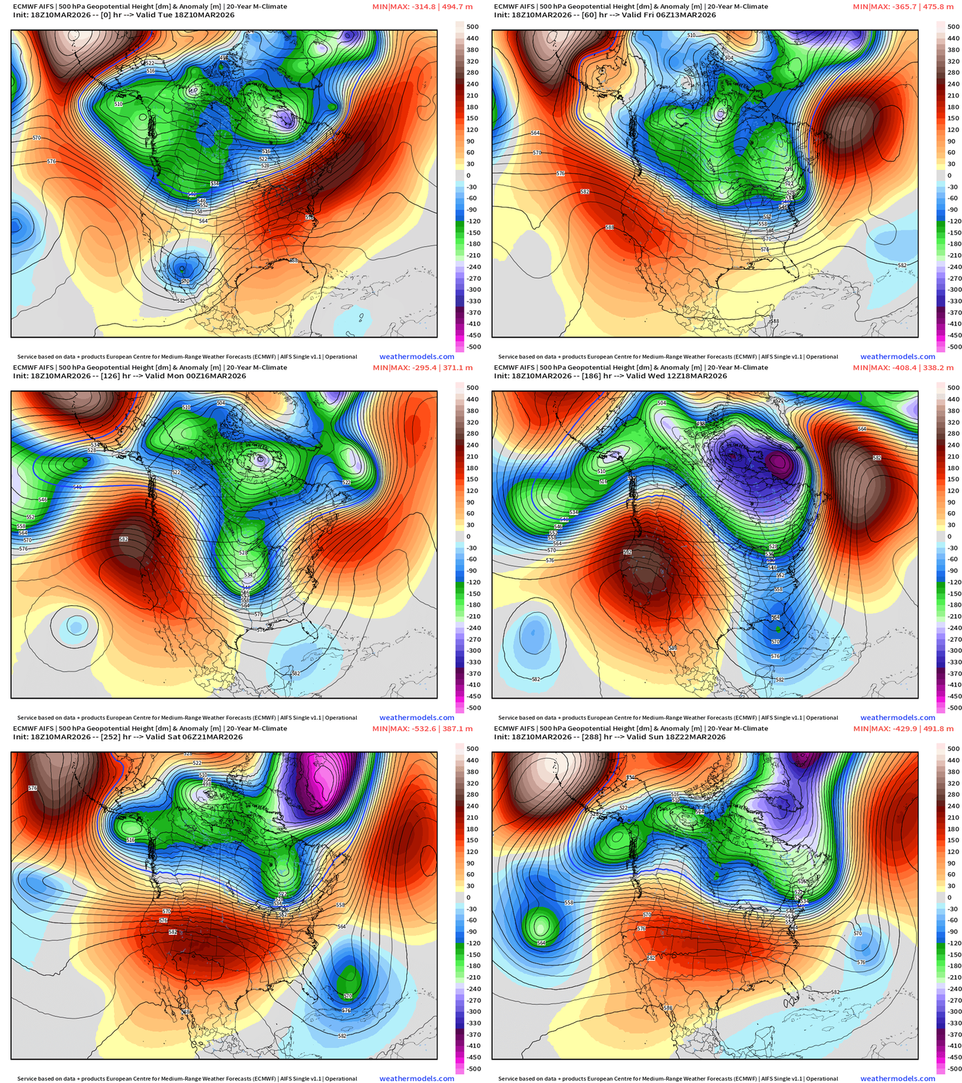
Major heat dome across the Western U.S. vs. trough dipping out of Canada east of the Rockies = very cold
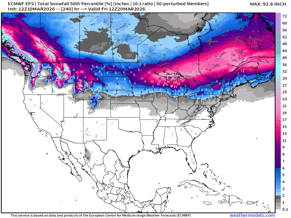
Snowfall | Median of ECMWF Ensembles at 12z | Next 10-days
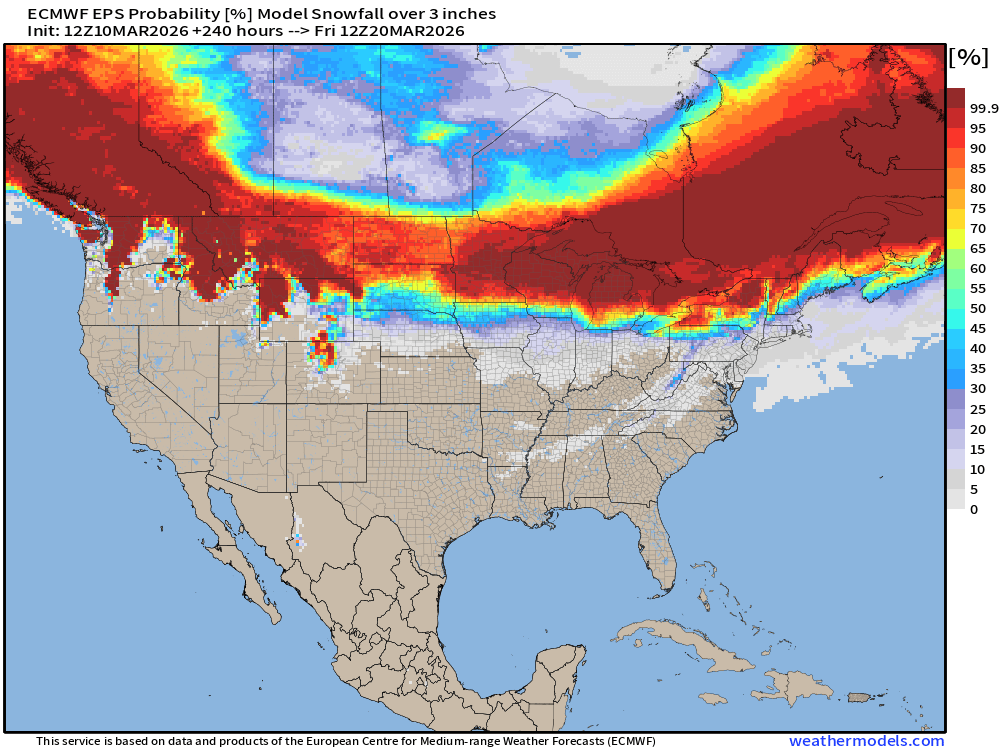
Probability of at least 3” of Snowfall Next 10-days
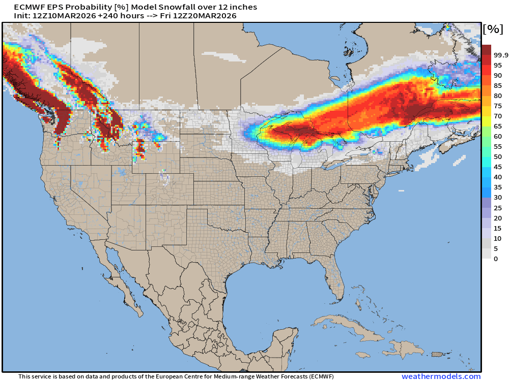
Probability of at least 12” of Snowfall Next 10-days
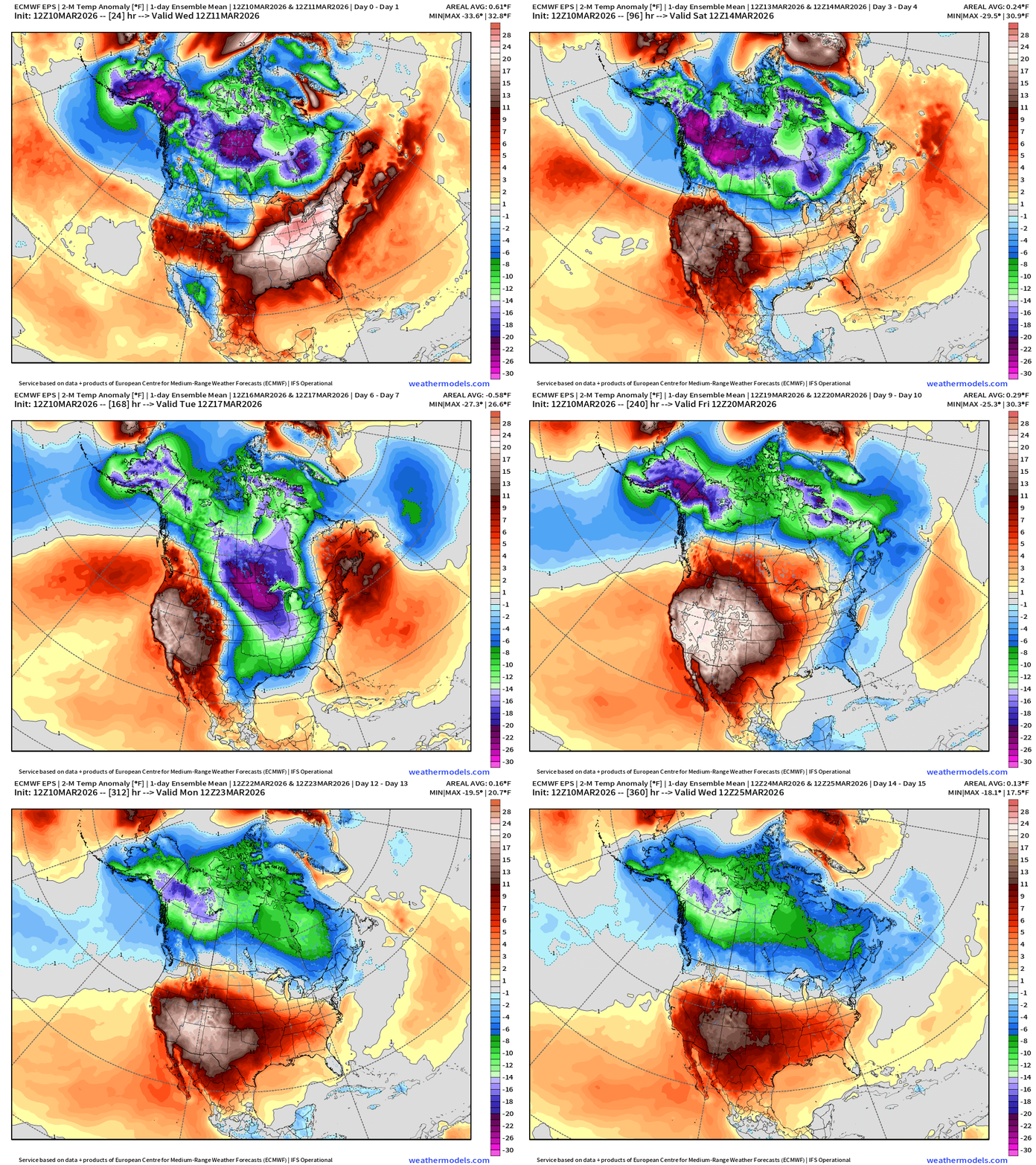
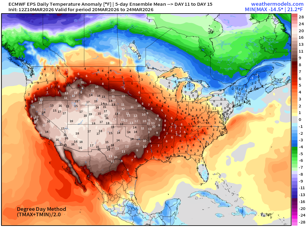
Temperature Anomaly | Next 15-days | ECMWF EPS 12z Ensemble Mean Flagship
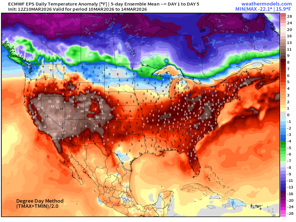
5-Day Chunk #1 | Temperature Anomaly | March 10 - March 14
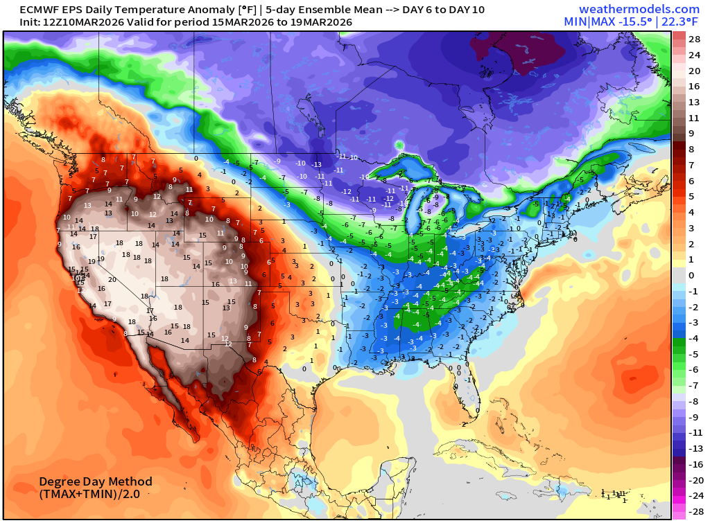
5-Day Chunk #2 | Temperature Anomaly | March 15 - March 19
5-Day Chunk #3 | Temperature Anomaly | March 20 - March 24
Maps sourced from weathermodels.com designed and innovated by yours truly! Please subscribe there for real-time access to the newest maps, charts from all of the weather models including ECMWF and AIFS, and NOAA GFS/GEFS. NOAA WPC and SPC for fronts/convective outlooks.
- Milepost
- 892 · laid 2026-03-11T01:17:06.946000Z
- Source
- https://weather.substack.com/p/march-10-2026-tuesday-weather-update
- Digest
- 730b7f94bf175781906abee6bb4005c43fe6663f5ae5a2ee3c6b0099c72de6fc
- Machine
- JSON