March 3, 2026 Tuesday Weather Update
After week of Spring warmth return to winter into mid-March as polar vortex stretches into Lower 48
March 2026 was the warmest March in the 132-year national record (1895–2026), at 50.8°F against a 1991–2020 normal of 43.6°F (+7.3°F).
March 2026 was the 8th-driest March in the 132-year national record (1895–2026), at 1.8in against a 1991–2020 normal of 2.5in (-0.7in).
NOAA/NCEI Climate at a Glance, contiguous United States. This is the observed record for the month, not a score of anything said in this piece — the forecast ledger begins 2026-08-17 and cannot reach earlier posts.

Daily High Temperatures to Thursday, March 12th.
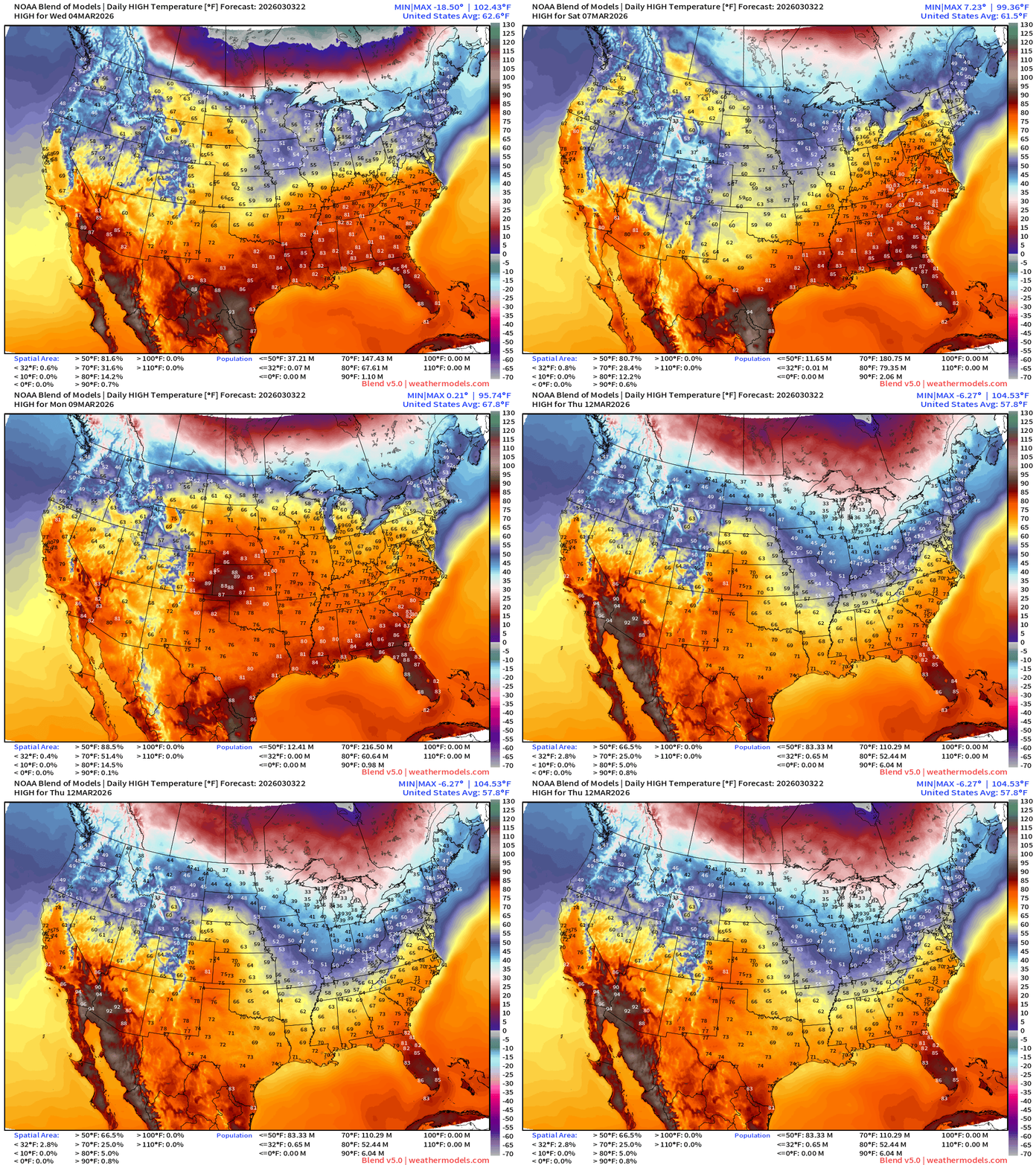
Enjoy the spring time warmth, maybe even “heat” with temperatures pushing into the 80s for > 100 million Americans over next 7-10 days. The next major risk of cold air will not be until middle of next week.
Lows for the next 8-days — through Thursday morning the 12th.
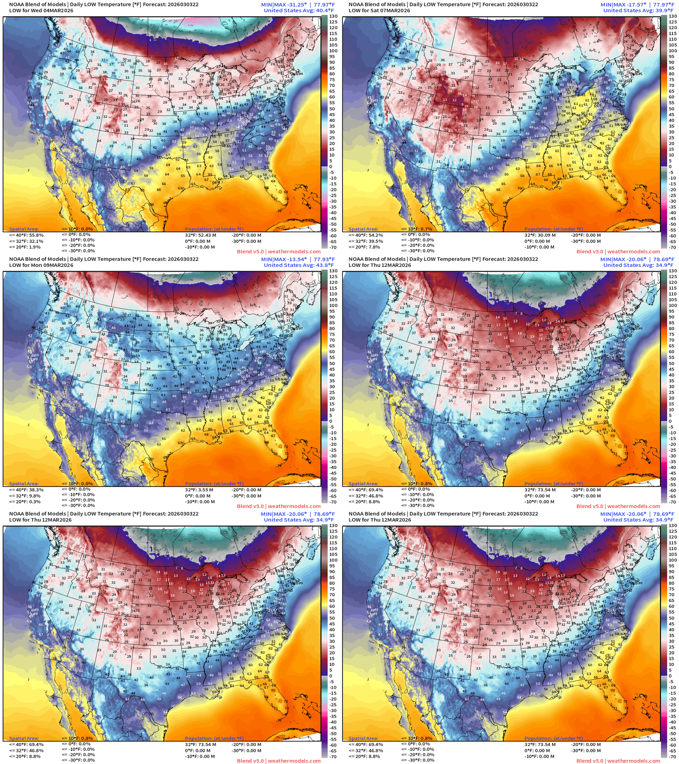
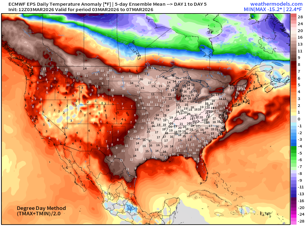
Very mild eastern U.S. for next 7-days and then we will see (hopefully) winter’s final Arctic blast move through the Lower 48 for middle March.
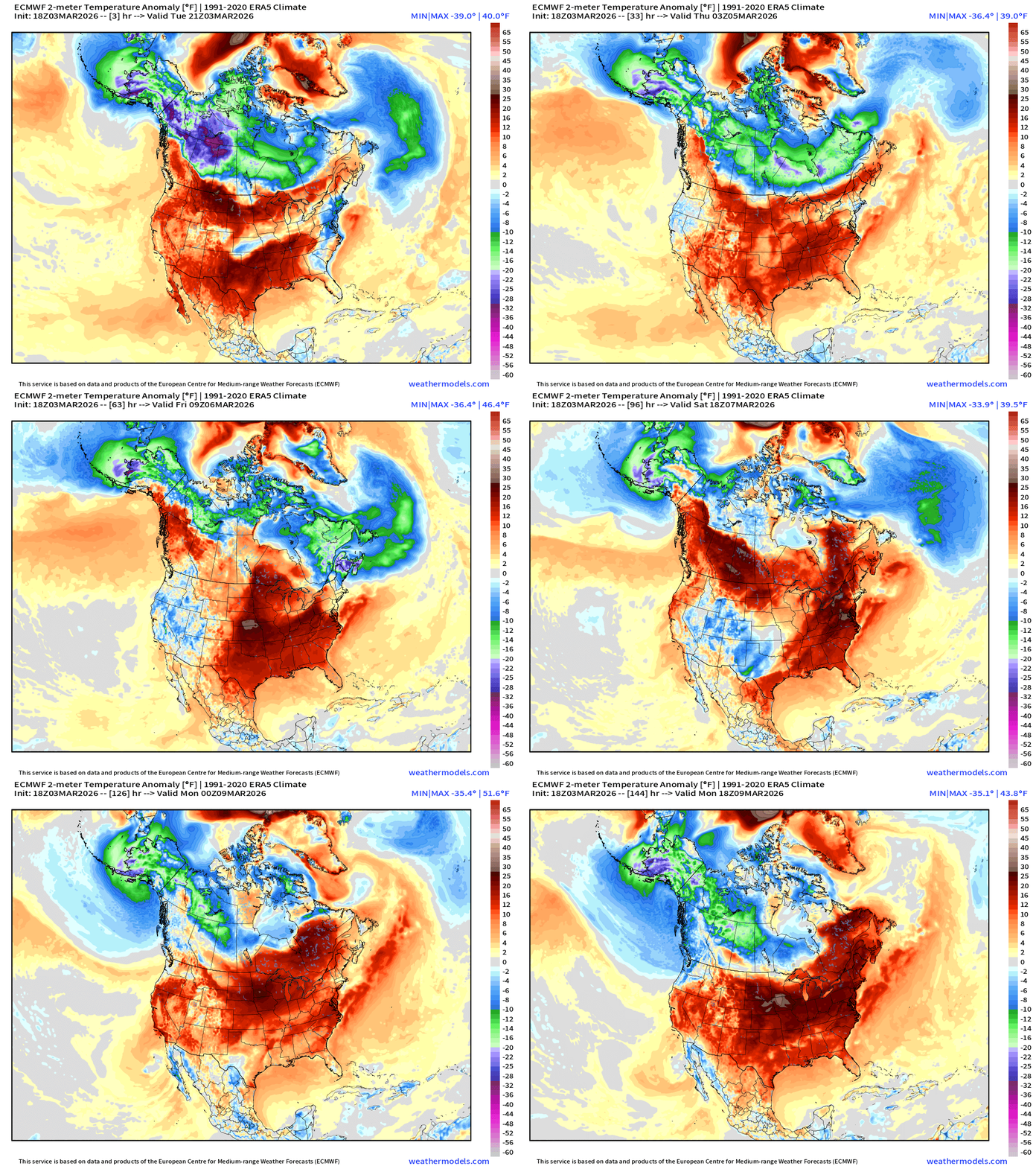
Temperature Anomaly Next 6-days —> Much above normal temperatures across much of the Lower 48 with warm, southerly flow. The coldest Arctic air across Canada is eroded with help from the Pacific leaving Alaska as the main source of cold pool formation.
Next 6-days of Precipitable Water (my favorite parameter)
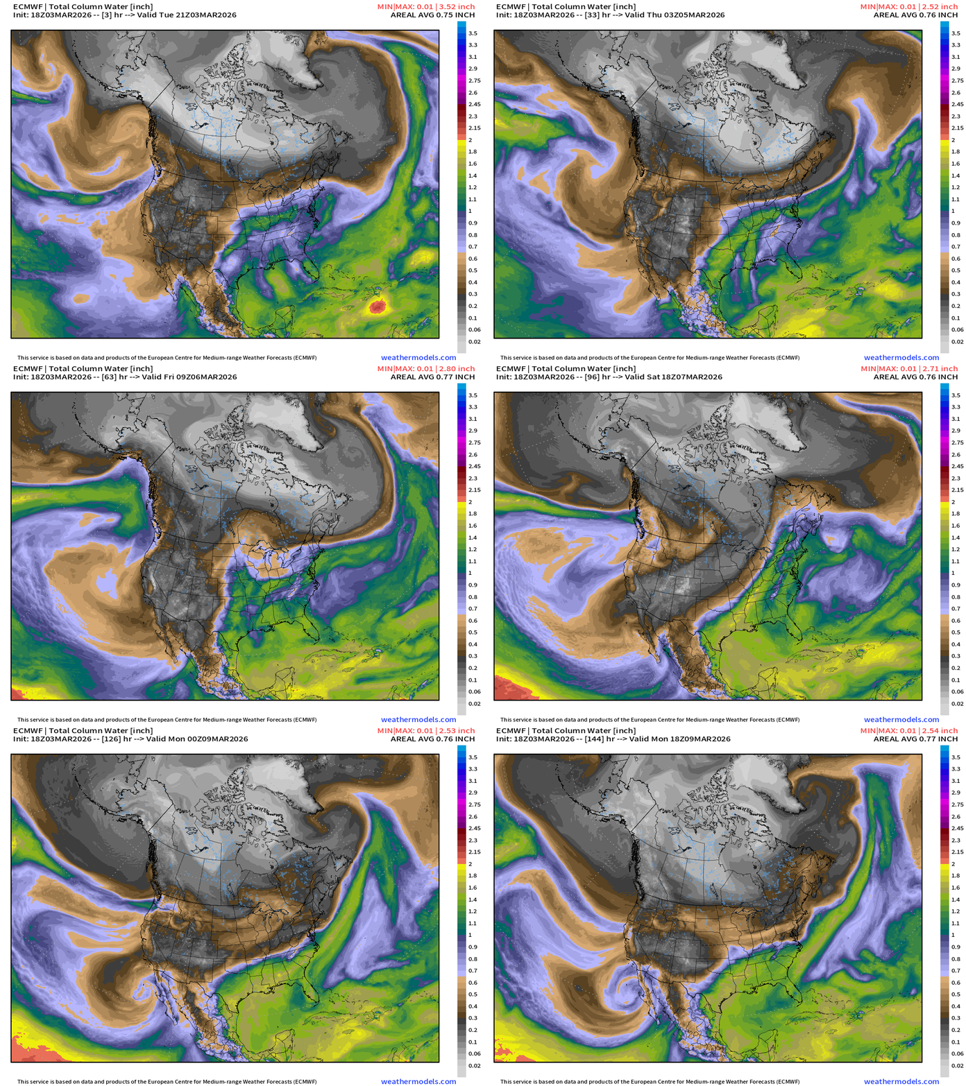
Not much update from yesterday … impressive surge of moisture out of the Gulf of Mexico moves across Eastern U.S. well into the Great Lakes.
An impressive atmospheric river impacts Alaskan panhandle and western Canada = heavy moisture and warmer air.
Next 12-days of Integrated Vapor Transport (ECMWF 12z)
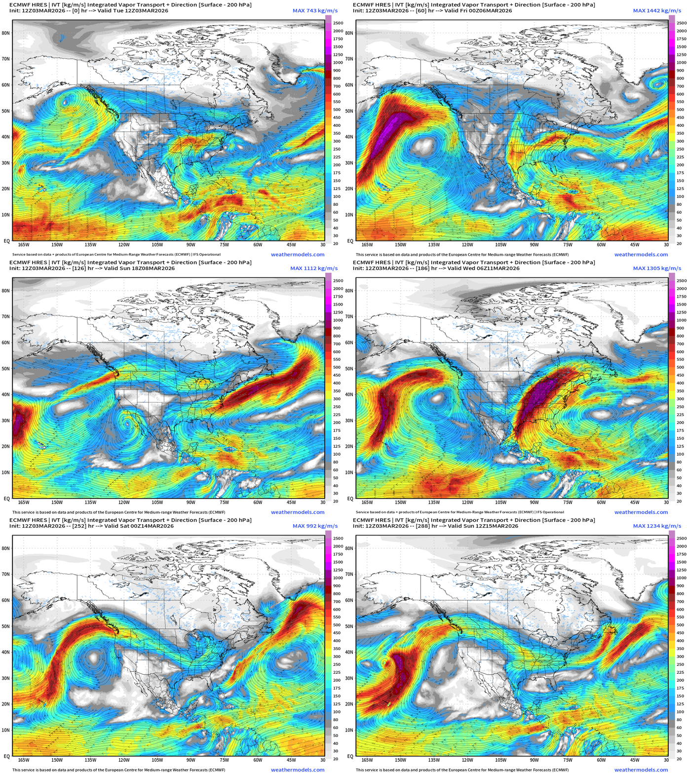
Next week or so, multiple surges of moisture from the Gulf of Mexico enhanced by storm systems = heavy rain and thunderstorms (severe weather) across the central Plains and eastward — “ring of fire” around subtropical ridge / Bermuda High.
Pacific moisture also introduced to the upper-level pattern for southern Canada.
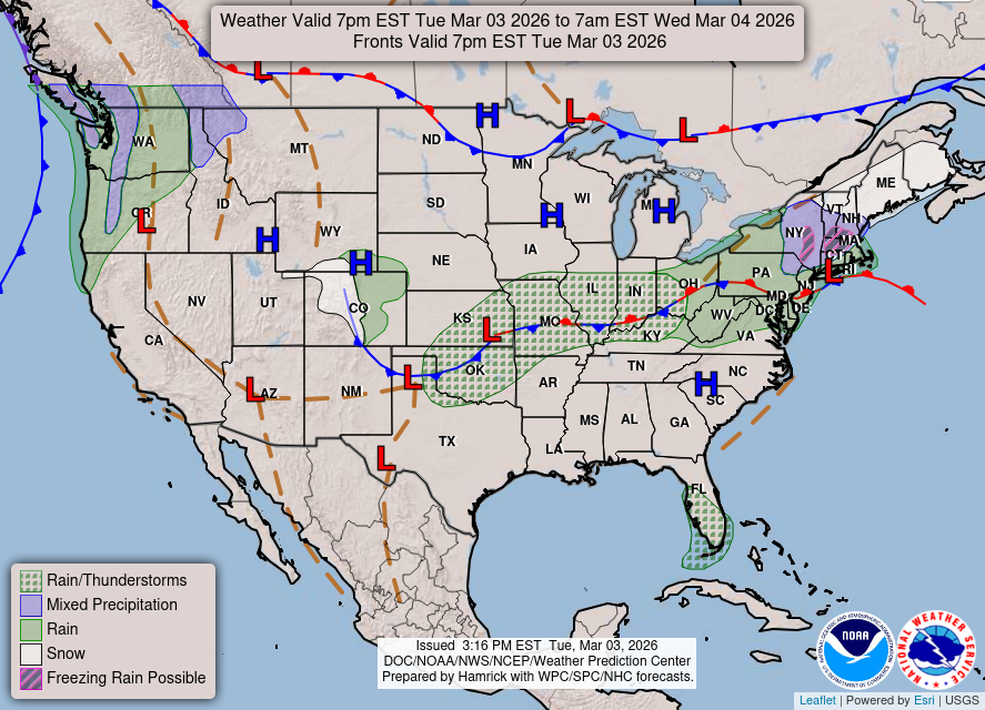
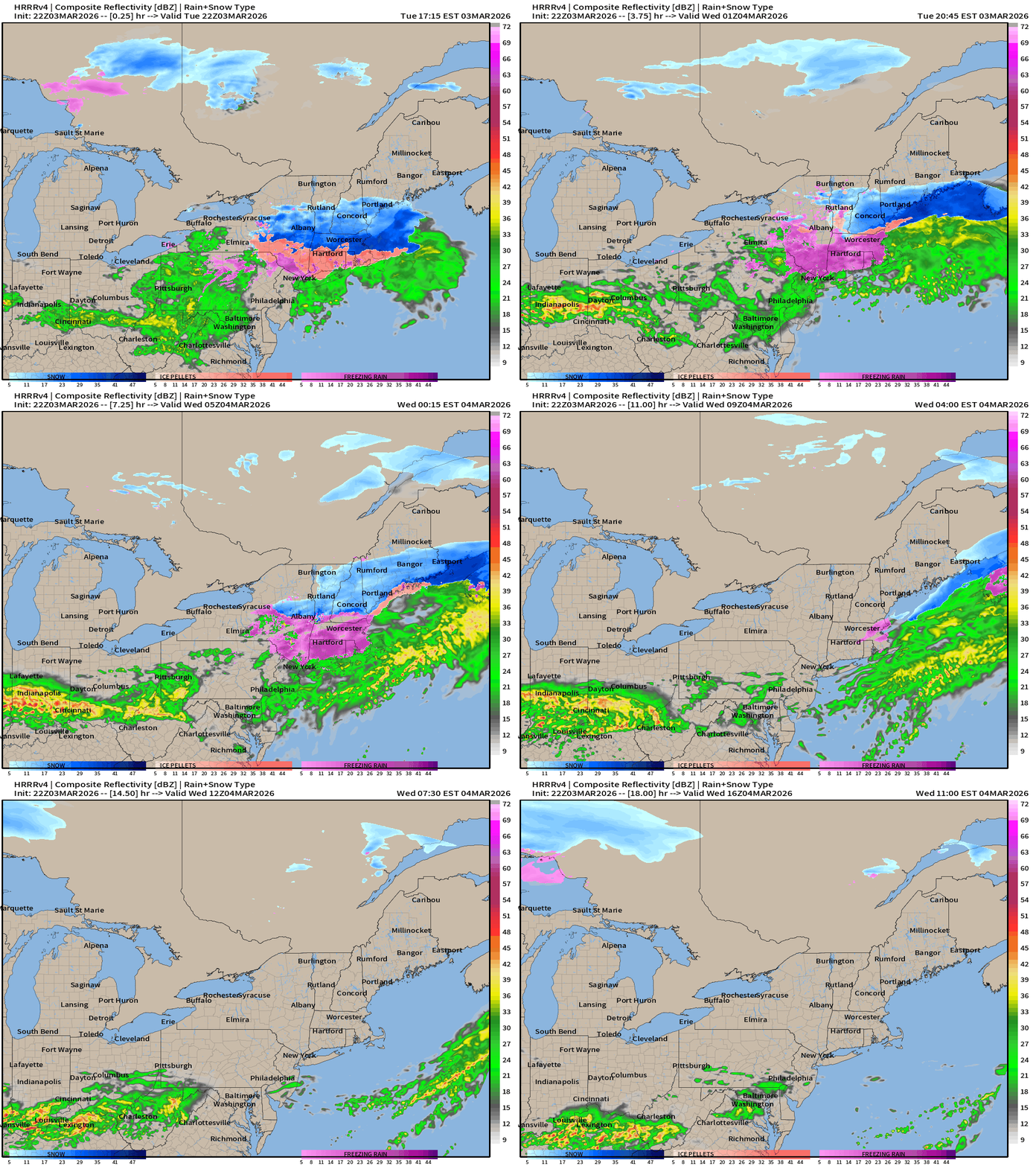
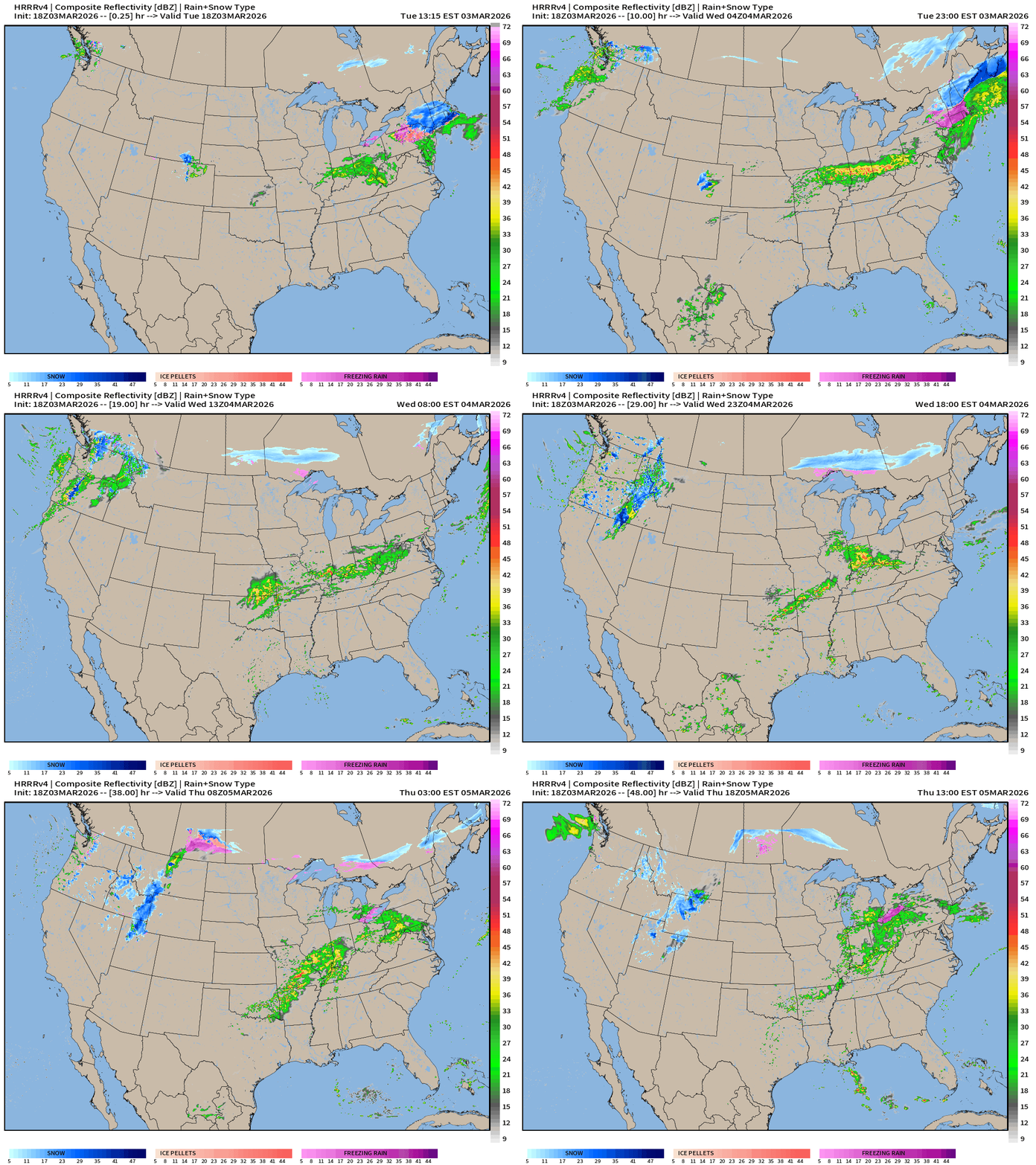
Weather into Wednesday morning — still some winter leftover before the warm front arrives with mix/slop in New England plus heavy snow in Maine. Plenty of rainfall along the frontal boundary from St. Louis into Ohio River Valley.
HRRR Simulated Radar into Wednesday morning 11 AM ET
Weather On Wednesday
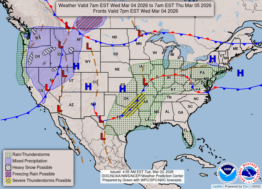
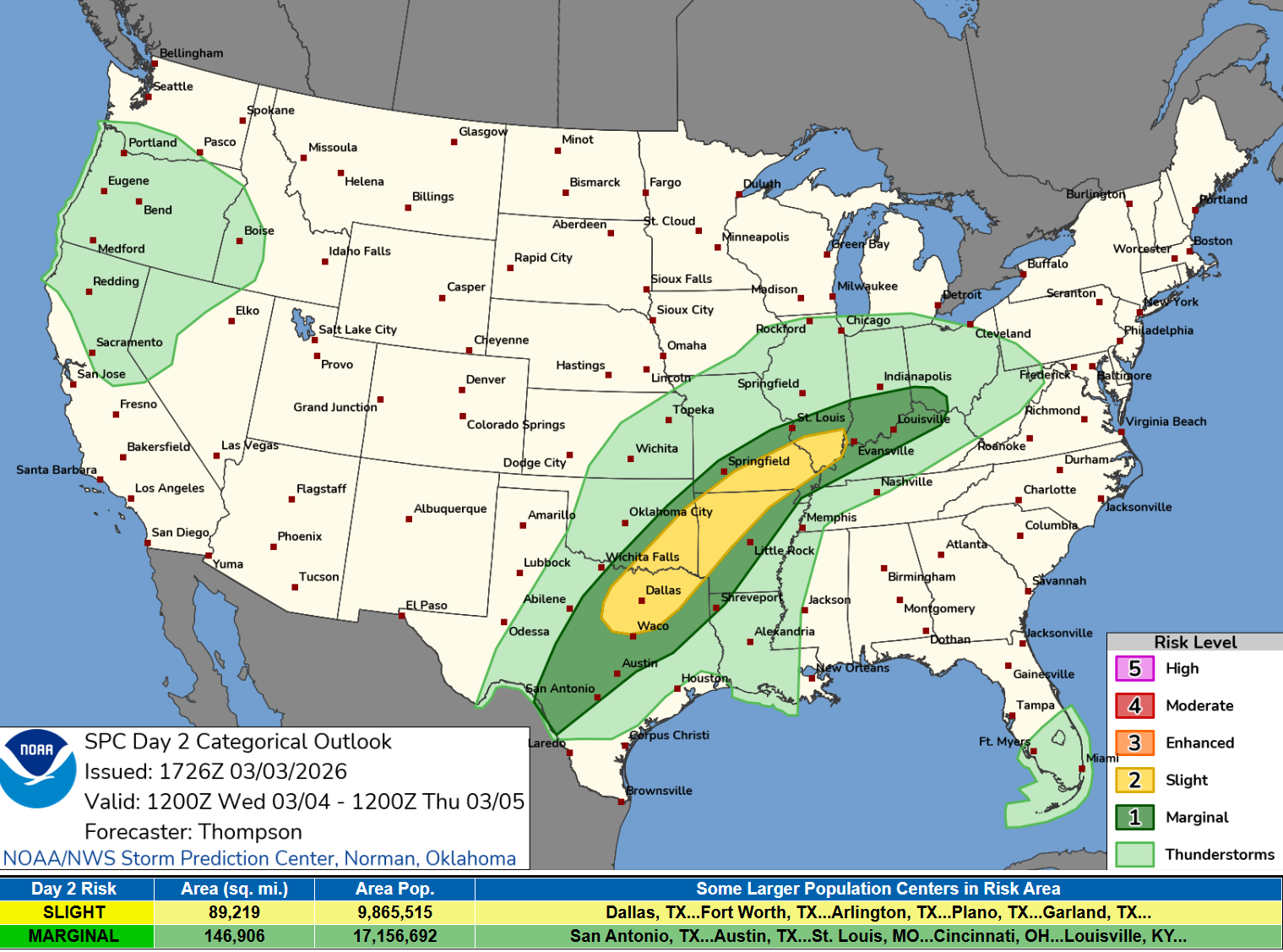
Slight chance of severe weather from Dallas to St. Louis on Wednesday
HRRR 18z — Radar Simulation Next 48-hours to Thursday 1 PM ET
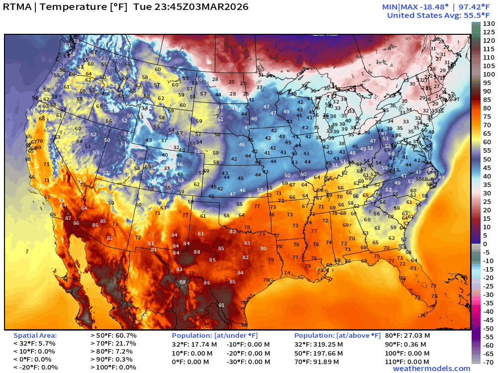
RTMA Current Temperature Analysis | 6:45 PM ET
RTMA Current Temperature Anomaly Analysis |6:45 PM ET
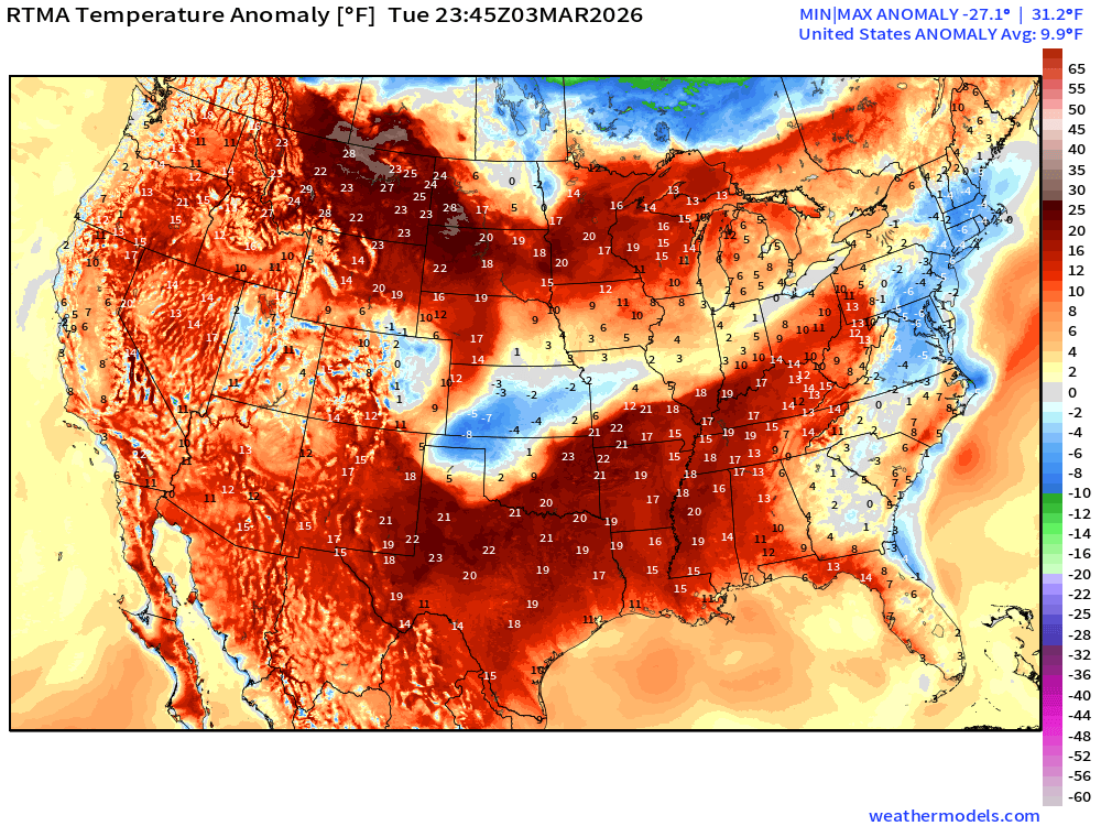
Lower 48 is a whopping 9.9°F above normal
Low Temperatures on Wednesday
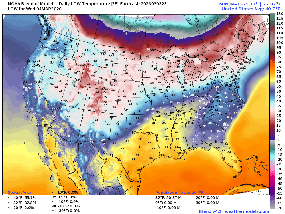
Only 51 million below freezing — Great Lakes into New England, not unusual.
High Temperatures on Wednesday
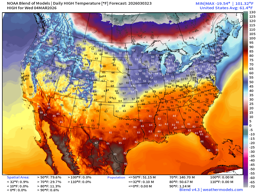
140 Million at least 70°F and 51 million at least 80°F with continued major improvement in Great Lakes and Northeast pushing into the 50s. 70s surge across the Ohio River
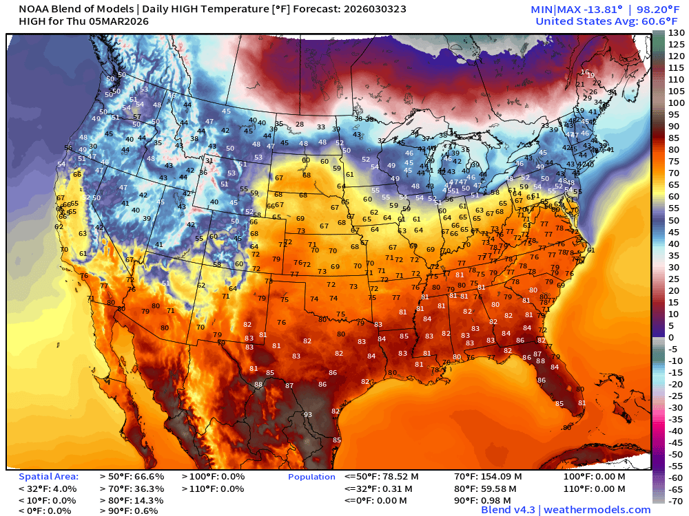
Highs on Thursday
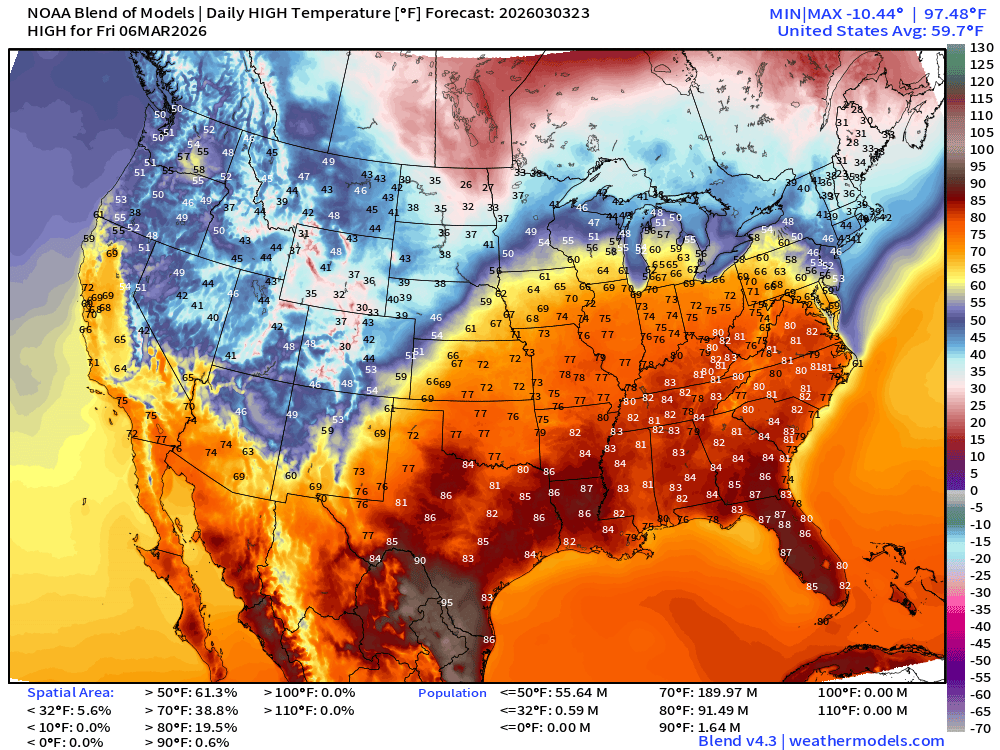
High Temperatures on Friday — Look Ahead to Major Spring Warmth
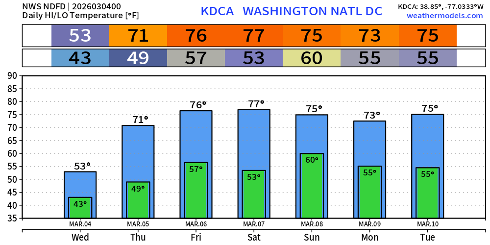
Washington D.C. Next 7-days
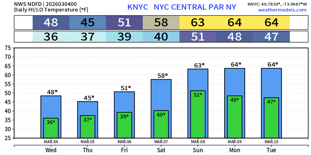
New York City Next 7-days
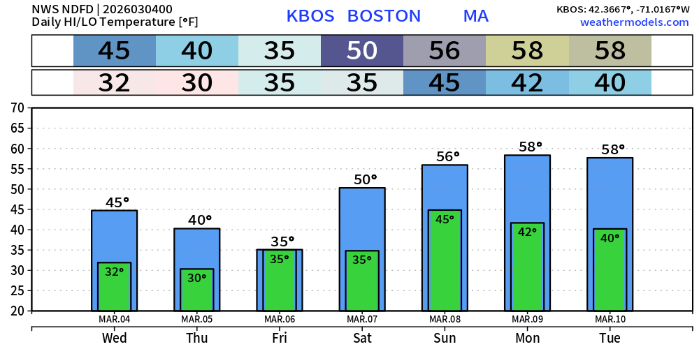
Boston Next 7-days
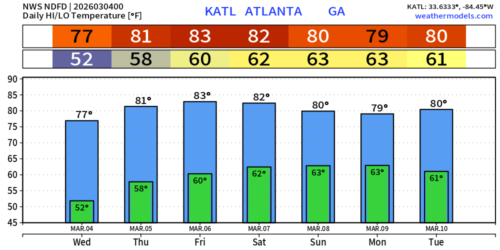
Atlanta Next 7-days
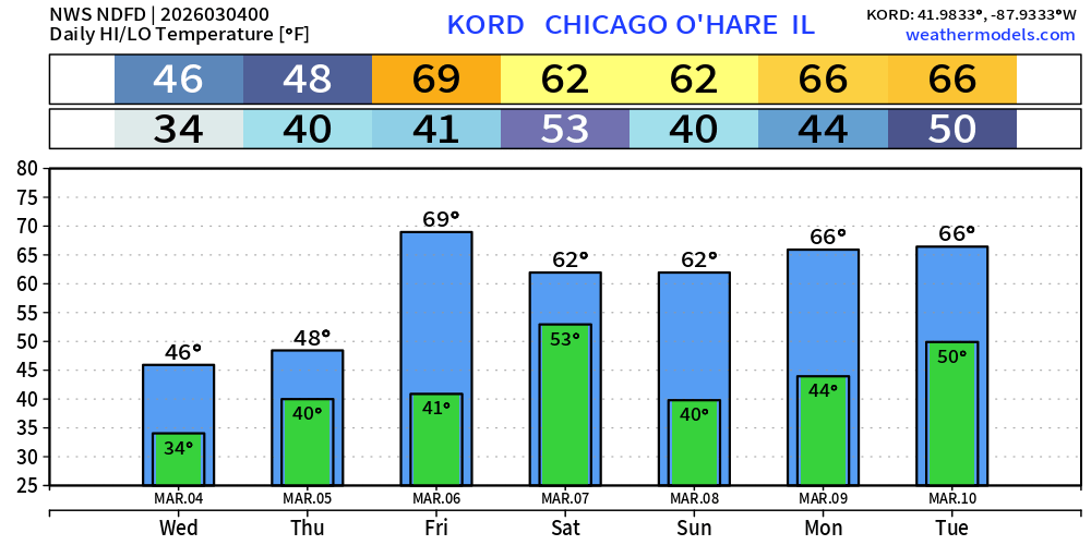
Chicago Next 7-days
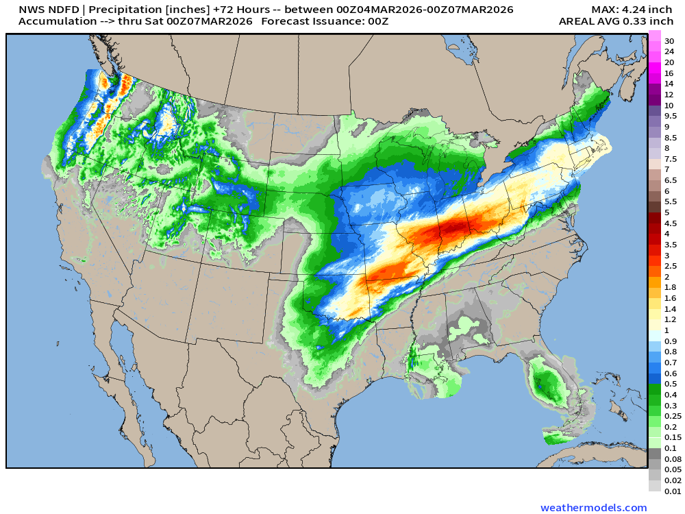
NDFD NWS Total Precipitation Next 72-hours through Friday Evening
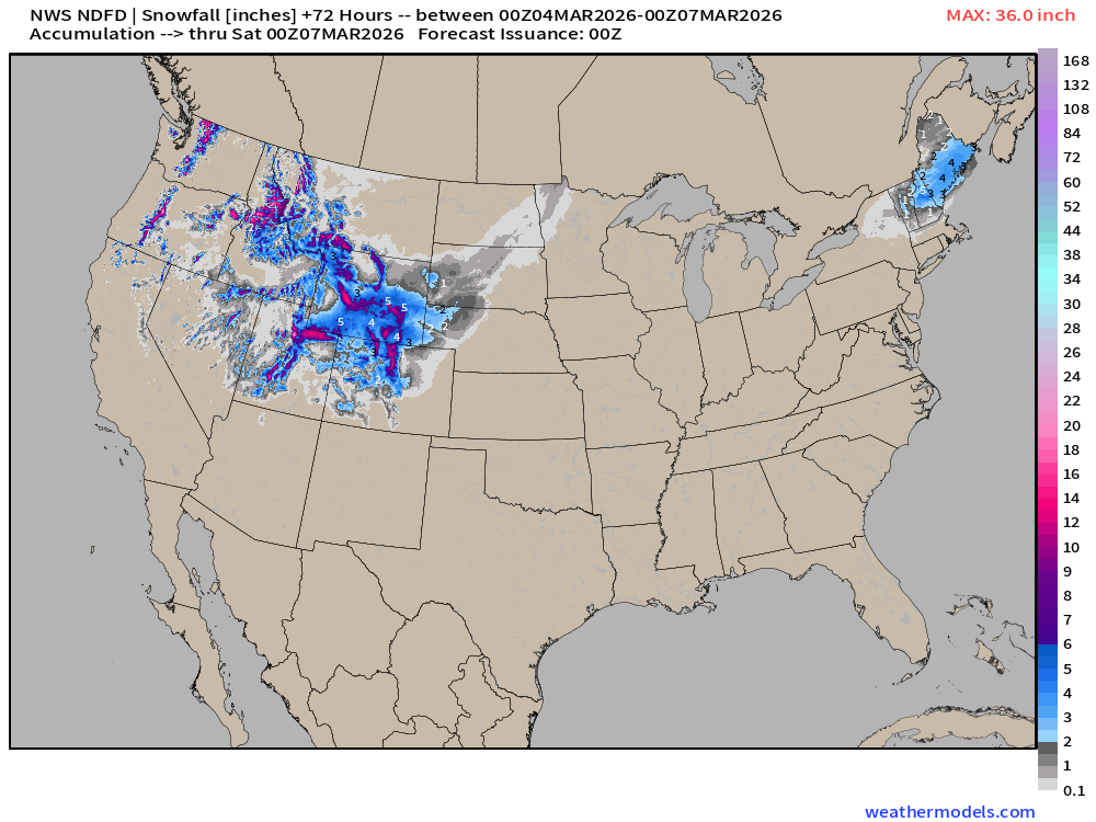
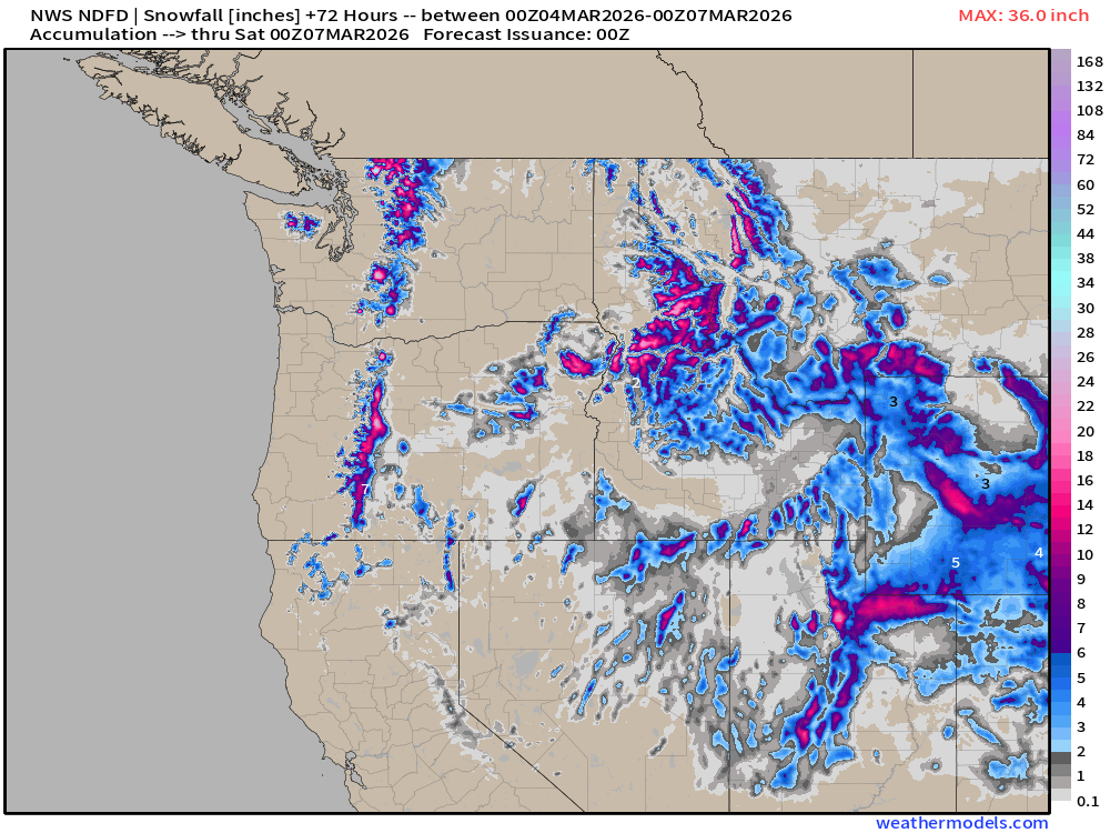
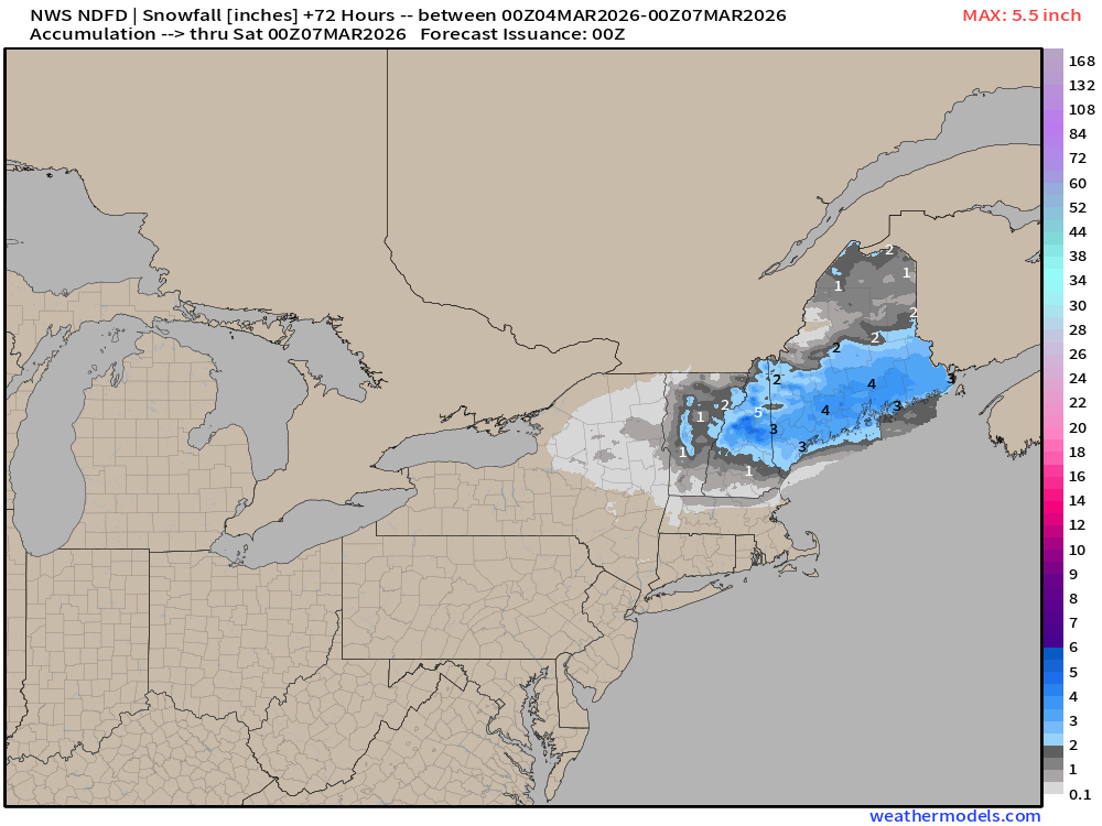
NWS Snowfall Next 72-hours — through Friday evening
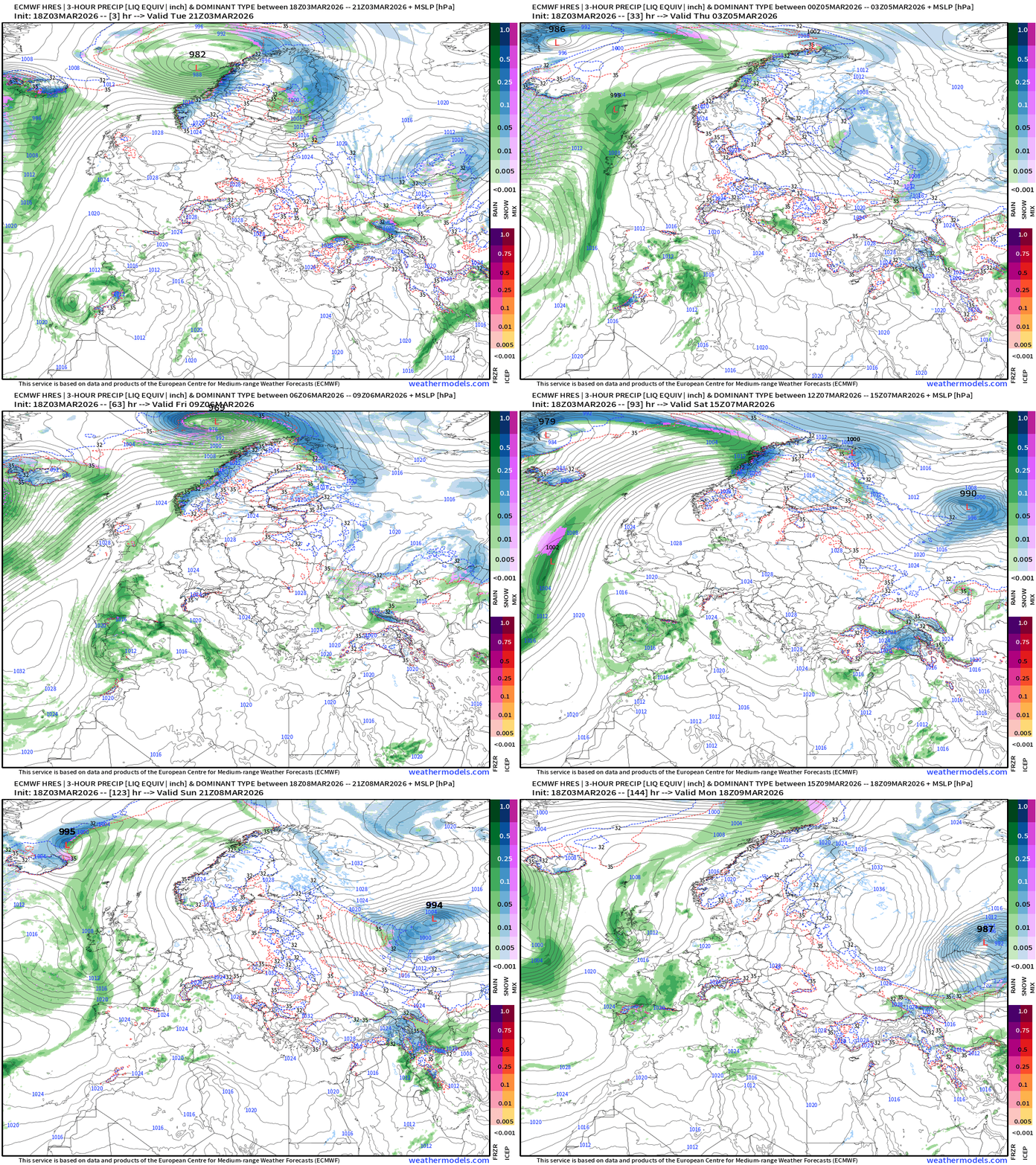
ECMWF 18z Precipitation Type + Intensity | Next 6-days

Heavy rain continues along the northern edge of the “ring of fire” ridge into the Great Lakes. A significant storm system sweeps a cold front through this weekend.
European Storm Systems — next 6-days
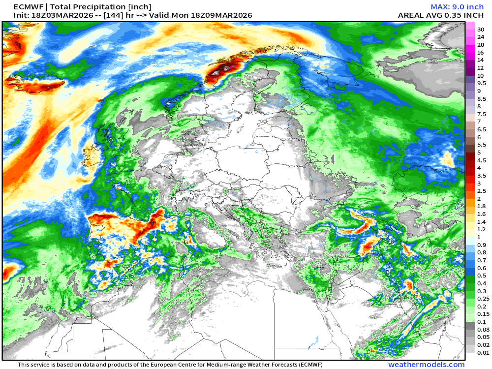
Total Precipitation across Europe next 6-days
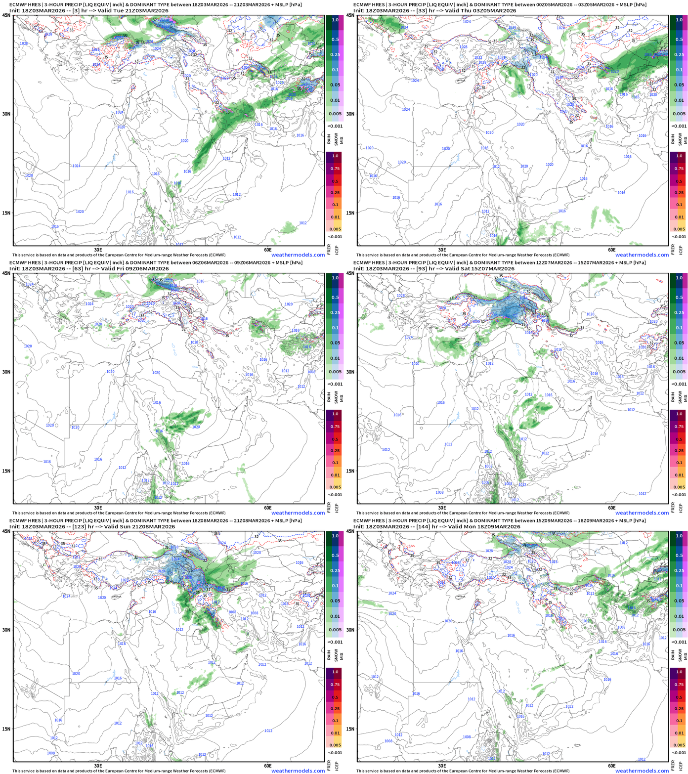
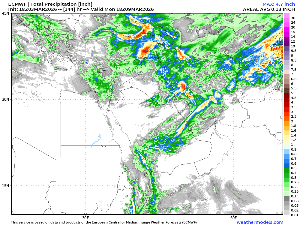
Middle East Precipitation and Type next 6-days
Total Precipitation Next 6-days
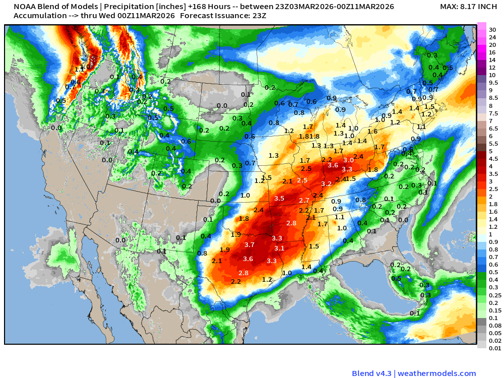
Blend of Models | 7 Days Precipitation Total
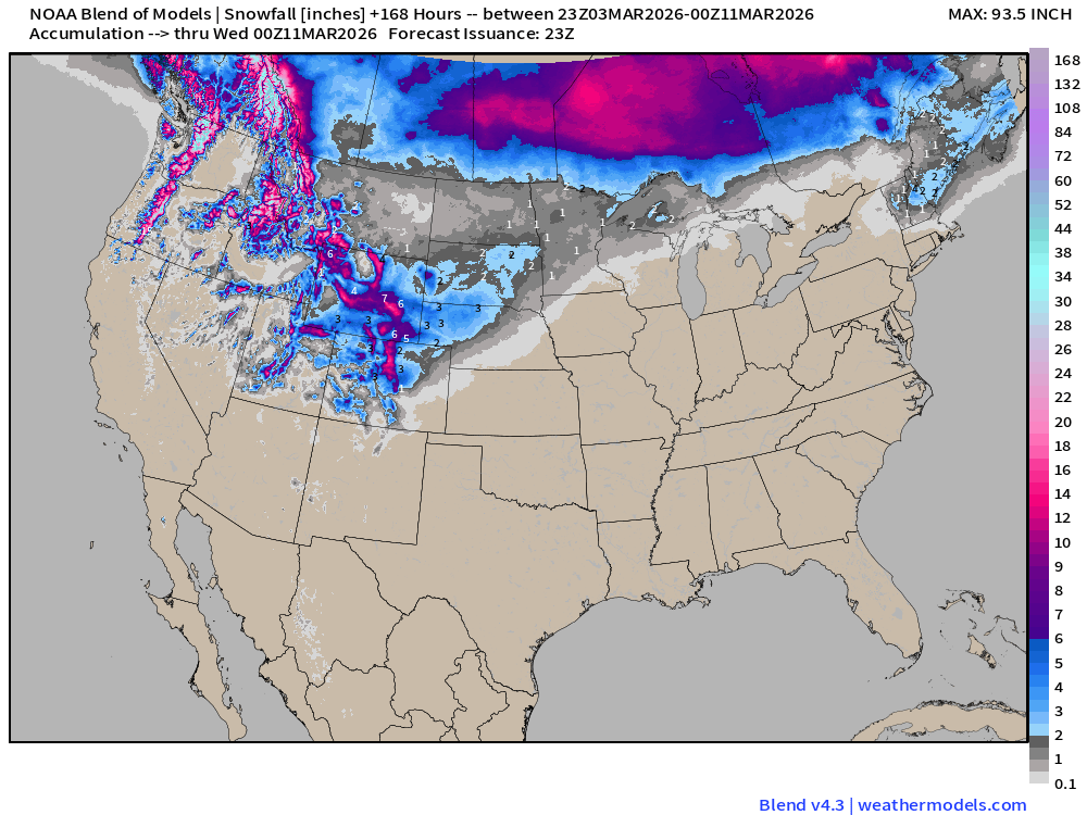
Blend of Models | Total Snowfall Next 7-Days
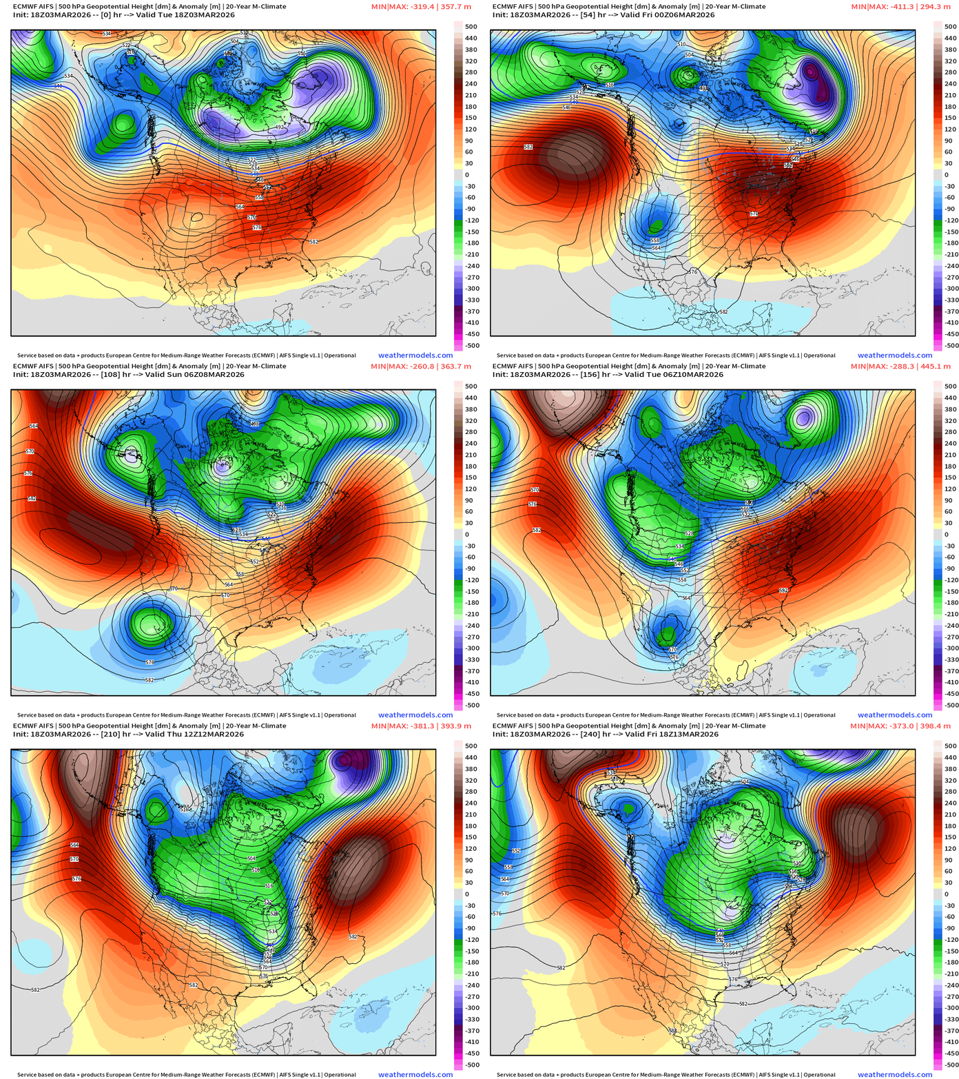
ECMWF AIFS 18z | Temperature at 500 mb | Next 10-days
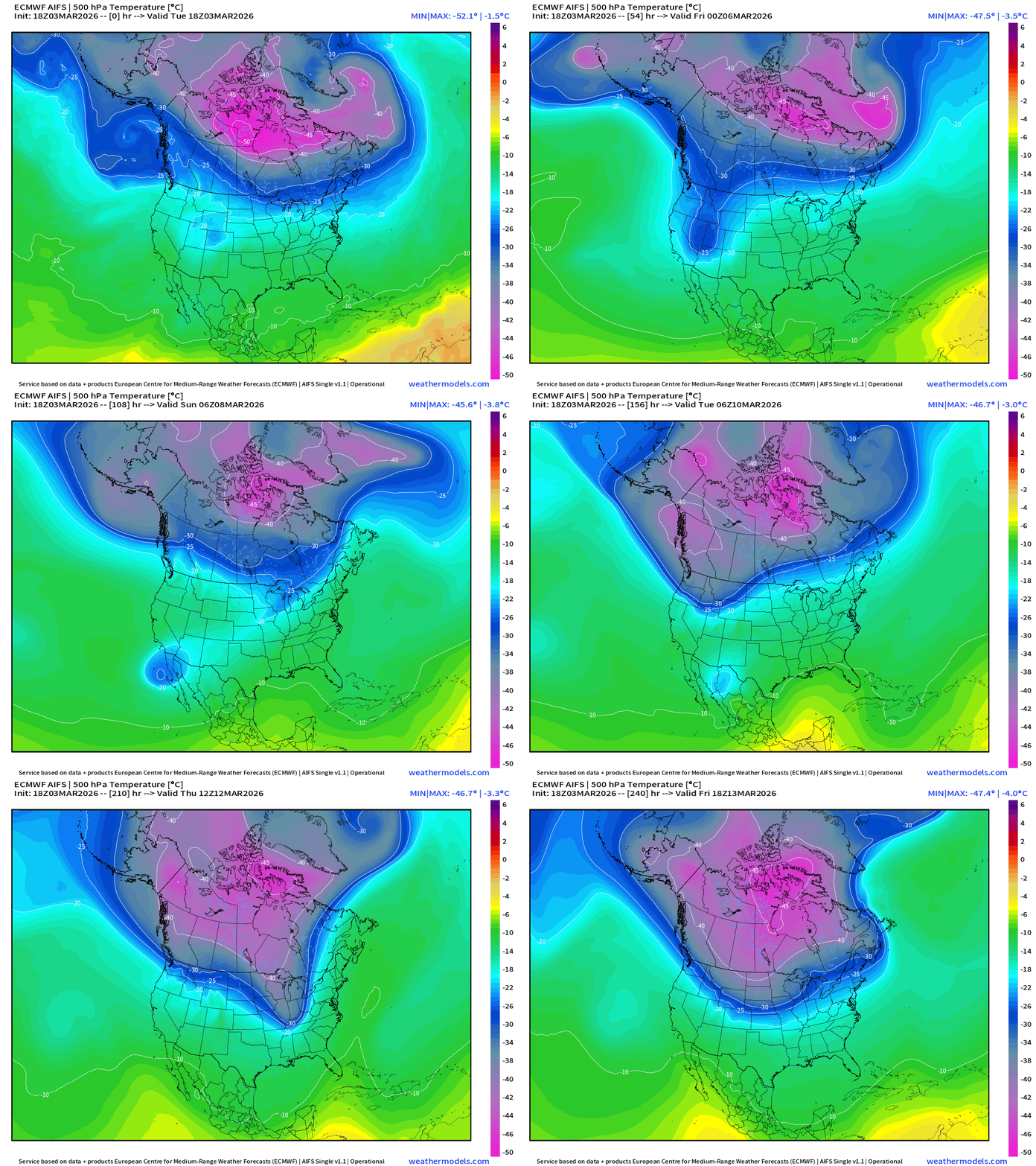
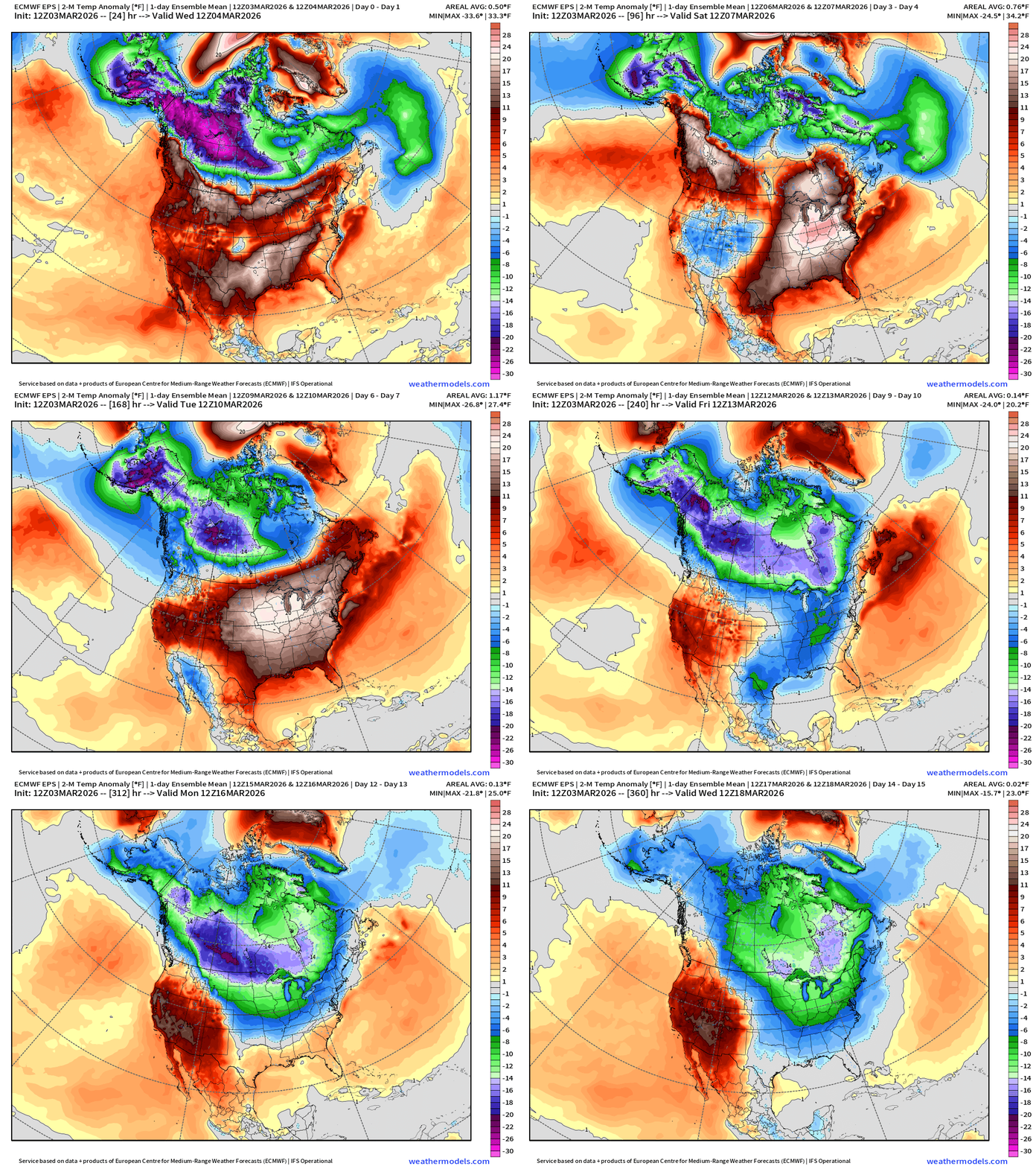
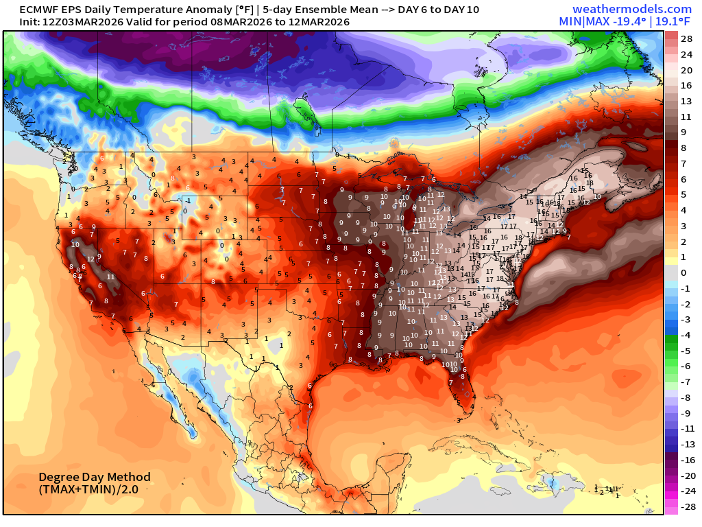
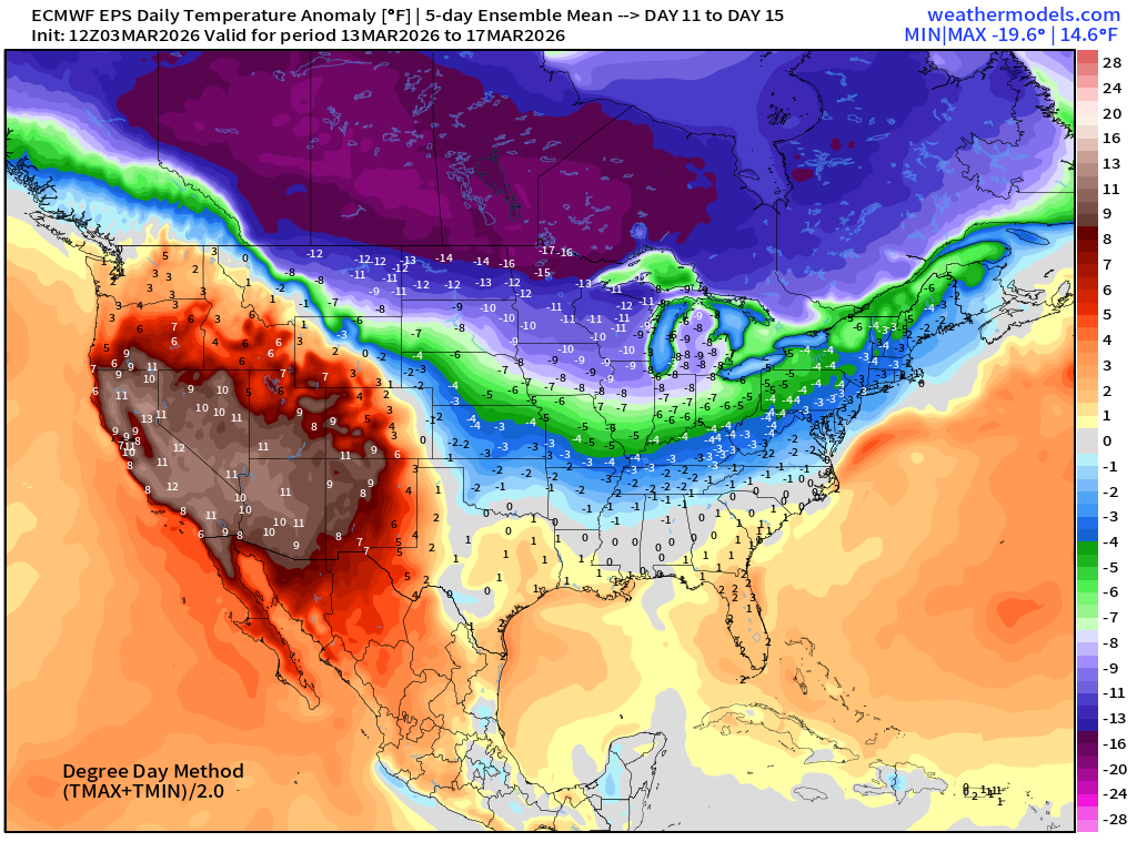
Middle of next week, the entire Polar Vortex shifts southward closer to the Canadian border with potential for “lobes” of cold Arctic air — even for mid-March — to sweep through the Lower 48.
Days 8 to 15 | 850-mb Temperature Anomaly
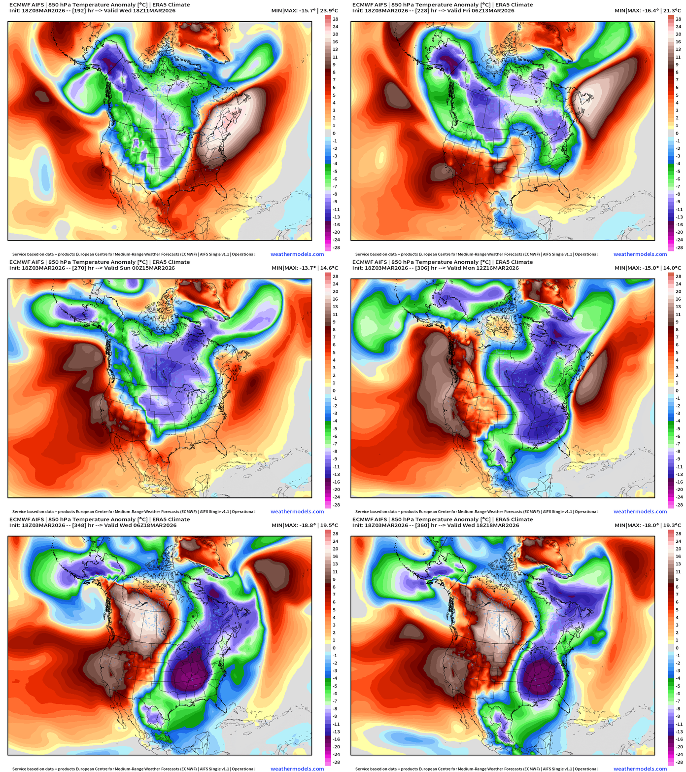
This would be a very significant “Arctic blast” for March 11-18 (Days 8-15)
ECMWF AIFS 18z | Height Anomaly at 500 mb | Next 10-days
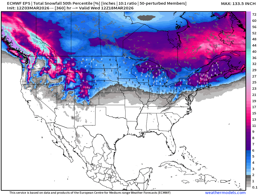
Snowfall | Median of ECMWF Ensembles at 12z | Next 15-days
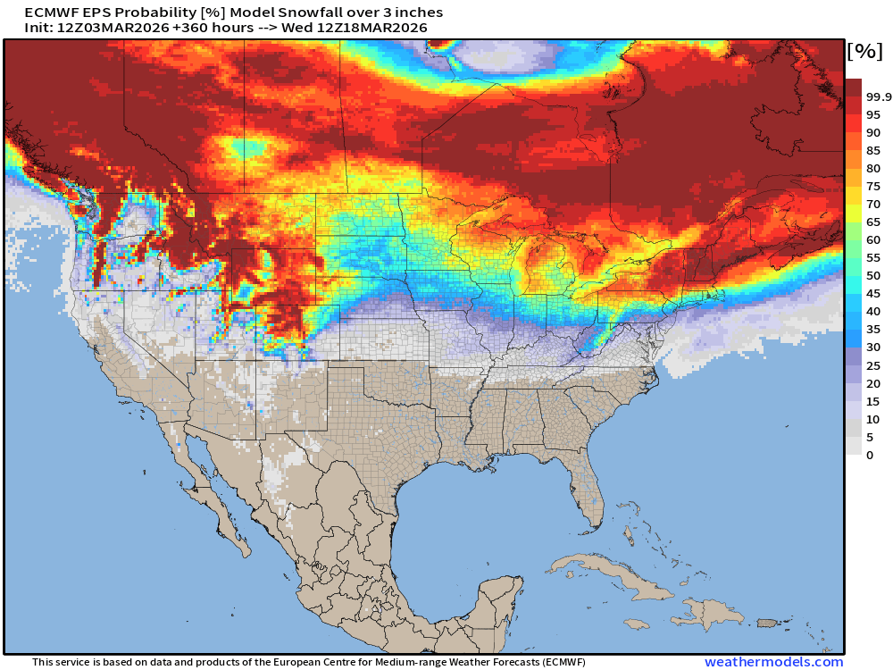
Probability of at least 3” of Snowfall Next 15-days
Temperature Anomaly | Next 15-days | ECMWF EPS 12z Ensemble Mean Flagship
5-Day Chunk #1 | Temperature Anomaly | March 3 - March 7
5-Day Chunk #2 | Temperature Anomaly | March 8 - March 12
5-Day Chunk #3 | Temperature Anomaly | March 13 - March 17
Maps sourced from weathermodels.com designed and innovated by yours truly! Please subscribe there for real-time access to the newest maps, charts from all of the weather models including ECMWF and AIFS, and NOAA GFS/GEFS.
- Milepost
- 887 · laid 2026-03-04T01:33:46.917000Z
- Source
- https://weather.substack.com/p/march-3-2026-tuesday-weather-update
- Digest
- 98ed928f636f759113a727c94639c370008f0ff7e334ab2cdde738eee081e6c7
- Machine
- JSON