February 26, 2026 Thursday Winter Weather
Spring like warmth arrives next week across the Eastern U.S.
February 2026 was the 4th-warmest February in the 132-year national record (1895–2026), at 40.3°F against a 1991–2020 normal of 35.6°F (+4.6°F).
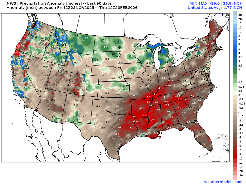
February 2026 was the 5th-driest February in the 132-year national record (1895–2026), at 1.4in against a 1991–2020 normal of 2.1in (-0.7in).
NOAA/NCEI Climate at a Glance, contiguous United States. This is the observed record for the month, not a score of anything said in this piece — the forecast ledger begins 2026-08-17 and cannot reach earlier posts.

Average temperature anomaly for Week 2: March 6-12th
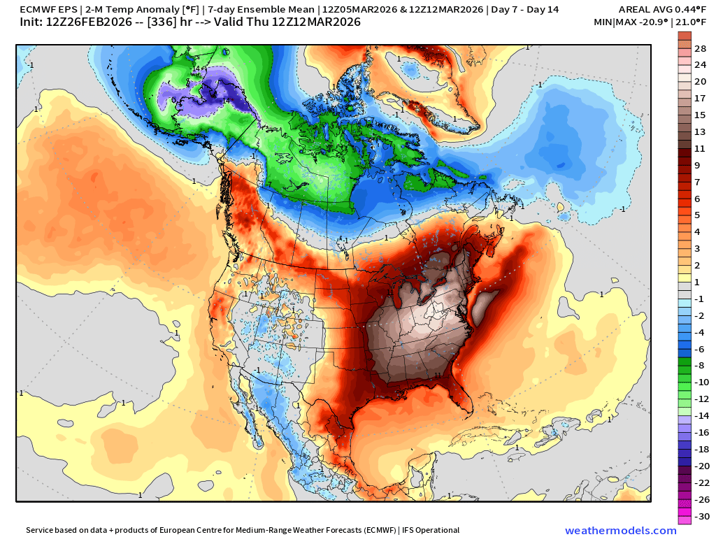
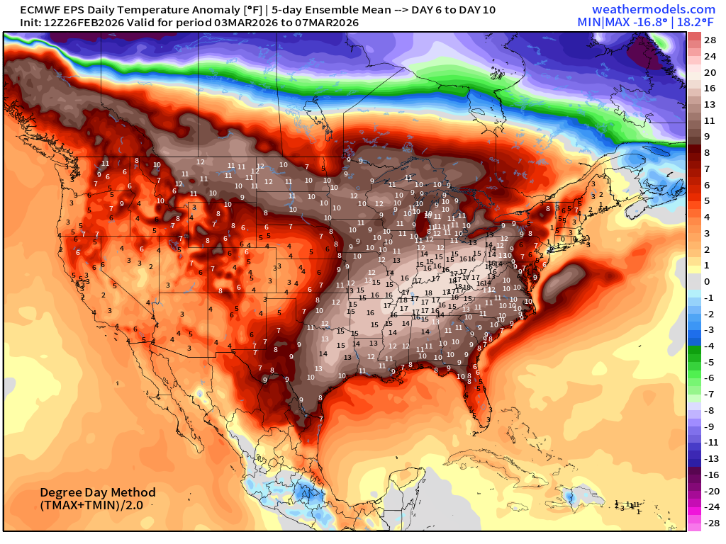
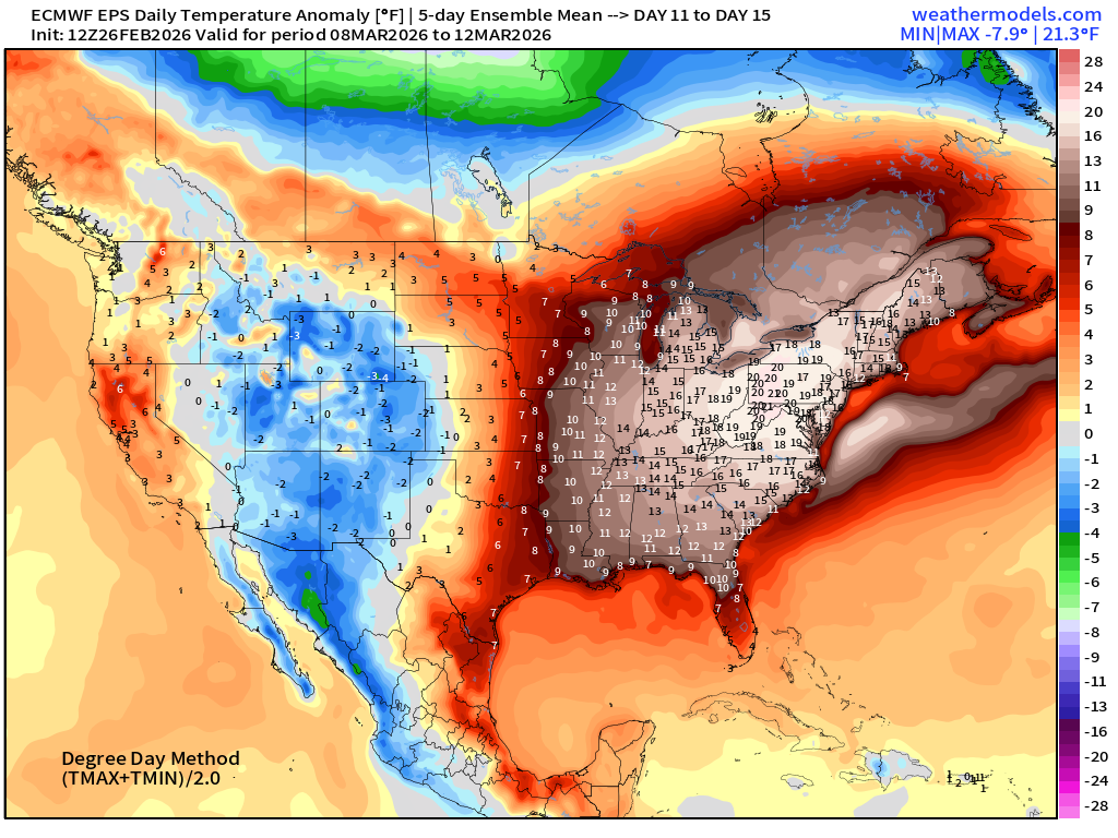
The Eastern U.S. warms significantly into second week of March with well-above normal temperatures. The “polar vortex” retreats into Arctic Canada and Alaska. Still watching a (major) “sudden stratospheric warming” (SSW) event to occur over next 10-days, and any near-surface or Lower 48 fallout / potential cold spell would be middle-March and onward, but until then, very warm.
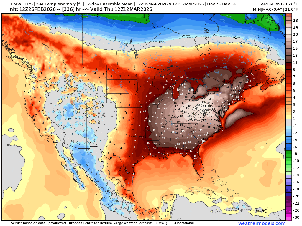
20°F above normal centered on Pittsburgh — and everyone east of the Mississippi at least 10°F above normal.
We still have one more Arctic blast to go — and it will be intense but brief, thankfully.
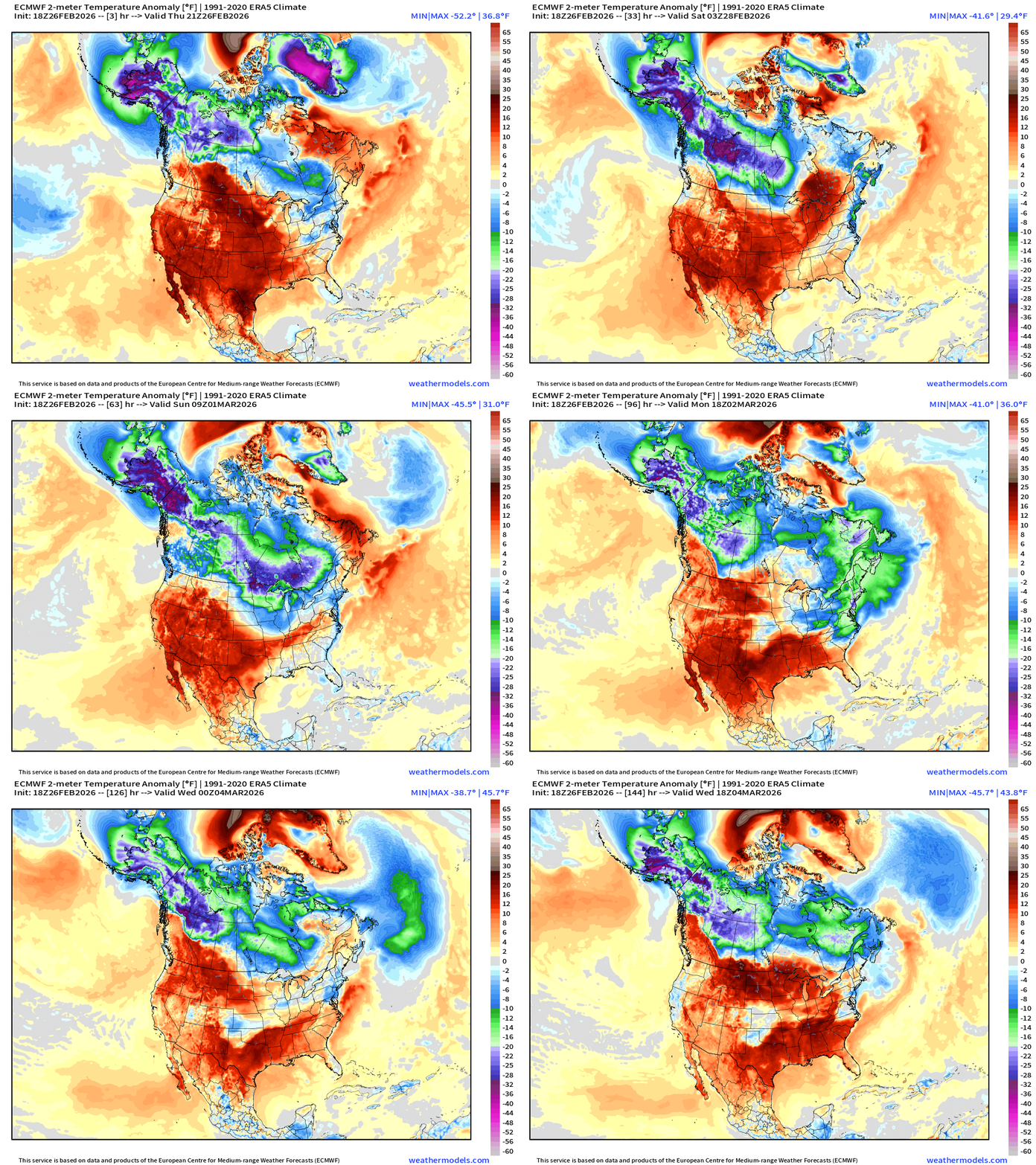
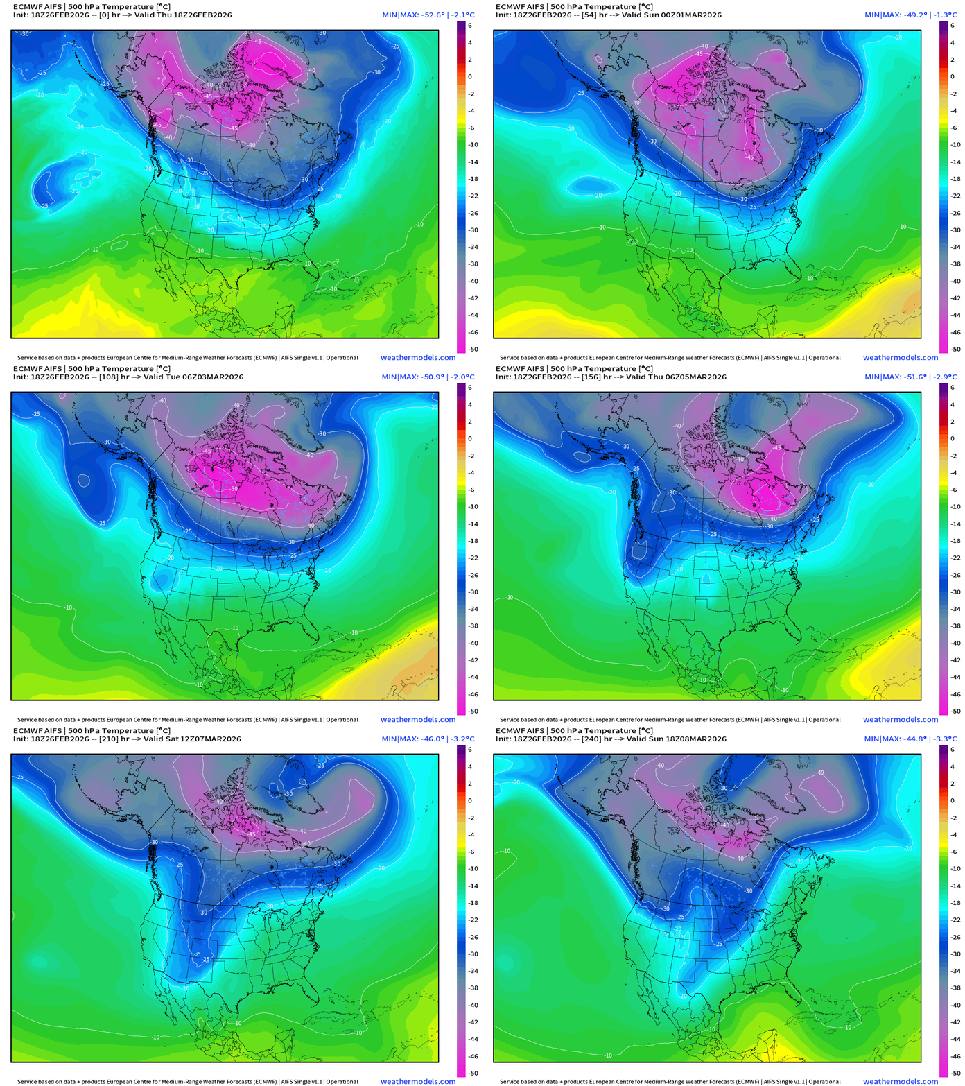
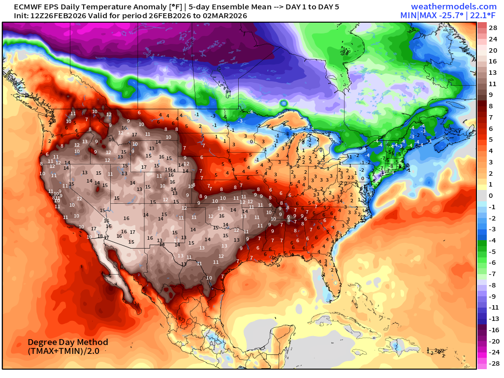
Temperature anomaly for the next 6-days shows the mega-TPV near Greenland combining with Alaska/NW Arctic Canada cold pool and descending into the Great Lakes and Northeast. Note that the cold lingers into Tuesday with a wedge in the Southeast U.S. (Atlanta) and the Mid-Atlantic.
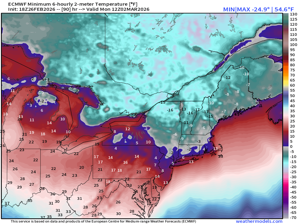
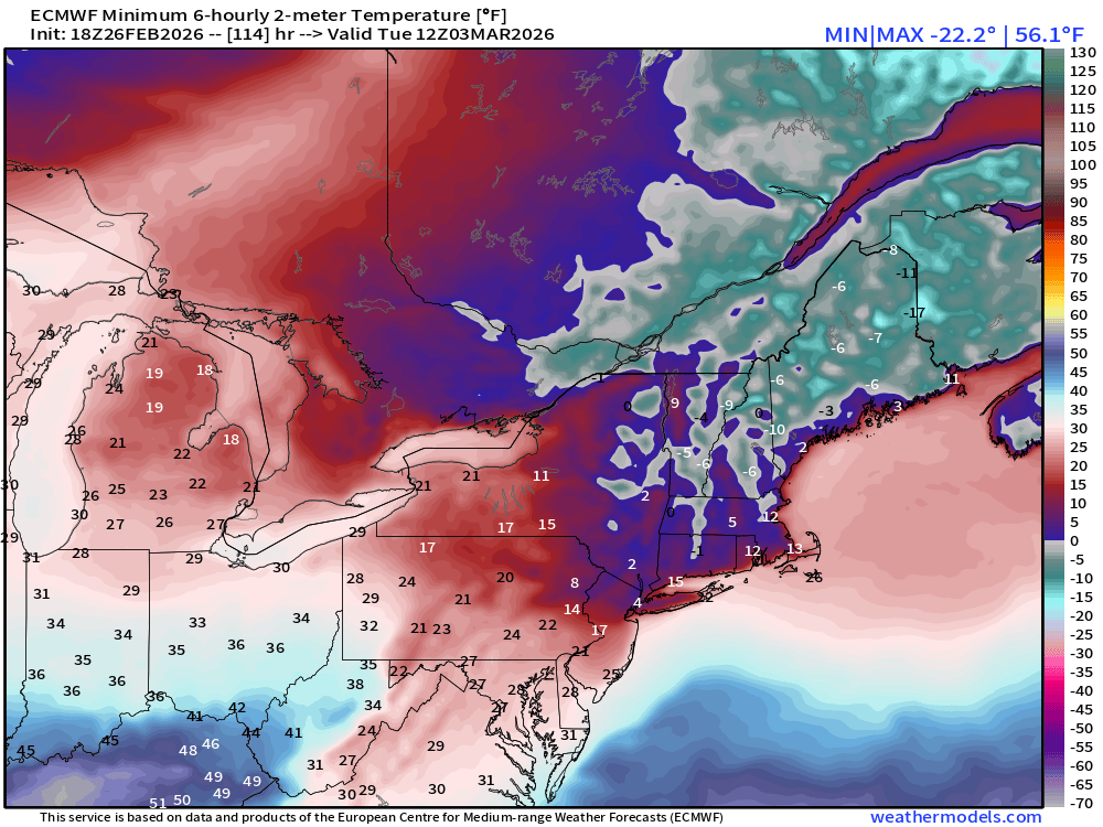
The coldest mornings will be Monday and Tuesday in the Northeast with ECMWF 18z showing minimum of 4°F or 5°F in New York City. These cold numbers still haven’t gone away in the flagship Europe model. Monday Lows:
Tuesday Lows:
Next 6-days of Precipitable Water (my favorite parameter) to show moisture or lack of it across North America
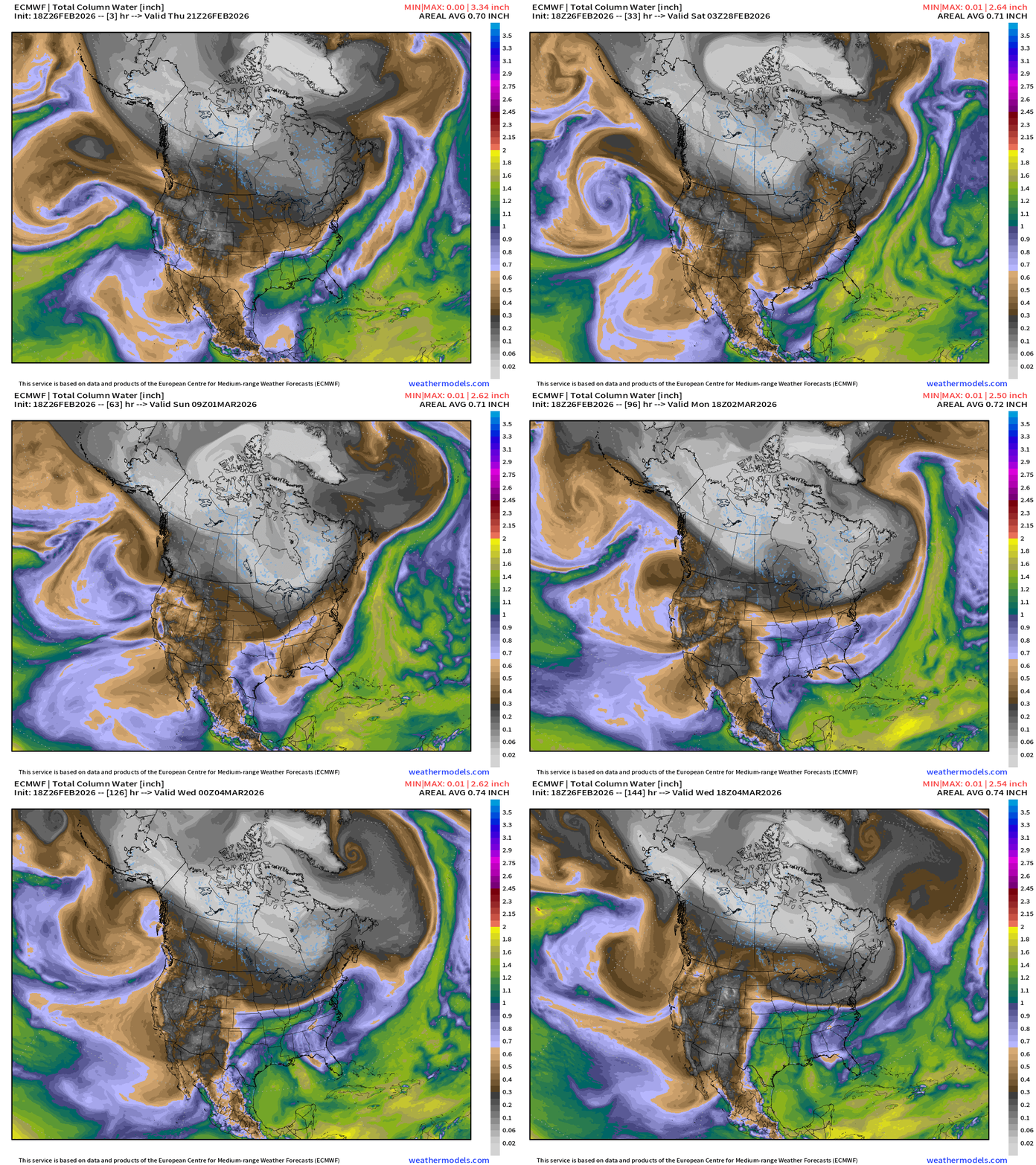
The white is exceptionally dry (little actual moisture — but relative humidity can be high because it is so cold) … with Canada almost entirely enveloped in brutal winter Arctic “polar vortex” cold air.
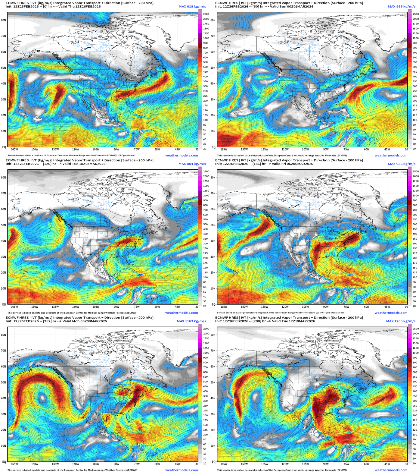
Pattern Shifts Next Week! The flow comes out of the south … and we see the Gulf of Mexico activated and open for business heading through the first week of March. This means much, much warmer and also wetter — good news for any drought concerns heading into to planting season. Next 12-days of Integrated Vapor Transport:
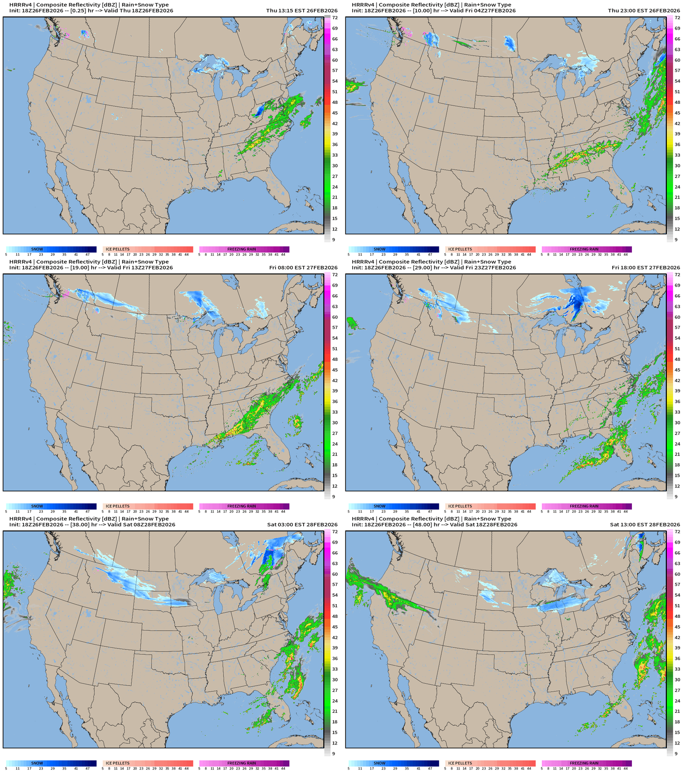
HRRR 18z — Radar Simulation Next 48-hours
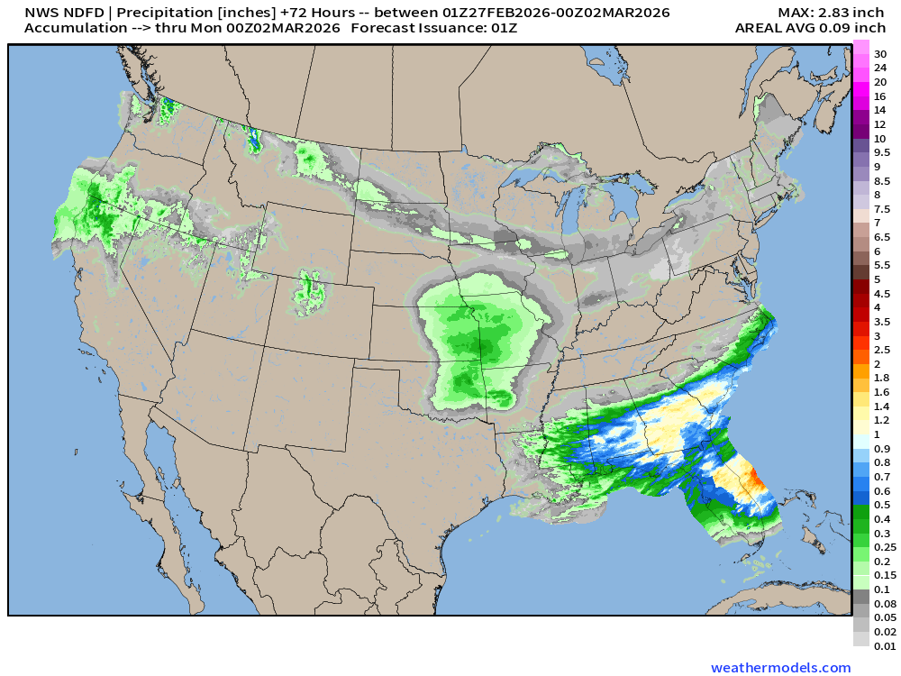
Rain continues across the Southeast into Florida but probably not much for far Southern Florida in the Everglades.
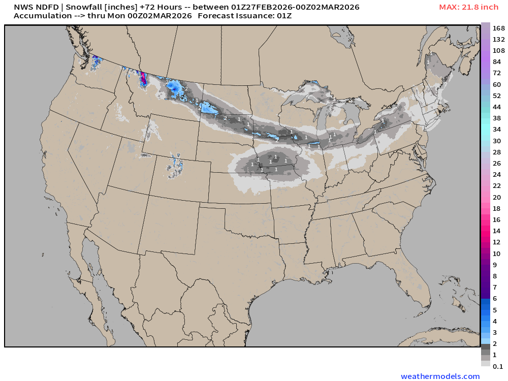
Light snowfall across the northern tier from Pacific moisture … not substantial.
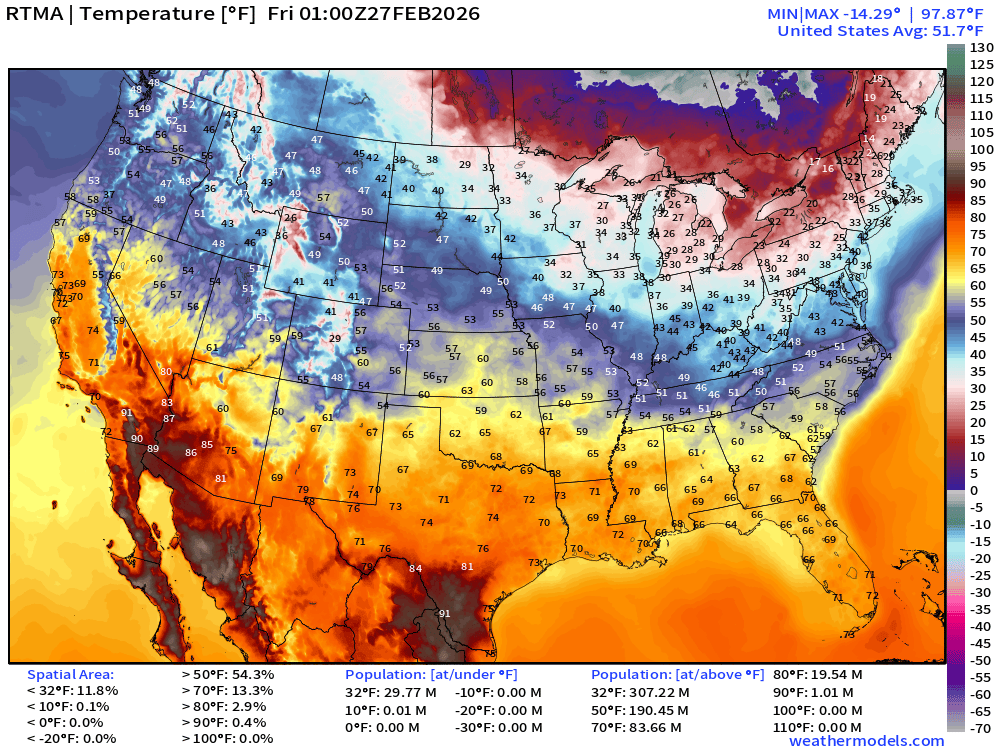
RTMA Current Temperature Analysis | 8:00 PM ET
RTMA Current Temperature Anomaly Analysis | 8:00 PM ET
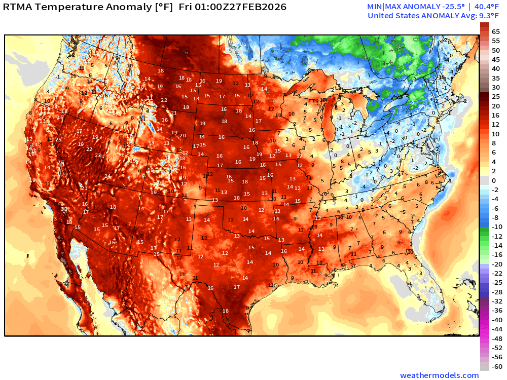
Lower 48 is 9.3°F above normal
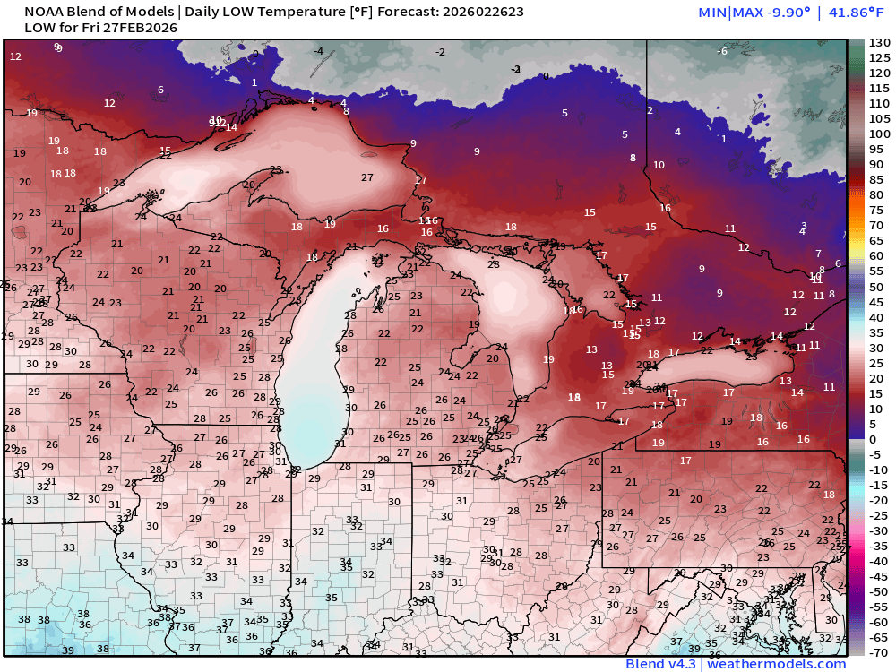
Low Temperatures on Friday
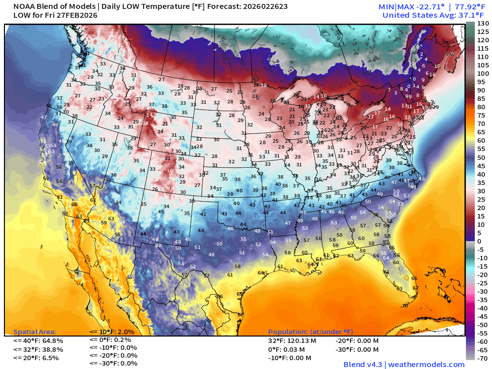
120 million below freezing
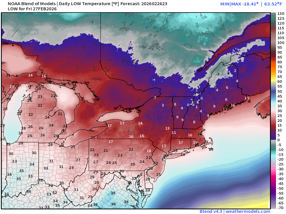
High Temperatures on Friday
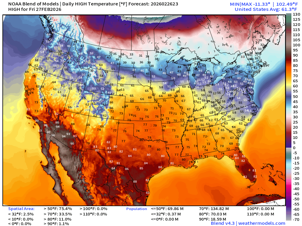
135 Million at least 70°F and 70 million at least 80°F but still in the 40s across the Great Lakes and Northeast.
NDFD NWS Total Precipitation Next 72-hours through Friday evening
NWS Snowfall Next 72-hours — through Friday evening
ECMWF 18z Precipitation Type + Intensity | Next 6-days
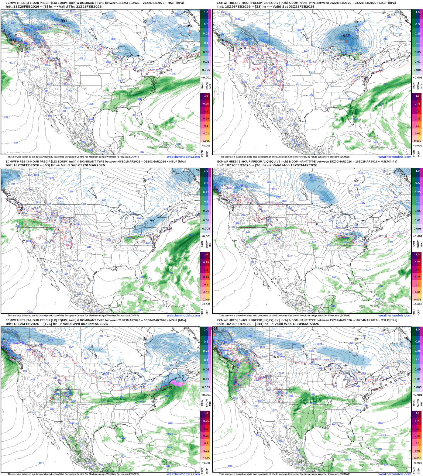
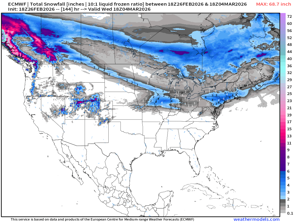
Not seeing a major winter storm forming or much precipitation (snowfall) into early next week, but still need to watch the frontal boundary that is draped along the Ohio River Valley for any low pressure development in the Northeast. Nothing imminent — but light accumulations in the 2” to 4” range maximum, so far.
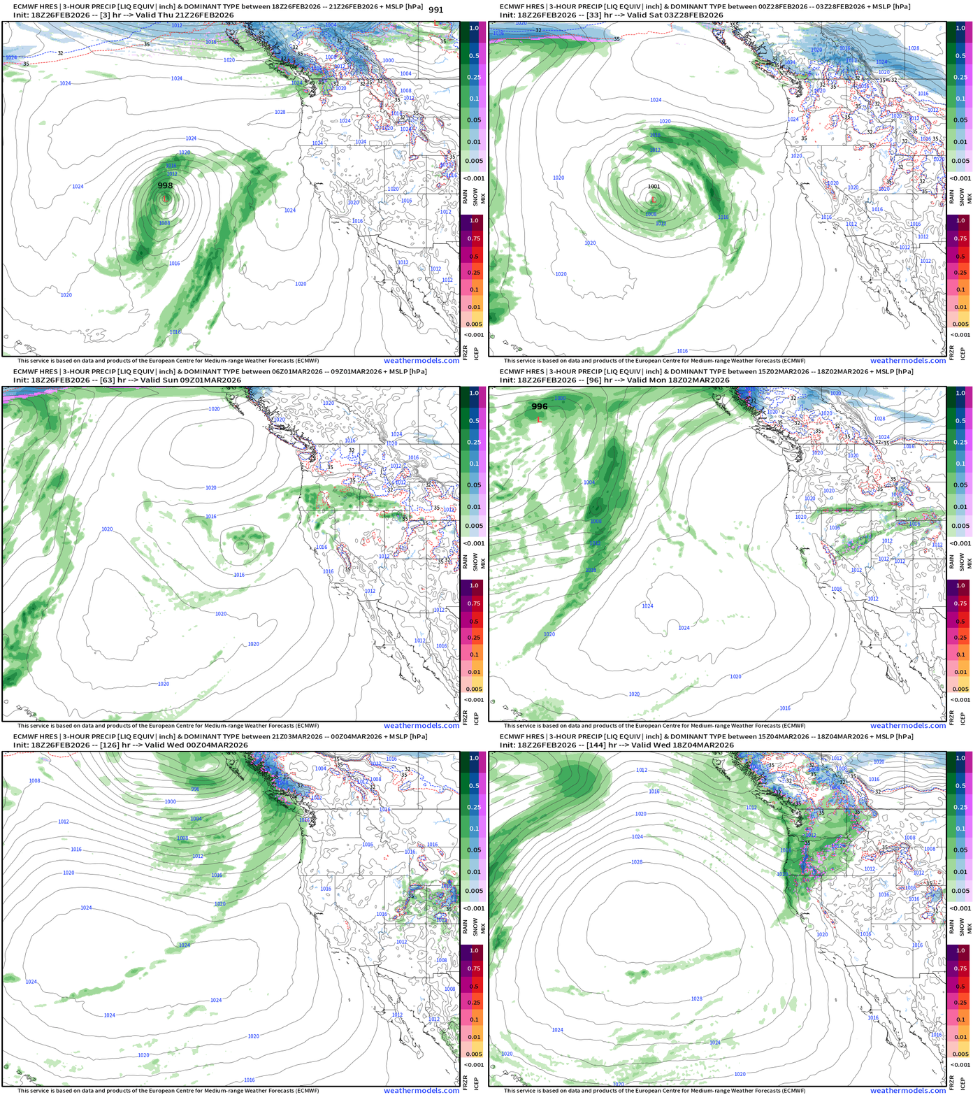
Western U.S. Storm Systems — next 6-days
Total Snowfall Next 6-days | ECMWF 18z
Last 90 days Precipitation Deficit | Winter has been dry over Eastern U.S.
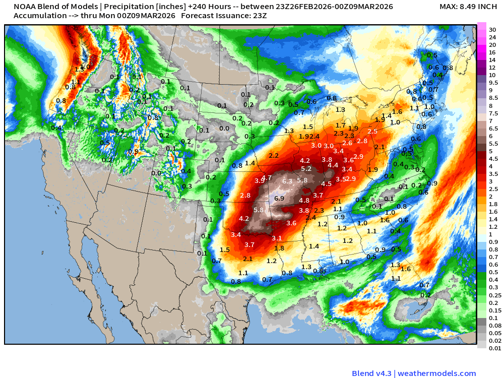
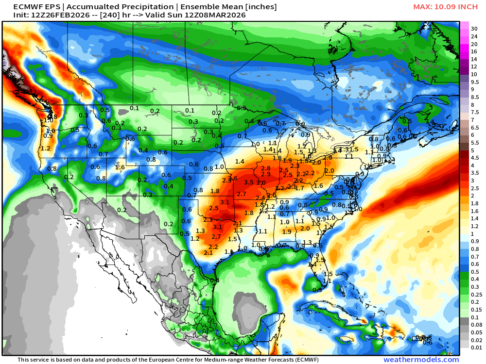
Huge rainfall totals on the way — centered on Missouri.
Blend of Models | 10 Days Precipitation Total
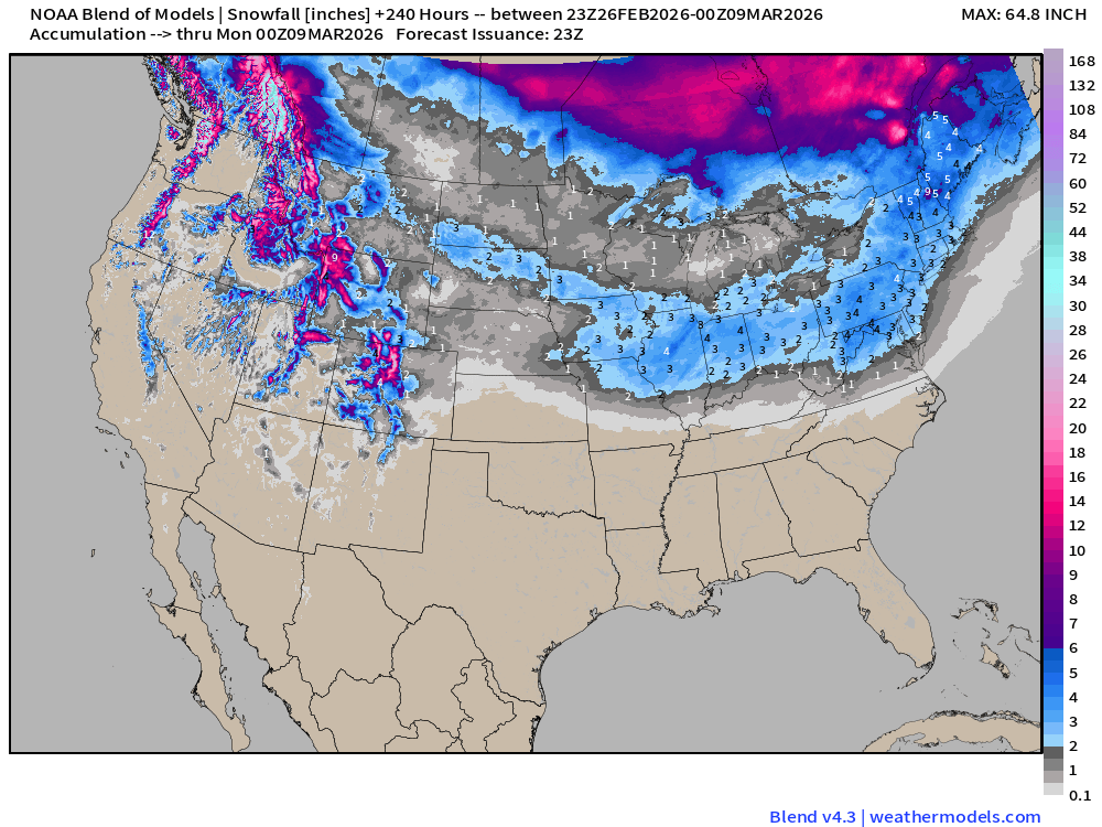
Blend of Models | Total Snowfall Next 10-Days
ECMWF AIFS 18z | Temperature at 500 mb | Next 10-days
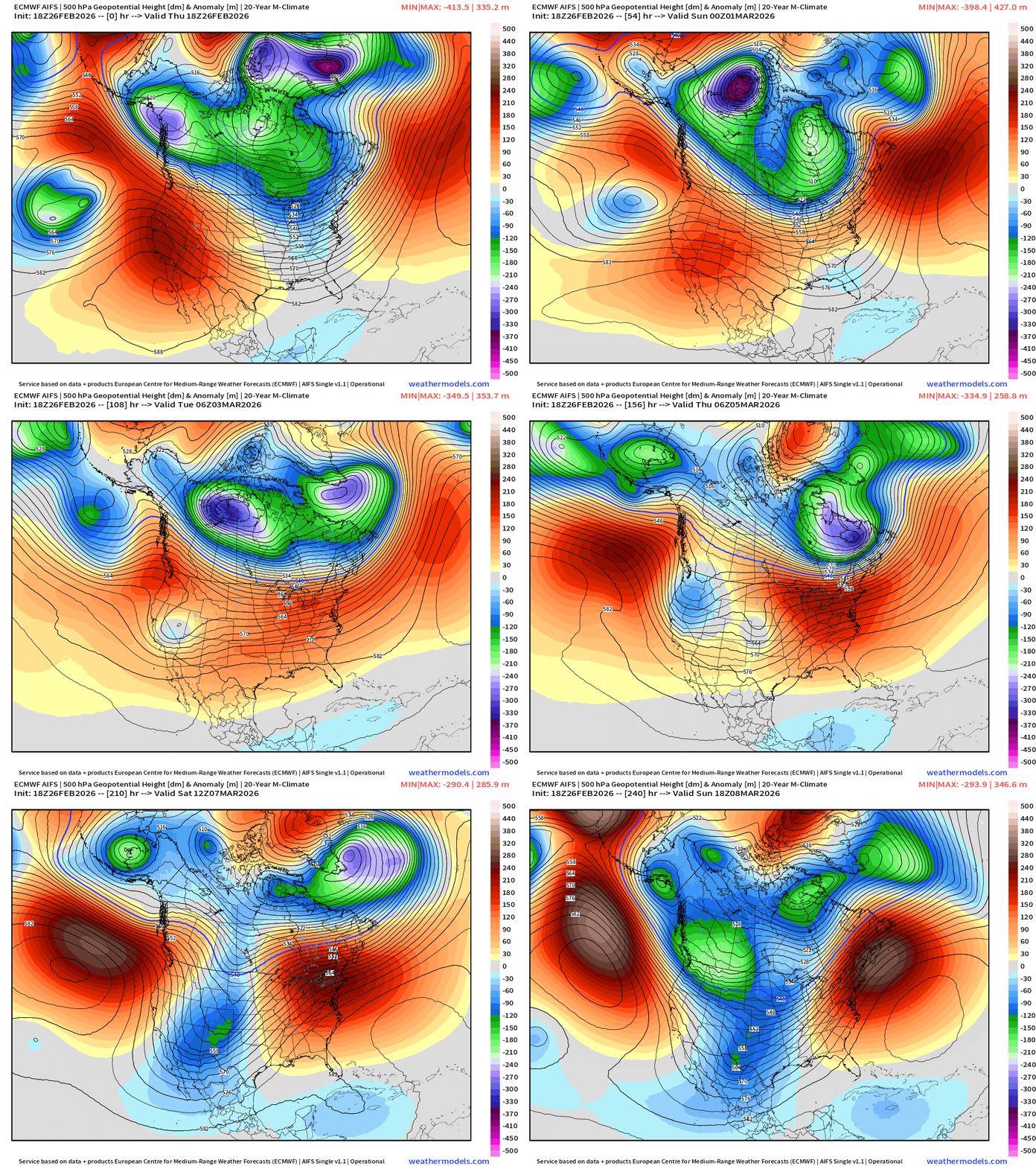
ECMWF AIFS 18z | Height Anomaly at 500 mb | Next 10-days
Significant Precipitation / Rainfall from Weather Pattern Shift | Next 10-days
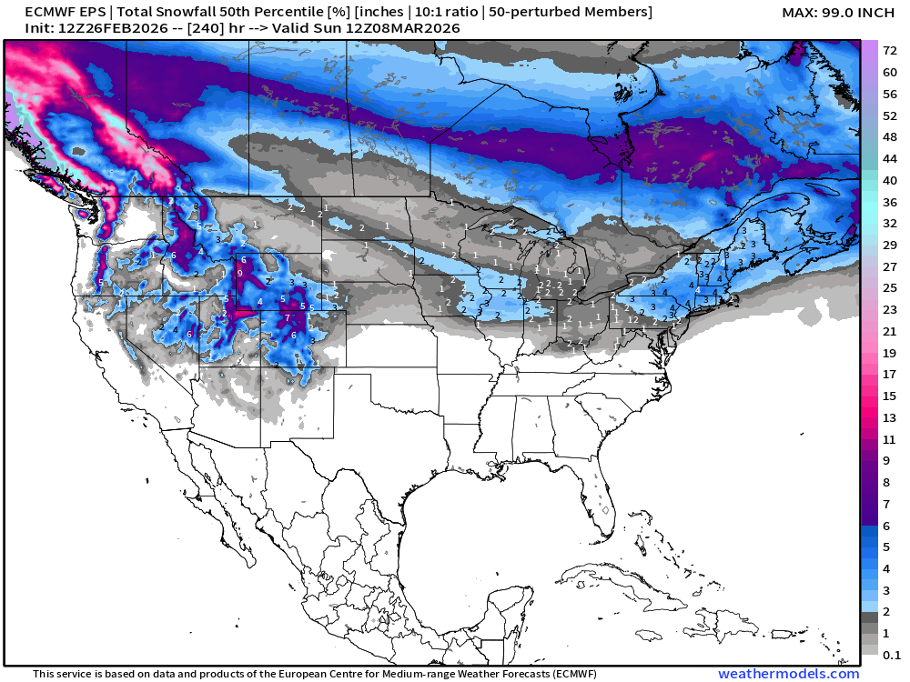
Snowfall | Median of ECMWF Ensembles at 12z | Next 10-days
Temperature Anomaly | Next 15-days | ECMWF EPS 12z Ensemble Mean Flagship
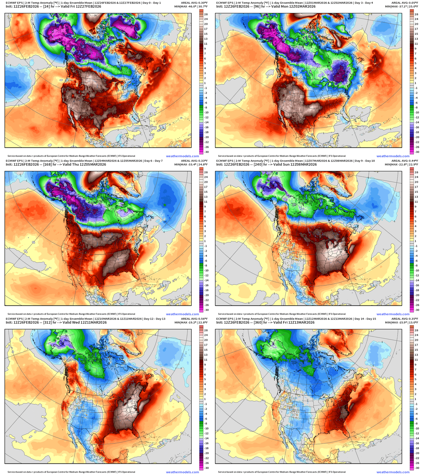
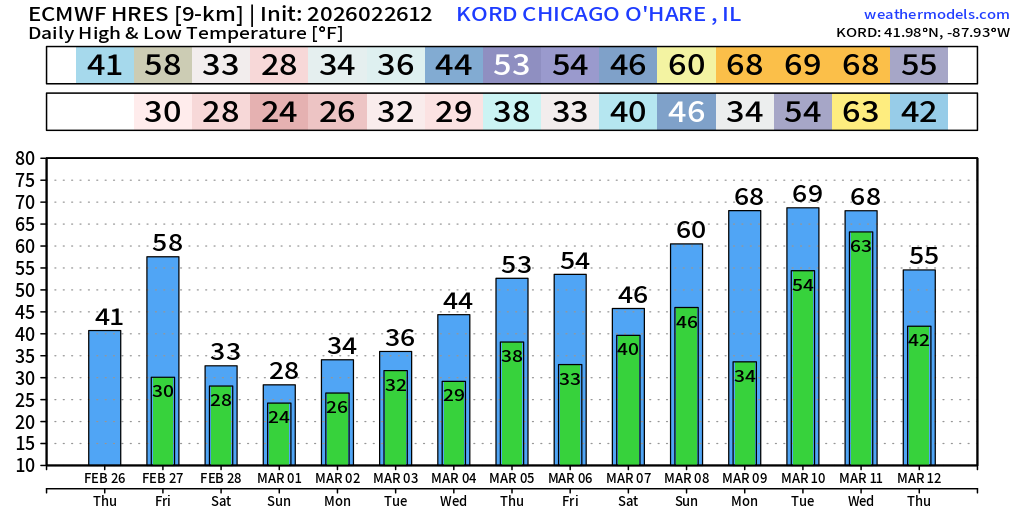
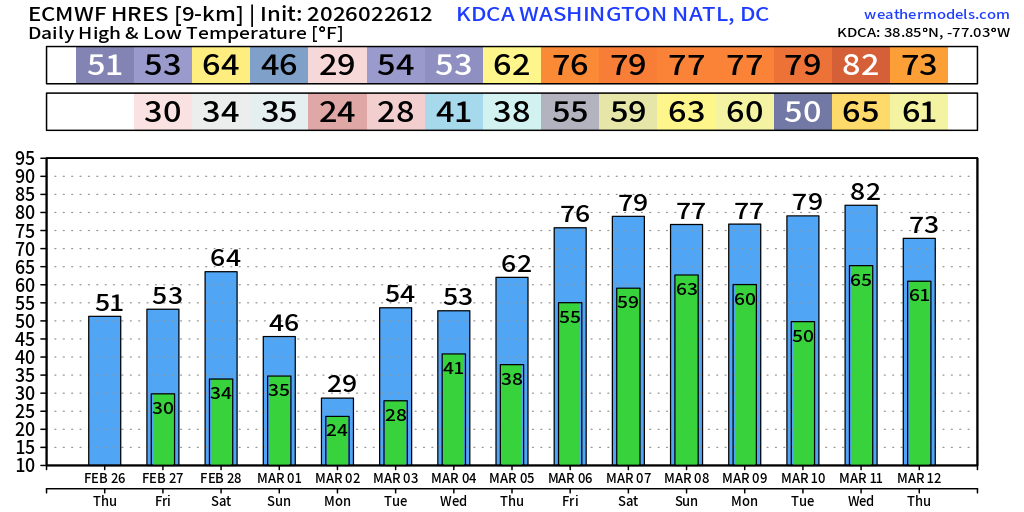
Spring like warmth into the second week of March!
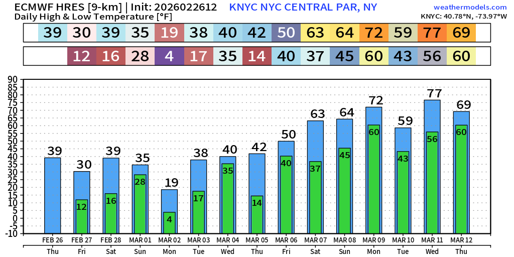
New York City | Next 15-days from ECMWF 12z — 60s and 70s
Chicago | Next 15-days from ECMWF 12z
Washington D.C. next 15-days — on major upswing into March 6th w/70s maybe 80°F
5-Day Chunk #1 | Temperature Anomaly | Feb 26 - March 2
5-Day Chunk #2 | Temperature Anomaly | March 3 - March 7
5-Day Chunk #3 | Temperature Anomaly | March 8 - March 12
Maps sourced from weathermodels.com designed and innovated by yours truly! Please subscribe there for real-time access to the newest maps, charts from all of the weather models including ECMWF and AIFS, and NOAA GFS/GEFS.
- Milepost
- 884 · laid 2026-02-27T02:16:35.964000Z
- Source
- https://weather.substack.com/p/february-26-2026-thursday-winter
- Digest
- 365ebdf49e6398773482fb0b56cb93d60563afab2bcc8b1b6503f3e176d4df10
- Machine
- JSON