February 25, 2026 Wednesday Winter Weather
One more week of harsh winter cold then we turn the corner to more Spring like warmth
February 2026 was the 4th-warmest February in the 132-year national record (1895–2026), at 40.3°F against a 1991–2020 normal of 35.6°F (+4.6°F).
February 2026 was the 5th-driest February in the 132-year national record (1895–2026), at 1.4in against a 1991–2020 normal of 2.1in (-0.7in).
NOAA/NCEI Climate at a Glance, contiguous United States. This is the observed record for the month, not a score of anything said in this piece — the forecast ledger begins 2026-08-17 and cannot reach earlier posts.

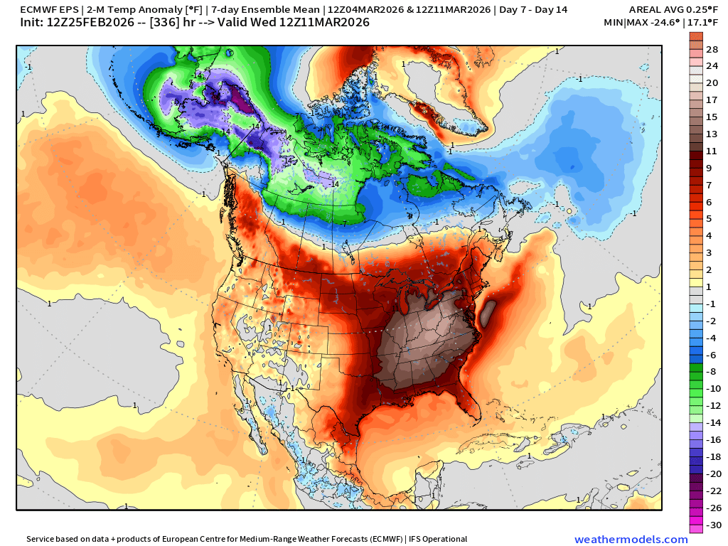
Average temperature anomaly for Week 2: March 5-11th
Relief is in sight from the harsh winter weather as the “polar vortex” will be locked up over Arctic Canada and Alaska into mid-March. We’ll be watching a (major) “sudden stratospheric warming” (SSW) event to occur over next 10-days, and any near-surface or Lower 48 fallout / potential cold spell would be middle-March and onward.
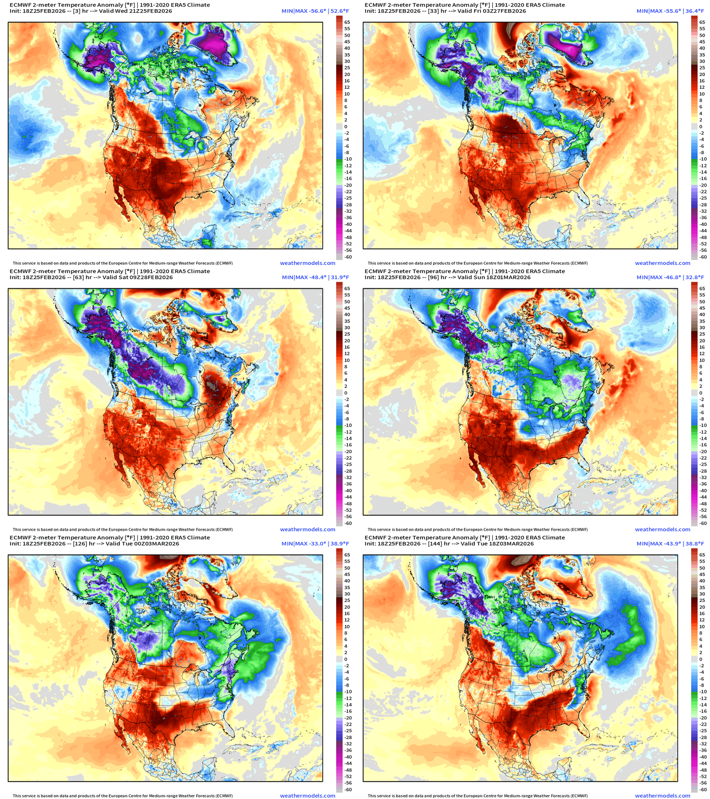
One more Arctic blast to go — and it will be exceptionally intense but brief, thankfully. Temperature anomaly for the next 6-days shows the mega-TPV near Greenland combining with Alaska/NW Arctic Canada cold pool and descending into the Great Lakes and Northeast. Note that the cold lingers into Tuesday with the wedge in the Southeast U.S. (Atlanta) and the Mid-Atlantic.
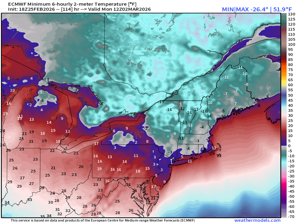
The coldest morning will be Monday in the Northeast with ECMWF 18z showing minimum of 1°F in New York City — a March monthly record low, and coldest/latest since 1°F on February 25, 1914.
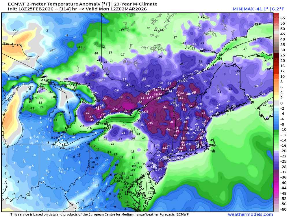
Temperatures will be 25°F to 40°F below normal at 7 AM ET on Monday morning across the Northeast from Toronto to Boston and NYC.
Next 6-days of Precipitable Water (my favorite parameter) to show moisture or lack of it across North America
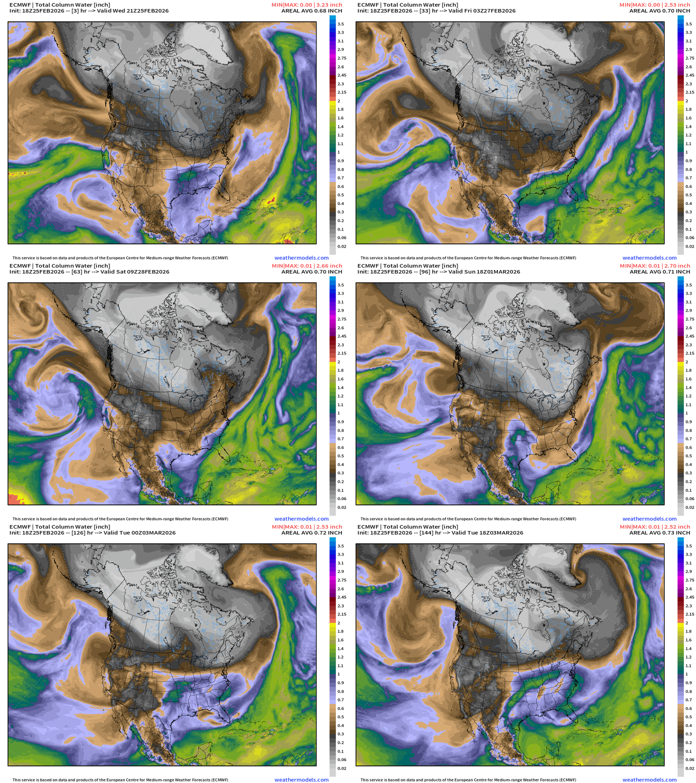
The white is exceptionally dry (little actual moisture — but relative humidity can be high because it is so cold) … with Canada almost entirely enveloped in brutal winter Arctic “polar vortex” cold air.
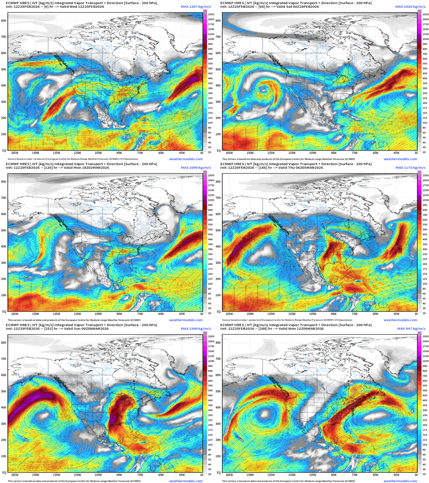
Pattern Shifts Next Week! The flow comes out of the south … and we see the Gulf of Mexico activated and open for business heading through the first week of March. This means much, much warmer and also wetter — good news for any drought concerns heading into to planting season. Next 10-days of Integrated Vapor Transport:
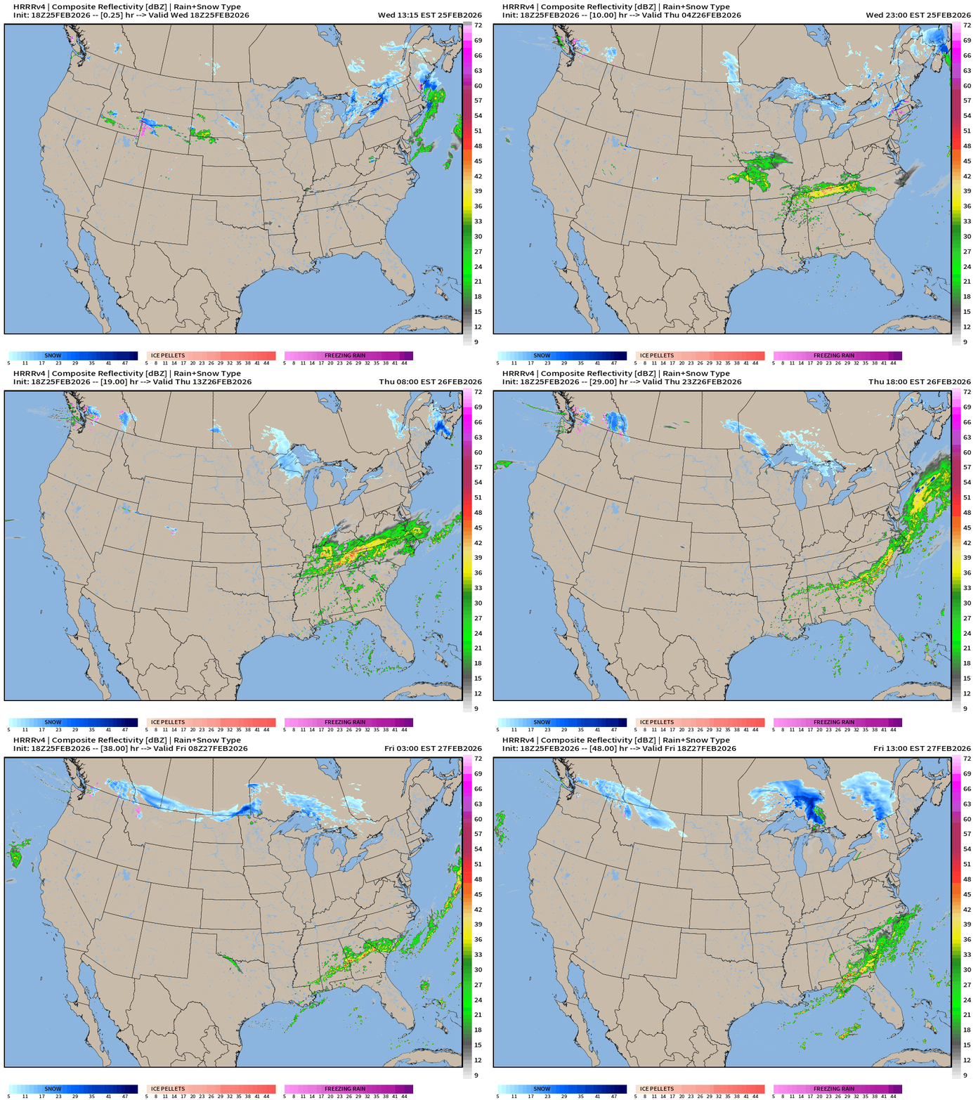
HRRR 18z — Radar Simulation Next 48-hours | Rain across TN Valley and into the Southeast from a frontal boundary
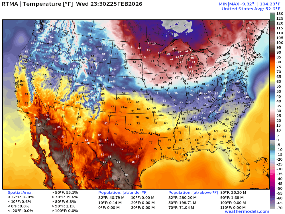
RTMA Current Temperature Analysis | 6:30 PM ET
RTMA Current Temperature Anomaly Analysis | 6:30 PM ET
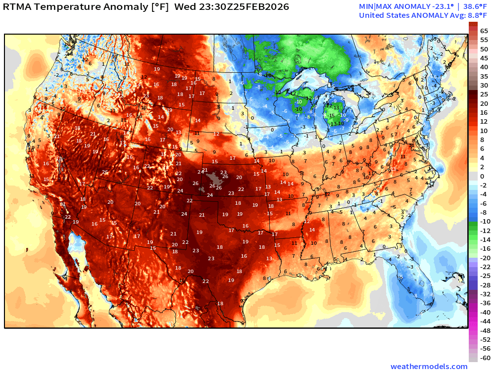
Lower 48 is 8.8°F above normal
Low Temperatures on Thursday
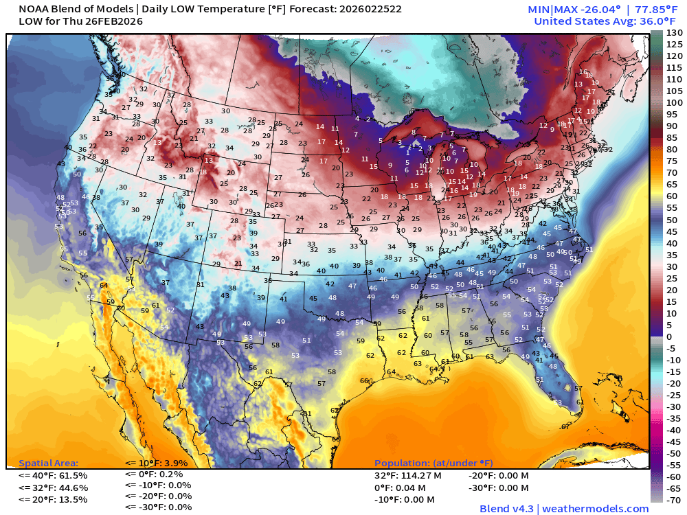
114 million below freezing
High Temperatures on Thursday
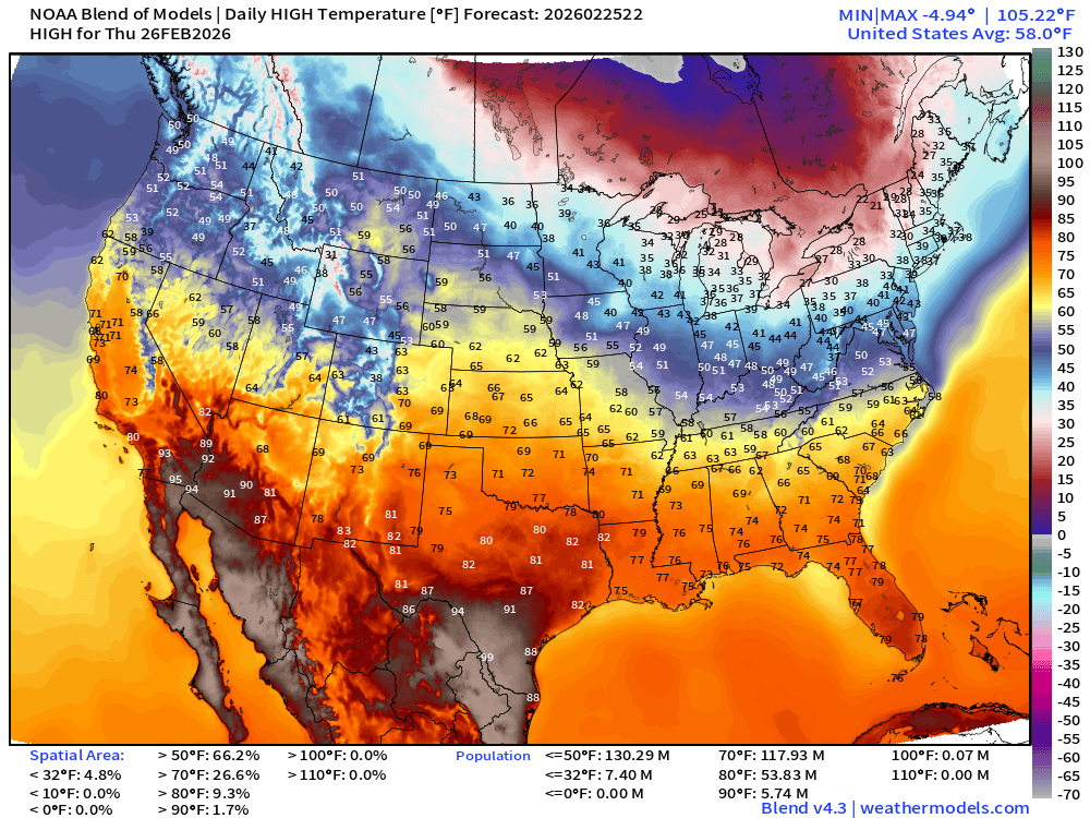
118 Million at least 70°F and 54 million at least 80°F but still in the 30s and 40s across the Great Lakes and Northeast.
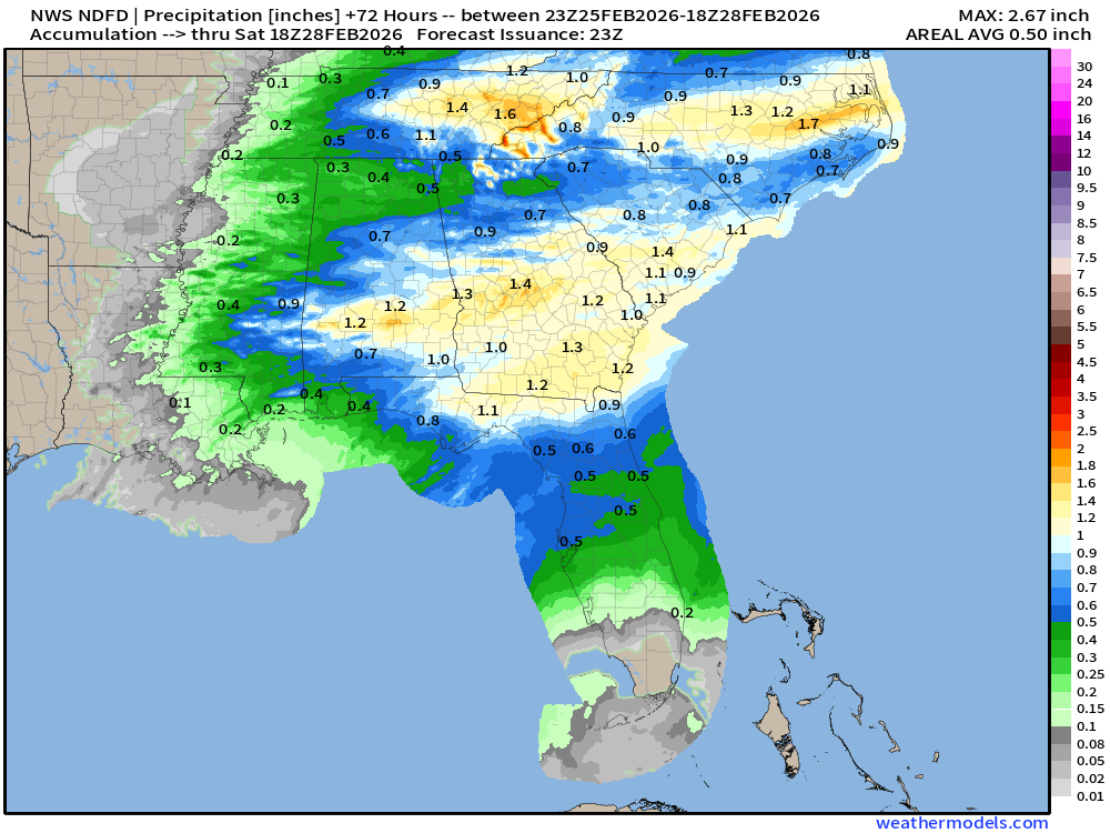
NDFD NWS Total Precipitation Next 72-hours through Friday evening
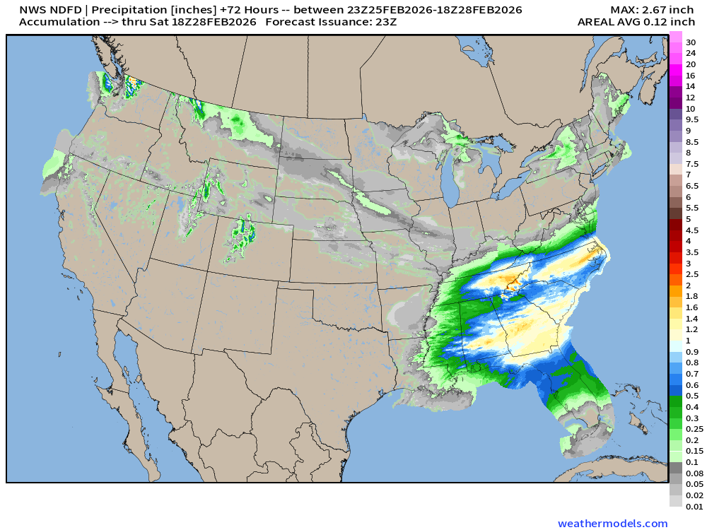
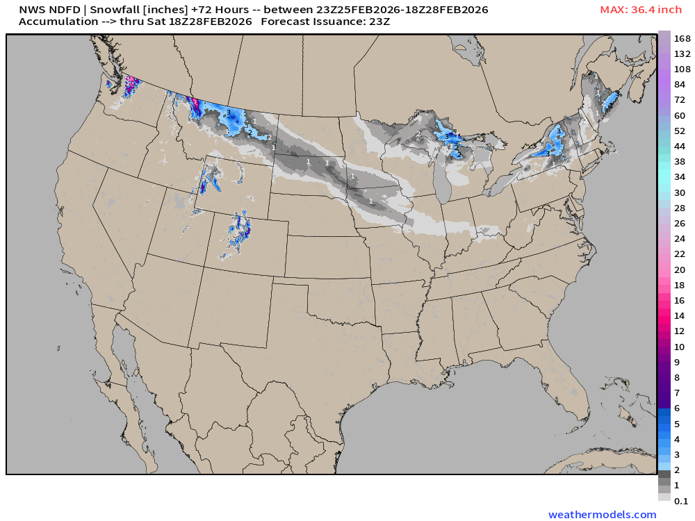
NWS Snowfall Next 72-hours — through Friday evening
ECMWF 18z Precipitation Type + Intensity | Next 6-days
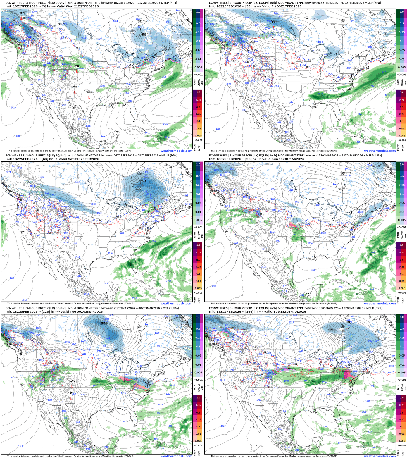
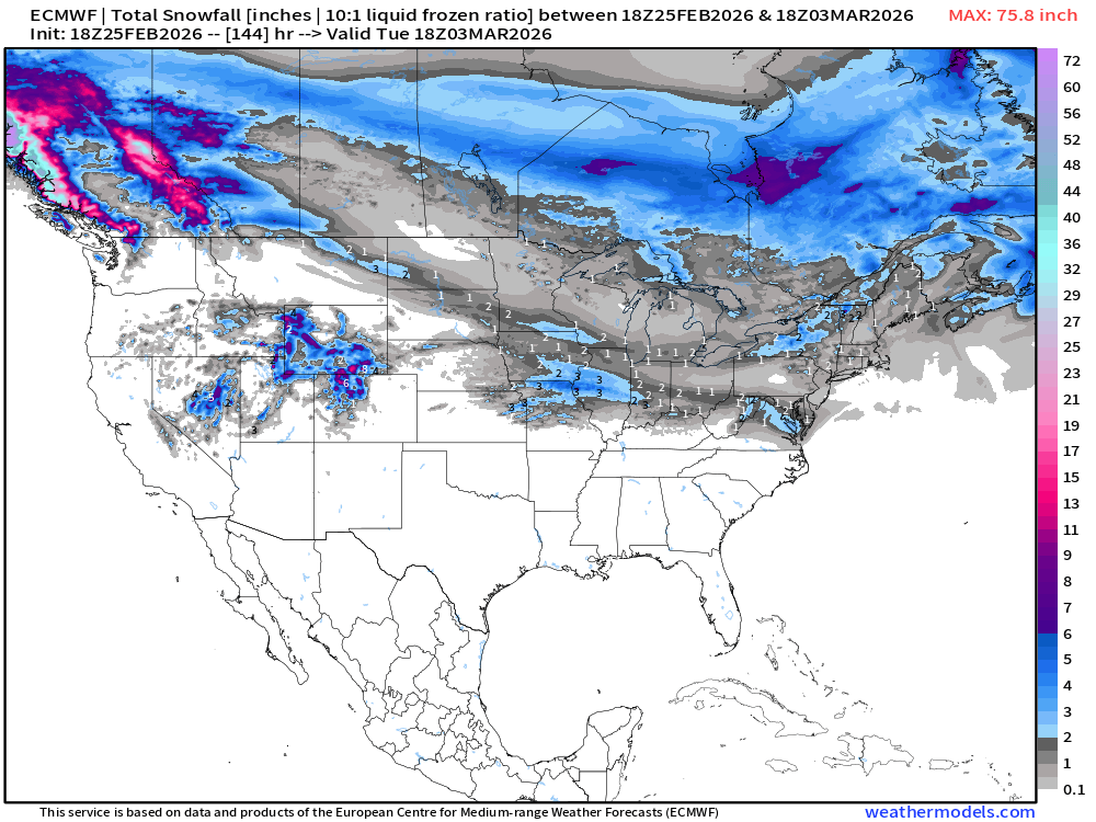
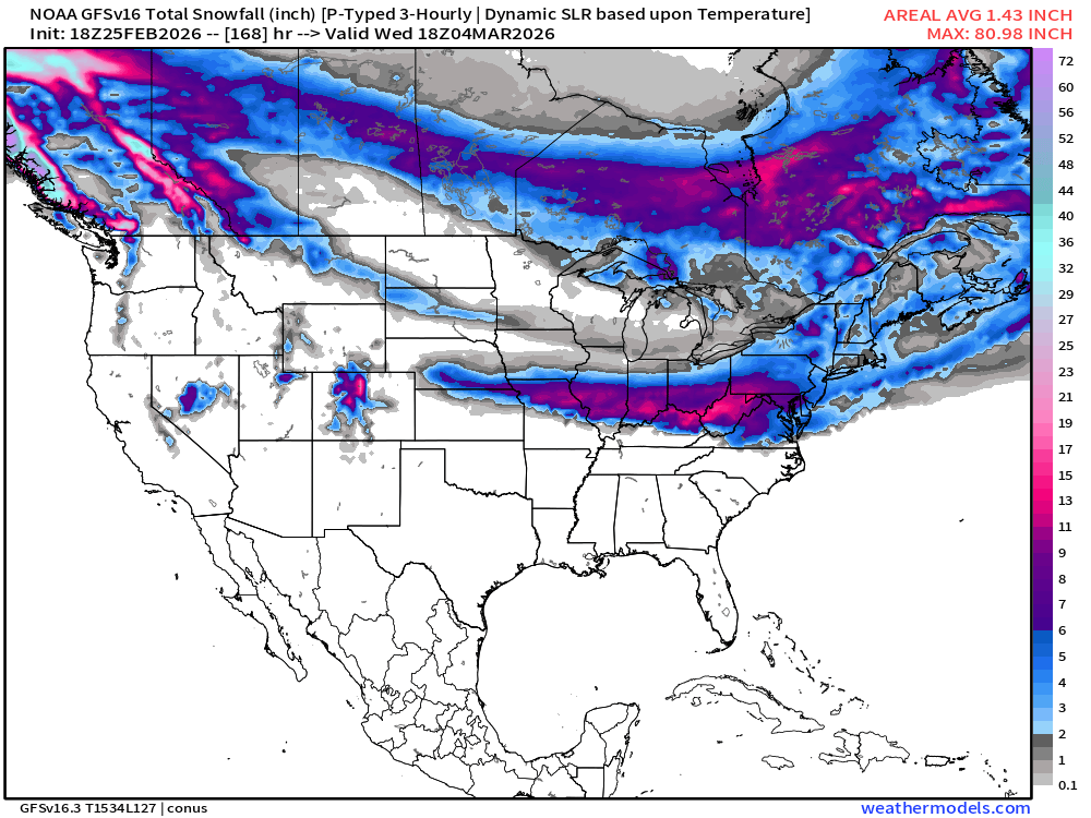
Not seeing a major winter storm forming or much precipitation (snowfall) into early next week, unlike the GFS model, which is why we’ll see the ECMWF 6-day snowfall quite light accumulations, but the Blend of Models juiced up with GFS snowfall.
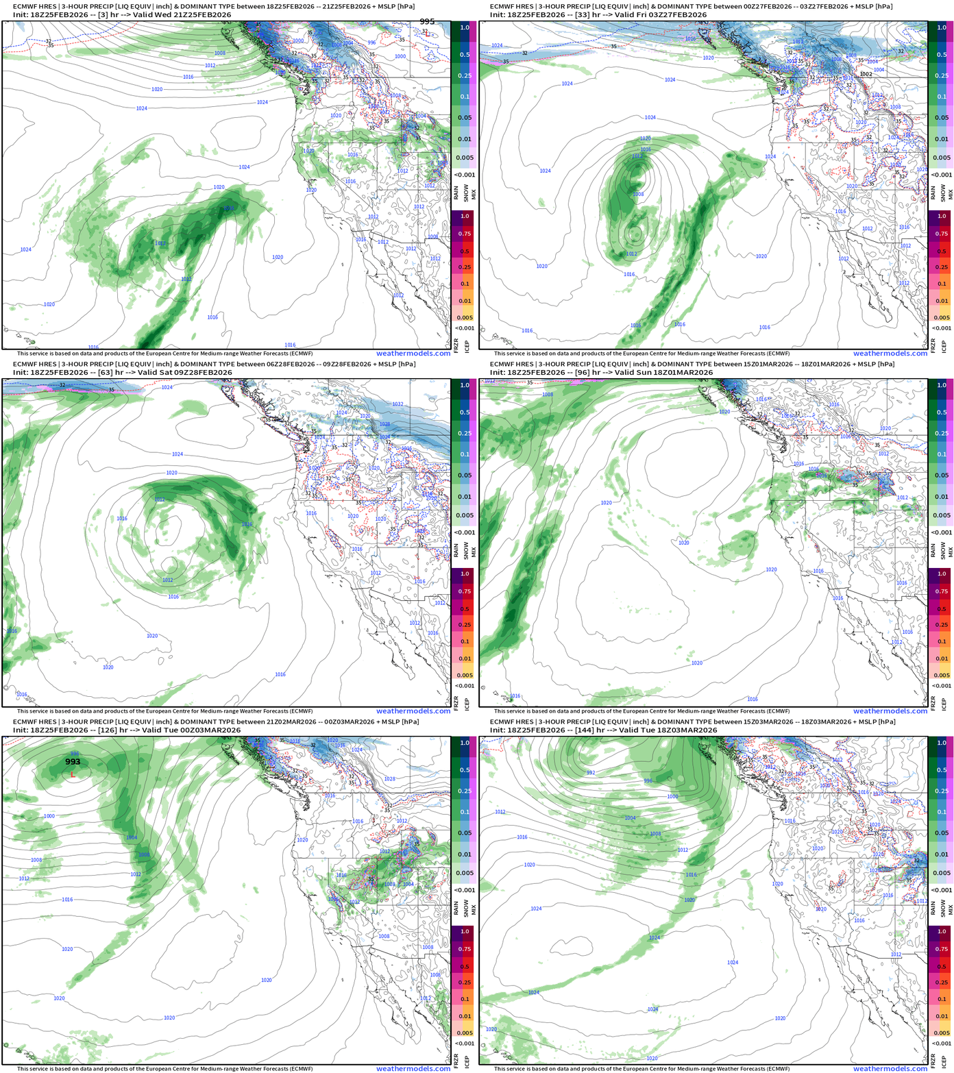
Western U.S. Storm Systems — next 6-days
Total Snowfall Next 6-days | ECMWF 18z
GFS Snowfall Next 7-days | GFS 18z
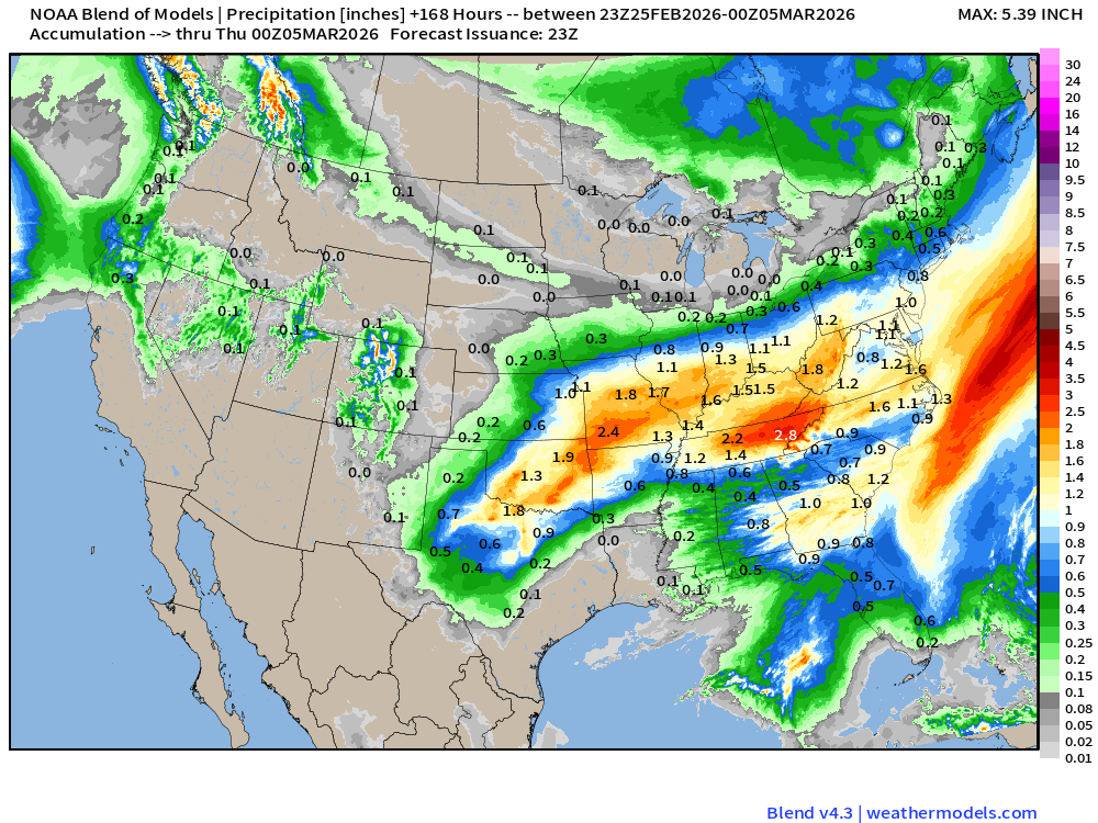
Blend of Models | 7 Days Precipitation Total
Blend of Models | Total Snowfall Next 7-Days
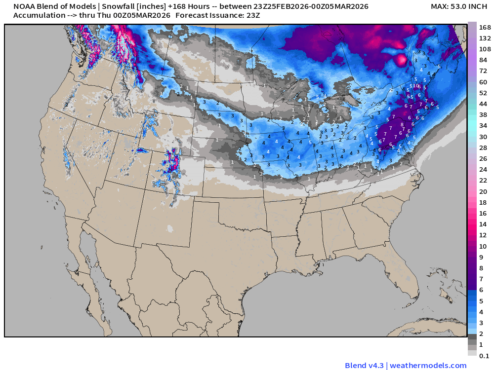
Skeptical about this exceptional snowfall in the Northeast over next 7-days!
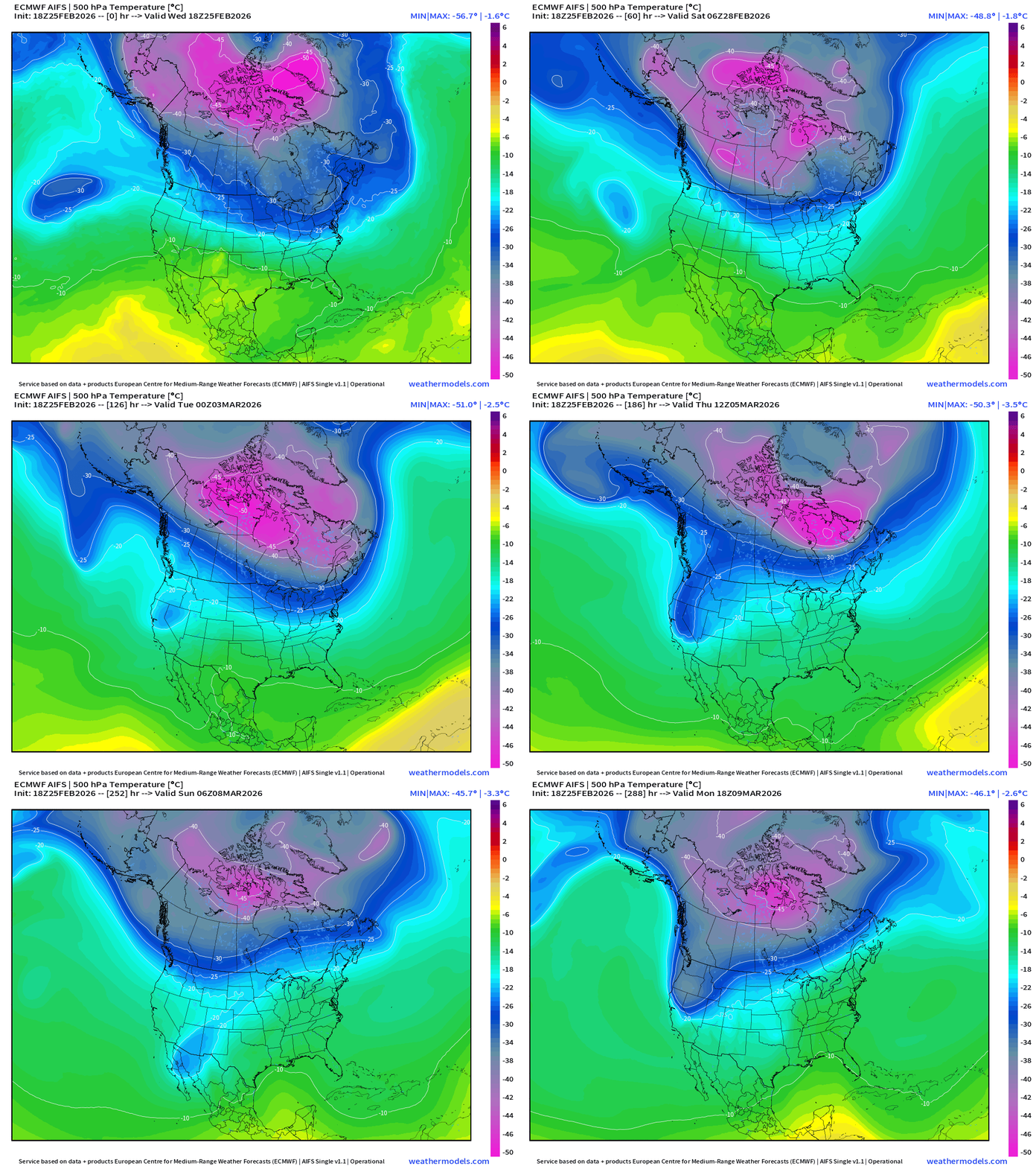
ECMWF AIFS 18z | Temperature at 500 mb | Next 12-days
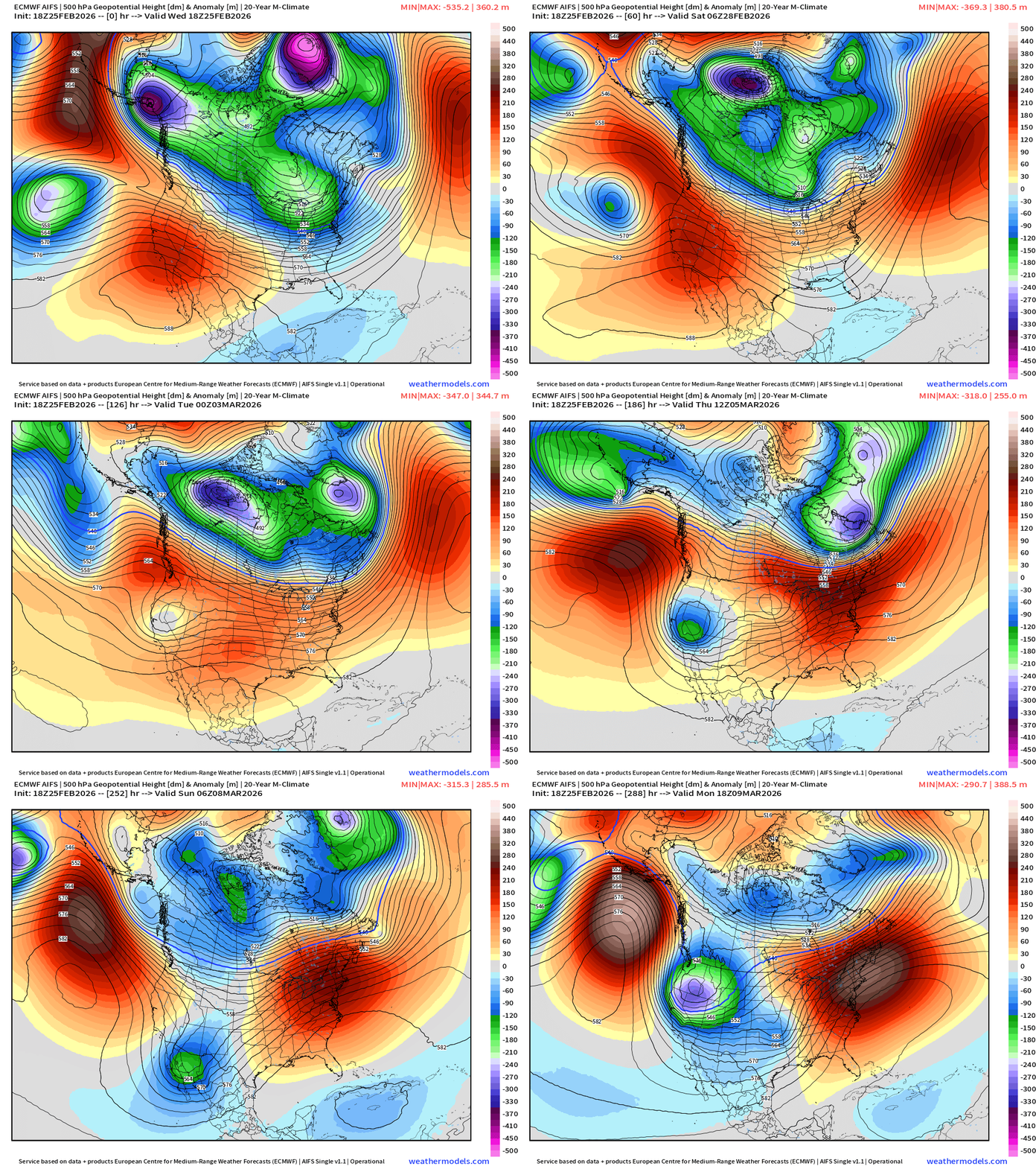
ECMWF AIFS 18z | Height Anomaly at 500 mb | Next 12-days
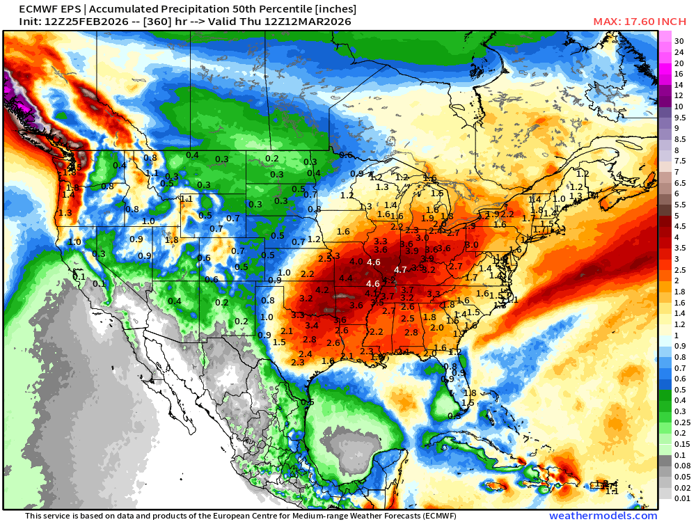
Boatloads of Precipitation / Rainfall from Weather Pattern Shift | Next 15-days
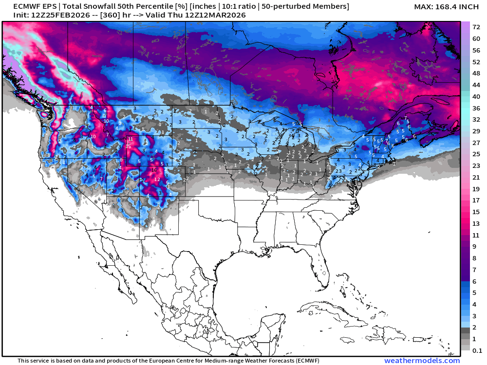
Snowfall | Median of ECMWF Ensembles at 12z | Next 15-days
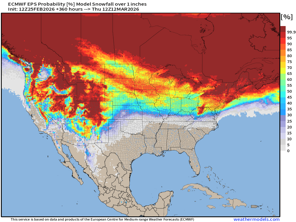
Probability of 1-inch of snowfall or more in the next 15-days
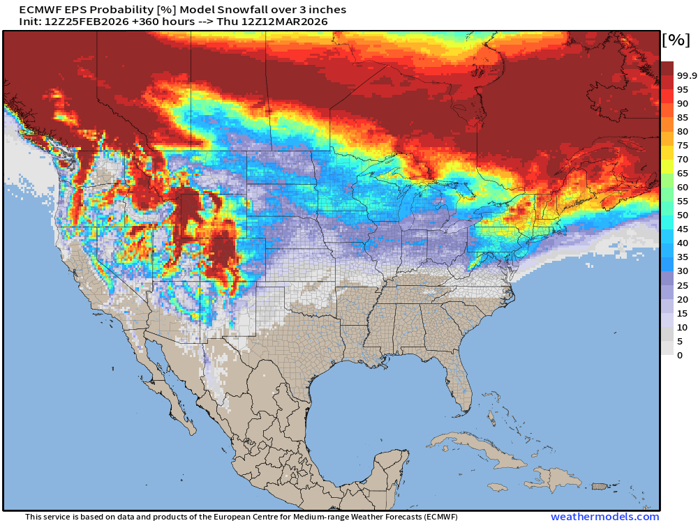
Probability of 3-inches of snowfall or more in the next 15-days
Temperature Anomaly | Next 15-days | ECMWF EPS 12z Ensemble Mean Flagship
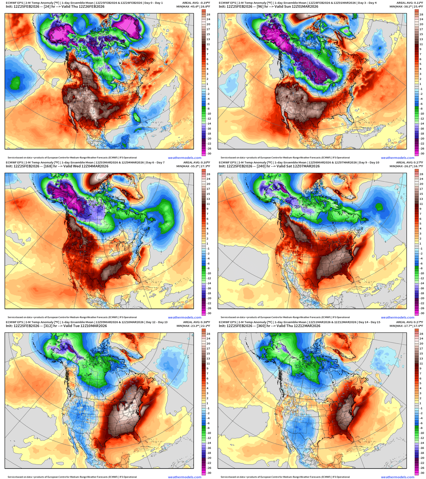
Spring like warmth into the second week of March!
New York City | Next 15-days from ECMWF 12z — 60s to almost 70°F
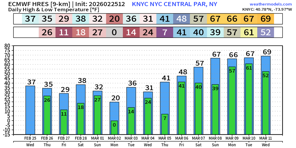
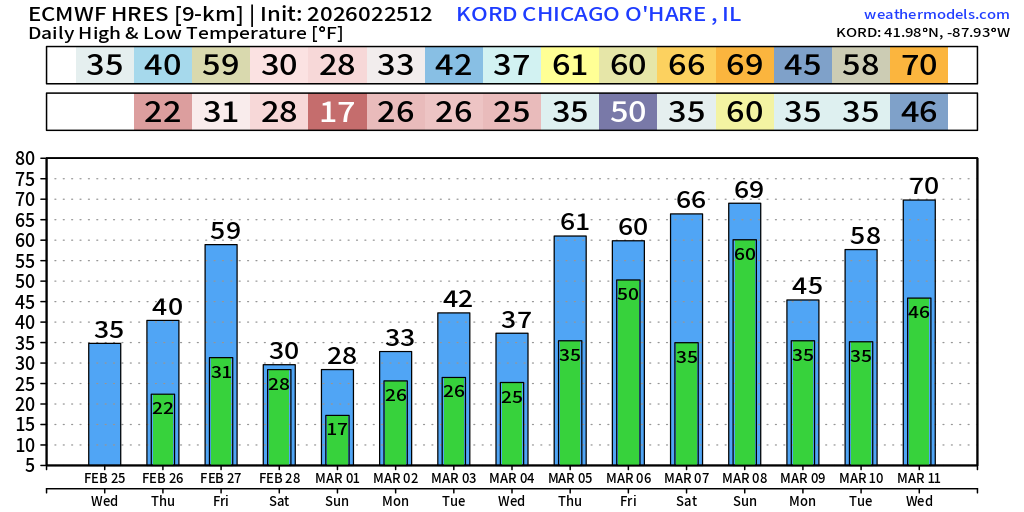
Chicago | Next 15-days from ECMWF 12z — 60s by next Thursday, but first 59°F on Friday.
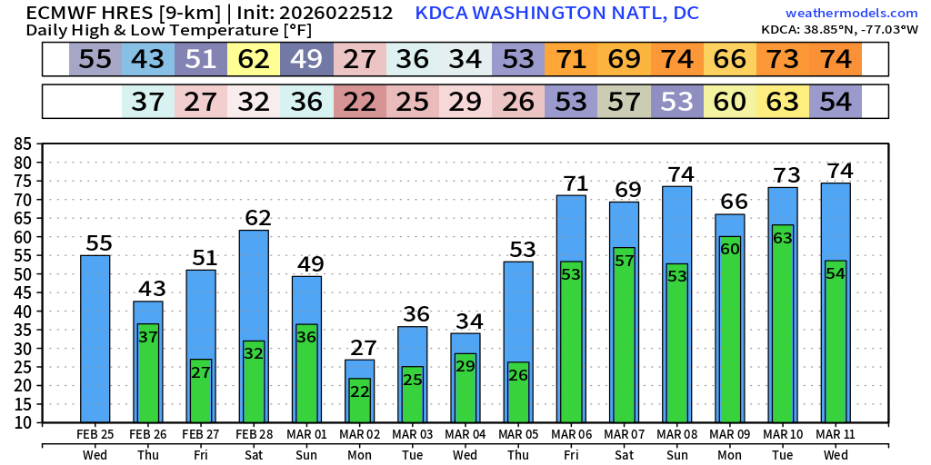
Washington D.C. next 15-days — on the upswing into March with 70s.
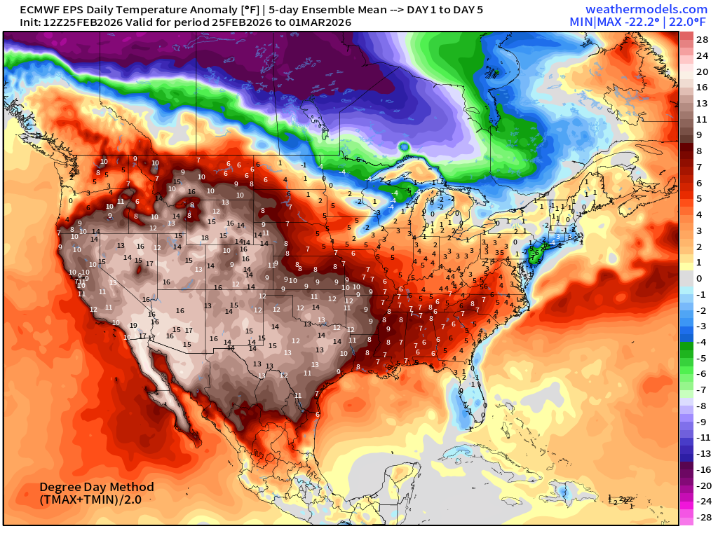
5-Day Chunk #1 | Temperature Anomaly | Feb 25 - March 1
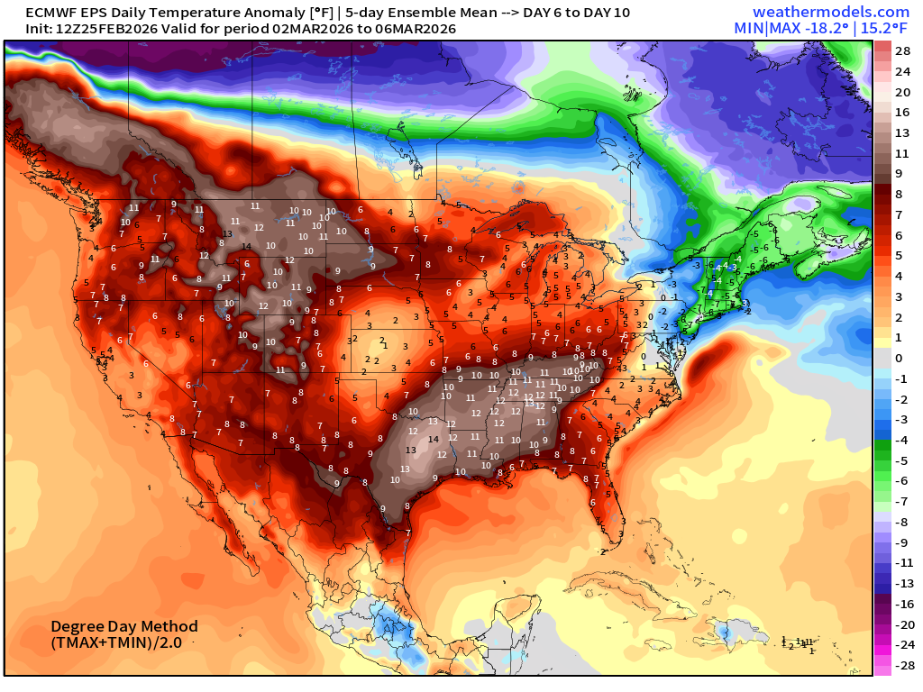
5-Day Chunk #2 | Temperature Anomaly | March 2 - March 6
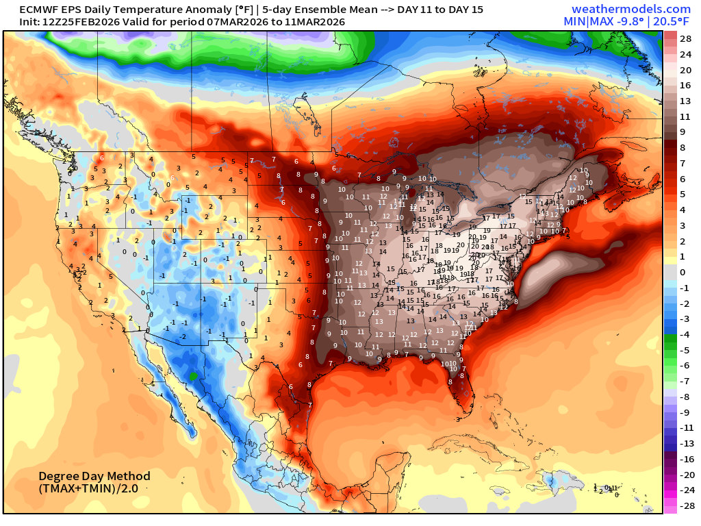
5-Day Chunk #3 | Temperature Anomaly | March 7 - March 11
Maps sourced from weathermodels.com designed and innovated by yours truly! Please subscribe there for real-time access to the newest maps, charts from all of the weather models including ECMWF and AIFS, and NOAA GFS/GEFS.
- Milepost
- 883 · laid 2026-02-26T01:15:14.588000Z
- Source
- https://weather.substack.com/p/february-25-2026-wednesday-winter
- Digest
- c37c1b070e587dd5e07a5b2acd55845042101a30c20982a4efd428a1e61f7553
- Machine
- JSON