February 23, 2026 Monday Winter Weather
Multiple Arctic blasts likely into early March as extreme polar vortex spins in Canada
February 2026 was the 4th-warmest February in the 132-year national record (1895–2026), at 40.3°F against a 1991–2020 normal of 35.6°F (+4.6°F).
February 2026 was the 5th-driest February in the 132-year national record (1895–2026), at 1.4in against a 1991–2020 normal of 2.1in (-0.7in).
NOAA/NCEI Climate at a Glance, contiguous United States. This is the observed record for the month, not a score of anything said in this piece — the forecast ledger begins 2026-08-17 and cannot reach earlier posts.

Monday Evening Headline: Blizzard of 2026 delivers massive snowfall and hurricane force wind gusts from AP News —> For Northeast blizzard, everything was just right to roll up a monster snowfall
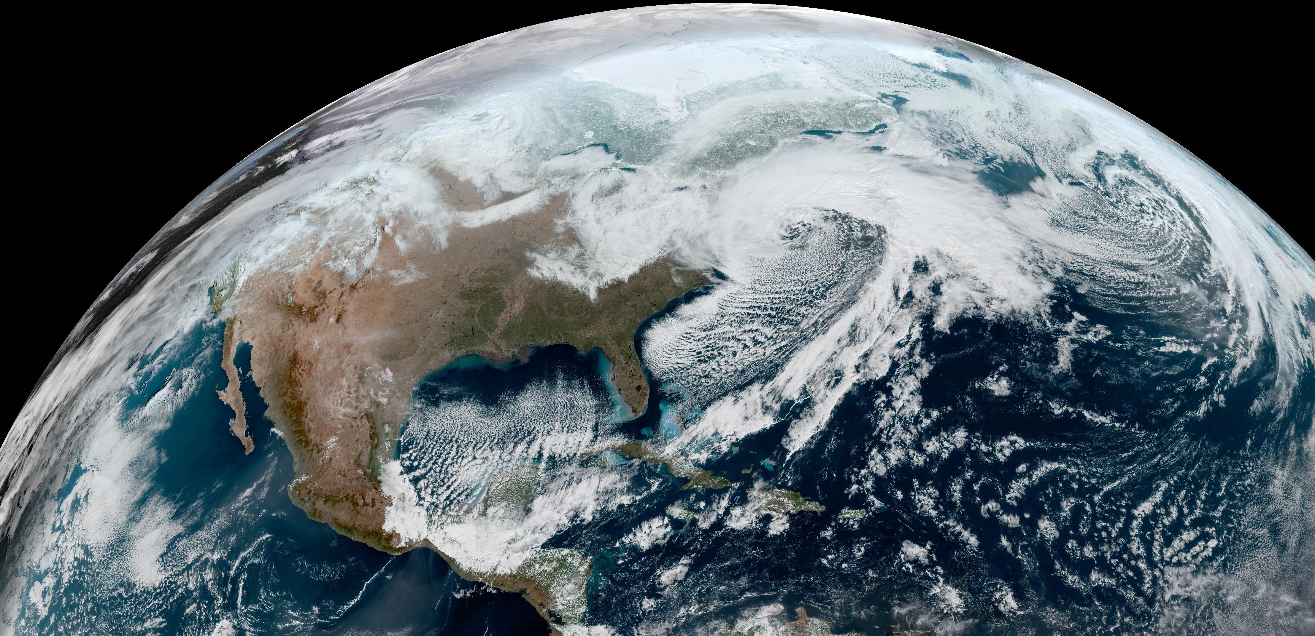
“I’ve always been fascinated about how Mother Nature figures out how to put all the pieces together in order to maximize the most extreme outcome,’' said private meteorologist Ryan Maue, a former chief scientist for the National Oceanic and Atmospheric Administration. ”I think you could make a pretty good case that this is on par with some of the most impressive blizzards in history.”
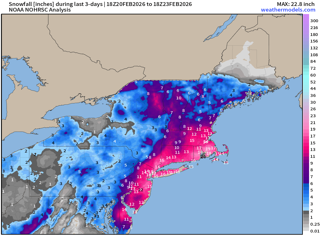
Preliminary snowfall analysis through early afternoon on Monday with still a LOT more to be added to the map. We’ll update tomorrow to get the final observations. Historically, this storm system produced snowfall on par or exceeding the Blizzard of 1978 — the previous benchmark for New England. The slow movement and proximity of strong deformation bands of convective snowfall led to rates of 4” per hour.
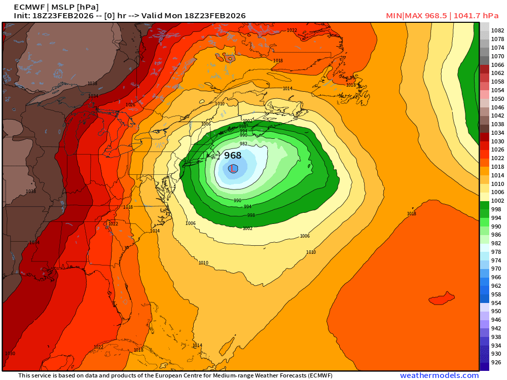
Central Pressure in the 18z ECMWF analysis was 968 mb … on par with a hurricane. While this cyclone did not have tropical origins, it is similar to a post-tropical hurricane we’d see in September or October with an expanded wind field and heavy precipitation on the back side within colder air. In late February = huge snowfall.
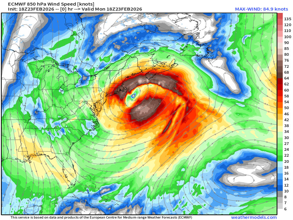
The center of the blizzard is relatively calm with an eye-like feature — with shallow warm-core structure.
A very intense "tropospheric polar vortex” or TPV is dominating our hemisphere with a “lobe” connecting to the blizzard, which fueled its rapid pressure falls and intensification. Textbook intense “bomb cyclone” development in winter.
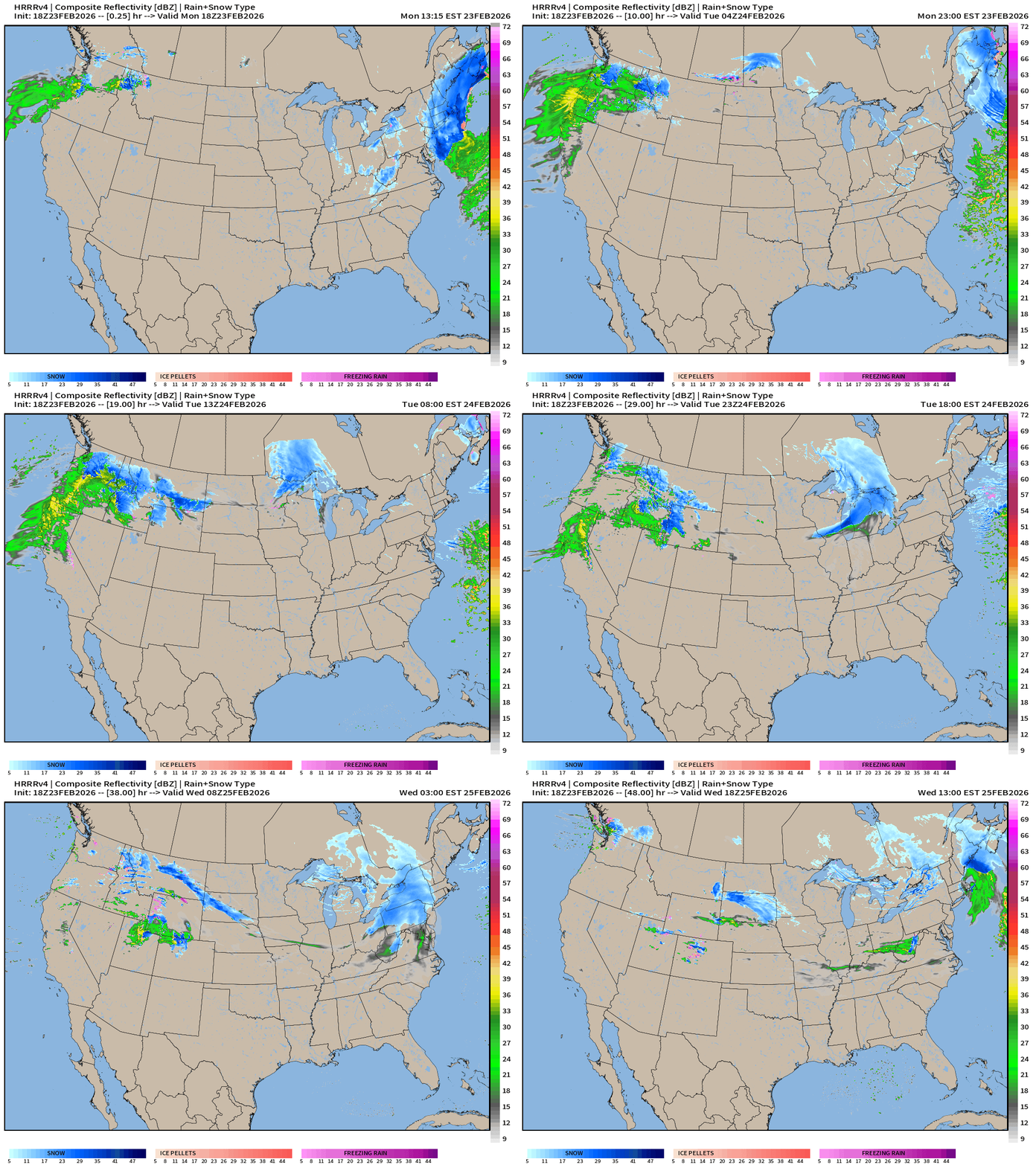
HRRR 18z — Radar Simulation Next 48-hours
Thankfully, we have less extreme winter weather to deal with for the rest of the week.
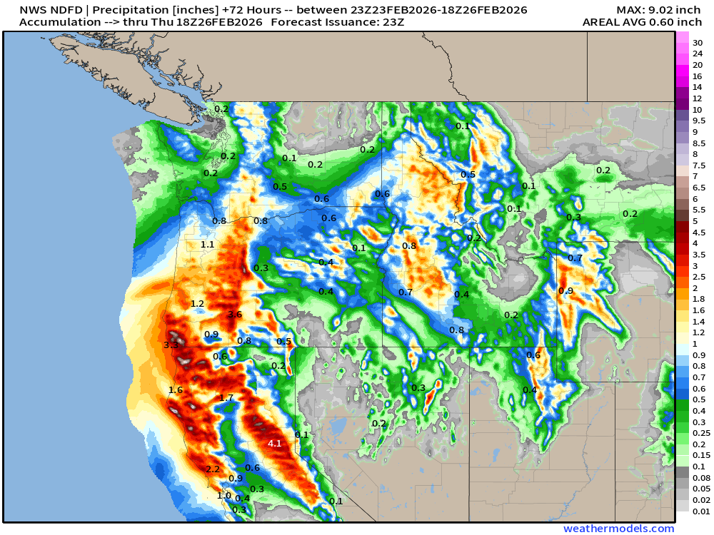
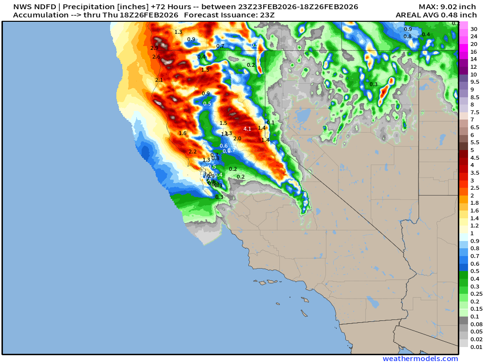
A storm system and atmospheric river will continue to landfall the Pacific Northwest including northern California.
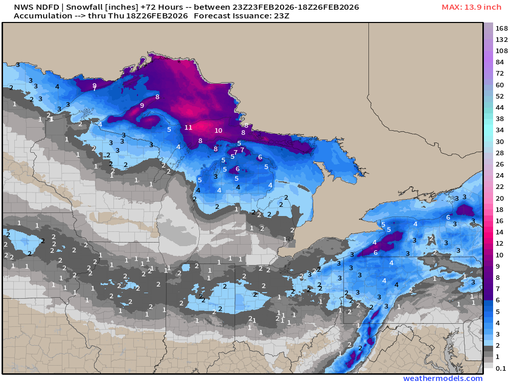
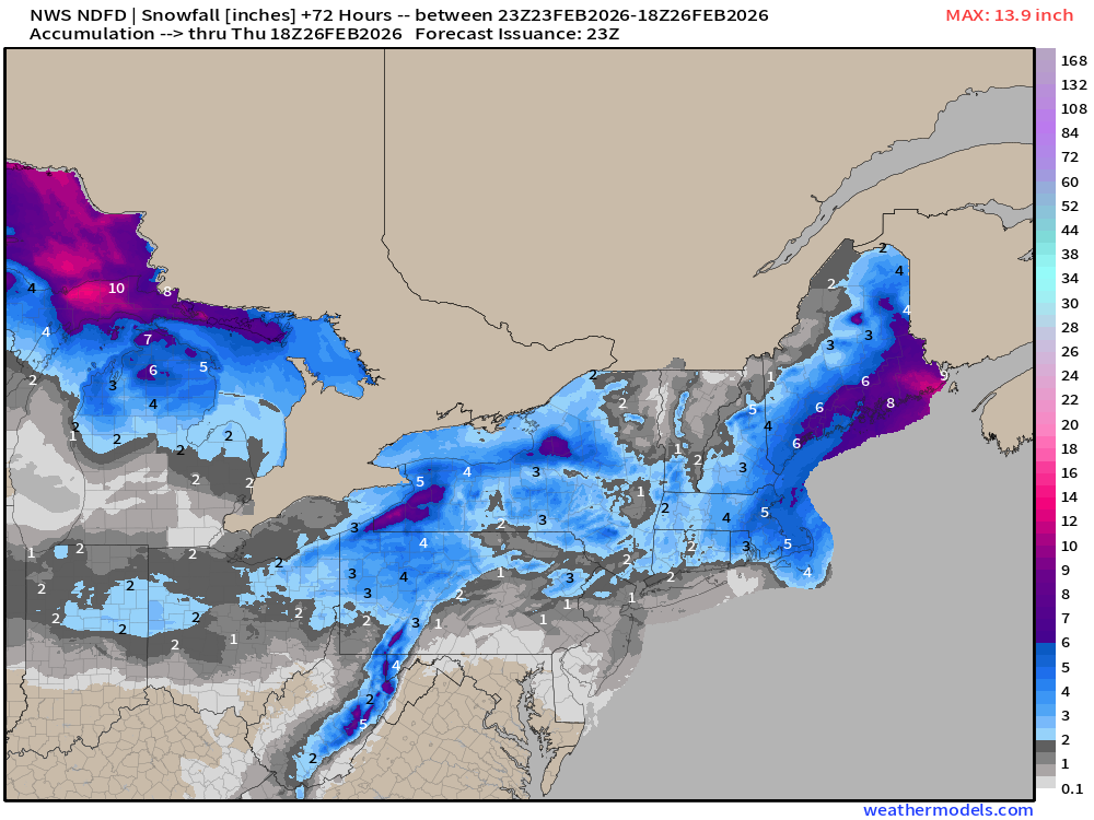
A clipper system will head through the Great Lakes on Tuesday into the Northeast on Wednesday.
Snowfall Next 48-hours
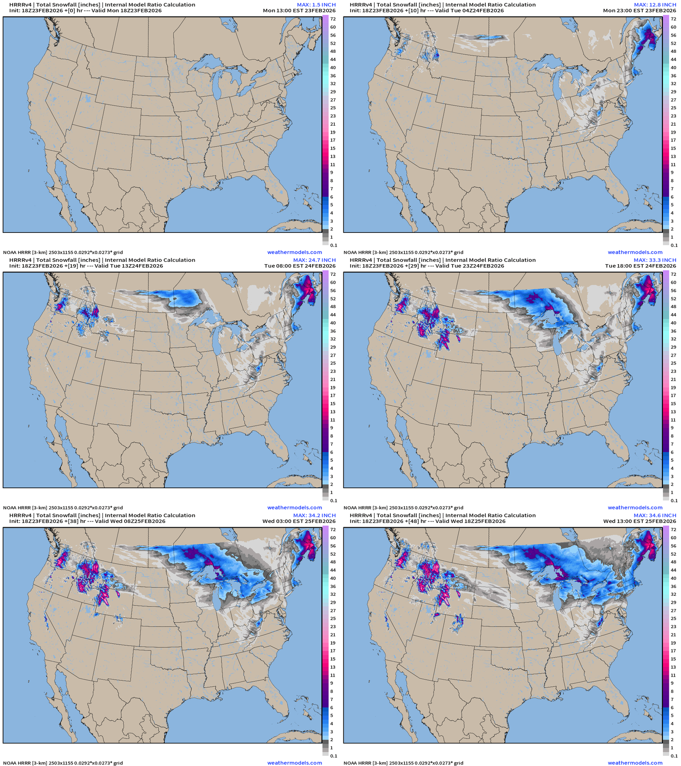
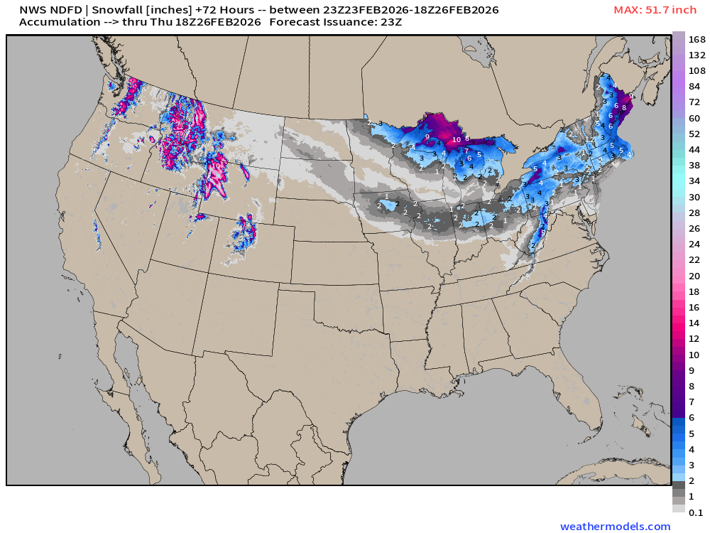
Welcome snowfall in the northern Rockies … and then a large coverage from clipper system across Canada, the Great Lakes, and into New England.
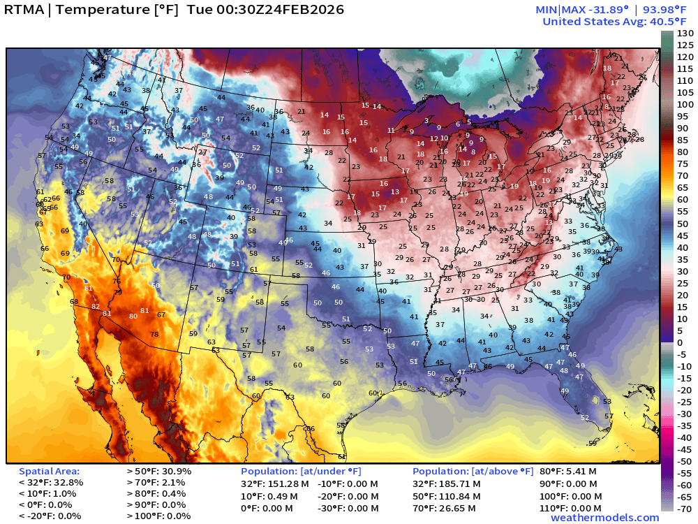
RTMA Current Temperature Analysis | 7:30 PM ET
RTMA Current Temperature Anomaly Analysis | 7:30 PM ET
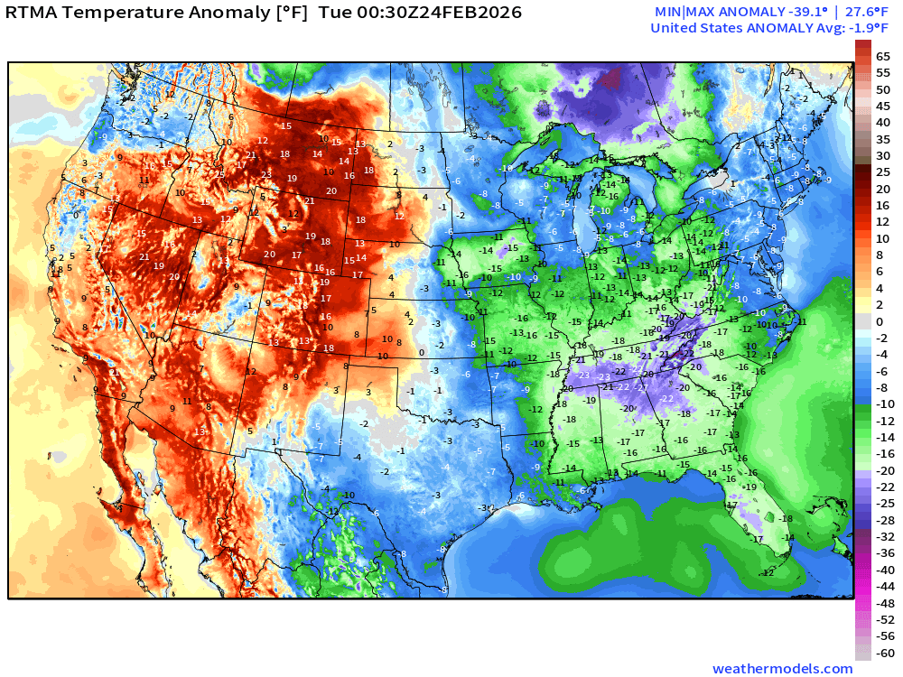
Lower 48 is -1.9°F below normal with coldest in TN/GA and eventually Florida.
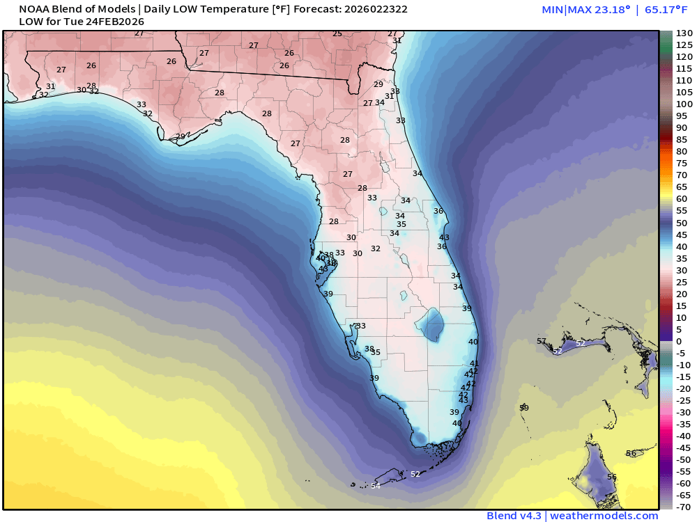
Low Temperatures on Tuesday
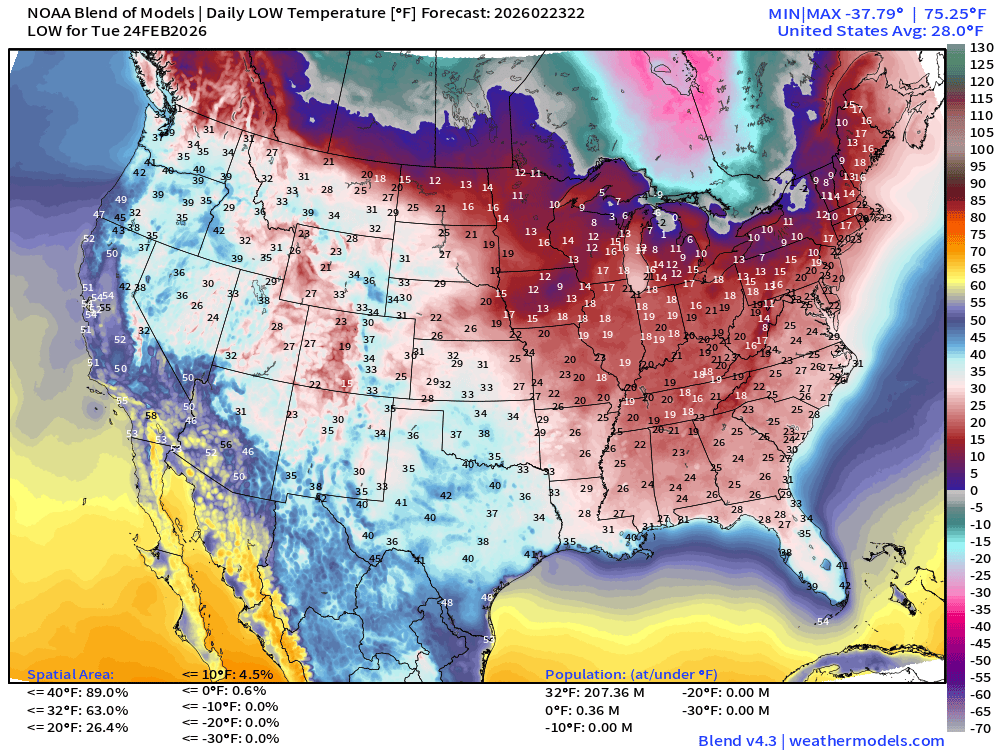
207 million below freezing to the Gulf coast including Florida.
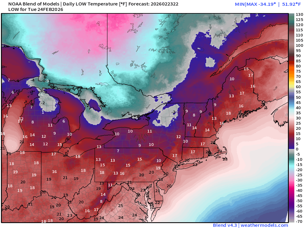
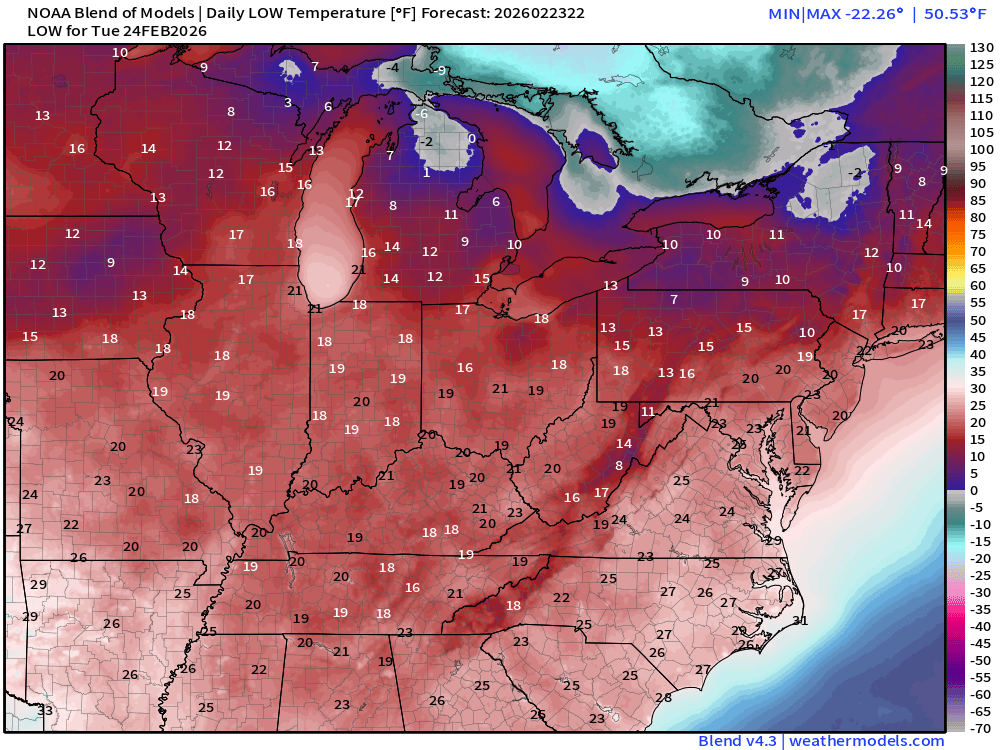
Upper-20s into North Florida Tuesday morning
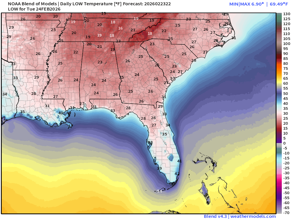
And freezing south of Interstate 4 east of Tampa and further down peninsula = record daily cold.
High Temperatures on Tuesday
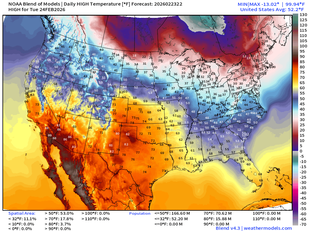
Slow recovery of warmth across the Southeast into the 50s and only highs in the 60s in South Florida —> chilly day!
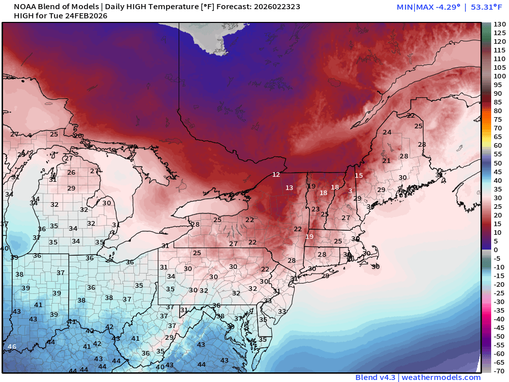
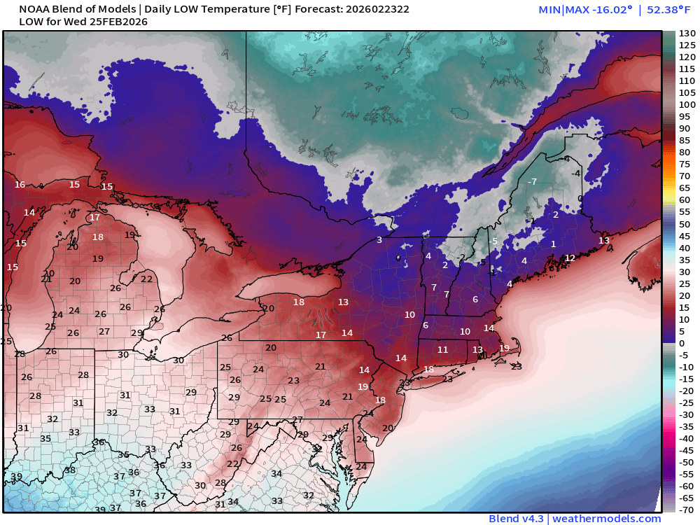
Low Temperatures on Wednesday
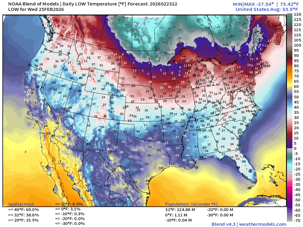
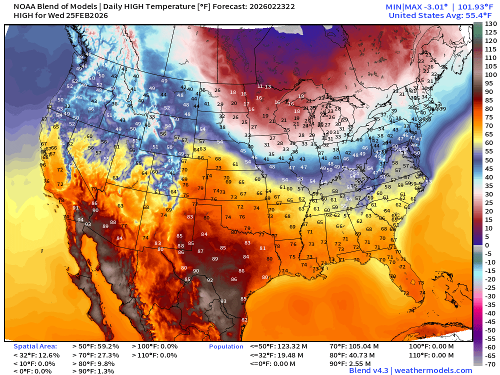
High Temperatures on Wednesday
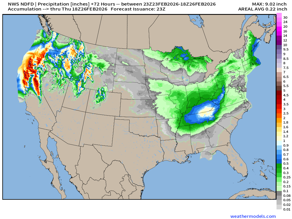
NDFD NWS Total Precipitation Next 72-hours through Thursday afternoon
NWS Snowfall Next 72-hours — through Thursday afternoon
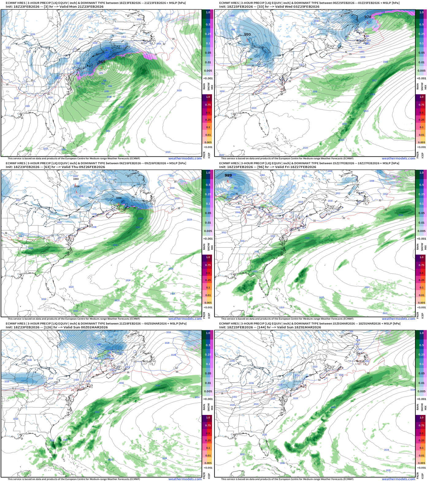
ECMWF 18z Precipitation Type + Intensity | Next 6-days
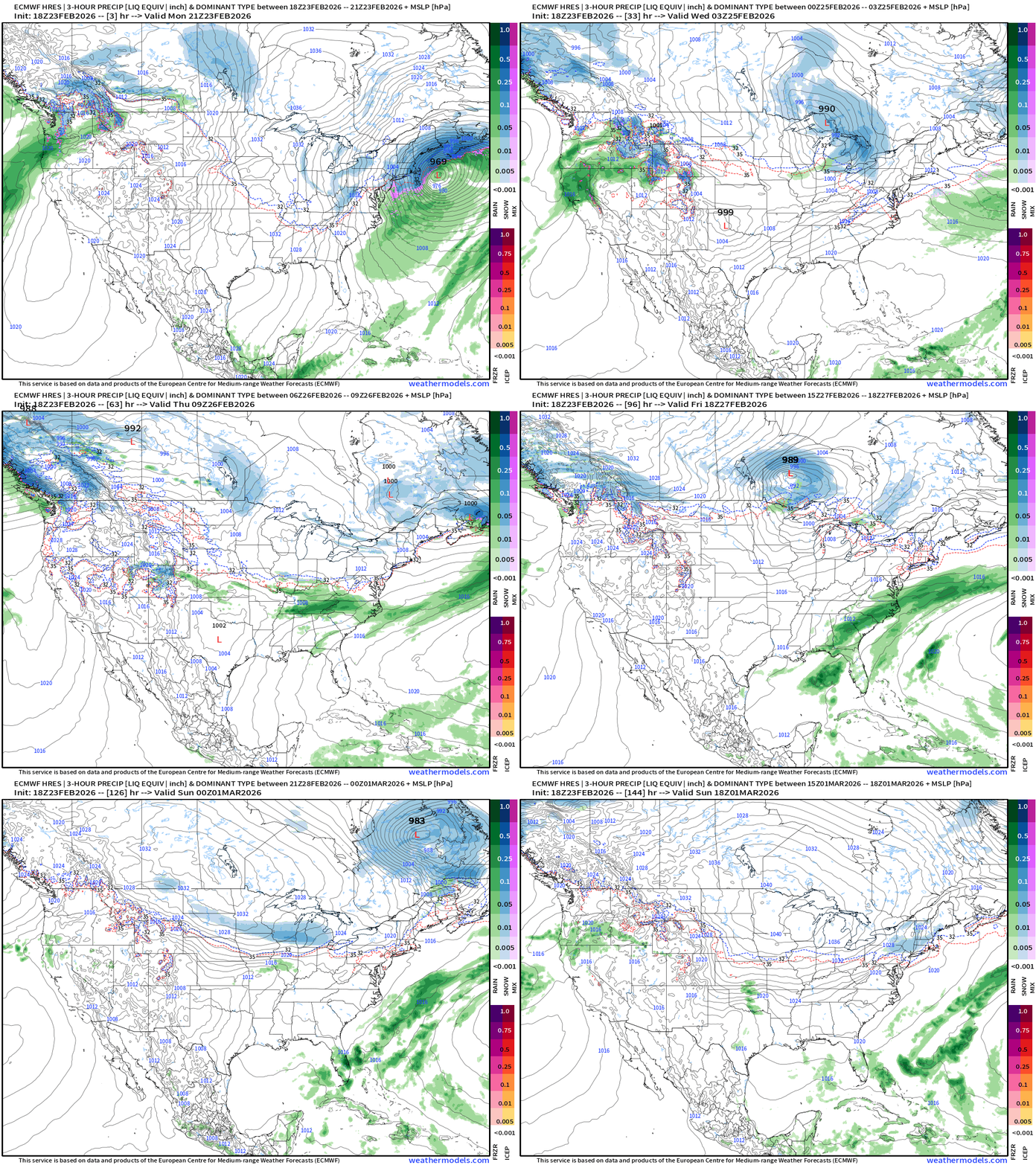
Clipper System mainly from Great Lakes on Tuesday into Northeast on Wednesday
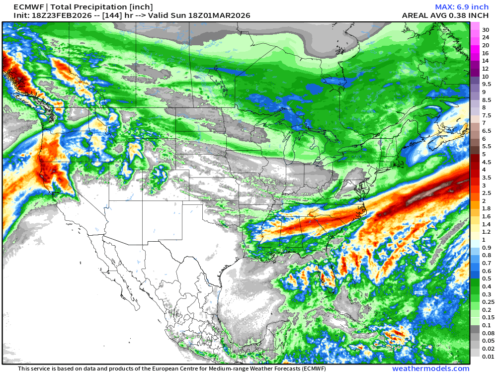
Rainfall in the Southeast along a frontal boundary on Friday
Eastern U.S. Next 6-days storm systems | ECMWF 18z
Western U.S. Storm Systems — next 6-days
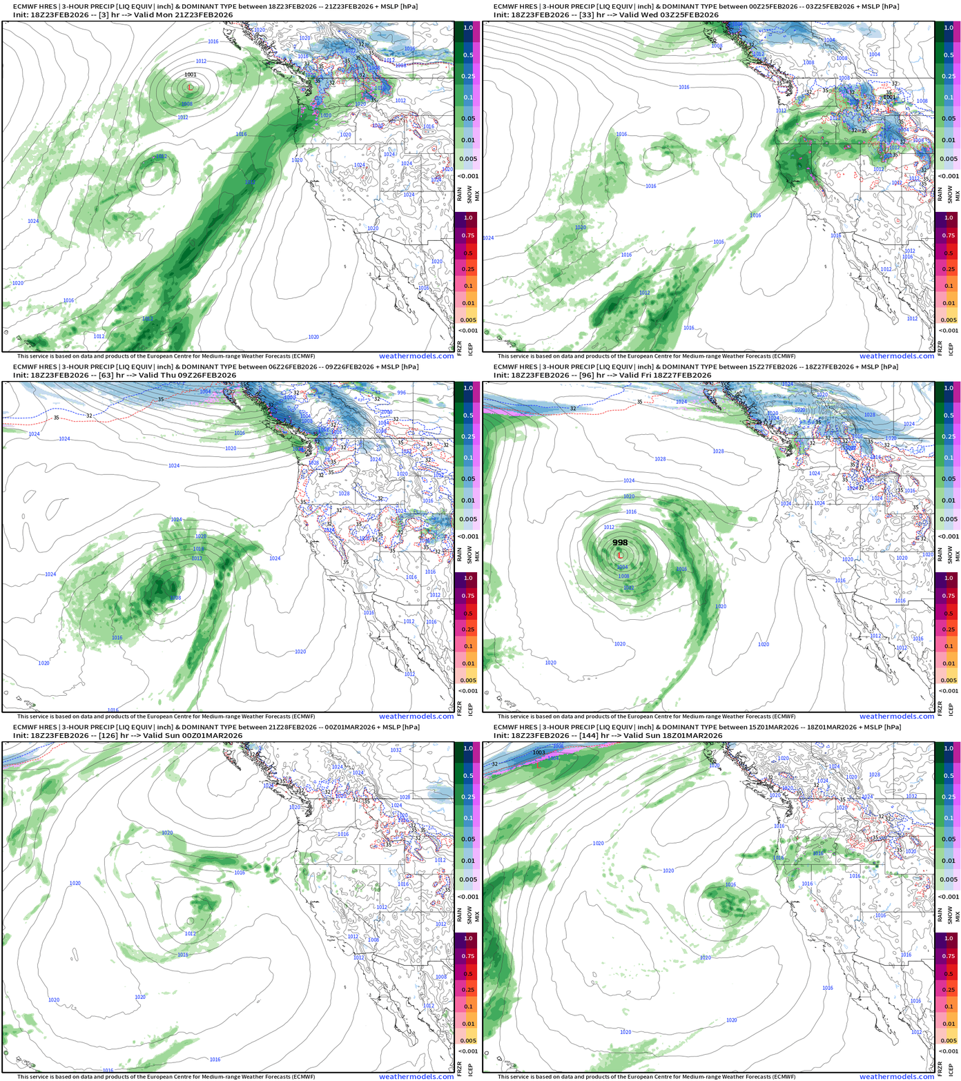
Predominant flow is out of the Southwest — much warmer and less snowfall potential for the mountains — most precipitation as rainfall. Break in storms after Wednesday.
Total Snowfall Next 6-days | ECMWF 18z
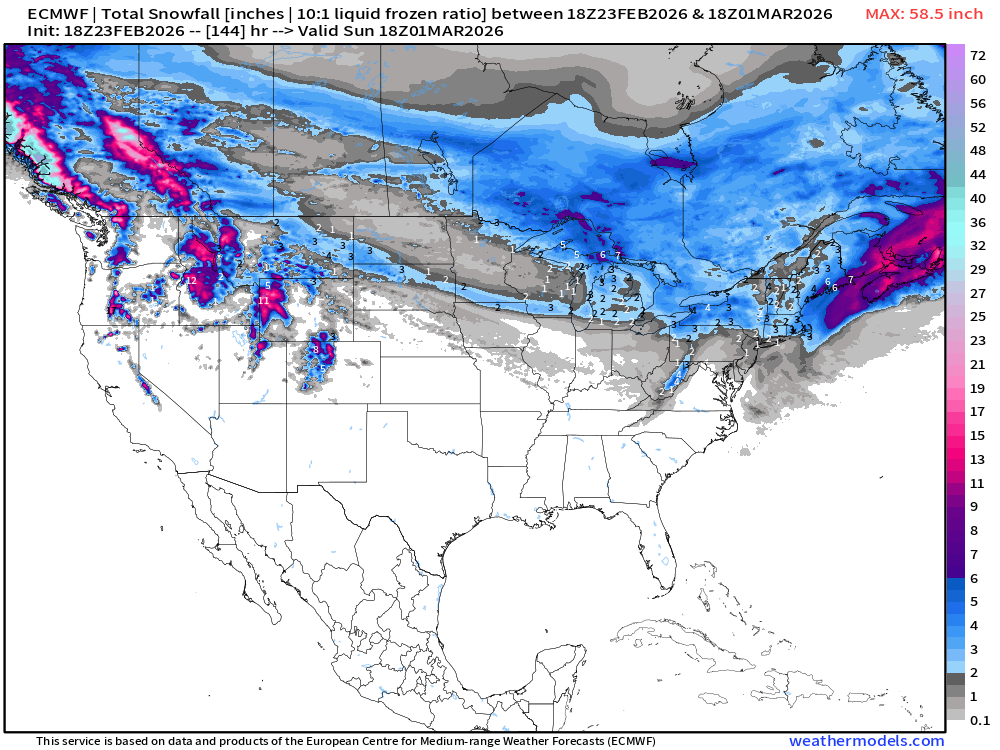
Total Precipitation (Rain + Snow) Next 6-days | ECMWF 18z
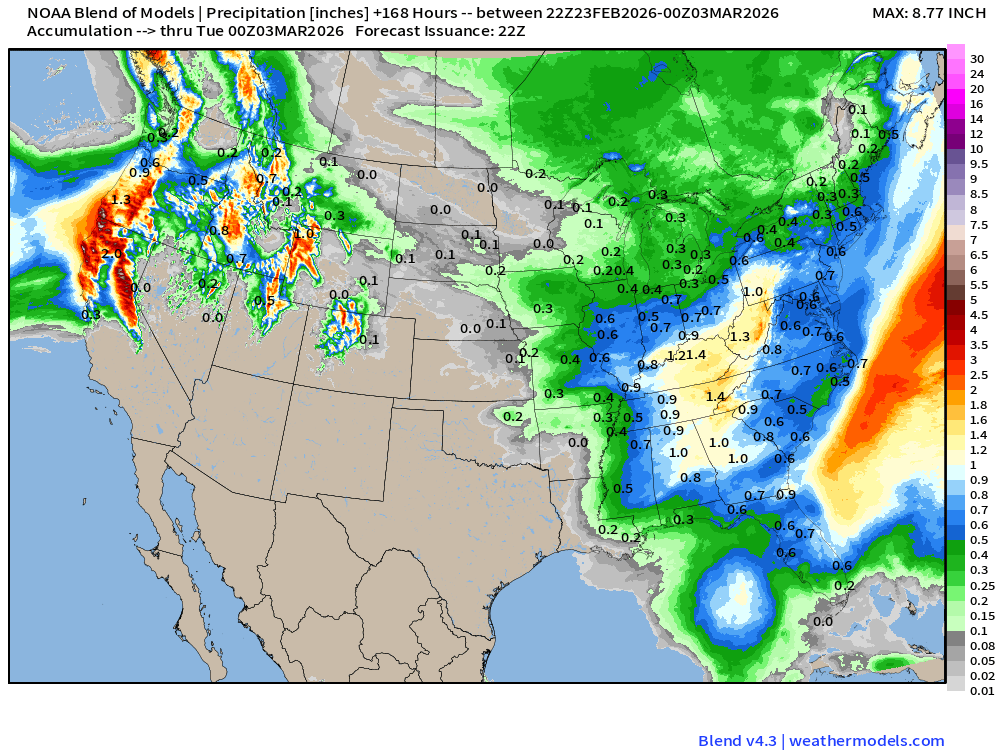
Blend of Models | 7 Days Precipitation Total
Blend of Models | Total Snowfall Next 7-Days
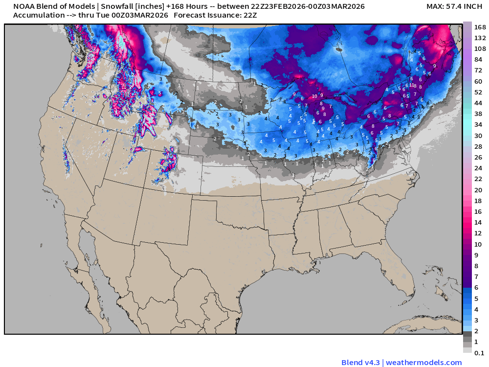
Western Winter goes kaput: Sierra Nevada snowfall nearly blank — not much in the Great Basin or Colorado Rockies.
Clipper Systems keep the Great Lakes and Northeast wintry — with colder air for whatever moisture to fall as new snow.
Medium and Extended Range
Arctic Blast | Temperature Anomaly Next 12-days
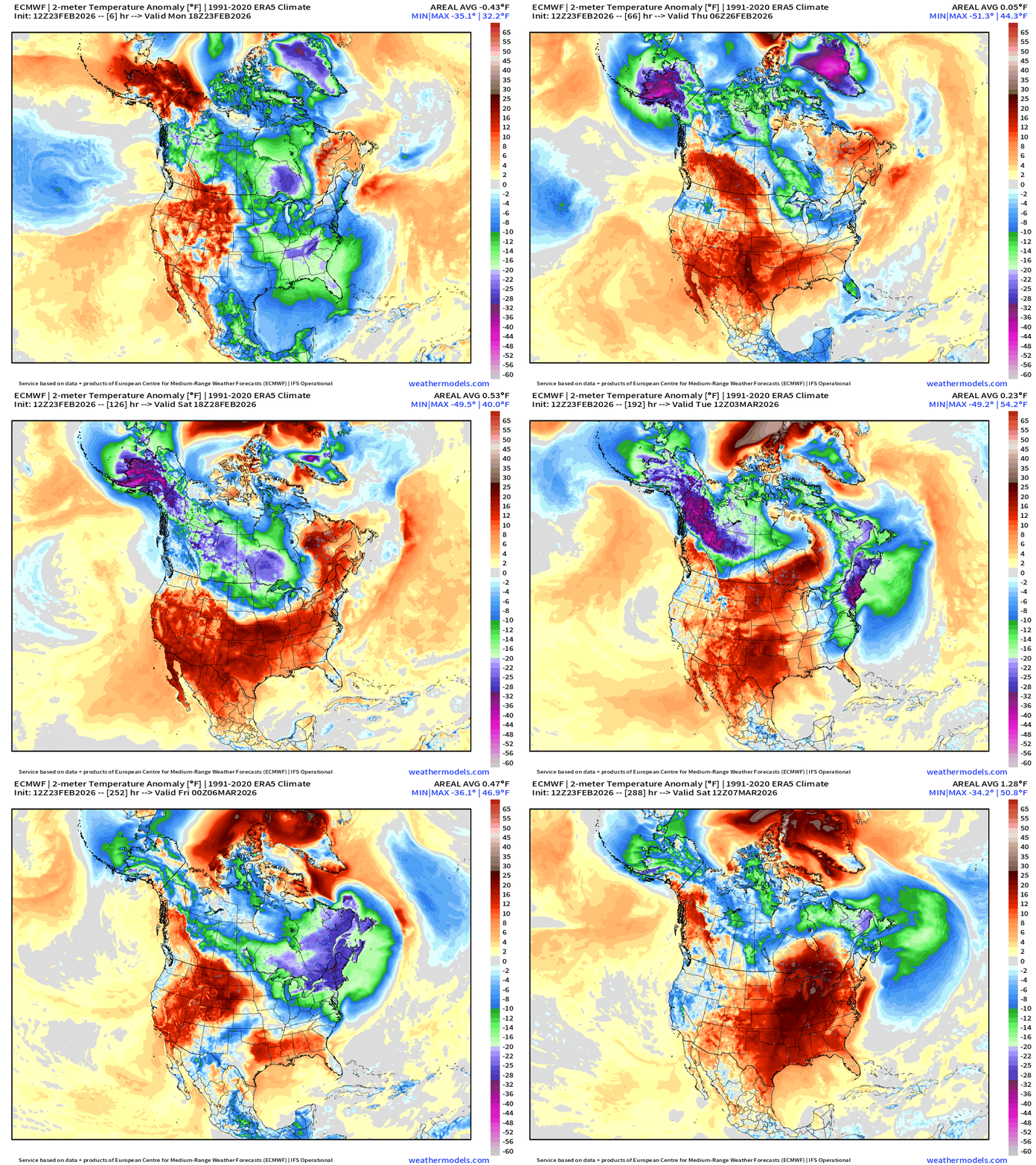
The massive “tropospheric polar vortex” circulation near Greenland tracks west across Arctic Canada to combine forces with a cold pool over Alaska.
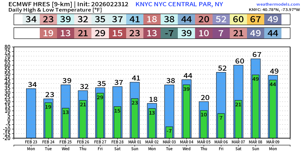
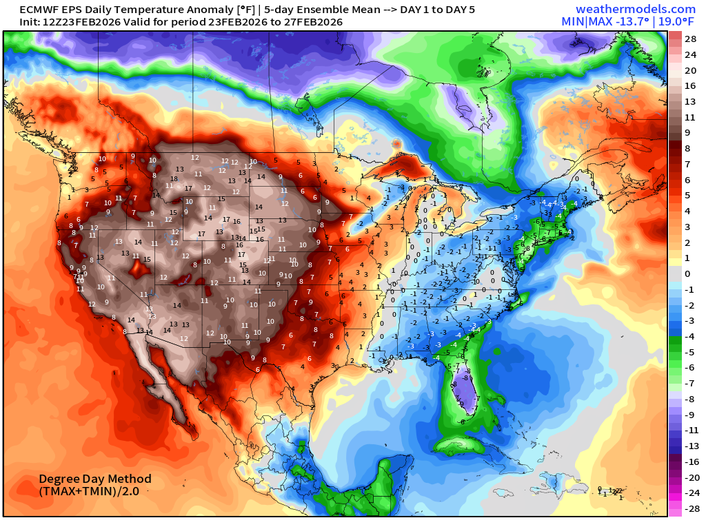
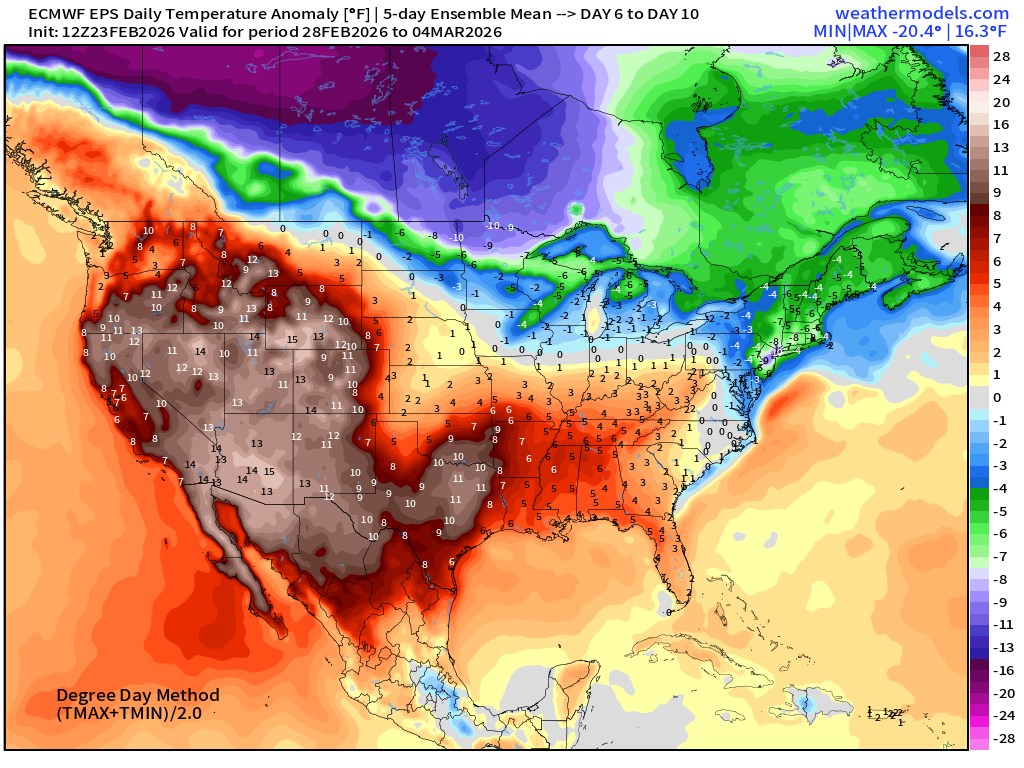
Then, multiple “blasts” of very cold Arctic air head south into the Great Lakes and Northeast for the next 10-days — with potential for coldest air of the winter season in New England. This ECMWF HRES 12z run had -7°F for Tuesday, March 3rd for New York City, which would break every daily record past February 15th.
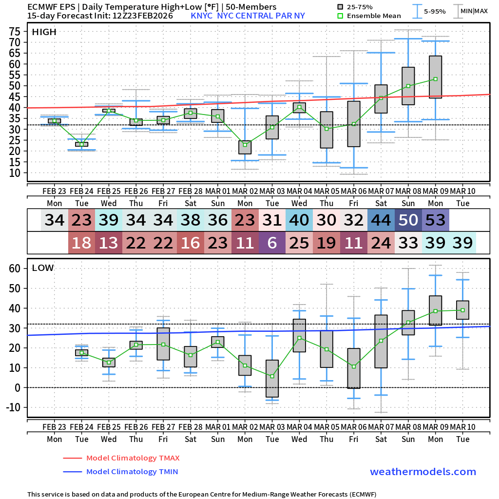
The ensemble median is 6°F in New York City with many extreme cold tail ensembles.
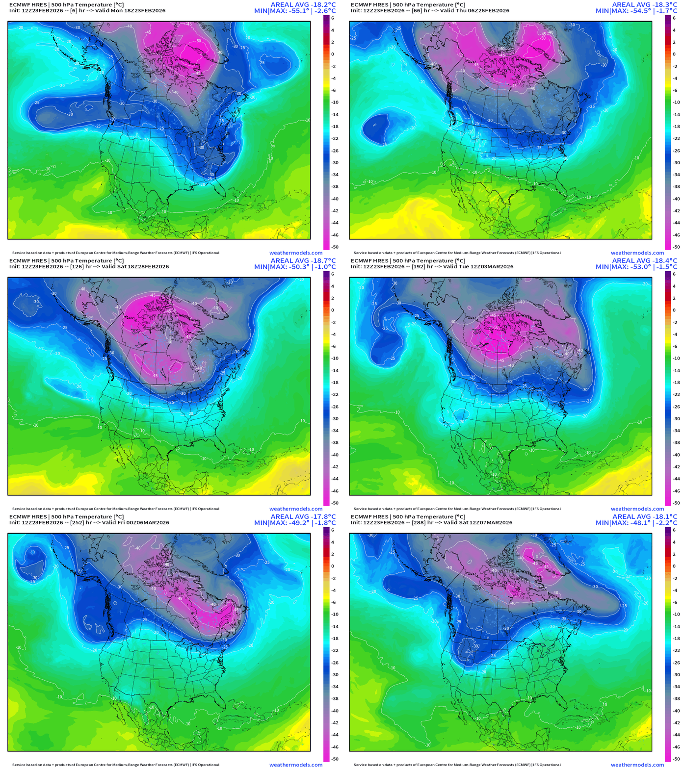
The intensity of the TPV near Greenland is extremely cold — near historical levels pushing -58°C at 500 mb. And, if that -50°C core stays coherent and moves closer to the Lower 48 in Manitoba or Ontario and Quebec, then each passing shortwave will deliver another Arctic blast, each becoming colder. This is an extremely cold period for Canada and it may be shared with the Lower 48 into first week of March before Spring tries again across the East Coast.
Dynamic Tropopause from GFS next 7-days
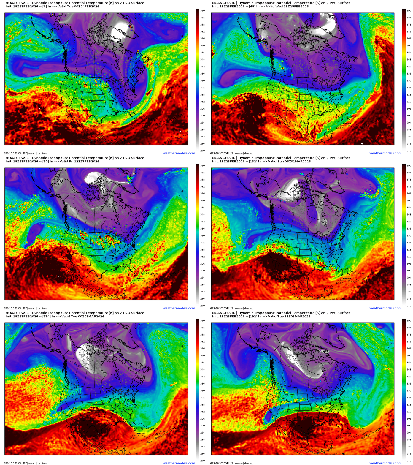
Truly massive “white fuzzball” smashes into/over Greenland and then breaks westward back toward Alaska with little loss of coherence.
Temperature Anomaly | Next 15-days | ECMWF EPS 12z Ensemble Mean Flagship
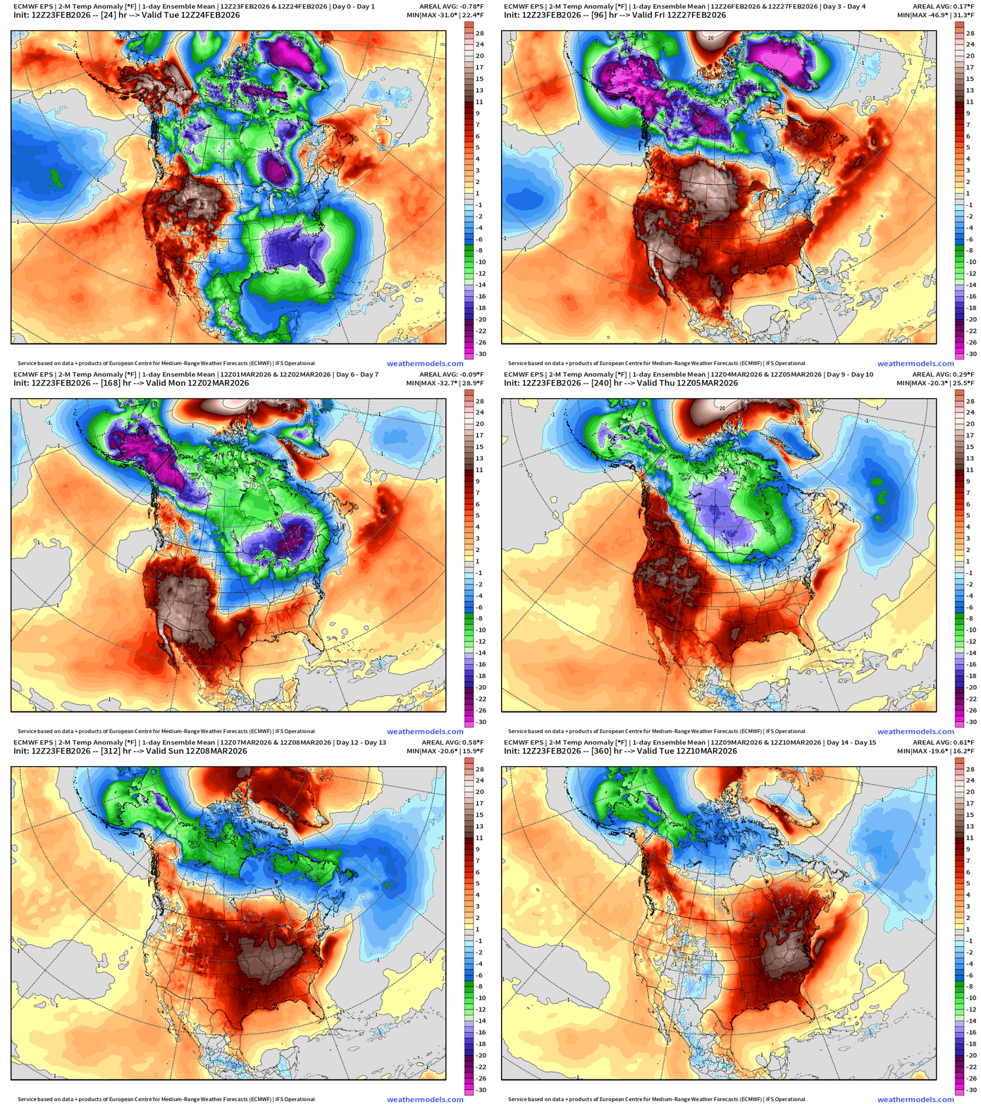
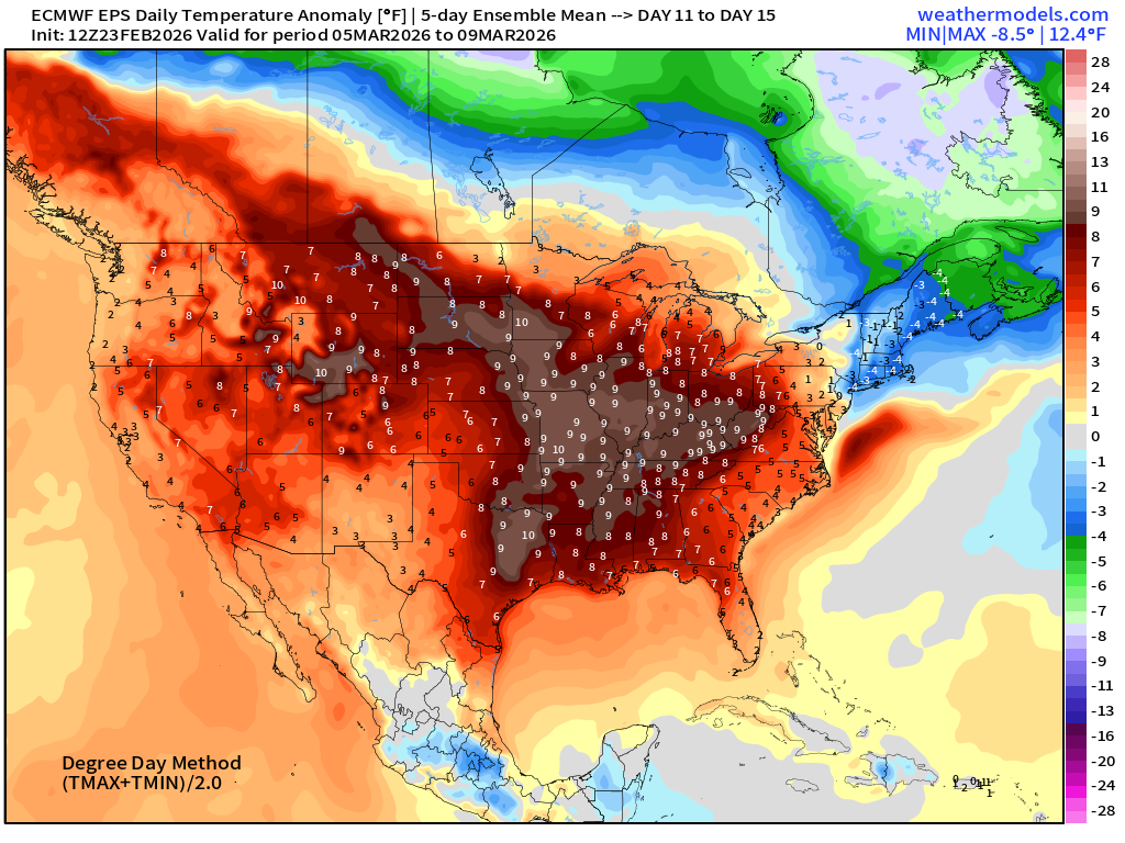
This has a lot of cold potential to match the HRES assuming its cluster is chosen by Mother Nature. Sustained warm up after Day 12 … thankfully!
5-Day Chunk #1 | Temperature Anomaly | Feb 23 - Feb 27
5-Day Chunk #2 | Temperature Anomaly | Feb 28 - March 4
5-Day Chunk #3 | Temperature Anomaly | March 5 - March 9
Maps sourced from weathermodels.com designed and innovated by yours truly! Please subscribe there for real-time access to the newest maps, charts from all of the weather models including ECMWF and AIFS, and NOAA GFS/GEFS.
- Milepost
- 881 · laid 2026-02-24T01:15:09.177000Z
- Source
- https://weather.substack.com/p/february-23-2026-monday-winter-weather
- Digest
- 54746a5e16f623c145e9888f5fb931495f55da674a21b6411ac97560c0546c15
- Machine
- JSON