February 20, 2026 Blockbuster Blizzard Watch
Major winter storm to form off Mid-Atlantic coast and deliver huge snowfall and gusty winds to New England
February 2026 was the 4th-warmest February in the 132-year national record (1895–2026), at 40.3°F against a 1991–2020 normal of 35.6°F (+4.6°F).
February 2026 was the 5th-driest February in the 132-year national record (1895–2026), at 1.4in against a 1991–2020 normal of 2.1in (-0.7in).
NOAA/NCEI Climate at a Glance, contiguous United States. This is the observed record for the month, not a score of anything said in this piece — the forecast ledger begins 2026-08-17 and cannot reach earlier posts.

Friday Top Headline: A major winter storm will rapidly intensify off the Mid-Atlantic coast and move off New England. Heavy snow and gusty winds will create dangerous blizzard conditions along the East Coast from New Jersey to southeast New England.
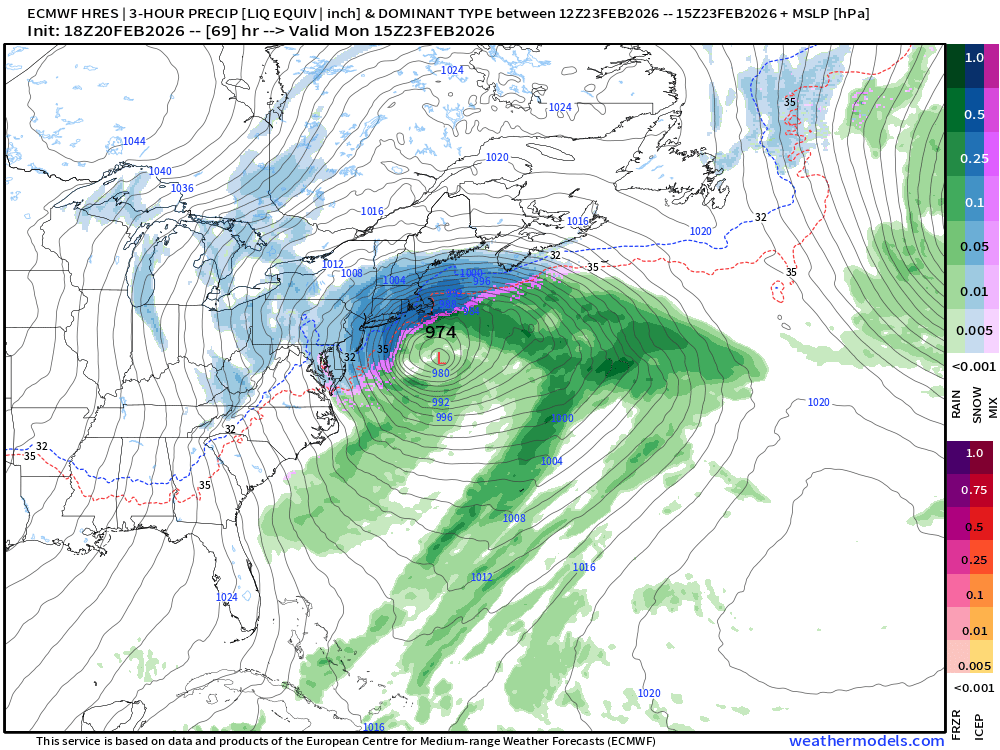
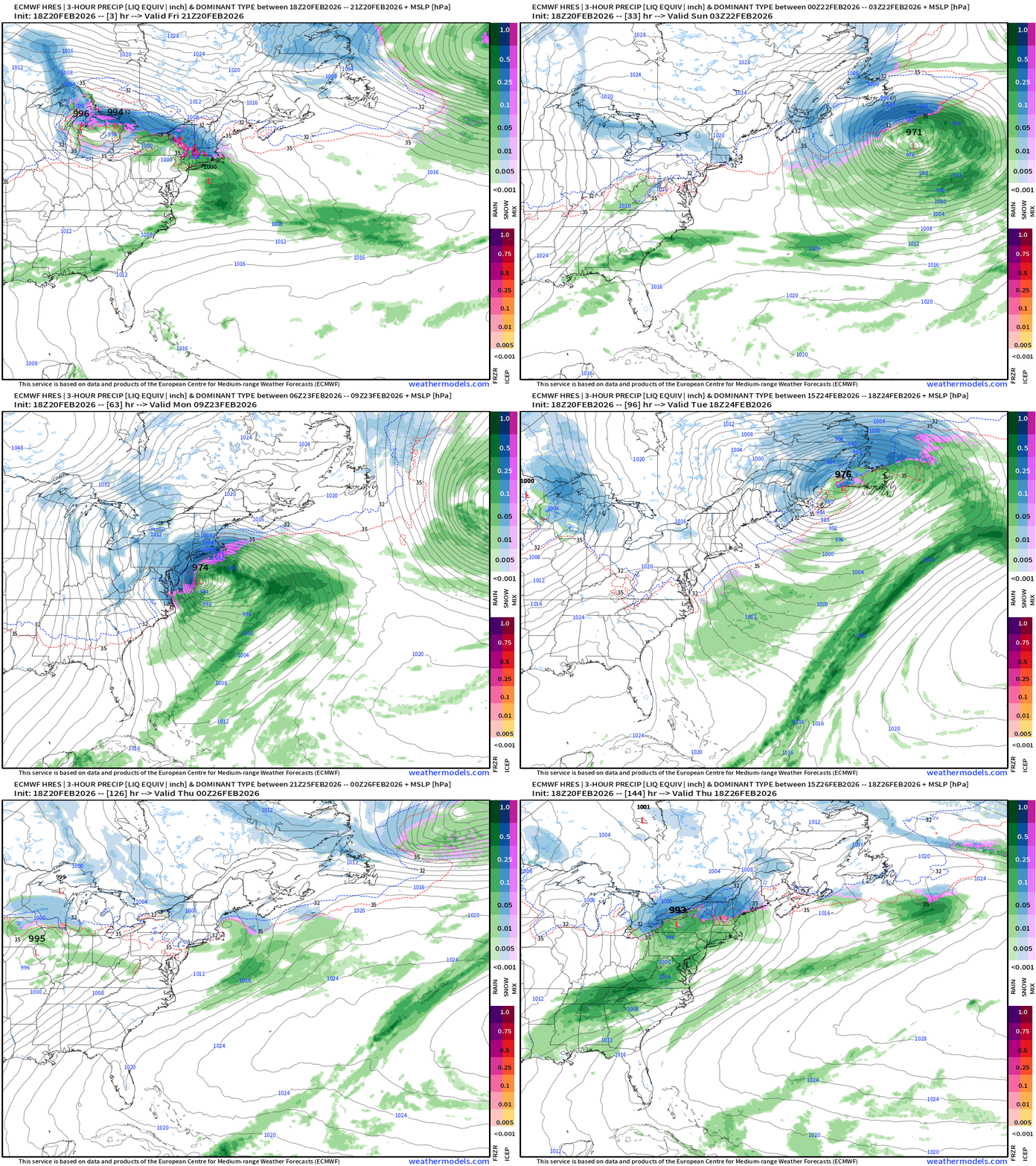
Updated ECMWF 18z guidance (high resolution 9-km) shows the lifecycle of a Miller Type B “bomb cyclone” off the Mid-Atlantic to New England coast dropping to about 970 mb on Tuesday.
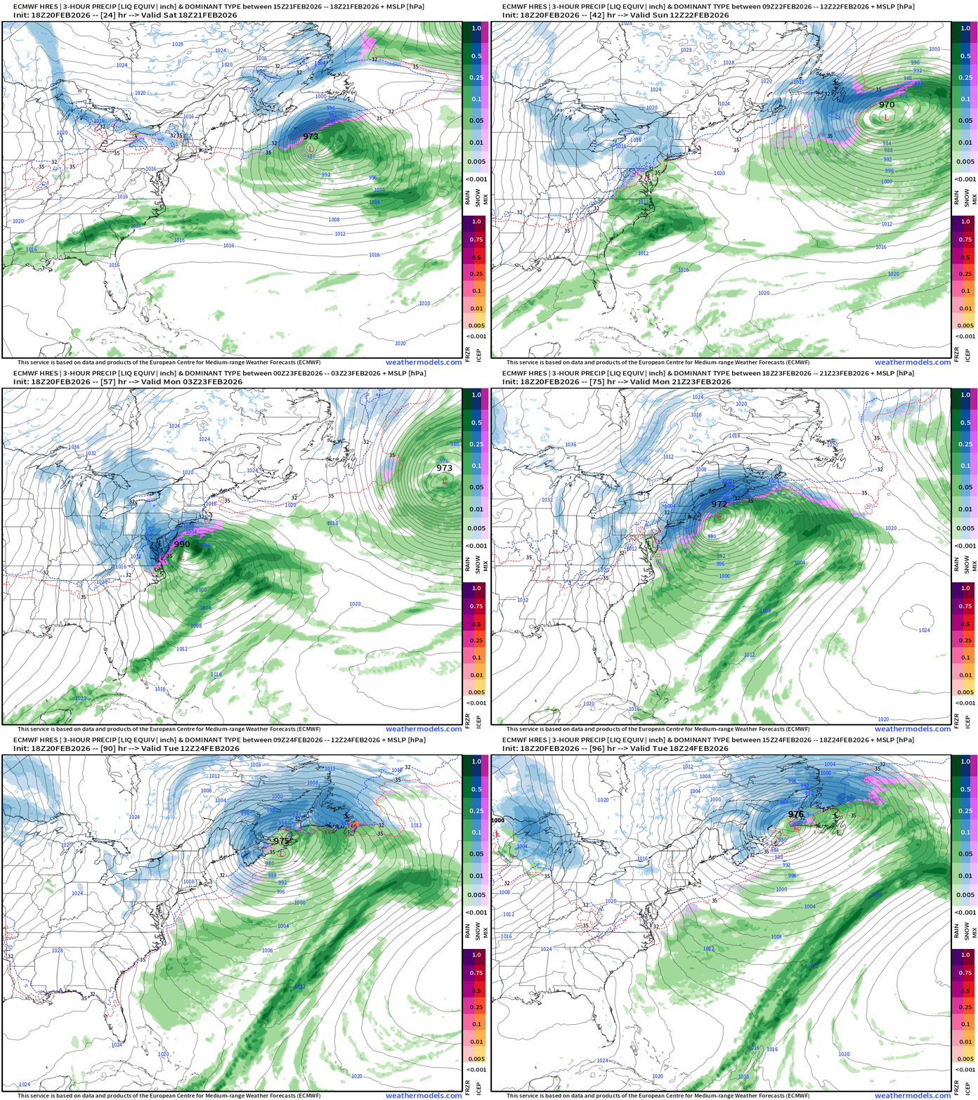
Heavy snowfall and gusty winds on the backside of the Low Pressure center will impact the I-95 corridor from Washington D.C. to Philadelphia and New York City.
Still uncertainty concerning snowfall accumulations but I think we are going to see the models trending upward in the coming 24-hours.
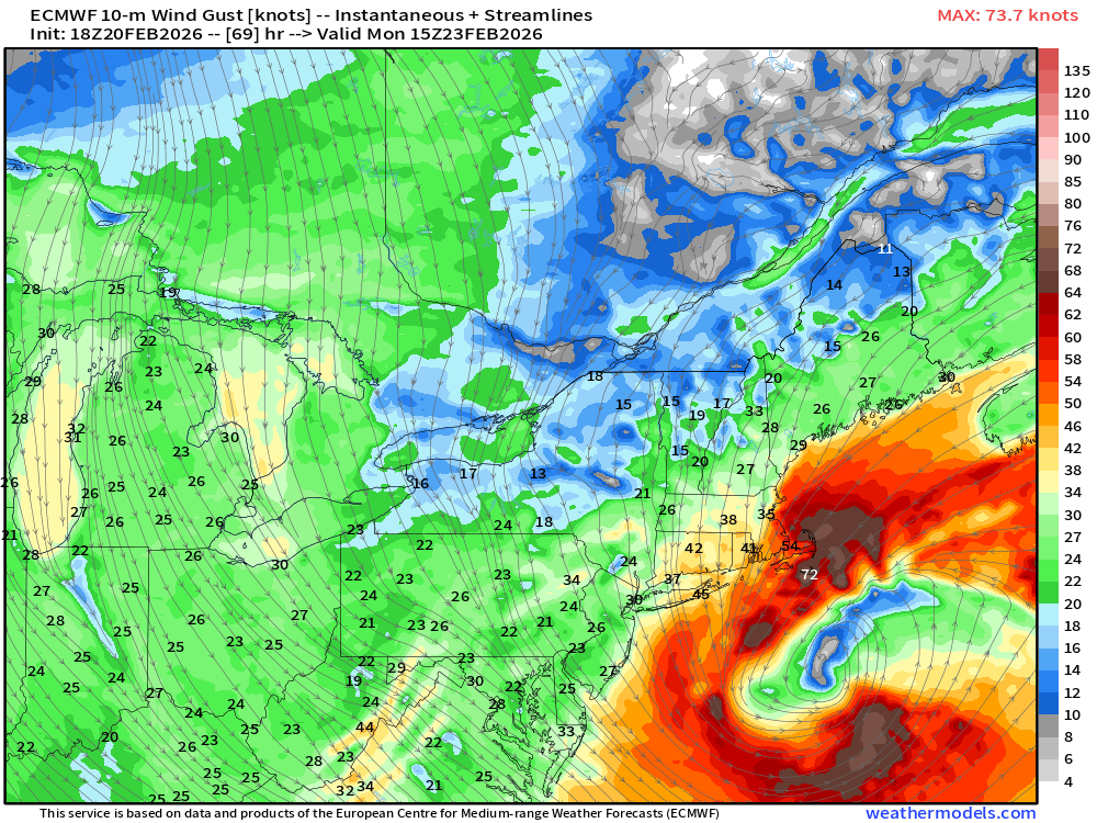
Wind Gusts — Monday morning
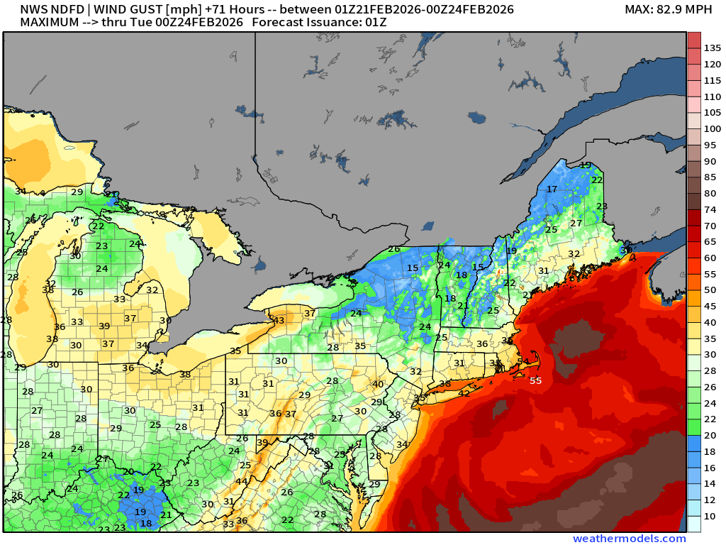
We can’t yet pinpoint the maximum wind gusts for every location, but the track suggests the highest chance of hurricane force wind gusts would be in southeastern New England including Cape Code and Nantucket, which isn’t unusual for this type of systems.
Central Pressure in the low-970s at the “benchmark” location
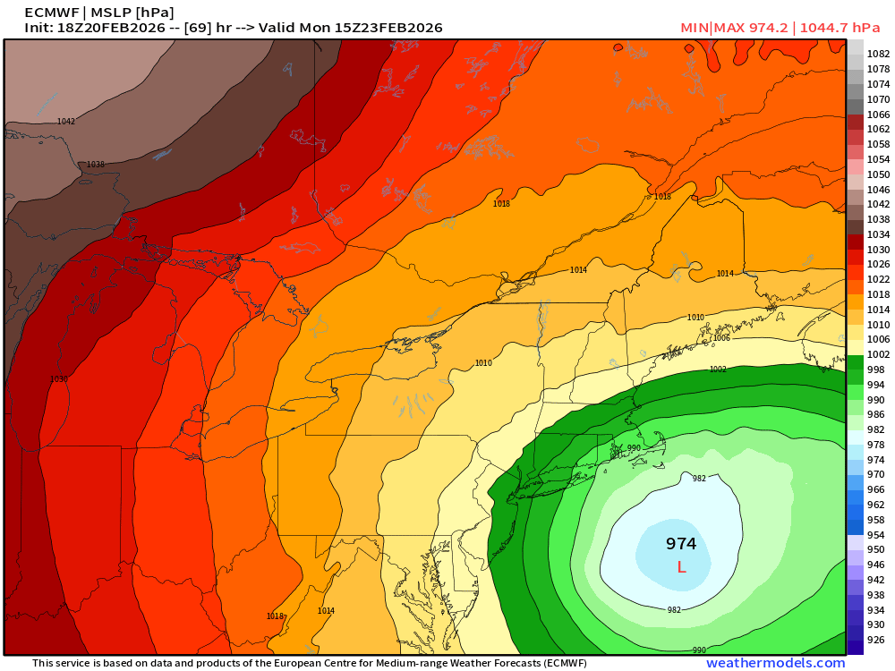
A further westward track movement would mean even heavier snowfall and stronger winds into NYC and Boston.
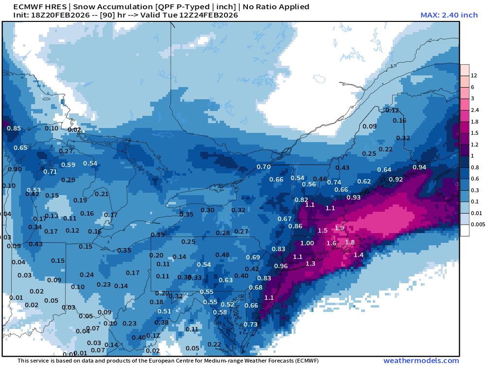
Overall Snowfall for next 4-days using a “dynamic” snow to liquid ratio …
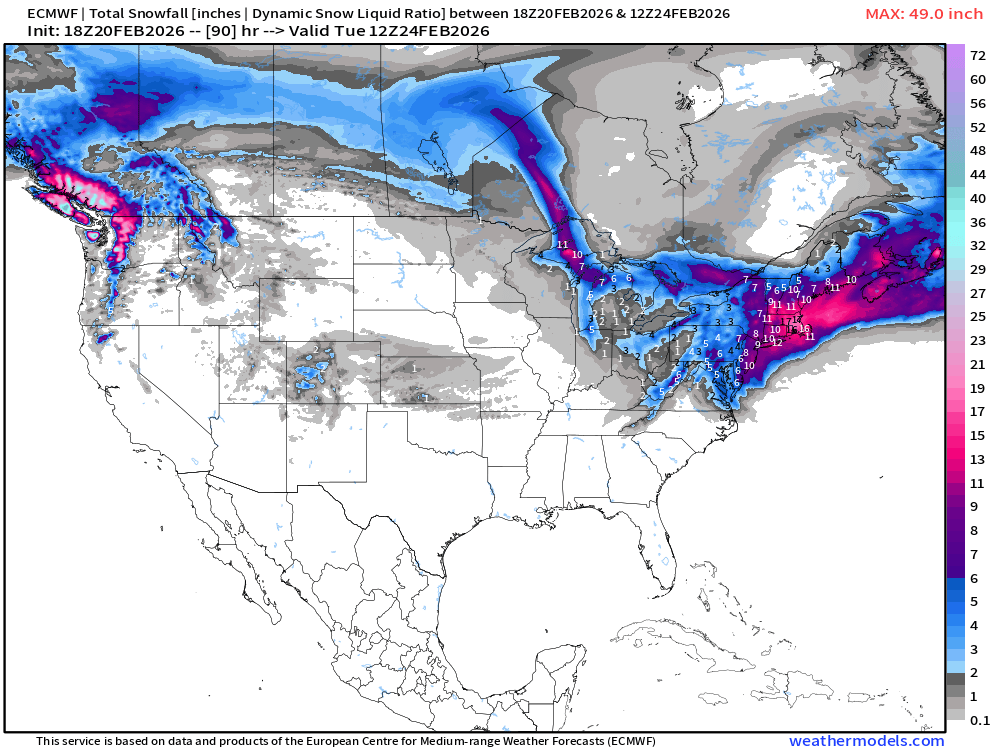
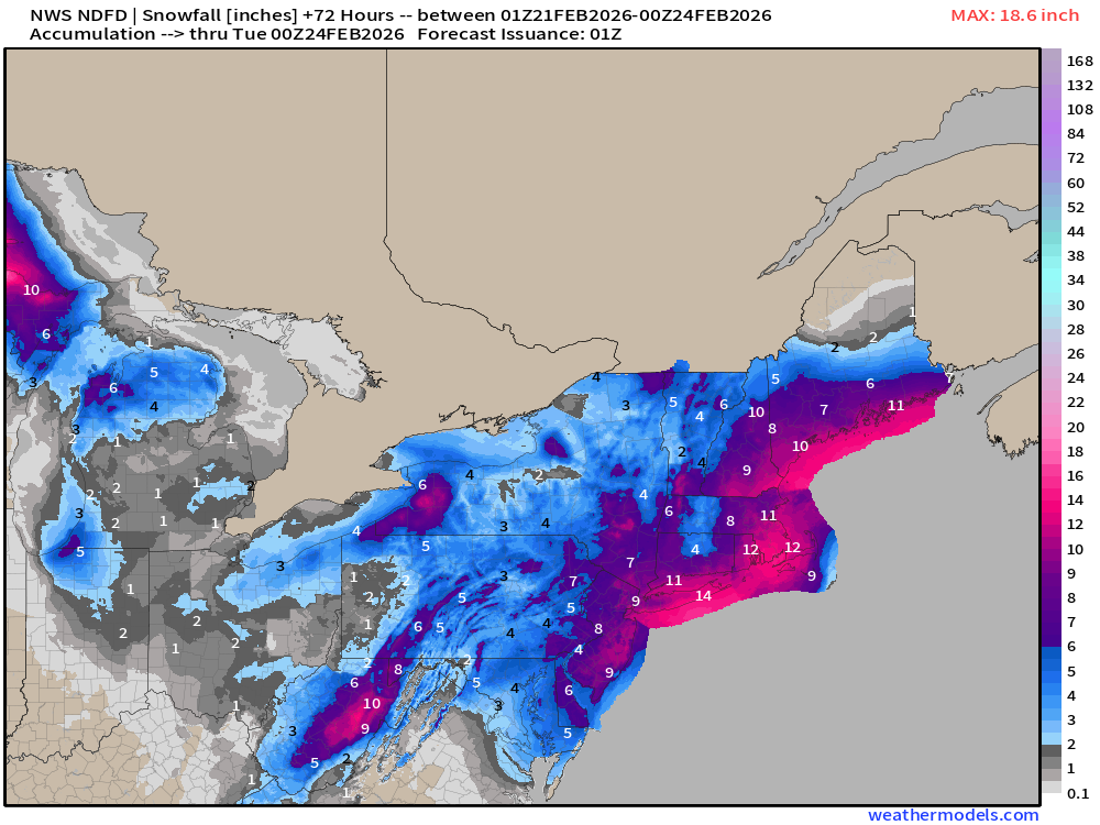
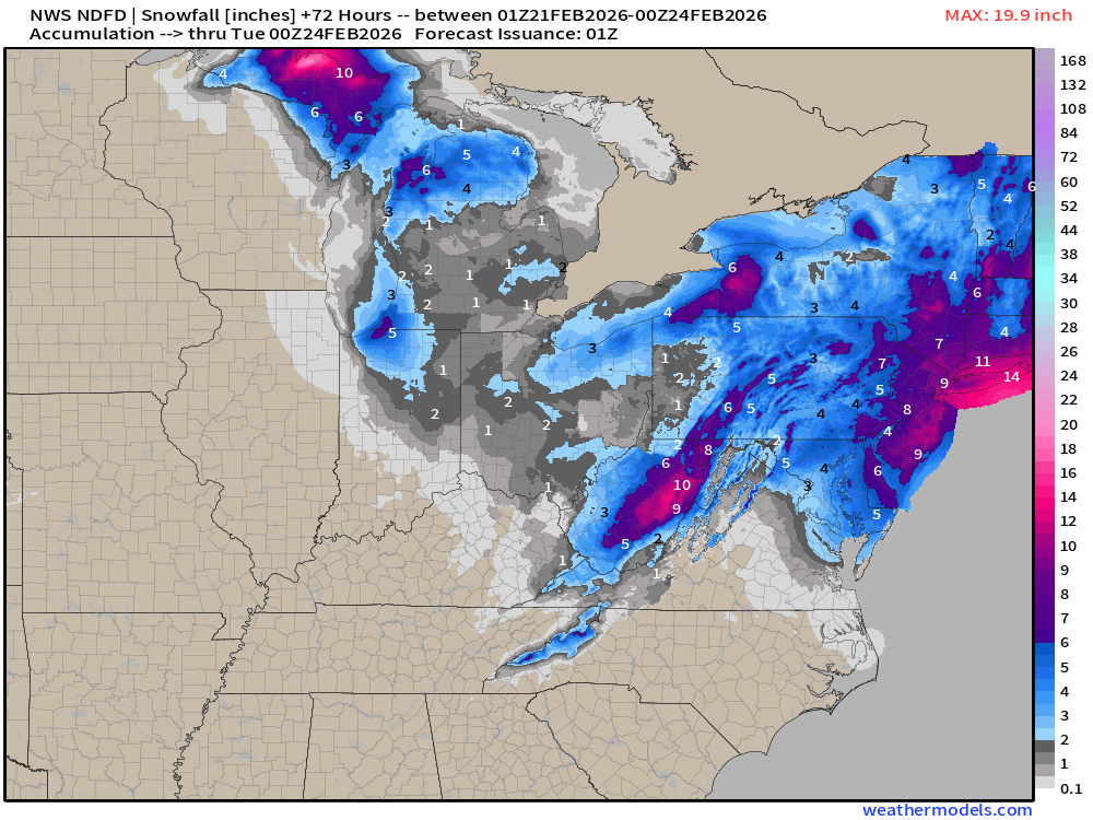
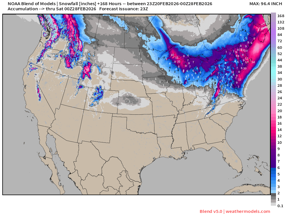
Washington D.C. is in the 4” to 6” range … and the totals increase by steps as you head into New England. Philadelphia 6” to 8” and NYC 8” to 10”
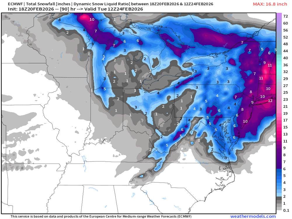
With 12” to 18” across New England … and this is just the floor — as I’ll show the AIFS has significantly more snowfall, and the ensemble spread is still quite wide!
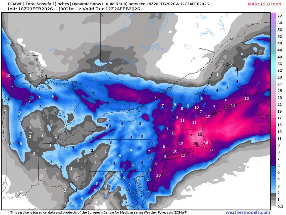
The median ensemble snowfall (EPS 18z) is a tick above the ECMWF HRES … and this is 10:1 ratio, which is about right for temperatures in the upper-20s to lower 30s.
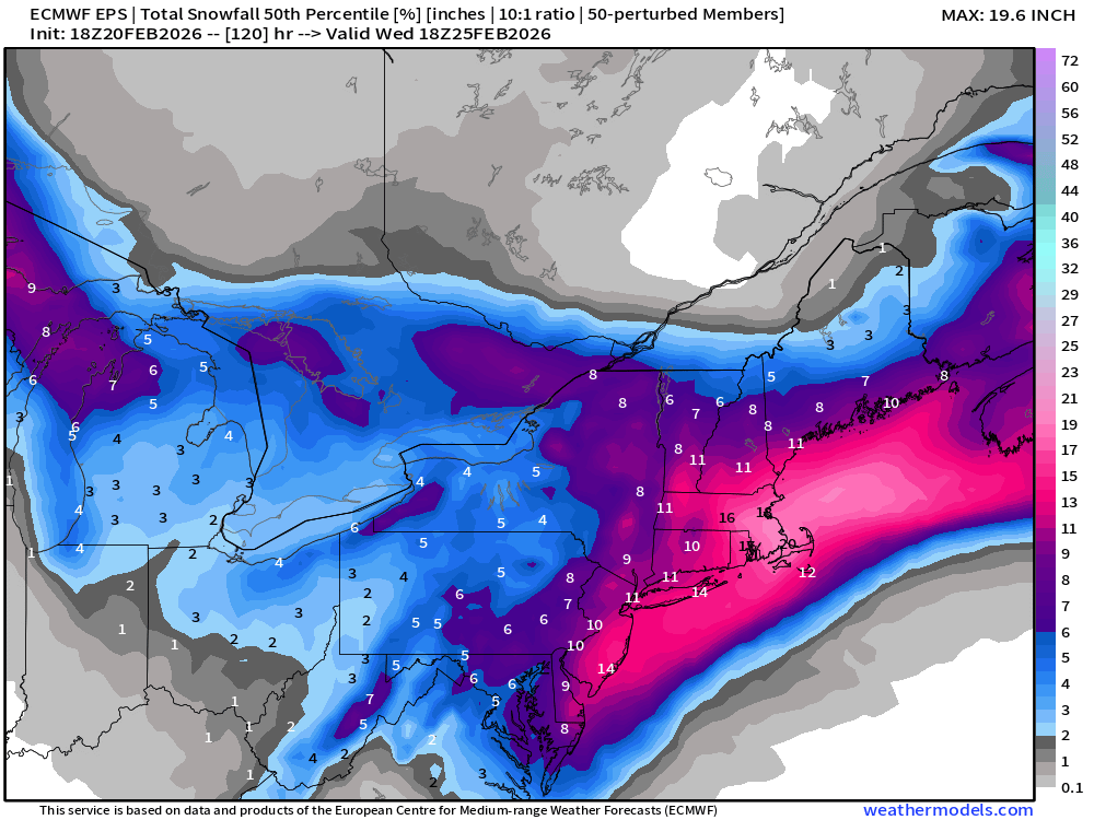
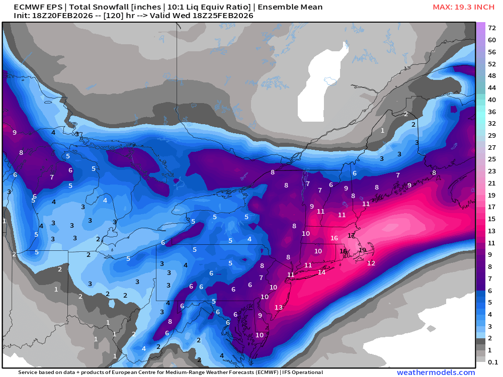
The Ensemble Mean and Median are quite close — suggesting the range of snowfall amounts is fairly normally distributed, which is good, and desirable in an ensemble system once we come closer to the event e.g. within 3-4 days.
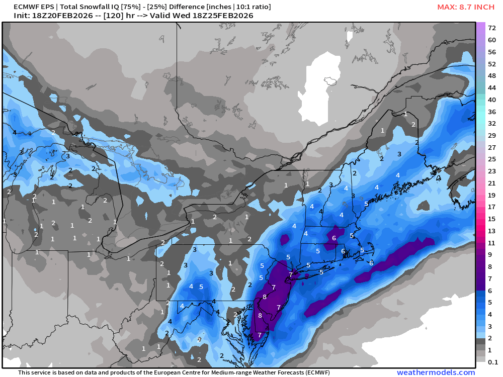
There is spread around the mean — or interquartile spread around the median, and this shows were more “boom or bust” can be found.
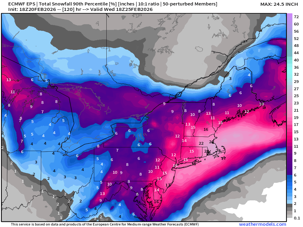
And, if we dial it up to the 90th percentile for more extreme outcomes, you can see we quickly get into the 15” to 24”+ range for the big cities = potential for quite a bit more than folks might expect from initial forecasts.
Probability of 6” of snowfall or more —>
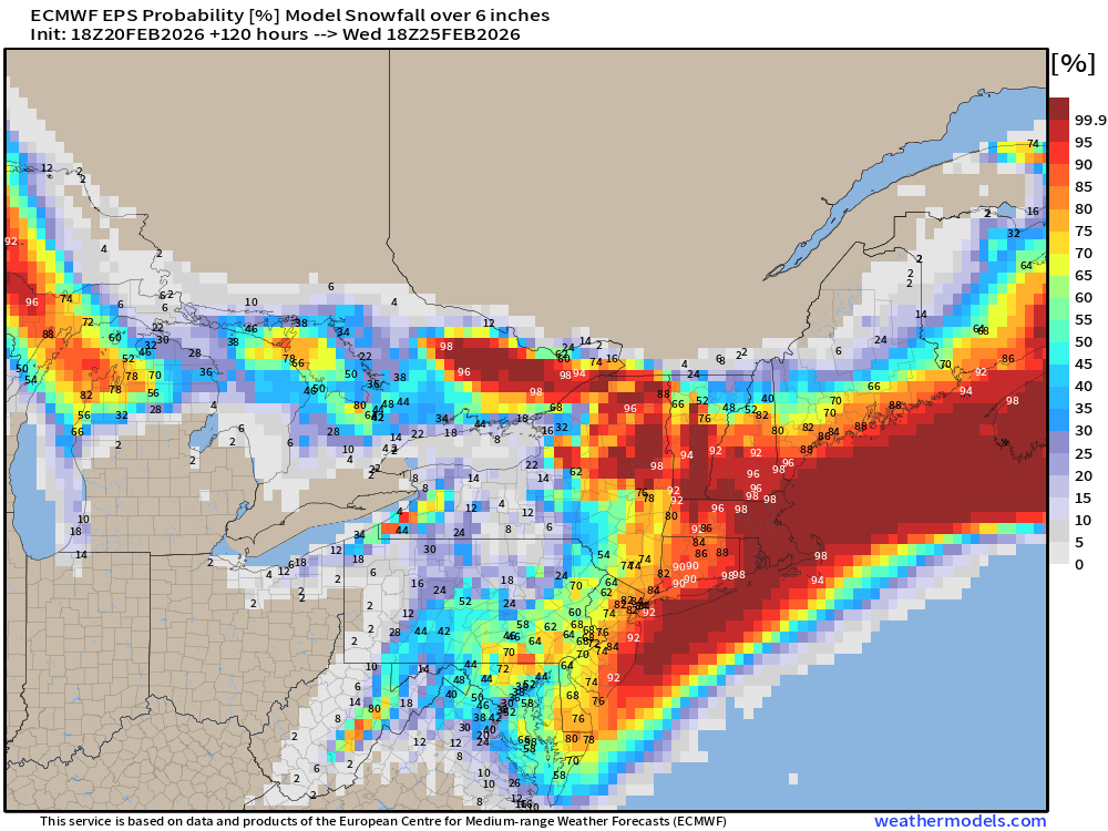
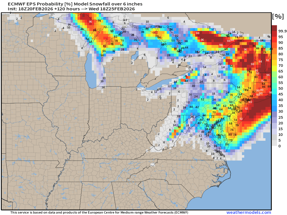
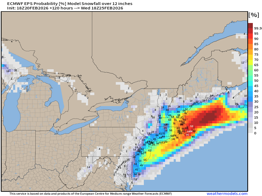
And, let’s dial it up to 12” or more — which has quite a large area over land > 75%
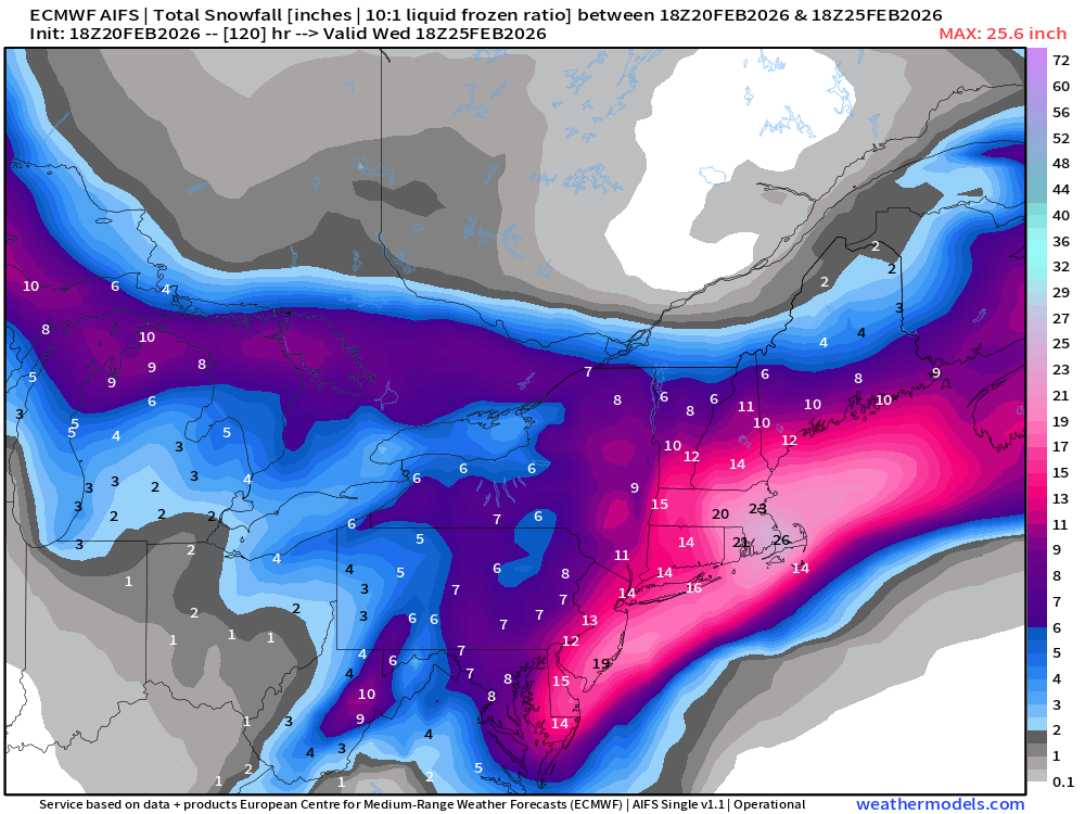
Now, let’s see the ECMWF AIFS 18z depiction — the highest skill model on the planet right now — for global modeling.
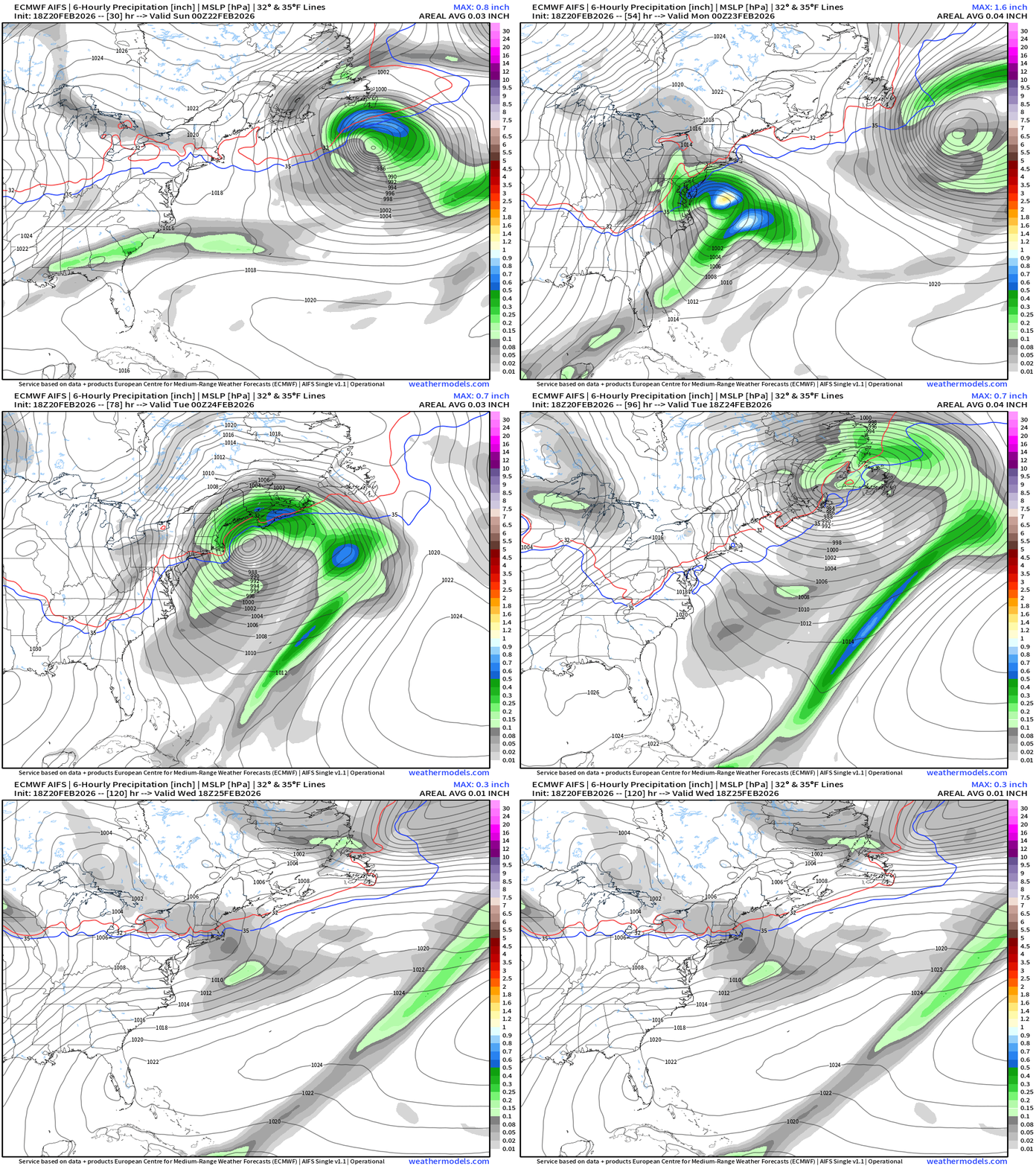
AIFS 18z snowfall is much higher across the board for this “blockbuster blizzard”
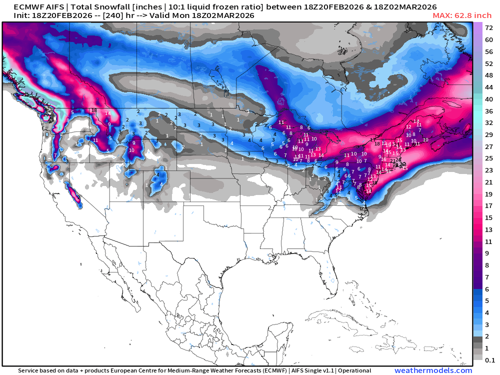
Zooming out and expanding to 10-days … winter really comes back for the Great Lakes and Northeast into early March.
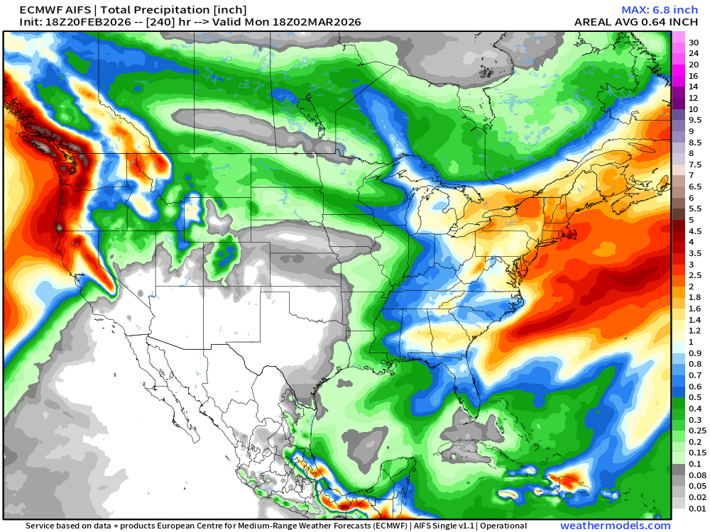
Next 10-days Total Precipitation — otherwise rather dry with Arctic air and northwesterly flow dominating east of the Rockies.
No more GFS with this storm
Not showing the GFS anymore — because it was out to lunch for the extreme snowfall totals over Washington D.C. with too high QPF. We shall stick with ECMWF and Blend of Models (version 5) for model guidance and the official NWS grids from human forecasters in the region.
Temperature Analysis from RTMA | 7:45 PM ET
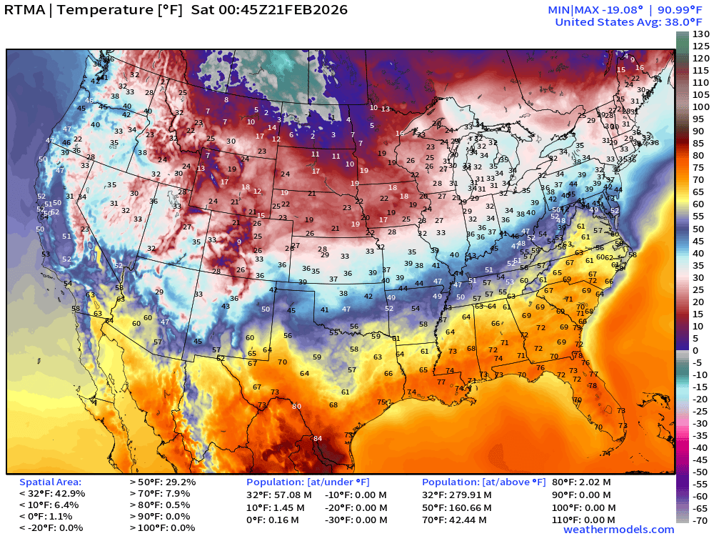
RTMA Temperature Anomaly | 7:45 PM ET
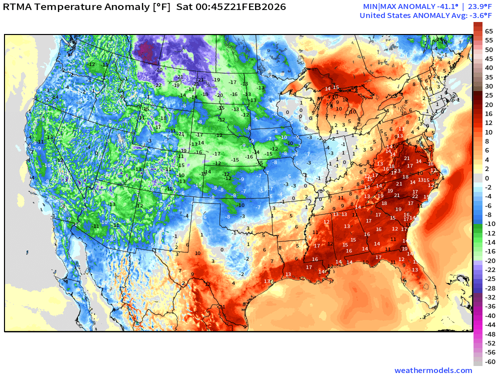
The Lower 48 is below normal by -3.6°F
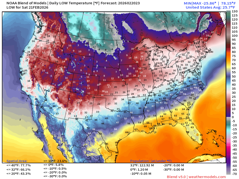
Saturday Low Temperatures
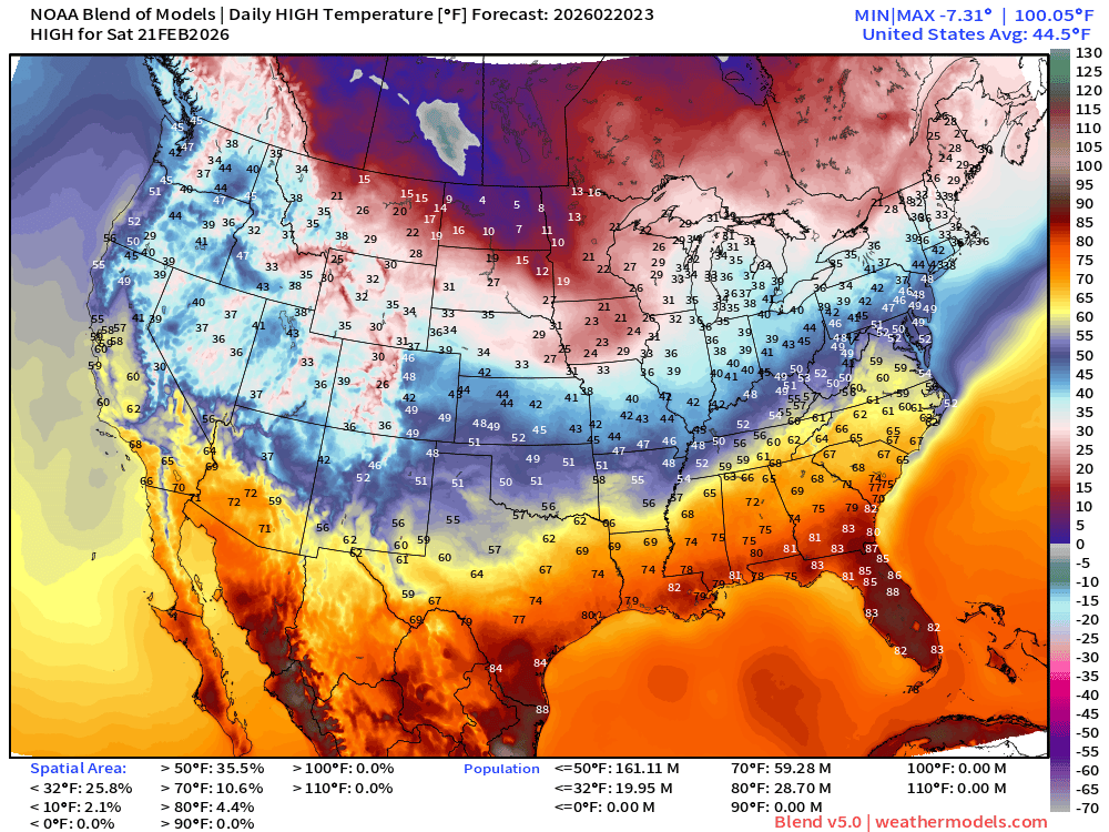
High Temperatures on Saturday
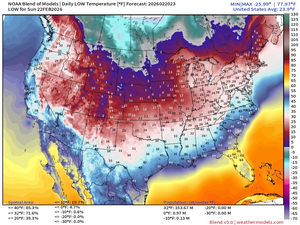
Sunday Low Temperatures
Sunday High Temperatures
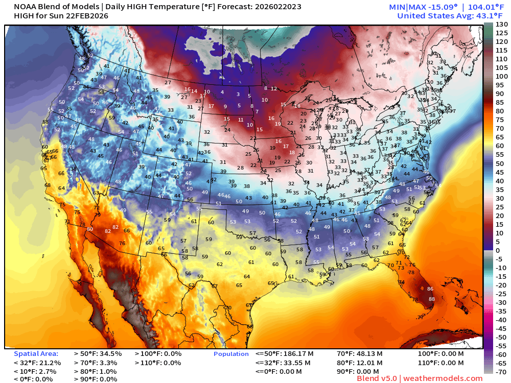
Monday Low Temperatures — Arctic Air crashes through Southeast
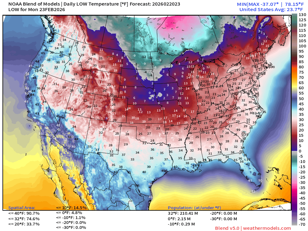
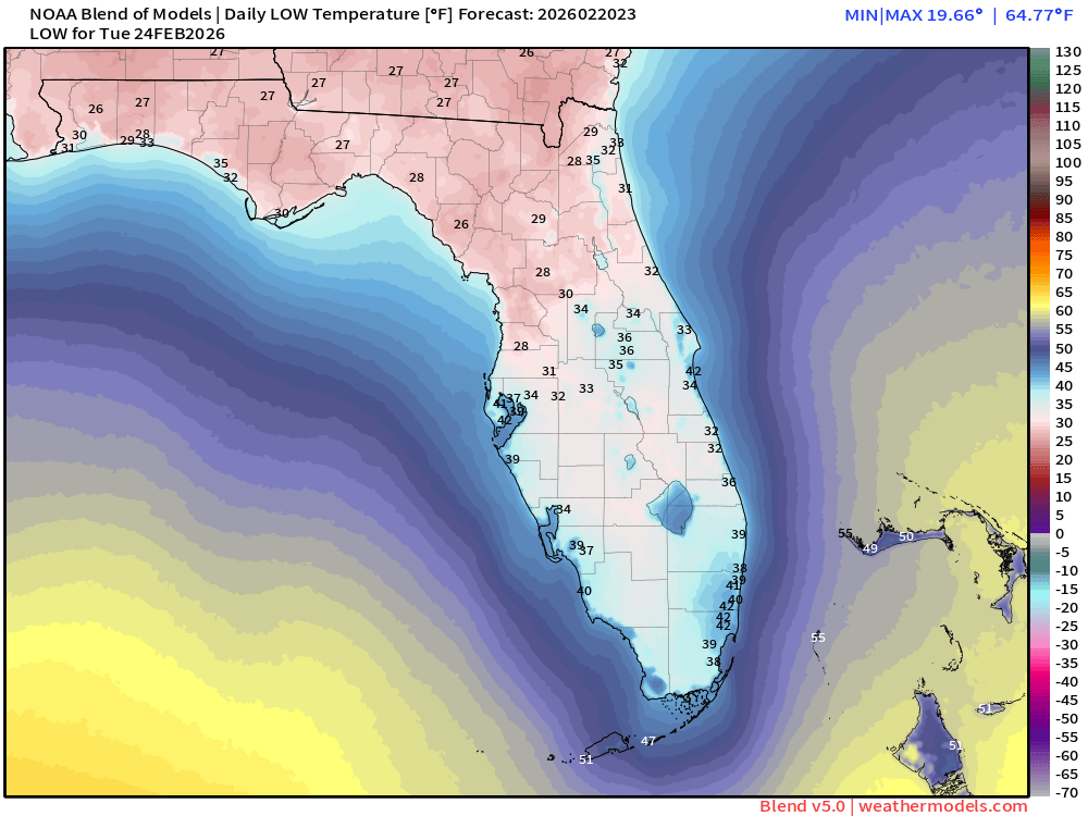
Coldest is Tuesday Morning
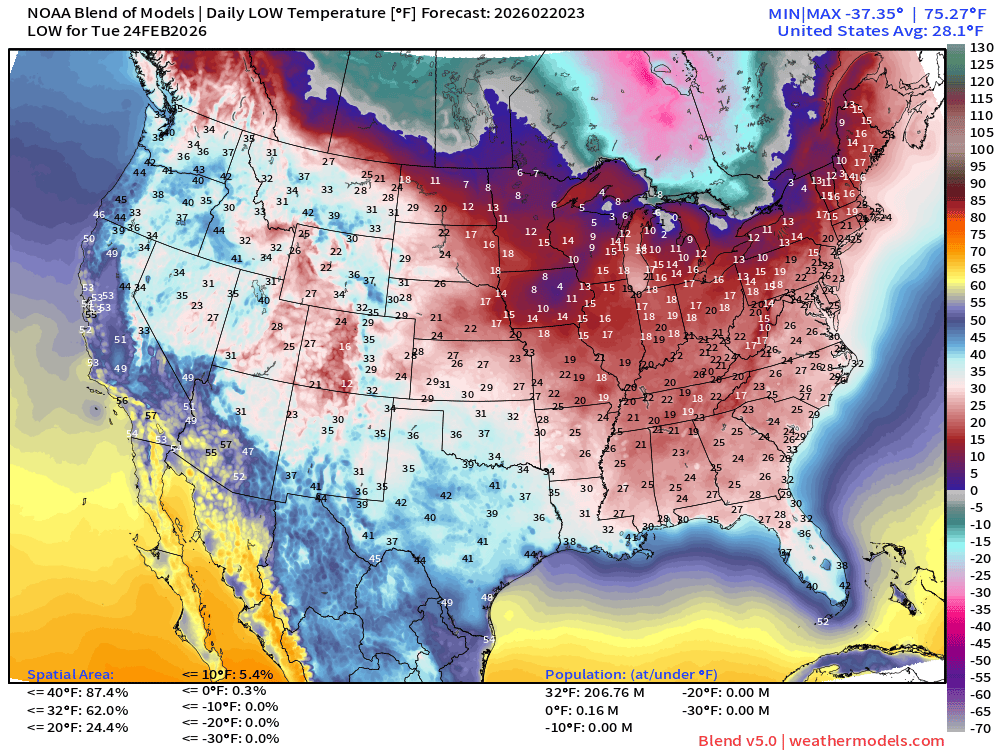
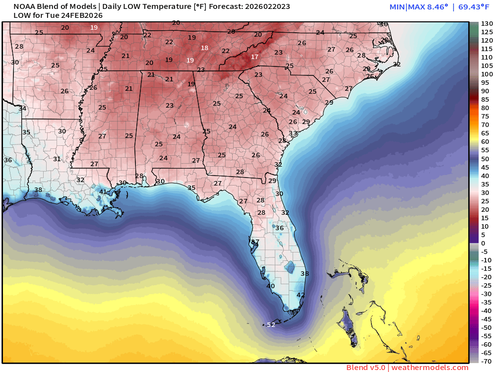
207 million below freezing including into Florida down to Ocala, and perhaps to Interstate 4
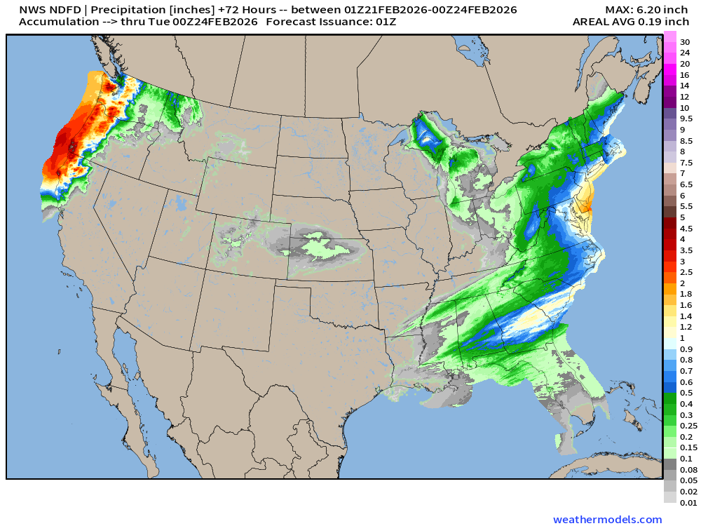
NDFD NWS Total Precipitation Next 72-hours
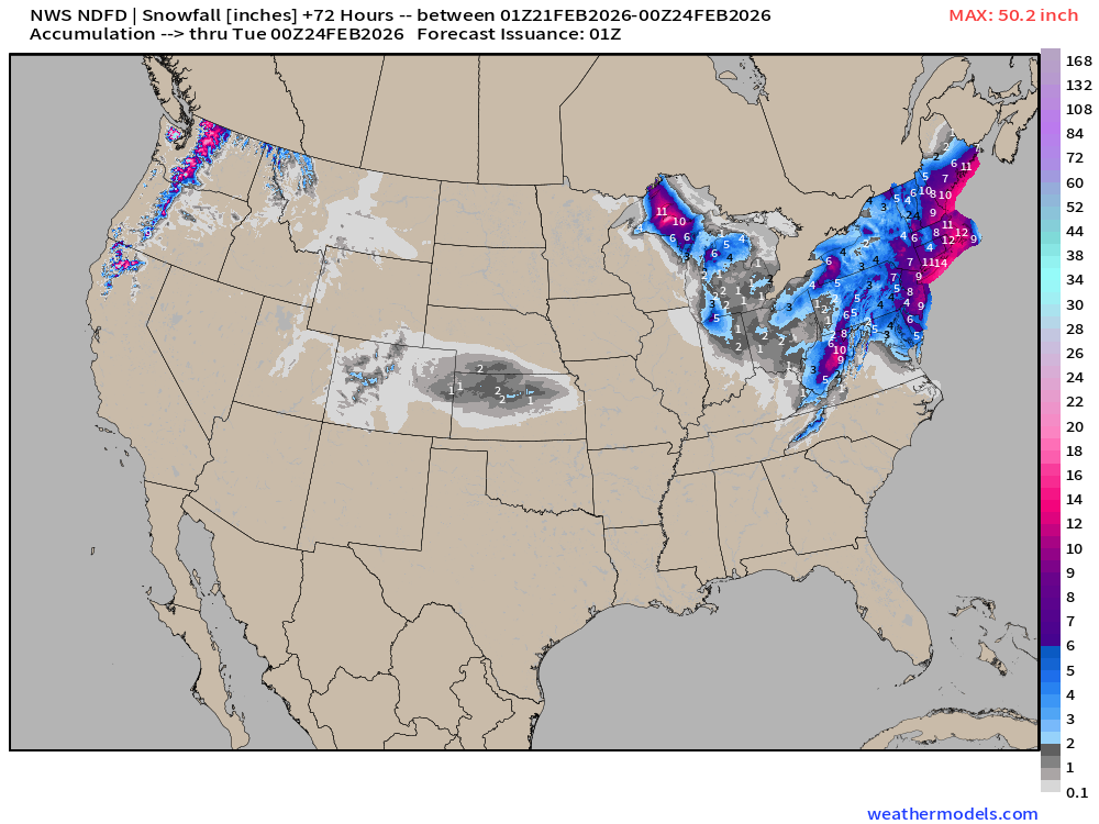
NDFD NWS Total Snowfall Next 72-hours
Preliminary “human” forecasts from the National Weather Service — to be filled in through next 24-hours and coordinated among the offices.
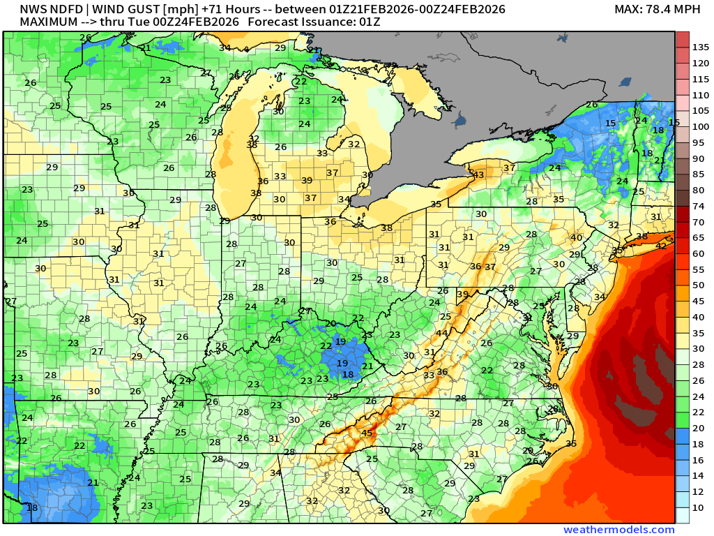
Maximum Wind Gusts next 72-hours
ECMWF 18z Precipitation Type + Intensity | Next 6-days
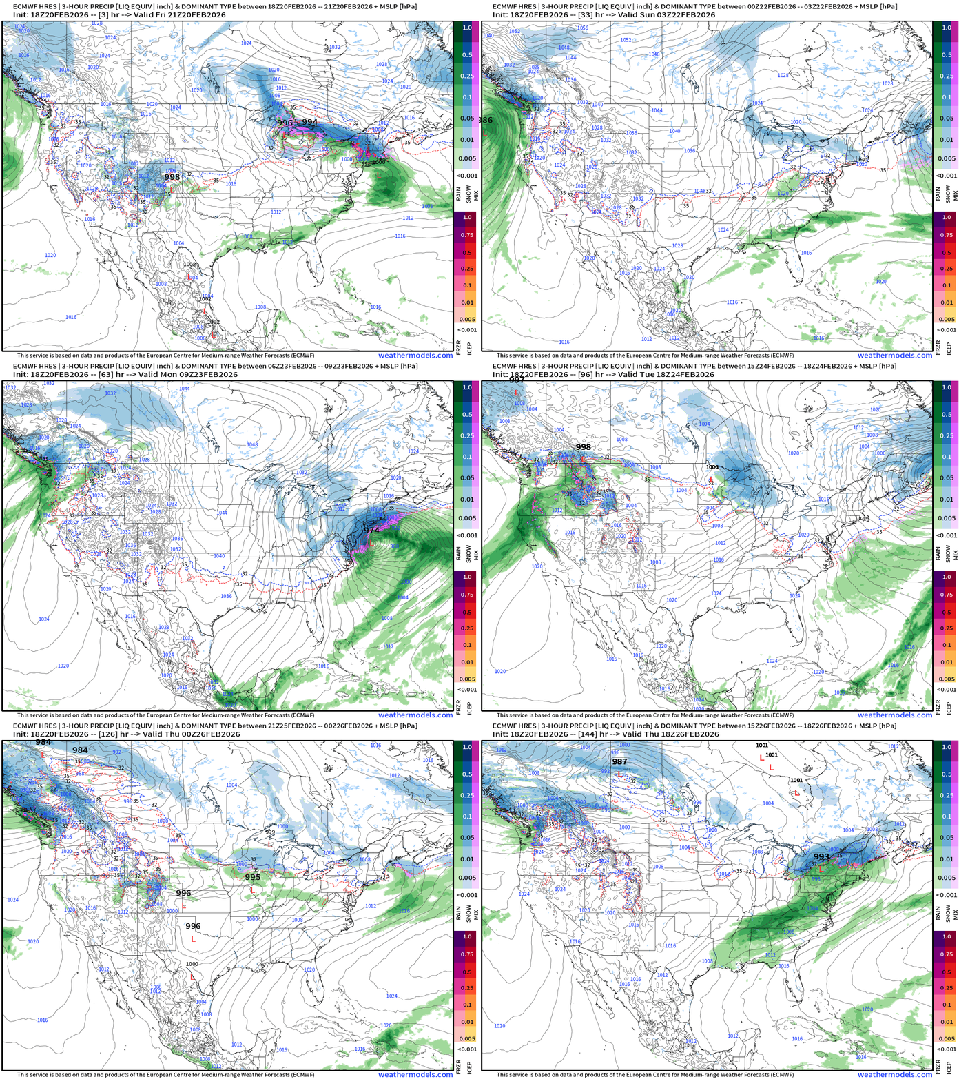
Eastern U.S. Next 6-days storm systems | ECMWF 18z
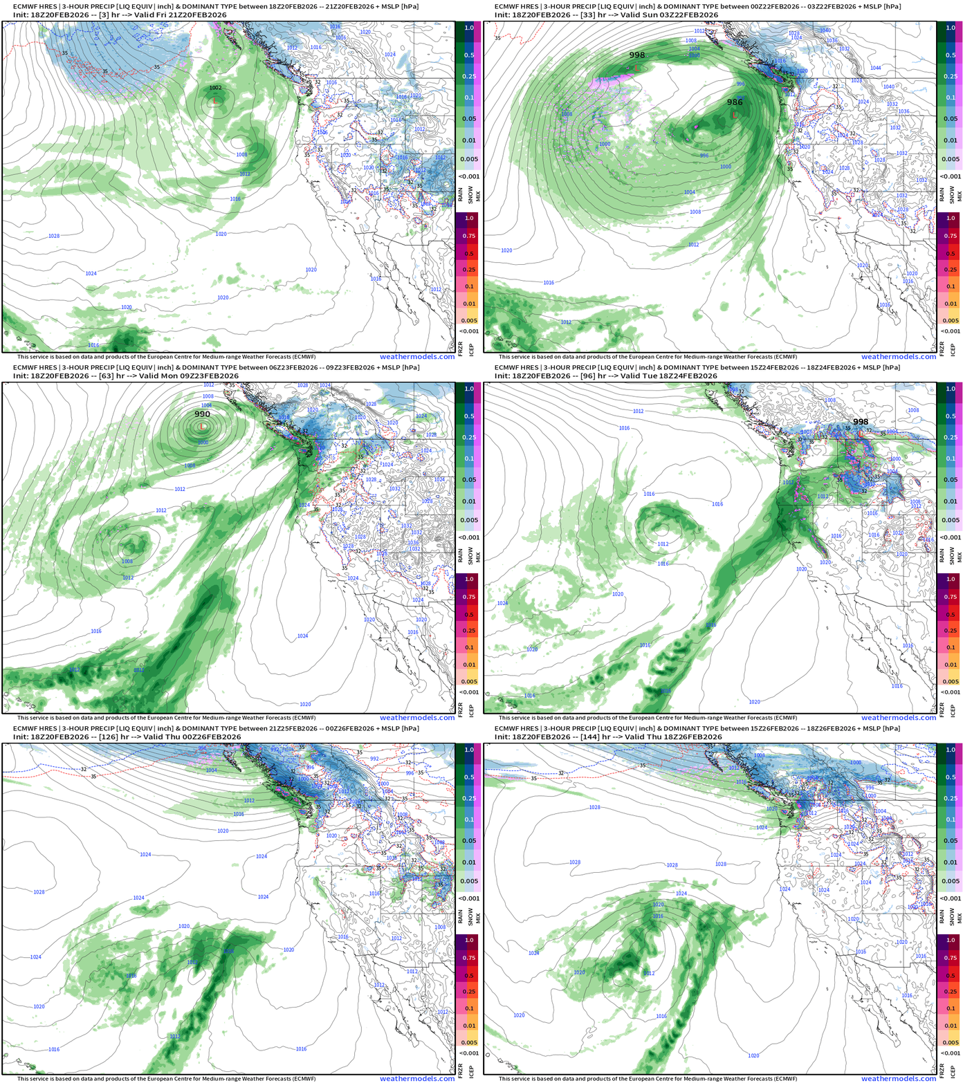
Western U.S. Storm Systems — next 6-days
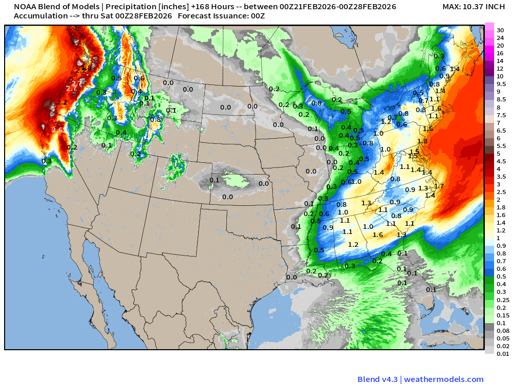
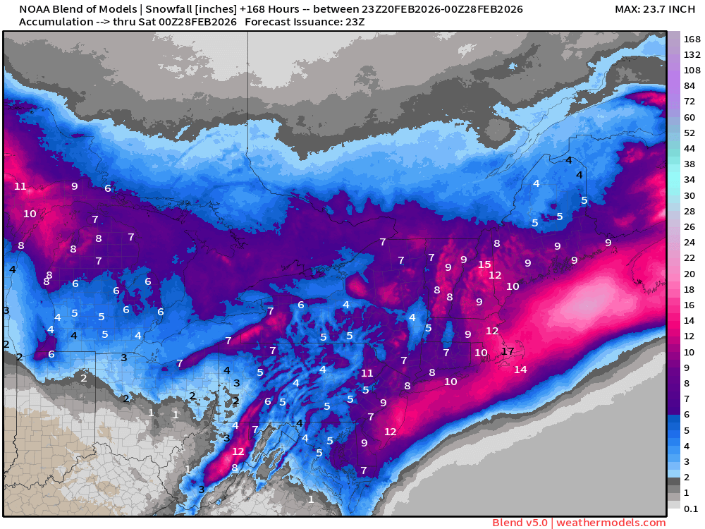
Blend of Models | 7 Days Precipitation Total
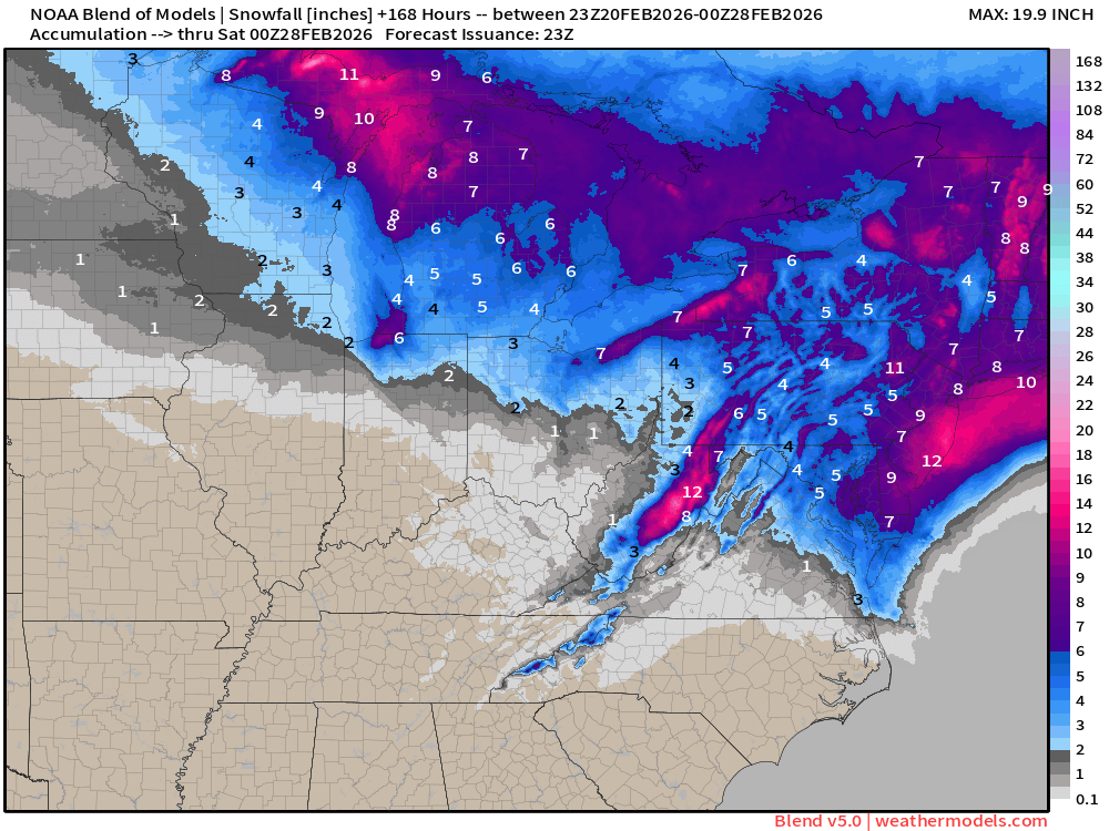
Blend of Models | Total Snowfall Next 7-Days
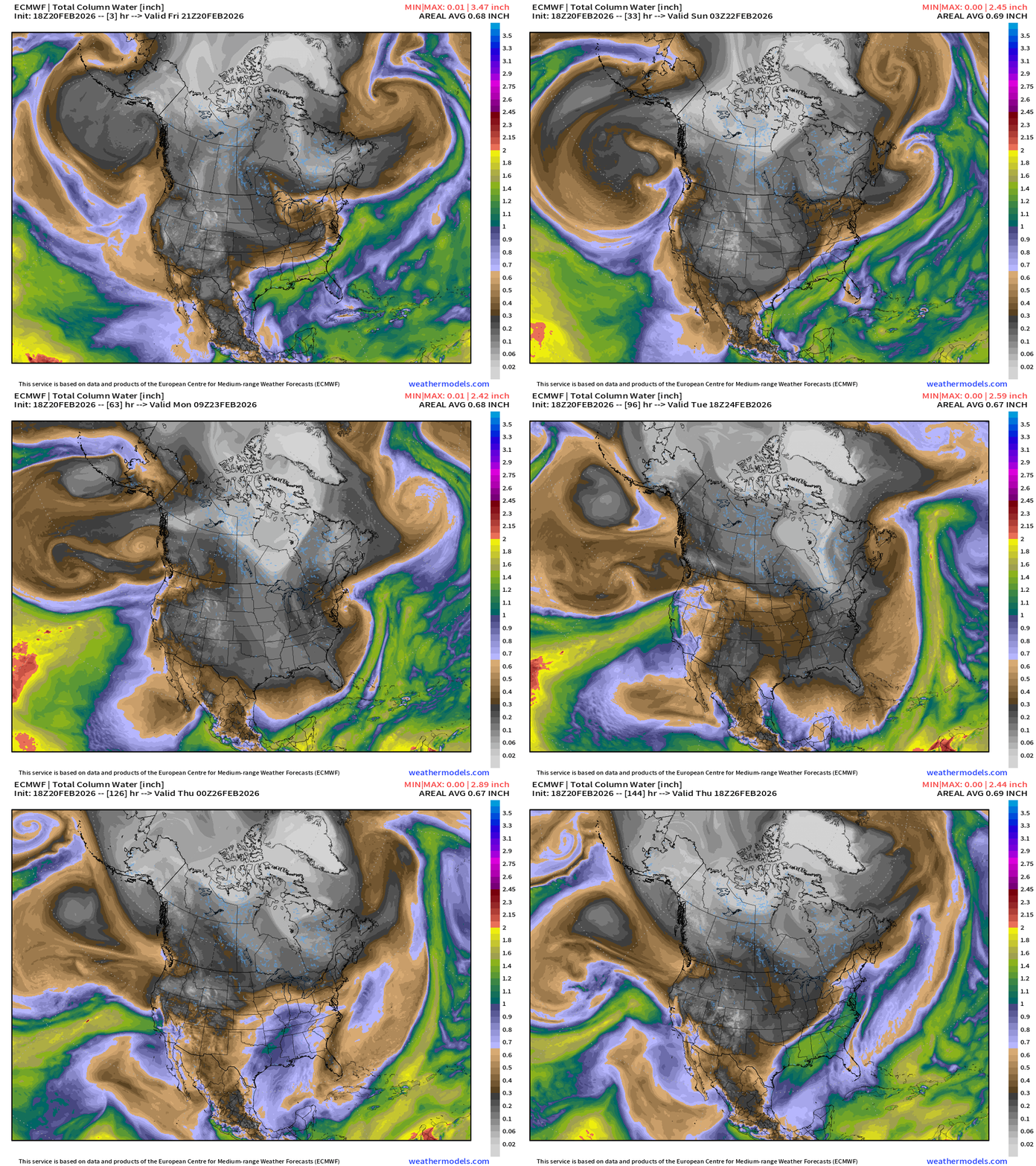
ECMWF IFS 18z | Precipitable Water Next 6-days
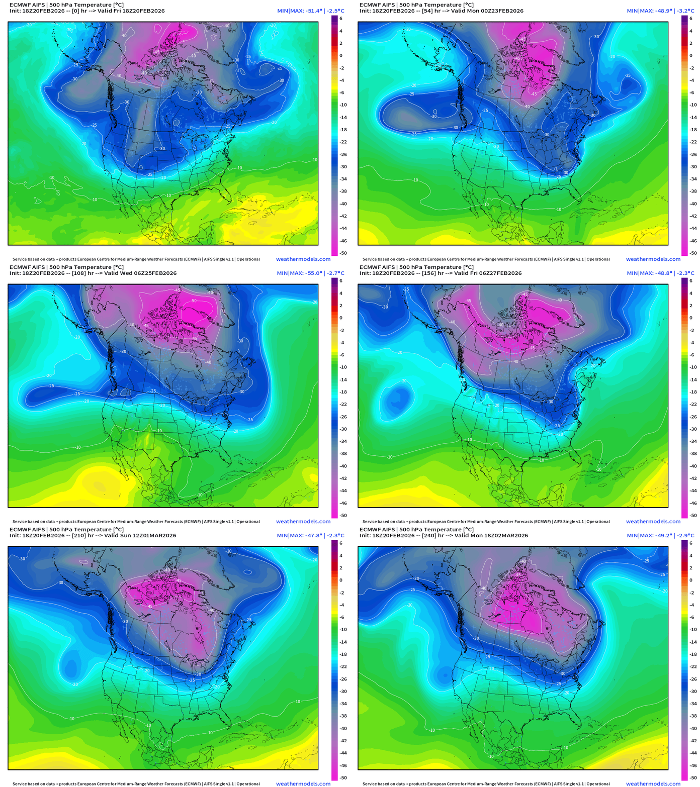
ECMWF AIFS 18z | Upper Level 500 mb Temperature Field
Temperature Anomaly Next 15-days | ECMWF EPS 12z Ensemble Mean
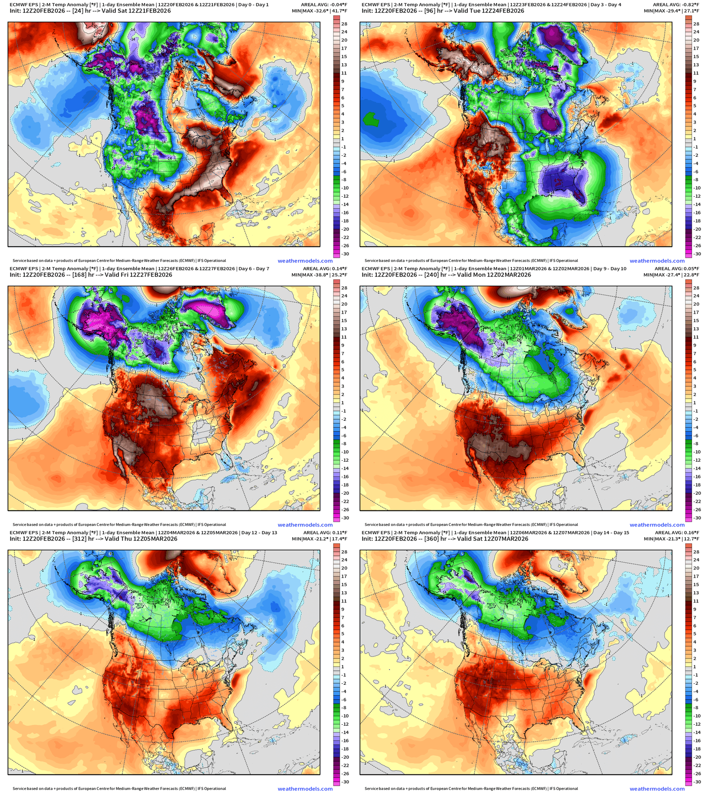
Temperature Anomaly | Next 15-days | ECMWF EPS 12z
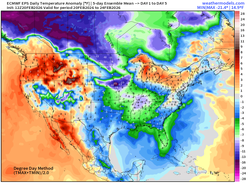
5-Day Chunk #1 | Temperature Anomaly | Feb 20 - Feb 24
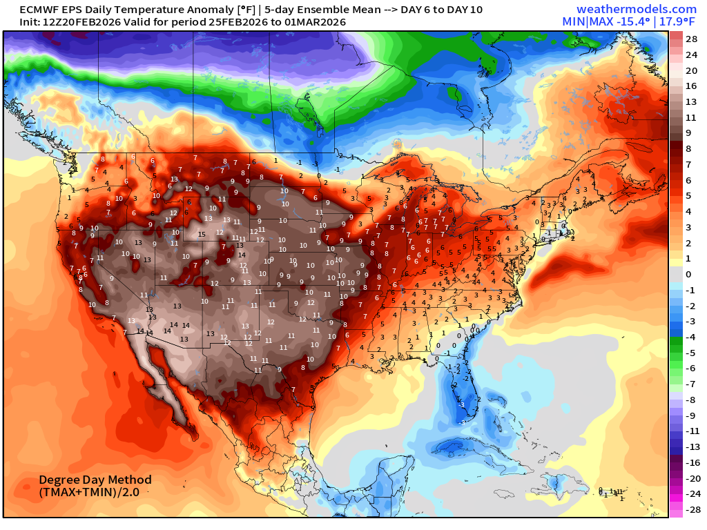
5-Day Chunk #2 | Temperature Anomaly | Feb 25 - March 1
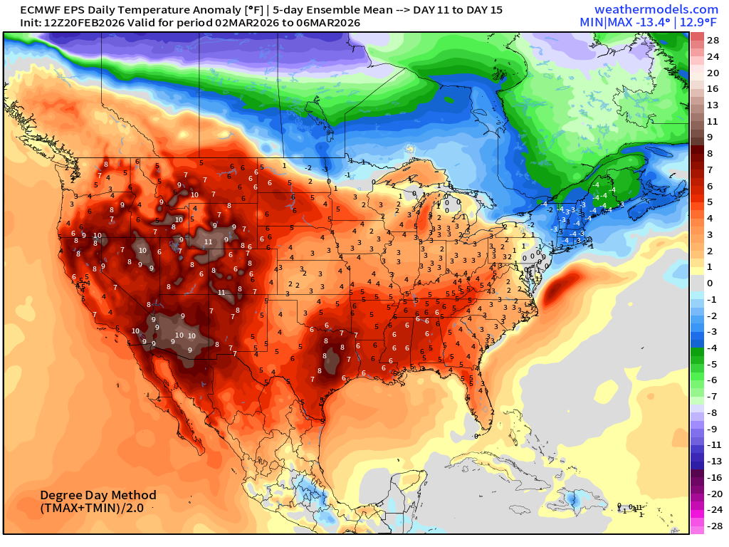
5-Day Chunk #3 | Temperature Anomaly | March 2 - March 6
Maps sourced from weathermodels.com designed and innovated by yours truly! Please subscribe there for real-time access to the newest maps, charts from all of the weather models including ECMWF and AIFS, and NOAA GFS/GEFS.
- Milepost
- 877 · laid 2026-02-21T02:14:07.936000Z
- Source
- https://weather.substack.com/p/february-20-2026-blockbuster-blizzard
- Digest
- 01d2caaf7392424b28f2b61cb93cbd73b87e3cb912868ddbad659ece8bcc606c
- Machine
- JSON