February 18, 2026 Wednesday Evening Update
Arctic air returns behind potential Mid-Atlantic Coastal Storm this weekend
February 2026 was the 4th-warmest February in the 132-year national record (1895–2026), at 40.3°F against a 1991–2020 normal of 35.6°F (+4.6°F).
February 2026 was the 5th-driest February in the 132-year national record (1895–2026), at 1.4in against a 1991–2020 normal of 2.1in (-0.7in).
NOAA/NCEI Climate at a Glance, contiguous United States. This is the observed record for the month, not a score of anything said in this piece — the forecast ledger begins 2026-08-17 and cannot reach earlier posts.

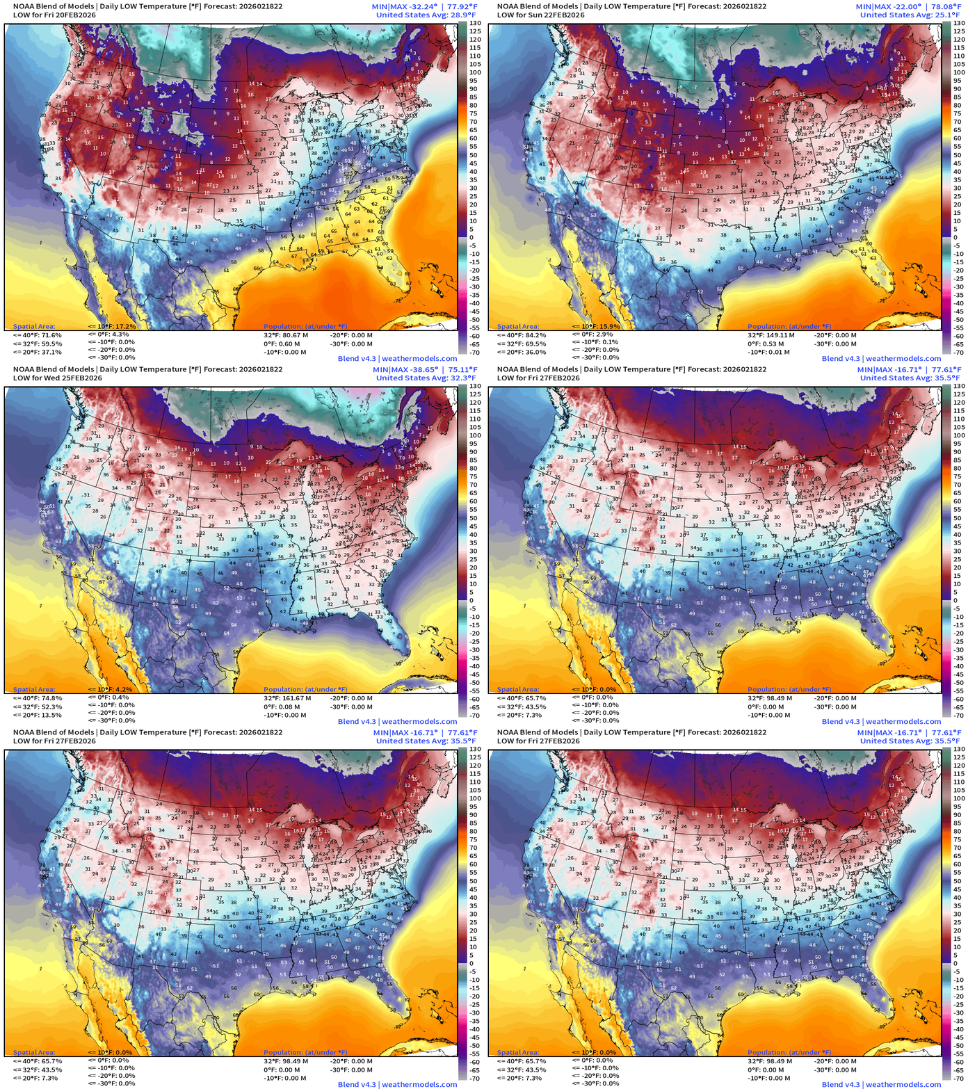
Arctic Air returns this weekend behind the East Coast storm system — with freeze into North Florida yet again on Tues/Wed of next week. However, this is not severe cold — and shows we are turning the corner on winter rather quickly — under 2 weeks until March. The cold air pool retreats to start the new month. Lows next 8-days:
East Coast Storm System — Nor’easter Watch
The ECMWF EPS at 18z (median) of ensembles are still NOT interested in the coastal storm having major impacts to the Mid-Atlantic or the Northeast.
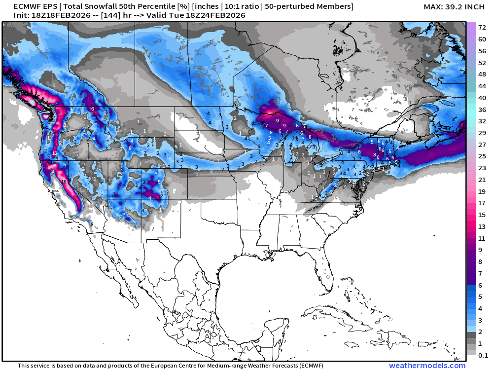
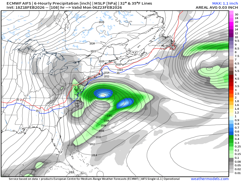
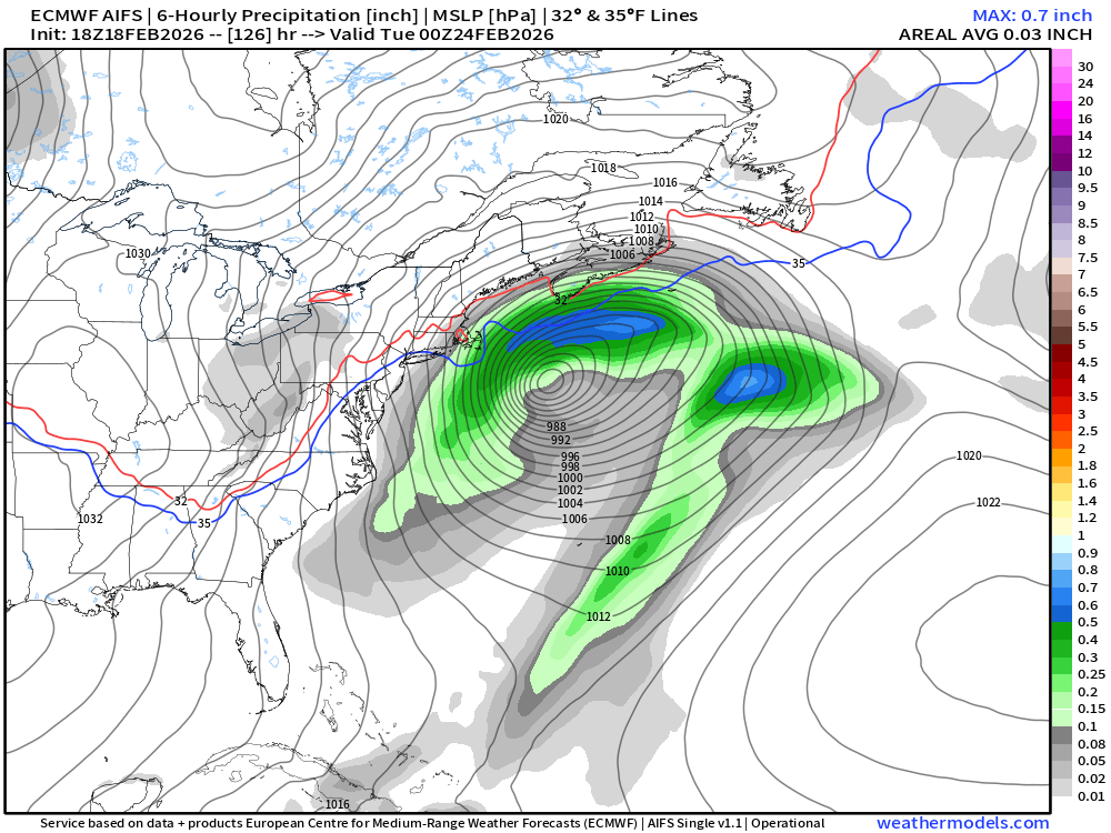
The back side of the low pressure system will have moisture in cold-enough air on Monday, but the total QPF (amount of precipitation) would be too low to provide “blockbuster” storm snowfall totals. Instead, we’re currently in the 2” to 4” category as the highest probability outcome.
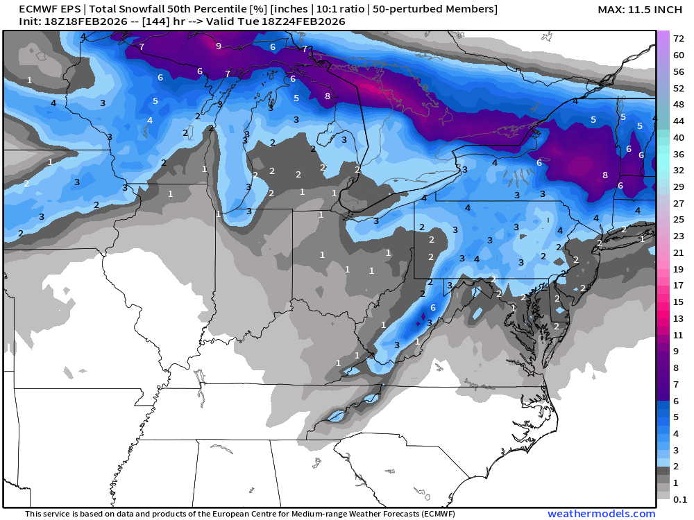
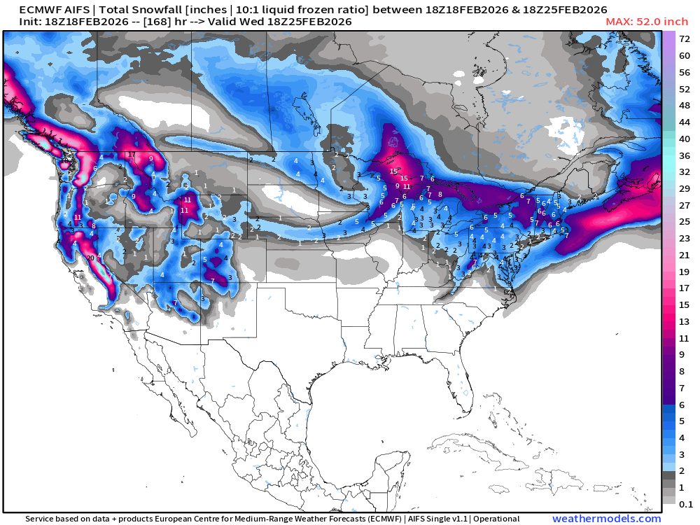
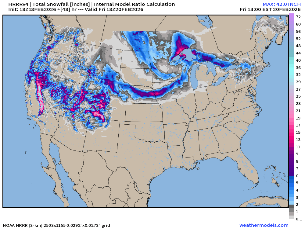
Meanwhile, snowfall will pile up in the 6” to 12” range without a Nor’easter but instead Clipper systems along the polar front boundary — and a Great Lakes storm system.
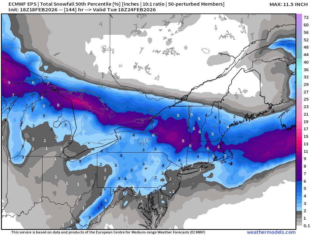
Looking at the 6” probability of snowfall through next Tuesday afternoon:
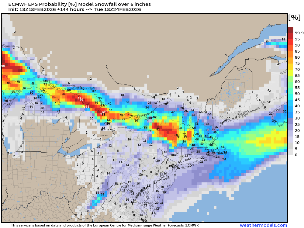
And, we have 1 in 6 chance of seeing at least 6” of snowfall along the I-95 corridor from DC/Philly/NYC, but almost a sure thing in central New York into New England including Boston with the other snowfall events.
Updated ECMWF AIFS-Single 18z for late Sunday into Monday evening is far enough off the coast during “rapid intensification” or “bomb-o-genesis” to keep heaviest QPF and snowfall away.
AIFS Snowfall Next 7-days
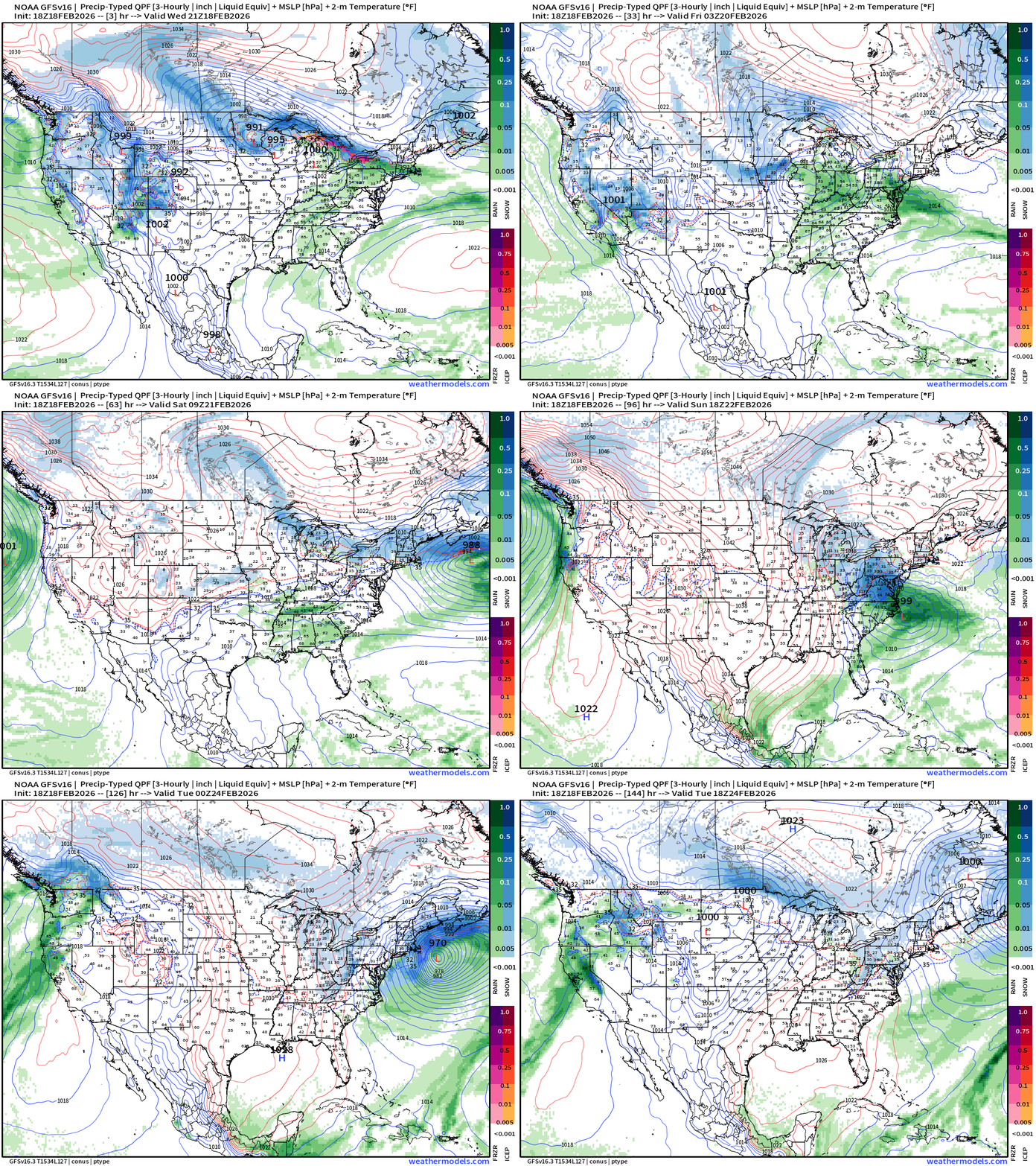
GFS 18z — Happy Hour Forecast — goes bonkers with rapid intensification right along the coast — and heavy snowfall. This is an outlier solution.
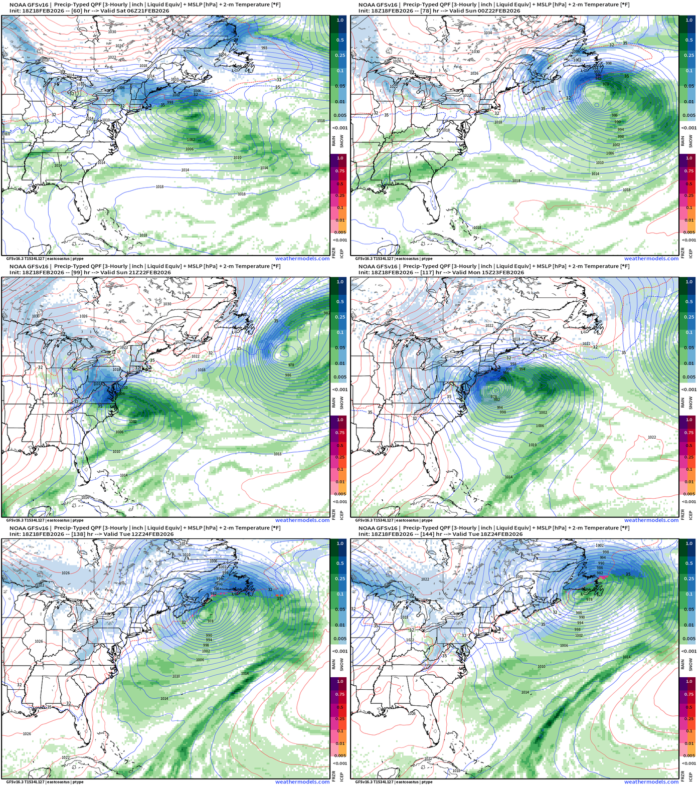
While this is unlikely to verify, it sure is a powerful “blizzard” that would be crippling if the track adjusted just slightly WNW along the I-95 corridor.
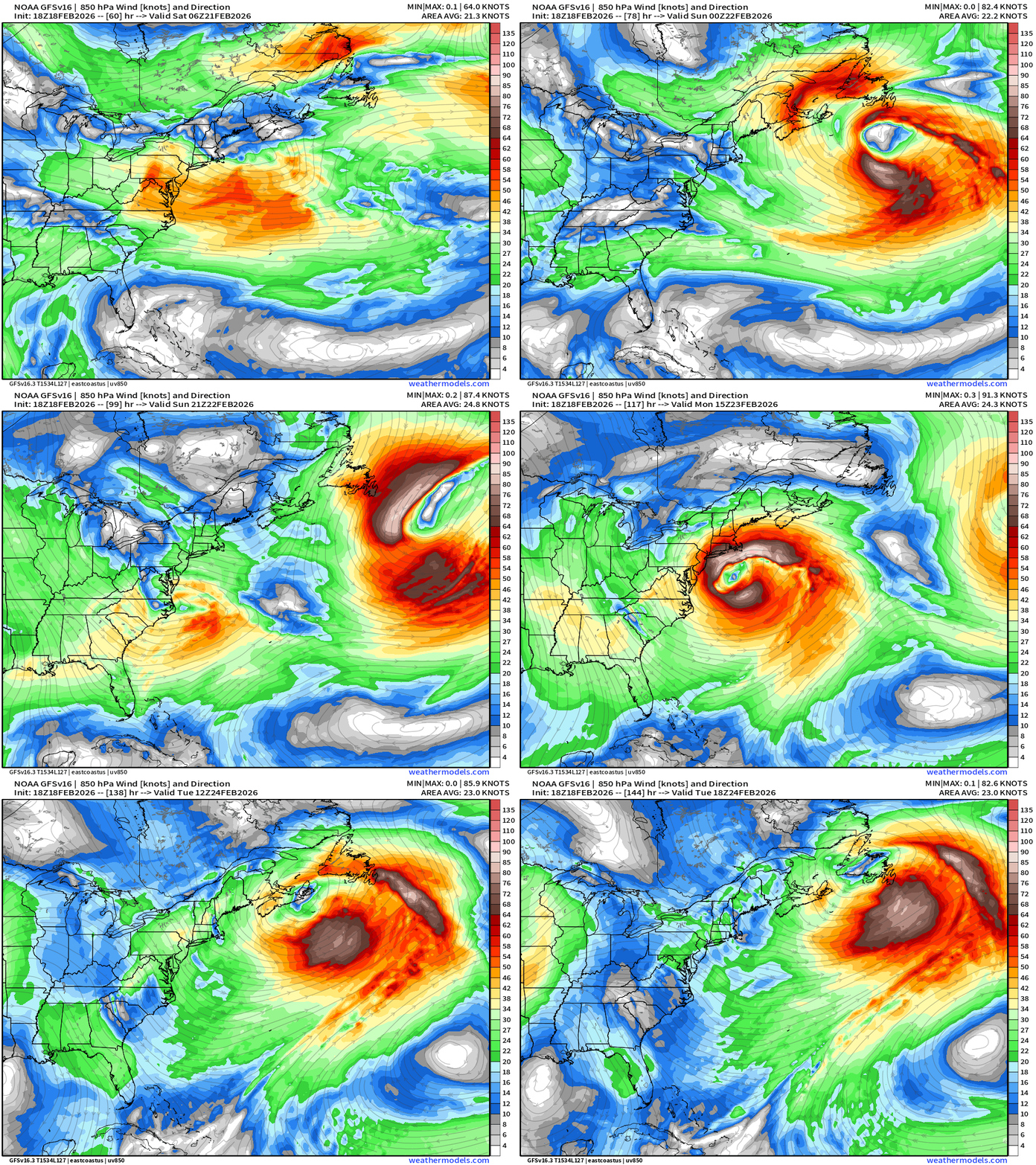
GFS 18z Heavy Snowfall for the Chesapeake Bay environs
The problem is that GFS just doesn’t perform well with shortwaves crossing the Rocky Mountains leading to cyclogenesis off the East Coast 3-days later.
GFS 18z: 7-Day Snowfall
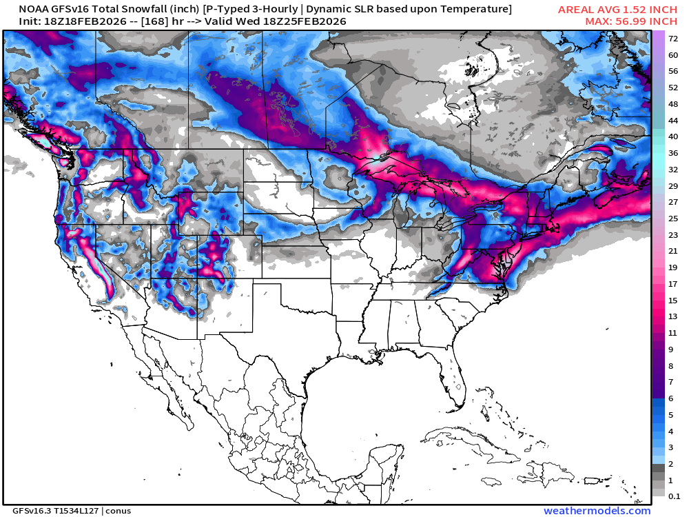
GFS shows a major mid-Atlantic snow storm but the ECMWF suite of guidance is not on board. We are still in the 20% range for a “blockbuster” — instead looking at a manageable brief snowfall event for Monday. The Nor’easter watch continues …
CONUS Radar Simulation through early morning Friday (1 PM ET)
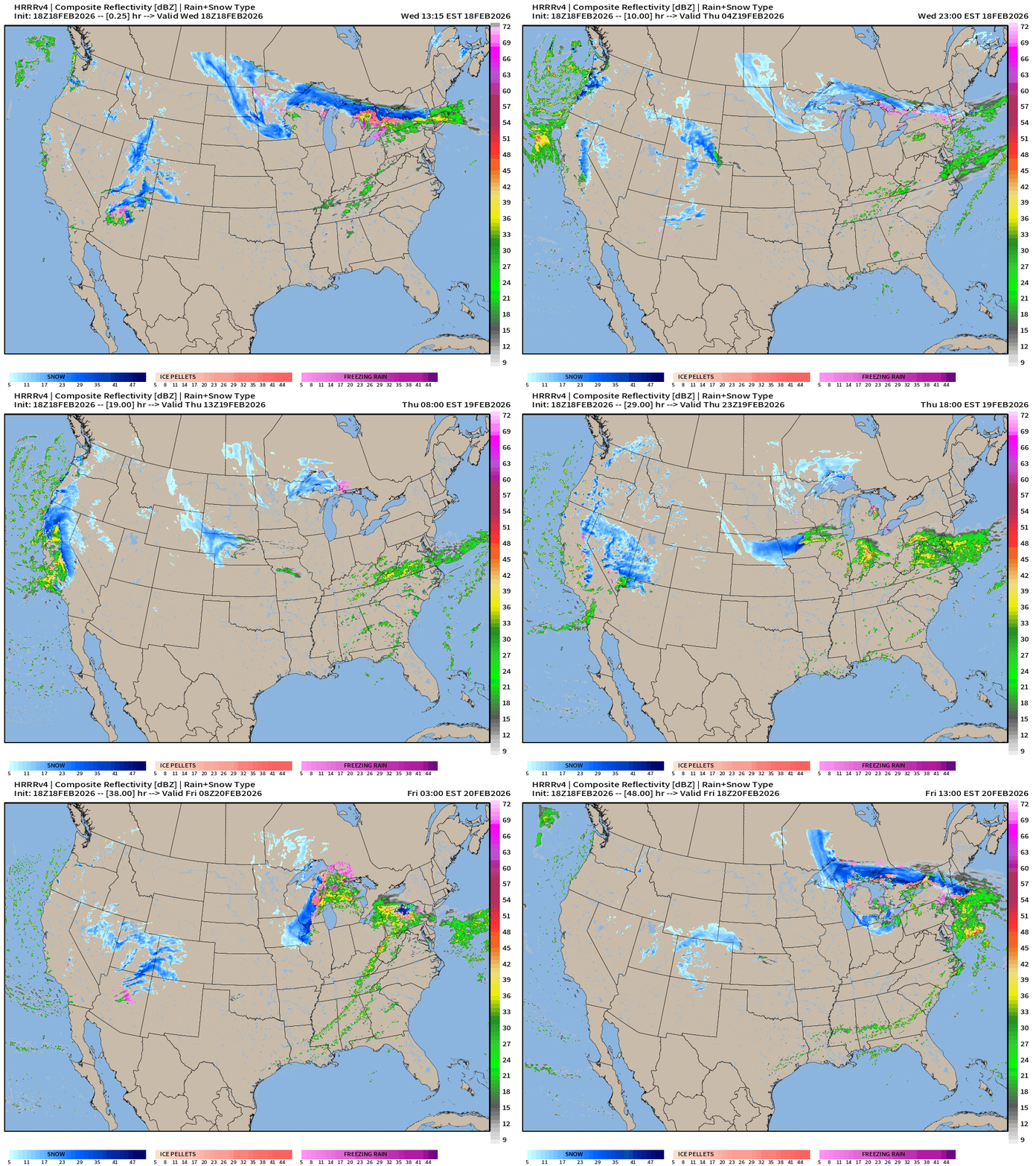
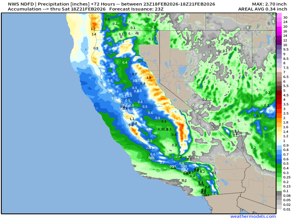
Western U.S. is hammered with rain and snow from yet another major storm system on Wednesday into Thursday
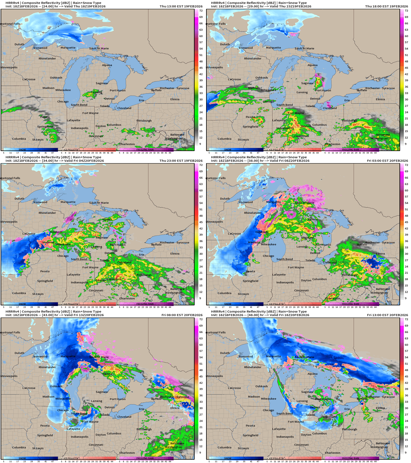
That warmer Pacific moisture heads east and northward into the Midwest and Great Lakes — fueling a storm system in the Midwest and Great Lakes into Friday.
Severe weather (slight risk) in the warm sector centered upon Indianapolis
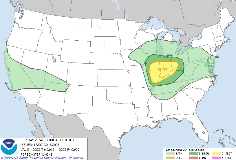
SPC Discussion: Severe thunderstorms, with potential to produce a few tornadoes, hail and damaging wind gusts, are possible across parts of the middle Mississippi into lower Ohio Valleys Thursday afternoon into early evening.
HRRR Simulated Radar for “severe storm potential” late Thursday
HRRR total snowfall next 48-hours
RTMA | Temperature Analysis | 7:00 PM ET
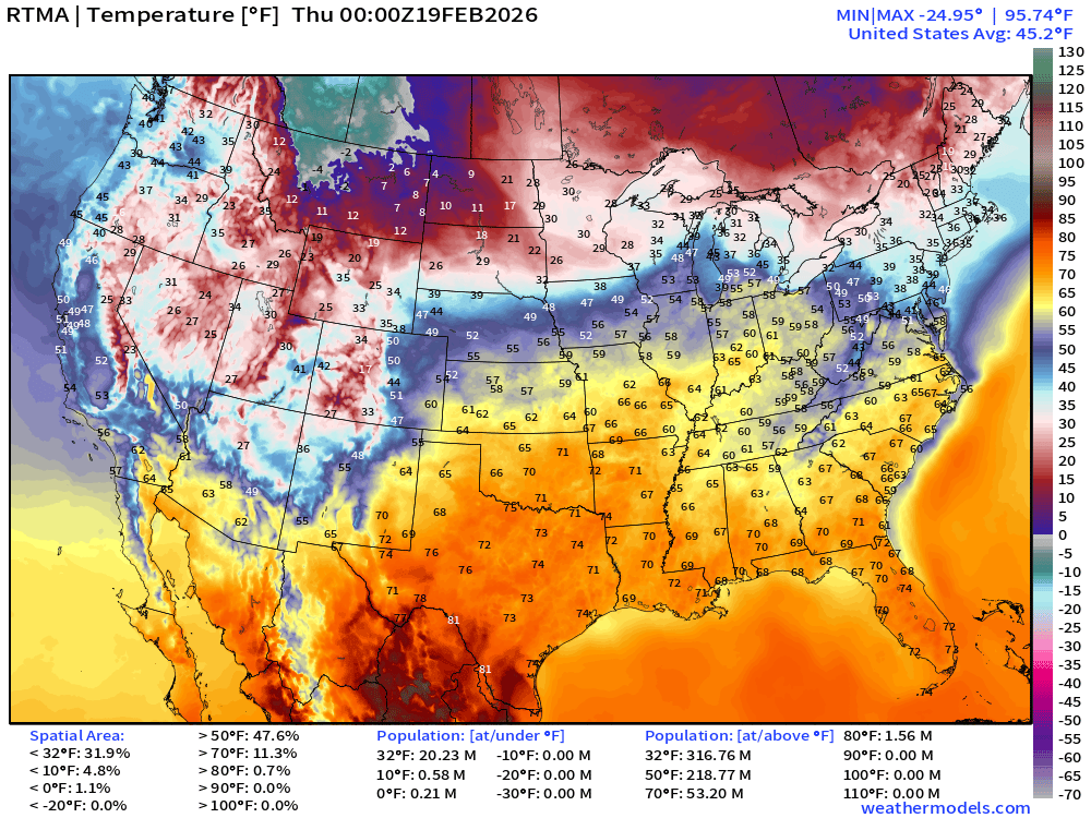
Avg Lower 48 temperature was 45.2°F
Temperature Anomaly | 7:00 PM ET
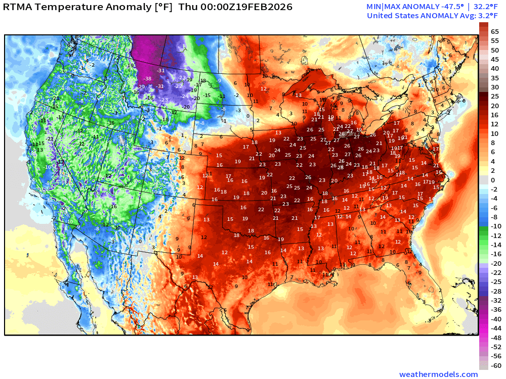
Lower 48 Temperature Anomaly above normal by 3.2°F
Low Temperatures on Wednesday
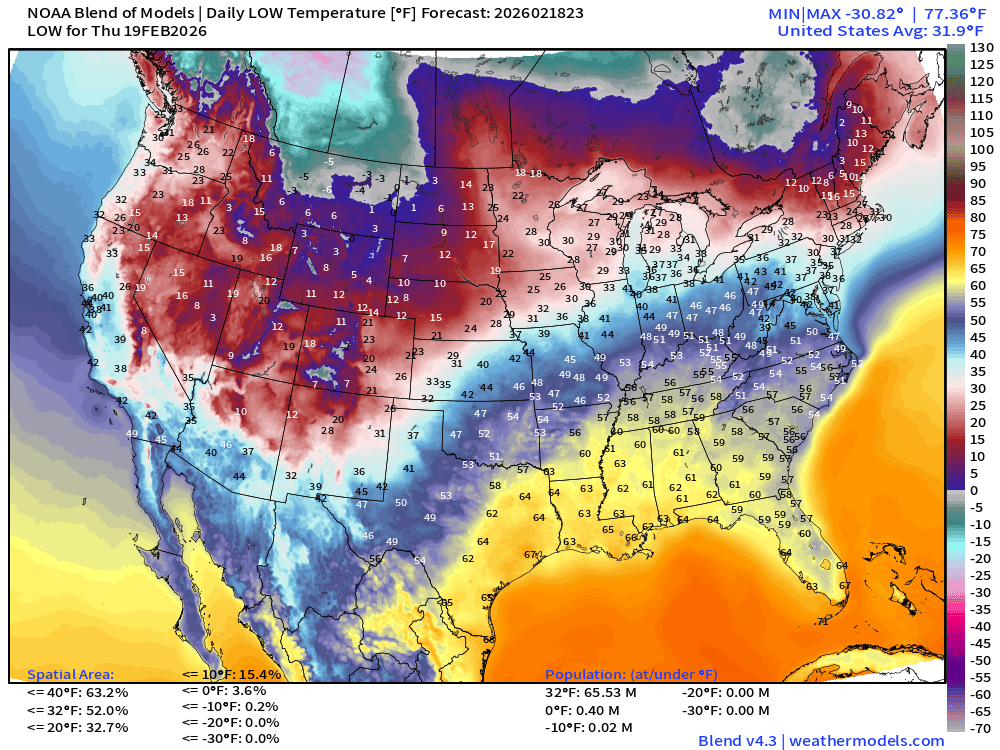
Only 65 million below freezing with coldest in Montana, into the Rockies, and Maine
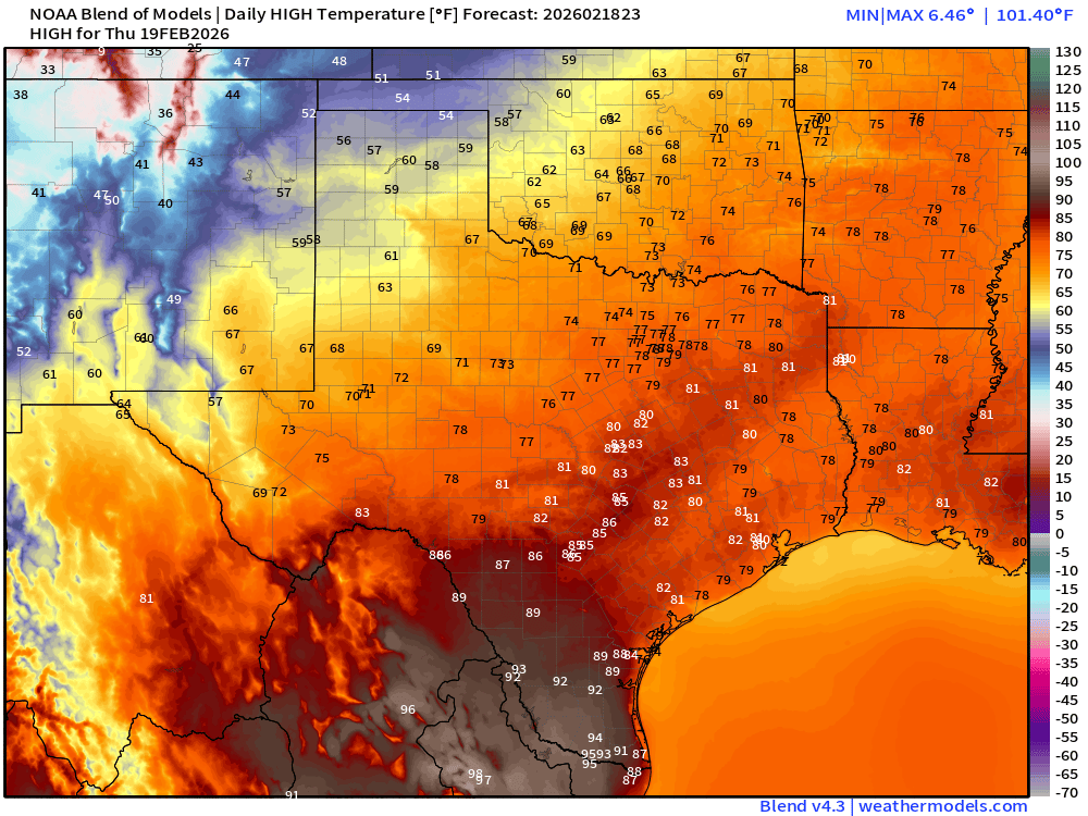
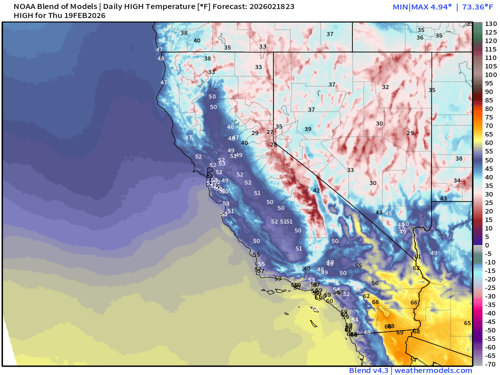
High Temperatures on Wednesday
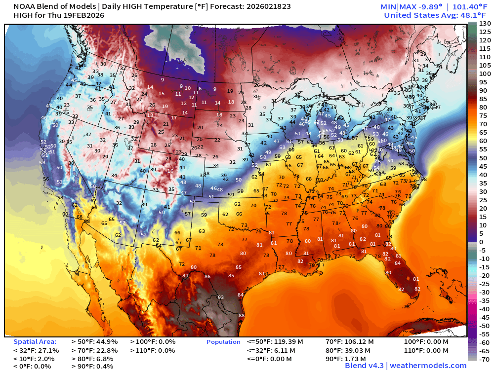
Very warm > 106 million at least 70°F surging into the Ohio River Valley
Into the mid-90s and evening 100°F along the Rio Grande
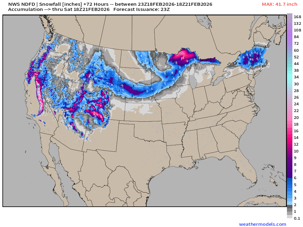
NWS NDFD Snowfall next 3-days
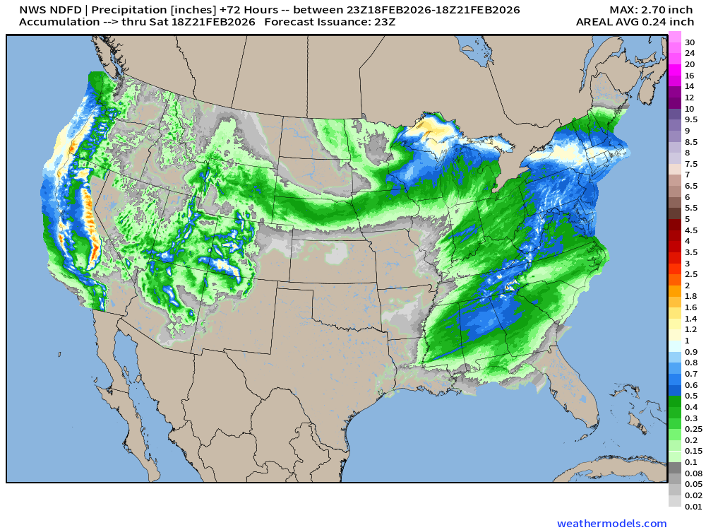
NWS NDFD Precipitation (QPF) next 3-days through Saturday afternoon
ECMWF 18z Precipitation Type + Intensity | Next 6-days
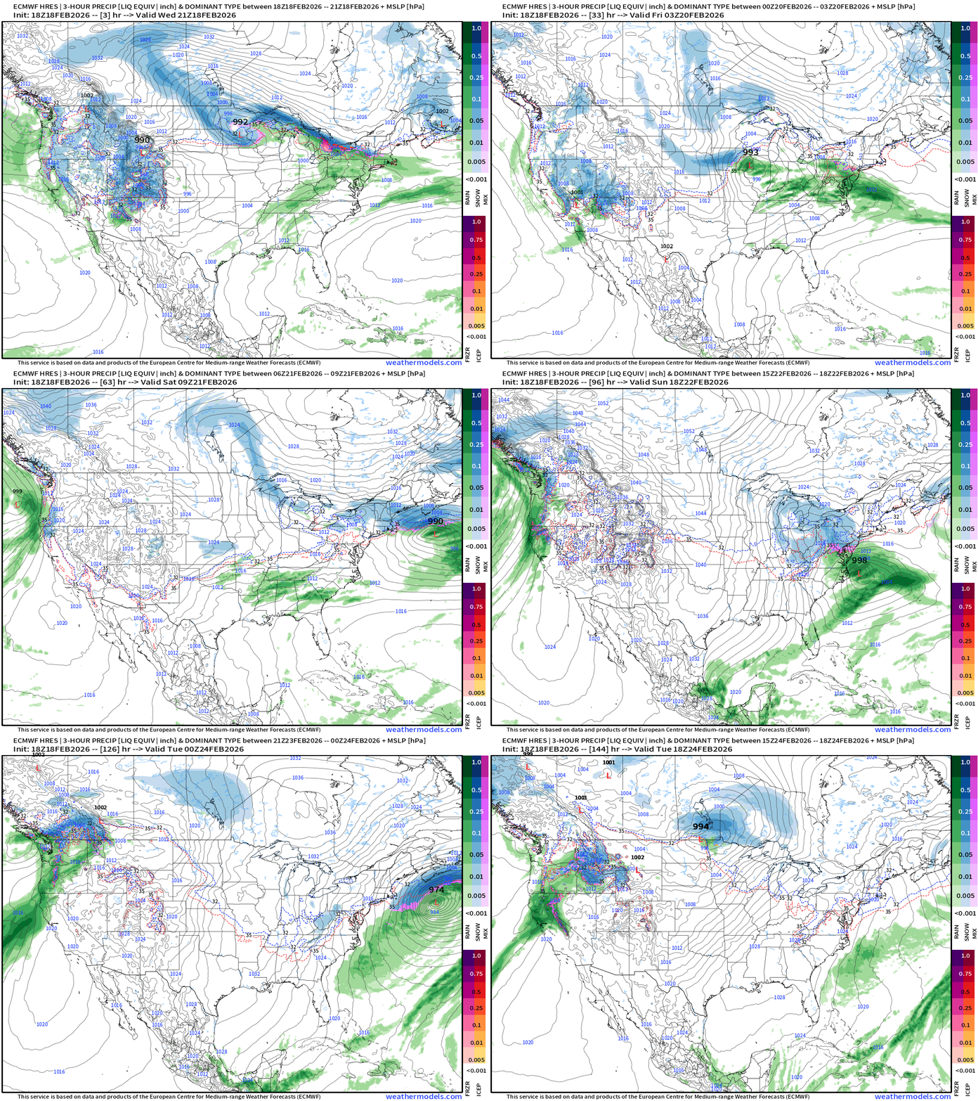
Nice little storm system for the Great Lakes into Friday — scoots quickly off the East Coast — as we await the decision on the mid-Atlantic development
Eastern U.S. Next 6-days storm systems | ECMWF 18z
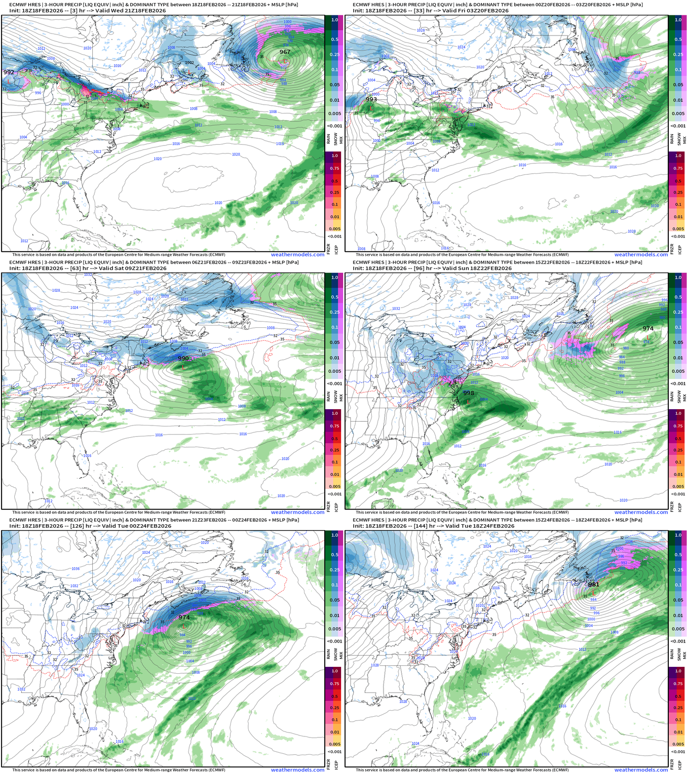
Nor’easter Watch Sunday-Monday — but sufficiently offshore to avoid major impacts — so far, so good.
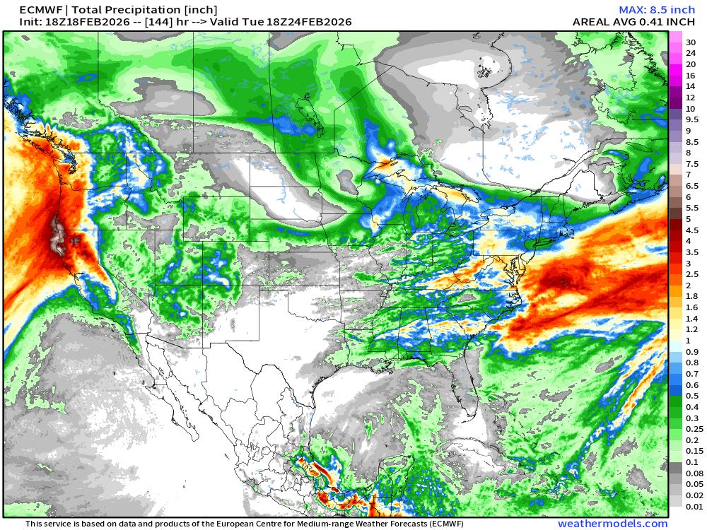
Western U.S. —> Multiple Storms continue Pinwheeling Moisture in a large cold trough/gyre
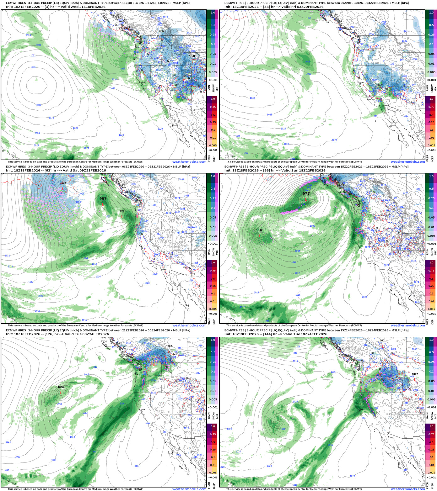
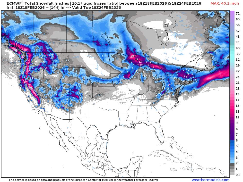
ECMWF 18z Total Snowfall Next 6-days
ECMWF 18z Total Precipitation Next 6-days
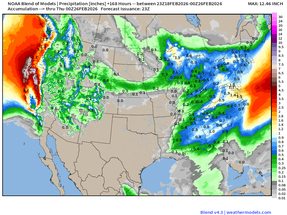
Blend of Models | 7 Days Precipitation Total
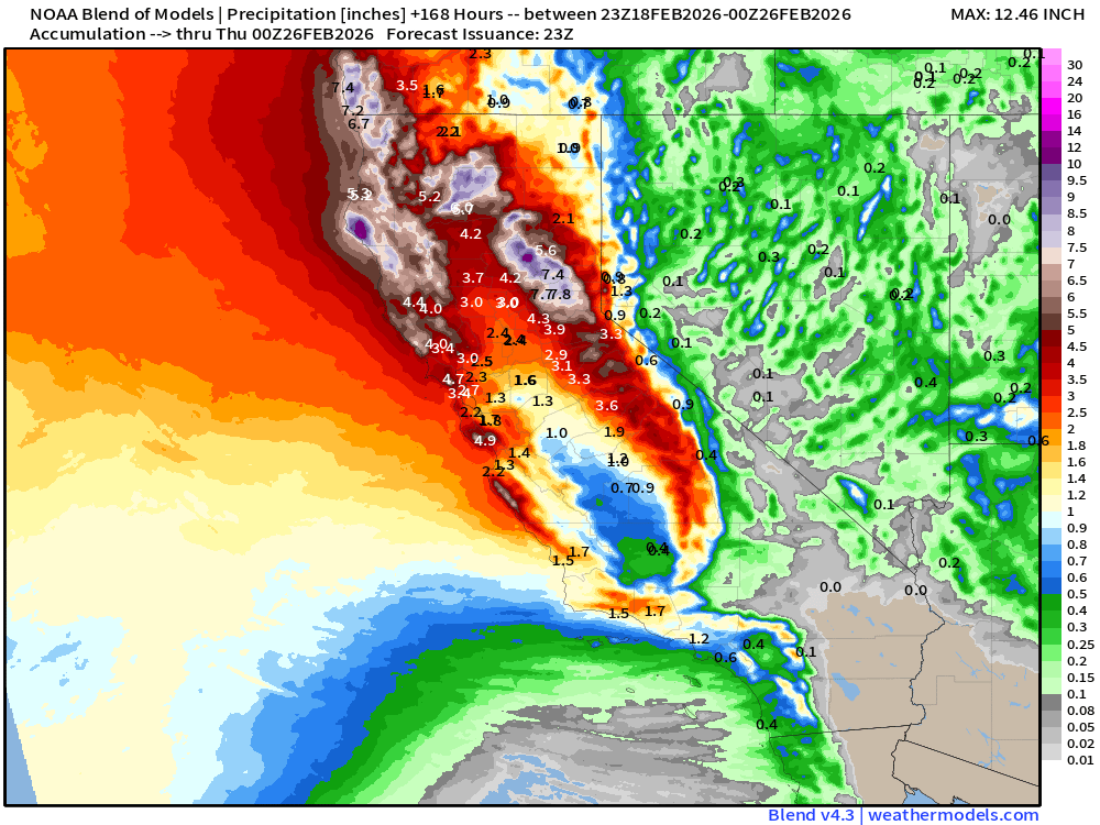
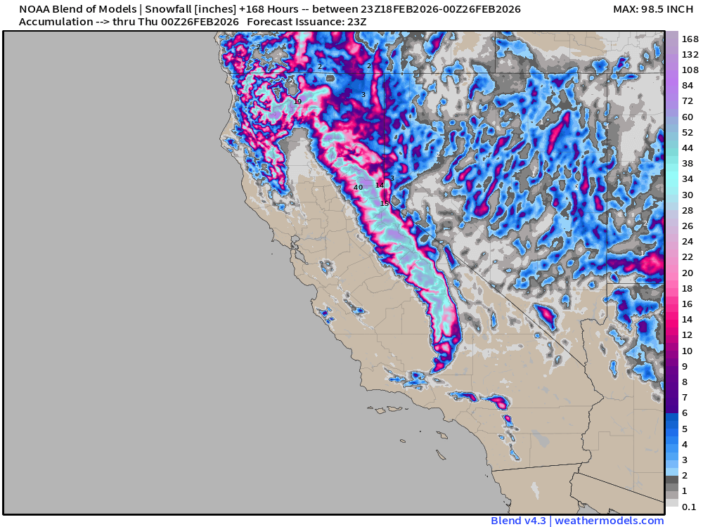
Blend of Models | Total Snowfall Next 7-Days
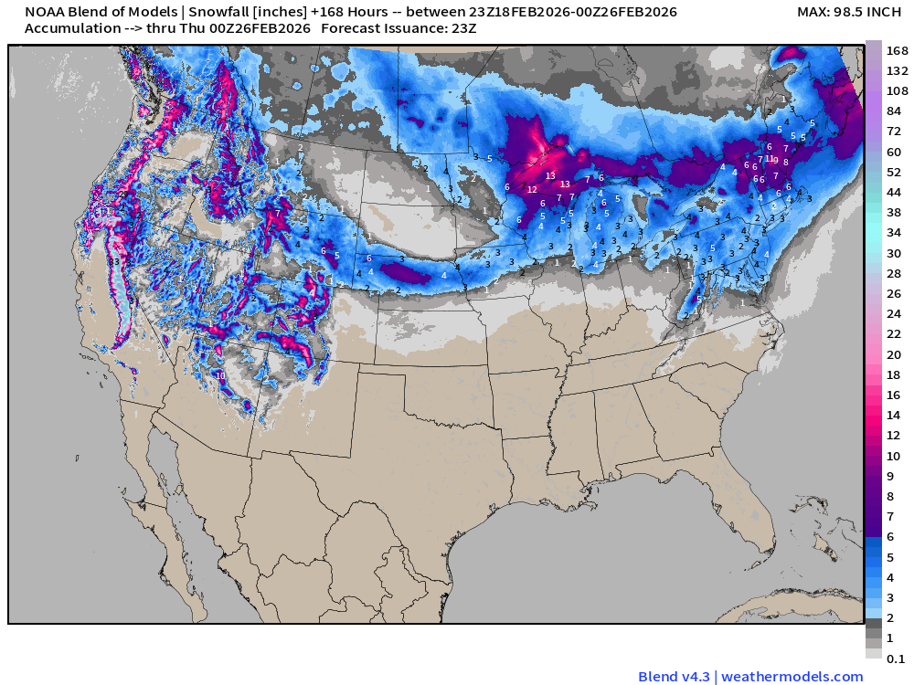
Blend of Models is in the 2” to 4” range for the Mid-Atlantic matching ECMWF
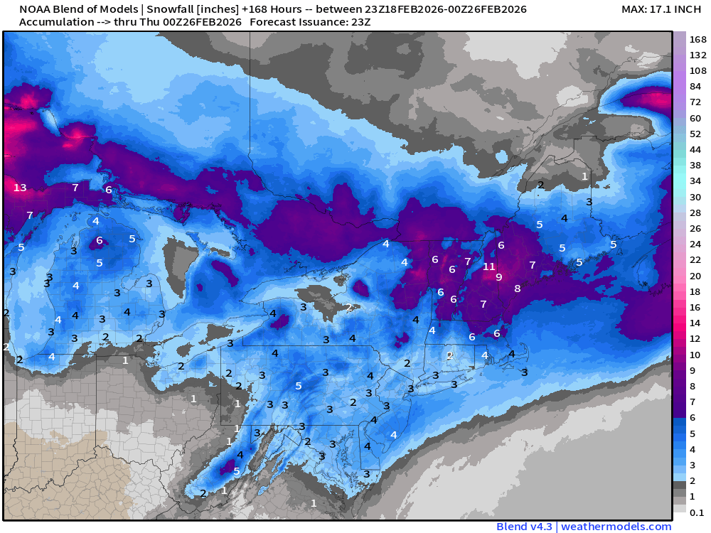
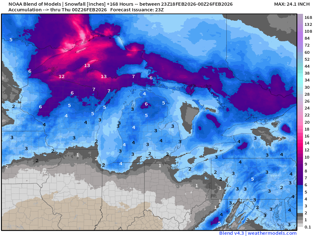
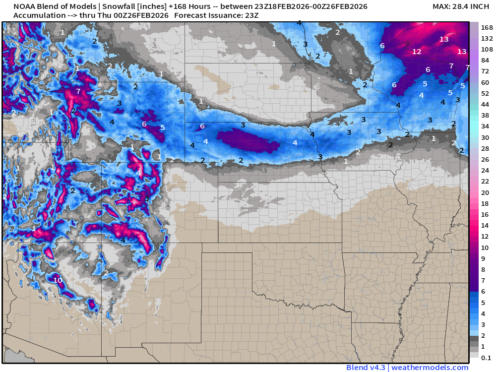
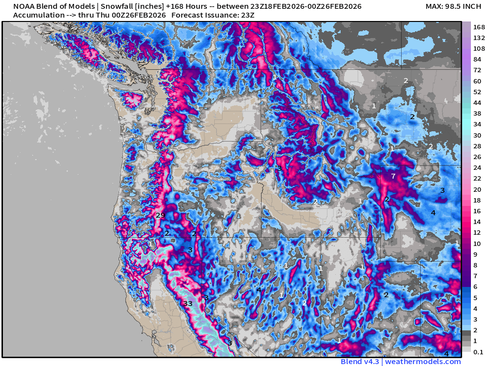
Snowfall in the Sierra, Cascades, and Rockies will be measured in feet / yards.
Flagship ECMWF 12z EPS | Temperature Anomaly | Next 15-days
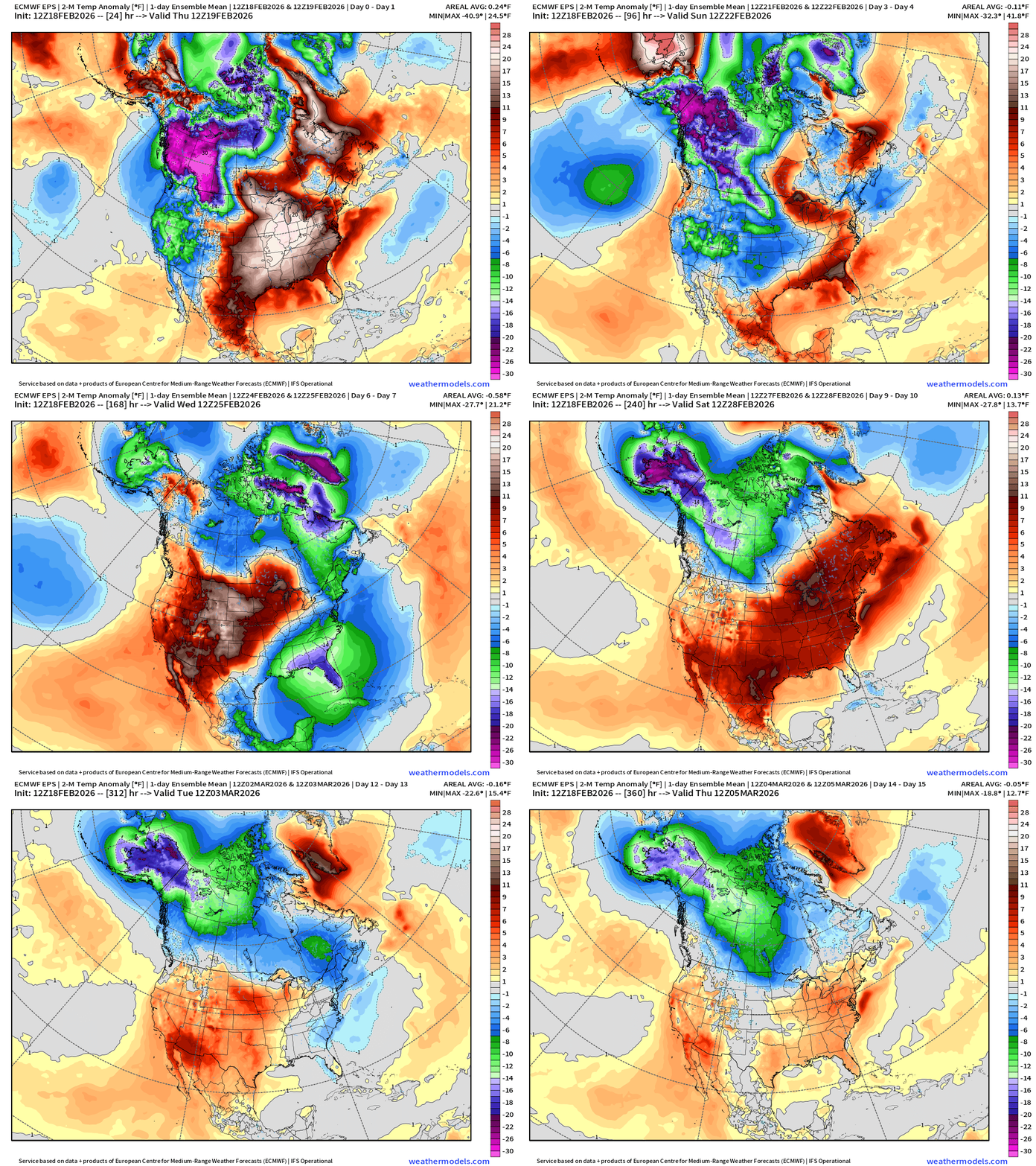
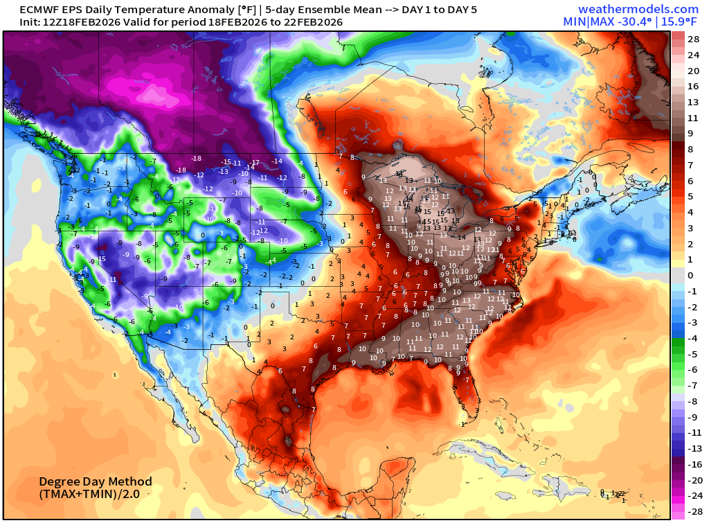
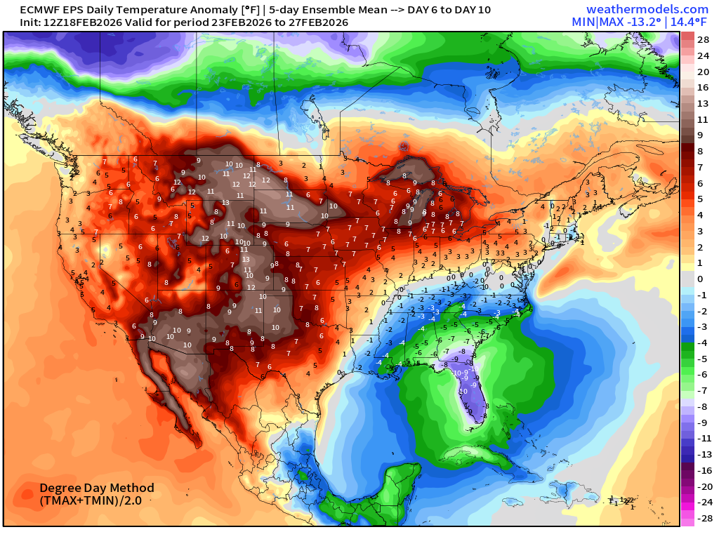
Major surge of Arctic air returns for the Eastern U.S early next week — followed by another significant warm up — in the ensemble mean across the Lower 48. Then, the cold recharges again in the Arctic including northern Canada and Alaska.
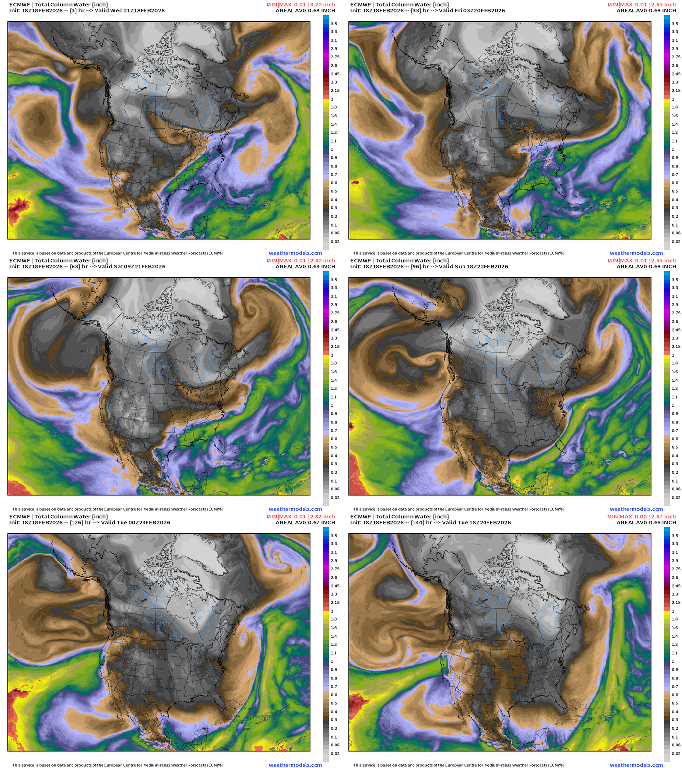
ECMWF IFS 18z | Precipitable Water Next 6-days
ECMWF AIFS-Single 18z | Temperature (500 hPa) Next 10-days
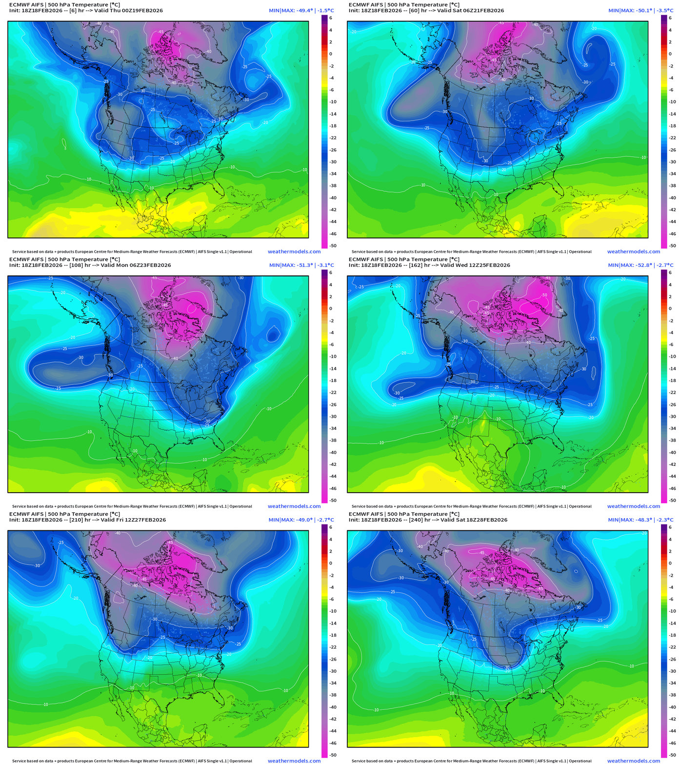
The temperature at 500 mb is the easiest way to highlight the “polar vortex” across North America with the coldest pool at -50°C (pink) with the -25°C contour usually associated with below freezing temperatures at 2-meters (surface).
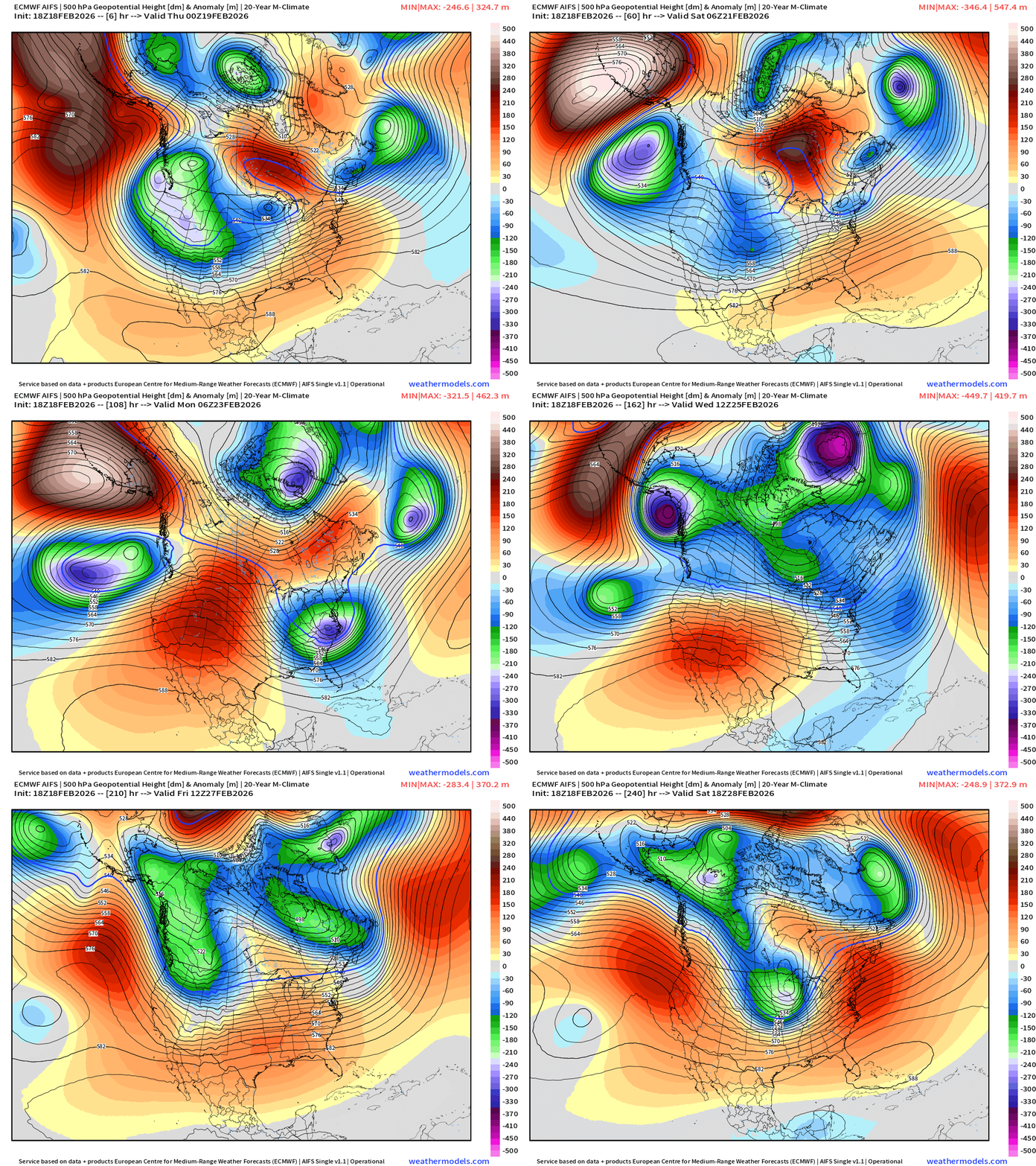
ECMWF AIFS-Single 18z | Height Anomaly (500 hPa) Next 10-days
Temperature Anomaly | Next 15-days | ECMWF EPS 12z
5-Day Chunk #1 | Temperature Anomaly | Feb 18 - Feb 22
5-Day Chunk #2 | Temperature Anomaly | Feb 23 - Feb 27
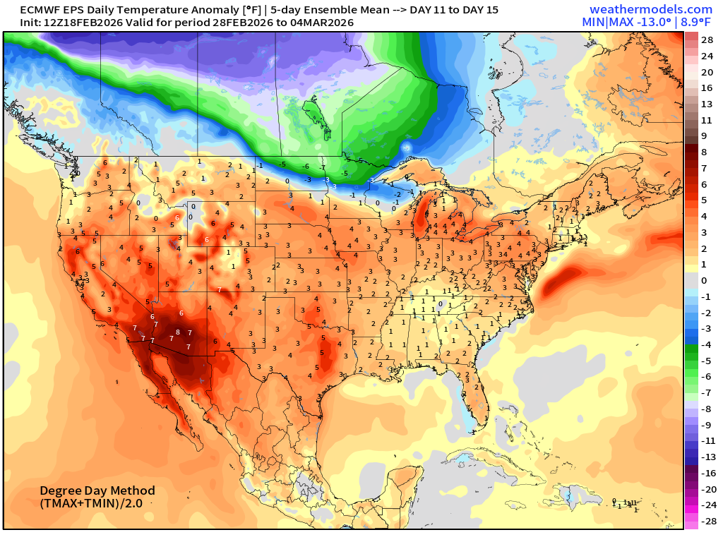
5-Day Chunk #3 | Temperature Anomaly | Feb 28 - March 4
Maps sourced from weathermodels.com designed and innovated by yours truly! Please subscribe there for real-time access to the newest maps, charts from all of the weather models including ECMWF and AIFS, and NOAA GFS/GEFS.
- Milepost
- 874 · laid 2026-02-19T01:38:03.386000Z
- Source
- https://weather.substack.com/p/february-18-2026-wednesday-evening
- Digest
- 975aeffeb49706fb5dcca670352b0bdf5f0cfe939b5bf4114d3358c11209445d
- Machine
- JSON