February 17, 2026 Tuesday Evening Update
Still on blizzard watch, sort of, but plenty of winter weather until then
February 2026 was the 4th-warmest February in the 132-year national record (1895–2026), at 40.3°F against a 1991–2020 normal of 35.6°F (+4.6°F).
February 2026 was the 5th-driest February in the 132-year national record (1895–2026), at 1.4in against a 1991–2020 normal of 2.1in (-0.7in).
NOAA/NCEI Climate at a Glance, contiguous United States. This is the observed record for the month, not a score of anything said in this piece — the forecast ledger begins 2026-08-17 and cannot reach earlier posts.

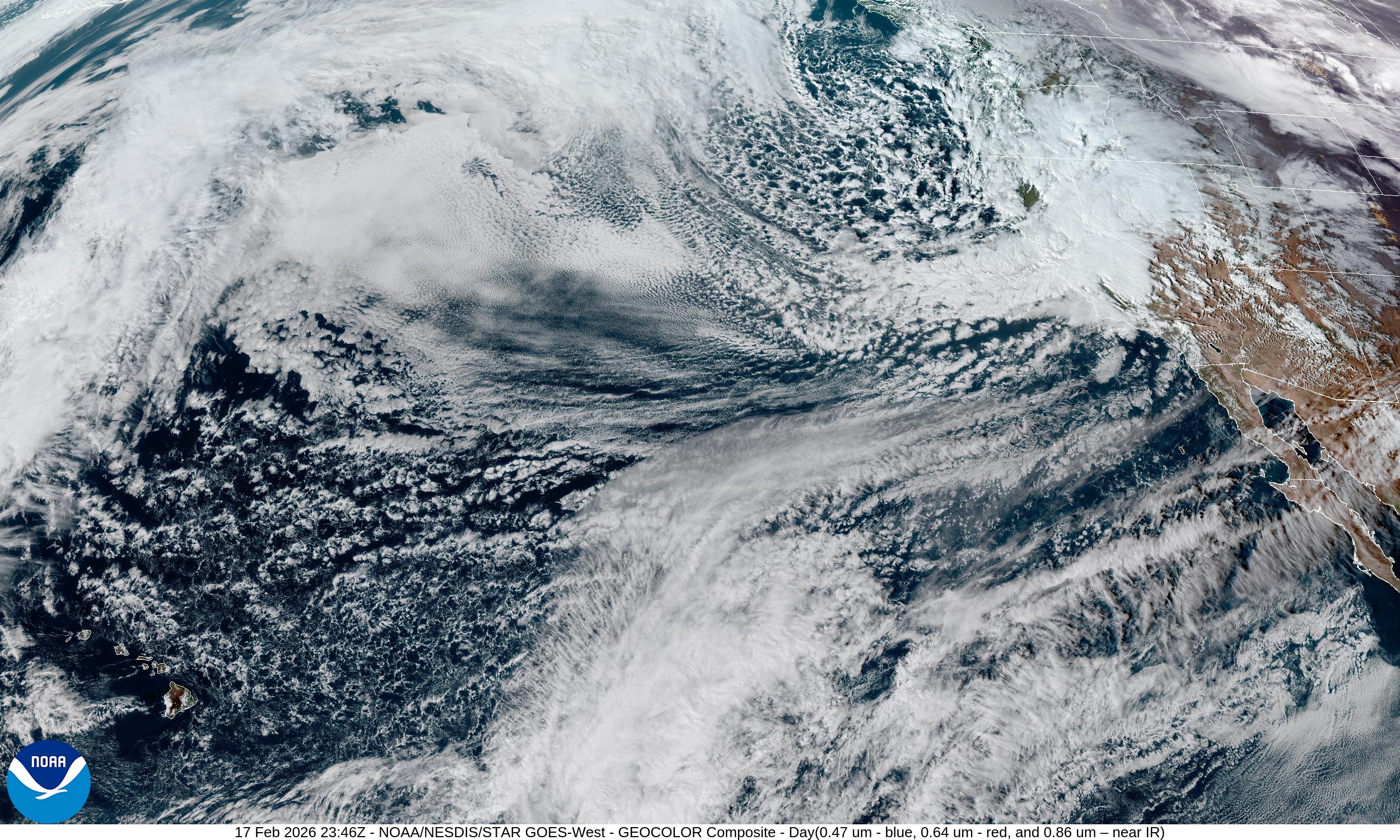
The next week will have plenty of winter weather while we wait to figure out if the developing East Coast storm will track far enough west to wallop the I-95 corridor.
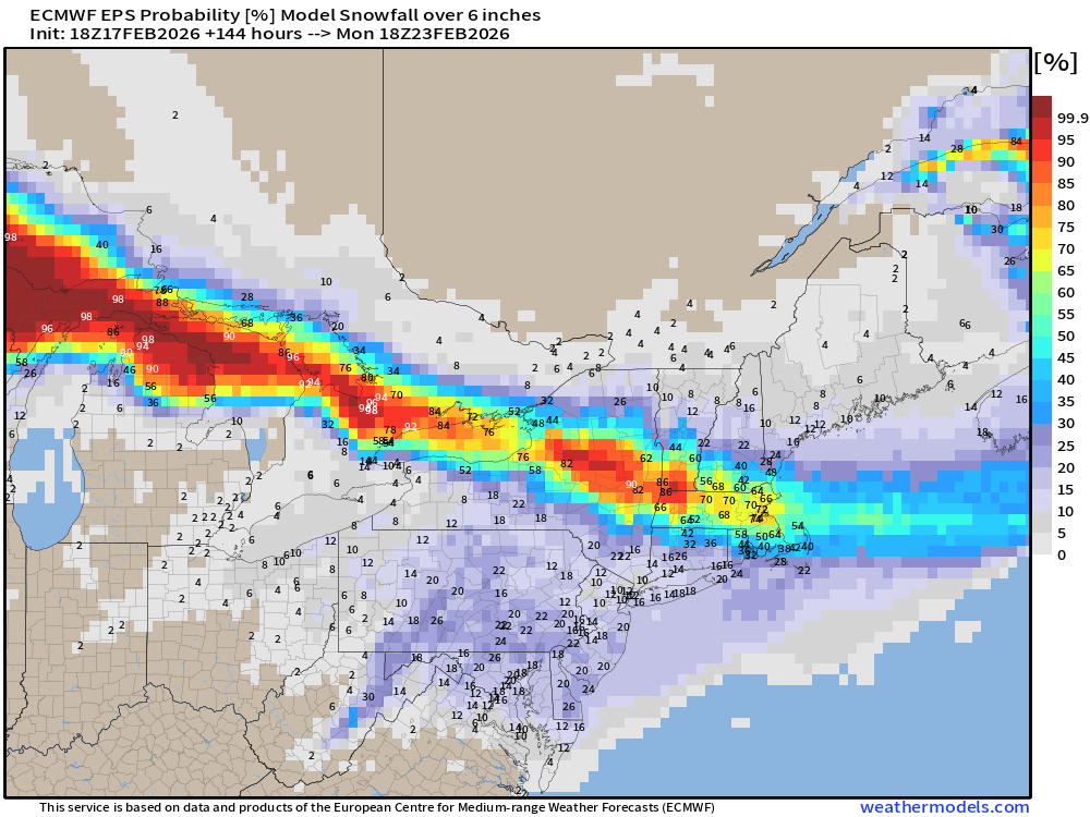
The ECMWF EPS at 18z (median) of ensembles is not interested in the Nor’easter at all — instead the majority of members miss out to sea.
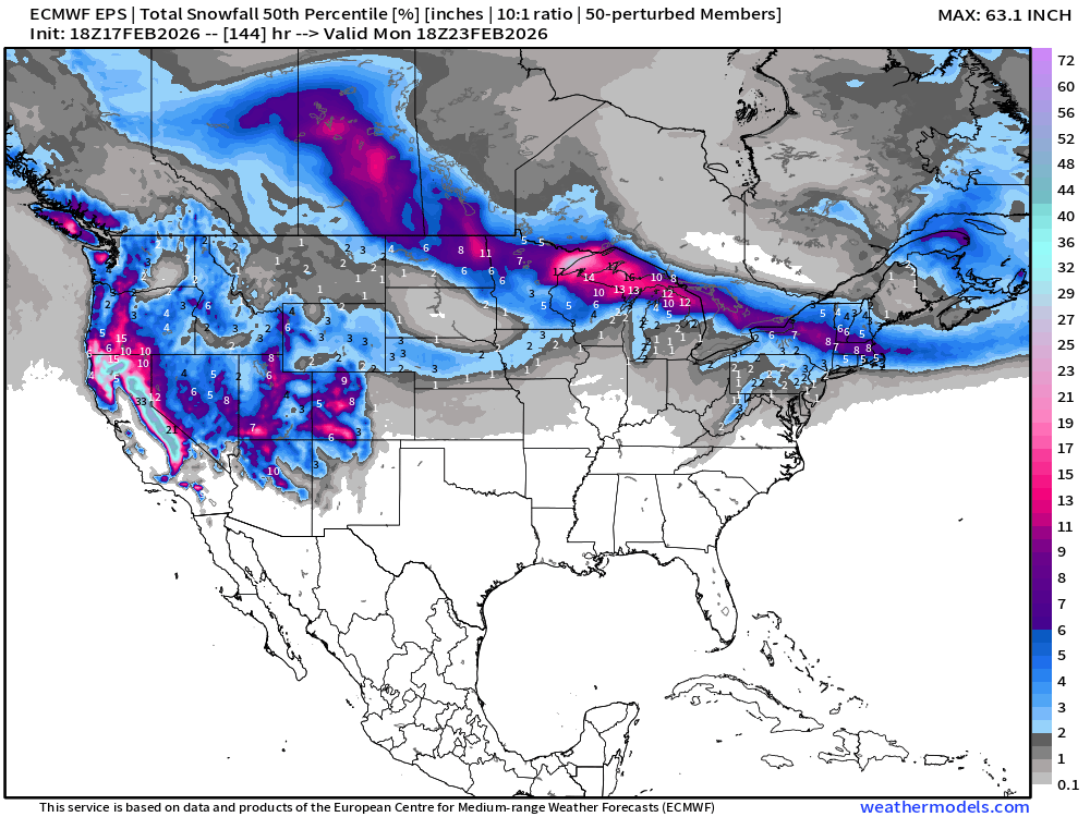
However, in the meantime, the northern tier from Dakotas to Great Lakes and New England will be on the top end of surge of Pacific moisture to combine cold air = stripe of significant snowfall.
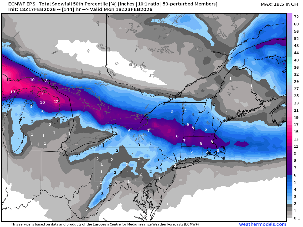
There is “spread” in the ensemble outcome for the Mid-Atlantic — with the 75% minus 25% range showing 4” across the region, but since this skews right (to higher extremes), we should look at the 6” probability.
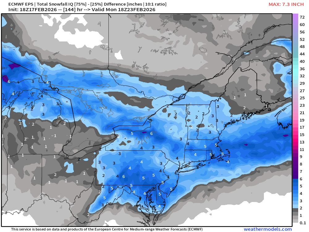
And, we have 1 in 5 chance of seeing at least 6” of snowfall along the I-95 corridor from DC/Philly/NYC … until we get into the “Clipper” moisture stream, with Boston having a high chance > 75%.
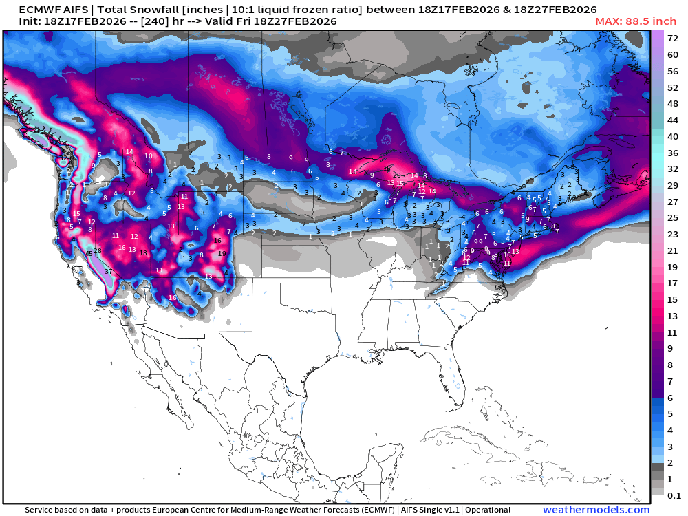
Updated AIFS 18z has significant snowfall along the immediate coast but has trended out to sea with the low pressure center matching more so the IFS (Full physics)
Similarly, GFS 18z is a tad bit further east with strong low pressure (bomb cyclone category) … based upon this afternoon/evening guidance, I’d say this is trending to being a non-event or minimal impacts. We just went through this for Presidents’ Day blizzard that never happened. We’ll keep trying!
Odds decreased for major Nor’easter with potential for blockbuster snowfall: 1 in 5
CONUS Radar Simulation through early morning Wednesday (12 PM ET)
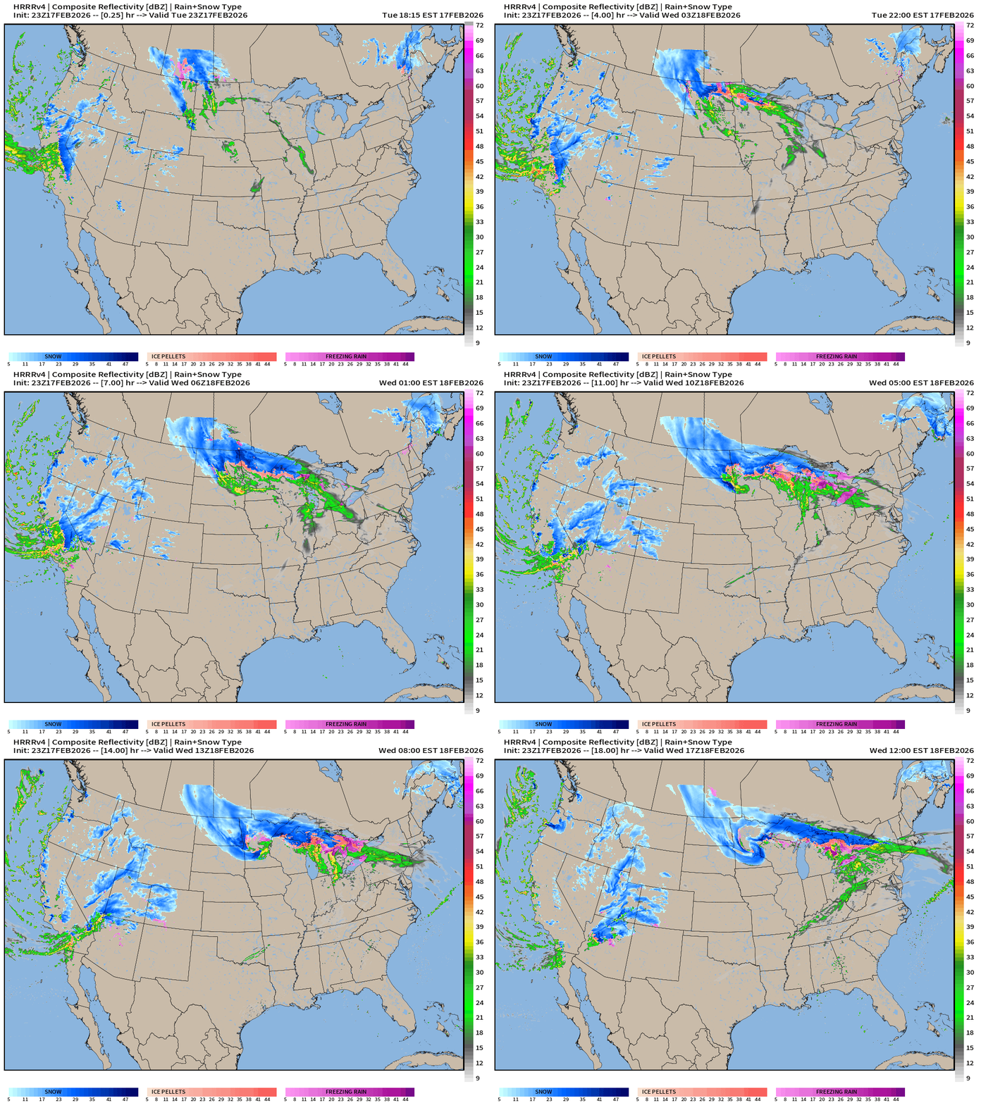
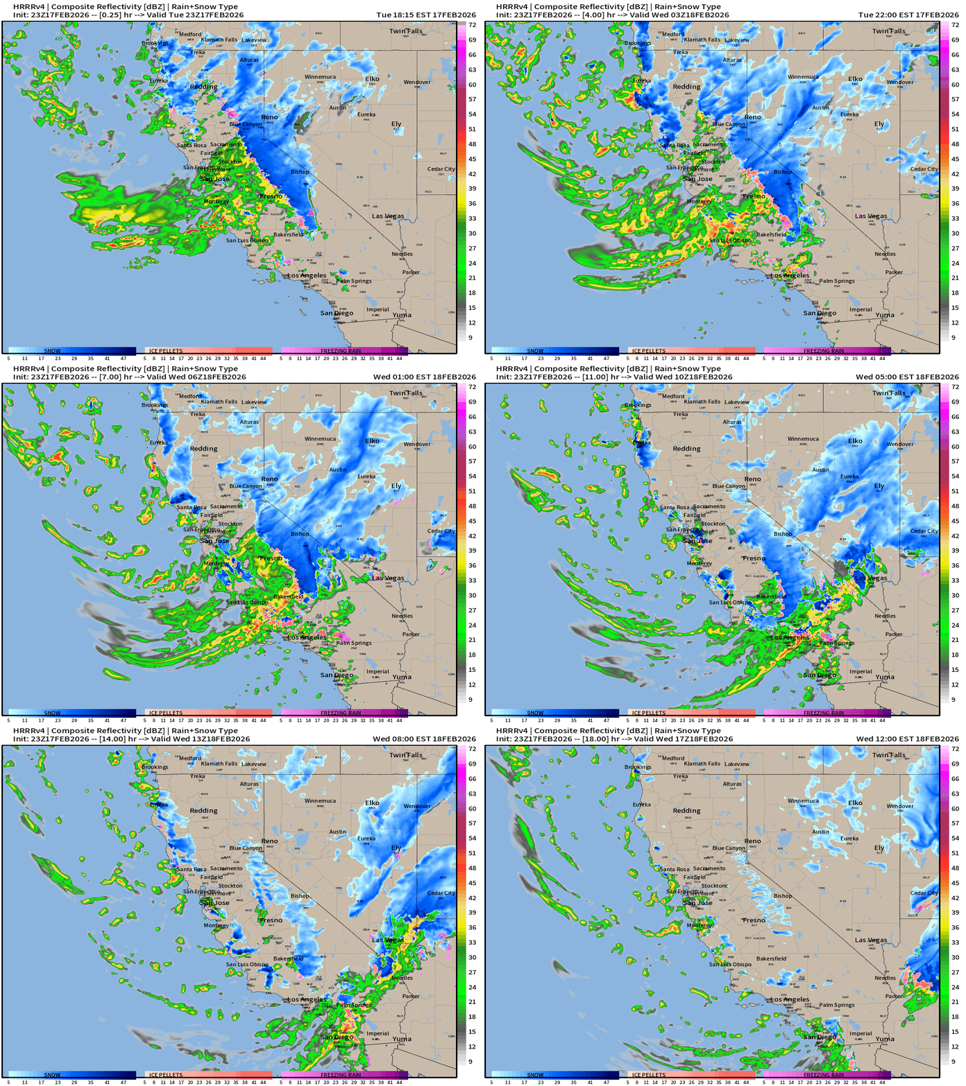
Western U.S. is hammered with rain and snow — another storm system on Wednesday into Thursday
That warmer Pacific moisture heads east and northward into the Midwest and Great Lakes — setting up along a frontal boundary and developing a Clipper system or low pressure that keeps winter going for the Northern Tier
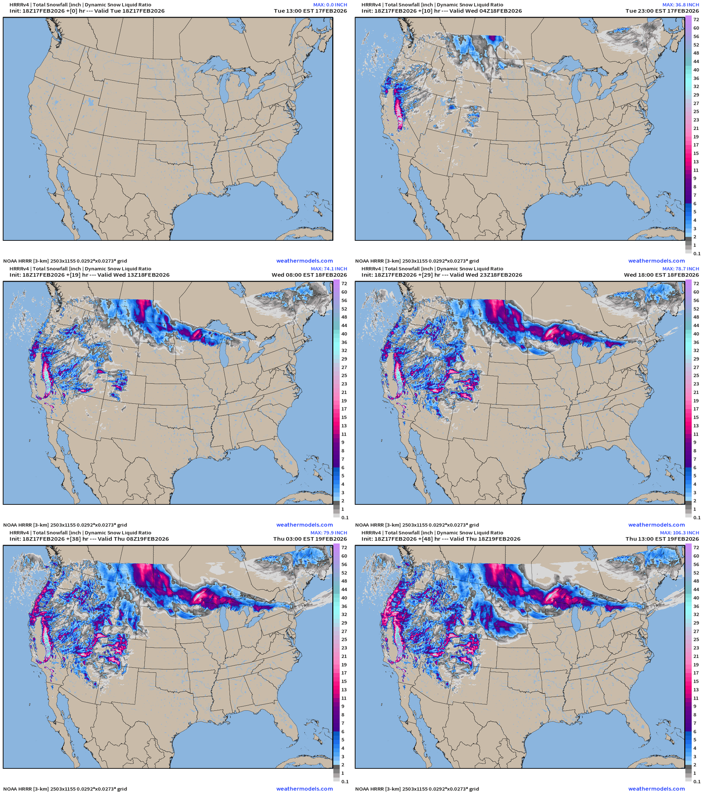
Snowfall Next 48-hours into Thursday 1 PM ET
RTMA | Temperature Analysis | 8:15 PM ET
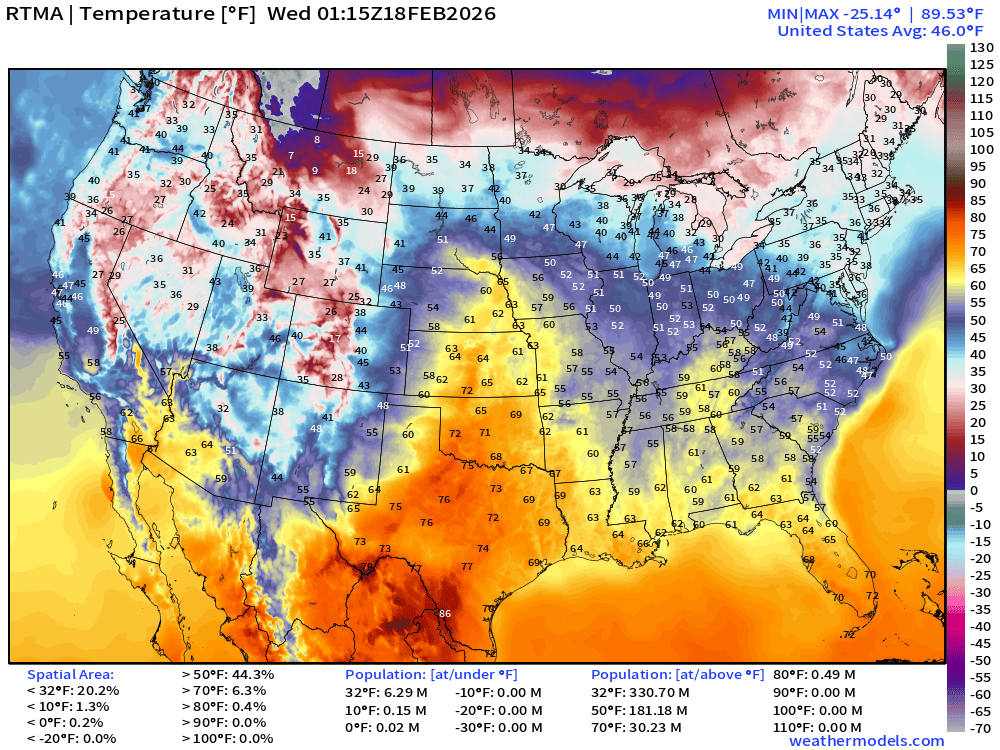
Avg Lower 48 temperature was 46.0°F
Temperature Anomaly | 8:15 PM ET
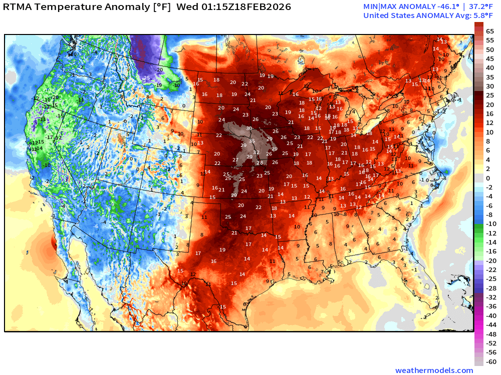
Lower 48 Temperature Anomaly above normal by 5.8°F
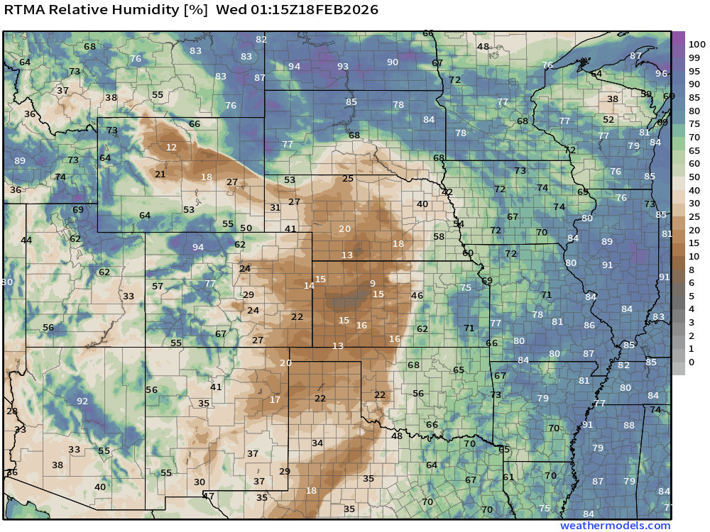
Very low humidity = ongoing fires in Plains —> extreme fire danger with winds
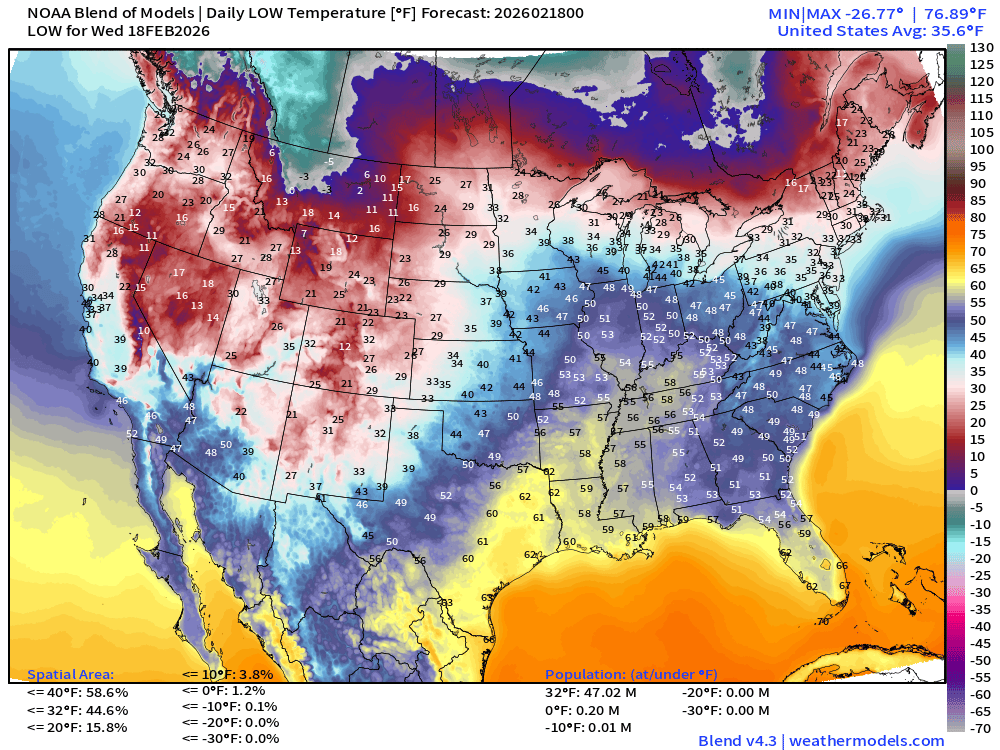
Low Temperatures on Wednesday
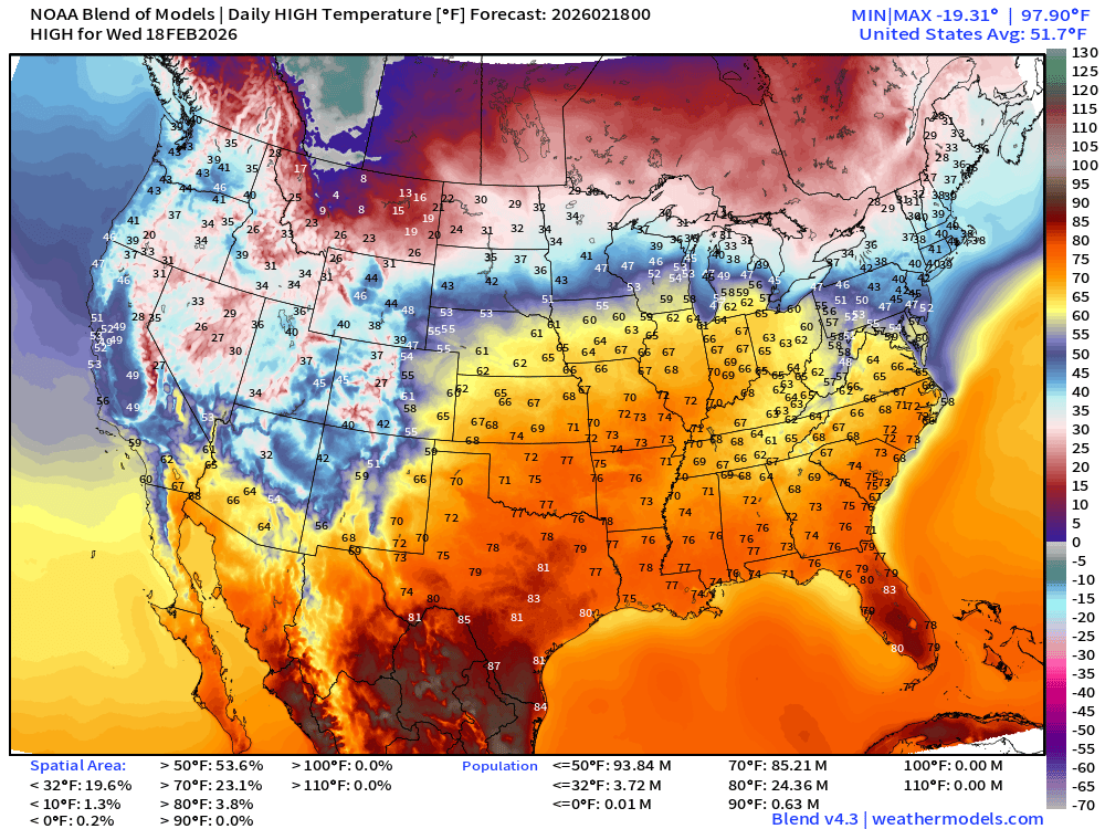
High Temperatures on Wednesday
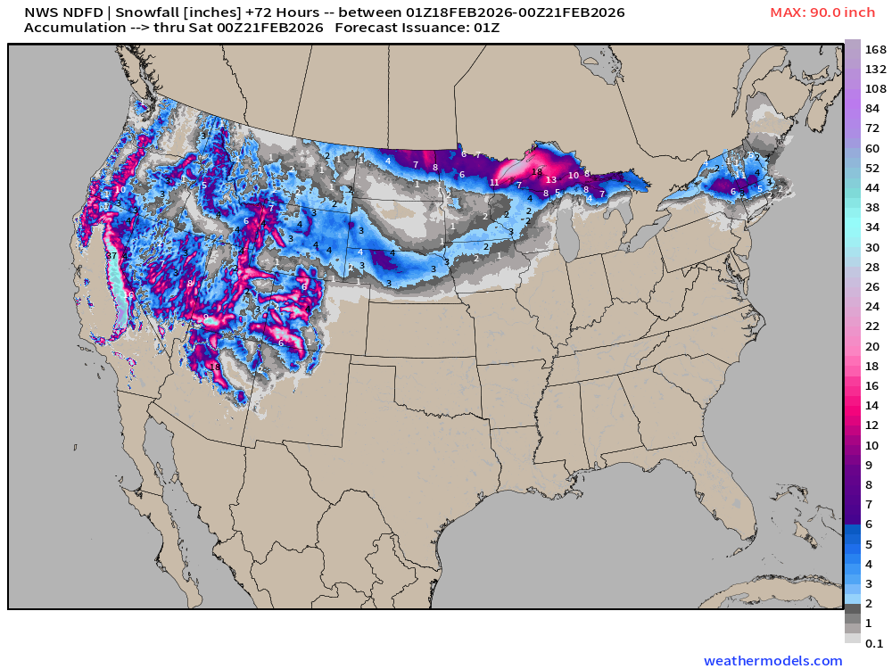
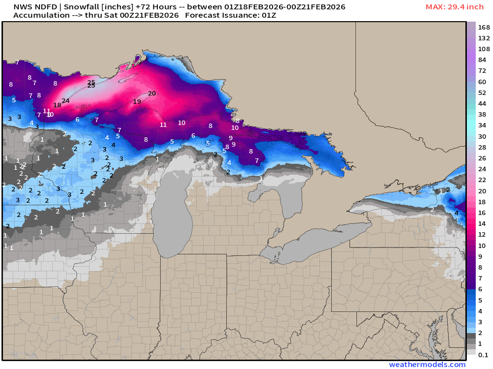
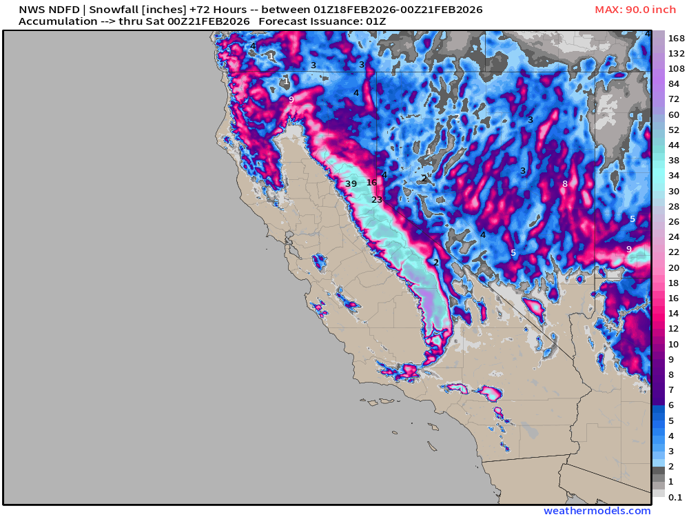
NWS NDFD Snowfall next 3-days
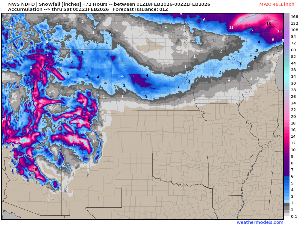
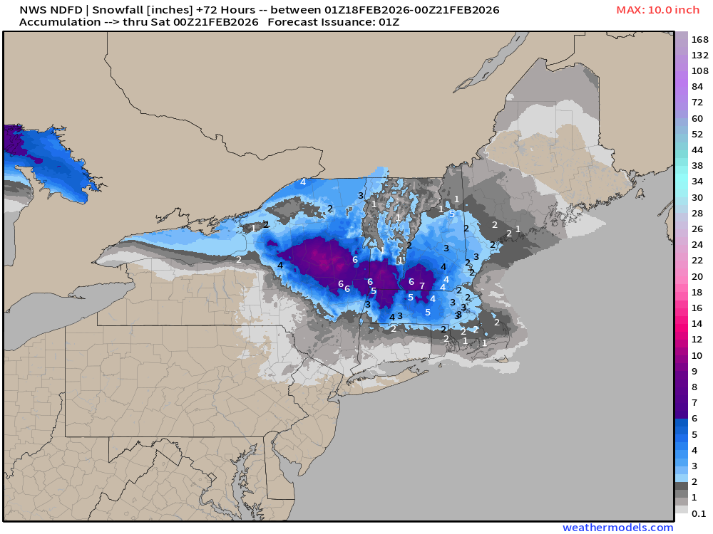
Clipper systems / boundary of moisture into New England —> 3” for Boston
Arrowhead of Minnesota over 2-feet of snowfall
Still another 7-8 feet of snowfall expected in the Sierra during next 3-days, and it’s not stopping anytime soon.
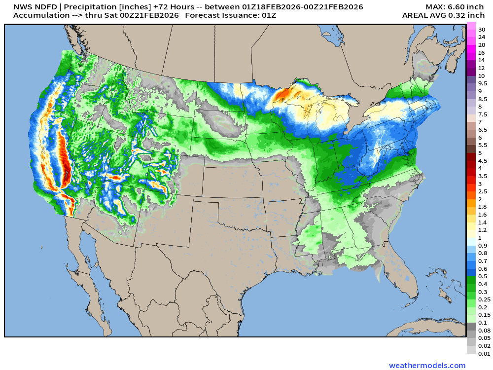
NWS NDFD Precipitation (QPF) next 3-days through Friday Evening
ECMWF 18z Precipitation Type + Intensity | Next 6-days
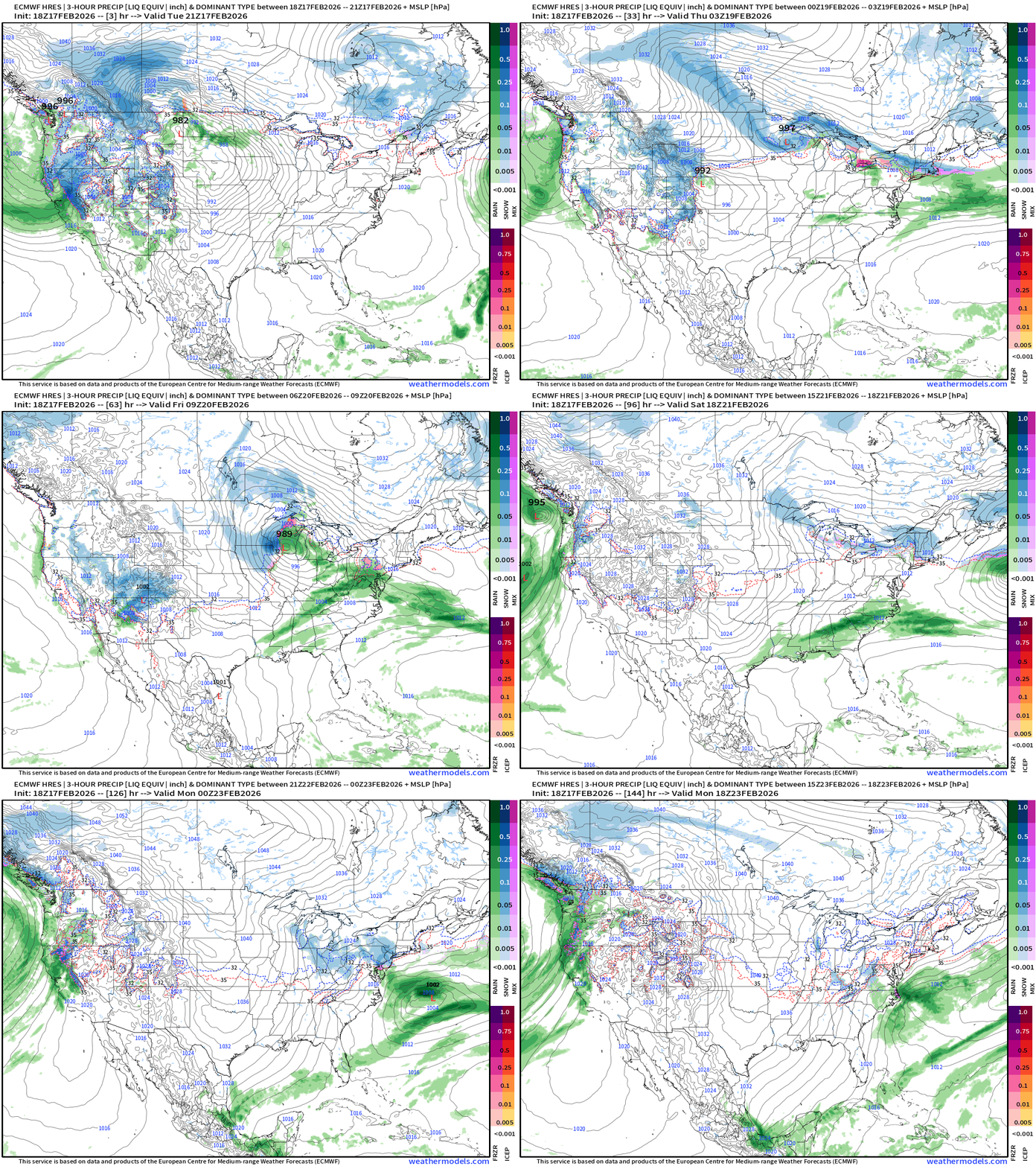
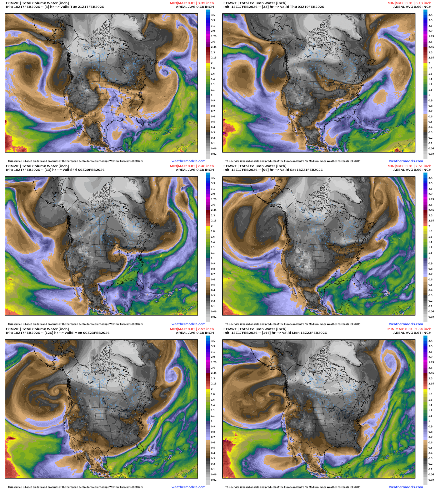
Moisture from the Pacific storm systems surge northward with the jet stream into Southern Canada — and fuels a “northern tier” boundary with Clipper Systems —> accumulating snow from the Dakotas into Great Lakes and Northeast.
Eastern U.S. Next 6-days storm systems | ECMWF 06z
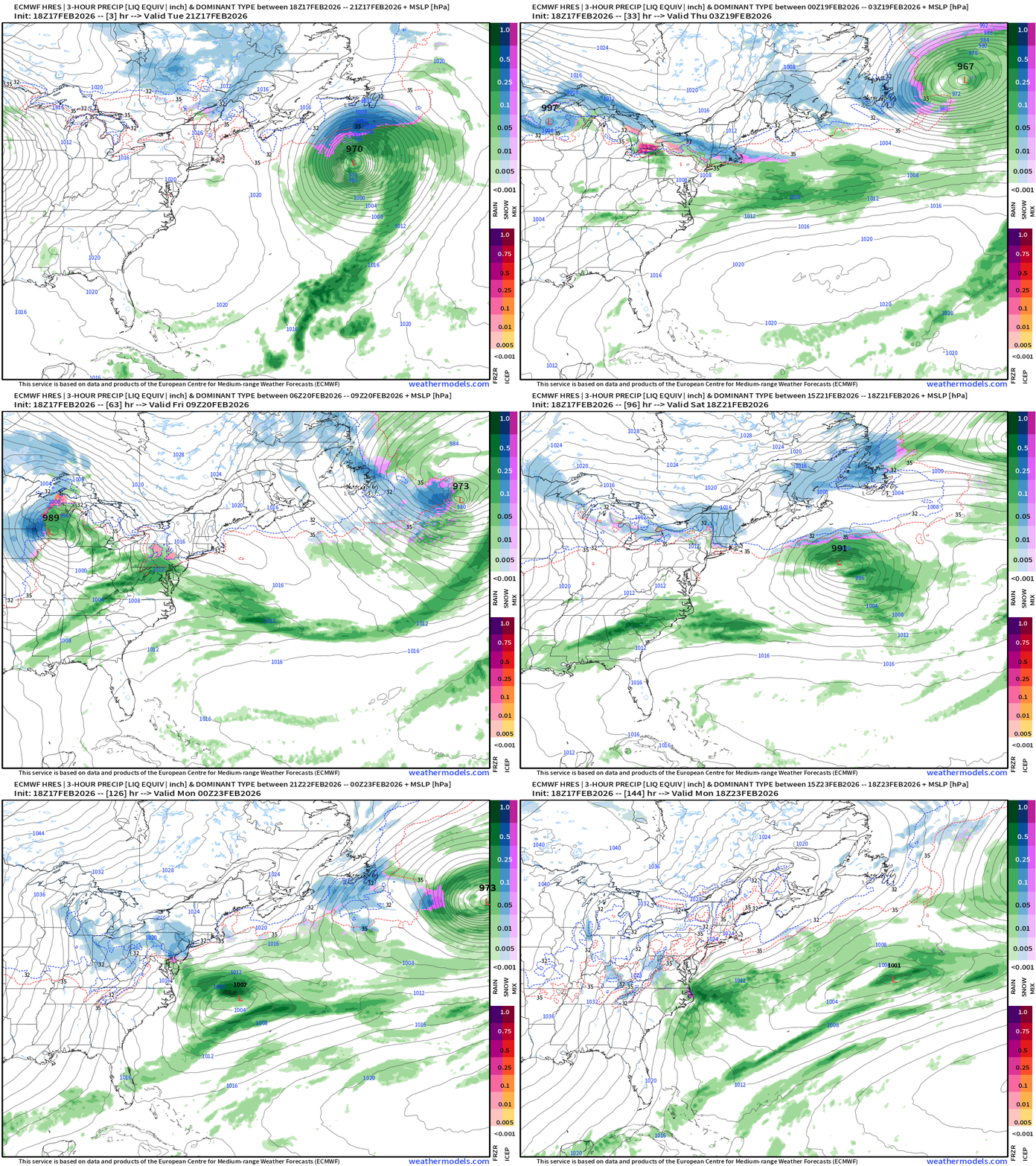
Nor’easter Watch Sunday-Monday — but not looking good
Western U.S. —> Multiple Storms Pinwheeling Moisture
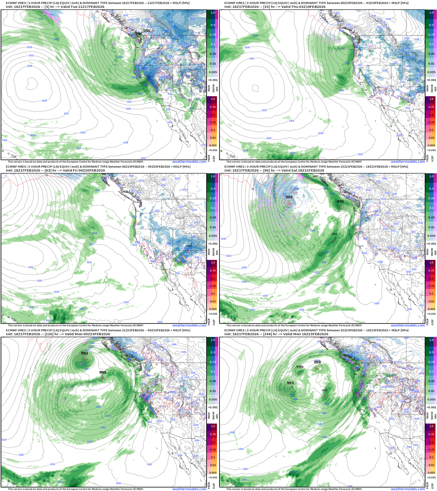
Sequence of storms until a break on Friday and Saturday before another HUGE circulation drops out of the Gulf of Alaska and spins more moisture onshore
Blend of Models | 7 Days Precipitation Total
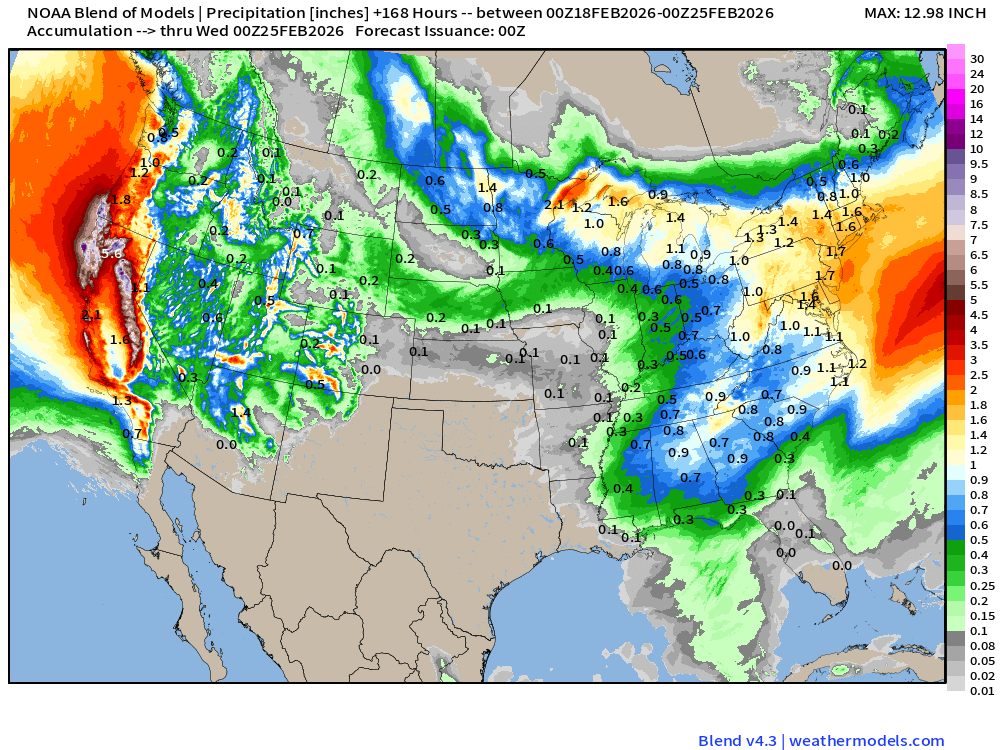
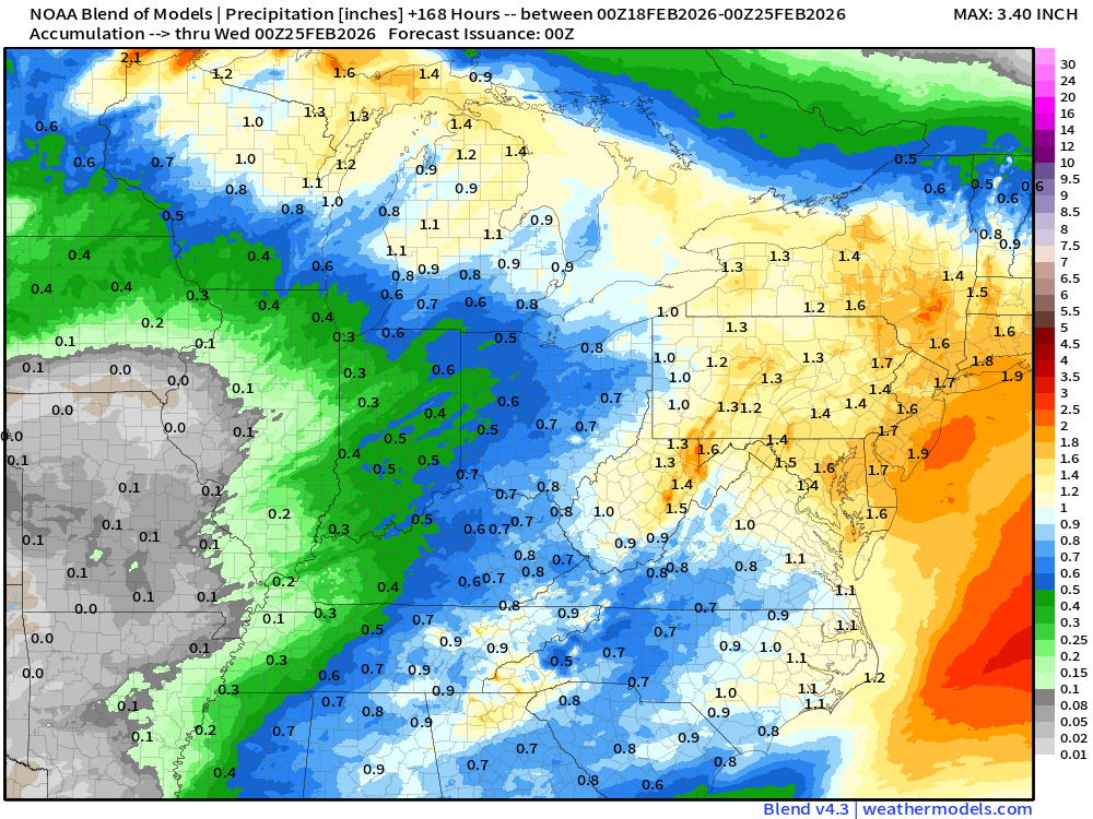
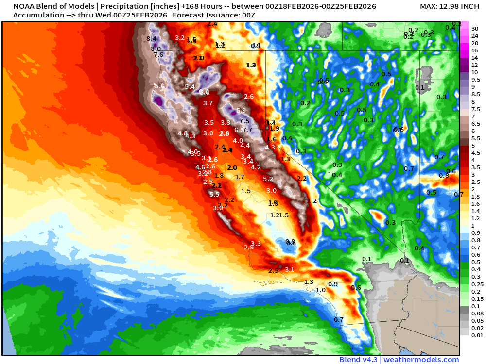
Holy moly — huge precipitation totals for California — rain at coast + mountain snow
Blend of Models | Total Snowfall Next 7-Days
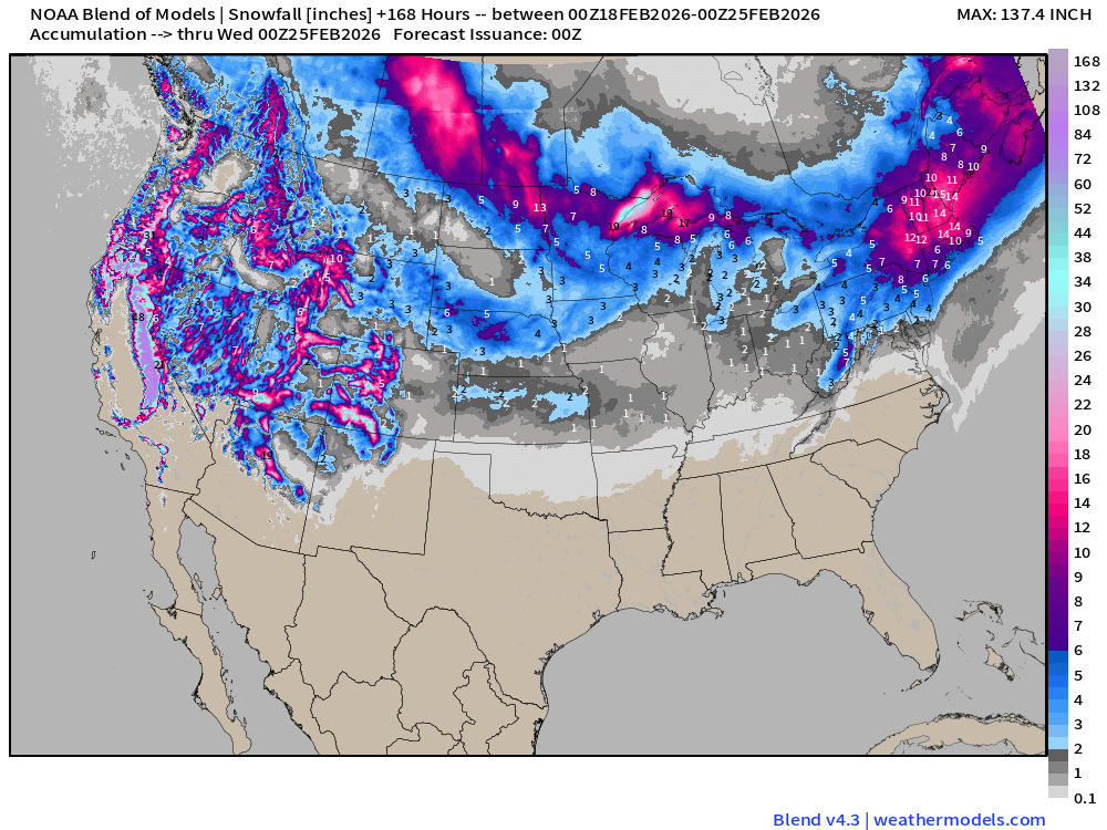
The Blend of Models is an ensemble mean of multiple different models and ensembles, so this New England snow signal seems exceptional — but with multiple Clipper systems and plenty of moisture, may be a good average estimate!
Snowfall in the Sierra, Cascades, and Rockies will be measured in feet / yards.
Flagship ECMWF 12z EPS | Temperature Anomaly | Next 15-days
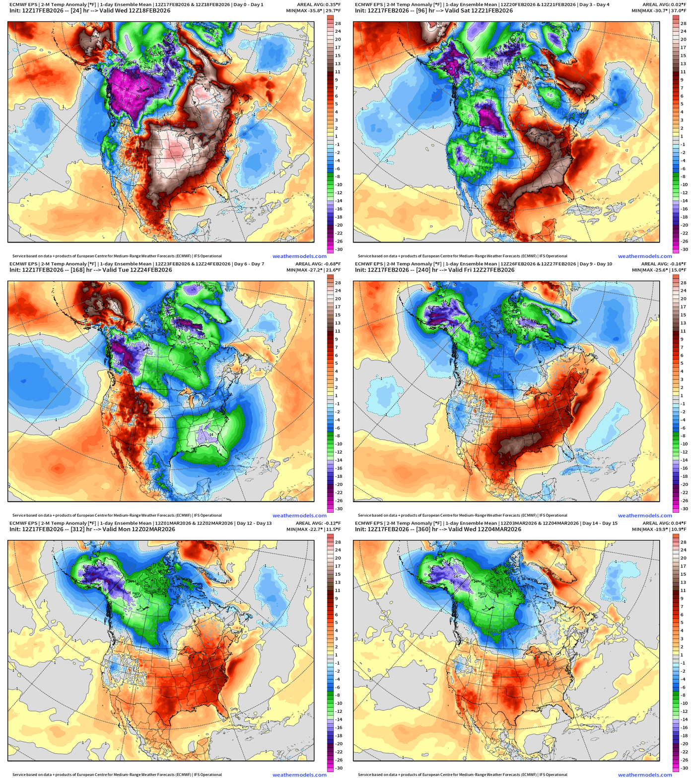
A major surge of Arctic air returns for the Eastern U.S early next week — followed by another significant warm up — in the ensemble mean.
ECMWF IFS 18z | Precipitable Water Next 6-days
10-day Snowfall (Long Range) ECMWF AIFS 18z Cycle
ECMWF AIFS-Single 18z | Temperature (500 hPa) Next 10-days
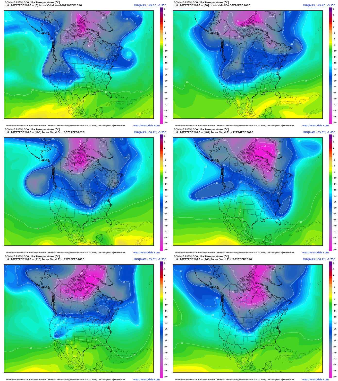
The temperature at 500 mb is the easiest way to highlight the “polar vortex” across North America with the coldest pool at -50°C (pink) with the -25°C contour usually associated with below freezing temperatures at 2-meters (surface).
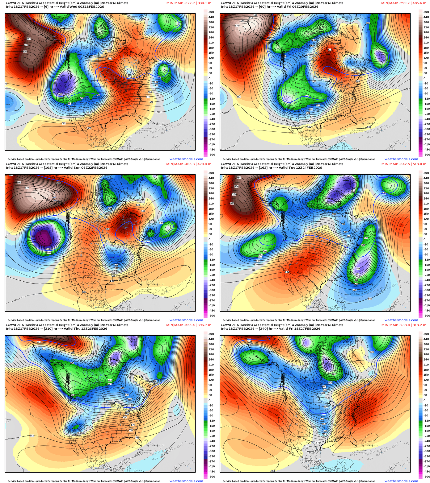
Heading into the final week of February —> the main Polar Vortex cold pool reservoir remains largely locked up over Canada north of the Arctic Circle, but seeing multiple lobes descending in the Northwest and Northeast with surface low pressure systems.
Temperature Anomaly | Next 15-days | ECMWF EPS 12z
5-Day Chunk #1 | Temperature Anomaly | Feb 17 - Feb 21
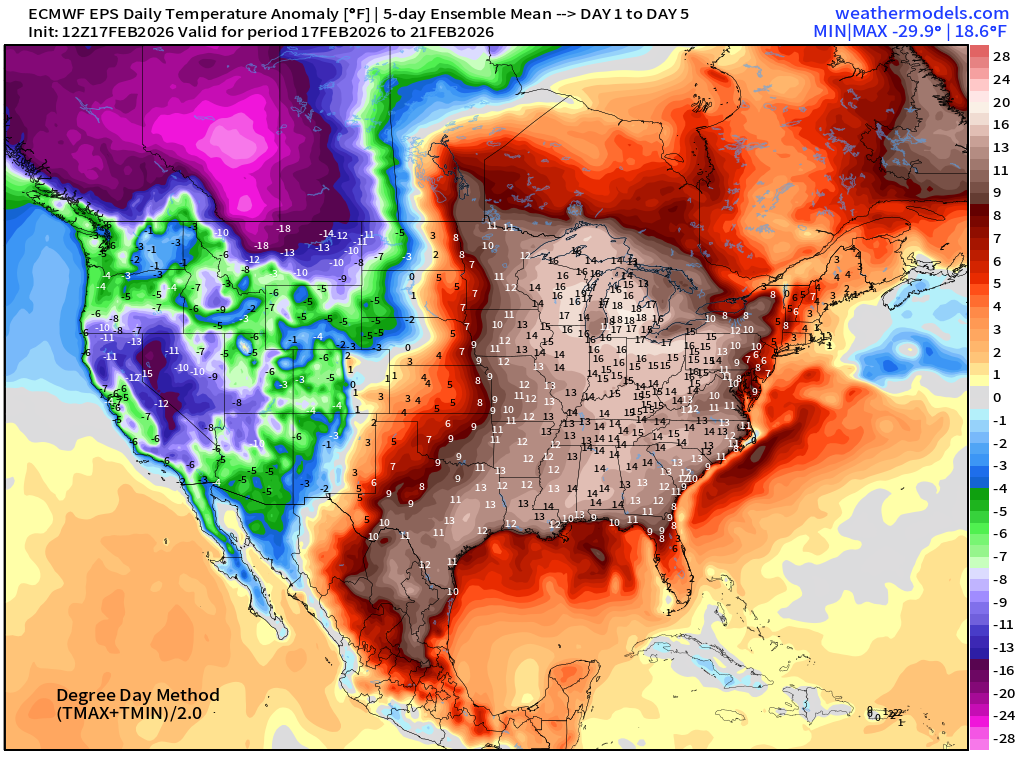
Well above normal for entire eastern U.S. but Rockies and western Canada very cold
5-Day Chunk #2 | Temperature Anomaly | Feb 22 - Feb 26
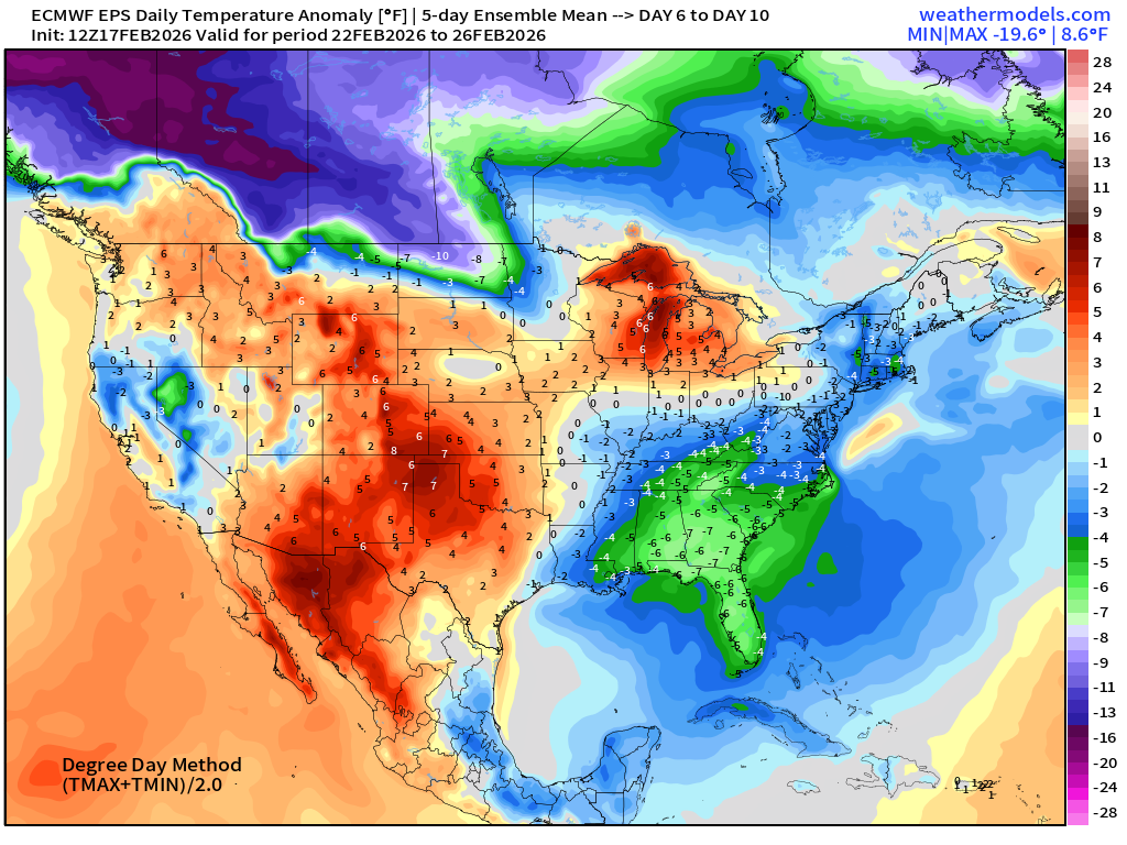
Colder than normal just came into the Day 6-10 chunk with -7°F centered on Tallahassee.
5-Day Chunk #3 | Temperature Anomaly | Feb 27 - March 3
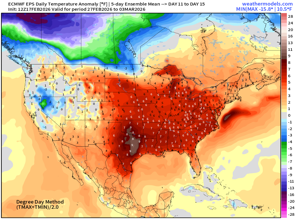
But, warmth returns for the beginning of March.
Maps sourced from weathermodels.com designed and innovated by yours truly! Please subscribe there for real-time access to the newest maps, charts from all of the weather models including ECMWF and AIFS, and NOAA GFS/GEFS.
- Milepost
- 873 · laid 2026-02-18T02:22:42.152000Z
- Source
- https://weather.substack.com/p/february-17-2026-tuesday-evening
- Digest
- caf6a3be7ed547c7181766e3899fa2947d79987a8c20300198897ced88c7edc8
- Machine
- JSON