February 16, 2026 Monday Morning Weather
Stormy western U.S. for the upcoming week while Clipper systems cross the northern tier
February 2026 was the 4th-warmest February in the 132-year national record (1895–2026), at 40.3°F against a 1991–2020 normal of 35.6°F (+4.6°F).
February 2026 was the 5th-driest February in the 132-year national record (1895–2026), at 1.4in against a 1991–2020 normal of 2.1in (-0.7in).
NOAA/NCEI Climate at a Glance, contiguous United States. This is the observed record for the month, not a score of anything said in this piece — the forecast ledger begins 2026-08-17 and cannot reach earlier posts.

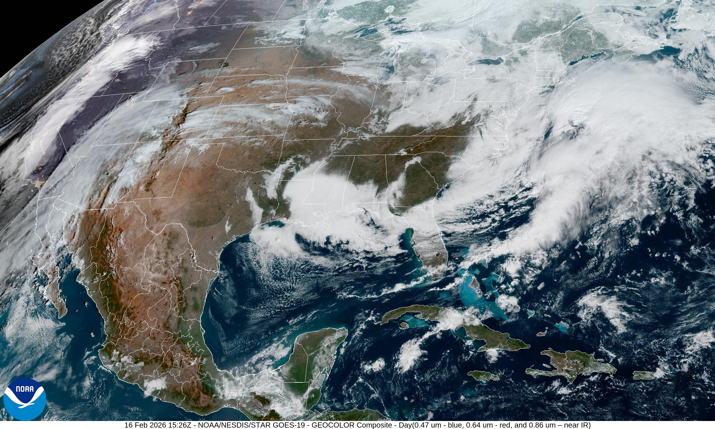
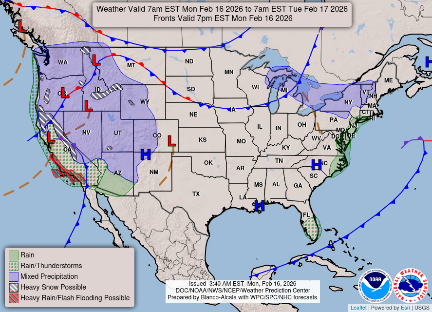
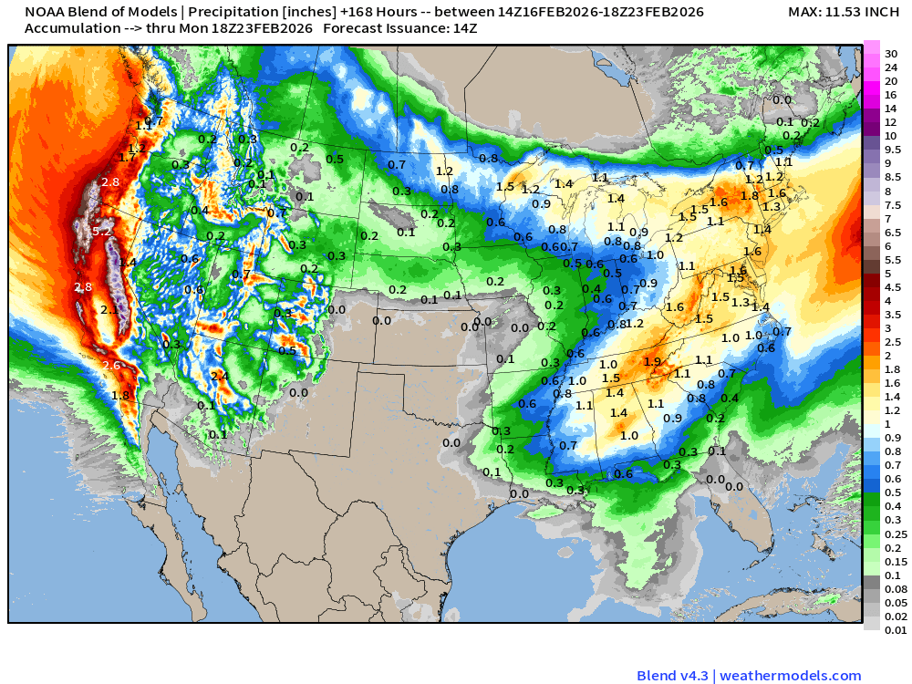
Major storm system crashing into California today with heavy coastal rain and mountain snows. The main moisture flow is out of the Southwest, but the upper-level pattern will shift colder out of the Gulf of Alaska in the coming days = more unsettled, more snowfall … extending inland across the Great Basin and Rockies. Everyone happy here to resume winter in earnest — make up for lost ground from the past several weeks of extraordinary warmth.
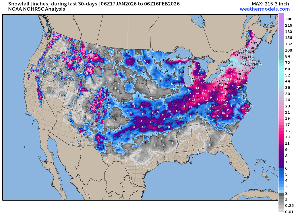
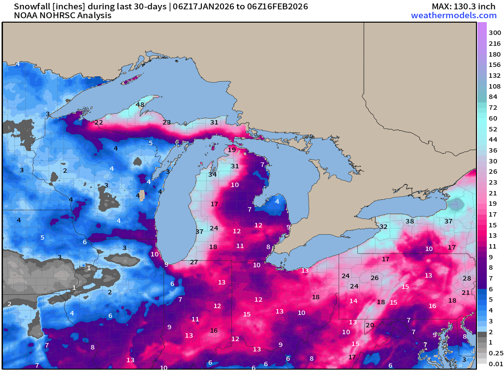
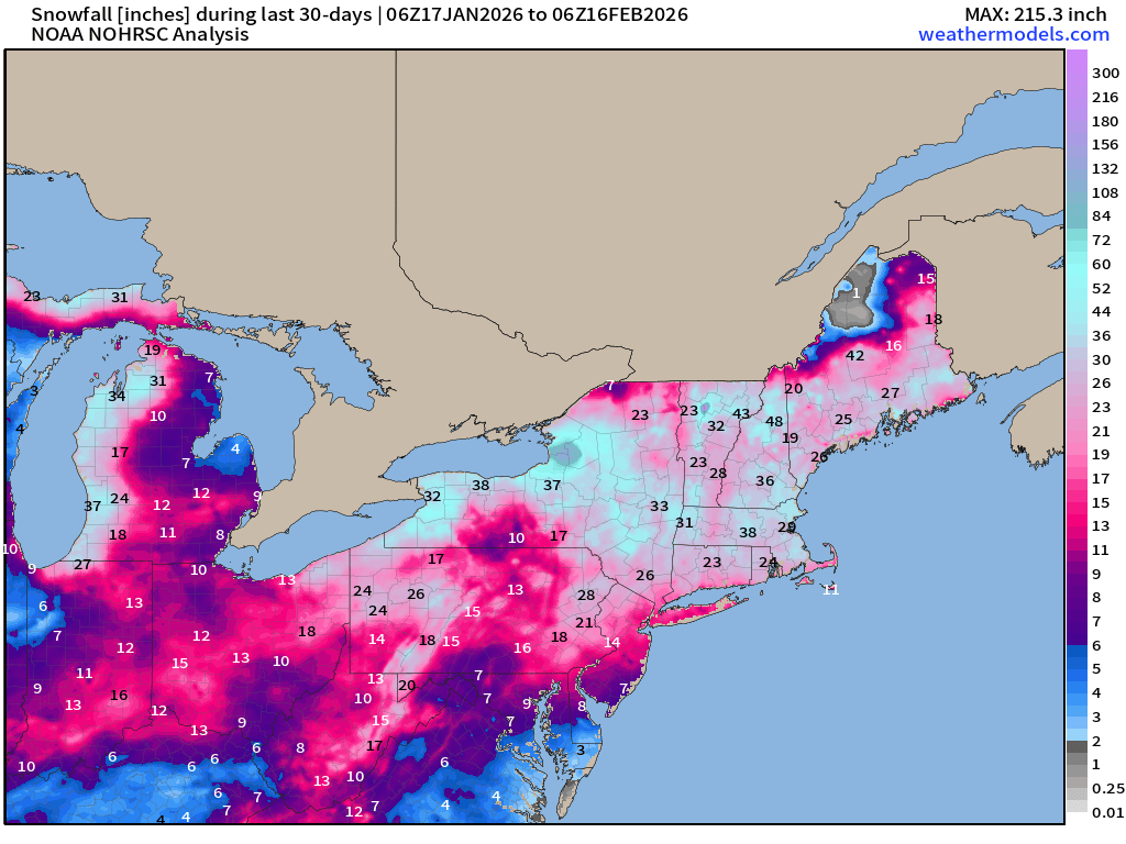
Over the past 30-days, New England and the Great Lakes have been the snowfall champions.
CONUS Radar Simulation through early morning Tuesday (3 AM ET)
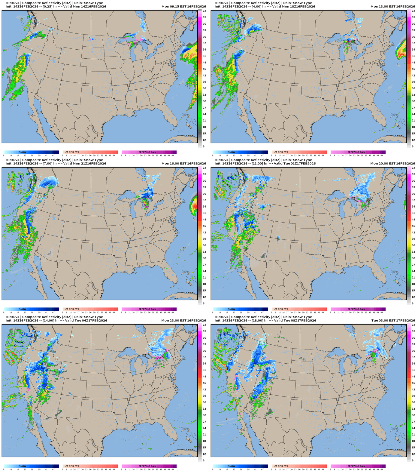
The entire Western U.S. will see rain/snow from two storms systems converging on the coast. A weak clipper system heading through Ontario into New England will have some light accumulations.
RTMA | Temperature Analysis | 10:00 AM ET
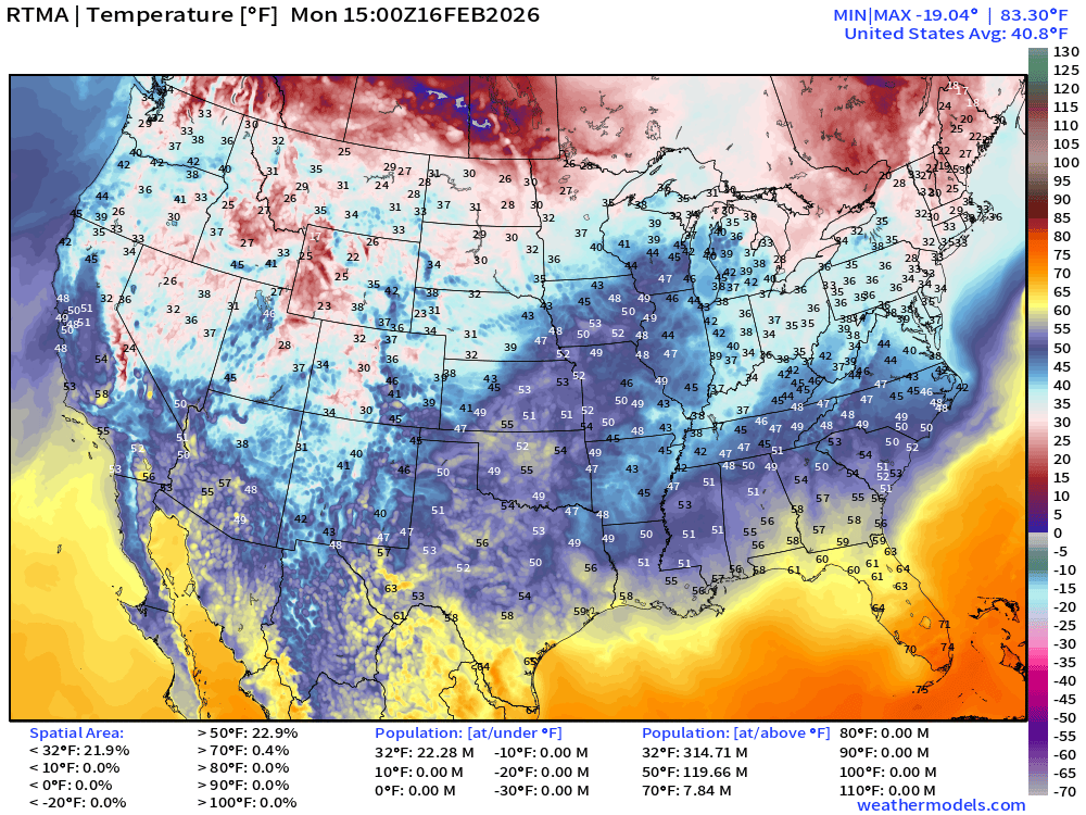
Avg Lower 48 temperature was 40.8°F — with only 22 million below freezing
Temperature Anomaly | 10:00 AM ET
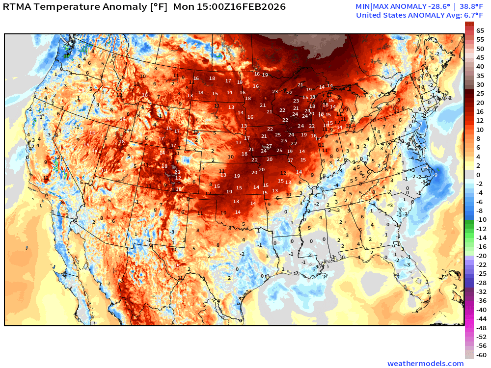
Lower 48 Temperature Anomaly above normal by 6.7°F
High Temperatures on Monday
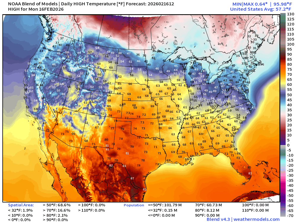
Quite mild east of the Rockies especially in the Plains — well into the 60s and 70s. Above freezing in the Northeast just enough to melt snow even with the mid-February sun angle.
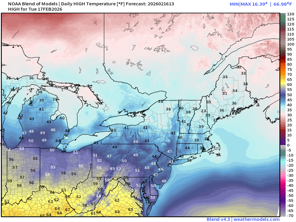
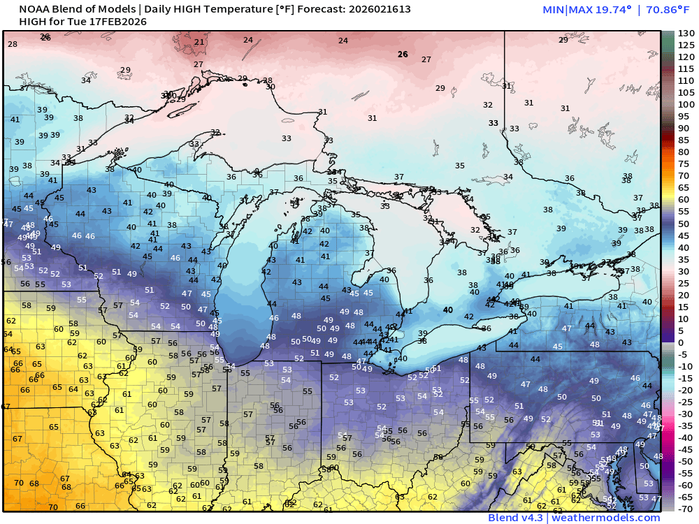
High Temperature Anomaly on Monday
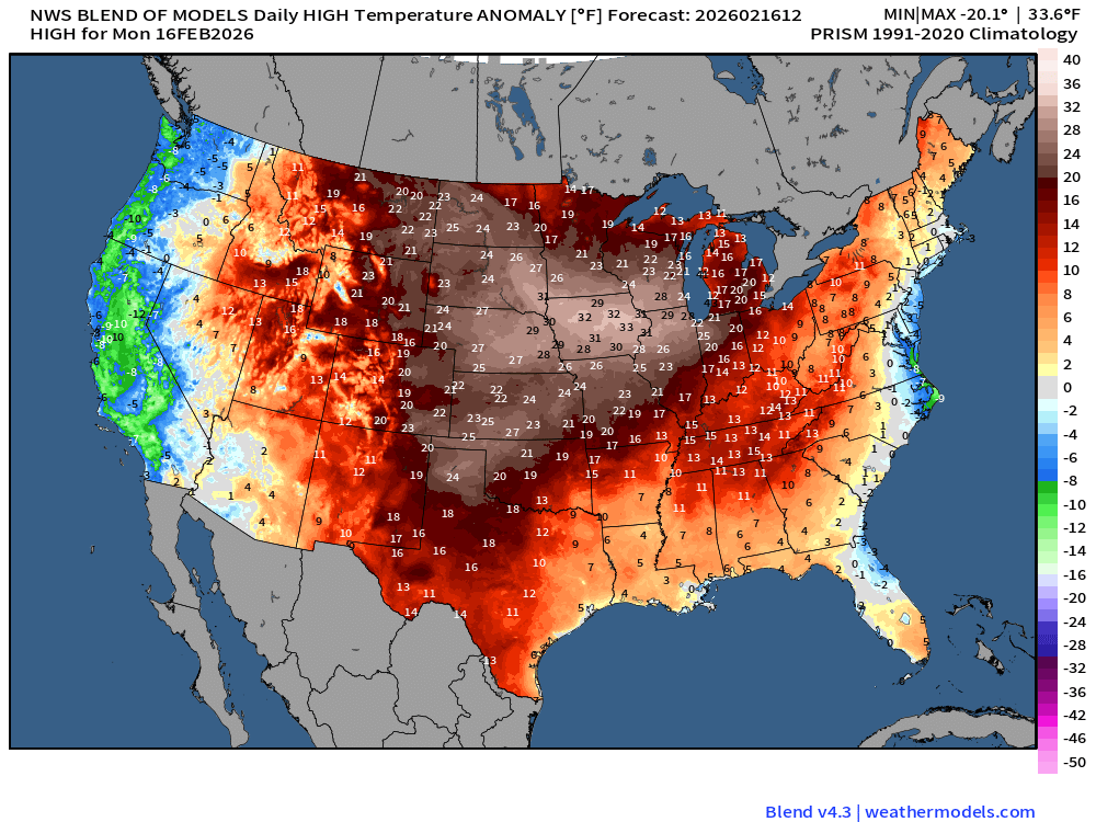
Temperatures in the mid-60s in Iowa are > 30°F above normal. Only below normal slice of the Lower 48 is along the immediate west coast
NWS NDFD Snowfall next 3-days
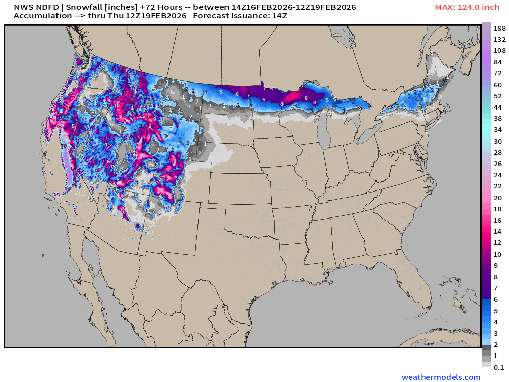
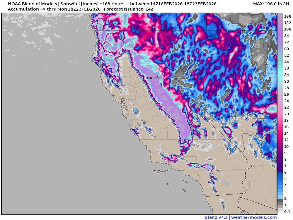
More than 10-feet of snowfall expected in the Sierra during next 3-days, but it’s not stopping anytime soon.
NWS NDFD Precipitation (QPF) next 3-days through Thursday Morning
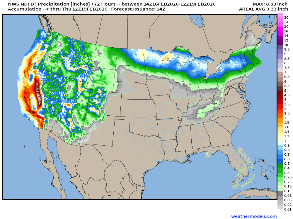
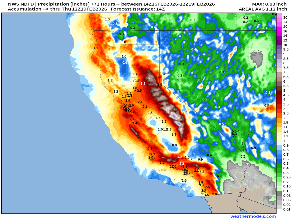
Storm System: Radar Simulation next 18-hours — through Tuesday 3 AM ET
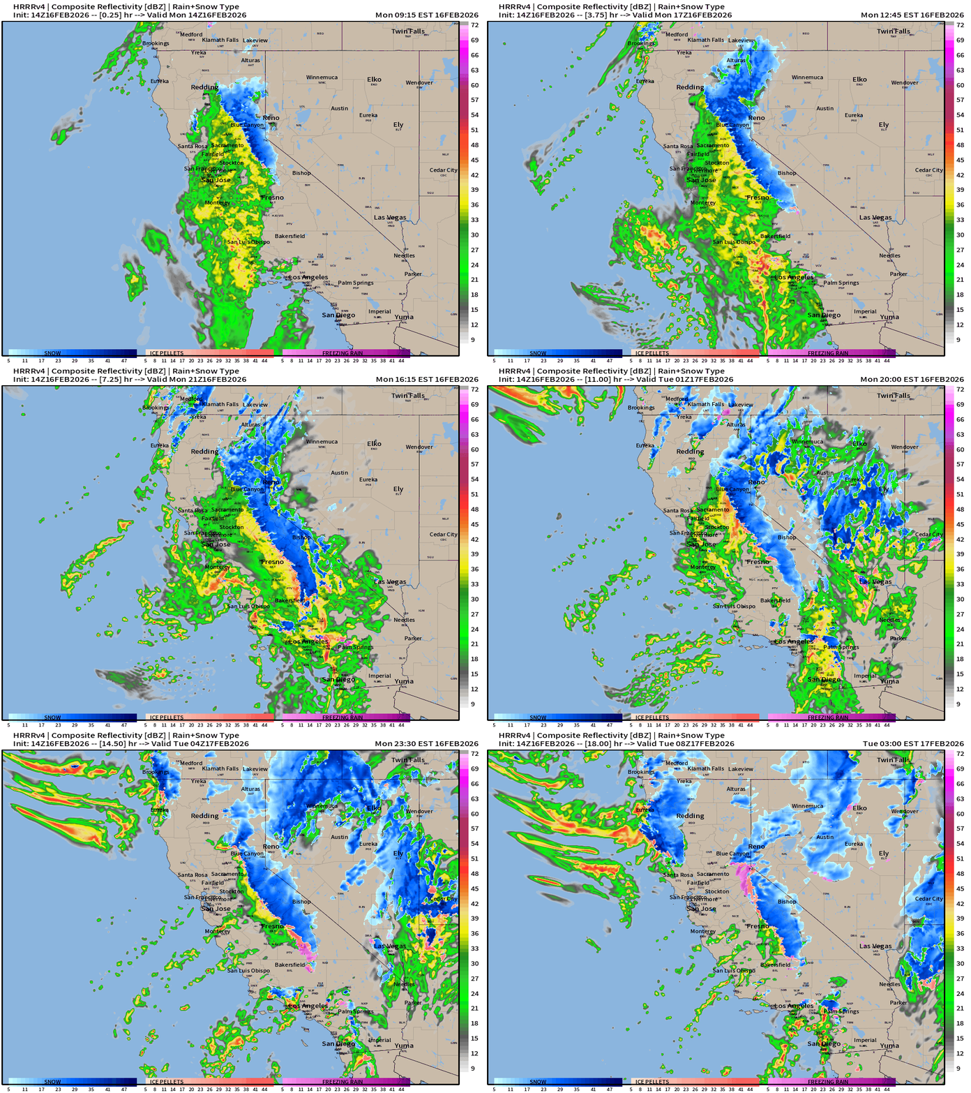
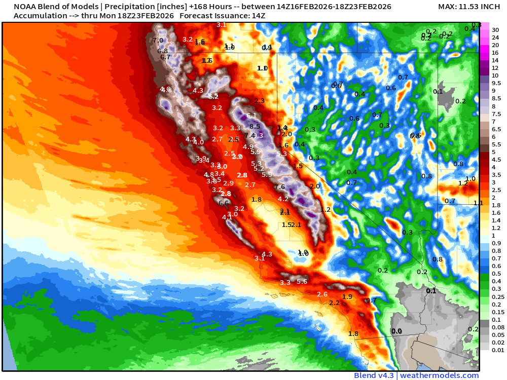
Massive influx of moisture across the Western U.S. as a trough digs along the coast —> atmospheric rivers of moisture head inland = heavy California rain and snow (mountains)
High Temperatures Next 8-days —> Mid-February thaw continues
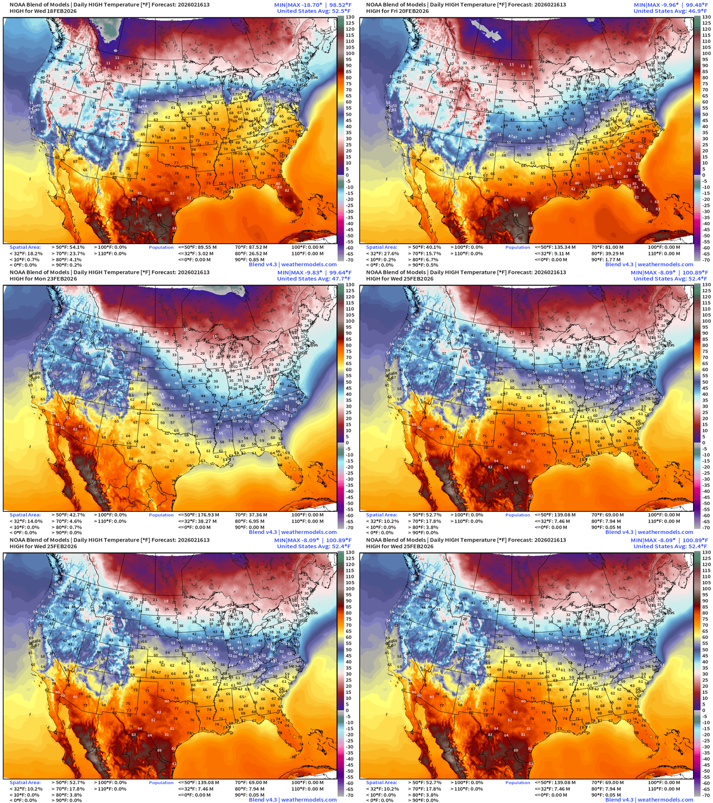
Arctic air is mostly at bay, but it’s still not spring in the Midwest, Great Lakes, and Northeast as high temperatures revert back to the 20s and 30s by next weekend.
ECMWF 06z Precipitation Type + Intensity | Next 6-days
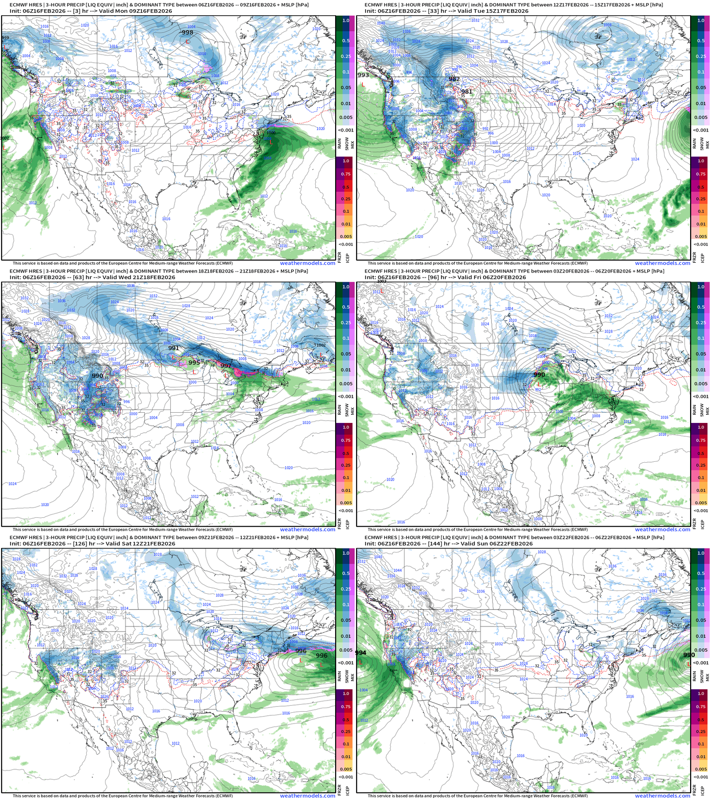
Moisture from the Pacific storm system surges northward with the jet stream into Southern Canada — and fuels a “northern tier” boundary with Clipper Systems —> accumulating snow from the Dakotas into Great Lakes and Northeast from Tues-Thursday. High uncertainty about potential Nor’easter early next week.
Eastern U.S. Next 6-days storm systems | ECMWF 06z
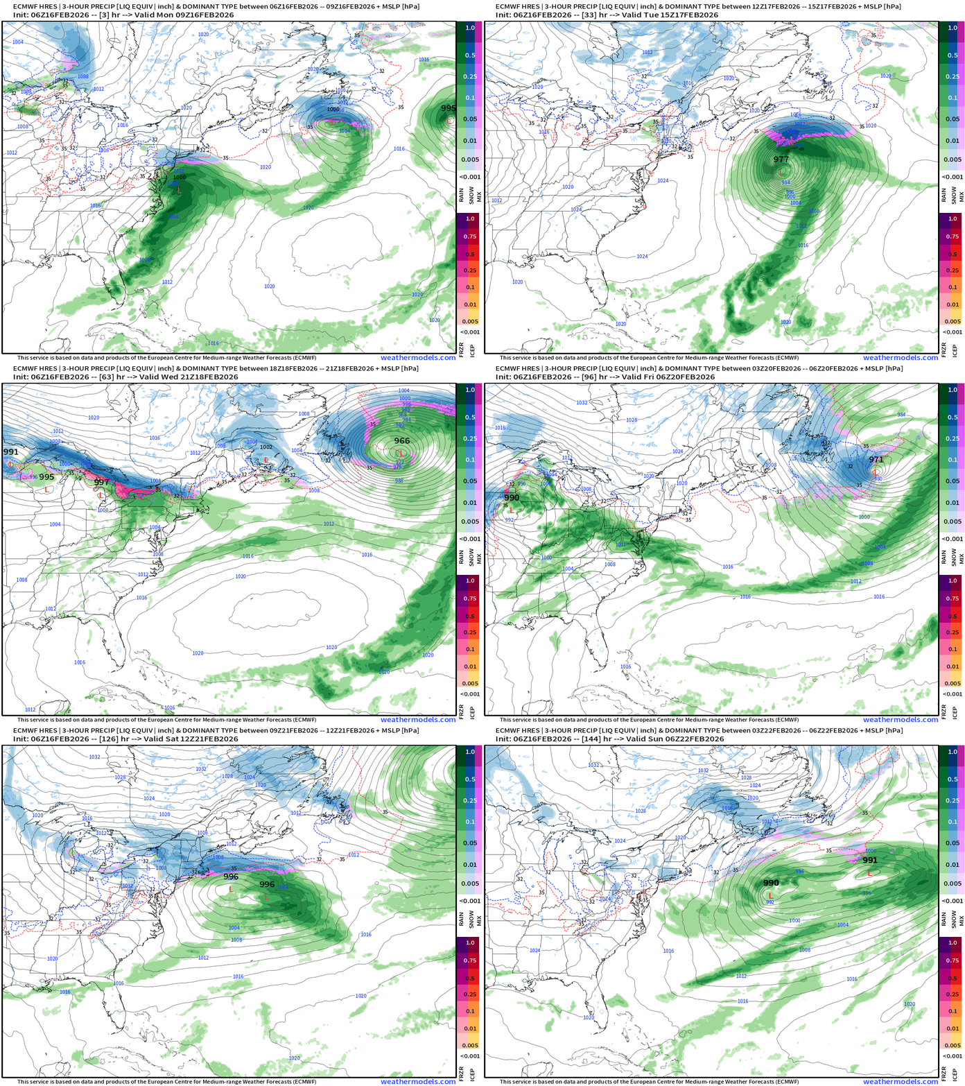
Next significant precipitation for Northeast: Clipper system Thursday, then another surge of moisture out of the south this weekend
Western U.S. Pattern Change —> Winter Resumes in a Major Way
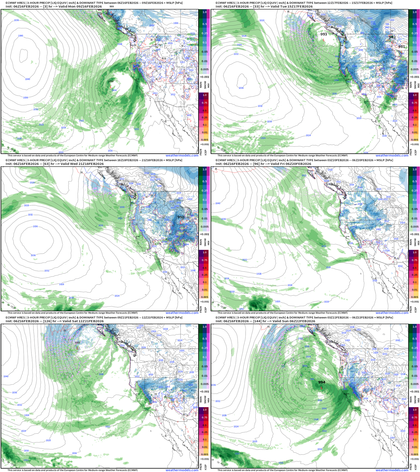
Major Storm System current underway across California but just the first in a sequence within a large trough or gyre that sets up shop offshore in the Pacific.
Blend of Models | 7 Days Precipitation Total
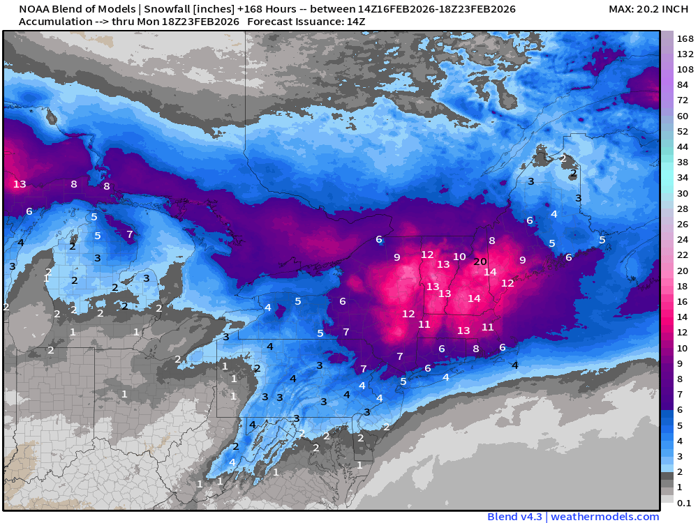
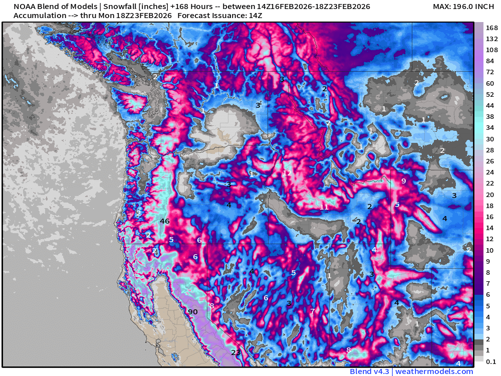
Blend of Models | Total Snowfall Next 7-Days
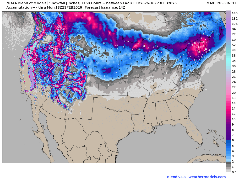
The Blend of Models is an ensemble mean of multiple different models and ensembles, so this New England snow signal seems exceptional — but with multiple Clipper systems and plenty of moisture, may be a good average estimate!
Snowfall in the Sierra, Cascades, and Rockies will be measured in feet / yards.
Flagship ECMWF 00z EPS | Temperature Anomaly | Next 15-days
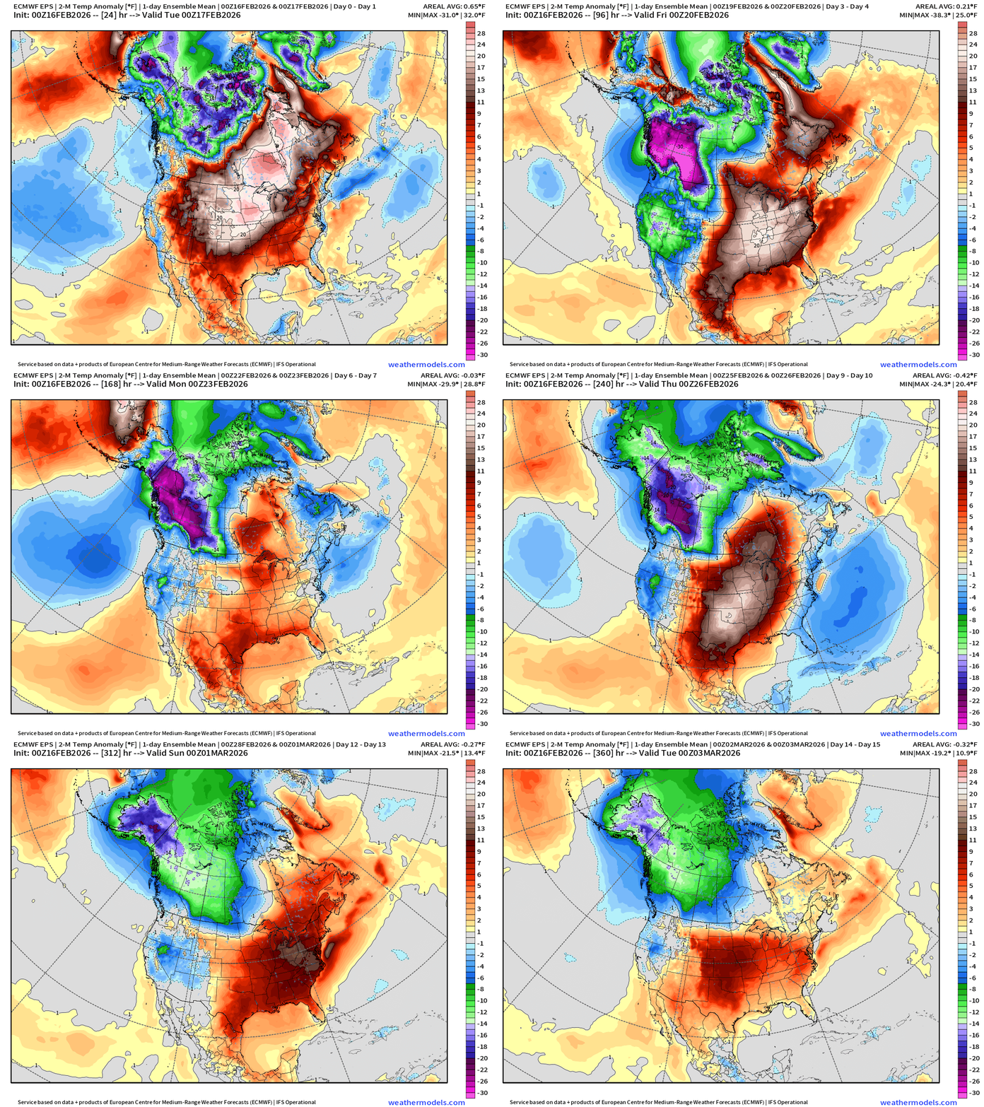
A brief surge of Arctic air returns for the Eastern U.S early next week — so by next weekend we should be talking about an Arctic cold front that may be associated with a Nor’easter. Then, another warm up into early March as we turn the corner toward Spring.
ECMWF IFS 06z | Precipitable Water Next 6-days
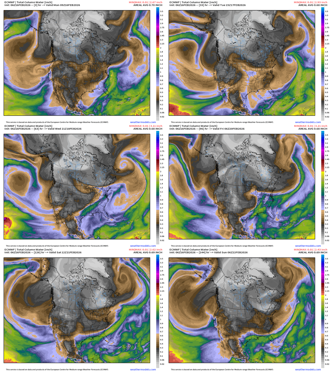
Multiple centers of low pressure swirl off the California coast and direct a sequence of atmospheric rivers inland originating mainly from the Gulf of Alaska. Seeing the Gulf of Mexico more involved in weather systems as we transition into March but the cold/dry air continues to infiltrate the Lower 48 first from the U.S. Northwest — and then from east of the Rockies into next weekend.
We’ve narrowly escaped a couple coastal storms in a row now — we’ll see if our luck holds out early next week.
ECMWF 00z Snowfall | Next 10-days
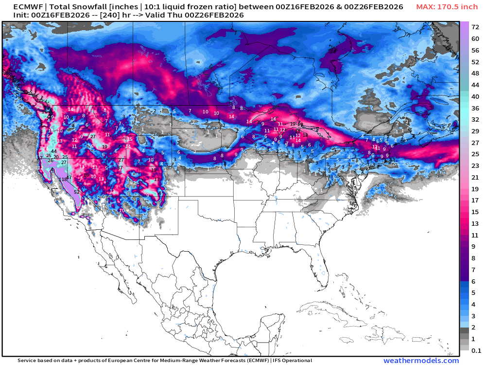
Nor’easter that was in the 12z grid on Sunday — has gone poof! No development, but we’ll see if it comes back this afternoon.
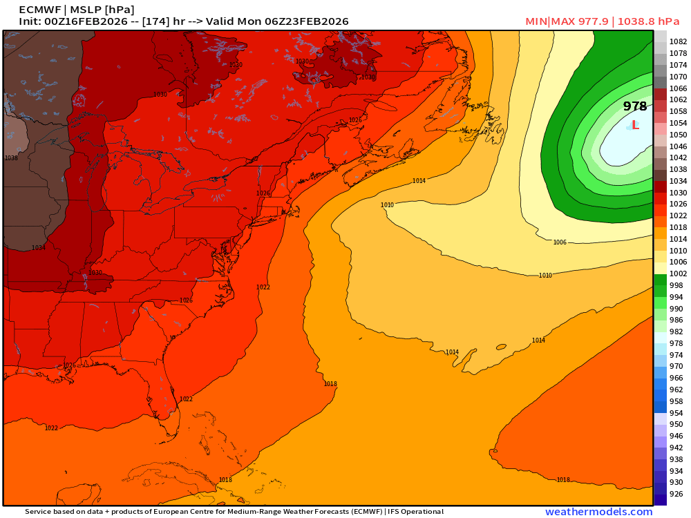
We’ll monitor this “potential” storm, but we’ve narrowly escaped “big ticket” snowfalls (just barely) when medium-to-long range modeling showed major impacts.
10-day Snowfall (Long Range) ECMWF AIFS 06z Cycle
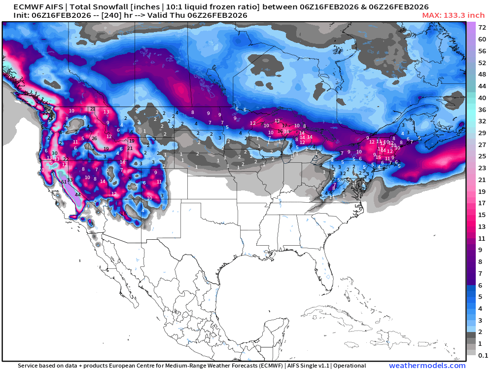
ECMWF AIFS 06z still does develop the storm system — but it’s sufficiently offshore to avoid coastal impacts — at least at this juncture.
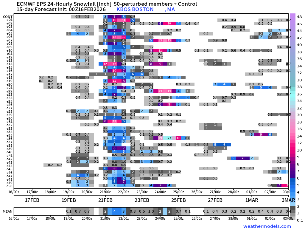
Checking on “big ticket” snowfall in NYC from ensemble members (00z ECMWF EPS)
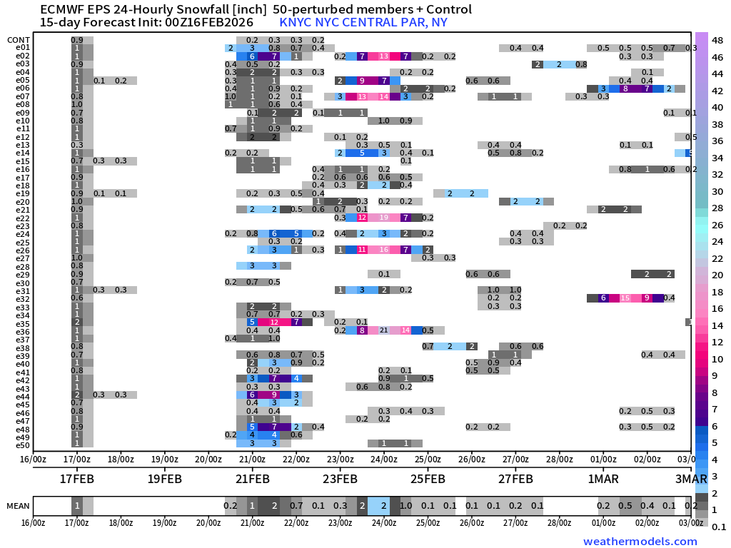
2 main opportunities: Clipper system next Thurs/Fri, and then major Nor’easter following Sun/Mon. Boston:
ECMWF AIFS-Single 06z | Temperature (500 hPa) Next 10-days
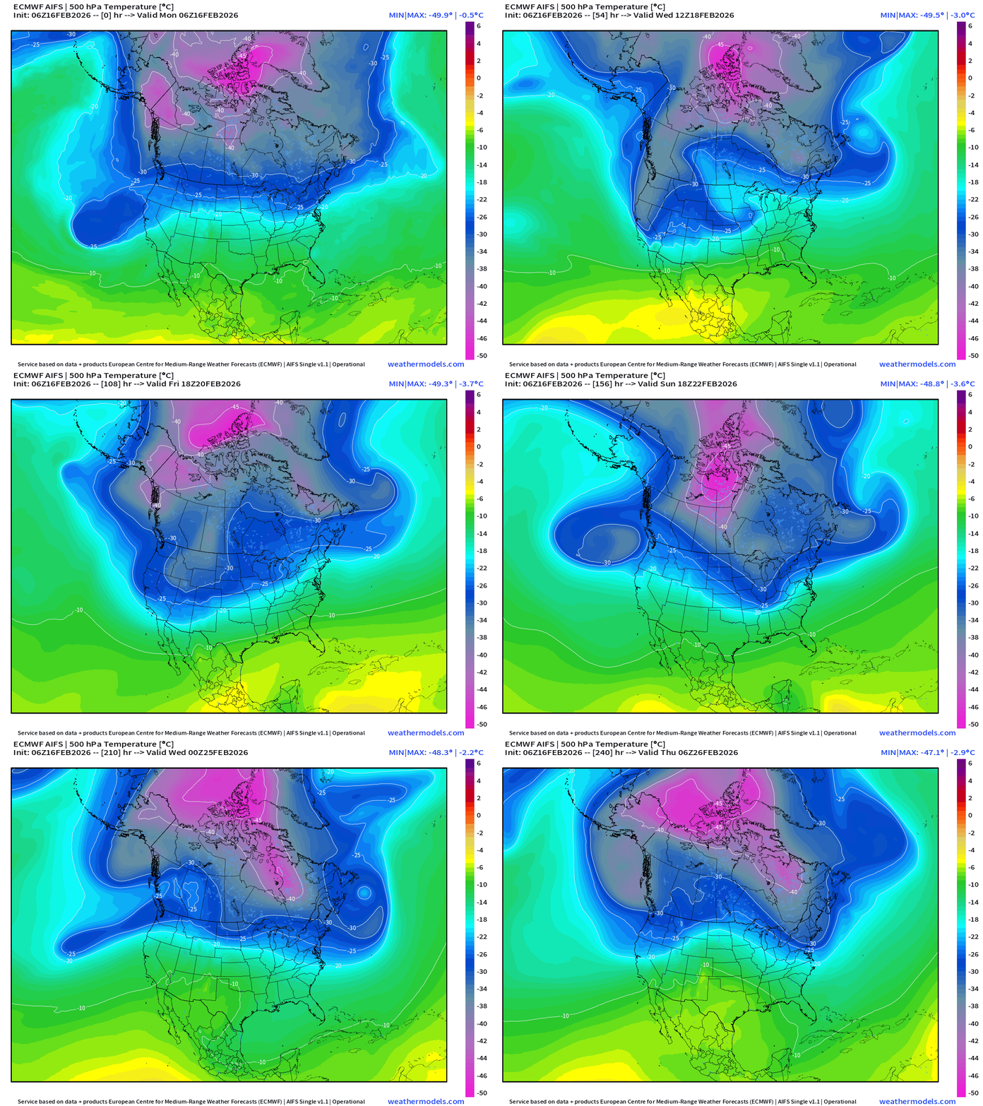
The temperature at 500 mb is the easiest way to highlight the “polar vortex” across North America with the coldest pool at -50°C (pink) with the -25°C contour usually associated with below freezing temperatures at 2-meters (surface).
Heading into the final week of February —> the main Polar Vortex cold pool reservoir remains largely locked up over Canada north of the Arctic Circle, but seeing multiple lobes descending in the Northwest and Northeast with surface low pressure systems.
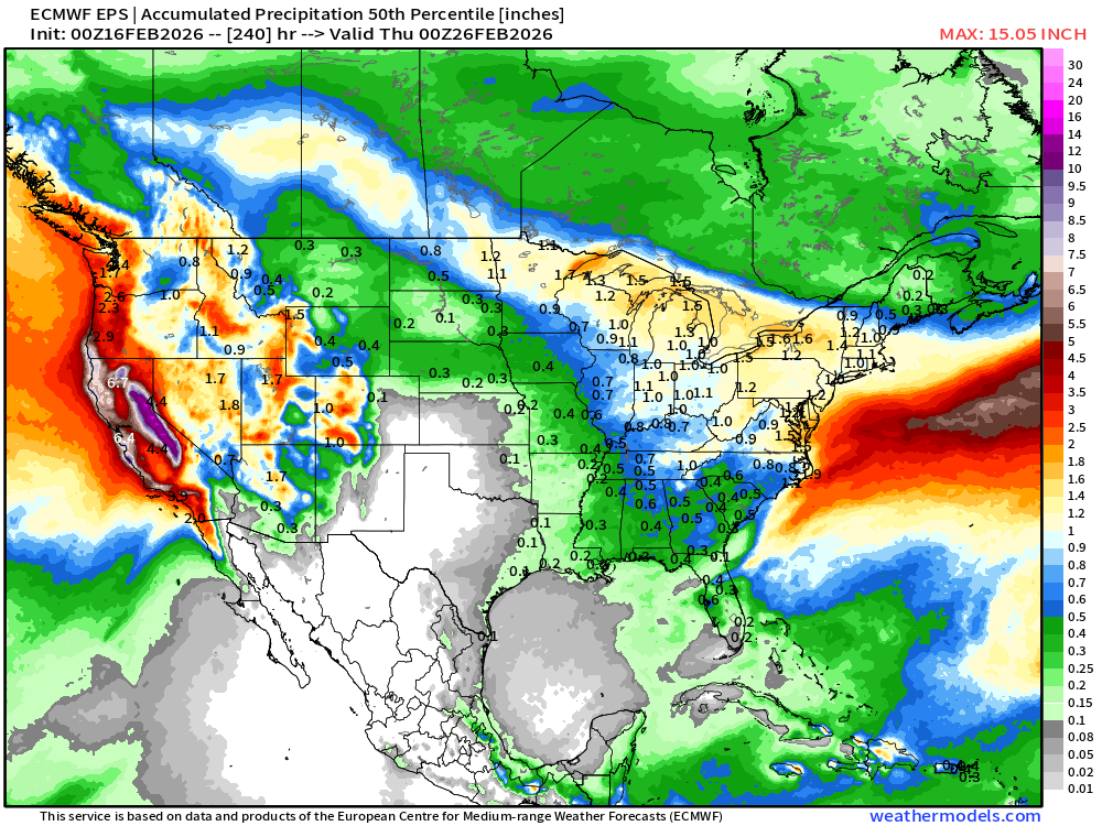
Total Precipitation Median from Ensembles Next 10-days
Ensemble Median next 10-days Total Snowfall (ECMWF EPS 00z)
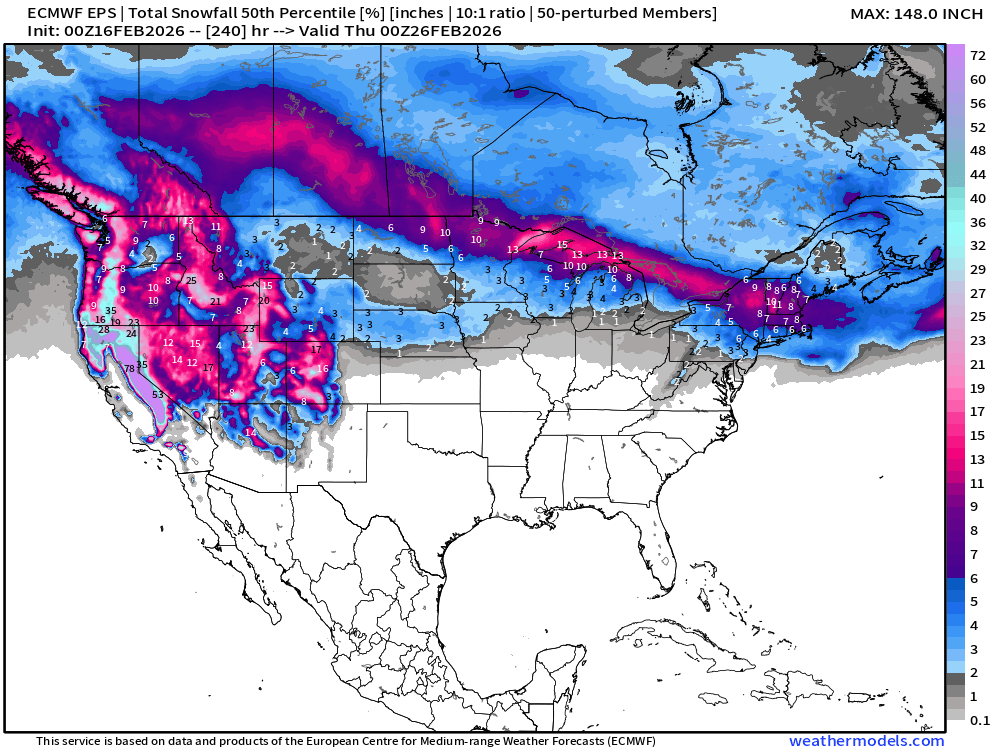
Interquartile spread (75th % minus 25th %) shows the variability in ensemble members
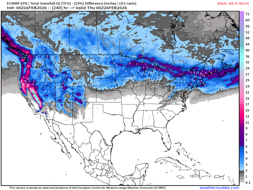
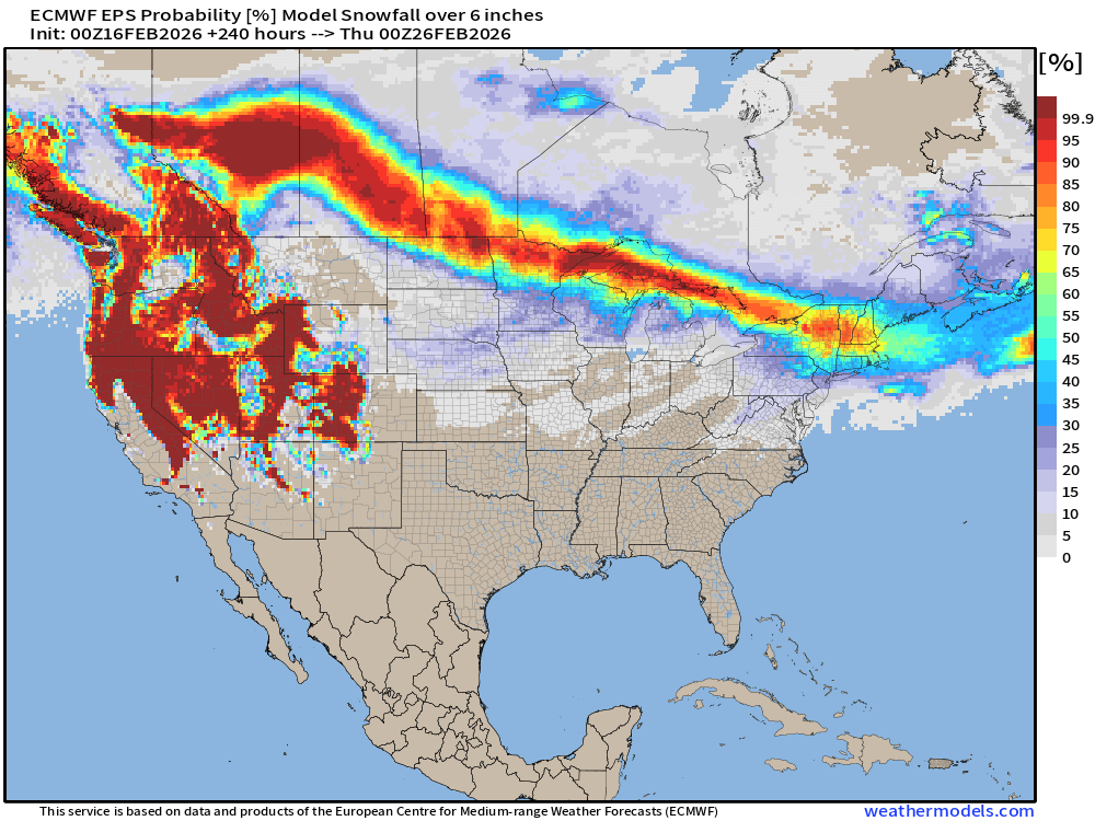
Snowfall is skewed toward heavier amounts — more extremes, so also need to look at probabilities.
Probability of 1-inch of snowfall from the Ensembles (00z)
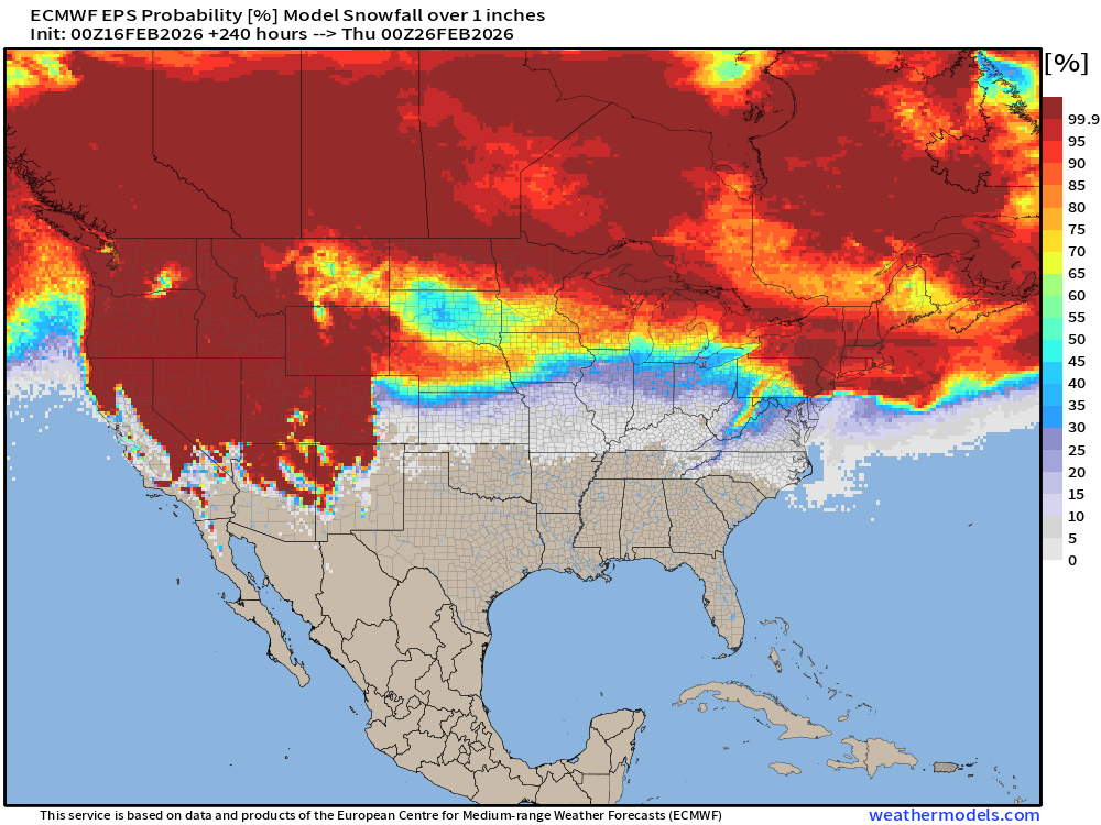
Probability of 6-inches of snowfall from the Ensembles (00z)
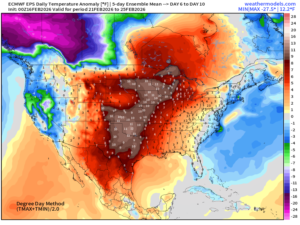
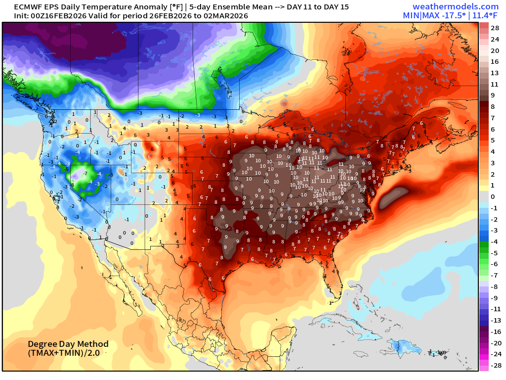
Temperature Anomaly | Next 15-days | ECMWF EPS 00z
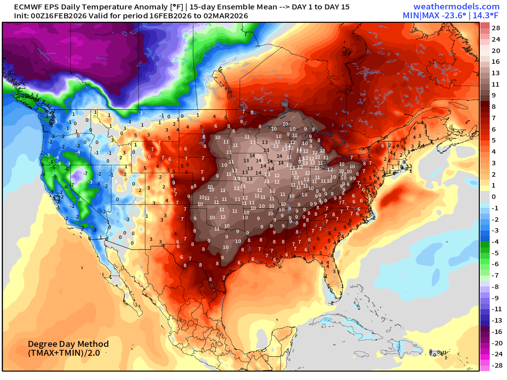
Eastern U.S. major warmth for the next 2-weeks on average.
5-Day Chunk #1 | Temperature Anomaly | Feb 16 - Feb 20
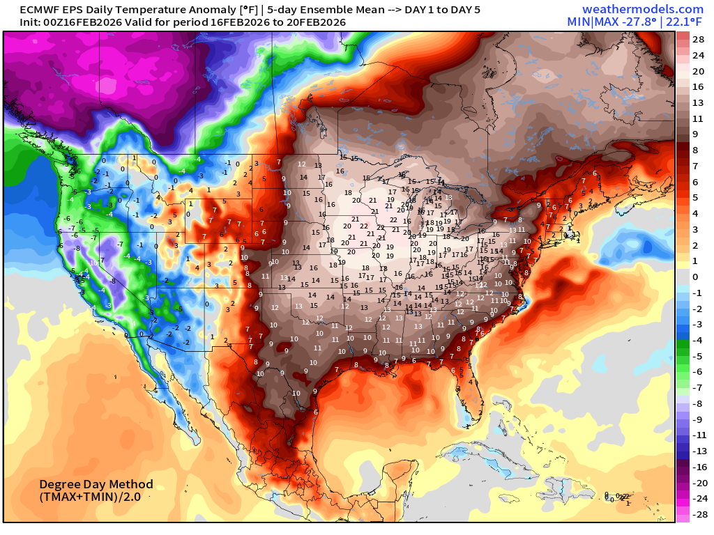
Well above normal for entire eastern U.S.
5-Day Chunk #2 | Temperature Anomaly | Feb 21 - Feb 25
5-Day Chunk #3 | Temperature Anomaly | Feb 26 - March 2
Maps sourced from weathermodels.com designed and innovated by yours truly! Please subscribe there for real-time access to the newest maps, charts from all of the weather models including ECMWF and AIFS, and NOAA GFS/GEFS.
- Milepost
- 871 · laid 2026-02-16T16:03:54.102000Z
- Source
- https://weather.substack.com/p/february-16-2026-monday-morning-weather
- Digest
- 6f3e804eb2147b6be125352bef3c2f9ea4ceca8c6cc6499fb72da202b1cfd615
- Machine
- JSON