February 9, 2026 Monday Winter Weather
Very warm weather across the Central U.S with 42 million at least 80°F
February 2026 was the 4th-warmest February in the 132-year national record (1895–2026), at 40.3°F against a 1991–2020 normal of 35.6°F (+4.6°F).
February 2026 was the 5th-driest February in the 132-year national record (1895–2026), at 1.4in against a 1991–2020 normal of 2.1in (-0.7in).
NOAA/NCEI Climate at a Glance, contiguous United States. This is the observed record for the month, not a score of anything said in this piece — the forecast ledger begins 2026-08-17 and cannot reach earlier posts.

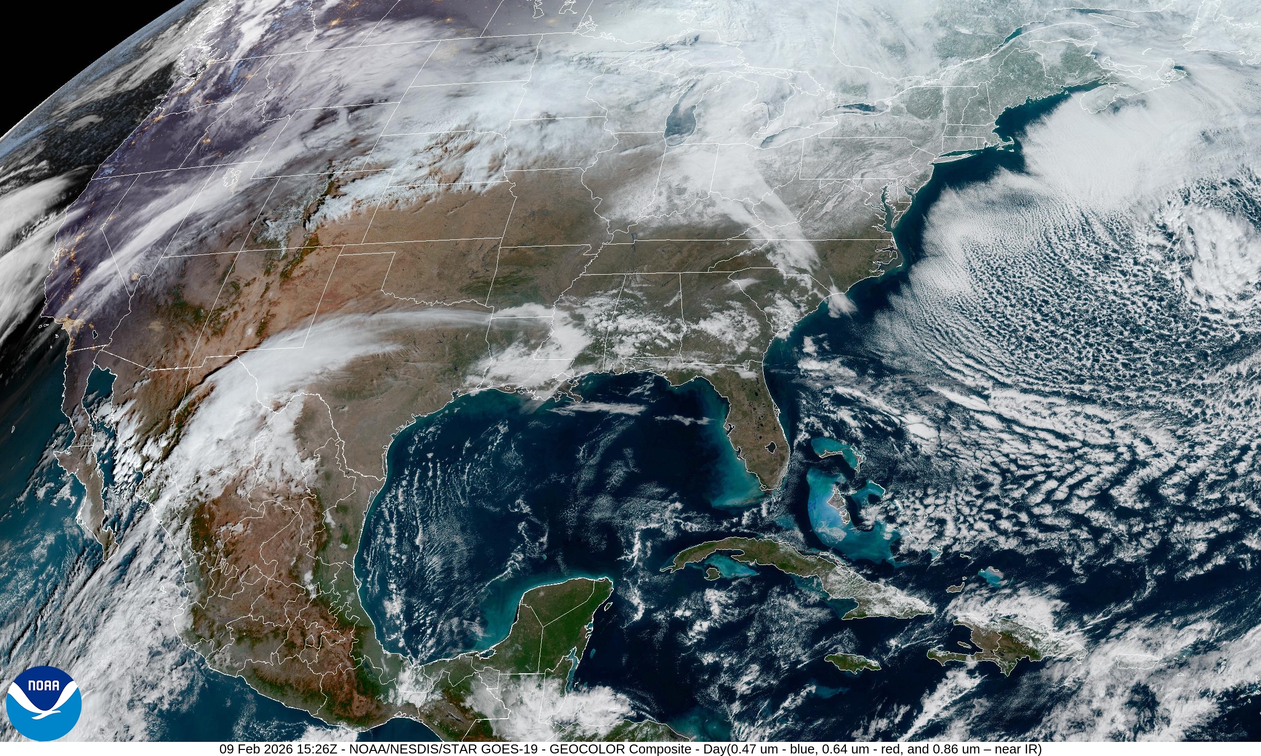
Cold Canadian Arctic air continues to spill across the warm Atlantic waters creating beautiful cloud streets and “ocean effect” snowfall off the New Jersey coastline over the warmer waters of the Gulf Stream wall.
Headlines this Monday morning:
Pattern change — more western moisture (and cold) + subtropical jet stream loads up Southeast with welcome rain (much warmer, too)
Arctic air is on hiatus this week for vast majority of Lower 48 except lingering across Northeast for yet another day or two
Warming east of the Rockies into next week while the Western U.S. sees winter again!
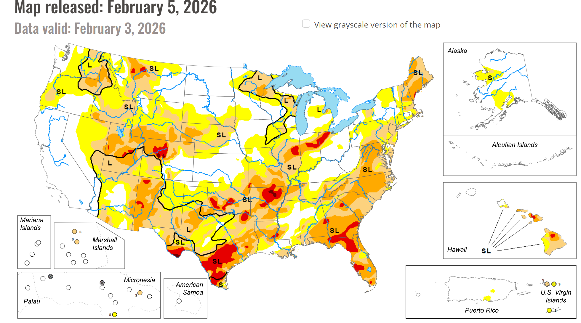
Drought concerns across the Lower 48 with the glaring exception of California!
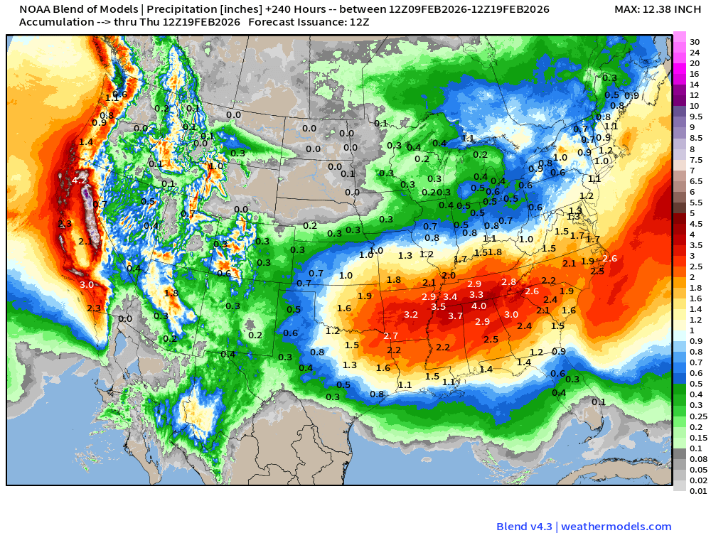
This winter has featured extended periods of cold, dry Canadian Arctic air, and not very much precipitation. Texas and Florida, Illinois and Indiana all could use some bountiful rain/snow in the coming weeks to get ready for Spring.

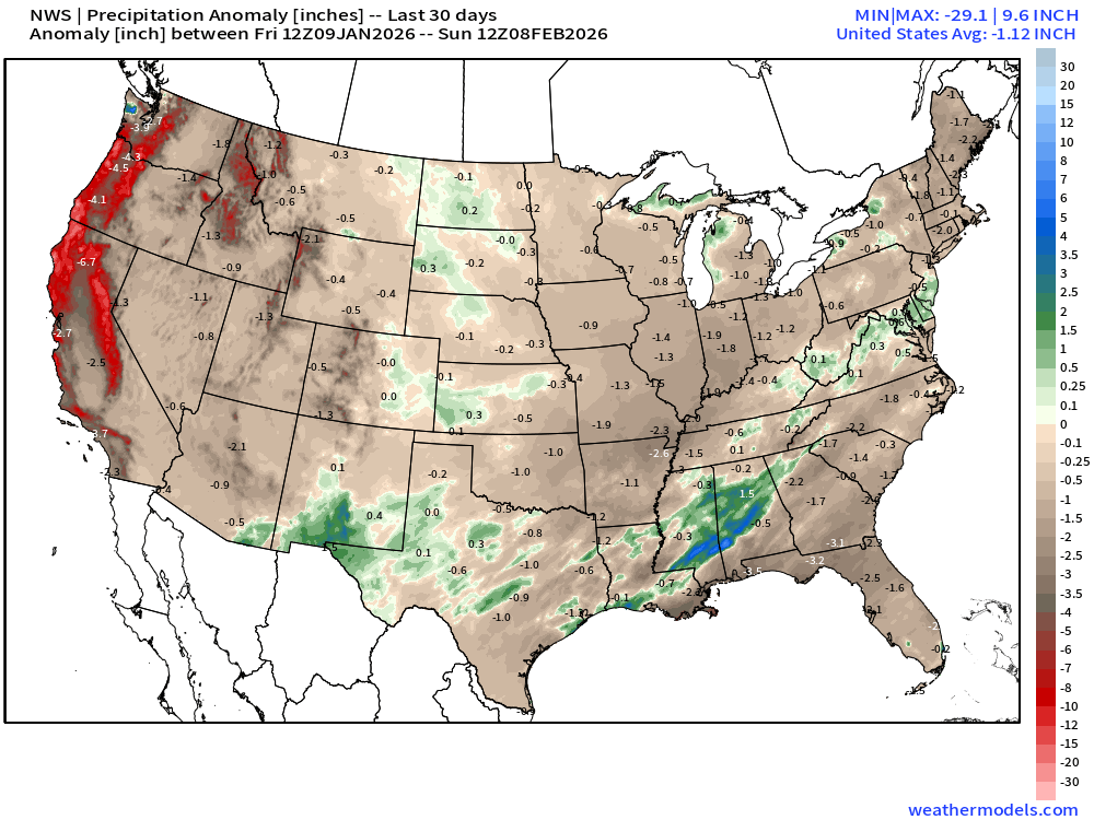
Over the past 30-days, the Western U.S. has largely been under the influence of ridging so any atmospheric rivers would be directed well north into Alaska or Western Canada. While the expected precipitation (liquid equivalent) isn’t very much from Jan 9 - Feb 8, the noticeable lack of “water” across the Western U.S. would be quite problematic for the spring if we didn’t see a major pattern change on the way.
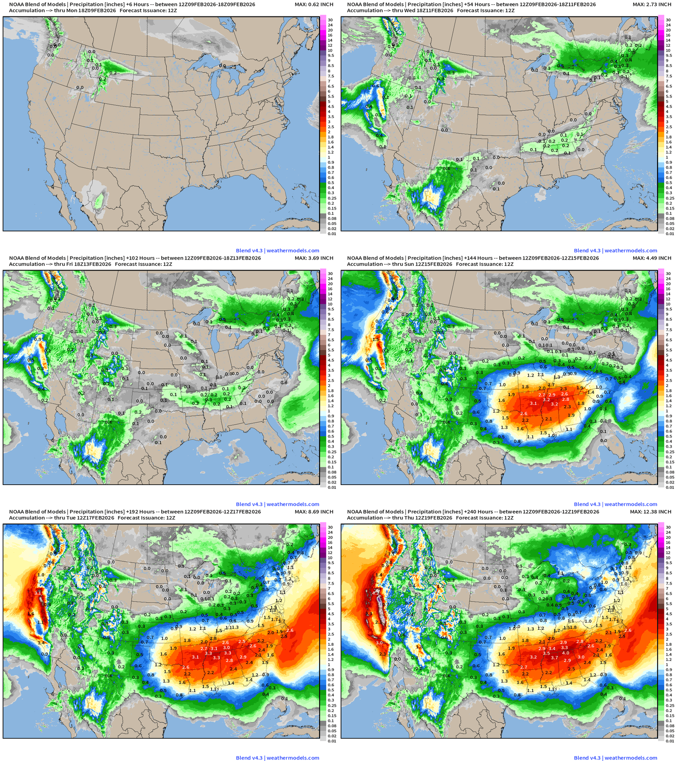
That pattern change = wetter and colder (more snow) across the Western U.S. as the jet stream dips well south into northern Mexico — and picks up subtropical moisture to dump on the Southeast.
Seems everyone is winning over the next 10-days! We ditch the coldest air, and see more moisture in places that need it.
Weather Trader is an entirely reader-supported publication into its third year. To receive daily new posts and support our work, consider becoming a free or paid subscriber. All content is generated by the author including the maps!
Flagship ECMWF 00z EPS | Temperature Anomaly | Next 15-days
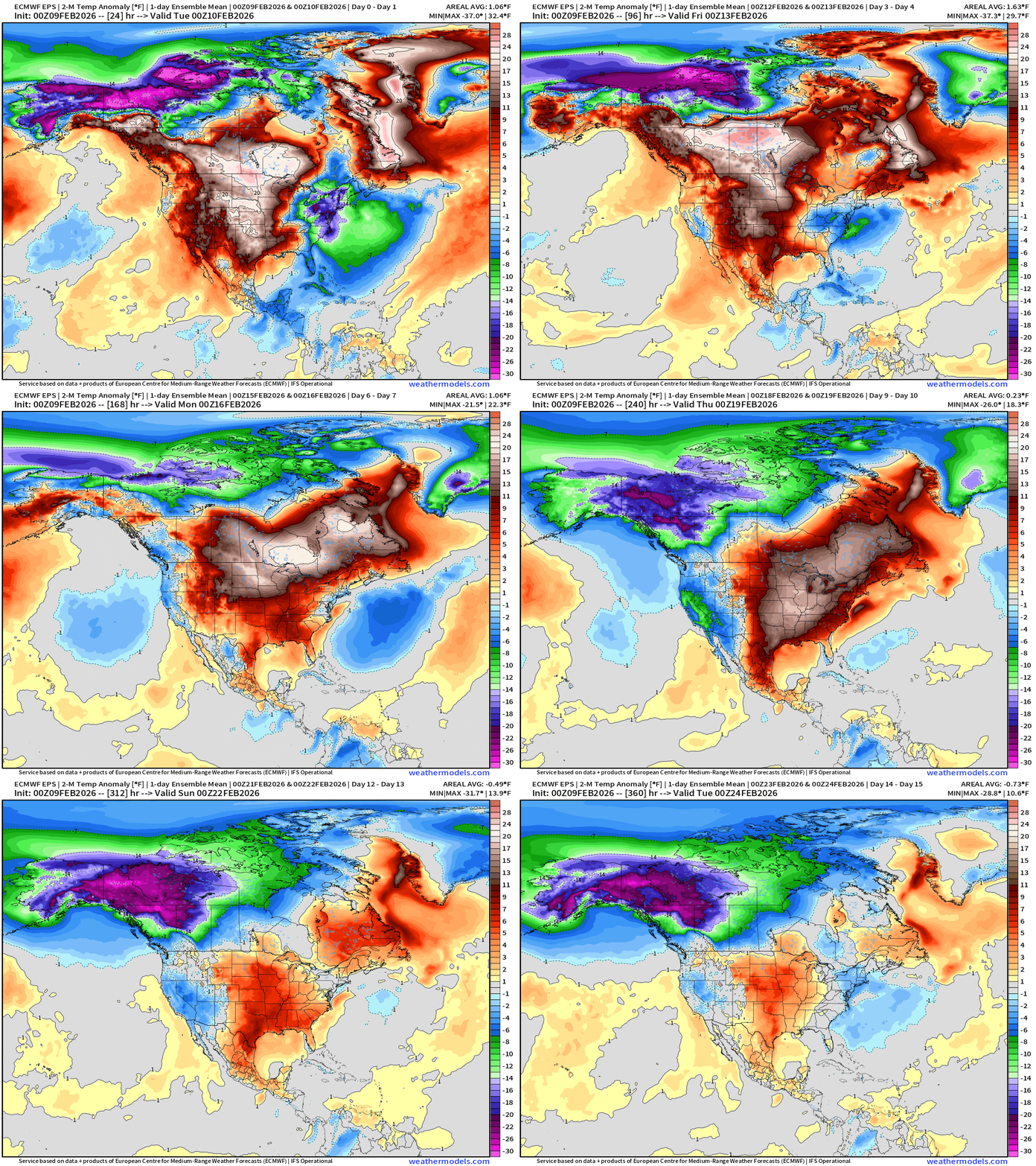
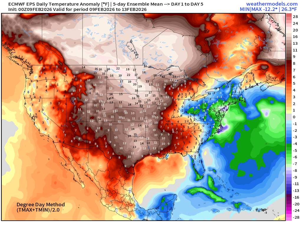
Central U.S. warmth pushes east but is beaten back by a trough this weekend!
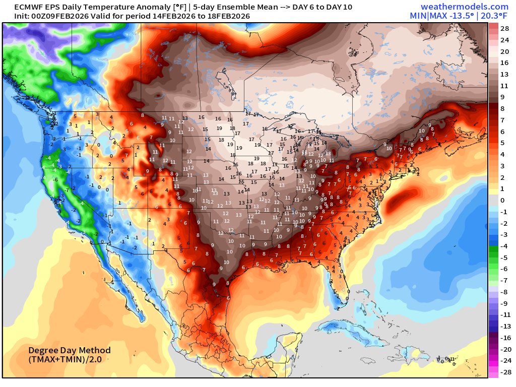
But, another warming event may finally blanket the U.S. east of the Rockies with above normal temperatures around Day 8 or February 17th.
Pattern change with VERY intense cold pool reforming over Alaska and Northwest Canada — like we saw a few weeks ago, and troughs dipping down the U.S. West coast — great for snowfall in the mountains and much colder temperatures.
Will this huge cold pool break loose into the Lower 48?
ECMWF IFS 06z | Precipitable Water Next 6-days
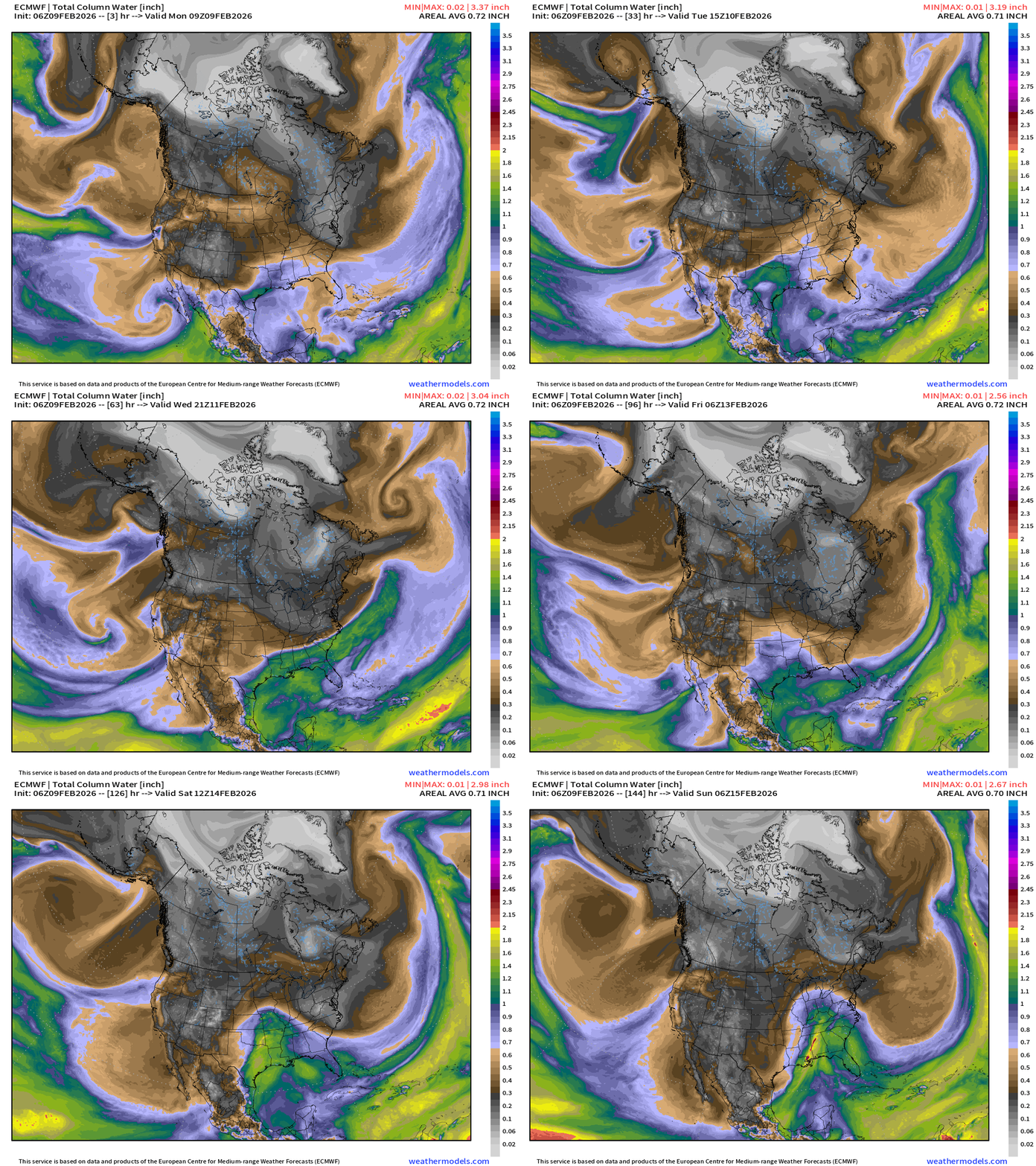
A weak trough dips out of Canada (grey coloring = dry) into the Great Lakes and Northeast into this weekend to put a break on the warming.
A storm system forms in the central U.S. with a moisture plume out of the Gulf of Mexico — this is an early “severe weather season” for the southern U.S. from Texas to Florida — typical of mid-February.
Atmospheric rivers “tickling” California with moisture — not major bombardments but enough to keep the rain bucket filling and the snow falling on the mountains.
ECMWF 06z Temperature Anomaly | Next 6-days
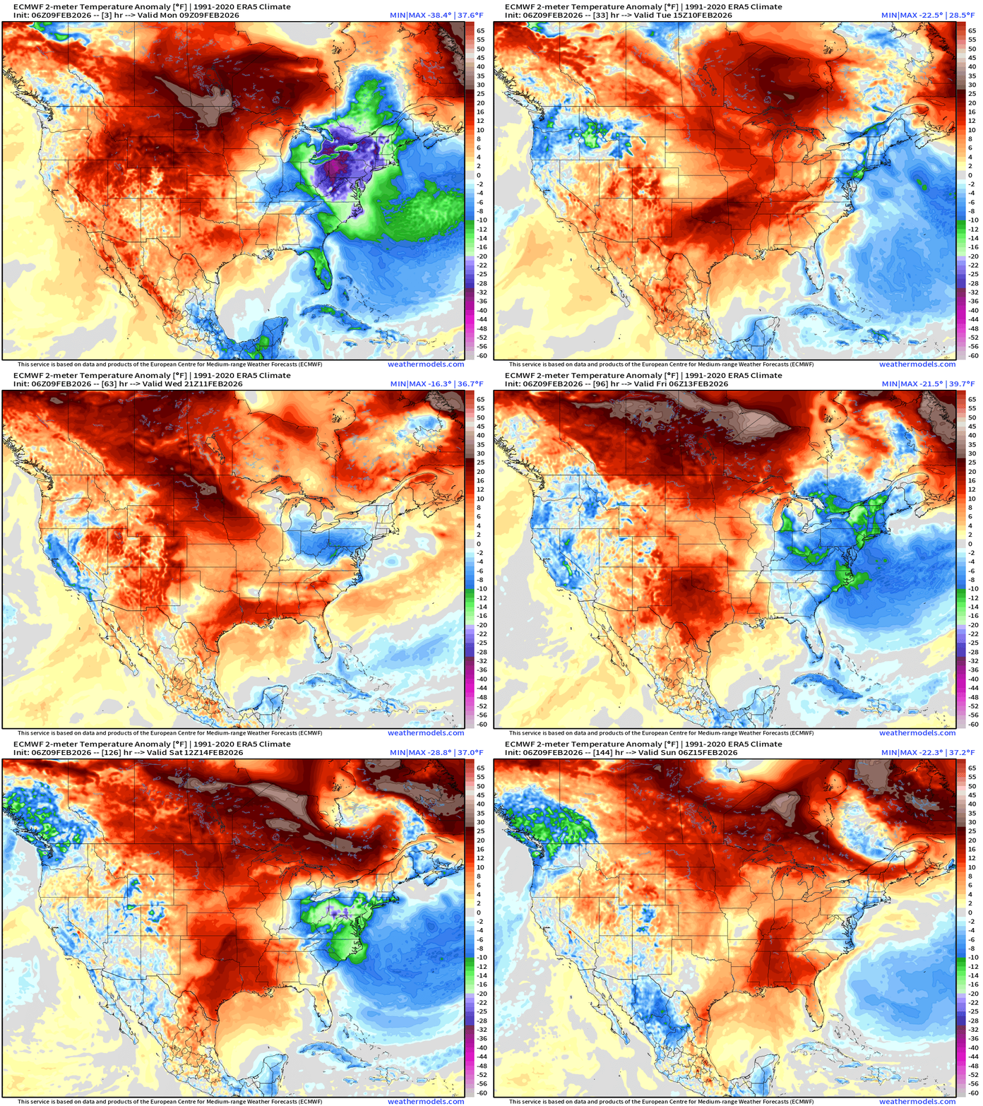
The colder Green and Blue (well below normal) disappears for a day or two across the Northeast and Mid-Atlantic but returns again this weekend —> back to “colder”
Warm —> RED across the western U.S. into the Plains pushes eastward on Tuesday. The entire central part of North America from Texas to Canada is much warmer than normal — a welcome change from the “Polar Vortex”
Moisture Transport Next 10-days | Integrated Vapor Transport
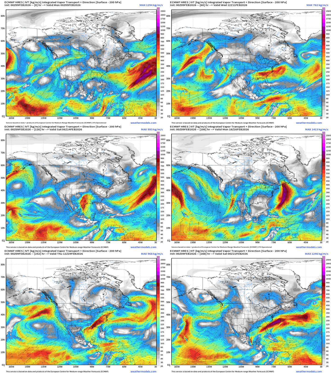
The Southern Stream storm track remains active with the subtropical jet stream delivering plenty of moisture to the southern U.S.
Western U.S. sees moisture plumes … light to moderate atmospheric rivers from the SW until next week when the large scale flow flips out of the much colder north.
Not seeing a major storm system for the Northeast this Presidents' Day Weekend
ECMWF 06z Precipitation Type + Intensity | Next 6-days
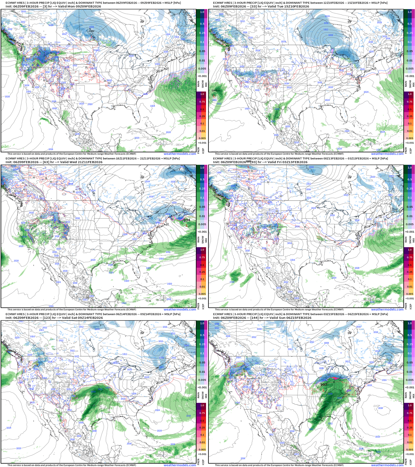
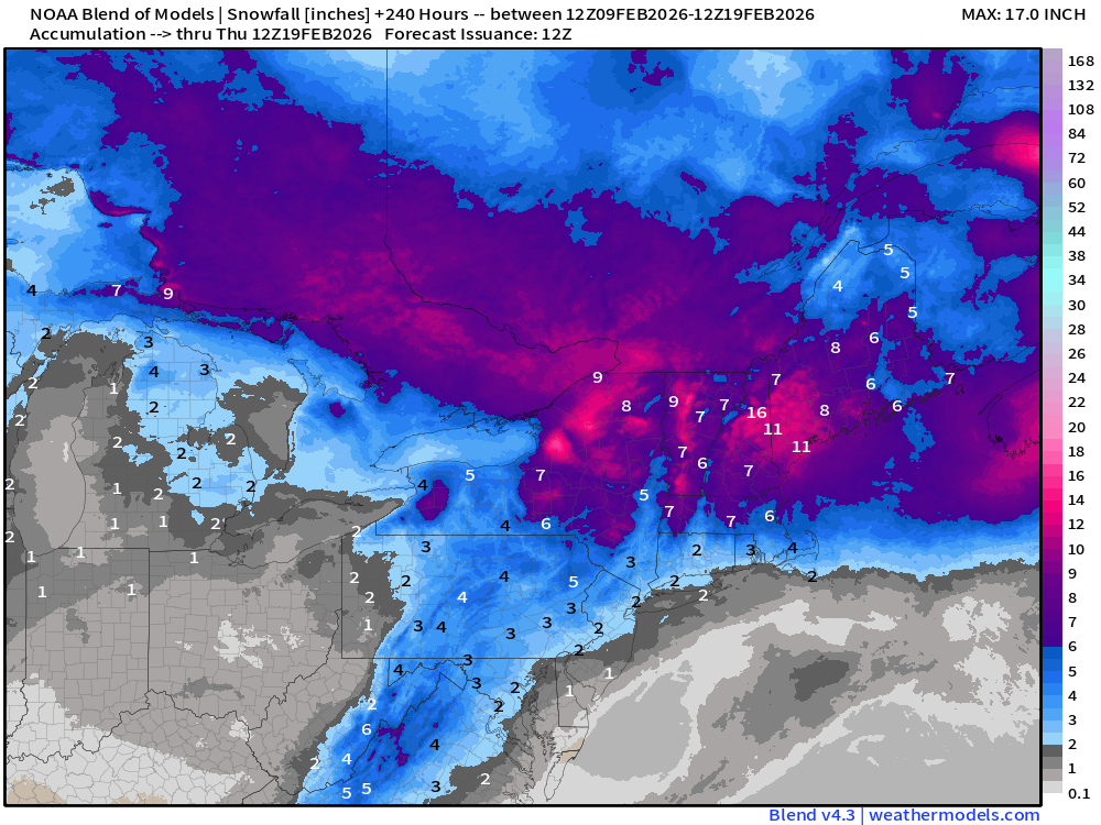
Another weak Clipper system next Tues-Wed across Great Lakes into Northeast, that should deliver significant snow to Ontario and then into northern New England.
Heavy rain and snow returns to the Pacific Northwest, and moisture heads into the Great Basin primarily from a secondary storm system right into California on Wednesday
Central U.S. storm system gathers on Sat/Sun and tracks from Oklahoma into the Great Lakes with a moisture laden cold front = thunderstorms. Thankfully, not snowfall across the Southern U.S. as model solutions “scare-casted” over the past few days.
West Coast USA Zoom | Next 6-days
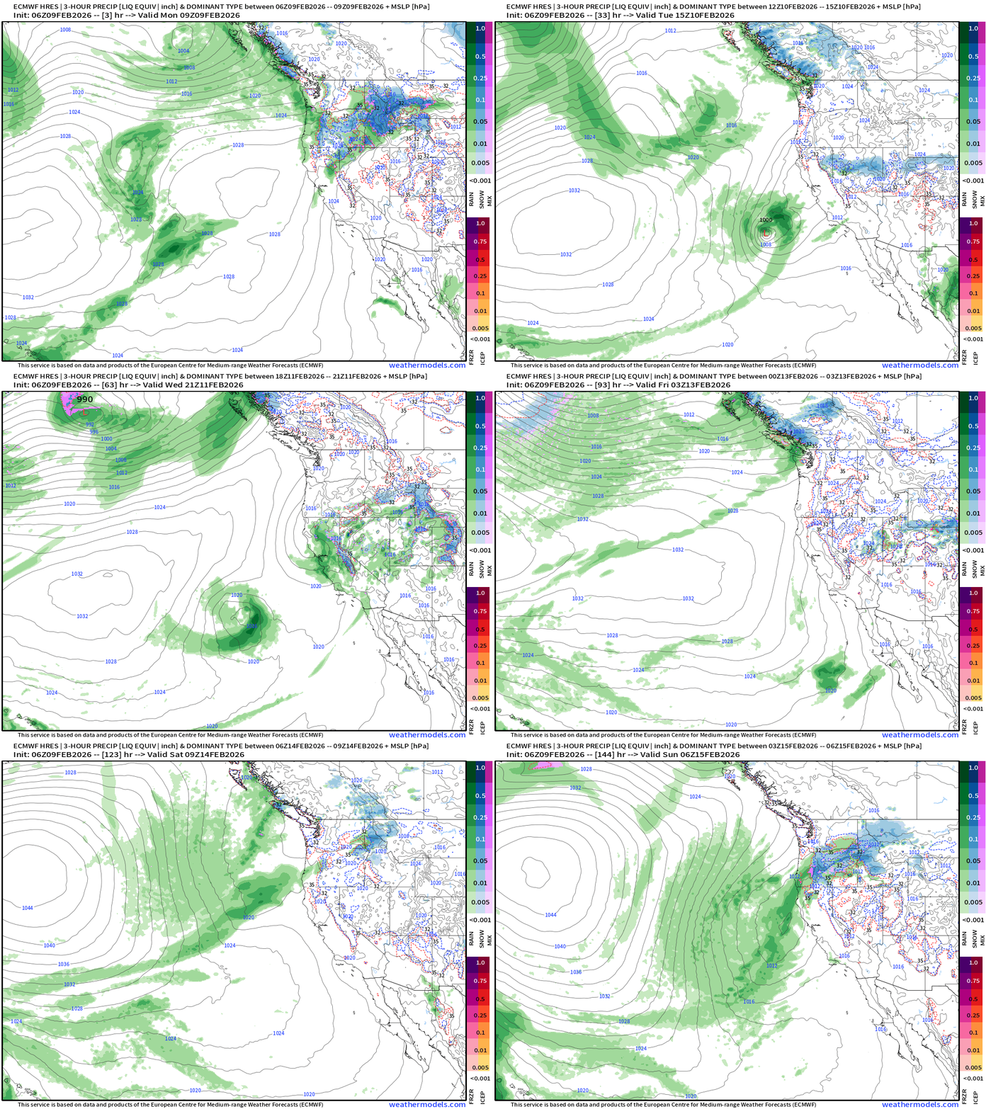
Weak but coherent storm system landfalls central California on Wednesday with a burst of rainfall across the entire state and snowfall at higher elevations. This is coming out of the Southwest, so warmer system + higher snow elevations.
Then, we change the direction of upper-level flow generally out of the north from the Gulf of Alaska = cooler, more unsettled into next week.
East Coast USA Zoom | Next 6-days
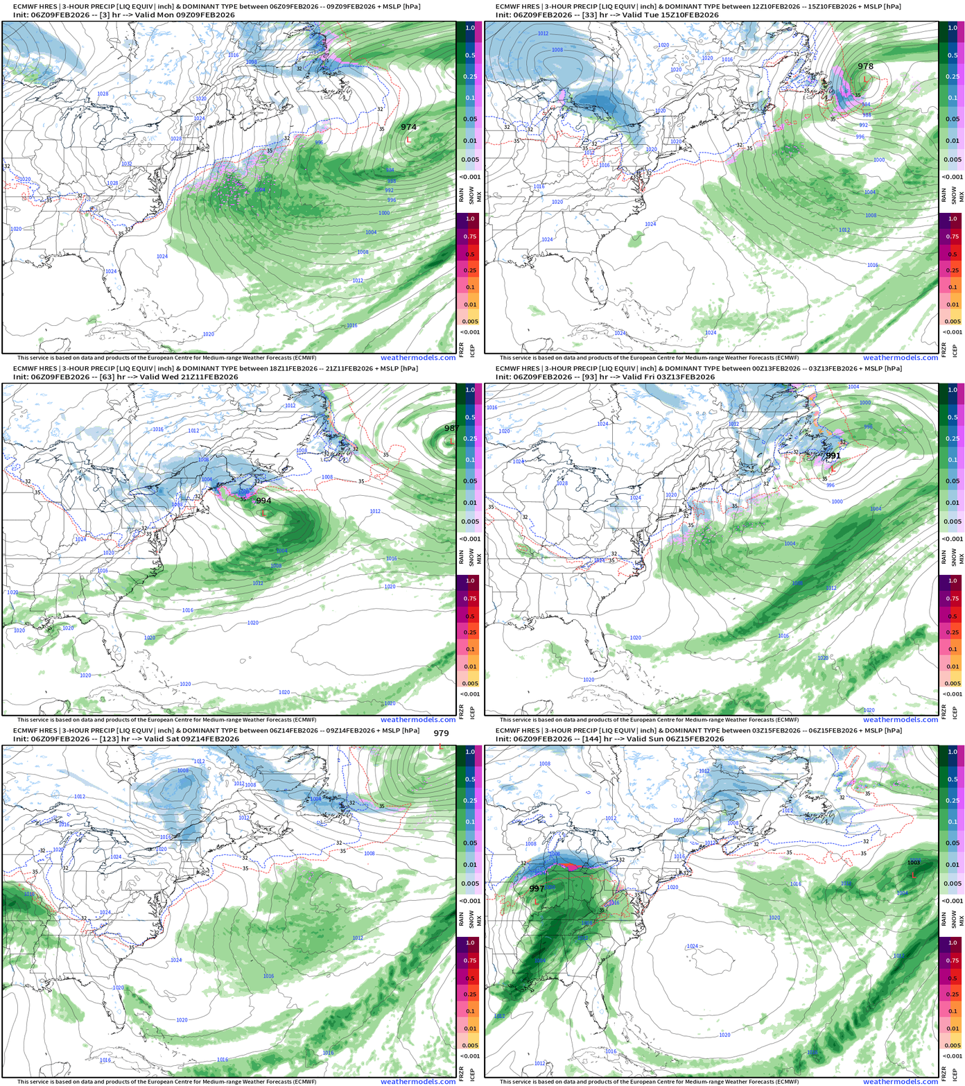
Only show in town here is a Clipper system through Canada into Tues/Wed.
15-day Snowfall (Long Range) ECMWF 00z
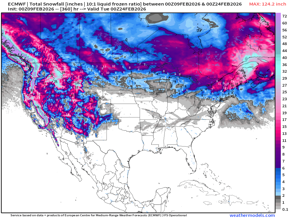
15-day Snowfall (Long Range) ECMWF AIFS 06z
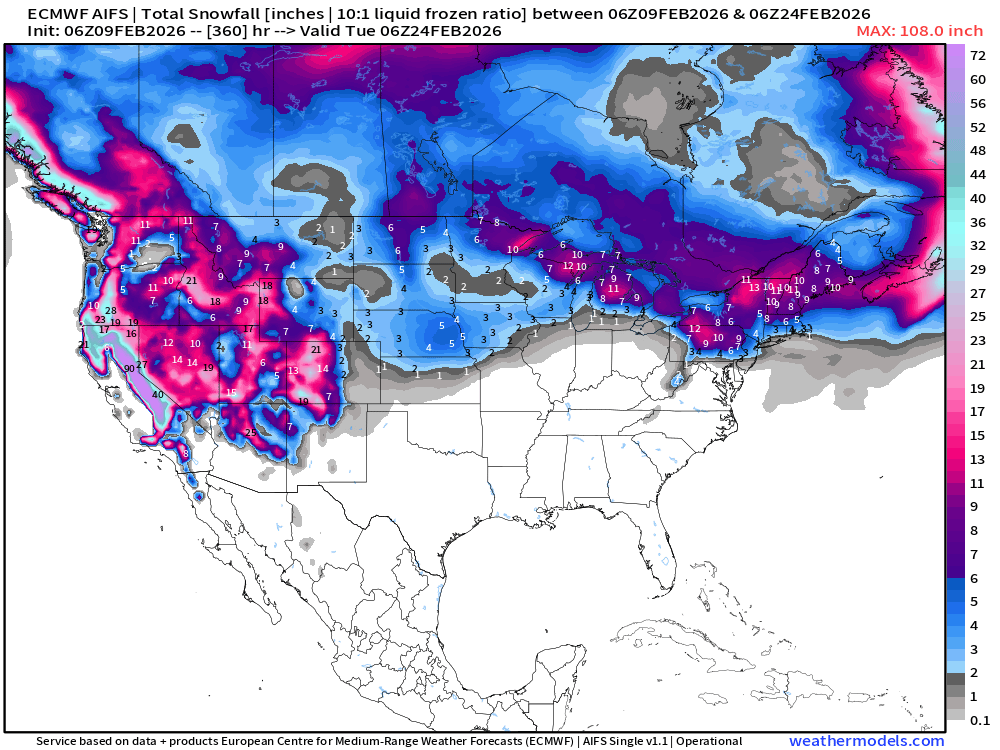
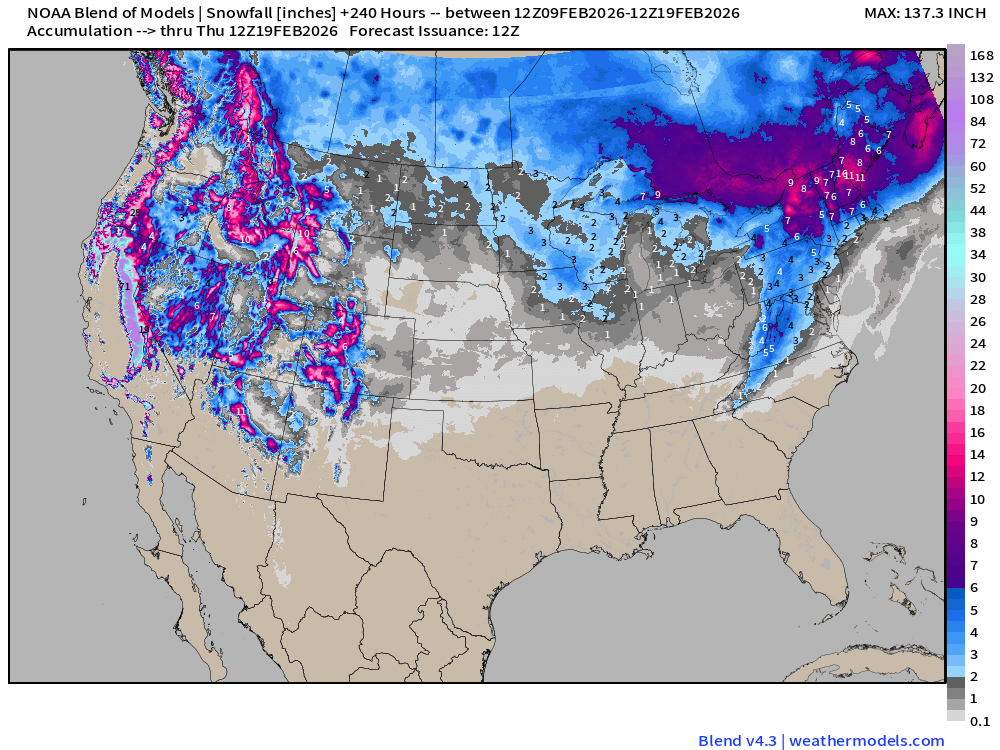
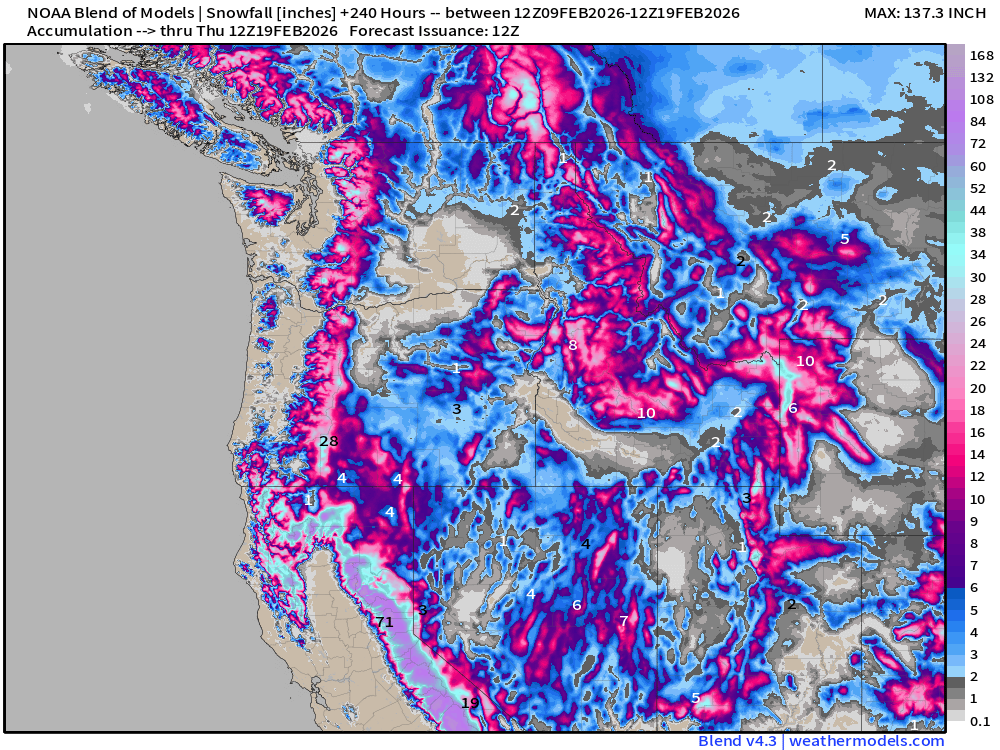
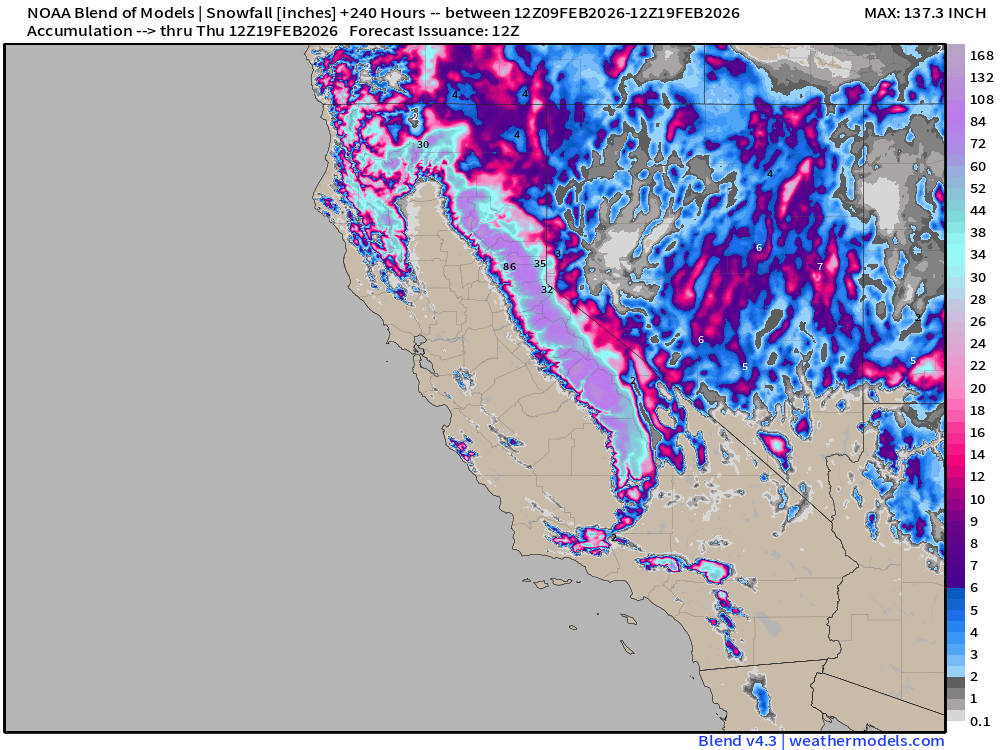
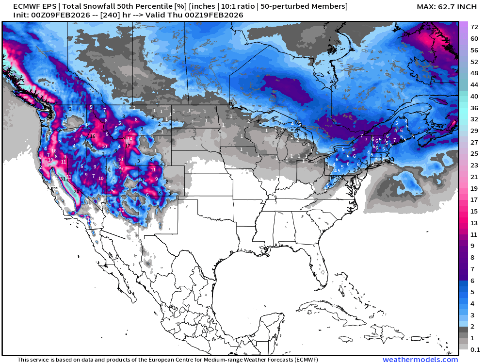
No doubt about heavy snowfall returning to the Western U.S.
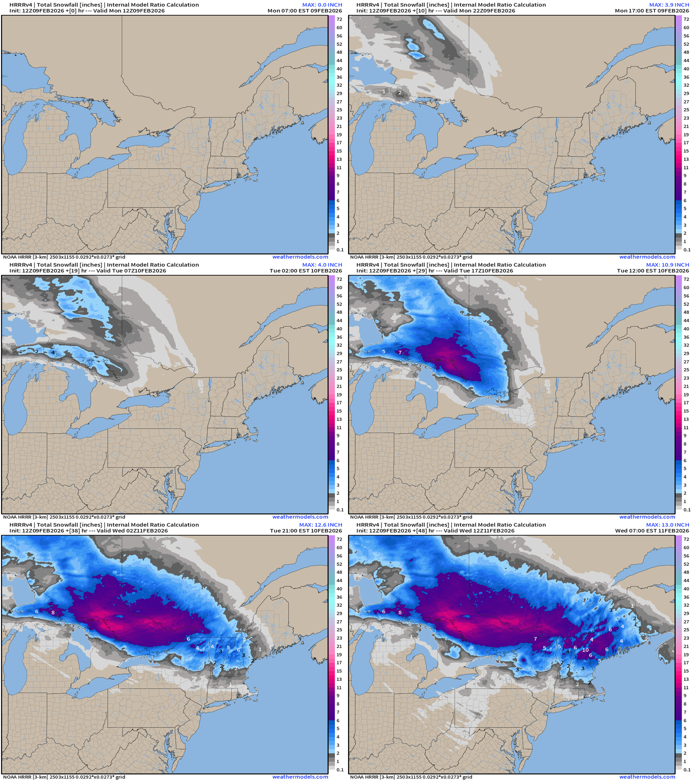
HRRR Simulated Radar Next 48-hours
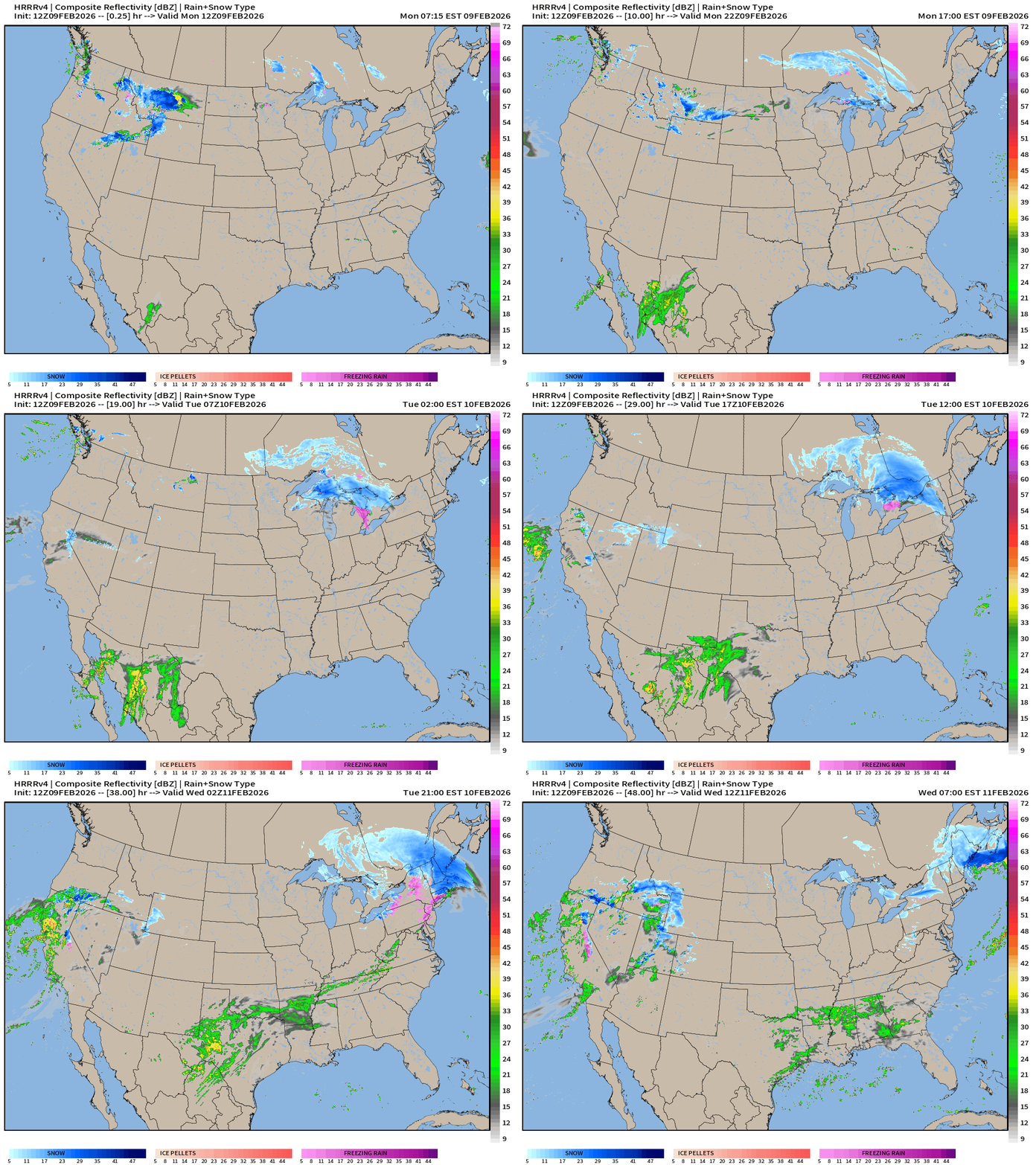
Clipper system performs quite well — look at all of the snowfall for Ontario then extending into New York and New England. Boston may get swiped with 2” or 3”
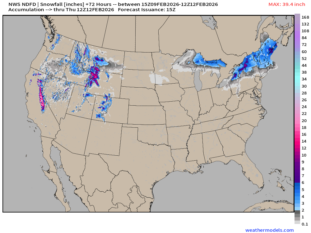
NWS NDFD Snowfall next 3-days
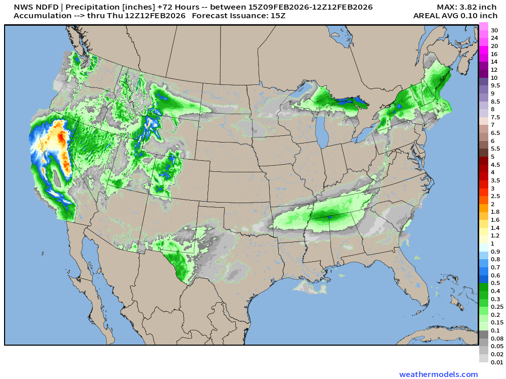
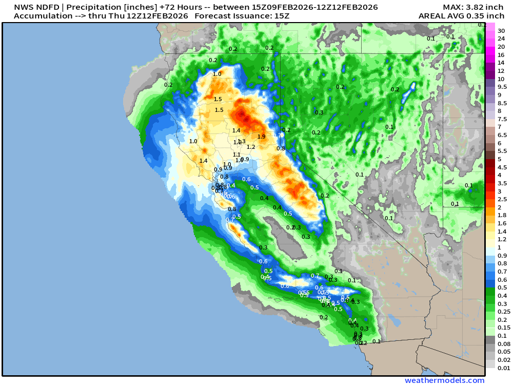
NWS NDFD Precipitation (QPF) next 3-days
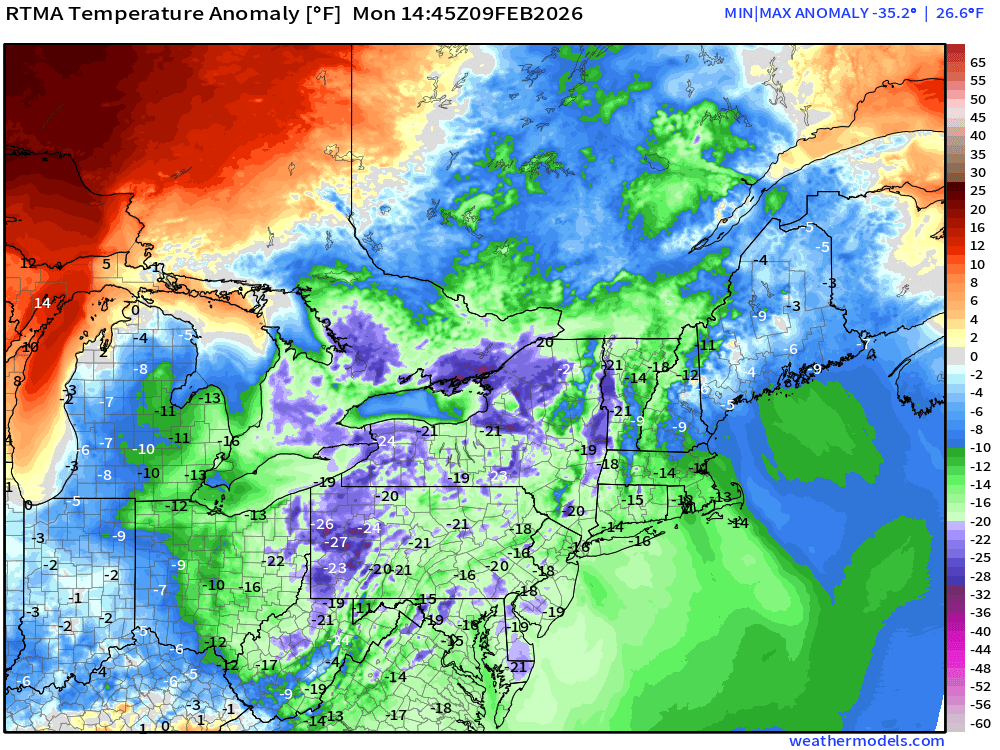
RTMA | Temperature Analysis | 9:45 AM ET
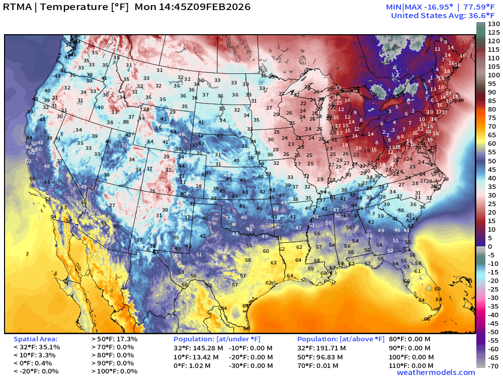
Avg Lower 48 temperature was 36.6°F — 145 million below freezing.
Temperature Anomaly | 9:45 AM ET
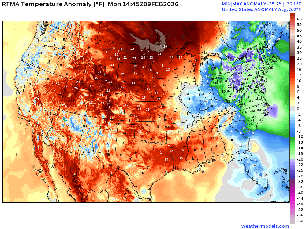
Lower 48 Temperature Anomaly above normal by 5.2°F
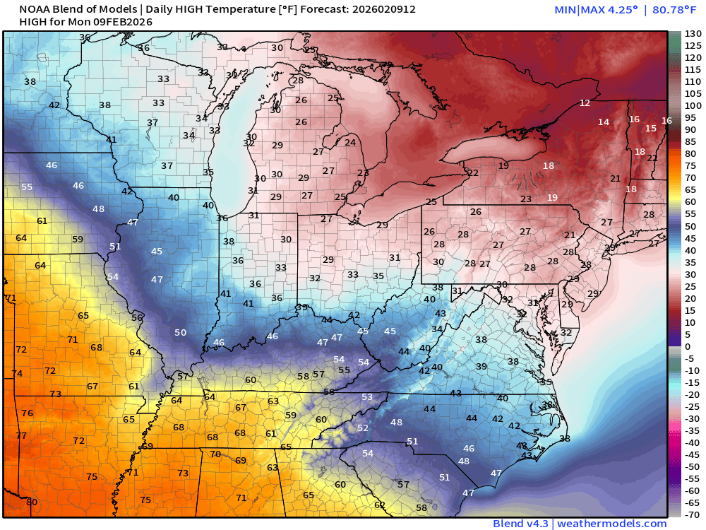
High Temperatures on Monday
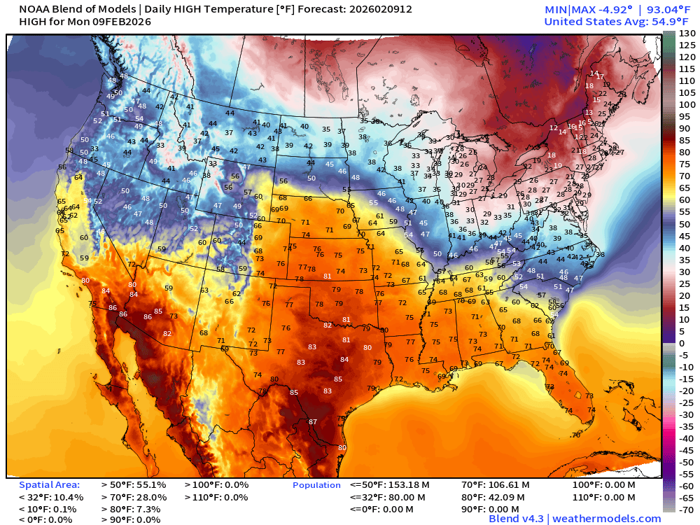
Heat wave across the central U.S. with over 42 million at least 80°F
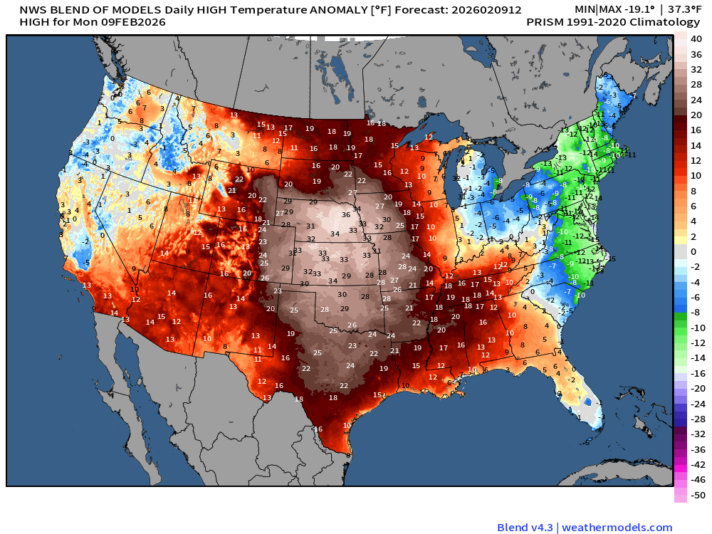
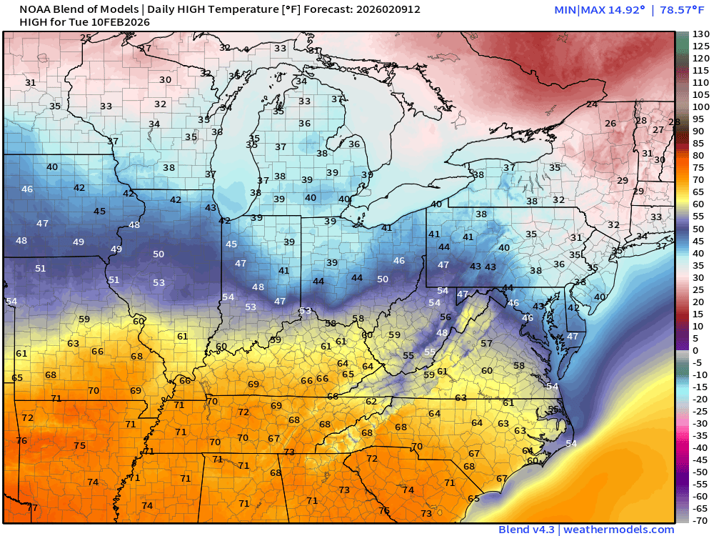
Temperatures are way above normal by 25°F to 37°F from Texas to Nebraska.
We won’t get to freezing in New York City on Monday!
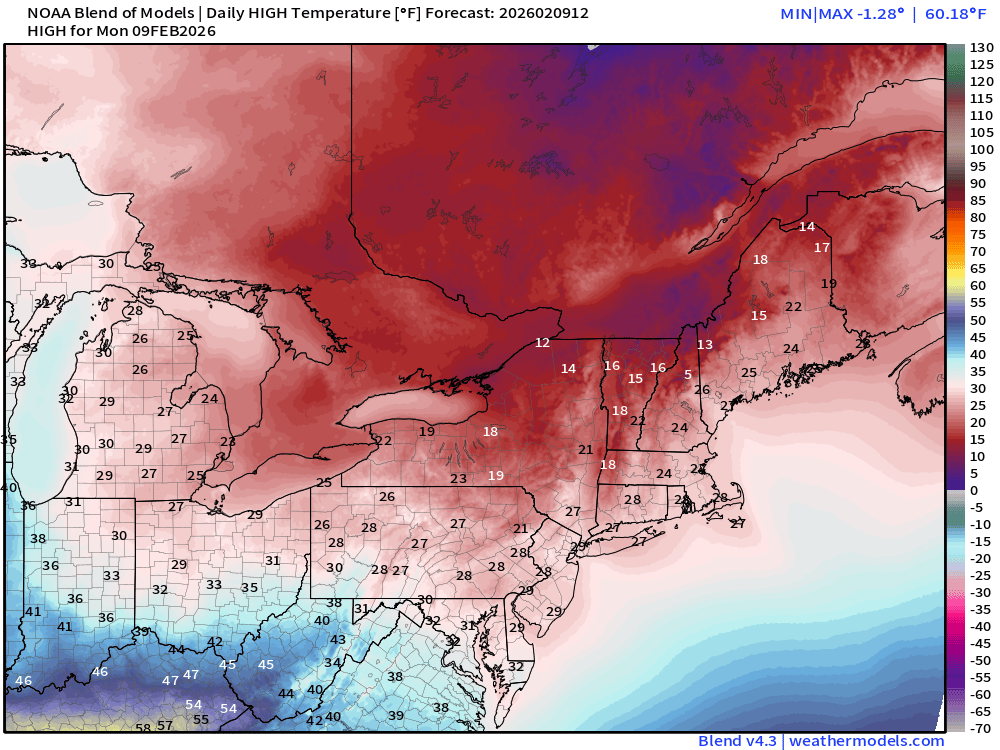
One more day of freezing — until a mediocre thaw arrives!
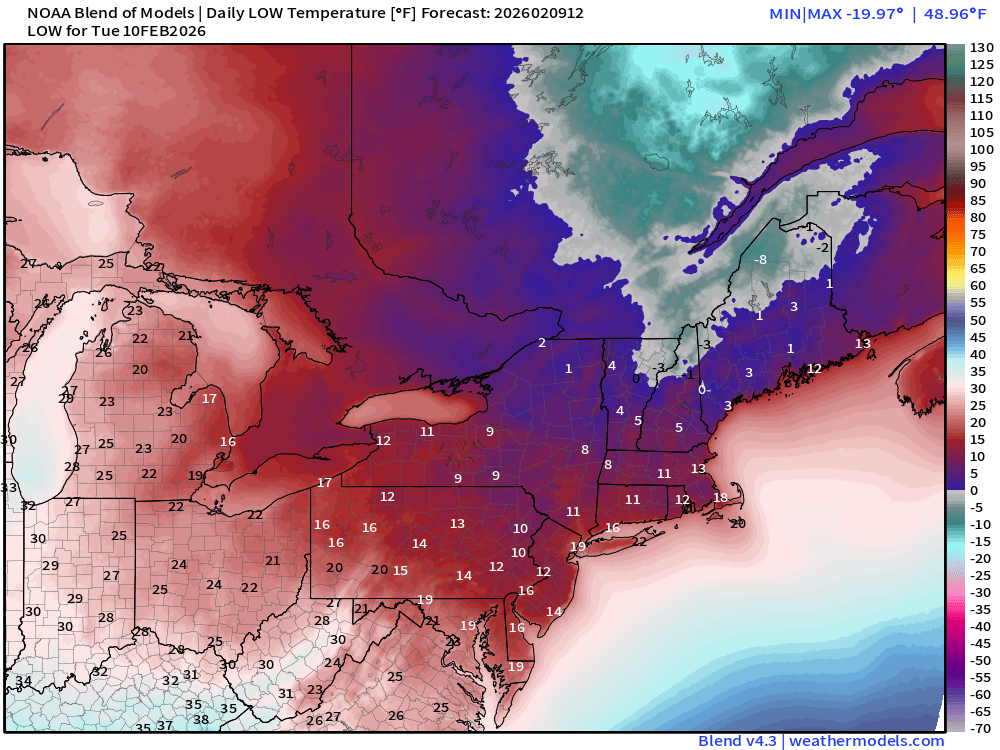
Low Temperatures on Tuesday
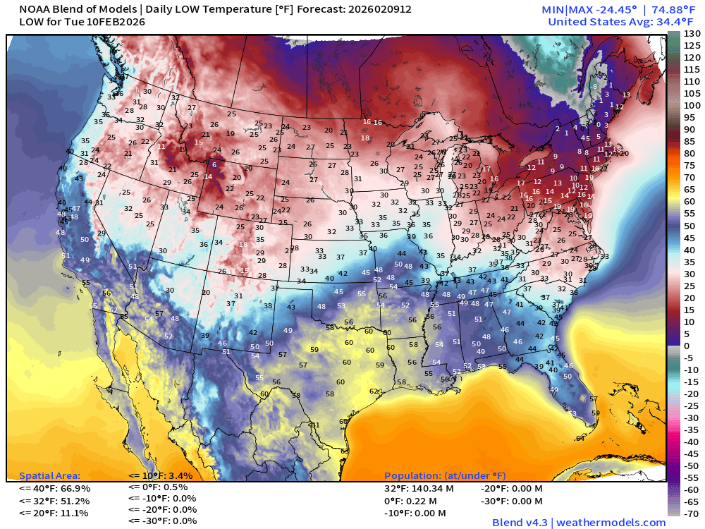
34.4°F average Lower 48 minimum - 140M below freezing and only 220K below 0°F
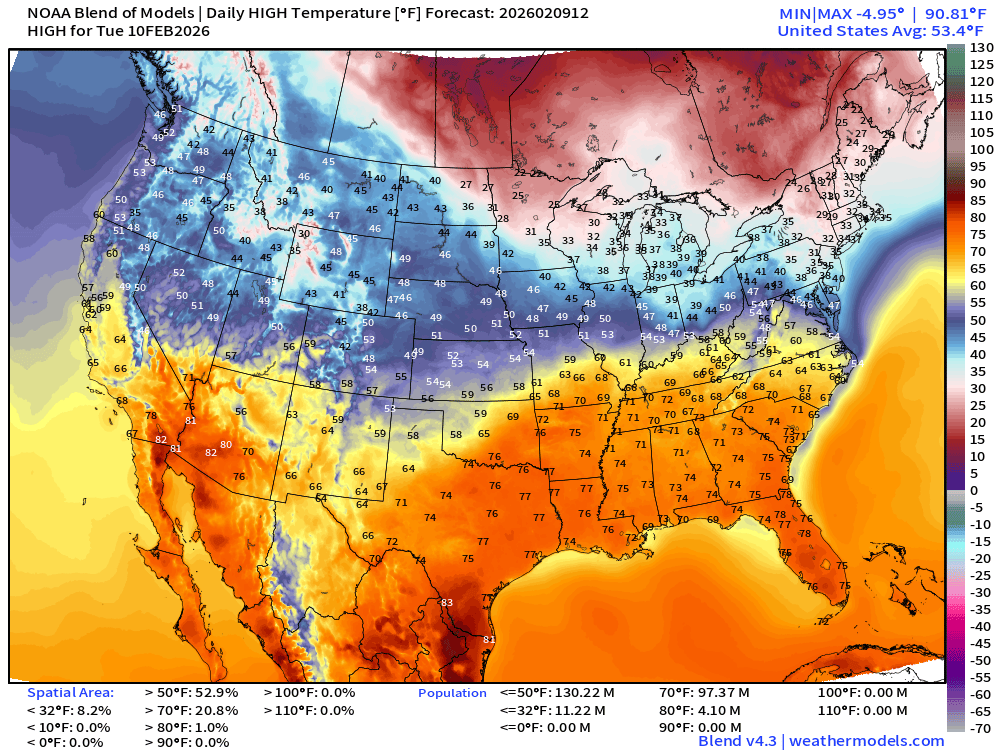
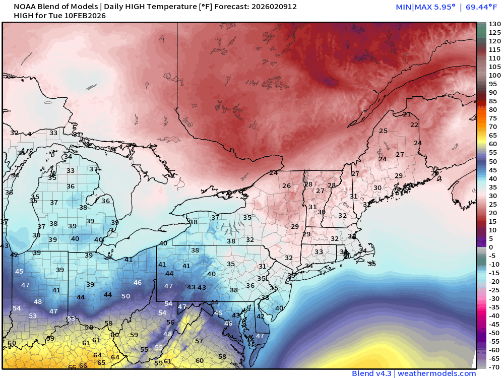
High Temperatures Tuesday
ECMWF AIFS-Single 06z | Temperature (500 hPa) Next 10-days
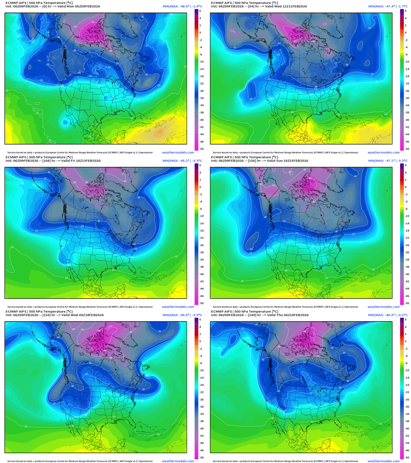
The temperature at 500 mb is the easiest way to highlight the “polar vortex” across North America with the coldest pool at -50°C (pink) with the -25°C contour usually associated with below freezing temperatures at 2-meters (surface).
Heading into the final week of February —> the main Polar Vortex cold pool reservoir is full loaded but well to the north over Arctic Canada. Let’s hope it stays there!
Multiple troughs into the Pacific Northwest try to pull that cold PV air southward.
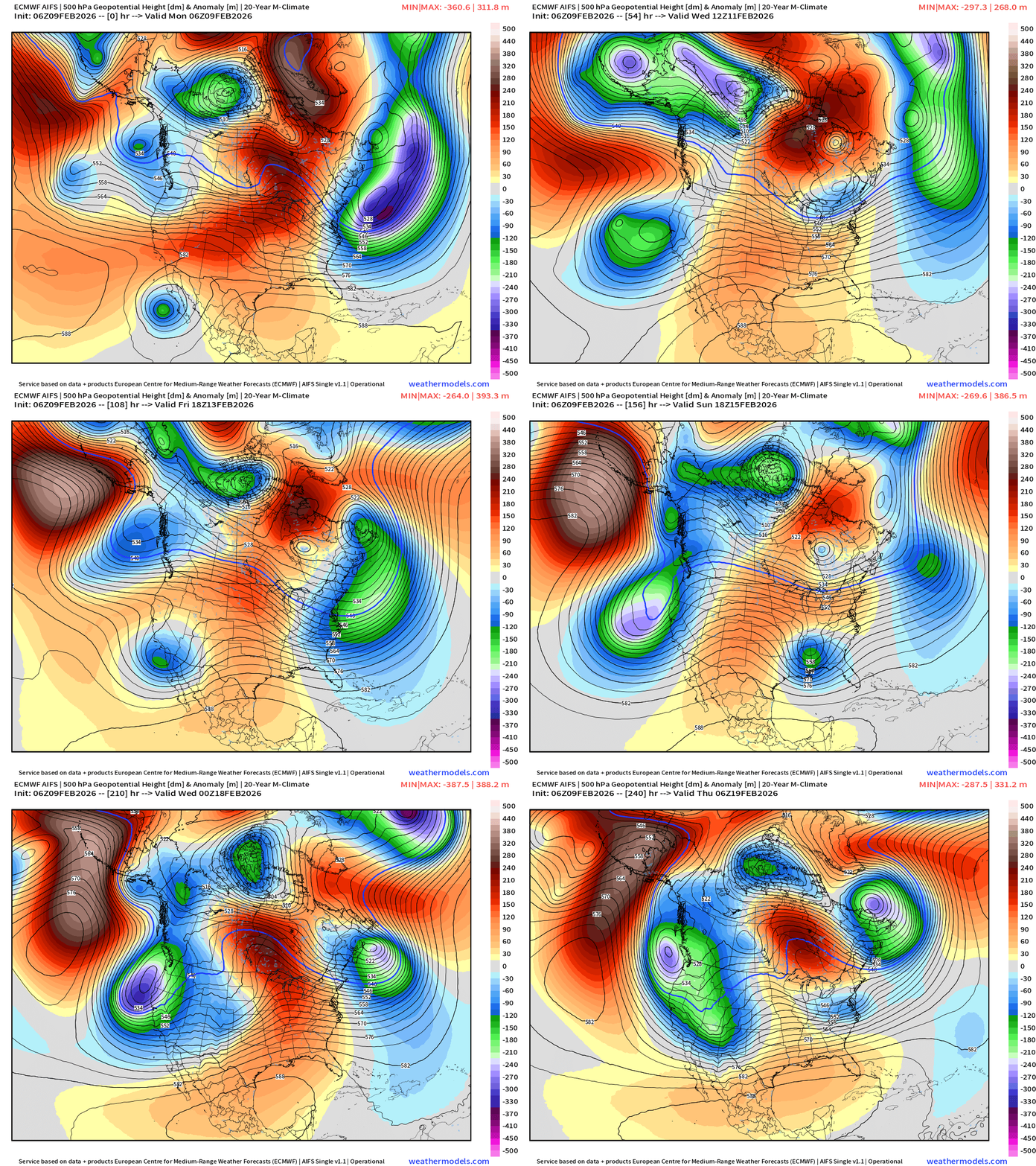
ECMWF AIFS-Single 06z | 500 mb Height Anomaly Next 10-days
Blend of Models | 10 Days Precipitation Total
Blend of Models | Total Snowfall Next 10-Days
Long Range Snowfall | EPS 00z — Next 10-days Ensemble Median
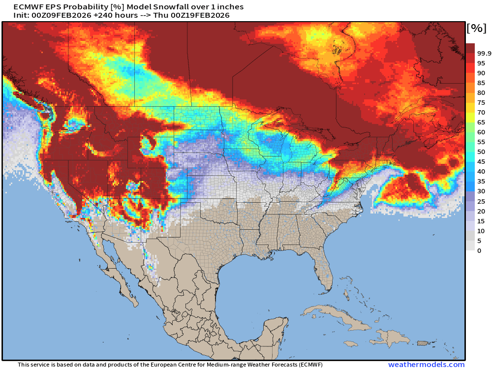
Probability of at least 1” snowfall next 10-days
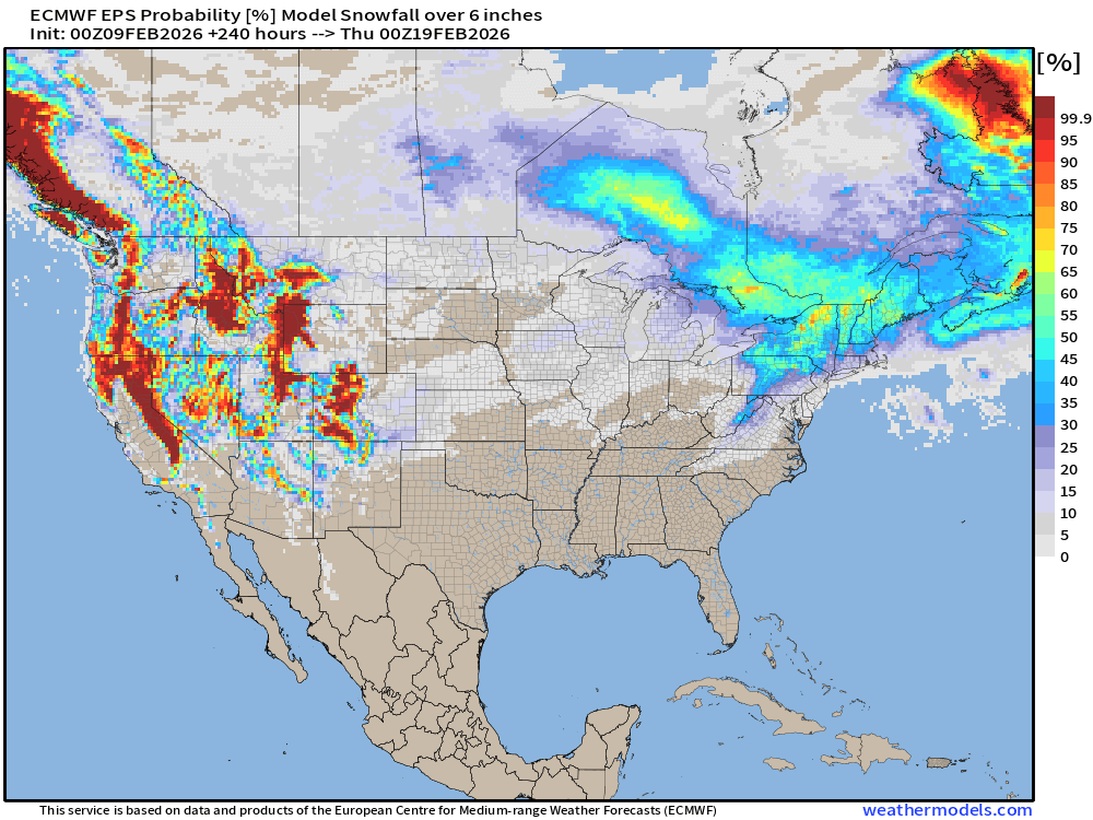
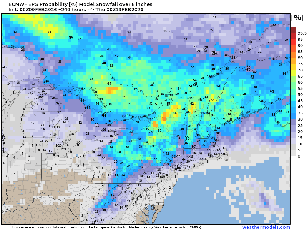
Probability of at least 6” snowfall next 10-days
Temperature Anomaly | Next 15-days | ECMWF EPS 00z
5-Day Chunk #1 | Temperature Anomaly | Feb 9 - Feb 13
5-Day Chunk #2 | Temperature Anomaly | Feb 14 - Feb 18
5-Day Chunk #3 | Temperature Anomaly | Feb 19 - Feb 23
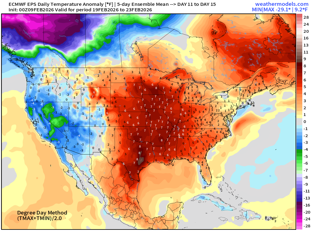
Much warmer across the Central and Eastern U.S. as California and the West Coast goes negative anomaly — and strongly so. Huge cold pool forms over Alaska and Western Canada
Maps sourced from weathermodels.com designed and innovated by yours truly! Please subscribe there for real-time access to the newest maps, charts from all of the weather models including ECMWF and AIFS, NOAA AI-GFS/AI-GEFS
- Milepost
- 863 · laid 2026-02-09T16:05:19.183000Z
- Source
- https://weather.substack.com/p/february-9-2026-monday-winter-weather
- Digest
- bb635f35c55bf3aab94dcff253cf57af38cd1a27c85820fdcf4e2aa5244a5b3a
- Machine
- JSON