February 6, 2026 Friday Winter Weather
Next several days will remain very cold across the Great Lakes, Northeast and Mid-Atlantic
February 2026 was the 4th-warmest February in the 132-year national record (1895–2026), at 40.3°F against a 1991–2020 normal of 35.6°F (+4.6°F).
February 2026 was the 5th-driest February in the 132-year national record (1895–2026), at 1.4in against a 1991–2020 normal of 2.1in (-0.7in).
NOAA/NCEI Climate at a Glance, contiguous United States. This is the observed record for the month, not a score of anything said in this piece — the forecast ledger begins 2026-08-17 and cannot reach earlier posts.

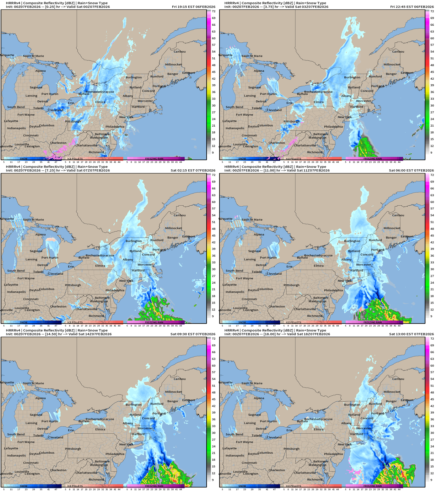
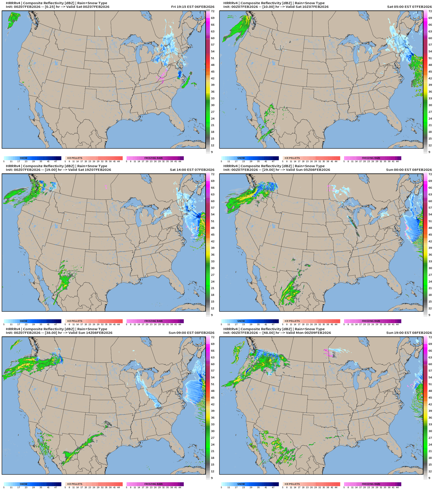
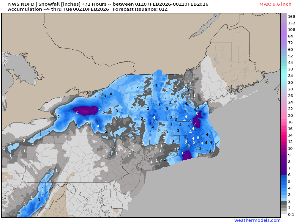
HRRR 00z came in like a wrecking ball with a “Norlun trough” or inverted trough/convergence zone on the back side of a developing Atlantic cyclone offshore. The initial snow is from the Clipper portion of this event but as the storm system organized well offshore, the circulation around it lines up heavy snow bands along the eastern New England coast including Boston.
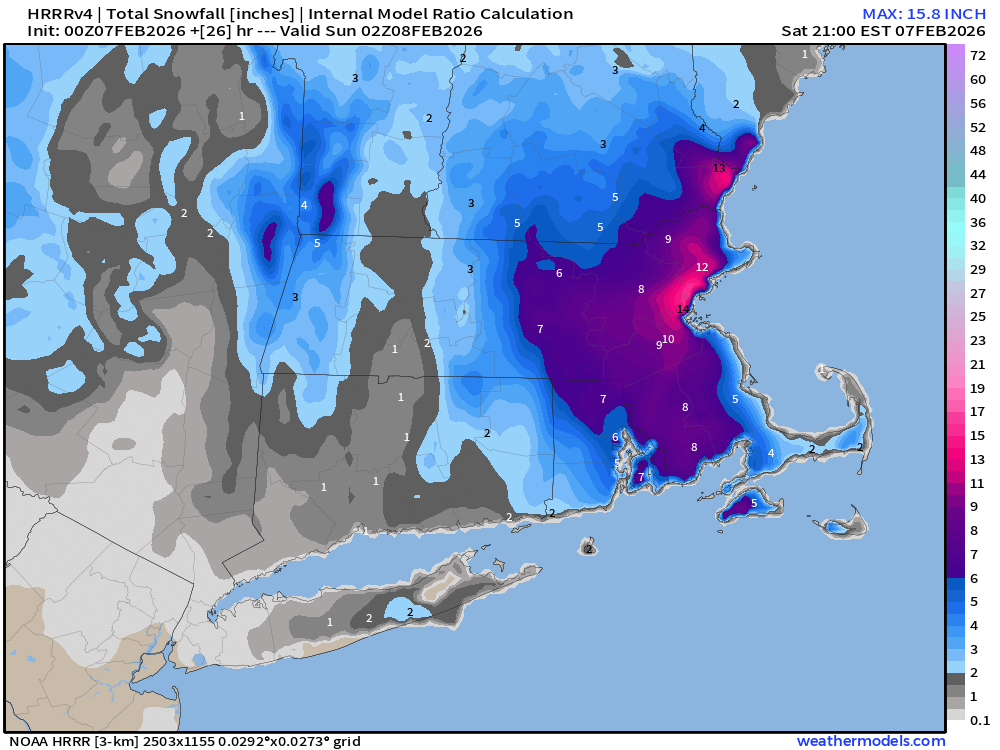
Indeed HRRR delivers 14” in Boston — which would be quite a surprise considering the current forecasts were in the 4” to 6” range.
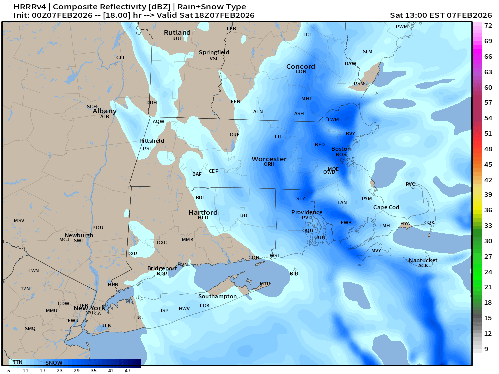
At 1 PM ET, it will be “snowing to beat the band” or “puking” snow (at least according to HRRR). This banding event could also move W/E by 50 miles and completely change the impacted areas.
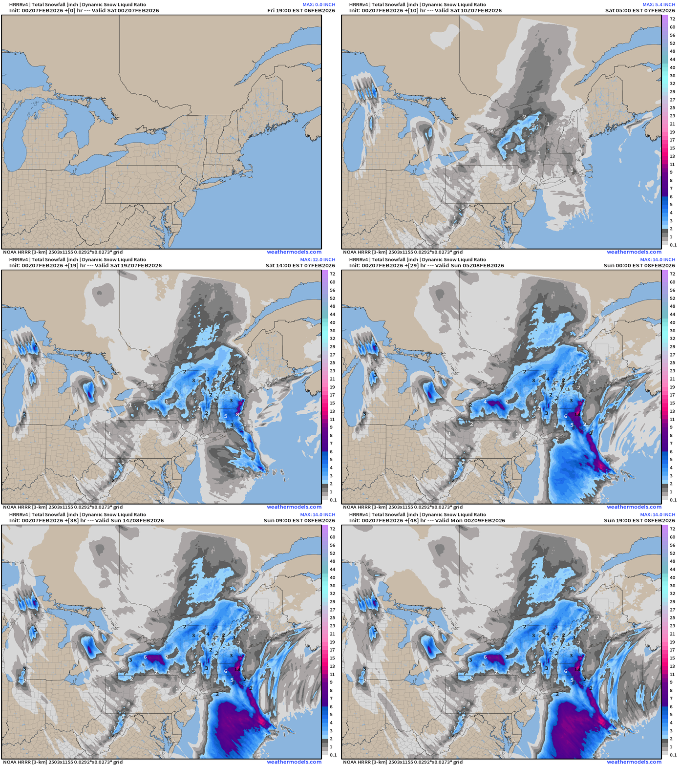
Snowfall Accumulation over the next 48-hours shows a lot of “wasted” snow over the wall of the Gulf Stream current as Arctic air undercuts the warm moist air being conveyor’d behind the low pressure center.
ECMWF IFS 18z | Precipitable Water Next 6-days
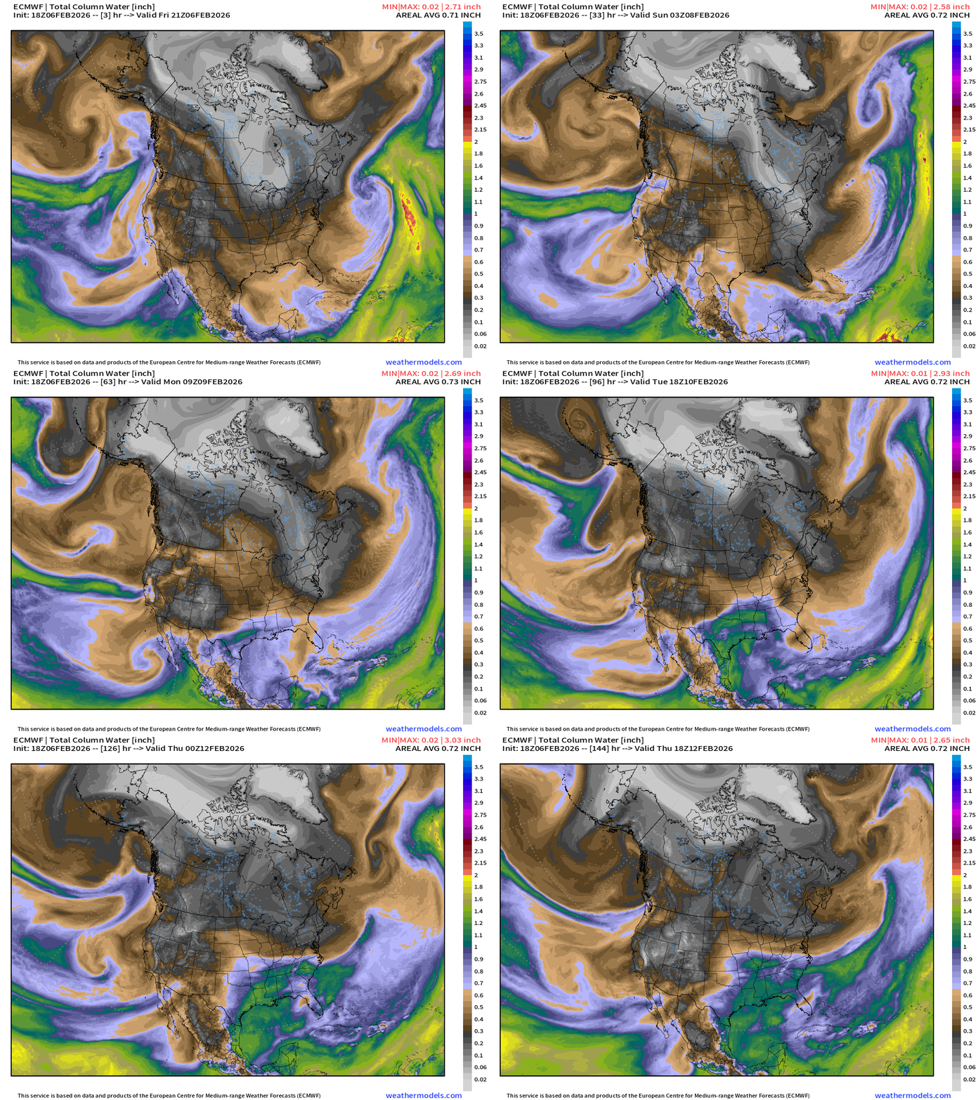
My favorite parameter — showing the blast of cold and dry Canadian Arctic air into the Lower 48 through the Great Lakes into the Mid-Atlantic like a tendril of smoke.
Turns out the developing storm into weekend off the East Coast may have some impressive impacts to the New England coast. We’ll see!
Not much change from yesterday’s update: West coast: atmospheric river landfalls WA/OR this weekend and lingers southward down California into next week. Plenty of welcome moisture for snowfall will be delivered to higher elevations. This AR is from the due west — warmer origin. However, into middle of next week, the flow is decidedly out of the north and within a building trough from Alaska, colder and more typical of mid-winter = snowfall.
Snowfall from that ECMWF 18z run over the next 6-days
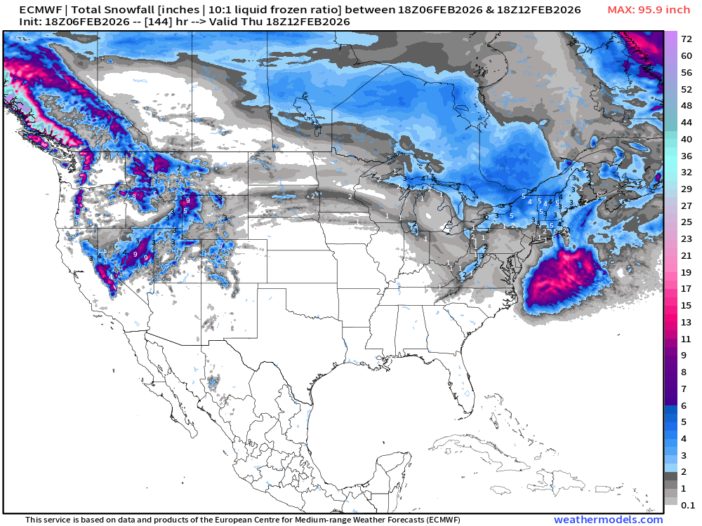
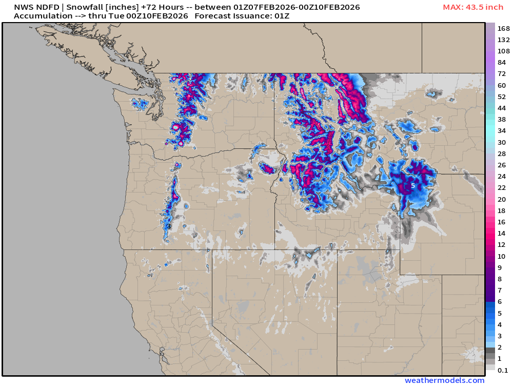
Snowfall returns to California Sierra next week. Also extends into the Rockies.
Major Arctic Blast for Great Lakes, Mid-Atlantic, and Northeast
ECMWF 18z Temperature Anomaly | Next 6-days
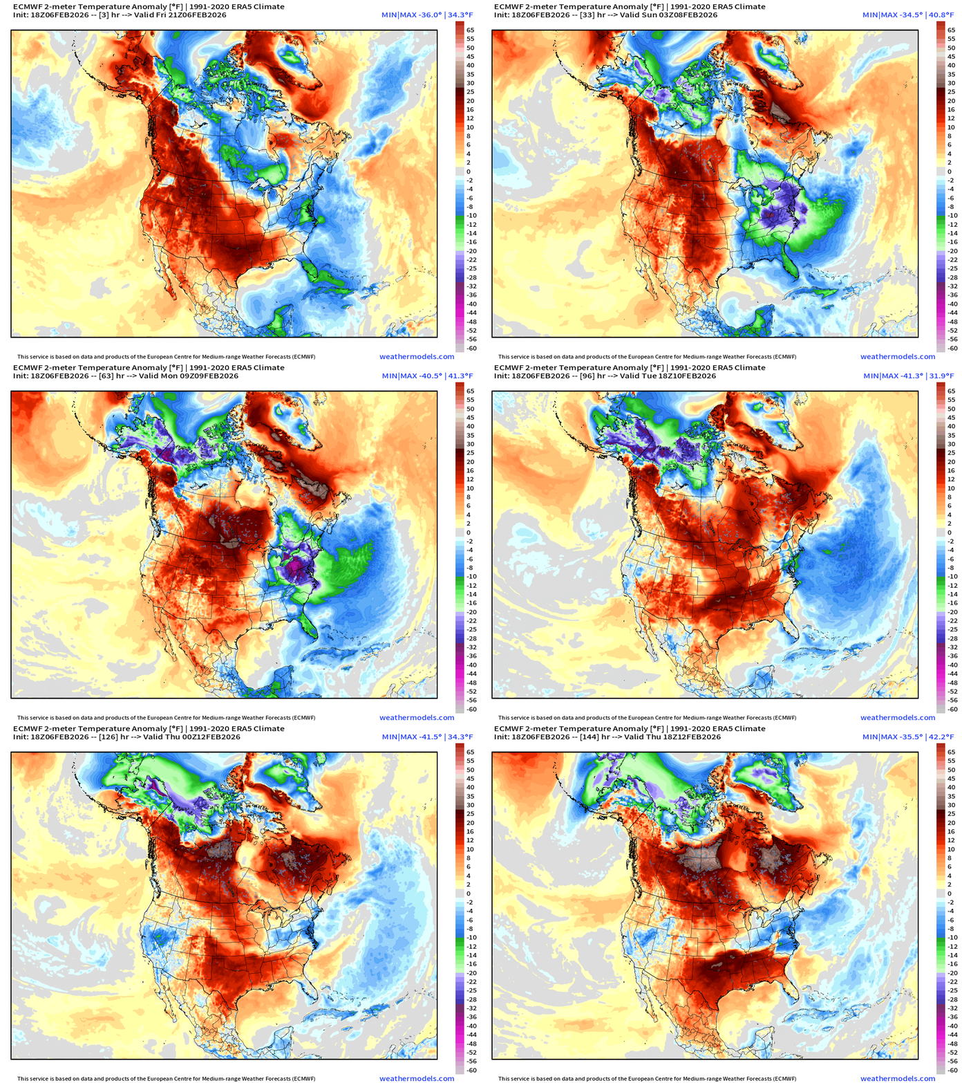
Weekend: purple is -30° to -40°F below normal — in Ohio and Pennsylvania over snow pack meaning that temperatures could crater with calm winds and clear skies Sun/Mon mornings. The cold air mass finally erodes into Tuesday, but not exactly a major warm up thereafter. It will feel considerably better, though.
Meanwhile, a lot of RED across the western U.S. into the Plains pushes eastward on Tuesday but yet another trough in the Mid-Atlantic stops it from pushing off the East Coast.
Moisture Transport Next 10-days | Integrated Vapor Transport
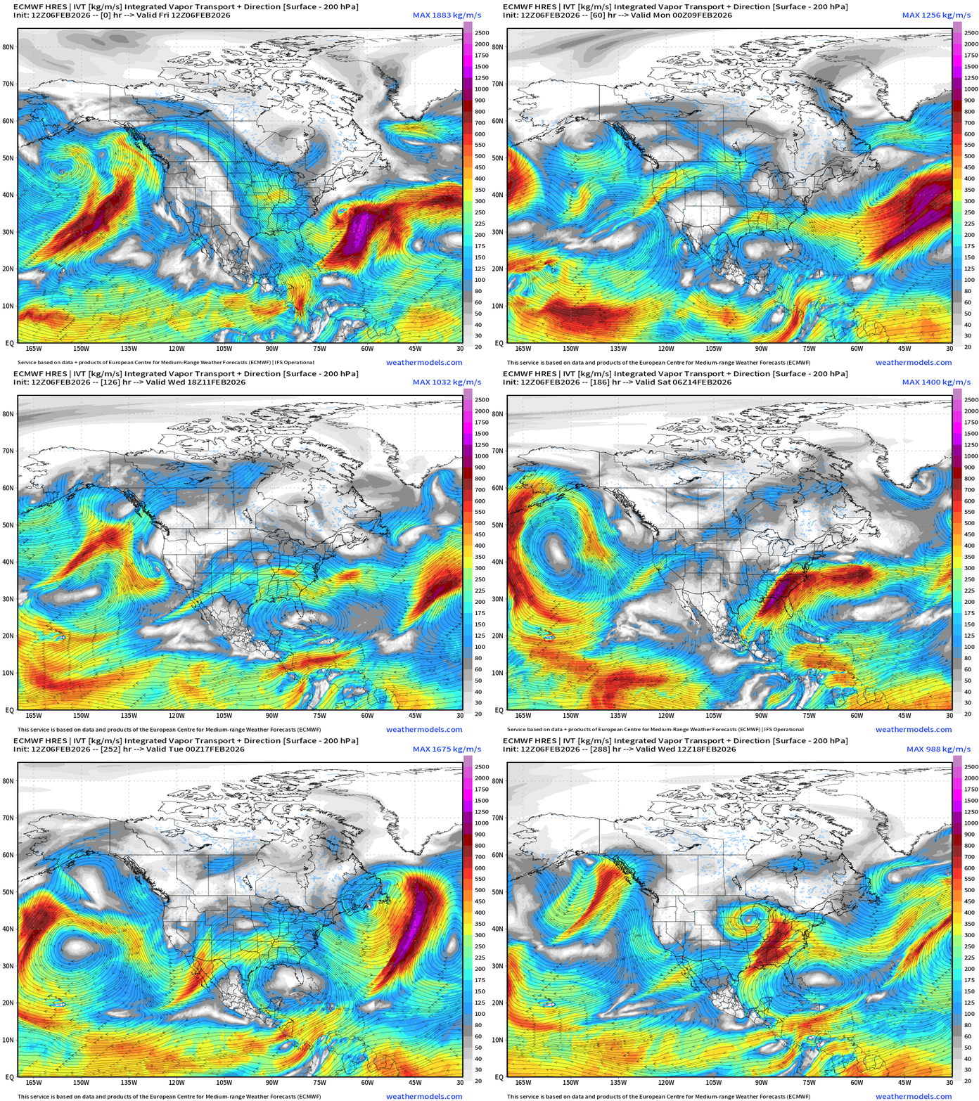
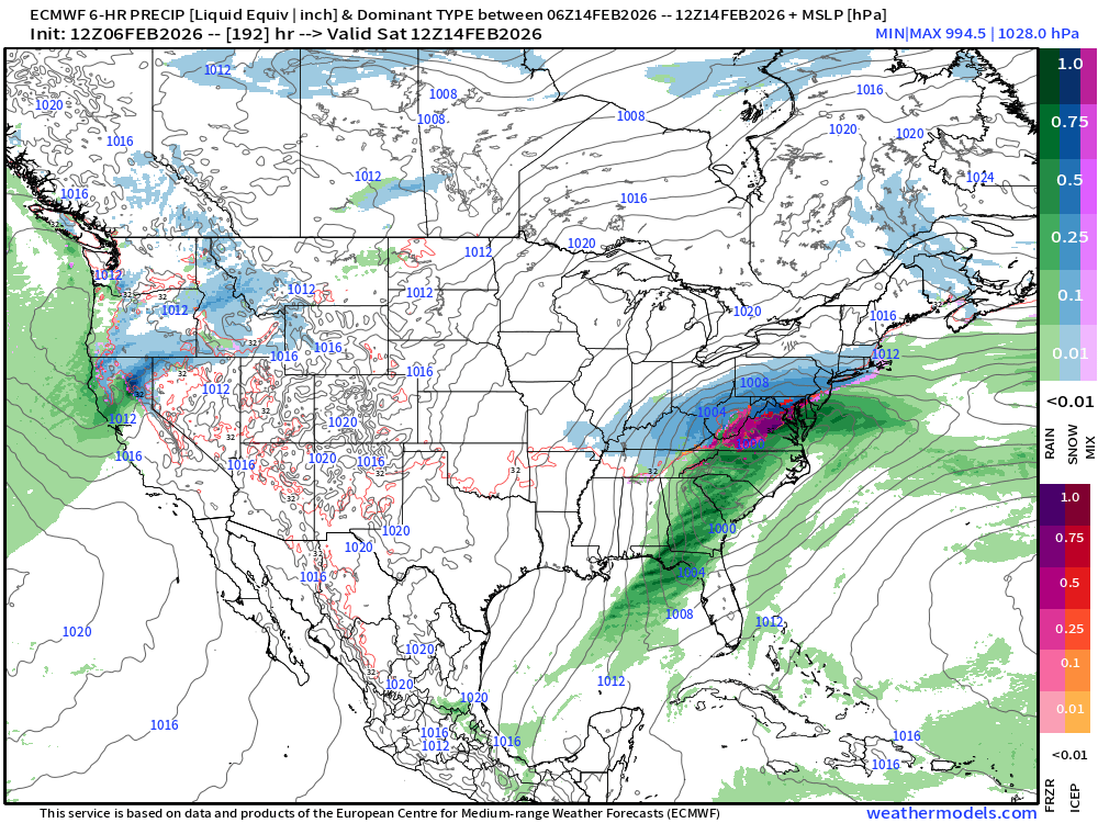
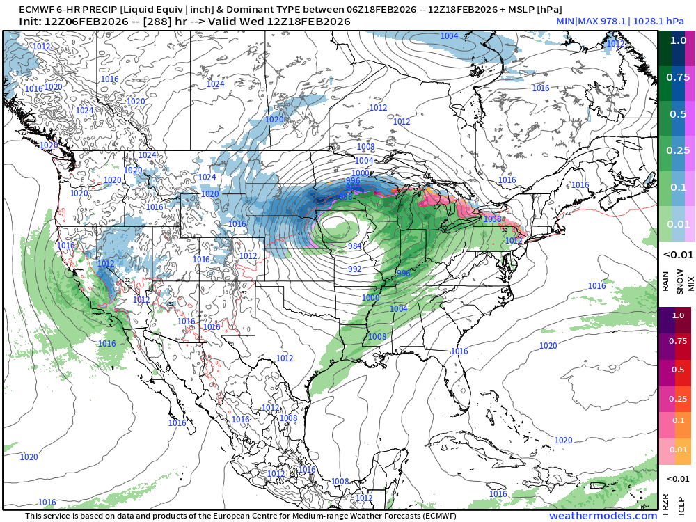
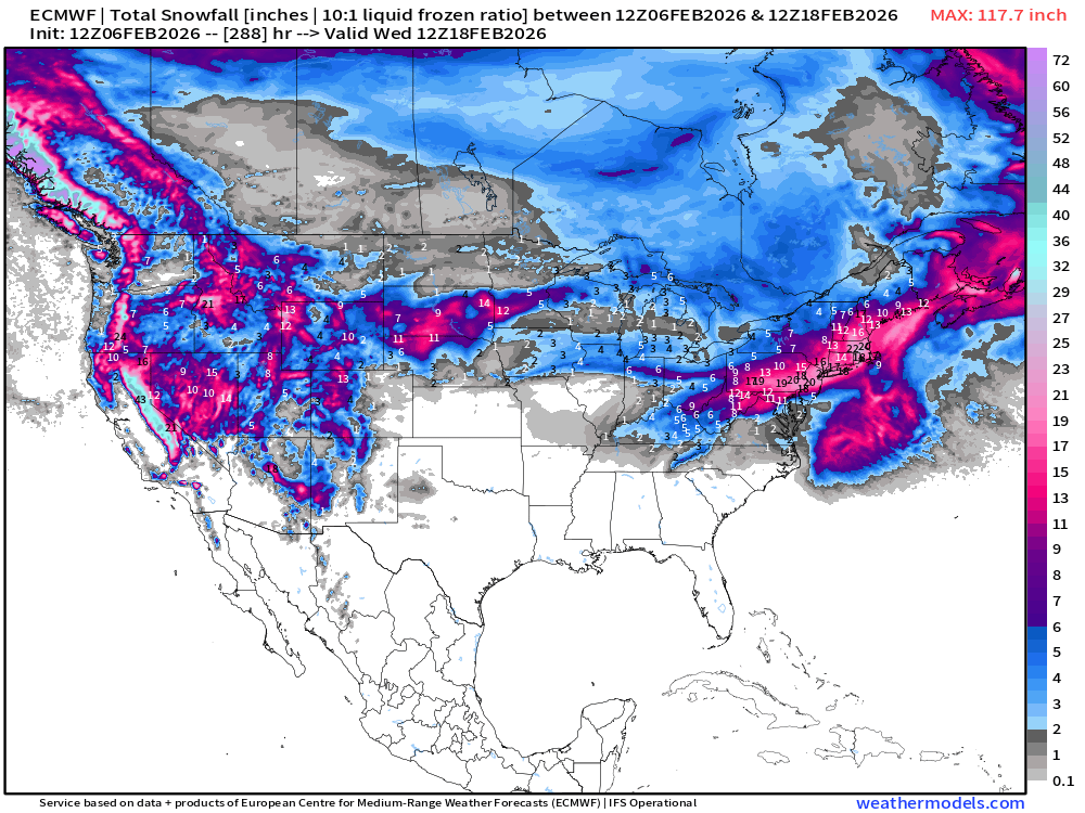
A couple new features: the Nor’easter is back in the ECMWF IFS at 12z with a major snowfall event later next weekend. Then, a storm system appears in the center of the Lower 48 — a new pattern, so perhaps we finally can bank on a Western Trough for a little while!
This isn’t fantasy land completely b/c the storm develops in the 6-7 day time frame and heads ENE into the Mid-Atlantic — but here are Days 8 and 12 — with total snowfall for next 12-days from ECMWF 12z (for reference) — reminder, we don’t “lead pipe cinch lock” anything from the global models past Day 5, but keep a close eye to monitor trends. This would be quite exciting come Monday and we have a Presidents’ Day weekend storm to talk about — it’s been on the radar for a few days, if you recall.
European 6-day Precipitation Type and Intensity
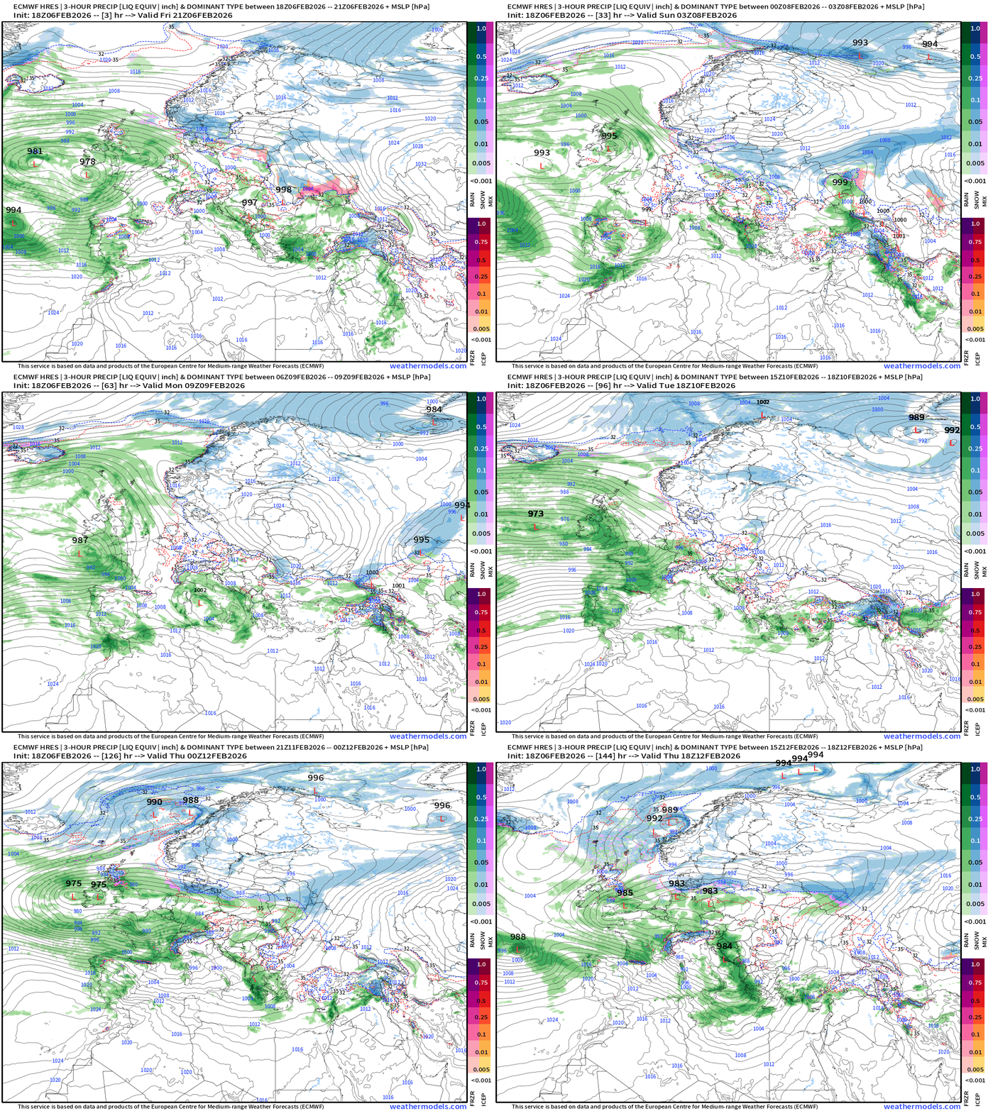
Busy pattern continues across Southern Europe with multiple little storms crossing into the Med. and continuing onward with plenty of moisture from the Atlantic.
Spain and Portugal will continue to see major rainfall … but also through the Mediterranean for Italy, Greece, and Turkey.
ECMWF 18z Precipitation Type + Intensity | Next 6-days
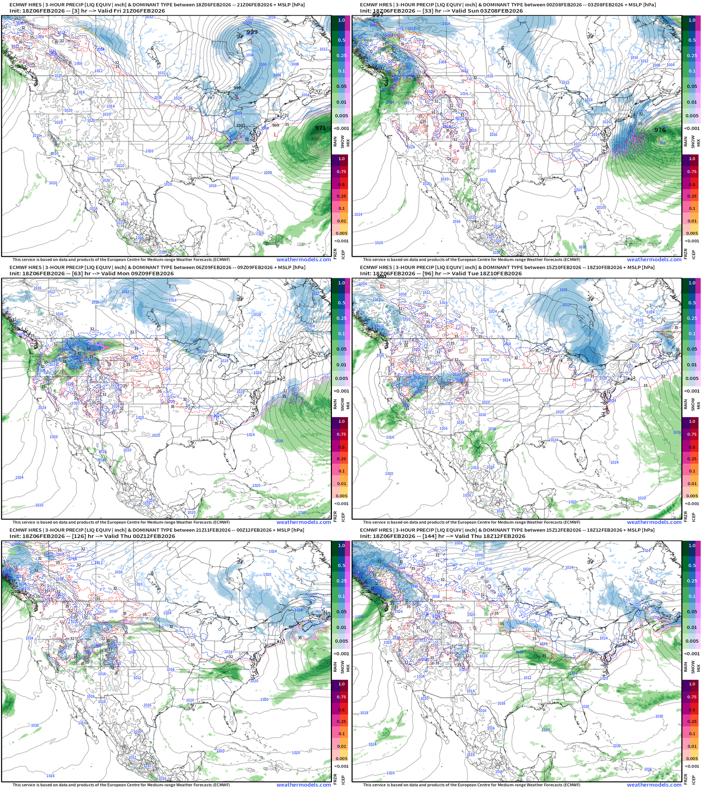
A Clipper (shortwave) tracks through the Northeast on Sat and develops well off the New England coast / Gulf of Maine. BUT — now we have a Norlun trough event possible (from beginning of this newsletter)
Perhaps another weak Clipper system next Tues-Wed across Great Lakes into NE
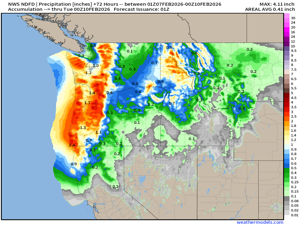
Heavy rain and snow returns to the Pacific Northwest, and moisture heads into the Great Basin primarily from a secondary surge (river) through California.
West Coast USA Zoom | Next 6-days
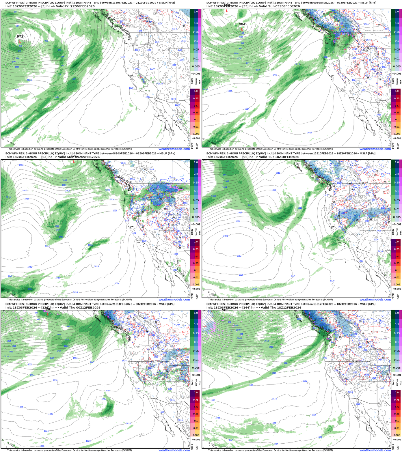
Atmospheric river landfalls the Pacific Northwest through Monday out of the Southwest. Then, the pattern shifts to a trough and the moisture will come out of the Northwest = much colder air mass = huge snowfall on the way.
East Coast USA Zoom | Next 6-days
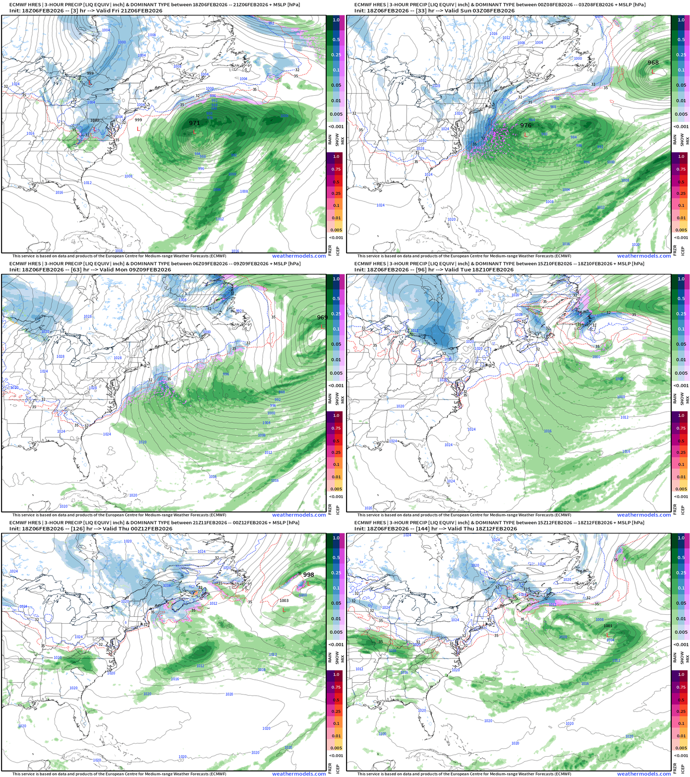
More cold Canadian Arctic air for the Northeast as storm systems form/track well offshore. The Clippers may drop a fresh blanket of snow prior to exiting into the North Atlantic.
HRRR Simulated Radar Next 48-hours
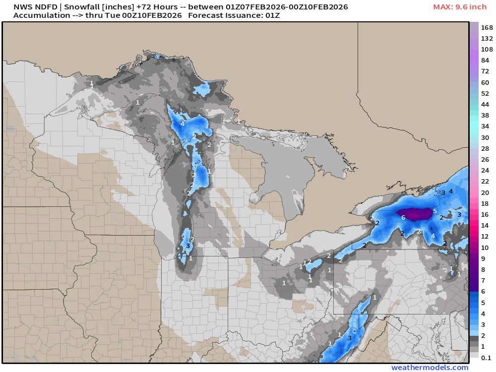
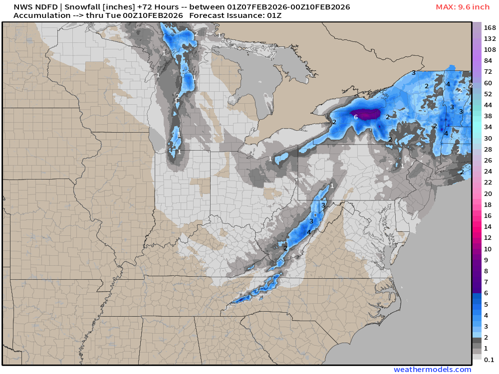
NWS NDFD Snowfall next 3-days
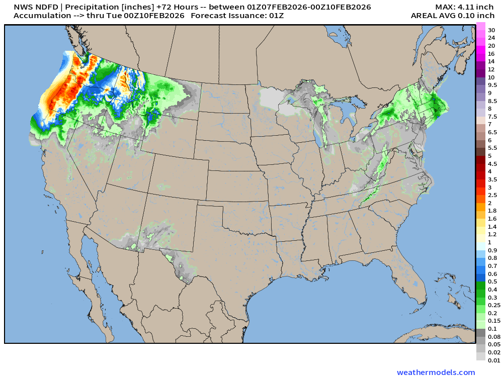
NWS NDFD Precipitation (QPF) next 3-days
RTMA | Temperature Analysis | 8:00 PM ET
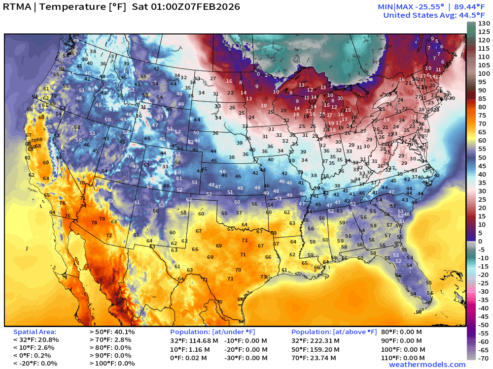
Avg Lower 48 temperature was 44.5°F — 115 million below freezing.
Temperature Anomaly | 8:00 PM ET
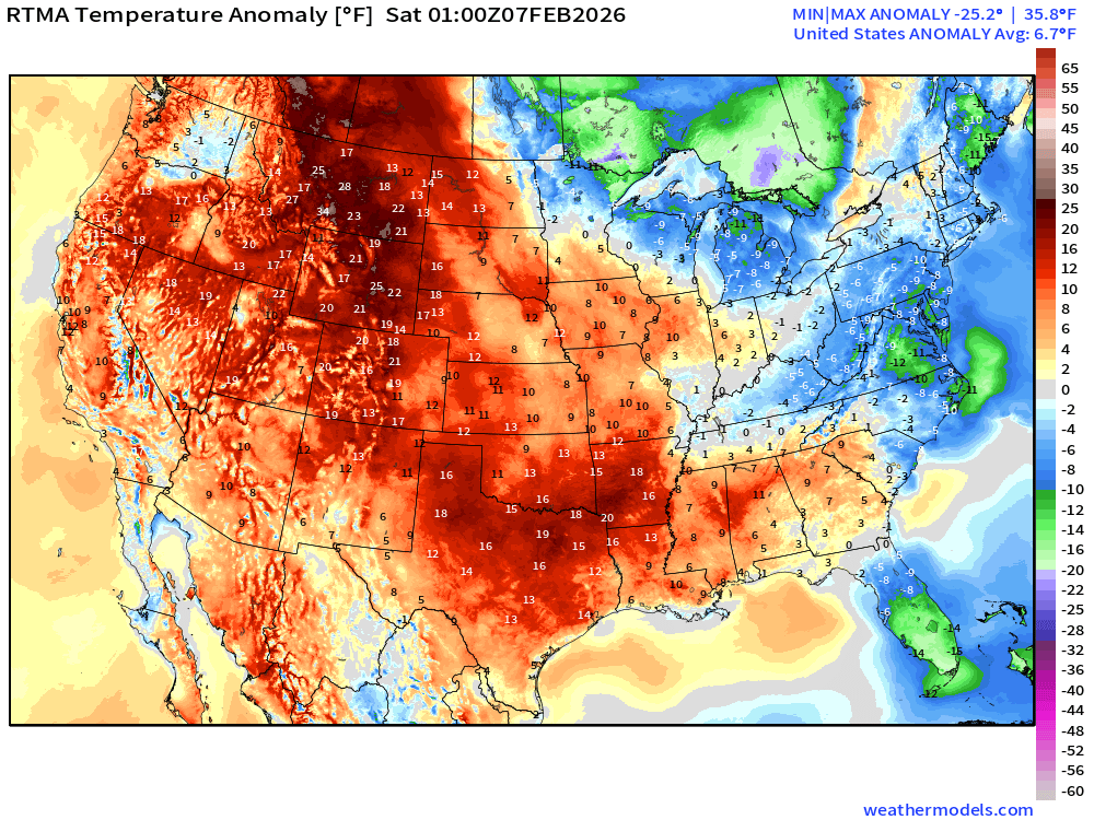
Lower 48 Temperature Anomaly above normal by 6.7°F
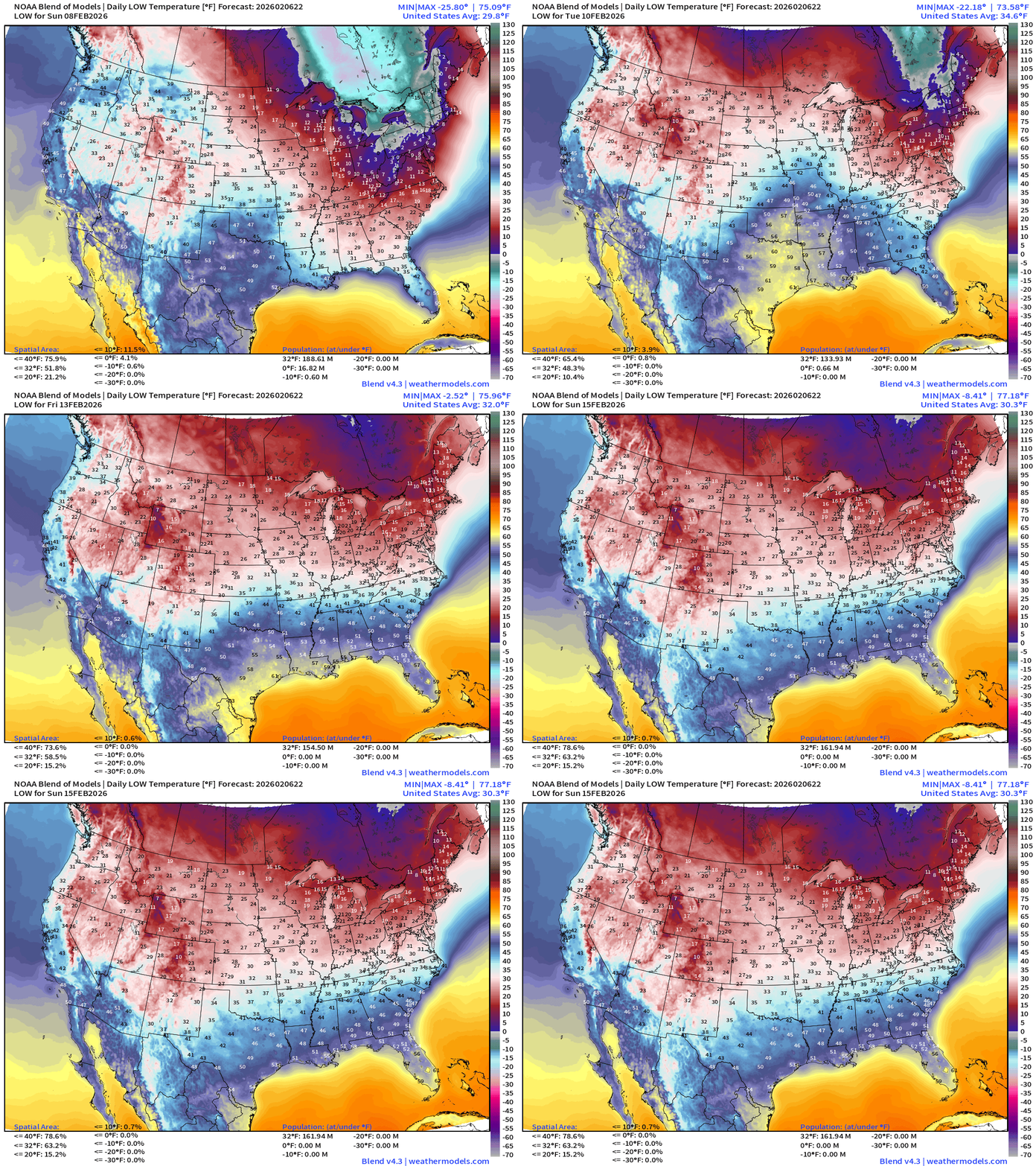
Low Temperatures next 8-days
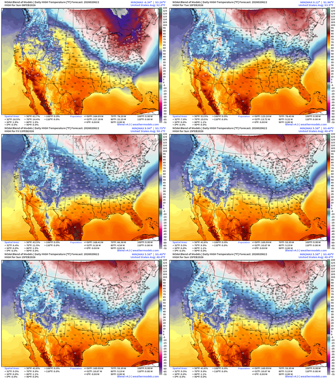
High Temperatures next 8-days
Saturday Low Temperatures
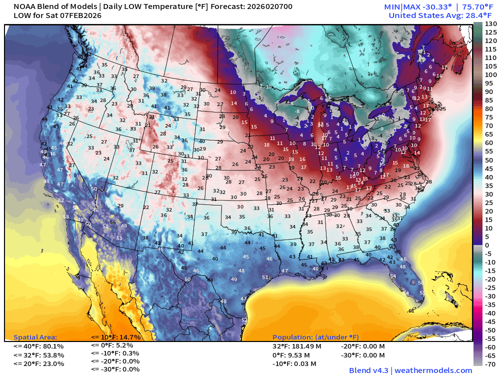
181 million below freezing — and even about 10 million below 0°F
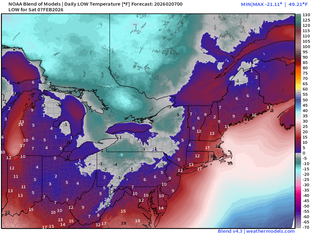
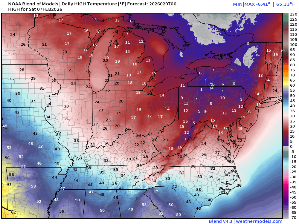
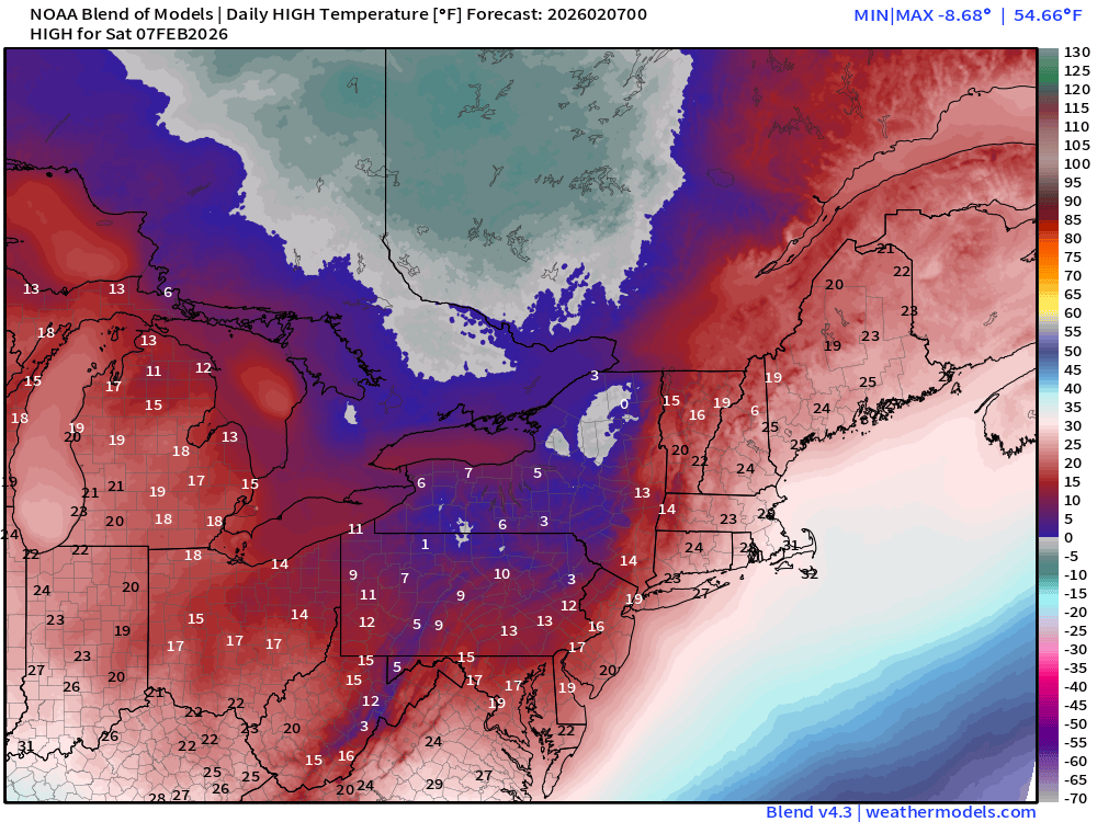
High Temperatures on Saturday
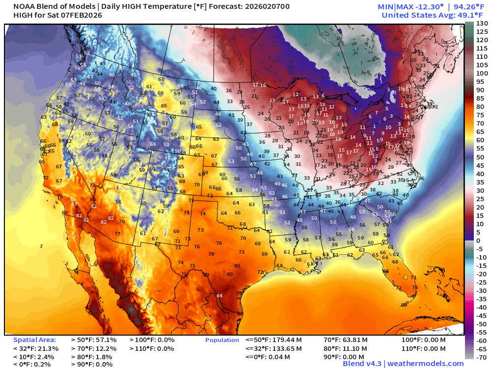
Not a very warm weekend across the Great Lakes and Northeast into the Mid-Atlantic including Detroit, Cleveland, Pittsburgh, DC, and up I-95 from Philly to NYC.
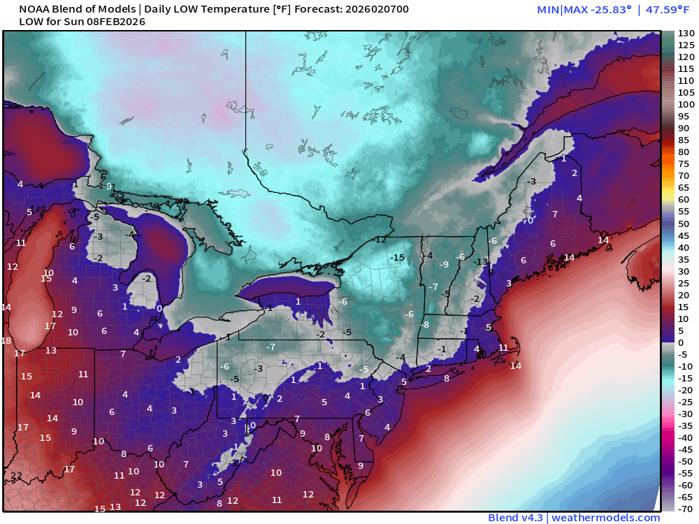
Sunday Low Temperatures
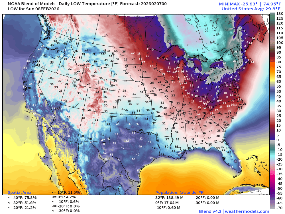
Even colder across the region with subzero actual temperatures capturing several states. Single digits along I-95 corridor from Washington D.C. to Philly, NYC and Boston.
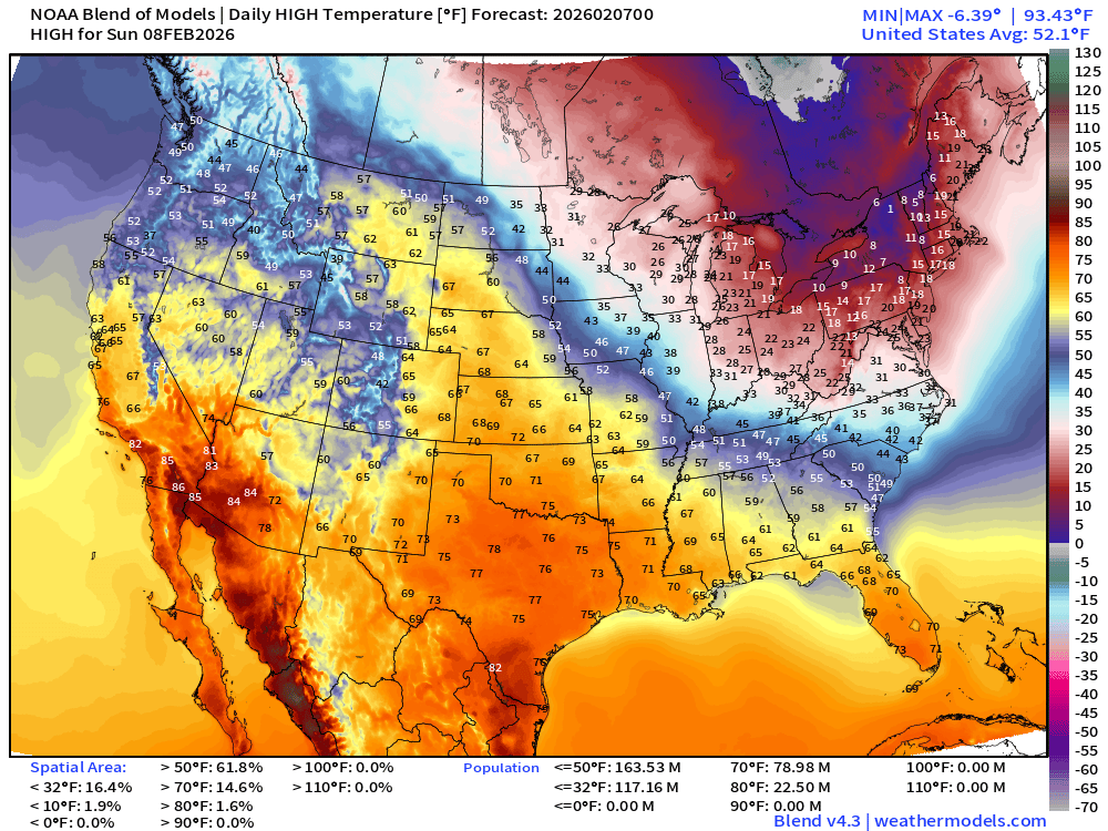
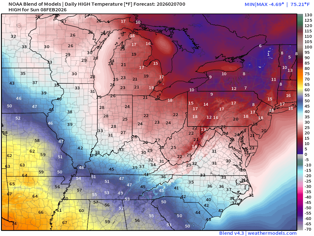
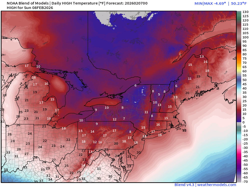
High Temperatures on Sunday
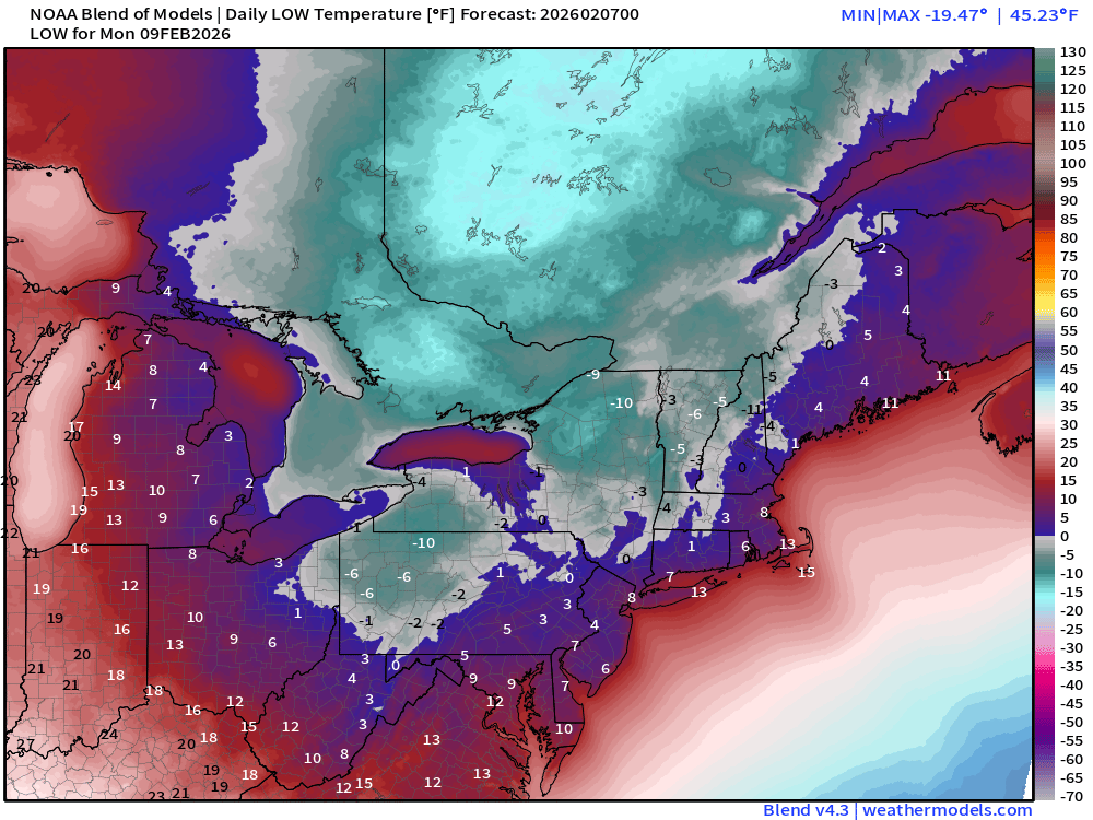
Low Temperatures on Monday
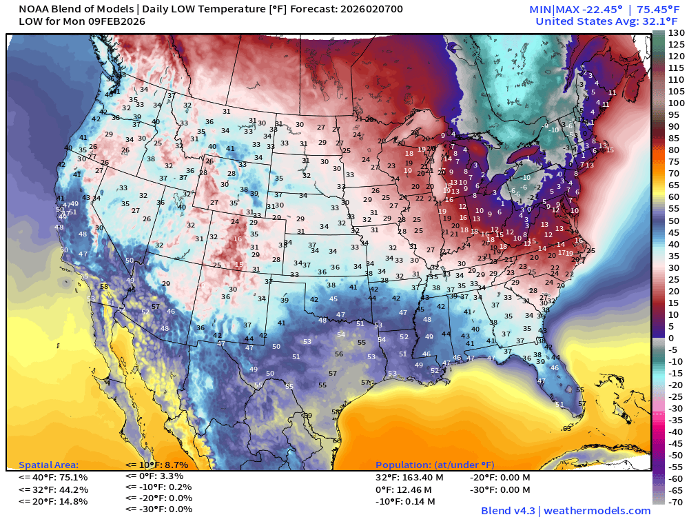
And, the cold continues into Monday morning — with calm winds and clear skies, might be the worst/coldest of the next 3 days
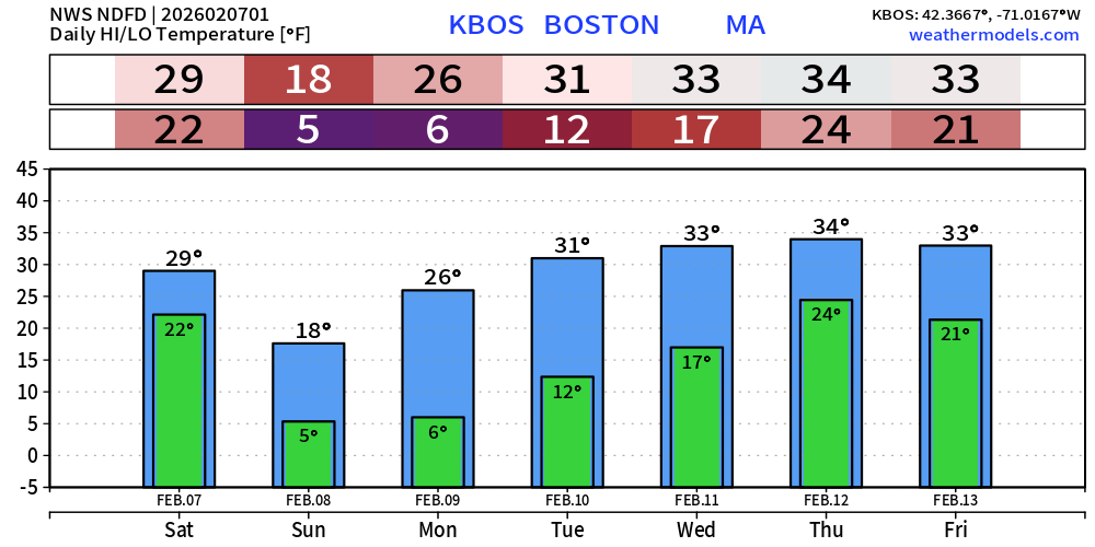
Boston next 7-days (NWS) —> relief/thaw arrives by next Wed/Thurs
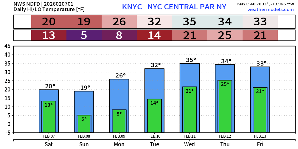
NYC next 7-days (NWS)
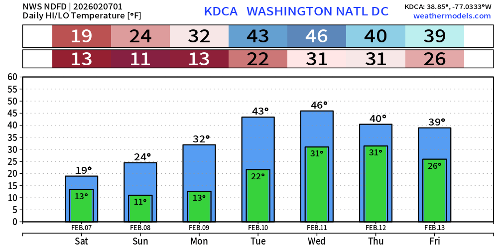
Washington D.C. next 7-days (NWS)
Flagship ECMWF 12z EPS | Temperature Anomaly | Next 15-days
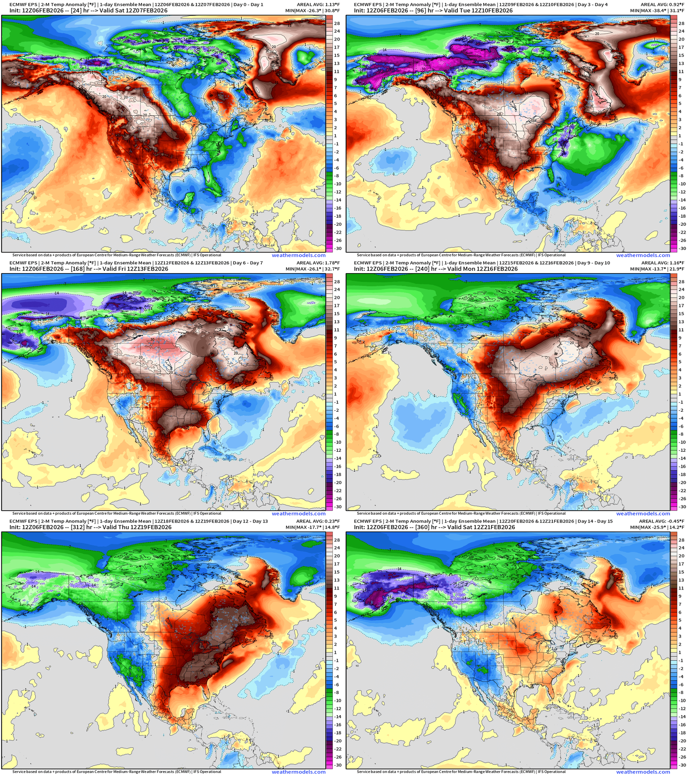
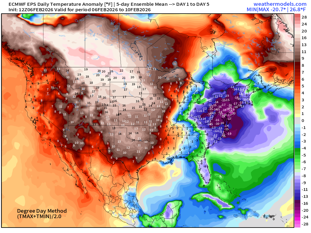
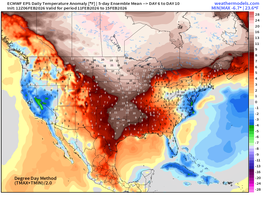
Significant warming trend for the central U.S. into Days 6-10, but it now appears we have a return of a trough into following weekend before trying again to warm up the East Coast entirely.
ECMWF AIFS-Single 18z | Temperature (500 hPa) Next 12-days
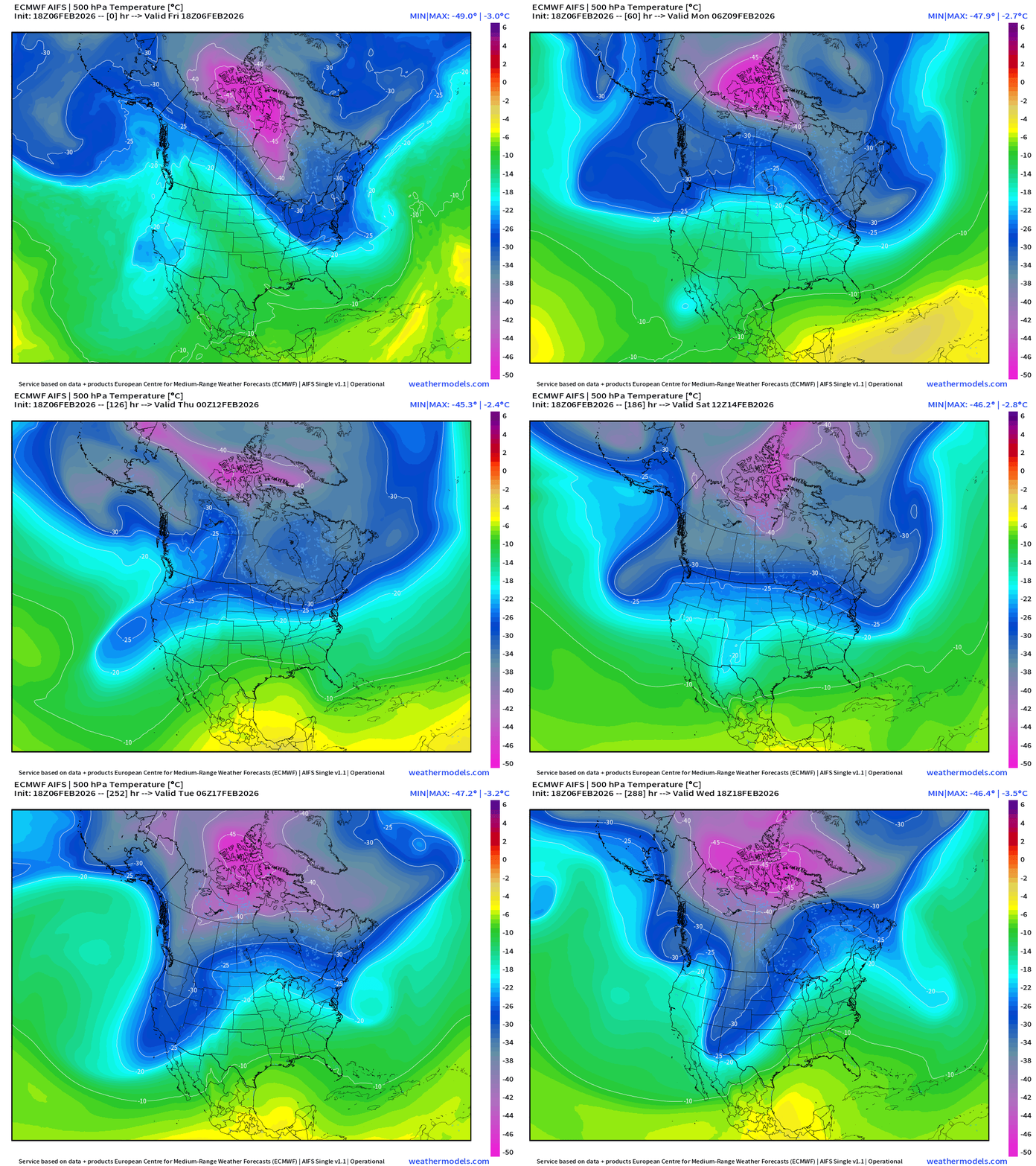
The temperature at 500 mb is the easiest way to highlight the “polar vortex” across North America with the coldest pool at -40°C (pink) with the -25°C contour usually associated with below freezing temperatures at 2-meters (surface).
You can see from AIFS the trough formation at Days 7-9 again in the Northeast — that is not a warm single for Valentine’s Day!
Quick Look at European Temperature Anomaly over next 15-days
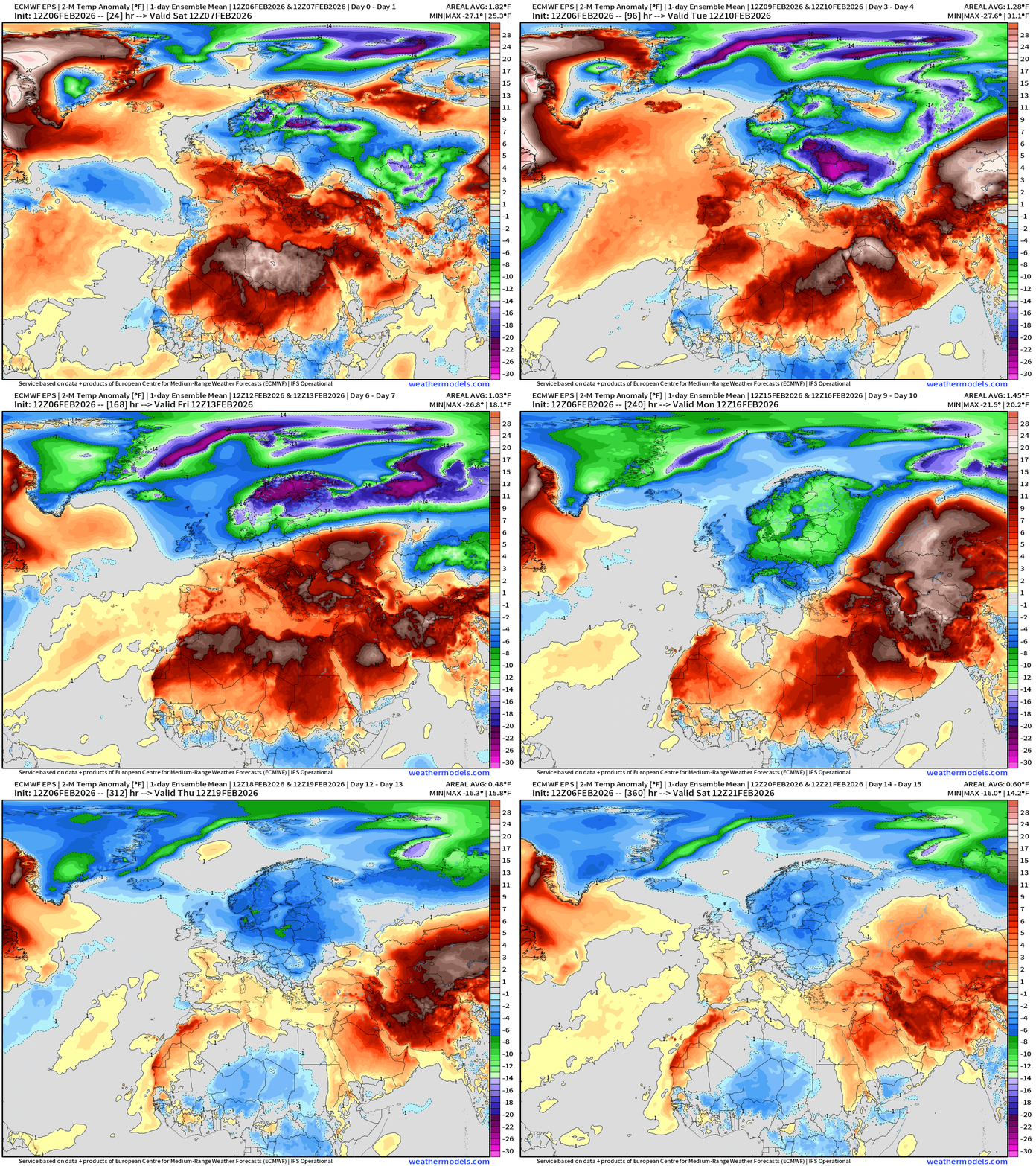
Northern Europe remains very cold — but the warmth from the Atlantic moisture feed will keep the entire Mediterranean much warmer than normal.
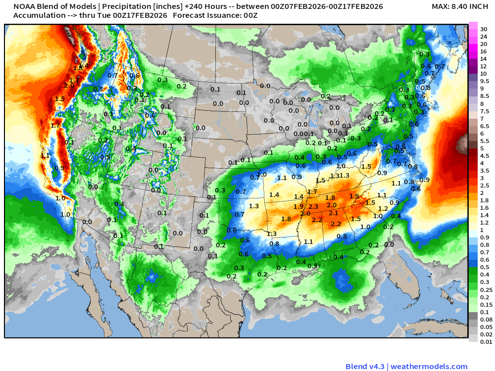
Blend of Models | 10 Days Precipitation Total
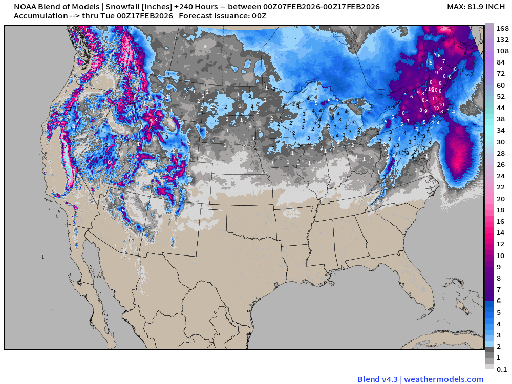
Blend of Models | Total Snowfall Next 10-Days
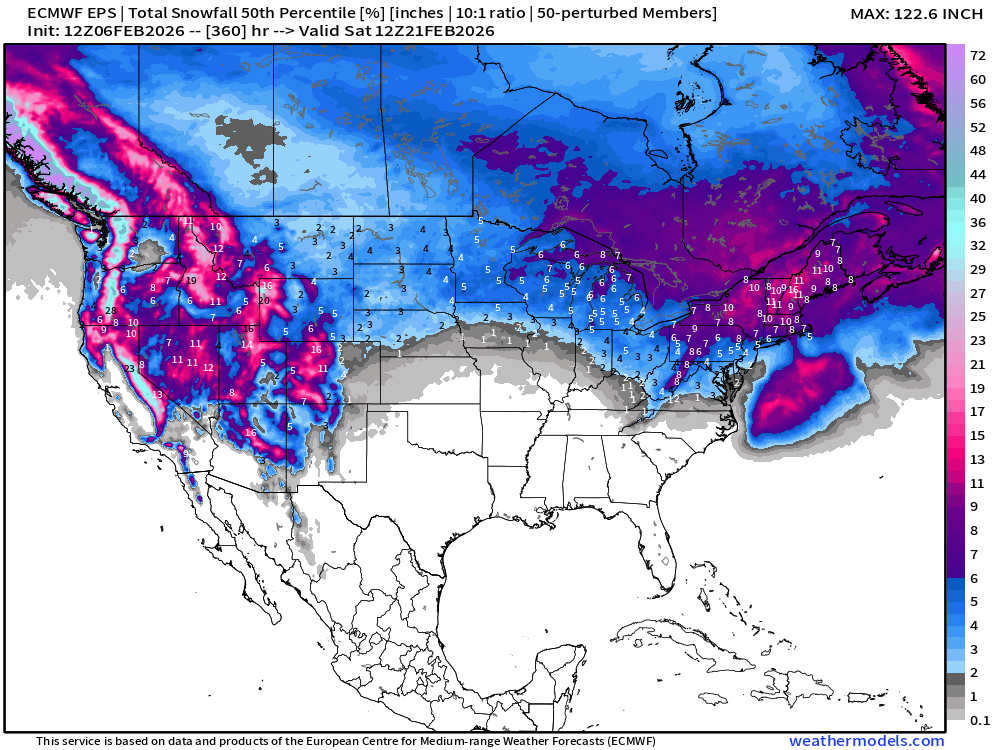
Long Range Snowfall | EPS 12z — Next 15-days Ensemble Median
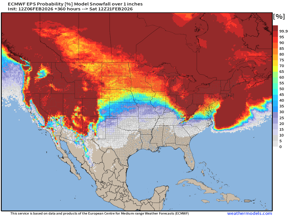
Probability of at least 1” snowfall next 15-days
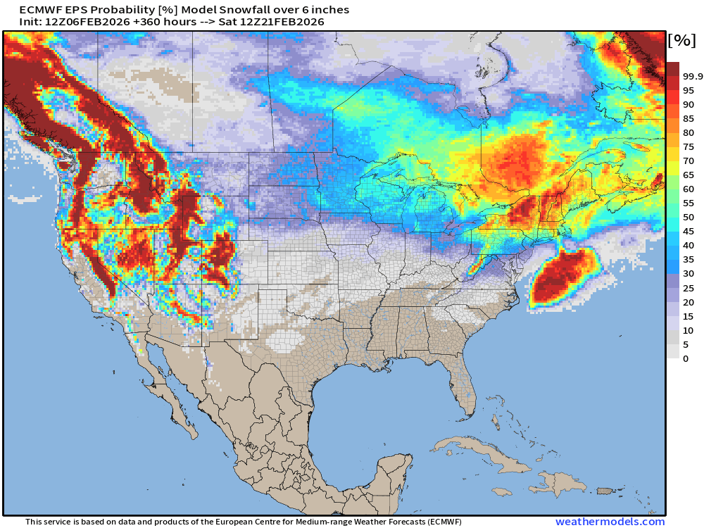
Probability of at least 6” snowfall next 15-days
Probability of at least 12” snowfall next 15-days
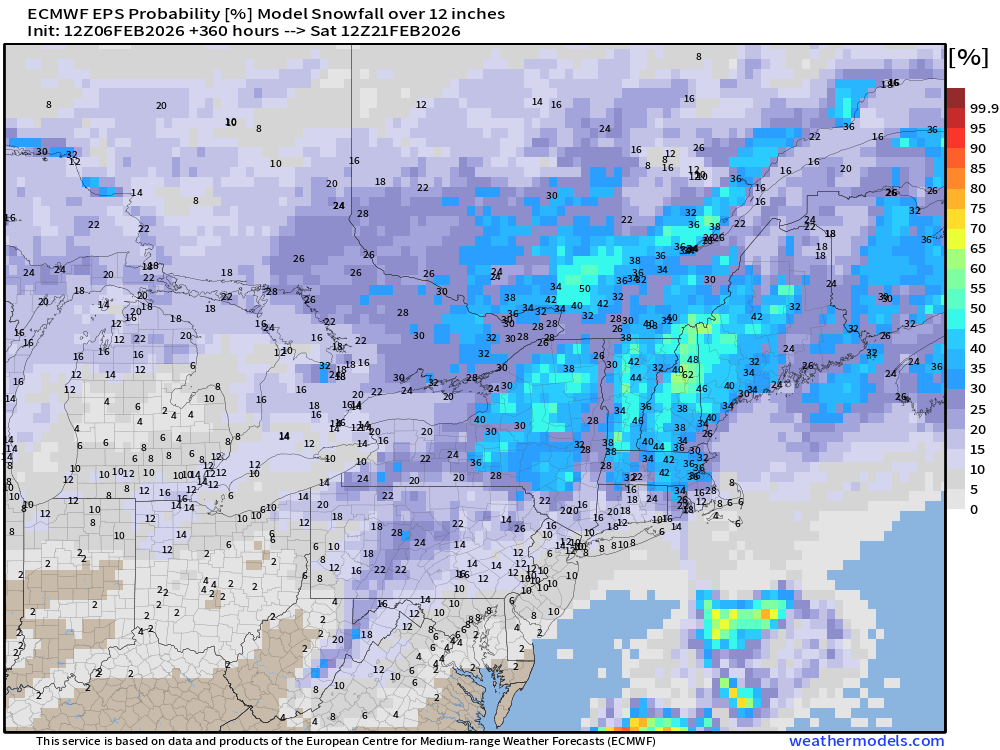
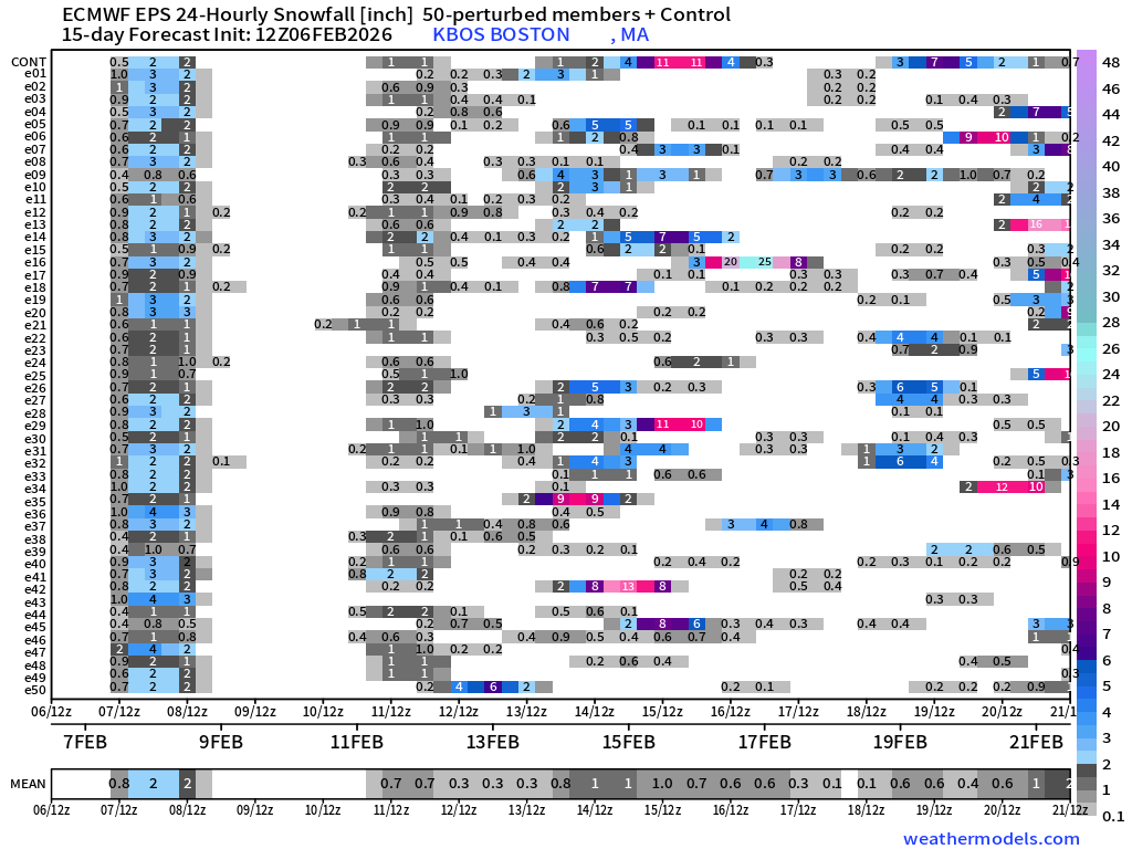
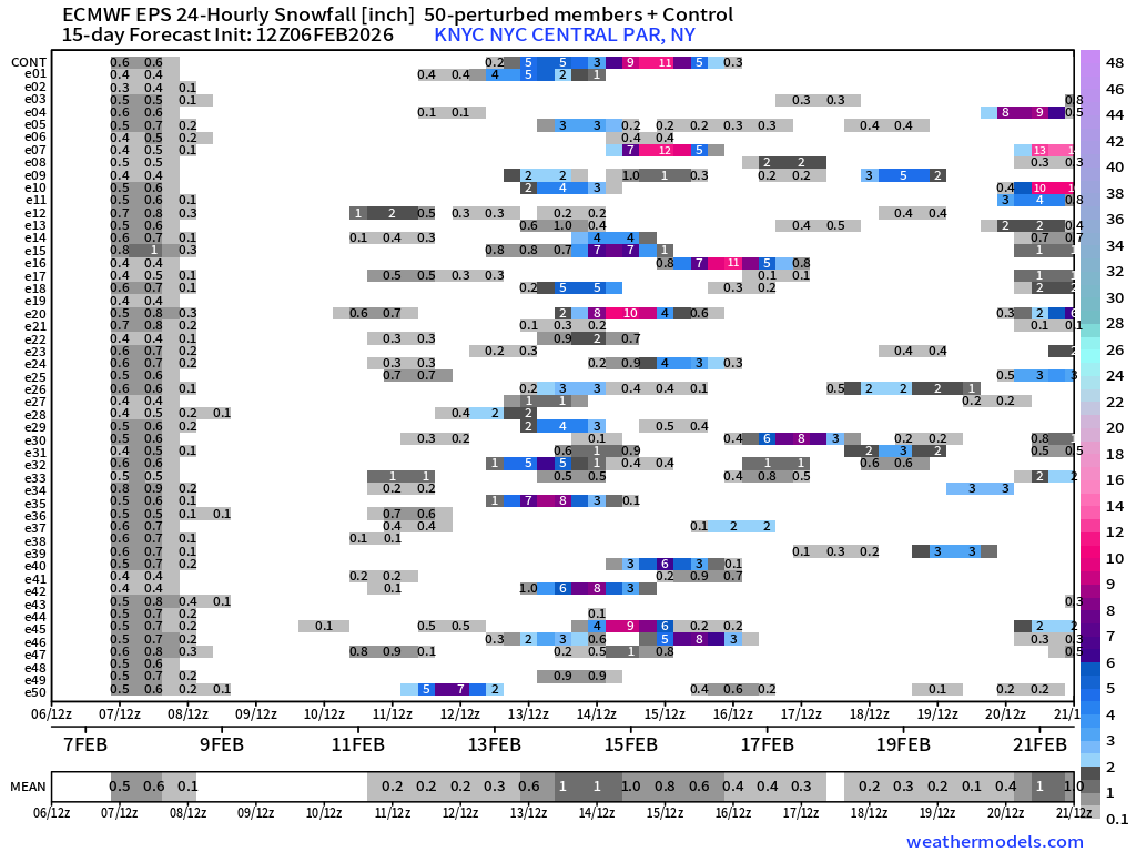
Quite a few “big ticket” items on the menu for Boston and NYC as the overall large-scale pattern over North America favors snow storms and Nor’easters!
Temperature Anomaly | Next 15-days | ECMWF EPS 12z
5-Day Chunk #1 | Temperature Anomaly | Feb 6 - Feb 10
5-Day Chunk #2 | Temperature Anomaly | Feb 11 - Feb 15
5-Day Chunk #3 | Temperature Anomaly | Feb 16 - Feb 20
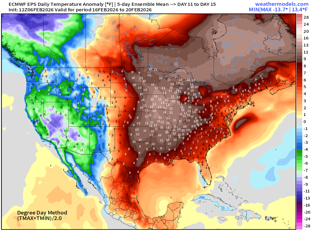
Much warmer across the Central and Eastern U.S. as California and the West Coast goes negative anomaly — and strongly so.
Maps sourced from weathermodels.com designed and innovated by yours truly! Please subscribe there for real-time access to the newest maps, charts from all of the weather models including ECMWF and AIFS, NOAA AI-GFS/AI-GEFS
- Milepost
- 861 · laid 2026-02-07T02:41:30.150000Z
- Source
- https://weather.substack.com/p/february-6-2026-friday-winter-weather
- Digest
- de51dee5da333853ce0a8d47bac20d2d218d5b1bf95c678a22ba6082363edb48
- Machine
- JSON